Noise Report. Duportail Street Bridge Project Benton County, Washington Ninth Avenue S., Suite 300 Federal Way, WA 98003
|
|
|
- Antonia Norris
- 5 years ago
- Views:
Transcription
1 Noise Report Duportail Street Bridge Project Benton County, Washington Prepared for: City of Richland, WA Berger/ABAM Engineers, Inc Ninth Avenue S., Suite 300 Federal Way, WA Prepared by: Widener & Associates nd Avenue West, Suite D Everett, WA July 2010
2 This page left blank intentionally for printing purposes.
3 Acronyms db(a) The A-weighted sound level measured in decibels. A-weighted network = a frequency-equalizing function which approximates the sensitivity of human hearing to sounds of moderate SPL. EB EPA East bound traffic lane Environmental Protection Agency FHWA Federal Highway Administration L eq (1h) The equivalent sound level (the logarithmic sum of sound exposure levels) over 1 hour mph Miles per hour NAC NB Noise Abatement Criteria North bound traffic lane SB South bound traffic lane SEP SPL Sound Exposure Level Sound Pressure Level TNM FHWA traffic noise model version 2.5 WB West bound traffic lane WSDOT Washington State Department of Transportation Noise Study: Duportail Street Bridge Project i
4 This page left blank intentionally for printing purposes. Noise Study: Duportail Street Bridge Project ii
5 Executive Summary Widener & Associates undertook this study to analyze existing and predicted future traffic noise conditions in the vicinity of the proposed Duportail Street Bridge Project, located in the City of Richland. The project involves the construction of a four- lane bridge between the existing Duportail Street on the south-west side of the Yakima River, to Duportail Street on the north-east side of the river. In addition, intersection improvements at State Route (SR) 240 and Duportail Street will be included, as well as a new roadway (Tanglewood Drive) on the north side of the proposed bridge will be constructed to connect the existing land uses to Duportail Street. A stormwater detention pond, and a new water main, will be constructed. The current Columbia Irrigation Canal drainage will be piped under the proposed bridge. The proposed project is located within the legal geographic area of: Township 09 North, Range 28 East, Sections 15 and 16, Benton County, Washington. Existing land use along the project corridor consists of primarily natural open space, multi-family residential, and a few businesses. Refer to the Vicinity Map; Figure 1. Sound levels for the 'Existing 2009', 'No Build 2032' and 'Build 2032' conditions were derived from the Traffic Noise Model (TNM) 2.5, verified with field measurements, and compared with the Federal Highway Administration (FHWA) and the Washington State Department of Transportation (WSDOT) standards and criteria. Sound level recording and modeling was undertaken in accordance with FHWA guidelines and standards. A total of twelve receivers were modeled within the project area. As per WSDOT guidelines, all receivers were modeled for the worst case hourly condition in the project area as a whole (the PM peak hour). Traffic data (turning movement counts) was collected in 2008 and forecasted for 'Existing 2009', 'No Build 2032', and 'Build 2032' conditions by The Transpo Group Inc. This study shows that noise above established thresholds (as defined by FHWA/WSDOT) would occur at five locations along the project corridor; three of the five receivers would be experience levels above the Noise Abatement Criteria, and all five would experience substantial increases. The greatest increase in sound level experienced under the 'Build 2032' condition as compared to the existing condition is 13.6 db(a) at Receiver 6, and the highest sound level modeled under the Noise Study: Duportail Street Bridge Project iii
6 'Build 2032' condition is 70.3 db(a) at Receiver 1 which is above the noise abatement criteria of 66 db(a) for residential locations. Based on the results of this study, abatement measures were fully evaluated in accordance with FHWA and WSDOT noise abatement policy. It was concluded that a noise barrier is warranted for impacted residential receivers. Several of the barrier options analyzed were determined to be both feasible and reasonable and therefore the analysis provides calculations for the minimum wall height that is feasible and reasonable the maximum wall size allowable, and the optimized wall which reaches the 10 db(a) reduction goal. Noise Study: Duportail Street Bridge Project iv
7 Table of Contents 1. Introduction Noise Characteristics and Measurement Defining Noise Measuring Noise Project Description Location Proposed Work Purpose and Need Criteria for Determining Impacts Methods Field Data Collection Traffic Noise Model Receivers Traffic Data Results Existing Noise Environment Field Measurement Sound Levels Modeled at Receivers Future Noise Environment Summary of Modeled Results Construction Noise Mitigation Needs Overview of Mitigation Options Barrier Analysis Recommended Barrier Heights References Appendix A: Calibration Certificates Appendix B: Data Used in the Model Appendix C: Sound Level Data Sheets Noise Study: Duportail Street Bridge Project v
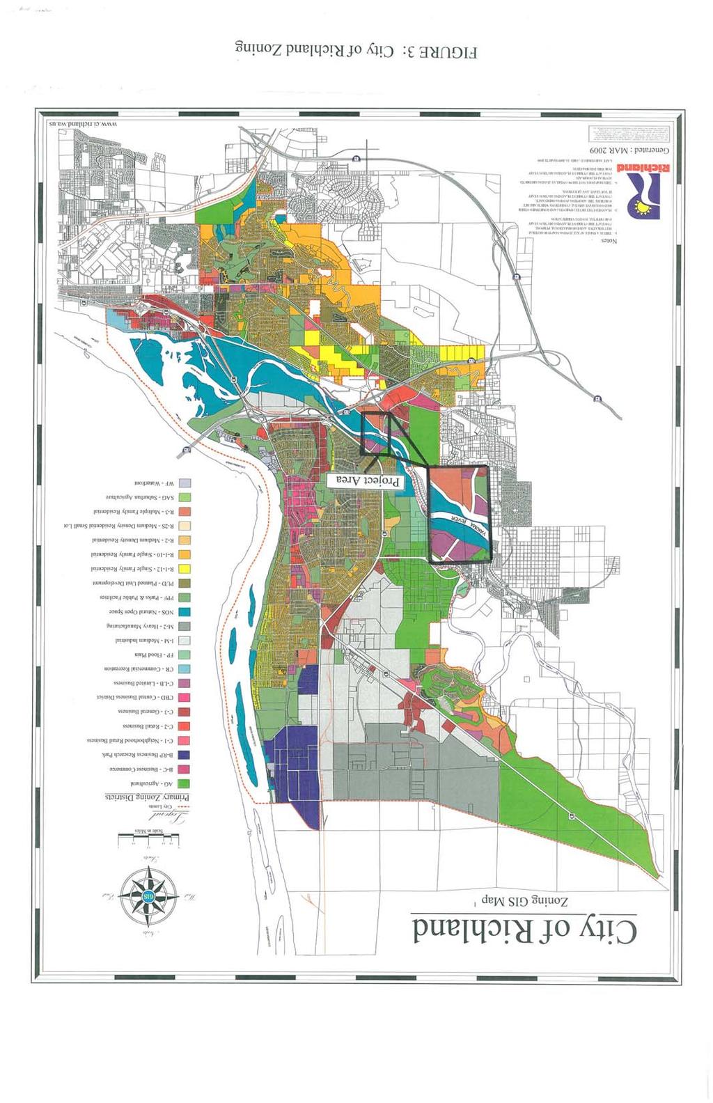
8 List of Tables Table 1: Sound Pressure Levels of Representative Sounds and Noises... 2 Table 2: FHWA noise abatement criteria Table 3: Summary of results for the Existing, No 2032, and Build 2032 conditions Table 4: Typical construction equipment noise levels Table 5: Noise mitigation cost per residence Table 6: Barrier 1, Benefited Receiver Breakdown Table 7: Barrier 2, Benefited Receiver Breakdown List of Figures Figure 1: Vicinity Map... 7 Figure 2: Receiver Locations... 9 Figure 3: Land Use Designations Figure 4: Benefited Receivers Noise Study: Duportail Street Bridge Project vi
9 1. Introduction The purpose of this report is to document and analyze existing traffic noise conditions and predicted future traffic noise conditions in the vicinity of the proposed Duportail Street Bridge, in Richland, WA. Sound levels for the Existing 2009, No Build 2032 and Build 2032 conditions were compared with the FHWA / WSDOT standards and criteria. Sound levels were derived from the FHWA approved noise model, TNM 2.5. Calculations generated by the model were verified using field measurements in accordance with FHWA and WSDOT requirements. This report was used to determine whether or not noise abatement measures should be warranted as part of the proposed project, and as appropriate, to make recommendations regarding such options. 1.1 Noise Characteristics and Measurement Defining Noise Noise is defined as unwanted sound (Maekawa and Lord., 1994; Bell et al., 1996; Berglund et al., 1996). Noise is recognized as having both a physical and a psychological component. The physical component is set, while the psychological component (the degree of annoyance) depends on the listener and their physiological and psychological state as well as the frequency and time of the varying pattern of the sound. Low frequency (particularly anthropogenic sources) and impulse sounds are thought to result in higher levels of annoyance (Berglund et al., 1975; Hall et al., 1981; Maekawa and Lord, 1994; Bell et al., 1996; Berglund et al., 1996) Measuring Noise When measuring noise, the decibel scale, the A-weighted network, and the descriptor L eq are usually used to describe and quantify the noise levels experienced by a receiver. These descriptors are described in the following paragraphs. The decibel scale is a logarithmic scale, derived from the Pascal scale and based on sound pressure levels (the physical correlate of loudness). The threshold of human hearing is at 20 micropascals or 0 db. A change of 20 db corresponds to a ten-fold increase in micropascals. Thus, 20 db is equivalent to 200 micropascals. However, the decibel scale provides a better approximation of the perception of loudness than the Pascal scale, 1 db indicates the same fractional change in sound pressure at all levels. Generally, a 3 db increase is barely perceptible Noise Study: Duportail Street Bridge Project 1
10 to human listeners. A 6 db increase corresponds to a doubling of the sound pressure; however, a 10 db increase is necessary for the sound to be perceived as being twice as loud (FHWA, 1995; Maekawa et al., 1994; Boeker and Van Grondelle, 1995). Refer to Table 1 for examples of typical sound source levels. Table 1: Sound Pressure Levels of Representative Sounds and Noises Source Decibels Description Large rocket engine (nearby) Jet take-off (nearby) Pneumatic riveter 130 Jet take-off (60 meters) 120 Pain threshold Construction noise (3 meters) Subway train Heavy truck (15 meters) and 90 Constant exposure Niagara Falls 80 endangers hearing Average factory 70 Normal conversation (1 meter) Quiet office Quiet Library Soft whisper (5 meters) Rustling leaves Normal breathing 10 Very quiet Hearing threshold 0 Barely audible Source: Tipler 1976 The type of weighting curve used in measuring sound is important in determining the accuracy of the result as a measure of the impact of the sound on those hearing it. The frequency of sound determines the ability of the human auditory system to detect it. As the sound of a constant sound pressure level decreases in frequency from about 1 khz or increases in frequency from about 5 khz, its perceived loudness decreases. Therefore, in order to measure what is actually being heard by humans, measurement of sound pressure level is adjusted to account for the relative loudness of the frequency through the use of weighting networks (A, B and C) in sound level meters. Networks are based on approximate equal-loudness contours rather than the hearing threshold curve. The A-weighted network is considered to most accurately represent human perception of noise (Maekawa and Lord, 1994; Boeker and Van Grondelle, 1995; Berglund et al., 1996). The descriptor used to measure traffic-induced sound levels in this study is db(a) L eq (1h), which is defined as the equivalent A-weighted sound level [the logarithmic sum of sound exposure levels (SELs)] over 1 hour Noise Study: Duportail Street Bridge Project 2
11 2. Project Description 2.1 Location The proposed project is located within the southwestern section of the City of Richland. The project consists of a constructing a bridge over the Yakima River connecting Duportail Street on the south-west side of the river, to Duportail Street on the north-east side of the river. The project is further located within Benton County, WA. The legal geographic area is: Township 09 North, Range 28 East, and Sections 15 and 16. Existing land use along the project corridor is primarily natural open space, multi-family residential, and a few businesses. Refer to Vicinity Map; Figure Proposed Work The City of Richland proposes to construct a four-lane bridge over the Yakima River, connecting the existing Duportail Street from its intersection with Queensgate Drive on the south-west side of the river to Duportail Street on the north-east side of the river to its intersection with SR 240. Project activities will include the following: Construction of a four lane bridge; with two 12-foot travel lanes and a pedestrian/bicycle path on the upriver side of the bridge. Sidewalks will be installed from Queensgate Drive (south-west of Yakima River) to Cityview Drive. The north-east segment of Duportail Street will be extended south to connect with the proposed bridge, and will be widened north, to the intersection with Cottonwood Drive; sidewalks will be added where needed to connect with the existing network. Tanglewood Drive will be extended eastward to intersect with Duportail Street north of the proposed bridge and terminate in a dead end approximately 700 feet east of the proposed intersection. The intersection of Duportail Street and SR 240 will be upgraded to handle higher traffic volumes. The BNSF railroad tracks running parallel to SR 240 will be raised to the same grade as the intersection of SR 240 and Duportail Street. Noise Study: Duportail Street Bridge Project 3
12 SR 240 will be widened on both sides of intersection with Duportail Street due to the addition of right turn exit lanes from SR 240 onto Duportail Street. New roadways will be constructed to connect Tanglewood Drive to Riverstone Drive, and Tanglewood Drive to the Shoreline Village apartment complex east of Duportail Street. The existing water main crossing within the Yakima River will be replaced. The existing CID (Columbia Irrigation District) canal south of the proposed bridge will be piped under the proposed bridge. A drainage/detention pond will be installed northeast of the intersection of Duportail Street and Tanglewood Drive. The purpose of this project is to create another crossing of the Yakima River to aid in the movement of traffic from the north side of the Yakima River to the south by providing a bridge that will address current and future transportation needs. An additional north-south crossing in the city of Richland aims to improve mobility, and will alleviate current and future congestion within the SR 240 and I-182 corridor areas. 2.3 Purpose and Need Need The City of Richland is planning to serve the growing infrastructure needs of the city particularly emergency vehicle response times and non-motorized transportation by constructing the proposed project. In addition, improvements are needed for the city s water pipeline in this area, which is now exposed in places and susceptible to damage or vandalism. There are four existing conditions associated with the roadway that require action to address the above needs: Reduce Emergency Response times on the South Side of the river Currently, there is only one crossing over the Yakima River in the city of Richland that services the new developments on the south side of the river. There are two other crossings, SR 224 in the north part of Richland, and SR 240 to the south of the city, however to take one of these routes would be lengthy and time consuming. The SR 224 crossing and the I-182 crossing are Noise Study: Duportail Street Bridge Project 4
13 roughly 3 miles apart, SR 240 crosses just south of I-182. Emergency vehicles needing to get to the other side of the river must choose between crossing to the north, or crossing to the south, which may extend response times to locations located between the existing crossings. Improve non-motorized access The three existing crossings over the Yakima River in the city of Richland do not have designated bicycle or pedestrian access. This restricts non-motorized transportation to remaining on one side of town or the other. Improve the city s arterial street network connectivity to reduce the amount of local trips on SR 240 and I-182 I-182 is currently the only one of three crossings over the Yakima River that services the new developments on the south side of the river. Residential and retail developments southwest of the city center have created a need for more cars to travel over the I-182 Bridge. The I-182 Bridge is increasingly being used as a route for local trips from the city center to the newer developments. The need for local trips to use I-182 is anticipated only to increase as development and population rise. Exposed 36-inch waterline The existing 36-inch waterline that is the sole source of domestic water to all of the residents and businesses in southern Richland crosses the Yakima River near Duportail Street. The waterline is exposed in places as it crosses the river, leaving the waterline susceptible to potential further damage and vandalism Purpose The purpose of this project is to create an additional crossing of the Yakima River in the city of Richland to improve emergency vehicle response times to currently underserved areas of town, and improve mobility for bicycle and pedestrian users from the south side of the Yakima River to the north. A new fire station is planned at the approximate location of the intersection of Duportail Street and City View Drive. The proposed new connection over the Yakima River for emergency vehicles using Duportail Street would be a faster, more direct route in some cases. The proposed bridge will contain sidewalks and a bike lane, creating a safe crossing for nonmotorized traffic, as the design speed for the proposed bridge is 35 mph. The proposed new Noise Study: Duportail Street Bridge Project 5
14 connection over the Yakima River can be used for a more direct route to shopping, employment, or other purposes. An additional north-south crossing in the city of Richland aims to improve mobility, and will substantially reduce the amount of local trips within the SR 240 and I-182 corridor areas. A new waterline will be constructed on the proposed bridge, and the current deteriorating, 36 waterline will be valved out of service and abandoned in place. A previous commitment has been made by the City to replace the water line and the city has received a grant from FEMA to reduce vulnerabilities to the waterline. Noise Study: Duportail Street Bridge Project 6

15 ? UI 6 0 hi I MD.34040,ci RICHLAND Ct! AIRPORT I 3- I BMj /1 t ~. :j.tt. - 4.~ \ ~ K ~ Boa.. Duportail Street ~ BridgeProject ~ a fl n I. 337 N U i rn I. l e -.,._.. -I Figure 1: Vicinity Map Duportail Street Bridge Project City of Richiand City of Richland April 14, 2009
16 This page intentionally left blank for printing purposes. Noise Study: Duportail Street Bridge Project 8

17 N I inch = 450 feet Feet tlt, I 0 SD 4 0 H 1 0 : -ã I Legend Proposed Alignment Figure Duporlall Street Bridge Project Receiver City of Richiand Validation Point April 28, 2009
18 This page is intentionally left blank for printing purposes. Noise Study: Duportail Street Bridge Project 10
19
20 This page left blank intentionally for printing purposes. Noise Study: Duportail Street Bridge Project 12
21 3. Criteria for Determining Impacts This section discusses applicable noise regulations and agency guidelines that provide the basis for evaluating potential noise impacts and mitigation or abatement for a proposed project. Noise regulations and guidelines for federally funded highway projects in Washington are established by the WSDOT and the FHWA. The FHWA (23 C.F.R (g)) defines traffic noise impacts to occur either when: predicted traffic noise levels approach or exceed the noise abatement criteria; predicted traffic noise levels substantially exceed the existing noise levels; or predicted traffic noise levels are severe noise levels The WSDOT has defined approach to be within 1 db(a) below the FHWA noise abatement criteria of 67 db(a) and has defined substantially exceed to be a 10 db(a) increase over existing noise levels. A severe impact is defined as a 15 db(a) increase over existing levels or a level greater than 75 db(a) L eq (1h). Therefore, a noise impact is determined to occur when predicted noise levels approach or exceed the FHWA noise abatement criteria 1 as given in Table 1 or when predicted noise levels are 10 db(a) or greater over the existing level. For example, traffic noise impacts for Activity Category B (residences, schools etc.) would occur if predicted noise levels were to be equal or greater than 66 db(a) L eq (1h). Table 2: FHWA noise abatement criteria Activity Category A B C L eq (1h) db(a) Description of Activity Category Lands on which serenity and quiet are of extraordinary significance and 57 (exterior) serve an important public need and where the preservation of those qualities is essential if the area is to continue to serve its intended purpose. 67 (exterior) Picnic areas, recreation areas, playgrounds, active sports areas, parks, residences, motels, hotels, schools, churches, libraries, and hospitals. 72 (exterior) Developed lands, properties, or activities not included in Categories A or B above. D - Undeveloped lands. E Source: 23 C.F.R. Part (interior) Residences, motels, hotels, public meeting rooms, schools, churches, libraries, hospitals, and auditoriums. 1 Noise standards that specify exterior L eq(h) noise levels for various land activity categories. Noise Study: Duportail Street Bridge Project 13
22 Sound levels generated by any proposed project are primarily compared to the FHWA / WSDOT standards and criteria rather than to the Existing condition or to the No Build 2032 condition. The project proponent is required to consider mitigation options when the proposed project meets or exceeds FHWA / WSDOT standards and criteria in the future build condition. In a case where the criteria are exceeded by a lesser degree as a result of the proposed project than under the Existing condition, the project proponent is still required to consider mitigation options. Noise Study: Duportail Street Bridge Project 14
23 4. Methods 4.1 Field Data Collection Sound levels were recorded in the field on the 19 th of January, Sound level recordings were made at three sites along the project corridor between 11 am and 2 pm. Refer to Figure 2 and the data sheets provided in Appendix C. Recordings were made using a Larson and Davis Type 1 Sound Level Meter (model 820) and the following variables: Descriptor: L eq Sample rate, 15 minutes Integration rate: Fast Weighting, A The timing and source of other noises perceptible above the traffic noise were also noted. The sound level meter, microphone, and calibrator were within factory calibration. Calibration certificates for the meter, microphone, and calibrator are provided in Appendix A. The microphone was placed 5 feet off the ground, sites that were chosen were areas of potential outdoor human use (refer to Appendix C). Traffic data collected in the field was used to validate the model in accordance with FHWA and WSDOT requirements. Traffic data and weather conditions collected in the field at the time of the sound recording were entered into the model. The following traffic data was collected during each 15-minute sound recording interval the following traffic data and baseline information was recorded: total numbers of each traffic type (automobiles, medium trucks [2 axles and 6 tires] heavy trucks [greater than 2 axles / 6 tires], buses, and motorbikes) directionally separated; average speed (collected using a radar gun) temperature humidity Sound levels calculated by the model were compared with those recorded in the field. The acceptable margin of error between the field recordings and the modeled results were plus or minus 2 db(a). The data collected at sites one and two were used to validate the model. The difference between the field recordings and modeled results for all sites were within 2 db(a). Noise Study: Duportail Street Bridge Project 15
24 4.2 Traffic Noise Model The FHWA traffic noise model version 2.5 (TNM) was used to model the existing and future ( Build 2032 and No Build 2032 ) road traffic-induced noise environment within the project area. The No Build and Build conditions were then modeled for the year Receivers A total of twelve receivers were modeled. Eleven receivers are characterized as Activity Category B receivers, and one receiver is are characterized as an Activity Category C receiver, as the footprint for the proposed project consists of lands zoned for residential and business use. For all Category B receivers, the impact criterion is 66 db(a), and for the Category C receiver the impact criterion is 71 db(a). Receivers were chosen based on the following factors: 1. Proximity to the existing and proposed roadway. Sites most likely to be impacted were favored. 2. Location along the corridor. Receivers were selected along the length of the project corridor as well as within approximately 500 feet of the project corridor limits. 3. Primary areas of outdoor use. Receivers were placed at sites which appeared to have the most foot traffic. 4. Sites which would be removed as a result of the proposed project or which were too close to the roadway to model (within 6.5 feet) were not selected. As per WSDOT guidelines, all receivers were modeled for the worst case condition in the project area as a whole (the PM peak hour) for 2009 and This was determined by analyzing traffic data collected for the City of Richland, and modeled for the existing and design years by The Transpo Group, Inc. Noise Study: Duportail Street Bridge Project 16
25 4.2.2 Traffic Data Existing Condition Turning Movement Data Turning movement data for the PM Peak Hour was calculated based on tube counts at each of the major intersections within the project corridor by The Transpo Group, Inc., Tube count data provided traffic numbers for both the project corridor and the side streets. The data was directionally separated, and was broken down by vehicle type. (Refer to Appendix B) Data Used in TNM Turning movement traffic numbers were used to model the existing condition. Percentages of each vehicle type were calculated based on the data provided by The Transpo Group, Inc. Speeds along the corridor were based on posted speed limits No Build 2032 Condition Predicted turning movement counts provided by The Transpo Group, Inc. were used to model the No Build 2032 condition. Percentages of vehicle types and speeds were assumed to be the same as for the Existing 2009 condition. Refer to Appendix B for the turning movement data and the vehicle percentages used to model the No Build 2032 condition. The posted speed for each roadway was used, resulting in the worst hourly noise conditions Build 2032 Condition Predicted turning movement counts were also used to model the Build 2032 condition. Percentages of vehicle types were assumed to be the same as for the Existing 2009 and No Build 2032 conditions. The proposed posted speed for the new roadway was used, and the remaining roadways were assumed to have the same posted speed. Refer to Appendix B for the turning movement data used to model the Build 2032 condition. Noise Study: Duportail Street Bridge Project 17
26 5. Results 5.1 Existing Noise Environment Field Measurement Sound levels were recorded in the field at three sites along the project corridor. The result from one of the sites was thrown out due to it being in very close proximity to another measured site. Data from the two valid sites (sites one and two) were compared to the modeled results (based on traffic data collected during the sound level recording) in order to validate the model in accordance with WSDOT requirements. WSDOT requires that the modeled results and the field measurements come within plus or minus 2 db(a) of one another. Site one (Receiver 1) was located south-east of the proposed bridge, on the sidewalk of north-bound Duportail Street. Site two, (Receiver 2) was located north-west of the proposed bridge, on the sidewalk directly across from the Shoreline Village apartment complex. These locations represent both sides of the proposed project area. The L eq levels measured in the field were 64.0 db(a) for site one, and 60.1 db(a) for site two. The L eq levels calculated by the model were 62.6 db(a) for site one (Receiver 1), and 59.1 db(a) for site two (Receiver 2). Therefore, the result is within the acceptable margin of error and modeling of all receivers under all conditions (Existing, No Build, and Build) could proceed. The meter was correctly calibrated at the time of recording. All field validation sites are depicted in Figure 2. Environmental conditions recorded during field measurements are as follows: Temperature, 33 F; Relative Humidity, 60%; Sound levels at all field recording sites were dominated by vehicular traffic. Refer to the data sheets provided in Appendix C Sound Levels Modeled at Receivers Of the twelve receivers studied, none exceeded the FHWA/WSDOT sound level criteria under the existing (2009 Peak) condition. Existing L eq for the one Category C receiver was 51.0 db(a). Refer to Table 2 for the results of existing sound levels modeled at all twelve receivers, and to Figure 2 for the locations. Noise Study: Duportail Street Bridge Project 18
27 Number 5.2 Future Noise Environment The 2032 Build scenario predicts that five of the twelve receivers modeled will experience a substantial increase over the existing condition. Three of these exceed the noise level criteria under the '2032 Build' condition as well. Three of the twelve receivers modeled exceeded the noise level criteria under the '2032 No Build' condition. The greatest sound level experienced at any receiver was 70.3 db(a) at receiver 1 under the '2032 Build' condition. The greatest sound level experienced under the 'Build 2032' condition is 70.3 db(a) at receiver 1. Refer to Table 3 for the results of the predicted future db(a) sound level under each condition. Table 3: Summary of results for the Existing, No 2032, and Build 2032 conditions Receivers Name/Description Existing (2009) LAeq1hr No Build (2032) LAeq1hr Build (2032) LAeq1hr db(a) Increase over Existing Impact Approach Noise Level Criteria Impact Substantial Increase Criteria 1 Site 1 Duportail (south-east) Site 3 Duportail (north-west) Parking Lot Residence Residence Residence Tennis Court Apartment Parking Lot Apartment Parking Lot Apartment Lawn Apartment Parking (Tanglewood) Cottonwood Dr. Residence Impacted Receiver (substantial increase) - Impacted Receiver (both sound level and substantial increase) Noise Study: Duportail Street Bridge Project 19
28 5.3 Summary of Modeled Results This study shows that noise above established thresholds (as defined by FHWA/WSDOT) will occur in several locations along the project corridor. Three of the twelve receivers experienced a noise level above the sound level criterion. These three receivers in addition to two more receivers experienced a 'substantial increase. The greatest increase in sound level experienced under the 'Build 2032' condition as compared to the existing condition is 13.6 db(a) at receiver 6, and the highest sound level modeled under the 'Build 2032' condition is 70.3 db(a) at receiver 1. Based on the results of this study, five receivers would experience traffic noise impacts (as defined by FHWA/WSDOT) as a result of the proposed project. 5.4 Construction Noise Short-term noise impacts would occur as a result of construction activities. General construction activities (such as grading, laying base, and paving) would take place as part of the proposed project. Jack hammering may also be necessary as part of the proposed project. Based on WSDOT guidance, short-term noise impacts are expected to radiate up to a maximum of one mile from the project area. Based on the data tabulated by the Environmental Protection Agency (EPA) and WSDOT (refer to Table 3), sound levels generated during construction are not expected to exceed 95 db(a). Construction equipment sounds (usually point source) decrease about 6 db(a) with every doubling of distance. Table 4 depicts typical construction equipment sound levels 50 feet from there source. Surrounding commercial sites would temporarily experience higher noise levels as a result of construction. The City of Richland s municipal code chapter 9.16, Nuisances, section , Prohibition (9) reads: Any sound made by the construction, excavation, repair, demolition, destruction, or alteration of any building, property or upon any building site between the hours of 9:00 p.m. and 7:00 a.m. which is audible greater than seventy-five (75) feet or more from a residential district. Therefore, construction between the hours of 7 am and 9 pm is permissible and not subject to regulation by the municipal code. Areas surrounding the project are zoned for residential use; potential impacts to residential zones are possible. Even though construction noise is exempt Noise Study: Duportail Street Bridge Project 20
29 under the City of Richland s municipal code, some simple measures can be taken to minimize construction noise. Some suggestions are discussed in the next section. Table 4: Typical construction equipment noise levels Noise Level (dba) at 15 meters (50 ft.) Compactors (rollers) Front-end loaders Earth Moving Backhoes Tractors Scrapers, graders Pavers Trucks Equipment Type Other Impact Stationary Materials Handling Concrete mixers Concrete pumps Cranes (movable) Cranes (derrick) Pumps Generators Compressors Pneumatic wrenches Jack hammers, rock drills Pile drivers (peaks) Vibrator Saws Source: EPA, 1971 and WSDOT, The construction noise from this project is exempt from the City of Richland's municipal code between the hours of 7 am and 9 pm and is not required to be mitigated. However, there are some simple techniques that can be put into place to reduce the noise impacts for nearby offices or people passing by the construction area: Minimize construction noise by turning off engines when not in use. Back up alarms can produce some objectionable sound, although they are exempt from the state noise ordinance. It is recommended that vehicles drive forward as much as possible to avoid the use of back-up alarms. Noise Study: Duportail Street Bridge Project 21
30 Substitute hydraulic or electric models for impact tools such as rock drills or jackhammers. Noise Study: Duportail Street Bridge Project 22
31 6. Mitigation Needs 6.1 Overview of Mitigation Options As discussed in Section 3, the project proponent is required to consider mitigation options when the proposed project meets or exceeds FHWA/ WSDOT criteria/standards regardless of whether or not the criteria/standards were met or exceeded under the 'Existing' condition. As this study identifies noise impacts, mitigation measures need to be fully evaluated in accordance with FHWA and WSDOT noise abatement policy for receivers that would be impacted by the proposed project. FHWA and WSDOT require that the following types of abatement be considered and evaluated for 'reasonableness and feasibility': Traffic management measures (e.g. traffic control devices and signing for prohibition of certain vehicle types, time-use restrictions for certain vehicle types, and modified speed limits); Change of alignment either vertical or horizontal; Construction of noise barriers; Acquisition of property and; Noise insulation Feasibility deals primarily with engineering considerations such as whether or not a substantial reduction in sound levels can be achieved and whether or not abatement measures would affect property access. To be feasible, a noise wall must be constructed to achieve a noise reduction of at least 7 dba at one or more sensitive receivers and a reduction of at least 5 dba at 60% of the first row of sensitive receivers. Reasonableness assesses the practicality of the abatement measure including: cost, the amount of noise reduction, and future traffic levels. The WSDOT noise mitigation cost per residence is given in the following table: Noise Study: Duportail Street Bridge Project 23
32 Table 5: Noise mitigation cost per residence Design Year Traffic Noise Decibel Level Allowed Cost Per Household * Equivalent Wall Surface Area Per Household 66 dba $37, ft 2 67 dba $41, ft 2 68 dba $44, ft 2 69 dba $48, ft 2 70 dba $51, ft 2 71 dba $55, ft 2 72 dba $59, ft 2 73 dba $62, ft 2 74 dba $66, ft 2 *Reevaluated each year. Based on $53.40 per square foot constructed cost (WSDOT, 2006) Note: the allowed cost per household (or residential equivalent) can be used for the full range of mitigation options including the construction of barriers and the acquisition of property. The following section discusses the reasonableness and feasibility of each of the abatement measures in regard to the Duportail Street Bridge Project. Traffic management measures (e.g. traffic control devices and signing for prohibition of certain vehicle types, time-use restrictions for certain vehicle types, and modified speed limits): As the route is being developed as an east-west arterial in accordance with the comprehensive plans, it is not possible to prohibit or put time-use restrictions on certain vehicle types as the purpose of the route is to facilitate all vehicle types (including truck traffic) thereby drawing traffic away from neighborhood streets. The City s policy on setting speed limits is based on safety concerns; thus, speed limits are set at the 85 th percentile speed as varying speeds are considered to be the most dangerous. Therefore, lowering the speed limit would be a safety concern. This abatement option is not considered to be reasonable. Change of alignment either vertical or horizontal: The project is within an urban corridor which is either highly developed or zoned for development. Changing the horizontal alignment would only shift impacts rather than eliminate them, and would create additional design problems and impacts particularly at the Yakima River crossing. Although depressing the roadway would reduce noise impacts, it would be cost prohibitive. This abatement measure is not considered to be either feasible or reasonable. Noise Study: Duportail Street Bridge Project 24
33 Construction of noise barriers: The three receivers affected by the project are residences, (Category B). The residences are located on the south of the Yakima River, adjacent to Duportail Street on the east side. The barrier analysis (refer to Section 6.2) concluded that the construction of a 10 foot high wall, 420 feet in length and a 10 foot high wall 534 feet in length would provide reasonable and feasible mitigation for noise impacts to receivers located in the mobile home park. Acquisition and vacating of property: Based on the allocated mitigation cost per residence (refer to Table 4) and property values in the area which are estimated at $13.00/ft 2 of land [based on average appraisal values for ROW acquisition plus the cost of relocation and negotiation], this abatement option is not considered to be reasonable. For example, given that the minimum property size is estimated at 4,000 ft 2, the land alone is valued at $52,000 which is greater than WSDOT s allocated mitigation cost for 70 db(a) condition, and the highest predicted noise level at a residential receiver is 66.5 db(a). Furthermore, the true property value would be higher than $52,000 as fair market property values and the value of any improvements / structures have not been included in the estimate. Noise insulation of public use or non-profit institutional structures: Noise insulation is only considered for public and non-profit institutional structures if interior noise levels are above 52 db(a). There are no such structures within 500 feet of the proposed project limits; therefore this option does not need to be considered. 6.2 Barrier Analysis A barrier analysis was undertaken in TNM to assess the reasonability and feasibility of mitigation for impacts to receivers located in a mobile home park. The barrier analysis considered noise barriers along two sections of Duportail Street, on the south side of the proposed bridge. The barriers were modeled between Duportail Street and the residences, following the general path of the existing back yard fences to the mobile home properties. Noise Study: Duportail Street Bridge Project 25
34 Barrier 1: Between Duportail Street and Mobile Home Park, South of City View Drive TNM modeling indicated that a barrier 420 feet in length running behind the residents of the mobile home park south of City View Drive (Figure 4) would be effective in reducing traffic noise resulting from the proposed bridge. Receivers in this area have been modeled to show an increase of 12.4 db(a) over existing conditions, triggering a substantial increase. The WSDOT allowance for a substantial increase of 12 db(a) over existing conditions is $62,790 per residence. The maximum wall height allowable under WSDOT s criteria is up to 24 feet; however the goal of a noise reduction of at least 7 dba at one or more sensitive receivers and a reduction of at least 5 dba at 60% of the first row of sensitive receivers is met with a 10 foot wall, and the optimized wall height (a wall which reaches the 10 db(a) goal or stops providing at least 0.5 db(a) for every two feet of additional wall) is reached at 12 feet (Table 6). Table 6: Barrier 1, Benefited Receiver Breakdown Wall Height (Feet) Wall length (Feet) WSDOT est. cost ($53.40/ft 2 ) Total # benefited receivers # 1 st row benefited receivers Min/max db reduction in 1 st row #2 nd row benefited receivers Min/max db reduction in 2 nd row $ available to spend Reasonable $224, / N/A $565,110 Yes $269, / N/A $565,110 Yes $313, / N/A $565,110 Yes $538, / N/A $565,110 Yes Barrier 2: Between Duportail Street and Mobile Home Park, North of City View Drive TNM modeling indicated that a barrier 534 feet in length running behind the residents of the mobile home park north of City View Drive (Figure 4) would be effective in reducing traffic noise resulting from the proposed bridge. Receivers in this area have been modeled to show an increase of 13.6 db(a) over existing conditions, triggering a substantial increase. The WSDOT allowance for a substantial increase of 14 db(a) over existing conditions is $70,060 per residence. The maximum wall height allowable under WSDOT s criteria is up to 16 feet; however the goal of a noise reduction of at least 7 dba at one or more sensitive receivers and a reduction of at least 5 dba at 60% of the first row of sensitive receivers is met with a 12 foot wall, and the optimized wall height is not applicable in this situation as not all receivers reach Noise Study: Duportail Street Bridge Project 26
35 the 10 db(a) goal, and the wall continues to provide 1 db(a) reduction for every two feet of additional wall until the cost allowance is reached (Table 7). Table 7: Barrier 2, Benefited Receiver Breakdown Wall Height (Feet) Wall length (Feet) WSDOT est. cost ($53.40/ft 2 ) Total # benefited receivers # 1 st row benefited receivers Min/max db reduction in 1 st row #2 nd row benefited receivers Min/max db reduction in 2 nd row $ available to spend Reasonable $342, / N/A $490,420 Yes $399, / N/A $490,420 Yes $456, / N/A $490,420 Yes Recommended Barrier Heights Several of the barrier options analyzed were determined to be both feasible and reasonable and therefore the above analysis provides calculations for the minimum wall height that is feasible and reasonable the maximum wall size allowable, and the optimized wall which reaches the 10 db(a) reduction goal. A 420 foot long, 24 foot high wall meets the WSDOT reasonable and feasible criteria for Barrier 1, however it is recommended that the optimized wall option is used, as a 12 foot wall provides a minimum of 10.4 db(a) of sound reduction. A 534 foot long, 16 foot high wall meets the WSDOT reasonable and feasible criteria for Barrier 2. An optimized wall does not work for this group of receivers, as a 10 db(a) minimum cannot be reached, and the addition of wall height continues to provide benefit until the cost allowance is reached. Therefore, a 16 foot wall is recommended for Barrier 2. In terms of providing long-term, maximum relief from traffic noise to the homes east of Duportail Street as a result of the proposed project, it would be most effective for the City of Richland to construct the tallest noise barriers that are affordable, and that have the support of the community. While 12 and 16 foot barriers provide the most noise protection, residents of the community may find the barrier has a negative visual impact. The analysis contained in this Noise Study: Duportail Street Bridge Project 27
36 report will be presented in the Environmental Assessment (EA) for the project, and public input will be solicited during the EA comment period. Property owners opinions will be taken into consideration, and the above reasonableness criteria may be reevaluated. Noise Study: Duportail Street Bridge Project 28

37 SR 240 7% it Yakima River City Si fr S View Dr. S S SS S 4 -I Legend Proposed Alignment Barrier Benefited Receiver Figure 4: Benefited Receivers Duportait Street Bridge Project City of Richiand December 10, 2009
38 This page left blank intentionally for printing purposes. Noise Study: Duportail Street Bridge Project 30
39 7. References 23 C.F.R. Part 772, Procedures for Abatement of Highway Traffic Noise and Construction Noise Bell, P.A., Greene, T.C., Fisher, J.D., Baum, A., 1996, Environmental Psychology 4 th Harcourt Brace College Publishers, Florida, USA. Ed. Berglund, B., Hassmen, P., Job, R. F. S., 1996, 'Sources and effects of low-frequency noise'. Journal of the Acoustical Society of America, v99, n5, p Boeker, E., Van Grondelle, R., 1995, Environmental Physics. John Wiley & Sons Ltd, UK. FHWA, June 1995, Highway Traffic Noise Analysis and Abatement Policy and Guidance, USDOT, FHWA, Office of Environment and Planning, Noise and Air Quality Branch, Washington DC Hall, F.L., Birnie, S., Taylor, M., Palmer, J.E., 1981, 'Direct comparison of community response to road traffic noise and to aircraft noise'. Journal of the Acoustical Society of America, v70, n6, p Maekawa, Z., Lord, P., 1994, Environmental and Architectural Acoustics. E & FN SPON, London, UK. The Transpo Group, Inc. Draft Duportail Street Bridge Traffic Report. July, Widener & Associates. Duportail Street Bridge Project Purpose and Need. June, City of Richland, Municipal Code. Chapter 9.16, Nuisances. Accessed on April 28, Noise Study: Duportail Street Bridge Project 31
40 This page left blank intentionally for printing purposes.
41 Appendix A: Calibration Certificates
42 This page intentionally left blank for printing purposes.
43
44 This page intentionally left blank for printing purposes.
45
46
47
48
49 Appendix B: Data Used in Model
50 This page intentionally left blank for printing purposes.
51 Existing (2009) Volume Heavy Truck % # Heavy Truck # Auto Intersection 1 Duportail NB 28 2% 1 27 Duportail SB 40 2% 1 39 Queensgate EB 319 2% Queensgate WB 539 2% Intersection 2 SR 240 EB % SR 240 WB % Duportail NB 97 2% 2 95 Duportail SB 131 2% Intersection 3 Duportail NB 59 2% 1 58 Duportail SB 97 2% 2 95 Glenbriar EB 44 0% 0 44 GLenbriar WB 80 0% 0 80 Intersection 4 Duportail NB 15 2% 0 15 Duportail SB 17 2% 0 17 Riverpoint EB 3 0% 0 3 Riverpoint WB 12 0% 0 12
52
53 2032 Build Volume Heavy Truck % # Heavy Truck # Auto Intersection 1 Duportail NB % Duportail SB % Queensgate EB % Queensgate WB 690 2% Intersection 2 SR 240 EB % SR 240 WB % Duportail NB % Duportail SB % Intersection 3 Duportail NB 980 2% Duportail SB % Glenbriar EB 65 0% 0 65 GLenbriar WB 60 0% 0 60 Intersection 4 Duportail NB 905 2% Duportail SB % Tanglewood EB 144 2% Tanglewood WB 216 2% 4 212
54
55 2032 No Build Volume Heavy Truck % # Heavy Truck # Auto Intersection 1 Duportail NB 305 2% Duportail SB 350 2% Queensgate EB % Queensgate WB % Intersection 2 SR 240 EB % SR 240 WB % Duportail NB 165 2% Duportail SB 260 2% Intersection 3 Duportail NB 70 2% 1 69 Duportail SB 120 2% Glenbriar EB 95 0% 0 95 GLenbriar WB 55 0% 0 55 Intersection 4 Duportail NB 5 2% 0 5 Duportail SB 20 2% 0 20 Riverpoint EB 20 0% 0 20 Riverpoint WB 5 0% 0 5
56
57 Appendix C: Sound Level Data Sheets
58 This page intentionally left blank for printing purposes.
59
60
61
62