Reservoir Operations, Surface Water, Watershed Monitoring, and Drought
|
|
|
- Amice Bond
- 5 years ago
- Views:
Transcription

1 Reservoir Operations, Surface Water, Watershed Monitoring, and Drought Cactus and Pine GCSA August 27, 2018 Stephen Flora, Hydrologist
2

3

4


5 Arizona s Climate Is Unpredictable Extreme Variable Greatest Threats Drought Flood Wildfire Response Plan for Future Prepare for Operations Protect for Resilience


6 SRP Agricultural Improvement and Power District Established 1937 as a political subdivision of the state of Arizona 1 million customers in and around the Phoenix metro area Salt River Valley Water Users Association Established 1903 A Federal reclamation project A private corporation Delivers 800,000 acre-feet per year Salt River Project
7 KEY MAP Williams Flagstaff E. Clear Creek Watershed Sedona Verde River Watershed SRVWUA EAST CLEAR CREEK WATERSHED Prescott Camp Verde VERDE RIVER WATERSHED Salt River Watershed Show Low SALT RIVER WATERSHED Payson Agua Fria Alpine SRV Phoenix WUA Globe Watershed and SRP Service Area


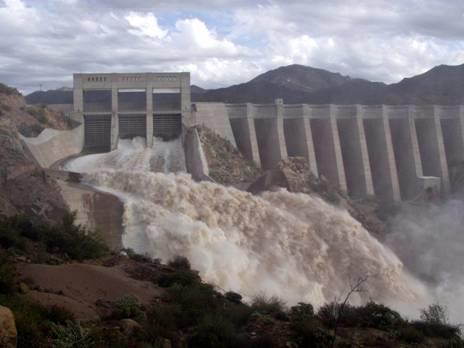
8 SRP Reservoirs and Water Delivery System


9 Surface Water Resources (SWR) Maintenance/Operation Coordination Summer Salt System Winter Verde System Monitoring and Forecasting for Reservoirs/Streamflow/Weather Water Supply Planning and Emergency Reservoir Operations 1. Plan for Drought 2. Prepare for Flood 3. Protect the Watershed Salt/Verde River System Operations


10 1 Mostly, It s About Managing For Times of Scarcity. Droughts Happen, and Are Nothing New to Arizona Roosevelt Lake Total
 2 nd Driest WY as of now 2010 1,419,000 2,311,000 100 2011 223,000 2,006,000 87 2012 196,000 1,512,000 66 2013 449,000 1,453,000 63 2014 148,000 1,300,000 56 2015 328,000 1,314,000")
11 Salt and Verde River Inflows Year Jan-May Inflow (AF) May 1 Storage (AF) May 1 Percent Full 2018 Winter Precipitation 3.13 (27% of normal) 2 nd Driest WY as of now ,419,000 2,311, ,000 2,006, ,000 1,512, ,000 1,453, ,000 1,300, ,000 1,314, ,181 1,307, ,440 1,731, ,013* 1,337, *2018 Lowest Jan-May Inflow 2002 Inflow 106,000 AF Lowest Inflow - consecutive 8-year period Lowest Inflow - consecutive 23-year period

12 Inflow Reservoir Operations Deliveries Groundwater Reservoir/River Losses Reservoir Planning and Operations


13
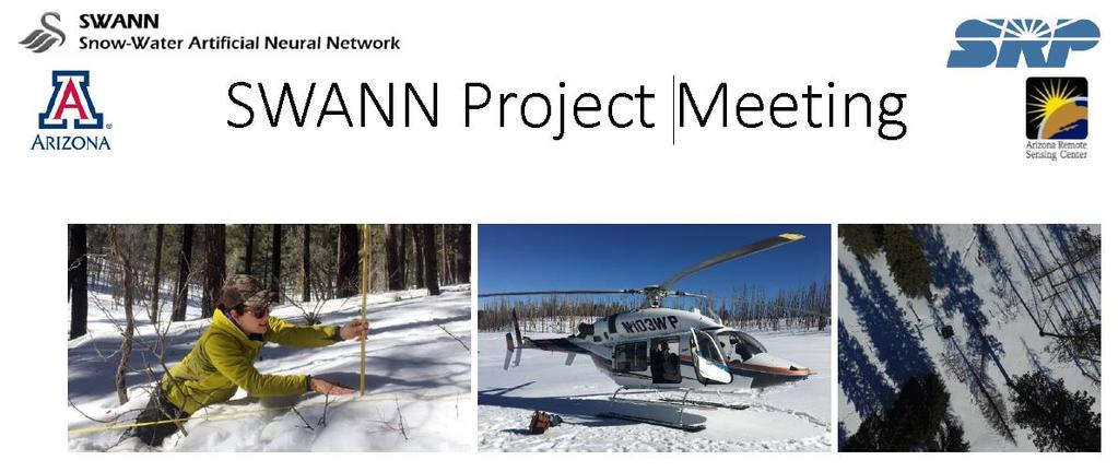
14 Provides Critical Snowpack Information for Stormflow Prediction


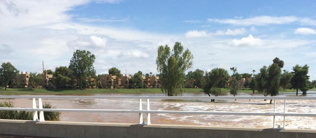
15 2 Floods Happen Be Prepared Refill Reservoirs and Replenish Groundwater


16 SWR coordinates WEROC WEROC Activation Criteria >20,000 cfs below Granite Reef Dam WEROC assumes operational responsibility, monitoring, documentation, and communication Water Emergency Reservoir Operations Center (WEROC)


17 PROP Committee, Agency Briefings & Communication Operational Priority Safety of Dams Population/Public at Risk Reservoir Release WEROC and Reservoir Release
18 WEROC Functional Exercise 2018 SRP s last Water Emergency Reservoir Operations Center (WEROC) event occurred in January As such, SRP Surface Water Resources is planning to conduct a simulated WEROC event (functional exercise) in November 2018 to satisfy USBR requirement. Functional exercise must conducted be in real time, complete communication protocols, and use resources that are available during an activation. No mobilization or action in the field will occur. FEB MAR APR MAY JUN JUL AUG SEP OCT NOV Preparation Activities: Communications Data Identification and Preparation Exercise Process Flows Storm Template Determination Resource Planning 2018 Planning/Data/Scenario Preps Development Readiness Testing Development Activities: Control Cell Input UI Set Up AQ Environment Data Loads XLS Storm Template Readiness Activities Technical Bug Fixes Process Changes Readiness Rehearsals 3-Day WEROC Certification Exercise Mid Nov 2018

19
 Summer")
20 Jun 15 Aug 23: 6.45 (154%) Summer Monsoon 2018


21 Watershed Monitoring Large, Mid, and Small Scale Long-Term Monitoring Plan Scale Large Mid Small


22


23 Middle Sycamore MS-1 Restoration Observation Area: Response to One-Hour Monsoon Storm event 2 days later with ¼ of precipitation from previous event! Middle Sycamore MS-1 Restoration Observation Area: Response to One-Hour Monsoon Storm event!


24 3 Other SRP Efforts to Protect the Resilience of the Watershed Forest Restoration


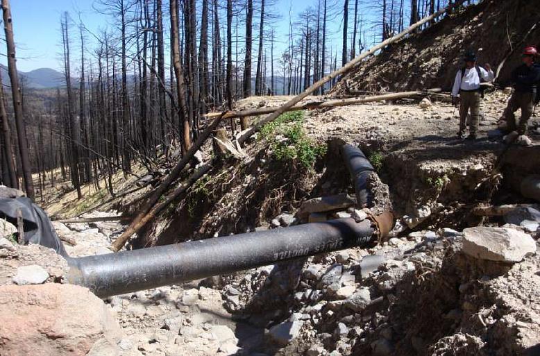

25 - Mount Baldy 09/09/2014, Council Meeting: Education Series, B. L. Hallin 10 Water Resource Impacts

26 - Mount Baldy Accelerating treatments and protecting watersheds Restoration Increases Resiliency Against Future Drought/Climate Change Monitoring Key to Identifying Change and Adaptive Management Watershed Solutions 10

27

28 Strong consensus among various ENSO models of at least a weak to moderate El Niño

29 El Niño Avg 30-yr Avg Best to plan for continuation of drought conditions


30 More groundwater pumping to conserve surface water we are initiating more pumping this year Coordinated heightened conservation messaging with Valley Cities/ADWR/CAWCD Reduce water allocation to customers Mutual aid agreements Seek other innovative water sharing agreements If The Drought Worsens Yet Further (In Order Taken)

31 Thank You 1. Plan for Drought 2. Prepare for Flood 3. Protect the Watershed