Brenna McDonald Missouri Department of Natural Resources Missouri Geological Survey
|
|
|
- Willis Martin
- 5 years ago
- Views:
Transcription
1 Missouri Risk-Based Corrective Action Process for Petroleum Storage Tanks, Evaluation of Groundwater Use in Greene County from a Geological Perspective Brenna McDonald Missouri Department of Natural Resources Missouri Geological Survey
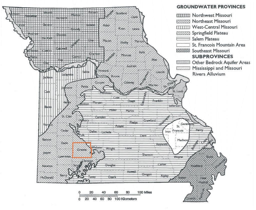
2 The Missouri Risk-Based Corrective Action Process for Petroleum Storage Tanks requires that all current and reasonably anticipated future use of groundwater must be protected. The geology of Greene County has a major effect on decision making regarding the evaluation of groundwater use. Due to the presence of karst features and fracture systems, contaminants have the potential to migrate rapidly, both horizontally and vertically and often make it difficult to determine the ultimate fate of contaminants released at a site. This presentation will discuss the geologic aspects of the evaluation of groundwater use in Greene County.
3 Site Specific Data Collection Identify Groundwater Zones Identify Existing Wells AUL That Eliminates Reasonable Probability of Future Use? Previously Figure 6-2, but the flow chart hasn t changed. Suitable for Use? Only Source? Evaluation required for EACH groundwater zone present at a site. Reasonable Probability of Future Use? Left side of chart pertains to a current-use evaluation. Reasonable Probability of Impact by Site COCs? Further Evaluation of Groundwater Use Pathway Required Middle of chart pertains to a future-use evaluation. Carry Groundwater Use Pathway Forward Figure 6-1. Site Conceptual Model for Domestic Consumption of Groundwater Exposure Pathway Analysis
4 Current and Future Use Site Specific Data Collection Identify Groundwater Zones

5 This publication is available for download as a PDF file at:
6

7 This stratigraphic section does not discuss more recent geologic materials such as residuum, loess, and alluvial deposits.
8 Many documents we review separate the shallow groundwater in the unconsolidated zone and run it through the flow chart. For much of Greene County, the unconsolidated materials supply recharge to the underlying aquifer and should be considered part of the underlying aquifer. Though there are site-specific exceptions, for most of Greene County, separating the shallow groundwater in the unconsolidated zone from the Springfield Plateau Aquifer isn t useful. It must be shown that a confining unit exists. Mostly, the only time we are concerned about groundwater in the unconsolidated zone is if the groundwater can be used, in and of itself, as an aquifer (such as in an alluvial setting).
9 Site Specific Data Collection Identify Groundwater Zones Identify Existing Wells AUL That Eliminates Reasonable Probability of Future Use? Current Use of Groundwater Suitable for Use? Only Source? Reasonable Probability of Future Use? Reasonable Probability of Impact by Site COCs? Further Evaluation of Groundwater Use Pathway Required Carry Groundwater Use Pathway Forward Figure 6-1. Site Conceptual Model for Domestic Consumption of Groundwater Exposure Pathway Analysis

10 WIMS Well Information Management System Post 1986 Logmain Pre-1986; t comprehensive Public Drinking Water Most likely many wells not plotted
11 Site Specific Data Collection Identify Groundwater Zones Future Use of Groundwater Identify Existing Wells AUL That Eliminates Reasonable Probability of Future Use? Suitable for Use? Only Source? Current Use Reasonable Probability of Future Use? Reasonable Probability of Impact Reasonable Probability of Impact by Site COCs? Further Evaluation of Groundwater Use Pathway Required Carry Groundwater Use Pathway Forward Figure 6-1. Site Conceptual Model for Domestic Consumption of Groundwater Exposure Pathway Analysis
12

13
14 Site Specific Data Collection Identify Groundwater Zones Identify Existing Wells AUL That Eliminates Reasonable Probability of Future Use? AUL Effectively eliminates futureuse of the Springfield Plateau Aquifer. Suitable for Use? Only Source? Reasonable Probability of Future Use? As for the Ozark Aquifer, beneath the Ozark Confining Unit, no AULs exist which would restrict installation of wells. Reasonable Probability of Impact by Site COCs? Further Evaluation of Groundwater Use Pathway Required The Ozark Aquifer is suitable for use in Greene County. Carry Groundwater Use Pathway Forward Figure 6-1. Site Conceptual Model for Domestic Consumption of Groundwater Exposure Pathway Analysis
15 We skipped the Only Source decision block of Figure 6-1. This decision block is commented upon in many reports, even though the groundwater zone in question is Suitable for Use. Most likely due to misunderstanding the purpose of this block. The Only Source decision block is for areas where the groundwater would not normally be considered Suitable for Use, e.g., areas with high TDS in groundwater, but the only source available. There are places in the state where the only available groundwater is not aesthetically pleasing, but because it is the only source available, it is treated and used.
16 Future Use of Groundwater For the Ozark Aquifer, the Reasonable Probability of Impact is fairly straightforward. Because the Ozark Aquifer is separated from the Springfield Plateau Aquifer by the Ozark Confining Unit, and new wells are required to be cased into the Ozark Confining Unit, the probability of impact to future groundwater wells completed in the Ozark Aquifer is nearly non-existent.
17 Current Use of Groundwater Prior to the Missouri Well Construction Rules, many groundwater wells were installed with minimal casing that penetrate both aquifers. Basically, only one way exists for there to be a Reasonable Probability of Impact to groundwater in the Ozark Aquifer in Greene County: 1. Older (or pre-law) existing wells in the area that are open to both the Springfield Plateau and Ozark Aquifers.
18 Current Use of Groundwater To evaluate Reasonable Probability of Impact to Existing Wells need to know whether contaminants can migrate to those wells. 1. Where is the discharge point for shallow groundwater? 2. How does the groundwater get there?

19 Current Use of Groundwater Several methods can be used to provide evidence for direction of groundwater movement. The most common is a potentiometric surface map. A potentiometric surface map has its limits in Greene County due to the well-developed karst systems present.

20 This site would require more information than just potentiometric and topographic maps. Sinkholes and losing streams are near this site. Must get a bigger picture.

21 So, zooming out.. You can see that there are two potential shallow groundwater discharge points. The springs and gaining stream to the southeast. The gaining stream section to the east. Still, left with a fairly large area of concern.

22 When we add Dye Trace Study Data. We see that the most likely discharge point for the site is to the southeast toward the spring. This reduces the area of potential impact to groundwater wells.
23 At most locations a ¼ mile radius search distance is sufficient when identifying domestic water wells for potential impact. However, in Greene County, due to its karstic nature, a ¼ mile search radius will most likely not be enough.
24 As you can see the most likely discharge point is approximately ¾ mile from the site. Main problem with karst environments is how fast and how far can contaminants travel through the subsurface The dye trace shown here only took two days from the time of injection to the time of recovery.

25 In Greene County, and in other counties known to have karst environments, the distance away from the site necessary to be investigated is likely going to be larger that in many other areas of the state. Location of the site and site-specific information are going to be key when searching for existing wells. A door-to-door well survey may become necessary.
26 Current Use of the Springfield Plateau Aquifer. Identify the Potential Impact Area. Determine the Local Discharge Point for Shallow Groundwater. Identify Existing Wells within the Potential Impact Area. Determine Whether Those Wells are at Risk.
27 Points to Remember: When we are tasked with reviewing a Domestic Use of Groundwater Pathway Analysis, we need to be reasonably certain that we know where the contaminants are and to where they ultimately discharge (their fate and transport). Any Questions??
28 Data Resources GeoSTRAT WIMS Geologic Resources of Missouri
29 Missouri Geological Survey Director: Joe Gillman Date: July 1, 2014 thing in this document may be used to implement any enforcement action or levy any penalty unless promulgated by rule under chapter 536 or authorized by statute.