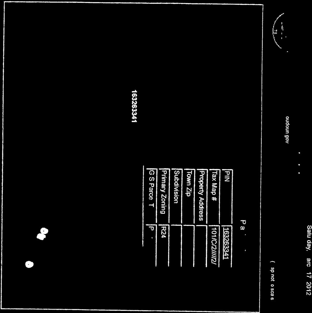
BOARD OF SUPERVISORS BUSINESS MEETING ACTION ITEM. Loudoun County Parkway/US Route 50 Conceptual Interchange Design. Blue Ridge & Dulles
|
|
|
- Abel Malone
- 5 years ago
- Views:
Transcription
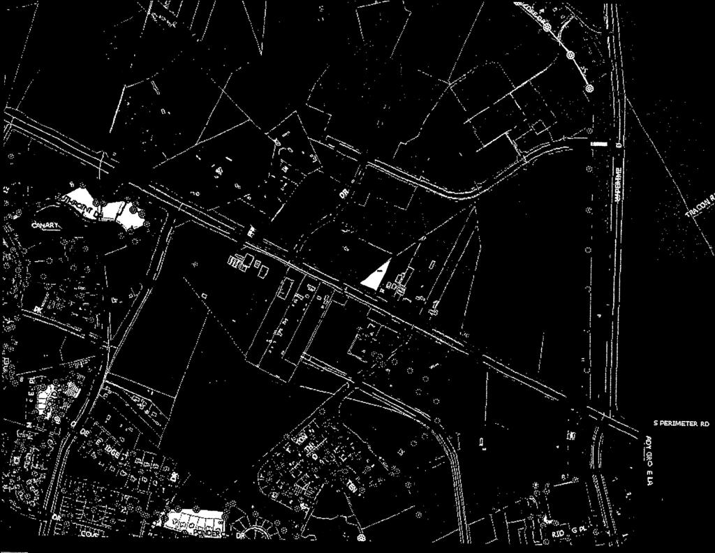
1 Date of Meeting: June 7, 2016 # 9 BOARD OF SUPERVISORS BUSINESS MEETING ACTION ITEM SUBJECT: ELECTION DISTRICTS: CRITICAL ACTION DATE: STAFF CONTACTS: Loudoun County Parkway/US Route 50 Conceptual Interchange Design Blue Ridge & Dulles At the pleasure of the Board Marc Dreyfuss, Transportation and Capital Infrastructure Lou Mosurak, Transportation and Capital Infrastructure Joe Kroboth, III, Transportation and Capital Infrastructure PURPOSE: To report on the results of a planning level study conducted to develop a conceptual design for the planned interchange at Loudoun County Parkway (Route 606) and US Route 50, and request endorsement of the conceptual design from the Board of Supervisors (Board). RECOMMENDATION: Staff recommends that the Board endorse the preferred partial cloverleaf conceptual design for an interchange at Loudoun County Parkway and US Route 50, as shown in Attachment 1. BACKGROUND: The Countywide Transportation Plan (CTP) includes a planned gradeseparated interchange at the intersection of Loudoun County Parkway (Route 606) and US Route 50, adjacent to the southwest corner of Washington Dulles International Airport (Dulles Airport), as shown on Attachment 2. Currently, the at-grade intersection of these roadways is operating at a failing level of service (LOS) during all peak periods. Improvements to both Old Ox Road (Route 606) and Loudoun County Parkway (Route 606/607) to the north of this intersection are currently under construction and are anticipated to increase demand at this already congested intersection. Land development applications have been submitted to the County in the northwest quadrant (ZMAP Dulles Landing) and southeast quadrant (SPEX Mosby Self- Storage) of the existing intersection and are under review, and additional land development applications are in the near future for the southwest quadrant of the existing intersection. Given the potential limitations that could result from these proposals, a conceptual interchange design study was undertaken to ensure that the County is able to identify and negotiate the needed rightof-way that would be needed for future engineering and construction of an interchange at this
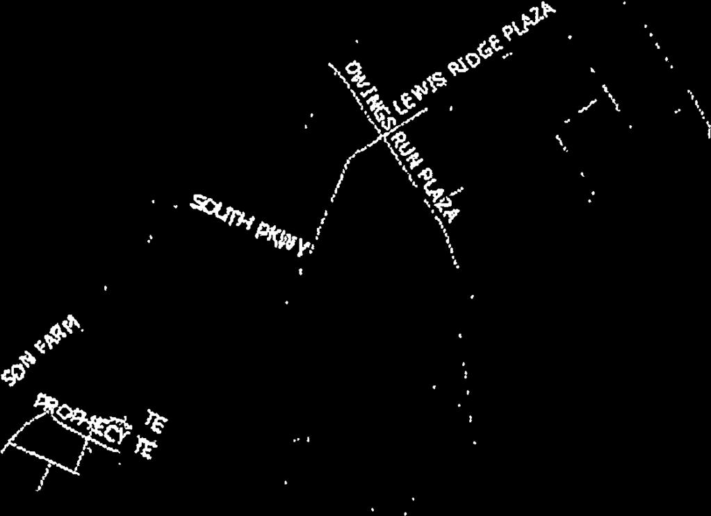
2 Item 9, Loudoun County Parkway/US Route 50 Conceptual Interchange Design Board of Supervisors Business Meeting June 7, 2016 Page 2 location. As additional background, a chronology of significant actions regarding this planned interchange is outlined below. Initial Interchange Design Effort (2006 to 2013): In November 2006, the November 2006 Local Road Bond Referendum was approved by Loudoun County voters, allocating $3.3 million in funding to complete the design of an interchange at Loudoun County Parkway and US Route 50. Following approval of this referendum, Loudoun County entered into a contract (QQ-01255) with Wilbur Smith Associates, Inc. (WSA) to prepare a conceptual design (10%) for a grade-separated interchange at this location. The value of the WSA contract was $297,006. In November 2008, the Board voted to suspend several capital projects for 90 days including design work for this interchange. On February 3, 2009, in an effort to reduce debt, the Finance, Government Services and Operations Committee (FGSOC) decided to not issue new debt for the interchange project. Due to funding constraints, the project was placed on hold until In July 2012, the Department of Transportation and Capital Infrastructure (DTCI) held meetings with impacted property owners to present the conceptual interchange design and solicit feedback on the design and impacts to these properties. In July 2013, these designs, along with feedback gained from meetings with stakeholders, were brought forth to the Transportation and Land Use Committee (TLUC) for consideration (Attachment 3). At that time, staff noted several property impact issues and considerable construction costs related to the interchange concepts. These concepts included large, flyover ramps that impacted large land areas in all quadrants. At that time, the TLUC chose not to act on these conceptual designs and did not support any of the proposed concepts. The TLUC recommended that staff conduct additional traffic analyses and that more efficient design configurations be considered before proceeding any further with the interchange design effort. The TLUC suggested that staff look at alternative designs for this interchange that could potentially lower the cost of the project and have less of an impact on affected properties. The TLUC meeting summary is included as Attachment 4. Western Dulles Access Study (2014 to 2015) In 2013 the Virginia Department of Transportation (VDOT) initiated an Environmental Assessment (EA) for the Dulles Air Cargo, Passenger and Metro Access Highway (DACPMAH), a new limited-access roadway providing direct access from the west and south to Dulles Airport. The DACPMAH study was envisioned as a means to improve connectivity to the airport particularly as it relates to the yet undeveloped Western Lands along the Old Ox Road corridor. Multiple access points to the Western Lands were considered off of Loudoun County Parkway between US Route 50 and Old Ox Road. In 2014, the Board initiated the Western Dulles Access Study (WDAS) in response to DACPMAH. The WDAS study, completed by Kimley-Horn and Associates (Kimley-Horn), indicated that the CTP road network could accommodate the traffic generated by development of the Dulles Airport and its Western Lands. Several related projects were undertaken in this
3 Item 9, Loudoun County Parkway/US Route 50 Conceptual Interchange Design Board of Supervisors Business Meeting June 7, 2016 Page 3 vicinity immediately following the results of WDAS, including preliminary interchange design work at Loudoun County Parkway (Route 606/607) and Old Ox Road (Route 606), a Comprehensive Plan Amendment (CPAM) for the Evergreen Mills Road corridor, a preliminary design study for an interchange at US Route 50 and Northstar Boulevard (Route 659 relocated), and a conceptual design study for an interchange at Loudoun County Parkway and US Route 50. These studies indicated that both the Loudoun County Parkway at Old Ox Road and Loudoun County Parkway at US Route 50 intersections require grade-separated interchanges in order to efficiently move existing and planned traffic volumes. Current Interchange Design Effort (2015 to 2016): In November 2015, DTCI commenced work on a conceptual design for the Loudoun County Parkway/US Route 50 interchange as a derivative work product from WDAS. This work was expedited due to land development applications in the vicinity of the interchange site. The goal of the study was to ensure that appropriate land dedication and access management could be requested as part of the development review process. An analysis of current and forecasted traffic volumes, as well as four distinctive interchange concepts, were provided to DTCI by the consultant, Kimley-Horn, in January This initial analysis considered a Modified Cloverleaf, a Partial Cloverleaf (ParClo), a Modified Single- Point Urban Interchange (Modified SPUI), and a Diverging Diamond Interchange (DDI). From this initial alternatives analysis: 1. A Diverging Diamond Interchange (DDI) design was dismissed due to forecasted failing levels of service at several interchange approaches. 2. A Modified Full Cloverleaf interchange design is forecasted to operate acceptably in 2040 based upon the analysis but was dismissed due to the expansive footprint that would be required for such an interchange, the associated impacts to surrounding properties, visual impacts and costs due to the inclusion of a southbound to eastbound flyover ramp, and a desire to avoid excessive weave/merge movements. These factors would have likely lead to an increased final cost for both design, land acquisition, and construction of the interchange. 3. A Modified Single-Point Urban Interchange (SPUI) design is forecast to operate acceptably based on the analysis and had the smallest footprint of any of the alternatives considered. However, this small footprint was made possible by a third-level flyover ramp, which would have resulted in the need for several high bridges and significant visual impacts and possibly impact the airspace clearances for the nearby Dulles Airport. These factors would have likely lead to an increased final cost for both design and construction of the interchange. 4. A Partial Cloverleaf (ParClo) interchange design is forecasted to operate acceptably based on the anticipated 2040 traffic volumes. While it features a footprint slightly larger than the Modified SPUI, the ParClo s largest impacts are to land in the southwest
4 Item 9, Loudoun County Parkway/US Route 50 Conceptual Interchange Design Board of Supervisors Business Meeting June 7, 2016 Page 4 quadrant already reserved for dedication to the County under the proffers of approved land development applications (South Riding LP, ZMAP and Toll VA II LP, ZMAP ) and land in the northeast quadrant that is owned by the Metropolitan Washington Airports Authority (MWAA). The ParClo design would also require only a single bridge span to carry Loudoun County Parkway over US Route 50, limiting visual impacts and likely lowering the cost of construction. In order to understand the potential property impacts of the Modified SPUI and ParClo interchange concepts, Kimley-Horn prepared diagrams to demonstrate the property impacts and public road access changes that would be mandated by each conceptual design. These diagrams are included as Attachment 5 and show that the property impacts of the two designs would be nearly identical. Additionally, based on 2040 traffic forecasts, it was determined that an interchange design with a single bridge overpass across US Route 50 would be feasible if freeflow traffic could be maintained from southbound Loudoun County Parkway to eastbound US Route 50. After consideration of the alternatives, staff recommended the ParClo interchange and directed the consultant to move forward with the final report based upon this alternative, noting the relative limited impacts to surrounding land, the limited visual impacts, and the likely lower cost of construction. A final report was prepared by Kimley-Horn and delivered to staff on March 18, This report is provided as Attachment 6 and shows overwhelming preference for the ParClo interchange option, with the only noted drawback being the traffic signals required on Loudoun County Parkway under this concept. These signals would be located along the mainline of Loudoun County Parkway (Route 606) at the end of the exit ramp from westbound Route 50 to move onto southbound Loudoun County Parkway and at the end of the exit ramp from eastbound Route 50 to move onto both directions of Loudoun County Parkway. However, movements along US Route 50, from US Route 50 onto northbound Loudoun County Parkway, and from southbound Loudoun County Parkway to onto both eastbound and westbound US Route 50 would be free-flowing, meaning the heaviest traffic movements at this interchange would not be signalized. ISSUES: Board Endorsement needed: Staff is seeking an endorsement from the Board for the ParClo conceptual interchange design. Without endorsement, the County may not be able to ensure that the interchange could be constructed using the optimal ParClo design at the lowest possible cost due to land development applications (currently under review) impacting the footprint of the future interchange. Following endorsement, design engineering would be required to determine exact property impacts, visual impacts, and construction costs. FISCAL IMPACT: There is no direct fiscal impact resulting from the endorsement of a conceptual design for this interchange. If the Board chooses not to endorse the conceptual design, project costs could increase if an opportunity to secure right-of-way for the interchange is missed by not having an endorsed conceptual design. Currently, the final design of the interchange is not funded in the Capital Improvement Program budget.
5 Item 9, Loudoun County Parkway/US Route 50 Conceptual Interchange Design Board of Supervisors Business Meeting June 7, 2016 Page 5 ALTERNATIVES: 1. The Board could endorse the conceptual interchange design, thereby securing opportunities for planning efforts to move forward and for staff to work with property owners to acquire necessary right-of-way. 2. The Board could direct staff to further evaluate one of the other interchange designs mentioned in the study and this item. 3. The Board could direct staff to hold a public information meeting on this conceptual design to seek input and report back to the Board. 4. The Board could take no action, and staff would continue to request right-of-way for the future interchange as may be necessary in order to accommodate the most expansive potential design (full cloverleaf) for this interchange. DRAFT MOTIONS: 1. I move that the Board of Supervisors endorse the conceptual partial cloverleaf design for the Loudoun County Parkway / US Route 50 interchange, as shown in Attachment 1 (to the June 7, 2016 Action Item), subject to future design and engineering studies. OR 2. I move an alternate motion. ATTACHMENTS: 1. Conceptual Interchange Design for Board Endorsement (March 2016) 2. Countywide Transportation Plan Map showing Loudoun County Parkway / US Route 50 intersection vicinity and the associated CTP Planning Guidelines for Major Roadways (Appendix 1) 3. TLUC Item #8: Status/Endorsement of US Route 50/Route 606 Interchange Concept Plan (July 12, 2013) 4. TLUC Meeting Summary (July 12, 2013) 5. Property Impact Map Resulting from Conceptual Interchange Design (March 2016) 6. Final Report on Conceptual Interchange Analysis (March 2016)


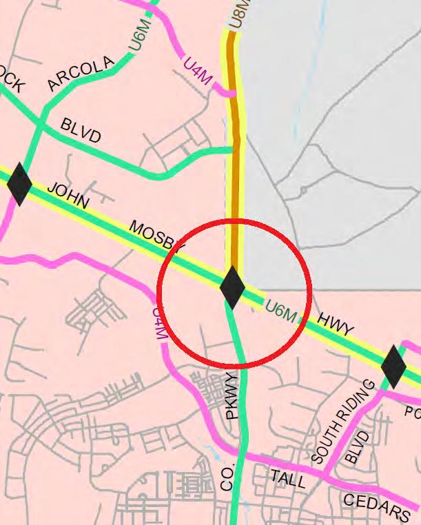
6 US ROUTE 50 FUTURE CONNECTION TO BE DETERMINED DULLES LANDING DR TALL CEDARS PKWY RIDING CENTER DR FUTURE CONNECTION TO BE DETERMINED LEGEND: Potential Collector Road Eastern Alignment Option 1 Potential Collector Road Eastern Alignment Option 2 1 Potential Collector Road Western Alignment Proposed Bridge Proposed Sidewalk/Trail Proposed Median Barrier Existing Right-of-Way/Property Line Proposed Right-of-Way Proposed/Existing Roadway EXHIBIT LOUDOUN COUNTY DTCI ELK LICK RD ROUTES DEPICTED ARE CONCEPTUAL IN NATURE AND ARE YET TO BE DETERMINED LOUDOUN COUNTY PARKWAY/ US ROUTE 50 INTERCHANGE CONCEPTUAL LAYOUT FUTURE CONNECTION TO BE DETERMINED FUTURE ACCESS TO BE DETERMINED FINAL CONFIGURATION OF SIDEWALK/TRAIL TO BE DETERMINED LOUDOUN COUNTY PKWY FUTURE CONNECTION TO BE DETERMINED THE INTERCHANGE CONFIGURATION SHOWN REFLECTS CURRENT AASTHO AND VDOT DESIGN STANDARDS. CENTERLINE RADII FOR INTERCHANGE RAMPS REFLECT A DESIGN SPEED OF 30 MPH. THE LENGTH OF ACCELERATION/DECELERATION LANES REFLECT THE DISTANCE REQUIRED TO CHANGE SPEEDS TO/FROM A POSTED SPEED LIMIT OF 55 MPH ON US ROUTE 50 AND LOUDOUN COUNTY PARKWAY TO A POSTED RAMP SPEED OF 25 MPH. ATTACHMENT 1
7 ATTACHMENT 2
8 20. US Route 50 - John Mosby Highway Segment Fairfax County Line west to VA Route 659 Relocated (Northstar Boulevard) Policy Area Suburban (Dulles) Existing Condition Functional Class Lanes/Right of Way Description Interim Condition Functional Class Lanes/Right of Way Description Bicycle/Pedestrian Facilities Minor Arterial 4-6/Varies R4M/R6M. Controlled access and local access median divided rural arterial. Currently six-lane (R6M) section between VA Route 742 (Poland Road) and VA Route 606 (Loudoun County Parkway). Individual site access occurs along entire segment. Median crossover spacing varies. Design speed varies. Principal Arterial 6/200 feet Additional ROW may be needed for turn lanes U6M. Controlled access median divided urban arterial. Individual site access will be terminated. Left and right turn lanes required at all intersections. Design speed determined by VDOT and DTCI. Refer to Table A in Appendix 6 and to Loudoun County Bicycle and Pedestrian Mobility Master Plan for facilities requirements. Ultimate Condition Functional Class Lanes/Right of Way Description Principal Arterial 6/200 feet Additional ROW may be needed for interchange(s) U6M. Limited access median divided urban arterial. Grade-separated interchanges at VA Route 2200 (Tall Cedars Parkway), VA Route 2201 (South Riding Boulevard), VA Route 606 (Loudoun County Parkway), VA Route 606 Extended (Arcola Boulevard/West Spine Road), and VA Route 659 Relocated (Northstar Boulevard). Grade-separated options to be explored at VA Route 609 (Pleasant Valley Road). All at-grade access is terminated. Functionality of planned interchanges within the segment of the planned limited access corridor between VA Route 606 (Loudoun County Parkway) and VA Route 659 Relocated (Northstar Boulevard) to be reviewed by a later study. Design speed determined by VDOT and DTCI. Bicycle/Pedestrian Facilities Refer to Table A in Appendix 6 and to Loudoun County Bicycle and Pedestrian Mobility Master Plan for facilities requirements. A1-19
9 36. VA Route Loudoun County Parkway Segment VA Route 606 (Old Ox Road) at VA Route 842 (Arcola Road/future Arcola Boulevard) intersection south to US Route 50 (John Mosby Highway), following existing VA Route 606 alignment Policy Area Existing Condition Functional Class Lanes/Right of Way Description Interim Condition Functional Class Lanes/Right of Way Suburban (Dulles) Major Collector 2-4/varies R2/U4M. Local access undivided and median divided urban collector road; two-lane (R2) section north of VA Route 621 (Evergreen Mills Road); four-lane divided (U4M) section elsewhere. Design speed varies. Minor Arterial 4/120 feet Additional ROW may be needed for turn lanes Description U4M. Controlled access median divided urban arterial. Refer to VDOT Road Design Manual for median crossover spacing requirements. Left and right turn lanes required at all intersections. 50 mph design speed. Bicycle/Pedestrian Facilities Ultimate Condition Functional Class Lanes/Right of Way Refer to Table A in Appendix 6 and to Loudoun County Bicycle and Pedestrian Mobility Master Plan for facilities requirements. Principal Arterial 8/200 feet Additional ROW may be needed for turn lanes and interchange(s) Description Bicycle/Pedestrian Facilities U8M. Limited access median divided urban arterial. Grade-separated interchanges at VA Route 606 (Old Ox Road) and US Route 50 (John Mosby Highway). Additional grade-separated options to be explored at other existing intersections along segment. Study of alternative uses (e.g., HOV, bus lanes) to be considered when facility is expanded to Ultimate Condition. Design speed determined by VDOT and DTCI. Refer to Table A in Appendix 6 and to Loudoun County Bicycle and Pedestrian Mobility Master Plan for facilities requirements. A1-28
10 37. VA Route Loudoun County Parkway Segment US Route 50 (John Mosby Highway) south to VA Route 620 (Braddock Road) Policy Area Existing/Interim Condition Functional Class Lanes/Right of Way Suburban (Dulles) Minor Arterial 4/120 feet Additional ROW may be needed for turn lanes and bicycle/pedestrian facilities Description U4M. Controlled access median divided urban arterial. Refer to VDOT Road Design Manual for median crossover spacing requirements. Left and right turn lanes required at all intersections. 50 mph design speed. Bicycle/Pedestrian Facilities Ultimate Condition Functional Class Lanes/Right of Way Refer to Table A in Appendix 6 and to Loudoun County Bicycle and Pedestrian Mobility Master Plan for facilities requirements. Principal Arterial 6/120 feet Additional ROW may be needed for turn lanes and bicycle/pedestrian facilities Description U6M. Controlled access median divided urban arterial. Gradeseparated interchange at US Route 50 (John Mosby Highway). Refer to VDOT Road Design Manual for median crossover spacing requirements. Left and right turn lanes required at all intersections. 50 mph design speed. Bicycle/Pedestrian Facilities Refer to Table A in Appendix 6 and to Loudoun County Bicycle and Pedestrian Mobility Master Plan for facilities requirements. A1-29
11 BOARD OF SUPERVISORS TRANSPORTATION AND LAND USE COMMITEE INFORMATION ITEM Date of Meeting: July 12, 2013 # 8 SUBJECT: ELECTION DISTRICT: CRITICAL ACTION DATE: STAFF CONTACTS: Status Update on the Route 50/Route 606 Interchange Concept Plan Dulles At the Pleasure of the Board Chris Glassmoyer, Transportation & Capital Infrastructure (DTCI) Joe Kroboth, III, DTCI BACKGROUND: The Countywide Transportation Plan (CTP), adopted June 15, 2010 and amended May 2, 2012, includes a future provision for Route 50, from North Star Boulevard east to Route 28, to become a limited access highway in the future. To accomplish this goal, five interchanges will need to be constructed along this corridor. At this time these interchanges are shown on the CTP, but none of these interchanges are in the Capital Improvement Program (CIP), including the Route 50/Route 606 interchange. On November 1, 2006, Loudoun County entered into a contract (QQ-01255) with Wilbur Smith Associates, Inc. (WSA) to prepare a conceptual design (10%) for a highway interchange at the intersection of Route 50 and Route 606. The value of the WSA contract was $297,006. As a part of the November 2006 Local Road Bond Referendum, the voters approved $3.3 million in funding to complete the interchange design. In November 2008 the Board voted to suspend several capital projects for 90 days which included funding for this interchange project. On February 3, 2009 the Finance,Government Services and Operations Committee, based on the need to reduce debt, decided to not issue the debt for the interchange project. The rationale being there was no funding available (programmed or proffered) to obtain right-of-way or progress to construction. Design on the concept plan continued and the Virginia Department of Transportation (VDOT) communicated their endorsement for the conceptual design in a letter dated February 13, 2012 (Attachment 1). Meetings with impacted property owners were then held by the Department of Transportation and Capital Infrastructure (DTCI) staff in July 2012 to present the concept interchange and illicit feedback on the design and impacts to these properties. ATTACHMENT 3
12 Item #8: Status/Endorsement of Route 50/Route 606 Interchange Concept Plan Transportation and Land Use Committee July 12, 2013 Page 2 ISSUES: Throughout the development of the interchange conceptual design, two relevant issues have evolved that affect how we move forward with this project. They are: 1. Approvals of Special Exceptions (SPEX) and Site Plans (STPL) impacting the Conceptual Interchange - Two commercial plans have been approved and constructed along Route 50 and Elk Lick Road which preclude access to parcels located at the south east quadrant of the interchange. These developments are the Main Street Development (approved July 16, 2009 as SPAM ) and the Hogan and Sons Goodyear (approved January 13, 2009 as SPEX ). The Hogan and Sons Goodyear plan is part of the overall South Riding Professional Center. On the graphic of the interchange (Attachment 2) a cul-de-sac is depicted, which would have been an extension of Defender Drive from east of Elk Lick Road. However, with the two developments listed above already constructed, a standard VDOT section road with adequate right-of-way cannot be constructed between the two developments, thus eliminating access to eight (8) parcels located at the south east quadrant of the interchange. If access cannot be provided to these parcels, the properties would become a total take rather than a right-of-way acquisition. Per the Loudoun County Real Estate, Assessment & Parcel Database, staff estimates the cost of acquisition of the properties to be approximately $20 million vs. $6 million if access could be provided, allowing these properties to be developed in the future (note these are estimates utilizing 2011 assessment values). 2. Impacts to properties in vicinity of the Conceptual Interchange - During July 9-16, 2012, DTCI invited property owners to a series of meetings to unveil the conceptual interchange design and ask for feedback. A total of 31 property owners directly impacted by the concept were invited via certified mail, and approximately 12 properties were represented or attended the meetings. Approximately six properties, per the concept, would be total takes and the remainder would require right-of-way dedications and easements to construct the interchange. The interchange would impact existing commercial businesses at the northeast, southeast, and southwest quadrants, and correspondence was received from five properties (Attachment 3). As discussed in the previous issue, the eight properties at the southeast quadrant would be denied access and thus landlocked, increasing land acquisition costs by approximately $14 million. For the existing businesses at the northeast quadrant, the viability of their operations would be greatly diminished. At the southwest quadrant, the interchange proposes elimination of an access to South Riding Market Square, risking existing lease agreements with tenants. While the conversion of Route 50 to a limited access highway and the interchange at Route 606 is a priority; Staff is of the opinion that additional traffic analyses should be performed and other more efficient design configurations be considered before proceeding any further with the interchange design.
13 Item #8: Status/Endorsement of Route 50/Route 606 Interchange Concept Plan Transportation and Land Use Committee July 12, 2013 Page 3 ATTACHMENTS: 1. VDOT Letter dated February 13, Interchange Concept Exhibit dated April 9, Correspondence from Property Owners

14 ATTACHMENT 1


15 ATTACHMENT 2
16


17

18
19

20


21
22


23


24


25
26
27 Meeting Summary Transportation and Land Use Committee July 12, 2013 Page 6 contain agriculturally and forestally significant land. Seconded by Supervisor Reid. The motion passed (Supervisor Clarke absent for the vote). Election District: Blue Ridge Staff Contacts: Kellie Boles & Tom Flynn, Department of Economic Development 7. Status Update-Water & Wastewater Needs Assessment Implementation Work Plan (Information) Alan Brewer, General Services, provided the Committee with a status update of work completed as part of the Evaluation Phase of the Work Plan. Chairman Volpe thanked staff for their work on the Work Plan and asked that future reports include applications that have needed assistance with either water or wastewater needs. Election District: Countywide Staff Contacts: Gwen Kennedy, Alan Brewer & Richard Pezullo, General Services 8. Status/Endorsement of Route 50/Route 606 Interchange Concept (Information) Joe Kroboth, Director of Transportation and Capital Infrastructure (DTCI), stated that in 2006 Loudoun County entered into a contract with Wilbur Smith Associates, Inc. to develop a conceptual plan for the Route 50/Route 606 Interchange Project. He explained that since that time, there had been a significant amount of change to that area as well as several other traffic studies and more current information available. Chris Glassmoyer, DTCI, stated the plan for the project in 2006 was to meet with property owners to present the concept plan, which was accomplished through a series of meetings held in late 2012, after which letters of objection from the property owners were received. He explained that through the process, two developments along Route 50 and Elk Lick Road were discovered to have been approved and constructed precluding access to eight (8) properties in the southeast quadrant of the proposed interchange footprint; creating considerable cost implications of acquiring right-of-way. He further explained that Toll Commercial (located in the southwest quadrant) would experience access issues, putting them in conflict with their lease for their tenants. For these reasons and other developments regarding Route 606 and potential future air cargo access road projects, Mr. Glassmoyer stated staff s recommendation for reconsideration of the original conceptual footprint. He further stated staff s support of the interchange on the Countywide Transportation Plan, but suggested that the County should consider looking at alternative designs that could potentially lower the cost of the project and have less of an impact on affected properties when project funding becomes available. Election District: Dulles Staff Contacts: Chris Glassmoyer & Joe Kroboth, Transportation & Capital Infrastructure ATTACHMENT 4
 N NOT TO SCALE Approximate starting point of lane separation between mainline Loudoun County Parkway and free-flow ramps to US 50 Interchange")
28 US Route 50 and Loudoun County Parkway Interchange Planning Level Concept Evaluation Figure 17 Partial Cloverleaf Property Access Impact Evaluation No Right-Turn onto Dulles Landing Drive from US Route 50 (allow inbound trips from US 50 WB On-Ramp) N NOT TO SCALE Approximate starting point of lane separation between mainline Loudoun County Parkway and free-flow ramps to US 50 Interchange Configuration: Level 1 US Route 50 Level 2 Loudoun County Parkway Allow Business Access from Vance Road Only Legend Future Interchange Eliminate Access to US Route 50 Full Access Signalized Intersection Full Access Stop Controlled Intersection Right-In and/or Right-Out Stop Controlled Intersection New Residential Driveway New Local Roadway Existing Communications Tower to be Relocated / / Alt. Location for New Roadway Residence / Business with Access from US Route 50 Only Residence / Business to be Eliminated The interchange configurations depicted above reflect Synchro 9.0 networks that were developed schematically using the program and GIS base mapping. The configurations of the interchange, residential driveway, and local roadway shown in the figure do not reflect design standards and are not considered to be design level detail. These are presented for graphical purposes only and are not to scale. Further evaluation of concept geometry using computer-aided design software is recommended to evaluate geometric configurations and feasibility.
29 US Route 50 and Loudoun County Parkway Interchange Planning Level Concept Evaluation Technical Report FINAL REPORT March 2016 ATTACHMENT 6
30 Contents Executive Summary... 1 Chapter 1. Introduction... 3 Chapter Existing Conditions... 3 Chapter Traffic Forecasting and No Build Analyses... 6 Chapter Traffic Forecasting Chapter 5. Interchange Concept Development and Analysis Chapter 6. Property Acquisition and Access Impacts Evaluation Chapter 7. Recommendations Figures Figure 1: 2015 Peak Hour Traffic Volumes... 5 Figure 2: Select Link Analysis Segments... 9 Figure 3: 2020 Turning Volume Reassignments Figure 4: Forecast 2020 Intersection Traffic Volumes Figure 5: Travel Demand Model 24-Hour Link Volumes Figure 6: Consolidated Intersection Volumes at Gum Spring Road Figure 7: 2040 No Build Scenario Forecast Peak Hour Traffic Volumes Figure 8: Interchange/5-Interchange Build Scenario Post-Processing Figure 9: Interchange Build Scenario Forecast Peak Hour Traffic Volumes Figure 10: Interchange Build Scenario Forecast Peak Hour Volumes Figure 11: Interchange Build Scenario Forecast Peak Hour Volumes Figure 12: Interchange Build Scenario Forecast Peak Hour Volumes Figure 13: SPUI Property Impact Evaluation Figure 14: Partial Cloverleaf Property Impact Evaluation Figure 15: Existing Roadway Network Configuration Figure 16: SPUI Property Access Impact Evaluation Figure 17: Partial Cloverleaf Property Access Impact Evaluation FINAL REPORT March 2016 Page i
31 Tables Table E1: Summary of Overall Intersection LOS and Delay... 1 Table E2: Summary of 2040 Overall Intersection LOS and Delay... 2 Table 1: Summary of LOS and Delay (Existing Conditions)... 4 Table 2: VDOT AADT Data Summary... 7 Table 3: TDM Volume Summary... 8 Table 4: Summary of Overall Intersection LOS and Delay Table 5: Summary of Overall Intersection LOS and Delay ( interchange Scenario) Table 6: Summary of Overall Intersection LOS and Delay ( interchange Scenario) Table 7: Pros and Cons of Interchange Configurations FINAL REPORT March 2016 Page ii
32 Executive Summary The Loudoun County Comprehensive Transportation Plan (CTP) has identified the need for a grade separated interchange at the existing signalized intersection of US Route 50 and Loudoun County Parkway. This study was completed in an effort to identify potential interchange configurations to accommodate future traffic conditions. The following is a high-level overview of the results of the study intended to highlight key information gathered from the operational analyses and potential property impacts. Existing Conditions Failing operations during the AM and PM peak hours for all turning movements with queue spillback from the available storage lanes at the study intersection Significant queuing southbound during the PM peak hour (upwards of 0.5 miles) 2020 No Build Conditions Assuming a 4 percent annualized growth rate through the year 2020 without any construction of the CTP network, traffic conditions worsen at the study intersection Considering the CTP transportation network, notable shifts in travel patterns can be expected in 2020 that would reduce traffic demand at the study intersection. The CTP network included: o Arcola Boulevard o Gum Spring Road north of US Route 50 (aligned with Stone Springs Boulevard) o Extension of Northstar Boulevard through US Route 50 o Completion of Loudoun County Parkway o Route 606 widening (six lane facility) Table E1: Summary of 2015 and 2020 Overall Intersection LOS and Delay Peak Hour AM Peak Hour PM Peak Hour 2015 Existing E (74.5) E (57.9) 2020 No Build (w/out CTP network) F (115.8) F (91.7) 2020 No Build (w/ctp network) E (68.5) D (42.7) 2020 No Build Conditions Results The CTP network (summarized above) will improve intersection level of service The CTP network includes the widening of Loudoun County Parkway to 6 lanes; this allows for the reallocation of green time at the intersection to the failing left-turn movements 2040 No Build and Build Conditions The 2040 No Build condition does not account for the CTP network; therefore, continued deterioration of operating conditions is expected A single point urban interchange (SPUI), diverging diamond interchange (DDI), partial cloverleaf interchange, and full cloverleaf interchange were identified as candidate interchange configurations FINAL REPORT March 2016 Page 1
33 The SPUI and partial cloverleaf interchange are recommended and would operate at an overall intersection LOS D or better during both peak hours, with most movements at LOS E or better Table E2: Summary of 2040 Overall Intersection LOS and Delay 1 Peak Hour No Build SPUI DDI 2 Partial Cloverleaf 2 AM Peak Hour PM Peak Hour F (154.3) F (116.0) C (29.4) C (34.0) D (43.1) F (87.2) B (17.5) C (23.4) Full Cloverleaf 3 C (21.4) B (14.3) 1 Analyses were completed considering 4 and 5 interchanges constructed along US Route 50 and the County limits. The LOS results in Table E2 consider 5 interchanges along US Route LOS and delay reported is for the worst performing intersection at the interchange. 3 LOS reported is based upon HCS density analyses of the weaving segments; LOS and density (pc/mi/ln) is reported for the worst performing weave segment. Property Impacts The SPUI would impact approximately 21 acres around the study intersection while the partial cloverleaf would impact approximately 34 acres (approximately 60% more than the SPUI) Two homes and one business would likely be displaced by either interchange configuration Recommendations The County should prioritize CTP network improvements (summarized above under 2020 No Build Conditions) to delay the need for significant intersection improvements (or interchange construction) at the study intersection Mitigation measures to the study intersection should be identified if the CTP network will not be in place by the year These could include: o Localized intersection improvements (e.g. widening, free-flow right-turn lanes) o Signal timing optimization The Partial Cloverleaf is recommended as the optimal configuration for this interchange considering operations and the scale of construction (i.e. no third level flyover structures) A comprehensive evaluation of all interchange locations along the US Route 50 corridor between Northstar Boulevard and Fairfax County is recommended to identify the optimal configuration at each planned location and determine operational characteristics, challenges, and potential mitigation measures. This could be conducted as a corridor study to encompass interchange access, arterial configurations, and land use planning. Based on the outcome of the comprehensive interchange evaluation, a secondary evaluation of access to individual properties along the corridor is recommended to ensure comparable access can be maintained. o A preliminary review of access to US Route 50 was completed in April 2015 by Kimley-Horn and Associates between Northstar Boulevard and Loudoun County Parkway. The evaluation focused on identifying recommendations for restricted access and interchange locations consistent with the CTP. o This study could be expanded upon to include the portion of US Route 50 east of Loudoun County Parkway. FINAL REPORT March 2016 Page 2
34 Chapter 1. Introduction A planning level concept evaluation was completed for a proposed future interchange at US Route 50 and Loudoun County Parkway to identify a configuration that best supports horizon year (2040) traffic volume forecasts. The evaluation was based on existing traffic data and the traffic volume assignments generated by the County travel demand model. The 2040 no build and build models were considered as part of the assessment, with the build models accounting for planned transportation network improvements per the approved the Countywide Transportation Plan (CTP). Additional analyses were performed for 2020 no build conditions to assess near-term operating conditions with and without transportation network improvements to enhance access through the study area. These analyses were completed independently of the interchange evaluation to understand intersection operations and levels of congestion without intersection improvements. The 2020 analyses were also completed to determine the degree of congestion that could be expected with an at-grade intersection and whether near-term improvements might be necessary to mitigate congestion. The results are intended to assist with planning efforts to implement near-term improvements and better understand the horizon for large scale intersection improvements. Based on the results of traffic forecasting procedures, future (2040 build) turning movement counts were developed and evaluated to determine the interchange configuration that adequately accommodates all turning movements between US Route 50 and Loudoun County Parkway while providing for acceptable operations. Given the anticipated travel patterns during peak periods, a single-point urban interchange (SPUI), diverging diamond interchange (DDI), partial cloverleaf interchange, and full cloverleaf interchange were identified as candidate interchange configurations. The partial cloverleaf interchange and SPUI were identified as the concepts that best balance traffic operations and minimize impacts to adjacent properties. Ultimately, the partial cloverleaf interchange was recommended as the preferred concept for further consideration in future planning studies. However, completing a formal interchange justification report (IJR) requires the evaluation of two feasible and constructible interchange alternatives. It is recommended that the SPUI be considered as the second interchange alternative. This report summarizes the methodology used to develop horizon year traffic volumes, the operational results of the traffic forecasts, a summary of potential interchange configurations, and recommendations for further or additional analyses. Chapter Existing Conditions Turning movement count (TMC) data was collected at four signalized interchanges along US Route 50 to serve as a basis from which to perform peak hour operational analyses for existing conditions and develop forecast TMCs for future year analyses. TMC data was collected from 7:00 to 10:00 AM and from 3:30 to 7:30 PM on April 7, 2015 at the following locations: US Route 50 / Loudoun County Parkway US Route 50 / Gum Spring Road US Route 50 / Gum Spring Road/Gateway Village Place US Route 50 / Stone Springs Boulevard Data was collected prior to the opening of the Stone Springs Boulevard extension, which connects US Route 50 from the existing intersection at Stone Springs Boulevard to Gum Spring Road. The TMC data indicated that the AM peak hour is from 7:15 to 8:15 AM and the PM peak hour is from 4:30 to 5:30 PM. Figure 1 summarizes the peak hour TMC data at the study area intersections along with the 2014 VDOT FINAL REPORT March 2016 Page 3
35 AADT data for study area roadways. Note that the study area network was reconfigured in May 2015 to extend Stone Springs Boulevard to Gum Spring Road north of US Route 50 and realign the existing section of Gum Spring Road. This change in the network is shown in Figure 1, but the TMC data collected does not account for this change in access. Peak hour operational analyses for existing conditions were completed for the signalized intersection of US Route 50 and Loudoun County Parkway using Synchro 9.0 software to evaluate level of service (LOS) and delay. SimTraffic software was used to evaluate 95 th percentile queuing. Current signal timing parameters were obtained from VDOT to use in the evaluation of operations. Table 1 summarizes AM and PM peak hour LOS and delay. Detailed LOS, delay, and queue results can be found in Attachment A. During the AM peak hour, the intersection operates at an overall LOS E, approaching the threshold for LOS F. The cycle length of 170 seconds and significant volume of peak direction through and turning movements contributes to the poor intersection performance. 95 th percentile queue length results from SimTraffic indicate the eastbound left-turn movement queue exceeds the available storage, contributing to the nearly 1,000 foot queue along the eastbound approach. The northbound right-turn movement also exceeds the available storage, which can be attributed to the high turning volume and low green time allocation as compared to other turning movements. Similar to the AM peak hour, the overall intersection operates at a LOS E during the PM peak hour, although the delay is closer to the threshold for LOS D. The PM peak hour cycle length is shorter at 140 seconds and left-turning volumes are not as significant as AM peak hour volumes. 95 th percentile queue length results indicate that the westbound right-turn and southbound right-turn movements exceed the available storage capacity. The impact of queue spillback in the westbound direction is minimal, with the available storage more than sufficient for average queue lengths. In the southbound direction, the queue spillback is significant, creating 95 th percentile queue lengths along the southbound approach of nearly one mile. This is a result of the significant turning volume and limited capacity of the movement given the current geometry and green time allocation. Table 1: Summary of LOS and Delay (Existing Conditions) Peak Hour Overall Intersection EB Approach WB Approach NB Approach SB Approach AM Peak Hour PM Peak Hour E (74.5) E (57.9) E (78.3) D (52.5) E (56.8) D (50.0) F (91.8) E (55.7) E (61.2) E (76.0) FINAL REPORT March 2016 Page 4
36 US Route 50 and Loudoun County Parkway Interchange Planning Level Concept Evaluation Figure Peak Hour Traffic Volumes AM Peak Hour: 7:15-8:15 AM PM Peak Hour: 4:30-5:30 PM N NOT TO SCALE , ,068 (427) 178 (132) Stone Springs Blvd 139 (212) 421 (358) 359 (1,018) 231 (510) US Route (207) 14 (34) 173 (301) 148 (156) 1,303 (619) 8 (14) Gum Spring Rd 15,000 Gateway Village Pl 385 (245) 476 (1,270) 22 (68) US Route 50 5 (12) 46 (26) 80 (50) 3 41 (29) 13 (16) 7 (17) 11 (10) 1,399 (668) 160 (301) Valero Driveway Gum Spring Rd 1 (2) 512 (1,405) 200 (962) US Route (198) 12 (7) 1,191 (312) (659) 224 (580) 509 (368) 750 (273) 1,820 (600) 99 (157) Loudoun County Pkwy 378 (674) 420 (1,567) 94 (468) US Route (142) 615 (342) 387 (133) X XX (XX) X,XXX Legend Turning Movement Signalized Intersection AM (PM) Peak Hour Volume Data Collection on 4/7/ VDOT AADT New Road Network (May 15)
37 Chapter Traffic Forecasting and No Build Analyses TRAFFIC FORECASTING An interim assessment of no build conditions was completed for the intersection assuming 2020 traffic conditions. Since a travel demand model has not been developed for the year 2020, currently available traffic data and forecasting information from other County models were evaluated to develop a growth rate to project 2020 traffic volumes. An initial assessment of VDOT historical average annual daily traffic (AADT) volumes was completed for study area roadways. Table 2 summarizes the available data between 2010 and 2014, the resultant 5-year growth rate, and the average annual growth rate. VDOT AADT volumes are relatively steady over the five year period. The largest rate of traffic volume increase is noted along Route 606 south of US Route 50. Construction along US Route 50 in recent years may have contributed to the fluctuation in volumes. Overall, the data suggests very little growth in traffic volumes has occurred over the past five years. A secondary evaluation of the County travel demand models (TDM) was completed to evaluate changes in forecast traffic volumes. Similar roadway segments were evaluated in the 2010 and 2040 no build models. Table 3 summarizes the model daily link volumes for the similar roadway segments summarized in Table 2. Based on the results of the traffic data evaluation, an average annualized growth rate of 1 to 2 percent is recommended. However, the current pace of development in the vicinity of the subject intersection exceeds the rate of traffic volume growth that could be expected at 1 to 2 percent annually. To be conservative and better replicate changes in traffic volumes over the next five years, a growth rate of 4 percent is recommended to grow 2015 traffic volumes to future year 2020 conditions. Beyond the year 2020, it is reasonable to assume that the rate of traffic growth would taper off as the pace of development diminishes. FINAL REPORT March 2016 Page 6
38 Table 2: VDOT AADT Data Summary Roadway From To US Route 15 US Route 15 Route 28 Route 28 US Route 50 US Route 50 US Route 50 US Route 50 Route 606 Route 606 Prince William County 5 Year Growth Rate* Average 14,000 14,000 14,000 14,000 14,000 0% 0% 0% 0% 0% 0% US 50 Gap Road 12,000 11,000 11,000 12,000 12,000 0% -8% 0% 9% 0% 0% Westfields Boulevard US Route 50 94,000 97,000 94,000 97,000 97,000 1% 3% -3% 3% 0% 1% 104, , , ,000102,000 0% 7% -8% -1% 1% 0% Pinebrook US 15 16,000 15,000 15,000 15,000 15,000-1% -6% 0% 0% 0% -2% Road Pinebrook Road 28,000 29,000 29,000 29,000 33,000 3% 4% 0% 0% 14% 4% Fairfax Route ,000 40,000 38,000 38,000 39,000-1% -5% -5% 0% 3% -2% County Fairfax County Route 28 54,000 55,000 64,000 63,000 62,000 3% 2% 16% -2% -2% 4% Braddock Road US Route 50 US Route 50 US Route 50 Loudoun County Route 606 US Route 50 Evergreen Mills Road *data unavailable for Route 606 south of US 50 in 2010; actual growth rate represents 4 years of data Review of VDOT Historical AADT Data - 12,000 12,000 13,000 15,000 6% - 0% 8% 15% 8% 30,000 28,000 28,000 30,000 31,000 1% -7% 0% 7% 3% 1% AVERAGE 1% Annual Growth Rate FINAL REPORT March 2016 Page 7
39 Table 3: TDM Volume Summary Review of TDM Roadway From To US Route 15 US Route 15 Route 28 Route 28 US Route 50 US Route 50 US Route 50 US Route 50 Prince William County 30 Year Growth Rate 16,800 21,200 1% US 50 Gap Road 18,200 30,500 2% Westfields Boulevard US Route 50 62, ,600 3% 118, ,000 1% US 15 Pinebrook Road 15,700 25,600 2% Pinebrook Road Route ,900 32,700 0% Route 606 Fairfax County 49,200 74,500 1% Fairfax County Route 28 55,500 86,300 1% US Route 606 Braddock Road 7,300 23,200 4% Route 50 Route 606 US Route 50 US Route 50 US Route 50 Loudoun County Evergreen Mills Road 31,600 78,900 3% AVERAGE 2% In addition to evaluating traffic volume growth, an evaluation of the potential redistribution of traffic volumes was performed assuming an enhanced transportation network by 2020 to reflect the current CTP without interchanges. The following network improvements were assumed in the evaluation of traffic patterns: Northstar Boulevard between Braddock Road and Shreveport Drive (existing terminus) Loudoun County Parkway between Route 606 and Evergreen Ridge Drive, providing the missing link in the roadway alignment Stone Springs Boulevard between US Route 50 and Gum Spring Road (recently completed) Arcola Boulevard between US Route 50 and Route 606 Route 606 widening to a six lane facility These network enhancements are expected to be built soon as part of the 2040 CTP and will provide relief to the existing signalized intersection at US Route 50 and Loudoun County Parkway, which provides primary access to the north of US Route 50. In order to evaluate the redistribution of traffic, select link analyses were completed using the 2040 TDM along three segments depicted in Figure 2: FINAL REPORT March 2016 Page 8
40 1. US Route 50 east of Northstar Boulevard 2. Loudoun County Parkway north of Route Route 606 east of Loudoun County Parkway Figure 2: Select Link Analysis Segments The selection of the three roadway segments depicted in Figure 2 were targeted at identifying the following trip patterns and potential diversions from the study intersection: Segment 1 o East-west trips that would divert to Gum Spring Road and Arcola Boulevard o Trip diversion from Loudoun County Parkway south of US Route 50 to Northstar Boulevard o US Route 50 that bypass Loudoun County Parkway and use Northstar Boulevard as an alternate north-south connection Segment 2 and Segment 3 o East-west and north-south trips that would divert to the parallel roadways of Gum Spring Road and Arcola Boulevard Although the select link analysis would be based upon 2040 forecast volumes, the goal was to identify patterns of trip redistribution and apply the results to forecast 2020 traffic volumes. The select link analysis indicates that trips along segment 1 that are destined to or from the north can be expected to bypass the intersection of US Route 50 and Loudoun County Parkway. Northstar Boulevard carries peak directional volumes from the south, with a greater proportion of eastbound trips in the morning and westbound trips in the evening. Trips along Northstar Boulevard to the north are relatively consistent. It was assumed these trips represent vehicles that remain on US Route 50 and bypass Loudoun County Parkway to reach destinations to the north. The proportion of trips assigned to the eastbound left-turn movements at Gum Spring Road and Arcola Boulevard were manually adjusted to FINAL REPORT March 2016 Page 9
41 allocate 25% of the forecast trips to Gum Spring Road and 75% to Arcola Boulevard given the interchange planned at the latter intersection and more direct access to the north. With respect to Segment 2, minimal traffic redistribution potential from the study intersection is expected from the future section of Loudoun County Parkway north of Route 606. Of the trips along this section of roadway, less than 10 percent travel through the Gum Spring Road and Arcola Boulevard intersections by diverting from the study intersection. The majority of the trips are oriented to the south and east. The select link analysis indicates that no trips along this section of roadway would travel through the intersection of Northstar Boulevard and US Route 50; all trips travel through the network east of Gum Spring Road. Unlike Segment 2, there is a notable trip diversion potential indicated in the Segment 3 select link analysis from Route 606 through Arcola Boulevard at US Route 50 with the CTP network. More than 20 percent of traffic along Route 606 is expected to make use of this connection in both directions during the AM and PM peak periods. Trip diversion through Gum Spring Road is far less. A nominal proportion of traffic was observed to travel along Northstar Boulevard south of US Route 50 based upon the select link analysis, with larger proportions continuing through the intersection along US Route 50. These trips were captured as part of the select link analysis of Segment 1; therefore, these trips were removed from consideration so as not to overestimate the potential trip diversion. The redistribution factors were independently applied to forecast traffic volumes along the respective select link roadway segments. For the first segment, peak hour directional link volumes along US Route 50, obtained from TMC data collected in April 2015, were grown to 2020 at the recommended rate of 4 percent annually. TMC data collected for another study along Route 606 at Pebble Run Place (east of the future interchange with Loudoun County Parkway) was grown in a similar manner from 2013 to use in applying the third select link analysis factors. Given that the Loudoun County Parkway select link analysis segment does not exist today, the 2040 forecast link volumes in the TDM for the AM and PM peak periods were compared for the Loudoun County Parkway and Route 606 select link analysis segments. Based on the comparison, directional factors were developed to generate Loudoun County Parkway volumes from the Route 606 data. Figure 3 provides a summary of the trip redistribution volumes (2020) for the study area that were used to generate 2020 volumes accounting for trip redistribution given the CTP network. Attachment B provides a tabular and graphical summary of the development of base conditions and redistributed 2020 traffic volumes. FINAL REPORT March 2016 Page 10


 Turning")


")

42 US Route 50 and Loudoun County Boulevard Interchange Planning Level Concept Evaluation Figure Turning Volume Reassignments (Combined Select Link Analysis) Network configuration reflects planned 2040 conditions Legend At Grade Intersection XX (XX) XX,XXX Grade Separated Interchange Future Roadway AM (PM) Turning Movement Proportion of Select Link Volume (green = reassignment, red = reduction) Turning Movement 2040 Build 24-Hour TDM Link Volume -243 (-738) -107 (-353) -91 (-109) N NOT TO SCALE
 2.")
43 TRAFFIC ANALYSIS Using the Synchro network developed for existing conditions, peak hour operational analyses were completed for the 2020 no build scenario. SimTraffic software was also used to evaluate 95 th percentile queuing. Two conditions were evaluated: no build with no trip redistribution, 4 percent annualized growth (Figure 4A) no build with trip redistribution (see Figure 6), 4 percent annualized growth (Figure 4B) Figure 4: Forecast 2020 Intersection Traffic Volumes A. No Build without Traffic Redistribution B. No Build with Traffic Redistribution To provide a comparison to existing signal operations, identical cycle lengths were considered, with adjustments to splits made as necessary to balance signal operations against forecast demand. Table 4 summarizes AM and PM peak hour LOS and delay for existing conditions, 2020 no build conditions without trip redistribution, and 2020 no build conditions with trip redistribution. Detailed LOS, delay, and queue results can be found in Attachment A. During the AM peak hour, overall intersection operations diminish to LOS F in the no build condition without any traffic redistribution. Conflicting demands of heavy through and opposing left-turn volumes results in significant delays, with most individual movements operating at LOS E or worse. Average delay by movement exceeds 150 seconds for the northbound through and southbound left-turn movements. 95 th percentile queue lengths for many turning movements exceed the available storage, with through movement queue lengths over 0.5 miles in the eastbound and southbound directions. Given the redistribution of trips, overall intersection operations in 2020 improve over existing conditions in the AM peak hour, maintaining overall LOS E with slightly less average delay. Average delay diminishes to 100 seconds or less for all movements and 95 th percentile queue lengths for turning movements are accommodated by existing storage with the exception of the northbound right-turn movement. Through movement queue lengths improve significantly, with only the northbound through movement exhibiting queue lengths greater than 1,000 feet. Similar to the AM peak hour, the overall intersection operations diminish in 2020 to LOS F without any traffic redistribution in the no build condition during the PM peak hour. Although the overall intersection delay is 20 percent less in the PM peak hour, several individual movements continue to experience average delays of more than 100 seconds. Several turning movement queue lengths exceed the available storage, and the FINAL REPORT March 2016 Page 12
44 westbound and southbound through movements experience 95 th percentile queue lengths of 0.5 miles or more. Operating conditions improve with the redistribution of trips through the network, reducing overall intersection delay to less than 50 seconds (LOS D). All movements are expected to operate at LOS E or better. Average delays by movement are less than 70 seconds, indicating some spare capacity is available to process increased demand before triggering LOS F conditions. Without the redistribution of trips, the westbound left-turn movement queue is accommodated by the existing storage. This is likely a result of access to the storage lane being blocked by the adjacent through movement queues. Given the CTP network, queue lengths diminish in all directions, including the westbound through. As a result, the westbound left-turn movement queue is expected to exceed the available storage capacity. The westbound right-turn movement continues to exceed available storage capacity, but all other movements are accommodated by the existing geometry. Table 4: Summary of Overall Intersection LOS and Delay Peak Hour AM Peak Hour PM Peak Hour 2015 Existing E (74.5) E (57.9) 2020 No Build (w/out CTP network) F (115.8) F (91.7) 2020 No Build (w/ctp network) E (68.5) D (42.7) Existing conditions already demonstrate failing levels of service, with delays approaching LOS F. The results of the 2020 analyses indicate that the study intersection will perform far worse than existing conditions without the construction of the CTP network. Given the expanded network proposed in the CTP, the intersection is expected to perform slightly better than existing conditions without any geometric improvements to the intersection. This is attributed to the expected redistribution of trips from the study intersection to the new network roadways. Based on these findings, it is recommended that network enhancements consistent with the CTP be programmed for funding and design to offer relief to the intersection and extend the service life of the current configuration. Signal timing optimization and localized geometric could potentially improve operations and further delay the need for large scale infrastructure improvements. It is recommended that once the 2020 County TDM is available for use that the traffic volumes be reevaluated against those developed as part of this study. Chapter Traffic Forecasting The County travel demand models were evaluated for the following scenarios to determine 24-hour, AM peak period, and PM peak period link volumes: 2010 (base year) 2040 no build 2040 build (4-interchanges along US Route 50) 2040 build (5-interchanges along US Route 50) The travel demand model for 2040 no build assumes all intersections along US Route 50 are at-grade and no additional roadway segments intersect with US Route 50. The base 2040 build scenario model network accounts for a number of local roadway improvements, including the proposed Northstar Boulevard arterial, FINAL REPORT March 2016 Page 13
45 a realigned Gum Spring Road (from the north) intersecting with US Route 50 at Stone Springs Boulevard, and the proposed Arcola Boulevard arterial tying into US Route 50 from the north with the southern segment of Gum Spring Road as well as the CTP network. The difference between the 4-interchange and the 5-interchange model scenarios is associated with the Arcola Boulevard and Gum Spring Road juncture with US Route 50. In the 4-interchange scenario, this juncture is considered to be an at-grade intersection. In the 5-interchange scenario, this juncture is considered to be a grade separated interchange. The remaining four interchanges along US Route 50 are at Northstar Boulevard, Loudoun County Parkway, S Riding Boulevard, and Willard Road. 24-hour model link volumes are summarized in Figure 5. The models include 24-hour forecast link volumes as well as four distinct periods: AM peak period, PM peak period, midday, and nighttime. The AM peak period link volumes represent three (3) hours during the morning and the PM peak period link volumes represent four (4) hours during the afternoon/early evening. In order to obtain a peak hour equivalent volume, existing TMC data were evaluated to identify a peak hour equivalent factor. TMC data between the hours of 6:00 and 9:00 AM were evaluated at the four study area intersections, and an average equivalent peak period hourly factor of 0.37 was identified. A similar process of evaluating the PM peak period volumes between 3:30 and 7:30 PM yielded an average equivalent peak period hourly factor of These factors indicate that the peak hour volumes represent only a marginal spike in traffic volumes, and the forecast volumes will largely be sustained over the peak period. The NCHRP Report 255: Highway Traffic Data for Urbanized Area Project Planning and Design contains methodologies that can be applied to forecast link volumes to generate future year turning movement volumes. Based on this methodology, given base year (existing conditions) seed volumes, base year (existing conditions) directional link volumes, and future year directional link volumes, future year turning movement forecasts can be estimated by comparing relative differences between the base year counts and applying those relationships to future turning movements. The goal for this iterative process is to generate future turning movements that are within 10 percent of the forecast link volumes. This approach was used in the development of future year turning movement volumes. However, at Northstar Boulevard, without base year TMC volumes, existing TMC data was reviewed from the adjacent intersections along the corridor in an effort to identify turning movement patterns and volumes that could be applied at Northstar Boulevard. This step allowed for the development of Northstar Boulevard base year seed volumes that could be used in applying the NCHRP 255 methodology. The intersection of US Route 50 and Loudoun County Parkway is the first intersection west of Route 28 where two major arterials intersect. The TMC data indicates peak directional turning movements to and from the north, west, and south. West of this intersection, Gum Spring Road is the next north-south arterial that intersects US Route 50. Given that Gum Spring Road is further west of the major employment centers and traffic generators, this arterial was identified as the more appropriate seed count to use with the NCHRP 255 methodology. Today, Gum Spring Road is an offset arterial, requiring travel through two intersections to make a continuous north-south path. The turning movements to and from Gum Spring Road that would represent this movement (i.e. southbound left-turn to eastbound right-turn and northbound left-turn to westbound right-turn) indicate that this is likely a common maneuver among peak hour commuters. These movements are shown in red text in Figure 6. In order to develop seed TMC data for a consolidated intersection, 75% of the volume contributing to the north-south travel pattern was reassigned as the northsouth through movements. The remaining 25% was assumed to originate from US Route 50. Volumes to and from Gateway Village Place and the Valero Driveway were assumed to be redistributed to alternate access points along US Route 50 in an existing conditions environment. FINAL REPORT March 2016 Page 14
46 US Route 50 and Loudoun County Parkway Interchange Planning Level Concept Evaluation Figure 5 Travel Demand Model 24-Hour Link Volumes N NOT TO SCALE 19,400 (43,500) {52,800} [52,400] Model Assumptions 2040 No Build model does not include the planned roadway segments (shown in a dashed orange line above) and all intersections along US 50 are at-grade 2040 Build (4-interchange scenario) model includes the planned roadway segments (shown in a dashed orange line above) and interchanges at Northstar Boulevard, Loudoun County Parkway, S Riding Boulevard, and Willard Road 2040 Build (5-interchange scenario) is the same as above, adding an interchange at Gum Spring Road/Arcola Boulevard X,XXX (X,XXX) {X,XXX} [X,XXX] 2010 Link Volume (2040 No Build Link Volume) {2040 Build Link Volume} (no interchange at Arcola Blvd) [2040 Build Link Volume] (interchange at Arcola Blvd) Legend At-Grade Intersection (Build Scenario) Grade Separated Interchange (Build Scenario)* *at-grade intersection assumed at Arcola Blvd for 4-interchange scenario


47 Figure 6: Consolidated Intersection Volumes at Gum Spring Road Given the seed volumes and equivalent peak period hourly factors, the peak period link volumes from the travel demand models were post-processed to develop future year turning movement volumes. Existing peak hour TMC data was used to generate future year turning movement volumes at study area intersections for the no build condition. However, the no build model does not capture the most current geometry at the easternmost intersection of Gum Spring Road with US Route 50. In the model, this intersection is configured as a one-way (northbound) link. The existing TMC data reflects the current, full movement intersection configuration. As such, the forecast link volumes were adjusted to capture the redistribution of trips to and from Gateway Village Place to Gum Spring Road. Without the reassignment, forecast volumes to Gateway Village Place would not be consistent with the anticipated traffic volumes along this roadway, which terminates approximately 2,000 feet south of US Route 50. Figure 7 summarizes the forecast future year no build turning movement volumes. For build conditions, existing peak hour TMC data was used at the intersection of Loudoun County Parkway and US Route 50 only. At Arcola Boulevard and Gum Spring Road, the consolidated intersection TMC data was used as a seed volume in the absence of TMC data to or from the new Arcola Boulevard Link. At Gum Spring Road and Stone Springs Boulevard, the existing TMC data at Stone Springs Boulevard was used as a seed for the eastbound through and right-turn movements, the northbound left-turn and right-turn movements, and the westbound left-turn and through movements. Similar to Arcola Boulevard, the Gum Spring Road alignment does not exist today; thus, the consolidated intersection TMC data was used as a seed for the remaining movements. For both intersections, the NCHRP 255 methodology was able to successfully iterate and yield future turning movement volumes within 10% of the forecast link volume. For Northstar Boulevard, the same consolidated intersection TMCs were used as seed volumes to generate future year turning movement volumes. However, the resultant volumes did not reflect the trends that were expected. The forecast northbound right-turn movement to US Route 50 (AM peak hour) and westbound left-turn movement from US Route 50 (PM peak hour) indicated greater use of US Route 50 than Northstar Boulevard. Based on a review of the model, this did not accurately represent the anticipated travel patterns. As such, 10% of the forecast volume for these movements was reassigned to the northbound (AM peak hour) and southbound (PM peak hour) through movements along Northstar Boulevard. In addition, the forecast through movement along eastbound US 50 indicated greater use of US 50 than Northstar Boulevard. Again, it was concluded that this did not best represent the anticipated travel patterns. Therefore, 10% of the forecast volume for the eastbound through movement was reassigned to the eastbound left-turn movement during the AM and PM peak hours. FINAL REPORT March 2016 Page 16
48 At Loudoun County Parkway, the volume of traffic assigned to the east on US Route 50 was deemed to be higher than expected, particularly at the future interchange into South Riding from US Route 50. Given the multiple points of access into South Riding, a portion of the volume assigned to the northern entry from US Route 50 was redistributed to the eastern entry point from Loudoun County Parkway at Tall Cedars Parkway. Peak hour equivalent factors applied to peak period volumes at the South Riding interchange forecast approximately 250 trips into South Riding in the AM peak hour and nearly 700 trips in the PM peak hour. 50% of these trips were redistributed to Tall Cedars Parkway, reducing forecast volumes for the southbound left-turn and eastbound through movements. Half of these trips were assigned to the southbound through movement and half to the eastbound right-turn movements, as shown in Figure 8. The seed volume adjustments described above were followed for the 4-interchange and 5-interchange build condition scenarios. The peak period link volumes were the only difference between the scenarios, which generated only moderately different future year turning movement volumes. Forecast turning movements and 24-hour link volumes are summarized in Figure 9 and Figure 10. FINAL REPORT March 2016 Page 17
49 US Route 50 and Loudoun County Parkway Interchange Planning Level Concept Evaluation Figure No Build Scenario Forecast Peak Hour Traffic Volumes N NOT TO SCALE , ,784 (1,238) 365 (734) Stone Springs Blvd 406 (622) 224 (141) 942 (1,792) 134 (230) US Route (209) 23 (131) 126 (515) 283 (206) 1,678 (1,128) 22 (56) Gum Spring Rd Gateway Village Pl 419 (384) 868 (1,638) 36 (336) US Route (23) 188 (56) 221 (151) 3 41 (39) 14 (8) 6 (15) 13 (12) 1,694 (1,418) 293 (338) Valero Driveway Gum Spring Rd 2 (1) 930 (1,918) 368 (447) US Route (418) 9 (6) 815 (425) (1,192) 382 (1,477) 470 (1,131) 1,216 (417) 1,080 (694) 108 (150) Loudoun County Pkwy 769 (952) 795 (986) 131 (414) US Route (176) 1,428 (958) 330 (283) X XX (XX) X,XXX Legend Turning Movement Signalized Intersection AM (PM) Peak Hour Volume 2040 No Build 24-Hour TDM Link Volume
50 US Route 50 and Loudoun County Parkway Interchange Planning Level Concept Evaluation Figure Interchange/5-Interchange Build Scenario Post-Processing 4-Interchange Scenario 5-Interchange Scenario 76,900 A +61 (+168) -61 (-168) N NOT TO SCALE 77,100 B +62 (+163) -62 (-163) N NOT TO SCALE -61 (-168) +61 (+168) -62 (-163) +62 (+163) A 223 (780) 493 (1,871) 834 (1,285) 652 (377) 1,042 (823) 77 (200) Loudoun County Pkwy 877 (1,154) 404 (902) 194 (734) US Route (171) 1815 (1214) 750 (466) A 223 (780) 554 (2,039) 773 (1,117) 652 (377) 981 (655) 138 (368) Loudoun County Pkwy 877 (1,154) 404 (902) 194 (734) US Route (171) 1815 (1214) 750 (466) X XX (XX) X,XXX Legend Grade Separated Interchange Turning Movement Signalized Intersection AM (PM) Peak Volume 2040 No Build 24-Hour TDM Link Volume B 231 (759) 495 (1,844) 853 (1,266) 660 (389) 1,051 (846) 76 (205) Loudoun County Pkwy 893 (1,144) 411 (879) 193 (724) US Route (168) 1864 (1215) 771 (465) B 231 (759) 557 (2,007) 791 (1,103) 660 (389) 989 (683) 138 (368) Loudoun County Pkwy 893 (1,144) 411 (879) 193 (724) US Route (168) 1864 (1215) 771 (465)
51 US Route 50 and Loudoun County Parkway Interchange Planning Level Concept Evaluation Figure Interchange Build Scenario Forecast Peak Hour Traffic Volumes 1 N NOT TO SCALE , (811) 390 (1,392) 64 (322) 729 (470) 1,052 (469) 92 (79) Northstar Blvd 207 (260) 197 (919) 164 (912) US Route (80) 1,290 (882) 1,049 (540) 2 45 (839) 12 (249) 15 (103) 908 (555) 1,274 (651) 207 (163) Gum Spring Rd Stone Springs Blvd 185 (89) 400 (1,198) 57 (165) US Route (164) 240 (89) 80 (94) (656) 673 (1,053) 180 (378) 575 (352) 752 (458) 36 (48) Arcola Blvd Gum Spring Rd 408 (295) 185 (729) 131 (814) US Route (58) 1,236 (895) 839 (565) (780) 554 (2,039) 773 (1,117) 652 (377) 981 (655) 138 (368) Loudoun County Pkwy 877 (1,154) 404 (902) 194 (734) US Route (171) 1815 (1214) 750 (466) X XX (XX) X,XXX Legend Turning Movement Signalized Intersection AM (PM) Peak Hour Volume 2040 No Build 24-Hour TDM Link Volume
 449 (1,319) 96 (328) 715 (451) 1,121 (490) 73 (75) Northstar Blvd 226 (254) 178 (900) 144 (894) US Route 50 87 (79) 1,209 (867) 1,078 (579) 2 47 (631) 10 (202) 5 (88) 1,005 (560) 1,304 (712)")
52 US Route 50 and Loudoun County Parkway Interchange Planning Level Concept Evaluation Figure Interchange Build Scenario Forecast Peak Hour Traffic Volumes 1 N NOT TO SCALE , (766) 449 (1,319) 96 (328) 715 (451) 1,121 (490) 73 (75) Northstar Blvd 226 (254) 178 (900) 144 (894) US Route (79) 1,209 (867) 1,078 (579) 2 47 (631) 10 (202) 5 (88) 1,005 (560) 1,304 (712) 217 (165) Gum Spring Rd Stone Springs Blvd 166 (110) 388 (1,375) 49 (202) US Route (151) 211 (90) 65 (100) (857) 619 (1,192) 137 (438) 574 (402) 758 (464) 45 (46) Arcola Blvd Gum Spring Rd 392 (301) 198 (758) 152 (732) US Route (61) 1,298 (956) 892 (538) (759) 557 (2,007) 791 (1,103) 660 (389) 989 (683) 138 (368) Loudoun County Pkwy 893 (1,144) 411 (879) 193 (724) US Route (168) 1864 (1215) 771 (465) X XX (XX) X,XXX Legend Turning Movement Signalized Intersection AM (PM) Peak Hour Volume 2040 No Build 24-Hour TDM Link Volume
53 Chapter 5. Interchange Concept Development and Analysis In order to identify and develop appropriate interchange configurations, the forecast turning movement volumes were evaluated at the future interchange of US Route 50 and Loudoun County Parkway. US Route 50 mainline exhibits a peak directional travel pattern, with AM peak hour trips traveling eastbound and PM peak hour trips traveling westbound. Loudoun County Parkway traffic volumes do not exhibit similar directional patterns. Turning movements to the east from Loudoun County Parkway are comparable during the AM peak hour, with significant through traffic along northbound Loudoun County Parkway. Mainline through volumes along Loudoun County Parkway are significant in both directions during the PM peak hour. The southbound left-turn and westbound right-turn volumes are comparable during the AM and PM peak hours. The northbound right-turn and westbound left-turn volumes are forecast to be complementary to each other during the AM and PM peak hours, respectively. The same is true for the eastbound left-turn and southbound right-turn movements. The remaining turning movements exhibit relatively lower volumes. Considering the peak period travel patterns, the first step in concept development was to identify which arterial roadway would be free-flow through the interchange. After reviewing the forecast traffic volumes and conflicting movements, it was determined that Loudoun County Parkway and US Route 50 would realize similar benefits to operations as free-flow arterials. Given that the County CTP identified US Route 50 as a free-flow arterial east of Northstar Boulevard, concept development accounted for this configuration. The selection of interchange concepts based on the forecast turning movement volumes yielded the following list of potential interchange types: Single-Point Urban Interchange (SPUI) with a Directional Flyover (southbound Loudoun County Parkway to US Route 50) Diverging Diamond Interchange (DDI) Partial Cloverleaf Interchange Cloverleaf Interchange with a Directional Flyover (southbound Loudoun County Parkway to US Route 50) Operational analyses were completed using Synchro 9.0 software to evaluate level of service (LOS) and delay. SimTraffic software was used to evaluate 95th percentile queuing. Given the absence of controlled intersections, weave segments for the cloverleaf interchange were evaluated using HCS software. As a basis for comparison, 2040 no build conditions were evaluated considering existing geometry and signal operations. To compare the scenarios with each other, a cycle length of 120 seconds was considered during the AM peak hour and a cycle length of 140 seconds was considered during the PM peak hour. These were identified based on the natural cycle lengths of the various concept intersections. Table 5 summarizes the overall intersection LOS and delay for each concept under the 4-interchange build scenario, and Table 6 summarizes the same result metrics for the 5-interchange build scenario. Initially, the Partial Cloverleaf interchange was evaluated with all movements signalized at the northern intersection. Based on the demand of the southbound to eastbound movement, the ramp movements to US Route 50 were barrier separated from signal operations to allow free-flow access to the westbound and eastbound ramps and reduce overall intersection delay. Figure 11 and Figure 12 depict the approximate geometric configurations of each concept and report LOS by movement and overall intersection. Redistributed traffic volumes are presented to the right of the graphics. Detailed LOS, delay, and queue results can be found in Attachment C for the 4-interchange build scenario and Attachment D for the 5- interchange build scenario. No build results can be found in Attachment A. HCS reports are also included for the cloverleaf interchange scenario for the above referenced weaving segments (two total). FINAL REPORT March 2016 Page 22
54 Table 5: Summary of Overall Intersection LOS and Delay ( interchange Scenario) Concept AM Peak Hour PM Peak Hour Intersection #1 A Intersection #2 B Intersection #1 A Intersection #2 B No Build SPUI DDI Partial Cloverleaf Interchange Cloverleaf Interchange** F (154.3) C (29.0) D (38.4) A (5.3) A (5.0) - - C (26.9) B (17.3) C (20.8) F (116.0) D (36.4) F (90.7) B (17.4) B (14.5) - - D (37.3) C (23.5) B (13.5) *Average delay reported in units of seconds per vehicle Intersection #1 A is defined as the northernmost intersection on Loudoun County Parkway. In the absence of results for intersection #2, it is the only intersection evaluated at the juncture. Intersection #2 B is defined as the southernmost intersection on Loudoun County Parkway (if present). **In the absence of controlled intersections, HCS weave segment LOS and density (pc/mi/ln) is reported for the northbound Loudoun County Parkway weave segment as Intersection #1 and for the westbound US Route 50 weave segment as Intersection #2; all other ramp connections between US Route 50 and Loudoun County Parkway function as merge/diverge segments. Table 6: Summary of Overall Intersection LOS and Delay ( interchange Scenario) Concept AM Peak Hour PM Peak Hour Intersection #1 A Intersection #2 B Intersection #1 A Intersection #2 B No Build SPUI DDI Partial Cloverleaf Interchange Cloverleaf Interchange F (154.3) C (29.4) D (43.1) A (5.3) A (5.1) - - C (27.4) B (17.5) C (21.4) F (116.0) C (34.0) F (87.2) B (17.1) B (14.3) - - D (36.3) C (23.4) B (13.6) *Average delay reported in units of seconds per vehicle Intersection #1 A is defined as the northernmost intersection on Loudoun County Parkway. In the absence of results for intersection #2, it is the only intersection evaluated at the juncture. Intersection #2 B is defined as the southernmost intersection on Loudoun County Parkway (if present). **In the absence of controlled intersections, HCS weave segment LOS and density (pc/mi/ln) is reported for the northbound Loudoun County Parkway weave segment as Intersection #1 and for the westbound US Route 50 weave segment as Intersection #2; all other ramp connections between US Route 50 and Loudoun County Parkway function as merge/diverge segments. FINAL REPORT March 2016 Page 23
55 US Route 50 and Loudoun County Parkway Interchange Planning Level Concept Evaluation Figure Interchange Build Scenario Concept Geometry and Level of Service 1 C (D) (780) 493 (2039) 77 (112) 652 (377) 981 (655) 138 (368) Loudoun County Pkwy 877 (1154) 404 (902) 194 (734) US Route (171) 1815 (1214) 750 (466) 2 Diverging Diamond Interchange D (F) 223 (780) 1327 (3156) 748 (2773) 773 (1117) 2 Free-flow movements shown in green 877 (1154) 194 (734) Westbound Ramps 98 (171) 2467 (1591) Single-Point Urban Interchange Partial Cloverleaf C (D) 3 Cloverleaf Eastbound Ramps 652 (377) 138 (368) 3 Loudoun County Pkwy 1913 (1385) 750 (466) A (B) 4 C (B) 223 (780) 773 (1117) 554 (2039) 4 Free-flow movements shown in green 877 (1154) 194 (734) Westbound Ramps A (B) 773 (1117) 748 (2773) 2467 (1591) 98 (171) 5 B (C) Eastbound Ramps 652 (377) 138 (368) 5 Loudoun County Pkwy 1913 (1385) 750 (466) X Signalized Intersection Signal Controlled Turning Movement AM (PM) Peak Hour LOS Weave Segment Vehicle X (X) (# corresponds to volume diagram) (# of Lanes) (LOS Reported by Movement) Density Analysis Segment X (X) AM (PM) Overall Intersection LOS The interchange configurations depicted above reflect Synchro 9.0 networks that were developed schematically using the program and GIS base mapping. The configurations do not reflect design standards and are not considered to be design level detail. These are presented for graphical purposes only and are not to scale. Further evaluation of concept geometry using computer-aided design software is recommended to evaluate geometric configurations and feasibility.
56 US Route 50 and Loudoun County Parkway Interchange Planning Level Concept Evaluation Figure Interchange Build Scenario Concept Geometry and Level of Service 1 C (C) (759) 557 (2007) 79 (110) 660 (389) 989 (683) 138 (368) Loudoun County Pkwy 893 (1144) 411 (879) 193 (724) US Route (168) 1864 (1215) 771 (465) 2 Diverging Diamond Interchange D (F) 231 (759) 1348 (3110) 750 (2731) 791 (1103) 2 Free-flow movements shown in green 893 (1144) 193 (724) Westbound Ramps 102 (168) 2524 (1604) Single-Point Urban Interchange Partial Cloverleaf C (D) 3 Cloverleaf Eastbound Ramps 660 (389) 138 (368) 3 Loudoun County Pkwy 1966 (1383) 771 (465) A (B) 4 C (B) 231 (759) 791 (1103) 557 (2007) 4 Free-flow movements shown in green 893 (1144) 193 (724) Westbound Ramps A (B) 791 (1103) 750 (2731) 2524 (1604) 102 (168) 5 B (C) Eastbound Ramps 660 (389) 138 (368) 5 Loudoun County Pkwy 1966 (1383) 771 (465) X Signalized Intersection Signal Controlled Turning Movement AM (PM) Peak Hour LOS Weave Segment Vehicle X (X) (# corresponds to volume diagram) (# of Lanes) (LOS Reported by Movement) Density Analysis Segment The interchange configurations depicted above reflect Synchro 9.0 networks that were developed schematically using the program and GIS base mapping. The configurations do not reflect design standards and are not considered to be design level detail. These are presented for graphical purposes only and are not to scale. Further evaluation of concept geometry using computer-aided design software is recommended to evaluate geometric configurations and feasibility. X (X) AM (PM) Overall Intersection LOS
57 The results of the 4-interchange and 5-interchange build scenarios are nearly identical and exhibit similar trends among the different interchange concepts under consideration. The concepts assumed a six-lane profile along US Route 50 and Loudoun County Parkway with a wide median to accommodate future leftturn lanes. North of US Route 50, Loudoun County Parkway was assumed to be an eight-lane facility; the southbound right-turn and westbound right-turn movements were considered to be drop and add-lane movements, respectively. Left-turn movements were limited to dual left-turn lanes to minimize the width of on-ramps to or from US Route 50 Boulevard and the number of lane change maneuvers that would be required. Although included in the Synchro network models, the acceleration and deceleration lanes shown do not affect the outcome of the Synchro analyses as the software does not provide operational results for uncontrolled movements. Based on the results of the analyses and a preliminary assessment of pros and cons, summarized in Table 7, the partial cloverleaf interchange and SPUI were identified as interchange configurations that would best match the future traffic demands at the interchange. Each is expected to provide for LOS D or better overall intersection operations. In addition, all movements are expected to operate at LOS E or better Another benefit these configurations offer beyond operational performance is limited impacts to adjacent properties, which is outlined further in the next section. Although the directional flyover ramp requires construction of a third level of roadway infrastructure in the SPUI, this improvement could be staged until such time as the volume dictates free-flow operations between southbound Loudoun County Parkway and eastbound US Route 50. Table 7: Pros and Cons of Interchange Configurations Concept Pro Con SPUI DDI Partial Cloverleaf Interchange Cloverleaf Interchange Interchange footprint minimized Phased implementation Two-phase signal operations Unsignalized access to US Route 50 (all movements) Reduced number of vehicle conflict points Unsignalized access to US Route 50 (3 of the 4 movements) Reduced number of vehicle conflict points Unsignalized interchange operations EB and WB left-turn signalized Third-level flyover ramp EB and WB left-turn signalized Lengthy interchange approach required to accommodate lane shifts Speed limit reduction from 45 mph to 30 or 35 mph on Loudoun County Pkwy Consolidated turning movements increase demand and delay for signalized movements EB and WB left-turn signalized Large interchange footprint Third-level flyover ramp Chapter 6. Property Acquisition and Access Impacts Evaluation Considering the two recommended interchange configurations of the SPUI and partial cloverleaf interchange, a qualitative assessment of potential property acquisition and access modifications required was completed. Physical impacts to adjacent properties were evaluated using the planning level geometry developed in Synchro 9.0 software, GIS data and aerial imagery. While useful in assessing these impacts, the geometry does not accurately reflect design standards. Further evaluation of concept geometry using FINAL REPORT March 2016 Page 26
58 computer-aided design software is recommended to evaluate geometric configurations and the feasibility of the conceptual designs. In doing so, there may be opportunities to reduce the footprint of the interchange. Note that the assessment of access assumes the directional flyover ramp in the SPUI would tie into US Route 50 in the center median. This assumption was made in order to minimize the weaving volumes in the eastbound direction between Loudoun County Parkway and South Riding Boulevard. Due to the limitations of Synchro software, this geometric configuration is not shown in the figures. Figure 13 and Figure 14 illustrate the potential property impacts of the SPUI and partial cloverleaf interchange geometry, respectively. Affected properties are labeled 1 through 13 in the graphics, referenced to identical properties in each figure. Using available GIS property information, the approximate size of each property was identified to assess the relative impacts of the interchange geometry. The percentage of each property affected is documented at the top of each figure, with the associated property impact identified in acres. Note that this assessment considered geometry only and does not account for additional reservations for stormwater management facilities or right-of-way clearances. Based on this qualitative assessment, the SPUI is expected to impact nearly 21 acres in the vicinity of the study intersection. Considering the planning level geometry of the partial cloverleaf, approximately 34 acres of property could be impacted. This represents nearly a 60 percent increase in property impacts as compared to the SPUI. The largest differences are associated with the northeast and southwest corners of the intersection. The tight geometry of the SPUI allows for partial impacts to properties in these quadrants. The need to provide adequate intersection spacing along Loudoun County Parkway and accommodate the cloverleaf loop ramp contributes to the greater property impacts with the partial cloverleaf interchange. In addition to a qualitative assessment of impacts to adjacent properties, existing and future access were evaluated to determine what modifications might be necessary. Today, a number of businesses front US Route 50 within the study area. In addition, three homes occupy the southeast corner of the existing intersection with Loudoun County Parkway. Figure 15 illustrates the current traffic control, access provided along study area roadways, and the location of businesses and homes that front US Route 50. A grass median controls where left-turn movements can be made to or from the arterial. Right-in/right-out access is noted at locations where shared access or a named street is limited to right-turn ingress and egress. The majority of businesses and homes are only provided right-in/right-out access to US Route 50. Despite the fact that the partial cloverleaf interchange has a greater impact to adjacent properties as outlined above, both interchange configurations are expected to have similar impacts to property access along US Route 50 as shown in Figure 16 and Figure 17. Two of the three existing homes would be impacted by the interchange geometry. Future access to US route 50 eastbound directly impacts these homes, with secondary impacts associated with constructability of the on-ramp. The southernmost home could potentially be spared from direct impacts from the interchange, but indirect noise and visual impacts would be expected. In order to maintain access to this home, a residential driveway would be needed to provide access to Loudoun County Parkway south of the interchange. In addition to impacts to homes in this vicinity, the existing communications tower would need to be relocated given the potential alignment of Loudoun County Parkway travels through its current location. FINAL REPORT March 2016 Page 27


59 US Route 50 and Loudoun County Parkway Interchange Planning Level Concept Evaluation Figure 13 SPUI Property Impact Evaluation acres, 0% impact, 0 acres affected acres, 5% impact, 0.6 acres affected acres, 5% impact, 0.8 acres affected acres, 50% impact, 1.9 acres affected acres, 0% impact, 0 acres affected 6 7,507 acres, <1% impact, 5 acres affected acres, 100% impact, 5.5 acres affected acres, 100% impact, 1.5 acres affected 9 1 acre, 100% impact, 1 acre affected acres, 5% impact, 0.8 acres affected acres, 50% impact, 1.9 acres affected acres, 10% impact, 1.6 acres affected acres, 5% impact, 0.2 acres affected 20.6 TOTAL ACRES AFFECTED N NOT TO SCALE The interchange configurations depicted above reflect Synchro 9.0 networks that were developed schematically using the program and GIS base mapping. The configurations do not reflect design standards and are not considered to be design level detail. These are presented for graphical purposes only and are not to scale. Further evaluation of concept geometry using computer-aided design software is recommended to evaluate geometric configurations and feasibility.


60 US Route 50 and Loudoun County Parkway Interchange Planning Level Concept Evaluation Figure 14 Partial Cloverleaf Property Impact Evaluation acres, 0% impact, 0 acres affected acres, 5% impact, 0.6 acres affected acres, 5% impact, 0.8 acres affected acres, 100% impact, 3.7 acres affected acres, 100% impact, 2.2 acres affected 6 7,507 acres, <1% impact, 15 acres affected acres, 100% impact, 5.5 acres affected acres, 100% impact, 1.5 acres affected 9 1 acre, 100% impact, 1 acre affected acres, 5% impact, 0.8 acres affected acres, 50% impact, 1.9 acres affected acres, 5% impact, 0.8 acres affected acres, 0% impact, 0 acres affected 33.8 TOTAL ACRES AFFECTED N NOT TO SCALE The interchange configurations depicted above reflect Synchro 9.0 networks that were developed schematically using the program and GIS base mapping. The configurations do not reflect design standards and are not considered to be design level detail. These are presented for graphical purposes only and are not to scale. Further evaluation of concept geometry using computer-aided design software is recommended to evaluate geometric configurations and feasibility.


61 US Route 50 and Loudoun County Parkway Interchange Planning Level Concept Evaluation Figure 15 Existing Roadway Network Configuration N NOT TO SCALE Legend Full Access Signalized Intersection Full Access Stop Controlled Intersection Right-In and/or Right-Out Stop Controlled Intersection Grass Median Closely Spaced Driveways / Residence / Business with Access from US Route 50 Only
 N NOT TO SCALE Interchange Configuration:")


62 US Route 50 and Loudoun County Parkway Interchange Planning Level Concept Evaluation Figure 16 SPUI Property Access Impact Evaluation No Right-Turn onto Dulles Landing Drive from US Route 50 (allow inbound trips from US 50 WB On-Ramp) N NOT TO SCALE Interchange Configuration: Level 1 US Route 50 Level 2 Loudoun County Parkway Level 3 Flyover Directional Ramp Flyover Directional Ramp to Touch Down in Median Allow Business Access from Vance Road Only Legend Future Interchange Eliminate Access to US Route 50 Full Access Signalized Intersection Full Access Stop Controlled Intersection Right-In and/or Right-Out Stop Controlled Intersection New Residential Driveway New Local Roadway Existing Communications Tower to be Relocated / / Alt. Location for New Roadway Residence / Business with Access from US Route 50 Only Residence / Business to be Eliminated The interchange configurations depicted above reflect Synchro 9.0 networks that were developed schematically using the program and GIS base mapping. The configurations of the interchange, residential driveway, and local roadway shown in the figure do not reflect design standards and are not considered to be design level detail. These are presented for graphical purposes only and are not to scale. Further evaluation of concept geometry using computer-aided design software is recommended to evaluate geometric configurations and feasibility.
 N NOT TO SCALE Approximate starting point of lane separation between mainline Loudoun County Parkway and free-flow ramps to US 50 Interchange")


63 US Route 50 and Loudoun County Parkway Interchange Planning Level Concept Evaluation Figure 17 Partial Cloverleaf Property Access Impact Evaluation No Right-Turn onto Dulles Landing Drive from US Route 50 (allow inbound trips from US 50 WB On-Ramp) N NOT TO SCALE Approximate starting point of lane separation between mainline Loudoun County Parkway and free-flow ramps to US 50 Interchange Configuration: Level 1 US Route 50 Level 2 Loudoun County Parkway Allow Business Access from Vance Road Only Legend Future Interchange Eliminate Access to US Route 50 Full Access Signalized Intersection Full Access Stop Controlled Intersection Right-In and/or Right-Out Stop Controlled Intersection New Residential Driveway New Local Roadway Existing Communications Tower to be Relocated / / Alt. Location for New Roadway Residence / Business with Access from US Route 50 Only Residence / Business to be Eliminated The interchange configurations depicted above reflect Synchro 9.0 networks that were developed schematically using the program and GIS base mapping. The configurations of the interchange, residential driveway, and local roadway shown in the figure do not reflect design standards and are not considered to be design level detail. These are presented for graphical purposes only and are not to scale. Further evaluation of concept geometry using computer-aided design software is recommended to evaluate geometric configurations and feasibility.