Shenzhen Transport Emission Model based on Big Data
|
|
|
- Kathleen Cain
- 5 years ago
- Views:
Transcription

1 Asia-Pacific Forum on Low-Carbon Technology 2018 Changsha, 24 th of Oct 2018 Shenzhen Transport Emission Model based on Big Data Real-time Emission Monitoring Platform Qiu Jiandong Huang Yuting Shenzhen Urban Transportation Planning Center
2 01 Background Overview 02 Challenges in transport emission quantification 03 Key technologies in transport emission monitoring 04 Application


3 Background Why do we need a transport emission model? Vehicle emission accounts for more than 40% of air pollution in Shenzhen The government of Shenzhen issued "The Plan of Air Quality Improvement in Shenzhen u Strengthening the prevention and control of vehicle exhaust pollution Improving standards for vehicle emissions Promoting the use of new-energy vehicles Setting up low emission areas


4 Background What we expect to do: build a localized emission model - to quantify transport emissions - to evaluate the impact of policy and planning - to support decision making In June 2013, a cooperation contract between Transport Commission of Shenzhen Municipality and German Federal Ministry of the Environment was signed Support for traffic congestion alleviation and low-carbon transport system establishment in Shenzhen

5 Background In 2014, the first real-time monitoring platform in China was established Achievements Traffic demand model Emission factors database Traffic status evaluation Traffic emission model Real-time traffic emission monitoring platform v1.0
6 01 Background Overview 02 Challenges in transport emission quantification 03 Key technologies in transport emission monitoring 04 Application
 displacement(1.0l, 1.2L, 1.")
7 Challenge 1:How to monitor traffic emission dynamically Traffic change dynamically, large amounts of detailed traffic data is needed Complicated fleets/vehicles:types of vehicles (car, bus, truck ) emission standards(iv, V, VI ) displacement(1.0l, 1.2L, 1.5L ) fuels(gasoline, diesel, natural gas ) Dynamic traffic state:free flow,congestion,stop-and-go Macro-scale National Meso-scale City Emission models Micro-scale Vehicle


8 Challenge 2: How to quantify emissions of multiple transport modes Emissions from aircrafts and ships should also be evaluated for a comprehensive understanding of emission from transportation section Emission from aircraft can be calculated by LTO (Landing and Take-off) cycle and the engine emission databank (provided by ICAO), flight information from the airport is also needed. Emission from ports and ships: emission factor database, ship s information, dynamic data

9 Challenge 3:How to evaluate the impact on environment Emission Air pollution Pollutant concentration causes the direct impact on public health Pollutants dispersion affected by the meteorological factors(temperature, wind, etc.) Emission on the road Pollutants disperse in the air

10 Challenge 4:How to verify the model The emission & pollution results should be verified by on-road measurement Large-scale of experiment should be conducted to form a closed loop monitoring and evaluation system Emission by model calculation
11 01 Background Overview 02 Challenges in transport emission quantification 03 Key technologies in transport emission monitoring 04 Application
12 Key Technologies 1. Multi-source traffic big data fusion 2. Traffic emission model refinement 3. Emission model localization 4. Real-time monitoring 5. Pollutant dispersion model 6. Verification: on-road measurement

13 1. Multi-source traffic big data fusion R & D Center of Transportation Industry of Integrated Traffic Big Data Processing and Application Technology, Ministry of Transport, PRC Shenzhen Transportation Carbon Emission Engineering Laboratory Shenzhen Key Laboratory of Traffic Information and Traffic Engineering Guangdong Research Institute of Transport Information 17,000 Taxis GPS Data (update every 20 sec)

14 1. Multi-source traffic big data fusion R & D Center of Transportation Industry of Integrated Traffic Big Data Processing and Application Technology, Ministry of Transport, PRC Shenzhen Transportation Carbon Emission Engineering Laboratory Shenzhen Key Laboratory of Traffic Information and Traffic Engineering Guangdong Research Institute of Transport Information 15,000 Buses GPS Data (update every 15 sec)

15 1. Multi-source traffic big data fusion R & D Center of Transportation Industry of Integrated Traffic Big Data Processing and Application Technology, Ministry of Transport, PRC Shenzhen Transportation Carbon Emission Engineering Laboratory Shenzhen Key Laboratory of Traffic Information and Traffic Engineering Guangdong Research Institute of Transport Information 72,000 Trucks GPS Data (update every 5 min)

16 1. Multi-source traffic big data fusion R & D Center of Transportation Industry of Integrated Traffic Big Data Processing and Application Technology, Ministry of Transport, PRC Shenzhen Transportation Carbon Emission Engineering Laboratory Shenzhen Key Laboratory of Traffic Information and Traffic Engineering Guangdong Research Institute of Transport Information Navigation GPS data (update every 1 sec)

 Vehicle plate Traffic flow IC")
17 1. Multi-source traffic big data fusion Multi-source data: data from government, user-generated data Dynamic traffic data: taxi/bus/truck GPS data, navigation GPS data from app etc. navigation GPS from map app / 10 thousand 750 Million Records of Big Data Daily Bus Taxi Social contact app data Special vehicle data (monitor by government) Vehicle plate Traffic flow IC card Parking
18 2. Traffic emission model refinement The from bottom to up model was based on the emission of every single vehicle The detailed emission information can be obtain in various scales Travel demand model Traffic Big Data Real-time traffic flow data Real-time trajectory of taxi\bus\truck Real-time license plate recognition data Real-time traffic flow Real-time traffic state Temporal and spatial distribution of vehicle types Real-time traffic information Refined vehicle emission information Traffic emissions Localized emission factors of vehicle types and driving cycles
 Similar in fuel standards and emission standards Different in traffic state, fleet composition, driving behavior Europe and China What should be")
19 Shenzhen HBEFA The gap between Shenzhen HBEFA and PHEM measurement < 10% 3. Emission model localization Why should be localized? Emission factors are calculated by the HBEFA (Europe) Similar in fuel standards and emission standards Different in traffic state, fleet composition, driving behavior Europe and China What should be localized? Characteristics of travel and traffic \ Driving cycles \ Emission factors
 of car/bus/truck by integrated")
 by traffic index system, license plate recognition etc.")

20 3. Emission model localization 1 Localization of characteristics of travel and traffic Travel demand:obtain the traffic flow and vehicle kilometers of travel (VKT) of car/bus/truck by integrated multi-modal transport model Traffic state: obtain the real-time traffic flow, speed and level of service(los) by traffic index system, license plate recognition etc. Passenger car Car Flow, VKT 255 road section, frequency 1s Bus Bus Flow, VKT Truck Truck Flow, VKT Shenzhen integrated multi-modal transport model Shenzhen road traffic index system License plate recognition system from traffic police bureau
21 3. Emission model localization 2 Driving cycle localization More than 6000 hours GPS data was collected to get the typical driving cycles in Shenzhen 4 types of road: expressway, major arterial, minor arterial, branch; 5 levels of service:free flow, heavy traffic, saturated traffic, stop-and-go, heavy stop-and-go; speed speed time time
22 HBEFA and Shenzhen 3. Emission model localization 3 Traffic emission factors localization Input the typical driving cycles of Shenzhen into the PHEM model Emission factor database: 4500 factors in total, 1500 for each type of vehicles (car/bus/truck) Driving cycles comparison between


23 3. Emission model localization 4 Fleet composition localization Extracting the fleet composition by license plate recognition and vehicle inspection and maintenance record. Vehicles of the fleet is divided according to the vehicle types, ages, displacement, fuels, emission standard. Fleet composition in different area


24 4. Real-time monitoring Fuel consumption and emission dynamically evaluation Various information providing for the government and the public Data collection Data processing information release The framework of the platform

25 4. Real-time monitoring Fuel consumption and CO2 emissions of multiple transportation modes are integrated Metro Yantian Port CO2 emission Line1 Line2 Shenzhen Baoan Airport Railway station Ports Passenger Bus station Real-time traffic emission monitoring platform v2.0
26 5. Pollutant dispersion model Gauss diffusion theory is applied to build the dispersion model of traffic emissions Evaluating pollutions caused by traffic emission in city scale Modelling pollution distribution dynamically corresponding to real-time emission monitoring Gauss diffusion theory Inputs Emission sources Receptor Outputs Geometry of roads Pollutants emission Meteorological parameters Spatial relationship with wind direction Concentration


27 6. Model verification Mobile on-road environment monitoring On-road Plume Chasing and Analysis System (OPCAS) Roadside fixed-point monitoring on-road environment monitoring Tracing measurement of emission from the car in front OPCAS system sampling filter
28 01 Background Overview 02 Challenges in transport emission quantification 03 Key technologies in transport emission monitoring 04 Application
29 Application 1. Emission quantification and monitoring tool 2. Transport planning & policy 3. Environmental policy 4. Transport-environment information to the public
30 1. Emission quantification and monitoring tool 1 Real-time monitoring of multi-modes transportation Emissions from roads, airports, ports and hubs Spatial and temporal distribution Real-time traffic emission monitoring platform v2.0


31 1. Emission quantification and monitoring tool 2 Provide emission information to government In multi-scale: vehicle road district city On a workday ~7000 tons of fuel consumption and ~23,000 tons of CO2 emission from all vehicles in Shenzhen, equivalent to the absorption of 1,308 sq.km green space Emissions in districts 34% 68% road mileage CO2 emission Emissions on different types of roads


32 2. Transport planning & policy 1 Evaluate environmental impacts of transport construction projects Xincai tunnel reduced the carbon dioxide along the corridor by 12%, and increased speed in the AM peak hour by 13.7% and in the PM peak hour by 7.0% Xincai tunnel Emission calculation 新彩 隧道 交通排放
 收费标准 ( 元 / 半小时 ) 征收时段一类区域二类区域三类区域一类区域二类区域三类区域 工作日 (7:00-21:00) 6 4 2 工作日 ( 全天 ) 5 3 2 非工作日 (7:00-21:00) 3 2 1 非工作日 ( 全天 ) 3 2 1 碳排放测试比现状下降 22.30% 碳排放测试比现状下降 21.")
33 2. Transport planning & policy 2 Evaluate traffic management policy The environmental beneficial of parking charge policy: carbon dioxide emission reduced by 22% 征收时段 Plan 1 方案一 Plan 2 方案二 收费标准 ( 元 / 半小时 ) 收费标准 ( 元 / 半小时 ) 征收时段一类区域二类区域三类区域一类区域二类区域三类区域 工作日 (7:00-21:00) 工作日 ( 全天 ) 非工作日 (7:00-21:00) 非工作日 ( 全天 ) 碳排放测试比现状下降 22.30% 碳排放测试比现状下降 21.50% Before After parking policy plan 1


 Carbon Emission")
34 3. Environmental policy 1 Set up low emission zone \ low carbon zone Shenzhen is planning to build low emission zone in the former special region, central town of Baoan and central town of Longgang Shenzhen International Low Carbon City (Longgang district) Carbon Emission Monitoring Platform

35 3. Environmental policy 2 Support carbon trading in transportation industry Quantify the reduction of carbon emission of transport enterprises (freight, public transport), compensate and encourage them to use green vehicles / adopt low-carbon approaches Shenzhen carbon trading system is one of the first carbon trading systems in china, which was open on


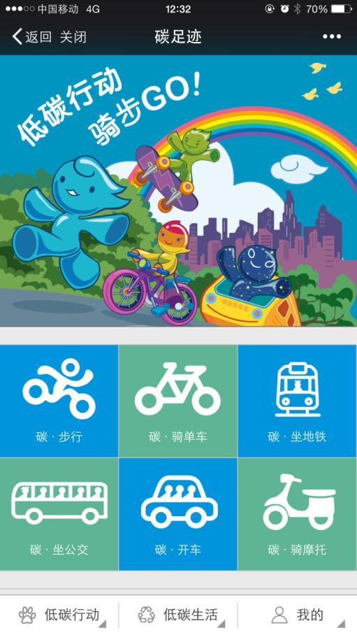
36 4. Transport-environment information to the public Help citizen to avoid exposition in polluted air, to choose green travel route Outdoor fitness 步行 Traffic emission visulization App - Carbon Footprint


37 4. Transport-environment information to the public Reveal a chain effect of travel demand on population exposure Traffic activities Emissions Concentrations Population exposure

38 Conclusion Quantifying and monitoring emissions based on traffic big data Emissions of multi-modes transport and air pollution modelling are integrated in a platform Providing various and useful information to promote the development of low-carbon transportation
39 Asia-Pacific Forum on Low-Carbon Technology 2018 Changsha, 24 th of Oct 2018 Thank you 深圳市城市交通规划设计研究中心 Shenzhen Urban Transport Planning Center (SUTPC) 丘建栋 Qiu Jiandong Tel: 深圳市城市交通规划设计研究中心 Shenzhen Urban Transport Planning Center (SUTPC) 黄玉婷 Huang Yuting Tel: