Traffic/Mobility Analytics
|
|
|
- Theresa Dennis
- 5 years ago
- Views:
Transcription


1 Daniel P. Farley Section Chief Traffic Operations Deployment and Maintenance How PennDOT is using large vehicle probe and crowd source information to begin to better plan, design, deploy, operate, and maintain work zones throughout the commonwealth. Traffic/Mobility Analytics Construction Innovation Conference June 9, 2017


2 PennDOT 11,500 Employees 11 Engineering Districts 4 Regional TMC s 52,000+ Events in ,700+ ITS Devices


3 Traffic Operations Performance Metric Program Each instance of congestion occurs at a specific location in time and space, providing the baseline upon which we measure the severity of congestion to compare how mitigation measures address congestion. This includes identify patterns of recurring congestion, such as particular roadways, certain days of week, and times of the day. Data Buckets When and Where is Congestion? What is the Cause of Congestion? Once we know the locations of congestion, we need to understand the causes of congestion at each location. Examples include bottlenecks, poor signal timing, traffic incidents, inclement weather, special events, and work zones. Example causes of congestion Information The effectiveness of congestion mitigation programs, policies, and efforts is measured by comparing the intensity of congestion before and after implementation of the strategy. Program Goals: 1. Mitigate recurring congestion 2. Maintain mobility during planned events 3. Minimize traffic impacts of unplanned incidents/events What Congestion Management Strategies? PennDOT and other agencies uses various strategies to address different causes of congestion. The metrics program allows us to see how well these strategies work. This helps guide future investment toward the programs with the best benefits. Example Strategies
 How does work zone length affect mobility through the work zone? (#53) What causes traffic to slow down after the merge? (#55) What is the capacity of a single lane?")
4 How do we use probe data to calibrate our work zone prediction models? (#112) How does grade at the merge area affect mobility? (#54) How does sign placement affect work zone performance? (#84) How does work zone length affect mobility through the work zone? (#53) What causes traffic to slow down after the merge? (#55) What is the capacity of a single lane? (#58) What is the impact of lane merges? (#61) What is the throughput (capacity) of a particular work zone configuration? (#79) What causes crashes in work zones? (#66) What length of queue is a threshold that increases crashes? (#102) When do crashes occur based on volume and work zone configuration? (#65) What is the threshold of delay which causes diversion? (#76) WORK ZONES WHERE AND WHEN IS CONGESTION? What is the capacity of a road? (#293) What is the speed at which maximum throughput occurs on a particular road? (#295) How many mile-hours of congestion occur in a year? (#171) How many vehicles are arriving at the end of a queue? (#172) What is the magnitude of congestion? (#214) What is the duration of congestion? (#283) How predictable is recurring congestion (time and magnitude and location? (#174) What are patterns of recurring congestion? (#173) How does travel reliability vary between winter and summer? (#28) Where are we seeing recurring congestion daily? (#17) What is the cost of congestion? (#163) How does traffic vary by time of year? (#59) What signalized intersections have significant volume changes (increase or decrease)? (#203) How many vehicles drive into the back of a queue, % of vehicles? (#290) What is the Cause of Congestion? Why is there congestion in and near work zones? Reduced capacity Lanes closed Merge at lane closure Grade Signage Reduced or no shoulders Length of work zone Crashes Limited recovery area Lack of space to move crashes off travel lanes
5 WORK ZONES What Congestion Management Strategies? Do we have longer queues if we give advance notice of lane closure? (#85) How can we make work zones safer/improve capacity? (#277) How does single lane with shoulder compare to two lanes with no shoulder in the same width? (#56) When do we need to keep 2 lanes open because there are no parallel routes? (#41) How does diversion affect performance of parallel routes? (#77) How much traffic diverts due to a particular work zone pattern? (#75) What activities on parallel routes affect work zone? (#80) Do we take work zones as seriously as snow? (#27) How do we justify spending extra to keep a lane open? (#63) How do we know where work zones are? (#83) What is the B/C ratio where user delay drives design decisions? (#51) What is the impact of advance notice of work zones? (#32) What is the value of having maintenance notify TMC of planned activities? How do drivers react to work zones? (#276) Is there a value in adding detectors? (#67) Is there benefit installing detection during design phase to predict work zone performance? (#68) Should we add detection as soon as projects are added to the TIP? (#70) Should we add more permanent count stations? (#69) Can we predict queues for work zones to get DMS message far enough back to provide alternate routes? (#18) Did additional ITS devices added to I-81 work zone improve the operation? (#52) What are the impacts of ITS on work zones? (#87) Are our work zones getting more reliable? (#88) Does the theory of hard shoulder running in other areas apply to work zones? (#60) For short term lane closures, what PATAs do we use most and what are the impacts? (#86) How does work zone design affect performance? (#49) Is there a better way to do lane merges? (#62) What are the impacts of state police presence for queue protection? (#103) What can/should we do differently planning/designing work zones? (#45) What is an acceptable length of queue approaching a work zone? (#46) What management strategies should be used for long-term work zones? (#64) Strategies to address work zone congestion: Work zone configuration Keep more lanes open Signage Divert traffic to other routes ITS devices Increased knowledge of planned maintenance activities State police presence Calibrate capacity models to better predict work zone performance during design stage Work zone speed limits Program Goal: Maintain mobility during planned events What should the maximum length of a work zone be? (#43) What s the difference in cost between closing a lane and building enough to keep the lane open during construction? (#50) Would shoulder running in work zones work during peak periods? (#57) Are we meeting the delay threshold in the Work Zone Safety & Mobility Policy? (#47) How does actual delay compare to predicted delay during design phase? (#48) How does driver compliance of work zone speed limits affect crash rates? (#74) How far before a work zone should the reduced speed limit take effect? (#42) How much speed variation is there in work zones? (#101) What is driver compliance of work zone speed limits? (#73) Where should we increase enforcement of work zone speed limits? (#44)
6 DATA Sources INRIX PennDOT s Road Condition Reporting System (RCRS) Traffic signal data Volume counts Crowd Source Data (WAZE, Facebook, etc ) PennDOT s Advanced Transportation Management System (ATMS) PennDOT s GIS Mapping System (PennShare, GIS-IQ, Maintenance-IQ) Reportable Crash Information Roadway Weather Information System (RWIS) Weather data Advanced Vehicle Location (AVL) Systems Asset mgmt. (ITS, Traffic Signals, Others)
7 What is Probe Speed Data What is it? Measurement of the average speed of traffic on a section of roadway at a given time Where does it come from? Privately sourced data from INRIX Probe data Generated from GPS in vehicles, not roadside detectors Benefit doesn t require installation/maintenance of infrastructure equipment, leads to significant cost savings


8 What is Probe Speed Data Sources Long-haul trucks Other commercial fleets Deals with auto and GPS manufacturers Mobile devices (INRIX mobile app and others) Inrix App Users Local Commercial Fleets Long haul truck company

9 1984 ft 475 ft Reflects current traffic conditions Reported every minute Generally 3-5 minutes behind actual road conditions Figures provided by INRIX


10 Coverage Area 25,000 TMC Segments; 16,600 Miles 112,000 XD Segments; 23,200 Miles (20,200 Arterials) Pennsylvania is an All-In State INRIX is the Selected Data Vendor Real-Time Data and Achieved Data since 2011 Data used in 511PA Statewide Travel Times when appropriate 7 validations completed in PA through I-95 VPP and have generally performed significantly better than contract (AASE < 5 mph, Speed Bias < 3 mph)
11 What is Probe Speed Data Is it reliable? I-95 Corridor Coalition Validation Performed regularly at various sites in states along the I-95 corridor since validations completed in PA (8 th validation next week I-79 Work Zone) Contract requires speeds to be accurate within an average of 5 mph across all speed bins for freeways (0-30, 30-45, 45-60, 60+) Freeways vs Arterials Data validations on PA freeways have generally performed significantly better than contract requirements (AASE < 5 mph, Speed Bias < 3 mph) Arterial reliability is generally good in areas where there are 1 or less signals per mile


12 Current Performance Metric Tools Available Regional Integrated Transportation Information System Current PennDOT Data includes

13 Overview Of Available Tools


14 General Tool Usage Route Selection Time Period Selection

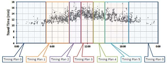
15 Congestion Scan Time of Day Events/ Activities Typical Performance Metrics Exit Numbers & Mileage

16 Trend Map Typical Performance Metrics

17 Performance Charts Typical Performance Metrics
18 Performance Summaries Typical Performance Metrics

19 User Delay Cost Analysis Typical Performance Metrics

20 Bottleneck Rankings Typical Performance Metrics

21 Dashboard Typical Performance Metrics

 Holiday")
22 Current Probe Speed Data Uses Traveler Information/511PA 511PA Traffic Speed Map ( 511PA Slowdown Reports (Phone System/Mobile App) Travel Times on Dynamic Message Signs (DMS) Holiday Travel Forecasts
 and QA Holiday Traffic")
23 Current Probe Speed Data Uses Traffic Operations Travel Times and Speed Map in ATMS After Action Reports (AAR) and QA Holiday Traffic Preparations

24 Current Probe Speed Data Uses Workzone Analysis/Operations User Delay Cost Analysis Work Zone Travel Times Queue Protection Requests Dedicated Traveler Information Websites for Projects

25 Current Probe Speed Data Uses Performance/Operations Metrics

26 Current Probe Speed Data Uses Holiday Traffic Trend Maps

27 Current Probe Speed Data Uses Workzone Delay Analysis & User Delay Costs

28 Queue Detection Current Probe Speed Data Uses
29 Current Probe Speed Data Uses Workzone Speed Limit Evaluations Speed (MPH) Mean 85th Percentile 95th Percentile Regulatory Speed Limit Work Zone Speed Limit Historic Average Speed PM 10 PM 9 PM 8 PM 7 PM 6 PM 5 PM 4 PM 3 PM 2 PM 1 PM 12 PM 11 AM 10 AM 9 AM 8 AM 7 AM 6 AM 5 AM 4 AM 3 AM 2 AM 1 AM 12 AM Time of Day

30 Incident/Event Analysis Current Probe Speed Data Uses Incident Occurs RCRS Entry DMS Message
 PennDOT employees, contractors, and partner agencies who are I-95 Corridor Coalition members Sign up at www.ritis.org/register")
31 Available to Any PennDOT Employees Getting Access Consultants/contractors doing work on PennDOT s behalf Partner agencies (Planning, PSP, PEMA, etc) PennDOT employees, contractors, and partner agencies who are I-95 Corridor Coalition members Sign up at

32 Temporary Traffic Control Portal Temporary Traffic Control
33 Daniel P. Farley Section Chief Traffic Operations Deployment and Maintenance QUESTIONS?