Science Presentation
|
|
|
- Pearl King
- 5 years ago
- Views:
Transcription
1 Science Presentation
2 CSU Ballooning Program Humble Beginnings Taylor University & PACER Programs Ballooning Course Experience Pre-Engineering Summer Camp Student Experiences and Reflection

3 Starting Student Space Hardware Programs A How To Workshop I June 20-22, 2002 Boulder, Colorado


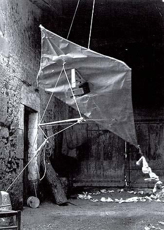
4 Kite Aerial Photography


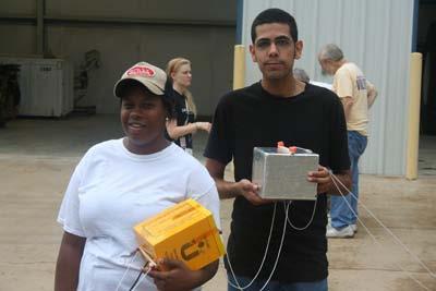
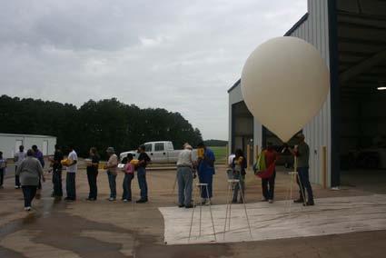
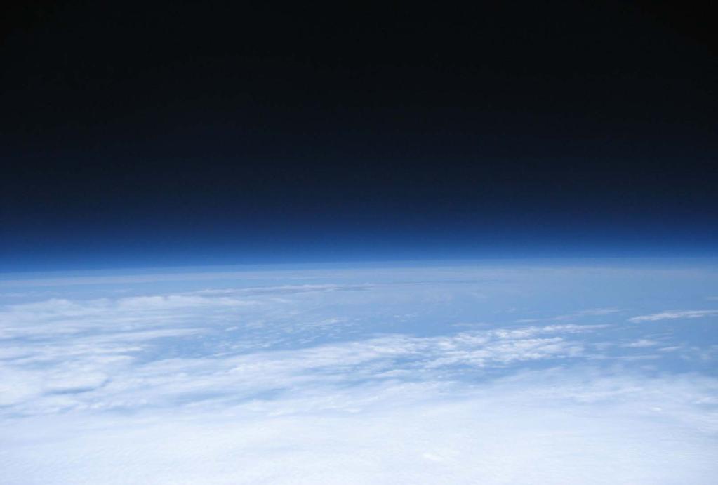
5 Development of a Balloon Tracking System and Payload Nathaniel J. Morris - Wright State University, Dayton, OH Augustus Morris, Jr., Ph.D., P.E.- Central State University, Wilberforce, OH Tracking System Objectives Approach Payload In order to recover a high altitude balloon successfully, a tracking system must be implemented. A tracking system will relay the exact position of the balloon to a mobile during its course of flight. Thus, a mobile station has a higher chance of recovering the high altitude balloon. Without such a tracking system the chances of recovering the balloon and payload decreases dramatically. To develop a reliable tracking system, hardware such as a GPS and Ham Radio will be used to communicate between the balloon s payload and the mobile station. Additionally as a middle man, a map-based tracking software will help plot out the balloon s flight path. Moreover, the tracking software will provide a simulated flight path based on weather patterns to estimate possible landing sites. To have a successful high altitude balloon launch a tracking system becomes a necessity. Over the last 10 years there has been a sharp increase in the number of student-led scientific balloon satellite missions. The increase is primarily due to advances in sensor technology and the miniaturization of tracking and communication electronics. Students are now able to be involved in the design of the balloon vehicle, the scientific experiment, and the payload. A typical mission allows data to be collected at altitudes approaching 100,000 feet. A balloon vehicle at such altitudes must withstand 99 % of the extreme conditions of outer space. By definition, such altitudes are labeled as near space. For the first time, students can be directly involved in space science and aerospace engineering at an affordable cost. Usually, the communication and tracking system of the balloon satellite is the most expensive component of the entire balloon vehicle. To develop a high altitude balloon system, the tracking system and payload are the most important components. An efficient tracking system can help make a mission successful because a tracking system can increase the chances of recovering the payload. Recovering the payload is important because there is hardware that stores data collected during the course of flight. The data analysis of the stored measurements within the payload ultimately determines the success of the launch. Therefore the first course of action is to develop a tracking system. Specifically the items that will be used for the transmitter are a Kenwood TH-D7A transceiver, a Garmin 25 LVC GPS device, a Garmin GPS Antenna and a 4.5VDC power supply. On the receiving end of the tracking system the items that will be used are a personal computer with APRS Point, Kenwood TH-D7A transceiver, and a Garmin V GPS navigator. The previously stated hardware will be used to help develop the tracking system for a high altitude balloon. The tracking system will be tested out by tracking a route taken by a car. A payload is the heart of the experiment because it stores all of the data needed to track and measure variables during a high altitude balloon s flight. The entire balloon train cannot weigh more than twelve pounds, therefore the size of the payload must be optimized to include internal parts that have a sum weight of twelve pounds or less. Many variables can be measured and stored during a balloon mission, limited by the sensors used. Particularly this project s payload will be constructed to fit a GPS, timing chip, camera, power supply, data logger, and a heating filament. GPS has become very important tool while working with high altitude balloons to track location. A GPS determines an object s current location by using four or more signals from GPS satellites to calculate variables -x,y,z, and t. Eventually -x,y,z, and t are converted to latitude and longitude. Hence longitude and latitude are used to map specific locations on a map. Once the GPS calculates the latitude and latitude of the object s current state, the information is sent to a Ham Radio to transmit the information to the mobile station, which uses a computer to store and interpret the data. The focus of this effort centers on integrating the appropriate technologies and components needed to develop a balloon satellite tracking system and payload. A Global Positioning System (GPS) on the balloon allows its position and velocity to be measured. Amateur radio can be used to communicate the balloon s location to a ground station. Automatic Packet Reporting Systems(APRS) formats the data sent via radio in a manner similar to internet communication between computers. A tracking system was developed from off the shelf hardware and software. A payload was developed by enclosing common sensors in an insulating structure. Ground testing the system would occur before using in an actual mission. During the course of flight for the balloon, the hardware that is recording position and other measurements needs to have an enclosure that protects the internal parts from extreme conditions. The first initiative is to build a payload that is durable and resistant to environmental changes. Therefore, the most cost effective and reliable material would be foamcore because it is a light material and has some insulating attributes. Using the foamcore to create a 6 x6 x6 cube will provide the protection and space needed to send the payload electronics into harsh conditions. Additionally, a heat filament will be implemented into the payload because at high altitudes the atmospheric temperature can approach -40 degrees C. However, to make sure that extremely cold conditions will not hinder the experiment a cold test will be used to test the insulating ability of the foamcore with the heat filament activated. The cold test will use dry ice to simulate temperatures at -40 degrees C to determine if the payload can handle a real launch. To stay under the twelve pound rule, a strong but light material will have to be used to construct the payload enclosure. In addition, the payload must endure extremely cold conditions, therefore a material that is an efficient thermal insulator must also be considered. Foamcore is a material meeting the criteria of a good payload material. To construct a box with enough space, dimensions of 6 x6 x6 were used to develop the payload. Once the payload and tracking system is brought together, a series of temperature readings will be collected at altitude increments of 100 feet ending at a top altitude of During each 100 foot increment temperature will be measured for every 2 minutes until 1000 feet is reached. Conclusively, if the payload and tracking system proves to be reliable then an un-tethered high altitude balloon launch will be the next step for this research. Tracking Discussion Results Payload The tethered balloon data indicates a typical temperature vs altitude profile. As the temperature was measured at higher altitudes, the temperature lowered. The data logger used appears to collect the data appropriately. Temperature vs Time Cold Test with 8 W Heater The payload in conjunction with the payload was able to protect its contents very well during the cold test. Payload temperatures approached 80 degrees C while the ambient temperature was near -40 degrees C. Keep in mind; however, that a DC voltage supply was used for the heater instead of a battery. Also, the power of the heater during an actual balloon flight would most likely be less than 1 watt. Temperature (Celsi Time (sec) TEMPERATURE (Cels TIME (Minutes) The Payload Tracking System The Ground Station The tracking system had issues tracking the car once it was greater than one mile from the ground station. When the one mile mark was reached, the Ham radio at the ground station would lose communication between the car Ham radio. Eventually the problem was resolved when discovering that some of the APRS settings were not activated for long range communication such as the relay and wide 3-1 unproto settings. Moreover the current location for testing the tracking system was just out of range from any known digital repeaters causing only one hop communication. Since the tracking system is not very reliable, more tweaking must be done before the tracking system is ready for a flight that may reach 100,000 feet in the air. Conclusively in the future there is hope to increase the reliability of the tracking system in order to successfully perform a high altitude balloon launch. Air Temperature at 100 foot Increments Payload Cold Testing Cycling an 8 W Heater Acknowledgements Various Views of the Payload Simulation of Tracking Using Weather Data This work was supported in part by the Lewis Stokes Alliance for Minority Participation (LSAMP), the National Science Foundation (NSF), Wright State University, and Central State University.


6 Introduction to High-Altitude Balloon Workshop Presented by Taylor University and StratoStar Systems

7 Summer 2009
8 Spring 2010 Lessons Learned
9 Pre-Engineering Camp

10 What Can Go Wrong Now?

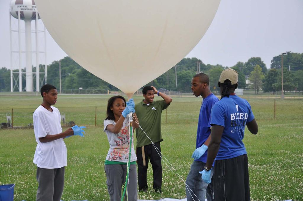
11 Summer 2010 Flight

12 So Where is the Silver Lining?

13 Experiences & Adventure
14 Mission Goals & Objectives Verifying U.S Standard Atmospheric Model for altitudes up 100,000 ft Collect data of temperature, pressure, and photographs using sounding balloon launched in Palestine, TX Recruit students at CSU to participate in the PACER program
15 Science Objectives Determining variability in temperature and pressure of the troposphere, tropopause, and stratosphere during the last week in July from Compare data collected from the sounding balloon to the U.S Standard Atmospheric Model taking into account with temperature, and variability in Palestine, TX, during the last week in July. 1
16 Science Requirements In order to achieve the goal for the MTPA project, the following requirements must be met: Record time through flight once every 60 to 90 seconds. Measure temperature in a range of -70 C to 30 C with an accuracy of 3 C. Measure pressure in a range of 1000 mbar to 4 mbar with an accuracy of 8 mbar. 2
17 Technical Objective Implementation of a temperature sensor. Implementation of a pressure sensor. Implementation of an automated camera. Developing a payload for a balloon flight. 3
18 Technical Requirements A real time clock contained in the payload Collect temperature and pressure every 60 to 90 seconds. Take photographs at interval between 1 and 3 times per minute. Measure pressure between 4 mbar and 1000 mbar accurate to nearest 8 mbar. Measure temperature between -70 C and 30 C accurate to nearest 3 C. Payload attached to the balloon line via straws 17 cm apart. Fit payload within test enclosures Implement project be by a team of 4 and cost maximum of 500 dollars. Payload not exceed 500 g. 4
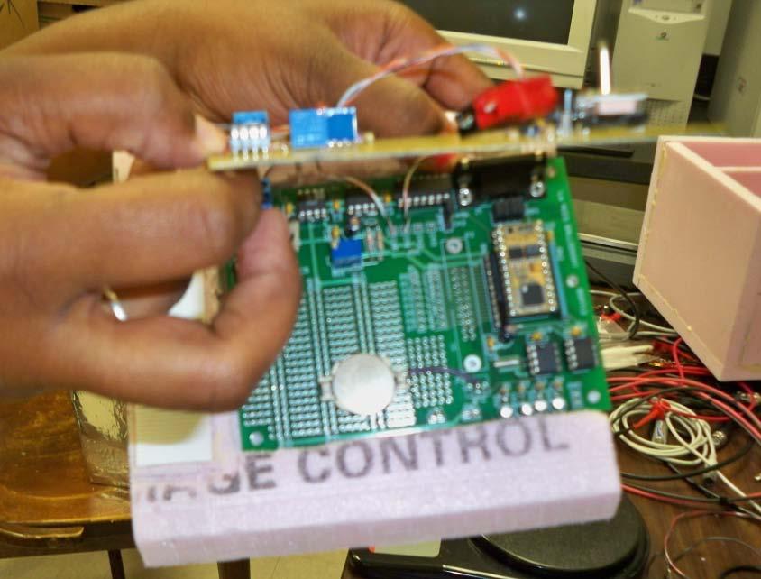
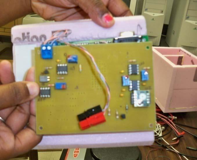
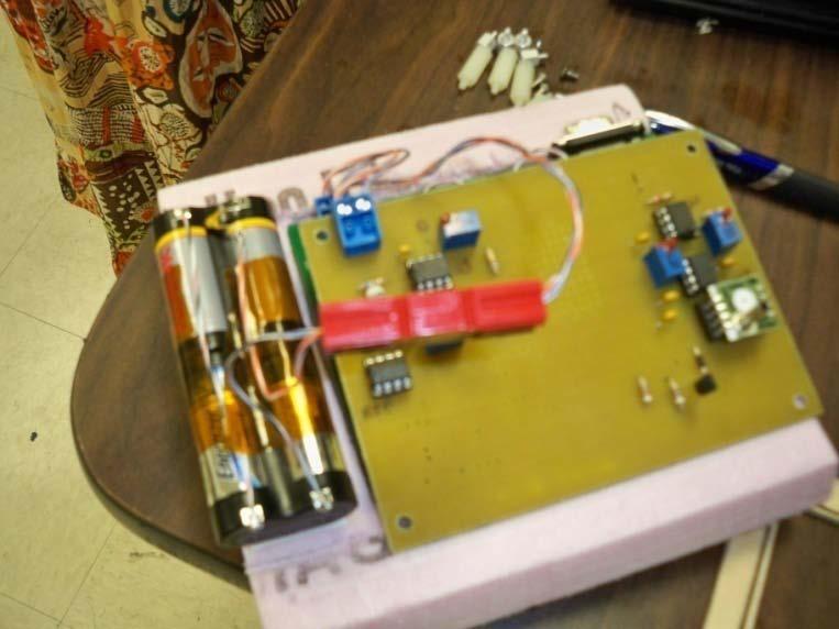

19 BalloonSat & Sensor circuit board! 5
20 Flight Software 6


21 DAP Payload 7
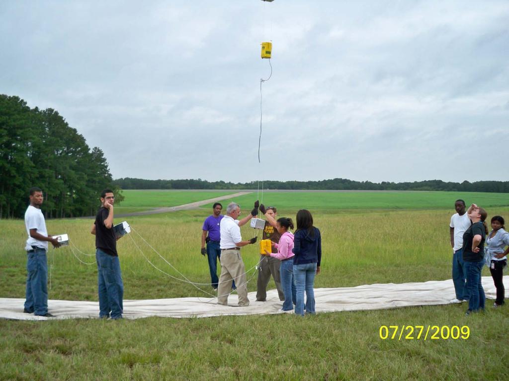
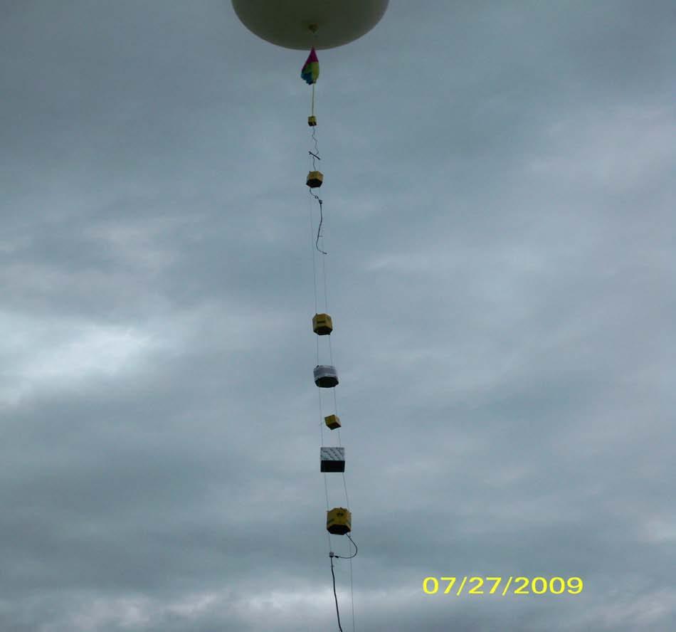
22 LAUNCH 8


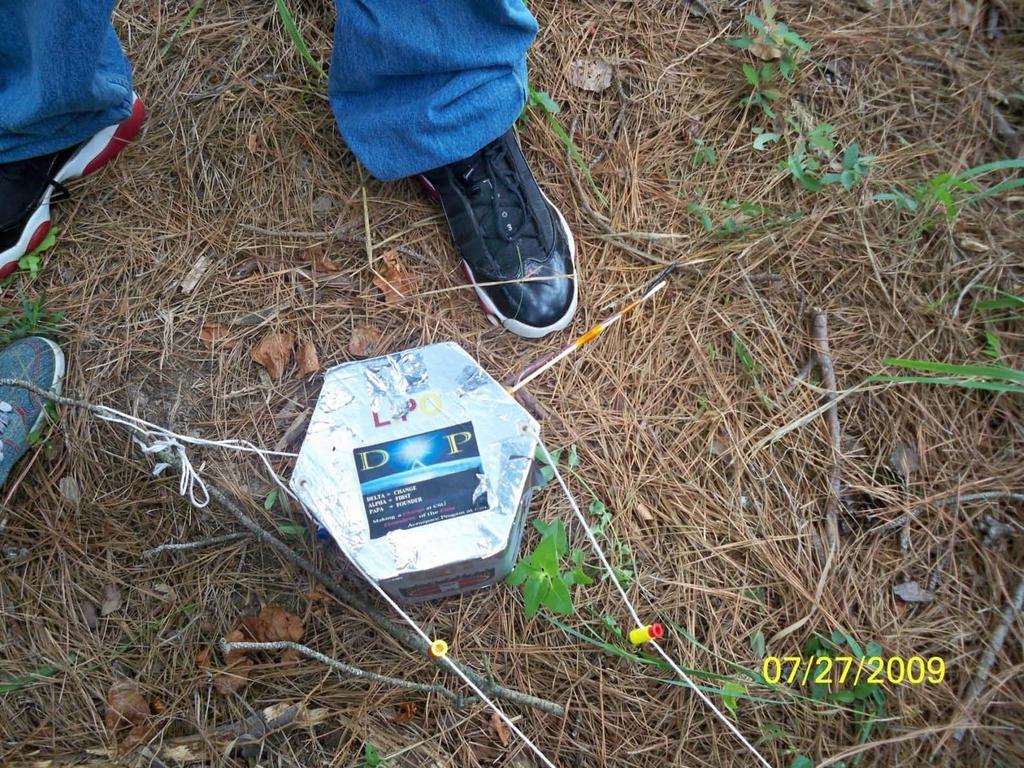

23 Recovery 9

24 Hope you enjoyed the presentation Any Questions or Comments? This has been a CSU production Team Leader-Dr.Morris Electronics- A. Easley Mechanical-C. Gaither Software-D. Taylor 10