Welcome to the second SIDRA SOLUTIONS Exploring Models event
|
|
|
- Clinton Gabriel Freeman
- 5 years ago
- Views:
Transcription

1 1
2 Introduction by Dr Rahmi Akçelik Director SIDRA SOLUTIONS Welcome to the second SIDRA SOLUTIONS Exploring Models event I d like to begin by acknowledging the Traditional Owners of the land on which we meet today. I would also like to pay my respects to Elders past and present. 2

3 Our Guest Presenter Dr Nagui Rouphail Nagui Rouphail is currently Professor in the Department of Civil, Construction, and Environmental Engineering at North Carolina State University in Raleigh, NC, USA. Dr Nagui M. Rouphail served as Director of the Institute for Transportation Research and Education (ITRE) at North Carolina State University during


4 Our Guest Presenter Nagui Rouphail Nagui is an internationally recognized scholar in the areas of highway capacity and operations, traffic simulation and intelligent transport systems, and the interface of traffic flow and air quality. He has published over one-hundred and sixty refereed journal articles, including ten best paper awards from TRB, ASCE and ITE. 4
5 Presentation by Nagui Rouphail Traffic models in the era of big data 5

6 "All models are wrong but some are useful" George Box, Famous British Statistician, in a 1976 paper published in the Journal of the American Statistical Association 6
7 Outline I. Introduction and definitions II. Link-based data and modeling applications III. Vehicle-based data and modeling applications IV. Emerging research and application opportunities V. Questions and discussion 7
8 I. Introduction: What is Big Data Has been given a variety of definitions: Describes a collection of datasets so large and complex that they become difficult to process using traditional data processing applications Describes the exponential growth and availability of data both structured and unstructured in terms of volume, velocity, diversity and variability Describes the use of predictive analytics, user behavior analytics, or other advanced analytics that extract value from data, regardless of size 8


 9")
9 14.8 min Sample : Connected Vehicle Big Data (SPMD) 9

10 Sample Test Location in a BsmP1 File Ann Arbor, Michigan 10 seconds worth of data 100 Latitude-Longitude Pairs ~ 200 meters of travel ~ 70 kph average speed 10

11 Traffic data timeline evolution 11
12 The focus of this presentation Emerging data sources Digital infrastructure Link-based traffic data and applications Individual and connected vehicle data 12
 Localized data (signs, signals, other local) Digital Infrastructure Current coverage: most of the USA and Europe")
13 HERE data example in preparation of AV deployment Three levels of details Road model (topology and attributes) HD Lane model (same but for each lane) Localized data (signs, signals, other local) Digital Infrastructure Current coverage: most of the USA and Europe 13
14 Digital Infrastructure: Road Model Local network in NC Over 10,000 Lat Long positions Major roads only Total centerline kilometers:
15 I. Introduction and definitions II. Link-based data and modeling applications III. Vehicle-based data and modeling applications IV. Emerging research and application opportunities V. Questions and discussion 15

 to provide data for")


16 Current state of practice: reduce reliance on fixed infrastructure sensors (issue?) 3 rd Party data providers (INRIX, HERE, TomTom Contract with state agency (DOT) to provide data for various road classes Massive data downloads or real time data displays at multi resolutions II. Link-Based Speed/Travel Time Data Interface for Selecting and Downloading Traffic Message Channel (TMC) Data by time and space On the RITIS Platform 16
17 How do Link-Based Sensors Gather Data Each participating vehicle probe reports position (latitude-longitude), instantaneous speed each second to a data server (phone or OBD) Positions are matched to TMC s and data aggregated over an interval (e.g. 30 sec, 1 minute) and speed archived for each link for each interval Data are checked for internal consistency, and aggregated at multiple levels, depending on agency needs. Ideal for generating RELIABILITY performance measures over extended periods of time However, no indication of probe sample size, or missing data but a confidence metric is provided Link or route based data can also be gathered using blue tooth or AVI sensors yielding individual vehicle link speed and travel (or trip) times. 17
 Recurring bottlenecks identification and ranking Macroscopic and mesoscopic model calibration and validation 18")
18 Modeling Applications of Link-Based Probe Speed and Travel Time Data Measuring link, route and system reliability (all sources of congestion) Recurring bottlenecks identification and ranking Macroscopic and mesoscopic model calibration and validation 18


19 Recurring Bottleneck Identification &Ranking Single day, spatiotemporal congestion Index (CI) based on: speed/ffs. Threshold CI 0.70 Aggregation across multiple days based on Average Historic Congestion Index (AHCI). Threshold AHCI > 33% 19

20 Study area and top Ranked Bottlenecks 20
21 Rank RBIF Bottleneck Location Activation Period Probability of Activation (in 88 weekdays) Overall RBIFmi. hrs) 1 I-40 Eastbound at Wade Avenue/MM :00-19: I-40 Westbound at Gorman St/MM 295 6:30-9: I-540 Eastbound at Six Forks Rd/ MM 11 16:30-18: I-440 Westbound at Western Blvd./MM 2 16:15-18: I-40 Westbound at NC-55/MM :00-18: I-540 Westbound at Leesville Rd/ MM 7 7:15-9: I-440 Westbound at Wade Ave./MM 4 7:15-9: I-40 Eastbound at US-70 16:15-18: I-440 Eastbound at US-70 16:45-18: I-440 Eastbound at Melbourne Rd/ MM 1 7:30-9: I-40 Eastbound at Hammond Rd/ MM :00-18: I-40 Eastbound ay NC-55/ MM 278 7:45-8: I-40 Westbound at Gorman St/MM :15-17: I-440 Eastbound at US-401/US-1/Capital Blvd/MM 11 17:30-18:
22 Probe Data for Model Calibration & Validation FREEVAL: macroscopic model for analyzing freeway facilities. Embodies the US-HCM 6 th Edition method published in 2016 Analyzes facilities up to 40 km long and up to 24 hrs (96 int.) Facilities are modeled as a contiguous series of basic, ramp and weaving segments, each with geometric and demand properties Handles both under and oversaturated flow regimes, including the effect of queue spillback, blockages and demand starvation Calibration challenge: Detailed demand data (?) and local segment capacity often unknown and variable 22
23 Calibration Process Code the facility in FREEVAL using model defaults estimates of demand (AADT profile) and capacity and run Generate model speed contours by segment and time period Convert empirical link-based speeds from RITIS to HCM segment values Run the calibration process (GA) to calibrate demand and capacity parameters to optimize speed matches 23

24 Initial Comparison with Uncalibrated Model ACTUAL MODEL 24

25 After Demand Calibration ACTUAL MODEL 25

26 After Demand and Capacity Calibration 26
27 Calibration Results 27


28 Available from HERE Speed Data feature Provides more detailed speed info Recognizes levels of gap filling Advanced Speed Reports Truck reports available 28
29 I. Introduction and definitions II. Link-based data and modeling applications III. Vehicle-based data and modeling applications IV. Emerging research and application opportunities V. Questions and discussion 29
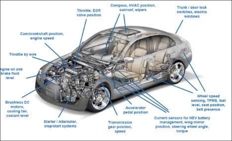
30 III. Individual Vehicle Based Data Data sources: GPS, AVL, OBDII, Mobile device, CV sensors Provides detailed vehicle trajectories at various time resolution from Hz. Types of data generated depends on the source Will focus here on an OBD-II based system at NC State operating on a fleet of about 30 vehicles using volunteer drivers in a naturalistic driving setting (part of larger fleet) Will also demo data visualization from CV sensors, time permitting 30


31 i2d Intelligence to Drive About 50 million records of data recorded at ITRE/ NC State and continuing About 40 data items extracted each second Archived in a SQL database Can provide individual and fleet-wide information 31


32 i2d Technology Integration Process Vehicles Sensors OBD Port i2d Device Web Access Additional Sensors Memory Processor Cellular Network 32

33 33 Trips and Trip Statistics

34 Modeling Applications of Vehicle Data Calibration of vehicle dynamics data at intersections Predicting shock wave speeds and their reach Detecting, documenting and characterizing lane changes Network monitoring of high deceleration events. Portugal 34

35 Trajectory Details and Contextual Data Stopped Delay at Traffic Signal Traffic Signal The blue lines to the right show the lateral acceleration The up and down pulse indicates two consecutive turns in the opposite direction as shown in the map Instantaneous fuel consumption The line to the right shows road elevations measured using a barometric altimeter 35
 connected to OBD-II.")

36 ITRE DATA LAB- FREEWAY ROUTE ITRE DATA (Driver and Transportation Analytics) lab continuously collect 1Hz data for vehicles in their naturalistic driving environment. Data dates back to April 2014 until now The data in this slide are collected at 1Hz resolution from On- Board-Units (OBU) connected to OBD-II. Instrumented vehicles were deployed, in a controlled experiment setting, at 1-3 minutes headways on a freeway route during the congested peak period (see map). Vehicle trajectories indicate the incidence of a shock wave affecting the first vehicle about 1 mile after entry and affecting the 5 th vehicle tailing the others as well. Estimate of shockwave speed can be derived from the trajectories. OBU- COLLECTED TRAJECTORIES FOR FIVE INSTRUMENTED VEHICLES ON FREEWAY ROUTE INDICATING SHOCKWAVE Distance (feet) :46:34 7:47:17 7:48:00 7:48:43 7:49:26 First Car Seond Car Third Car Fourth Car FifthCar 36
 were made and videotaped to")
37 Detecting and Characterizing Lane Changes Enabled by integrating digital road infrastructure and vehicle position data Emulates how autonomous vehicles will eventually navigate urban road environments using own sensors Pilot testing on a 10km testbed using pre-planned lane changes to validate the lane detection model 6 trips, 3 in each direction (CW, CCW) were made and videotaped to confirm lane change position and timing. 37

38 Latitude and longitude for each lane edge and lane separator was extracted into a road database on the pilot testbed Digitizing the Route This was done in intervals of 12 m for the interior lanes, and 4 m on the outer edges At intersections, both through and turning paths are also digitized 38
39 + ve 0 - ve A lane change detection model (lat,long) (lat,long) Model assumes vehicle GPS data are reliable and accurate (?) Each lane edge of the road is digitized with its lats & longs at 1 Hz intervals Vehicle GPS knows its lats & longs at 1-10 Hz resolution Conceptually simple: calculate the distance from the vehicle GPS receiver to each lane edge Distances and lane positions smoothed to account for GPS data noise; lane changes detected when CL is crossed and are tracked until distance stabilizes 39
40 The lane change model Relies strictly on basic vehicle and digital road position reference points Fuses 1 Hz vehicle trip position and the digitized road information using the R open source coding platform Invokes an R- utility that calculates the minimum distance between each trip point lat-long point, and the various lanes or lane separator edge lines. Also can distinguish on which side of an edge line the vehicle is present Focused initially on lane changes between two through lanes on a North-South arterial road (Davis Dr.) in North Carolina Detects lane changes when the vehicle lateral distance from the centerline changes from +ve to ve and vice versa Identifies start and end of the lane change maneuver at the point where distance to centerline stabilize at both ends. Continually tracks vehicle lane position 40
41 9 7.2 Trip 5 Davis Southbound (Hzl Gridlines at Approx 1/2 lane width) SMOOTHED LEFT LANE EDGE 5.4 SMOOTHED CENTERLINE SMOOTHED RIGHT LANE EDGE Sample Result- Two Lane Changes SB Trip.. Then entering a far right turn pocket 41
42 Trip 6- Davis Northbound (Hzl Gridlines approx 1/2 Lane Width) SMOOTHED LEFT LANE EDGE SMOOTHED CENTERLINE y = x x Sample Result- Twelve Lane Changes NB Trip 1.8 SMOOTHED RIGHT LANE EDGE Then entering a left turn pocket 42
43 Summary of Calibrated Model Results Trip # Detected Lane Changes Missed Lane Changes Falsely Identified Lane Changes Range of Lateral Speed (m/s) TOTAL
44 I. Introduction and definitions II. Link-based data and modeling applications III. Vehicle-based data and modeling applications IV. Emerging research and application opportunities V. Questions and discussion 44
45 IV. Emerging Research and Application Opportunities High resolution data will help improve microscopic simulation models of driver behavior (car following, lane selection, lane changing, desired speed, gap acceptance, etc.) Signal timing schemes, performance measurement models based on real-time probe samples rather than from static fixed sensor locations, including vehicle priority schemes See Multimodal Intelligent Traffic Signal System (MMITS) pdf?66d0ea 45
46 IV. Emerging Research and Application Opportunities Enabling the testing of some long held assumptions embedded in traffic models: deceleration response to clearance intervals, approach/ departure speeds, queue discharge patterns, etc. Real-time shockwave prediction models from probe trajectory samples, and traveler information response (queue warning). Similar approach for incident detection modeling. Testing basic assumptions present in travel demand models: trip generation models, effects of demographics, route and departure time choice models, etc. 46


 Increased focus on")
47 IV. Emerging Research and Application Opportunities Predictive models of high crash locations based on microscale driver behavioral data (high density of severe longitudinal or lateral acceleration/ deceleration events) Increased focus on naturalistic driving studies 47

48 IV. Emerging Research and Application Opportunities On the fly signal timing model schemes with knowledge of individual vehicles position, speeds and destinations by RSE s Developing new data visualization schemes to convey insights as well as anomalies. See Visualizations/element6/ Short term flow rate prediction based on detailed speed / travel time data (State DOT s in the USA slowly abandoning expensive, high maintenance infrastructure-based sensors) flocking to 3 rd party data 48
49 The Challenge for Traffic Engineers Be aware / cautious of the black box syndrome of certain big data analytics (e.g. use of AI and machine learning) Understand data limitations; verify that they meet traffic flow expectations Chose the data elements from which you can extract traffic value Learn how to work with and manipulate new data elements (e.g. lat-longs) Identify new safety and operational applications not heretofore possible given the type of data available: What are predictive abilities the new data provide? What driver characteristics can we now (better) understand? 49
50 In Conclusion Expect to be inundated with data at high resolution ( 10Hz), at multiscale and not necessarily all ready for model use The immediate advantage for traffic modelers is an ability to enhance model calibration with the availability of new data elements There are opportunities to develop new intersection control schemes based on projected individual connected vehicle arrivals at the junction -- virtually a scheduling / reservation exercise Expect efforts to be initially focused towards data modeling rather than new model development The $64,000 question is: Will data eventually replace models? Likely not, if long term prediction are still essential 50

51 Thank you very much for your attention Nagui M. Rouphail, Professor. NC State University, Raleigh, NC,USA SIDRA SOLUTIONS 51