INTEROPERABILITY AMONG
|
|
|
- Cornelius Cannon
- 5 years ago
- Views:
Transcription
1 18 th July 2014 INTEROPERABILITY AMONG DIFFERENT SAR PLATFORMS IUSAR Workshop 13 th IAS Conference Daniel Serrano (ASCAMM)
2 OUTLINE Interoperability among SAR platforms ICARUS interoperability needs Multiple heterogeneous vehicle operations Way forward
3 Interoperability among SAR platforms

4 What do we call interoperability? Ability to operate in synergy in the execution of assigned tasks. Capability of diverse systems and organizations to share data, intelligence and resources. Easy compatibility with future and already existing platforms and C4I systems. Source: BFAST
5 Why is it important? Interoperability acts as the glue for unmanned systems: a common method for communicating different technologies. Reduces development and integration time: avoids custom implementations and speeds up the integration time by the use of proven technology. Provides a framework for technology insertion: new technology can be easily integrated, expanding the functionality currently available on the field.
6 What is the current situation? Unmanned Systems in SAR operations: initial demonstration of their benefits in the field. Middleware and common tools: some tools are supporting the developments and data exchange (ROS, MOOS, MAVlink, OGC standards, etc) But there are no protocols or standards in place for the insertion and use of autonomous SAR platforms in the field.
7 Standardization for Unmanned Systems interfaces: Several standards, addressing specific domains, place emphasis on different types of data: STANAG 4586: data from payloads onboard UAVs, JAUS: command and control (C2) of heterogeneous UxV, Unmanned Maritime Systems Standardisation Technologies (UMS-ST) at EDA,
8 ICARUS interoperability needs
.")
9 ICARUS interoperability needs ICARUS involves a team of very diverse assistive unmanned air (4), ground (2) and sea vehicles (2 + n). They must collaborate as a coordinated, seamlesslyintegrated team in the single C4I system of the human crisis managers

10 How is ICARUS targeting interoperability? 1. Single standardized Command and Control for all platforms. Source: Space Applications

11 2. Seamlessly integrated communication network. Source: Integrasys

12 3. Platforms are to comply with the ICARUS standard interface, which shall be based on existing standards (see later).
13 ICARUS also considers interoperability in the operational scenario: 4. Definition of roles, tasks and responsibilities. Mission goal: the overall objective that the team must accomplish. Mission planning: responsible to coordinate the team and to allocate roles to each of the robots. Role: the robot's behavior and its interactions with other members of the fleet or with humans. Tasks: A set of actions to be executed by a robot. Responsibility: Role allocated to a robot in an ICARUS mission.


14 ICARUS roles INTEROPERABILITY AMONG DIFFERENT SAR PLATFORMS


15 ICARUS robot tasks INTEROPERABILITY AMONG DIFFERENT SAR PLATFORMS


16 5. Adjustable automation The degree of intervention of the human operator
17 Levels of interoperability To account for very diverse platforms technologies Level 1: Indirect receipt/transmission of UxV metadata and payload data. RC2 receives the communication from another RC2 or other communication channel (web-server, storage, etc). Level 2: Direct receipt/transmission of UxV metadata and payload data. RC2 has direct communication with the platform, but does not control it. Level 3: Control and monitoring of the UxV payload, not the unit, in addition to LOI2. Level 4: Control and monitoring of the UxV without launch and recovery (unless specified as monitor only) Level 5: Control and monitoring of the UxV including launch and recovery (unless specified as monitor only)
18 ICARUS data model
19 ICARUS data model Definition of standard concepts (messages) describing capabilities and services commonly found in a ICARUS team. Groups of concepts: System management Pose and velocity telemetry Modes, waypoints and motion commands Mission management Raw sensors Manipulator Sensing (perception) Mission command and control
20 System management Basic interoperability mechanism between components and systems in an ICARUS system. Following sets and protocols builds upon these concepts Examples: Heartbeat System status Clock Alarms Emergency Field Type Description Timestamp uint32 Message time Source ID uint32 Sender address Destination ID unit32 Destination address Status uint8 0 Standby 1 Ready 2 Failure Error code uint16 Example of system status
21 Pose and velocity telemetry Robot states such as pose, velocity and attitude. Examples: Global pose Local pose Attitude Velocity Field Type Description Timestamp uint32 Message time Source ID uint32 Sender address Destination ID unit32 Destination address Latitude unit32 Degrees, WGS84 Longitude unit32 Degrees, WGS84 Altitude unit32 Meters ASL Position Error unit32 RMS Roll unit16 Radians Pitch unit16 Radians Yaw unit16 radians Example of global pose
22 Modes, waypoints and motion commands Robot commands such as change operation mode, position and velocity request. Examples: Automation mode Global waypoint Local waypoint Velocity command Limits Local path Low level actuator Field Type Description Timestamp uint32 Message time Source ID uint32 Sender address Destination ID unit32 Destination address Velocity X unit32 m/s Velocity Y unit32 m/s Velocity Z unit32 m/s Roll rate Unit16 Radians/s Pitch rate Unit16 Radians/s Yaw rate unit16 Radians/s Example of velocity command
23 Mission management Definition of the mission adaptable to the automation mode. Examples: Platform mission Platform mission status Field Type Description Timestamp uint32 Message time Source ID uint32 Sender address Destination ID unit32 Destination address Mission ID unit32 Destination address Mission mode uint16 Modes identifier Goals definition array Mission goals Segments array Legs Waypoints array Locations Example of a mission file
24 Raw sensors Sensor data as provided by the platforms sensors Examples: Global pose sensor Inertial sensor Altimeter sensor Other sensors Field Type Description Timestamp uint32 Message time Source ID uint32 Sender address Destination ID unit32 Destination address Latitude unit32 Degrees, WGS84 Longitude unit32 Degrees, WGS84 Altitude unit32 Meters ASL Error estimation unit32 Standard deviation Number of Sats unit16 Type of solution Label GPS, D-GPS, RTK, etc Raw GPS sensor data
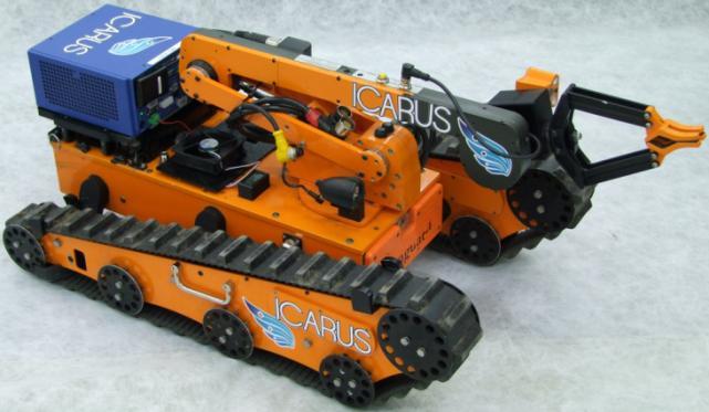
25 Manipulator Manipulator states, commands and tools Examples: State estimation Limits and parameters Tooling state Tolling limits and parameters ICARUS SUGV with manipulator

26 Sensing Perception of the environment. Examples: Digital imagery data Planar laser range finder Audio Video Other sensors (chemicals, etc) Sensor configuration Aerial images

27 Command and control Information related to SAR missions and external parties. Examples: Sectors Maps Team mission file Disaster alerts and coordination info Satellite images Humanitarian related info Example of a third-party: Global Disaster Alert and Coordination System (GDACS)
28 ICARUS standard interface
29 ICARUS standard interface Lack of a single standard of reference for interoperability of unmanned systems. Harmonizing the existing standards, by combining them into one, would obviously solve most of the problems. ICARUS standard interface is highly based on JAUS. It is compatible with popular transport protocols (TCP, UDP, serial) independently of the communication link beneath it. And it is already multi environment (air, sea and land).

30 ICARUS Topology System ICARUS Subsystem UAV C2I Node UAV C2I Component Global Pose Waypoint C2I
31 ICARUS Services SERVICES CORE MOBILITY ENVIRONMENT SENSING 1.Transport 2.Events 3.AccessControl 4.Management 5.Time 6.Liveness 7.Discovery Sensors: 1.GlobalPoseSensor 2.LocalPoseSensor 3.VelocityStateSensor 4.AccelerationStateSensor Drivers 1.GlobalWaypointDriver 2.GlobalWaypointListDriver 3.LocalWaypointDriver 4.LocalWaypointListDriver 5.GlobalVectorDriver 6.LocalVectorDriver 7.VelocityStateDriver 8.PrimitiveDriver 1.VisualSensor 2.RangeSensor 3.DigitalVideoSensor
32 Adaptation strategy for heterogeneous platforms to the ICARUS standard interface Robot A ROS node 1 ROS node 2 C2I ROSrobot JAUSRobot JAUSFleetHandler fleet Robot B Oceansys node 1 Oceansys node 2 JAUSRobotHandler #A robothandler #A Oceansys robot JAUSRobot JAUSRobotHandler #B robothandler #B ROS-C2I Robot C JAUSRobotHandler #C robothandler #B JAUSRobot Oceansys ROS JAUS
33 Traceability between JAUS and ROS CORE SERVICE SET CONCEPT JAUS++ ROS Robot profile JAUS::Identification icarus_msgs/robotinfo Heartbeat JAUS::HeartBeatPulse System status JAUS::Management::Status Clock JAUS::Time Using existing standard messages New ROS msg approved by ICARUS partners New ROS message proposed but no approved To be discussed later Optional/not required for ICARUS MOBILITY SERVICE SET CONCEPT JAUS ++ ROS Global pose Local pose Velocity state Acceleration state Global Waypoint Local Waypoint Driving global vector Driving local vector JAUS::GlobalPose JAUS::LocalPose JAUS::VelocityState JAUS::AccelerationState JAUS::GlobalWaypoint JAUS::GlobalWaypointList JAUS::LocalWaypoint JAUS::LocalWaypointList JAUS::GlobalVector JAUS::LocalVector SENSORS (ROBOT C2I) DRIVERS (C2I ROBOT) icarus_msgs/globalposewithcovariances tamped geometry_msgs/posewithcovariancesta mped geometry_msgs/twistwithcovariancesta mped icarus_msgs/globalwaypointstamped icarus_msgs/localwaypointstamped Nav_msgs/Path Velocity Command JAUS::VelocityCommand geometry_msgs/twiststamped Low Level Actuators JAUS::WrenchEffort geometry_msgs/wrenchstamped ENVIRONMENT SENSING SET CONCEPT JAUS++ ROS Digital Imagery JAUS::Image sensor_msgs/image Planar Laser Range JAUS::RangeScan sensor_msgs/laserscan Video Stream JAUS::DigitalVideo
34 ICARUS heterogeneous platforms

35 Aerial Platforms Source: ASL ETHZ Source: ASCAMM Source: Skybotix

36 Ground Platforms Source: UKL/AV Source: META

37 Maritime Platforms Source: CALZONI Source: INESC
38 ICARUS multiple heterogeneous platforms operations


39 Sea trials (REX14 Portuguese Naval School - July 2014)
 The CTC also includes")


40 Air trials (Barcelona UAV Test Centre - July 2014) The CTC also includes Temporarily Segregated Airspace: Name: TSA-31 CTC-MOIA, Extension: ha. and a maximum ceiling of ft. Coordinates of the four corners of this airspace: N E; N E; N E; N E;


41 Air-Land trials (Marche-en-Fammene September 2014)
")

42 Air-Sea trials (La Spezia October 2014) INTEROPERABILITY AMONG DIFFERENT SAR PLATFORMS
43 Dissemination
44 ICARUS is leading a NATO STO Exploratory Team (SCI-ET-009) to promote standardization for unmanned systems. The topic is "Command and Reporting Standards and Development Tools for UxS and will run during Several partners are contributing. A set of NATO STO Lecture Series (SCI-LS-271) will follow this study to disseminate the outcomes. The candidates locations are Portugal (Lisbon), Spain (Barcelona), Belgium (RMA-Brussels) and Italy (La Spezia). For any further information or contributions, contact me at: dserrano@ascamm.com

45 18 th July 2014 INTEROPERABILITY AMONG DIFFERENT SAR PLATFORMS IUSAR Workshop 13 th IAS Conference Daniel Serrano (ASCAMM)