Raising Ship s Efficiency
|
|
|
- Raymond Thompson
- 5 years ago
- Views:
Transcription

1 Singapore, 23 rd May 2012 Raising Ship s Efficiency Presented by: Capt. Ishtiyaq Sawant, ST Shipping Capt. Tarun K. Mathur, Transas

2 Factors defining Efficient Ship Operations Sound commercial decisions leading to net economic benefit are always based on safe and efficient operations on board. Efficient operations on board start by appropriate decisions taken by management ashore. One decision which affects operations on board is purchasing decision.

3 Major Factor leading to appropriate Purchasing Decisions: Identifying the need correctly! For eg., for making a decision to purchase an ECDIS for your fleet: Is the need only to satisfy the regulatory requirement? Will it lead to a sound decision? Will it provide a net-economic benefit? If not, then what is the correctly identified need?

 Ensuring a")
4 Why do we need ECDIS on board? Among various other benefits the two major reasons for having and ECDIS on board are: 1) Making the ship and the environment safer 2) Ensuring a net-economic benefit to the company
 Accuracy of plotted position 4) Incorrect or incomplete passage plan 5) Reluctance to use ship s engines 6) Charts not updated with T&P notices and NAVTEX")
5 Making the ship and environment safer: ECDIS is primarily considered as an anti grounding tool Majors Factors contributing to grounding of a vessel: 1) OOW inattentive during navigational watch 2) Infrequent plotting of vessel s position 3) Accuracy of plotted position 4) Incorrect or incomplete passage plan 5) Reluctance to use ship s engines 6) Charts not updated with T&P notices and NAVTEX messages not plotted on to the chart 7) UKC calculations incorrect or missing 8) Failure to use the equipment correctly lack of appropriate training
of all positions can it be easily played back? 3.")
6 Making the ship and environment safer: Equipment features desired: 1. OOW inattentive during navigational watch Does the equipment have necessary navigational alarms to alert the OOW? Can BNWAS be interfaced with the ECDIS? 2. Infrequent plotting of vessel s position Does the ECDIS store a continuous record (period?)of all positions can it be easily played back? 3. Accuracy of plotted position How many position sensors can be connected to ECDIS (over and above the IMO requirements)? Does the ECDIS evaluate the inaccuracies which may occur in the GPS / position sensor?


7 Making the ship and environment safer: Equipment features desired: 4. Incorrect or incomplete passage plan: Does the ECDIS offer a complete passage planning module which confirms to IMO recommendations? 5. Reluctance to use ship s engines Does the ECDIS provide necessary information (like effective UKC using the tides and current database)? 6. Charts not updated with T&P notices and NAVTEX messages not plotted on to the chart Does the ECDIS have effective provisions to update T&P notices (Additional Information Overlay AIO) and plot NAVTEX messages?


8 Making the ship and environment safer: Equipment features desired: 7. UKC calculations incorrect or missing Does the ECDIS offer UKC values? Using tides and currents at that particular time? 8. Failure to use the equipment correctly lack of appropriate training Does the ECDIS manufacturer provide efficient training infrastructure? Presence in major crew supplying nations

9 Ensuring a net-economic benefit to the company: Long term cost of ownership of the ECDIS system Reliability of system and support zero downtime assurance Efficient chart infrastructure and optimized chart processes Fuel Savings
10 NAVI-PLANNER 4000 Voyage Planning Tools

11 Product for Ship & Shore to paperless navigation Navi-Planner 4000 is a set of databases, applications and services intended for voyage planning. It can be used both onboard as a back of the bridge, and ashore as a management tool. Port to port planning full Voyage Plan AtoBviaC auto routing Under Keel Clearance Route checking Reference point selection Chart list Detailed voyage plan reports Route export/import Stand alone or Integrated part of Navi-Sailor 4000 ECDIS MFD

12 Voyage plan: a simple way Step 1 Quick Route Automatic route creation with AtoBviaC

13 Voyage plan: a simple way Step 2 Route Credentials WP Names, XTE Turn Radius Vessel Draught for each leg Speed Limitations Check Route vs Safety Parameters Save
 Play ahead functionality with the weather forecasts, route and route schedule consideration Route optimization by weather")
14 Voyage plan: a simple way Step 3 Weather Routing Weather forecast ordering Various weather data visualization (pressure, wind, wave heights, swell) Play ahead functionality with the weather forecasts, route and route schedule consideration Route optimization by weather conditions
")
15 Voyage plan: a simple way Step 4 Collect Data Charts Reference Points UKC Tides (Total Tide) Currents

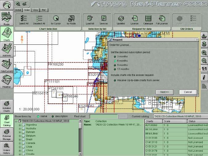
16 Voyage plan: a simple way Step 5 Chart Administration
 NMs that relate specifically to ENCs The Overlay contains information about changes or hazards of a temporary nature, such as temporary changes in")

17 Voyage plan: a simple way Step 5 Chart Administration Admiralty Information Overlay Temporary & Preliminary Notice to Mariners (NM) and additional ENC P (EP) NMs that relate specifically to ENCs The Overlay contains information about changes or hazards of a temporary nature, such as temporary changes in aids to navigation; advance notice of permanent changes, new survey information that will be issued as an ENC update and additional information that has not been included in national ENCs The Admiralty Information Overlay is displayed on top of the standard ENC display in ECDIS and can be toggled on and off

18 Voyage plan: a simple way Step 6 Create Add Info Lines Objects Text Attachments Can be used as Aids to Navigation


19 Voyage plan: a simple way Step 7 Enter general info Vessel Information Voyage Information Automatic & Manual input Print preview of Reports & Plans

20 Voyage plan: a simple way Step 8 Print out reports Monitor route and schedule in ECDIS Internal report of conducted operations e.g. weekly correction Passage plans accepted by all mayor oil companies, OCIMF, CDI etc Clear and understandable chart status report for crew and inspectors e.g. port state


21 Thank You.