Rural Intelligent Transportation Systems Toolbox. A National Highway Institute Training Program
|
|
|
- Christian Davidson
- 5 years ago
- Views:
Transcription
1 Rural Intelligent Transportation Systems Toolbox A National Highway Institute Training Program
2 Course Goals Introduce the Rural ITS (Intelligent Transportation Systems) Toolbox Increase familiarity with ITS strategic planning 1-2
3 By the end of the day you will be able to: Identify rural transportation needs and challenges Define transportation technology State the value of Rural ITS Toolbox Describe key factors in ITS strategic planning Explain the benefits of rural transportation technology Relate lessons learned in rural transportation technology Identify additional information resources 1-3
4 Course Agenda/ Sessions 1. Introduction (30 min) 2. Rural Challenges and Transportation Technology (60 min) 3. Planning for Success (60 min) 4. Rural ITS Tools (150 min) 5. Information Resources & Course Summary (60 min) 1-4
5 Learning Exercise Methodology General Challenges Stakeholder Groups Prioritized List Rural ITS Development Tracks, Tools, and Implementation Considerations & Solutions 1-5
6 NHI Course Evaluation Course Content Instructional Material and Facilities Course Instructor(s) General Observations 1-6
7 Training Site Logistics Location of facilities/smoking area Snacks/soda machines Turn off pagers and cell phones Message board 1-7
8 Self-Introductions Name Agency What are your training objectives? 1-8

9 Session 2 Rural Challenges and Transportation Technology 1
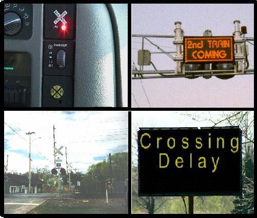
10 Learning Objectives Recognize transportation needs, challenges, and opportunities in rural environments Identify the seven rural ITS development tracks 2-2
11 Exercise # 1 What are your rural transportation needs and challenges? 2-3
 Rates per 100 m illion VMT 2.5 2 1.5 1 0.")
12 Rural Transportation in Context % of total roadway miles are rural (3,084,000 miles) % of vehicle miles traveled is in rural areas % of crash fatalities occur on rural highways (23,876 fatalities in 2000) Rates per 100 m illion VMT Rural Urban Fatal Crash Rates (2000) Source: FHWA Highway Statistics 2000, Table HM-10, VM-2 2-4
13 Fatal Crash Rates by Rural Road Class Interstate Other Principal Arterial Minor Arterial Major Collector Minor Collector Local rural fatal crashes per 100 million VMT Rural Road Class

14 Understanding Rural Transportation Challenging topography, weather events, and road conditions Limited alternative routes High percentage of recreational travelers and commercial vehicle operators 2-6

15 A Concentration of Recreational Traffic Seasonal demand Route congestion High-frequency crash locations High parking demand and turn-over Limited transit options Limited infrastructure and funding 2-7


16 Transit and Mobility Rural residents need to get to jobs, shops and medical facilities 45% of rural elderly and 57% of rural poor without a vehicle 38% have no access to public transportation; a further 28% have little access Source: TCRP A - 21,

17 Emergency Response Emergency response is a series of phases Rural response is 30% longer Volunteer efforts can add to response times Source: 2-9

18 Availability of Power and Communications Limited cellular communication coverage Limited power availability Limited wireless E-911 service 2-10

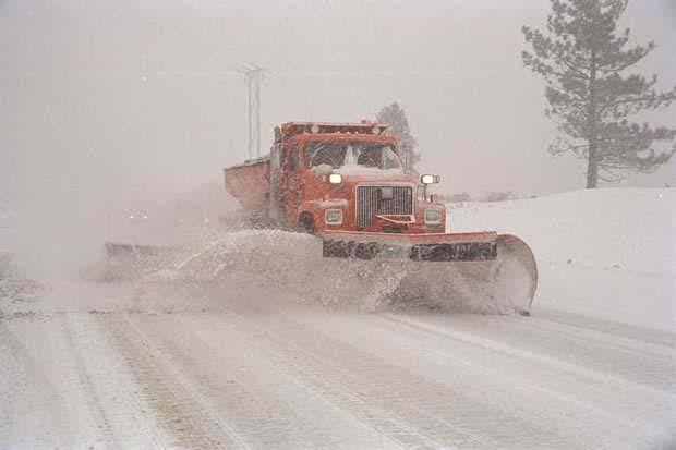
19 Weather and the Environment Impacts include:,,,,, total fatalities, (881 in snow/sleet) total injuries, (63,000 in snow/sleet) $2 billion spent on snow and ice control each year Source: USDOT, National Highway Safety Administration, Traffic Safety Facts
 and 55% of rural paved roadways (926,000 miles) Limited budgets & resources Work zone safety Source:FHWA Highway Statistics 2000,")
20 Maintenance and Operations Primarily a city and county responsibility Local agencies maintain 95% of rural unpaved roadways (3.1M miles) and 55% of rural paved roadways (926,000 miles) Limited budgets & resources Work zone safety Source:FHWA Highway Statistics 2000, Table HM

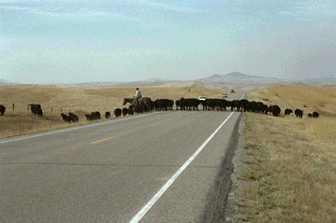
21 Animal Conflicts Around 726,000 animal/vehicle crashes each year Property damage costs of around $1 billion per year Source: Conover, M.R. Wildlife Society Bulletin,
22 Let s Review the Challenges! Recreational traffic Rural transit Emergency response Communications & power infrastructure Weather and environment Maintenance responsibilities Animal vehicle conflicts 2-14
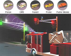
23 Intelligent Transportation Systems ITS can be one solution to the variety of rural transportation problems we have discussed 2-15
24 How is Transportation Technology Being Used? Extensive use in the nation s principal urban areas. Promising in rural areas to improve safety, security, mobility, and economic viability 2-16

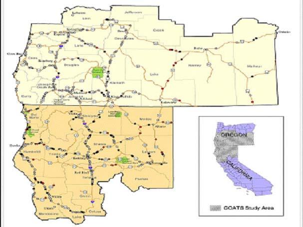
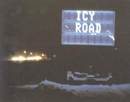
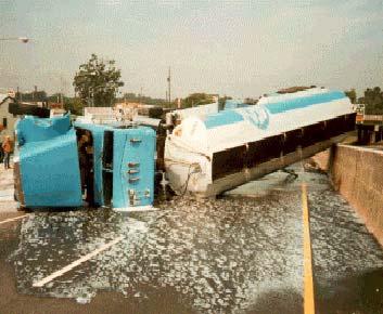
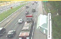
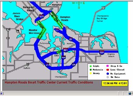
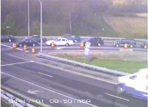
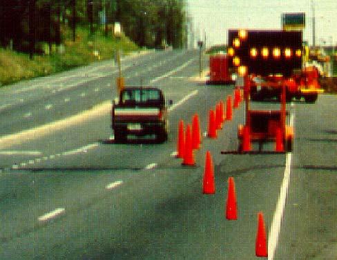
25 Rural Transportation Technology Application Example 2-17

26 Rural Transportation Technology Application Example 2-18
27 Using Transportation Technology in Rural Areas Transportation technology is not the solution for every challenge we have discussed, but it has shown particular promise in solving some of the problems 2-19
28 The Rural ITS Toolbox Rural ITS user needs were developed on a national basis Seven Development Tracks have been created to address user needs The Rural ITS Toolbox is structured around these development tracks 2-20
29 The Development Tracks Emergency Services Travel and Tourism Information Traffic Management Rural Transit and Mobility Crash Prevention and Security Operations and Maintenance Surface Transportation and Weather 2-21
30 Matching Development Tracks with Challenges Emergency Services 30% longer response Travel and Tourism Seasonal congestion Traffic Management Work zone safety Rural Transit and Mobility 38% without service Crash Prevention & Security 60% of fatalities Operations and Maintenance Local agency responsibility Surface Transportation and Changing conditions Weather 2-22
31 Learning Objectives Recognize transportation needs, challenges, and opportunities in rural environments Identify the seven rural ITS development tracks 2-23
32 Session 3 Planning for Success 1
33 Learning Objectives Describe the strategic planning process Identify key institutional stakeholders Describe options to maintain stakeholder involvement Identify alternatives for assessing needs Identify major activities within each process step 3-2
34 Describe Strategic Planning Process The strategic planning process is a method by which all the stakeholders, user needs, and technology assets are integrated to realize an overall deployment goal. 3-3
35 Key Strategic Planning Process Steps 1. Gather and Expand Stakeholders 2. Assess Transportation Needs 3. Inventory Related Improvements 4. Define Regional ITS Architecture 5. Develop Strategic Deployment Plan 3-4
36 Step 1: Gather & Expand Regional Partners Strategic planning requires input and broad involvement by different groups Stakeholders need to be actively involved in the process through a structured process Process Identify champion (lead organization) Form Steering Committee and develop business, management and outreach plan Document input and keep stakeholders involved and informed 3-5
37 Institutional Foundation Advanced Technologies Transportation Needs Institutional Support 3-6
38 Potential Partners Local Gateway Community Chambers of Commerce Transit Operators/ Fleet Operators (trucking, delivery service) Emergency Management/ Response Providers Native American Organizations Private Telecommunication companies Concessionaire s State Department of Tourism Department of Commerce or Economic Development Police/ Highway Patrol Department of Transportation; Federal/U.S. Department of Transportation (FHWA, FTA) Forest Service National Weather Service National Park Service 3-7
39 Management Relationships Friends of the Committee (Other Regional Stakeholders) Governing Board Steering Committee Chair Co-Chair Policy Projection Direction Regional Team CA North Coast North East Oregon Technical Task Force(s) TBD 3-8
40 Outreach Workshops Workshops used to identify transportation challenges and technology opportunities Benefits Introduce project Solicit viewpoints and awareness Maintain interest and achieve long-term consensus Develop public and private partners 3-9
41 Lessons Learned Institutional buy-in key to success! Early winner is essential Need continuous stakeholder engagement and re-education Diverse stakeholders who may have limited multi-agency experience Limited funding with extreme competition Most familiar with traditional or low-tech approaches Transportation not the hook 3-10
42 Step 2: Assess Transportation Needs Problem definition Problem prioritization Geographic area of focus 3-11
43 Problem Definition & Prioritization Methods: Interviews (stakeholders) Effective for buy-in and data collection Surveys (stakeholders, travelers) Intercept, mail-in Quantitative data, cost effective and objective Workshops Addresses perceived needs and consensus Quantitative data collection and analysis 3-12
44 Screening Criteria Goal Safety Safety Mobility Performance Measure Road Closure Emergency Response Time Transit Dependent Criteria Type and Duration and Frequency Fatal crashes over 40 minutes Population (age, physical, income) over 40% Economic Viability Recreation Traffic/Expenditures Annual visitors over 200K 3-13
45 3-14
46 Lessons Learned Quantitative data is beneficial but costly. Qualitative data can be perception based. Screening criteria should be used to determine priorities Graphical representations help achieve consensus 3-15
47 Step 3: Inventory Technology Related Improvements Identify the stakeholders systems Understand current connectivity and planned upgrades Transportation Problems/ Needs System Inventory Regional ITS Plan Transportation Improvement Plan Federal Aid Program Integrated ITS Projects Regional Goals/Objectives YOUR REGION 3-16
48 Step 4: Define Regional ITS Architecture A regional framework for ensuring institutional agreement and technical integration for the implementation of ITS projects in a particular region. Identify integration opportunities Ensure efficient implementations Federally required for funding 3-17
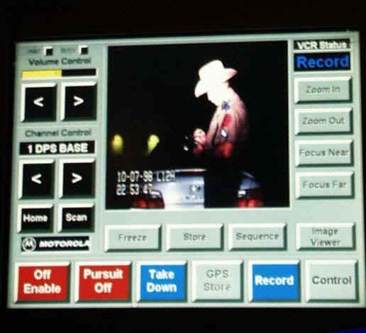
49 Step 5: Develop Strategic Deployment Plan Describes what, where, when, how, and why Regional framework and roadmap for identifying challenges and deploying technologies Provides information that stakeholders need A marketing and education tool (future) 3-18
50 Overall Lessons Learned Planning and coordination is time intensive Involve multiple stakeholders go beyond DOT Recognize institutional issues early Develop effective management structure Adopt regional philosophy through coordination/ integration 3-19
51 Learning Exercise Prioritize Session 2 challenges (max. 4) Identify key stakeholders Identify methods to maintain stakeholder involvement Time: 20 minutes 3-20
52 Session 3 Learning Objectives Describe strategic planning process Identify key institutional stakeholders Describe options to maintain stakeholder involvement Identify alternatives for assessing needs Identify major activities within each process step 3-21
53 Session 4 Rural ITS Tools 1
54 Learning Objectives Demonstrate familiarity with the mapping of needs to the seven rural ITS development tracks Use the Toolbox to: Identify technologies that are being used to address user needs Recognize key stakeholders Describe lessons learned by others Describe typical qualitative benefits 4-2
55 Rural ITS Toolbox Purpose Serve as a resource document on successful rural ITS projects Share the developing body of information Avoid redundant efforts in developing your own solutions 4-3
56 Rural ITS Toolbox Organization By the 7 development tracks main body of report By user need appendix By geographic location - appendix 4-4
57 Rural Development Tracks Emergency Services Travel and Tourism Information Traffic Management Rural Transit and Mobility Crash Prevention and Security Operations and Maintenance Surface Transportation and Weather 4-5

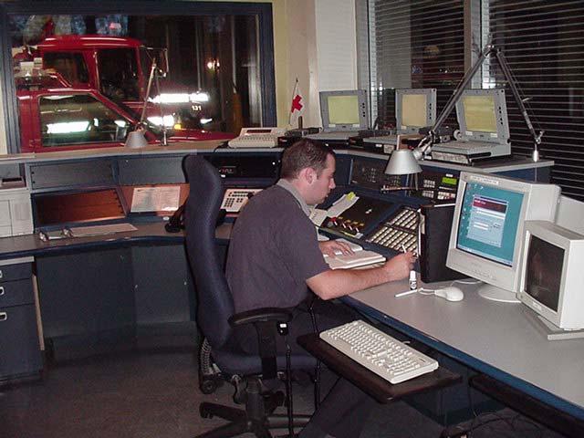
58 Emergency Services Track 4-6


59 Tourism and Travel Information Track 4-7
60 Traffic Management Track 4-8


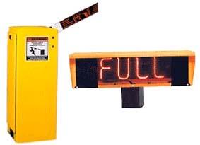
61 Rural Transit and Mobility Track 4-9
62 Crash Prevention and Security Track 4-10

63 Operation and Maintenance Track 4-11

64 Surface Transportation and Weather Track 4-12
65 Using the Rural ITS Toolbox For each Tool: User needs addressed Description Real-world examples Lessons learned Benefits Opportunities Implementation Institutional issues References 4-13
66 Real-World Examples in the Toolbox For each example: Goals Approach Location Current status Future activities Cost information Participants Impacts Key contacts 4-14
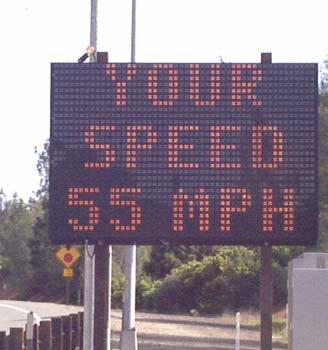
67 Speed Warning Systems Page 76 Needs slow traffic near intersections, work zones; slow commercial vehicles on mountain passes and tight curves Description Advise safe speed based on geometry, weather, current speed. Include weight and classification for trucks 4-15
68 Speed Warning Systems continued Benefits: Fewer fatalities and injuries Reduced property damage costs Reduced incident management costs Lessons learned favorable public perception Opportunities Use signs for other warnings or advisories 4-16
69 Speed Warning Systems continued Institutional issues Police involvement for speed enforcement Implementation issues Calibration is critical; inaccurate speed readings lose credibility with public 4-17
70 Colorado Truck Speed Warning System Goals Improve truck safety on steep grades Approach Radar speed detection; dynamic message sign with YOU ARE SPEEDING AT XX MPH. 45 MPH CURVE AHEAD Location I-70 at Glenwood Canyon Status Operational since Sept
71 Colorado Truck Speed Warning System Future Leave permanently installed Impacts: Before: 85 th percentile speed = 66 mph After: 85 th percentile speed = 48 mph Cost Initial deployment $25-30,000 Participants Colorado DOT Contact Jim Nall,
72 Weather Data Gathering/ Processing Page 121 Needs provide weather/road condition info to travelers & maintenance operators Description Gather weather data from multiple sources; use models for more accurate forecasts and to determine best maintenance response 4-20
73 Benefits: Weather Data Gathering/ Processing continued Lower infrastructure costs by sharing data Cost savings to agencies Better informed travelers Lessons learned combining devices achieves statewide coverage quickly Opportunities Collaboration with private sector weather sites 4-21

74 Weather Data Gathering/ Processing continued Institutional issues data ownership Implementation issues Ensure consistent data quality through use of standards 4-22
75 Washington State rweather Program Goals Collect real-time/predictive statewide weather info Approach Create dense monitoring network using DOT, airport, agricultural & environmental stations; use weather & road condition prediction models Location 400 sites statewide Status Project in development 4-23
76 Washington State rweather Program Future Continued testing Impacts TBD Cost $1.25M USDOT + $312k WSDOT Participants WSDOT; Univ. of Washington; NW Regional Weather Consortium Contact Bill Brown,
77 Traveler Information by Phone Page 17 Needs Provide drivers weather & road condition information to make better travel decisions Description Use the easy-to-remember national travel information number, 511, to provide pre-trip and en-route information 4-25
78 Traveler Information by Phone continued Benefits: Improved info for operations Centralized repository for info Better informed travelers Lessons learned system may be overloaded during peaks (e.g., severe weather event) Opportunities Consider private sector sponsorship of the traveler info service 4-26

79 Traveler Information by Phone continued Institutional issues participation of telecom carriers is very beneficial Implementation issues Customer feedback is necessary to shape service 4-27
80 Travel Shenandoah 511 System on I-81 I in Virginia Goals Provide real-time weather, traffic and construction info for the I-81 corridor Approach Implement a voice interactive 511 system in cooperation with landline & wireless telecom carriers Location 325 miles of I-81 from WV to TN Status Operational since Feb
81 Travel Shenandoah 511 System on I-81 I in Virginia Future Continued operation and statewide expansion Impacts Averages 7,000 calls per month Cost $535,000 annually Participants Virginia DOT; Shentel; Virginia Tech Contact Todd Kell,
82 Learning Exercise Part 1 For 2 top priority challenges: Identify applicable development tracks Identify 1 or 2 applicable rural ITS tools For each tool identify: stakeholders you would engage how you would address the lessons that others have learned what benefits you would expect Time: 60 minutes 4-30
83 Learning Exercise Part 2 Identify potential institutional and implementation issues for two of the selected rural ITS tools Develop these in the context of the needs you are using the tools to respond to Time: 30 minutes 4-31
84 Learning Objectives Demonstrate familiarity with the mapping of needs to the seven rural ITS development tracks Use the Toolbox to: Identify technologies that are being used to address user needs Recognize key stakeholders Describe lessons learned by others Describe typical qualitative benefits 4-32
85 Session 5 Information Resources and Course Summary 1
86 Learning Objectives Identify two additional resources Briefly summarize the course 5-2
 367-7487 ITS Resource Guide 2002")
87 Information Contacts Local ITS America Chapter (202) Local FHWA representative Toll Free Help Line (866) ITS Resource Guide
")
88 Information Contacts USDOT ITS Peer-to-Peer Program (888)
89 Information Resources Rural ITS User Needs Document Rural ITS Toolbox 5-5
90 Information Resources Best Practices in Rural and Statewide ITS Strategic Planning ITS Simple Solutions 5-6


91 Information Resources ARTS Outreach CD ARTS Outreach Video 5-7


92 Internet Resources

93 Internet Resources

94 Information Resources Guidance Documents & Handbooks: Regional ITS Architecture Guidance Document 5-10
 http://www.pcb.its.dot.")
95 Related Courses National Highway Institute (NHI) Professional Capacity Building Program (PCB)
96 Course Goals Introduce the Rural ITS (Intelligent Transportation Systems) Toolbox Increase familiarity with ITS strategic planning 5-12
97 Course Learning Objectives Identify rural transportation needs and challenges Define transportation technology State the value of Rural ITS Toolbox Describe key factors in ITS strategic planning Explain the benefits of rural transportation technology Relate lessons learned in rural transportation technology Identify additional information resources 5-13
98 Needs and Challenges Emergency Services 30% longer response Travel and Tourism Economic Viability, high visitation, limited services Traffic Management limited detection, need for coordination Rural Transit and Mobility 38% without service Crash Prevention & Security 60% fatalities Operations and Maintenance Local agency responsibility Surface Transportation and dynamic conditions, life- Weather threatening 5-14
99 Key Strategic Planning Process Steps 1. Gather and Expand Stakeholder Partners 2. Assess Transportation Needs 3. Inventory Related Technological Improvements 4. Define Regional Technological Architecture 5. Develop Strategic Deployment Plan 5-15
100 National ITS Architecture
101 Strategic Planning Lessons Learned Planning and coordination is time intensive Involve multiple stakeholders go beyond DOT Recognize institutional issues early Develop effective management structure Adopt regional philosophy through coordination/ integration 5-17
102 Rural ITS Toolbox Serve as a resource document on successful rural ITS projects Share the developing body of information Avoid redundant efforts in developing your own solutions 5-18
103 Tools 5-19
104 Learning Objectives Identify two additional resources Briefly summarize the course 5-20
105 Thank You 21