INTELLIGENT TRANSPORTATION SYSTEMS APPENDIX
|
|
|
- Randolf Edward Welch
- 5 years ago
- Views:
Transcription


1 INTELLIGENT TRANSPORTATION SYSTEMS APPENDIX Southern California Association of Governments ADOPTED APRIL 2012
2 INTELLIGENT TRANSPORTATION SYSTEMS Introduction 1 Existing System Description 1 Existing System Performance and Operational Impacts from ITS 2 Future Baseline System Improvements 3 Recommended Policies and Actions 3
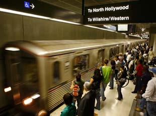
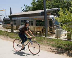
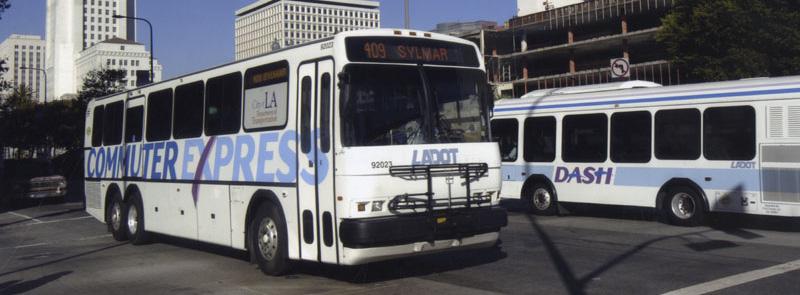
3 Intelligent Transportation Systems 1 Introduction Intelligent Transportation Systems (ITS) make use of advanced detection, communications, and computing technology to improve the safety and efficiency of our surface transportation network. ITS is a program of technology applications and integration that allows system operators and users to better manage and optimize the use of transportation system capacity. ITS allows for the use of information technologies to collect data about the status of our highways, traffic signals, transit vehicles, trucks and trains, and integrates that data in ways that affect and improve the efficiency of the system. ITS systems are not new to the SCAG region. Systems like the City of Los Angeles Automated Traffic Surveillance and Control (ATSAC) computer-based signal system have been in place since first installed around the LA Coliseum for the 1984 Olympics. This assists in optimizing signal timing to accommodate varying traffic demands throughout the day. Beginning in the 1990 s, Rapid Bus ITS systems have been installed using technology to prioritize transit movements through signalized intersections. These technologies have grown to track buses, provide motorists and transit users real-time information, and manage natural and manmade disasters in state of the art Traffic Management Centers. Existing System Description The freeways system in Southern California have an extensive freeway detection system covering much of the urbanized portion of the system. Loop detectors in the pavement and video cameras provide information on speed and volume, and identify congestion and incidents which are fed to Caltrans/California Highway Patrol (CHP) Transportation Management Centers (TMC s). The TMC s are manned 24/7 by CHP and Caltrans personnel, and monitor and respond to changes in traffic conditions, including both planned events and emergencies. Information is conveyed to the public through traditional media, advanced media (the Internet, PDA s), and through changeable message signs on our Freeways. These capabilities allow Caltrans to respond quickly to incidents and allow the public to adjust their travel plans. Arterial ITS systems are in place throughout the SCAG Region; local arterial systems include advanced signal synchronization capabilities and the ability to detect and respond to changes in traffic volume or direction of travel, or incidents. Some arterial ITS systems include bus prioritization for the operation of Rapid Bus transit operations. Many local arterial ITS systems include high level video detection to observe traffic conditions and incidents. Local ITS systems also include information components such as changeable message signs and highway advisory radio channels to convey information to users during events or emergencies. Transit ITS systems include automatic vehicle location (AVL) systems that detect bus locations, heading, speed, and time of arrival. AVL systems allow for the monitoring of bus performance, improved safety and security, and enhanced customer information such as real-time scheduling. AVL systems are often used in conjunction with bus priority signal systems to improve running times and reduce delays, and are an integral component of most of the Rapid Bus systems. Bus Transit ITS also includes advanced passenger counting systems and electronic fare systems that improve operations, reduce fraud and fare evasion, and collect data to better understand system performance and plan more effective operations. Such systems also allow for more effective use of transit systems in response to emergencies to assist in the evacuation of impacted areas. Today, AVL Transit systems are widely deployed, including on most of the buses of LACMTA, Long Beach Transit, Omnitrans, Riverside Transit Agency, Santa Monica, and a number of other operators. Southern California has led the nation in the provision of accurate and timely traveler information, including real-time traffic and incident data on our freeway system. Information on transit and ridesharing is also available extensively online and through electronic media, including real-time information on transit. The region recently deployed a traveler information system (similar in concept to 9-1-1) which will allow for a one-stop multi-media contact point for all traveler information services. The system is part of a national initiative to create a national system of traveler information services. There have been existing programs among Los Angeles and railroads (SCRRA, UP, and BNSF) to implement an interface standard between the rail warning circuit controller and traffic signal controller (this interface standard is known as IEEE ) for the purpose of establishing a supervised communication circuit. This standard has been promulgated by CPUC, and is now reflected in both the MUTCD and AREMA. An extended application of this standard involves the application of Advance Preemption, which allows the traffic signal to complete the pedestrian timing for conflicting crosswalks
4 2 Intelligent Transportation Systems prior to the active trains arriving the rail crossing. This extension, however, requires the railroad circuitry be designed in such a way, or be modified. This extended application is now common for active signalized intersections near rail crossings, for the light-rail transits, especially near pedestrian generators. The standards for Positive Train Control have been incorporated into the regional architecture and are currently being implemented by Metrolink. SCAG has a critical role in the development and managemetn of ITS in the region. As the Metropolitan Planning Organization, SCAG is charged with developing and maintaining a regional ITS architecture. The architecture is the regional planning tool for ensuring a cooperative process to prioritize and deploy ITS technologies and for identifying critical data connections between institutional stakeholders. The architecture assists the region in deploying ITS systems that are truly integrated and able to share information among many agencies in consistent and compatible formats to achieve improved safety and efficiency of transportation operations. SCAG works closely with the county transportation commissions (CTCs), local governments, and Caltrans Districts to update and maintain the regional architecture, and assure the use of required systems, engineering requirements, and applicable standards, which is required when federal funds are used on ITS projects. are monitored for the proper timing of signal phases, traffic volumes, and changes on arterials, and optimal timing plans are introduced to maximize arterial flow, and minimize unnecessary delay. The SCAG region has the most extensive system of freeway monitoring detection in the United States, with approximately 65 percent of the urbanized freeway system under some form of detection. The arterial system has also grown to cover significant portions of Los Angeles and Orange County cities, and is increasingly being deployed and interconnected in Riverside and San Bernardino Counties. Ramp metering is also extensively deployed throughout the urbanized areas. But, significant gaps in coverage and capability of freeway and arterial ITS systems still exist, including limited coverage of ports routes and major corridors in and out of the urbanized area. Existing System Performance and Operational Impacts from ITS ITS technologies are not a mode of travel; they are a means of assuring that our modes of travel are being managed and operated at maximum effectiveness. An example is ramp metering of freeways, which is designed to assess the optimal flow rate (highest achievable capacity) and to meter the traffic so that it merges with the flowing traffic in a way that minimizes flow disruption that would otherwise reduce the capacity that the lane is able to carry. Today, sub-optimal flow on our freeways and arterials, so-called stopand-go traffic, creates significant losses to design capacity. ITS technologies allow us to observe, confirm, and proactively address these losses in operational efficiency. This will allow for rapid response to clear incidents and accidents, adjust ramp metering rates, identify bottlenecks and slow approaching traffic to reduce collisions that would further diminish the system s optimal flow rate capacity. Similarly, traffic signal systems
5 Intelligent Transportation Systems 3 Future Baseline System Improvements ITS plays a critical role in the operation and management strategies designed to increase the efficiency of the existing transportation system. The 2012 RTP/SCS allocates $7.6 billion in Transportation System Management measures, which includes ITS. The region will continue to update the capabilities of our Caltrans TMC s, expand ramp metering and corridor management strategies, fill detection gaps, increase the use of signal system controls, and increase and improve the technical capabilities for transit bus and rail systems. ITS systems are not modeled directly in the regional demand model, but comparative studies of the impacts shows significant travel time savings on arterials, as well as the potential for improving the effective flow rates of our freeways and the ontime performance of our bus and rail system to 95 percent or higher. ITS will be an increasing part of the regional goods movement strategies. The Ports of Los Angeles and Long Beach have identified ITS technologies, specifically automated vehicle location (AVL), as a major component in their proposed air quality mitigation strategies. Advanced monitoring will assist in achieving system efficiencies in ports and intermodal operations, reducing delays and waiting times at gates and destinations, and allowing for more flexible dispatching, all of which reduce emissions. Weigh in motion systems and enhanced detection will allow for better enforcement of commercial vehicles rules, reducing pavement damage, and identifying critical paths for goods movement planning in the future. ITS systems will allow for enhanced capabilities to protect the transportation system and respond to emergencies. One goal of the RTP is to integrate transportation system information into a shared use capacity with emergency service responders. Visual safety systems, detection, automated vehicle location, and the ability to share this information with public safety agencies will assist in deterring, preparing for, responding to, and recovering from manmade security events and natural disasters. These technologies, although in place to manage the transportation system, can assist in providing a deterrence to crime and terrorism, as well as assist in major incident responses such as road closure or other events requiring the close coordination of evacuation vehicles. Recommended Policies and Actions Maintain and update the Regional ITS Architecture to assure eligibility of federal funding from state of the art ITS technologies for regional stakeholders. Continue the development of a Regional Configuration Management process among CTCs, Caltrans Districts, Ports, and local governments to assure consistent and compatible integration of ITS technologies and interoperable operations. Identify funding sources for transportation system operations and management strategies, including ITS, to ensure optimal operation of the existing and future transportation system in the region. This will be coordinated with the CTCs, Caltrans, and other agencies implementing ITS technology. Implement near-term ITS priorities to improve the safety and efficiency of the current transportation system, including: ramp metering, increased freeway detection, monitoring of goods movement operations, advanced traveler information systems/5-1-1/goods movement information systems, transit vehicle location and real-time schedule adherence, Rapid Bus systems, computer-based signal timing systems, interconnection between roadway traffic signals and railroad signal systems, automated fare collection and toll collection technologies. Identify ITS base systems for future integrated freeway and corridor management strategies, including potential congestion pricing systems and High Occupancy Toll Lanes. Mainstream ITS investments and make ITS systems part of the capital investment in new projects to assure optimal operations of new transportation investments.
6 818 West 7th Street, 12th Floor Los Angeles, CA Phone: (213) Fax: (213) REGIONAL OFFICES Imperial County 1405 North Imperial Avenue Suite 1 El Centro, CA Phone: (760) Fax: (760) Orange County OCTA Building 600 South Main Street Suite 906 Orange, CA Phone: (714) Fax: (714) Riverside County th Street Suite 805 Riverside, CA Phone: (951) Fax: (951) San Bernardino County Santa Fe Depot 1170 West 3rd Street Suite 140 San Bernardino, CA Phone: (909) Fax: (909) Ventura County 950 County Square Drive Suite 101 Ventura, CA Phone: (805) Fax: (805) please recycle