AERIAL INSPECTIONS USING UNMANNED AERIAL VEHICLES
|
|
|
- Blake Shaw
- 5 years ago
- Views:
Transcription


1


2 AERIAL INSPECTIONS USING UNMANNED AERIAL VEHICLES MICHAEL A. PEREZ, WESLEY C. ZECH, PH.D., WESLEY N. DONALD, PH.D. MRN/SWANA MID-ATLANTIC A N N UA L C ONFERENCE ELLICOTT CITY, MD JUNE 22, 2016
 Regulations limit NPS pollution from construction sites 1 acre Requirements for erosion & sediment control practices, inspections, and")
3 Research Motivation Construction related environmental impacts Produce 20 to 1,000 times more sediment discharge 80 million T/yr of construction generated sediment Water quality & aquatic ecosystem degradation 2012 NPDES Construction General Permit (CGP) Regulations limit NPS pollution from construction sites 1 acre Requirements for erosion & sediment control practices, inspections, and maintenance

4 ESC INSPECTION REQUIREMENTS Formal inspection Conducted by Qualified Credential Inspector (QCI) Weekly or after 0.25 in. storm events Time consuming & arduous site walkthrough inspections Reports to be retained for three years from permit expiration Need for more effective/efficient methods

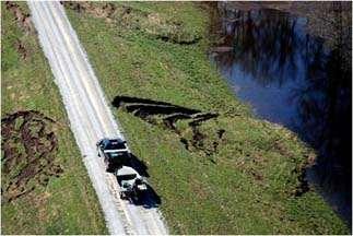
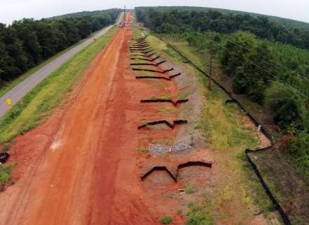
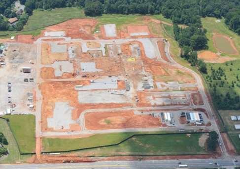
5 US HWY 27 / SR1 WIDENING RANDOLPH COUNTY, GA

6 US HWY 27 / SR1 WIDENING RANDOLPH COUNTY, GA


7 UNMANNED AERIAL VEHICLES - UAVs Initially developed for military sector Autonomous or remotely guided Rapidly increasing civilian / research applications Availability / affordability Low altitude, high resolution spatial and sensing data collection High flexibility in data collection and platforms


8 Agriculture Archeology Delivery Services Emergency Management Inspections Law Enforcement Mapping Meteorology Photography Search & Rescue Wildlife Monitoring EMERGING UAV APPLICATIONS
9 TRANSPORTATION & CONSTRUCTION INSPECTION APPLIC ATIONS DAM & LEVEE SAFETY EROSION & SEDIMENT NATURAL RESOURCES BRIDGE & OVERHEAD TRAFFIC SIGNS REVERSE-LANING OPERATIONS


10 OVERHEAD LIGHTING UTILITY INSPECTION APPLIC ATIONS PIPELINE WASTE MANAGEMENT POWER GENERATION TRANSMISSION LINES & TOWERS


11 PHOTOGRAMMETRY & MAPPING APPLIC ATIONS DEM: STOCKPILE & EARTHWORK 3D: BRIDGE & STRUCTURES 2D: ROADWAY DESIGN

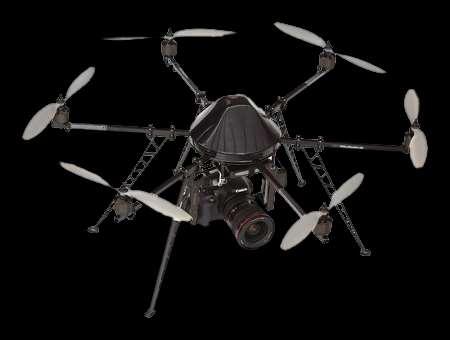


12 COMMERCIALLY AVAILABLE UAVS


13 UAV TYPES ROTARY Easily deployable - VTOL Agile maneuverability Ability to hover, stare Payload precision Confined & vertical operation FIXED WING Higher cruising speeds Low energy consumption Longer duration / range Simpler structure Longer range


14 UNMANNED AERIAL SYSTEM ELEMENTS GPS SENSOR RC PC

15 WIFI GPS BATTERY Camera Angle CAPTURE MODES Position TELEMETRY


16 PROJECT OBJECTIVES Identify UAV applications Erosion & sediment control site inspections Project management & documentation Conduct case study on active construction site Investigate photogrammetric applications Identify advantages in UAV based inspections


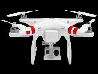
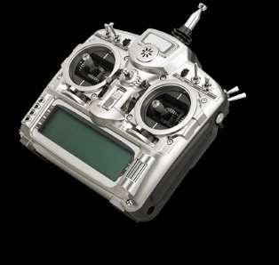
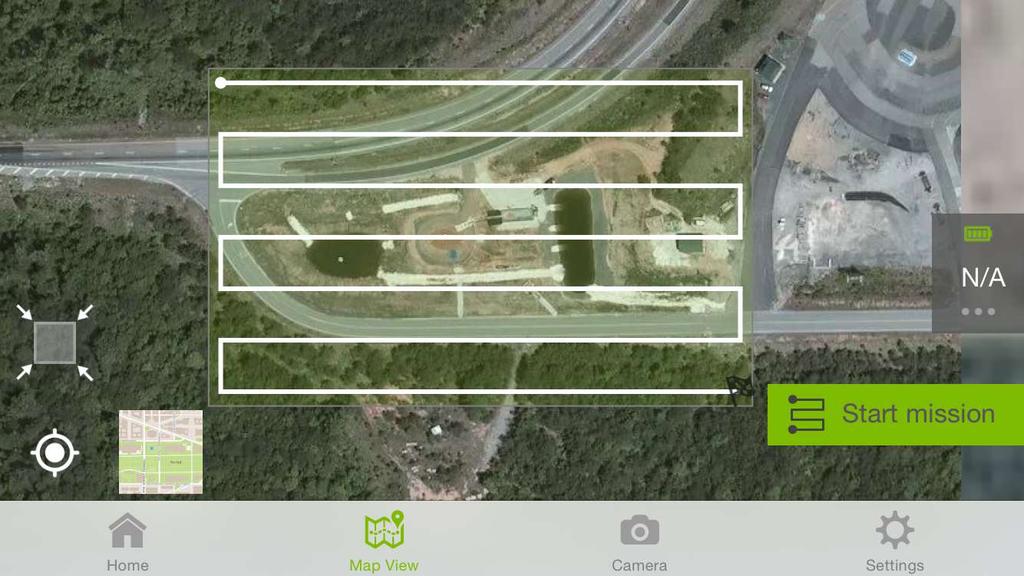
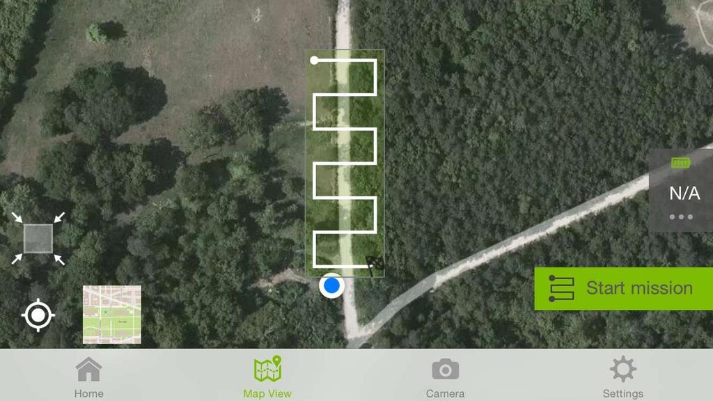
17 DJI PHANTOM 2 VISION UAV Quadcopter 13.8 in. length / 2.6 lb. weight 25 min. / 984 ft. flight range 34 mph max. flight speed Sensor 14 MP photographs / 1080/30P video 0-60 deg. gimbal tilt Operation First person real-time view GPS flight control enabled Autonomous flight plan application

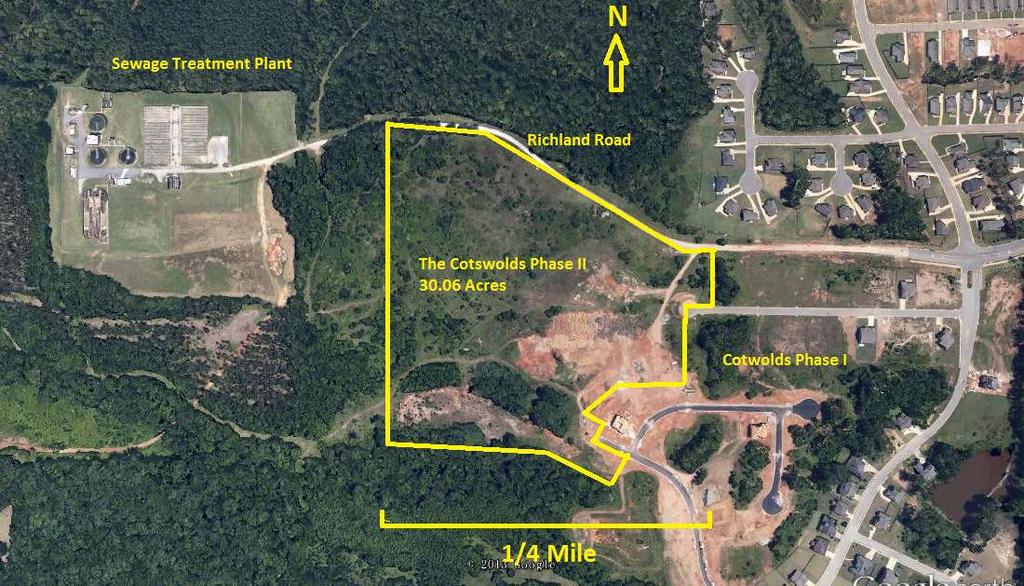
18 Selected site study CASE STUDY 25 acre residential subdivision (Auburn, AL) Six total inspections over 16 weeks 18 rain events 0.25 (21.8 total) Flight plan 150 flight altitude / 70% image overlap Followed traditional on-foot inspections
19

20 SEDIMENT BASIN STEEP SLOPE STREAM

21 SEDIMENT BASIN STREAM
22 GULLY EROSION GROUND PERSPECTIVE


23 GULLY EROSION AERIAL PERSPECTIVE

24 GULLY EROSION GROUND PERSPECTIVE

25 GULLY EROSION AERIAL PERSPECTIVE (4/10/14)

26 CORRECTIVE ACTION (5/1/14)

27 EROSION AND FLOW PATH IDENTIFICATION

28 SEDIMENTATION

29 SEDIMENT BASIN

30 INEFFECTIVE E&S CONTROLS
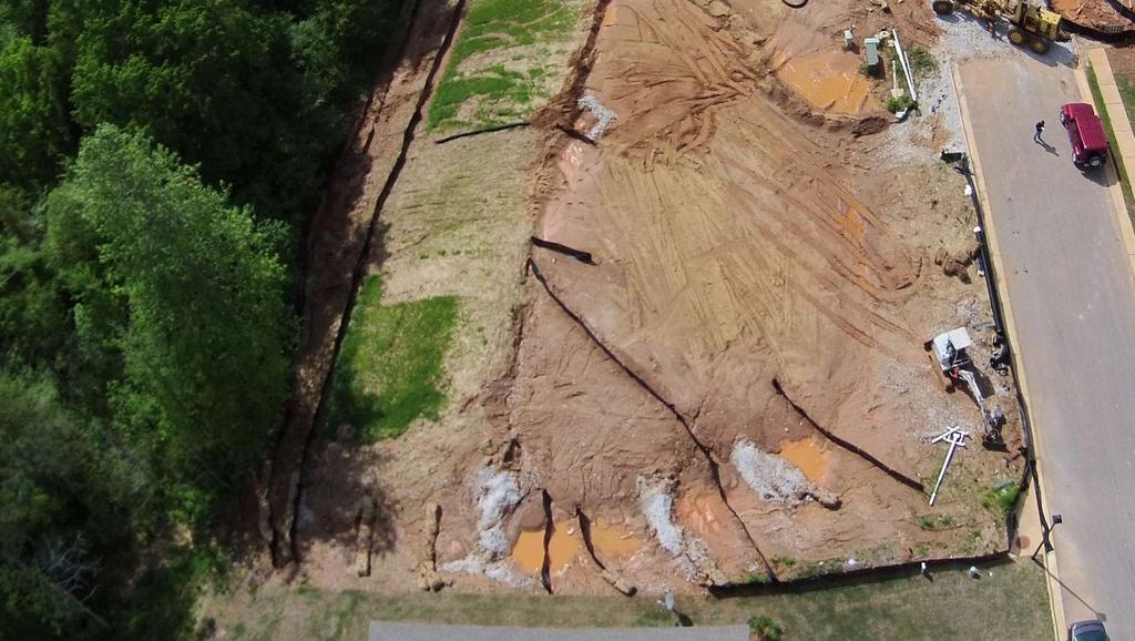
31 E&S CONTROL IMPROVEMENTS


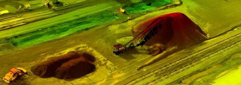
32 PHOTOGRAMMETRY Obtaining reliable measurements from overlapping photographs Scaled three-dimensional reconstruction through triangulation Common applications Large-scale topographic surveys, landuse maps, forestry covers Image resolution Airplane / satellite: 7.9 to 19.7 in./pixel Low altitude UAV: 0.40 in./pixel

33 PROJECT MOSAIC: APRIL 10, PHOTOS, 150 FT. ELEV.

34 PROJECT MOSAIC: JUNE 30, PHOTOS, 150 FT. ELEV.

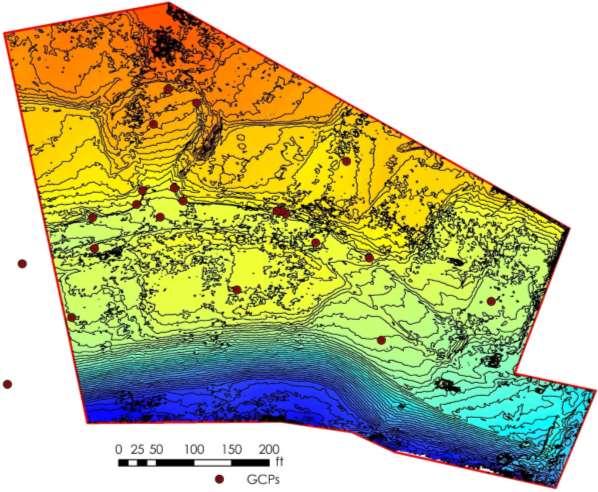
35 PHOTOGRAMMETRIC DEM GENERATION

36
37
38
39

40 VOLUME ESTIMATION STOCKPILES Haul & transport estimation Efficient material storage / handling SEDIMENT BASINS Available storage volume Identification of dredging / maintenance needs

41 EROSIVITY: ASSESMENT, RISK, & PREDICTION DEM surface comparisons Soil migration volumes Risk & prediction Topographic feature characterizations Delineation of drainage sub-basins, runoff flow reaches / paths GIS risk indicator models for runoff Tools for ESC selection / sizing


42 VEGETATIVE ESTABLISHMENT Temporary or permanent vegetation Effective erosion control Used to stabilize disturbed areas Required within 14 days Provide 70% of pre-construction cover Normalized Difference Vegetation Index (NDVI) Measures infrared reflectance of vegetation Identification of areas in need of seeding, nourishment


43 CONSTRUCTION DOCUMENTATION Construction industry is burdened with legal disputes Assessment of pre-development conditions Identification of natural resources Project progression Evaluation of progress Contractor claims / disputes Material management Pavement sub-base thickness Stock-pile volumes Project communication Public meetings Design engineers / contractors ALDOT constructed wetland, - Montgomery, AL

44 INITIAL ROADWAY GRADING: MARCH 8, 2014

45 FOLLOWING HEAVY RAINFALL EVENTS: MARCH 30, 2014

46 ROADWAY BASE LAYER PLACEMENT: MAY 1, 2014

47 ROADWAY & VERTICAL CONSTRUCTION: JUNE 30, 2014


48 CONCLUSIONS Affordability / low cost Efficient & flexible to landscape UAV site inspection advantages Bird s eye perspective Identification of flow paths Bridges the gap scale and resolution Low altitude data collection High resolution DEM generation

49 CONTINUING RESEARCH GOALS Further conduct aerial erosion and sediment control inspections Comparatively analyze UAVs / photogrammetry software platforms Access the accuracy of developed volumetric estimation methods Develop UAV inspection recommendations / guidelines


50 FAA STANDPOINT Current ban on commercial operations Regulation proposal released 2/15/15 Small drones 55 lbs 500 ft commercial operation ceiling 100 mph restriction Visual contact w/ UAV Ban on nighttime operation Aerospace knowledge exam TSA background security check No requirements for pilots license Final regulations expected September 2015 delays likely

51

52 UAV OPERATION SAFETY CONSIDERATIONS Public Awareness Be courteous, polite, professional Area & Environment Overhead obstructions: wires/cables, towers Animals, bystanders, property Buffer zones, alternate landing area Topography Inclement weather: wind, visibility, temperature, precipitation Avoid controlled airspace Flight Plan Use a co-pilot / spotter Notify bystanders, property owners Contingency plan Emergency preparedness Equipment Pre-flight inspection Check for and address any damage Battery status: RC & UAV Safety & Common Sense!


53 esc.auburn.edu AU-ESCTF MICHAEL A. PEREZ