Section B Planning and Implementation Part 4 Infrastructure Development Initiatives. CHAPTER 16 Transit-oriented Development
|
|
|
- Lionel Potter
- 6 years ago
- Views:
Transcription


1 Section B Planning and Implementation Part 4 Infrastructure Development Initiatives CHAPTER 16 Transit-oriented Development
2
3 chapter Transit-oriented Development Introduction Among others, the development of SJER will focus on Transit-oriented Development (TOD). This is in line with the policies of the NPP: NPP: The TOD concept will be promoted as the basis of urban planning to ensure viability of public transportation. NPP: Transportation systems in all major urban centres shall adopt a modal split of 50:50 between public and private transport. TOD seeks to implement a more sustainable approach to urban planning in the use of land around transit stations Goals In moving towards TOD, strong emphasis shall be placed on integrating development and public transportation strategies. In doing so, the goals for CDP on TOD are to: TRANSIT-ORIENTED DEVELOPMENT GOALS Introduce an efficient Public Transportation system to link major centres/townships and to encourage a Transit Oriented Development especially within the SEC and its immediate surroundings. Organize growth at the SEC level to be compact and transit-supportive. Enhance SJER economic base by capitalizing on the TOD Definition Transit Oriented Development (TOD) is a walkable mixed-use form of development typically focused within 400m radius of a transit station or any public bus network. Development shall be concentrated near stations to make transit convenient for people and encourage rider ships. This form of development utilises existing infrastructure, optimises use of the transit network and enhances mobility for local communities. The CDP will identify major centres such as commercial nodes, employment concentrated areas and institutional nodes, as areas to be included in the TOD Objectives To support the goals for SJER TOD, several objectives has been identified to integrate land use development with public transportation systems; Ensure transit is supportive of land uses; Increase density around transit stations; Create pedestrian oriented design; Make each station a centre for activity; and Manage parking, bus and vehicular traffic. 16-1
4 SECTION B PLANNING AND IMPLEMENTATION 16.5 Transportation Development in SJER A. Overview SJER has an existing imbalanced modal split of about 70:30 with a bias of private transport. In addition, Table 16.1 shows that the traffic is estimated to grow at an average rate of 4.2% up to the horizon year of 2025 where the volume of daily trip generation is estimated to double from the current figures in 15 years; up to the year Table 16.1: Traffic Growth Factor from Year Year Rate (%) Trips (vpd) ,254,256 1,516,251 1,847,606 2,549,989 3,100,120 3,936,802 (Note: vpd vehicle per day) If left unchecked, the large amount of traffic generated will cause traffic congestion and represents an immediate and future challenge. It follows that the key strategy for public transportation development in SJER is: KEY DIRECTION TOD 1: To ensure efficient movement of goods and people by provision of various forms of transportation systems; to provide access to locations within SJER and in particular to the SEC area. B. Enhance Regional and Local Public Transportation System Provision of a comprehensive Public Transport network to consist of a combination and integration of: i. Subject to the results of a National Interest Study currently being undertaken, a High Speed Rail System linking SJER to Kuala Lumpur; ii. Light Rail Transit (LRT) (proposed for intercity connection); iii. Monorail (to serve within the CBD of Johor Bahru); iv. KTM Komuter train; v. KTM intercity express trains (proposed ERL); vi. KTM freight trains passing through the Central District; vii. Inner City transport (tourist city bus, town bus and monorail); viii. Buses (Stage, Express, School, Tourist and Tour); and ix. Taxis. Proposed High Speed Rail System A National Interest Study is currently being undertaken to evaluate the viability of such a proposal. The proposed High Speed Rail envisaged; links Kuala Lumpur to Johor Bahru at a speed of around 300 km/hour. Proposed KTM Intercity Express Trains (ERL) The proposed KTM intercity express trains (ERL) shall operate with an average travel speed of 120 km/h and is proposed to ply the route of Johor Bahru Sentral II in Senai and Johor Bahru Sentral I in CBD of Johor Bahru; it can be achieved within 15 minutes of travel time. Table 16.2: Proposed Development Of Express Rail Link (ERL) Routes Johor Bahru Sentral II Johor Bahru Sentral I Route Length (km) Light Rail Transit (LRT) Number of Stations Travel Time (One Way Trip) Implementation Phase Indicative Cost (RM Million) mins By the year 2010 the population in SJER area is forecasted to be 1.5 million, of which about 0.54 million and 0.59 million are within the Johor Bahru Municipal Council and Majlis Perbandaran Johor Bahru Tengah administered areas respectively. These findings indicate that existing and proposed road network system cannot cope with the continuous traffic growth. In line with the proposals under the NPP, SJER s transportation system is envisaged to be more mass-oriented rail base urban public transportation system to reduce usage of personal 16-2
5 TRANSIT-ORIENTED DEVELOPMENT CHAPTER 16 PART4 mode of transportation. As identified, there are three optimal routes linking the new urban growth centres, Pasir Gudang, Nusajaya, Tebrau and Skudai, to Johor Bahru Sentral I. It is proposed that this route will be served by the LRT service with 38 stop stations and 10 transfer stations. For ultimate integration, the regional rail based transportation infrastructure must achieve the objective of linking the new business and financial centre in Johor Bahru with Singapore. It is recommended that the possibility of linking the proposed LRT from Johor Bahru to Johor Bahru Sentral I be extended to the Singapore MRT at Woodlands. It follows that this will require the agreement and facilitation of authorities in both Malaysia and Singapore. Table 16.3: Proposed Development of Light Rail Transit (LRT) Routes Johor Bahru Sentral I UTM Johor Bahru Sentral I Ulu Tiram Pasir Gudang- Nusajaya Route Length (km) Monorail Nos Of Stn. Travel Time (One Way Trip) Implementation Phase Indicative Cost (RM Million) minutes , minutes , minutes , Total Cost 6, A further rail based and environmental friendly inner city public transport mode is the monorail system. It is proposed that it will be elevated above the existing road network that links the CBD main attraction point to the commercial inner core and Johor Bahru Sentral I. There are two optimal routes linking Johor Bahru Sentral I to the Lagoon Puteri Transfer Station on the west and Majidee Square Transfer Station to the east. A total of 16 stop stations within 14.5 km route length were identified. Implementation of the monorail system in Johor Bahru CBD will reduce the usage of personal modes of transportation thereby relieving traffic congestion and solving inadequate the need of car park facilities. Table 16.4: Proposed Development of Light Rail Transit, LRT (Monorail) Routes Johor Bahru Sentral I Danga Bay Johor Bahru Sentral I Wisma Daiman Route Length (km) KTM Komuter train Nos Of Stn. Travel Time (One Way Trip) Implementation Phase minutes Indicative Cost (RM Million) 1, minutes Total Cost 1, In transforming SJER to be mass-oriented urban rail system, the existing KTM routes reserve must be utilised to serve the need of Mass Rapid Transit System that is fully integrated with the proposed LRT system. There are 25 stations and 6 transfer stations proposed for the 3 MRT routes i.e. connecting Johor Bahru Sentral II Nusajaya, Johor Bahru Sentral II Pasir Gudang and Johor Bahru Sentral I Johor Bahru Sentral II. Table 16.5: Proposed Development of Mass Rapid Transit Routes Johor Bahru Sentral II Pasir Gudang Johor Bahru Sentral II PTP Johor Bahru Sentral I Johor Bahru Sentral II Route Length (km) Nos Of Stn. Travel Time (One Way -Trip) Implementation Phase Indicative Cost (RM Million) minutes minutes minutes Total Cost 1,

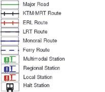
6 SECTION B PLANNING AND IMPLEMENTATION Figure 16.1: Proposed Comprehensive Public Transportation System for SJER RAIL NETWORK AND TRANSIT STOP MRT Route Ferry Route MRT Station Monorail Station LRT Route Tram Route LRT Station Ferry Station 16-4
7 TRANSIT-ORIENTED DEVELOPMENT CHAPTER 16 PART4 Buses In the short to medium term, bus services should be upgraded and continue to play the role as the backbone of SJER s public transportation until the mass-oriented urban rail system takes place (targeted to be after 2010). In the long term, bus services must be oriented to act as the feeder service to the rail-based transport system. Several corridors have been identified and needs the support of enhanced bus services. The corridors can be largely categorised into two types; the corridor with the sufficient passenger demand, and the corridor without sufficient passenger demand. For the corridor with sufficient passenger demand, it is very important to maintain or increase the patronage by providing better bus services. Poor level of bus services might result in further decrease of passengers. These include Skudai, Tebrau and Pasir Gudang Area. On the other hand, commuters of corridors with insufficient passenger demand are proposed to use their own means of transportation. It is not easy to attract those people to use public transportation; thus, higherlevel bus services such as express bus services may be required to serve the designated corridor. C. Supporting Public Transport Facilities Transit supporting facilities are facilities for public transportation users. It is normally located along transit corridors like the rail network and road based public transport such as buses and taxis that serve as feeder to the main public transportation network. Three types of transit supporting facilities are proposed namely the multi-modal transportation terminal, the independent rail stations (MRT, LRT, Komuter, monorail and trams) and road base transportation facilities in the form of bus and taxi stands/stops/stations. Multi-modal Transportation Terminal The multi-modal transportation system will consists of different modal transportation networks that, by themselves, allow a traveller to move from one location to another. Inter-modal connection provides the ability to transfer from one modal network to another. To achieve the above objective, a local transit terminal is proposed to be located within the CBD of Johor Bahru. The existing bus terminal at Jalan Terus is proposed to be upgraded to accommodate the local transit terminal and have a dedicated pedestrian route connection between the Johor Bahru Sentral I and the Transit Terminal located at the existing Johor Bahru KTM terminal. This terminal is also proposed to be upgraded to function as a local transit terminal that hosts such facilities for LRT, ERL and Monorail services. To cater for regional linkages, a Regional Transit Terminal known as Johor Bahru Sentral II at Senai is proposed. This terminal will function as a regional transit terminal for the Johor Bahru District transit system. It will consist of facilities for High Speed Rail system, LRT and KTM Komuter Services. Park-And-Ride Facilities In order to encourage the use of public transport, alotted car parking lots must be provided in the vicinity of the terminals and stations. Commuters and visitors that drives into urban areas should be encouraged to utilise the peripheral car parking lots and switch to LRT, buses and other means of public transportation system to complete their journeys. Since private vehicles are still the preferred mode of travel, services which accommodate the usage of private vehicles such as park-and-ride could be a popular alternative. The park-and-ride facilities will encourage the use of public transport systems. Bus and Taxi Stand Taxi stands are proposed to be located at suitable locations within the proposed road hierarchy and within the larger building projects; particularly adjacent to bus stops such as the KTM Impian Perdana and Kotaraya II. Taxi stands are also proposed along Jalan Tun Abdul Razak and Jalan Terus to service the proposed pedestrian priority areas. 16-5

8 SECTION B PLANNING AND IMPLEMENTATION Figure 16.2: Rail Network and Transit Stops 16-6
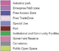
9 TRANSIT-ORIENTED DEVELOPMENT CHAPTER 16 PART Integrating Land Use and Transportation Development The growth, form and land use pattern of SJER, particularly for road network, is inextricably linked to the form of transport readily available to provide public mobility. Access to vehicular mode of transport has come within easy reach of a large part of the population, creating demand for linear or sprawling form of development along the route or corridor of major highways and roads. The CDP has recognised the need to integrate the development and public transport strategies; transport planning must be integrated with the overall land use planning as it is an integral element of land use planning. In addition, transport infrastructures, particularly road and rail network, can act as a catalyst to growth and major development. Hence, the primary objective of transportation and land use planning in CDP is: KEY DIRECTION TOD 2: To integrate transportation development, in particular public transportation, with land use development in order to support sustainable travel choices and to promote compact forms of urban environment towards increasing efficiency of the transport system Measures proposed in the CDP to achieve the above are:- Land Use Development Strategy for Integrated Rail Network Effective land use and transport planning is aimed to minimise the need to travel or influence the mode of travel through the coordinated arrangement or location of traffic generating uses in relation to existing transport, particularly the more sustainable transport mode, and influencing proposals for new route that is in line with land use planning. It is the objective of SJER to provide a comprehensive and integrated transportation system that serves inter and intra city travel and to integrate land use development with public transportation and road network. To achieve the above, the proposal for rail network will serve areas that are identified as growth areas such as Nusajaya and Senai Airport; employment centres such as Tanjung Langsat Industrial Area, Pasir Gudang Industrial Area, Plentong Industrial Area, Ulu Tiram Industrial Area, Port of Tanjung Pelepas and University Teknologi Malaysia; commercial centres such as Johor city centre, Nusajaya CPA, Senai district centre, Skudai district centres, Ulu Tiram district centre and Pasir Gudang district centre. Local centres such as Tanjung Langsat, Rinting, Permas Jaya, Mount Austin and Tanjung Pelepas will also be served by rail together with other areas of focus where development will be concentrated within the urban growth boundary of SJER and within the SEC. Emphasis on the more sustainable mode of transportation that is the transit-based network; rail and other form of public transport that supports or act as feeder to the rail network; Integration of rail network with land use development strategies by directing and focussing land use development towards areas along transit corridors and within TOD zones; and Intensification of development around transit stations (TOD zones). 16-7

10 SECTION B PLANNING AND IMPLEMENTATION Figure 16.3: Proposal for Intergrated Land Use and Rail Network BUKIT BATU AYER BEMBAN K O T A T I N G G I KELAPA SAWIT KULAI P O N T I A N PEKAN NENAS INDAHPURA INDUSTRIAL AREA INDAHPURA UTM TECHNOVISION PARK SENAI INDUSTRIAL AREA JOHOR TECHNOLOGY PARK UTM SENAI AIRPORT SKUDAI CARGO HUB PERLING KEMPAS INDUSTRIAL AREA TAMPOI LARKIN TEBRAU INDUSTRIAL AREA MOUNT AUSTIN PERMAS JAYA ULU TIRAM INDUSTRIAL AREA PLENTONG INDUSTRIAL AREA KOTA MASAI TANJUNG LANGSAT INDUSTRIAL AREA GELANG PATAH NUSAJAYA INDUSTRIAL AREA NUSAJAYA CENTRAL PLANNING AREA NUSAJAYA INDUSTRIAL AREA JOHOR STATE ADMINISTRATIVE CENTRE JB CITY CENTRE PASIR GUDANG INDUSTRIAL AREA PASIR GUDANG PORT TANJUNG LANGSAT TANJUNG LANGSAT PORT TANJUNG PELEPAS PORT TANJUNG PELEPAS INDUSTRIAL AREA MAJOR EMPLOYMENT CENTRE JB CITY CENTRE / NUSAJAYA CPA LOCAL CENTRE PRIMARY DEVELOPMENT CORRIDOR RAIL NETWORK DISTRICT CENTRE SECONDARY DEVELOPMENT CORRIDOR 16-8
.")
 are within the public transport catchment coverage.")
11 TRANSIT-ORIENTED DEVELOPMENT CHAPTER 16 PART4 Within SJER, 33% of the area (74,465 hectares) will be within the three kilometre catchment radius of the planned public transport network; both rail based and road based. Out of the above, 3,415 hectares of area in SJER will be directly accessible to pedestrian (within 400m radius of the planned transit stations). Areas outside this radius will be served by a feeder system; involving road based public transportation such as buses and taxis. Figure 16.4: Example of Integration of Development with Transit Facilities In the SEC, 76% of the areas (34,463 hectares) are within the public transport catchment coverage. Areas outside it are areas zoned as environmental protection zone. To ensure integration and implementation of the proposed rail network, land use and transportation development within public transport corridor will be tailored towards securing the reserves or right of way for public transportation network. Areas and road reserves affected by proposal for rail network will be developed to incorporate space for rail facilities; either through dedicated reserves or shared space within the road reserves. Other reserves that require supporting public transport facilities such as terminals, stations and lay-bys will be integrated within the planning and development of areas within the corridor or coverage of public transport network. LANDSCAPE/ PEDESTRIAN 2.5m DRAIN 1.5m 6 LANES DUAL CARRIAGEWAY (40m) PRIMARY ROAD (R5/U5) M/CYCLE LANE 3.0m CARRIAGEWAY 10.5m 7.5m MEDIAN 3.0m CARRIAGEWAY 10.5m M/CYCLE LANE 3.0m LANDSCAPE/ PEDESTRIAN 2.5m DRAIN 1.5m Figure 16.5: Example of Right of Way for Rail, Bus and Public Transports 16-9
12 SECTION B PLANNING AND IMPLEMENTATION Figure 16.6: Coverage of Proposed Rail Network Within walking/cycling distance (400m radius) Area covered by feeder and others public transportation (3km) 16-10
13 TRANSIT-ORIENTED DEVELOPMENT CHAPTER 16 PART Intensification of Development within TOD Zones To increase the usage of public transport, and to ensure it would be considered as a viable option for daily commuters, residential development and activity centre development will be located, with access, close to the proposed transport networks. Key trip generators, such as higher density residential development and principal, major and specialised activity centres, will be concentrated on the principal public transport network the MRT, LRT, Monorail and tram services. Providing pedestrian-friendly environment is a priority in TOD zones as pedestrians are the primary user of the transit and associated TOD uses. The distance that a pedestrian is likely to travel to take transit, in this case, rail mode transit, is typically and has been universally determined to be within 5 to 10 minutes walk or approximately 400m. Table 16.6: Designated TOD Zones TOD Zones Centre Within SEC Outside SEC The key measure to integrate land use development with transportation planning while promoting transit-oriented development in support of public transportation is to provide priority and incentives to development areas around the transit stations. This is to be implemented through intensification of developments within designated TOD zones. KEY DIRECTION TOD 3: To facilitate intensification of TOD zones by incorporating mixed use development with high-density residential, high commercial plot ratio and integrated community and business facilities. A. Transit Oriented Development Zone (TOD Zone) City Centre District Centre Local Centre 1. Johor Bahru Central Planning Area 2. Johor Bahru CBD 3. Nusajaya Central Planning Area 1. Pasir Gudang 1. Skudai 2. Senai 3. Ulu Tiram 1. Tampoi 2. Gelang Patah 3. Tanjung Pelepas 4. Nusajaya Creative Centres 5. Permas Jaya 6. Rinting 7. Tanjung Langsat 1. Mount Austin The TOD zone is defined as a zone within 400m radius of a rail station or terminal; intensive development will be promoted. Intensification of TOD zone will be promoted through the following measures:- Transit supportive uses and high intensity activity nodes within Highway Business Centre 1. Taman Air Molek 2. Tampoi Jaya 3. Taman Tampoi Utama 4. Indahpura 5. Nusajaya 6. Johor Bahru City Centre 1. Kempas 400m walking radius of a transit station; High density residential and high plot ratio of commercial development within transit planning zone; Mixed use development of commercial, residential, community facilities and other civic uses; Pedestrian-friendly environment; and Good urban design Others 1. Tanjung Pelepas 2. Nusajaya/ Gelang Patah 3. Taman Bukit Indah 4. Taman Sutera 5. Kempas 6. Taman Daya 7. Skudai 8. Taman Molek 9. Taman Ria 10. Kota Puteri 11. Pasir Gudang 12. Second Link (FAZ) 1. Taman Impian Emas 2. Kangkar Pulai 3. Pulai Spring 4. UTM 5. Taman Ungku Tun Aminah 6. Bandar Tiram 7. Taman Nora 8. Taman Pelangi Indah 9. Hospital Sultan Ismail 10. Taman Sutera II 11. Taman Bukit Mewah 12. Johor Bahru Sentral II 16-11
14 SECTION B PLANNING AND IMPLEMENTATION Centre Within SEC Others 13. Leisure Farm 14. Nusajaya Theme Park 15. Nusajaya Creative Centre 16. Johor Bahru Sentral Lagun Puteri 13. Holiday Plaza 14. Wisma Daiman 15. Bakar Batu 16. Permas Jaya 17. Taman Rinting 18. Masai 19. Kg. Pasir Gudang Baru 20. Tanjung Puteri 21. Tanjung Langsat Industrial Area 22. Tanjung Langsat Jetty 25. Taman Tampoi Indah 26. Tampoi 27. Taman Sri Pandan 28. Kg. Ubi Baru 29. Plaza Pelangi 31. Danga Bay 32. Straits View 33. Kg. Mohd Amin 34. Maktab Sultan Abu Bakar 35. Hospital 36. Gertak Merah 37. Khalid Abdullah 38. Jalan Meldrum 39. Menara MSC Cyberport 40. The Zon 41. Leisure Mall 42. Wisma Lien Ho TOD Zones Outside SEC activities such as clean industrial activities, research & development (R&D), design & development (D&D). TOD zones outside SEC on the other hand, are designated for further intensity residential or commercial development. To encourage mixed-use development at TOD zones in SEC, bonus plot ratio can be exercised. For Johor Bahru CPA and Nusajaya CPA, higher plot ratio is given to TOD Zones compared to other commercial developments within the CPA. Table 16.7: Development Intensity in TOD Zones TOD Zones within SEC TOD Zones outside SEC Johor Bahru CPA Nusajaya CPA Other TODs outside Johor Bahru CPA & Nusajaya CPA Total plot ratio of 7.0 Mixed Use development (MX1) with breakdown of 60% commercial and 40% residential 20% reduction on parking requirements Total plot ratio of 4.0 Mixed Use development (MX1) with breakdown of 40% commercial and 60% residential 20% reduction on parking requirements Commercial development - plot ratio to follow FAR requirements designated according to hierarchy of centres High density residential development density to follow designated densities as indicated in Proposal Map 20% reduction on parking requirements B. Mixed-Use Development in TOD Zone Within SEC, the TOD Zones are designated for mixed-use development; either incorporating commercial (offices, retail and other compatible commercial uses) with residential, in order to support transport facilities and to promote 24-hour activities in the form of residential activities within centres, or incorporating offices, retail and compatible industrial 16-12
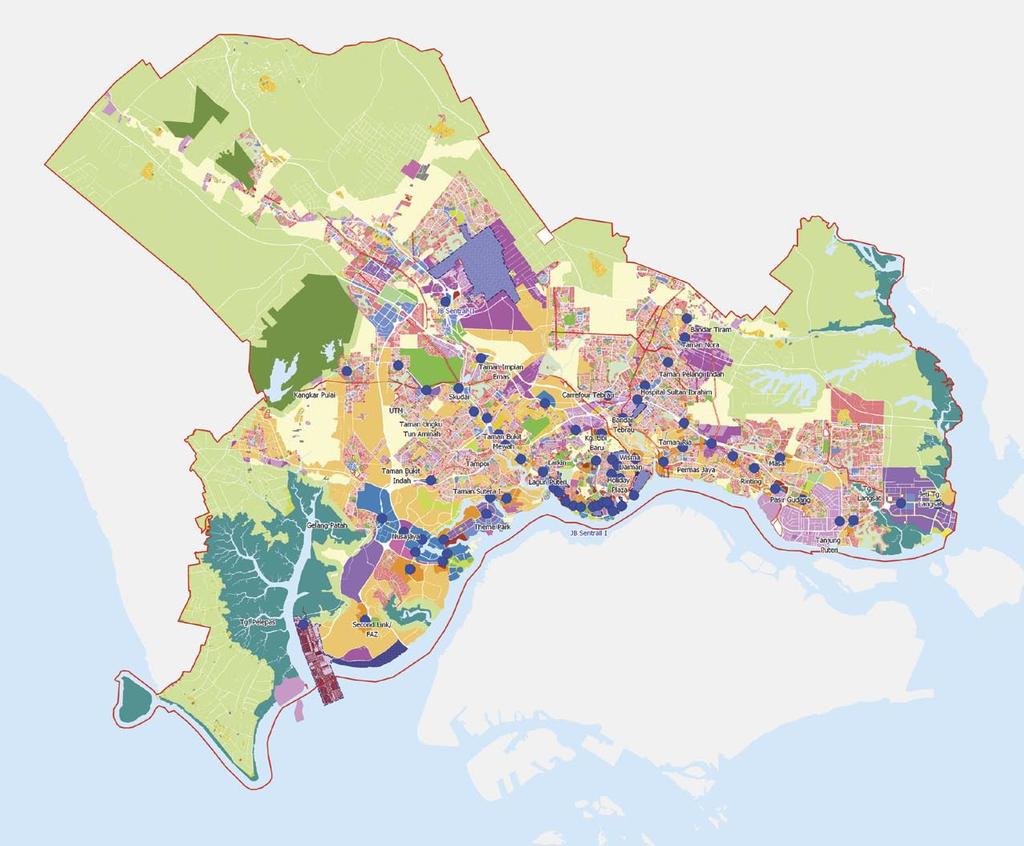

15 TRANSIT-ORIENTED DEVELOPMENT CHAPTER 16 PART4 Figure 16.7: Designated TOD Zones 16-13
16 SECTION B PLANNING AND IMPLEMENTATION C. Transit-supportive Land Use Transit-supportive land uses encourage transit use and increase transportation network efficiency. As such, pattern of land uses around transit stations should be characterised by: - high employee and/or residential densities; The primary transit supportive land uses that will be encouraged within TOD Zones in SJER are employment uses (office, industry), residential (high density), retail (pedestrian oriented street retail and shopping retail with strong pedestrian connections), civic use, entertainment, recreational and cultural facilities. promote travel time outside the am/pm peak periods; encourage extended hours of activity, throughout the day and week; and attract pedestrian users/generate pedestrian traffic. Table 16.8: Transit Supportive Use Base Zoning District Primary Transit Supportive Use Secondary Transit Supportive Use Development Guide Mixed Use High density residential Recreational centres Johor Bahru CPA and Nusajaya CPA (Mixed Use 1) developments (Condominium, Library Total plot ratio of 7.0 [Applicable to apartment) Integrated community facilities Mixed Use development (MX1) with breakdown of 60% TOD within SEC. Commercials commercial and 40% residential Not applicable Offices 20% reduction on parking requirements to TOD outside Pedestrian oriented street retails SEC] Restaurants Other TODs outside JB CPA & Nusajaya CPA Other compatible commercial Total plot ratio of 4.0 activities Mixed Use development (MX1) with breakdown of 40% commercial and 60% residential 20% reduction on parking requirements Mixed Use Commercial Pedestrian oriented street retails FAR to follow general guide for plot ratio according to designated (Mixed Use 2) Offices Shopping mall retail with strong centres:- [Applicable to High employee industrial pedestrian connections TOD within SEC. Not applicable to TOD outside SEC] activities Research and development Restaurants Entertainment Hotels Movie theatres Johor Bahru CBD Plot Ratio 5.0 Johor Bahru CPA Plot Ratio 4.0 Nusajaya CPA Plot Ratio 4.0 District Centre Plot Ratio 2.5 Local Centre Plot Ratio 2.0 Highway Business District Plot Ratio % reduction on parking requirements High density Condominiums Offices Density of 300 persons per acre residential Apartments Pedestrian oriented retails development Townhouses Restaurants Recreational centres Library Integrated community facilities 16-14


17 TRANSIT-ORIENTED DEVELOPMENT CHAPTER 16 PART4 Base Zoning District Primary Transit Supportive Use Secondary Transit Supportive Use Development Guide Commercial Offices Condominiums FAR to follow general guide for plot ratio according to designated [Applicable to Pedestrian oriented street retails Apartments centres:- all TOD] Shopping mall retail with strong Townhouses pedestrian connections Restaurants Entertainment Hotels Recreational centres Library Johor Bahru CBD Plot Ratio 5.0 Johor Bahru CPA Plot Ratio 4.0 Nusajaya CPA Plot Ratio 4.0 Movie theatres District Centre Plot Ratio 2.5 Local Centre Plot Ratio 2.0 Highway Business District Plot Ratio % reduction on parking requirements Industrial High employee industrial Offices Plot ratio of 1.0 [Applicable to activities Pedestrian oriented street retails Additional 20% floor space for commercial component on top of all TOD] Research and development Restaurants allowable industrial floor space Entertainment Hotels Figure 16.8(a): Example of Potential Sites for Intensification within Transit Planning Zone (Before) Figure 16.8(b): Example of Potential Sites for Intensification within Transit Planning Zone (After) Danga Bay Existing Land Use Danga Proposed Land Use Commercial Industrial Residential Undeveloped Land Open Space& Sports Facilities Institutional Community Facilites Established Housing High Density Residential Medium High Density Residential Medium Density Residential Low Density Residential Villages Commercial Squattes Mix Use Established Industry Industrial Park 16-15
18
Of Land Use Mix, Location and Travel Carbon Emission: State of The Relationship in Neighbourhoods of Iskandar Malaysia
 Of Land Use Mix, Location and Travel Carbon Emission: State of The Relationship in Neighbourhoods of Iskandar Malaysia WAN KASSIM, SH. ATHIRAH IZYAN and M. RAFEE MAJID Department of Urban and Regional
TIONGNAM INDUSTRIAL PARK KEMPAS JB. Premium Corporate Factories & Offices
 TIONGNM INDUSTRIL PRK KEMPS JB Premium Corporate Factories & Offices Name That Spells Continuous Success stinas Construction & Development Sdn Bhd, a member of Tiong Nam Properties Group of Companies is
The Victorian Transport Plan (Department of Transport, 2008).
.") 18 TRANSPORT Planning should ensure an integrated and sustainable transport system that provides access to social and economic opportunities, facilitates economic prosperity, contributes to environmental
18 TRANSPORT Planning should ensure an integrated and sustainable transport system that provides access to social and economic opportunities, facilitates economic prosperity, contributes to environmental
WELLINGTON NORTHERN CORRIDOR. Project Summary Statement 21 December 2009
 WELLINGTON NORTHERN CORRIDOR Project Summary Statement 21 December 2009 1 Table of Contents 1. Purpose of Document 2. Strategic Context 3. Benefits 4. Project Scope and Economics 5. Implementation Plan
Regional Travel Demand Management Plan
 Regional Travel Demand Management Plan Adopted October 2009 Quality for life Regional Travel Demand Management Plan Adopted October 2009 For more information, contact: Greater Wellington 142 Wakefield
Iskandar Malaysia Strong Sustainable Metropolis of International Standing
 Iskandar Malaysia Strong Sustainable Metropolis of International Standing Side Event on 2 nd East Asia Low Carbon Growth Partnership Dialogue Knowledge Platform for Low Carbon Development Low Carbon Society
D21 WAREHOUSE PROPERTY INFORMATION SPACE PROPOSAL. Lot D21, Jalan Tanjung A/3, Port of Tanjung Pelepas Gelang Patah, Johor Darul Takzim
 D21 WAREHOUSE PROPERTY INFORMATION SPACE PROPOSAL Lot D21, Jalan Tanjung A/3, Port of Tanjung Pelepas 81560 Gelang Patah, Johor Darul Takzim June 2017 ABOUT AXIS-REIT Mission of the Fund To provide consistent
Fishermans Bend Integrated Transport Plan Peer Review John Kiriakidis, GTA Consultants 28/03/2018
 Fishermans Bend Integrated Transport Plan Peer Review John Kiriakidis, GTA Consultants 28/03/2018 GTA creating transport that works 01 Preliminaries GTA creating transport that works Review scope : Review
Greater Newcastle Transport Plan
 Greater Newcastle Transport Plan Engineers Australia submission 16 February 2018 11 National Circuit, Barton ACT 2600 Tel: 02 6270 6555 Email: publicaffairs@engineersaustralia.org.au www.engineersaustralia.org.au
[LOG 3] CONSUMERS PERCEPTION ON DEVELOPMENT OF LRT (LIGHT RAIL TRANSIT) IN SOUTHERN PART OF JOHOR TOWARD GO GREEN TRANSPORTATION
![[LOG 3] CONSUMERS PERCEPTION ON DEVELOPMENT OF LRT (LIGHT RAIL TRANSIT) IN SOUTHERN PART OF JOHOR TOWARD GO GREEN TRANSPORTATION](/thumbs/93/112014303.jpg "[LOG 3] CONSUMERS PERCEPTION ON DEVELOPMENT OF LRT (LIGHT RAIL TRANSIT) IN SOUTHERN PART OF JOHOR TOWARD GO GREEN TRANSPORTATION") [LOG 3] CONSUMERS PERCEPTION ON DEVELOPMENT OF LRT (LIGHT RAIL TRANSIT) IN SOUTHERN PART OF JOHOR TOWARD GO GREEN TRANSPORTATION Mustakim Melan 1, Muhammad Khairunizam Jamal@Jamil 2, Muhammad Rahmat Abdul
[LOG 3] CONSUMERS PERCEPTION ON DEVELOPMENT OF LRT (LIGHT RAIL TRANSIT) IN SOUTHERN PART OF JOHOR TOWARD GO GREEN TRANSPORTATION Mustakim Melan 1, Muhammad Khairunizam Jamal@Jamil 2, Muhammad Rahmat Abdul
That will also contribute to achievement of a number of objectives and policies in the Regional Policy Statement.
 Board of Inquiry MacKays to Peka Peka Expressway Proposal Submitters Evidence Public Transport Voice 5 October 2012 Executive Summary Increasing modal share for public transport is a key outcome in the
This document has been developed to provide context to the Board as part of the strategic planning process. Regional development and travel trends
 1 This document has been developed to provide context to the Board as part of the strategic planning process. Regional development and travel trends and forecasts are provided, including population, employment,
Subdivisions in Iskandar Malaysia: Do Their Designs Encourage Increase in Travel Carbon Emissions?
 Subdivisions in Iskandar Malaysia: Do Their Designs Encourage Increase in Travel Carbon Emissions? Anis Shazreen Azmi 1*, M. Rafee Majid 2 and Ho Chin Siong 3 1 Graduate Student, Department of Urban and
Summary of transportation-related goals and objectives from existing regional plans
 SMTC 2050 Long Range Transportation Plan Appendix A: Summary of transportation-related goals and objectives from existing regional plans SMTC 2050 Long Range Transportation Plan Summary of transportation-related
EXECUTIVE SUMMARY ORGANIZATION OF REPORT
 EXECUTIVE SUMMARY Over the past year, the Dillon Consulting team conducted a comprehensive review of public transit in Guelph. The City of Guelph has for many years been a leader among Canadian municipalities
POLK COUNTY TPO Polk County 2060 Transportation Vision Plan Final Report. ADOPTED June 18, 2009
 POLK COUNTY TPO Polk County 2060 Transportation Vision Plan Final Report ADOPTED June 18, 2009 TABLE OF CONTENTS CHAPTER 1 Introduction and Prior Planning Effort...Page 1-1 CHAPTER 2 Population and Employment
Stakeholder Consultation Outcomes
 City of Hobart TRANSPORT STRATEGY 2018-2030 Consultation Phase MODULE 1 FREIGHT, PORT AND AIR Stakeholder Consultation Outcomes November 2016 in association with T ABLE OF C ONTENTS 1. Background 2. Consultation
2. Goals and Objectives
 Pedestrians in Charlotte s busy Uptown. CRTPO Mission The mission of the Charlotte Regional Transportation Planning Organization (CRTPO) is to plan for transportation options that ensure mobility, respect
PART 9 - TRANSPORTATION
 CONTENTS...PAGE TRANSPORTATION...3 9.0 INTRODUCTION...3 9.1 RESOURCE MANAGEMENT ISSUES...3 9.2 RESOURCE MANAGEMENT OBJECTIVES AND POLICIES... 4 9.3 RESOURCE MANAGEMENT STRATEGY...5 9.4 ANTICIPATED ENVIRONMENTAL
MMC ADDS SENAI INTERNATIONAL AIRPORT TO LOGISTICS PORTFOLIO
 FOR IMMEDIATE RELEASE MMC ADDS SENAI INTERNATIONAL AIRPORT TO LOGISTICS PORTFOLIO Kuala Lumpur, Friday, 20 March 2009: MMC Corporation Bhd s (MMC) shareholders today approved the acquisition of Senai Airport
NIES (National Institute for Environmental Studies), Japan
, Japan") Developing Low Carbon Society (LCS) Scenarios Iskandar Malaysia - 1. If we cannot go to LCS, 2. LCS offers higher QOL with less energy demand and lower-carbon energy supply 3. LCS needs good design, early
Developing Low Carbon Society (LCS) Scenarios Iskandar Malaysia - 1. If we cannot go to LCS, 2. LCS offers higher QOL with less energy demand and lower-carbon energy supply 3. LCS needs good design, early
Sustainable Transport Specialist Report
 Sustainable Transport Specialist Report CEUGP/SR16A August 2007 TABLE OF CONTENTS 1 INTRODUCTION... 4 PREFACE... 4 1.1 Process... 4 1.1.1 Specialist Report... 4 1.1.2 Workshops... 4 1.2 Desirable Outcomes...
in the Fraser Valley Foundation Paper #4
 S t r a t e g i c R e v i e w o f Tr a n s i t in the Fraser Valley Foundation Paper #4 Exploring the Possibilities for the Fraser Valley Prepared by: TABLE OF CONTENTS 1.0 INTRODUCTION... 1 1.2 THE PROCESS...
KL TravelPass. All your transport tickets in one card
 KL TravelPass All your transport tickets in one card KL TravelPass is a smart payment card that allows the cardholder to ride on the KLIA Ekspres and on the city s rail services. The card was recently
MASTER PLAN. Urban Rail Development. Plan. Bus Transformation Plan. Taxi Transformation. Plan. Interchange and Integration Plan.
 Taxi Transformation Plan Interchange and Integration Plan Urban Rail Development Plan MASTER PLAN Travel Demand Management Plan Bus Transformation Plan Land Use Plan Establishing city-bus service within
EXECUTIVE SUMMARY REGIONAL TRANSPORTATION PLAN 2050
 EXECUTIVE SUMMARY REGIONAL TRANSPORTATION PLAN 2050 Introduction Goals Policies, and Performance Measures Growth Forecast and Planned Land Use Development Key Recommendations i Executive Summary April
Avalon Airport Rail Link. Community and Stakeholder Issues and Ideas Report Understanding what s important. December 2011
 Avalon Airport Rail Link Community and Stakeholder Issues and Ideas Report Understanding what s important 6 December 2011 1. 1. Introduction The Victorian Government committed $3 million in the 2011-12
Article 12. Commercial Zoning Districts C-1, Central Business District. C-2, Limited Neighborhood Commercial District
 Article 12 Commercial Zoning Districts Section 12.100 Section 12.101 Section 12.102 C-1, Central Business District C-2, Limited Neighborhood Commercial District C-3, General Commercial District 12.100
IPSWICH NORTHERN ROUTES STUDY. Stage 1 Progress
 IPSWICH NORTHERN ROUTES STUDY Stage 1 Progress 17 th January 2017 STUDY CONTEXT 2 The study is being funded in partnership with the Suffolk district and borough councils. Work forms part of the Suffolk
4 Economic vitality. Chapter. In this chapter:
 Chapter 4 vitality In this chapter: 4.1 Supporting the York Region Strategy 4.2 City Building 4.3 Planning for Employment Lands 4.4 Planning for Retail 4.5 Financial Management The Regional Municipality
Chapter 4: Transportation and Land Use
 Chapter 4: Transportation and Land Use Transportation and land use together make possible the wide range of destination opportunities in the region. Transportation provides the connections, and, in turn,
Transit Service Guidelines
 G R E AT E R VA N CO U V E R T R A N S P O RTAT I O N A U T H O R I T Y Transit Service Guidelines PUBLIC SUMMARY REPORT JUNE 2004 Greater Vancouver Transportation Authority TRANSIT SERVICE GUIDELINES
Transport Assessment Guidelines November 2015 Cambridgeshire County Council
 Transport Assessment Guidelines November 2015 Cambridgeshire County Council Introduction The National Planning Policy Framework (NPPF, March 2012) states that All developments that generate significant
Northeast Sector Area Transit Plan. Phase 1: Issues and Opportunities Summary
 Northeast Sector Area Transit Plan Phase 1: Issues and Opportunities Summary November 2013 1 Contents 1. Introduction... 2 1.1 Overview...2 1.2 Plan Structure & Scope...2 1.3 Purpose of Phase 1...3 1.4
PART 5: DEVELOPMENT FRAMEWORK Figure 54: Revise Functional Road Hierarchy
 Figure 54: Revise Functional Road Hierarchy 93 The second step was to overlay the hierarchy with all the public transport modes planned to operate within the precinct as shown in Figure 58 below. Figure
Calgary Transportation Plan. Adopted by Council September calgary.ca call 3-1-1
 Calgary Transportation Plan Adopted by Council September 2009 calgary.ca call 3-1-1 Document Updates: Date Report Description 2012 January 10 C2012-03 Delete and replace Maps 1, 2, 5, 6 and 7 to relfect
HAMILTON B LINE LRT EVALUATION OF PHASING SCENARIOS TECHNICAL REPORT
 HAMILTON B LINE LRT EVALUATION OF PHASING SCENARIOS March 2013 Table of Contents 1 Introduction... 1 1.1 Background... 1 1.2 Purpose of Study... 1 1.3 Report Structure... 2 2 Phasing Scenarios... 3 2.1
ALBION FLATS DEVELOPMENT EXISTING TRAFFIC CONDITIONS AND POTENTIAL IMPACTS
 EXISTING TRAFFIC CONDITIONS AND POTENTIAL IMPACTS FINAL REPORT SEPTEMBER 2010 TABLE OF CONTENTS 1.0 INTRODUCTION 1 2.0 EXISTING TRAFFIC CONDITIONS 2 3.0 FUTURE TRAFFIC CONDITIONS 3 4.0 POTENTIAL IMPACTS
Priorities are for AG comment at today's meeting. Four time frames proposed for implementation
 Prioritization Overview Priorities are for AG comment at today's meeting Four time frames proposed for implementation Prioritization Overview Some editing of Principles to read as implementation versus
Nashville Southeast Corridor High-Performance Transit Alternatives Study. Final Report
 Nashville Southeast Corridor High-Performance Transit Alternatives Study Final Report August 2007 - Nashville Southeast Corridor Executive Summary I. Introduction The southeast corridor is a 30 mile long
Executive Summary. Introduction
 Executive Summary 01 Introduction The City of Southampton lies at the western end of the South Hampshire sub-region. The wider urban South Hampshire area, consisting of Southampton, Eastleigh, Fareham,
TRANSPORT SYSTEM IN URBAN INDIA
 MULTI MODAL TRANSPORT SYSTEM IN URBAN INDIA Pawan Kumar, Asstt TCP, Town & Country Planning Organization,, MoUD, New Delhi 1 Urban India(2001) Total Urban Population = 286.11 million = 27.78 % of total
Multi-purpose port. I n t e r n a t i o n a l S h i p p i n g L a n e. Senai Airport
 The Complete Johor Port is a dedicated and complete multi-purpose port offering comprehensive services. It is perfectly geared to handle cargo of any type and requirement through its terminals specialising
Northern Virginia Region Draft Needs Summary
 Needs Map: Need A A DEMAND The ability of communities around transit stations (particularly the areas within 1-2 miles of the stations and other travel hubs) to attract skilled workers and grow businesses
SCS Scenario Planning
 E SCS Scenario Planning Introduction As part of the 2035 MTP/SCS process, AMBAG developed a series of land use and transportation alternative scenarios for evaluation and testing to demonstrate how the
APPENDIX A: Transportation Planning Rule
 A APPENDIX A: Transportation Planning Rule This appendix contains the full text of Oregon s Transportation Planning Rule (TPR). Transportation Planning Rule (TPR) NOTE: The official copy of an Oregon Administrative
Chapter 3 - Goals, Objectives, & Strategies
 Chapter 3 - This chapter presents goals, objectives, and strategies that have been developed as part of the Richmond Area MPO 2026 Long-Range Transportation Plan (LRTP) update. Strategies have been developed
Amman Transportation Strategy
 Amman Transportation Strategy from Planning to Implementation Ayman Smadi Regional Conference on Sustainable Urban Transport Damascus (Syria), April 11-13, 2010 Outline Background and introduction Current
SWDP 4: Moving Around South Worcestershire. SWDP 4: Moving Around South Worcestershire. Managing Travel Demand
 SWDP 4: Moving Around South Worcestershire Managing Travel Demand A. Proposals must demonstrate that: the layout of development will minimise demand for travel, they offer genuinely sustainable travel
Evaluation of University Technology Malaysia on Campus Transport Access Management
 Evaluation of University Technology Malaysia on Campus Transport Access Management Arash Moradkhani Roshandeh, and Othman Che Puan International Science Index, Humanities and Social Sciences waset.org/publication/10983
EXAMPLES OF COMPREHENSIVE PLAN POLICIES HOW TO ESTIMATE THE BENEFITS OF THE CTR PROGRAM
 TABLE OF CONTENTS INTRODUCTION... I BACKGROUND OF THE COMMUTE TRIP REDUCTION EFFICIENCY ACT... II MAKING THE CONNECTION BETWEEN COMMUTE TRIP REDUCTION AND THE GROWTH MANAGEMENT ACT... IV CTR PLANNING AND
City of Brantford Chapter 3 TABLE OF CONTENTS
 Chapter 3 The Land Use & Transportation Connection TABLE OF CONTENTS 3.1 THE LAND USE & TRANSPORTATION LINK... 1 3.2 POPULATION & EMPLOYMENT GROWTH FORECASTS... 3 3.2.1 Proposed Places to Grow Plan Forecasts
Business Zones This fact sheet explains the business zones in the Lithgow Draft LEP 2013 and the key business development standards Business Zones
 Business Zones This fact sheet explains the business zones in the Lithgow Draft LEP 2013 and the key business development standards Business Zones The Draft LEP 2013 proposes to adopt six out of the possible
Transportation, Mobility and Access
 Transportation, Mobility and Access In The City of North Vancouver A Discussion Paper Prepared to Inform the Direction of a New Official Community Plan 2021 & Beyond Dragana Mitic Assistant City Engineer
Bijwasan: A World Class Station
 Bijwasan: A World Class Station Presentation to Governing Body, UTTIPEC 19 th December, 2014 INDEX 1. AIMS & OBJECTIVE OF THE PROJECT 2. EXISTING CONDITIONS 3. MASTER PLAN - GENERAL LAYOUT 4. TRAFFIC STUDY
Network Operation Planning - A new approach to managing congestion
 Network Operation Planning - A new approach to managing congestion Andrew Wall VicRoads, Melbourne, VIC, Australia 1 Introduction Congestion is an unavoidable aspect of most urban cities. However, there
Transport choices for everyone
 Getting around easily. Well connected routes. Integrated transport options. Great public transport. A well planned city. Proofed for the future. Personal safety. Enjoyable journeys. River walkways. Choices
Chapter 2 Transportation Element Goals, Objectives and Policies
 Chapter 2 Transportation Element Goals, Objectives and Policies City of Belleview Comprehensive Plan Adopted by Ord 2016-10 on July 5, 2016 GOALS, OBJECTIVES AND POLICIES Goal 2 Transportation...1 Objective
SECTOR ASSESSMENT (SUMMARY): URBAN TRANSPORT 1
: URBAN TRANSPORT 1") Greater Dhaka Sustainable Urban Transport Project (RRP BAN 42169) Sector Road Map SECTOR ASSESSMENT (SUMMARY): URBAN TRANSPORT 1 1. Sector Performance, Problems, and Opportunities 1. Dhaka, the capital
Greater Dhaka Sustainable Urban Transport Project (RRP BAN 42169) Sector Road Map SECTOR ASSESSMENT (SUMMARY): URBAN TRANSPORT 1 1. Sector Performance, Problems, and Opportunities 1. Dhaka, the capital
INDEPENDENT PUBLIC INQUIRY SYDNEY S LONG TERM PUBLIC TRANSPORT PLAN
 INDEPENDENT PUBLIC INQUIRY PO Box 484 North Sydney NSW 2059 SYDNEY S LONG TERM PUBLIC TRANSPORT PLAN T: 02 8904 1011 F: 02 8904 1133 E: nswmanager@planning.org.au About PIA The Planning Institute of Australia
Chapter 7 Route Window NE6 Goodmayes station. Transport for London
 Chapter 7 Route Window NE6 Goodmayes station GOODMAYES STATION 7 Route Window NE6 Goodmayes station Baseline conditions 7.7 This route window is in the London Borough of Redbridge. Goodmayes station is
Project Appraisal Using PRISM Simon Hubbard 28 th September 2004
 Project Appraisal Using PRISM Simon Hubbard 28 th September 2004 Introduction : Overview of Presentation - Option Appraisal Policy Context - Potential PRISM Applications - Use of the Model / Scale of the
NICHES+ Champion City City of Cork Implementing Smarter Travel
 Traffic Management Centres NICHES+ Champion City City of Cork Implementing Smarter Travel NICHES+ is a Coordination Action funded by the European Commission under the Seventh Framework Programme for R&D,
1 RICHMOND HILL CENTRE / LANGSTAFF URBAN GROWTH CENTRE - TRANSPORTATION STUDY
 Report No. 4 of the Transportation Services Committee Regional Council Meeting of April 22, 2010 1 RICHMOND HILL CENTRE / LANGSTAFF URBAN GROWTH CENTRE - TRANSPORTATION STUDY The Transportation Services
The Auckland Transport Models Project - Overview and Use to Date -
 The Auckland Transport Models Project - Overview and Use to Date - John Davies (Auckland Regional Council) Jojo Valero (Auckland Regional Council) David Young (David Young Consulting) Auckland Transport
SOUTHWEST LRT (METRO GREEN LINE EXTENSION)
") 8 Evaluation of Alternatives This chapter evaluates the effectiveness of the No Build Alternative and the Southwest Light Rail Transit (LRT) Project (the Project) based on the information contained in
8 Evaluation of Alternatives This chapter evaluates the effectiveness of the No Build Alternative and the Southwest Light Rail Transit (LRT) Project (the Project) based on the information contained in
campaigning by the Railway Development Society Limited
 campaigning by the Railway Development Society Limited Department for Transport A14 Challenge Team Roads Policy Great Minster House, 33 Horseferry Road, London SW1P 4DR Please Reply to: 24 Bure Close St.
Chapter 4. Recommendations
 Chapter 4 Recommendations Project Rating Methodology 1.0 Introduction This chapter outlines the prioritization of potential investments that were identified during this MIS process. During this study there
3 Planning and design of the transport network. Chapter State highway and local road networks
 3 Planning and design of the transport network Chapter 3 Delivering the Integrated Planning Policy through planning and design of the transport network This chapter contains the following sections: Section
Contents i Contents Page 1 A New Transportation Plan Community Involvement Goals and Objectives... 11
 Contents i Contents 1 A New Transportation Plan... 1 Why develop a new plan?... 1 What area does the LRTP focus on?... 2 Why is this LRTP important?... 3 Meeting Requirements for Transportation Planning...
Eu Public- Private Smart Move High Level Group
 Eu Public- Private Smart Move High Level Group Final Recommendations Follow up to the European Commission Transport White Paper and contribution to the EU 2020 Growth Agenda European Union // Eu Public-Private
Transit Oriented Development Strategic Plan for Bhopal
 Transit Oriented Development Strategic Plan for Bhopal 26 th February, 2015 IBI GROUP INTRODUCING BHOPAL Transport Urban Form Policy Framework Bhopal Curitiba Bhopal Curitiba Ottawa Population 1.79 million
4: Transportation and Land Use
 Chapter Figure 4-1: Recent development has brought more housing and mixed use Downtown Minneapolis - looking north from E 15th Street at the Grant Street / 11th Street exit 4: Transportation and Land Use
Service Routes and Community Transit Hubs: Right Sizing Transit NATIONAL CONFERENCE ON RURAL PUBLIC AND INTERCITY TRANSPORTATION OCTOBER 2-5, 2016
 Service Routes and Community Transit Hubs: Right Sizing Transit NATIONAL CONFERENCE ON RURAL PUBLIC AND INTERCITY TRANSPORTATION OCTOBER 2-5, 2016 Competing with the Auto It is tough to match the convenience
Freight transport policy and measures in Norway
 PIARC meeting and seminar 13-15 June 2005 in Ouagadougou Freight transport policy and measures in Norway Senior Adviser Hans Silborn, Norwegian Public Roads Administration Norway is a sparsely inhabited
Property Developments In Bangsar
 Property Developments In Bangsar By Corey Heafy (corey.heafy@propertyreviews.my) Report based on analysis commissioned by PropertyReviews.my. PropertyReviews.my, H-08, Setiawalk, Pusat Bandar Puchong,
CASE STUDY 5. Extension of the Adriatic-Ionian ferry corridor from Peloponnese to Crete" University of the Aegean Dpt. Shipping, Trade & Transport
 Lisbon, 15 December 2011 CASE STUDY 5 Extension of the Adriatic-Ionian ferry corridor from Peloponnese to Crete" University of the Aegean Dpt. Shipping, Trade & Transport The concept of the Case Study
Innovate For Sustainability SALES HOTLINE : /
 TM Innovate For Sustainability Developer : DSILC (M) SDN. BHD. (1033829-A) No. 15-01 (Ground Floor), Jalan Nusaria 11/1,Taman Nusantara, 81550 Gelang Patah, Johor. Fax : 1700 81 0953 Email : sales@ecoplex.com.my
Problem Framing Report
 NGAURANGA TO AIRPORT STRATEGIC STUDY Problem Framing Report Problem Framing Report prepared for by Prepared by: Approved for Release: Tim Selby, Deputy Team Leader Ian Clarke, Traffic/Transportation Manager
Low-carbon Energy Efficient Urban Environment
 Low-carbon Energy Efficient Urban Environment P l a n n i n g f o r t h e f u t u r e of I n d i a Rahul Nawle Managing Director, Eco-sketch Planners Pvt. Ltd. C i t i e s a r e a s y s t e m a t i c c
Commercial Zoning Update
 Project Summary Applicant: Type of Amendment: Location and Size of Area: Current Land Use and Zoning: Neighborhood Council Area: Staff Recommendation: Planning Scope and and Development Assessment Services
Drivers of Congestion Growth & Change
 Drivers of Congestion Growth & Change A Congestion Blueprint Transport Policy Branch, Department of Transport and Main Roads 1 Our values, our diversity 2 Queensland Government s objectives for the community
8. STRATEGIC ROAD NETWORK
 8. STRATEGIC ROAD NETWORK 8.1 INTRODUCTION The strategic road forms the backbone of the region s transport. It comprises the state highways and some higher volume local roads. It serves an important role
Department of Transport City of Joburg April 2015
 Department of Transport City of Joburg April 2015 Transport Vision A people-centred transport system that is transformed. A very liveable City: very pro public transport, walking and cycling. The City
North Central Bedfordshire Growth Options Study Appendix 5 part 2
 Central Bedfordshire Council www.centralbedfordshire.gov.uk rth Central Bedfordshire Growth Options Study Appendix 5 part 2 July 2017-1 - Location ID: N14 Name: Potton West Location area: 93.2 hectares
NSW Long Term Transport Master Plan Discussion Paper 2012 Submission by Planning Institute of Australia (NSW Division)
") NSW Long Term Transport Master Plan Discussion Paper 2012 Submission by Planning Institute of Australia (NSW Division) The Planning Institute of Australia (PIA) is the peak body representing professionals
NSW Long Term Transport Master Plan Discussion Paper 2012 Submission by Planning Institute of Australia (NSW Division) The Planning Institute of Australia (PIA) is the peak body representing professionals
Illawarra Business Chamber/Illawarra First. Submission on NSW Draft Freight and Ports Plan
 Illawarra Business Chamber/Illawarra First Submission on NSW Draft Freight and Ports Plan Illawarra Business Chamber A division of the NSW Business Chamber Level 1, 87-89 Market Street WOLLONGONG NSW 2500
Lesson 2. Principles of. Transportation. Land Use 2-1
 Lesson 2 Principles of Transportation & Land Use 2-1 Learning Outcomes Explain transportation s impact on land use and development patterns, including historical growth patterns Explain how land use patterns
Sample TOR for CMP Preparation
 Annex 6 Sample TOR for CMP Preparation This annex provides a sample terms of reference (TOR) for use in appointing consultants to assist with the preparation of a CMP. The TOR should be amended where necessary
3 Documentation of Alternatives
 Sacramento Intermodal Transportation Facility TR #9 SITF Alternatives 3 Documentation of Alternatives This section documents the four alternative concept plans for the Sacramento Intermodal Transportation
Public Transport Infrastructure
 Christchurch City Council Public Transport Infrastructure Activity Management Plan Long Term Plan 2015 2025 3 December 2014 Christchurch City Council Quality Assurance Statement Christchurch City Council
AUSTRALASIAN RAILWAY ASSOCIATION SUBMISSION
 AUSTRALASIAN RAILWAY ASSOCIATION SUBMISSION To the Department of Transport, Planning and Local Infrastructure On the Plan Melbourne Metropolitan Planning Strategy THE ARA The Australasian Railway Association
Getting around in Essex A bus and passenger transport strategy summary
 Getting around in Essex A bus and passenger transport strategy summary Working in partnership with 2 Contents Introduction 5 Section One Buses are important to Essex 6 Buses make life better for people
PART 3: STATUS QUO 2008
 2.1 Transportation Movement within the Rosebank Study Area is if not the most important, certainly one of the most important components of a well functioning Node. The Study Area has a well established
Town of Tecumseh. Town of Tecumseh Council Chambers June 26, Town of Tecumseh.
 Transportation ti Master Plan Public Information Centre #1 Council Chambers June 26, 2008 WELCOME The is currently completing a Transportation Master Plan in accordance with the Class Environmental Assessment
RURAL CENTER COMMUNITY ROLE COUNCIL ROLE RURAL CENTER ALL COMMUNITIES
 Orderly and Efficient Land Use Align land use, development patterns, and infrastructure to make the best use of public and private investment. Plan for forecasted population and household growth at overall
PIA - Core Skills in Planning Lecture Series 2015
 PIA - Core Skills in Planning Lecture Series 2015 Fundamentals of Transport Planning for Steve Williams (RPEQ # 6417) Lambert & Rehbein Introduction What is Transport Planning? Legislative Environment
Traffic & Highway Engineering Text Book. Fourth Edition, SI Nicholas J. Garber Lester A. Hoel 2010
 Traffic & Highway Engineering Text Book Fourth Edition, SI Nicholas J. Garber Lester A. Hoel 2010 Chapter 2 Transportation Systems and Organizations Chapter 2 Transportation System & Organization Developing
Land Use Planning and GHG Emissions of Urban Transport. Elizabeth Deakin Director, UC Transportation Center Professor of City and Regional Planning
 Land Use Planning and GHG Emissions of Urban Transport Elizabeth Deakin Director, UC Transportation Center Professor of City and Regional Planning Emerging Patterns of Growth Global Economy: international
STAFF REPORT. Planning Commission. Anjanette Simon, Associate Planner
 STAFF REPORT TO: Planning Commission HEARING DATE: May 23, 2012 FROM: APPLICATIONS: LOCATION: Anjanette Simon, Associate Planner ZMA2012-0005 (158th and Baseline Station Community High Density Residential