MAJOR DEVELOPMENT PLAN FOR WESTERN POWER DEPOT JANDAKOT AIRPORT
|
|
|
- Jonas Hart
- 6 years ago
- Views:
Transcription


1 MAJOR DEVELOPMENT PLAN FOR WESTERN POWER DEPOT JANDAKOT AIRPORT PREPARED FOR JANDAKOT AIRPORT HOLDINGS SEPTEMBER 2017
2 STAFF RESPONSIBLE FOR THIS REPORT WERE: Director Senior Consultant Consultant Project Code Report Number Tim Dawkins Marieka van den Bergh Stephanie Norgaard PA1466 Draft for Public Comment Urbis Pty Ltd ABN All Rights Reserved. No material may be reproduced without prior permission. You must read the important disclaimer appearing within the body of this report. urbis.com.au
3 TABLE OF CONTENTS Glossary of Terms... iv Executive Summary... v 1. Introduction Legislative Framework Airports Act Jandakot Airport Master Plan Jandakot Environment Strategy Site Characteristics Site Details Jandakot Airport Lease Existing Development and Surrounding Use Development Objectives Need and Justification Contribution to Economic Development Employment Generation Other Economic Benefits Proposed Development Western Power Depot Office Building Workshop and Warehouse Buildings Ancillary components Site layout and Design Environmentally Sustainable Design Landscaping Site Conditions and Servicing Environmental Environmental Protection and Biodiversity Conservation Act 1999 (EPBC Act) Jandakot Airport Environment Strategy Heritage European Heritage Indigenous Heritage Contamination Risk Mitigation Geotechnical Services Water Supply Power Telecommunications Gas Sewer Drainage Access and Traffic Management Existing Road Network Traffic Generation & Impact Traffic Generation Traffic Impact on Road Network COMMENT_FINAL GLOSSARY OF TERMS i
4 7.3. Future Road Connectivity Parking & Manoeuvring Public Transport Jandakot Airport Master Plan Assessment Jandakot Airport Master Plan Non-Aviation Development Precinct Jandakot Airport Environment Strategy Jandakot Underground Water Pollution Control Area (JUWPCA) Management Plans State & Local Planning Framework State Planning Framework Local Planning Framework City of Cockburn Local Commercial and Activity Centre Strategy City of Cockburn Town Planning Scheme No Local Planning Policies Noise & Flight Path Impacts National Airports Safeguarding Framework Noise Exposure Lighting Restrictions Protection of Airspace Obstacle Limitation Surface Pans-Ops Controlled Activity Effect on Flight Paths Building Generated Windshear Bird and Animal Hazard Management Navigation Aids Air Traffic Control Tower Line of Sight Public Safety Zones Noise Generated from Proposal Consultation Approvals Approval Sought Approval Process Conclusion Disclaimer Appendix A Appendix B Development Plans Transport Report FIGURES: Figure 1 Location Plan... 5 Figure 2 Cadastral Plan... 6 Figure 3 Aerial Photograph... 8 Figure 4 Employment and Economic Network Figure 5 Existing Road Network Figure 6 Future Traffic Flows Figure 7 Restricted Lighting Zones ii GLOSSARY OF TERMS COMMENT_FINAL
5 Figure 8 Obstacle Limitations Surface for Site Figure 9 Jandakot Airport PANS-OPS Surface Heights TABLES: Figure 1 Location Plan... 5 Figure 2 Cadastral Plan... 6 Figure 3 Aerial Photograph... 8 Figure 4 Employment and Economic Network Figure 5 Existing Road Network Figure 6 Future Traffic Flows Figure 7 Restricted Lighting Zones Figure 8 Obstacle Limitations Surface for Site Figure 9 Jandakot Airport PANS-OPS Surface Heights COMMENT_FINAL GLOSSARY OF TERMS iii
6 GLOSSARY OF TERMS Term Airports Act 1996 Airports (Protection of Airspace) Regulations 1996 Jandakot Airport Holdings Pty Ltd Major Development Plan Jandakot Airport Master Plan 2014 Jandakot Environment Strategy 2014 Environmental Protection and Biodiversity Act 1999 Contaminated Sites Act 2003 Jandakot Underground Water Pollution Control Area Civil Aviation Safety Authority Abbreviation The Act The Regulations JAH MDP Master Plan Environmental Strategy EPBC Act CS Act JUWPCA CASA iv GLOSSARY OF TERMS COMMENT_FINAL
7 EXECUTIVE SUMMARY Jandakot Airport Holdings Pty Ltd (JAH) plans to develop a depot facility at Jandakot Airport on behalf of Western Power. This Major Development Plan (MDP) has been prepared in accordance with the requirements of the Airports Act 1996 (the Act). For the purposes of the Act, the Depot comprises of the construction of a new building that is not wholly or principally for use as a passenger terminal; and the cost of construction exceeds $20 million. Therefore, the proposed development is classified as a major airport development. Accordingly, the development cannot be carried out except in accordance with this MDP. JAH plans to build the Western Power Depot (the Depot) on a hectare site known as site 516 located in the southern portion of the airport area, within the mixed business precinct. The site has access via a new two lane local road which provides a connection south to Berrigan Drive and Jandakot Road or north to Karel Avenue and Roe Highway. The proposed Depot is located within Precinct 6 of the Jandakot Airport Master Plan 2014 (the Master Plan). Western Power s vision will be facilitated through the delivery of an exemplar depot facility to meet the operation requirements and provide a high standard workplace for staff. The improvements required to meet the needs of Western Power include: Administration offices Warehouse and workshop space Vehicle maintenance facilities Storage Covered and secured parking for light and heavy fleet vehicles General parking for staff and visitors The Depot will consist of four (4) buildings with a total covered floor area of 28,580sq.m and an uncovered floor area of 12,094sq.m. There are a number of other covered and uncovered areas on site, comprising of storage for fleet vehicles, refuelling, wash-down, environmental waste, storage and parking. Following the completion of construction and once fully operational, the Depot is estimated to employ up to 750 staff. The location of the proposed depot is in the southern boundary of Jandakot Airport within the mixed business precinct, well clear of the airside services that are the predominate use of the Airport. The subject land has already been cleared and is development ready with all services available. The site has significant separation from sensitive land uses, thus ensuring the operation can occur without impacting any existing or future uses in the locality. There will be no significant environmental impacts as a result of the proposed development. Overall, the proposal is an example of modern depot development, and takes advantage of the exceptional location and convenient access to the regional road network. The development is shown to be consistent with the Master Plan and meets all the statutory requirements of the Act. Western Power have been working closely with JAH to ensure the development is in accordance with their requirements, the Airports Act 1996 (the Act) and the Master Plan. This MDP has been prepared in consultation with key stakeholders and the public through targeted engagement, as well as the public comment requirements specified under the Act. COMMENT_FINAL EXECUTIVE SUMMARY v
8 1. INTRODUCTION This Major Development Plan (MDP) has been prepared by Urbis Pty Ltd on behalf of Jandakot Airport Holdings Pty Ltd (JAH) in support of the development of the Western Power Depot (the Depot) within the Jandakot Airport Mixed Business Precinct. Jandakot Airport is situated 16 kilometres south of the City of Perth and provides aviation facilities for tourism, pilot training and other general aviation services. The proposed new Depot represents the continuation of the development of non-aviation facilities within Jandakot Airport, complementing existing development. The building will be developed in a single stage and will meet the existing and foreseeable requirements for Western Power as a major hub in the south-west for the next 20 years or more. This MDP has been prepared in accordance with the Airports Act 1996 (the Act), Jandakot Airport Master Plan 2014 (Master Plan) and is consistent with the Jandakot Airport Leasing and Development Guidelines and the Landscape Design Guidelines, reflecting the general high standard of development expected throughout the area. The new Depot will enable Western Power to consolidate some of its existing depot facilities and operations in the metropolitan region, providing a centralised distribution hub to increase operational and financial efficiencies for the business in a new state-of-the-art facility. The location at Jandakot Airport offers significant locational advantages associated with land availability and efficient connections into the regional road network. There is a close affinity with the values and vision set out in the Master Plan and the location provides the opportunity to be part of an extremely high quality mixed business precinct with a diverse range of complementary users, including significant distribution and depot facilities. The value that has been invested into Jandakot Airport by JAH is clearly evident, and it provides a solid footing for a successful long term outcome. The MDP has been prepared in accordance with Division 4, Section 91 of the of the Act. The Preliminary Draft MDP will be placed on public display for a period of 20 business days and the submissions received will be forwarded to the then Minister for Infrastructure and Transport for determination. COMMENT_FINAL ERROR! NO TEXT OF SPECIFIED STYLE IN DOCUMENT. 1
9 2. LEGISLATIVE FRAMEWORK This section sets out the statutory framework that governs the development of the land within Jandakot Airport and the mandatory requirements to be addressed by this MDP AIRPORTS ACT 1996 The Act and associated Regulations are Commonwealth legislation that is responsible for the regulation of ownership, management and conduct of major Australian airports. Part 5 of the Act sets out the requirements for land use, planning and building controls. In accordance with the Act, all major airport development requires a Major Development Plan. The MDP is submitted to the Minister of the Department for Infrastructure and Transport (the Minister) for assessment. The Minister has the power to approve or to refuse to approve the plan. Section 89 of the Act sets out all those activities defined as major airport development. The proposed development subject of the MDP is determined to be major airport development by pursuant to Section 89(1)(e): Constructing a new building, where: (i) (ii) The building is not wholly or principally for use as a passenger terminal; and The cost of construction exceeds $20 million or such higher amount as is prescribed; For the purposes of the Act, the new depot facility will include, administration offices, warehouse and workshop space, vehicle maintenance facilities, storage, covered and secured parking for light and heavy fleet vehicles and general parking for staff and visitors. Based on the estimated construction cost in order of $36 million (thereby exceeding the $20 million threshold under the Act) the proposed development is considered a major airport development thereby triggering the need for a Major Development Plan (MDP) to be prepared and submitted to the Minister for approval. Complementary legislation includes the Airports (Environment Protection) Regulations 1997, the objectives of which are to establish a system of regulation and accountability for activities at airports that s generate or have the potential to generate pollution and/or excessive noise and to promote improved environmental management practices for activities carried out at airport sites. In accordance with the Act, Jandakot Airport is required to produce a final Master Plan which now includes the Environment Strategy. This Environment Strategy describes how JAH will meet the environmental management requirements of the Act. It has been developed with consideration of current airport operations as well as proposed future development JANDAKOT AIRPORT MASTER PLAN 2014 Under Section 69 of the Act, each airport is required to produce a master plan. The Jandakot Airport Master Plan 2014 (the Master Plan) includes the provision of the fourth runway and associated taxiways, aviation land use areas, commercial land use areas and general access arrangements. Under Section 94(5) of the Act, a major development plan cannot be approved unless it is consistent with the relevant final master plan (where one exists). The matters to be addressed by the MDP are set out under Section 91 of the Act and are summarised the checklist provided in Table 1. Table 1 Major Development Plan Requirements ACT REF MAJOR DEVELOPMENT PLAN REQUIREMENTS SECTION IN MDP 91(1)(a) The proponents objectives for the development 4 91(1)(b) The extent to which the development will meet the future needs of civil aviation uses of the Airport and other users of the Airport (1)(c) A detailed outline of the proposed development 5 91(1)(ca) Whether or not the development is consistent with the Airport s lease for the airport LEGISLATIVE FRAMEWORK COMMENT_FINAL
10 91(1)(d) Whether or not the development is consistent with the final master plan for Jandakot Airport 91(1)(e) If the development could affect noise exposure levels at the airport and the effect the proposed development would have on noise exposure levels 91(1)(ea) If the development could affect flight paths at the airport the effect that the development would be likely to have on those flight paths 91(1)(f) The proponents plans, developed following consultation with airport users, for managing aircraft noise intrusion in areas forecast to be subject to exposure above the significant ANEF levels (having regard for AS ) 91(1)(g) An outline of the approvals that the proponent has sought, is seeking or proposes to seek under Division 5 or Part 12 in respect of elements of the development N/A the development sits outside the identified ANEF contours (1)(ga) The likely affect the proposed development would have on: - Traffic flows at the airport and surrounding the airport 7.3 Employment levels at the Airport, and The local and regional economy and community, including an analysis of how the proposed development fits within the local planning schemes for commercial and retail development in the adjacent area 9 91(1)(h) An assessment of environmental impacts that might reasonably be expected to be associated with the development 91(1)(j) The proponents plans for ameliorating or preventing identified environmental impacts 91(1)(k) If the plan relates to a sensitive development the exceptional circumstances that the proponent claims will justify the development of the sensitive development at the airport N/A the proposal is not for a sensitive development. 91(1)(l) Such other matters (if any) as are specified in the regulations N/A 91(4) The proponents plan must demonstrate the extent of the consistency with planning schemes in force under a law of the State where the Airport is location; and identity and justify any inconsistencies 9 As demonstrated in Table 1, this MDP addresses all the required matters above in accordance with Section 91 of the Act. COMMENT_FINAL LEGISLATIVE FRAMEWORK 3
11 2.3. JANDAKOT ENVIRONMENT STRATEGY In accordance with the Act, Jandakot Airport is required to produce a final Master Plan which is to include the Environment Strategy. The Environment Strategy outlines Jandakot Airport s environment management objectives for the five-year period from 2014 to The Environment Strategy describes how JAH will meet the environmental management requirements of the Act. It has been developed with consideration of current airport operations as well as proposed future development. The purposes of the Environment Strategy, as outlined in Section 71 of the Act are to identify: The airport lessee company s objectives for the environmental management of the airport; and The areas (if any) within the airport site which the airport lessee company, in consultation with State and Federal conservation bodies, identifies as environmentally significant; and The sources of environmental impact associated with airport operations; and The studies, reviews and monitoring to be carried out by the airport lessee company in connection with the environmental impact associated with airport operations; and The time frames for completion of those studies and reviews and for reporting on that monitoring; and The specific measures to be carried out by the airport lessee company for the purposes of preventing, controlling or reducing the environmental impact associated with airport operations; and The time frames for completion of those specific measures; and Details of the consultations undertaken in preparing the strategy (including the outcome of the consultations); and Any other matters that are prescribed in the regulations. 4 LEGISLATIVE FRAMEWORK COMMENT_FINAL
, and occupies an area of 622 hectares (refer")
12 3. SITE CHARACTERISTICS 3.1. SITE DETAILS Jandakot Airport is situated approximately 16km south of the City of Perth, 13 km east of the Port of Fremantle (measured in a straight line), and occupies an area of 622 hectares (refer Figure 1). The proposed site that is subject to this MDP is hectares and is in the southern portion of the airport, within the Non-Aviation Development Area. The site has access via a new two lane local road which provides a connection south to Berrigan Drive and Jandakot Road or north to Karel Avenue and Roe Highway. Figure 1 Location Plan Source: Urbis 2017 The subject site is referred to as site 516 for the purpose of the agreement between Western Power and JAH. COMMENT_FINAL SITE CHARACTERISTICS 5

13 The site is currently vacant, with clearing being finalised in 2015 for development. The site has been graded and stabilised to create a level lot, fully serviced and ready for commercial development. No previous development approvals have been granted over the site. The legal description of the site is detailed in Table 2 and illustrated in Figure 2. Table 2 Site Particulars LOT PLAN/DIAGRAM VOL/FOLIO REGISTERED PROPRIETOR Lot 500 P /474 Commonwealth of Australia 2278/469 Figure 2 Cadastral Plan Date Source: MNG, SITE CHARACTERISTICS COMMENT_FINAL
14 3.2. JANDAKOT AIRPORT LEASE Jandakot Airport is located on Commonwealth Government land. On 1 July 1998, the Commonwealth Government sold a 50-year lease over Jandakot Airport, with an option of a 49-year lease extension to JAH. Section 91 of the Act requires that a major development is consistent with the airport lease. The proposal for the Western Power Depot is consistent with the Jandakot Airport lease which permits the land comprising Jandakot Airport to be used for lawful purposes that are not inconsistent with its use as an airport. The airport lease also requires that any development is in accordance with an approved master plan. As detailed in Section 8, the Depot is consistent with the Master Plan in terms of the nominated land uses for the precinct. An essential term of the lease is that the lessee must comply with all legislation relating to the Airport site, including the Act. Whilst the Act requires that JAH operate the airport site as an airport, it also provides for the efficient economic development of the airport site and for its development for additional uses. The nonaviation development of the Jandakot Airport estate serves a key function in ensuring the economic viability of Jandakot Airport and compliments its primary operation as an airport EXISTING DEVELOPMENT AND SURROUNDING USE The land surrounding the subject site forms part of the Jandakot Mixed Business Precinct that has been developed over the past decade, through significant capital works undertaken in accordance with the vision set out in the Master Plan. The subject site is located in the southern boundary of the Jandakot Airport (refer Figure 3). The closest sensitive land use to the subject site is rural-residential in the suburb of Jandakot to the south and west of the site with the nearest dwelling being approximately 200 metres from the edge of the site. The rural-residential dwellings have a large setback creating a vegetation strip on excess of 150m between the boundary of the Airport and the nearest residential dwelling. A summary of the surrounding land uses in provided in Table 3. Table 3 Surrounding Land Uses SURROUNDING ENVIRONMENT North ADJACENT DEVELOPMENT / LAND USE Jandakot Airport runway, Jandakot Airport, Jandakot bulk goods area BEYOND Canning Vale Industrial, residential suburbs South Undeveloped rural, rural residential properties Calleya Residential Estate, Jandakot bulky goods area East Cleared land, undeveloped rural land Undeveloped rural, rural residential properties West Cleared, rural residential properties Residential suburbs COMMENT_FINAL SITE CHARACTERISTICS 7

15 Figure 3 Aerial Photograph Source: Nearmaps SITE CHARACTERISTICS COMMENT_FINAL
16 4. DEVELOPMENT OBJECTIVES JAH is seeking to establish a depot facility to lease to Western Power. Western Power currently has multiple depots across metropolitan Perth and is seeking to consolidate activities in a northern metropolitan and southern metropolitan depot. Western Power s Vision for this facility is: To create a depot facility which promotes operational efficiency whilst maintaining a safe working environment for Western Power staff. To align tangible infrastructure to Western Power s corporate objectives; creating a facility that not only showcases Western Power as an employer of choice, but that is responsible to their customers and the community. To align accommodation/buildings with current Western Power best-practice, and Government of Western Australia, Property Accommodation Standards. Western Power s vision is being facilitated through the delivery of an exemplar depot facility to meet the operation requirements and provide a high standard workplace for staff. The improvements required to meet the needs of Western Power include: Administration offices Warehouse and workshop space Vehicle maintenance facilities Storage Covered and secured parking for light and heavy fleet vehicles General parking for staff and visitors Western Power s vision and objectives for this development are well aligned with the continuing development of the mixed business precinct providing additional economic benefits from non-aviation land within the airport NEED AND JUSTIFICATION Jandakot Airport commenced operation in 1963, and currently supports a wide range of air services, including flight training schools, the Royal Flying Doctor Service, Department for Fire and Emergency Services, WA Police and many other general aviation uses. In more recent times the land within the airport lease area has evolved into a more diverse precinct, with the development of a significant portion of the site for non-aviation purposes. Jandakot Airport represents a highly strategic location for transport-based uses that can operate without impacting on the core operations of the airside services. The State Government s planning framework identifies Jandakot Airport as a Specialised Centre, intended to focus on regionally significant economic or institutional activities that generate many work and visitor trips, which therefore require a high level of transport accessibility. Specifically, the Jandakot Specialised Centre is identified as having a primary function of Aviation and Logistic Services. The proposed development of the Depot facility is strongly aligned with this objective. As outlined in the Master Plan, the vision for Jandakot Airport is to successfully develop and manage Jandakot Airport as a strategically significant aviation hub with a supporting business campus. The following objectives guide the planning and development of the airport site: Maintain Jandakot Airport as a leading General Aviation facility through investment in infrastructure necessary to satisfy the forecast operational requirements; Enhance the airport s contribution to WA employment and economic growth through appropriate aviation and non-aviation development; Encourage sustainable development of the airport land through consideration and integration of environmental, financial and social values and stakeholder interests; COMMENT_FINAL DEVELOPMENT OBJECTIVES 9
17 Ensure the long-term viability and sustainability of the airport and its stakeholders through effective planning, development and management; and Provide a safe, secure, reliable and efficient airport operating environment. The future development and growth of Jandakot Airport will build on the already significant economic value of the airport estate. Proposed major capital works outlined in the Master Plan include the construction of the fourth runway, expansion of the associated aviation development, including an additional 10 hectares of land with taxiway access for aviation development in Precinct 6A, and further development of the commercial estate. Western Power is seeking to establish a new depot in Jandakot Airport to promote operational efficiency, depot modernisation to provide a facility with a high level of amenity for staff and align the facility with current industry best-practice. The proposed depot responds strongly to the vision and development objectives established under the Master Plan. Overall the proposal will positively contribute to the commercial precinct within Jandakot Airport, complement the existing range of uses, support a diverse working population and provide a high quality built form. The proposed development will not impact the future operating capacity of the airport CONTRIBUTION TO ECONOMIC DEVELOPMENT Employment Generation State Planning Policy 5.3 Jandakot Airport Vicinity (SPP 5.3) acknowledges the importance of Jandakot Airport as an element of transport infrastructure that services the region and the State as a whole. Located centrally within Perth s southern suburbs, Jandakot Airport is an ideal employment destination with easy access to a broad range of suburbs, incorporating diversified demographics (and skillsets) due to its location on the Kwinana Freeway and Roe Highway. The Draft South Metropolitan Peel Sub-Regional Planning Framework identifies Jandakot Airport as a Specialised Centre which is anticipated to provide 1,729 jobs by The proposed Depot is estimated to accommodate 750 staff comprising administrative and field operations staff contributing a large portion of the projected employment generation for Jandakot Airport. The employment benefits of the proposed depot originate from: Construction Jobs the construction cost for the facility is estimated at approximately $36 million, an investment that will attract much needed construction jobs. Direct Jobs in the order of 750 staff will eventually be employed at the site, including in the office components, once fully operational. Of the total number of staff, 60 per cent will be field based operational staff, with the other 40 per cent permanently based at the depot. Indirect Jobs in addition to direct employment, a number of jobs can be expected to be created in the broader economy as suppliers to the new facility. Jobs created will be as diverse as cleaning, office supplies, goods-in deliveries, mechanical repairs and maintenance, etc. The proposed development will elevate the status of Jandakot Airport as a location for establishing a business, providing a further catalyst for the development of new business opportunities in the locality. In summary, the proposed Depot will: Enhance the airport s contribution to WA employment through the delivery of non-aviation development. Create several hundred jobs during construction, and in its ongoing operation. Provide additional employment in the South Metropolitan Peel sub-region and assist in achieving employment targets as set out in various State Government documents. Provide a range of full time and part time jobs accessible to the local workforce. 10 DEVELOPMENT OBJECTIVES COMMENT_FINAL
18 Other Economic Benefits In addition to the significant employment benefits discussed above we expect the facility to provide a number of other economic benefits for the local area and broader region including: Providing local and regional employment in the South Metropolitan Peel sub-region and support to the wider industrial sector across the State, as well as a diverse range of local services and suppliers. Increased employment self-sufficiency increasing the local community s access to employment. Providing additional business and tax revenue for the Commonwealth and State. Providing an additional large scale non-aviation development in the Jandakot precinct that could stimulate further economic activity in the area. Assisting in meeting the employment and development intensity and employment targets under the City of Cockburn Local Commercial and Activities Centres Strategy. Facilitating freight traffic on higher level roads, with efficient road access to other depot locations such as Perth Airport, Kewdale Intermodal, and Fremantle Port. Will not detrimentally impact or compete with any surrounding local businesses as the development does not include any retail operations. Figure 4 provides a spatial context of the site at a metropolitan scale, identifying the regional road network as well as the existing and potential future industrial areas. COMMENT_FINAL DEVELOPMENT OBJECTIVES 11

19 Figure 4 Employment and Economic Network Source: Western Australian Planning Commission 12 DEVELOPMENT OBJECTIVES COMMENT_FINAL
20 5. PROPOSED DEVELOPMENT 5.1. WESTERN POWER DEPOT The proposed Depot will consist of four (4) buildings constructed with a mixture of concrete, aluminium and steel. The development will cover a total area of hectares and has a total covered floor area of 28,580sq.m and an uncovered floor area of 12,094sq.m. The depot comprises of the following: Table 4 Summary of Building Areas Development Component Area (sq.m) Building 1 Office 2 Levels 4,000 (NLA) Building 2 HV Testing & Labs 2,550 Generator Area 110 Building 3 CEVA (drive through zone) 5,000 Store 1,300 Environmental Shed 700 Cable Drums Covered Storage Yard 1,250 Building 4 Operations Workshop 1,200 Fleet Workshop 3,350 Fleet Office 300 Fleet Amenities 150 Oil Waste Store 1,200 Elevated Working Platform (EWP) Commissioning Area 176 Covered Tyre and Battery Store 230 There are several other covered and uncovered areas on site, comprising of storage for fleet vehicles, refuelling, wash-down, environmental waste, storage and parking. No major signage is proposed as part of the development. The proposal is detailed in the Development Plans prepared by Meyer Shircore and Associates Architects at Appendix A. COMMENT_FINAL PROPOSED DEVELOPMENT 13
21 Office Building The proposed development comprises of 4,000sq.m of net lettable area over two levels. The office will provide for the administrational activities associated with the logistics and operations of the depot in the south-west region. The office building will provide a high quality built form and act as the front door for the development being visible from the main passenger vehicle entry point. The office building will provide workstation space, a number of meeting and training rooms, staff room and kitchen, end of trip facilities and an open courtyard for staff use. The office has been designed to provide a direct connection with the HV testing and laboratories via a pedestrian link. The building has been designed with a high quality of building materials internally and externally. Architectural features comprise of aluminium fins to enhance the facade, feature masonry walls and extensive glazing (refer to building elevations at Appendix A). The upstairs working area façade treatment includes glazing to provide an open and inviting appearance to the street and to provide a natural light to the building. Windows are also provided to the first floor of the office to provide surveillance over staff parking area and adjacent buildings. JAH will liaise with Airservices Australia to ensure that there is no impact as a result of reflection from the development infrastructure Workshop and Warehouse Buildings The main component of the development is the various workshops, testing and laboratories building, logistics and storage. The workshop and warehouse buildings will house the day-to-day operations of the depot facility including: Vehicular maintenance Electronic clean room areas Supply stores / archives Laboratories Tyre storage Operations and Fleet workshops Oil waste storage Office and amenities The workshop and warehouse buildings are separated from the office building by palisade fencing with security access to ensure the safety of staff and visitors Ancillary components A portion of the depot comprises of ancillary components to allow for the operation of the facility. These areas are both covered and uncovered which is consistent with the nature of depot and logistic facilities. The eastern portion of the site compromises of both a covered and uncovered heavy fleet vehicle storage and parking for trailers. Areas for environmental waste, on-site refuelling and a wash-down bay are also provided. The western corner of the site will be occupied by an uncovered storage area to house equipment with an associated covered assembly area. 14 PROPOSED DEVELOPMENT COMMENT_FINAL
22 5.2. SITE LAYOUT AND DESIGN The site layout has been carefully designed to ensure the safety of staff and visitors and encourage the most efficient operation of the depot. Access to the site is via two entrances off the Jandakot Airport internal road: 1. Truck entry only - in the north-eastern corner of the site providing direct access to the covered fleet parking areas and workshop buildings. 2. Truck exit only in the west corner of the site separating heavy vehicles from standard vehicle internal traffic. 3. Car entry and exit only access will be provided via a crossover on the northern boundary of the site providing direct access to visitor and staff parking associated with the office building. This parking area is completely secured with palisade fencing separating passenger vehicles from the heavy vehicle parking areas and workshop buildings. The site layout has been designed to allow for the manoeuvring of light to heavy vehicle types including: Heavy Fleet (Large): 4m wide x 12.5m long x 4m high clear (includes EWP s Crane Borers, Crane, Jinkers). Heavy Fleet (Small): 3m wide x 6m long x 4m high clear (Tractor, Trailers, Forklifts, Fire Pump Equipment). Light Fleet: 2.6m wide x 5.5m long x 2.5m high clear (typically 4wd vehicles, some with racks and roof mounted equipment). The Depot design is to maximise site efficiency in overall building layout, pedestrian and vehicle circulation. Efficient circulation must minimise distance travelled within the depot for typical morning and afternoon work practices. The workshop and warehouse buildings are completely separated from the office building by palisade fencing with security access to ensure the safety of staff and visitors. Clearly marked pedestrian paths will guide staff and guests around the office building and staff/visitor parking areas. Security access will be required for vehicles and pedestrians entering the site and again when entering the workshop / depot area Environmentally Sustainable Design Consistent with the Jandakot City Leasing and Development Guidelines, the development will include the design and implementation of sustainable building technology. As a minimum, design criteria for all buildings will conform to the energy efficiency requirements of the Building Code of Australia. Building envelopes and internal layouts will be designed to minimise energy consumed for heating, cooling and light. Building services will be designed to minimise energy and resource use LANDSCAPING The Jandakot Airport Landscape Design Guidelines contain guidance on detailed landscape treatments for the airport in order to achieve an environmentally appropriate outcome with a high level of amenity and integrated appearance. The landscape design for the depot will be implemented in accordance with the Jandakot Airport Landscape Design Guidelines. A minimum 6.0m wide landscape strip is proposed along the entire site frontage with additional landscaping and shade trees provided throughout the car parking areas. Shade trees will become an important aspect of the development, particularly throughout the car park to provide shade, reduce urban heat island effect and assist in softening the visual impact of the parking area on the streetscape. Tree management requirements and maximum heights will be taken into account when selecting suitable shade tree species to ensure aviation operations are not impacted. The landscape plan responds to the need for water sensitive design through the implementation of water wise principles. This includes minimal application of turf and use of drought tolerant planting that requires little to no water once established. The proposal results in a low maintenance landscape that provides space for staff to work and recreate, whilst also meeting key environmental needs. Maintenance of landscaping and planting will be in accordance with the Guidelines. COMMENT_FINAL PROPOSED DEVELOPMENT 15
23 6. SITE CONDITIONS AND SERVICING 6.1. ENVIRONMENTAL Development works associated with the creation of Precinct 6 has resulted in the removal of all remnant vegetation from the site. As such, the proposed Depot does not require any additional vegetation to be cleared. There is no evidence of contamination within the subject site and the land is therefore suitable for the development of mixed business uses. No significant impacts are expected as a result of the construction or operation of the proposed Depot. The site has already been cleared (under Environment Protection Biodiversity Conservation Act 1999 (EPBC Act) approval, 2013/7032) and does not contain fauna habitat. A Construction Environmental Management Plan (CEMP) will be required as a condition of building approval. The CEMP will address issues including: Acid sulphate soil management associated with excavation and dewatering Erosion and sediment control Noise Dust Waste management Soil disposal Hazardous materials management Onsite hydrocarbon management and refuelling Vehicle/plant servicing Environmental Protection and Biodiversity Conservation Act 1999 (EPBC Act) The EPBC Act provides a level of protection for matters of national environmental significance. Specifically, the EPBC Act protects the environmental qualities on Commonwealth land and regulates the actions of Commonwealth departments and agencies. Jandakot Airport is located on land leased from the Commonwealth and therefore is subject to the Provisions of the EPBC Act. EPBC referral 2013/7032 (Jandakot Airport Precinct 6 and 6A) was approved by the Department of Environment and Energy (DEE) (formerly the Department of Environment) in July This approval allows for the clearing of native vegetation within Precincts 6 and 6A for the subsequent mixed business and aviation developments. The conditions of approval include the acquisition of offset land, the development and implementation of a CEMP and measures to protect the Jandakot Groundwater Mound. Subsequently, the site has been cleared and is development ready. Prior to EPBC referral 2013/7032, EPBC referral 2009/2796 (Jandakot Airport Expansion, Commercial Development and Clearance of Native Vegetation) conditions of approval allowed for the preceding development within Precincts 3, 4 and 5 of Jandakot Airport. This MDP is consistent with EPBC 2009/4796 conditions of approval Jandakot Airport Environment Strategy The Master Plan (which includes the Environment Strategy 2014) contains a rigorous assessment of the environmental qualities of the site and sets out the planning framework to reflect the findings. Precinct 6 (including the site) has been identified for mixed business development under the Master Plan. Precinct 6 forms a logical extension of the existing mixed business precinct at the Airport. Flora surveys were conducted as part of the EPBC referral and the Master Plan. These surveys take into consideration the environmental qualities of the Master Plan area and the requirement to conserve important areas of vegetation. No further environmental assessment is required and the proposed Depot is considered consistent with the Master Plan and the development intentions for the site. 16 SITE CONDITIONS AND SERVICING COMMENT_FINAL
24 6.2. HERITAGE European Heritage No European heritage sites are recorded within the site boundary. There are however, surrounding sites in the wider locality of heritage significance and are listed on the City of Cockburn Municipal Inventory specifically: Dutch Windmill Jandakot Hall Jandakot School and Farm Quarters, and Jandakot Wool Scours The proposed Depot is not located within close proximity and does not have any visual connection with any of these places Indigenous Heritage The Jandakot Airport Heritage Management Plan (Appendix I of the Conservation Management Plan) was developed to ensure that JAH conducts its developments in a manner that complies with the Act and other statutory requirements in relation to areas of Aboriginal cultural significance. The Heritage Management Plan is informed by the findings of archaeological and ethnographic site identification surveys (including the area now identified as Precinct 6) undertaken by Australian Interaction Consultants (AIC) in AIC concluded that no new ethnographic or archaeological sites were identified and a previously identified artefact scatter (Site 4309 Prinsep Road) is no longer a site within the meaning of Section 5 of the Aboriginal Heritage Act As a consequence, there are no known sites of Aboriginal significance at Jandakot Airport. For all works involving earth disturbance, CEMPs include procedures for monitoring and further investigation in the unlikely event that a previously unknown heritage site is encountered or disturbed CONTAMINATION The Contaminated Sites Act 2003 (CS Act) aims to provide transparent and up to date information on contamination within Western Australia. The Act is administered by the Department of Water and Environment Regulation (DWER) (formally the Department of Environment Regulation). DER classifies sites as reported to them within one of seven classifications, being: Report not substantiated Possibly contaminated investigation required Not contaminated unrestricted use Contaminated restricted use Contaminated remediation required Remediated restricted use Decontaminated Contamination is defined as the existence of substances at levels above that of background concentrations that present a risk to human health or the environment. Jandakot Airport is not listed on the WA Contaminated Sites Database. The closest contaminated sites listed on the WA database are approximately 1300m to the south west and have been 'Remediated for restricted use'. Being Commonwealth Land, any existing (known and potential) and future contaminated sites will be managed under the Airports (Environment Protection) Regulations 1997 and documented within the Airport s Environmental Site Register. COMMENT_FINAL SITE CONDITIONS AND SERVICING 17
25 Risk Mitigation A CEMP will be required to be developed and implemented as a condition of building approval, which will identify all potential environmental risks and the controls that will be in place in order to manage and mitigate those risks. This will include management of wastes, hazardous materials, acid sulfate soils air quality, noise and groundwater. Western Power will be required to develop an Operational Environmental Management Plan (OEMP) prior to occupation of the new facility that will demonstrate how potential risks to groundwater quality will identify the potential environmental risks posed by their operational activities along with the proposed controls and procedures that will be implemented in order to manage and mitigate those risks. Consistent with the Groundwater Management Plan, bulk storage of potentially polluting dangerous goods and chemicals will not be permitted within the boundary of the Jandakot Underground Water Pollution Control Area (JUWPCA). Minor storage within and outside of the JUWPCA will be managed under the approved OEMP and consistent with relevant legislation and Australian Standards. Any bulk storage of dangerous goods will be subject to licensing and conditions therein under the Dangerous Goods Safety Act GEOTECHNICAL It is noted that the site is generally level, and will simply need to be shaped to facilitate the development of the Depot. No significant excavation is required, with the exception of the trenching for the sewer and the underground stormwater soak wells. The Department of Water and Environment Regulation (DWER) Acid Sulfate Soils (ASS) risk mapping indicates that the majority of the site is classified as Class 2; moderate to low risk of ASS occurring within 3m of the natural soil surface but high to moderate risk of ASS beyond 3m. A small area in the south west corner of the proposed development site is classified as Class 1; high to moderate risk of ASS occurring within 3m of the natural soil surface. However, it should be noted that much of the site (including all Class 1 ASS areas) have been filled/elevated to obtain the current site levels ready for development. No disturbance of the Class 1 below the previous natural soil surface (i.e. below the 'fill') is anticipated. The management of ASS at Jandakot Airport is detailed within the Jandakot Airport Groundwater Management Plan and the Master Plan. Triggers for ASS investigations are defined, and if investigation identifies the presence of ASS, and ASS Management Plan will be developed and implemented. These procedures will be addressed within the CEMP SERVICES Water Supply The location of the proposed development will allow for direct connection to the existing water main, located along Centurion Place. This water main provides for a 150mm diameter water connection for both combined domestic and fire water services. Prior to the development progressing, testing of the flows and pressures will be undertaken for the fire hydrants and fire sprinklers. If there is insufficient water, the installation of fire pumps and water storage tanks will be required Power The subject site allows for the direct connection of the proposed Depot development to the existing underground power located in Centurion Place. JAH have allocated 2 megavolt amperes for the Depot Telecommunications The Depot will be connected to the existing telecommunications infrastructure provided by Telstra in Centurion Place. There are several existing telecommunications pits at the front boundary of the site which will provide a connection to the Depot Gas Gas is not currently required for the Depot operation Sewer The subject site has access to a sewer connections from the existing sewer main located in Centurion Place, which discharge into a main prior to further discharging to a pump station. 18 SITE CONDITIONS AND SERVICING COMMENT_FINAL
26 Drainage Stormwater infrastructure will be designed in accordance with the Jandakot Airport Groundwater Management Plan and the Jandakot City Leasing and Development Guidelines. As the site is partially located within the JUWPCA, the following design principles will apply: Stormwater from all roof surfaces will be discharged directly to soakwells within the site boundary. Stormwater from all roads, carparks and external hardstands within the JUWPCA boundary will be discharged via piped drainage networks into existing drainage basins located outside of the JUWPCA boundary. Stormwater will be retained and managed within the site boundary (excluding the JUWPCA), allowing for the retention of 1:20 year storm occurrence without water ponding on site and 1:100 year event without water entering the building(s). COMMENT_FINAL SITE CONDITIONS AND SERVICING 19

27 7. ACCESS AND TRAFFIC MANAGEMENT A Transport Report has been prepared by Transcore at Appendix B to consider any potential traffic and access considerations associated with the proposed development. A summary of the report findings is provided in the following sections EXISTING ROAD NETWORK The subject site is located on the southern side of the new Precinct 6 access road that is currently nearing completion. This new access road connects to Pilatus Street with the intersection constructed as a roundabout, as shown in Figure 5. Figure 5 Existing Road Network Source: Transcore 2017 At the time of writing this report the new access road and the adjacent section of Pilatus Street extension are nearing completion but not yet open to traffic. Access to Precinct 6 from the district level road network is currently provided through two major road links. Karel Avenue provides connection to Roe Highway (to the north), while Berrigan Drive provides connection to Kwinana Freeway (to the south-west) and Jandakot Road (to the south-east). Pilatus Street provides an important spine road link through Precinct 6 area and will become the main southern route connecting to Jandakot Road and Berrigan Drive. A detailed summary of the existing road network is provided hereunder: 20 ACCESS AND TRAFFIC MANAGEMENT COMMENT_FINAL
28 The new Precinct 6 access road is being constructed to the same standard as Spartan Street, which is a single-carriageway, two-lane, boulevard-style road with a 3m wide red asphalt median with raised traffic islands in some sections. It will have 1.5m on-road cycling lanes and a 2.5m shared path has been constructed along the northern side of the road. Pilatus Street south of Karel Avenue, transitions from a four-lane dual carriageway road into a single carriageway, two-lane road south of Marriott Road widening on its approach to Spartan Street to accommodate a right-turn pocket. It entails 1.5m on-road cycling lanes and a pedestrian path along the western side of the road and with crossing points at each intersection. The southern extension of Pilatus Street from Spartan Street to Berrigan Drive is constructed as a singlecarriageway, two- lane road with potential to be upgraded to dual carriageway in future if required. The short, southernmost section of Pilatus Street north of Jandakot Road to Berrigan Drive has already been constructed to dual carriageway standard. Karel Avenue is the main access road into Jandakot Airport. It runs east-west within Jandakot Airport then turns northward and connects to Roe Highway, South Street and Leach Highway. Karel Avenue, south of Roe Highway, entails variable cross sections, changing from a two-lane divided, boulevard-style road (west of Berrigan Drive and east of Mariott Road) to a four-lane, dualcarriageway road with wide median. Dedicated on-road cycling lanes are also provided on all sections of the road. A 2.5m wide shared path is in place along the southern side (east of Berrigan Drive) while a 3.0m wide shared path is in place along the western side of Karel Avenue north of Berrigan Drive. The east-west section of Karel Avenue is classified as a District Distributor B road in the Main Roads WA Functional Road Hierarchy and has a posted speed limit of 70km/h. The north-south section is classified as a District Distributor A road and has a 60km/h speed limit from Berrigan Drive to Roe Highway. Berrigan Drive is constructed as a single carriageway, two-lane road (one 3.5m traffic lane in each direction with 1.5m sealed shoulders) from Karel Avenue south to Pilatus Street, then a dual carriageway road west of Jandakot Road. Berrigan Drive is classified as a District Distributor A road and has a posted speed limit of 70km/h in this area. It forms an interchange with Kwinana Freeway about 2.5km southwest of Karel Avenue and provides a district distributor road link between Kwinana Freeway and Roe Highway. Existing average weekday traffic counts on Karel Avenue, Berrigan Drive and Jandakot Road have been obtained from counts undertaken for Jandakot Airport in September 2015 or more recent counts from City of Cockburn and Main Roads WA websites, where available. Existing traffic volumes are summarised in Table 5. Table 5 Existing Traffic Volumes Road Location Average weekday traffic Date Karel Ave E of Berrigan Dr 13,045 vpd May 2016 Karel Ave W of Berrigan Dr 20,093 vpd Sep 2015 Berrigan Dr S of Karel Ave 14,517 vpd Sep 2015 Berrigan Dr W of Jandakot Rd 18,032 vpd Sep 2015 Jandakot Rd E of Berrigan Dr 14,862 vpd Mar 2017 COMMENT_FINAL ACCESS AND TRAFFIC MANAGEMENT 21
29 7.2. TRAFFIC GENERATION & IMPACT Traffic Generation The traffic that will be generated by the proposed Western Power development will primarily be related to arrival and departure of staff and fleet vehicles travelling to and from the site each day. Visitors and delivery vehicles will only represent a small proportion of traffic flows generated by the proposed development. Western Power has advised that the workforce operating at or from this site is estimated to be up to 750 staff of which 40 per cent are administrative staff and 60 per cent operational staff. Western Power has advised that all staff generally arrive between 6.30am and 8.00am and depart between 3.00pm and 5.00pm. Based on advice from Western Power the following assumptions are incorporated in the traffic generation calculations: Typically, per cent of staff are absent on leave or due to illness on a typical day. 10 per cent is assumed typical for the purpose of this analysis. Western Power will provide bus transport from Murdoch Station to the site for employees. This could be up to 20 per cent of staff but 10% is assumed for this analysis. Some staff will ride share or cycle to work.10 per cent is assumed for the purpose of this analysis. Typically, 20 per cent of the field vehicles are not used on any given day. Based on these assumptions the staff movements will generate traffic flows of approximately 1,050 vehicles per day (vpd) (525 in / 525 out). This will be a combination of cars which park in the staff car park and light fleet vehicles which park in the depot area. Visitor traffic is nominally estimated at three times the number of visitor parking bays (59 visitor spaces are proposed) which indicates approximately 350vpd (175 in / 175 out). Fleet vehicles traffic generation assumed 80 per cent of the fleet vehicles travel from and to the site each day. Parking is provided for 138 heavy fleet vehicles, 56 small fleet vehicles and 184 light fleet vehicles. Hence it is estimated the fleet vehicles traffic generation would be approximately 600vpd (300 in / 300 out. This would include approximately 220 heavy vehicle movements per day (110 in / 110 out). The total traffic generation of the proposed Western Power development is therefore estimated at approximately 2,000vpd (1,000 in / 1,000 out) with approximately 11 per cent heavy vehicle movements Traffic Impact on Road Network The impact of the development traffic on major access routes is expected to be moderate and generally within the capacity of surrounding roads. The reported existing and development-generated traffic volumes and level of increase on major roads are summarised in Table 6. As the eastern link to Ranford Road has not yet been constructed the traffic using that route is assigned to Karel Avenue in the interim scenario. Table 6 Impact on major surrounding roads interim scenario Road Location Existing Average weekday traffic Development Karel Ave E of Berrigan Dr 13,100 vpd 1,260 vpd 9.6% Karel Ave W of Berrigan Dr 20,100 vpd 1,260 vpd 6.3% Pilatus St (Berrigan Dr) N of Jandakot Rd 14,500 vpd 660 vpd 4.6% Berrigan Dr W of Jandakot Rd 18,000 vpd 500 vpd 2.8% Jandakot Rd E of Berrigan Dr 14,900 vpd 160 vpd 1.1% Level of increase (%) 22 ACCESS AND TRAFFIC MANAGEMENT COMMENT_FINAL
30 The existing traffic volumes on the 350-metre section of Karel Avenue between Roe Highway and Berrigan Drive are already relatively high for a two-lane divided road but it is understood that the State Government plans to upgrade this section of Karel Avenue to dual carriageway standard (two lanes each way) in The upgraded Karel Avenue will provide sufficient capacity for the long term projected traffic flows on Karel Avenue and will be more than sufficient to accommodate the traffic generated by the proposed Western Power depot development FUTURE ROAD CONNECTIVITY The Master Plan identifies a number of road improvements that are planned to be implemented. These are identified as follows: Berrigan Drive between Kwinana Freeway and Jandakot Road will be upgraded to four-lane divided road standard. The City of Cockburn has commenced the design of these works; Karel Avenue between Berrigan Drive and Roe Highway may be upgraded to a four-lane divided road. Additional investigation by Main Roads WA will determine the Karel Avenue and Roe Highway interchange upgrade requirements. Main Roads WA is responsible for the design and construction of these works, should they be required; The East Link road requires a two-lane arterial road with turn lanes at controlled junctions to be built along the Johnston Road alignment to join Ranford Road. JAH will then build the extension of Orion Road to meet Johnston Road at the airport boundary. The State Department of Planning proposes to designate a Regional Roads reservation in the Metropolitan Region Scheme from the airport boundary to Ranford Road wide enough for this new road to be upgraded to four-lane divided if required in future; The South Link road (Pilatus Street) is proposed as a two-lane arterial road with turn lanes at controlled junctions; The Berrigan Drive and Karel Avenue intersection will be upgraded to a signalised intersection to replace the existing single-lane roundabout; and The intersection of Berrigan Drive, Jandakot Road, the South Link road (Pilatus Street) and Dean Road will be upgraded to a signalised intersection by the City of Cockburn. These works will include the diversion of Berrigan Drive (north) into a T-junction with the South Link road (Pilatus Street). Pilatus Street is currently under construction southwards from the Jandakot Airport boundary to Berrigan Drive as planned in the Master Plan. A new signalised intersection at Berrigan Drive / Jandakot Road / Pilatus Street / Dean Road intersection became operational around May This included the realignment of Berrigan Drive to connect at a new T-intersection on the new Pilatus Street alignment. It is understood that the State Government has set aside funds to upgrade the section of Karel Avenue between Roe Highway and Berrigan Drive to dual carriageway standard (two lanes each way), in accordance with the long term requirements for the Master Plan, with this work to be tendered by the end of this year for construction in A future road (the eastern link) connecting Jandakot Airport with Ranford Road is proposed in the Master Plan (refer to Figure 6 which details the future traffic flows at 2034). COMMENT_FINAL ACCESS AND TRAFFIC MANAGEMENT 23

31 Figure 6 Future Traffic Flows PARKING & MANOEUVRING Source: Jandakot Airport Master Plan 2014 The development will include 28,580sq.m of floor space including 4,000sq.m of office space in a two-storey office building, workshops, storage and heavy fleet parking areas. In addition, the development includes 12,094sq.m of uncovered floor area and extensive parking areas and hardstand. The proposed parking provision includes a staff and visitor car park for 426 cars and parking bays for 138 heavy fleet vehicles (4m x 12.5m bays), 56 small fleet vehicles (3m x 6m bays) and 184 light fleet vehicles (2.6m x 5.5m bays). The Master Plan requires adequate parking based on standards similar to the City of Cockburn requirements. In accordance with the City of Cockburn LPS 3, the following parking rates have been reviewed for guidance: Industry Light 1:50m 2 GLA Storage, Warehouse 1:1 employee Transport Depot 1:1 employee Based on the assumptions outlined in section 7.2.1, a total of 525 staff vehicles will enter and exit the site per day which will be a combination of cars utilising the staff car park and light fleet vehicles which park in the depot area. A total of 610 car bays comprising exclusively of staff parking and light fleet vehicles are provided. This is a rate of 1 bay per 47m 2 GLA of covered floor space and provides 1.16 bays per employee. In addition, 138 heavy vehicle and 56 small fleet vehicle car bays are provided in the depot area. Given the nature of the depot operations more than sufficient parking is provided to service the proposed development. 24 ACCESS AND TRAFFIC MANAGEMENT COMMENT_FINAL
32 Secure bicycle parking will be provided for 40 bicycles and separate male and female end-of-trip facilities are included. The development will provide security fencing with sliding access gates for vehicle access (one driveway for the car park and two driveways for fleet vehicles, one entry only and one exit only). All three driveways will connect to the new Precinct 6 access road. Additional boom gate control is shown for the staff parking area separate from the visitor parking area adjacent to the two-storey office building at the front of the site. The vehicle fleet operated by Western Power is generally up to 12.5m rigid vehicles but the site is required to be designed generally to accommodate turn movements by 19m semi-trailers and to allow for through movement by 27.5m B-doubles which may visit the site less frequently, as well. The Development Plans at Appendix A illustrate the turn paths for 27.5m B-doubles throughout the site, demonstrating that that size of vehicle is easily accommodated by the proposed site layout PUBLIC TRANSPORT There are limited public transport services available at the subject locality at present. The nearest bus route (bus route 515 operating between Murdoch Station and Berrigan Drive/Turnbury Park Drive) runs on Berrigan Drive west of Precinct 6. Route 515 also deviates down Karel Avenue to Compass Road/Eagle Drive several times a day. COMMENT_FINAL ACCESS AND TRAFFIC MANAGEMENT 25
33 8. JANDAKOT AIRPORT MASTER PLAN ASSESSMENT 8.1. JANDAKOT AIRPORT MASTER PLAN 2014 Under Section 69 of the Act, each airport is required to produce a master plan. The Master Plan is the current master plan in place for Jandakot Airport. Under Section 94(5) of the Act, a major development plan cannot be approved unless it is consistent with the relevant final master plan. The subject site is located within Precinct 6 Mixed Business. A 4 hectare portion of the site is also identified as Existing and Proposed Service Area which was originally identified in the Master Plan for a stormwater drainage management system, however it is no longer required. This proposal adheres to this vision in that is it constitutes a development proposal that will work towards the creation of a mixed business precinct that will be compatible with the aviation uses. An assessment of the proposal against the objectives of the Master Plan is provided in Table 7. Table 7 Assessment of Master Plan Objectives Objectives Assessment Development Objectives Planning Objectives (non-aviation) Maintain Jandakot Airport as a leading General Aviation facility through investment in infrastructure necessary to satisfy the forecast operational requirements. Enhance the airport s contribution to WA employment and economic growth through appropriate aviation and non-aviation development. Encourage sustainable development of the airport land through consideration and integration of environmental, financial and social values and stakeholder interests. Ensure the long-term viability and sustainability of the airport and its stakeholders through effective planning, development and management. Provide a safe, secure, reliable and efficient airport operating environment. Integrate the airport s overall aviation and nonaviation development. The proposal is not a sensitive land use and will operate independently to Jandakot Airport. Therefore, there will be no implications on Jandakot Airport s operational requirements. The proposal will provide new employment opportunities for the Jandakot area and is considered an appropriate non-aviation development. The proposed development will attract a significant workforce to the local area bring financial and social return to Jandakot. The land earmarked for development has already been cleared and the EPBC referral was approved by DEE in July The proposal has been designed in accordance with the requirements of the applicable planning framework, specifically the Master Plan, and will contribute to the sustainable viability of the airport. As above, the proposal will have no implications on the operational requirements of Jandakot Airport. The proposed Depot is of a scale consistent with development typically located within an airport area. The use is not sensitive and can operate in parallel to the airport. 26 JANDAKOT AIRPORT MASTER PLAN ASSESSMENT COMMENT_FINAL
34 Precinct Objectives Objectives Accommodate the planning constraints unique to airport property such as aircraft noise modelling and airspace surfaces that place land use conditions and building height limitations on development. Respect and integrate the current regional and local planning schemes surrounding the airport with the aviation and nonaviation land uses, as required by the Airports Act Respect the planning efforts of airport neighbours such as the City of Cockburn, City of Melville and City of Canning. Ensure that development provides a pleasant environment for visitors to, and workers at, the airport. Provide alternative revenue streams to diversify income and reduce the risk of a single source income. Development: provide a mixed-use business park-like setting, with appropriate land uses having regard to the Jandakot Underground Water Pollution Control Area. Assessment The proposal has been designed in accordance with the regulatory requirements. Refer to Section 10. An assessment of the proposal against the City of Cockburn s local planning framework has been provided in Section 9. The assessment confirms the proposal is generally consistent with the provisions of the City s strategic and statutory planning framework. The proposal has been designed in accordance with the requirements of the Master Plan which has been prepared in consultation with the City of Cockburn, Melville and Canning. The proposal has been designed to be sympathetic to the street and the surrounding area. A high level of landscaping will provide a pleasant environment for visitors and workers. The proposal will diversify the current business/commercial offerings through introducing a new use and large scale business operation of Jandakot Airport area. The proposal will be designed to fit into the mixed business setting. The proposal s compliance with the JUWPCA is discussed is Section and Desired Character: support warehouse and storage land uses, consistent with the City of Cockburn s Mixed Business zone, with development to be controlled to prevent impacts to the Jandakot Water Mound. Envisioned Development: the precinct will be developed primarily with warehouse and storage type land uses. These land uses will be in accordance with those listed as discretionary uses for the precinct in Table 3.2 of the Master Plan. The proposal captures a variety of uses including Industry Light, Warehouse, Office and Storage. These uses are consistent with the objectives of the Mixed Business zone. Further details are provided in Section 9. Like the above, the proposed uses are consistent with the discretionary uses envisioned for Precinct 6 under the Master Plan. Further details have been provided in Section COMMENT_FINAL JANDAKOT AIRPORT MASTER PLAN ASSESSMENT 27
35 Non-Aviation Development Precinct 6 The objective of Precinct 6 is to provide a mixed-use business park-like setting and to provide uses appropriate for the JUWPCA (for the eastern half of the Precinct and a small strip on the southern boundary). Precinct 6 will support office, business, professional services, warehouse, manufacturing and storage type development and land uses that will be generally consistent with the City of Cockburn s Mixed Business zone and will be controlled to prevent impacts to the Jandakot Water Mound. Discretionary uses that are consistent with the development proposal include: Industry Light Industry Service Motor Vehicle Repair Warehouse Office Storage Yard The Depot is entirely consistent with the precinct intent for Mixed Business land uses. 28 JANDAKOT AIRPORT MASTER PLAN ASSESSMENT COMMENT_FINAL
36 8.2. JANDAKOT AIRPORT ENVIRONMENT STRATEGY The Environment Strategy (2014) is incorporated in Master Plan (2014) in accordance with the changes to the Act. This Environment Strategy describes how JAH will meet the environmental management requirements of the Act. It has been developed with consideration of current airport operations as well as proposed future development. As stated in Section 6.1.1, the Master Plan and the Environment Strategy included a rigorous assessment of the environmental qualities of the site and set out the planning framework to reflect the findings. EPBC referral 2013/7032 (Jandakot Airport Precinct 6 and 6A) was approved by the DEE in July This approval allows for the clearing of native vegetation within Precincts 6 and 6A for the subsequent mixed business and aviation developments. The conditions of approval include the acquisition of offset land, the development and implementation of a CEMP and measures to protect the Jandakot Groundwater Mound. Subsequently, the site has been cleared and is development ready Jandakot Underground Water Pollution Control Area (JUWPCA) The western and southern extent of Jandakot Airport is located within the JUWPCA (refer to Plan number SK005 prepared by Meyer Shircore and Associates Architects at Appendix A). The subject site is partially located within the Priority 1 (P1) area, being the highest priority area established under the powers of the Metropolitan Water Supply, Sewerage, and Drainage Act The EPBC Act Approval Conditions required the Jandakot Ground Water Management Plan (GWMP) to be developed. Associated with the GWMP, Jandakot Airport has a number of control measures in place in order to protect groundwater quality from the impact of land use operations; these include, but are not limited to: Operational and Construction Environmental Management Plans; Regular audits of tenant operations; Installation of piped sewerage system; Installation of stormwater infrastructure to capture stormwater from roads, carparks and hardstands within the JUWPCA as detailed in section 6.5.6; Development and implementation of a Local Water Management Strategy; and Installation of groundwater monitoring bores and undertaking groundwater quality monitoring. The subject site is partially located within the JUWPCA (Ground Water Protection Boundary). Existing developments at the airport that are located within the JUWPCA are managed in accordance with the Jandakot Airport Groundwater Management Plan. The Groundwater Management Plan will similarly be applied to Precincts 6 where the proposed development is located. Western Power will be required to prepare a Tenant Operation Environmental Management Plan which will further ensure that the appropriate groundwater protection measures are in place Management Plans A number of environmental factors at the airport are managed through specific management plans, programs and strategies. Many of these plans, such as the Conservation Management Plan, are linked to EPBC approval conditions and require the approval of the Minister for DEE. Management Plans relevant to this proposal include: Construction Environmental Management Plan All construction/civil works (including demolition) with the potential for environmental impacts require a CEMP, which must be reviewed and endorsed by the JAH Environmental Management team prior to works commencing. The requirement for CEMPs is typically included as a condition of the building/works/ demolition permit. COMMENT_FINAL JANDAKOT AIRPORT MASTER PLAN ASSESSMENT 29
37 Tenant Operational Environmental Management Plans Jandakot Airport tenants are responsible for managing their own operations in an environmentally responsible manner. JAH has developed guidelines and templates to assist tenants in the development of Operational Environmental Management Plans (OEMPs). The requirement for a tenant OEMP is directly linked to a tenant s environmental risk profile as defined in the Jandakot Airport Tenant Environmental Risk Allocation and Auditing Frequency Criteria. An OEMP will be developed and implemented prior to occupation. The specific requirements for both of the aforementioned management plans will be provided by JAH as part of the Development Application (or required as a condition of approval). As no clearing or demolition are proposed as part of this MDP, no Management Plans are required relating to these activities. 30 JANDAKOT AIRPORT MASTER PLAN ASSESSMENT COMMENT_FINAL
38 9. STATE & LOCAL PLANNING FRAMEWORK 9.1. STATE PLANNING FRAMEWORK The proposed Depot has been considered within the context of the State planning framework. An assessment of the against the key planning documents has been provided in Table 8. Table 8 State Planning Framework Assessment Document Summary Assessment Western Australian State Aviation Strategy (2015) State Planning Strategy 2050 Directions 2031 and Beyond: Metropolitan Planning Beyond the Horizon The Strategy is the first developed for WA and complements the Federal Aviation Policy. The objectives of the strategy are: To support the economic and social development of Western Australia through the provision of safe, affordable, efficient and effective aviation services. To provide a sound framework for policy setting and future planning and investment in Western Australia international and domestic air services and airport infrastructure. The State Planning Strategy is the lead strategic planning document within the Western Australian State Government. The Strategy sets out a broad framework for the integration and coordination of strategic planning across various State, Regional and Local jurisdictions, to the year This high-level spatial framework and strategic plan for Perth and Peel establishes a vision for the future expansion of Perth and Peel which is expected to grow from 1.65 million to 2.2 million people by Jandakot Airport is identified as a Specialised Centre and located within the South-West Sub-Region under Directions Specialised centres generally have strategic specialised roles based around major institutions or airports. The proposed Depot is consistent with the State Aviation Strategy. The proposal will provide services to the community and employment opportunities that will contribute to the economic and social development of Western Australia. The Depot will adhere to the framework of the Strategy with the implementation of land-use that is appropriate for an airport location and contributes to Western Australia s future directions for the Jandakot Airport area. In this regard, the proposed Depot contributes to the broad principles of the Strategy, particularly in relation to the facilitation of employment opportunities and consolidation of services to one strategic location. The proposed Depot will further the role of Jandakot Airport as a Specialised Centre through the logistic services use as part of the non-aviation uses that support Jandakot Airport. COMMENT_FINAL STATE & LOCAL PLANNING FRAMEWORK 31
39 Document Summary Assessment (Draft) Perth and 3.5 Million (Draft) South Metropolitan Peel Sub-Regional framework Metropolitan Region Scheme State Planning Policy 2 Environmental and Natural Resources State Planning Policy 2.3 Jandakot Groundwater Protection Policy Perth and 3.5 million was released is the strategic land-use framework that builds upon the principles of Directions 2031 and Beyond. Perth and 3.5 million sets out underlying principles that accommodates significant population growth towards The South Metropolitan Peel Sub- Regional Planning Framework is one of three frameworks prepared for the outer sub-regions of Perth and Peel that support the overarching Perth and Peel at 3.5 million strategic framework. Specifically, the Jandakot Specialised Centre is identified as having a primary function of Aviation and Logistic Services. The Jandakot Airport is located within a Public Purpose Commonwealth Government reserve of the Metropolitan Region Scheme (MRS). State Planning Policy No. 2 (SPP 2) defines the principles and considerations that represent good and responsible planning in Western Australia in relation to environment and natural resource issues. The relevant objectives of the policy are to: Integrate environment and natural resource management with broader land use planning and decision-making; and Protect, conserve and enhance the natural environment. State Planning Policy No. 2.3 aims to protect the Jandakot Groundwater Protection Area from development and land uses that may have a detrimental impact on the water resource. The objectives of this policy include: ensuring that all development and changes to land use within the policy area are compatible with maximising Consistent with the objectives of Perth and 3.5million, the proposed Depot offers a compatible use to the aviation environment and will generate employment opportunities. The proposed Depot will directly contribute to achieving the objectives of the South Metropolitan Peel Sub-Regional framework through its contribution to employment and economic development. The proposed development of the Depot facility is strongly aligned with this objective. The proposal will not reduce the operational capacity of the airport, and is consistent with the types of uses commonly co-located at airports. The proposal is consistent with the MRS reserve. The proposed Depot will not adversely impact on the protection of water resources or the quality of air, soil and land, as discussed in Section 8.2. The subject site is partially located within the JUWPCA (Ground Water Protection Boundary). Existing developments at the airport that are located within the Jandakot Mound s Source Protection Area are managed appropriately. The Groundwater Management Plan will similarly be applied to Precincts 6 where the proposed development is located. 32 STATE & LOCAL PLANNING FRAMEWORK COMMENT_FINAL
40 Document Summary Assessment State Planning Policy No. 3 Urban Growth and Settlement State Planning Policy 4.1 State Industrial Buffer State Planning Policy 4.2 Activity Centres for Perth and Peel the long-term protection and management of groundwater, in particular for public drinking water supply; and To prevent, minimise or manage development and land uses that may result in contamination of groundwater. This policy sets out the principles and considerations which apply to planning for urban growth and settlements in Western Australia. The relevant objectives of the policy include: To promote sustainable and wellplanned settlements across the state with the provision of sufficient and suitable land for housing, recreation, open space and employment; Concentrate investment in the improvement of services and infrastructure; and Promote the development of liveable neighbourhood form that provides convenient access to employment and services. The purpose of State Planning Policy 4.1 State Industrial Buffer is to provide a consistent state wide approach for the protection and long-term security of sites including industrial zones and transport terminals. The objectives of SPP4.1 includes: The provision of definition and securing of buffer areas around industry, infrastructure and some special uses. To protect industry, infrastructure and special uses from the encroachment of incompatible land uses. The State Planning Policy 4.2 Activity Centres for Perth and Peel defines a hierarchy of centres. Jandakot Airport is defined as a Specialised Centre in the hierarchy. These centres focus on regionally-significant economic or institutional activities that attract Western Power will be required to prepare a Tenant Operation Environmental Management Plan which will further ensure that the appropriate groundwater protection measures are in place. Refer to Section 8 for further details of compliance. The proposed Depot will further the objectives of SPP 3 through contributing to employment opportunities and consolidating jobs in an established area. The provision of a consolidated Depot will also improve the delivery of infrastructure and services to the community. The proposal is a compatible land use in the vicinity of Jandakot Airport and forms part of the non-aviation precinct of the Airport as envisaged by the Master Plan. The proposed Depot will introduce significant employment opportunities to the Jandakot Airport area. The use is compatible to the intended function of the Specialised Centre supporting the COMMENT_FINAL STATE & LOCAL PLANNING FRAMEWORK 33
41 Document Summary Assessment State Planning Policy 5.3 Jandakot Airport Vicinity State Planning Policy 5.4 Road and Rail Transport Noise and Freight Considerations in Land Use Planning substantial numbers of people. The Specialised Centre for Jandakot Airport has a primary function of aviation and logistic services. The objectives of State Planning Policy 5.3 Jandakot Airport Vicinity is to: Protect Jandakot Airport from encroachment by incompatible land use and development, so as to provide for its ongoing, safe, and efficient operation; and Minimize the impact of airport operations on existing and future communities with particular reference to aircraft noise. SPP 5.3 applies to two main areas: Core Area defined by the 20 ANEF contour Frame Area defined by the area bounded by This area is defined by Roe Highway, Ranford Road, Warton Road, Armadale Road and the Kwinana Freeway but does not include areas within the ANEF. The policy aims to promote a system in which sustainable land use and transport are mutually compatible. The relevant objectives include: Protect people from unreasonable levels of transport noise by establishing a standardised set of criteria to be used in the assessment of proposals; and Protect major transport corridors and freight operations from incompatible urban encroachment. development on complementary, nonaviation uses. The subject site is located partially within the Core Area with the majority of the site located in the Frame Area. Appendix 1 of the policy identifies that Industry, warehouse, storage, transport depot uses (including any ancillary components such as office) are Acceptable in both the Core and Frame areas. As such the proposal is compliant with this policy. The level of traffic and noise generated by the proposal is of a scale consistent with the function of Jandakot as a Specialised Centre. Further details on the traffic and noise assessments has been provided in Section 7 and Section STATE & LOCAL PLANNING FRAMEWORK COMMENT_FINAL
42 9.2. LOCAL PLANNING FRAMEWORK City of Cockburn Local Commercial and Activity Centre Strategy The City of Cockburn s Local Commercial and Activities Centres Strategy (LCACS) was released in 2012 and provides the strategic framework for the planning and development of the City s activity centres over the next 15 years. The LCACS was developed in line with the principles of Directions 2031 and State Planning Policy 4.2 Activity Centres for Perth and Peel, which sets out the activity centre hierarchy. In alignment with these strategic policy directions, the LCACS sets out its localised activity centre hierarchy for the City of Cockburn local government area (LGA). The site is located within the Jandakot Airport Industrial Area, which is identified under the LCACS as a Strategic Specialised Centre. LCACS and State Planning Policy 4.2 recognise that Strategic Specialised Centres present a unique opportunity for complementary development. Specifically, the LCACS has identified development intensity, diversity and employment as the key factors affecting the centres economic performance. The LCACS has identified an employment gap (shortfall) for the Jandakot Airport Centre of 1,953 to 3,568 jobs depending on population growth over the next 20 years. Directions 2031 expectations that the southwest subregion (including the City of Cockburn) needs to increase employment self-sufficiency to a rate of 70%, the equivalent of 41,000 new jobs by The proposed Depot will provide several benefits aligned with the issues identified by the LCACS. The proposal will aid the intensification of the locality as well as providing for the further diversification of land use activities surrounding the airport and supporting up to 750 employees in the Jandakot Strategic Specialised Centre. Therefore, the proposed Depot is aligned with the overall intent of the Jandakot Strategic Specialised Centre City of Cockburn Town Planning Scheme No. 3 The Master Plan was developed in consultation with the City of Cockburn and was based on the provisions and operation of the City of Cockburn Local Planning Scheme No 3 (LPS 3). The Master Plan adopts the same zoning terminology as the City of Cockburn s LPS 3. However, it is highlighted that the Master Plan is the guiding statutory documents for development on the airport land. The proposed Depot is located within the Master Plan Precinct 6 which supports office, business, professional services, warehouse, manufacturing and storage type development. The uses of Precinct 6 are generally intended to be consistent with the City of Cockburn s Mixed Business zone. The objective of the Mixed-Use zone under the LPS 3 is to: Provide for a mixed-use environment that includes residential development and a range of compatible smaller scale commercial uses such as office, retail and eating establishments. The proposed Depot incorporates aspects of several land use definitions under the LPS 3. These uses include: Industry Light Warehouse Office Storage Yard (storage of commercial vehicles) The proposed development is generally consistent with the LPS 3 land use categories and support the intent of the Mixed Business precinct of the Master Plan Local Planning Policies The City of Cockburn has a suite of planning policies that apply in a range of circumstances for application made within the City s boundaries. The following policies will be relevant for the use of the site for the purpose of a Depot. It is important to note that, the policy provisions are not strictly enforced and variations to any prescribed standards are possible. COMMENT_FINAL STATE & LOCAL PLANNING FRAMEWORK 35
43 The local planning policies provide the supplementary requirements for the development of industrial land which includes both the industrial and mixed business areas. The key local planning policy to be considered include: Local Planning Policy 3.7 Signs and Advertising Local Planning Policy 3.9 Industrial Development Local Planning Policy 5.6 Vehicle Access Local Planning Policy 5.7 Uniform Fencing The development is generally consistent with the City of Cockburn planning framework, however the provisions set out in the Master Plan and Jandakot City Leasing and Development Guidelines prevail. 36 STATE & LOCAL PLANNING FRAMEWORK COMMENT_FINAL
44 10. NOISE & FLIGHT PATH IMPACTS NATIONAL AIRPORTS SAFEGUARDING FRAMEWORK The current and future safety of aircraft operations and long term sustainability and viability of the airport can be adversely impacted by inappropriate land use and activities in areas surrounding the airport. The National Airports Safeguarding Advisory Group (NASAG) was established to prepare a National Airports Safeguarding Framework (NASF). The NASF is a national land use planning framework that aims to: Improve community amenity by minimising aircraft noise-sensitive developments near airports including through the use of additional noise metrics and improved noise-disclosure mechanisms; and Improve safety outcomes by ensuring aviation safety requirements are recognised in land use planning decisions through guidelines being adopted by jurisdictions on various safety-related issues. The draft NASF was released for public comment in March 2012, and endorsed by Commonwealth, State and Territory Ministers at the Standing Council on Transport and Infrastructure (SCOTI) meeting in May The national land use planning framework will ensure future airport operations and their economic viability are not constrained by incompatible residential development. The proposed development does not fall inside the boundary of a Public Safety Zone. The proposed development satisfies the NASF guidelines as outlined in Table 9 below. Table 9 NASF Guidelines NASF GUIDELINE Guideline A: Measures for Managing Impacts of Aircraft Noise Guideline B: Managing the Risk of Building Generated Windshear and Turbulence at Airports Guideline C: Managing the Risk of Wildlife Strikes in the Vicinity of Airports Guideline D: Managing the Risk of Wind Turbine Farms as Physical Obstacles to Air Navigation Guideline E: Managing the Risk of Distractions to Pilots from Lighting in the Vicinity of Airports Guideline F: Managing the Risk of Intrusions into the Protected Airspace of Airports RESPONSE See 10.2 Noise Exposure. See 10.9 Building Generated Windshear. See Bird & Animal Hazard Management. Not applicable to the proposed development. See 10.3 Lighting Restrictions. See 10.4 Protection of Airspace. Guideline G: Protecting Aviation Facilities, Communications, Navigation and Surveillance (CNS). See Navigation Aids. COMMENT_FINAL NOISE & FLIGHT PATH IMPACTS 37
45 10.2. NOISE EXPOSURE Section 91(1)(e) of the Act requires an MDP to identify whether the proposed development will affect noise exposure levels. For land use planning purposes in Australia, noise impact is illustrated using the Australian Noise Exposure Forecast (ANEF). An ANEF chart displays the predicted noise exposure levels for aircraft movements 20 years into the future. The ANEF chart illustrates noise contours plotted at 20, 25, 30, 35 and 40 ANEF units. The contour plot is the calculated total noise energy at that given point on the ground on an annual average day. The higher the ANEF value, the greater the expected exposure to aircraft noise in that area. The ANEF is referenced in Australian Standard AS Acoustics - Aircraft Noise Intrusion Building Siting and Construction that provides land use planning and building treatment guidance in the vicinity of airports. Table 10 below displays the restrictions that AS places on the types of new developments which can be built within various ANEF contours. Table 10 Building Type Acceptability in ANEF Zones BUILDING TYPE ACCEPTABLE CONDITIONAL UNACCEPTABLE House, home, unit, flat, caravan park Less than 20 ANEF 20 to 25 ANEF Greater than 25 ANEF Hotel, motel, hostel Less than 25 ANEF 25 to 30 ANEF Greater than 30 ANEF School, university Less than 20 ANEF 20 to 25 ANEF Greater than 25 ANEF Hospital, nursing home Less than 20 ANEF 20 to 25 ANEF Greater than 25 ANEF Public building Less than 20 ANEF 20 to 30 ANEF Greater than 30 ANEF Commercial building Less than 25 ANEF 25 to 35 ANEF Greater than 35 ANEF Light industrial Less than 30 ANEF 30 to 40 ANEF Greater than 40 ANEF The proposed development is located outside of the ANEF 30 contour on the Jandakot Airport Ultimate capacity ANEF. With reference to AS , the proposed development is classified as a Commercial Building and is therefore deemed to be conditionally acceptable for aircraft noise intrusion. AS recommends that the maximum noise level from aircraft noise inside commercial buildings and offices should be reduced to 75 decibels (dba). The location, design and construction of the proposed development will be consistent with the provisions of this standard. The National Airports Safeguarding Framework Guideline A: Measures for Managing Impacts of Aircraft Noise acknowledges that the 20 ANEF and 25 ANEF zones do not capture all high noise affected areas around an airport and proposes consideration of calculated average daily aircraft noise events for new developments. The 2029/30 N60 Contours, as prepared for Master Plan 2014, shows that the development site is located within the contours for 100 average daily noise events exceeding 60 db(a). Given the nature of the proposed development operations to be conducted at the site, these aircraft noise events are not expected to disrupt the proposed commercial activities LIGHTING RESTRICTIONS The Civil Aviation Safety Authority has the authority, under the Civil Aviation Regulations 1988, to control ground lights where they have the potential to cause confusion or distraction (from glare) to pilots in the air. CASA has established guidelines (Manual of Standards Part 139 Section Lighting in the Vicinity of Aerodromes) on the location and permitted intensities of ground lights within a 6km radius of an airport. The development site is located in Restricted Light Zones B and C. This limits the maximum intensities of ground lights to 50 to 150 candela (cd). These luminosity restrictions ensure no interference for pilots approaching to land. All external light fittings and temporary lighting used during the construction of the proposed development will comply with the Restricted Light Zone requirements and CASA guidelines. In line 38 NOISE & FLIGHT PATH IMPACTS COMMENT_FINAL

46 with the National Airports Safeguarding Framework Guideline E: Managing the Risks of Distractions to Pilots from Lighting in the Vicinity of Airports, any proposals for coloured lights will be referred to CASA for detailed guidance. JAH will ensure that ground lighting complies with CASA requirements so as not to impact ATC operations. Figure 7 identifies the location of the subject site within the Restricted Lighting Zones. Figure 7 Restricted Lighting Zones SOURCE: JAH PTY LTD COMMENT_FINAL NOISE & FLIGHT PATH IMPACTS 39
47 10.4. PROTECTION OF AIRSPACE The Department of Infrastructure and Regional Development protects the airspace around leased Federal airports under the Airports Act 1996 and the Airports (Protection of Airspace) Regulations Obstructions and obstacles in the vicinity of an airport have the potential to create air safety hazards and to seriously limit the scope of current and future aviation operations into and out of an airport. International and national standards have been adopted that define two sets of invisible surfaces to delineate the various airspace obstacle protection areas: the Obstacle Limitation Surface; and Procedures for Air Navigation Services - Aircraft Operations surfaces. Prescribed airspace is the airspace above any part of either of these surfaces. The development is clear off the obstacle limitation surface, the take-off and approach splay, the PANS-OPS surface and the VSS, and therefore does not affect any flight path. The potential of reflective glare off the building will be considered and mitigated in the design development stage of the project OBSTACLE LIMITATION SURFACE The Obstacle Limitation Surface (OLS) is a defined area of airspace designed to provide protection for visual flying (VFR) operations, where the pilot is flying by sight. The OLS identifies the conceptual surfaces which have been determined to be the lower limits of the airspace requirements for aircraft operations in visual flight conditions. It is possible to have some penetration of the OLS provided that approval includes appropriate risk mitigations. Airspace requirements have been considered for the construction and operation of the proposed development. At the north-west corner, the development site is subject to an OLS height of 55 metres Australian Height Datum (AHD) while the south-east corner is subject to an OLS of 73.5 meters AHD. The maximum height of the proposed development is 13.7m above the established ground level at 30 metres AHD; therefore the maximum overall height of the development is 43.7 metres. AHD The proposed development will not impact the OLS. Figure 8 identifies the location of the subject site in context of the OLS. 40 NOISE & FLIGHT PATH IMPACTS COMMENT_FINAL
 is a second defined area of airspace, usually positioned above the OLS surface, which protects")
48 Figure 8 Obstacle Limitations Surface for Site PANS-OPS SOURCE: JAH PTY LTD Procedures for Air Navigation Services Aircraft Operations (PANS-OPS) is a second defined area of airspace, usually positioned above the OLS surface, which protects aircraft operating in instrument flying (IFR) conditions whereby the pilot is relying entirely on the information derived from cockpit navigation instruments. These surfaces are established by instrument procedure designers approved by CASA under Civil Aviation Safety Regulations (CASR) Part 173 to ensure that an aircraft will have a specified minimum clearance above any accountable obstacle. Since the PANS-OPS are a function of the underlying obstacle environment, no penetrations are permitted. The proposed development will not impact the PANS-OPS surface (refer Figure 9). COMMENT_FINAL NOISE & FLIGHT PATH IMPACTS 41

49 Figure 9 Jandakot Airport PANS-OPS Surface Heights CONTROLLED ACTIVITY SOURCE: JAH PTY LTD The Regulations establish the system for the protection of airspace. Any activities that could result in an intrusion of prescribed airspace are referred to as controlled activities that can only be carried out with approval. Controlled activities include: Permanent structures, such as buildings; Temporary structures, such as cranes; and Any activities causing intrusions into the protected airspace through glare from artificial light or reflected sunlight, air turbulence from stacks or vents, smoke, dust, steam of other gasses or particulate matter. Cranes and equipment to be used during the construction phase and operation of the Proposed development will be subject to a Controlled Activity assessment by JAH, with any activities that may result in an intrusion of the OLS to be further assessed by Airservices and CASA and approved by the Department of Infrastructure in accordance with the Regulations. As part of the JAH development approval process, JAH will require the construction arrangements to include appropriate equipment and methods to ensure there is no penetration of the PANS-OPS The Regulations and the National Airports Safeguarding Framework Guideline F: Managing the Risk of Intrusions into the Protected Operational Airspace of Airports acknowledge that intrusions into the operational airspace can result from activities that cause the emission of steam, other gas, dust or other particulate matter, or otherwise cause air turbulence. The development will operate as an office, workshop and depot, and there are no proposed activities that could cause an intrusion into operational airspace. 42 NOISE & FLIGHT PATH IMPACTS COMMENT_FINAL
50 10.8. EFFECT ON FLIGHT PATHS Section 91 of the Act requires an MDP to outline if a development could affect flight paths. The 43.7m AHD elevation of the building is below the lowest airspace surface of 55 metres AHD as described in section 10.5 and thus the proposed development will not affect any existing or future approach and departure paths at Jandakot Airport BUILDING GENERATED WINDSHEAR JAH have provided CASA with requested information for the development and CASA have noted that based on the information provided, a windshear assessment is not required BIRD AND ANIMAL HAZARD MANAGEMENT Birds and other animals can pose a serious safety risk to aircraft operations. JAH is required to monitor and control the presence of birds and animals on, or in the vicinity, of the airport in accordance with Civil Aviation Safety Authority requirements. JAH has a comprehensive Wildlife Hazard Management Plan that defines the methods applied to control birds and animal hazards on airports, as well as a Feral Animal Management Plan to address overabundant native species. The National Airports Safeguarding Framework Guideline C: Managing the Risk of Wildlife Strikes in the Vicinity of Airports acknowledges that new land uses in the vicinity of an airport can significantly influence the risk of wildlife hazards to aircraft operations, with food garbage disposal noted as being a high risk wildlife attractant. Management of all waste, including food, is addressed through an Operational Environmental Management Plan to prevent wildlife being attracted to the proposed development. In addition, aspects such as roof design and development lighting will take into account their potential wildlife attractant qualities, particularly for birds and bats, and amendments made if warranted NAVIGATION AIDS Airservices Australia provides a Non-Directional Beacon (NDB) at Jandakot Airport to facilitate location navigation for aircraft arrivals and departures. In addition, a microwave communication link exists between the Jandakot and Perth Air Traffic Control Towers. These navigation and communication links provide for transmission of radio waves that must be protected from structures or obstacles that could cause signal refraction or interference. Information will be provided to Airservices Australia to allow an assessment to be made to ensure that the proposed development does not impact on the navigation and communication aids (including flashing lights of vehicles). Considering NASF Guideline G, the development is clear of all CNS facilities including the location of proposed new NDB site AIR TRAFFIC CONTROL TOWER LINE OF SIGHT The Air Traffic Control Tower is required to be sited in a location that enables clear lines of sight, unimpaired by direct or indirect external light sources such as apron lights, car parking lights, surface traffic and street lights and reflective surfaces. The proposed Development will not compromise the ATC line of sight to any of the aircraft movement areas PUBLIC SAFETY ZONES The purpose of a runway safety zone is to identify an area adjacent to the end of a runway where special considerations might be applied to new developments to minimise the risk of damage by aircraft during landing or take off. Currently, neither the Australian Commonwealth Government nor the Western Australian Government requires the provision of a public safety area or runway protection zone at the ends of runways. The National Airports Safeguarding Advisory Group (NASAG) is considering additional safeguarding guidelines, such as Public Safety Zones, for inclusion in the National Airports Safeguarding Framework, but these additional guidelines have not yet been released for public comment. A review of existing key requirements for provision of a PSZ was undertaken as it is expected that PSZ will become a defined requirement in the future and, as such, should be taken into consideration for new developments. The COMMENT_FINAL NOISE & FLIGHT PATH IMPACTS 43
51 proposed development is located 320m South East of the runway 06R threshold and 420m South East of the runway 06L threshold NOISE GENERATED FROM PROPOSAL The majority of activities associated with the proposed development occur within the internal areas of the buildings, with the exception of the manoeuvring of vehicles in and around the site. No regular manufacturing or fabrication process is proposed at this depot. The overall noise generated from the site will be minimal and it will not impact on the operations of the Airport. The layout of the site ensures that all layover, parking, and manoeuvring of vehicles occurs on site. Light vehicles are contained within the parking area to the south of the proposed development and will not create any significant noise impacts. The heavy vehicles are all limited to the eastern and northern sides of the proposed development. Potential noise impacts will be managed via the CEMP and subsequent OEMP ad detailed in Section The closest sensitive land use to the subject site is rural-residential in the suburb of Jandakot to the south and west of the site with the nearest dwelling being approximately 175 metres from the edge of the site. The rural-residential dwellings have a large setback creating a vegetation strip approximately 150m between the boundary of the Airport and the nearest residential dwelling. A 2.4 metre high screen wall is proposed on the southern boundary of the site, on top of the existing batter with landscaping on the batter to provide additional separation and screening to the rural-residential land. Regular truck traffic has been moved further north as far as practicably possible (taking building footprints and external storage areas into account), which will further ameliorate potential noise impacts. 44 NOISE & FLIGHT PATH IMPACTS COMMENT_FINAL
52 11. CONSULTATION In accordance with the Act, the Draft MDP was subject to a period of public comment for 20 business days. A schedule of submissions, including a summary of the comments and the manner in which they have been addressed, were included with the Draft MDP submitted to the Minister. Pursuant to section 92 of the Act, the following were notified in writing of the intention to submit the Draft MDP to the Minister: Minister for Transport; Planning; Lands (State) Department of Planning, Lands and Heritage City of Cockburn City of Melville City of Canning A schedule of submissions, including a summary of the comments and the manner in which they have been addressed, was included with the draft MDP submitted to the Minister for approval. COMMENT_FINAL CONSULTATION 45
53 12. APPROVALS APPROVAL SOUGHT Western Power is seeking approval from the Minister for Infrastructure and Transport, to construct a depot facility at Jandakot Airport for a cost of approximately $38 million, exceeding the $20 million threshold for the preparation of a MDP APPROVAL PROCESS Development within Jandakot Airport is a two part process; the Minister for Infrastructure and Transport considers applications and determines MDPs, whilst the appointed Airport Building Controller is the approving authority for the issue of Building Permits. Jandakot Airport and the Department of Regional Infrastructure and Development provide the equivalent functions of a Local Government authority for all development on the Airport land. The process is designed to ensure Federal Government oversight of major development on federally leased airport lands. The MDP is subject to a referral process and takes into account comments from the public, including Local and State planning authorities, in addition to the CASA and Airservices Australia. The Commonwealth Minister for Infrastructure and Transport is responsible for making decisions in respect of the MDP. JAH would then provide consent to the proposed development through a Development Application assessed against the Development Guidelines established for the Jandakot Airport. 46 APPROVALS COMMENT_FINAL
54 13. CONCLUSION This MDP has been prepared to support the proposed Western Power Depot which is anticipated to be the largest Western Power Depot in Western Australia. Western Power currently has multiple depots across metropolitan Perth and is seeking to consolidate activities in a northern metropolitan and southern metropolitan depot. The proposed Western Power Depot has been assessed against all the requirements of the Act and the Master Plan and demonstrated clear compliance with the statutory requirements. The proposed Depot represents a significant investment in the locality that will provide a regional economic stimulus by supporting over 750 employees and creating much needed indirect employment during construction. Western Power s vision and objectives for this development are well aligned with the continuing development of the mixed business precinct providing additional economic benefits from non-aviation land within Jandakot Airport. COMMENT_FINAL CONCLUSION 47
55 APPENDIX A DEVELOPMENT PLANS


 c.")

 6,217m² (6.")


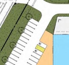
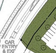


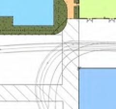
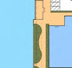
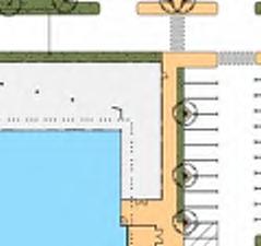
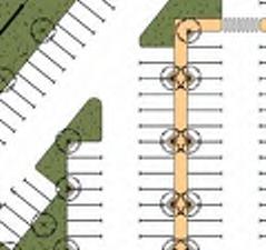
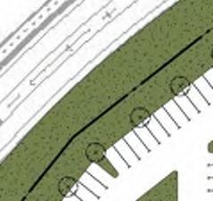


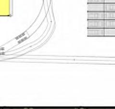


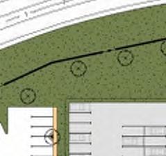


56 SITE CRITERIA 1. Site Area 100,094m² Truck Entry Proposed 15m Wide Crossover 2. Landscaping a. Soft Landscaping b. Hard Landscaping (inc. bike store) c. Bike Storage Awning Total 3,824m² 2,393m² (50m²) already counted above) 6,217m² (6.2% of site area) Palisade Fence Palisade Fence Car Entry & Exit Palisade Fence 6m Wide Landscaping Visitor Parking Area Proposed 7m Wide Crossover S.A.Gate 6m Wide Landscaping Palisade Fence Court Yard 336m² Office 2 Levels 4000m² Boom Gate BUILDING 1 Palisade Fence Pedestrian Link Security Access Service Generator Area 110m² 6m Wide Landscaping Staff Parking Area BUILDING 2 HV Testing & Labs 2550m² Palisade Fence Palisade Fence Palisade Fence Loading Loading Bay 1 Bay 2 Security Access Security Access Palisade Fence S. Auto Gate Black Chainlink mesh fence Black Chainlink mesh fence Uncovered Light Fleet 184 Bays (2.6m x 5.5m) 4,600m² Environmental Waste 200m² Refuel 72m² Packaged refuelling bowser combo (18m x 4m) BUILDING 5 Covered Washdown 50m² 10m high concrete Panel walls to 2 side BUILDING 6 Covered Heavy Fleet (Large) 72 Bays (4m x 12.5m) 3,600m² Small Trailer 15 Bays (3m x 6m) 270m² 3. Covered Floor Area a. Office - 2 Levels b. HV Testing & Labs c. Operations Workshop d. Fleet Workshop e. Fleet Office & Amenities f. Oil Waste Store g. CEVA Drivethrough h. CEVA Store & Env. Shed i. Covered EWP HV Testing Area j. Covered Battery Storage k. Covered Tyre Storage l. Covered Washdown m. Covered Yard Storage n. Covered Pole Assembly o. Covered Heavy Fleet (Large) Parking Area p. Generator Area Total 4. Uncovered Floor Area a. Environmental Waste b. Refuel c. Uncovered Trailer Parking d. Uncovered Pole Storage e. EWP Commissioning Area f. On Grade Storage Area g. Heavy Fleet (Small) Parking Area h. Light Fleet Parking Area 2,000m² NLA - GLA will be larger than NLA shown (4000m² total over 2 x 2000m² floor plates) 2,550m² 1,200m² 3,350m² 450m² 1,200m² 5,000m² 2,000m² 50m² 50m² 180m² 50m² 1250m² 240m² 6,900m² 110m² 28,580m² 200m² 72m² 2,130m² 1,450m² 176m² 1,450m² 2,016m² 4,600m² Operations Workshop 1200m² Total 12,094m² Truck Exit BUILDING 8 Palisade Fence Covered Pole Assembly 240m² Covered EWP HV Testing Area 50m² Fleet Office 300m² Fleet Workshop Amenities 150m² BUILDING Pedestrian Link BUILDING 3 CEVA 5000m² Drive Through Zone BUILDING 7 Covered Heavy Fleet (Large) 66 Bays (4m x 12.5m) 3,300m² 5. Light Duty Paving a. Uncovered Light Duty Ashphalt Parking 6. Balance of Concrete Area a. Uncovered Balance of Concrete Paving 11,229m² 47,056m² Truck exit road and crossover by builder Truck Exit S. Auto Gate Palisade Fence Pole Butt Bins Uncovered Pole Storage 1450m² LINE OF JUWPCA Black Chainlink mesh fence EWP Commissioning Area (22m clear) 176m² 3,350m² Drive Through Zone Oil Waste Store 1200m² Covered Battery Storage 50m² Covered Tyre Storage 180m² Store 1,300m² Cable Drums Covered Storage Yard 1250m² Environmental Shed 700m² LINE OF JUWPCA Black Chainlink mesh fence Large Trailer 25 Bays (4.5m x 11m) 1,860m² Uncovered Heavy Fleet (small) 56 Bays (3m x 6m) 2,016m² 7. Car Parking a. Staff & Visitor parking b. Heavy Fleet bays c. Small Fleet bays d. Light Fleet bays 8. Paving Beyond Boundary a. Truck Entry Crossover b. Visitor & Staff Entry Crossover (bitumen) c. Truck Exit Road & Crossover 426 car bays 138 bays 56 bays 184 bays 132m² 79m² 1,046m² Hardstand 2.4m High screen wall N SITE PLAN SCALE: 1 : 1000 PROPOSED DEVELOPMENT LOCATION:PRECINCT 6, JANDAKOT AIRPORT FOR:JANDAKOT AIRPORT HOLDINGS SK005 AUG 2017 As A


57 Courtyard wall Open Courtyard louvered awnings below Covered Courtyard A Sliding door Sliding door Sliding door A B 6500 STAFF NFA m² B 6500 Workstation Space C D E High level roof fascia over. Low level entry feature element over. MAIN ENTRY AIR LOCK Exit MR NFA 11.0 m² FHRFIP Line of slab over shown dashed Security Access MR NFA 11.0 m² MR NFA 42.0 m² MR NFA 23.7 m² TRAINING NFA 50.0 m² STORE NFA 14.0 m² KITCHEN NFA 50.0 m² STORE NFA 11.2 m² PRINT/STORE NFA 23.3 m² TRAINING NFA 50.0 m² COMPACTUS NFA 22.4 m² SECURITY NFA 14.0 m² FCR NFA 24.2 m² SWB 5 showers + 1 ambulant shower 30 lockers FEMALE EOT MALE EOT 30 lockers Open stair ironing dryer dryer ironing 5 showers + 1 ambulant shower Sliding door CCR NFA 40.4 m² Exit FHR 46 bicycle bays pump Sliding gate AIR LOCK Sliding door BIN STORE NFA 15.4 m² A/C PLANT STAFF ENTRY Louvred screens C D E High level roof fascia over. Low level entry feature element below. Roof Below Line of skylight over shown dashed. BREAK OUT NFA 20.8 m² Void over Foyer QR NFA 14.7 m² QR NFA 14.7 m² CLN NFA 3.3 m² PRINT/ STORE NFA 28.7 m² COMPACTUS NFA 30.0 m² FEMALE NFA 13.6 m² MALE NFA 14.6 m² Open stair PRINT/STORE NFA 23.2 m² MR NFA 22.4 m² MR NFA 22.4 m² PRINT NFA 16.9 m² STORE NFA 9.5 m² RECEPTION NFA 12.8 m² FCR NFA 25.6 m² SWB Open stair FHR BREAK OUT NFA 17.2 m² Workstation Space Roof below F G Workstation Space MR NFA 20.0 m² MR NFA 20.0 m² QR NFA 12.9 m² QR NFA 14.2 m² CLN NFA 6.1 m² FEMALE NFA 14.8 m² MALE NFA 27.6 m² PRINT/STORE NFA 23.7 m² QR NFA 14.1 m² QR NFA 14.1 m² MR NFA 20.0 m² MR NFA 20.0 m² Workstation Space BREAK OUT NFA 17.5 m² F G Awning below Workstation Space MR NFA 20.0 m² MR NFA 20.0 m² QR NFA 14.2 m² QR NFA 12.9 m² CLN NFA 6.1 m² FEMALE NFA 14.8 m² MALE NFA 15.3 m² COMPACTUS NFA 30.0 m² PRINTERS QR NFA 14.7 m² QR NFA 13.4 m² MR NFA 20.0 m² MR NFA 20.0 m² BREAK OUT NFA 16.9 m² Awning below H Open stair Exit H Open stair 8400 Workstation Space 8400 Workstation Space I I N N OFFICE GROUND FLOOR PLAN SCALE: 1 : 200 OFFICE FIRST FLOOR PLAN SCALE: 1 : 200 PROPOSED DEVELOPMENT LOCATION:PRECINCT 6, JANDAKOT AIRPORT FOR:JANDAKOT AIRPORT HOLDINGS SK005 AUG : A


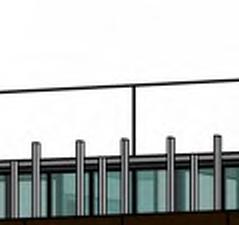

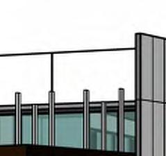
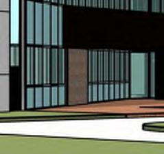

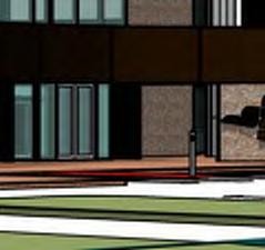

58 A B C D E F G H I Alpolic cladding. Aluminium fins. R.L B1 - Top of Parapet R.L B1 - Top of Fins R.L B1 - First FL R.L B1 - Ground FL Feature masonry wall. WEST ELEVATION SCALE: 1 : 200 CFC wall panel to feature entry element. Feature masonry wall. CFC parapet wall. Aluminium fins. R.L B1 - Top of Parapet R.L B1 - Top of Fins 2000 R.L B1 - First FL R.L B1 - Ground FL Feature masonry wall. EAST ELEVATION SCALE: 1 : 200 Louvered screens. R.L B1 - Top of Parapet R.L B1 - Top of Fins CFC parapet wall. Aluminium fins. R.L B1 - Top of Parapet R.L R.L. B1 Top 7.000of Fins B2 - Top of parapet Aluminium fins. CFC parapet wall. 2 1 Alpolic cladding. R.L B1 - First FL R.L B2 - U/S Steel R.L B1 R.L. - First 3.000FL B2 - Dado R.L B1 - Ground FL SOUTH ELEVATION SCALE: 1 : 200 R.L B2 B1 - Ground FL CFC wall panel. NORTH ELEVATION SCALE: 1 : 200 Feature masonry wall. 3D View 1 SCALE: 3D View 2 SCALE: PROPOSED DEVELOPMENT LOCATION:PRECINCT 6, JANDAKOT AIRPORT FOR:JANDAKOT AIRPORT HOLDINGS SK005 AUG : A

 Landscape")
 200x50 RHS Column")


 Ridge Vent")
 HV TESTING &")


 elevation)")


59 OFFICE 4No Service Bays Palisade Fence Palisade Fence 200x50 RHS Beam over (Typ) Landscape 100x50 RHS Column Screen (Typ) 200x50 RHS Column (Typ) Awning over shown dashed Landscape Palisade Fence Covered Pedestrian Link Security Access Entry Awning over shown dashed Ridge Over GENERATOR GFA 110m² Louvres to Generator Highlight windows (see elevation) Ridge Vent Over Alum frame over Highlight windows (see elevation) HV TESTING & LABS GFA 2,550m² ANTISTATIC & CONDUCTIVE FLOOR FINISH Alum frame over Bollards Alum frame over Highlight windows (see elevation) Highlight windows (see elevation) Alum frame over Roller Door 5m High x 5m wide Electric Roller Door 3m wide canopy over shown dashed Roller Door ARMCO Crash rail N GROUND FLOOR PLAN - HV TESTING & LABS SCALE: 1 : 200 BUILDING 2 PROPOSED DEVELOPMENT LOCATION:PRECINCT 6, JANDAKOT AIRPORT FOR:JANDAKOT AIRPORT HOLDINGS SK005 AUG : A


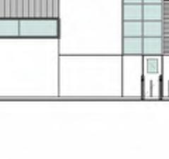


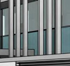
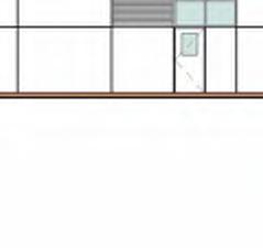


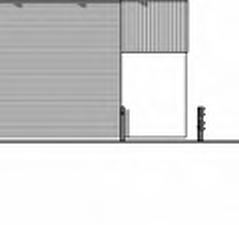
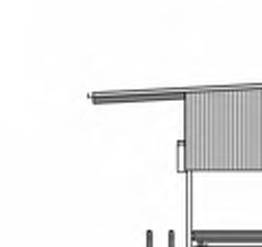

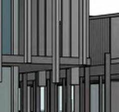
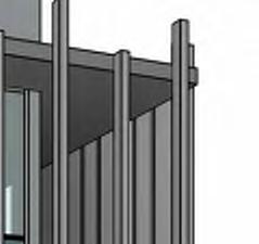

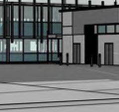


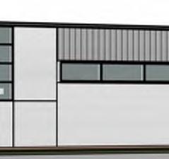


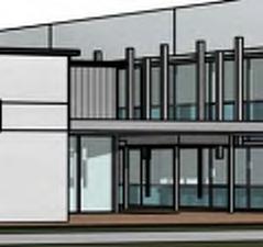


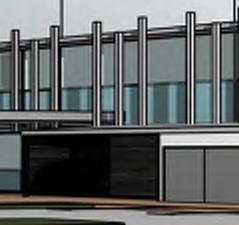

60 Flat pan metal wall cladding Ridge Vent Colorbond metal deck roof at 3 pitch with insulation R.L B2 - U/S Steel R.L B2 - U/S Steel 5000 R.L B2 - Dado R.L B2 - Ground FL Entry awning 200x50 RHS column Column screen Full height concrete tilt panel wall 2700 Covered awning 5000 R.L B2 - Dado R.L B2 - Ground FL Colorbond metal deck wall cladding with insulation 3m high concrete da.do wall WEST ELEVATION SCALE: 1 : 200 EAST ELEVATION SCALE: 1 : 200 Colorbond metal deck roof at 3 pitch with insulation Flat pan metal wall cladding with insulation Flat pan metal wall cladding with insulation Ridge Vent Colorbond metal deck wall cladding with insulation R.L B2 - U/S Steel 5000 R.L B2 - Dado R.L B2 - Ground FL Covered Awning Full height concrete tilt panel wall Louvres to generator Colorback glazing Vision Panel glazing 300mm wide Alum frame to perimeter Ventilation Louvres Vision Panel glazing 300mm wide Alum frame to perimeter Full height concrete tilt panel wall 3m Wide Canopy 3m high concrete da.do wall SOUTH ELEVATION SCALE: 1 : 200 Colorbond metal deck roof at 3 pitch with insulation Flat pan metal wall cladding with insulation Flat pan metal wall cladding with insulation R.L B2 - U/S Steel 5000 R.L B2 - Dado R.L B2 - Ground FL Full height concrete tilt panel wall Vision Panel glazing Colorback glazing 3m high concrete da.do wall Full height concrete tilt panel wall Ventilation Louvres 300mm wide Alum frame to perimeter Entry awning Covered Awning NORTH ELEVATION SCALE: 1 : 200 BUILDING 2 PROPOSED DEVELOPMENT LOCATION:PRECINCT 6, JANDAKOT AIRPORT FOR:JANDAKOT AIRPORT HOLDINGS SK005 AUG : A


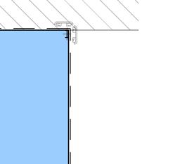
61 Line of roof over shown dashed Line of roof over shown dashed Pedestrian Link 5m High x 5m wide Electric Roller Door 5m High x 5m wide Electric Roller Door Alsynite roof sheeting over shown dashed (typical) CABLE DRUMS COVERED STORAGE YARD 1250m² 8m CLEAR HEIGHT Roller Door STORE GFA 1,300m² 8m CLEAR HEIGHT Roller Door Roller Door CEVA 5000m² DRIVE THROUGH ZONE 8m CLEAR HEIGHT DRIVE THROUGH ZONE m High Block Wall Ridge Over DRIVE THRU DRIVE THRU DRIVE THRU DRIVE THRU DRIVE THRU Ridge Over DRIVE THRU C L ENVIRONMENTAL SHED GFA 700m² 8m CLEAR HEIGHT m High x 5m wide Electric Roller Door Roller Door Roller Door Line of roof over shown dashed Bollards ARMCO crash rail Line of roof over shown dashed 5000 LAYDOWN AREA (TYPICAL) N GROUND FLOOR PLAN - CEVA, STORE & SHED SCALE:1 : 250 BUILDING 3 PROPOSED DEVELOPMENT LOCATION:PRECINCT 6, JANDAKOT AIRPORT FOR:JANDAKOT AIRPORT HOLDINGS SK005 AUG : A


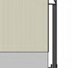

62 Surfmist colorbond metal deck roof at 3 pitch with insulation Surfmist colorbond metal deck wall cladding with insulation Alsynite roof sheeting R.L B3 - U/S Steel R.L B3 - Dado R.L B3 - Ground FL 2.5m high light grey concrete da.do wall WEST ELEVATION SCALE: 1 : 200 Alsynite roof sheeting Surfmist colorbond metal deck roof at 3 pitch with insulation Surfmist colorbond metal deck wall cladding with insulation R.L B3 - U/S Steel R.L B3 - Dado R.L B3 - Ground FL 2.5m high light grey concrete da.do wall EAST ELEVATION SCALE: 1 : 200 Surfmist olorbond metal deck roof at 3 pitch with insulation Surfmist colorbond metal deck wall cladding with insulation Surfmist colorbond metal deck roof at 3 pitch with insulation Surfmist colorbond metal deck wall cladding with insulation R.L B3 - U/S Steel R.L B3 - U/S Steel R.L B3 - Dado R.L B3 - Ground FL R.L B3 - Dado R.L B3 - Ground FL 2.5m high concrete da.do wall 2.5m high light grey concrete da.do wall NORTH ELEVATION SCALE: 1 : 200 SOUTH ELEVATION SCALE: 1 : 200 Roof over shown dashed Colorbond roof sheeting at 3 pitch Line of roof ARMCO Crash rail Concrete tilt panel walls Covered Washdown 50m² Black Chainlink mesh fence Concrete tilt panel wall Concrete tilt panel wall Roof over shown dashed ARMCO Crash rails ARMCO Crash rails N COVERED WASHDOWN LAYOUT SCALE: 1 : 200 WASHDOWN - FRONT ELEVATION SCALE: 1 : 200 WASHDOWN - SIDE ELEVATION SCALE: 1 : 200 BUILDING 3 & BUILDING 5 WASHDOWN PROPOSED DEVELOPMENT LOCATION:PRECINCT 6, JANDAKOT AIRPORT FOR:JANDAKOT AIRPORT HOLDINGS SK005 AUG : A


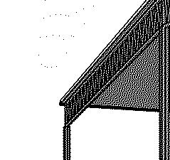


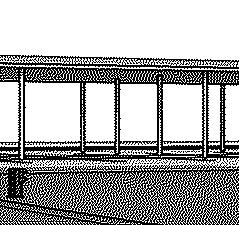


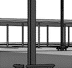

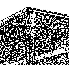


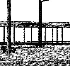


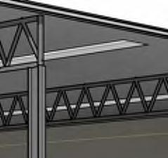

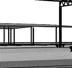


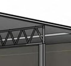
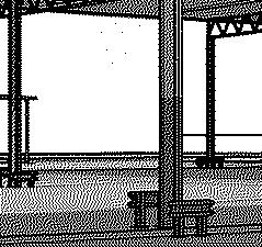
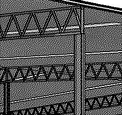


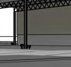


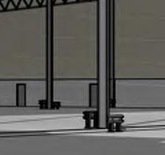


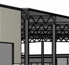


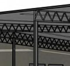


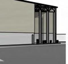
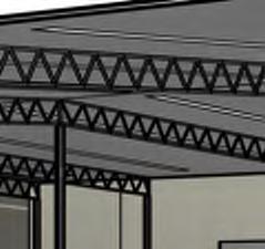


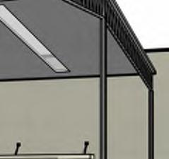

63 BUILDING 3 PROPOSED DEVELOPMENT LOCATION:PRECINCT 6, JANDAKOT AIRPORT FOR:JANDAKOT AIRPORT HOLDINGS SK005 AUG A1 8


64 Black Chainlink mesh fence Line of roof over shown dashed 3m wide canopy over shown dashed Roller Door Roller Door Roller Door Roller Door Roller Door Roller Door Roller Door Roller Door 5m High x 5m wide Electric Roller Door Crane over by others COVERED EWP HV TESTING AREA 50m² 4m High x 5m wide Electric Roller Door 2.4m High Block Wall m High x 3m wide Electric Roller Door Lean to roof. Clear height 4m Roller Door UNCOVERED EWP COMMISSI- ONING AREA 176m² BATTERY STORAGE 50m² COVERED TYRE STORAGE 180m² 5m High x 5m wide Electric Roller Door ENCLOSED OIL WASTE STORE GFA 1,200m² 8m CLEAR HEIGHT BUNDED FLOOR Crane runaway beam over Ridge Over Safety shower/eye wash COVERED FLEET WORKSHOP GFA 3,350m² 8m HOOK HEIGHT 10.5m TOP OF CRANE DRIVE THROUGH ZONE Crane runaway beam over Crane runaway beam over Crane over by others Ridge Over AMENITIES GFA 150m² Safety shower/eye wash Crane runaway beam over FLEET OFFICE GFA 300m² DIS. FEMALE CLNR LUNCH ROOM MALE Crane runaway beam over OPERATIONS WORKSHOP 4m High x 5m wide Electric Roller Door Safety shower/eye wash Crane over by others COVERED GFA 1,200m² 5m HOOK HEIGHT 7m TOP OF CRANE Crane runaway beam over Roller Door Roller Door Roller Door Roller Door Roller Door Roller Door Roller Door Bollards Line of roof over shown dashed ARMCO crash rail Pedestrian Link Pedestrian Link Pedestrian Link 3m wide canopy over shown dashed Pedestrian Link N GROUND FLOOR PLAN - WORKSHOP SCALE:1 : 250 BUILDING 4 PROPOSED DEVELOPMENT LOCATION:PRECINCT 6, JANDAKOT AIRPORT FOR:JANDAKOT AIRPORT HOLDINGS SK005 AUG : A


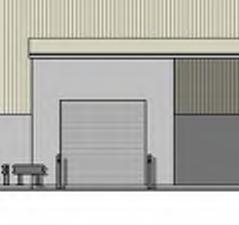


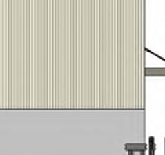


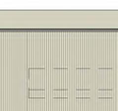
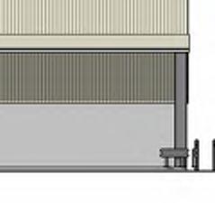

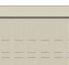


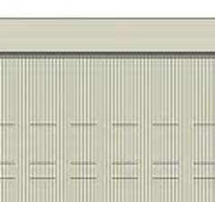
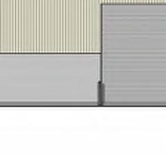
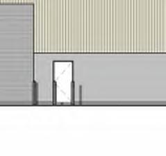


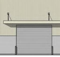
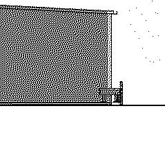
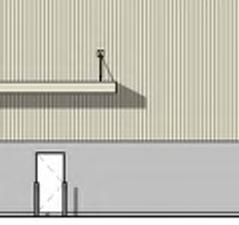
65 Surfmist colorbond metal deck roof at 3 pitch with insulation Surfmist colorbond metal deck wall cladding with insulation Surfmist colorbond metal deck roof at 3 pitch with insulation Surfmist colorbond metal deck wall cladding with insulation R.L B4 - U/S Steel 2 Crane by others Crane by others Crane runway beam R.L B4 - Dado 4200 Spring Ht R.L B4 - Ground FL WEST ELEVATION SCALE: 1 : m high light grey concrete da.do wall 2.5m high light grey concrete da.do wall Concrete tilt panel wall Surfmist colorbond metal deck roof at 3 pitch with insulation Surfmist colorbond metal deck wall cladding with insulation R.L B4 - U/S Steel 2 R.L B4 - U/S Steel 1 R.L B4 - Dado R.L B4 - Ground FL 2.5m high light grey concrete da.do wall Concrete tilt panel wall SOUTH ELEVATION SCALE: 1 : 200 Surfmist colorbond metal deck wall cladding with insulation Surfmist colorbond metal deck roof at 3 pitch with insulation Surfmist colorbond metal deck wall cladding with insulation Surfmist colorbond metal deck roof at 3 pitch with insulation R.L B4 - U/S Steel 2 Crane by others Crane by others R.L B4 - U/S Steel 1 Crane runway beam R.L B4 - Dado 4200 Spring Ht R.L B4 - Ground FL EAST ELEVATION SCALE: 1 : m high light grey concrete da.do wall 2.5m high light grey concrete da.do wall Surfmist colorbond metal deck roof at 3 pitch with insulation Surfmist colorbond metal deck wall cladding with insulation R.L B4 - U/S Steel R.L B4 - U/S Steel 1 R.L B4 - Dado R.L B4 - Ground FL 2.5m high light grey concrete da.do wall NORTH ELEVATION SCALE: 1 : 200 BUILDING 4 PROPOSED DEVELOPMENT LOCATION:PRECINCT 6, JANDAKOT AIRPORT FOR:JANDAKOT AIRPORT HOLDINGS SK005 AUG : A


66 BUILDING 4 PROPOSED DEVELOPMENT LOCATION:PRECINCT 6, JANDAKOT AIRPORT FOR:JANDAKOT AIRPORT HOLDINGS SK005 AUG A
67 APPENDIX B TRANSPORT REPORT

68 Western Power Development - Precinct 6, Jandakot Airport Transport Report for Major Development Plan PREPARED FOR: Jandakot Airport Holdings Pty Ltd July 2017
69 Document history and status Author Revision Approved by Date approved Revision type R White r01 B Bordbar 25/07/2017 Draft R White r01a B Bordbar 26/07/2017 Final File name: Author: Project manager: Client: Project: Document revision: t17194-rw-r01a.docx R White B Bordbar Jandakot Airport Holdings Pty Ltd Western Power Development - Precinct 6, Jandakot Airport r01a Project number: t Copyright in all drawings, reports, specifications, calculations and other documents provided by the Consultant in connection with the Project shall remain the property of the Consultant. The Client alone shall have a license to use the documents referred to above for the purpose of completing the Project, but the Client shall not use, or make copies of, such documents in connection with any work not included in the Project, unless written approval is obtained from the Consultant or otherwise agreed through a separate contract.
70 TABLE OF CONTENTS 1.0 INTRODUCTION DEVELOPMENT PROPOSAL EXISTING SITUATION EXISTING ROAD NETWORK EXISTING PUBLIC TRANSPORT OPPORTUNITIES FUTURE SITUATION TRAFFIC ASSESSMENT TRAFFIC GENERATION AND DISTRIBUTION FUTURE TRAFFIC FLOWS TRAFFIC IMPACT ON ROAD NETWORK CONCLUSIONS APPENDIX A: PROPOSED DEVELOPMENT SITE PLAN APPENDIX B: JANDAKOT AIRPORT MASTER PLAN 2014 PRECINCT PLAN AND ROAD HIERARCHY
71 REPORT FIGURES Figure 1 : Site Location... 4 Figure 2 : Precinct 6 access road (June 2017)... 5 Figure 3 : Existing Bus Routes... 7 Figure 4. Future Traffic Flows REPORT TABLES Table 1: Existing traffic volumes... 6 Table 2: Impact on major surrounding roads interim scenario... 12
72 1.0 Introduction This Transport Report has been prepared by Transcore on behalf of Jandakot Airport Holdings Pty Ltd with regard to the proposed Western Power depot development. This depot is proposed to be located within Precinct 6 access road in the southern portion of Jandakot Airport. For the purpose of this report, the subject site is also referred to as Site 516. Jandakot Airport is Commonwealth land and for certain type of developments including the proposed Western Power development the Major Development Plan (MDP) process will need to be followed. The MDP will need to cover and address specific information as set out in the Airports Act 1996, including: 91(1)(ga) the likely effect of the proposed developments that are set out in the major development plan, or the draft of the major development plan, on: (i) traffic flows at the airport and surrounding the airport This Transport Report addresses the requirement of 91(1)(ga)(i) of the Airports Act t17194-rw-r01a.docx Page 1
73 2.0 Development Proposal The subject of this report is the proposed Western Power development of a new southern metropolitan depot which is intended to consolidate the activities currently undertaken at a number of existing smaller depots across the Perth metropolitan area. There will also be a new north metropolitan depot at another site north of the Swan River servicing the northern half of the metropolitan area. The proposed development will include office and workshop facilities for an estimated 750 staff comprising administrative and field operations personnel. Western Power has advised that 40% of this number are administrative staff and 60% operations staff. Western Power indicated that the proposed development is to provide for the following facilities: 1. Administrative offices (including amenities), 2. Warehouse, workshops, laboratories and electronic clean room areas 3. Vehicular maintenance facilities (Heavy Fleet) 4. Supplies stores / archives 5. Covered parking areas for all Heavy Fleet vehicles 6. Secure parking for operational Light Fleet 7. Staff and visitor parking The proposed development site plan is shown in Appendix A. The proposed site is approximately 10 hectares in area. The site plan indicates the development will include over 28,500m 2 of covered floor area (including 4,000m 2 of office space in a two storey office building, workshops, storage and heavy fleet parking areas), over 12,000m 2 of uncovered floor area and extensive parking areas and other hardstand areas. The proposed parking provision includes a staff and visitor car park for 426 cars and parking bays for 138 heavy fleet vehicles (4m x 12.5m bays), 56 small fleet vehicles (3m x 6m bays) and 184 light fleet vehicles (2.6m x 5.5m bays). The site plan shows that the site will be fenced for security with sliding access gates for vehicle access (one driveway for the car park and two driveways for fleet vehicles (one entry only and one exit only). All three driveways will connect to the new Precinct 6 access road. Additional boom gate control is shown for the staff parking area separate from the visitor parking area adjacent to the two-storey office building at the front of the site. Secure bicycle parking will be provided for 40 bicycles and separate male and female end-of-trip facilities are included. Western Power has advised that all staff generally arrive between 6.30am and 8.00am and depart between 3.00 and 5.00pm. t17194-rw-r01a.docx Page 2
74 The vehicle fleet operated by Western Power is generally up to 12.5m rigid vehicles but the site is required to be designed generally to accommodate turn movements by 19m semi-trailers and to allow for through movement by 27.5m B-doubles which may visit the site less frequently, as well. The site plan at Appendix A shows turn paths for 27.5m B-doubles throughout the site, demonstrating that that size of vehicle is easily accommodated by the proposed site layout. The development proposal does not propose any modifications to the existing Jandakot Airport Mixed Business Precinct road network. t17194-rw-r01a.docx Page 3

75 3.0 Existing Situation The subject site is situated within Precinct 6 of the Jandakot Airport Mixed Business Precinct (JAMBP). It is located on the southern side of the new Precinct 6 access road that is currently nearing completion, as shown in Figure 1. Figure 1 : Site Location This new access road connects to Pilatus Street with the intersection constructed as a roundabout, as shown in Figure 2. At the time of writing this report the new access road and the adjacent section of Pilatus Street extension are nearing completion but not yet open to traffic. t17194-rw-r01a.docx Page 4
, while Berrigan Drive provides connection to Kwinana Freeway (to the southwest) and Jandakot Road (to the southeast).")
76 Figure 2 : Precinct 6 access road (June 2017) The access to the JAMBP from the district level road network is currently provided through two major road links. Karel Avenue provides connection to Roe Highway (to the north), while Berrigan Drive provides connection to Kwinana Freeway (to the southwest) and Jandakot Road (to the southeast). Pilatus Street provides an important spine road link through the JAMBP area and will become the main southern route connecting to Jandakot Road and Berrigan Drive. 3.1 Existing Road Network The new Precinct 6 access road is being constructed to the same standard as Spartan Street, which is a single-carriageway, two-lane, boulevard-style road with a 3m wide red asphalt median with raised traffic islands in some sections. It will have 1.5m on-road cycling lanes and a 2.5m shared path has been constructed along the northern side of the road. Pilatus Street south of Karel Avenue, transitions from a four-lane dual carriageway road into a single carriageway, two-lane road south of Marriott Road, widening on its approach to Spartan Street to accommodate a right-turn pocket. It entails 1.5m on-road cycling lanes and a pedestrian path along the western side of the road and with crossing points at each intersection. The southern extension of Pilatus Street from Spartan Street to Berrigan Drive is constructed as a single-carriageway, twolane road with potential to be upgraded to dual carriageway in future if required. The short, southernmost section of Pilatus Street north of Jandakot Road to Berrigan Drive has already been constructed to dual carriageway standard. Karel Avenue is the main access road into JAMBP. It runs east-west within Jandakot Airport then turns northward and connects to Roe Highway, South Street and Leach Highway. Karel Avenue, south of Roe Highway, entails variable cross sections, changing from a two-lane divided, boulevard-style road (west of Berrigan Drive and east of Mariott Road) to a four-lane, dual-carriageway road with wide median. t17194-rw-r01a.docx Page 5
77 Dedicated on-road cycling lanes are also provided on all sections of the road. A 2.5m wide shared path is in place along the southern side (east of Berrigan Drive) while a 3.0m wide shared path is in place along the western side of Karel Avenue north of Berrigan Drive. The east-west section of Karel Avenue is classified as a District Distributor B road in the Main Roads WA Functional Road Hierarchy and has a posted speed limit of 70km/h. The north-south section is classified as a District Distributor A road and has a 60km/h speed limit from Berrigan Drive to Roe Highway. Berrigan Drive is constructed as a single carriageway, two-lane road (one 3.5m traffic lane in each direction with 1.5m sealed shoulders) from Karel Avenue south to Pilatus Street, then a dual carriageway road west of Jandakot Road. Berrigan Drive is classified as a District Distributor A road and has a posted speed limit of 70km/h in this area. It forms an interchange with Kwinana Freeway about 2.5km southwest of Karel Avenue and provides a district distributor road link between Kwinana Freeway and Roe Highway. Existing average weekday traffic counts on Karel Avenue, Berrigan Drive and Jandakot Road have been obtained from counts undertaken for Jandakot Airport in September 2015 or more recent counts from City of Cockburn and Main Roads WA websites, where available. Existing traffic volumes are summarised in Table 1. Table 1: Existing traffic volumes Road Location Average weekday traffic Date Karel Ave E of Berrigan Dr 13,045 vpd May 2016 Karel Ave W of Berrigan Dr 20,093 vpd Sep 2015 Berrigan Dr S of Karel Ave 14,517 vpd Sep 2015 Berrigan Dr W of Jandakot Rd 18,032 vpd Sep 2015 Jandakot Rd E of Berrigan Dr 14,862 vpd Mar Existing Public Transport Opportunities There are limited public transport services available at the subject locality at present. The nearest bus route (bus route 515 operating between Murdoch Station and Berrigan Drive/Turnbury Park Drive) runs on Berrigan Drive west of JAMBP. Route 515 also deviates down Karel Avenue to Compass Road/Eagle Drive several times a day. The local bus service map is illustrated in Figure Note: route No. 515 deviation to Compass Road/Eagle Drive (Jandakot Airport) is not shown in the Transperth bus service map t17194-rw-r01a.docx Page 6

78 Figure 3 : Existing Bus Routes t17194-rw-r01a.docx Page 7
79 4.0 Future Situation Pilatus Street is currently under construction southwards from the Jandakot Airport boundary to Berrigan Drive as planned in the Jandakot Airport Master Plan A new signalised intersection at Berrigan Drive / Jandakot Road / Pilatus Street / Dean Road intersection became operational around May This included the realignment of Berrigan Drive to connect at a new T-intersection on the new Pilatus Street alignment. It is understood that the State Government has set aside funds to upgrade the section of Karel Avenue between Roe Highway and Berrigan Drive to dual carriageway standard (two lanes each way), in accordance with the long term requirements for the Jandakot Airport Master Plan 2014, with this work to be tendered by the end of this year for construction in A future road (the eastern link) connecting Jandakot Airport with Ranford Road is proposed in the Jandakot Airport Master Plan The Jandakot Airport Master Plan 2014 provides a plan illustrating the road hierarchy and future road links mentioned above (see Appendix B). t17194-rw-r01a.docx Page 8
80 5.0 Traffic Assessment 5.1 Traffic Generation and Distribution The traffic that will be generated by the proposed Western Power development will primarily be related to arrival and departure of staff and fleet vehicles travelling to and from the site each day. Visitors and delivery vehicles will only represent a small proportion of traffic flows generated by the proposed development. Western Power has advised that the workforce operating at or from this site is estimated to be up to 750 staff. 40% of this number are administrative staff and 60% operations staff. Western Power has advised that all staff generally arrive between 6.30am and 8.00am and depart between 3.00 and 5.00pm. Based on advice from Western Power the following assumptions are incorporated in the traffic generation calculations: Typically 10% to 20% of staff are absent on leave or due to illness on a typical day. (10% is assumed typical for the purpose of this analysis.) Western Power will provide bus transport from Murdoch Station to the site for employees. (This could be up to 20% of staff but 10% is assumed for this analysis.) Some staff will ride share or cycle to work. (10% is assumed for the purpose of this analysis.) Typically 20% of the field vehicles are not used on any given day. Based on these assumptions the staff movements will generate traffic flows of approximately 1,050 vehicles per day (vpd) (525 in / 525 out). This will be a combination of cars which park in the staff car park and light fleet vehicles which park in the depot area. Visitor traffic is nominally estimated at three times the number of visitor parking bays (59 visitor spaces shown on the site plan at Appendix A) which indicates approximately 350vpd (175 in / 175 out). Fleet vehicles traffic generation assumed 80% of the fleet vehicles travel from and to the site each day. As noted in section 2.0 parking is provided for 138 heavy fleet vehicles), 56 small fleet vehicles and 184 light fleet vehicles. Hence it is estimated the fleet vehicles traffic generation would be approximately 600vpd (300 in / 300 out. This would include approximately 220 heavy vehicle movements per day (110 in / 110 out). The total traffic generation of the proposed Western Power development is therefore estimated at approximately 2,000vpd (1,000 in / 1,000 out) with approximately 11% heavy vehicle movements. t17194-rw-r01a.docx Page 9
81 Traffic distribution to and from the subject site is assumed to be distributed in a similar pattern to the overall Jandakot Airport traffic distribution, based on projected future traffic patterns shown in the Jandakot Airport Master Plan 2014, as follows: 52% to/from Karel Avenue north (to Roe Hwy, Kwinana Fwy north, etc.); 25% to/from Berrigan Drive southwest (to Kwinana Freeway south, etc.); 11% to/from the future east link to Ranford Road; 8% to/from Jandakot Road; and, 4% internal trips within the Jandakot Airport Master Plan area. 5.2 Future Traffic Flows Future traffic flows generated by full development of the Jandakot Airport Master Plan are shown in Figure 6.2 of the Jandakot Airport Master Plan 2014 report. The anticipated new traffic movements generated by the proposed Western Power development have been assigned on the road network and are shown on a copy of that traffic flows diagram in Figure 4. The Western Power traffic flows shown are part of the future total Jandakot Airport traffic generation, not additional to it. This shows that the proposed Western Power development will generate approximately 2,000vpd of the future total 5,800vpd on the Precinct 6 access road. t17194-rw-r01a.docx Page 10

82 Figure 4. Future Traffic Flows t17194-rw-r01a.docx Page 11
83 5.3 Traffic Impact on Road Network The impact of the development traffic on major access routes surrounding JAMBP is expected to be moderate and generally within the capacity of surrounding roads. The reported existing and development-generated traffic volumes and level of increase on major roads are summarised in Table 2. As the eastern link to Ranford Road has not yet been constructed the traffic using that route in Figure 4 is assigned to Karel Avenue in the interim scenario. Table 2: Impact on major surrounding roads interim scenario Road Location Average weekday traffic Level of Existing Development increase (%) Karel Ave E of Berrigan Dr 13,100 vpd 1,260 vpd 9.6% Karel Ave W of Berrigan Dr 20,100 vpd 1,260 vpd 6.3% Pilatus St 4.6% N of Jandakot Rd 14,500 vpd 660 vpd (Berrigan Dr) Berrigan Dr W of Jandakot Rd 18,000 vpd 500 vpd 2.8% Jandakot Rd E of Berrigan Dr 14,900 vpd 160 vpd 1.1% The existing traffic volumes on the 350-metre section of Karel Avenue between Roe Highway and Berrigan Drive are already relatively high for a two-lane divided road but it is understood that the State Government plans to upgrade this section of Karel Avenue to dual carriageway standard (two lanes each way) in The upgraded Karel Avenue will provide sufficient capacity for the long term projected traffic flows on Karel Avenue and will be more than sufficient to accommodate the traffic generated by the proposed Western Power depot development. t17194-rw-r01a.docx Page 12
84 6.0 Conclusions This report provides traffic analysis of the proposed Western Power depot development in Precinct 6 of the Jandakot Airport Master Plan. The proposed development will generate daily traffic flows of approximately 2,000 vehicles per day (vpd) with around 11% being heavy vehicles. This traffic generation is consistent with the anticipated future traffic generation reported in the Jandakot Airport Master Plan 2014 and is therefore accommodated by the planned road network in this area. In the short term scenario after completion of the proposed Western Power depot development the additional traffic generated by this development will represent less than a 10% increase on existing traffic volumes on the external road connections into the Jandakot Airport Master Plan area. This traffic increase is generally within the capacity of the existing road network. It is understood that the State Government plans to upgrade the section of Karel Avenue between Roe Highway and Berrigan Drive to dual carriageway standard (two lanes each way) in The upgraded Karel Avenue will provide sufficient capacity for the long term projected traffic flows on Karel Avenue and will be more than sufficient to accommodate the traffic generated by the proposed Western Power depot development. t17194-rw-r01a.docx Page 13
85 Appendix A PROPOSED DEVELOPMENT SITE PLAN t17194-rw-r01a.docx Page 14
86 SITE CRITERIA 1. Site Area 100,094m² Truck Entry Proposed 15m Wide Crossover 2. Landscaping a. Soft Landscaping b. Hard Landscaping (inc. bike store) c. Bike Storage Awning Total 3,824m² 2,393m² (50m²) already counted above) 6,217m² (6.2% of site area) Palisade Fence Palisade Fence Car Entry & Exit Palisade Fence 6m Wide Landscaping Visitor Parking Area Proposed 7m Wide Crossover S.A.Gate 6m Wide Landscaping Palisade Fence Court Yard 336m² Office 2 Levels 4000m² Boom Gate BUILDING 1 Palisade Fence Pedestrian Link Security Access Service Generator Area 110m² 6m Wide Landscaping Staff Parking Area BUILDING 2 HV Testing & Labs 2550m² Palisade Fence Palisade Fence Palisade Fence Loading Loading Bay 1 Bay 2 Security Access Security Access Palisade Fence S. Auto Gate Black Chainlink mesh fence Black Chainlink mesh fence Uncovered Light Fleet 184 Bays (2.6m x 5.5m) 4,600m² Environmental Waste 200m² Refuel 72m² Packaged refuelling bowser combo (18m x 4m) BUILDING 5 Covered Washdown 50m² 10m high concrete Panel walls to 2 side BUILDING 6 Covered Heavy Fleet (Large) 72 Bays (4m x 12.5m) 3,600m² Small Trailer 15 Bays (3m x 6m) 270m² 3. Covered Floor Area a. Office - 2 Levels b. HV Testing & Labs c. Operations Workshop d. Fleet Workshop e. Fleet Office & Amenities f. Oil Waste Store g. CEVA Drivethrough h. CEVA Store & Env. Shed i. Covered EWP HV Testing Area j. Covered Battery Storage k. Covered Tyre Storage l. Covered Washdown m. Covered Yard Storage n. Covered Pole Assembly o. Covered Heavy Fleet (Large) Parking Area p. Generator Area Total 4. Uncovered Floor Area a. Environmental Waste b. Refuel c. Uncovered Trailer Parking d. Uncovered Pole Storage e. EWP Commissioning Area f. On Grade Storage Area g. Heavy Fleet (Small) Parking Area h. Light Fleet Parking Area 2,000m² NLA - GLA will be larger than NLA shown (4000m² total over 2 x 2000m² floor plates) 2,550m² 1,200m² 3,350m² 450m² 1,200m² 5,000m² 2,000m² 50m² 50m² 180m² 50m² 1250m² 240m² 6,900m² 110m² 28,580m² 200m² 72m² 2,130m² 1,450m² 176m² 1,450m² 2,016m² 4,600m² Operations Workshop 1200m² Total 12,094m² Truck Exit BUILDING 8 Palisade Fence Covered Pole Assembly 240m² Covered EWP HV Testing Area 50m² Fleet Office 300m² Fleet Workshop Amenities 150m² BUILDING Pedestrian Link BUILDING 3 CEVA 5000m² Drive Through Zone BUILDING 7 Covered Heavy Fleet (Large) 66 Bays (4m x 12.5m) 3,300m² 5. Light Duty Paving a. Uncovered Light Duty Ashphalt Parking 6. Balance of Concrete Area a. Uncovered Balance of Concrete Paving 11,229m² 47,056m² Truck exit road and crossover by builder Truck Exit S. Auto Gate Palisade Fence Pole Butt Bins Uncovered Pole Storage 1450m² LINE OF JUWPCA Black Chainlink mesh fence EWP Commissioning Area (22m clear) 176m² 3,350m² Drive Through Zone Oil Waste Store 1200m² Covered Battery Storage 50m² Covered Tyre Storage 180m² Store 1,300m² Cable Drums Covered Storage Yard 1250m² Environmental Shed 700m² LINE OF JUWPCA Black Chainlink mesh fence Large Trailer 25 Bays (4.5m x 11m) 1,860m² Uncovered Heavy Fleet (small) 56 Bays (3m x 6m) 2,016m² 7. Car Parking a. Staff & Visitor parking b. Heavy Fleet bays c. Small Fleet bays d. Light Fleet bays 8. Paving Beyond Boundary a. Truck Entry Crossover b. Visitor & Staff Entry Crossover (bitumen) c. Truck Exit Road & Crossover 426 car bays 138 bays 56 bays 184 bays 132m² 79m² 1,046m² Hardstand 2.4m High screen wall N SITE PLAN SCALE: 1 : 1000 PROPOSED DEVELOPMENT LOCATION:PRECINCT 6, JANDAKOT AIRPORT FOR:JANDAKOT AIRPORT HOLDINGS SK005 AUG 2017 As A
87 Appendix B JANDAKOT AIRPORT MASTER PLAN 2014 PRECINCT PLAN AND ROAD HIERARCHY t17194-rw-r01a.docx Page 16
88 t17194-rw-r01a.docx Page 17
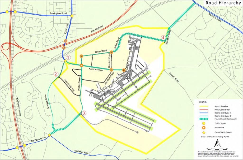
89 t17194-rw-r01a.docx Page 18
KMART DISTRIBUTION CENTRE. Major Development Plan Site 501 Spartan Street - Jandakot Airport
 KMART DISTRIBUTION CENTRE Major Development Plan Site 501 Spartan Street - Jandakot Airport January 2015 URBIS STAFF RESPONSIBLE FOR THIS REPORT WERE: Director Associate Director Senior Consultant Job
ALDI DISTRIBUTION CENTRE
 ALDI DISTRIBUTION CENTRE Preliminary Draft Major Development Plan Site 218 Orion Road - Jandakot Airport March 2014 URBIS STAFF RESPONSIBLE FOR THIS REPORT WERE: Director Associate Director Consultant
Application for Planning Consent
 Application for Planning Consent Essendon Airport Essendon Fields House Level 2, 7 English Street Essendon Fields, VIC, 3041 T: +61 3 9948 9400 The use of land and building works at Essendon Airport (including
9.3.9 Industry uses code
 9.3.9 Industry uses code 9.3.9.1 Application (1) This code applies to accepted development and assessable development identified as requiring assessment against the Industry uses code by the tables of
Understanding the State Planning Policy July 2017 Changes to state interest statements, policies and assessment benchmarks
 Understanding the State Planning Policy July 2017 Changes to state statements, policies and assessment benchmarks This fact sheet outlines the key policy changes to the state statements, policies and assessment
The Victorian Transport Plan (Department of Transport, 2008).
.") 18 TRANSPORT Planning should ensure an integrated and sustainable transport system that provides access to social and economic opportunities, facilitates economic prosperity, contributes to environmental
18 TRANSPORT Planning should ensure an integrated and sustainable transport system that provides access to social and economic opportunities, facilitates economic prosperity, contributes to environmental
Conditions of Approval for the MDP for the brickworks at Perth Airport
 Conditions of Approval for the MDP for the brickworks at Perth Airport Definitions In this document, unless a contrary intention appears, the terms below have the meanings given to them: AES means Airport
This table identifies provisions subject to and consequentially affected by appeals:
 Chapter 17 Airport Zone This table identifies provisions subject to and consequentially affected by appeals: Provision Subject To Appeal (identified in red text in the relevant chapter/s) Consequentially
Business and Industrial Areas Queenstown, Frankton, Arrowtown and Wanaka 11.1 Issues, Objectives and Policies
 . Business and Industrial Areas Queenstown, Frankton, Arrowtown and Wanaka.1 Issues, Objectives and.1.1 Resources, Activities and Values Business activities occur throughout the commercial, service and
Motueka Aerodrome. Development Plan. March 2012 REVIEW SCHEDULE. Date Approved. Comments. Issue #
 Motueka Aerodrome Development Plan REVIEW SCHEDULE Issue # 1 2 3 4 5 6 7 Date Approved Comments March 2012 1 P ageof10 Motueka Aerodrome Development Plan. March 2012 1. Role of Development Plan The Development
ENVIRONMENTAL MANAGEMENT
 ENVIRONMENTAL MANAGEMENT PERTH AIRPORT IS COMMITTED TO EFFECTIVE ENVIRONMENTAL MANAGEMENT OF THE AIRPORT ESTATE. ENVIRONMENTAL MANAGEMENT IS THE JOINT RESPONSIBILITY OF PERTH AIRPORT, AIRLINE OPERATORS,
FRINGE COMMERCIAL ZONE RULES
 Chapter 17 FRINGE COMMERCIAL ZONE RULES INTRODUCTION This chapter contains rules managing land uses in the. This zone surrounds the CBD area of the City and contains much of the commercial service activity
siting, building and design guidelines April 2017 Newgate, Tarneit Design Guidelines
 siting, building and design guidelines April 2017 1 2 INTRODUCTION PROCESS These present a series of measures designed to protect the design integrity of your new house at that will support the value of
General A. General A.1 Activities Not Specifically Provided For A.2 Temporary Activities... 3
 Section Contents General... 2 4A. General... 2 4A.1 Activities Not Specifically Provided For... 2 4A.2 Temporary Activities... 3 4A.3 Activities on the Surface of Water... 6 4A.4 Status of Roads... 7 4A.5
Abbot Point Stormwater Return Dam (EPBC 2010/5561) Operation Annual Compliance Report, January 2016
 Operation Annual Compliance Report, January 2016") Abbot Point Stormwater Return Dam (EPBC 2010/5561) Operation Annual Compliance Report, 2015 22 January 2016 Table of Contents 1. Introduction... 4 1.1. The purpose of this Document... 4 1.2. Project Background...
Abbot Point Stormwater Return Dam (EPBC 2010/5561) Operation Annual Compliance Report, 2015 22 January 2016 Table of Contents 1. Introduction... 4 1.1. The purpose of this Document... 4 1.2. Project Background...
MIXED ACTIVITY ZONE. Chapter 4. Mixed Activity Zone
 Chapter 4 Mixed Activity Zone 4. MIXED ACTIVITY ZONE 4.1 RESOURCE MANAGEMENT ISSUES 1. Activities adjoining main arterial roads can adversely affect the safety, sustainability and efficiency of the network.
22.1 ISSUES OBJECTIVES POLICIES RULES PERFORMANCE STANDARDS 10
 22 NETWORK UTILITIES 22.1 ISSUES 3 22.2 OBJECTIVES 4 22.3 POLICIES 4 22.4 RULES 6 22.5 PERFORMANCE STANDARDS 10 Whanganui District Plan (15 January 2018) Chapter 22 Network Utilities 22-1 22 NETWORK UTILITIES
Melbourne Airport Business Park Warehouse Site 2 (Airport Drive)
") Australia Pacific Airports (Melbourne) Pty Ltd Bid No. 60329110 Melbourne Airport Business Park Warehouse Site 2 (Airport Drive) MELBOURNE AIRPORT BUSINESS PARK WAREHOUSE SITE 2 (AIRPORT DRIVE) MAJOR DEVELOPMENT
Australia Pacific Airports (Melbourne) Pty Ltd Bid No. 60329110 Melbourne Airport Business Park Warehouse Site 2 (Airport Drive) MELBOURNE AIRPORT BUSINESS PARK WAREHOUSE SITE 2 (AIRPORT DRIVE) MAJOR DEVELOPMENT
Appendix S10 - Airport Business Zone Structure Plan
 S10.1 S10.1.1 S10.1.2 General The Airport Business Zone Structure Plan covers an area of some 157ha surrounding the airport operational area. It contains some existing industrial and service activities
Introduction. Freight and Logistics Council of Western Australia BULLETIN # ISSUED JUNE 2014
 Freight and Logistics Council of Western Australia BULLETIN # 03 ISSUED JUNE 2014 Introduction In 2013 the Freight and Logistics Council of WA (FLCWA) coordinated a comprehensive tour of several industrial
Specifications. Level 1 Essential Energy Works for the Warialda Truck Wash
 Specifications Request for Quotation (RFQ) RFQ Title RFQ Number Level 1 Essential Energy Works for the Warialda Truck Wash GWY_1819_Q03 Issue Date 21st December 2018 This document contains the specification
MAIN RESIDENTIAL ZONE RULES
 Chapter 5 MAIN RESIDENTIAL ZONE RULES Introduction This chapter contains rules managing land uses in the. boundaries of this zone are shown on the planning maps. The All rules apply throughout the unless
The planning proposal is inconsistent with the following section 117(2) Directions:
 Directions:") Attachment 2: Section 117(2) Directions The planning proposal has been assessed against all relevant section 117(2) Directions. The planning proposal has been assessed as follows: The planning proposal
Attachment 2: Section 117(2) Directions The planning proposal has been assessed against all relevant section 117(2) Directions. The planning proposal has been assessed as follows: The planning proposal
SUBURBAN RESIDENTIAL. QLDC PROPOSED DISTRICT PLAN [PART THREE] DECISIONS VERSION 7 lower density SUBURBAN residential
![SUBURBAN RESIDENTIAL. QLDC PROPOSED DISTRICT PLAN [PART THREE] DECISIONS VERSION 7 lower density SUBURBAN residential](/thumbs/79/80169357.jpg "SUBURBAN RESIDENTIAL. QLDC PROPOSED DISTRICT PLAN [PART THREE] DECISIONS VERSION 7 lower density SUBURBAN residential") 7 LOWER DENSITY SUBURBAN RESIDENTIAL 7.1 Zone Purpose The Lower Density Suburban Residential Zone is the largest residential zone in the District. The District Plan includes such zoning that is within
7 LOWER DENSITY SUBURBAN RESIDENTIAL 7.1 Zone Purpose The Lower Density Suburban Residential Zone is the largest residential zone in the District. The District Plan includes such zoning that is within
ULDA Decision Notice
 ULDA Decision Notice Site Address Bowen St, Roma Real property description Lot 142 SP250497 Type of approval UDA development approval subject to conditions Aspects of development Reconfiguring a Lot with
(1) Site Suitability PURPOSE
 Site Suitability PURPOSE") 3.3 Code for Development and Use of Rural Service Industries PURPOSE This purpose of this code is to encourage the development and use of suitable rural service industries on rural, industrial or suitable
3.3 Code for Development and Use of Rural Service Industries PURPOSE This purpose of this code is to encourage the development and use of suitable rural service industries on rural, industrial or suitable
IMPLEMENTATION GUIDELINE NO. 23
 IMPLEMENTATION GUIDELINE NO. 23 Refuse Arrangements and Management for Multiple Residential Development Date of Resolution These guidelines were adopted by Council on the 22 February 2011 and takes effect
Legislative environment
 4 Legislative environment Development at Brisbane Airport is governed by a range of Australian and Queensland Government legislative requirements. 4.1 Master Planning This 2014 Master Plan sets out the
RURAL CONSERVATION ZONE
 Chapter 37 RURAL CONSERVATION ZONE INTRODUCTION This Chapter contains rules managing land uses in the. The boundaries of this zone are shown on the Planning Maps. All rules apply throughout the unless
PERMITTED USES: Within the MX Mixed Use District the following uses are permitted:
 6.24 - MX - MIXED USE DISTRICT 6.24.1 INTENT: The purpose of the MX Mixed Use District is to accommodate the development of a wide-range of residential and compatible non-residential uses (including major
Sovereign Pocket Design Essentials
 Sovereign Pocket Design Essentials May 2017 stockland.com.au/sovereignpocket The Design Essentials Introduction The Vision for Sovereign Pocket Sovereign Pocket at Deebing Heights is conveniently close
RE: BANKSTOWN BUSINESS ESTATE - Site Remediation Strategy
 Gemma Wawn, Leda Holdings Pty Ltd, Level 11, 5 Hunter Street, SYDNEY NSW 2000 Email: g.wawn@ledaholdings.com.au 23 June 2015 RE: BANKSTOWN BUSINESS ESTATE - Site Remediation Strategy CES Ref: CES131004-LED-AB
Nambeelup, Western Australia.
 Nambeelup, Western Australia. PERTH Perth Airport (Domestic/International) N ROTTNEST ISLAND Legend The Peel Region. WESTERN AUSTRALIA Fremantle Port FREMANTLE Kwinana Port ROCKINGHAM Kwinana Freeway Jandakot
Draft State Planning Policy Road and Rail Noise
 Submission December 2017 Draft State Planning Policy 5.4 - Road and Rail Noise Submission to the Western Australian Planning Commission Contact Caroline Cherry C.Cherry@cmewa.com The Chamber of Minerals
Chapter 7 Transport. Appendix A to Legal Submissions. Council's Revised Stage 2 Proposal (marked up) 1 September 2015 version
 1 September 2015 version") Chapter 7 Transport Key: In this Revised Proposal Appendix A to Legal Submissions Stage 1 provisions are shown in grey text; and Stage 2 provisions are shown in black text. The Stage 1 text is as per the
Chapter 7 Transport Key: In this Revised Proposal Appendix A to Legal Submissions Stage 1 provisions are shown in grey text; and Stage 2 provisions are shown in black text. The Stage 1 text is as per the
13 February 8, 2012 Public Hearing APPLICANT:
 13 February 8, 2012 Public Hearing APPLICANT: MID-ATLANTIC AUTO PROPERTY OWNER: DZR, LLC STAFF PLANNER: Leslie Bonilla REQUEST: Conditional Use Permit (truck rental, automobile service, and automotive/bulk
DESIGN GUIDELINES WAC0012.indd 1 WAC0012.indd 1 9/10/07 5:48:31 PM 9/10/07 5:48:31 PM
 DESIGN GUIDELINES THE VISION Westralia Airports Corporation (WAC) is developing a number of premium commercial estates on Perth Airport. By their nature, airports are synonymous with cutting edge technology
beaconsfield gardenia estate stages 1 & 2
 beaconsfield gardenia estate stages 1 & 2 building design guidelines prepared by hansen partnership pty ltd on behalf of banriar investments pty ltd february, 2016 urban planning I urban design I landscape
Community and Stakeholder Engagement Plan
 24 SEPTEMBER 2018 Community and Stakeholder Engagement Plan Page i Document Control File Name Document Name Revision WSA Co Community and Stakeholder Engagement Plan 0 Revision History Revision Date Description
TES Industrial Development SW ¼ SEC Lacombe County Outline Plan
 TES Industrial Development Lacombe County Outline Plan 112849297 June 2012 am v:\1128\active\112849297\07_reports_studies\rpt_tes_20120508.doc i Table of Contents 1.0 INTRODUCTION... 1 1.1 PURPOSE... 1
This Chapter contains rules managing land uses in the Main Rural Zone. The boundaries of this zone are shown on the Planning Maps.
 Chapter 34 MAIN RURAL ZONE RULES INTRODUCTION This Chapter contains rules managing land uses in the. The boundaries of this zone are shown on the Planning Maps. All rules apply throughout the unless otherwise
Division 19 Limited Development (Constrained) Zone: Assessment Criteria and Assessment Tables
 Zone: Assessment Criteria and Assessment Tables") Division 19 Limited Development (Constrained) Zone: Assessment Criteria and Assessment Tables 4.19.1 Limited Development (Constrained) Zone The provisions in this division relate to the Limited Development
Division 19 Limited Development (Constrained) Zone: Assessment Criteria and Assessment Tables 4.19.1 Limited Development (Constrained) Zone The provisions in this division relate to the Limited Development
B-2 COMMUNITY COMMERCIAL BUSINESS DISTRICT. Uses allowed in the B-2 Community Commercial Business District are subject to the following conditions:
 SECTION 46-53.1 B-2 COMMUNITY COMMERCIAL BUSINESS DISTRICT A. PURPOSE The B-2 Community Commercial Business District is oriented toward retail, service businesses and multi-family residential development.
Nobel Way, The Hub, off Witton Road, Perry Barr, Birmingham, B6 7EU
 Committee Date: 11/06/2015 Application Number: 2015/02541/PA Accepted: 22/04/2015 Application Type: Reserved Matters Target Date: 22/07/2015 Development Ward: Perry Barr Nobel Way, The Hub, off Witton
subdivision WORKING ENVIRONMENT AND COMMUNITY ENVIRONMENT RULES ASSESSMENT CRITERIA
 Character, Mauri, Amenity Values, Neighbourhood Character, Health & Safety and Heritage RULES ASSESSMENT CRITERIA 5.0 General The following rules shall apply to the of land situated in the Community Environment
Yorkton Rona Commercial and Industrial development. Concept Plan and Serviceability Report
 Yorkton Rona Commercial and Industrial development Concept Plan and Serviceability Report Prepared for: 101242326 Sask Ltd. Box Ft Quappelle, SK Canada S0G 1S0 Prepared by: Stantec Consulting Ltd. 302-1345
SECTION 8 : BUSINESS RESOURCE AREA
 SECTION 8 : BUSINESS RESOURCE AREA Note: Refer to Section 6 for Issues, Methods of Implementation, and Environmental Results Anticipated. 8.1 OBJECTIVES The objectives contained in this section are specific
S e c t i o n S u b d i vision
 S e c t i o n 2. 6 - S u b d i vision Subdivision is a process of defining and redefining land parcel boundaries and can provide a framework for future land use and development. Integrated, well planned
Crown Copyright, State of NSW through its Department of Planning and Environment 2018
 The Department of Planning and Environment acknowledges the Traditional Custodians of the land and pays respect to all Elders past, present and future. Crown Copyright, State of NSW through its Department
The ARDEN Group Development Standards 05/17/13 Rezoning Petition No (University City Auto Mall) Site Development Data:
 Site Development Data:") The ARDEN Group Development Standards 05/17/13 Rezoning Petition No. 2013-052 (University City Auto Mall) Site Development Data: --Site Acreage: +/- 39 Ac. --Tax Parcel #: 047-23-108 --Existing Zoning:
The ARDEN Group Development Standards 05/17/13 Rezoning Petition No. 2013-052 (University City Auto Mall) Site Development Data: --Site Acreage: +/- 39 Ac. --Tax Parcel #: 047-23-108 --Existing Zoning:
5.8 LOW DENSITY RESIDENTIAL ZONE
 5.8 LOW DENSITY RESIDENTIAL ZONE 5.8.1 ZONE PURPOSE (1) Low density residential development areas are designed to satisfy a particular demand from people wishing to live in a semi-rural setting, but to
This marked up copy of part 10a.12 shows the amendments resulting from the council s decision on submissions to part 10a.12 (decision report no.
 This marked up copy of part 10a.12 shows the amendments resulting from the council s decision on submissions to part 10a.12 (decision report no.16-2) Insertions are shown with underlining and deletions
74 Subdivision Rules - Business 1, 2, 3, 4, Town Basin, Marsden Point Port, Port Nikau and Airport Environments
 74 Subdivision Rules - Business 1, 2, 3, 4, Town Basin, Marsden Point Port, Port Nikau and Airport 74.1 Introduction This chapter contains subdivision rules for the Business 1, 2, 3, 4, Town Basin, Marsden
C&B Alberta Solar Development ULC
 Decision 22499-D01-2017 June 7, 2017 Decision 22499-D01-2017 Proceeding 22499 Application 22499-A001 June 7, 2017 Published by the: Fifth Avenue Place, Fourth Floor, 425 First Street S.W. Calgary, Alberta
Permeability across the entire site within the General Residential Zone is a minimum of 30%.
 Partly Operative District Plan Rule Assessment The following assessment is to demonstrate compliance or non-compliance with the rules of the Partly Operative District Plan. The proposed duplex dwellings,
H28. Special Purpose Quarry Zone
 H28. Special Purpose Quarry Zone H28.1. Zone description Mineral resources are important to Auckland s economy and development. The Special Purpose Quarry Zone provides for significant mineral extraction
Draft Policy Review. Use of Shipping Containers
 Draft Policy Review Use of Shipping Containers Policy Number: Policy Section: Policy Title: T.01.02 Town Planning Use of Shipping Containers File Reference: OBJECTIVES: 1. To maintain the amenity of the
SUBURBAN COMMERCIAL ZONE - RULES
 Suburban Commercial Zone Chapter 18 SUBURBAN COMMERCIAL ZONE - RULES INTRODUCTION This chapter contains rules managing land uses that take place within the suburban shopping centres of the City. This includes
Chapter 4 Planning and statutory requirements. Chapter 4 Planning and statutory requirements
 Chapter 4 Planning and statutory requirements Chapter 4 Planning and statutory requirements Contents Page number 4. Planning and statutory requirements 4-1 4.1 Approval under the EPBC Act 4-1 4.1.1 Controlled
Morton West, Dacland. Hydrology / Stormwater Management Report Permit Application
 Morton West, Dacland Hydrology / Stormwater Management Report Permit Application February 2014 Document history Revision: Revision no. Author/s R01 Jonathon McLean Approved Jonathon McLean Distribution:
5. transportation. 5.5 Methods of implementation. 5.1 Introduction. 5.6 Principal reasons. 5.2 Issues. 5.7 Anticipated environmental results
 5. transportation 5.1 Introduction The land transportation routes (road and rail) provide communication links for the District with other regions and a means of movement within the District. The District
DESIGN GUIDELINES WAC0013.indd 1 WAC0013.indd 1 15/10/07 9:18:35 AM 15/10/07 9:18:35 AM
 DESIGN GUIDELINES THE VISION Westralia Airports Corporation (WAC) is developing a number of premium commercial estates on Perth Airport. By their nature, airports are synonymous with cutting edge technology
Planning Assessment Report
 Moorabbin Airport Corporation 18-Feb-2014 Planning Assessment Report Costco Major Development Plan Project i Table of Contents Executive Summary ii 1.0 Introduction 1 2.0 Background 2 2.1 Proponent 2 2.2
Development Permit. Development Permit to permit conversion of the existing roller rink into retail units. Approval to Proceed
 City of Surrey PLANNING & DEVELOPMENT REPORT File: Development Permit Proposal: Development Permit to permit conversion of the existing roller rink into retail units. Recommendation: Approval to Proceed
contents 1 introduction general requirements building design guidelines... 2
 138 rix road, building design guidelines hansen partnership pty ltd 1 contents 1 introduction... 2 2 general requirements... 2 3 building design guidelines... 2 building siting and site cover... 2 front
ARTICLE 13 SITE PLAN REVIEW
 Sections: 13-1 Intent 13-2 Applicability 13-3 Authority 13-4 Filing Fee 13-5 Submission Requirements 13-6 Standard of Review 13-7 Development Standards ARTICLE 13 SITE PLAN REVIEW SECTION 13-1 INTENT 13-101.
Chapter 17.6 Airport Activities Page 1
 Chapter 17.6 Airport Activities Page 1 Chapter 17.6 Airport Activities 17.6.1 Introduction The Auckland International Airport ( Airport ) is situated in Mangere on the shores of the Manukau Harbour. The
H3. Residential Single House Zone
 H3. Residential Single House Zone H3.1. Zone description The purpose of the Residential Single House Zone is to maintain and enhance the amenity values of established residential neighbourhoods in number
Guidelines for Slope Management in Subdivisions Cardinia Shire Council Pakenham East Precinct Structure Plan
 Guidelines for Slope Management in Subdivisions Cardinia Shire Council Pakenham East Precinct Structure Plan Prepared by Urban Design & Management Pty Ltd December 2017 Purpose These guidelines have been
Looking After Our Environment
 Item: 12.06 Subject: DRAFT BIODIVERSITY CERTIFICATION ASSESSMENT AND APPLICATION - PORT MACQUARIE AIRPORT AND SURROUNDING LAND Presented by: Development and Environment Services, Matt Rogers Alignment
TABLE OF CONTENTS. Atlas-Campaspe Mineral Sands Project Environmental Impact Statement
 TABLE OF CONTENTS 1 INTRODUCTION 1-1 1.1 PROJECT OVERVIEW 1-1 1.1.1 Purpose of this Report 1-1 1.1.2 Project Summary 1-1 1.1.3 Land Tenure, Development Application Area, Tenements and Zoning 1-7 1.1.4
Construction Method Statement
 Construction Method Statement Introduction. The project involves the construction of the new Apartment Extra Car Home for Grwp Cynefin in Pothmadog, Gwynedd, Wales. The programme and construction methodology
HOW TO RESTRUCTURE A COUNCIL DEPOT AND INCORPORATE SUSTAINABILITY, SAFETY AND IMPROVED PRODUCTIVITY WITH SOUND STAFF CONSULTATION.
 HOW TO RESTRUCTURE A COUNCIL DEPOT AND INCORPORATE SUSTAINABILITY, SAFETY AND IMPROVED PRODUCTIVITY WITH SOUND STAFF CONSULTATION. Hans Meijer, City Works Manager, Penrith City Council, NSW, Australia.
State code 23: Wind farm development
 23.1 Purpose statement The purpose of the code is to protect individuals, communities and the environment from adverse impacts as a result of the construction, operation and decommissioning of wind farm
H2. Residential Rural and Coastal Settlement Zone
 H2. Residential Rural and Coastal Settlement Zone H2.1. Zone description The Residential Rural and Coastal Settlement Zone applies to rural and coastal settlements in a variety of environments including
Viridor Energy from Waste Facility. Environmental Statement Non-Technical Summary
 Viridor Energy from Waste Facility Environmental Statement Non-Technical Summary September 2012 Viridor Energy from Waste Facility Environmental Statement Non-Technical Summary Introduction Viridor has
Community Consultation Report December 2016
 Community Consultation Report December 2016 Project Background The City of Greater Geelong, Wyndham City and the Department of Environment, Land, Water and Planning are working together to deliver the
MAIN INDUSTRIAL ZONE RULES
 Chapter 23 MAIN INDUSTRIAL ZONE RULES Introduction This chapter contains rules managing land uses in the. The boundaries of this zone are shown on the planning maps. All rules apply throughout the unless
D E S I G N G U I D E L I N E S
 DESIGN GUIDELINES - 2 - AS ONE OF THE BIGGEST INVESTMENTS IN LIFE, YOUR HOME IS MORE THAN JUST BRICKS AND MORTAR. It s fertile ground for your dreams and that special place where you plant the seeds of
NORTHERN RESIDENTIAL ZONE
 Chapter 7 NORTHERN RESIDENTIAL ZONE INTRODUCTION This chapter contains rules managing land uses in the. boundaries of this zone are shown on the planning maps. The All rules apply throughout the unless
Intermodal Logistics Centre at Enfield Environmental Assessment CHAPTER 21 ENVIRONMENTAL MANAGEMENT AND MITIGATION
 Intermodal Logistics Centre at Enfield Environmental Assessment CHAPTER 21 ENVIRONMENTAL MANAGEMENT AND MITIGATION October 2005 Measures Contents 21. 21-1 21.1 Introduction 21-1 21.2 Construction 21-1
July State Planning Policy. Department of Infrastructure, Local Government and Planning
 July 2017 State Planning Policy Department of Infrastructure, Local Government and Planning The State of Queensland, July 2017. Published by the Department of Infrastructure, Local Government and Planning,
F3. Coastal Marina Zone
 F3. Coastal Marina Zone F3.1. Zone description The Coastal Marina Zone provides for the development and operation of various established marinas, including both land and water components. The zone covers
SCHEDULE 4 TO CLAUSE THE SPECIAL USE ZONE. Shown on the planning scheme map as SUZ4. GOULBURN VALLEY HARNESS AND GREYHOUND RACING PRECINCT
 --/--/--- Proposed C199 SCHEDULE 4 TO CLAUSE 37.01 THE SPECIAL USE ZONE Shown on the planning scheme map as SUZ4. GOULBURN VALLEY HARNESS AND GREYHOUND RACING PRECINCT Purpose General To facilitate use,
18 Cumulative Impacts and Interaction of Effects
 18 Cumulative Impacts and Interaction of Effects 18.1 Introduction This chapter addresses the cumulative impacts and main interactions between different aspects of the environment likely to be significantly
ANNEXURE 3. CASSIA GLADES Stage 2A DEVELOPMENT CONDITIONS AND BUILDING GUIDELINES LOT
 ANNEXURE 3 CASSIA GLADES Stage 2A DEVELOPMENT CONDITIONS AND BUILDING GUIDELINES LOT The Buyer acknowledges and agrees with the Seller that: 1. Introduction In order to encourage the attainment of a consistent
I433. Pukekohe Hill Precinct
 I433. Pukekohe Hill Precinct I433.1. Precinct Description The Pukekohe Hill Precinct covers approximately 196 hectares of land and is located at the southern urban edge of Pukekohe. Land use, development
SEARs project justification and conclusion
 31 Project justification and conclusion This chapter presents a justification for the project and a conclusion to the environmental impact statement (EIS). The justification is based on the strategic need
H3. Residential Single House Zone
 H3. Residential Single House Zone H3.1. Zone description The purpose of the Residential Single House Zone is to maintain and enhance the amenity values of established residential neighbourhoods in number
PART 6 GENERAL REGULATIONS
 PART 6 GENERAL REGULATIONS The General Regulations set forth in Part 6 shall apply to Development in all Districts, and may be amended in the same manner as any other Part or Section of this Bylaw. SECTION
QLDC PROPOSED DISTRICT PLAN [PART THREE] AUGUST 2015 BUSINESS MIXED USE
![QLDC PROPOSED DISTRICT PLAN [PART THREE] AUGUST 2015 BUSINESS MIXED USE](/thumbs/90/103709785.jpg "QLDC PROPOSED DISTRICT PLAN [PART THREE] AUGUST 2015 BUSINESS MIXED USE") 16 QLDC PROPOSED DISTRICT PLAN [PART THREE] AUGUST 2015 16 b usiness mix ed use BUSINESS MIXED USE QLDC PROPOSED DISTRICT PLAN [PART THREE] AUGUST 2015 16 business mixed use 16.1 Purpose The intention
16 QLDC PROPOSED DISTRICT PLAN [PART THREE] AUGUST 2015 16 b usiness mix ed use BUSINESS MIXED USE QLDC PROPOSED DISTRICT PLAN [PART THREE] AUGUST 2015 16 business mixed use 16.1 Purpose The intention
supports the needs of the community and businesses to identify and advertise businesses and activities; and
 8A.3 SIGNS 8A.3.1 Introduction to Signs This chapter recognises the role of signs in communicating information for businesses and the community. It provides a framework to manage the effects of signs in
1 P a g e. Development Control Code for Best Practice Waste Management in the ACT 2019
 1 P a g e Document Information Review and Approval Date approved: [insert date approved] Date effective: 1 January 2019 Approved by: Review period: Document Details Content owner: Contact: [insert approval
Section Three, Part 4 Residential Zone HOUSING DEVELOPMENT, CONSOLIDATION, GREENFIELD SITES AND RESIDENTIAL AMENITY
 PART 4 RESIDENTIAL ZONES HOUSING DEVELOPMENT, CONSOLIDATION, GREENFIELD SITES AND RESIDENTIAL AMENITY 4.1 INTRODUCTION This part of the District Plan sets out the provisions for residential development
The Strand design and siting guidelines
 P R O P E R T Y A U S T R A L I A The Strand design and siting guidelines May 2016 contents 1 Introduction 1 1.1 Purpose 2 1.2 The Value of Design 2 1.3 Operation 2 1.4 Landscaping Construction 2 2 Approval
Community and Stakeholder Engagement Plan
 Community and Stakeholder Engagement Plan December 2018 Document Control File Name Document Name Revision WSA00-WSA-00400-PM- PLN-000001 WSA Co Community and Stakeholder Engagement Plan 1 Revision History
Manningham Works Code of Practice
 Manningham Works Code of Practice June 2017 Manningham City Council 699 Doncaster Road (PO Box 1) Doncaster Vic 3108 t 9840 9333 f 9848 3110 e manningham@manningham.vic.gov.au www.manningham.vic.gov.au
DRAINAGE REVIEW: Berwick Health and Education Precinct. for. Victorian Planning Authority
 DRAINAGE REVIEW: Berwick Health and Education Precinct for Victorian Planning Authority April 2017 Document history Revision: Revision no. 03 Author/s Jonathon McLean Approved Jonathon McLean Distribution:
Intermodal Logistics Centre at Enfield Environmental Assessment CHAPTER 1 INTRODUCTION
 Intermodal Logistics Centre at Enfield Environmental Assessment CHAPTER 1 INTRODUCTION October 2005 Contents 1. 1-1 1.1 Background 1-1 1.1.1 The Applicant 1-1 1.1.2 Growth in Container Trade 1-1 1.1.3
Works, services and infrastructure code
 9.4.11 Works, services infrastructure code 9.4.11.1 Application (1) This code applies to assessable development identified as requiring assessment against the Works, services infrastructure code by the