The Metropolitan Transportation Plan for North Central Texas
|
|
|
- Claude Holmes
- 6 years ago
- Views:
Transcription


1 The Metropolitan Transportation Plan for North Central Texas
2 What is NCTCOG? The North Central Texas Council of Governments is a voluntary association of cities, counties, school districts, and special districts which was established in January 1966 to assist local governments in planning for common needs, cooperating for mutual benefit, and coordinating for sound regional development. It serves a 16-county metropolitan region centered around the two urban centers of Dallas and Fort Worth. Currently the Council has 238 members, including 16 counties, 169 cities, 22 independent school districts, and 31 special districts. The area of the region is approximately 12,800 square miles, which is larger than nine states, and the population of the region is over 6.5 million, which is larger than 38 states. NCTCOG's structure is relatively simple; each member government appoints a votingrepresentative from the governing body. These voting representatives make up the General Assembly which annually elects a 15-member Executive Board. The Executive Board is supported by policy development, technical advisory, and study committees, as well as a professional staff of 324. NCTCOG's offices are located in Arlington in the Centerpoint Two Building at 616 Six Flags Drive (approximately one-half mile south of the main entrance to Six Flags Over Texas). North Central Texas Council of Governments P. O. Box 5888 Arlington, Texas (817) NCTCOG's Department of Transportation Since 1974 NCTCOG has served as the Metropolitan Planning Organization (MPO) for transportation for the Dallas-Fort Worth area. NCTCOG's Department of Transportation is responsible for the regional planning process for all modes of transportation. The department provides technical support and staff assistance to the Regional Transportation Council and its technical committees, which compose the MPO policy-making structure. In addition, the department provides technical assistance to the local governments of North Central Texas in planning, coordinating, and implementing transportation decisions. Prepared in cooperation with the Texas Department of Transportation and the U. S. Department of Transportation, Federal Highway Administration, and Federal Transit Administration. "The contents of this report reflect the views of the authors who are responsible for the opinions, findings, and conclusions presented herein. The contents do not necessarily reflect the views or policies of the Federal Highway Administration, the Federal Transit Administration, or the Texas Department of Transportation."
3 NCTCOG Executive Board President John Horn County Judge Hunt County Past President Kathryn Wilemon Councilmember City of Arlington Director Michael Glaspie Councilmember City of Arlington Director Lee Kleinman Councilmember City of Dallas Director Keith Self County Judge Collin County Director Laura Wheat Mayor Town of Westlake Vice-President Lissa Smith Mayor Pro Tem City of Plano Director Bruce Archer Councilmember City of Mesquite Director Kelly Allen Gray Councilmember City of Fort Worth Director Dan McClendon Councilmember City of Burleson Director Kevin Strength Mayor City of Waxahachie Director B. Glen Whitley County Judge Tarrant County Secretary-Treasurer Tom Lombard Councilmember City of North Richland Hills Director J.D. Clark County Judge Wise County Director Clay Lewis Jenkins County Judge Dallas County Director Bobbie Mitchell County Commissioner Denton County Director Chris Watts Mayor City of Denton Ex Officio, Non-Voting Member Jeff Leach Texas House of Representatives Executive Director R. Michael Eastland Regional Transportation Council Mark Riley, Chair County Judge, Parker County Ron Jensen, Vice Chair Mayor, City of Grand Prairie Rob Franke, P.E., Secretary Mayor, City of Cedar Hill Monica R. Alonzo Mayor Pro Tem, City of Dallas Bruce Arfsten Councilmember, Town of Addison Douglas Athas Mayor, City of Garland Brian Barth, P.E. District Engineer, TxDOT Fort Worth District Carol Bush County Judge, Ellis County Mike Cantrell Commissioner, Dallas County Rudy Durham Mayor, City of Lewisville Andy Eads Commissioner, Denton County Charles Emery Board Chair Denton County Transportation Authority Gary Fickes Commissioner, Tarrant County Sandy Greyson Councilmember, City of Dallas Mojy Haddad Board Member, North Texas Tollway Authority Roger Harmon County Judge, Johnson County Clay Lewis Jenkins County Judge, Dallas County Jungus Jordan Councilmember, City of Fort Worth Lee Kleinman Councilmember, City of Dallas Stephen Lindsey Councilmember, City of Mansfield Brian Loughmiller Mayor, City of McKinney David Magness Commissioner, Rockwall County Scott Mahaffey Board Chair Fort Worth Transportation Authority Matthew Marchant Mayor, City of Carrollton Maher Maso Mayor, City of Frisco Cary Moon Councilmember, City of Fort Worth Stan Pickett Mayor, City of Mesquite Kevin Roden Councilmember, City of Denton Amir Rupani Citizen Representative, City of Dallas Kelly Selman, P.E. District Engineer, TxDOT Dallas District Gary Slagel Board Secretary, Dallas Area Rapid Transit Lissa Smith Mayor Pro Tem, City of Plano Mike Taylor Mayor Pro Tem, City of Colleyville Stephen Terrell Mayor, City of Allen T. Oscar Trevino, Jr., P.E. Mayor, City of North Richland Hills William Velasco, II Citizen Representative, City of Dallas Oscar Ward Councilmember, City of Irving Bernice J. Washington Board Member Dallas/Fort Worth International Airport Duncan Webb Commissioner, Collin County B. Glen Whitley County Judge, Tarrant County Kathryn Wilemon Councilmember, City of Arlington W. Jeff Williams Mayor, City of Arlington Erik Wilson Deputy Mayor Pro Tem, City of Arlington Zim Zimmerman Councilmember, City of Fort Worth Michael Morris, P.E. Director of Transportation, NCTCOG Surface Transportation Technical Committee Jim O Connor, Chair City of Irving
4 CONTENTS Introduction Exhibit 1-1: 12-County Dallas-Fort Worth Metropolitan Planning Area and County Seats (map) Legislative Basis for the Metropolitan Transportation Plan Metropolitan Transportation Plan Supports the Regional Economy Mobility 2040 Goals Metropolitan Transportation Plan Development Process Exhibit 1-2: Development Process Mobility 2040 Planning Elements Policies, Program, and Projects Exhibit 1-3: Mobility 2040 Expenditures Public and Partner Involvement Summary Financial Reality Mobility 2040 Supported Goals Introduction Mobility 2040 Policies Financial Planning Process Exhibit 2-1: Financial Planning Process Exhibit 2-2: Major Expenditures Exhibit 2-3: Revenue Sources
5 Mobility The Region s Financial Reality Summary Exhibit 2-4: Revenues and Expenditures Social Considerations Mobility 2040 Supported Goals Public Benefits of the Transportation System Regional Population and Employment Trends Exhibit 3-1: Historical Population Growth by County, 1990 to Exhibit 3-2: Forecasted Population Growth by County, 2017 to Exhibit 3-3: Increase in Population Density by County, 2017 to Exhibit 3-4: Population Density in the 12-county MPA, 2017 and 2040 (map) Exhibit 3-5: Change in Population Density in the 12-County MPA, 2017 to 2040 (map) Exhibit 3-6: Forecasted Employment Growth by County, 2017 to Exhibit 3-7: Employment Density in the 12-County MPA, 2017 and 2040 (map) Exhibit 3-8: Change in Employment Density in the 12-County MPA, 2017 to 2040 (map) North Central Texas Population Profile Changes Exhibit 3-9: North Central Texas Population Change, 1970 to Exhibit 3-10: Population by Race and Ethnicity, Exhibit 3-11: Limited English Proficiency by Language Group, Exhibit 3-12: Age Group Distribution, Cultural Trends Exhibit 3-13: Mode of Travel to Work by Race and Ethnicity, Nondiscrimination Efforts Mobility 2040 Policies Exhibit 3-14: Federally Designated Environmental Justice Population Definitions Exhibit 3-15: Environmental Justice Index for the 12-County MPA (map) Contents
6 Regional Environmental Justice Analysis Exhibit 3-16: Levels of Environmental Justice Analysis during Transportation Project Development Process Exhibit 3-17: Environmental Justice Performance Indicators Exhibit 3-18: Job Access by Auto and Transit Exhibit 3-19: Localized Congestion Change across Transportation Scenarios Exhibit 3-20: Average Time in Minutes to Travel 20 Miles Exhibit 3-21: Percent of Population within 30 Minutes of a Special Generator (University or Regional Shopping Center) Contents Exhibit 3-22: Percent of Population within 15 Minutes of a Hospital Special Generator Summary Exhibit 3-23: Environmental Justice Analysis Performance Results for EJ Aggregate Protected Population Compared to Non-Protected Populations Public Involvement Introduction Public Participation Plan Exhibit 3-24: Number of Media Outlets Receiving Press Releases Public Involvement for Mobility Exhibit 3-25: Mobility 2040 Infographic Exhibit 3-26: North Central Texas MPA Regional Tribal Interests Summary Environmental Considerations Mobility 2040 Supported Goals Introduction Healthy Communities Exhibit 4-1: Public Health Indicators by County Exhibit 4-2 Chapter Sections Mobility 2040
7 Mobility Air Quality Exhibit 4-3: Metropolitan Planning Area Boundary and Hour Ozone Nonattainment Area (map) Exhibit 4-4: 8-Hour Ozone Trend Line, 1998 to Exhibit 4-5: Dallas-Fort Worth Ozone Nonattainment Area Air Quality Conformity Analysis Results: Emissions of Nitrogen Oxide Exhibit 4-6: Dallas-Fort Worth Ozone Nonattainment Area Air Quality Conformity Analysis Results: Emissions of Volatile Organic Compound Comprehensive Air Quality Measures Exhibit 4-7: Total Energy Transportation Sector Carbon Dioxide Emissions Exhibit 4-8: On-Road Transportation CO2 Emissions (per Capita), 2017 to Exhibit 4-9: National MSAT Emission Trends, 2010 to 2050, for Vehicles Operating on Roadways Air Quality Policies and Programs Exhibit 4-10: Vehicle/Equipment/Technology Activities Awarded through Competitive Calls for Projects, 2006 to Exhibit 4-11: Total Grant Funding Awarded through Competitive Calls for Projects, 2006 to North Central Texas Natural Environment Climate Considerations Priority Ecosystems Exhibit 4-12: Texas Ecoregions and Metropolitan Planning Area Boundary (map) Exhibit 4-13: Changes in Developed Land, 2001 to 2011 (map) Governing Regulations Ecosystem Approach to Developing Infrastructure Projects Exhibit 4-14: Regional Ecosystem Framework Composite Score by Subwatershed (map) Stakeholder Coordination Mitigating Transportation Impacts Environmental Scoring Exhibit 4-15: Environmental Scoring Categories and Questions Summary Contents
8 Contents Operational Efficiency Mobility 2040 Supported Goals Operational Efficiency Strategies Mobility 2040 Policies Travel Demand Management Travel Demand Management Policies and Programs Exhibit 5-1: Existing, Planned, and Candidate Park-and-Ride Facilities (map) Environmental Justice Summary Transportation System Management Transportation System Management and Operations Policies and Programs Environmental Justice Summary Transportation System Safety Transportation System Safety Policies and Programs Exhibit 5-2: 2014 County-Level Crash Rate (map) Exhibit 5-3: 2010 to 2014 Bike or Pedestrian Crash Incident Density (map) Exhibit 5-4: 2010 to 2014 Pedestrian and Bicycle Crashes and Fatalities in the 12-County North Central Texas Region Safety Planning and Implementation Efforts Exhibit 5-5: Regional Safety Committees and Working Groups Exhibit 5-6: Regional Safety Committees and Working Groups Strategies Exhibit 5-7: Cities with 10 or More Intersections Identified in the Intersection Safety Implementation Plan Exhibit 5-8: Regional Wrong-Way Driving Crash Statistics, All Roadways Exhibit 5-9: Cities Participating in the Dallas County Wrong-Way Driving Pilot Program Mobility 2040
9 Mobility Exhibit 5-10: 7 Priority Corridors for Wrong-Way Driving Countermeasure Deployment in Tarrant County Exhibit 5-11: NCTCOG-Supported Regional Safety Education and Training Opportunities Exhibit 5-12: Additional Safety-Related Programs Summary Transportation System Security Transportation System Security Policies Transportation Resource Support for Mass Evacuation Events Transportation and Emergency Responders Uniform Communication System Summary Sustainable Development Regional Growth Trends and Forecasts Exhibit 5-13: Regional Growth Percentage Mobility 2040 Supported Goals Sustainable Developments Policies Exhibit 5-14: Regional Transportation Council Sustainable Development Policy SD Exhibit 5-15: Regional Transportation Council Policy Supporting School Districts Exhibit 5-16: Sustainable Development Funding Program -Summary of Funds Summary Mobility Options Aviation The Importance of Regional Aviation Planning Aviation Policies and Programs Aviation Planning in Context Aviation Facilities in North Central Texas Exhibit 6-1: Aviation Facilities in North Central Texas (map) Contents
10 Data Collection and Performance Tracking Exhibit 6-2: Annual Air Passengers Volumes Contents Exhibit 6-3: Total Regional Air Cargo Transported Annually Surface Access to Aviation Exhibit 6-4: Surface Travel Time Contours for the Dallas/Fort Worth International Airport in 2040 (map) Continuous System Planning Encroachment Prevention and Compatible Land-Use Planning Regional Military Compatible Land-Use Planning Integrated Aviation Education System Coordinate Unmanned Aircraft Systems Summary Freight Mobility 2040 Supported Goal Freight Planning Rail Planning Exhibit 6-5: Regional Rail Network Owners (map) Air Cargo Planning Pipeline Planning Truck Planning Exhibit 6-6: Regional Truck Routes (map) Exhibit 6-7: Regional Truck Lane Restrictions (map) Exhibit 6-8: Truck Lane Restrictions Impacts Freight Policies Freight Programs Summary Mobility 2040
11 Mobility Active Transportation Mobility 2040 Supported Goals Providing Traveler Choice Introduction Active Transportation Context in North Central Texas Exhibit 6-9: Combined Regional Veloweb, Community Paths, and On-Street Bikeway Network (map) Exhibit 6-10: Combined Regional Veloweb, Community Shared-Use Paths, and On-Street Bikeways Network Miles by Facility Status (February 2016) Exhibit 6-11: The Regional Veloweb (map) Exhibit 6-12: Regional Veloweb 2040 Pathways Classifications and Primary Design Considerations Exhibit 6-13: Community Shared-Use Paths (map) Exhibit 6-14: On-Street Bikeway Network (map) Policies, Programs, and Projects Priority Areas to Improve Facilities and Accessibility Summary Public Transportation Introduction Mobility 2040 Supported Goals Providing Traveler Choice Exiting Public Transportation Services Exhibit 6-15: Existing Rail Services (map) Public Transportation Programs People Movers Exhibit 6-16: People Mover Recommendations (map) Exhibit 6-17: High-Intensity Bus Service Opportunities Exhibit 6-18: Candidate High-Intensity Bus Corridors (map) Exhibit 6-19: Major Transit Corridor Recommendations (map) Contents
12 Exhibit 6-20: High-Speed Rail Recommendations (map) Exhibit 6-21: Cost Estimates Contents Exhibit 6-22: Passenger Rail Technology Characteristics Interaction with Freight Financial Summary Exhibit 6-23: Public Transportation Programs Policies Roadway Mobility 2040 Supported Goals Providing Traveler Choice Regional Roadway Agencies Controlled-Access Roadways Roadway Classifications Roadway Funding Considerations Management of the Roadway System Tolling Policies and Business Terms Exhibit 6-24: Business Terms for TxDOT-Sponsored Toll Roads on State Highways Exhibit 6-25: RTC Tolled Managed Lane Policy Exhibit 6-26: Express Lanes/HOV Lanes Policy Development of Roadway Recommendations Exhibit 6-27: Prioritization of Improvements Exhibit 6-28: Results of Regional Toll Analysis Project Evaluation, Selection, and Prioritization Exhibit 6-29: MAP-21 Criteria Exhibit 6-30: Project Delivery Exhibit 6-31: Cap/Main System Exhibit 6-32: Potential Improvements Mobility 2040
13 Mobility Exhibit 6-33: Major Roadway Recommendations (map) Exhibit 6-34: Tolled Facilities (map) Exhibit 6-35: Illustrative Major Roadway Corridors for Future Evaluation (map) Exhibit 6-36: Funded Major Arterial Improvements (map) Roadway Policies and Programs Summary Exhibit 6-37: Roadway Recommendations (map) Regional Performance Introduction National Performance Requirements Infrastructure Voluntary Evaluation Sustainability Tool Performance Goal Themes Exhibit 7-1: Regional System Performance Exhibit 7-2: Lane Miles at Level of Service ABC, DE, and F Exhibit 7-3: Population and Employment within Existing Transit Service Areas Implementation Theme Exhibit 7-4: Relationship between Fuel Efficiency and Fuel Consumption Future Considerations Impacting Performance Summary Conclusion Increased Growth and Demand for Transportation Making the Most of Available Funding Exhibit 8-1: Expenditure Categories Meeting Mobility 2040 Themes Transportation Beyond Contents
14 introduction


15 INTRODUCTION Mobility 2040: The Metropolitan Transportation Plan for North Central Texas is the defining vision for the multimodal transportation system in the Dallas- Fort Worth Metropolitan Planning Area. The plan, known as Mobility 2040, was adopted in March 2016 by the Regional Transportation Council, which serves as the policy body for the Metropolitan Planning Organization for North Central Texas. The Regional Transportation Council is a 44-member independent transportation policy body comprised of elected or appointed officials from the metropolitan area and representatives from area transportation providers. Mobility 2040 guides the implementation of multimodal transportation improvements, policies, and programs in the 12-county Metropolitan Planning Area through the year Exhibit 1-1 illustrates the 12-county Dallas-Fort Worth Metropolitan Planning Area. Exhibit 1-1: 12-County Dallas-Fort Worth Metropolitan Planning Area and County Seats Mobility 2040: A Focus on Transportation Choice: North Central Texas is a dynamic, diverse, and rapidly growing region whose residents increasingly require a range of transportation options to serve their varied travel needs. Centered on the urban cores of Dallas and Fort Worth, the Metropolitan Planning Area is the crossroads of a wide range of places including central business districts, suburbs, historic town centers, infill developments, parks and preserves, and farms and ranchlands. Mobility 2040 serves as a financially-constrained blueprint for this region s long-term multimodal transportation needs. The plan provides a range of transportation options to serve the needs of North Central Texans now and into the future. As the region grows from approximately 7 million residents today to an estimated 10.7 million by 2040, it will require a maturing transportation system of roads, transit, and bicycle and pedestrian facilities, complemented by local policies and programs that enhance this investment in infrastructure. These efforts to provide choice to the traveling public and maintain the quality of life driving the region s growth are detailed in Mobility The Metropolitan Planning Organization at a Glance: To facilitate a continuous, cooperative, and comprehensive planning process, federal law requires states to establish Metropolitan Planning Organizations for urban areas with more than 50,000 residents. Since 1974, the North Central Texas Council of Governments and the Regional Transportation Council have served as the Metropolitan Planning Organization for the Dallas-Fort Worth area. The North Central Texas Council of Governments Executive Board sets policy for comprehensive planning and coordination in North Central Texas and serves as the Metropolitan Planning Organization s fiscal agent. The Regional Transportation Council sets transportation policy for the Metropolitan Planning Organization and guides the decision-making process. The Regional Transportation Council relies on technical committees made up of staff from area governments to review, comment on, and prepare recommendations for transportation improvements. The North Central Texas Council of Governments Transportation Department provides support and staff assistance to the Regional Transportation Council and its technical committees.
16 Mobility Legislative Basis for the Metropolitan Transportation Plan Since the 1970s, Metropolitan Planning Organizations have been responsible for developing and maintaining a Metropolitan Transportation Plan. With the passage of the Intermodal Surface Transportation Efficiency Act of 1991 (ISTEA), the role of the Metropolitan Transportation Plan in the overall transportation planning process was greatly advanced. ISTEA called for the strengthening of the Metropolitan Transportation Plan; the plan would become a central mechanism for selecting investments to develop the metropolitan transportation system. The passage of the Transportation Equity Act for the 21st Century (TEA-21) continued this philosophy. Building on the two previous laws, the Safe, Accountable, Flexible, Efficient Transportation Equity Act: A Legacy for Users, or SAFETEA-LU (Public Law ), was signed into law in This act approved funding for surface transportation projects and also represented the largest surface transportation venture in the country to date. While SAFETEA-LU authorized funding for many transportation funding categories and specific projects, it also continued the concepts identified in ISTEA and TEA-21 regarding the cooperative, continuing, and comprehensive regional transportation planning process. Moving Ahead for Progress in the 21 st Century, or MAP-21 (Public Law ), was signed into law on July 6, MAP-21 focused on streamlining the country s surface transportation programs and establishing performance-based metrics for many facets of the transportation system. MAP-21 established the following goals: Safety: To achieve a significant reduction in traffic fatalities and serious injuries on all public roads. Infrastructure Condition: To maintain the highway infrastructure asset system in a state of good repair. Congestion Reduction: To achieve a significant reduction in congestion on the National Highway System. System Reliability: To improve the efficiency of the surface transportation system. Freight Movement and Economic Vitality: To improve the national freight network, strengthen the ability of rural communities to access national and international trade markets, and support regional economic development. Environmental Sustainability: To enhance the performance of the transportation system while protecting and enhancing the natural environment. Reduced Project Delivery Delays: To reduce project costs, promote jobs and the economy, and expedite the movement of people and goods by accelerating project completion through eliminating delays in the project development and delivery process, including reducing regulatory burdens and improving agencies' work practices. While MAP-21 expired in October 2014, continuing resolutions passed by the US Congress extended its authorization through December of Mobility 2040 was developed to fully meet all requirements of the act. In December 2015, Congress passed a new five-year transportation funding bill called Fixing America s Surface Transportation Act, or the FAST Act (Public Law ). The FAST Act is expected to provide additional funding for transportation projects, and new planning requirements in the act will be taken into account in future updates or amendments to the mobility plan. Metropolitan Transportation Plan Supports the Regional Economy North Central Texas is a major economic, social, and political center of both Texas and the United States. The region represents 30 percent of the state s gross domestic product and is the 12 th largest metropolitan economy in the world. The region supports a diverse economy and is home to 18 Fortune 500 companies. 1 By the year 2040, the region is expected to experience a 48 percent increase in population and a 46 percent increase in employment. The transportation system is central to this growth because it allows for the efficient movement of people and goods. Without adequate transportation funding to ensure a high level of mobility, the region will face challenges in sustaining Introduction 1 North Texas Commission, 2015 Profile of North Texas,
17 Introduction economic growth. This is an important reality for the region and should be a priority for the state. Mobility 2040 Goals Goals define the purpose of Mobility 2040 and guide efforts to accommodate the multimodal mobility needs of a growing region. These goals support and advance the development of a transportation system that contributes to the region s mobility, quality of life, system sustainability, and continued project implementation. Mobility Improve the availability of transportation options for people and goods. Support travel efficiency measures and system enhancements targeted at congestion reduction and management. Ensure all communities are provided access to the regional transportation system and planning process. Quality of Life Preserve and enhance the natural environment, improve air quality, and promote active lifestyles. Encourage livable communities which support sustainability and economic vitality. System Sustainability Ensure adequate maintenance and enhance the safety and reliability of the existing transportation system. Pursue long-term sustainable revenue sources to address regional transportation system needs. Implementation Provide for timely project planning and implementation. Develop cost-effective projects and programs aimed at reducing the costs associated with constructing, operating, and maintaining the regional transportation system. KEY REGIONAL TRANSPORTATION PLANNING DOCUMENTS METROPOLITAN TRANSPORTATION PLAN: A long-range plan for the Metropolitan Planning Area covering a planning horizon of at least 20 years. The Metropolitan Transportation Plan fosters mobility and access for people and goods, efficient system performance and preservation, and good quality of life. TRANSPORTATION IMPROVEMENT PROGRAM: A short-range program of transportation improvements based on the long-range transportation plan; the Transportation Improvement Program should be designed to achieve the area s goals using spending, regulating, operating, management, and financial tools. CONGESTION MANAGEMENT PROCESS: Areas with populations greater than 200,000 are designated as Transportation Management Areas. Transportation Management Areas must have a congestion management process that identifies actions and strategies to reduce congestion and increase mobility. The congestion management process includes a variety of strategies ranging from Travel Demand Management techniques to the implementation of transit or bicycle and pedestrian facilities. The congestion management process provides for the effective management of new and existing transportation facilities. STATE IMPLEMENTATION PLAN: A metropolitan area's designation as an air quality nonattainment area or maintenance area creates additional requirements for transportation planning. Transportation plans, programs, and projects must conform to the state s air quality plan, known as the State Implementation Plan. In a nonattainment or maintenance area for air quality, the Metropolitan Planning Organization is responsible for coordinating transportation and air quality planning. Additionally, as a nonattainment area, the region must go through the transportation conformity process. Conformity is a way to ensure that transportation plans and programs meet air quality goals in order to be eligible for federal funding and approval. Whenever a Metropolitan Transportation Plan or Transportation Improvement Program is amended or updated, the Metropolitan Planning Organization must comply with the conformity requirements. 1-3 Mobility 2040
18 Mobility Metropolitan Transportation Plan Development Process Exhibit 1-2: Development Process Mobility 2040 was developed amid growing concern about increased congestion, more restrictive air quality requirements, and the balance of tax- and toll-funded projects. Mobility 2040 also accounts for additional revenue sources that were identified by the State Legislature in the 2015 Legislative Session and approved by Texas voters in November In order to make the most efficient use of available funds, Mobility 2040 recommendations were prioritized to first maximize the existing transportation system, then invest strategically in infrastructure improvements. The principles used to allocate financial resources include: Maintain and operate existing facilities Improve efficiency of existing facilities Reduce single-occupancy trips Improve land use-transportation connection Increase transit trips Increase auto occupancy Increase system capacity for autos This process is detailed in Exhibit 1-2. Impacts to system safety and security, Environmental Justice, environmental mitigation, and intermodal planning were also considered throughout the development of Mobility Mobility 2040 Planning Elements A number of important planning elements played a role in the development of the recommendations contained in Mobility The major sections of the plan reflect these elements and emphasize their importance in providing a comprehensive strategy that supports a quality transportation system. The Expanded Dallas-Fort Worth Regional Travel Model serves as the source for forecasting vehicle miles of travel and other travel characteristics for the area. This model is based on a four-step sequential process designed to model travel behavior and predict the level of travel demand at regional, sub-area, or smallarea levels. This model, developed by the North Central Texas Council of Governments Transportation Department, is used to project future travel conditions and evaluate the performance of roadway and rail facilities in the 12-county Metropolitan Planning Area and Hill County. Financial Reality: Mobility 2040 recommendations are required to be financially constrained, meaning only reasonably expected sources of revenue over the time horizon of the plan can be included. Many transportation funding sources, such as gas tax revenues, have not kept pace with increasing fuel efficiency. This has created a gap between the funding that is available and the funding that is needed for system improvements. In the 2013 and 2015 State Legislative sessions, legislators took steps to partially address this shortfall by allocating new revenue sources to certain types of transportation projects. This additional revenue addresses some, but not all, of the transportation needs in Texas. Therefore, Mobility 2040 strikes a balance between a range of existing and expected funding sources to achieve financial constraint. Social Considerations: North Central Texas will experience both continued growth and a continued shift in its demographic profile. Changes in how different generations use transportation may also impact the transportation system. Improved mobility, accessibility, and choice should strike a balance with the needs of North Central Texans. Public input is vital to the development of the recommendations for Considering the benefits and burdens of transportation on communities is important to ensure specific groups or communities do not experience disproportionate or adverse impacts due to improvements to the transportation system. Introduction
19 Introduction Environmental Considerations: Clean air, water, and the availability of open space for recreation and wildlife habitat are central quality-of-life considerations for residents of North Central Texas. It is important to consider the impacts the transportation system has on these environmental resources. Transportation projects can progress efficiently when transportation planners partner with and exchange data with natural resource agencies as part of a broad approach to assess conservation goals and opportunities. Mobility 2040 supports a transportation system that maintains and enhances the environment, and considers and accommodates conservation priorities. The plan creates a decision-making process that will lead to high-quality transportation projects. Operational Efficiency: Building enough capacity to completely solve the region s congestion problems is not a viable option. Efforts must be made to manage the current system more effectively. Using technology and other lowcost operational strategies to manage congestion and the demand placed on the system can maximize the current network and substantially improve congestion and air quality in the region. Emphasizing the relationship between land use and transportation is an important strategy in improving operational efficiency as the region continues to develop. Mobility Options: Providing transportation choices is vital to maintaining and improving the quality of life for North Central Texas residents. Mobility 2040 considers improvements to roadways, public transportation, active transportation (bicycle and pedestrian), and freight. Because the transportation needs of the region far outweigh the available funds, strategic investment in infrastructure is required. Mobility 2040 recommendations strike a balance between meeting the most critical mobility needs while making a variety of transportation options available. Policies, Programs, and Projects Mobility 2040 recommendations consist of policies, programs, and projects that reflect regional priorities and support Mobility 2040 goals and the continued development and implementation of a robust transportation system. The major expenditures for Mobility 2040 are summarized in Exhibit 1-3, and detailed recommendations are provided throughout the document. The construction of infrastructure projects alone cannot achieve the goals of Mobility To encourage the development of alternative, strategic solutions, Mobility 2040 includes a voluntary list of policies that local governments and transportation agencies can choose to adopt. These policies address a range of issues affecting transportation, including the siting of schools, land-use strategies, and transit support, among others. By adopting 50 percent of applicable policies, participating agencies will receive an offset of local funds in federal transportation projects. A complete list of these policies and additional information about this initiative are provided in Appendix G. Major Expenditures Exhibit 1-3: Mobility 2040 Expenditures Actual $, Billions Infrastructure Maintenance $37.4 Management and Operations Strategies $7.2 Growth, Development, and Land-Use Strategies $3.6 Public Transportation $27.2 Roadway System $43.4 Total $118.9 Values may not sum due to independent rounding Public and Partner Involvement Public participation is essential to any planning process. During the development of Mobility 2040, a number of techniques were used to educate and involve the public. Soliciting feedback from the public and educating North Central Texas residents through public meetings, community events, presentations, surveys, and print and digital media were essential to developing a long-range transportation plan that widely supports the region s priorities. Over 2,500 respondents completed a survey focused on transportation preferences available through the spring and summer of 2015, while another 1,200 people completed a second survey in the fall. Outreach for Mobility 2040 began in spring 2015 and continued through all phases of Metropolitan Transportation Plan development. Regional transportation and non-transportation partners also were consulted through development of the policy, program, and project recommendations in Mobility These partners were involved through committee, public, and project-specific meetings, phone calls, and other correspondence to coordinate long-range regional transportation efforts. 1-5 Mobility 2040
20 Mobility Summary Mobility 2040 is the product of a comprehensive, cooperative, and continuous planning effort. The recommendations seek to meet the transportation demands of the estimated 10.7 million people who will call North Central Texas home by The Regional Transportation Council Resolution adopting Mobility 2040 and the North Central Texas Council of Governments Executive Board Resolution endorsing Mobility 2040 are included in Appendix H. Introduction
21 financial reality

22 FINANCIAL REALITY Transportation Funding at a Glance: Mobility 2040 Supported Goals Pursue long-term sustainable revenue sources to address regional transportation system needs. Provide for timely project planning and implementation. Develop cost-effective projects and programs aimed at reducing the costs associated with constructing, operating, and maintaining the regional transportation system. Introduction Federal regulations require that Metropolitan Transportation Plans be financially constrained to available resources. This means that projects and programs may only be included in the long-range plan if funding can be identified for their implementation. It is estimated that the North Central Texas region would need approximately $431.5 billion to eliminate the worst levels of congestion. Mobility 2040 identifies approximately $118.9 billion in resources to fund transportation in the region through the year Mobility 2040 does not represent a wish list of transportation improvements, but instead is an inventory of the most needed projects and programs that best meet the region s transportation goals within available funding. In addition to financial constraint, the Metropolitan Transportation Plan (MTP) must report financial information for total project costs and must use year-of-expenditure dollars to more accurately reflect the true cost of implementing programs and projects over time. Financial information in Mobility 2040 is adjusted for inflation and represents year-of-expenditure costs for the total project unless otherwise noted. Funding improvements to the region s multimodal transportation system is complex. A number of revenue sources are available to build and maintain the system; however, many revenue streams for transportation are restricted to certain uses. This means that only particular types of improvements can be funded with a given source. Transit in the region is largely funded by sales taxes that are collected within a transit authority s service area. Roadway projects are funded through federal and state taxes, vehicle registration fees, toll user fees, state and local bond programs, and local governments general funds. Other transportation improvements like bicycle/pedestrian facilities and congestion management tools can also be funded through these sources. Two documents are important for funding transportation projects: this document, the Metropolitan Transportation Plan, and the Transportation Improvement Program. The Metropolitan Transportation Plan is a long-range planning document that acts like a budget. It serves as a guide for the projects and programs the region would like to implement over the life of the Metropolitan Transportation Plan. It also identifies potential ways in which the desired improvements could be funded. The Transportation Improvement Program is a near-term planning document and acts like a checking account. It lists the specific projects that will be programmed for funding in the near term, typically two to four years. For a project to be implemented, it must be in both the Metropolitan Transportation Plan and the Transportation Improvement Program. Did you know state and federal fuel taxes are assessed on a per-gallon basis? This means that no matter how much fuel costs, you are always paying the same amount of tax. current state fuel taxes are $0.20 per gallon and have not increased since 1991? federal fuel taxes are $0.184 per gallon for gasoline and $0.244 for diesel and have not increased since 1993? Mobility 2040 Policies Policies represent an important part of the planning process as they often set the tone for project or program development and delivery. The following policies are broad and meant to guide the financial aspects of transportation
23 Mobility planning. These policies are not intended to address the specific allocation of funds or funding for individual projects and programs. F3-011: Utilize multiple funding sources, including innovative funding methods, in order to fully fund projects. F3-001: The Regional Transportation Council will select and program projects within the guidelines established by the funding source. Programming and selection guidelines for Regional Transportation Council Local Funds are determined by the Regional Transportation Council. F3-002: Incorporate sustainability and livability options during the project selection process. Include additional weighting or emphasis as appropriate and consistent with Regional Transportation Council policy objectives including, but not limited to, demand management, air quality, natural environment preservation, social equity, or consideration of transportation options and accessibility to other modes (freight, aviation, bicycle, and pedestrian). F3-003: Ensure adequate funding for multimodal elements within implemented projects. F3-004: Utilize project staging and phasing of Metropolitan Transportation Plan recommendations to maximize funding availability and cash flow. F3-005: Ensure that adequate funding is given to maintenance and operations of the existing multimodal transportation system consistent with federal and/or state guidelines and recommendations. F3-006: Pursue roadway and transit pricing opportunities to expedite project delivery. F3-007: Pursue project cost reductions through value engineering, streamlined project development, and other activities. F3-012: Support planning activities including studies, data collection, surveys, and analyses to advance transportation policies, programs, and projects. Financial Planning Process The Metropolitan Planning Organization recognizes that the region s transportation needs far exceed the ability to pay for the improvements. Likewise, federal planning regulations require that financial constraint is exercised in the MTP. Recommendations are developed based on the goals of the MTP, and costs to implement the recommendations are estimated and summed. Revenue sources are identified and projected through the plan horizon year of Next, revenues are allocated to recommendations as allowed by constraints on those revenues. Funding allocations are analyzed to determine whether they create an appropriate level of service for the categories the Mobility 2040 recommendations fall into. If they don t, allocations are adjusted. It is important to note that some sources of revenue for transportation improvements can only be spent on specified modes of transportation such as roadways or rail. Exhibit 2-1 details the financial planning process for Mobility Exhibit 2-1: Financial Planning Process Financial Reality F3-008: Pursue an increase in North Central Texas share of state and federal allocated funds consistent with the Regional Transportation Council s legislative position. F3-009: Pursue legislative actions aimed at increasing revenue through initiatives identified by the Regional Transportation Council. F3-010: Leverage traditional and non-traditional transportation funding to expand services across the region.
24 Financial Reality Costs The costs for individual projects and programs were estimated in two ways. Direct costs for known individual projects were provided by the projects implementing agencies. If direct costs were not available, unit costs were used to calculate total project costs. Costs for recommended programs and projects are reported in the appendices of this document. Revenue Forecast Funds available for implementing projects and programs are estimated using financial forecasting models. These models track and project revenue based on historical trends and anticipated future growth. State legislative action in the 2013 and 2015 sessions allowed for the additional transportation revenue approved by voters as Proposition 1 and Proposition 7. The Texas Department of Transportation developed the estimate for the funding available to the region from these propositions. The financial forecasts in Mobility 2040 used the following sources: Federal and state motor fuels taxes State vehicle registration revenues Other federal and state taxes Revenue from the region s toll and managed lane system Local funds Sales tax collected by transit authorities Proposition 1 funds Proposition 7 funds Mobility 2040 Revenue Estimate After evaluating historic trends, the current state of transportation funding, and the plausibility of future funding, a revenue estimate of $118.9 billion was developed for Mobility Exhibit 2-2 summarizes the major expenditure categories where revenue is anticipated to be spent in order to implement the recommendations of Mobility Exhibit 2-2: Major Expenditures Mobility 2040 Expenditures Infrastructure Maintenance $37.4 Management and Operations Strategies $7.2 Growth, Development, and Land-Use Strategies $3.6 Public Transportation $27.2 Roadway System $43.4 Values may not sum due to independent rounding Total (Actual $, Billions) $118.9 Financial projections that extend 20 or more years in the future are anything but certain, and revenue is largely dependent on national, state, and local policies. The financial plan in Mobility 2040 is based on funding sources that can reasonably be expected to be available for transportation uses. It will serve as the basis for ongoing financial planning. The following financial assumptions are utilized in Mobility 2040: Proposition 1 funds will be available through the MTP horizon year of Proposition 7 sales tax funds will be available through Proposition 7 excise tax funds will be available through The diversion of funds from the state highway fund will end. The federal fuel tax will be increased by 5 cents in 2020 and 5 cents in The state fuel tax will be increased by 5 cents in 2020 and 7 cents in Starting in 2020, a $10 local option vehicle registration or mobility fee will be assessed within the 12-county Metropolitan Planning Area boundary. An additional $10 increase will be assessed beginning in Compared with recent MTPs, there will be less reliance on toll lanes to fund transportation improvements. Over the life of the MTP, regional transportation partners will continue to implement projects. Over the life of the MTP, there will be an increased reliance on local entities to fund projects locally. Exhibit 2-3 shows the categories of revenue sources for Mobility Mobility 2040

25 Mobility Exhibit 2-3: Revenue Sources Continue RTC/Texas Transportation Commission Partnership Program to leverage available funding. Utilize innovative project financing using tools made available by the State Legislature. Decrease project costs through value engineering and project development streamlining. Continue to pursue legislative actions aimed at increasing revenue through additional initiatives identified by the RTC. Continue to pursue the region s fair share of transportation revenues. The Region s Financial Reality Despite the $118.9 billion in transportation improvements identified in the MTP and increased revenue from legislative action, by 2040 the region will continue to fall substantially behind in its ability to keep pace with a growing population and the resulting congestion. The region will need approximately $431.5 billion to eliminate the worst levels of congestion in that time frame. This represents an approximate shortfall of $312.6 billion. Additional resources will be needed in the future to address the region s growing transportation needs. Summary Revenue Initiatives Demonstrating financial constraint does not tie Mobility 2040 to any specific strategy to generate revenue. The financial assumptions contained within Mobility 2040 are merely an example of what could reasonably be expected to happen in the future. This allows for a more flexible approach to financial planning. However, while this approach is flexible, it puts an increasing burden on the Regional Transportation Council (RTC) to monitor the financial situation of the plan on a regular basis and to adjust accordingly. This is particularly true for traditional transportation funding sources like motor fuel taxes, which are anticipated to decline over time. The RTC will continue to monitor state and federal initiatives regarding replacements for revenues from fuel tax. The RTC also will encourage the development of alternative options for funding. In addition to the RTC s current legislative program, it is proposed that the following strategies be acted upon to ensure that projected revenue are realized: Mobility 2040 represents a $118.9 billion blueprint for the continued maintenance and development of the regional transportation system over 20-plus years. Mobility 2040 complies with all federal financial requirements for Metropolitan Transportation Plans. Exhibit 2-4 summarizes the anticipated revenues and expenditures for Mobility It is important to note that the source of funds for any given expenditure may change as projects develop. As the North Central Texas region continues to grow, additional solutions will be imperative to comprehensively address the ever-increasing transportation needs. Financial Reality

26 Exhibit 2-4: Revenues and Expenditures Financial Reality 2-5 Mobility 2040
27 social considerations
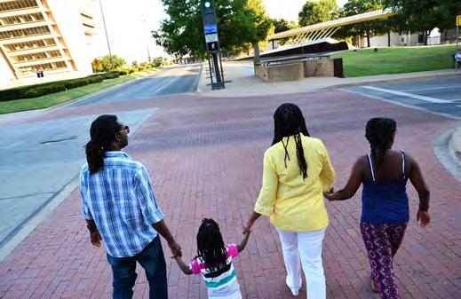
28 SOCIAL CONSIDERATIONS Social Considerations at a Glance: Mobility 2040 Supported Goals Ensure all communities are provided access to the regional transportation system and planning process. Encourage livable communities which support sustainability and economic vitality. Preserve and enhance the natural environment, improve air quality, and promote active lifestyles. Provide for timely project planning and implementation. Public Benefits of the Transportation System The transportation system provides residents in the North Central Texas region access to jobs, medical care, education, recreation, and cultural activities. Easy access to daily destinations and multiple transportation options contribute to the quality of life in a neighborhood, city, or region. In coordination with local governments and transportation partners, the North Central Texas Council of Governments aims to develop transportation infrastructure that is accessible to all. Although most North Central Texans choose to drive, it is crucial to provide other transportation choices. Opportunities to walk, take transit, or cycle are linked to healthy communities. Walking can improve the environment and personal health, reduce traffic congestion, enhance quality of life, and provide economic rewards and other benefits. 1 Mobility 2040 includes policies, programs, and projects that support a range of mobility options that can contribute to healthy, livable communities. By developing active transportation systems such as bicycle and pedestrian facilities, Mobility 2040 promotes physical activity and more equitable Engaging the public and addressing their needs is of utmost importance in any public planning process. The North Central Texas Council of Governments proactively seeks to educate North Central Texans and engage them in the transportation planning process. By 2040, over 10 million people are expected to call the region home. Meeting the mobility needs of today and tomorrow requires all stakeholders to coordinate and collaborate. Nondiscrimination also plays a vital role in the transportation planning process. Through public outreach and analysis, the Regional Transportation Council seeks to understand and address the needs of the North Central Texas community. In This Chapter: Regional Population and Employment Trends North Central Texas Population Profile Changes Cultural Trends Nondiscrimination Efforts Regional Environmental Justice Analysis Public Involvement Did You Know by the year 2040, the 12-county Metropolitan Planning Area is forecasted to grow to 10.7 million residents, a 48 percent increase in the North Central Texas population? job accessibility will increase for protected populations by 53 percent if the Mobility 2040 roadway and transit recommendations are built by the year 2040? Simple justice requires that public funds, to which all taxpayers of all races contribute, not be spent in any fashion which encourages, entrenches, subsidizes, or results in racial discrimination. John F. Kennedy, Pedestrian and Bicycle Information System, 2010,
29 Mobility communities. Additional information on healthy communities is found in the Environmental Considerations chapter. Considerations for healthy, livable, and sustainable communities should be integrated into the transportation planning process. This chapter analyzes the social impacts of the regional transportation system. The Environmental Considerations, Operational Efficiency, and Mobility Options chapters of Mobility 2040 recommend programs and projects that support healthy, livable, and sustainable communities for the existing and future residents of the region. Historical Population Growth In 2010, the 12-county Dallas-Fort Worth Metropolitan Planning Area had a population of approximately 6.4 million. 3 By the year 2040, these counties are forecasted to grow to 10.7 million residents. This expected growth represents a 67 percent increase in the population of North Central Texas over 30 years. Historical population growth is important to understanding where populations will grow in the future. Exhibit 3-1 shows the population distribution by county for 1990, 2000, and Regional Population and Employment Trends Regional population and employment trends and forecasts analyze where residents live, work, and carry out leisure activities, and predict where residents will do these things in the future. Transportation planners need this information in order to provide facilities and connections that meet the mobility and accessibility needs of existing and future populations. The region has added approximately 1 million people per decade since According to the US Census Bureau, the Dallas-Fort Worth-Arlington Metropolitan Statistical Area is the fourth most populous in the country and the most populous in the state. In 2014, the Metropolitan Statistical Area was also the second fastest growing area in the United States after the Houston region. 2 From 2010 to 2014, the region added nearly 400,000 residents. Forecasts project that these growth trends will continue through Several key demographics transportation planners must consider are the density, size, and profile of the population. These characteristics impact where transportation improvements will be needed in order to curb congestion and affect the land use-transportation connection. These two aspects are explored further in the Mobility Options chapter and the Sustainable Development portion of the Operational Efficiency chapter. Exhibit 3-1: Historical Population Growth by County, 1990 to 2010 MPA County Population Number Percent Number Percent Number Percent Collin 264, , , Dallas 1,852, ,218, ,368, Denton 273, , , Ellis 85, , ,610 2 Hood 28, , ,182 1 Hunt 64, , ,129 1 Johnson 97, , ,934 3 Kaufman 52, , ,350 2 Parker 64, , ,927 2 Rockwall 25, , ,337 1 Tarrant 1,170, ,446, ,809, Wise 34, , ,127 1 Totals 4,013, ,197, ,417, Source: US Census Data. The four urban counties Collin, Dallas, Denton, and Tarrant had a combined population of 5.6 million in 2010, or 88 percent of the 12-county population. This percentage share has remained stable since However, the individual population shares for Collin and Denton counties have increased while the Social Considerations 2 The Dallas-Fort Worth-Arlington Metropolitan Statistical Area is a Census designation that consists of Collin, Dallas, Delta, Denton, Ellis, Hunt, Johnson, Kaufman, Parker, Rockwall, Tarrant, and Wise counties US Census,
30 Social Considerations shares in Dallas and Tarrant counties have decreased. This change can be attributed to rapidly growing cities in Collin and Denton counties. Population Forecasts A population forecast is a projection of how many people will live in a certain area based on factors like past growth trends, development potential, and market demand. Mobility 2040 uses the North Central Texas Council of Governments 2040 demographic forecast to develop transportation recommendations. The year 2017 is used as a base year to compare population and employment growth expected to occur by Based on population forecasts for 2017 and 2040, the total population of the Metropolitan Planning Area (MPA) is projected to increase from 7,235,508 in 2017 to 10,676,844 in Exhibit 3-2 represents this 48 percent increase for the region and the growth by individual counties in the MPA. Exhibit 3-2: Forecasted Population Growth by County, 2017 to 2040 MPA County 2017 Population 2040 Population Growth Percent Growth Collin 951,795 1,560, ,626 64% Dallas 2,600,408 3,357, ,061 29% Denton 804,396 1,241, ,285 54% Ellis 163, , ,203 73% Hood 55,034 81,578 26,544 48% Hunt 87, ,022 43,743 50% Johnson 158, ,521 93,838 59% Kaufman 114, ,097 95,356 83% Parker 123, ,286 72,105 59% Rockwall 93, ,357 72,927 78% Tarrant 2,020,278 3,094,649 1,074,371 53% Wise 62, ,865 39,277 63% Totals 7,235,508 10,676,844 3,441,336 48% Source: NCTCOG 2040 Demographic Forecasts Tarrant County is projected to gain the most population just over one million residents between 2017 and Dallas, Collin, and Denton counties follow Tarrant County in terms of forecasted population growth in this timeframe. Kaufman County is projected to have the greatest percent increase in growth at 83 percent. Counties projected to grow by more than 50 percent include Collin, Denton, Ellis, Johnson, Kaufman, Parker, Rockwall, Tarrant, and Wise. Population Density In addition to population forecasts, population density is critical when planning transportation facilities. Denser areas may warrant more multimodal transportation infrastructure to ensure that residents are able to travel efficiently. In the four urban counties (Collin, Dallas, Denton, and Tarrant), population density is projected to increase from 1,848 to 2,681 people per square mile between the years 2017 and For the entire MPA, population density is projected to increase from 802 to 1,184 people per square mile. 4 Exhibits 3-3, 3-4, and 3-5 show the population density by county and by traffic survey zone between 2017 and Traffic survey zones are a geographic unit used for transportation planning. They are similar in size to Census block groups. People/Square Mile 4,500 4,000 3,500 3,000 2,500 2,000 1,500 1, Exhibit 3-3: Increase in Population Density by County, 2017 to Population density for the Dallas-Fort Worth MPA is calculated by dividing the total regional population by the area of the region; Exhibits 3-4 and 3-5 show population density by Traffic Survey Zone. Source: NCTCOG 2040 Demographic Forecasts 3-3 Mobility 2040
31 Mobility Exhibit 3-3 shows increases in population density by county. The counties with the greatest increases in people per square mile are Tarrant 1,258; Dallas 877; Collin 722; Rockwall 578; and Denton 491. In 2040, the five most densely populated counties in the MPA will be Dallas with 3,888 people per square mile; Tarrant with 3,622; Collin with 1,862; Denton with 1,394; and Rockwall with 1,319. Exhibit 3-5: Change in Population Density in the 12-County MPA, 2017 to 2040 Exhibit 3-4: Population Density in the 12-County MPA, 2017 and 2040 Historic Employment Growth North Central Texas is a major economic, social, and political center of both Texas and the United States. Job growth continues to flourish in the region and state. The North Central Texas region represents 30 percent of the state s gross domestic product. 5 The region is also home to 18 Fortune 500 companies. 5 From 2000 to 2013, the number of employed individuals in the region increased by 24 percent. The transportation system is central in supporting this growth because it allows for the efficient movement of people and goods. Understanding not only population growth, but employment growth, is critical to transportation planning and to providing the best system to move people to and from jobs. Social Considerations 5 North Texas Commission, 2015 Profile of North Texas,

32 Employment Forecast The North Central Texas Council of Governments forecasts employment growth to ensure that transportation facilities provide the region s residents with access to jobs. Employment within the 12-county MPA is projected to increase 46 percent from 4,584,235 jobs in 2017 to 6,691,449 jobs in During the same period, the average employment density in the region is projected to increase from 508 to 742 jobs per square mile. Exhibit 3-7: Employment Density in the 12-County MPA, 2017 and 2040 Social Considerations Employment growth in the MPA is shown in Exhibits 3-6, 3-7, and 3-8. The highest increase in the number of jobs is projected to occur in Dallas County with 1,050,448 new jobs for a growth rate of 49 percent. The second-highest increase is projected to occur in Tarrant County with 542,806 new jobs for a 45 percent increase. Hunt County is projected to have the highest rate of employment growth with a 54 percent increase. Exhibit 3-6: Forecasted Employment Growth by County, 2017 to 2040 County 2017 Employment 2040 Employment Growth Collin 542, , ,427 41% Dallas 2,147,027 3,197,475 1,050,448 49% Denton 298, , ,999 49% Ellis 68,913 96,872 27,959 41% Hood 23,703 29,448 5,745 24% Hunt 45,548 70,099 24,551 54% Johnson 75, ,198 29,746 39% Kaufman 46,312 64,040 17,728 38% Parker 62,665 80,404 17,739 28% Rockwall 39,879 53,372 13,493 34% Tarrant 1,196,521 1,739, ,806 45% Wise 37,651 47,224 9,573 25% Totals 4,584,235 6,691,449 2,107,214 46% Growth in the region s employment plays an important role in forecasting population. Regions with job growth retain current residents and attract new ones moving to the area for employment opportunities. Transportation planners use this information to forecast future revenue streams for transportation projects and determine areas that will need additional infrastructure. The region s employment forecasts show that employment opportunities will continue to grow, leading to long-term economic growth and vitality in North Central Texas. Source: NCTCOG 2040 Demographic Forecasts 3-5 Mobility 2040
33 Mobility Exhibit 3-8: Change in Employment Density in the 12-County MPA, 2017 to 2040 Asian, or Hawaiian/Pacific Islander, or who defines his or her ethnicity as Hispanic. Individuals may identify themselves both as one or more races and as Hispanic. To avoid double counting people, individuals who identify themselves as being part of the Hispanic ethnic group or who identify themselves as one of the races listed above and not Hispanic are included in the total minority population. The overall population in the region has increased nearly 160 percent, from 2.5 million people in 1970 to more than 6.4 million in During the same period, the minority population has increased more than 550 percent, from 500,000 in 1970 to over 3 million in Exhibit 3-9 illustrates changes in the region s racial and ethnic make-up over time. Exhibit 3-9: North Central Texas Population Change, 1970 to 2010 North Central Texas Population Profile Changes In a region that is demographically diverse, planners must consider how this diversity affects residents transportation needs. Demographic trends indicate that the region s population profile will change over time in terms of race, ethnicity, income, language, and age. The data source for the majority of the demographic data in Mobility 2040 is the 2013 American Community Survey 5-Year Estimates, the most recent dataset that included all the applicable data at the time Mobility 2040 was developed. 90% 80% 70% 60% 50% 40% 30% 20% 10% 0% Percent White Percent Minority Source: National Historic Geographic Information System. Today, the region is demographically diverse with a total minority population of just over 50 percent. Exhibit 3-10 illustrates the racial profile of the North Central Texas region in Social Considerations Changes in Race and Ethnicity Since the 1970s, both the overall population and minority population have increased dramatically in the region. Minority is defined as any person who identifies his or her race as African American, American Indian/Alaskan Native,
34 Social Considerations White Hispanic Exhibit 3-10: Population by Race and Ethnicity, 2013 African American Asian American Indian/Alaskan Native Hawaiian/Pacific Islander Other 15.4% 1.3% 0.2% 1.9% 26.8% 6.0% 48.4% Source: American Community Survey, Historically, the minority population has grown at a faster rate than the overall population. Based on patterns in birth rates and migration, this trend is expected to continue into the future. A growing number of MPA residents also have been born in foreign countries. The number of individuals who are not native to the United States and were born in a foreign country increased by 46 percent from 2000 to considered Limited English Proficient (LEP). Transportation planners are concerned with how to effectively engage LEP speakers in outreach. According to the American Community Survey results, the largest LEP language group in North Central Texas is Spanish-speaking individuals at almost 11 percent of the region s total population. When all other languages are included, approximately 13 percent of the total population has a limited ability to read, write, speak, or understand English. Exhibit 3-11 represents the percentage of LEP individuals by language group in the region. Exhibit 3-11: Limited English Proficiency by Language Group, 2013 Not LEP LEP Spanish LEP Asian Languages LEP Indo-European Languages LEP Other Languages 0.7% 1.7% 10.6% 0.3% 86.7% Changes in Income Income is an additional population indicator that must be considered when planning transportation facilities. Individuals or households with lower incomes may not have access to a working vehicle and must rely on other modes of transportation. Planners are particularly interested in individuals who fall below the poverty level established annually by the Department of Health and Human Services. From 2000 to 2013, the percent of the region s population that lives below the poverty level increased from approximately 11 percent to 15 percent. Changes in Language As North Central Texas continues to become a more diverse region, the number of non-english speaking residents will likely increase. People who identify their ability to read, write, speak, or understand English as less than very-well are Changes in Age Source: American Community Survey, Changes in age also are important for planners to consider, because different age groups can have different transportation needs. As people age, their travel behavior, preferences for housing location, and service needs may change. Exhibit 3-12 represents the age profile of North Central Texans. The distribution of age groups remained relatively stable from 1990 to 2010; however, the 65 and 3-7 Mobility 2040
35 Mobility over age group has grown by almost 48 percent between 2000 and 2013, although this group remains less than 10 percent of the total population. Under and Over Exhibit 3-12: Age Group Distribution, 2013 The North Central Texas Council of Governments strives to understand the current and future demographics of the region to provide an effective transportation system that meets the needs of a diverse region. Planners must understand the region s demographics to effectively engage the public or to understand how people travel. Current trends, historical census data, population projections, and economic factors are used to inform decision making. Cultural changes are also important to consider when developing infrastructure recommendations. Cultural Trends 24% 9% 22% National trends indicate that residents may be changing their preferences concerning where they live and work; they also show that young people are delaying driving. Although these trends are not as prevalent in North Central Texas as elsewhere, the trends will likely have some impact between now and 28% 17% Source: American Community Survey, The cultural trends discussed below have a direct or indirect impact on how residents may utilize the regional transportation system now and in the future. Increase in Telecommuting A report by the Census Department found that the percentage of US workers who work at least one day from home grew from 7 percent to 9.5 percent between 1997 and The percentage of US workers who worked the majority of their days from home increased from 3.6 percent to 4.3 percent between 2005 and In the North Central Texas region, the percentage of workers who worked the majority of their days from home grew from 4.3 percent in 2010 to 4.6 percent in Telecommuting can reduce demand on the transportation system and decrease the severity of peak-hour congestion. Preferences of the Baby Boomer Generation A 2012 national survey conducted by the American Planning Association found that while 39 percent of baby boomers between the ages of 50 and 65 currently live in a suburb where they have to drive to most places, only 7 percent want to live in that kind of suburb and 19 percent want to live in a suburb with walkable amenities. 7 Despite these stated preferences, researchers who compared national Census data to birth and death records found that members of the baby boomer generation actually left urban counties between 2000 and The majority of these baby boomers migrated to non-metropolitan counties that featured recreational opportunities and scenic amenities. Dallas County experienced a net loss of baby boomers between 2000 and 2010, while Tarrant County showed a small net increase of younger baby boomers. Rockwall, Kaufman, and Hood counties saw the greatest increase in baby boomers during the last decade. 8 Preferences of the Millennial Generation Millennials people born from 1980 to 1996 are delaying getting a driver s license. Nationally, the percent of 18-year-olds with driver s licenses fell from 80 Social Considerations 6 US Census 2012 Home-Based Workers in the United States, American Planning Association s 2014 Investing in Place 8 University of Wisconsin-Madison Applied Population Laboratory s 2013 Age-Specific Net Migration Estimates for US Counties,


36 Social Considerations percent to 61 percent from 1983 to Researchers have suggested many reasons for the drop, including a decrease in employment rates, an increase in the overall cost of driving, the availability of other modes of transportation, the THE TRUE COSTS OF TRANSPORTATION Most people consider housing costs to be the primary indicator of cost of living. However, transportation costs also make up a significant portion of household expenses. The Center for Neighborhood Technology (CNT) created the Housing and Transportation Affordability Index to measure affordability of an area based on the cost of housing, and the cost of transportation based on the location of the home. CNT has defined an affordable range for combined housing and transportation costs as consuming no more than 45 percent of household income. Based on the 2013 American Community Survey, the CNT estimates that the average amount households in the MPA spend on housing and transportation costs is 51 percent of their income. This is higher than Philadelphia, Seattle, and Houston; equal to Phoenix; and lower than San Diego. amount of time spent socializing via the Internet rather than in person, and the rate of young people attending school rather than working full time. 10 Millennials may also be driving less. A Federal Highway Administration study found that the number of miles traveled by young people fell in 2009 compared with 1995 and The miles traveled by young people also fell compared with other age groups in However, economic factors, including the recession, may be responsible for some of this drop. 11 In North Central Texas, Census data show that the percent of 16- to 19-year-olds traveling to work by carpool increased by about two percentage points from 2007 to 2013 following the recent recession. The percent of 16- to 19-year-olds driving to work alone decreased by about three percentage points in the same timeframe. A 2012 survey conducted by the American Planning Association found that people aged 21 to 34 ranked metropolitan features including schools, transit, and safe streets as their third-highest consideration when choosing a place to live, below the cost of housing and transportation, and below jobs and business growth. However, the percent of millennials in North Central Texas who choose commuting options other than driving alone is still very low compared with other metropolitan areas in the country. Preferences of Racial and Ethnic Groups As the number of minority and foreign-born residents in the region increases, the transportation system should be responsive to the needs of different cultural groups. However, the overwhelming majority of workers in the region commute to work via car, truck, or van regardless of race or ethnicity, as shown in Exhibit About 80 percent drive alone to work, and more than 10 percent carpool. Public transit is lightly used by groups in all counties; workers in North Central Texas are about as likely to walk to work as to take public transit. No broad trends emerge that demonstrate that one race or ethnicity prefers one mode of transportation Census Bureau s 2014 new Census Bureau statistics show how young adults today compare with previous generations in neighborhoods nationwide 10 Delbosc, A., and G. Currie Causes of Youth Licensing Decline: A Synthesis of Evidence. Transport Reviews 33: Mobility Federal Highway Administration s The Next Generation of Travel: Research, Analysis and Scenario Development. Accessed April 2015
37 Mobility Exhibit 3-13: Mode of Travel to Work by Race and Ethnicity, 2013 accountable for their actions and mandated that those agencies ensure their policies and practices were not discriminatory in nature. African-American American Indian Alaska Native Asian Hawaiian Pacific Islander Hispanic Non-Hispanic white Drove alone, car or truck Public transportation Taxicab, motorcycle, or bike Nondiscrimination Efforts Carpooled Walked Worked at home Source: American Community Survey. The North Central Texas Council of Governments (NCTCOG) and the Regional Transportation Council are committed to providing an equitable transportation system for all residents. Throughout the development of Mobility 2040, nondiscrimination and Environmental Justice principles were incorporated so that no person is excluded from participation in, denied benefits of, or discriminated against in planning efforts. NCTCOG seeks to understand the impacts of programs and activities on the region and Environmental Justice populations through assessment, analysis, and outreach efforts. NCTCOG holds nondiscrimination as a core principle in all efforts, including transportation planning. Several laws and regulations guide NCTCOG s Nondiscrimination/Environmental Justice Program. The first piece of nondiscrimination legislation that shapes NCTCOG s efforts is Title VI of the Civil Rights Act of Title VI stated that No person in the United States shall, on the ground of race, color, or national origin, be excluded from participation in, be denied the benefits of, or be subject to discrimination under any program or activity receiving Federal Financial Assistance. Title VI held all agencies that receive federal financial assistance The Environmental Justice Movement, as it is known today, started in the early 1980s when low-income and minority populations began to protest the siting of toxic waste landfills in their neighborhoods. These efforts culminated in the signing of Executive Order in 1994, which mandated federal agencies incorporate Environmental Justice principles into their activities. This has evolved from protecting community human health to include social and economic health. ENVIRONMENTAL JUSTICE is the fair treatment and meaningful involvement of all people regardless of race, color, national origin, or income with regard to the development and implementation of plans, policies, and programs. Under federal law, agencies must incorporate Environmental Justice into their activities. The three fundamental principles at the core of Environmental Justice are to: Avoid, minimize, or mitigate disproportionately high and adverse human health and environmental effects, including social and economic effects, on minority and low-income populations. Ensure the full and fair participation by all potentially affected communities in the transportation decision-making process. Prevent the denial of, reduction in, or significant delay in the receipt of benefits by minority and low-income populations. NCTCOG seeks, at a minimum, to meet all state and federal regulations relating to nondiscrimination; however, it is the goal of the agency to go above and beyond basic requirements to create a transportation system that is beneficial to all residents of the region. The following objectives guided the creation of Mobility 2040: Encourage community participation in the development of Mobility 2040, including traditionally underserved communities. Support data gathering and analysis of projects and programs to identify any potentially negative social, economic, health, or environmental impacts on communities. Seek to mitigate disproportionately high and adverse human health impacts when identified through analysis or public comment. Social Considerations
38 Social Considerations These goals are a reflection of NCTCOG s continual efforts to serve all members of the community throughout the transportation planning process. Mobility 2040 Policies Mobility 2040 supports the following nondiscrimination and public involvement polices: EJ3-001: Evaluate the benefits and burdens of transportation policies, programs, and plans to prevent disparate impacts and improve the decision-making process, resulting in a more equitable system. EJ3-002: Balance transportation investment across the region to provide equitable improvements. PI3-001: Meet federal and state requirements to ensure all individuals have full and fair access to provide input on the transportation decision-making process. PI3-002: Demonstrate explicit consideration and response to the public input received. PI3-003: Use strategic outreach and communication efforts to seek out and consider the needs of those traditionally underserved by the transportation planning process. NCTCOG s efforts to integrate nondiscrimination principles during planning involve three main components: Assessment: Identify the location of protected populations in the region. This serves as the first step in identifying potential impacts to protected populations. Analysis: Analyze the potential impacts of any project, policy, plan, or program recommendation. Staff should identify any disparate impacts of its decisions in the short- or long-term future. Outreach: Involve all population groups in plans or processes. The NCTCOG Title VI Program documents all nondiscrimination efforts the department undertakes. This document can be found at The following discussion and analysis focuses on specific efforts to support nondiscrimination in all transportation planning programs, policies, and activities. Identifying Protected Populations Executive Order states that agencies must collect, maintain, and analyze information on Environmental Justice populations located near sites that may have a substantial environmental or economic effect on nearby populations. The magnitude and scope of Mobility 2040 s recommendations require population patterns of the entire region be evaluated PI3-004: Enhance visualization of transportation policies, programs, and projects. PI3-005: Provide education to the public and encourage input and engagement from all residents on the transportation system and the transportation decisionmaking process. Integrating Nondiscrimination Principles into the Planning Process Nondiscrimination is an integral concern while planning and developing projects. NCTCOG strives to address the needs of protected populations (low-income and minority individuals) and assess the impacts of activities throughout the span of a project, from planning to implementation. Understanding how populations utilize the transportation system, coupled with the knowledge of demographic trends, helps planners design a system that will accommodate current and future needs. Mobility 2040 The first step in the process is to identify where the region s low-income and minority populations are located. These federally designated populations are referred to as Environmental Justice or protected populations and are defined in Exhibit 3-14.
39 Mobility Population Exhibit 3-14: Federally Designated Environmental Justice Population Definitions Black/African American Race American Indian/Alaskan Native Race Asian Race Native Hawaiian or Pacific Islander Race Hispanic Ethnicity Low-Income Definition A person having origins in any of the Black racial groups of Africa A person having origins in any of the original peoples of North and South America who maintain tribal affiliation or community attachment A person having origins in any of the original peoples of the Far East, Southeast Asia, or the Indian Subcontinent A person having origins in any of the original peoples of Hawaii, Guam, Samoa, or other Pacific Islands A person of Mexican, Puerto Rican, Cuban, Central or South America, or other Spanish culture or origin regardless of race A person whose household income is below the poverty line as determined by the US Department of Health and Human Services 2013 American Community Survey 5-Year Estimates. There is no critical EJI score; any thresholds should be determined by the particular project. Exhibit 3-15: Environmental Justice Index for the 12-County MPA The following groups also are considered throughout the planning process in order to meet the requirements of Title VI: People aged 65 years and older People with disabilities People who are Limited English Proficient Female head of household (any female-headed household with own children under age 18 present and no husband) Zero-car households Maps depicting the locations of these populations in the region are found in Appendix B. The Environmental Justice Index (EJI) is used by NCTCOG to aggregate lowincome and minority populations for analysis. Three variables, including percent below poverty, percent minority, and population density, are used to identify Census block groups with concentrations of minority and low-income populations. The resulting map can help planners easily identify populations for further analysis and examine how recommendations in Mobility 2040 affect protected populations. Exhibit 3-15 displays the EJI for the North Central Texas 12-county Metropolitan Planning Area. All calculations are based on the Regional Environmental Justice Analysis Nondiscrimination efforts are considered at multiple levels throughout the process, from the long-range plan to project implementation. Analysis is conducted at four levels to ensure no one population bears undue burdens of the transportation system and to provide a greater understanding of how the project will impact a community on a macro and micro level. Projects proceed through the four levels of Environmental Justice Analysis shown in Exhibit This section of Mobility 2040 analyzes Environmental Justice at the Metropolitan Transportation Plan level. Social Considerations
40 Exhibit 3-16: Levels of Environmental Justice Analysis during Transportation Project Development Process Social Considerations Analysis Scope Results Performance Indicators Metropolitan Transportation Plan (Mobility 2040) All projects proposed in Mobility 2040 on a regional level Impacts of proposed projects on regional mobility and accessibility Regional Priced Facilities All new priced facilities proposed in Mobility 2040 on a regional level Regional impacts on communities with the addition of all priced facilities Mobility 2040 has identified $118.9 billion in transportation projects spread over approximately 9,500 square miles. Because of the magnitude of projects to be analyzed, an Environmental Justice assessment of each project is infeasible. For this reason, the Travel Demand Model is used to perform a regional Environmental Justice Analysis on the entire transportation system proposed in Mobility One goal of Mobility 2040 is to make transportation options more available for people and goods. This is achieved through enhancing mobility and accessibility. Mobility is the ability for people and goods to travel from one place to another. Mobility can be affected by factors such as design, road capacity, or Intelligent Transportation Systems such as electronic toll collectors and dynamic message signs that inform drivers about traffic conditions. Accessibility describes how well the system provides access to locations and opportunities. Accessibility can be affected by factors such as the cost in time and dollars and the number of modal choices available to reach a location. 12 Six performance indicators that identify quality-of-life factors affected by accessibility and mobility are used to evaluate the Mobility 2040 recommendations. These performance indicators are shown in Exhibit 3-17, and National Environmental Policy Act Project/corridor-specific analysis Localized impacts on a community due to the construction and operation of a project, including noise and air quality concerns Construction/ Project Implementation Disadvantaged Business Enterprise and contractor requirements Job Opportunities Program, enhancing Environmental Justice community involvement and outreach the results of the Mobility 2040 evaluation are shown in Exhibits 3-18 through Exhibit 3-17: Environmental Justice Performance Indicators Accessibility Number of jobs accessible within 30 minutes by automobile* Number of jobs accessible within 60 minutes by transit* Population within 30 minutes to university and regional shopping center special generators Population within 15 minutes to hospitals Mobility Average level of congestion Average travel time *The travel time thresholds of 30 minutes by auto and 60 minutes by transit are based on regional travel patterns Metropolitan Transportation Plan Environmental Justice Analysis Methodology The Mobility 2040 recommendations were evaluated using the established performance indicators and demographic data from the American Community Survey (ACS) 5-Year Estimates. Beginning in 2010, the decennial 12 Accessibility-VS. Mobility-Enhancing Strategies for Addressing Automobile Dependence in the US, Handy, Mobility 2040
41 Mobility Census no longer reports income data. Moving forward, the North Central Texas Council of Governments EJI and Metropolitan Transportation Plan Environmental Justice Analysis will acquire this data from the most recent ACS estimates. The ACS data is based on a sample of the population and therefore has a larger margin of error than the decennial Census data. However, this is the most complete data available for this analysis. More information regarding data considerations can be found at The following four steps were used to complete the Environmental Justice Analysis for Mobility 2040: Step 1. Identified Protected Populations: Traffic survey zones with a percentage of low-income or total minority population above the regional average were identified as protected and zones are referred to as the EJ Aggregate Protected Class in the results. Traffic survey zones above the regional average for any single population listed in Exhibit 3-14 were also identified as protected. These results are documented in Appendix B. When a traffic survey zone is included as a protected zone, the entire population of the zone is considered protected for this analysis. Step 2. Calculated Performance Indicators: Protected traffic survey zones were compared to non-protected traffic survey zones for the identified performance indicators. A detailed description of how the performance indicators were calculated can be found in Appendix B. Step 3. Analyzed Network and Demographic Scenarios: The six performance indicators were compared across several scenarios that combined existing or planned transportation networks and current and future demographics: 2017 Current Network: Existing roadway and transit facilities with 2017 population Build Network: All roadway and transit facilities recommended in Mobility 2040 with 2040 demographics No-Build Network: Existing roadway and transit facilities with 2040 demographics Priced Facilities No-Build Network: 13 All roadway and transit facilities recommended in Mobility 2040, excluding new or expanded priced facilities, and 2040 demographics (results detailed in the Mobility Options chapter). Step 4. Compared Results: Current, Build, and No-Build scenarios were compared for protected and non-protected populations. The Current network forms the baseline for assessing the impacts of building the Mobility 2040 roadway and transit recommendations. Rerouting current facilities to remedy potential disparities between protected and non-protected groups is not a realistic option; therefore, Mobility 2040 compares the Current and Build scenarios to see the rate at which any disparities are being perpetuated in future plans. Comparing the Build and No-Build scenarios also establishes how effectively the transportation system increases job accessibility while controlling for population growth. The results are compared across the different scenarios to provide a complete picture of how changes in the transportation system impact mobility and accessibility in North Central Texas. Due to the rapid population growth that is forecast to continue through 2040, some of the performance indicators worsen even in the 2040 Build scenario. The primary purpose of the Regional Environmental Justice Analysis is to determine if the recommendations in the plan have a disproportionate or adverse impact on protected groups when compared to non-protected groups. The following discussion summarizes the results of the Environmental Justice performance indicators. Appendix B provides the detailed regional Environmental Justice Analysis results which includes performance indicator outcomes for the aggregate and individual protected populations. Environmental Justice Results The results of the Environmental Justice Analysis show that if built (2040 Build), the Mobility 2040 roadway and transit recommendations provide protected populations access to 3 percent more jobs by car and 78 percent more jobs by transit in the future when compared to the Current network. Overall, the protected population would have access to 53 percent more jobs if the Mobility 2040 recommendations are built, compared to a decrease of 6 percent if the recommendations were not built. Both protected and non-protected Social Considerations 13 Priced Facilities No-Build network excludes all priced facilities currently under construction and Comprehensive Development Agreements under contract for construction.
42 Social Considerations populations experience a much higher rise in the number of jobs accessible by transit compared to auto, likely due to increasing traffic congestion. Exhibit 3-18 reflects the number of jobs accessible for both protected and non-protected populations between the three scenarios. It is important to note that only fixedroute transit is included in this analysis such as rail and bus lines; the results do not include other transit options that exist in the region such as demandresponse services Exhibit 3-18: Job Access by Auto and Transit percent decrease. This can be attributed to current and future land uses and recommended transportation system improvements in the urbanized areas. The decrease in access to jobs for non-protected populations, especially in the auto analysis, can be attributed to increased regional congestion. Exhibit 3-19 displays congestion changes for protected and non-protected populations across the three scenarios. In the Current and Build scenarios, the protected populations experience more localized congestion than the non-protected population. This is likely because the majority of protected populations live close to the urban core where congestion tends to be worse. Congestion will worsen at a faster rate, however, for the non-protected populations in the No-Build scenario, likely due to increased growth outside of the urban core where the concentration of protected populations is lower. Exhibit 3-19: Localized Congestion Change across Transportation Scenarios Current to 2040 No-Build 0 Current Network 2040 Build 2040 No-Build Protected Acces by Auto Non-Protected Access by Auto Protected Access by Transit Non-Protected Access by Transit Current to 2040 Build However, if the transportation system remains as it is today, the expected increase in population will cause congestion to worsen for protected and nonprotected populations. This will result in a decline in the number of jobs accessible. Both groups experience a loss of mobility and accessibility from the Build to No-Build scenario. When comparing the impacts from the Current to No-Build scenarios, the nonprotected population sees a larger percent decline in access to jobs than the protected populations, with protected population experiencing an overall decrease of 6 percent and the non-protected populations experiencing a 38 0% 10% 20% 30% 40% 50% 60% 70% 80% Non-Protected Protected With increased congestion, the length of time to travel a set distance increases. To relate the localized congestion displayed above to everyday travel, the average trip time and length for each scenario was determined. An average mile per hour was calculated to determine the time it would take both protected and non-protected populations to travel 20 miles across all three scenarios. Twenty 3-15 Mobility 2040
43 Mobility miles was used as the threshold because it represents an average commute length in the Dallas-Fort Worth area. university or hospital for its expertise, it does provide access to basic needs and services. The results in Exhibit 3-20 are a direct reflection of how future transportation investments will be allocated. A large portion of planned projects are located in urbanized areas where the protected populations are primarily located. Therefore, travel time will increase at a faster rate for the non-protected populations than the protected populations in both the Build and No-Build scenarios Exhibit 3-20: Average Time in Minutes to Travel 20 Miles Current 2040 Build 2040 No Build Protected Non-Protected To determine accessibility to regional attractions, percent of populations within 30 minutes of special generators was calculated. For this indicator, a lower time threshold of 15 minutes is used for hospitals due to the critical nature of accessing emergency care. Results showed that over 90 percent of the protected population is 30 minutes from a university or regional shopping center. This trend remains relatively constant across all scenarios while it decreases across all scenarios for the non-protected population, as seen in Exhibit Hospital access is significantly higher for protected populations than non-protected populations across all three scenarios, as seen in Exhibit While the transportation system cannot account for the freedom of choice for a specific To assess the impacts of tolled and managed lane facilities recommended in Mobility 2040, the Priced Facilities No-Build Analysis was conducted. Results showed increased mobility and accessibility for protected populations with the addition of these priced facilities. The results and discussion of this analysis can be found in the Mobility Options chapter Exhibit 3-21: Percent of Population within 30 Minutes of a Special Generator (University or Regional Shopping Center) Protected Population- University Non-Protected Population- University Protected Population- Regional Shopping Center Current Build No Build Non-Protected Population- Regional Shopping Center Social Considerations
44 Exhibit 3-22: Percent of Population with in 15 Minutes of a Hospital Special Generator Performance Measure Exhibit 3-23: Environmental Justice Analysis Performance Results for EJ Aggregate Protected Population Compared to Non-Protected Population Population 2017 Current Network 2040 No-Build 2040 Build Protected 3,822,220 5,360,224 5,360,224 Percent Change (No-Build vs. Build) Social Considerations Protected Population - Hospital Non-Protected Population - Hospital Number of Jobs Accessible within 30 Minutes by Auto Number of Jobs Accessible within 60 Minutes by Transit Percent of Lane Miles Congested Non-Protected 3,413,288 5,316,620 5,316,620 Totals 7,235,508 10,676,844 10,676,844 Protected 678, , , % Non-Protected 497, , , % Difference 181, , ,414 Protected 1,406,226 1,486,495 2,499, % Non-Protected 876, ,486 1,751, % Difference 530, , ,980 Protected 45% 74% 64% -10% Non-Protected 43% 74% 60% -14% Difference 2% 0% 4% Current Build No Build Summary As a whole, the Mobility 2040 roadway and transit recommendations do not have disparate impacts on protected populations. Overall mobility and accessibility increase for the protected populations in the Build scenario. Exhibit 3-23 illustrates the overall results of the three main performance indicators for the EJ aggregated population compared to the non-protected population. Appendix B contains the complete methodology and results for all protected populations for the Environmental Justice Analysis Mobility 2040

45 PUBLIC INVOLVEMENT Introduction A proactive public participation process is vital to ensuring that the transportation planning process fosters meaningful involvement by all users of the system, including the business community, community groups, environmental organizations, freight operators, and the traveling public. Informing stakeholders of critical issues facing the region and providing opportunities to contribute ideas and offer input is important to developing a plan that represents a wide variety of interests and mobility needs without causing adverse effects in the natural and built environment. The overall objectives of the North Central Texas Council of Governments Public Participation Plan are that it be proactive and provide complete information, timely public notice, full public access to key decisions, and opportunities for early and continuing involvement. While federal laws and regulations provide some requirements for public involvement, NCTCOG strives to go beyond these requirements and provide a comprehensive program to ensure all residents of the region are provided an opportunity to participate in decision making and stay informed about efforts to plan a transportation system that will be accessible, financially viable, and sustainable. Facebook ad in English and Spanish The PUBLIC PARTICIPATION PLAN addresses the following: Public involvement requirements Timelines for public comment on various documents Environmental Justice Public notifications Public participation and coordination procedures for environmental documents Provisions for holding public meetings with abbreviated comment periods of no less than 72 hours and longer Provisions for inclement weather Title VI complaint procedures Language Assistance Plan Online comment opportunities Inclusion of technology in seeking feedback/comments Evaluation of public involvement strategies Public Participation Plan The NCTCOG 2015 Transportation Public Participation Plan guides how and when public involvement will be carried out based on decisions made by the Regional Transportation Council. Through its Language Assistance Plan, NCTCOG seeks to ensure all residents can provide input on transportation decisions regardless of their ability to read, write, speak, or understand English. The Language Assistance Plan analyzes four factors to identify LEP populations and determine how these individuals are served or are likely to be served by NCTCOG Transportation Department programs. To better provide access to the LEP population, several key documents are translated into Spanish, and Google Translate enables Website visitors to read basic translations of Transportation Department Webpages in 90 languages. Notices to the public about opportunities to provide input include


46 Social Considerations text in English and Spanish about how to request alternate formats and language translation. NCTCOG makes a reasonable effort to accommodate translation requests if members of the public provide sufficient notice. Public Involvement Strategies Public meetings and other opportunities for the public to provide input are held throughout the year. These events seek input on upcoming decisions by the Regional Transportation Council and inform the public of other planning activities. The NCTCOG Transportation Department NCTCOG Public Meeting maintains a database of individuals and groups wishing to receive notice of these events and informs them before every opportunity. NCTCOG also advertises in the Texas Register and in local and minority newspapers. Exhibit 3-24 lists the different types of media outlets that receive press releases announcing opportunities for public input and other news related to departmental programs and projects. Exhibit 3-24: Number of Media Outlets Receiving Press Releases Local newspapers/magazines (total) 117 Minority newspapers/magazines 11 Television stations (total) 14 Minority television stations 2 Radio stations 8 The Transportation Department also publishes monthly and semiannual newsletters, various technical brochures, and required planning documents each year. These are available to the public in both print and online formats. Fact sheets clearly and concisely explain projects and programs affecting the region, helping educate the public about topics such as transportation funding and air quality. These publications are listed in Appendix B. Providing information through the Internet is an important strategy for keeping the public informed, and the NCTCOG Website is updated regularly to ensure that accurate and timely information is available. The Transportation Department has joined social media networks and streaming video Websites to further expand opportunities to provide education and to make it easier to submit public comments. Online livestreaming of Regional Transportation Council meetings began in September Prior to that, video recordings were made available online the day following a meeting. Public meetings are recorded and posted online, allowing greater access and convenience for the public to learn about and provide input on plans. As the Transportation Department s online presence has grown, the department has sought to adapt its public involvement procedures to modern communication preferences. Online opportunities have presented a new way for the public and transportation partners to comment on routine items such as modifications, minor amendments, and administrative revisions to planning documents. These online opportunities are advertised in the same manner as public meetings and meet the comment period requirements outlined in the Public Participation Plan. The Transportation Department is able to better match content, strategies, and audiences by using this tool to inform the public about proposed minor changes to documentation. The Transportation Department participates in community events to educate the public on transportation and air quality initiatives and also hosts telephone town halls to provide a forum for discussion about topics related to regional transportation and air quality. As needed, print and online surveys are conducted to determine public awareness and/or sentiment with regard to certain planning issues. In addition, communication with the media serves as a strategy for disseminating information to UT-Arlington Earth Day the public via media releases or personal contact with reporters. The Transportation Department is also seeking to build networks of partners that will share information about transportation programs and the planning process with their members, stakeholders, and the broader public. By leveraging existing 3-19 Mobility 2040


47 Mobility networks of homeowner associations, business groups, and community organizations especially those that engage minority groups and individuals with low incomes, disabilities, or who are LEP NCTCOG is reaching greater numbers of people and more diverse audiences. priorities survey were translated into Spanish and advertised on Facebook. In addition, a Spanish-language flier was distributed to Pizza Patron restaurants and to some neighboring businesses located in ZIP codes with a high EJI score (50 or greater). Finally, visualization tools like animations, maps, renderings, and photos are used when possible online, in presentations, and in publications to increase understanding among all audiences. Visual elements can also be especially beneficial for LEP individuals. Public Involvement for Mobility 2040 A variety of strategies were used to encourage public participation during the development of Mobility Information about goals, demographic forecasts, financial constraints, involvement opportunities, air quality impacts, and overall development was featured in publications, on the NCTCOG Website, within social media, and in s sent to individuals who have expressed an interest in NCTCOG information. NCTCOG held public meetings and gave presentations to numerous community groups. During public meetings and outreach events, surveys were conducted to gather input on transportation priorities for Mobility These surveys were also available online and distributed through and social media. Exhibit 3-25 represents a Mobility 2040 infographic that was displayed at outreach events. Mobility 2040 survey flier in Spanish A considerable effort was also made to provide the Hispanic community opportunities to participate in Mobility 2040 development. The Mobility 2040 Website homepage and transportation In compliance with the Public Participation Plan, public meetings were held 60 days and 30 days prior to Regional Transportation Council approval of Mobility A list of public meetings and community events held where development of Mobility 2040 was discussed is included in Appendix B. A summary of public comments received for Mobility 2040 and official responses to those comments are also included in Appendix B. The 2016 Transportation Conformity document includes public meeting notices, meeting minutes, and comments for all public meetings that featured a Mobility 2040 or Conformity agenda item. Partner Coordination In addition to engaging the public, regional transportation and nontransportation partners were consulted as NCTCOG developed the policy, program, and project recommendations in Mobility Regional transportation partners include the Texas Department of Transportation, North Texas Tollway Authority, regional transit authorities, and environmental resource agencies. These partners were involved through committee, public, and project-specific meetings, phone calls, and other correspondence to coordinate long-range regional transportation efforts. Several transportation committees such as the Surface Transportation Technical Committee, Air Transportation Advisory Committee, Regional Freight Advisory Council, and the Bicycle and Pedestrian Advisory Committee lend expertise and help develop recommendations for the Regional Transportation Council to consider. The Regional Transportation Council guided staff s development of Mobility 2040 priorities and policies and is ultimately responsible for Bicycle and Pedestrian Advisory Committee Workshop approving and implementing Mobility Social Considerations

48 21Exhibit 3-25: Mobility 2040 Infographic Social Considerations Tribal Coordination NCTCOG recognizes the unique government-to-government relationship that the Federal Highway Administration has with Indian Tribal Governments. Exhibit 3-26 displays all the federally recognized tribes that have an interest in the North Central Texas region. NCTCOG coordinates with the Federal Highway Administration to reach out to Indian Tribal Governments to allow them the opportunity to participate in the transportation planning process. Tribal contacts receive all public input opportunity notices, as well as copies of the Mobility Matters newsletter, to keep them involved in transportation decision making and informed about transportation planning efforts and ongoing opportunities for input and involvement Mobility 2040
49 Mobility Exhibit 3-26: North Central Texas MPA Regional Tribal Interests American Indian Tribal Interests in Dallas-Fort Worth Metropolitan Planning Area (as of June 2015) Apache Tribe of Oklahoma Caddo Nation of Oklahoma Kialegee Tribal Town Kiowa Indian Tribe of Oklahoma The Delaware Nation Kickapoo Tribe of Oklahoma Mescalero Apache Tribe Tonkawa Tribe of Indians of Oklahoma Comanche Nation of Oklahoma Kickapoo Traditional Tribe of Texas Poarch Band of Creek Indians Wichita and Affiliated Tribes Transparent processes and opportunities for public involvement guide the development of a transportation plan that helps improve air quality while being multimodal and financially viable. NCTCOG actively sought the public s participation as it developed Mobility This process has guided recommendations that manage congestion, provide access to jobs and recreation, and contribute to a high quality of life for the residents of North Central Texas. Summary A transportation system must include transportation options for all residents of the region. Mobility is important to residents quality of life and to promoting economic vitality in the region. Therefore, the Regional Transportation Council seeks to ensure Mobility 2040 incorporates social considerations, and it thoroughly analyzes the impacts plan recommendations have on protected populations. Social Considerations
50 Environmental considerations
51 ENVIRONMENTAL CONSIDERATIONS Environmental Considerations at a Glance: Mobility 2040 Supported Goals Preserve and enhance the natural environment, improve air quality, and promote active lifestyles. Encourage livable communities that support sustainability and economic vitality. Develop cost-effective projects and programs aimed at reducing the costs associated with constructing, operating, and maintaining the regional transportation system. Introduction North Central Texas is not only economically and socially diverse, but it is also diverse in the environmental resources that millions of people rely on for clean air, water, and recreational opportunities. These resources are key not just for supporting quality of life for humans, but also for preserving essential habitat for wildlife. How and where the transportation system is built can negatively impact these environmental resources. Continued growth in North Central Texas could sustain or increase conflicts with air quality, water quality, wildlife habitats, the man-made (built) environment, and other resources. Therefore, the natural and built environments must be considered when planning and implementing transportation projects. Reducing the burden that transportation places on the environment through protecting, retaining, restoring, or enhancing the region s environmental assets is a goal of Mobility Healthy Communities Many factors influence the health of individuals and communities. These include income, education, physical environment, health services, social support networks, genetics, personal behavior, and gender. Transportation can impact these factors by affecting safety; air quality; and access to jobs, schools, Implementing infrastructure projects for a growing region is necessary. However, major infrastructure improvements such as highways and transit lines can negatively impact habitat and ecosystems. Similarly, many small improvements can have cumulative impacts on a scale larger than the size of individual projects. Making infrastructure more sensitive to wildlife and ecosystems through integrated planning and interagency cooperation is an initiative that promotes conservation priorities and sustainable uses and explores a variety of mitigation options. Mobility 2040 supports expediting the process to approve transportation projects while maintaining compliance with all applicable laws, safety, environmental health, and effective public involvement. In this Chapter: Healthy Communities Air Quality National Ambient Air Quality Standards and Ozone Nonattainment Status Comprehensive Air Quality Measures Air Quality Policies and Programs North Central Texas Natural Environment Climate Considerations Priority Ecosystems Governing Regulations Ecosystem Approach to Developing Infrastructure Projects Stakeholder Coordination Mitigating Transportation Impacts Environmental Scoring Did You Know since 2005, regional programs such as Dallas-Fort Worth Clean Cities has displaced over 134 million gasoline-equivalent gallons of fuel through the use of alternative fueled vehicles? a 57 percent reduction in nitrogen oxide emissions from on-road mobile sources is expected to occur between 2017 and 2040? Texas ranks second only to California in terms of overall biodiversity, which is a measure of the variety of plants, animals, and micro-organisms in an area?

52 Mobility health services, and community/recreational facilities. Strategically improving the transportation system can positively affect these factors and help improve the health of the community. The following sections discuss current health indicators for the counties in the Metropolitan Planning Area and efforts included in Mobility 2040 that support healthy communities. Public Health Indicators The Centers for Disease Control and Prevention monitors over 40 indicators that are important in understanding the health of communities. Results for each indicator are available at the county level and allow communities to compare their county to peer counties in the US that have similar demographic, population density, and household income characteristics. 1 Exhibit 4-1 summarizes how the 12 counties within the Metropolitan Planning Area perform in comparison to peer counties using eight indicators that can be affected by transportation: 1) access to parks, 2) unhealthy fine particulate matter (PM2.5) days, 3) unhealthy ozone days, 4) adult obesity, 5) motor vehicle deaths, 6) unintentional injury (including motor vehicle), 7) unemployment, and 8) living near highways. Appendix C shows more specific information on each indicator by county. In general, counties within the Dallas-Fort Worth Metropolitan Planning Area show the region is performing the same or better than peer counties. Exhibit 4-1: Public Health Indicators by County Environmental Considerations 1 Centers for Disease Control Community Health Status Indicators Website,
53 Environmental Considerations Supporting and Promoting Healthy Communities The way people travel impacts their quality of life in many ways. Reducing the use of motor vehicles, which contribute pollution to the air, promotes healthy communities. Lowering the number of cars and trucks on roadways can help lessen congestion and improve safety. Improving roadway design to accommodate bicycles and pedestrians can help reduce accidents and injuries. Opportunities to use transit, to walk, or to bicycle instead of driving are linked to healthy communities. For example, walking whether for utilitarian or recreational purposes can help improve personal health, reduce traffic congestion, and reduce travel costs. The Centers for Disease Control and Prevention Health Impact Assessment 2 identifies six transportation strategies to improve health: 1) reduce vehicle miles traveled, 2) expand public transportation, 3) promote active transportation, 4) incorporate healthy community design features, 5) improve safety for all users, and 6) ensure equitable access to transportation networks. All nine of the We know that the transportation choices we make play an important role in building and maintaining healthy communities. For example, safer roadways and traffic patterns reduce crashes. Streets where walkers and bikers are protected from motor vehicles encourage people to get more exercise as part of their daily routines. Increasing the transportation options available in a community helps reduce congestion and air pollution even as it ensures that communities have access to necessary services like fullservice grocery stores and doctors' offices. Former Transportation Secretary Ray LaHood goals for Mobility 2040, as well as numerous policies, programs, and projects, help support these strategies and promote healthy communities by improving mobility, quality of life, and sustainability (see Exhibit C-1 in Appendix C). Exhibit 4-2 identifies sections within this document that highlight these efforts. Exhibit 4-2 Chapter Sections Strategy Section Chapter Reduce vehicle miles traveled Travel Demand Management Transportation System Management and Operations Operational Efficiency Operational Efficiency Expand public transportation Public Transportation Mobility Options Promote active transportation Active Transportation Mobility Options Incorporate healthy community design features Improve safety for all users Comprehensive Air Quality Measures Ecosystem Approach to Developing Infrastructure Projects Sustainable Development Transportation System Safety Transportation System Security Ensure equitable access to transportation networks Nondiscrimination Efforts Environmental Considerations Environmental Considerations Operational Efficiency Operational Efficiency Operational Efficiency Social Considerations Air Quality The negative impacts of poor air quality on health are of high concern in North Central Texas. Air quality is vital to a community s overall quality of life, but the negative impacts of polluted air can more adversely affect sensitive populations such as children and the elderly. For example, a 2012 update to the Community- Wide Children s Health Assessment and Planning Survey by Cook Children s Hospital profiled children aged 0 to 14 in six North Central Texas counties. The survey found that 18.1 percent of these children, or approximately 110,000, had 2 Transportation Health Impact Assessment Toolkit, 2011, Mobility 2040
54 Mobility asthma. 3 While regional air quality has improved in recent years, it must continue to improve to further benefit both people who have asthma or respiratory problems and those who could also experience health effects when exposed to air pollution. The region s economic generators both produce air pollution and suffer from its effects. North Central Texas is a leader in global and domestic trade (for further discussion, see the Freight section in the Mobility Options chapter). This trade, while creating approximately 20 percent of the region s employment, has serious implications for regional air quality. Generally, the trucks and trains employed in goods movement are fueled by diesel and, therefore, are major contributors to air pollution. Failure to meet federal standards for air quality could result in additional emission control requirements that negatively affect local businesses. It may also result in a freeze on all federally funded transportation projects, costing the region millions of dollars in federal transportation funding and ultimately affecting jobs in the region. Because the transportation sector is a significant source of air pollutants, the North Central Texas Council of Governments (NCTCOG) monitors air quality impacts attributable to transportation, and administers several programs to improve air quality in the region. National Ambient Air Quality Standards and Ozone Nonattainment Status The federal Clean Air Act requires the United States Environmental Protection Agency (EPA) to set national ambient (outdoor) air quality standards for air pollutants that are considered harmful to public health and the environment. These pollutants are referred to by the EPA as criteria pollutants and include carbon monoxide, nitrogen oxides, ground-level ozone, sulfur dioxide, particulate matter, and lead. Each county in the nation is assessed according to the standards for each criteria pollutant. An area with attainment status has pollutant concentrations within the limits established by the EPA as being protective of human health and the environment. An area with nonattainment status has pollutant concentrations that exceed those limits. Based on the magnitude of a pollutant in a given area, the EPA classifies counties into one of the following categories, listed in order of increasing severity: marginal, moderate, serious, severe 15, severe 17, and extreme. Most NCTCOG air quality efforts focus on ozone, which is the only transportation-related National Ambient Air Quality Standards (NAAQS) for which the region is designated in nonattainment. Ground-level ozone pollution is caused by a photochemical reaction of volatile organic compounds and nitrogen oxides, which are known as ozone precursors, in the presence of sunlight and heat. The first nonattainment designation affected four counties in the region and was made in 1991 under the 1-hour ozone standard. The Clean Air Act requires the EPA to reevaluate criteria pollutant standards every five years, and the ozone NAAQS and nonattainment designations have changed several times. The standards have become more stringent, and additional counties have been added to the region s nonattainment area. Under the most recent EPA ozone standard, the ten counties shown in Exhibit 4-3 are classified as moderate nonattainment for the hour ozone standard and must reach attainment by December 31, Exhibit C-2 in Appendix C presents the timeline of changes to the EPA s Ozone Standard and the implications for the North Central Texas region. The timeline illustrates how, as the Ozone Standard gets lower, more counties in the region are impacted. Despite making significant strides toward improving air quality, the region faces challenges in meeting increasingly stringent air quality standards. Exhibit 4-4 illustrates progress in reducing ambient ozone concentrations since 1998 for the 1997, 2008, and hour ozone standards. Air Quality Conformity The goal of the North Central Texas Council of Governments air quality programs is to achieve healthy air quality for North Texas residents and the environment by meeting and maintaining federally mandated standards for all air pollutants. NCTCOG participates in a cooperative, collaborative process with local, state, and federal agencies to improve air quality across the region. This partnership includes close coordination as the Texas Commission on Environmental Quality Environmental Considerations 3 Cook Children s Community-Wide Children s Health Assessment and Planning Survey, 2008,
55 Environmental Considerations develops the State Implementation Plan (SIP). The SIP, a regional air quality plan required by the Clean Air Act, outlines how ozone concentrations will be reduced in the nonattainment area to a level that complies with the federal standard. Exhibit 4-3: Metropolitan Planni ng Area Boundary and Hour Ozone Nonattainment Area improvement programs; or projects, programs, and policies identified in transportation plans. As part of the conformity analysis, a motor vehicle emission budget test is usually conducted if EPA-approved motor vehicle emission budgets are applicable at the time of analysis. The conformity analysis does not measure ozone directly, but instead measures ozone precursors: volatile organic compounds (VOC) and nitrogen oxides (NOX). Budgets for NOX and VOC are established in the regional SIP. Under the motor vehicle emission budget test, vehicle emissions for each analysis year must be less than the applicable air quality budgets. Exhibit 4-4: 8-Hour Ozone Trend Line, 1998 to 2015 In North Central Texas, the Regional Transportation Council (RTC) has taken a proactive role in helping the Texas Commission on Environmental Quality revise the SIP for the region. NCTCOG assists with air quality technical planning and implements control strategies at the local level to enhance federal and state efforts. Numerous other stakeholders throughout the region, including local governments and business coalitions, also support this process and facilitate local implementation. The federal government requires projects and programs in nonattainment areas, including North Central Texas counties with ozone nonattainment status, to be analyzed for transportation conformity in order to be approved and implemented. Transportation conformity air quality analysis must be conducted on federally funded projects; projects requiring federal approval; transportation 1 Attainment Goal - According to the US EPA National Ambient Air Quality Standards, attainment is reached when, at each monitor, the Design Value (three-year average of the annual fourth-highest daily maximum 8-hour average ozone concentration) is equal to or less than 75 parts per billion (ppb). *Data not certified by the Texas Commission on Environmental Quality Source: NCTCOG A conformity determination is a two-step process in metropolitan areas. First, the RTC, as the policy body of the region s Metropolitan Planning Organization, is responsible for conducting the local-level transportation conformity determination for the North Central Texas counties that are designated as nonattainment. Second, the Federal Highway Administration and Federal Transit Administration make a federal-level transportation conformity determination. Only after receiving this federal determination can the region s long-range transportation plan and Transportation Improvement Program be implemented. 4-5 Mobility 2040


56 Mobility Upon favorable federal conformity determination, a four-year window begins during which projects, programs, and policies identified in the Metropolitan Transportation Plan and Transportation Improvement Program may move toward implementation. Transportation development projects may only move forward if the Metropolitan Transportation Plan and Transportation Improvement Program achieve federal approval. The vehicle emission results documented in the 2016 Transportation Conformity document demonstrate that the ten-county Dallas-Fort Worth ozone nonattainment area meets the regional air quality conformity requirements of the budget test. The conformity analysis results are shown in Exhibits 4-5 and 4-6. and pedestrian facilities, traffic signal improvements, high-occupancy vehicle lanes, and park-and-ride facilities, together with other elements of the RTC Air Quality Program, were instrumental in meeting both NOX and VOC budgets in analysis year With RTC initiatives, NOX and VOC emissions for 2017 were reduced by an additional 2.60 and 0.66 tons per day, respectively. The magnitude of emission reductions resulting from RTC initiatives demonstrates the region s commitment to and effectiveness at reducing vehicle emissions. Exhibit 4-6: Dallas-Fort Worth Ozone Nonattainment Area Air Quality Conformity Analysis Results: Emissions of Volatile Organic Compound Exhibit 4-5: Dallas-Fort Worth Ozone Nonattainment Area Air Quality Conformity Analysis Results: Emissions of Nitrogen Oxide 1 Source: Environmental Protection Agency Notice of Adequacy Status of the Dallas-Fort Worth, TX Reasonable Further Progress 8-Hour Ozone Motor Vehicle Emission Budgets for Transportation Conformity Purposes; 81 FR 1184, Attainment Goal - According to the US EPA National Ambient Air Quality Standards, attainment is reached when, at each monitor, the three-year average of the annual fourth-highest maximum 8-hour average ozone concentration is equal to or less than 75 parts per billion (ppb) The Clean Air Act identifies certain transportation strategies as Transportation Control Measures, which are highly effective at reducing transportation emissions. RTC initiatives, including Transportation Control Measures like bicycle 1 Source: Environmental Protection Agency Notice of Adequacy Status of the Dallas-Fort Worth, TX Reasonable Further Progress 8-Hour Ozone Motor Vehicle Emission Budgets for Transportation Conformity Purposes; 81 FR 1184, The results of the conformity determination demonstrate that Mobility 2040 meets the specific transportation air quality conformity requirements of the Clean Air Act (42 USC 7504, 7506(c) and (d)) and amendments, the applicable revision to the air quality plan (2015 Reasonable Further Progress SIP, including the approved 2017 Motor Vehicle Emissions Budgets), and the transportation conformity rule (40 CFR Parts 51 and 93). This conformity determination was approved by the RTC in March 2016 and is anticipated to be approved by the Federal Highway Administration and the Federal Transit Administration in June For additional transportation conformity information, refer to the 2016 Environmental Considerations
57 Environmental Considerations Transportation Conformity document. 4 This document, once approved, will be evaluated according to the same process. Comprehensive Air Quality Measures The programs and policies supported by Mobility 2040 not only seek to improve the efficiency of the transportation system, which in turn improves air quality, but also serve to reduce petroleum use. According to the Federal Highway Administration, the consumption of petroleum fuels by the transportation sector has increased 86 percent since While the average fuel efficiency of motor vehicles has increased over time, so has the overall number of miles driven. Vehicle miles traveled are forecasted to grow from approximately 206 million miles per year in 2017 to 320 million miles per year in 2040, translating to a continued strong demand for traditional petroleum fuels. While technologies such as electric vehicles and the increased availability of alternative fuels will provide options to reduce petroleum consumption and promote energy conservation, local strategies and programs are important to encourage faster fleet turnover and alternative fuel adoption, as well as to reduce vehicle miles traveled. Greenhouse Gases Greenhouse gases (GHG) trap heat in the atmosphere and create a naturally occurring warming phenomenon called the greenhouse effect. With human activities and the increased burning of fossil fuels that produce GHGs such as carbon dioxide (CO2) and methane, the atmosphere is trapping more heat, further warming the atmosphere. This warming may affect the built and natural environment in ways that are potentially broad reaching and unpredictable at a regional level. The North Central Texas region could experience changes in precipitation levels, impacts to human health, and impacts to natural ecosystems. A more detailed discussion of this phenomenon and the potential implications for our region can be found in the Asset Management section in the Regional Performance chapter. Some GHGs occur naturally in the atmosphere, while others result from human activities. Naturally occurring GHGs include water vapor, CO2, methane, nitrous oxide (N2O), and ozone. Certain human activities associated with transportation, however, add to the levels of most of these gases: CO2 is released to the atmosphere when fossil fuels (oil, natural gas, and coal) are burned. Methane is emitted during the production and transportation of coal, natural gas, and oil. N2O is emitted during combustion of fossil fuels. GHGs that are not naturally occurring include chlorofluorocarbons and hydrofluorocarbons, which are by-products of foam production, refrigeration, and air conditioning; and perfluorocarbons, which are generated by industrial processes. In the United States, however, transportation is second only to electricity generation as a source of greenhouse gas emissions. 6 According to the EPA, in 2013, transportation activities accounted for 33 percent of CO2 emissions from fossil fuel combustion. 7 As Exhibit 4-7 shows, CO2 emissions from the transportation sector have increased nationwide from 1973 to Periods of decline in CO2 emissions are evident; however, it is likely that transportation will remain a large contributor of greenhouse gas emissions in the US in the near term. Currently, scientists are unable to determine which parts of the US will become wetter or drier as the atmosphere warms, but the overall trend is expected to include increased precipitation and evaporation, more intense rainstorms, and drier soils. While the impacts on the North Central Texas region are currently unknown, they are important to consider in the context of infrastructure design and future maintenance needs. For example, changes in temperature and precipitation over time could impact flooding of roads and increase maintenance associated with weather events. Research has shown that an increase in average North Central Texas Council of Governments, 2016, Transportation Conformity, 5 US Department of Transportation Federal Highway Administration, Office of Highway Policy Information, Our Nation s Highways: 2011, Mobility US Department of Transportation, 7 US Environmental Protection Agency, Inventory of U.S. Greenhouse Gas Emissions and Sinks: , Chapter-Executive-Summary.pdf

58 Mobility temperatures could exacerbate ozone issues 8 and make it more difficult to attain federal ozone standards Exhibit 4-7: Total Energy Transportation Sector Carbon Dioxide Emissions greenhouse gases and CO2, and are providing resources to support mitigation and adaptation activities to preserve transportation infrastructure. More details are available in the Asset Management section of the Mobility Options chapter. Exhibit 4-8 displays per capita on-road transportation emissions of CO2 for the region s counties that are in nonattainment. As shown, these emissions will decline by nine pounds per day per person from 2017 to Million Metric Tons of CO Exhibit 4-8: On-Road Transportation CO 2 Emissions (per Capita), 2017 to Year Adapting the transportation system to these potential changes is an initiative that is emerging at the federal transportation level. Adaptation planning could include strategies such as: Planning evacuation routes Relocating at-risk infrastructure and communities Adjusting the design life of future roadway construction due to environmental changes The Federal Highway Administration has issued initiatives and guidance suggesting that climate change goals may be required in the future. As federal and state agencies issue further guidance, the region may need to consider planning and selecting regional projects based on their ability to reduce greenhouse gases, particularly CO2. NCTCOG and other regional partners are anticipating these requirements and are proactively evaluating many transportation and air quality projects for their impact on pollutants, including Source: North Central Texas Council of Governments emission inventories developed for 2016 Transportation Conformity Mobile Source Air Toxics In addition to the criteria air pollutants for which there are NAAQS, the Environmental Protection Agency also regulates air toxics. Mobile Source Air Toxics (MSAT) are a subset of the 188 air toxics defined by the Clean Air Act. Most air toxics originate from human-made sources including on-road mobile sources (highway vehicles), non-road mobile sources (airplanes and construction Environmental Considerations 8 Intergovernmental Panel in Climate Change, The Regional Impacts of Climate Change,
59 Environmental Considerations equipment), area sources (dry cleaners), and stationary sources (factories and refineries). Some toxic compounds are present in fuel and are emitted into the air when fuel evaporates or passes through an engine unburned. Other toxics are emitted from the incomplete combustion of fuels or as secondary combustion products. Metal air toxics also result from engine wear or from impurities in oil or gasoline. Exhibit 4-9 shows that national MASAT emissions are expected to decline drastically over time, even while vehicle miles traveled dramatically increase. Reductions in MSAT emissions can be attributed to the use of cleaner fuels and more efficient engines. Emissions (Tons/Year) 140, , ,000 80,000 60,000 40,000 20,000 0 Exhibit 4-9: National MSAT Emission Trends, 2010 to 2050, for Vehicles Operting on Roadways 9 Acrolein Butadiene Formaldehyde Polycyclics Benzene Diesel PM Naphthalene VMT VMT (Trillions/Year) Air Quality Policies and Programs Regional planning factors such as increasing mobility, supporting economic vitality, enhancing the environment, promoting energy conservation, and improving the quality of life also address air quality impacts. Many programs, policies, and projects described in other chapters of this document improve air quality by increasing efficiency in the transportation system. The following efforts are among those that reduce transportationrelated emissions: Mitigating congestion caused by vehicle incidents. Reducing the number of vehicles driven by individual commuters through the use of alternative transportation options or technology advancements. Improving roadway design to facilitate traffic flow. These strategies are discussed in the Operational Efficiency chapter. Many of these programs and projects are included as voluntary control strategies in the region s SIP. These strategies improve how the transportation system operates but have a secondary benefit for air quality. DALLAS-FORT WORTH CLEAN CITIES COALITION (DFWCC), which was established in 1995, became one of the first Clean Cities established under an Energy Policy Act provision for an organization that promotes the use of alternative fuels and advanced vehicle technologies to lessen American dependence on foreign sources of petroleum. DFWCC collaborates with local fleets in both the public and private sectors to increase the use of alternative fuels and advanced technology vehicles, improve fuel economy and the use of technologies that reduce idling, and reduce vehicle miles traveled. To support the national Clean Cities goal of reducing 2.5 billion gallons of petroleum by 2020, DFWCC has a target of reducing petroleum consumption among local fleets by 15 percent each year; this is documented in the DFWCC Annual Report FHWA, 2013, s.cfm Mobility 2040

60 Mobility In addition, the RTC has instituted many programs and policies with the primary goal of improving air quality. NCTCOG is responsible for coordinating air quality planning in the federally classified nonattainment area. As the majority of ozoneforming emissions can be attributed to mobile sources and other transportationrelated activities, NCTCOG and other stakeholders, including local governments and various public and private associations and coalitions, have taken a proactive approach toward improving regional air quality. These stakeholders have implemented policies and programs to support and enhance federal and state planning efforts intended to reduce emissions and air quality impacts. A wide variety of programs seek to reduce NOX, VOC, and other criteria pollutant emissions by expediting the use of advanced technologies, as well as implementing demonstration programs to study the feasibility of control measures that could be used across the region. AIR QUALITY EMPHASIS AREAS: NCTCOG air quality programs generally address one or more of the following emphasis areas: High-Emitting Vehicles/Equipment: An estimated 10 percent of the region s vehicles are contributing up to 50 percent of the pollution. Low Speeds: Vehicles operating at lower speeds release more emissions because their engines are not operating under optimal conditions. Idling: Vehicle idling increases pollutant emissions through unnecessary and incomplete fuel combustion that occurs while an engine is not operating at an optimal temperature. Vehicle Miles Traveled: In a metropolitan area with a large, growing population, reducing the total vehicle miles traveled is an important component of improving air quality. Energy and Fuel Use: Use of alternative fuel vehicles can reduce ozone-forming emissions and decrease petroleum consumption, helping both air quality and energy security. Integration of other advanced energy technologies, such as high-efficiency lighting and solar energy, can help ensure that the system operates optimally while conserving energy and helping reduce power plant emissions. Cold Starts: Vehicles emit a greater amount of pollutants during the first few minutes after ignition because the engine has not yet reached optimal operating temperature. Frequent and shorter trips increase the magnitude of this problem. Hard Accelerations: Operating a vehicle in ways that require greater engine power, such as hard or jackrabbit accelerations, consumes more fuel and emits more pollutants. AIR NORTH TEXAS is an outreach campaign created to educate North Texans on simple things they can do in their everyday lives to improve air quality. In 2010, the campaign created and began celebrating Clean Air Action Day. This annual event reminds North Central Texans to try something new in their lives to reduce emissions, such as taking transit, bringing their lunch to work, or combining errands. The goal is for individuals to continue these activities all year, or at least during Ozone Season. Clean Air Action Day is held on the first Friday of summer. NCTCOG staff also make policy recommendations, participate in partnerships, and provide support for other stakeholders who are working to reduce emissions. Exhibits 4-10 and 4-11 illustrate the total number of activities and total funding awarded to local fleets through competitive funding programs for the 2006 to 2014 period. Exhibit 4-10: Vehicle/Equipment/Technology Activities Awarded through Competitive Calls for Projects, 2006 to 2014 Total Number of Activities Awarded: 1,909 Environmental Considerations

61 Exhibit 4-11: Total Grant Funding Awarded through Competitive Calls for Projects, 2006 to 2014 AQ3-002: Provide technical assistance and analysis to attain and maintain National Ambient Air Quality Standards and reduce negative impacts of other air pollutants. Environmental Considerations AQ3-003: Support and implement educational, operational, technological, and other innovative strategies that improve air quality in North Central Texas, including participation in collaborative efforts with local, regional, state, federal, and private sector stakeholders. AQ3-004: Support and implement strategies that promote energy conservation, reduce demand for energy needs, reduce petroleum consumption, and/or decrease greenhouse gas emissions. F3-002: Incorporate sustainability and livability options during the project selection process. Include additional weighting or emphasis as appropriate and consistent with Regional Transportation Council policy objectives including, but not limited to, demand management, air quality, natural environment preservation, social equity, or consideration of transportation options and accessibility to other modes (such as freight, aviation, bicycle, and pedestrian). (While this is listed as a financial policy, it has specific implications for the air quality portion of the plan.) Total Grant Funding Awarded: $48,722,584 Numerous communication strategies help explain the importance of these measures to stakeholders and the public, including Air North Texas, education programs, and the outreach components of many strategies. This comprehensive approach to reduce emissions will become increasingly important as the region balances population and economic growth with the need to continue to improve air quality. All air quality policies, programs, projects, and maps are included in Appendix C. The programs and policies of Mobility 2040 support the following air quality policies: AQ3-001: Pursue successful transportation conformity determinations of the Metropolitan Transportation Plan and Transportation Improvement Program consistent with federal and state guidelines. AIRCHECKTEXAS DRIVE A CLEAN MACHINE VEHICLE REPAIR AND REPLACEMENT ASSISTANCE PROGRAM offers financial aid to owners of vehicles that fail the emissions portion of the annual state inspection. Owners may use the money to repair or replace their vehicle. To date, the program has retired 31,002 vehicles and repaired 32,244, paying a total of over $91 million to participating dealers and more than $18 million to registered emissions repair facilities. Mobility 2040 supports the following air quality programs: AQ2-001: Air Quality Communication Program AQ2-002: Air Quality Demonstration Program AQ2-003: Air Quality Enforcement Program AQ2-004: Air Quality Partnerships and Collaborations 4-11 Mobility 2040
62 Mobility AQ2-005: Air Quality Regional Policies AQ2-006: Air Quality Technology Improvements AQ2-007: Air Quality Technical Planning and Analysis North Central Texas Natural Environment Considering the natural environment is important when developing transportation plans and projects. Open spaces such as parks are key components for maintaining quality of life and healthy communities in North Central Texas. Open space maintained in its natural state also provides habitat for wildlife and helps maintain healthy water quality for people and wildlife. A transportation planning process that assesses and integrates conservation priorities will produce transportation projects that are sensitive to high-priority environments in the region that better support healthy communities and habitats, and that foster a high quality of life for all residents. Natural Environment Policies and Programs Mobility 2040 supports the following environmental resource policies: ER3-001: Protect, retain, restore, or enhance the region s environmental assets during planning and implementation of transportation programs and projects. ER3-002: Work cooperatively with regulatory and conservation partners to develop innovative approaches that meet their conservation priorities and facilitate the delivery of transportation projects. ER3-003: Encourage transportation programs and projects that provide appropriate access to the natural environment to support healthy lifestyles. F3-002: Incorporate sustainability and livability options during the project selection process. Include additional weighting or emphasis as appropriate and consistent with Regional Transportation Council policy objectives including, but not limited to, demand management, air quality, natural environment preservation, social equity, or consideration of transportation options and accessibility to other modes (such as freight, aviation, bicycle, and pedestrian). (While this is listed as a financial policy, it has specific implications for the environmental resources portion of the plan.) Mobility 2040 supports the following environmental resource program: ER2-001: Environmental Data Collection and Resource Agency Consultation Program Climate Considerations Transportation planners must adapt to increasing variability in the planet s climate. The US Department of Transportation has identified several ways weather variability may affect transportation systems. More severe or frequent flooding may threaten low-lying infrastructure. Higher temperatures may degrade paved surfaces or cause rail tracks to buckle. Severe weather may lead to more auto accidents and more delays for aircraft passengers. 10 The Federal Highway Administration has provided tools to help Metropolitan Planning Organizations assess the vulnerability of their transportation systems. The Federal Highway Administration encourages transportation planners to consider their systems resilience and sustainability early in the decision-making process. 11 Additional information on infrastructure resiliency can be found in the Operational Efficiency chapter. Priority Ecosystems Texas is home to a variety of natural environments that provide recreation for the state s residents and habitat for wildlife. The state ranks second only to California in terms of overall biodiversity, which is a measure of the variety of plants, animals, and micro-organisms in an area. 12 However, the state s unique natural environments face many threats. The Texas Parks and Wildlife Department (TPWD) has identified population growth as a significant challenge Environmental Considerations 10 US Department of Transportation, Climate Adaptation Plan 2014, Plan.pdf 11 Federal Highway Administration, Building Climate Resilient Transportation, t_brochure.pdf 12 NatureServe s 2002 State of the Union: Ranking America s Biodiversity


63 to conservation. 13 The state s growing population requires more development and more transportation infrastructure, placing a greater demand on water supplies, decreasing or fragmenting habitat, and preventing wildlife from traveling among conserved areas. Areas of critical concern for transportation planners and project developers are priority habitat types, priority species, wetlands, and open space. The potential transportation system impacts to these natural environments should be monitored over time. Exhibit 4-12: Texas Ecoregions and Metropolitan Planning Area Boundary 14 Environmental Considerations Priority Habitat Types Ecoregions are geographic areas defined by their type, quality, and quantity of environmental resources. The North Central Texas 12-county Metropolitan Planning Area includes three ecoregions: 1) Texas Blackland Prairie, 2) Cross Timbers and Prairies, and 3) East Central Texas Plains, as shown in Exhibit These ecoregions include habitats that the TPWD has identified as high priorities for conservation because they support a high number of rare species or threatened resources. These habitats include: Native grasslands Surface water Groundwater Riparian areas and floodplains Corridors that allow animals to travel daily or seasonally Habitats that serve as breeding, feeding, and/or sheltering areas Native grasslands, including those found in the Texas Blackland Prairie, have been greatly diminished and fragmented as land is converted for agriculture, pasture, and urban development. The grasslands also face threats from non-native species and from native species that encroach on and degrade the grasslands. Indian grass at The Nature Conservancy s Clymer Meadow Preserve. The preserve is a remnant of native Texas Blackland Prairie in Hunt County Source: NCTCOG Surface water provides drinking water and recreation for humans, but it also serves as habitat for many freshwater species, including migratory waterfowl, fish, mussels, and insects. These waters can be affected by increased urbanization; by conversion of natural areas to agricultural land; and by pollution, including runoff from roads. Groundwater sources are replenished when precipitation infiltrates and percolates through the ground. Impervious surfaces such as roads and parking lots can prevent water from infiltrating the ground and instead create water runoff that flows into lakes, rivers, and streams. 13 Texas Parks and Wildlife Department s 2012 Texas Conservation Action Plan : Statewide/Multi-Region Handbook 14 Data from TPWD, map produced by NCTCOG 4-13 Mobility 2040

64 Mobility Riparian areas and floodplains provide habitat to plants and animals that depend on streams that border these areas. The vegetation present in intact riparian areas protects water quality by preventing erosion, providing habitat for animals, and maintaining appropriate water temperature. Riparian areas can be damaged by flood management, when stream banks are cleared for recreation, and when bridges and reservoirs are built. Corridors that allow animals to travel daily or seasonally provide habitat for birds waiting out the winter months. They promote the birds migration across the United States and between South and North America. Some of these birds are TPWD Species of Greatest Conservation Need. Habitat that provides areas for animals to congregate also serves as feeding and breeding grounds; however, the presence of humans can threaten these areas. Additional information regarding the three ecoregions found in the Metropolitan Planning Area and the habitats that exist within them can be found in Appendix C. High Priority Species The Metropolitan Planning Area is within the range of 16 species listed as state or federal threatened or endangered species and one species that is a candidate for these lists. Protection of these species is part of the environmental clearance process of transportation project development. A list of these species and the ecoregions and counties they likely inhabit is located in Appendix C. Federal and state endangered male Black-capped Vireo (Vireo atricapilla) Source: TPWD TPWD has also developed an ecoregionspecific list of Species of Greatest Conservation Need that includes species that face some risk of extinction but are not yet considered threatened or endangered. Hundreds of plant and animal species found on this list live in the ecoregions that extend into the North Central Texas area. Wetlands Less than five percent of Texas total land area is wetlands, yet Texas has the fourth greatest wetland acreage in the lower 48 states. Many wetland types exist in Texas. Wetlands can be found along rivers, streams, lakes, and ponds; in depressions in the land where surface water collects; and at springs or other locations where groundwater comes to the surface of the earth. Wetlands provide habitat and protect environmental quality. While wetlands provide many ecosystem services or benefits to society, approximately half of the historic wetland acreage in Texas has been converted to cropland or urban development. The Texas Wetlands Conservation Plan recommends several conservation actions. These include supporting riparian and buffer protection; restoring and enhancing wetlands, including those on state-owned property; incorporating wetlands into watershed-based management plans; and encouraging greater use of mitigation banks that compensate for wetland losses in the same watershed as the lost wetlands. 15 Because wetlands provide value to the state and local region, conserving this unique water resource is fundamental to supporting healthy ecosystems. The North Central Texas region is served by approximately 20 wetland mitigation banks in the larger Fort Worth US Army Corps of Engineers District. Transportation project developers purchase credits from these banks when they are required to mitigate environmental impacts caused by a project. Open Space and Undeveloped Land As the North Central Texas population continues to grow, more land will be developed for urbanization. As a result, the amount of undeveloped or natural land will continue to be diminished, as shown in Exhibit Data from the National Land Cover Database show that open space and agricultural lands decreased between 2001 and 2011, while the total amount of developed land increased. 16 Environmental Considerations 15 Texas Parks and Wildlife Department s 1997 Texas Wetlands Conservation Plan, 16 National Land Cover Database, 2001 and 2011
65 Environmental Considerations New transportation infrastructure can have a direct or indirect impact on open space and undeveloped land. However, tools exist to encourage conservation of these natural areas. In addition to local, state, or federal parks, public- and private-sector agencies have purchased or designated lands to maintain as natural areas. These designated conservation lands include Wildlife Management Areas and conservation easements. Wildlife Management Areas are managed by the TPWD and are meant to represent habitats and wildlife populations typical of a certain ecological region. A conservation easement is a tool that local governments or land trusts can use to permanently limit the use of land. Exhibit 4-13: Changes in Developed Land, 2001 to 2011 Agency, US Army Corps of Engineers, and the Texas Commission on Environmental Quality. Agencies such as TPWD and the US Fish and Wildlife Service regulate other state and federal laws such as the Texas Parks and Wildlife Code and the Endangered Species Act. Agencies such as these, in addition to local municipalities, special districts, and non-government organizations such as The Nature Conservancy, collectively ensure that environmental laws are adhered to. These agencies also help ensure that environmental resources are sustained for future generations. Exhibit C-6 in Appendix C provides a summary of federal, state, and local resource agencies that are stakeholders in the transportation planning process and that have specific resources and regulations of interest during the development and implementation of transportation projects. THE COUNCIL ON ENVIRONMENTAL QUALITY regulations define mitigation as: Avoiding the impact altogether by not taking a certain action or parts of an action. Minimizing impacts by limiting the degree or magnitude of the action and its implementation. Rectifying the impact by repairing, rehabilitating, or restoring the affected environment. Reducing or eliminating the impact over time by preservation and maintenance operations during the life of the action. Compensating for the impact by replacing or providing substitute resources or environments. ECOSYSTEM-BASED MITIGATION: The process of restoring, creating, enhancing, and preserving habitat and other ecosystem features in conjunction with or in advance of projects in areas where environmental needs and the potential environmental contributions have been determined to be greatest. 12 Governing Regulations Many federal, state, regional, and local agencies are tasked with regulating and ensuring the health of both human and natural environments. These agencies have many laws and regulations that must be followed when implementing transportation projects. For example, the Clean Water Act and its regulations are monitored and regulated by agencies including the Environmental Protection Ecosystem Approach to Developing Infrastructure Projects For more than a decade, federal agencies have been encouraging transportation and conservation planning agencies to collaborate to restore or sustain the health of ecosystems. This ecosystem approach also expands the agencies focus to a broader ecosystem scale as opposed to one confined by project boundaries, allowing for more efficient and cost-effective avoidance and minimization 4-15 Mobility 2040
 is a preliminary screening tool developed to streamline")
66 Mobility strategies. Agencies also can identify more meaningful mitigation and conservation opportunities. 17 Exhibit 4-14: Regional Ecosystem Framework Composite Score by Subwatershed The North Central Texas Regional Ecosystem Framework (REF) is a preliminary screening tool developed to streamline efforts to identify opportunities for environmental stewardship while planning infrastructure projects. The REF data tool identifies opportunities for avoiding, minimizing, or compensating the impact of infrastructure projects at an ecosystem level, opportunities that may not have been evident using a traditional project-level approach. Developed in consultation with resource and regulatory agencies and other environmental stakeholders, the REF helps to achieve the federal goal that transportation planners restore or sustain the health of ecosystems by collaborating with conservation agencies and by implementing ecosystem-level planning. The REF can be a useful tool both at the system level and project level. NCTCOG collaborated with the EPA, TPWD, and other resource and regulatory agencies to identify ten factors that indicate the environmental value of subwatersheds. These factors were grouped into three categories: Water Considerations, including the REF layers flood zones, impaired water segments, surface water density, and wetlands Green Infrastructure, including the REF layers agricultural lands, natural areas, and wildlife habitat Ecosystem Value, including the REF layers diversity, rarity, and ecosystem sustainability NCTCOG acquired data on these environmental factors from federal and state agencies, including the Federal Emergency Management Agency, Texas Commission on Environmental Quality, and the United States Geological Survey s National Land Cover Database. Each of the region s 281 subwatersheds received a score for the ten REF layers based on the quantity of the environmental factor present in the subwatershed. These scores were combined to generate a REF Composite Score to show areas of relative ecological importance in the region, as shown in Exhibit The REF can assist with prioritizing efforts to conserve environmentally valuable land while providing recreation and mobility opportunities for the residents of North Central Texas. The REF also can help to determine mitigation strategies that advance preservation or restoration initiatives aligned with partner resource agencies conservation priorities. NCTCOG will continue to collaborate with resource agencies and regional stakeholders to include additional data and to update the Regional Ecosystem Framework. Information from the REF is incorporated into the preliminary environmental screening of roadway and transit projects included in Mobility More information is found in the Environmental Scoring section of this chapter. Environmental Considerations 17 US DOT/Volpe National Transportation Systems Center, 2006, Eco-Logical: An Ecosystem Approach to Developing Infrastructure Projects
67 Environmental Considerations Additional REF maps and a more detailed description of the methodology can be found in Appendix C. Stakeholder Coordination As part of ongoing environmental coordination efforts, NCTCOG consults and utilizes data from resource and regulatory agency stakeholders. These stakeholders include federal, state, and regional agencies, as well as nongovernmental organizations. Two groups facilitate environmental coordination: the Transportation and Resource Agency Consultation and Environmental Streamlining stakeholder group and the Planning and Environmental Linkages workgroup. The Transportation and Resource Agency Consultation and Environmental Streamlining stakeholder group includes representatives from both governmental and non-governmental groups that are integral in conservation and transportation efforts within the region. This group met during the development of Mobility 2040 to provide input on policies and the development of the plan. This stakeholder group will continue to meet to provide continuous input on environmental concerns. The Planning and Environmental Linkages workgroup was developed to meet the requirements of the Moving Ahead for Progress in the 21st Century Act. This group, which consists of roadway transportation partners involved in environmental clearance issues in the region, meets quarterly to discuss project status and other relevant transportation issues. This group has been actively involved in planning Mobility 2040 and will continue to support transportation planning efforts in the region. Mitigating Transportation Impacts All levels of government are involved in providing transportation systems that allow residents to travel to conduct business, transport goods, and carry out daily activities including recreation. Major transportation infrastructure, which can negatively impact the environment, must sometimes be constructed. Exhibit C-7 in Appendix C summarizes regional mitigation strategies that transportation agencies can employ to minimize, reduce, mitigate, or compensate for transportation project impacts that cannot be avoided. These strategies are intended to be regional in scope; however, mitigation may address and be applied to project-level impacts. NCTCOG coordinates with federal, state, and local resource agencies to develop a regional, ecosystem-based mitigation approach that expedites the delivery of transportation projects while encouraging preservation and restoration of highpriority ecosystems. Ecosystem-based mitigation goes beyond existing compensatory mitigation options by offering alternatives, including off-site mitigation and/or out-of-kind mitigation in areas defined as the most ecologically valuable by interagency partners and the public. The North Central Texas Council of Governments developed the REF as the first step in promoting ecosystem-based mitigation in the North Central Texas area, and coordination efforts will continue with transportation and conservation planning agencies to integrate these concepts into transportation planning and projects. Leveraging opportunities and combining planning efforts integrated planning will support conservation priorities while developing needed infrastructure that complies with applicable laws. As individual projects advance toward further planning and development, the federal government requires a detailed environmental analysis consistent with the National Environmental Policy Act. During this analysis, project features may be narrowed and refined, and environmental impacts and mitigation strategies will be appropriately ascertained for individual projects. Environmental Scoring An evaluation of the Mobility 2040 transit and roadway recommendations was conducted as a preliminary assessment of how the projects might affect the natural environment. The resulting scores are found in Appendix C, Exhibits C-8 and C-9. The results include scores derived from two EPA analysis tools, NEPAssist and the Geographic Information System Screening Tool, as well as NCTCOG s REF. Each roadway or transit corridor received a Yes or No answer or a score for each of the questions presented in Exhibit These scores are meant to be used as a preliminary screening tool to identify potential impacts. The answers identify areas of relatively high concern, which may require further review, documentation, and consultation with the applicable regulatory or planning agency during the planning and project development processes Mobility 2040
68 Mobility Exhibit 4-15: Environmental Scoring Categories and Questions Category Question/Scoring Criterion Data Source Water Ecology Land Cover Within 1 mile of the 100 year floodplain? Within 1 mile of an Impaired Water Segment? Within 1 mile of an NLCD wetland? Surface Water Percent Within 1 mile of a federal/state park or wildlife area? Within a Priority Conservation Area as designated by The Nature Conservation? Within 1 mile of an area with an REF Diversity Score of 5? Within 1 mile of an area with an REF Rarity Score of 5? Within 1 mile of an area with an REF Sustainability score of 5? NEPAssist Analysis NCTCOG Regional Ecosystem Framework NEPAssist Analysis GISST Analysis NEPAssist Analysis The Nature Conservancy NCTCOG Regional Ecosystem Framework NCTCOG Regional Ecosystem Framework NCTCOG Regional Ecosystem Framework % Wildlife Habitat GISST Analysis % Agriculture GISST Analysis % Wetlands GISST Analysis Exhibit C-10 in Appendix C lists the subwatersheds each of the transit and roadway corridors fall within. Subwatersheds are a critical geographic unit to use when considering environmental resources. Summary Mobility 2040 supports policies and programs that adhere to federal air quality conformity requirements and will improve the region s air quality through comprehensive strategies and partnerships. In addition, Mobility 2040 supports and presents initiatives to facilitate project delivery while enhancing stewardship for key natural resources in North Central Texas. Developing transportation infrastructure in ways that are more sensitive to the high-priority environments in the region will support healthy communities and habitats and a high quality of life for all residents. NCTCOG will continue to coordinate with resource and regulatory partner agencies to develop innovative approaches to infrastructure development that are sensitive to natural resources. All environmental resource policies, programs, projects, and maps are included in Appendix C. Environmental Considerations
69 operational efficiency
70 OPERATIONAL EFFICIENCY Operational Efficiency at a Glance: Operational efficiency is important to maintaining a reliable and safe transportation system that supports an improved quality of life for the traveling public. There are multiple strategies employed to promote efficiency of the transportation system by managing and reducing congestion. These strategies include addressing Travel Demand Management, Transportation System Management, Intelligent Transportation Systems, and Sustainable Development. Mobility 2040 Supported Goals Improve the availability of transportation options for people and goods. Support travel efficiency measures and system enhancements targeted at congestion reduction and management. Assure all communities are provided access to the regional transportation system and the planning process. Preserve and enhance the natural environment, improve air quality, and promote active lifestyles. Ensure adequate maintenance and enhance the safety and reliability of the existing transportation system. Develop cost-effective projects and programs aimed at reducing the costs associated with constructing, operating, and maintaining the regional transportation system. Mobility 2040 supports an efficient, safe, and secure transportation system that contributes to a high quality of life for the traveling public. Several initiatives improve operational efficiency of transportation systems, ranging from the use of technology to improving the connections and coordination between land use and transportation systems. By 2040, the region is expected to see a 48 percent increase in population. With this increase, the demands on the transportation system to carry people and goods will become greater. With the existing financial climate, the reality is that the Dallas-Fort Worth region will not be able to build enough roads and rail lines to satisfy the demands and needs of this growing population. The operational efficiency strategies discussed in this chapter provide alternatives to building higher-cost infrastructure to reduce congestion. In This Chapter: Travel Demand Management Transportation System Management and Operations Transportation System Safety Transportation System Security Sustainable Development Operational Efficiency Strategies The need to operate the regional transportation system as efficiently as possible is a top priority to provide a reliable and safe transportation system that will enhance the livability of North Central Texas. The Dallas-Fort Worth area is classified as a Transportation Management Area (urbanized areas with a population over 200,000) and is required by federal law to develop a congestion management process. The congestion management process is a systematic process for managing traffic congestion that provides information
71 Mobility on transportation system performance and alternative strategies for alleviating congestion and enhancing the mobility of persons and goods. Operational efficiency strategies addressed in this chapter are part of the multifaceted congestion management process. These strategies include Travel Demand Management, Transportation System Management, and Intelligent Transportation Systems. They are cost effective, quick implementation projects and programs that encourage the use of alternative travel modes and improve the efficiency of the transportation system. The Dallas-Fort Worth Congestion Management Process complements the strategies outlined in Mobility Additionally, transportation system safety and security is a concern in a region with millions of people. Monitoring and evaluating the safety and security of the transportation system is a key priority. Mobility 2040 Policies Effective and comprehensive policies are an important element in the planning and implementation of programs and projects. Mobility 2040 promotes the following congestion management policies: MO3-001: Ensure the efficient operation of the existing multimodal transportation system by evaluating and/or implementing maintenance, rehabilitation, enhancement, and/or operational type projects in order to maintain safe, efficient travel conditions. MO3-002: Ensure the existing multimodal transportation system operates efficiently by constructing bridge replacements with approaches, new bridges, overpasses or underpasses for railroads, bicycle/pedestrian facilities, off-system roads, and non-regionally significant facilities. Operational Efficiency 1 DFW CMP, NCTCOG.
72 TRAVEL DEMAND MANAGEMENT Traffic moves more efficiently along a roadway when fewer vehicles are on the road, especially during peak travel periods. Travel Demand Management (TDM) strategies reduce the number of vehicles that travel on roadways by promoting alternatives to driving alone. These alternatives include rail and bus transit, ridesharing options like carpools and vanpools, and active transportation options like bicycling and walking. Higher-occupancy travel modes such as rail transit, lanes for high-occupancy vehicles (HOV), and managed lanes do more than reduce demand by single-occupant vehicles; they also have the capacity to transport a larger number of people. TDM programs improve mobility, accessibility, and air quality within the North Central Texas region. The TDM strategies described and recommended in this chapter are relatively low-cost, quick-implementation programs and projects that encourage alternatives to driving alone. The higher cost and more complex TDM projects such as transit systems, HOV/managed lanes, and bicycle routes are described in the Mobility Options chapter. TDM activities can improve air quality by reducing the number of vehicles on the roads or by shifting drive-alone travel to off-peak periods. TDM strategies that reduce peak-period travel include flexible work hours, compressed work weeks, and telecommuting. TDM strategies that support high-occupancy modes and active transportation options such as walking and bicycling play a role in Sustainable Development. In turn, sustainable land use and development can encourage commuters to utilize TDM options. Employers help reduce the demand on roadways when they locate their businesses in areas supported by transit and/or they allow employees to reduce the number of times they must travel to work or allow them to travel outside of peak travel hours. Travel Demand Management Policies and Programs Mobility 2040 supports the following policies associated with Travel Demand Management: TDM3-001: Support the congestion management process which includes explicit consideration and appropriate implementation of Travel Demand Management, Transportation System Management, and Intelligent Transportation Systems strategies during all stages of corridor development and operations. TDM3-002: Support an integrated planning process that maximizes existing transportation system capacity before considering major capital infrastructure investment in the multimodal system. TDM3-003: Request local agency staff and North Central Texas Council of Governments staff to meet with all major employers (defined as employers of 250 or more employees) to discuss and encourage the implementation of voluntary employer trip reduction programs. Mobility 2040 supports the following Travel Demand Management programs: TDM2-100: Employer Trip Reduction Program TDM2-200: Regional Vanpool Program TDM2-300: Park-and-Ride Facilities TDM2-400: Transportation Management Associations Mobility 2040 also recommends the following TDM-related strategies to manage congestion:
73 Mobility Employer Trip Reduction Program The Employer Trip Reduction (ETR) Program is a cooperative educational program that seeks to reduce vehicle trips by employees working for large employers (defined as employers with 250 or more employees) in the region. Implemented by the North Central Texas Council of Governments (NCTCOG), the ETR Program markets and implements rideshare programs, telecommuting and flexible work schedule programs, and transit, and it encourages the use of bicycling, walking, and similar strategies to reduce vehicle trips. Dallas Area Rapid Transit (DART), the Fort Worth Transportation Authority (the T), Denton County Transportation Authority (DCTA), and other public- and private-sector organizations are historical partners in this effort. An essential tool used within the ETR Program is TryParkingIt.com, the regional commuter tracking and ride-match system. The Website enables commuters to locate carpool and vanpool ride matches along with transit and bicycle buddy matches. When commuters enter information about telecommuting or the trips they made using these alternative means, the Website generates a summary of miles saved, trips reduced, and harmful emissions reduced. TryParkingIt.com also helps regional planners develop and evaluate the regional transportation system, allowing them to calculate the mobility and air quality benefits of strategies to reduce vehicle trips. Employer Trip Reduction Program Policy Guidance The ETR Program requires strong public support, promotion, and participation to ensure success. Public support is needed to recruit and retain employers, establish Transportation Management Associations, help employers implement programs to reduce trips, and train on-site employee transportation coordinators. The public sector also must collect and maintain data to determine how well the program performs. Leaders in the public sector must develop aggressive programs to reduce trips for their own employees. These programs can provide a model for private industry if they establish targets that go beyond average efforts to reduce trips and monitor effectiveness. Employers should develop policies that give employees incentives to use carpooling, vanpooling, or transit. For example, if parking management and pricing policies save employers money, they could provide employees with subsidized transit passes or guaranteed ride home programs. Employers should seek to reduce employees trips by vehicle by a minimum of 20 percent. Employers can achieve these goals by using policies that change the hours that employees work and provide incentives to use alternative travel modes. Policy TDM3-003 further strengthens these recommendations for employers along the region s most congested corridors by encouraging large employers to establish and implement an ETR Program. NCTCOG has developed toolkits to help employers develop and implement programs. Rideshare Programs (Carpooling and Vanpooling) Ridesharing programs, such as carpooling and vanpooling, are essential TDM strategies. TryParkingIt.com and DFWConnectARide.com help commuters locate carpool matches in the region. TryParkingIt.com is designed for commuters who need to carpool or vanpool regularly. The Website matches commuters who have similar travel routes, travel times, and commute frequency. DFWConnectARide.com is designed for commuters with occasional carpooling needs. It provides real-time ridesharing options to quickly match commuters with others in the area. While vanpooling and carpooling both seek to increase the number of travelers per vehicle during peak travel periods, carpools usually include 2 to 5 people traveling in a private vehicle, while vanpools consist of 6 to 15 commuters and are typically aimed at commutes of 25 miles or more. The Regional Vanpool Program is currently operated by DART, the DCTA, and the T. By the end of Fiscal Year 2016, nearly 530 vans are expected to be operating as part of this program. Federal funds for operating costs can help employers and employees participate in vanpools, but these funds should not exceed 50 percent of the operating costs. In recent years, NCTCOG and transportation/transit authorities have contributed funds needed to subsidize vanpool operating costs. The balance of the funds can come from employer subsidies, vanpool rider fares, private grants, advertisers, and other commercial sponsors. Although the Regional Vanpool Program is operated by local transit agencies, opportunities exist for employers, private interest groups, Transportation Management Associations, and commuter groups to organize, fund, and operate vanpools without federal subsidy assistance. Representatives from NCTCOG, local transportation/transit authorities, and private vanpool providers can assist employers and commuters in setting up privately funded vanpool programs. Vanpool Program Policy Guidance Public- and private-sector vanpool programs must coordinate to ensure their programs are not overlapping and are operating efficiently. To protect the Operational Efficiency
74 region s air quality, vanpools that use fuel-efficient or low-emitting vehicles or operate in the region s ozone nonattainment area should be encouraged. Regular performance reporting ensures that subsidies are standardized and service is provided in the appropriate areas. Exhibit 5-1: Existing, Planned, and Candidate Park-and-Ride Facilities According to DART, the T, and DCTA, the program can serve nearly 13,245 riders per day and eliminate more than 25,607 vehicle trips per day if it couples marketing and public subsidies for vanpool riders and start-up programs. Operational Efficiency Park-and-Ride Facilities Park-and-ride facilities serve as collection areas for commuters transferring to higher-occupancy vehicles. They are often located and designed to serve bus or rail transit, but many are also used by carpoolers and vanpoolers. Park-and-ride facilities can be located near a central business district to serve areas with public transit and pedestrians or in suburban areas to collect riders near the origin of their trips. Combined with HOV/managed lanes, park-and-ride facilities can be an effective incentive for increasing vehicle occupancy, thus reducing congestion and vehicle emissions. Existing, planned, and candidate park-and-ride facilities are provided in Exhibit 5-1. While many park-and-ride facilities exist in areas served by transit, other facilities are planned for counties in the nonattainment area that are not currently served by transit authorities. Federal and local funding has been identified for several projects occurring outside of areas served by transit. The development of park-and-ride facilities in Hood, Hunt, and Wise counties may also be evaluated. Even after considering the impact of new rail and roadway facilities expected to be constructed by 2040, the region will need 46 park-and-ride facilities in addition to the existing sites. These additional park-and-ride sites would serve 17,850 commuters. Technical studies, forecasted congestion levels, transit service planning and simulations, and local government initiatives are the main tools used to identify candidate park-and-ride facilities. Inventories and costs associated with the existing, planned, and candidate park-and-ride facilities are provided in Appendix D. Transportation Management Associations Transportation Management Associations (TMA), also known as Transportation Management Organizations, are private and public-private organizations that implement strategies to mitigate congestion and work together on local transportation issues. Many are incorporated non-profit organizations. They frequently are membership organizations composed of employers, developers, building owners, and local government representatives. Most TMAs are located in areas of dense employment and focus on the TDM programs of public and private employers. The principal role of a TMA is to involve the business community in transportation planning and to provide a forum for the private sector to impact strategy development and implementation. TMAs can be involved in the following activities: Advocacy on transit, roadway, bicycle, pedestrian, land use, and air quality issues 5-5 Mobility 2040
75 Mobility Transit pass subsidy or voucher programs Shuttles or vanpools for employees, customers, or both Ride-matching services and support for carpools and vanpools Parking management programs Guaranteed or emergency ride home programs Telecommuting/teleconferencing center(s) operation Employee transportation coordinator training Promotional programs and incentives for alternative travel modes Educational programs TMAs seeking to increase their influence on mobility and accessibility can take advantage of future rail and roadway options and partner with transportation or transit authorities and agencies. Two TMAs currently operate within North Central Texas. The Central Dallas Association operates a TMA in the Dallas central business district, and Downtown Fort Worth, Inc. functions as the TMA for the Fort Worth central business district. A proposed third TMA has been funded in conjunction with the Greater Irving/Las Colinas Chamber of Commerce. Candidate TMA locations have also been recommended through corridor and feasibility studies. These locations have been identified based on employment densities in future years and the location and magnitude of traffic congestion. Candidate locations can be further evaluated during the environmental process. Existing and candidate TMA service areas are listed in Appendix D. Transportation Management Associations Policy Guidance Transportation Management Associations requesting start-up funds from the Regional Transportation Council must provide a written business plan to access funding for two years. After the first two years, only primary and secondary transportation services are eligible for funding. Primary services reduce drivealone or peak-period travel by either providing Travel Demand Management services directly or by promoting the use of alternative travel modes. Secondary transportation services provide information on TDM program options and advocate for alternative travel modes. driving alone. DART, the T, and DCTA operate regional vanpool programs that offer vanpool services in Environmental Justice protected class areas. Summary Travelers affect mobility, accessibility, and air quality by choosing when and how they travel. The importance of TDM strategies cannot be overstated. By reducing the number of people driving alone (demand), the capacity of the transportation system (supply) is more efficiently utilized. Mobility 2040 recommends a set of low-cost, quick-implementation options that complement the transportation system recommendations. Changes in technology, the workplace, business travel, and personal travel will improve the effectiveness of TDM strategies. Future updates to the Metropolitan Transportation Plan will revise existing strategies and add new and innovative approaches. All Travel Demand Management policies, programs, projects, and maps are provided in Appendix D. Operational Efficiency Environmental Justice Environmental Justice is taken into account in TDM strategies. Many park-andride facilities are located in and around areas that have large populations of people in protected classes and that provide the public with alternatives to


76 TRANSPORTATION SYSTEM MANAGEMENT Transportation System Management strategies, also known as Transportation System Management and Operations (TSMO), seek to identify and implement cost-effective strategies to mitigate congestion and improve traffic flow, safety, system reliability, and capacity. Compared with major improvements to capacity and infrastructure, management and operational projects are usually low-cost improvements that can be implemented or constructed quickly with minimal physical changes to the transportation network. TSMO projects should be recommended and implemented during the planning, engineering, construction, and operation of corridors. Corridor studies help refine transportation recommendations by providing detailed analyses of travel characteristics and inventories of transportation infrastructure. Corridor studies offer an excellent opportunity to study the feasibility and implementation of TSMO projects in a transportation corridor. TSMO projects should be recommended as part of a comprehensive strategy to improve transportation infrastructure in a corridor and improve traffic flow on arterials and local streets. No corridor study should be approved without the proper consideration of TSMO and TDM strategies. Agencies that implement such projects should seek applicable funding sources for the recommended projects and programs. TSMO strategies also include Intelligent Transportation Systems strategies, which seek to integrate advanced communications technologies, transportation infrastructure, and vehicles. Intelligent Transportation Systems covers a broad range of wireless, wire line, and electronics technologies to improve travel conditions and the reliability of the transportation system. North Central Texas is exploring new strategies that employ cutting-edge Source: technology and innovative operating concepts that expand TSMO capabilities. One of the strategies is to implement Connected Vehicle capabilities in the region. The core of the Connected Vehicle platform is the communications network which addresses safety, traffic management, and traveler information by enabling vehicle-to-infrastructure and vehicle-to-vehicle communication. Mobility 2040 supports the following Transportation System Management and Operations strategies to reduce recurring and nonrecurring congestion in North Central Texas: Capacity Investments Program Technology Investments Program Emerging Technology Investments Program Implementing capacity and technology investment projects improves safety and decreases travel time. This reduces emissions from vehicles and improves air quality. Identifying and eliminating bottleneck locations along the roadway system also reduces congestion. Managing incidents effectively reduces incident clearance time, which improves system reliability. Data from these types of projects will be aggregated and analyzed to develop performance measures to prioritize project investments at the regional level. Transportation System Management and Operations Policies and Programs Mobility 2040 supports the following Transportation System Management and Operations policies: TSMO3-001: Installation of pedestrian facilities by local agencies as part of intersection improvement and traffic signal improvement programs shall provide access to usable walkways or sidewalks. TSMO3-002: Require regional partners to coordinate during major special events or planned events to ensure minimal impact on the transportation system for individuals traveling to an event or through an event zone.
77 Mobility TSMO3-003: Require regional partners to coordinate with the US Department of Transportation on Connected Vehicle development and identify new Transportation System Management and Operations technologies that can be considered for deployment. TSMO3-004: Priority funding consideration will be given to projects that meet the regional Intelligent Transportation Systems deployment initiatives as outlined in the Dallas-Fort Worth Regional Intelligent Transportation Systems Architecture. TSMO3-005: Intelligent Transportation Systems projects must be consistent with the architecture and standards described in the Dallas-Fort Worth Regional Intelligent Transportation Systems Architecture. TSMO3-006: Encourage, evaluate, and deploy new energy-efficient, low-cost technologies for Intelligent Transportation Systems and Transportation System Management projects. TSMO3-007: Integrate all traffic operations systems between public sector entities, including sharing of data and videos. TSM03-008: Coordinate and share best practices to prevent copper wire theft supporting the operations and illumination of transportation infrastructure. Mobility 2040 supports the following Transportation System Management and Operations programs: TSMO2-001: Intersection Improvement Program TSMO2-002: Signal Improvement Program TSMO2-003: Bottleneck Improvement Program TSMO2-004: Special Events Management Program TSMO2-005: Bottleneck Program for Regional Corridors TSMO2-009: Advanced Traffic Management System Implementation Program TSMO2-0010: Advanced Public Transportation System Implementation Program TSMO2-0011: Intelligent Transportation Systems Interoperability Program Capacity Investments Program The Capacity Investments Program strategically expands the transportation system s capacity at bottlenecks and intersections, reducing or eliminating the need for new and expensive transportation infrastructure. Examples of projects that fall under this program are restriping, roundabouts, grade separation, and the addition of turning lanes. The following capacity investment strategies have been implemented in North Central Texas to reduce recurring and nonrecurring congestion: Intersection improvements Freeway and arterial bottleneck improvements Shoulder utilization during peak period Intersection Improvements Arterials provide the link between local streets and major roadways, in addition to providing access to a variety of destinations. On an arterial system, intersections are points of traffic conflict between drivers, pedestrians, and bicyclists. Infrastructure improvements such as turning lanes, grade separations, pavement striping, signage and lighting, bus turnouts, and channelization of traffic can greatly improve traffic flow on arterials. Ramps that comply with the Americans with Disabilities Act provide access to useable walkways. Local agencies can install these ramps during projects to improve intersections. More than 80 intersection projects are funded under the Transportation Improvement Program. These projects include the installation of traffic control devices, construction of roundabouts, traffic channelization, grade separations, and the addition of turning lanes. The cost of implementing these improvements through 2040 is estimated to be $1.8 billion. Operational Efficiency TSMO2-006: Intelligent Transportation Systems Implementation Program TSMO2-007: Regional Intelligent Transportation Systems Architecture Program TSMO2-008: Advanced Traveler Information System Implementation Program

78 Operational Efficiency Freeway and Arterial Bottleneck Removal Strategies to remove bottlenecks are low-cost, quick-implementation solutions to improve locations of isolated congestion. These types of strategies include: Adding travel lanes Restriping merging or diverging areas Reducing lane or shoulder widths to add a travel and/or auxiliary lane Providing bypass routes Modifying weave patterns Metering or closing entrance ramps Improving traffic signal timing on arterials Implementing HOV/managed lanes Regional transportation providers coordinate with local governments to identify and mitigate bottlenecks. Corridor studies and subregional traffic management teams are forums to identify potential bottleneck locations and recommend improvements. The Roadway section in the Mobility Options chapter further discusses the Bottleneck Improvement Program on roadways. In addition to these strategies, ways to innovatively manage traffic are being pursued in the region to alleviate bottlenecks. These approaches may include: Temporary use of shoulder lanes during peak periods to add additional capacity. Extending smooth traffic flow and the duration of efficient travel. Queue warning to inform drivers of the reason for slower speeds. Employ a series of advance signs that would be activated to advise drivers to use both lanes to the merge point when congestion is detected to prevent conflicts at merge point. While these approaches, coupled with TDM strategies, can maximize person throughput on the transportation system, larger-scale projects may be required to address bottlenecks that result from roadway design that decreases travel speed and increases the potential for traffic accidents. The Bottleneck Source: Improvement Program can improve travel conditions and safety by identifying and eliminating problems in roadway design such as insufficient acceleration and deceleration lanes and ramps, sharp horizontal and vertical curves, or narrow lanes and shoulders. While corridors are undergoing reconstruction, the design phase of each project needs to address the identified bottlenecks. Additional bottleneck locations will be considered as corridors are reconstructed to provide better transitions from current to future projects and to allow for early implementation of larger corridor projects. Work to improve the corridor will be monitored to identify congestion points at the corridor limits. All projects to remove bottlenecks will incorporate or transition into the larger permanent facility to reduce overall cost. This approach will help minimize the number of congestion points or bottlenecks in the short term and support the long-term build out of the transportation system. The Bottleneck Improvement Program is estimated to cost $300 million through Additional funding to support the bottleneck program will be available as part of the roadway infrastructure budget. These programs will improve the level of service on roadways and parallel arterials. Shoulder Utilization during Peak Period Allowing non-emergency vehicles to use shoulders for travel during peak periods is a strategy to manage congestion that is typically deployed in conjunction with complementary strategies. These may include variable speed limits and ramp metering to address capacity bottlenecks on segments of the freeway network. Shoulder utilization provides additional capacity at critical locations during times of recurrent congestion and reduced speeds without constructing additional pavement. Traffic signs indicate to drivers when they may drive on shoulders, and signs or overhead lane messages display the speed limit. Temporary use of shoulders is generally only permitted when vehicles are traveling below posted speeds. Commercial Vehicle Operations TSMO improves the efficiency and safety of freight operations. Please refer to the Freight section of the Mobility Options chapter for additional information. 5-9 Mobility 2040


79 Mobility Technology Investments Program Automated systems and other technological strategies are used to optimize the free flow of traffic. Signal optimization, a technological strategy, improves the operation, maintenance, timing, and locations of traffic signals to promote smoother traffic flow. Ramp metering is a congestion mitigation method that controls the rate of vehicles entering freeways, reducing mainlane congestion near entrance ramps, and discouraging short trips on freeways in congested locations. Technology investment strategies implemented in North Central Texas to reduce recurring and nonrecurring congestion include: Regional Intelligent Transportation Systems Architecture and Strategic Intelligent Transportation Systems Deployment Plan 511 and traveler information Arterial management Freeway management Transit management Other management solutions Regional Intelligent Transportation Systems Architecture and Strategic Intelligent Transportation Systems Deployment Plan The Regional Intelligent Transportation Systems (ITS) Architecture guides the use of ITS and builds regional consensus for integrating the systems of multiple agencies in the Metropolitan Planning Area. ITS projects funded through the Highway Trust Fund must be consistent with the National/Regional ITS Architecture and applicable standards, and they must incorporate the systems engineering process. Regional ITS Architecture must include the following: A description of the region Identification of participating agencies and stakeholders Source: Identification of the roles and responsibilities of participating agencies and stakeholders New and existing agreements required for operations affecting ITS project interoperability, utilization of ITS-related standards, and the operation of the projects identified in the Regional ITS Architecture System functional requirements System interface requirements Identification of ITS standards supporting regional and national interoperability A sequence of projects, or Strategic ITS Deployment Plan The Regional ITS Architecture was developed based on the corresponding transportation services identified by the regional stakeholders. The North Texas Regional ITS Architecture ( expands upon the efforts associated with the use of Intelligent Transportation Systems in North Central Texas. Subregional ITS plans also have been developed to identify projects, corridors, and systems where the use of ITS is a priority. The criteria for developing subregional ITS include: Filling gaps in the existing ITS communications infrastructure by completing critical system linkages. Leveraging transportation resources by targeting investment, where possible, to facilities undergoing reconstruction. Leveraging transportation resources by creating or enhancing public-private partnerships that will provide communications infrastructure for Regional ITS Architecture. 511 and Traveler Information The US 75 Integrated Corridor Management project has deployed the first 511 system in Texas. As part of the cooperation between North Central Texas agencies led by DART, the 511DFW system utilizes the 511 dial code in the region s counties that are in air quality nonattainment. The 511DFW system s public Website (511dfw.org) provides personalized travel information via the My511 link and the Transit Trip Planner link. Users who have created an account online also can access 511DFW by phone. Many public and private sources in the region contribute information to 511DFW. Traffic and Transportation Management Centers monitor and provide Operational Efficiency


80 Operational Efficiency information on traffic conditions. Staff at these centers receive information on highway conditions from police and transportation officials, motorist assistance patrol drivers, 911 calls, construction crews, traffic cameras, and roadway sensors. A related project may provide improved information via radio on weather conditions, road closures, or construction on key highways. Arterial Management Traffic signals at intersections are an effective means to control the movement of traffic, bicycles, and pedestrians on arterial streets. Older traffic signals and traffic signal plans become outdated if they cannot be adapted to changes in vehicular, bicycle, and pedestrian traffic or cannot accommodate more sophisticated traffic signal plans. Advances in communication and information technology over the past decade have provided tools for traffic engineers to manage signal systems more efficiently and effectively. Improved signal timing plans and computerized traffic signals that allow signals to communicate with other intersections can enhance traffic flow on arterial streets. Traffic operations engineers located at a Traffic Management Center can respond in real time when signals are connected to a centralized control center. Such coordinated systems have several advantages over signals with fixed-time systems. They can monitor traffic conditions Source: NCTCOG and implement timing plans that best serve current traffic needs. They can respond to recurring congestion and to nonrecurring congestion caused by accidents, weather conditions, special events, or fluctuating traffic volumes. Wireless communication between multiple vehicles and between vehicles and transportation infrastructure may have broad implications for how traffic signals are controlled in the future. Known as Dedicated Short Range Communications, this new strategy to control traffic signals would be able to use data from invehicle diagnostic sensors instead of relying on methods that detect traffic in static locations, such as video and in-pavement loop detectors. The new wireless system would provide a more complete picture of traffic situations, adding data on vehicle speeds, positions, arrival rates, rates of acceleration and deceleration, queue lengths, and stopped time. The Federal Highway Administration has established a goal for 25 percent of signals to be connected via Dedicated Short Range Communications by 2025 and 80 percent by More than 1,000 improvements to traffic signals are currently funded in the Transportation Improvement Program. These projects include signal timing optimization, signal equipment upgrades, system interconnection, and adaptive systems. Additionally, the Transportation Improvement Program requires the use of light-emitting diode lamps in all new and replacement traffic signal projects. The cost of implementing these traffic signal improvements by the year 2040 is estimated to be $800 million. As advances in technology are made, ITS technology can increasingly be incorporated into traffic signal improvements, further decreasing travel times. ITS also should reduce vehicle emissions because improved traffic signal operation reduces delays, braking and acceleration, and idling vehicles at intersections. Freeway Management Freeway management systems use strategies and technologies to monitor, control, and manage freeway traffic, providing more efficient operations. Available strategies and technologies include: Incident management Transportation management during construction Surveillance and detection (vehicle speed and count detectors, weather and environmental detection, overheight vehicle detection, automatic truck warning system, closed-circuit television Traveler information systems (dynamic message signs, lane-use control signals, highway advisory radio, telephone, in-vehicle systems) and other communications (television, radio, other media, and social media) Ramp and lane control (ramp metering, ramp closure), freeway mainline metering, freeway-to-freeway ramp metering, reversible lane control, 5-11 Mobility 2040


81 Mobility variable speed control, and priority control for high-occupancy vehicles (priority access control, HOV facilities) Freeway management typically links a freeway or Transportation Management Center to other ITS components in the region. Freeways in North Central Texas are operated by two Texas Department of Transportation Freeway Management Centers and multiple toll road operators. The Freeway Management Centers coordinate with several local jurisdictions to manage congestion on mainlanes, frontage roads, and arterials. Personnel electronically monitor traffic conditions using closed-circuit television and vehicle sensors. They also receive information from emergency responders and drivers using cell phones or social media. Personnel coordinate responses with intraagency and interagency resources, including those that respond to emergencies. Transit Management Transit Management Centers will serve as communications hubs for the T, DART, and DCTA, and the centers will be integrated with others operated by state and local governments. Security systems and technology that automatically locates vehicles, collects fares, and prioritizes traffic signals will provide better service and safety for transit users. A more personalized public transportation system will allow for flexible routing and service that responds to user demand. More advanced technology will allow transit operators to monitor traffic conditions for multiple modes of travel, including supporting special events and the operation of managed facilities. Mobility 2040 recommends the region develop an Advanced Public Transportation System that would improve the operation, convenience, and safety of the public transit system. The region should consider emerging technologies such as wireless detection systems and Connected Vehicle. The region will invest in the following systems: Tools that enable bus and rail operators to maximize resources Technology that allows public transit operators to automatically track and dispatch vehicles through a Global Positioning System Automated safety controls, such as Positive Train Control, for heavy rail services Critical safety systems for light rail Other Management Solutions Work Zone Management Construction disrupts travel patterns, frequently affecting roadway capacity. Work zones are more likely than other locations to be the site of traffic accidents. Strategies to manage traffic in work zones should be based on the project constraints, construction phasing/staging plan, type of work zone, and anticipated impacts of the work zone. To ensure they effectively mitigate impacts, strategies need to be consistently monitored and coordinated. Strategies that mitigate the impact construction has on capacity include improving alternate routes of travel, providing temporary facilities, staging work to occur during off-peak hours, and providing additional enforcement and advance information to travelers. Proper signage, safety devices, and lighting are necessary to ensure the safety of travelers and work crews. Special Events Management North Central Texas is home to major professional, collegiate, and amateur sporting teams and events. The region also hosts cultural and social activities such as street festivals, fairs, celebrations, and parades. Several major recreational facilities in urban and rural parts of the region host multiple events each year. These events present special challenges to surrounding transportation systems and services. Inclement weather magnifies the impact of these events. Operational Efficiency Source: Work groups plan for the traffic created by these events; applicable transit options also are used.

82 Operational Efficiency Several factors affect how the transportation system performs during special events: Time and duration of the event Transportation system capacity Availability of parking Number of participants and spectators Transportation mode options Weather conditions Surface conditions Amount and type of event information available to drivers Regional coordination during special events can increase the efficiency of transportation systems, mitigating the effect of the event. A detailed inventory of special events is maintained and identifies primary and secondary transportation impacts, including their magnitude and duration. Following special events, their impact on transportation and the success of efforts to mitigate those impacts should be documented. Several strategies can minimize traffic disruption caused by special events and enhance mobility. Managing traffic through the use of advanced traffic management systems, parking and lane assignment controls, and customized signal timing plans is essential. In addition, three special event practices are recommended: Coordination between regional partners during major events to ensure minimal impact on the transportation system. Input from regional partners within the event zone to ensure agencies don t schedule construction during major events. HOV/managed lanes paid for by organizers of major events. Other strategies can improve travel during special events, including information provided to travelers before and during their trips, transit and other highoccupancy modes that reduce demand on the transportation system, and advanced planning to manage incidents. The latter is important because an incident that occurs when demand on the transportation system is already near or exceeding capacity has a far greater impact than one that occurs during low traffic volumes. See the Transportation System Safety section in this document for more information on freeway incident management. Copper Theft Cooper theft has become an increasingly expensive issue for the past several years. The removal of copper wiring from the roadside damages devices and fiber-optic cabling in the process. This reduces nighttime visibility and causes device and communication failure, resulting in significant costs to replace equipment. Various strategies are being considered to protect the resources and prevent recurrence of theft and vandalism. Emerging Technology Investment Program The region is evaluating innovative transportation technologies that could reduce costs and traffic congestion, enhance safety, and increase economic productivity. Emerging technologies have the potential to limit the frequency and severity of crashes and to enhance mobility for North Central Texas residents while spurring economic growth. They also can reduce fuel wasted when commuters drive on congested roadways. These technologies include Connected Vehicle, autonomous vehicles, in-vehicle signage and warnings, open-road tolling, cloud computing, and crowdsourcing. Connected Vehicle Connected Vehicle technologies use wireless communication to connect vehicles with one another and the surrounding infrastructure, such as cell towers or roadside communication equipment. This connectivity is classified into three types: 1) vehicle-to-vehicle, 2) vehicleto-infrastructure, and 3) vehicleto-others (including personal Source: devices, bicyclists, and pedestrians). Connected Vehicle technologies allow secure, interoperable, networked wireless communications between vehicles, the roadway infrastructure, and personal communication devices. The devices collect and share data about important safety and mobility information such as vehicle position, speed, size, traffic signal information, and weather conditions. Connected Vehicle technologies create a collective intelligence that could enable 5-13 Mobility 2040


83 Mobility safety, mobility, and environmental solutions to help save lives, prevent injuries, reduce traffic congestion, and decrease emissions. Autonomous Vehicle Autonomous vehicles use radar, Global Positioning System, image recognition, or computer vision to navigate their environment with limited to no input from humans. This technology could improve reliability and reaction time, reducing traffic collisions; lead to smarter and greener driving and navigation; require less urban land for parking due to autonomous parking capabilities; and increase access to travel by occupants who face obstacles due to age or physical impairment. Cloud Computing/Crowdsourcing Cloud computing and crowdsourcing can be combined to enhance data services for transportation. Cloud computing makes information technology, infrastructure, platforms, and software available on the Internet and allows end users to remotely access high-powered computing resources through broadband connections. Crowdsourcing allows for rapid automatic collection of information from users of the system. Advanced data analytics using these instruments could improve system management, organizational efficiency, and public communication. In-Vehicle Signage and Warnings Roadside units mounted on traffic signs at key points along the roadway send messages to approaching vehicles, informing drivers about potentially dangerous conditions. Open-Road Tolling In an open-road tolling system, the toll operator collects tolls without using booths. Instead, drivers equip their cars with transponders or other readable devices connected to a credit card or payment account. Open-road systems also can use license plate recognition technology to invoice those without readable devices. By eliminating the need to stop to pay tolls, open-road tolling leads to better traffic flow, faster travel times, reduced congestion, and lower emissions. Environmental Justice Environmental Justice was considered while evaluating improvements to traffic signals and intersections and the use of ITS. The analysis reviewed TSMO projects in areas determined to have a high concentration of protected class populations. The analysis compared the total number of centerline miles with TSMO to the total number of centerline miles adjacent to a protected class population. In addition to safety, mobility, and air quality, Environmental Justice will be a criteria when TSMO projects are selected in the future. Summary Source: Capital costs for Intelligent Transportation Systems and Transportation System Management and Operations strategies are estimated at $2 billion and $1 billion, respectively. Operating costs for ITS are anticipated to be $700,000 per year when the system is fully implemented. TSMO and ITS should reduce recurrent traffic congestion by approximately 59,000 and 460,107 person hours per day regionally, respectively. The strategies should reduce non-recurrent traffic congestion by approximately 794,098 person hours per day regionally. ITS and TSMO also will reduce air pollution, the amount of fuel used, and the cost of maintaining the transportation system. They also will create safer streets and highways. Operational Efficiency
84 TRANSPORTATION SYSTEM SAFETY The Transportation System Safety Program focuses on improving traffic safety throughout the region for all users by supporting and coordinating planning efforts to develop safety policies, programs, and projects. The four Es of transportation safety engineering, enforcement, education, and emergency response continue to be integral components to improving the safety of the regional transportation system: Engineering: Highway design, traffic, maintenance, operations, and planning professionals Enforcement: State and local law enforcement agencies Education: Prevention specialists, communication professionals, educators, and citizen advocacy groups Emergency Response: First responders, paramedics, fire, and rescue The safety program also supports the Toward Zero Deaths (TZD) vision, a national strategy on highway safety that provides a framework for traffic safety planning efforts. The vision focuses on eliminating fatalities and serious injuries across all modes of travel; in essence, even one death on the transportation system is unacceptable. TZD emphasizes areas for improvement and utilizes proven countermeasures that integrate the four Es of Transportation Safety. The state of Texas also supports the TZD strategy and aims to achieve a consistent reduction in fatalities from year to year until the goal is reached. As highlighted in the 2014 Texas Strategic Highway Safety Plan, when an increase occurs, the goal is for the increase to be less than or equal to two percent, or to be better than the national percent change in fatalities. Because safety planning is a multidisciplinary effort and human behavior is a major factor in traffic safety, improvements that reduce roadway crashes, fatalities, and injuries include a diverse set of activities implemented by a variety of stakeholders, including transportation professionals, enforcement agencies, educators, and the emergency response community. The Transportation System Safety Program involves these stakeholders and regional partners in creating a safer transportation system through three core concepts: Data analysis and information system development Safety planning and implementation efforts Safety education and training efforts Transportation System Safety Policies and Programs The safety policies that Mobility 2040 supports include: TSSF3-001: Require implementation of safety strategies in work zones consistent with industry best practices. TSSF3-002: Develop safety information partnerships with the Texas Department of Transportation, local governments, local police departments, and other organizations to encourage the sharing of regional/jurisdictional safety data (including, but not limited to, crash data, red light camera data, and incident response and clearance time data). TSSF3-003: Implementation of programs, projects, and policies that assist in reducing fatalities across all modes of travel toward zero deaths. (Toward Zero Deaths no fatalities across all modes of travel) TSSF3-004: Implementation of roadway improvement strategies that assist in reducing wrong-way driving incidents consistent with regional and/or industry best practices. TSSF3-005: Implementation of low-cost, systemic intersection safety countermeasures that assist in reducing severe intersection crashes consistent with strategies outlined in the Intersection Safety Implementation Plan for North Central Texas. TSSF3-006: Mandatory passage of a jurisdictional incident management policy that is modeled after Regional Transportation Council Resolution R08-10, which
85 Mobility is a resolution supporting a comprehensive, coordinated, interagency approach to freeway incident management in the North Central Texas region. Mobility 2040 supports the following Transportation System Safety programs: TSSF2-001: Freeway Incident Management Program TSSF2-002: Regional Mobility Assistance Patrol Program TSSF2-003: Regional Safety Information System TSSF2-004: Safety Education and Training Program TSSF2-005: Crash Causal Road Factors Program All safety policies, programs, projects, and maps are provided in Appendix D. Data Analysis and Information System Development Problem identification is the first step in effective transportation safety planning. As a result, identifying, collecting, and analyzing crash, fatality, and other safety data is important to improving transportation safety in North Central Texas. The safety program coordinates with the Texas Department of Transportation, local governments, local police departments, the Texas A&M Transportation Institute, and other organizations to collect and analyze the data needed throughout the safety planning process. The safety program utilizes crash data to: Identify high-crash locations, intersections, or hot spots Determine types and severity of crashes Identify contributing factors for serious injury and fatality crashes Develop county, regional, and corridor-level crash rates for limited-access facilities Regional Safety Information System The Regional Safety Information System (RSIS) is a centralized database for traffic crash information in the North Central Texas region. Data from the Texas Department of Transportation s Crash Record Information System, the National Highway Traffic Safety Administration Fatality Analysis Reporting System, and the National Response Center are used by NCTCOG to analyze, map, and report performance measures through RSIS. Information from RSIS is used to identify locations with high crash occurrences, analyze crash rates, and evaluate analyses of factors that contribute to regional crashes. RSIS also provides the ability to determine the most prevalent types of fatal, injury, and non-injury crashes by type of roadway and to identify locations with above-average crash histories. RSIS is used to analyze crashes for the three main categories of regional transportation system users: 1) motor vehicles, 2) freight carriers, and 3) active transportation users. Motor Vehicle Crash Analysis In 2014, the NCTCOG Metropolitan Planning Area experienced 104,289 crashes; 16,548 resulted in serious injuries and 543 resulted in a fatality. Through RSIS, NCTCOG calculates regional- and county-level crash rates on limited-access facilities. Maps that compare county-level crash rates to the regional crash rate are developed annually. Exhibit 5-2 shows the county-level crash rates for North Central Texas in Counties that have a crash rate higher than the regional rate are shown in red, while counties with a rate below the regional rate are shown in green. Freight Carriers Crash Analysis Hazardous Materials North Central Texas represents one of the nation s largest inland ports that transports freight to destinations across the state and around the world. The region experiences traffic associated not just with moving commercial products and goods, but also with trucks associated with the natural gas industry. As a result, safety issues are one of the most significant truck transportation issues within the region. RSIS also is used to evaluate and map hazardous material spills on regional limited-access facilities utilizing data from the National Response Center. This analysis helps identify possible roadway segments that are especially affected by hazardous materials carriers. The HazMat Mobile Incident Locations Map for 2011 to 2014 is included in Appendix D. Active Transportation Crash Analysis Active transportation users, or bicyclists and pedestrians, are a growing segment of the regional transportation system. Over the past decade, the Federal Highway Administration (FHWA) has worked to aggressively reduce pedestrian deaths by focusing extra resources on the states and cities with the highest pedestrian fatalities and/or fatality rates. FHWA has designated Texas, Dallas, and Fort Worth as areas with a high number of pedestrian fatalities resulting from crashes with motor vehicles, and the agency has called on these areas to emphasize Operational Efficiency
86 pedestrian safety efforts. Cities receive the Focus Cities designation if they are among the top 20 cities for number of bicycle and pedestrian fatalities or if their bicycle and pedestrian fatality rate per population is greater than the average of the top 50 cities. Focus Cities are provided with additional training and educational resources to improve safety for both pedestrians and bicyclists. Exhibit 5-3: 2010 to 2014 Bike or Pedestrian Crash Incident Density Exhibit 5-2: 2014 County-Level Crash Rate Operational Efficiency Between 2010 and 2014, 5,997 pedestrian crashes; 2,426 bicycle crashes; and 528 bicycle and pedestrian fatalities were reported in North Central Texas. Exhibit 5-3 identifies the density of pedestrian and bicycle crashes within the region. Bicycle and pedestrian crashes in the region are generally clustered near central business districts, along major arterial roadways, and near other business or employment centers. Twenty-four percent of all bicycle and pedestrian crashes in the region occurred on state highways (on-system roadways) and represented 61 percent of all bicycle and pedestrian fatalities. Exhibit 5-4 identifies the number of reported crashes and fatalities by county and identifies whether they occurred on on-system or off-system roadways Mobility 2040
87 Mobility Exhibit 5-4: 2010 to 2014 Pedestrian and Bicycle Crashes and Fatalities in the 12-County North Central Texas Region County Collin Dallas Denton Ellis Hood Hunt Johnson Kaufman Parker Rockwall Tarrant Wise All Counties Roadway Number of crashes Number of fatalities Off-System On-System Off-System On-System Off-System On-System 90 9 Off-System 48 5 On-System 42 9 Off-System 16 0 On-System 8 2 Off-System 29 2 On-System 40 8 Off-System 66 4 On-System 24 6 Off-System 27 1 On-System 19 4 Off-System 27 2 On-System 19 4 Off-System 6 3 On-System 7 6 Off-System On-System Off-System 11 3 On-System 7 1 Off-System 6,310 (76%) 202 (39%) On-System 1,978 (24%) 317 (61%) Totals 8,288 (100%) 519 (100%) Safety Planning and Implementation Efforts Safety planning efforts include advancing initiatives to preserve, maintain, and improve transportation safety in North Central Texas and developing regionappropriate countermeasures that address crash types and locations. Mobility 2040 includes safety policies and programs that directly impact the safety of the transportation system for all users, encourage the implementation of safety countermeasures and strategies that reduce wrong-way driving incidents, and decrease the number of severe injuries and fatalities on the transportation system. Many of these strategies can be incorporated into roadway improvements as a standard practice. To garner input and feedback from regional partners, NCTCOG hosts and coordinates safety-related committees and working groups. The Regional Safety Advisory Committee helps develop regional safety policies, programs, procedures, projects, and activities that improve traffic safety throughout the region. The Regional Safety Advisory Committee also provides technical expertise and public outreach support, and the committee reviews regional safety planning and helps select safety projects funded by the Regional Transportation Council and NCTCOG s Executive Board. Exhibit 5-5 is a summary of safety-related committees and working groups hosted and coordinated by NCTCOG. NCTCOG and its safety partners have developed three strategies to improve systemic safety at intersections, address safety in work zones, and reduce wrong-way driving occurrences. More information on each strategy is included in Exhibit 5-6. Operational Efficiency
88 Exhibit 5-5: Regional Safety Committees and Working Groups Operational Efficiency Safety Group Members Purpose Regional Safety Advisory Committee Work Zone Safety Wrong Way Driving Mobility Assistance Patrols Manual on Uniform Traffic Control Devices Incident Management Performance Commercial Vehicle Enforcement Transportation professionals, Texas Department of Transportation, law enforcement agencies, researchers Transportation professionals Transportation professionals, researchers Transportation professionals, North Texas Tollway Authority, Texas Department of Transportation, police, mobility assistance patrol representatives Transportation professionals, emergency responders Transportation professionals, emergency responders Transportation professionals, law enforcement agencies Help develop regional safety policies, programs, projects, and activities. Investigate the use and effectiveness of strategies to reduce the number of fatalities and injuries in work zones; implement effective strategies to improve work zone safety; and integrate safety into the construction process. Investigate and recommend strategies that assist in reducing wrong-way driving incidents. Evaluate progress and effectiveness of program and maintain/develop routes. Review pending changes to the Texas and federal Manual on Uniform Traffic Control Devices. Develop consistent definitions for incident management performance measures; participate in annual Traffic Incident Management Self Assessment. Develop equipment and training programs that assist in effective commercial vehicle enforcement and create a data exchange system that allows enforcement agencies to view violations between agencies. Exhibit 5-6: Regional Safety Committees and Working Group s Strategies Improvement Strategy Development Partners Final Product NCTCOG Intersection Safety Implementation Plan Work Zone Safety Toolbox Wrong-Way Driving Mitigation Plan Regional Safety Advisory Committee, FHWA Transportation professionals Transportation professionals, researchers List of low-cost, systemic intersection safety countermeasures for urban signalized intersections. List of strategies that can assist in reducing the number of fatalities and injuries in work zones, including the strategies effectiveness and the contributing factors they affect. Systemic improvements and design plan for diamond interchanges that help reduce wrong-way driving incidents. FHWA Guidance to Promote Safety Countermeasures In 2012, FHWA issued the Guidance Memorandum on Promoting the Implementation of Proven Safety Countermeasures to reduce fatalities and serious injuries on the nation s highways. The guidance promotes the latest research to advance countermeasures that have been highly effective in improving safety. Mobility 2040 recommends that the 2012 guidance and future FHWA guidance be considered for federal, state, and local projects in the region Mobility 2040
89 Mobility Intersection Safety Implementation Plan In 2012, the North Centrall Texas Council of Governments partnered with the Regional Safety Advisory Committee and FHWA to develop an Intersection Safety Implementation Plan (ISIP) for North Central Texas. The goals of ISIP were to identify intersections with high crash rates and to recommend low-cost, systemic countermeasures that may reduce intersection fatalities. Crash data from 2006 through 2010 was analyzed to locate these intersections. During the five-year analysis period, it was determined that 215,043 out of 510,692 crashes occurred at intersections. Analyzing the top ten percent of intersections with severe crashes revealed that urban signalized intersections were the site of the greatest number of severe crashes. Of the 15,008 intersections analyzed, 1,522 intersections had 5 or more severe crashes during the five-year period. Exhibit 5-7 highlights the cities with ten or more intersections identified in ISIP. Exhibit 5-7: Cities with 10 or More Intersections Identified in the Intersection Safety Implementation Plan City Number of intersections Dallas 346 Fort Worth 167 Arlington 116 Plano 106 Garland 59 Richardson 42 Denton 35 Grand Prairie 32 Lewisville 27 Irving 24 Mesquite 22 Frisco 16 Mansfield 12 North Richland Hills 12 Hurst 11 Grapevine 10 McKinney 10 ISIP recommended five systemic countermeasures that could assist in reducing severe crashes at these urban signalized intersections: Retime traffic signals for better coordination and for proper red and amber. Install one signal head per approach. Change permitted and protected/permitted left-turn phasing to protected. Improve basic pavement marking and signs. Install advanced signs that warn of a signal ahead. In 2015, the state of Texas partnered with FHWA to develop a statewide ISIP. NCTCOG is also participating in this effort. Regional Pedestrian Safety Strategic Plan While mapping bicycle and pedestrian crash locations can reveal hot spots or clusters in the region, it doesn t identify what actions led to those crashes. Officers who arrive at the crash scene produce reports containing narratives and diagrams that can provide the information needed to determine the actions that led to a crash. FHWA and the Pedestrian and Bicycle Information Center have produced a list of common bicycle and pedestrian crash types with their accompanying diagrams. By coding this information, trends in the causes of crashes can be analyzed. Mobility 2040 active transportation programs will continue to collect and analyze pedestrian and bicycle crash data, using crash density maps to relate trends in unsafe actions to their physical locations. This will provide a more comprehensive view of the safety issues that need to be addressed. The development of a Regional Pedestrian and Bicycle Safety Strategic Plan will help guide appropriate strategies to reduce the number of crashes and fatalities across the region. The plan also will guide the strategic implementation of proven countermeasures to improve pedestrian and bicycle conditions on all roadways. Wrong-Way Driving Mitigation Planning The National Transportation Safety Board identifies wrong-way driving crashes on high-speed divided highways as the most serious type of highway collision. Although wrong-way driving collisions occur less frequently than other crashes, they are more likely to result in fatal and serious injuries than other types of Operational Efficiency
90 crashes. 2 Exhibit 5-8 summarizes the wrong-way crashes that occurred in the region from 2010 to Exhibit 5-8: Regional Wrong-Way Driving Crash Statistics, All Roadways Operational Efficiency Year TOTAL County Wrong-Way Driving Crashes Wrong-Way Driving Crashes Wrong-Way Driving Crashes Wrong-Way Driving Crashes Wrong-Way Driving Crashes Collin Dallas Denton Ellis Hood Hunt Johnson Kaufman Parker Rockwall Tarrant Wise Totals In 2012, NCTCOG began working with the Texas Department of Transportation and local jurisdictions in Dallas County to implement a Wrong-Way Driving Pilot Project. The goal was to prevent wrong-way driving along regional corridors by improving intersections, signage, and/or other countermeasures. The project focused on 350 diamond interchanges which connect streets and highways throughout Dallas County. The pilot project recommended eliminating conflicting lane assignment signs and pavement markings; placing straight arrow markings in extended bays; modifying signage message, size, and location; and making minor traffic signal enhancements such as installing light-emitting diode bulbs and utilizing vertical green arrows instead of the traditional green balls. Work began on many of these intersections in 2014 and is expected to be completed in The cities included in this Wrong-Way Driving Pilot Project in Dallas County are listed in Exhibit 5-9. Exhibit 5-9: Cities Participating in the Dallas County Wrong-Way Driving Pilot Project City/Agency Total Number of Intersections City/Agency Total Number of Intersections Carrollton 12 Dallas 194 Farmers Branch 2 Garland 15 Grand Prairie 25 Irving 38 Mesquite 16 Richardson 7 Rowlett 4 TxDOT 37 Total Source: National Transportation Safety Board Wrong-Way Driving. Highway Special Investigation Report NTSB/SIR-12/ Mobility 2040
91 Mobility Planning efforts for Phase 2 of the pilot project began in Phase 2 will be implemented in Tarrant County and will focus on 54.2 miles along seven priority corridors in Arlington and Fort Worth as shown in Exhibit Phase 2 will concentrate on limited-access facilities, and countermeasures may include wrong-way pavement markings in the travel lanes, enhanced signage with active detection units, modified sign placement, and use of technology for wrong-way driving incident notifications. Exhibit 5-10: 7 Priority Corridors for Wrong-Way Driving Countermeasure Deployment in Tarrant County Priority Corridor-Area From To Miles 1 IH 30 West Freeway University Drive Bridgewood Drive North Downtown Fort Worth Spur 280 Yucca Avenue/Northside Drive SH 360 Spur 303/Pioneer Parkway Trinity Blvd SH 199/Jacksboro Highway IH 820 FM IH 820 West Loop Old Decatur Road Winscott Road IH 820 East Loop Trinity Blvd. IH 20/Business 287/Mansfield Highway IH 30 Entertainment District Fielder Road SH Mobility Assistance Patrol Program Safety Education and Training Efforts The Mobility Assistance Patrol Program (MAPP) is an essential element of the region s safety program and incident management operations. Goals of MAPP are to improve roadway safety and alleviate congestion on area freeways and tollways. MAPP coverage area includes congested roadway systems in Dallas and Tarrant counties and portions of Collin and Denton counties. MAPP provides free assistance to stalled and stranded motorists by helping them to move disabled vehicles from the mainlanes; assisting with flat tires, stalled vehicles, and minor accidents; and ultimately getting the vehicles operating or off the facility. The program also assists law enforcement with traffic control when deemed necessary or when requested by law enforcement. MAPP is currently being operated by the Dallas County Sheriff s Office, Tarrant County Sheriff's Office, and the North Texas Tollway Authority. Portions of operations in Dallas and Tarrant counties are currently patrolled by privatesector partner agencies who serve the LBJ, DFW Connector, and North Tarrant Express TEXpress corridors. More information on MAPP is included in Appendix D. Educating stakeholders and increasing public awareness about safety issues is important to promoting safety in the region. NCTCOG was the first agency in the nation to formalize training in traffic incident management for all responders, including police, fire, emergency medical services, towing, and transportation agencies. The training is designed to increase awareness of safety issues for responders and motorists, improve multi-agency coordination, reduce response and clearance times for traffic incidents, and reduce on-scene confusion over responder roles, responsibilities, and jurisdictional line. To emphasize the importance and need to coordinate incident management, the Regional Transportation Council adopted Resolution R08-10: Resolution Supporting a Comprehensive, Coordinated, Interagency Approach to Freeway Incident Management. Policy TSSF3-006 requires the adoption of a jurisdictional policy modeled after this resolution. More information on the NCTCOG Traffic Incident Management Training Program and Resolution R08-10 is included in Appendix D. Examples of regional safety education and training efforts are shown in Exhibit Operational Efficiency
92 Exhibit 5-11: NCTCOG-Supported Regional Safety Education and Training Opportunities Operational Efficiency Traffic Incident Management Training Goal Training Outcomes Audience Initiate common, coordinated response to traffic incidents that builds partnerships, enhances safety for emergency responders, reduces upstream traffic accidents, improves system efficiency, and improves air quality. Photogrammetry Training Complements Traffic Incident Management training, accident reconstruction and forensic measurements. ITE Web Seminars Provide safety training opportunities for regional professionals. Driver Safety Initiatives Teens in the Driver Seat educational program to improve safety for teen drivers. Distracted driving educational awareness outreach. Work Zone Safety Work zone traffic control/qualified flagger, planning work zone traffic control, night road work planning and implementation, installation and maintenance of signs and pavement markings. Improves safety by notifying motorists of incidents, reducing rear-end collisions due to vehicle queue, and improves the safety of responders and commuters at the scene. Uses image-based 3D system to calculate measurements from photographs and digital camera images. Varied based on topic. Focuses on driving at night, distractions, speeding, failure to wear safety belts, and drinking and driving. Raises public awareness, reduces distractions within the vehicle, avoids crashes caused by distractions, and improves driver behavior. Varied based on topic. First responders, managers, executive-level policy makers Traffic incident responders Varied Texas schools All drivers City, county, Texas Department of Transportation, North Texas Tollway staff Mobility 2040 supports additional NCTCOG programs that improve safety and quality of life for all residents in the region, as summarized in Exhibit Mobility 2040
93 Mobility Exhibit 5-12: Additional Safety-Related Programs Regional Traffic Signal Retiming Program Purpose Outcome Safety Component Maximize existing roadway system capacity by implementing low-cost capital improvements on selected thoroughfares. Bottleneck Program Alleviate mobility and safety problems. Intelligent Transportation Systems Integrate traffic monitoring, incident detection systems, and traveler information systems. Traffic Signal/Intersection Improvement Program Audit thoroughfares, assess operational characteristics, estimate air quality benefits, implement recommendations. Collect data, evaluate freeway performance, identify bottleneck improvement locations. Reduce congestion on regional roadways. Signage, restriping, pedestrian signals, signal coordination improvements. Improve safety through bottleneck removal. Reduce number of congestion-related crashes. Improve traffic flow operation on arterials and intersections. Improve Infrastructure and traffic signals. Enhance safety on arterials and intersections. Active Transportation (Bicycle/Pedestrian) Education, Outreach, and Campaigns Increase bicycle and pedestrian mobility and safety. Regional Railroad Crossing Banking Reduce number of at-grade crossings and amount of infrastructure. Railroad Crossing Reliability Partnership Collect safety data and conduct pedestrian and bicycle safety education. Marketplace to collect credits for at-grade crossings that are eliminated. Increase bicycle and pedestrian safety, prevent crashes, and reduce injury or death. Reduce crashes and fatalities at railroad crossings. Improve 2,000 at-grade railroad crossings. Upgrade passive warning devices at railroad crossings. Prevent crashes and reduce injury or death. Railroad Safety Education Improve safety at rail crossings. Educate children, driver-education instructors, first responders. Prevent crashes and reduce injury or death. Truck Lane Planning Evaluate needs for truck traffic flow, identify probable truck-only lane corridors. Freight System Plan Remove trucks from the left lane of highways. Increase safety and mobility of non-truck and truck traffic. Review of all freight facilities and long-term freight needs. Freight System Plan Evaluate freight-related safety concerns. Hazardous Materials Routing Ensure hazardous materials are not routed through high population/high traffic areas. Regional General Aviation and Heliport Plan Plan for and develop Regional Aviation System. Emerging Technology Investment Programs Evaluate new technology including Connected Vehicle, in-vehicle signage and warnings, and open road tolling. Reduce risk associated with hazardous material transport. Develop aviation data, management system, forecasting model. Reduce the impact of incidents for occasions during which transportation system demand is already near or exceeding capacity. Improve safety associated with hazardous materials routing. Improve safety associated with aviation and heliport facilities. Incident management addressed in advance in conjunction with special events. Operational Efficiency
94 Summary Operational Efficiency The goal of the Transportation System Safety Program is to improve safety for all users of the transportation system by supporting and coordinating planning efforts to develop safety policies, programs, and projects. Because safety planning is a multidisciplinary effort and human behavior is a major factor in traffic safety, effective safety improvements must involve input by stakeholders from the engineering, enforcement, education, and emergency response communities. As the North Central Texas population continues to grow, implementing and funding safety initiatives that include training, data collection, and various regional safety programs is essential to save lives and to improve the reliability, efficiency, and maintenance of the transportation system Mobility 2040
95 TRANSPORTATION SYSTEM SECURITY The security of the transportation system is a national and regional priority. The goal of Transportation System Security is to support ongoing local, state, and federal initiatives to address security and emergency preparedness planning in North Central Texas. Local governments, transportation providers, and emergency responders in the region are working to coordinate response plans, response capabilities, and emergency medical services in the event of a major incident or catastrophic event. In addition, these partners are identifying critical transportation infrastructure so they can increase surveillance of these systems. The partners are developing approaches for sharing and disseminating information about severe weather, including timely information for tornadic activity, flooding, and other emergencies. Vehicles that communicate and help drivers make life-saving decisions have been highly anticipated and are now available. Segments of private industry, including manufacturers and information providers, are working with government agencies to optimize the benefits of these new technologies. A Connected Vehicle network can improve the transportation system s safety, security, mobility, and impact on the environment. Safety and security are the highest priorities for North Central Texas. The potential for vehicle-to-vehicle and vehicle-to-infrastructure communication systems to revolutionize roadway safety is imminent. Future challenges include testing new secure applications and deploying effective technology to ensure the system is secure and reliable. Transportation System Security Policies Mobility 2040 supports the following Transportation System Security policies: TSSC3-001: Support the Regional Transportation Emergency Responders Uniform Communication System. TSSC3-002: Transportation System Security should be considered and mitigation strategies put in place during planning, engineering, construction, and operation stages of corridor implementation for roadway and transit operations with emphasis on identified critical infrastructure or key resources. TSSC3-003: Participate in the identification and development of a security plan for the top ten regionally identified transportation infrastructure components. Mobility 2040 supports the following Transportation System Security programs: TSSC2-001: Transportation System Security Improvements, Expansions, Management, and Operations TSSC2-502: Transportation and Emergency Responder Uniform Communication System TSSC2-504: Transportation Security Education and Training TSSC2-506: Regional Response Plan Development The region s ITS infrastructure is an integral part of the Transportation System Security Program. Current and future Transportation and Transit Management Center ITS components improve the transportation system s security by monitoring traffic, detecting incidents, and responding to problems. Transportation Resource Support for Mass Evacuation Events NCTCOG and partner agencies in the region are establishing procedures to use transportation resources during mass evacuations. The partner agencies are assessing the use of land, air, rail, or other resources to facilitate effective and efficient emergency response or assistance operations. The Texas Homeland Security Strategic Plan is a high-level roadmap for all homeland security efforts across the state. A regional goal stemming from the plan is to develop the capability to provide an overwhelming response to any catastrophic incident that poses a significant threat to communities within Texas. To focus on North Central Texas, regional partners are working closely together to develop a Multi-Agency Coordination Plan. This plan will address topics such as regional emergency management, comprehensive resource

96 Operational Efficiency planning, readiness and response levels, regional coordination centers, situational awareness, pre-positioning of resources, and evacuations. One need related to regional readiness is the potential to accommodate hurricane evacuees. The region continues to prepare for possible evacuees from the Gulf Coast by participating in hurricane exercise projects. The region s roles include: Coordinating with local jurisdictions and state operations centers through shelter hubs to manage shelters in accordance with priorities established in state and local plans and procedures. Managing evacuation in accordance with state and local traffic management plans to ensure desired outcomes. The regional ITS infrastructure is an integral part of the evacuation planning toolkit. Such tools include contra-flow, traveler information sources, signal timing for emergency conditions, ramp closures, supply of heavy equipment and barriers, and ITS components such as closed-circuit television and vehicle detection. While it is critical to obtain information about the status of the regional transportation Hurricane Rita 2005 Mass Evacuation facilities, it is equally important to provide a mechanism to distribute information to the public. Several potential methods of disseminating information include dynamic message signs, Websites, a 511 system, and highway advisory radio. The Centers for Disease Control and Prevention, the Texas Department of State Health Services, and NCTCOG work with local jurisdictions to prepare to make full and effective use of the Strategic National Stockpile in the event of a possible biological terrorist attack. The Strategic National Stockpile is the Centers for Disease Control and Prevention s collection of medicine and medical supplies available to communities that run out of such supplies during an emergency. 3 The region is evaluating and planning transportation options for distributing Strategic National Stockpile items within 48 hours of an attack. These planning efforts include evaluating traffic and transit conditions and analyzing usage. The region is also planning for major incidents that require emergency response efforts. This planning includes traffic conditions analysis, transit system usage analysis, and analysis of various conditions. Transportation Critical Infrastructure NCTCOG and regional transportation partners annually assess transportation and other components for nomination to the inventory of critical infrastructure and key resources. The US Department of Homeland Security establishes the inventory s criteria, which are subject to change based on the latest security and intelligence information. The confidential inventory is used to develop security measures for surveillance and protection of the identified regional assets. Transportation and Emergency Responders Uniform Communication System The Transportation and Emergency Responders Uniform Communication System (TERUCS) enables network communication between Emergency Operations Centers (EOC) and Traffic Management Centers (TMC) in North Central Texas. TERUCS evolved from the 2007 Emergency Responder Uniform Communication System study, which assessed the benefits of a regional data and video communication network to exchange information between TMCs and EOCs. By utilizing the existing fiber-optic infrastructure deployed by partner agencies, TERUCS provides a wide area network for communication and video and data exchange, allowing stakeholders to share resources and leverage funding. TERUCS also provides a template for the flow of data and video across vertical (local, state, federal) and horizontal (local EOC, police, fire, transportation) hierarchies. TERUCS allows diverse TMCs and regional partners to share traffic Centers for Disease Control and Prevention s Strategic National Stockpile (SNS), Mobility 2040

97 Mobility related information across a common protocol. With TERUCS in place, emergency management staff will have access to live transportation data and video to improve incident response and clearance times, as well as to make better operational decisions when EOCs are activated. The jurisdictions participating in TERUCS have identified communication via secured video teleconferencing as the current primary EOC function. Teleconferencing would enable region-wide briefings during regionally significant catastrophic events and other major special events. Memorandum of Understanding NCTCOG is developing a draft Memorandum of Understanding that would lead to a regional agreement for ITS partner agencies to share fiber and data with each other, the Texas Department of Transportation, and NCTCOG. The Memorandum of Understanding will outline the roles and responsibilities of each party. Methods to share security-related messages with the public are being developed. Dynamic message signs and 511DFW are among the mechanisms that could be used to share information about security issues such as severe weather, flooding, infrastructure failure, and other potential emergencies. Connected Vehicle systems may also be instrumental by using dashboard displays and warnings. Summary The primary goal of Transportation System Security is to support ongoing local, state, and federal initiatives that address emergency preparedness and the security of the transportation system. The policies and programs discussed in this section are intended to achieve this goal in North Central Texas. All security policies, programs, and projects are provided in Appendix D. Source: NCTCOG Operational Efficiency
98 SUSTAINABLE DEVELOPMENT Regional Growth Trends and Forecasts From 2000 to 2010, the Dallas-Fort Worth Metropolitan Statistical Area had the second-largest population increase in the nation after the Houston Metropolitan Statistical Area. 4 The population of the Dallas-Fort Worth area grew by 23.4 percent during this period. According to NCTCOG s demographic forecasts, 5 the total population of the Metropolitan Planning Area is projected to increase 57 percent from 2015 (6,812,020 people) 6 to 2040 (10,676,844 people). Accommodating this growth with an efficient and effective transportation system is important to maintaining a high quality of life. However, considering the financial realities associated with funding additional capacity for the transportation system, development patterns and the location choices that existing and new residents make are critical pieces of future transportation recommendations. From 2000 to 2010, 52 percent of growth in the region was in eight cities. These cities and their respective percentage growth are shown in Exhibit Exhibit 5-13: Regional Growth Percentage City Growth Percentage Fort Worth 17 Dallas 10 Frisco 6 McKinney 6 Plano 4 Allen 3 Arlington 3 Grand Prairie 3 Regional forecasts indicate that population density (people per square mile) for the 12-county Metropolitan Planning Area will increase by 57 percent between 2015 and 2040; from 718 people per square mile to 1,130 people per square mile. Regional forecasts indicate that the largest share of population growth will occur in Collin, Dallas, Denton, and Tarrant counties, the four core North Central Texas counties. The increased population density that results from population growth in these core counties should support more sustainable development patterns and investments. These growth trends can support increases in infill development and improve the feasibility of transit options. The four core counties are forecasted to experience less greenfield development, less agricultural land converted to urban development, fewer vehicle miles traveled per person, and improved safety and air quality. Mobility 2040 emphasizes multimodal mobility options and policies, programs, and projects that support Sustainable Development and transportation. These strategies are integral to facilitating the movement of 10.7 million people in Additional discussion of regional demographic and growth trends is included in the Social Considerations chapter. Three Es of Sustainability Sustainable Development can be defined as development that meets the needs of the present generation without compromising the ability of future generations to meet their own needs. 7 Within Mobility 2040, an overall theme or commitment to Sustainable Development encompasses a holistic approach to growth by combining economic development, environmental protection, and social equity. These concepts are known as the three Es: economic, environmental, and equity US Census, 5 NCTCOG, 2015 Population Estimates 6 NCTCOG, 2040 Demographic Forecast 7 World Commission on Environment and Development (WCED), Our Common Future (First ed.), Oxford: Oxford University Press, Oxford and New York, 1987
99 Mobility Economic Development: Transportation policies often drive the maintenance and construction of transportation systems, which impact economic development. Transportation systems can impact the economy, consumer expenditures, employment, resource consumption, productivity, property values, affordability, and wealth accumulation. Economic sustainability focuses on issues related to the jobs/housing balance, regional economic development and revitalization, and research on innovative financial tools and mechanisms that promote economic revitalization. Environmental Protection: Transportation systems range from sidewalks to major highways. The type and location of such infrastructure and the process by which transportation systems are built impact environmental resources including air quality, open space, and watersheds. Mobility 2040 aims to improve transportation systems without causing a heavy burden on the environment. A high level of vehicle miles traveled typically results in a greater negative impact on air quality, more maintenance needs on roadways, and increased levels of pollutants in roadway runoff that must be mitigated. Encouraging development near existing transportation and utility infrastructure not only reduces vehicle miles traveled, it preserves open space. Environmental sustainability focuses on a number of development strategies, including location efficiency, reduction in vehicle miles traveled, green development and construction codes, land use-transportation connections, multimodal transportation connections, context-sensitive solutions, transit-oriented developments, brownfield redevelopment, habitat/land/water conservation, and the implementation of the ecosystem approach to mitigation. Social Equity: Transportation systems need to accommodate commuters who travel to jobs, education, and other needed services. Social equity is impacted when a variety of transportation systems, such as transit, sidewalks, and bike lanes, allow people to travel without the need for personal vehicles. Social sustainability focuses on creating affordable housing, Environmental Justice, fair housing choice, infill housing, revitalization, redevelopment, compliance with the Americans with Disabilities Act, improved health, and local food options. projects to involve and coordinate with responsible agencies from multiple disciplines. Complete Streets: Complete Streets are defined as those designed and operated to enable safe access and travel for all users. This design allows pedestrians, bicyclists, motorists, transit users, and travelers of all ages and abilities to move along the street network safely. According to the National Complete Streets Coalition, elements typically included in Complete Streets are sidewalks, bicycle lanes (or wide, paved shoulders), shared-use paths, designated bus lanes, safe and accessible transit stops, and frequent and safe crossings for pedestrians, including median islands, accessible pedestrian signals, and curb extensions. The design for a Complete Street in rural areas of the region will look different from one in urban or suburban areas. For example, Complete Streets in rural areas could provide wide shoulders, where those in suburban areas may include a separate multi-use path and sidewalks, and those in urban areas may also include marked or separated bicycle lanes, transit accommodations, and onstreet parking. Not all roadways in suburban and urban areas will have each of these characteristics in their design. The common denominator is balancing all users safety and convenience in the context of the road s adjoining land uses and its location in the region. Mobility 2040 endorses the development of local Complete Streets policies and the implementation of Complete Streets infrastructure that safely accommodates all users throughout the region. Mobility 2040 also endorses context-sensitive solutions to ensure that streets are indeed "complete" and are also designed and function appropriately based on the character of the area where the streets lie. As defined by FHWA and the American Association of State Highway and Transportation Officials, contextsensitive solutions is a collaborative, interdisciplinary approach that involves all stakeholders in providing a transportation facility that fits its setting. Applying context-sensitive solutions as projects are developed and delivered will preserve and enhance scenic, aesthetic, historic, community, and environmental resources while improving or maintaining safety, mobility, and infrastructure conditions. Operational Efficiency The goal of sustainable transportation is not just moving people and goods, but meeting people s mobility needs in a way that is the most sustainable and does not create negative impacts. Because transportation is linked to components of the three Es, it is critical for planners implementing Sustainable Development

100 Operational Efficiency Mobility 2040 Supported Goals Encourage livable communities which support sustainability and economic vitality. In an effort to maximize limited resources, infrastructure in transportation will be prioritized to support sustainable land uses (offering more than one land use choice or within a connected two-mile proximity to other land uses) within the urban core and to support similar nodes of development investment in more rural areas. Preserve and enhance the natural environment, improve air quality, and promote active lifestyles. Improve the availability of transportation options for people and goods. Sustainable Development is an important tool that can be used to increase mobility and improve air quality in North Central Texas. Sustainable Development, as it relates to transportation, can be defined more specifically as: Land use and transportation practices that promote economic development while using limited resources in an efficient manner. Transportation decision-making based on impacts on land use, congestion, vehicle miles traveled, and the viability of alternative transportation modes. Planning efforts that seek to balance access, finance, mobility, affordability, community cohesion, environmental quality, and community health. SD3-001: Support mixed-use, infill, and transit-oriented developments that utilize system capacity, reduce vehicle miles of travel, and improve air quality through improved rail mobility and access management as shown in Exhibit SD3-002: Promote transit-oriented development for all station types that improves the jobs/housing balance, last mile connections, and appropriate land-use density to encourage diverse transportation mode choices. SD3-003: Plan for land use-transportation connections, including a variety of land uses from natural areas to the urban core connected by multimodal transportation options through strategies such as smart zoning codes, green infrastructure, affordable housing, preservation of agricultural land, healthy communities, economic development tools, and innovative financing, etc. SD3-004: Support Independent School Districts and local governments through various programs and projects as supported by the Regional Transportation Council policy supporting school districts. Exhibit 5-14: Regional Transportation Council Sustainable Development Policy SD3-001 Sustainable Development is not: Connected to the Agenda 21 movement An avenue to promote United Nations policies A challenge to or restriction of property rights of land owners Sustainable Development Policies The foundation of the Sustainable Development policies listed below are Livability Principles provided by the US Department of Housing and Urban Development-Department of Transportation-Environmental Protection Agency Interagency Partnership, NCTCOG s Mobility 2040 Goals, the 12 Principles of Development Excellence, and the North Texas 2050 guidebook developed by the Vision North Texas process. More details on these principles are located in Appendix D. To promote Sustainable Development and transportation in the region, Mobility 2040 supports the following Sustainable Development policies: Implementing Sustainable Development As the region grows and demand for housing and transportation options change, Sustainable Development principles that promote density and diversity and 5-31 Mobility 2040
101 Mobility improve the economic, social, and environmental vitality of communities will become more important. Implementing Sustainable Development strategies in North Central Texas is important to demonstrating the outcomes of investing in new approaches to living and traveling in the region. Mobility 2040 Sustainable Development policies are supported by the following initiatives: Respond to local initiatives for town centers, mixed-use growth centers, transit-oriented developments, infill/brownfield developments, and pedestrian-oriented projects. Complement rail investments with coordinated investments in park-andride and bicycle and pedestrian facilities. Encourage local government regulations that promote mixed-use, infill, and transit-oriented developments. Promote interaction between planning and zoning officials, development communities, and transportation interests. Coordinate with transit agencies and the development community to incorporate access to facilities early in the design process. Incorporate livable and healthy communities factors as criteria in funding programs. Encourage multimodal transportation options including transit, bicycle, and pedestrian activities and programs. Encourage elements that reduce traffic congestion and pollution and offer traffic calming impacts, which result in safer environments for pedestrians. Encourage mixed-use zoning and form-based codes including Smart Growth 8 and New Urbanism Principles. 9 In addition to increasing mobility and improving air quality, Sustainable Development can promote healthy communities. In 2015, the US Surgeon General released a Call to Action promoting walking and walkable communities as a powerful public health strategy. Community design can support walking by locating residences within short distances of employment, retail, schools, and public transportation, and by building well-connected and safe sidewalks and paths between destinations. Context-sensitive street design can also encourage walking and make walking safer through measures that improve street lighting, reduce traffic speed, and increase the number of safe pedestrian crossings. 10 Additional discussion on healthy communities is included in the Environmental Considerations chapter. Mobility 2040 supports the following Sustainable Development programs: SD2-001: Land Use-Transportation Connections Program SD2-002: Community Schools and Transportation Program SD2-003: Transit-Oriented Development Program SD2-004: Sustainable Development Funding Program SD2-001: Land Use-Transportation Connections Program As land uses impose demands on the transportation system and transportation provides connections, both systems need to be planned in conjunction with each other. Land uses, when sustainably integrated, can affect air quality and the number of trips commuters make because when different land uses are clustered in close proximity, commuters have less need to take automobiles to access other land uses. The effects are amplified if the cluster of land uses includes a residential area. This type of development usually qualifies as a mixeduse development. Because most people make trips that originate at their homes, vehicle miles traveled can be reduced when single- or multi-family residential areas are within walking or biking distance of locations that provide employment, retail, restaurants, and entertainment. This produces fewer emissions and benefits air quality. When viable housing choices exist in urban mixed-use centers, fewer residential units must be constructed in greenfield suburban areas, thus reducing the overall mileage traveled from suburban areas to employment locations in the central city. Some of the strategies and projects addressing land use-transportation connections include: Operational Efficiency 8 Smart Growth Network, About Smart Growth, accessed October 19, New Urbanism, Principles of Urbanism, accessed October 19, US Department of Health and Human Services. (2015). Step It Up! The Surgeon General s Call to Action to Promote Walking and Walkable Communities. Washington, DC: US Department of Health and Human Services, Office of the Surgeon General.

102 Operational Efficiency Promoting smart zoning ordinances and building codes that allow varying densities, layouts, and heights. Creating a jobs/housing balance through promoting developments and creating strategic transportation connections. Integrating green infrastructure components into transportation projects to improve air quality, mitigate urban heat effects, and control stormwater runoff. Utilizing parking management strategies and innovative parking technologies. Developing workforce, mixed-income, and affordable housing options for diverse demographic groups. Preserving agricultural land in rural areas to allow for compact development in infill areas. Utilizing economic development tools and providing financial incentives to promote sustainable developments. Planning for healthy communities to promote active lifestyles, improving access to stores with healthy food, and improving air quality. Coordinating with various agencies through data collection, best practices, and planning to look at land use and transportation connections and improvements. SD2-002: Community Schools and Transportation Program The Regional Transportation Council approved a school policy in 2013 to promote coordination between the municipalities and school districts located within the Metropolitan Planning Area. Like local governments, school districts are also members of the North Central Texas Council of Governments, and this policy, P13-02, recognizes the independence of the school districts and contains innovative and multidisciplinary strategies for collaboration. This policy addresses candidate areas of interest between school districts, local governments, and the Regional Transportation Council. The policy includes a variety of topics and projects described in Exhibit By 2040, the number of school children under the legal driving age (aged 5 to 15 years) will increase by 545,000, or roughly 50 percent (assuming this age group s share of the population remains constant). The region will need to accommodate 50 percent more trips to and from schools. Hundreds of schools will need to be built or renovated. By addressing current school siting and transportation issues, the Community Schools and Transportation Program is intended to be a holistic approach to mitigating and improving traffic congestion, air pollution, and safety around our region s most vulnerable population group. Additional descriptions and specific program activities are outlined in Appendix D. Exhibit 5-15: Regional Transportation Council Policy Supporting School Districts SD2-003: Transit-Oriented Development Program Transit-Oriented Development (TOD) is a style of planning and development that encourages pedestrian activity by mixing higher density employment, housing, and commercial land uses within a half-mile walking distance of a passenger rail station. TOD encourages commuters to bike or walk in combination with using transit. It accomplishes this through a well-designed, accessible built environment and a network that connects bike and pedestrian facilities, thus reducing automobile dependence. TOD is evolving to include development within a half-mile around stations for bus rapid transit, street cars, and people movers. In order to maintain North Central Texas s regional transportation network as the region continues to grow, it is increasingly important to offer transit that links a greater choice of places to live, work, and play. Through the Sustainable Development Funding Program, NCTCOG has prioritized TOD for funding, planning, infrastructure, and land banking projects around rail transit stations (see Exhibit D-5 in Appendix D). The region has seen success in attracting development around rail transit stations, with approximately $5 billion of private investment in existing and planned commercial and residential development 5-33 Mobility 2040
103 Mobility around the DART light rail system since its opening in However, in the Metropolitan Planning Area, only marginally more than one percent of workers use transit to commute to work, while over 81 percent drive alone. 12 Expanding transit use requires a continued regional commitment to TOD. The Transit-Oriented Development Program will focus on the following key initiatives: Provide technical assistance and research best practices to plan and implement transit-oriented development. Foster regional coordination and data sharing through working group and training events to encourage transit-oriented development. Lead and conduct regional transit-oriented development data collection efforts to create a robust and reliable source of information that improves decision-making and facilitates transit-oriented development. Improve the job/housing balance with transit access by increasing density of development in station areas. Support the location of higher density, mixed income, and affordable housing options around transit stations that leads to increased ridership. Support parking management for transit-oriented development. Additional description and specific program activities are outlined in Appendix D. SD2-004: Sustainable Development Funding Program NCTCOG s Sustainable Development Funding Program is one of the best examples of regional programs that support livability principles in the region, state, and country. The program was created by the Regional Transportation Council to encourage public-private partnerships that positively address existing transportation system capacity, rail access, air quality concerns, and/or mixed land uses. Three calls for projects have been conducted since 2001; they have resulted in many projects that support livability principles, Mobility 2040 Sustainable Development policies, and other regional and national goals (see Exhibit 5-15). Program Year Exhibit 5-16: Sustainable Development Funding Program Summary of Funds Sustainable Development Project Type Program Funding* 2001 Infrastructure and Planning $45 Million 2006 Infrastructure, Landbanking, and Planning $45 Million 2011 Infrastructure and Planning $54 Million *Net funding includes matching funds from local governments Funding Source Congestion Mitigation & Air Quality/Surface Transportation- Metropolitan Mobility Regional Transportation Council Local Regional Transportation Council/Congestion Mitigation & Air Quality/Surface Transportation-Metropolitan Mobility/Regional Transportation Council Local By allocating transportation funds in the next 25 years to alternative modes of transportation that connect mixed land uses and pedestrian-scale projects, regional partners will work toward reducing automobile use and traffic congestion, and toward improving air quality and quality of life. This funding program will promote projects that are located within walking distance to existing or potential rail stations; that create infill in locations with a concentration of unemployed people, high-emitting vehicles, or low-income households; and/or are located in historic downtowns with pedestrian-oriented developments on the frontages of multiple contiguous street blocks. Exhibit D-5 in Appendix D shows the location of projects funded through the Sustainable Development Funding Program and shows the areas of interest for Sustainable Development within the region. Summary As the North Central Texas region becomes home to millions more people and jobs by 2040, the demand placed on the transportation system will continue to grow. Encouraging and implementing sustainable growth patterns will be important to supporting and maintaining a high quality of life for the region s Operational Efficiency 11 Terry Clower, Michael Bomba, Owen Wilson-Chavez, Matthew Gray, Development Impacts of the Dallas Area Rapid Transit Light Rail System, UNT Center for Economic Development Research, January US Census Bureau, Year American Community Survey, Table B08301, 12 Counties of Metropolitan Planning Area
104 residents. Mobility 2040 supports Sustainable Development and the land usetransportation connection as key initiatives to create an efficient transportation system that supports a livable and sustainable region. Operational Efficiency NCTCOG, in coordination with federal, state, and local government partners, the development community, and other stakeholders, will strive to improve the economic, environmental, and social equity of development by offering sustainable transportation and promoting connections between land use and transportation. Providing the tools to create livable communities in the region is the goal and vision for the future. All Sustainable Development policies, programs, projects, and maps are provided in Appendix D Mobility 2040
105 mobility options

106 MOBILITY OPTIONS Mobility Options at a Glance The Dallas-Fort Worth area is a large, diverse place and the mobility needs of residents and businesses vary greatly across this region. It is of utmost importance that the transportation system satisfies mobility needs and also provides transportation choices. The primary purpose of the Metropolitan Transportation Plan is to accommodate the multimodal mobility needs of this growing region. Mobility has a significant impact on quality of life. It allows people to live where they want; to access jobs, education, and healthcare; and provides a means to cultural and recreational activities. In addition to quality of life impacts, mobility also influences the regional economic vitality and appeal. The ability to move goods easily from producers to consumers has been a major factor in the growth and prosperity North Central Texas has experienced over the past 40 years. A variety of transportation options are available to meet the diverse travel demands of the Dallas-Fort Worth region. These modes work together to move goods, improve mobility, and provide access to, from, and throughout the area. Did You Know there are 27 airports and 1 military airfield in the region? Dallas-Fort Worth is home to the nation s largest inland port? Mobility 2040 recommends expanding the Regional Veloweb to approximately 1,876 miles? Mobility 2040 calls for approximately 380 miles of passenger rail? The following sections discuss mobility options for the North Central Texas region. Full-sized versions of the Mobility 2040 recommendations maps contained within this chapter can be found in Appendix E, along with detailed policy, program, and project recommendations. Mobility Options in North Central Texas Source: NCTCOG
107 AVIATION Aviation at a Glance The Importance of Regional Aviation Planning As the nation s largest inland port and its fourth-largest metropolitan area, North Central Texas relies heavily on aviation facilities to sustain growth and economic prosperity. By connecting the region to global markets, aviation facilities provide economic development opportunities, the ability to engage in business activities related to aviation and the movement of cargo, and leisure and tourism opportunities throughout the world. The region s airports serve as a nonconventional inland port system, providing global access and enhancing the regional economy. Improving and maintaining surface access and land-use compatibility is crucial to preserving the regional system of aviation facilities. The region has approximately 400 aviation facilities and is home to over 300 aerospace and aviation employers. Collectively, aviation in North Central Texas accounts for over $22 billion in economic impact. Because of this economic impact, the Regional Transportation Council has a planning goal that landside access should not limit growth at the region s airports. Ideally, these airports should be able to grow to their airside limit without delays from roadway congestion. This includes intermodal connectors which provide access for intermodal shipments to airports. Aviation facilities are vital transportation assets, and to remain competitive, they require coordinated planning, land-use protection, and funding support. Aviation Policies and Programs Policies are an important element in the planning and implementation of programs and projects. Mobility 2040 supports the following policies associated with aviation: AV3-001: Improve efficiency, safety, air quality, and access related to aviation. The goal of regional aviation planning in North Central Texas is to promote, maximize, protect, and advance regional aviation infrastructure to accommodate future growth in the region. Achieving this goal will require integrating transportation connections while ensuring adequate future air and ground access and capacity within the region s aviation system. North Central Texas Council of Governments Aviation Initiative Goals 1. Update general aviation and heliport regional plans. 2. Maintain the Air Transportation Advisory Committee. 3. Develop new policies, partnerships, plans, and programs for aviation. 4. Examine the market and timing for: Additional aviation facilities New intercity high-speed rail access to aviation Improve reliever, general aviation, and heliport assets 5. Determine needs related to: Long-term airspace demands Maintaining international competitiveness Surface access to and land use around airports/heliports Improving air quality Air Transportation Advisory Committee The Air Transportation Advisory Committee is composed of airport managers, city managers, aviation industry representatives, and aviation experts from throughout the region. This committee provides a regional forum for discussing aviation needs related to general aviation and heliports. During the Regional General Aviation and Heliport System Plan process, the Air Transportation Advisory Committee served as the Project Review Committee and performed technical review functions on behalf of the North Central Texas Council of Governments Executive Board and Regional Transportation Council on an as needed basis. Regional aviation planning at the North Central Texas Council of Governments does not address selection of projects for entitlement funding/block grants/airport Improvement Program funding, airport closures, interference with activities of private commercial pilots, or the performance of air carrier system planning. AV3-002: Provide input to the National Plan of Integrated Airport Systems and the Texas Airport System Plan.
108 Mobility Options AV3-003: Encourage compatible land-use planning surrounding airports in the region. AV3-004: Establish a comprehensive and integrated Aviation Education System in North Central Texas. Mobility 2040 supports the following programs associated with aviation: AV2-005: Aviation Surface Access Planning AV2-006: Data Collection and Performance Tracking AV2-007: Continuous System Planning AV2-009: Encroachment Prevention and Compatible Land-Use Planning AV2-010: Integrated Aviation Education System AV2-011: Coordination of Unmanned Aircraft Systems Aviation Planning in Context Various levels of planning are needed to meet the demands on the region s airport system. System planning occurs at all levels of government and plays a role in maintaining the region s airports. At the federal level, the National Plan of Integrated Airport Systems (NPIAS) provides an overview of national aviation capacity needs and funding requirements. The NPIAS identifies 3,331 existing and 14 proposed airports of national significance. These airports are eligible for federal funding under the Airport Improvement Program. Twenty-nine of these facilities are located in the 16-county region of North Central Texas. At the state level, the Texas Airport System Plan (TASP) provides an overview of needed capacity and a statewide aviation activity forecast. Out of more than 1,600 landing facilities in the state, 292 airports meet TASP requirements. The TASP provides guidelines that help determine how to maximize the value of public funds and identify capital improvements that best serve the state's aviation needs such as transportation, business, and economic development functions that will benefit Texas. At the regional level, the Regional General Aviation and Heliport System Plan provides aviation activity forecasts for a specific geography in North Central Texas and will make recommendations about aviation infrastructure that is used regionally by corporate entities, private citizens, and aviation students. At the local level, each airport will continue to maintain Airport Master Plans and Airport Layout Plans as required by the Federal Aviation Administration. In addition, as the Metropolitan Planning Organization for the 12-county Dallas- Fort Worth Metropolitan Planning Area, the North Central Texas Council of Governments is responsible for providing surface access and services to improve air quality at aviation facilities; for processing data summary requests related to the Airport Improvement Program and Environmental Protection Agency programs; and for monitoring capacity and use at the region s major airports, including air cargo and foreign trade zone activity. Aviation Facilities in North Central Texas The 12-county Metropolitan Planning Area is home to a variety of public and private aviation facilities, including: 2 Primary Commercial Service Airports: Airports that serve the needs of the flying public by hosting scheduled commercial airline service. These include Dallas/Fort Worth International Airport and Dallas Love Field. 11 Reliever Airports: Designated by the Federal Aviation Administration to relieve congestion at major commercial aviation locations by diverting general aviation traffic. 14 General Aviation Airports: Designed to meet the needs of corporate aviation, small-scale cargo use, and recreational flight. 1 Existing Military Training Airfield: Located at the Naval Air Station Fort Worth Joint Reserve Base. 4 Public-Use Heliports: Dallas Central Business District Vertiport, Garland/Dallas-Fort Worth Heloplex, Ferris-Red Oak Municipal Heliport, and DeSoto Heliport. Over 300 Private-Use Airports and Heliports: Serving the needs of private pilots and businesses. This includes private facilities serving recreational flight, short takeoff and landing, and sail planes. 6-3 Mobility 2040
109 Mobility These facilities are shown in Exhibit 6-1. Exhibit 6-2: Annual Air Passengers Volumes Exhibit 6-1: Aviation Facilities in North Central Texas Passenger Enplanements (in thousands) DALLAS LOVE FIELD DALLAS/FORT WORTH INTL Exhibit 6-3: Total Regional Air Cargo Transported Annually Air Cargo Processed in North Central Texas 1,000,000 Data Collection and Performance Tracking One of the North Central Texas Council of Governments (NCTCOG) roles is to monitor aviation trends at the region s commercial and air cargo airports. NCTCOG tracks the impact of unmanned aircraft systems and the innovative technologies introduced through the Federal Aviation Administration s Next Generation Air Transportation System (NextGen). Planning procedures for these technologies should benefit the long-term viability of the aviation system. Weight (tonnes) 800, , , , YEAR DALLAS/FORT WORTH INTL ALLIANCE Mobility Options Aviation connects North Central Texas to national and global markets. The data shown in the following two graphs (Exhibits 6-2 and 6-3) illustrate recent trends in passenger and cargo volumes at the region s major aviation facilities. NCTCOG staff will continue to monitor these volumes and trends in aviation technology to assess infrastructure needs at the regional level.
110 Mobility Options Surface Access to Aviation The mobility of air passengers and cargo is affected by the capacity of airports and surrounding highway and transit systems. Congestion in the air or on the ground can significantly impact air cargo operations and efficiency. National and international trade and travel require a surface transportation network that successfully connects with facilities for air passengers and cargo. The map in Exhibit 6-4 displays projected travel times to or from Dallas/Fort Worth International Airport. Similar maps for Dallas Love Field and Fort Worth Alliance Airport are located in Appendix E. This analysis was performed based on models for the average peak-period traffic in 2040 and it assumes the recommendations in Mobility 2040 have been constructed. Exhibit 6-4: Surface Travel Time Contours for the Dallas/Fort Worth International Airport in Continuous System Planning NCTCOG also worked with the Federal Aviation Administration to produce a Regional General Aviation and Heliport System Plan for the 16-county NCTCOG region and surrounding areas. This effort updated the regional inventory, developed a system to manage aviation data, and analyzed demand on the current and forecast system. This study explored market demand, system deficiencies, needed improvements, and economic impacts of the regional general aviation and heliport system. NCTCOG coordinated with federal- and state-level planning agencies to ensure that regional priorities are considered in planning and funding decisions at those levels. FACTORS AFFECTING AIRPORT SYSTEM PLANNING PHYSICAL CONSIDERATIONS Consider the geographical and engineered location of a new airport or of the expansion of an existing airport. OPERATIONAL CONSIDERATIONS Evaluate airside and landside access. ENVIRONMENTAL CONSIDERATIONS Take into account regulatory guidelines and mandates, including those addressing air quality, noise, and surrounding land use. ECONOMIC CONSIDERATIONS Evaluate the short- and long-term costs, as well as the source and timing of funding used to facilitate development of the aviation system. SOCIO-POLITICAL CONSIDERATIONS Ask the public: Will the idea and development of new projects work for the surrounding community and our region? This analysis fulfills NCTCOG s role as the region s Metropolitan Planning Organization. NCTCOG also will inventory specific improvements to the roadways surrounding the region s aviation facilities. This inventory will be created to assist decision makers in prioritizing and funding these connectors. This study also addressed potential constraints on regional airspace, including changes to passenger and air cargo activity, changes in business travel, and the influence of new technologies. NCTCOG will coordinate with city officials, the public, and aviation stakeholders to ensure that recommendations are implemented to enhance the regional aviation system. 6-5 Mobility 2040
111 Mobility Encroachment Prevention and Compatible Land- Use Planning As urban development increases, it will be vital for neighboring land use to be compatible with the region s aviation facilities. The noise associated with airfields makes some land uses incompatible when located in close proximity to aviation facilities. These land uses include housing, schools, offices, and public gathering places. Safety is also a concern, particularly near the ends of the runways. When airport neighbors voice noise and safety concerns, the results can include restrictions on flight schedules, costly modifications by airports, and in extreme cases, political pressure to close airports. Aviation facilities require a high level of public investment; promoting compatible land-use planning and land development controls can protect this investment. This effort will be of particular interest as the region s population continues grow. Regional Military Compatible Land-Use Planning In 2015, NCTCOG began work with the Naval Air Station Fort Worth Joint Reserve Base (NAS Fort Worth JRB), surrounding communities, and other regional military installations to develop a Regional Joint Land Use Study. The study will identify and implement strategies to ensure that the military presence in North Central Texas is sustained. This Joint Land Use Study follows up on a similar study that focused on NAS Fort Worth JRB and was completed in At the conclusion of the 2008 study, NAS Fort Worth JRB and surrounding communities created the NAS Fort Worth JRB Regional Coordination Committee (RCC). The RCC is a collaborative effort to ensure that future development near the installation is compatible with current and future operations of the base. The RCC enhances communication and cooperation among the base and local governments. RCC participants identify and solve issues shared among the communities surrounding the installation, including transportation topics such as transit, safety, and infrastructure improvements; emergency preparedness; storm water management; and community education. Integrated Aviation Education System Despite its pre-eminence in the aviation industry and the demonstrated need to train additional aviation professionals, the region lacks a public university with a comprehensive four-year college program for students who would like to pursue an aviation career. This was first documented by a Texas Transportation Institute report (2003) and later by NCTCOG s New Technology and Industry Trends Report (2007). In response to this need, beginning in 2009, NCTCOG coordinated with stakeholders and consultants to develop a strategic plan to integrate aviation education and employment. This aviation education initiative has emphasized science, technology, engineering, and math courses at Independent School Districts, community colleges, and universities. By July 2013, about 800 students were enrolled in Independent School District aviation programs and about 300 students were enrolled in college and university aviation programs. Embry Riddle Aeronautical University s Worldwide Campus announced in 2012 that it would offer bachelor s and master s degrees at Alliance Airport, and in 2013, Tarrant County College expanded its Aviation Maintenance program. NCTCOG also launched NCTaviationcareers.com to provide information about aviation training and careers. Coordinate Unmanned Aircraft Systems Technological advances are leading to new uses of unmanned aircraft. Historically used almost exclusively by the military, unmanned aircraft systems (UAS) use has grown in both the public and private sectors. The North Central Texas Council of Governments is working with municipalities, first responders, and transportation partners to ensure unmanned and manned aircraft can coexist in the busy skies above North Central Texas. NCTCOG compiled a report called Unmanned Aircraft: Policy, Operations and Local Integration, which serves as a framework for how the agency, with guidance from the Air Transportation Advisory Committee, will approach UAS coordination. In addition, the city of Mineral Wells has been identified as a center of UAS activity in the region. NCTCOG will continue working with partners through workshops and other outreach efforts to help facilitate a regional effort that allows UAS technology to realize its potential while ensuring the skies remain safe for traditional aviation activities. Summary The goal of the aviation planning efforts in North Central Texas is to promote, maximize, protect, and advance regional aviation infrastructure to accommodate future growth in the region. This goal will be accomplished by collecting data, tracking performance, reviewing and monitoring surface transportation access to aviation facilities, conducting continuous aviation system planning, planning for compatible land use to prevent encroachment, integrating aviation education systems, and coordinating UAS efforts. The policies, programs, and projects discussed in this section are intended to Mobility Options
112 advance the aviation planning activities and coordination efforts within North Central Texas. New projects, programs, and policies will be developed as needed, and they will enable NCTCOG s Executive Board and the Regional Transportation Council to continue to support important aviation goals throughout the region. See Appendix E for a complete listing of policies, programs, projects, and maps related to aviation. Mobility Options 6-7 Mobility 2040
113 FREIGHT Mobility 2040 Supported Goal Improve the availability of transportation options for people and goods. Freight Planning Freight and goods movement are essential to our daily lives. Homes could not be built, fuel could not be delivered, and store shelves could not be filled without freight movement. Each American requires the movement of 63 tons of freight per year. 1 If freight ceased to move, the effects would be felt within hours. Freight transportation is a key component in our regional, state, and national economies. Freight-related employment constitutes approximately 20 percent of all regional employment. In 2015, North Central Texas accounted for 30 percent of Texas gross domestic product. Four major Interstate Highways criss- KEY TERMS INTERMODAL TRANSPORTATION: The use of multiple modes to transport a particular element of freight. FIRST/LAST MILE: Local street and arterial connections to ports and rail yards that are key to the efficiency of the freight system. CLASS 1 RAILROADS: Freight railroads having annual carrier operating revenues of $250 million or more after adjusting for inflation. FOREIGN TRADE ZONE: An area within the US at or near an airport under US Customs control where goods are held duty free pending customs clearance. cross the region: IH 20, IH 30, IH 45, and IH 35 (including IH 35E and IH 35W branch routes). The region is a national railroad crossroads and a domestic and international air cargo hub, making it a national logistics hub. Ninety-eight percent of the US population can be reached from this region within 48 hours by truck. The region is the nation s largest inland port where freight is moved, transferred, and distributed to destinations across the state and around the world. North Central Texas has one of the most extensive surface and air transportation networks in the world, providing widespread trade opportunities for the more than 600 motor/trucking carriers and almost 100 freight forwarders operating within the region. As domestic and international freight demand continues to grow, the ability of infrastructure to meet that demand is crucial to the region s economy and mobility and to the safety of its residents. As such, freight integration is a critical component in the overall transportation planning process. Effective freight planning impacts Transportation Management and Operations, Transportation Safety, Intelligent Transportation Systems, and Air Quality. These programs are addressed in the Operational Efficiency and Environmental Considerations chapters. Effective freight planning must consider the following five significant freight transportation issues in the North Central Texas region: First/last mile connections Inadequate infrastructure Growing congestion on major regional transportation facilities Truck parking Safety To help overcome these freight transportation issues, NCTCOG has multiple regional freight planning goals: 1 Texas Freight Mobility Plan, 1/25/2016;


114 Mobility Options Seek freight community participation in the planning process. Monitor freight traffic through the region to identify potential bottlenecks. Improve freight movement efficiency to, from, and within the region. Promote safety, mobility, and accessibility. Reduce the air quality impacts of freight movements. Seamlessly incorporate freight considerations in transportation projects. Develop and use a sustainable and reliable funding source for freight programs and projects. Develop a regional freight database. Improve railroad safety and reliability. Achievement of these goals will enable NCTCOG to better plan for the needs of freight transportation facilities and the freight sector as a whole. In 2013, NCTCOG completed Freight North Texas: The North Central Texas Regional Freight System Inventory. This report assessed the freight network and the need for future programs and studies. As a part of this process, in September 2011, NCTCOG staff convened the Regional Freight Advisory Council, consisting of freight professionals. The Regional Freight Advisory Council provides guidance to NCTCOG staff and regional policy makers regarding freight activities, and the council also provides strategic product and project review. Freight North Texas is the first step in the continuous planning process. As more data is collected and further studies are conducted, the freight planning program will continue to move through this process. Several follow-up studies were recommended in Freight North Texas: Freight Congestion and Delay Study Regional Truck Parking Study Economic Impact of Freight on the Region Freight Project Evaluation System Land-Use Compatibility Analysis Rail Planning As a vital part of the nation s freight network, Texas has over 10,000 miles of freight tracks, the most of any state in the country. Three of the nation s Class 1 railroads operate within North Central Texas: 1) Burlington Northern Santa Fe Railway, 2) Kansas City Southern, and 3) Union Pacific Railroad. These railroads can be seen in Exhibit 6-5. Each of these Class 1 railroads operates at least one intermodal facility in the region. In addition, several short-line railroads have local operations in the region including the Dallas, Garland, and Northeastern Railroad and the Fort Worth and Western Railroad. These rail lines combine to serve all 48 contiguous states, Alaska, Canada, and Mexico, and they work cooperatively with trucking firms and ocean shippers to expedite intermodal freight movements. Exhibit 6-5: Regional Rail Network Owners Completing these studies will provide a more comprehensive and accurate representation of regional freight and will help to identify and prioritize effective initiatives. Key freight railroad facilities in North Central Texas include: Burlington Northern Santa Fe Railway Intermodal and Carload Transportation Center at Alliance Kansas City Southern Wylie Intermodal Terminal in Wylie 6-9 Mobility 2040
115 Mobility Union Pacific Railroad Dallas Intermodal Terminal in Wilmer Union Pacific Railroad Mesquite Intermodal Terminal in Mesquite Rail is an important part of the region s freight system and working with the rail industry to create a more complete freight network is critical. NCTCOG has several policies and programs pertaining to freight rail planning. These include promoting proper land-use planning, encouraging safe and efficient rail crossings, and improving access to the intermodal facilities. NCTCOG currently has several rail initiatives including the Railroad Crossing Reliability Partnership Program and the Regional Railroad Crossing Banking Program. These help to create safer and more efficient rail movement in the region. Air Cargo Planning North Central Texas has two major air cargo facilities: Dallas/Fort Worth International Airport and Alliance Airport. Alliance is exclusively an air cargo airport. Trucks are the primary method used to transport cargo away from the airports. Although air cargo carries a higher value than the other modes of freight, it does not have as big an impact on the regional freight network as other modes. Air cargo creates less impact because it has a relatively low weight compared with that of truck or rail cargo. Despite this low weight, the location of air cargo terminals and the volume of their goods movement still need to be considered in freight transportation planning. For more information about air cargo in the region, please refer to the Aviation section of this chapter. Pipeline Planning Pipelines and pipeline facilities in the region transport petroleum, natural gas, and other hazardous materials. The oil and natural gas industry is an integral component of the regional economy. The North Central Texas Council of Governments tracks the impact of the pipelines on freight transportation networks. Regional commercial pipelines total approximately 16,000 miles and this network operates mainly below ground. Free Trade Agreement, reductions in rail service, and growth in time-sensitive freight have greatly impacted the number of trucks on the nation s roadways, including those in North Central Texas. Truck travel characteristics and routes are continuously monitored and inventoried. This information helps to forecast the impact of proposed transportation planning and infrastructure projects on the movement of freight. Additionally, as more precise data is collected and monitored, models that forecast truck flow may be used to evaluate proposed changes to the transportation system. Dedicated truck routes are an important component of the regional freight system. Primary and secondary truck routes for the region can be seen in Exhibit 6-6. Federal, state, and local governments may establish truck routes as a means to direct freight traffic to minimize congestion for both passenger and freight vehicles. Truck routes also offer designated routes to key freight facilities. Within North Central Texas, 96 municipalities have some form of truck route designated by ordinance. Exhibit 6-6: Regional Truck Routes Mobility Options Truck Planning The US transportation system moves a daily average of approximately 54 million tons of freight valued at nearly $48 billion. Most freight in the US is moved via truck. Deregulation of the trucking industry, the passage of the North American
116 Mobility Options The truck lane restrictions proposed in the 2005/2006 Truck Lane Pilot Study and 2009 Truck Lane Restriction Expansion Study are operational along sections of highway segments in Collin, Dallas, Ellis, Parker, Rockwall, and Tarrant counties. Exhibit 6-7 illustrates these sections. As portrayed, the majority of the operational truck lane restrictions are in Dallas and Tarrant counties. Exhibit 6-7 also illustrates plans for future truck lane restrictions, which will eventually reach Denton County. Combined, these truck lane restrictions are expected to improve highway safety and mobility and the region s air quality. Exhibit 6-8 illustrates the impact of truck lane restrictions on the average speed for vehicles traveling on IH 20 and IH 30. Exhibit 6-7: Regional Truck Lane Restrictions benefit the regional system. The analyses identified several opportunities to improve these critical connections. Study recommendations include: Connecting truck routes to facilitate continuous routes in, out, and through the region. Improving the geometry of turns along truck routes. Improving weight capacity on the roads. Improving movement at railroad crossings. Lane Exhibit 6-8: Truck Lane Restrictions Impacts Without Truck Lane Restrictions (Standard Enforcement) mph With Truck Lane Restrictions (Standard Enforcement) mph Change in Average Speed mph Left Middle Right Source: NCTCOG (2009). North Central Texas Truck Lane Restriction Expansion Traffic Study Report. Retrieved from: The first/last mile connections are as important to freight movement as are Interstate Highways. Getting goods to and from intermodal facilities, warehouses, and factories on local streets and arterials can be the point of greatest delay. The North Central Texas Council of Governments completed the Freight Congestion and Delay Study in This study examined four focus areas near intermodal facilities and freight-oriented developments. The study s purpose was to find improvements to the first/last mile connections that would The process and findings of this study can be applied to areas beyond the four focus areas. Key freight truck facilities in North Central Texas include: Burlington Northern Santa Fe Railway Intermodal and Carload Transportation Center at Alliance Kansas City Southern Wylie Intermodal Terminal in Wylie Union Pacific Railroad Dallas Intermodal Terminal in Wilmer Union Pacific Railroad Mesquite Intermodal Terminal in Mesquite Dallas/Fort Worth International Airport Alliance Airport Air Cargo Terminals Foreign Trade Zone Number 39: Dallas/Fort Worth International Airport; Number 113: Ellis County; Number 168: Dallas-Fort Worth; Number 196: Fort Worth (Alliance) NCTCOG will continue to monitor the impacts on freight movement that result from major infrastructure projects external to the region, including the Panama Canal Expansion and potential Red River Navigation projects Mobility 2040
117 Mobility Freight Policies Mobility 2040 includes the following policies to guide attainment of freight goals: FP3-001: Foster regional economic activity through safe, efficient, reliable freight movement while educating elected officials and the public regarding freight s role in the Dallas-Fort Worth region s economy. FP3-002: Encourage the freight industry to participate in freight system planning and development to improve air quality and delivery time reliability. FP3-003: Identify and maintain regional freight networks to meet business and consumer demand benefiting everyday life. Freight Programs Programs are an important element in the planning and implementation of the freight goals and policies. Mobility 2040 supports the following programs associated with freight: Data Collection Freight System/Network Planning Freight Outreach Activities Land-Use Planning Each of these programs contains several parts and initiatives which are outlined in the section below. FP3-004: Enhance intermodal freight activity through innovation, facility development, and improved connections to the freight network by requiring local governments to create a dedicated and recurring funding source for projects that enhance freight mobility. FP3-005: Enhance freight-oriented land-use sustainability by requiring local governments to adopt compatible zoning requirements to property adjacent to freight-oriented development land uses. FP3-006: Incorporate technological advancements into the freight system. FP3-007: Improve efficiency by promoting safety, mobility, and accessibility on the freight networks. FP3-008: Monitor freight traffic annually along major corridors and major freight facilities through creation of and maintenance of a regional freight database. FP3-009: Incorporate freight analysis and involve the freight community in the planning process of all transportation projects. FP3-0010: Improve air quality related to freight through adopting local ordinances prohibiting truck engine idling. FP3-011: Improve railroad safety through public education, innovation, and partnering with local governments to address railroad crossing safety improvements. Data Collection (FP2-110) The program s purpose is to collect data and monitor freight traffic in the region, including: Vehicle classification counts and vehicle movements Freight travel demand forecasting model Freight transportation facility inventory Federal Highway Administration, state, local, and private data sources Economic information regarding impact of freight Data will be collected for the region, and particularly for areas with freight facilities and high freight traffic. Capital improvement needs will be documented as well. Data will also be used to help determine where potential issues may arise in the freight system and will help to create projects addressing these issues. Data will also be used in outreach to elected officials and policy makers to communicate freight s importance to the region. Freight System/Network Planning (FP2-120) The planning efforts and studies listed below are part of the Freight System/Network Planning Program: Safety: Increase public and freight operators safety through education and projects. Freight Rail: Continue various regional rail planning efforts, including: Railroad Crossing Banking Program Railroad Safety Education Program Mobility Options
118 Mobility Options Railroad Crossing Quiet Zone Planning Railroad Crossing Reliability Partnership Program Freight Routes: Identify, analyze, and improve freight routes, including: Innovative solutions (e.g. truck-only lanes) Bottleneck removal projects Improve truck parking availability Infrastructure improvements on primary and secondary freight networks and local truck routes First/last mile access improvements Operations improvement on key freight routes Implement projects to enhance network connectivity Hazardous Materials Routing: Analyze/reevaluate hazardous materials routing to ensure safe movement of hazardous materials, and reevaluate current routes to account for current population and employment data. Freight Outreach Activities (FP2-130) Summary Goods are moved, transferred, and distributed from North Central Texas to destinations across the United States and around the world via truck, train, and aircraft. Providing reliable infrastructure and freight planning that integrates multiple modes is crucial to the region s economy and is vital to the local, state, and national economies and residents quality of life. Mobility 2040 recommends a variety of goals, policies, and programs to support the efficient, safe, and reliable movement of freight in North Central Texas. The program s purpose is to engage in educational and outreach activities within and outside the freight sector. Outreach participants include professionals in the freight industry, public officials, and the general public. This outreach will increase understanding of freight s importance to the region and of long-term freight planning for the public, industry professionals, and decision makers. Land-Use Planning (FP2-330) This program s purpose is to help ensure compatible land uses are considered near freight development, including: Railroad tracks Intermodal facilities Freight-orientated developments Truck routes and other major freight carry roadways This program will help create safer and more efficient freight centers Mobility 2040
119 ACTIVE TRANSPORTATION Mobility 2040 Supported Goals Improve the availability of transportation options for people and goods. Support travel efficiency measures and system enhancements targeted at congestion reduction and management. Ensure all communities are provided access to the regional transportation system and planning process. Preserve and enhance the natural environment, improve air quality, and promote active lifestyles. Encourage livable communities which support sustainability and economic vitality. Ensure adequate maintenance and enhance the safety and reliability of the existing transportation system. Develop cost-effective projects and programs aimed at reducing the costs associated with constructing, operating, and maintaining the regional transportation system. Providing Traveler Choice All trips less than two miles in length in the urbanized area should have options available to be accomplished by non-motorized or transit modes of travel. All roadways in the urbanized area should be designed and constructed to accommodate at least three modes of transportation. Roadway projects should implement context-sensitive design approaches compatible with the community and neighborhood in which the roadway is located. Introduction Active transportation, or bicycle and pedestrian modes, is an integral component of Mobility Active transportation offers numerous options to improve the existing transportation system efficiently and cost effectively through a variety of systematic enhancements. Active transportation benefits all road users and creates more livable, safe, cost-efficient communities. The region s active transportation network is used as a mode of transportation by people of all ages and abilities to walk and bicycle. The network is used for non-recreational trips and a variety of purposes such as traveling to work or school, and as first mile/last mile connections with transit services, including bus stops and rail stations. A current federal statute, United States Code, Title 23, Chapter 2, Section 217 (23 USC 217), mandates that bicycle transportation facilities and pedestrian walkways shall be considered, where appropriate, in conjunction with all new construction and reconstruction of transportation facilities, except where bicycle and pedestrian use are not permitted. The United States Department of Transportation (USDOT) policy statement on Bicycle and Pedestrian Accommodation Regulations and Recommendations signed on March 11, 2010 is to incorporate safe and convenient walking and bicycling facilities into transportation projects. Every transportation agency, including DOT, has the responsibility to improve conditions and opportunities for walking and bicycling and to integrate walking and bicycling into their transportation systems. Because of the numerous individual and community benefits that walking and bicycling provide including health, safety, environmental, transportation, and quality of life transportation agencies are encouraged to go beyond minimum standards to provide safe and convenient facilities for these modes. The USDOT policy emphasizes that active transportation accommodations should be given the same priority as other transportation modes. Walking and bicycling facilities should meet accessibility requirements and provide safe, convenient, and interconnected transportation networks that ensure transportation choices are available for people of all ages and abilities, especially children. With this stronger emphasis for multimodal transportation facilities by USDOT, the Texas Department of Transportation has also established guidance,

120 Mobility Options signed on March 23, 2011, to proactively plan, design, and construct facilities to safely accommodate bicycles and pedestrians. Active Transportation Context in North Central Texas Many cities and counties in the region have developed and adopted bicycle master plans, trail master plans, or a combination of both. Various communities are also developing plans for local pedestrian networks and programs to provide safe routes to schools. In addition, numerous cities and transportation agencies have adopted local policies for bicycle accommodations to encourage bicycling as a form of transportation. The number of locally adopted community bicycle and trail master plans in the region grows each year. These documents are used in the development of Mobility 2040 to ensure regional connectivity and continuity. The types of pedestrian and bicycle facilities available differ from community to community, and their conditions vary based on the context and density of the surrounding area where they are located. In urban areas, the active transportation network typically includes a wide mix of interconnected sidewalks, off-street shared-use paths, and on-street bikeways, including designated or separated bike lanes and cycle tracks and marked shared lanes. The network concentration is the greatest in higher density urban areas and where there are high volumes of users requiring connections to transit and major destinations. These areas also have a significant number of short trips that can be achieved by walking and bicycling. In suburban areas, the active transportation network typically includes similar facilities to those in urban areas. However, the overall network and mix of the active transportation network may vary from urban areas due to differences in the physical design and density of land uses and the opportunities for short walking and biking trips. In rural unincorporated areas, the active transportation network may consist of signed wide shoulders on roads for safe bicycle travel between rural towns. In order to support regional goals related to mobility, land use, the environment, the economy, and public health, Mobility 2040 recognizes that the active transportation network in the region cannot be treated as stand-alone facilities. Sidewalks, off-street shared-use paths, and on-street bikeways should be integrated as part of Complete Streets, and they should be interconnected with transit services and other modes of transportation. This seamless multimodal transportation network can connect housing and key destinations, including employment centers, education, medical, retail and entertainment centers, and others. Additional information on Complete Streets can be found in the Sustainable Development section of the Operational Efficiency chapter and in the Roadway section of this chapter. According to the 2009 National Household Travel Survey, in urban areas, 52 percent of all trips were three miles or less in distance and 29 percent of all trips were one mile or less. These trips are ideal for biking, walking, transit, or a combination of these modes of travel. By encouraging investment in facilities that support these forms of transportation, the region has the opportunity to shift short trips to walking and bicycling modes, resulting in more transportation choices and improved air quality. Therefore, Mobility 2040 aims to provide options for non-motorized or transit modes of travel for all trips in the urbanized area that are less than two miles in distance. Combined Regional Paths and Bikeway Network The active transportation network in the region consists of regional shared-use paths (Regional Veloweb), supporting community shared-use paths, and the onstreet bikeway network (including on-street wide shoulders in rural areas). This network is reflected in the map in Exhibit 6-9 and the table in Exhibit This network plays a key role in supporting Mobility 2040 and the implementation of the multimodal Complete Streets and transit infrastructure that safely accommodate all travelers throughout the region. Mobility 2040 represents extensive research on and compilation of the locally adopted master plans for active transportation infrastructure throughout the 6-15 Mobility 2040
121 Mobility region. By working with local and regional stakeholders, the plan prioritizes corridors for improvement as represented by the Regional Veloweb and other policies for active transportation infrastructure investment and safety. Mobility 2040 represents the compilation of 56 locally adopted plans with shared-use paths (trails) and 23 locally adopted plans which include on-street bikeway facilities. Various new or updated plans are adopted each year throughout the region, and NCTCOG regularly coordinates with local jurisdictions to update a database of existing, funded, and planned active transportation facilities. Exhibit 6-9: Combined Regional Veloweb, Community Paths, and On-Street Bikeway Network Exhibit 6-10: Combined Regional Veloweb, Community Shared -Use Paths, and On-Street Bikeways Network Miles by Facility Status (February 2016) Regional Veloweb Paths 1 Facility Type* Miles Regional Veloweb, Existing 442 Regional Veloweb, Funded 146 Regional Veloweb, Planned 1,288 Community Shared-Use Paths 1 Total Veloweb Paths 1,876 Community Shared-Use Paths, Existing 333 Community Shared-Use Paths, Funded 42 Community Shared-Use Paths, Planned 1,999 Total Community Paths 2,374 Total Regional Veloweb and Community Paths 4,250 On-Street Bikeways 2 On-Street Bikeways, Existing 200 On-Street Bikeways, Funded 71 On-Street Bikeways, Planned 2,161 Total On-Street Bikeways (Urbanized Area) 2,432 On-Street Wide Shoulders, Existing (rural areas between communities) On-Street Wide Shoulders, Planned (rural areas between communities) Total On-Street Wide Shoulders (Rural Area) 348 Total On-Street Bikeways 2,780 Total All Facilities 7,030 Mobility Options 1 The Regional Veloweb and Community Shared-Use Path network does not include recreational paths/loops, private paths, equestrian or nature trails, or wide sidewalks less than 10 feet in width. 2 On-street bikeways in the urbanized area include separated or protected bike lanes/cycle tracks, bike lanes, marked shared lanes, and marked bicycle boulevards. On-street bikeways in the urbanized area do not include signed bike routes, signed share the road, unmarked wide outside lanes, or signed wide shoulders. The use of wide shoulders is included on various roadways linking rural communities outside of the urbanized area.
122 Recommended Off-Street Network: The Regional Veloweb Exhibit 6-11: The Regional Veloweb Mobility Options The Regional Veloweb is a network of off-street shared-use paths (trails) designed for non-recreational trip purposes by bicyclists, pedestrians, and other non-motorized forms of transportation. The Veloweb serves as the regional expressway network for active transportation, and it extends the reach of the region s roadway and passenger rail transit network for non-motorized transportation. The Veloweb has planned connections in 10 counties and 105 cities in North Central Texas. Alignments were determined through the cooperative efforts of local governments and NCTCOG staff by: Identifying existing and funded facilities. Reviewing locally planned bicycle and pedestrian facilities. Locating routes that would provide air quality benefits and access to transit stations and major destinations. Identifying corridors that provide the greatest potential for regional connectivity. The Regional Veloweb is reflected in Exhibit 6-11 and includes approximately 1,876 miles of shared-use path facilities in various stages of development. These shared-use paths are expected to be consistent with the recommendations and design guidance set forth by the American Association of State Highway Officials (AASHTO) for the development of bicycle facilities. The primary design considerations of Veloweb paths typically include wider cross sections (minimum 12-foot width) and grade-separated crossings of roadways with significant traffic flows. They may have wider 16- to 24-foot sections or separated facilities for pedestrians and bicyclists in areas experiencing high-peak user volumes due to the proximity to transit stations, employment and education centers, and/or other major venues. Design considerations for regional and community pathways are described in more detail in Exhibit Exhibit 6-12: Regional Veloweb 2040 Pathways Classifications and Primary Design Considerations Regional Pathways 2040 Primary Design Considerations Consistent with the guidance set forth by AASHTO for the development of bicycle facilities. Minimum width: 12 to 14 feet (typical) with 16- to 24-foot wide sections or separated facilities for pedestrians and bicyclists in areas with high-peak user volumes. Typically independent right-of-way corridors such as greenways, along waterways, freeways, active or abandoned rail lines, utility rights-of-way, and unused rights-of-way. Community Pathways Primary Design Considerations Consistent with the guidance set forth by AASHTO for the development of bicycle facilities. Minimum width: 10 to 14 feet (typical) with wider sections where warranted due to high-peak volumes. May include more alignments adjacent to local collector and arterial roadways, and through neighborhoods and areas where right-of-way is more constrained and user volumes are lower Mobility 2040
123 Mobility Regional Pathways 2040 Primary Design Considerations Continuous linear corridors that provide long-distance connections through cities and across counties; provide connections to major destinations including transit stations, employment and education centers, and/or other major activity venues with high volumes of users. Grade-separated crossing of roadways with significant traffic flows. Few, if any, driveway crossings and signalized or stop sign intersections. Supported by a network of local community paths, sidewalks, and onstreet bikeways that provide connections to local neighborhood destinations. Constructed with a long-lasting impervious surface. Community Pathways Primary Design Considerations Corridors generally shorter in length and may terminate within a community, may supplement adjacent on-street bikeways along roadways with higher traffic speeds and volumes not suitable for less experienced bicyclists, and may provide short connections between on-street bikeways and neighborhoods. May include more at-grade crossings of roadways with signalized or stop sign intersections while minimizing any conflicts with motor vehicles and associated operational and safety issues. Serves as an extension of the regional pathway network by providing connections to local neighborhood destinations. Constructed with a long-lasting impervious surface. Exhibit 6-13: Community Shared-Use Paths Off-Street Network: Community Shared-Use Paths Community shared-use path facilities support the Regional Veloweb and help extend the reach of the Veloweb network by connecting it to local and neighborhood destinations. Approximately 2,374 miles of these paths, shown in the map in Exhibit 6-13, are in various stages of development. These facilities are also expected to be consistent with the recommendations and guidance set forth by AASHTO for the development of bicycle facilities. This network of facilities does not include recreational park loops, private paths, equestrian or nature trails, or wide sidewalks less than ten feet in width. Mobility 2040 forecasts that a portion of the network of community shared-use paths will be implemented. The paths that will be constructed are primarily located in corridors that serve as extensions of the Regional Veloweb and provide connections to transit facilities and other local major destinations. While not fully funded by Mobility 2040, community shared-use paths provide important connections within communities and will be implemented as funding is available. Regional On-Street Bikeway Network On-street bikeways facilitate safe and convenient travel for bicyclists, and they serve as extensions of the Regional Veloweb and community shared-use path network by providing non-motorized travel connections between housing, employment, major destinations, and transit facilities. The existing and planned on-street bikeway network, shown in Exhibit 6-14, provides the densest network of bicycle facilities in a growing number of communities throughout the region. Currently more than 23 locally adopted plans include on-street bikeway facilities representing more than 2,780 miles in various stages of development. Consistent with guidance from AASHTO, the National Association of City Transportation Officials, the Federal Highway Administration, and the Separated Bike Lane Planning and Design Guide, the type and design of on-street bikeways can vary based on the community and context in which they are located. Bikeways in urban and suburban areas of the region are recommended to include the following: Mobility Options
124 Separated or protected bike lanes/cycle tracks Bike lanes Marked shared lanes Marked bicycle boulevards Exhibit 6-14: On-Street Bikeway Network pedestrian facilities should be designed and implemented to increase their safety and effectiveness. The pedestrian network provides a primary mode of travel for short trips and it supports other transportation modes. The network of pedestrian facilities should be complete, direct, safe, and enjoyable to use. This can be accomplished by addressing the continuity of the sidewalk network, the streetscape, and the physical context in which the sidewalk is located. Mobility Options Planning for the pedestrian network requires similar consideration and analysis as planning for roadways. The pedestrian network enhances economic development by connecting places where people like to live and visit, and it improves safety by supporting safe routes to school. When fully developed, the pedestrian network should provide safe links between destinations such as schools, employment, and transit facilities. Programs that invest in this network should prioritize improvements that connect to major destinations, improve safety, and help promote community livability and a healthy lifestyle. The primary considerations of the pedestrian network include: Completing gaps in the sidewalk network Completing first/last mile connections to transit services Providing safe routes, including crossings of busy streets and major barriers, that are compliant with the Americans with Disabilities Act Providing context-sensitive streetscapes Americans with Disabilities Act and Transition Plans Communities also may feature on-street bicycle facilities that include signed bike routes and signed shared roadways without designated bikeway pavement markings, including wide outside lanes. However, these facilities are not represented in Mobility Bikeways between communities in rural unincorporated areas of the region generally consist of paved shoulders, particularly on roadways with higher speeds or traffic volumes. Paved shoulders in these rural areas provide opportunities for travel between small communities. Pedestrian Network Pedestrian facilities must accommodate a diverse group of travelers of all ages and abilities, including people who walk, jog, use wheelchairs or walkers, or push strollers. Pedestrians tend to be the most vulnerable road users; therefore, The Americans with Disabilities Act (ADA) of 1990 is a civil rights statute that prohibits discrimination against people with disabilities. Title II of the American Disabilities Act addresses public services and the accessibility of public transportation to people with disabilities. After the ADA became effective, public facilities were required to be designed and constructed to be accessible by people with disabilities. Failing to design and construct facilities accessible by people with disabilities constitutes discrimination and is prohibited by law. Title II of the ADA applies to facilities built after 1990, pre-existing facilities, and any organization with 50 or more employees. State and local governments are required to perform self evaluations of current facilities and develop a transition plan to address deficiencies by building new projects and by altering existing projects, including performing reconstruction, 6-19 Mobility 2040
125 Mobility major rehabilitation, widening, resurfacing, signal installation, and upgrades. This affects pedestrian facilities in the public right-of-way, including sidewalks, curb ramps, and warnings detectable by a range of users. In the case of noncompliance for state or local governments, the Federal Highway Administration will seek a voluntary compliance agreement. If an agreement cannot be met, the Federal Highway Administration will send the case to the Attorney General for action. NCTCOG is helping local jurisdictions comply with ADA through policy, funding, and training for officials. Policies, Programs, and Projects This section describes the policy framework that guides the implementation of the region-wide network of urban and rural active transportation facilities. This includes the integration of Complete Streets, context-sensitive solutions, and other relevant initiatives into roadway planning, design, implementation, and maintenance policies. This multimodal network vision of Mobility 2040 will create a seamless and interconnected transportation network that safely accommodates users of all ages and abilities, including pedestrians, bicyclists, transit riders, and motorists. Three policies form the foundation of the Mobility 2040 active transportation vision; these policies are supported by a variety of programs and projects. Each element plays an integral role in meeting shared regional goals and needs. Policies guide decision-making processes, programs compose the policy framework, and performance measures maintain accountability. See Appendix E for a complete listing of policies, programs, projects, and maps related to active transportation. Policy BP3-001: Support the planning and design of a multimodal transportation network with seamless interconnected active transportation facilities that promotes walking and bicycling as equals with other transportation modes. The active transportation network must be interconnected with transit services and integrated as part of Complete Streets to connect key destinations, including employment centers; education, medical, retail, and entertainment centers; and other destinations for daily activities. Mobility 2040 promotes roadways in the urbanized area that are designed and constructed to accommodate at least three or more modes of transportation. BP2-001: Active Transportation Planning and Design A. Multimodal Transportation Plans: Encourage development of local pedestrian and bicycle plans, as well as modifications to local transportation plans and standards that provide for pedestrian accommodations, on-street bikeways, and the network of off-street trails. B. Complete Streets: Facilitate and support the adoption of local policies and the implementation of Complete Streets projects with bicycle and pedestrian facilities as routine accommodations for new roadway construction and reconstruction projects. C. Context-Sensitive Design: Incorporate bicycle and pedestrian modes in all transportation corridor studies, support the adoption of regional and local policies, and implement Complete Streets projects and roadway projects that are sensitive in design to the context of their surroundings. D. Corridor Studies: Integrate bicycle and pedestrian mobility in all transportation corridor studies, incorporate bicycle and pedestrian modes in corridor studies, and support the funding and construction of bicycle and pedestrian elements of final corridor studies. E. American with Disabilities Act Transition Plans: Encourage local agencies to adopt and implement American with Disabilities Act transition plans. F. Local Regulations: Encourage local jurisdictions to adopt ordinances, zoning standards, engineering standards, and guidelines that accommodate bicycle and pedestrian modes of travel through such means as Complete Streets policies, thoroughfare technical specifications, right-of-way and easement preservation, bicycle parking ordinances, bicycle passing ordinances, and end-of-trip facilities. G. Data Collection and Analysis: Monitor and evaluate the North Central Texas region s bicycling and walking efforts by collecting bicycle and pedestrian count data, analyzing bicycle and pedestrian crash data, conducting regional non-motorized travel surveys, and publishing findings. H. Technical Support/Resources/Research: Collect relevant research materials regarding bicycle and pedestrian transportation to utilize in regional initiatives and provide as resources to local governments and area stakeholders. Mobility Options
126 Mobility Options Policy BP3-002: Implement pedestrian and bicycle facilities that meet accessibility requirements and provide safe, convenient, and interconnected transportation for people of all ages and abilities. Mobility 2040 promotes bicycle and pedestrian projects that connect multiple jurisdictions and expand the regional network by improving coordination, connectivity, and continuity between counties and communities. To realize the potential of active transportation, special attention must be paid to the current barriers and safety issues the region is experiencing. These include: An incomplete network of bicycle and pedestrian facilities, including those that serve Environmental Justice and transit-dependent populations. High rates of pedestrian and bicycle crashes and fatalities involving motor vehicles. Limited funding for safe routes to school projects. Infrastructure that is not compliant with ADA. Significant barriers to safe active transportation travel; these barriers include freeways, major streets with high traffic volumes and speeds, and waterways. Improving safety is a top priority for USDOT, and Mobility 2040 is committed to reducing fatalities and serious injuries on the transportation network throughout North Central Texas. BP2-002: Active Transportation Network Implementation A. Complete the Regional Active Transportation Network: Continue the Regional Transportation Council Local Funding Program initiatives and Sustainable Development Funding Programs. The Local Funding Program initiatives include the Local Air Quality Transportation Alternatives Program. Sustainable Development Funding Programs direct funds to local governments to improve, expand, and complete the bicycle and pedestrian facilities network and related programs throughout the region. Implementation priorities include: 1. Close Gaps and Improve Connectivity in the Regional Veloweb, On- Street Bikeway Network, and Pedestrian Network: Eliminate major gaps in the regional network and complete connections to address major barriers such as freeways, railroads, and waterways. 2. Linkages to Transit and Major Destinations: Support and complete the development of pedestrian and bicycle facilities that provide access from neighborhoods to public transportation services, education facilities, employment centers, medical, retail, and other destinations. 3. Environmental Justice Areas and Transit-Dependent Populations: Improve accommodations for pedestrians and bicyclists in Environmental Justice areas and improve connections for transitdependent populations. 4. Regional Pedestrian Network: Develop a Regional Pedestrian Network and Safety Plan. Implement projects that improve accommodations and safety for pedestrians, with special attention given to vulnerable road users and disadvantaged communities. 5. Safe Routes to School: Coordinate with Independent School Districts, municipalities, public safety officials, and other agencies throughout the region to ensure safe and accessible walking and bicycling corridors to education facilities. B. Safety Improvements: Support efforts to reduce crashes and fatalities between motor vehicles and pedestrians and bicyclists, including the implementation of Proven Safety Countermeasures outlined by the Federal Highway Administration Office of Safety. Prioritize infrastructure design techniques and safety countermeasures projects in areas with high rates of pedestrian and bicycle crashes and fatalities. C. ADA Compliance: Support efforts to identify ADA accessibility needs and incorporate improvements into the overall transportation network. Policy BP3-003: Support programs and activities that promote pedestrian and bicycle safety, health, and education. Walking and bicycling are legitimate forms of transportation that have the potential to positively impact the region by shifting travel modes, resulting in reduced congestion and improved air quality and public health. Mobility 2040 promotes enhanced safety for active travel by increasing education and training opportunities for cyclists, pedestrians, motorists, and professionals who are designing and implementing roadway facilities, implementing safety infrastructure projects, and promoting enforcement of traffic laws to reduce bicycle and pedestrian-related conflicts Mobility 2040
127 Mobility BP2-003: Active Transportation Education and Outreach A. Safety Education Programs and Campaigns: Support and create programs and campaigns that educate bicyclists, pedestrians, and the general public about bicycle operation, bicyclists and pedestrians rights and responsibilities, and lawful interactions between motorists, bicyclists, and pedestrians to increase safety for all road users. Support programs aimed at increasing bicycle and walking trips by providing incentives, recognition, or services that make bicycling and walking more convenient transportation modes. B. Healthy and Livable Communities: Create healthier and more livable communities by encouraging the use of bicycle and pedestrian facilities for work and non-work trips, and for daily physical activity. C. Enforcement: Encourage enforcement efforts of traffic laws and target unsafe bicyclist, pedestrian, and motorist behaviors to improve safety and reduce collisions and conflicts between motorists, bicyclists, and pedestrians. D. Technical Training and Education: Provide pertinent training to transportation-related professionals. E. Mapping Facilities and Plans: Maintain a regional database and provide information regarding existing and planned active transportation facilities and related amenities throughout the region. Priority Areas to Improve Facilities and Accessibility Mobility 2040 recommends prioritizing improvements to active transportation facilities to close gaps within the larger network, increase the use of facilities, improve safety and comfort for pedestrians and bicyclists, and create easier access to destinations including: Public transportation facilities (bus stops and rail stations) Mixed-use/transit-oriented development areas Central business districts and major employment centers Educational institutions Neighborhood services (e.g. grocery stores, medical centers, and libraries) Neighborhoods with transit-dependent populations Areas with pedestrian and bicycle safety concerns and high rates of crashes These destinations and routes are places that generate higher-than-average pedestrian and bicycle traffic. Prioritizing improvements in these areas will create the greatest benefit for people who travel by walking or bicycling. Other factors to consider when prioritizing projects include community support, cost/benefit analysis, sharing of construction costs, and geographic balance to ensure facilities are evenly constructed throughout the region. Summary Active transportation is an important element in providing for the region s diverse needs and enhancing transportation choice. Walking and bicycling provide low-cost mobility options that place fewer demands on local roads and highways. Increased commitment to and investment in walking networks and bicycle facilities can help meet goals for cleaner, healthier air; less congested roadways; and more livable, safe, cost-efficient communities. The recommendations made in Mobility 2040 seek to increase active transportation as a viable transportation mode for the residents of North Central Texas. Mobility Options
128 PUBLIC TRANSPORTATION Introduction North Central Texas is incredibly diverse in geography, demographics, and economy. This diversity extends to the transportation system, which ranges from highways to bicycle and pedestrian infrastructure to public transportation services. This section outlines opportunities to expand public transportation services throughout the region to ensure that all residents have at least one public transportation option that enables them to access essential services and jobs. Mobility 2040 supports the creation of a seamless regional transit network that would provide travelers with transportation choices, including public transportation. To ensure that the transit network and individual public transportation services achieve this vision, Mobility 2040 includes policies and programs that guide future public transportation investments. Mobility 2040 Supported Goals Improve the availability of transportation options for people and goods. Support travel efficiency measures and system enhancements targeted at congestion reduction and management. Ensure all communities are provided access to the regional transportation system and planning process. Preserve and enhance the natural environment, improve air quality, and promote active lifestyles. Encourage livable communities which support sustainability and economic vitality. Develop cost-effective projects and programs aimed at reducing the costs associated with constructing, operating, and maintaining the regional transportation system. Providing Traveler Choice All trips less than two miles in length in the urbanized area should have options available to be accomplished by non-motorized or transit modes of travel. Public transportation in North Central Texas improves the quality of life for all residents, even those who do not use transit services themselves. The positive impacts of public transportation can be seen in: Improved mobility Improved air quality Vibrant economies and strong economic development Improved access to opportunity As the region moves toward the vision outlined in Mobility 2040, numerous factors will influence decisions related to future public transportation services. Those factors include: The limitations of available funding. The need to balance equity, environmental, and economic factors. Demographic and cultural shifts. The need to right-size public transportation services based on local context and preferences. Future public transportation services compete with other priorities for funding, which will be limited at the federal, state, and local levels. Several demographic trends influence future public transportation services. These include the extent, timing, and location of population growth and job growth; and residents age, ability, income, and mobility preferences. Communities can customize public transportation services to their residents specific needs. This section summarizes current public transportation services and describes public transportation programs that will provide a variety of transit alternatives by Existing Public Transportation Services Rapid growth in the region has given rise to an intricate and interconnected public transportation system that combines long-standing partnerships and
129 Mobility newly forged collaborations. This section briefly describes general characteristics of communities in the region and outlines current public transportation services. It describes the region s principal providers of public transportation, but does not include a comprehensive catalogue of all services available in any particular community. Community Type Core Districts North Central Texas is home to several large cities with core districts usually described as downtowns or central business districts. Core districts have higherintensity land uses and often are designed in a tight grid with small city blocks. Areas such as downtown Dallas, Fort Worth, and Denton have concentrations of high-density employment and residential uses, as well as a large number of cultural, entertainment, and tourism destinations. In North Central Texas, the metropolitan transportation authorities that provide transit service in core districts include Dallas Area Rapid Transit (DART), the Fort Worth Transportation Authority (FWTA or the T), and the Denton County Transportation Authority (DCTA). Suburban Development and Emerging Growth Areas Outside of core districts, typical suburban development supports less intense land uses that have lower density developments of housing and employment. These areas can be contiguous to core districts or can exist in growth areas on the former edges of the region. Much of the increase in population and employment in emerging growth areas has been built at a suburban land-use intensity, though communities in rapidly growing areas plan and implement some increased intensity areas. While DART, the T, and DCTA serve many of these areas, significant emerging growth has also occurred outside the service areas of transit authorities. As communities near 500,000 residents, a comprehensive approach to public transportation is needed. transportation providers supplies service in these areas; the providers descriptions are included in the following section. Transportation Providers Metropolitan transportation authorities operate most of the transit service in the region. They serve thousands of customers each day and tailor their services to local markets. The call-out boxes in this section spotlight DART, the T, and DCTA. DART provides local and express bus routes in core districts and suburban areas in and around Dallas. Downtown Dallas is the center of the extensive DART light rail system with four light rail lines converging there as shown in the Existing Rail SPOTLIGHT ON DART HISTORY Dallas Area Rapid Transit was created in DART transports passengers on its extensive light rail system, the Trinity Railway Express commuter rail in partnership with the T, bus routes, and paratransit services. With about 400 buses and 135 routes, DART s bus service provides local, regional, and express service. Arts, culture, sports, and daily business destinations can be reached using DART s system. SERVICE AREA The service area includes almost 700 square miles and is home to over 2.4 million people. The 13 member cities include Addison, Carrollton, Cockrell Hill, Dallas, Farmers Branch, Garland, Glenn Heights, Highland Park, Irving, Plano, Richardson, Rowlett, and University Park. RIDERSHIP AND COST Mobility Options Small Communities and Rural Areas The region is also home to many smaller communities, each with a few thousand residents, located in small clusters of housing and jobs. Some small communities have one or more larger institutions underpinning their economy, such as a university or a concentration of industrial uses. These small communities are surrounded by predominantly rural areas. Rural communities typically contain few residences or housing that is geographically spread out. A network of smaller DART reported $650 million in total operating funds and $266 million in capital funds in Each year, DART provides over 71 million annual unlinked trips. This total includes almost 38 million bus trips, over 29 million light rail trips, over 2 million commuter rail trips, almost 1 million vanpool trips, and over 800,000 ADA paratransit trips. Sources: National Transit Database.
130 Services map in Exhibit The Trinity Railway Express (TRE) is a commuter rail service that links downtown Dallas to downtown Fort Worth; it is operated jointly by DART and the T. Streetcars operate between downtown and Uptown Dallas and between downtown and the Oak Cliff neighborhood. Bus transfer centers and rail stations offer connections to transit services throughout DART s service area. For individuals whose abilities limit their use of bus and rail, DART operates an ADA complementary paratransit system. Exhibit 6-15: Existing Rail Services SPOTLIGHT ON THE T HISTORY The T was created in 1983 as the Fort Worth Transportation Authority, a regional transportation authority. It provides public transportation to meet the mobility needs of Tarrant County and the North Central Texas region. In addition to bus service and ADA paratransit, the T operates the TRE commuter rail in partnership with DART. Popular Fort Worth locations including the Fort Worth Zoo, theaters, music venues, and shopping are easily accessible via the T. Mobility Options SERVICE AREA The service area includes the cities of Fort Worth, Richland Hills, and Blue Mound, which total about 350 square miles, and are home to over 800,000 people. RIDERSHIP AND COST The T provides over 7.9 million annual trips on all services, including almost 400,000 ADA paratransit trips. In 2013, the T reported $60 million in total operating funds and $18.6 million in capital funds. Sources: National Transit Database The T operates in core districts and suburban areas in and around Fort Worth. In addition to the TRE, the T operates bus service that includes regular fixed routes, enhanced bus services on the Spur* route, express buses, rider request routes, shuttles, and ADA paratransit. Many bus services connect to park-and-ride locations to provide commuters with easy access to popular destinations. DCTA operates in core districts and suburban areas in Denton, Lewisville, and Highland Village. The A-train, DCTA s commuter rail service, connects to DART s light rail system in Carrollton. The A-train opened in DCTA complements rail service with local fixed-route buses, shuttles, demand response bus service, and ADA paratransit. In transit authority service areas, the public transportation network is supplemented by other transportation services. Regional and national bus and rail carriers link the region to outside destinations with services operated by Amtrak and private intercity bus companies. For-hire services, such as taxis and limousines, provide individual, personalized transportation service to the general public and, in many cases, do not require advance reservations. Transportation network providers, like Uber or Lyft, facilitate connections between individual riders and drivers that operate their own personal vehicles. Uber has partnered with DART so travelers can request an Uber ride via the transit authority s GoPass mobile ticketing application. DART, the T, and DCTA each facilitate vanpools that begin or end in their service areas. Vanpools and 6-25 Mobility 2040
131 Mobility carpools are shared-ride options for travelers starting from a similar area and traveling to and from work. Riders share costs among one another. SPOTLIGHT ON DCTA HISTORY Denton County Transportation Authority was created and signed into law after the voters in Denton County approved the authority in DCTA provides general public transportation via the A-train regional passenger rail, fixed-route buses, shuttles, and demand response/paratransit service. SERVICE AREA The service area includes 157 square miles and is home to about 235,000 people. The three member cities include Denton, Highland Village, and Lewisville. RIDERSHIP AND COST In 2013, DCTA spent $23 million in total operating funds and $6.2 million in capital funds. Each year, DCTA provides over 3 million trips, which include 2.5 million trips via bus, 500,000 via rail, and thousands of trips on ADA paratransit, demand response, and vanpool services. Sources: National Transit Database Other public transportation providers in the region provide bus service at a smaller scale. Several communities directly provide or contract to provide demand-response public transportation. Demand-response service requires riders to schedule trips in advance, and the service provider coordinates efficient shared-ride transportation based on these trip requests. Handitran serves the city of Arlington; Grand Connection serves the city of Grand Prairie; STAR Transit serves the city of Mesquite; and Northeast Transportation Services serves the cities of Bedford, Euless, Grapevine, Haltom City, Hurst, Keller, and North Richland Hills. These demand-response services are available for seniors and people with disabilities. As the region has grown, public transportation agencies that historically served the region s smaller communities and rural areas expanded to serve communities with suburban development and emerging growth. These transportation agencies also provide daily bus routes connecting communities to the region s core so riders can access jobs and services. Public Transit Services serves Parker County residents with demand-response transportation and operates a commuter connection from Mineral Wells and Weatherford to Fort Worth. City/County Transportation, operating under the city of Cleburne, serves Johnson County with demand-response transportation and a commuter connection from Cleburne and Burleson to Fort Worth. STAR Transit serves Kaufman County, Rockwall County, and portions of Dallas County, including Mesquite, Balch Springs, and Seagoville. STAR Transit provides demandresponse transportation, fixed routes, and commuter service into Dallas. Several smaller transportation providers operate demand-response service only for lifeline type trips. Nonprofit agencies or rural transit agencies provide such trips during a limited number of hours per day or a limited number of days per week. Span, Inc. provides demand-response transportation to Denton County communities outside of DCTA s service area. Community Transit Services serves Ellis County, The Connection serves Hunt County, and The Transit System serves Hood County. In addition, nonprofit or other providers offer client-specific transportation in support of their overall mission, which may be job training, nutrition, or services for specialized populations like cancer patients, individuals with disabilities, or older adults. Public Transportation Programs Meeting transit demand requires multiple forms of transit to ensure mobility for residents across North Central Texas. The transit programs outlined below summarize the types of transit service that are included in Mobility The Community Access Transit Program provides demand-response services, ensuring individuals across the region can access needed goods and services. The Last-Mile Transit Connections Program includes fixed bus and rail routes and people movers where demand is high enough to support these services. Regional connection programs for bus and rail service link activity centers and serve key travel corridors. The State and National Transit Connections Program includes high-speed rail and other services that extend beyond North Central Texas. Lastly, the Transit Enhancements and Mobility Improvements Program is focused on enhancing the efficiency and quality of public transportation. Together, these programs and services provide transit options for residents across the region, in line with community priorities, through Mobility Options

132 Mobility Options Community Access Transit (TR2-001) Primarily through demand-response services, community access transit links people to jobs and job training, community services, life-saving medical care, and life-enriching activities. SPOTLIGHT ON PLANNING FOR COMMUNITY ACCESS TRANSIT Demand-response service provides flexibility for when, where, and how service is operated, but typically riders schedule service a few hours to several days in advance. The service accommodates multiple riders who share the trip. Eligibility can be limited to people with disabilities, older adults, or others meeting defined criteria. In areas that have fixed-route services, such as local bus routes, federal regulations require that public transportation operators provide demandresponse transportation called ADA complementary paratransit for eligible individuals with disabilities who are unable to use the fixed routes. Other demand-response services include community shuttles, volunteer driver programs, and taxi voucher programs. In low-density areas where riders need to reach dispersed destinations, demand-response service provides the ability to serve a large geographic area. The time needed to plan for and implement this type of services is six months to a year. Last-Mile Transit Connections (TR2-002) Last-mile transit connections include fixed-route bus and rail transportation or people movers that enable travelers to reach regional transit facilities or to reach their final destination after using regional transit. Communities can implement these last-mile transit services in addition to providing facilities that allow travelers to make their last-mile connection by walking or biking. Mobility 2040 includes several last-mile transit connection projects which are outlined in the project listing in Appendix E. Public transportation services for seniors, individuals with disabilities, and low-income individuals are required to meet federal and state requirements for coordination and efficiency. In order to help the region meet those requirements, a detailed plan that prioritizes public transportation strategies for North Central Texas was completed in See the Access North Texas plan online at Streetcars, circulators, and trolleys are fixed-route rail transit services that operate within a limited area such as a downtown, regional activity center, or transit-oriented development. These services focus on destinations such as housing, employment, or entertainment in a district within a five-minute walk. Last-mile services can provide access to neighborhoods or help people travel to areas where parking is limited or is already at capacity. Like these services, rail services in the form of people movers, monorails, and automated guideways serve areas of concentrated activity that experience congestion. People movers are discussed in more detail below. Buses also can provide last-mile services. Local bus service that operates on fixed routes is central to robust transit systems. In lower density areas, buses provide multiple options for last-mile connections. Flex bus service can include some stops with fixed locations and times and some stops that vary based on demand. Feeder buses or site-specific shuttles can also connect passengers in lower density areas to nearby hubs of activity. The time needed to plan and implement last-mile connections varies by the type of service. Bus service typically requires six months to over a year for more complex systems. Rail technology typically requires five to ten years, but more time could be needed depending on environmental factors, funding source timing, and the extent to which the technology must be integrated with existing 6-27 Mobility 2040

133 Mobility transit services. Both bus and rail last-mile connections will require more time for planning and implementation if the connections involve capital improvements such as stops, stations, or the installation of overhead power. People Movers People movers circulate travelers across a geographically small area, typically using electric-powered vehicles operating at a separate grade from roadways. People movers often connect districts or single destinations to larger-scale regional transit. These systems are similar to regional light rail, but people movers typically operate smaller vehicles that serve smaller areas with stations spaced closer together and with shorter gaps of time between trips; this time is known as headway. In some early systems, poor planning led people movers to be associated with government waste. But when properly planned and carefully implemented, these systems can reduce local traffic, provide opportunities for transit-oriented development, alleviate parking issues, and expand the reach of existing and planned regional transit service. People movers are commonly built in the following locations: Hospital districts/campuses where a large number of visitors and medical professionals need to travel between closely spaced buildings. Entertainment districts where a large number of visitors travel between closely spaced destinations. Downtowns, particularly in areas where a people mover could connect to other forms of transit or serve areas with many residents and non-office commercial activity. Locations where a large attraction such as a stadium or airport is located near a regional transit route but is not directly served by that route; a people mover that connects the transit route to the attraction could reduce travel times to and from the attraction and increase ridership on the transit line. Within or between airport terminals, particularly where terminals are large or not immediately adjacent to one another. Two people mover systems currently operate in North Central Texas. The Dallas/Fort Worth International Airport Skylink shuttles passengers between Dallas/Fort Worth International Airport s terminals, which are large and spaced far apart. The system enables passengers to make connections without having to be rescreened by security. The Las Colinas Area Personal Transit (APT) system is a small people mover system at the Las Colinas Urban Center in Irving. The system initially suffered from low ridership, but after an increase in the system s hours of operation and the recent expansion of DART s Orange Line through Las Colinas, the APT now directly connects to DFW Skylink people mover trainset in operation at Dallas/Fort Worth International Airport. (Dallas/Fort Worth International Airport, 2014) regional transit and its ridership has increased from an average of 435 riders per work week to an average of 3,060 riders per work week. In response, the APT s operator has proposed upgrades and an extension to serve proposed development and the Irving Convention Center. Recent interest in people movers has resulted in stakeholder suggestions for new systems in the region. The following systems were proposed at a regional planning forum in 2014: Dallas Love Field: This system would connect Dallas Love Field s terminal to Dallas Area Rapid Transit s Green/Orange Line at the Inwood/Love Field station, potentially connecting to a rental car facility along the way. An earlier proposal that would have connected the terminal to DART s Burbank station by creating a tunnel underneath the airport s runways was determined to be too expensive. Southwestern Medical District: This system would provide circulation between various University of Texas Southwestern Medical Center and Parkland hospital campuses in the district and provide connections to the TRE and the DART Green/Orange Line. Dallas Midtown/Galleria: As part of a district revitalization effort, people movers could provide local circulation and connect travelers to regional transit as the district develops. Mobility Options
134 Mobility Options Arlington Entertainment District/University of Texas at Arlington: This longer system would connect the University of Texas at Arlington, downtown Arlington, Arlington s entertainment district, and proposed redevelopment areas to the Dallas/Fort Worth International Airport, the TRE, and proposed high-speed rail. Arlington General Motors Facility (freight): This freight-only system would connect the General Motors factory to a nearby railyard for shipping. Currently, vehicles assembled at this factory are moved to the railyard using trucks on surface streets, creating safety and congestion issues. Irving Freeport: This system would serve an area of office and light industrial land use immediately north of Dallas/Fort Worth International Airport, and may connect to DART s Orange Line. Naval Air Station Fort Worth Joint Reserve Base: This system would provide circulation within this military facility, possibly connecting to the nearby Lockheed Martin Aeronautics Company. No funding dedicated to people movers exists, but these proposals could seek funding via sales taxes, property taxes, fares, private funding, and federal grant programs, including New Starts and Small Starts. In response to these proposals and stakeholder requests, NCTCOG has studied the feasibility of people mover systems in the region. NCTCOG analyzed land-use patterns surrounding people mover systems operating successfully in other North American cities. This analysis indicated that the following land-use characteristics can generally be tied to the success of these systems: High population density High employment density Employment specializing in education; healthcare; finance and insurance; and professional, scientific, and technical services Presence of mixed and institutional land uses Preliminary results suggest that a number of areas in the region have these characteristics and may be able to support people mover systems. Mobility 2040 recommends the following strategies to further the implementation of people movers in the region: Continue research and analyze the feasibility of people movers in the region by: Considering adding a freight movement component Identifying transit currently serving studied areas to avoid duplication Producing information about future demographics Examining Environmental Justice concerns Considering activity centers and special generators Forecasting ridership levels Estimating costs and benefits Support Dallas County Utility and Reclamation District in its efforts to overhaul and expand the Las Colinas APT system to serve the Irving Convention Center and future development in Las Colinas. Continue ongoing efforts to implement a people mover system connecting Dallas Love Field to its rental car facility and DART light rail. Support stakeholders in their efforts to plan and implement a people mover system at the Southwestern Medical District in Dallas. Consider the proximity of the proposed systems at Dallas Love Field and the Southwestern Medical District, continue to explore the possibility of integrating the two systems, and encourage stakeholders to adopt compatible technology. Work with stakeholders to continue planning for a people mover system in the Dallas Midtown/Galleria area to provide local circulation and connections to existing and planned regional transit. Continue planning and stakeholder cooperation for a long-distance people mover system that would connect the University of Texas at Arlington, downtown Arlington, Arlington s entertainment district, and proposed redevelopment areas to the Dallas/Fort Worth International Airport, the TRE, and future high-speed rail. Continue current planning efforts and work toward implementing a freight mover system at General Motors Arlington assembly plant. Exhibit 6-16 depicts the people mover systems recommended for further study and planning Mobility 2040

135 Mobility Exhibit 6-16: People Mover Recommendations identifies potential corridors in the region. Prior to implementing service in these potential corridors, planning and analysis will consider short- and long-term implementation options and local conditions. Exhibit 6-17: High-Intensity Bus Service Opportunities High-Intensity Bus Service Lower cost replacement for rail service Precursor for rail service Other opportunities Where In corridors where rail service is not feasible. In rail corridors or on parallel facilities with excess capacity before rail service is implemented. In other high-demand corridors, including corridors with managed lanes or toll roads with excess capacity. Exhibit 6-18: Candidate High-Intensity Bus Corridors Regional Connections: Bus (TR2-003) Bus service can link communities or nodes of activity across the region. Bus service at the regional level includes high-intensity bus services ranging from traditional express bus service to service with defined stations and exclusive right-of-way: Premium bus service Bus rapid transit Commuter service Express buses Limited-stop bus services Mobility Options As development takes place, high-intensity bus service can respond to growing demand for transit relatively quickly; it can operate in areas where the cost or capital requirements of rail service are prohibitive. Successful services can expand over time and lay the groundwork for other transit services such as rail in the future. Exhibit 6-17 summarizes opportunities for high-intensity bus service, and the Candidate High-Intensity Bus Corridors map in Exhibit 6-18 Specific projects are included in Appendix E and are shown in the Major Transit Corridors Recommendations map on the following page.
136 Operating features can increase the capacity of transit service in corridors with high demand and can provide a realistic alternative to driving alone. User experience features in buses and at bus stations can make high-intensity bus service more attractive to riders. and the degree to which the routes will be integrated with existing transit services. Regional Connections: Rail (TR2-004) Mobility Options Operating Features Connections between outlying areas and central nodes of activity or connections between regional destinations. Frequent peak service in one or both directions along a route with potential for additional off-peak and weekend service. Travel-time savings when operated in managed lanes or high-occupancy vehicle lanes (managed lanes have the potential for guaranteed travel times on a portion of the route). Travel time savings associated with exclusive bus right-of-way. Transit signal prioritization where traffic signals are slightly adjusted in real time to expedite buses. Opportunities for buses to take priority at stop lights that are red (queue jumping). Mobility 2040 calls for expanded rail service as part of the region s multi-faceted transit network. Services include new commuter and regional rail service in highintensity transit corridors, extensions of rail lines in emerging transit markets, expansions that increase core capacity aimed at improving overall system capacity, and rail lines that connect communities. Regionally significant projects are outlined in Appendix E and are shown along with planned high-intensity bus corridors in the Major Transit Corridors Recommendations map in Exhibit Exhibit 6-19: Major Transit Corridor Recommendations Transit User Experience Features Buses with commuter amenities such as Wi-Fi, charging stations, and work surfaces. Buses designed to replicate a rail vehicle with easy, level boarding and longer vehicles. Park-and-ride lots or other waiting areas with potential for additional amenities like coffee shops or dry cleaning services. Defined stations with pre-board ticketing. Separate branding. Fare discounts if buses do not reach their destination on time. Integration with guaranteed ride home programs. The time needed to plan for and implement a single route with few enhancements is typically six months to one year. The time needed to plan and implement complex regional bus service can range from three to five years for a single route or five to ten years for a multi-route system. The variation in time depends on the scale of implementation, the amount of right-of-way available, The local passenger rail system includes light rail, regional rail, and commuter rail service. DART s light-rail system serves many destinations, from Dallas/Fort Worth International Airport to neighborhoods to downtown Dallas. Commuter rail or regional rail service may link outlying areas to a central area of activity such as a central business district, or it can connect nodes of activity in a highly developed corridor. Rail service involves rigorous planning and engineering; it 6-31 Mobility 2040
137 Mobility requires extensive capital investment in stations, rail cars, maintenance facilities, rail guideways on which the rail cars travel, signals along guideways and at crossings, and overpasses and underpasses. As projects recommended in Mobility 2040 are developed, their specific corridor and station locations could change, as could the vehicles used. Funding details also will be determined as the projects are developed. Regional connections with rail service can take 10 to 20 years to plan and implement. The time required depends on funding availability, collaborative support for a project, and other factors. In some cases, the initial time required for planning and implementation can be decreased by phasing a rail project. Phasing initially develops a segment that meets much of the goals of the larger project. Additional time would be needed to plan and implement expansions to this segment. the most effective and efficient plan for the region would provide a seamless service a one seat ride for passengers, meaning passengers would not be required to transfer to reach their destination. High-speed rail service within the Dallas-Fort Worth region is not necessarily intended to be a stand-alone service; rather, service within the Dallas-Fort Worth region is an integral component of a larger statewide and national network. Exhibit 6-20 High-Speed Rail Recommendations State and National Transit Connections (TR2-005) Transit also links North Central Texas to neighboring regions, the rest of Texas, and the nation. Existing services include intercity bus and intercity rail via Amtrak. Mobility 2040 includes plans for high-speed rail service that will connect North Central Texas to other regions. High-Speed Passenger Rail The North Central Texas region has been identified as a potential hub for passenger rail routes serving distant regions. Federal and state plans indicate a need for high-speed passenger rail service to, through, and within the region. Corridors traveling through North Central Texas include proposed service to Oklahoma City; Austin; San Antonio; Houston; Shreveport, Louisiana; and Little Rock, Arkansas. Alignments have not been determined, but planning is progressing for some of these corridors. Mobility Options Four proposed corridors would provide service from Oklahoma City to south Texas, Fort Worth to Shreveport, Fort Worth to Dallas, and Dallas to Houston. Recommendations for Mobility 2040 include at-grade and grade-separated highspeed rail service within the region, as identified in Exhibit The recommendations identified in this exhibit were thoroughly discussed with the Regional Transportation Council s (RTC) Multimodal/Intermodal/High-Speed Rail/Freight Subcommittee. The RTC determined the recommendations would include stations in downtown Fort Worth, Arlington, and downtown Dallas. In addition, the RTC determined The Dallas to Houston corridor has been identified as having the most potential for high-speed passenger rail service. An effort led by the private sector is analyzing the corridor for environmental impacts, alignment options, station locations, and funding options. The Dallas to Houston corridor is recommended as a grade-separated high-speed rail service corridor, as shown in Exhibit The proposed corridor extending from Oklahoma City to south Texas also exhibits high ridership potential, particularly segments south of Fort Worth. Initial planning indicates a need for at-grade high-speed rail service from Fort Worth to Oklahoma City. From Fort Worth southward, grade-separated high-
138 Mobility Options speed rail service has been identified as the appropriate technology. Additional analysis is needed to refine the corridor alignment and service types. Planning for the proposed corridor, extending eastward from Dallas to Shreveport, Louisiana, indicates a need for at-grade passenger services. Within the Dallas-Fort Worth region, both at-grade and grade-separated highspeed rail service is recommended from Fort Worth to Dallas. The recommended Fort Worth to Dallas grade-separated service includes stations in downtown Fort Worth, Arlington, and downtown Dallas as identified in Exhibit By connecting the identified grade-separated high-speed rail corridors, a one seat ride can be achieved from south Texas to Houston through the Dallas-Fort Worth region. Cost estimates for grade-separated high-speed rail within the Dallas-Fort Worth region are provided in Exhibit The Fort Worth to Austin and Dallas to Houston corridors will be funded with private sector initiatives. The Fort Worth to Dallas project will be funded with a public-private partnership. Exhibit 6-22 displays characteristics and typical costs for the passenger rail categories included in Mobility 2040, including grade-separated high-speed rail and at-grade high-speed rail. ID From To Exhibit 6-21: Cost Estimates Distance (within MPA) Private Public Total Revenue Sources ($millions) 1 Johnson/Hill County Line Fort Worth 38.0 $3,200 $0 $3,200 2 Fort Worth Dallas 34.8 $1,400 $1,500 $2,900 3 Ellis/Navarro County Line Dallas 41.6 $3,500 $0 $3,500 Totals $8,100 $9,600 Technology Service Exhibit 6-22: Passenger Rail Technology Characteristics Speed Range (mph) Station Spacing (miles) Power Source Approximate Capital Cost (millions per mile) Grade Separated Grade Separated >150 >200 Electric $85 Yes No Shared Service At-Grade Diesel or Electric $65 No Freight Amtrak < Diesel $20 Some Freight Commuter Rail < Diesel $25 Some Freight Regional Rail < Diesel or Electric $25 Some Freight Light Rail < Electric $75 Some Some Autos Streetcar < blocks Electric $20 No Autos Sources: NCTCOG, Fort Worth Transportation Authority, Dallas Area Rapid Transit, Texas Department of Transportation Interaction with Freight The high-speed rail corridors that have been recommended for at-grade service are located in active freight rail corridors. Project sponsors will work with corridor owners to accommodate passenger rail service. Although high-speed passenger rail service is recommended in these corridors, the RTC does not intend to degrade current or future freight rail service, but rather to enhance transportation options for the traveling public. Negotiations between the freight rail operators and the providers of high-speed passenger rail are expected to 6-33 Mobility 2040
139 Mobility explore many options to implement high-speed passenger rail and maintain freight rail service in the same corridors. Transit Enhancements and Mobility Improvements (TR2-006) In addition to implementing the public transportation services described above, by 2040, the region plans to invest time and money to maximize existing transit assets. This will be accomplished by projects, including those that enhance the safety of the transit system, cost effectively increase the capacity of the system, and improve the seamlessness of the system. Maximizing the existing system will increase its efficiency and support transit as a mode of choice for the region s residents and visitors. The operation of the transit system can be enhanced by coordinating services across providers. This can create seamless trips for transit users and provide regional travel for the crowds that attend special events. Mobility management techniques can provide transit information to travelers in a way that is strategic and cost effective. These improvements to the operation and mobility management of public transportation are known as operational enhancements. region. For more information on travel for bicyclists and pedestrians, please see the Active Transportation section of this chapter. The time needed to plan for and implement the transit enhancements and mobility improvements outlined here depends on the scope of the specific project and can range from several months to several years. Financial Summary This section summarizes the financial resources supporting the public transportation programs described in Mobility 2040, including capital and operating costs. Exhibit 6-23 outlines the costs to implement public transportation programs through The programs are financially constrained to expected revenues. The Financial Reality chapter provides information on the overall financial resources supporting implementation of this plan. Exhibit 6-23: Public Transportation Programs Physical changes that improve the transit system are known as capital enhancements. Capacity improvements can cost effectively meet growing demand for service. They include extending platforms at rail stations; adding larger buses to fleets; and double-tracking rail corridors, which adds a track to a corridor and allows trains to travel in opposite directions simultaneously. Safety and security improvements include adding security equipment, adding the latest safety features at railroad crossings, and using positive train control which is technology that automatically stops trains to prevent a crash. Technology improvements are cost-effective means to improve the capacity of transit systems. These improvements include changes to scheduling, signalization, and other areas of operations. Accessibility improvements make it easier for passengers of all ability to access transit services and facilities. These improvements can be made to rail or bus stations, and include sidewalks and curb cuts. Other accessibility improvements help transit passengers connect to other modes of transportation. These improvements provide better access for bicyclists and pedestrians and create systems to help travelers navigate through the Transit Cost Categories, Total Cost (Actual $, M) Community Access Transit Program $2,464.1 Last-Mile Transit Connections Program $11,951.3 Regional Connections: Bus Program $628.6 Regional Connections: Rail Program $21,296.1 State and National Transit Connections Program $9,800.0 Transit Enhancements and Mobility Improvements Program $1,056.1 Total $47,196.2 Federal Funding Federal funding for public transportation in North Central Texas, including funding from the Federal Transit Administration, is programmed by the RTC. Federal funding sources are available for capital investments, pilot projects, and transportation planning. In limited cases, this funding also is available for transportation operations, with some sources intended specifically for transitdependent populations. Federal funding programs are either formula-based or discretionary. Formula-based programs allow transit providers to access federal funds that are distributed to urbanized areas based on a formula using population, population density, and other factors related to ridership. Mobility Options
140 Mobility Options Discretionary funding, when available, typically involves submitting a project or program as part of a competitive selection process. State Funding The Texas Department of Transportation (TxDOT) also provides funding for public transportation allocated by the Texas Transportation Commission. Public transportation formula programs through TxDOT primarily focus on rural and small urban systems, but state funding is sometimes available on a discretionary basis for other public transportation projects. Local Funding Cities and counties have the option to contribute to transit services through their own revenue sources such as general funds and sales tax revenues. Public transportation competes for local funds against other priorities such as police, libraries, and parks unless funding is specifically dedicated to transit. Local sales tax can provide revenue for transit services. Currently, the state of Texas limits the combined sales tax for all taxing authorities to 8.25 percent. The state sales tax rate is 6.25 percent, leaving up to 2 percent for cities to apportion in a variety of ways. Several sales taxes can be used to fund public transportation. Cities that are members of DART, the T, and DCTA currently dedicate a portion of their sales tax to those transit authorities. Cities that want to support public transportation but do not already allow a Transit Sales and Use Tax may have opportunities to reallocate existing sales tax revenue to fund transit services or identify a different source of public funds to support transit. Policies The RTC has shown policy support for transit to further provide direction as the region creates successful public transportation services. This plan s policies for public transportation are outlined below. TR3-001: Public transportation needs should be met by existing transportation authorities and providers through a comprehensive, coordinated, and cooperative approach to maximize existing transportation resources. Alternative implementation approaches may be necessary if existing transportation authorities and providers are unable to provide needed services in a timely manner (consistent with Regional Transportation Council Policy P09-03). TR3-002: Work with the region s existing public transit providers to ensure a seamless multimodal transit system through: Seamless connections Coordinated fare structure One-stop access to services Standardization of assets, technologies, and service characteristics that promote interoperability Improved interaction between public, private-for-profit, and privatenonprofit transit providers (consistent with Regional Transportation Council Policy P09-03) Elimination of gaps in service to establish a minimum level of service Service expansion Innovative Finance, Public-Private Partnerships, and Private-Sector Funding Depending on the scale of the transit service to be implemented, a variety of innovative financing techniques, public-private partnerships, and private-sector participation may be needed to leverage other federal, state, and local funds. To implement the system of rail service included in Mobility 2040, creative partnerships involving all of these approaches will be needed. For bus service, private sector participation from employers, merchants, retail establishments, and private-nonprofit organizations can be incorporated on a case-by-case basis. Mobility 2040 will be consistent with the RTC s policy position on transit implementation in the Cotton Belt corridor, as shown in Appendix E. TR3-003: Existing public use rights-of-way should be monitored for appropriate public transportation service. TR3-004: Transportation authority members who receive funds for the implementation of projects that promote transit accessibility will be required to pay back funds, as determined by the Regional Transportation Council, should the entity choose to not continue as a member of that authority. TR3-005: Support the planning and development of high-speed rail to, through, and within the North Central Texas region by leading project development efforts and coordinating with federal and state initiatives as appropriate Mobility 2040
141 Mobility TR3-006: Maximize the efficient use of public transportation resources in North Central Texas including public, private-nonprofit, and private-for-profit providers of services. TR3-007: Implement safety, management and operations, and multimodal system integration projects and programs as appropriate. TR3-008: Establish policies and procedures that encourage and reward coordination. TR3-009: Support efforts to make accommodations for rail and other public transportation services to major events centers during special events. TR3-010: Support efforts by transit authorities to secure funding through local, state, federal, and other sources for the development and implementation of public transportation, including the Federal Transit Administration s New Starts Program. TR3-011: Establish policies fostering high-speed rail system interoperability resulting in a one seat ride system operation to, through, and within the North Central Texas region. TR3-012: Establish policies encouraging regional access by identifying gradeseparated high-speed rail station locations in downtown Fort Worth, Arlington, and downtown Dallas. TR3-013: Support the planning and development of sustainable land uses near grade-separated high-speed rail locations by coordinating with the cities of Fort Worth, Arlington, and Dallas. TR3-014: Support the planning and development of sustainable land uses near at-grade high-speed rail station locations by coordinating with the cities hosting stations. Mobility Options
142 ROADWAY Roadway at a Glance: Mobility 2040 Supported Goals Improve the availability of transportation options for people and goods. Support travel efficiency measures and system enhancements targeted at congestion reduction and management. Ensure all communities are provided access to the regional transportation system and planning process. Encourage livable communities which support sustainability and economic vitality. Ensure adequate maintenance and enhance the safety and reliability of the existing transportation system. Pursue long-term sustainable revenue sources to address regional transportation system needs. Provide for timely project planning and implementation. Providing Traveler Choice All roadways in the urbanized area should be designed and constructed to accommodate at least three or more modes of transportation. All roadway projects should implement a context-sensitive design approach compatible for the community and neighborhood in which the roadway is located. Regional Roadway Agencies Freeways and tollways in North Central Texas are constructed, operated, and maintained by both public and private agencies. The freeways in the region are managed by TxDOT whose Dallas, Fort Worth, and Paris districts encompass the North Central Texas region. The toll roads in the region have been constructed and are managed by the North Texas Tollway Authority. These public agencies work independently and in collaboration to improve existing roadways and develop new corridors to meet the growing demand for regional travel. Regional Roadway System Operators Texas Department of Transportation Dallas District Texas Department of Transportation Fort Worth District Texas Department of Transportation Paris District North Texas Tollway Authority Collin County Toll Road Authority Roadway System Figures Source: Expanded Dallas-Fort Worth Regional Travel Model Freeway/Tollway Lane Miles per County County Year 2017 Year 2040 Collin Dallas 2,077 2,615 Denton Ellis Hood 0 0 Hunt Johnson Kaufman Parker Rockwall Tarrant 1,498 1,876 Wise Express/HOV/Tolled Managed Lane Miles Per County County Year 2017 Year 2040 Collin 12 0 Dallas Denton Tarrant Freeway/Tollway Vehicle Miles of Travel per Day Source: Expanded Dallas-Fort Worth Regional Travel Model Year ,958,781 Year ,000,885 Total Change 47,042,104 Percent Change 49%
143 Mobility Controlled-Access Roadways The freeways and tollways in North Central Texas are primary elements in the regional roadway system. These roadways are characterized by controlledaccess freeway and tollway lanes where traffic enters via ramps, and cross streets use overpasses or underpasses rather than halting the flow of traffic on the freeways and tollways. Controlled-access roadways often include parallel frontage roads. The freeway and tollway system accounts for a small percentage of the total miles of roadway lanes in the region, but the system carries nearly half of all vehicular travel. Mobility 2040 projections indicate that significant demand will continue to be placed on freeways and tollways. Roadway Classifications The controlled-access roadways discussed in this section are described as freeways, tollways, and managed lanes; the latter include express lanes, express/high-occupancy vehicle (HOV) lanes, and tolled managed lanes. Freeways are generally funded with tax revenues and do not charge a toll for usage. Tollways, or toll roads, are corridors built and maintained primarily through user fees or tolls. On general-purpose toll lanes, tolls only vary by vehicle type and are fixed throughout the day. Express/HOV lanes and tolled managed lanes are typically constructed in the medians of existing corridors or in corridors formerly used exclusively as HOV lanes. Drivers can pay a toll to use these lanes instead of using parallel freeway lanes. The toll in these managed lanes can vary based on the number of people in a vehicle, the vehicle type, congestion in the lanes, or the time of day. Mobility 2040 and RTC policies both allow variable pricing on express/hov and tolled managed lanes based on the time of day, the facility s congestion level, and the number of occupants in the vehicle. During peak morning and evening commute periods, express/hov and tolled managed lanes will be either free or discounted for vehicles with at least two occupants. However, in the future, vehicles may need to have three or more people to receive discounted tolls based on the operations of the regional managed lane system and the need for continuity and consistency within the regional system. Roadway Funding Considerations Traditionally, TxDOT has financed highway projects on a pay as you go basis using motor fuel taxes and other revenue deposited in the State Highway Fund. However, increasing population, growing traffic demand, inflation, and increasing fuel efficiency have outpaced the ability of this traditional finance mechanism to fully fund necessary transportation improvements. Extensive improvements to the freeway and tollway system require high-cost initial elements, including right-of-way acquisition and construction, as well as expensive long-term costs, including maintenance, operation, and rehabilitation. Mobility 2040 faces the challenge of balancing huge demands on an aging and heavily used system with inadequate funding from traditional revenue sources, including fuel taxes and vehicle registration fees. For this reason, previous Metropolitan Transportation Plans for the region relied heavily on tolls and innovative financing to satisfy the demand for new roadway facilities and the expansion of existing corridors. Recent sessions of the State Legislature have focused on the reliance on tolls and the need to reevaluate the balance between tolled and non-tolled roadways. A guiding principle in the development of Mobility 2040 has been to consider this pendulum swing away from tolled roadways and toward more tax-funded facilities. State Proposition 1 and State Proposition 7 have provided the region with more transportation funding, and the state gas tax will no longer be diverted to non-transportation uses. However, the funding from these changes only accounts for approximately one-third of the identified need for transportation projects. For this reason, Mobility 2040 still includes recommendations for toll roads and tolled managed lanes both to manage congestion and to leverage funds to deliver both tolled and non-tolled capacity. However, Mobility 2040 does reduce the level of tolling as compared with previous Metropolitan Transportation Plans by a percentage comparable to the new funding made available for freeway capacity by the State Legislature. Management of the Roadway System As North Central Texas continues to experience population growth and traffic congestion, more emphasis will be placed on actively managing the capacity of major roadway facilities. New hardware and software technologies that provide an increased ability to monitor and operate roadways will enhance the reliability of tax-supported roads and toll roads. Mobility Options
144 Mobility Options ROADWAY TERMS TO KNOW TOLL ROAD: On a toll road, or tollway, all drivers using the general-purpose lanes pay a toll. MANAGED LANE: In managed lanes, operational strategies are proactively implemented in response to changing conditions. Managed lanes improve traffic operations and maximize the efficiency of a roadway through active management of the lane(s). According to Federal Highway Administration guidance, strategies for managing lanes typically fall into one of three categories: Vehicle eligibility based on occupancy requirements and/or vehicle type restrictions (e.g. trucks, buses). Access based on limiting access point(s) to the lane(s), time of day, contraflow and/or reversible operations, and/or ramp metering. Pricing/tolling based on occupancy, vehicle type, and/or time of day. Mobility 2040 identifies three types of managed lanes as part of the roadway system: EXPRESS/HOV LANES: Existing interim HOV lanes that will be converted to managed operation with minimal reconstruction efforts are called Express/HOV Lanes. These lanes will allow single-occupant vehicular use for a toll based on a fixed-fee schedule while high-occupancy vehicles, vanpools, transit vehicles, and motorcycles will remain free at all times. Vehicles using parallel freeway lanes or frontage roads in the corridor do not pay a toll. TOLLED MANAGED LANES: New toll lanes added to existing freeway corridors where significant reconstruction occurs are called Tolled Managed Lanes. The existing number of free lanes in the corridor remains the same or is increased while dynamically priced toll lanes provide additional capacity and mobility choices with a discounted toll for high-occupancy vehicles during peak periods. The tolled managed lanes in the North Central Texas region are called TEXpress lanes. Vehicles using parallel freeway lanes or frontage roads in the corridor do not pay a toll. EXPRESS LANES: Similar to tolled managed lanes, Express Lanes are typically built in the median of freeway corridors and separated from parallel traffic by barriers. Express lanes do not have a toll component, so they cannot offer a guaranteed speed. Express lanes have significantly fewer entrance and exit ramps than parallel freeway lanes and allow through traffic to avoid congestion that results from local trips. Express lanes are a new concept for the North Central Texas region and are being planned for corridors previously designed for tolled managed lanes where additional tax funding allows the roadway to be built without tolls. Tolled managed lanes have been added to existing freeways across the urban core of North Central Texas. In these corridors, drivers have the choice of paying a toll to use the tolled managed lanes or traveling for free on the parallel freeway lanes or frontage roads. It is RTC policy that no existing free lanes will be eliminated in corridors where tolled managed lanes are constructed. Additionally, in some corridors, the construction of tolled managed lanes leverages funding to build more freeway lanes. The tolls collected from tolled managed lanes help finance the expansion, reconstruction, and operation of not just the tolled lanes, but the freeway lanes and frontage roads as well. Managed lanes maximize the efficiency of a roadway through the introduction of tolls, time-of-day pricing, and/or vehicle occupancy, or vehicle type requirements. Different forms of managed lanes can be implemented based on the circumstances of the corridor: In the conversion of HOV lanes to express/hov lanes, excess capacity may allow vehicles with one occupant to access these lanes by paying a toll. In selected toll roads, capacity could be managed through incentives that encourage a higher number of occupants per vehicle or by using congestion pricing that varies the toll based on traffic levels at different times of day. In freeway corridors where additional capacity is warranted, added capacity could be provided based on vehicle type, vehicle occupancy restrictions, or tolling while existing lanes remain free. Tolling Policies and Business Terms Because of the ability for multiple entities to become involved in tollway construction and the operation of toll roads and tolled managed lanes, the RTC has expanded regional policies for these priced facilities. Toll Road Business Terms In April 2006, after consultation with TxDOT, the Regional Transportation Council approved new business terms for tollways on state highways. These terms were subsequently modified by the RTC in July 2006 and September The business terms are highlighted in Exhibit The terms were established to enable more local participation in the review and selection of public-private partnership toll projects, to set limits for toll rates and toll rate adjustments that maintain equity between various toll projects, and to help 6-39 Mobility 2040
145 Mobility introduce the region to a concept known as variable time-of-day pricing. This pricing charges higher toll rates during the peak periods of the day to encourage the use of carpools/vanpools and transit, and it encourages telecommuting. It also encourages flexible work hours that allow single-occupant travelers to use toll facilities during off-peak periods when tolls are lower. These efforts are expected to help improve peak-period level of service, congestion, and the region s air quality. Exhibit 6-24: Business Terms for TxDOT -Sponsored Toll Roads on State Highways 2 1. Maximum weekday peak period toll rate in 2010 was 17 cents per mile. The weekday peak period is currently defined as 6:30 am to 9:00 am and 3:00 pm to 6:30 pm. The Regional Transportation Council would need to approve any changes to this definition. 2. The maximum off-peak toll rate was 12.5 cents per mile in The off-peak period is defined as the period outside of the weekday peak period. 3. These peak and off-peak rates will average approximately 14.5 cents per mile. 4. Transit vehicles are exempt from toll charges. 5. Toll rates will be adjusted sooner and later in time using the all items Consumer Price Index and average household income. For Consumer Price Index values of three percent and under, the Index will be used and calculated applying annual compounded rates. For values over three percent, the average household income growth rate will be used. Toll rates will be adjusted every two years. If the Consumer Price Index or the average household income growth rates are negative for a two-year period, the growth rate will be set at zero and no adjustments to toll rates will be permitted. 6. Widening of SH 121 and SH 161 will need to meet the adopted Mobility Plan lane specifications and managed lane policies. 7. Excess revenue will be paid 75 percent up front and 25 percent over time. 8. The Texas Department of Transportation has requested that local governments participate in and monitor the Comprehensive Development Agreement procurement process. The Regional Transportation Council requests that local governments assign representatives to this procurement process. 9. The Regional Transportation Council requests that the Texas Transportation Commission reiterate that Comprehensive Development Agreement projects will not contain a no compete clause. This will permit additional mobility improvements over time without conflict with this agreement. 10. Duration of a Comprehensive Development Agreement should be less than 51 years. 11. Tolls will remain on projects after Comprehensive Development Agreement duration. 12. Competitive proposals from the private and public sector will be evaluated against the same objective evaluation criteria to be determined by the Regional Transportation Council. 13. The peak and off-peak toll rates will be set at 14.5 cents per mile for an initial interim period. The North Central Texas Council of Governments will conduct a pilot before and after study in a corridor within the region with the approved time-of-day pricing schedule. Results will be presented to the Regional Transportation Council before region-wide implementation of time-of-day pricing. The pilot study and subsequent action will be completed by Mobility Options The excess revenue policy for all TxDOT-sponsored toll facilities honors all previous RTC agreements and puts forth the following: All excess revenue generated from individual toll projects shall remain in the TxDOT district in which that revenue-generating project is located. Excess revenue generated from individual toll projects shall be placed in county-specific accounts and prorated based on the residential county of all toll payers on all tollways. Projects funded with excess toll revenue should be selected in a cooperative TxDOT/RTC selection process which considers the desires of the cities and counties where the revenue generating project is located. The policy enables non-tolled roadways, either on or off of the state highway system, to be improved or reconstructed using excess toll revenue funds. It also ensures that input from local governments will help determine which projects 2 This policy does not apply to North Texas Tollway Authority toll roads.
146 Mobility Options should receive funding. The RTC s policies regarding business terms and excess revenues further establish the North Central Texas region s commitment to toll projects where feasible, allowing swifter implementation of some projects that would be delayed if they were funded strictly with traditional revenue sources. Tolled Managed Lane Policy TxDOT and the RTC have developed additional policies for tolled managed lane projects. These policies support regional goals such as ensuring travel reliability, providing revenue for public-private partnership projects, and providing incentives for travelers to use HOV and transit. These policies support dynamic pricing which proves flexibility in setting the toll rate within allowable limits. This type of pricing allows operators to set market-based toll rates based on the demand being placed on the corridor and real-time congestion levels; the toll rates could fluctuate throughout the day in response to changing traffic conditions. Dynamic pricing is currently used on some managed lanes in the region. The policies for tolled managed lanes, as shown in Exhibit 6-25, were approved by the RTC in May 2006 and modified in September 2006, September 2007, and December The RTC approved other existing policies regarding excess toll revenue for tolled managed lanes in June The policies are nearly identical to those established for TxDOT-sponsored tollways, with one notable exception local governments and transportation authorities shall be given the right to invest in a tolled managed lane project as a means to fund the project, as well as to generate local revenue. Shares offered by the RTC would be allocated into programs related to air quality and sustainable development. These shares would also be used to leverage federal transportation funds. In some corridors, the RTC has committed to serve as a financial backstop to offer assurances and to hold bond holders harmless if revenues are negatively impacted by techniques used to manage congestion. Express/HOV Lanes Policy Managed lanes can be implemented in existing HOV corridors; however, the operation and design of these corridors limit some of the flexibility and management techniques typically available with managed lanes. The freeway corridors that currently include HOV lanes will be completely rebuilt over time, improving the flow of traffic on the general-purpose freeway lanes and frontage roads. In some cases, the HOV lanes will be reopened as tolled managed lanes, but some of the existing HOV lanes will be converted into express/hov lanes as an interim improvement until the corridor can be fully reconstructed. Due to geometric and design constraints, the express/hov lane facilities would have a fixed toll schedule that will vary by time of day and vehicle occupancy, but in some corridors, pricing could be impractical. In December 2012, the RTC adopted a new policy to specifically address the operation of the express/hov lane system as provided in Exhibit Mobility 2040
147 Mobility Exhibit 6-25: RTC Tolled Managed Lane Policy 1. A fixed-fee schedule will be applied during the first six months of operation; dynamic pricing will be applied thereafter. 2. The toll rate will be set up to 75 cents per mile during the fixed schedule phase. The established rate will be evaluated and adjusted, if warranted, with Regional Transportation Council approval. 3. Toll rates will be updated at least monthly during the fixed- schedule phase. 4. Market-based tolls will be applied during the dynamic-pricing phase. During dynamic operation, a toll rate cap will be established. The cap will be considered soft during times of deteriorating performance when a controlled rate increase above the cap will be temporarily allowed. 5. Transit vehicles will not be charged a toll. 6. Single- and two-occupant vehicles will pay the full rate. 7. Trucks will be allowed and will pay a higher rate. 8. High occupancy vehicles of two or more occupants and vanpools will pay the full rate in the off-peak period. 9. High occupancy vehicles with three or more occupants will receive a 50 percent discount during the peak period (six hours per weekday: 6:30 am - 9:00 am and 3:00 pm - 6:30 pm). This discount will phase out after the air quality attainment maintenance period. Eligible HOVs must pre-register as part of the HOV pre-declaration process. Regional Transportation Council sponsored public vanpools are permitted to add peak-period tolls as eligible expenses. Therefore, the Comprehensive Development Agreement firm will be responsible for the high occupancy vehicle discount and the Regional Transportation Council will be responsible for the vanpool discount. Managed lane occupancy requirements of 3+ may begin on or before June 1, 2016, resulting in the initial implementation of the existing HOV 2+ policy. HOV 3+ will be implemented when necessary due to operational constraints. 10. The toll rate will be established to maintain a minimum average corridor speed of 50 miles per hour. 11. During the dynamic-pricing phase, travelers will receive rebates if the average speed drops below 35 mph. Rebates will not apply if speed reduction is out of the control of the operator. This policy is suspended at this time. This policy could be phased in on or before June 1, 2018 after implementation of dynamic pricing. Quarterly reports regarding operator responsibility and customer communication needs will be presented to the Regional Transportation Council previous to implementation. 12. Motorcycles qualify as high occupancy vehicles. 13. No discounts will be given for green vehicles. 14. No scheduled inflation adjustments will be applied over time. 15. Every managed lane corridor will operate under the same regional policy. 16. Adoption of this policy will have no impact on the Regional Transportation Council Excess Revenue Policy previously adopted. 17. The Regional Transportation Council requests that local governments and transportation authorities assign representatives to the Comprehensive Development Agreement procurement process. 18. In Comprehensive Development Agreement leased corridors, the duration of the Comprehensive Development Agreement should maximize potential revenue. 19. Tolls will remain on the managed lanes after the Comprehensive Development Agreement duration. 20. Initially, managed lanes will be enforced manually with technology support. Over time, more advanced technology verification equipment will be phased in. Mobility Options
148 Exhibit 6-26: Express Lanes/HOV Lanes Policy Social Considerations 1. A fixed-fee schedule will be applied with periodic adjustments to the rate schedule necessary to meet established speed guarantee. It is anticipated that these corridors will be instrumented with toll collection equipment in time to seamlessly interface with tolled managed lanes. Other tolling methods can be considered if seamless operation cannot be achieved in a timely fashion. 2. The toll rate will be set, similar to the managed lane rate, up to 75 cents per mile. The established rate will be evaluated and adjusted, if warranted, with Regional Transportation Council approval. It is anticipated the actual toll rate will be lower than this. 3. Express lanes/hov lanes will be enforced manually. Enhanced technology will be utilized when available and can be retrofitted in each corridor. 4. Transit vehicles will not be charged a toll. 5. Single occupant vehicles will pay the full rate. 6. Trucks will not be permitted due to inadequate design standards. 7. Motorcycles qualify as high occupancy vehicles and will not be charged a toll. 8. No discount will be given to green vehicles. 9. High-occupancy vehicles with two or more occupants and vanpools will be free at all times. 10. When the available capacity of the express/hov lane is full from HOV2+ users, additional options based on select data points may be considered as to future occupancy requirements. 11. The toll rate will be established to maintain a minimum average corridor speed of 50 miles per hour. 12. Rebates will not apply to express/hov lanes since dynamic pricing will not be implemented. 13. Every express lane/hov lane corridor will operate under the same regional policy. 14. Adoption of this policy will have no impact on the Regional Transportation Council Excess Revenue Policy previously adopted. Interim HOV Facilities The proposed express/hov lanes differ from the existing HOV lanes in operation today. HOV lanes on IH 30, IH 35E, US 67, and US 75 are considered immediate action or interim facilities. These are temporary solutions in a corridor where a permanent facility is expected to be constructed at the same time the freeway is widened or reconstructed. Mobility 2040 recommends reconstruction for all of the corridors that currently include interim HOV lanes. These lanes will eventually be replaced with express lanes, tolled managed lanes, or generalpurpose lanes. The existing interim HOV lanes are located in the following corridors: IH 30: East R.L. Thornton Freeway Contra-flow lane with a moveable barrier; operates during peak travel hours only Limits: Dallas central business district to Northwest Drive in Mesquite IH 35E/US 67: South R.L. Thornton Freeway/Marvin D. Love Freeway One reversible, barrier-separated lane on IH 35E and part of US 67; operates only during peak travel hours One lane concurrent flow in each direction, buffer separated on US 67; operates 24 hours per day Limits on IH 35E: Dallas central business district to US 67 Limits on US 67: IH 35E to IH 20 US 75: Central Expressway One lane concurrent flow in each direction, buffer-separated facility; operates 24 hours per day Limits: IH 635 in Dallas to Bethany Drive in Allen Development of Roadway Recommendations As Exhibit 6-27 shows, the process to select programs and projects to include in the Metropolitan Transportation Plan first considers those that maximize the existing transportation system. Only after these strategies are reviewed and incorporated into the plan are strategic infrastructure projects such as rail lines, arterial roadways, freeways, and tollways considered. This approach ensures that regional travel demand is first addressed through those strategies that have the greatest air quality benefit; these programs and projects also are generally 6-43 Mobility 2040

149 Mobility more cost effective than adding capacity for single-occupant vehicles on major roadways. Exhibit 6-27: Prioritization of Improvement s To begin evaluating which freeway and tollway projects should be included in the plan, the recommendations from previous Metropolitan Transportation Plans are reviewed. Discussions with TxDOT and the North Texas Tollway Authority (NTTA) are conducted to determine potential modifications to those recommendations. The recommendations are then updated to include results from ongoing corridor studies, environmental assessments, environmental impact statements, and advanced planning studies. After potential projects are identified, technical, Environmental Justice, and financial analyses take place. These analyses are considered while the potential freeway and tollway projects are evaluated, selected, and prioritized. Technical Analysis The technical analysis of freeway and tollway projects relies on data from the Expanded Dallas-Fort Worth Regional Travel Model. Travel modeling is used to identify system deficiencies, determine demand on new or expanded facilities, and test the impact of potential improvements on corridor and regional congestion measured by level of service. Level of service is determined based on: Projected daily volumes Facility type (freeway, tollway, managed lane, arterial, etc.) Number of lanes Area type (urban, suburban, rural) Mobility Options
150 Regional Toll Analysis Tollways play an integral role in the recommendations of Mobility As part of the nondiscrimination efforts detailed in the Social Considerations chapter, analyses are performed to determine whether protected populations experience disproportionate negative impacts associated with the addition of tollways and tolled managed lanes. Environmental Justice is accounted for at three levels: System wide within the Metropolitan Transportation Plan System wide for the entire proposed tollway and tolled managed lane system At the corridor level for each project Jobs Within 30 Minutes by Automobile Exhibit 6-28: Results of Regional Toll Analysis Below Poverty Traffic Survey Zone Category All Protected Classes Non-Protected Class No-Build Build No-Build Build No-Build Build 707, , , , , ,970 Average Speed (mph) Minutes to Travel 20 Miles Mobility Options At the Metropolitan Transportation Plan (MTP) level, performance indicators are evaluated for a base year and for the MTP Build scenario versus the No-Build scenario. Results are calculated for each protected class versus the nonprotected population, and the region as a whole, to determine potential impacts. The performance indicators analyze employment accessibility via automobile and transit; average travel time to regional facilities, including universities and hospitals; average level of congestion; and overall average travel time. Environmental Justice analyses are described further in the Social Considerations chapter. The results of the regional toll analysis indicate that implementing the policies, programs, and projects of Mobility 2040 would not have disproportionate impacts on Environmental Justice populations. As Exhibit 6-28 shows, a No-Build scenario of the tolled and tolled managed system would negatively affect all North Central Texas commuters regardless of their TSZ category. A Build scenario of the tolled and tolled managed lane system would result in more jobs within 30 minutes by car, higher average speed, and shorter times required to travel 20 miles for all commuters regardless of their TSZ category. These results indicate that construction of this toll road and tolled managed lane system creates no disproportionate impacts on Environmental Justice populations. Trips are also analyzed at the corridor level for individual roadway studies in accordance with the National Environmental Policy Act. This analysis uses an origin-destination method that compares a Build scenario versus a No-Build scenario. For the system-wide tollway and tolled managed lane analysis, the origins of the trips drivers make are estimated and reviewed to determine whether protected populations and non-protected populations experience similar levels of mobility and accessibility. This analysis is performed for the No-Build scenario versus the Build scenario for the system of toll roads and tolled managed lanes. Systemlevel performance such as overall congestion, vehicle miles of travel, and speeds are reviewed to determine what regional impacts would occur if the tollways or tolled managed lanes were not constructed. The results of these analyses are shown in Exhibit 6-28 which compares travel information for three categories of traffic survey zones (TSZ): 1) those where the majority of the population is below poverty, 2) where the majority of the population belongs to a protected class, or 3) where the majority of the population does not belong to a protected class. For each of these TSZ categories, Exhibit 6-28 shows the number of jobs within 30 minutes by automobile, the average roadway speed in the zones, and the number of minutes it would take to travel 20 miles from the zones. Project Evaluation, Selection, and Prioritization Mobility 2040 projects were evaluated, selected, and prioritized using a technical, data-driven approach. The approach strategically prioritizes projects, a necessity because of the limited amount of funding available for improvements to roadway capacity. All candidate roadway projects and corridors were scored and ranked based on the seven national performance goals identified in the Moving Ahead for Progress in the 21 st Century Act (MAP-21). The MAP-21 goals determined what criteria would be used to score the projects and corridors, as highlighted in Exhibit Mobility 2040

151 Mobility Exhibit 6-29: MAP-21 Criteria Exhibit 6-30: Project Delivery MAP-21 Goal Congestion Reduction Performance Measure Criteria Used Traffic Volume/Roadway Capacity Unit Measure Traffic Volume/Roadway Capacity Ratio System Reliability Speed Variance from Average Speed Safety Crash Rate Fatal and Serious Crashes per 100 Million Vehicle Miles Traveled Infrastructure Condition Pavement Conditions Condition Score from TxDOT Freight Movement and Economic Vitality Environmental Sustainability Reduced Project Delivery Delay Basic Employment Number of Trucks Environmental Justice Index Planning Status, Funding Availability, Constraints, and System Continuity Employment Density Truck Vehicle Miles Traveled Percent Environmental Justice Population Density Information Only The methodology incorporates input from the Regional Transportation Council and absolute data for performance measures related to each MAP-21 goal. Each performance measure was assigned a weight based on feedback and polling data received from the RTC. The weighted scores were then used to rank the candidate corridor segments. The candidate corridors were then categorized by their potential project type: Capacity, Capital/Operations Asset Management (Cap/Main), Safety, or Major Rehabilitation. They were then ranked within their category. This classification and ranking allowed for potential corridors to be prioritized within each project type. The final step for project selection is project delivery, as illustrated in Exhibit Project delivery was an essential factor because it focused on planning elements such as system continuity, physical barriers, right-of-way constraints, and funding availability. It also focused on the project s planning status; for example, whether it had received environmental clearance or been included in a previous MTP. Preference was given to projects that had a stage or stages under construction but needed additional funding to complete the final elements. Capital/Operations Asset Management Financial realities make it difficult to continue large-scale projects that require total reconstruction to improve capacity; other options to optimize the regional transportation system must also be considered. Strategic design provides a new option available which involves a strategic design and performance-oriented approach to address corridor improvement planning through incorporation of the business principles of asset management. Cap/Main develops and applies a data management system to track and analyze performance information such as infrastructure conditions, traffic patterns, geometric design, and other characteristics, as illustrated in Exhibit Additional information and data collected includes: Planned/funded improvements Urban design/sustainability Socioeconomic/environmental Issues Crash data Congestion Levels In North Central Texas, initial pilot projects using the Cap/Main concept have occurred on IH 35E from US 77 north of Waxahachie to the Ellis/Hill County line, and on the IH 20/IH 30 corridor between Weatherford and downtown Fort Worth. These projects have provided valuable lessons and potential direction for future efforts, including strategies to alleviate bottlenecks and promote greater Mobility Options

152 system efficiency. Partnerships were formed with transportation providers and local stakeholders to collect and analyze data. These partnerships helped develop the data management system and created a more holistic understanding of infrastructure planning and investing from the perspective of lifecycle costs and benefits. Additionally, by integrating local knowledge, statewide expertise, and regional coordination with the data, staff were able to determine how to best proceed with potential projects. Decisions considered safety, accessibility, and mobility attributes while planning improvements to existing roadways within available rights-of-way. Projects could address critical needs and be something that all stakeholders could support. Exhibit 6-32: Potential Improvements Minor Scale Medium Scale Major Scale Re-Striping Lanes/Shoulders Auxiliary Lanes Interchange Reconfiguration Access Ramp Shifts Aesthetic Enhancements Improved Operations (Intelligent Transportation Systems, lighting, signage) Access Ramp Reconfiguration Continuous Frontage Roads Bridge Replacement Added Lanes (to existing pavement) Mobility Options Exhibit 6-31: Cap/Main System Controlled-Access Roadway Recommendations Exhibit 6-33 shows the final Mobility 2040 recommendations for controlledaccess roadways. The total cost for implementing these freeway, tollway, and managed lane improvements is over $30 billion. Costs from the plan are based on current planning and engineering studies, were reviewed by TxDOT and NTTA, and represent total project costs reflected in year-of-expenditure dollars which is consistent with federal planning requirements. Exhibit 6-33: Major Roadway Recommendation s Projects identified as Cap/Main are those where corridor deficiencies or performance gaps can be addressed using low to moderate cost techniques that are quicker to implement than complete replacement or reconstruction of the roadway. These cost- and time-saving techniques are examples of asset management. The Cap/Main pilot projects identified potential improvements, including those in Exhibit Mobility 2040
153 Mobility Tolled Facilities Exhibit 6-34 displays the network of tolled roads and tolled managed lanes that is recommended in Mobility The network shown in this map includes the existing toll road system managed by NTTA; new tollways that are expected to be constructed by local toll authorities, regional mobility authorities, and TxDOT; and the express/hov and a tolled managed lane system that is being developed cooperatively between NCTCOG, TxDOT, and NTTA. environmental analyses, the development of locally preferred alternatives, and identification of funding sources. Exhibit 6-35: Illustrative Major Roadway Corridors for Future Evaluation Exhibit 6-34: Tolled Facilities Corridors for Future Evaluation Exhibit 6-35 is an illustrative map of roadway corridors not included in the financially constrained portion of Mobility This map identifies specific corridors or wider study areas where additional analysis or funding are needed before recommendations can be included in the MTP. These corridors highlight areas of additional transportation need or locations where studies are beginning or ongoing; however, finalized recommendations must be produced before these corridors can be considered in future MTPs. For that to occur, the corridors will be subject to a project development process that includes feasibility studies, Regional Arterials In addition to larger, controlled-access roadways, arterial streets play a key role in urban mobility, carrying traffic from highways to local streets. By 2040, approximately 38 percent of vehicle miles traveled will be on the region s principal and minor arterials. Arterials pass through areas where a controlledaccess roadway would be unwarranted or undesirable and through areas with high concentrations of intensive land use such as central business districts. These streets may also supplement highways by providing an alternative route in the event of crashes, road construction, or recurring congestion. While arterials must provide needed transportation capacity, they also must be compatible with adjacent land uses and provide access to those land uses. NCTCOG continues to partner with local governments to identify needs and priorities on the arterial system. Recent arterial studies have taken place in Collin Mobility Options
154 County, Dallas County, and western Tarrant County and have identified corridors to be considered in future MTPs. In Collin County, as shown in Exhibit 6-35, studies are focusing on the need to improve north-south capacity on both the western and eastern sides of Lake Lavon, as well as east-west capacity in and near the US 380 corridor. Collin County s population is forecast to double to nearly two million people by 2040, and these arterial studies will ensure that the transportation network is prepared for such tremendous growth. Western Tarrant County is another fast growing location and Exhibit 6-35 shows arterial needs in several corridors west of IH 35W. As in parts of Collin County, this area of Tarrant County lacks a consistent arterial grid, and studies are ongoing to improve existing roads and identify potential new locations for arterials. Safe and accessible transit stops Designated bus lanes Safe and frequent pedestrian crossings 3 Exhibit 6-36: Funded Major Arterial Improvements Mobility Options Regionally Significant Arterials Regionally significant arterials (RSA) form the backbone of the arterial network. Arterials are identified as regionally significant if they serve regional transportation needs, provide service to regional activity centers, connect communities, and maintain access to and from areas outside of the region. RSAs are forecast to carry approximately 20 percent of all vehicular traffic in the region by The RSAs that are currently funded for improvement or are anticipated to be funded within the timeframe of Mobility 2040 are shown in Exhibit Complete Streets Complete Streets are those designed and operated to enable safe access and travel for users of all ages and abilities, including pedestrians, bicyclists, motorists, and transit users. According to the National Complete Streets Coalition, a Complete Street typically includes the following components: Sidewalks Bicycle lanes (or wide, paved shoulders in certain contexts) Shared-use paths Mobility 2040 supports the development of local Complete Streets policies and the implementation of Complete Streets infrastructure on both new and reconstructed streets; such design will safely accommodate all users in the region. Amenities included in a Complete Street design should depend on the street s context. Different components are needed to make a street complete in rural, suburban, and urban areas. In a rural area, completing a street could simply involve providing wide, paved shoulders, while in suburban areas, separate multi-use paths and sidewalks may be needed. In urban areas, denser 3 National Complete Streets Coalition s What are Complete Streets? Mobility 2040


155 Mobility have adjacent land uses that need reinvestment and revitalization. While no longer heavily used for through traffic, many of these streets are still key gateways that run through the center of communities. They are good candidates for Complete Streets improvements because of their underutilized capacity and generally wide right-of-way. development and a higher number of users may necessitate the addition of marked or separated bicycle lanes, transit accommodations, and on-street parking. However, not all of these components are necessary to make a street complete; the goal is to balance the safety and convenience of all road users, regardless of development density. The figure below is a rendering of a complete street that includes components that are context sensitive to the urban mixeduse surrounding. Since transportation projects can influence land use indirectly by increasing or decreasing mobility and accessibility, it is essential to integrate land-use contexts when planning the revitalization of urban thoroughfares. If transportation projects are context sensitive, they may spur reinvestment in the surrounding area that fits with the community vision. Local governments seeking to revitalize these corridors have undertaken some planning and implementation efforts. NCTCOG has partnered with local governments and TxDOT on several corridor studies including the Garland Road Vision, SH 5 Corridor Planning Study, SH 183 Corridor Master Plan, SH 199 Corridor Master Plan, and the Preston and Northwest Highway Area Plan. To help ensure that street designs are complete, Mobility 2040 encourages the use of Federal Highway Administration-endorsed principles for context-sensitive solutions (CSS). The Federal Highway Administration and the American Association of State Highway and Transportation Officials define CSS as a collaborative, interdisciplinary approach that involves all stakeholders to provide a transportation facility that fits its setting. Applying CSS as projects are developed should preserve and enhance scenic, aesthetic, historic, community, and environmental resources while improving or maintaining safety, mobility, and infrastructure condition. Urban Thoroughfare Revitalization Source: City of Dallas Complete Streets Design Manual The region contains many corridors where Complete Streets principles could be applied. Aging arterials in urbanized portions of the Metropolitan Planning Area are good examples. Many of these facilities are state highways that once served through traffic that are now largely served by the region s freeway system. Many of these facilities are underutilized, in need of repair and maintenance, and may Regional guidelines now under development should provide consistent strategies for selecting corridors to redevelop based on the needs of a community. These guidelines will form the basis of a needs assessment through which strategic investments can be selected to revitalize thoroughfares. Such guidelines could include the following River Oaks Blvd. (SH 183) in River Oaks. The SH 183 Corridor Master Plan currently underway is exploring revitalization options for this aging urban thoroughfare. (NCTCOG, 2012) strategies: repairing and maintaining older infrastructure; completing streets as necessary by adding alternative modes of transportation; coordinating with school districts on school location decisions and school-related traffic safety; and working with local governments, TxDOT, and public-private partnerships to complete projects. Mobility Options
MOBILITY 2045: A FOCUS ON TRANSPORTATION CHOICE:
 Mobility 2045: The Metropolitan Transportation Plan for North Central Texas is the defining vision for the multimodal transportation system in the Dallas- Fort Worth Metropolitan Planning Area. The plan,
RTC Mobility Plan Workshop. North Central Texas Council of Governments July 9, 2015
 RTC Mobility Plan Workshop North Central Texas Council of Governments July 9, 2015 Agenda 1. Introduction to the Metropolitan Transportation Plan (MTP) 2. New Planning Parameters 3. Emerging Planning and
The Metropolitan Transportation Plan. Public Meetings January 2016
 The Metropolitan Transportation Plan for North Central Texas Public Meetings January 2016 Presentation Agenda Mobility 2040 Draft Recommendations 2016 Transportation Conformity RTC Policy Bundle Concept
The Metropolitan Transportation Plan. Public Meetings February 2016
 The Metropolitan Transportation Plan for North Central Texas Public Meetings February 2016 Presentation Agenda Mobility 2040 Draft Recommendations RTC Policy Bundle Concept Transportation Improvement Program
Congestion Management Process 2013 Update
 OVERVIEW OF THE DALLAS-FORT WORTH CONGESTION MANAGEMENT PROCESS Traffic Congestion In The Dallas-Fort Worth Region With the Dallas-Fort Worth (DFW) urban area as its center, the North Central Texas region
MOBILITY 2025: THE METROPOLITAN TRANSPORTATION PLAN
 MOBILITY 2025: THE METROPOLITAN TRANSPORTATION PLAN Dan Lamers, P.E. North Central Texas Council of Governments Transportation Department www.nctcog.org/trans NORTH CENTRAL TEXAS COUNCIL OF GOVERNMENTS
Tri-County Regional Planning Commission 2045 Regional Metropolitan Transportation Plan Goals and Objectives Adopted March 22, 2017
 Tri-County Regional Planning Commission 2045 Regional Metropolitan Transportation Plan Goals and Objectives Adopted March 22, 2017 One of the initial steps in the development of the TCRPC 2045 Metropolitan
2. Guiding Principles, Objectives, and Policies
 2. Guiding Principles, Objectives, and Policies INTRODUCTION The guiding principles for the 2040 MTP Update establish the vision and key focus areas for this planning effort. They combine the guidance
The Metropolitan Transportation Plan for North Central Texas. Regional Transportation Council Chad McKeown, AICP January 14, 2016
 The Metropolitan Transportation Plan for North Central Texas Regional Transportation Council Chad McKeown, AICP January 14, 2016 Mobility 2040 Guiding Principles Conduct comprehensive corridor evaluations
Chapter 5 Transportation Draft
 Chapter 5 Transportation Draft Discussion Similar to the other elements in the Comprehensive Plan, the transportation element impacts the quality of life, economic development and public safety of the
Mobility 2025 Update: The Metropolitan Transportation Plan
 Mobility 2025 Update: The Metropolitan Transportation Plan May, 2001 North Central Texas Council of Governments Transportation Department MOBILITY 2025 UPDATE FINANCIAL SUMMARY Metropolitan Transportation
AGENDA STATUS REPORT ON REGIONAL TRANSIT INITIATIVE EFFORT NORTH CENTRAL TEXAS LEGISLATIVE DELEGATION BRIEFING
 AGENDA STATUS REPORT ON REGIONAL TRANSIT INITIATIVE EFFORT NORTH CENTRAL TEXAS LEGISLATIVE DELEGATION BRIEFING September 29, 2004 12:00 1:30 p.m. Transportation Board Room 1. Welcome/Introductions 2. Executive
TRANSPORTATION 101 Today and Tomorrow. Moving People and Goods
 TRANSPORTATION 101 Today and Tomorrow Moving People and Goods What is the Transportation Commission? An independent, seven-member body of citizens appointed by the Governor for six-year terms and representing
What is NCTCOG? North Central Texas Council of Governments P. O. Box 5888 Arlington, Texas (817)
") 2013 Update What is NCTCOG? The is a voluntary association of cities, counties, school districts, and special districts which was established in January 1966 to assist local governments in planning for
2013 Update What is NCTCOG? The is a voluntary association of cities, counties, school districts, and special districts which was established in January 1966 to assist local governments in planning for
Chapter 5 - Transportation
 Chapter 5 - Transportation Discussion Similar to the other elements in the Comprehensive Plan, the transportation element impacts the quality of life, economic development and public safety of the residents
MONITORING IMPLEMENTATION AND PERFORMANCE
 12 MONITORING IMPLEMENTATION AND PERFORMANCE The FAST Act continues the legislation authorized under MAP-21, which created a data-driven, performance-based multimodal program to address the many challenges
MTP Policies. January 26,
 MTP Policies January 26, 2018 1 MTP Policy Bundle Overview Dan Lamers 2 Overview of Policy Bundle Mobility 2045 recommendations consist of policies, programs, and projects that reflect regional priorities
PUBLICATIONS MAPS DATA
 PUBLICATIONS MAPS DATA REGIONAL INFORMATION CENTER North Central Texas Council of Governments Centerpoint Two, 616 Six Flags Drive, 76011 P. O. Box 5888, Arlington, Texas 76005-5888 Telephone: (817) 640-3300
The Policies section will also provide guidance and short range policies in order to accomplish the goals and objectives.
 4 Goals & Objectives INTRODUCTION The 2015-2040 MTP preserves and promotes the quality of life and economic prosperity of the MAB by providing a transportation system consistent with the regional goals.
CHAPTER 1. A New Transportation Plan
 Chapter 1. A New Transportation Plan 1 CHAPTER 1. A New Transportation Plan Why develop a new plan? The year 2005 marks 90 years since Anchorage emerged as a community serving as headquarters for railroad
INVESTMENT SCENARIOS CHAPTER Illustrative Investment Approaches Public Outreach 6-1
 CHAPTER 6 As detailed in Chapters 4 and 5, Texas multimodal transportation needs estimated at $21 billion annually (2014 constant dollars) illustrated in Exhibit 4-12 far outstrip the approximately $9.1
North Central Texas Council of Governments 157
 13. Transportation System Safety The goal of the Transportation System Safety Program Area is to improve transportation safety throughout the region by supporting planning efforts to develop safety policies,
Freight and Rail Stakeholder Webinar. January 7, 2014
 Freight and Rail Stakeholder Webinar January 7, 2014 Agenda Modal Needs Baseline Revenue Modal Scenarios Website Statewide Freight Plan Statewide Rail Plan Jeff Carroll MULTIMODAL TRANSPORTATION NEEDS
AICP EXAM REVIEW. Transportation Planning. February 19, 2016
 AICP EXAM REVIEW Transportation Planning February 19, 2016 Agenda Defining transportation planning Transportation stakeholders Transportation plan development Transportation funding Project development
1: INTRODUCTION AND PROCESS OVERVIEW
 GPATS Long-Range Transportation Plan 1: INTRODUCTION AND PROCESS OVERVIEW INTRODUCTION affects everyone in many ways and plays a critical role in shaping a region s physical and social infrastructure.
APPENDIX A PLANNING PROCESS FOR RURAL AREAS OF THE STATE
 APPENDIX A PLANNING PROCESS FOR RURAL AREAS OF THE STATE Background SCDOT Statewide Transportation Planning Process Consultation Cooperation with Local Officials in Non-Metropolitan (Rural) Areas SCDOT
EXECUTIVE SUMMARY REGIONAL TRANSPORTATION PLAN 2050
 EXECUTIVE SUMMARY REGIONAL TRANSPORTATION PLAN 2050 Introduction Goals Policies, and Performance Measures Growth Forecast and Planned Land Use Development Key Recommendations i Executive Summary April
2040 Addendum Performance-Based Planning November 2018
 2040 Long Range Transportation Plan 2040 Addendum Performance-Based Planning November 2018 Adopted June 13, 2018 250 S. Orange Ave, Suite 200, Orlando, FL 32801 407-481-5672 www.metroplanorlando.org MetroPlan
SECTION II CONTROLLED ACCESS FACILITIES
 SECTION II CONTROLLED ACCESS FACILITIES SYSTEM IDENTIFICATION A critical component of the Dallas-Fort Worth (DFW) Metropolitan Transportation System is the regional freeway and tollway systems, which are
Air North Texas Partner Awards. Regional Transportation Council November 12, 2015
 Air North Texas 2014-2015 Partner Awards Regional Transportation Council November 12, 2015 Air North Texas Our Partners American Lung Association DFW Region Brookhaven College City of Anna City of Arlington
Introduction. Performance Measurement. Pg. 01
 Pg. 01 Introduction The Alamo Area recognizes the importance of transportation performance tracking, goal setting and measurement to provide greater accountability and transparency and to achieve a more
Addendum 1: Performance Measures
 Addendum 1: 2 Addendum Livability 2040 Regional Transportation Plan Table of Contents 1.0 Introduction... 3 Federal Requirements... 3 MPO Measure Targets... 4 2.0 Safety Measure Targets... 9 3.0 Transit
CHAPTER 1 INTRODUCTION
 CHAPTER 1 INTRODUCTION 1.1 ABOUT THE FREDERICKSBURG AREA METROPOLITAN PLANNING ORGANIZATION Established in 1992, the Fredericksburg Area Metropolitan Planning Organization (FAMPO) is the federally designated
CHAPTER 1: INTRODUCTION/ GOALS AND OBJECTIVES
 CHAPTER 1: INTRODUCTION/ GOALS AND OBJECTIVES 1.1: INTRODUCTION ABOUT THE FREDERICKSBURG AREA METROPOLITAN PLANNING ORGANIZATION (FAMPO) Established in 1992, the Fredericksburg Area Metropolitan Planning
Chapter 14 Work Program
 Chapter 14 Work Program The Metropolitan Council will carry out or participate in many studies and plans over the next three years. This is not an exhaustive list of all work to be completed by the Metropolitan
Chapter 10 Goals, Objectives + Policies
 Chapter 10 Goals, + Policies Warehouse on Nestle Way near I-78 114 115 10.1 ESTABLISHMENT OF CONSISTENT GOALS 10.2 NATIONAL FREIGHT GOALS The Lehigh Valley s freight transportation investment decisions
MEETING SUMMARY FOR APRIL 13, 2017
 SARASOTA/MANATEE METROPOLITAN PLANNING ORGANIZATION Performance Measures/Project Prioritization Process Ad Hoc Committee 7632 15 th Street East Sarasota, Florida 34243 3:00-5:00 PM MEETING SUMMARY FOR
Regional Initiatives on Land Use and Transportation
 Regional Initiatives on Land Use and Transportation Alicia Hopkins, AICP, Senior Transportation Planner North Central Texas Council of Governments SEE Development Excellence Day November 2005 North Central
Trans-Texas Corridor-35 Update
 Trans-Texas Corridor-35 Update TTC-35 Regional Briefing July 13, 2006 North Central Texas Council of Governments Transportation Department Trans-Texas Corridor-35 Is there a need? 6 Lanes 12 Lanes 20 Lanes
North Texas Alternative Futures. Transportation. September 15, 2009
 September 15, 2009 Page i Table of Contents Page System... 1 Methodology... 1 Findings... 2 Bicycle and Pedestrian... 7 Action Tools... 12 Assumptions and Limitations... 15 Vision North Texas Research
Outer Loop/Rail Bypass Study
 Outer Loop/Rail Bypass Study Outer Loop Stakeholder Roundtable Southwest Segment Joshua City Hall April 16, 2008 North Central Texas Council of Governments Transportation Department Stakeholder Roundtable
CHAPTER 3 THE BUILDING BLOCKS POLICIES AND SUPPORTIVE STRATEGIES REGIONAL TRANSPORTATION PLAN/SUSTAINABLE COMMUNITIES STRATEGY
 CHAPTER 3 THE BUILDING BLOCKS POLICIES AND SUPPORTIVE STRATEGIES REGIONAL TRANSPORTATION PLAN/SUSTAINABLE COMMUNITIES STRATEGY CHAPTER 3 THE BUILDING BLOCKS POLICIES AND SUPPORTIVE STRATEGIES INTRODUCTION
Summary of transportation-related goals and objectives from existing regional plans
 SMTC 2050 Long Range Transportation Plan Appendix A: Summary of transportation-related goals and objectives from existing regional plans SMTC 2050 Long Range Transportation Plan Summary of transportation-related
Public Participation Plan... II-5
 TABLE OF CONTENTS CHAPTER I CHAPTER II CHAPTER III CHAPTER IV INTRODUCTION/BACKGROUND Purpose of the Transportation Improvement Program... I-1 TIP Objectives... I-1 Understanding the Metropolitan Planning
Chapter 3 - Goals, Objectives, & Strategies
 Chapter 3 - This chapter presents goals, objectives, and strategies that have been developed as part of the Richmond Area MPO 2026 Long-Range Transportation Plan (LRTP) update. Strategies have been developed
9.0 Meeting the Challenges
 9.0 Meeting the Challenges 9.1 SLRTP Goals The SLRTP is built around the six TxDOT Strategic Plan goals. 1. Develop an organizational structure and strategies designed to address the future multimodal
CHAPTER 2. VISION, GOALS AND MTP FRAMEWORK
 CHAPTER 2. VISION, GOALS AND MTP FRAMEWORK MTP VISION In order to create a framework for the 2040 Metropolitan Transportation Plan (MTP), a vision statement was drafted by the Vision/Goals Committee and
2040 Transportation Policy Plan Conversion to Performance Based Planning Basis. 25 th Annual CTS Transportation Research Conference May 21, 2014
 2040 Transportation Policy Plan Conversion to Performance Based Planning Basis 25 th Annual CTS Transportation Research Conference May 21, 2014 1 About the plan Long-range transportation plan for the Twin
Going Forward The Plan to Maintain & Improve Mobility Frequently Asked Questions (FAQs)
") Going Forward The Plan to Maintain & Improve Mobility Frequently Asked Questions (FAQs) What is Going Forward The Plan to Maintain & Improve Mobility (Plan) and why does the region need a Long Range Transportation
Going Forward The Plan to Maintain & Improve Mobility Frequently Asked Questions (FAQs) What is Going Forward The Plan to Maintain & Improve Mobility (Plan) and why does the region need a Long Range Transportation
RESOLUTION NO
 RESOLUTION NO. 2018-12 RESOLUTION OF THE SOUTHEASTERN WISCONSIN REGIONAL PLANNING COMMISSION AMENDING THE TRANSPORTATION IMPROVEMENT PROGRAM FOR SOUTHEASTERN WISCONSIN: 2017-2020 WHEREAS, the Southeastern
Moving Forward 2040 Long Range Transportation Plan Bicycle Mobility Master Plan Transit Master Plan
 Moving Forward 2040 Long Range Transportation Plan Bicycle Mobility Master Plan Transit Master Plan Paul DiGiuseppe Assistant Chief, Division of Planning Department of Administration (DOA) Needed to keep
THE REGION S PLAN POLICY FRAMEWORK. August 2015
 THE REGION S PLAN POLICY FRAMEWORK August 2015 2 What is The Policy Framework? Cover photo credit: Sinan Sinharoy for Atlanta BeltLine, Inc. Atlanta is one of the world s most dynamic metropolitan areas,
Addendum #3 to the Regional Transportation Plan
 Nashville Area Metropolitan Planning Organization Addendum #3 to the Regional Transportation Plan Effective November 21, 2018 Nashville Area Metropolitan Planning Organization 138 Second Avenue North Nashville,
Technical Briefing Report
 Technical Briefing Report March 2007 CONGESTION MANAGEMENT PROCESS (CMP) The Congestion Management Process (CMP) seeks a management solution to a growing traffic problem by targeting resources to operational
SECTION III - REGIONAL ARTERIAL SYSTEM. The Regional Arterial System is a subcomponent of a broader regional thoroughfare system.
 SECTION III - REGIONAL ARTERIAL SYSTEM SYSTEM IDENTIFICATION The Regional Arterial System is a subcomponent of a broader regional thoroughfare system. The NCTCOG Regional Thoroughfare Plan (RTP) recognizes
Williamsport Area Transportation Study Metropolitan Planning Organization
 Williamsport Area Transportation Study Metropolitan Planning Organization LONG RANGE TRANSPORTATION PLAN 2018-2038 CHAPTER 1 INTRODUCTION Purpose of a Long Range Transportation Plan Transportation infrastructure
MOBILITY 2025: THE METROPOLITAN TRANSPORTATION PLAN 2004 UPDATE
 MOBILITY 2025: THE METROPOLITAN TRANSPORTATION PLAN 2004 UPDATE Summary Presentation January 2004 North Central Texas Council of Governments Transportation Department www.nctcog.org/trans WHAT IS THE METROPOLITAN
WTP 2035 DRAFT STRATEGIES AND ACTIONS
 INTRODUCTION This Working Paper presents draft strategies and actions to be considered for inclusion in the draft Washington Transportation Plan 2035. It includes reference to the existing WTP 2030 strategies
GUIDING PRINCIPLES MEMORANDUM
 M E T R O P O L I TAN TRA NS P O RTATI O N PLAN GUIDING PRINCIPLES MEMORANDUM El Paso Metropolitan Planning Organization INTRODUCTION The guiding principles for development of the El Paso MPO s Destino
TEXAS TRANSPORTATION PLAN DEVELOPMENT
 CHAPTER 2 The Texas Transportation Plan (TTP) advances performance-based planning concepts and integrates existing and ongoing state transportation plans and initiatives. While TxDOT s role as owner-operator,
VISION STATEMENT, MISSION STATEMENT, AND GOALS AND OBJECTIVES
 VISION STATEMENT, MISSION STATEMENT, AND GOALS AND OBJECTIVES Vision Statement: Our vision is to provide a high quality, safe, efficient, and cost-effective multi-modal transportation system that supports
What is the Transportation Policy Plan (TPP)?
?") Summary What is the Transportation Policy Plan (TPP)? The region s long range transportation plan Includes all modes of transportation: highways, transit, airports, freight, biking, pedestrians Meets the
Summary What is the Transportation Policy Plan (TPP)? The region s long range transportation plan Includes all modes of transportation: highways, transit, airports, freight, biking, pedestrians Meets the
Performance Measures Workshop, May 18, 2017
 Measuring What Matters: Above and Beyond Requirements Performance Measures Workshop, May 18, 2017 Presentation Overview Background - origin and evolution of the Regional Outcomes Framework. Regional Outcomes
2030 Transportation Policy Plan SUMMARY PRESENTATION. Land Use Advisory Committee November 15, 2012
 2030 Transportation Policy Plan SUMMARY PRESENTATION Land Use Advisory Committee November 15, 2012 Today s Topics Transportation Policy Plan (TPP) Requirements and Background Current TPP Policies, Issues
Travel Time Index: Why All the Fuss? Tim Lomax Texas A&M Transportation Institute
 Travel Time Index: Why All the Fuss? Tim Lomax Texas A&M Transportation Institute http://mobility.tamu.edu/ Key Aspects of TTI s Performance Measurement Recommendations Goal: Help a range of audiences
connections 2040 the waco metropolitan transportation plan
 connections 2040 the waco metropolitan transportation plan developed by the waco metropolitan planning organization in cooperation with the following agencies: adopted by the waco MPO policy board: january
Transportation Improvement Program (TIP) Relationship to 2040 Metropolitan Transportation Plan (MTP) - Goals and Performance Measures
 Relationship to 2040 Metropolitan Transportation Plan (MTP) - Goals and Performance Measures") Mid-Region Metropolitan Planning Organization Mid-Region Council of Governments 809 Copper Avenue NW Albuquerque, New Mexico 87102 (505) 247-1750-tel. (505) 247-1753-fax www.mrcog-nm.gov Transportation
Mid-Region Metropolitan Planning Organization Mid-Region Council of Governments 809 Copper Avenue NW Albuquerque, New Mexico 87102 (505) 247-1750-tel. (505) 247-1753-fax www.mrcog-nm.gov Transportation
GOALS AND PERFORMANCE MEASURES
 PLANNING FRAMEWORK The planning framework guides the development of the Regional Transportation Plan, articulating what the region is trying to achieve. This chapter establishes a foundation to focus data-gathering
connections 2040 the waco metropolitan transportation plan amendment 1
 connections 2040 the waco metropolitan transportation plan amendment 1 developed by the waco metropolitan planning organization in cooperation with the following agencies: Adopted June 23, 2016 amendment
TRANS-TEXAS CORRIDOR-35 REGIONAL/STATE UPDATE
 TRANS-TEXAS CORRIDOR-35 REGIONAL/STATE UPDATE River of Trade Corridor Coalition Quarterly Meeting October 28, 2005 Greg J. Royster, P.E. Principal Transportation Engineer North Central Texas Council of
MAP-21 themes. Strengthens America s highway and public transportation systems. Creates jobs and supports economic growth
 MAP-21 themes Strengthens America s highway and public transportation systems Creates jobs and supports economic growth Supports the Department s aggressive safety agenda Simplifies and focuses the Federal
MTP VISIONS, GOALS, AND OBJECTIVES
 2 MTP VISIONS, GOALS, AND OBJECTIVES El Paso MPO 2045 Metropolitan Transportation Plan 2. GUIDING PRINCIPLES This chapter describes the process by which the vision and goals of the planning process were
Purpose of the Countywide Transportation Plan SAN FRANCISCO COUNTY TRANSPORTATION AUTHORITY
 > 12 Purpose of the Countywide Transportation Plan SAN FRANCISCO COUNTY TRANSPORTATION AUTHORITY 13 SAN FRANCISCO S MULTIMODAL transportation network is crucial to San Francisco s status as a major regional
PennDOT Office of Planning
 Every Voice Counts PennDOT Office of Planning Environmental Justice Plan Executive Summary Developed for: Pennsylvania Department of Transportation Office of Planning Center for Program Development and
Highway and Freight Current Investment Direction and Plan. TAB September 20, 2017
 Highway and Freight Current Investment Direction and Plan TAB September 20, 2017 Today s Topics Where are we now, what are the current issues? Where do we want to go? How will we get there? What are the
Regional Performance Measures Annual Progress Report TPO Board - 2/4/2016 Presentation by: Chris Wichman, Senior Planner
 2015 TPO Board - 2/4/2016 Presentation by: Chris Wichman, Senior Planner Overview History and definition of performance-based planning & programming Review of 2015 TPO Board Action Requested 2 History
Moving Ahead for Progress in the 21 st Century MAP-21
 Moving Ahead for Progress in the 21 st Century MAP-21 Mark Newland Transportation Finance Manager FHWA Indiana Division Purdue Road School March 6, 2013 Agenda Review changes between SAFETEA-LU and MAP-21.
ONE NEVADA TRANSPORTATION PLAN The Nevada Department of Transportation s Long-Range Transportation Plan
 Executive Summary The s Long-Range Transportation Plan SAFETY, INFRASTRUCTURE, MOBILITY, ECONOMY, SUSTAINABILITY, COMMUNITY This Plan is Our Plan! A Transportation Plan by Nevadans, for Nevada How safely,
U.S. Chamber of Commerce Recommendations to Congress Regarding SAFETEA-LU Reauthorization
 U.S. Chamber of Commerce Recommendations to Congress Regarding SAFETEA-LU Reauthorization Page 1 Defining the National Interest and the Federal Role The U.S. Chamber of Commerce believes that federal transportation
1.0 Introduction to Transportation Planning
 1.0 Introduction to Transportation Planning A good plan is like a road map: it shows the final destination and usually the best way to get there. H. Stanley Judd 1.1 Purpose Why is Transportation Planning
2040 Long Range Transportation Plan
 2040 Long Range Transportation Plan Executive Summary Adopted April 15, 2013 The Current Situation The George Washington Region includes the City of Fredericksburg and the counties of Caroline, King George,
2017 TRANSPORTATION POLICY STATEMENT
 0 TRANSPORTATION POLICY STATEMENT 1 1 1 1 1 1 0 1 0 1 0 1 Critical investments are needed to maintain and improve Virginia s transportation network. The structural imbalance between critical needs and
Regional Mobility Authorities in Texas
 Regional Mobility Authorities in Texas Testimony of Ginger Goodin, P.E., Senior Research Engineer and Director, TTI Transportation Policy Research Center John Overman, Research Scientist for Transit Mobility
PERFORMANCE-BASED PLANNING AND PROGRAMMING
 February 2017 performance-based planning and programming Boston Region MPO PERFORMANCE-BASED PLANNING AND PROGRAMMING WHAT IS PERFORMANCE-BASED PLANNING AND PROGRAMMING? Performance-based planning and
Introduction. National Performance Requirements. Addressing Performance in Mobility 2045
 Introduction Measuring and tracking the performance of the region s transportation system is a fundamental component of the Metropolitan Transportation Plan (MTP) and the performance-based planning process.
Introduction. National Performance Requirements. Addressing Performance in Mobility 2045
 Introduction Measuring and tracking the performance of the region s transportation system is a fundamental component of the Metropolitan Transportation Plan (MTP) and the performance-based planning process.
Chapter 1 Introduction
 Chapter 1 Introduction KEY POINTS The amount and value of freight are critical components of the overall economic health of Missouri. Missouri s multimodal freight system supports the movement of trucks,
regional strategy Integrating Land Use And Transportation Strategies climate & energy How It Works:
 regional strategy Integrating Land Use And Transportation Strategies Purpose To help reduce green house gas emissions by aligning transportation plans with sustainable land use strategies through strategic
ACTIVE TRANSPORTATION ADVISORY COMMITTEE. Memphis MPO March 30, 2015
 ACTIVE TRANSPORTATION ADVISORY COMMITTEE Memphis MPO March 30, 2015 Agenda Welcome & Introductions Announcements and Briefings Livability 2040: Regional Transportation Plan Congestion Management Process
PERFORMANCE-BASED PLANNING AND PROGRAMMING
 February 2017 performance-based planning and programming Boston Region MPO PERFORMANCE-BASED PLANNING AND PROGRAMMING WHAT IS PERFORMANCE-BASED PLANNING AND PROGRAMMING? Performance-based planning and
Final Regional 2035 Transportation Plan Adopted: January 21, 2010
 Final Regional 2035 Transportation Plan Adopted: January 21, 2010 Paul T. Hamilton, Chief Planner Tri-County Regional Planning Commission Federal Requirement Safe Accountable Fair and Efficient Transportation
TEXAS FREIGHT MOBILITY PLAN: DRAFT KEY POLICY RECOMMENDATIONS
 TEXAS FREIGHT MOBILITY PLAN: DRAFT KEY POLICY RECOMMENDATIONS Texas Freight Advisory Committee Midland August 14, 2014 Draft Key Policy Recommendations August 14, 2014 2014 Freight Mobility Plan Recommendations
2. Goals and Objectives
 Pedestrians in Charlotte s busy Uptown. CRTPO Mission The mission of the Charlotte Regional Transportation Planning Organization (CRTPO) is to plan for transportation options that ensure mobility, respect
PLANNING AND ENVIRONMENTAL LINKAGES (PEL)
") PLANNING AND ENVIRONMENTAL LINKAGES (PEL) TxDOT Transportation Short Course Environmental Session October 14, 2015 Sandy Wesch, PE, AICP NCTCOG PEL Efforts Regional Ecosystem Framework (REF) Metropolitan
PLANNING AND ENVIRONMENTAL LINKAGES (PEL) TxDOT Transportation Short Course Environmental Session October 14, 2015 Sandy Wesch, PE, AICP NCTCOG PEL Efforts Regional Ecosystem Framework (REF) Metropolitan
Technical Memorandum#1A
 Technical Memorandum#1A Goals, Objectives, and Performance Measures AMATS 2040 Metropolitan Transportation Plan Prepared for: AMATS Prepared by: HDR Approved by AMATS PC September 28, 2017 This page intentionally
NJTPA Region. Bergen Essex Hudson Hunterdon Jersey City Middlesex Monmouth Morris. Newark Ocean Passaic Somerset Sussex Union Warren
 NJTPA Region Bergen Essex Hudson Hunterdon Jersey City Middlesex Monmouth Morris Newark Ocean Passaic Somerset Sussex Union Warren North Jersey Transportation Planning Authority The Metropolitan Planning
Long Range Transportation Plan
 Charlotte County-Punta Gorda Metropolitan Planning Organization Long Range Transportation Plan Adopted October 2015 Board Charlotte County Commissioner Christopher G. Constance (Chair) Commissioner Stephen
APPENDIX A - PLANS AND POLICY REVIEW FEBRUARY 2017
 APPENDIX A - PLANS AND POLICY REVIEW FEBRUARY 2017 DENVERMOVES Transit Denver Moves: Transit APPENDIX A PLANS AND POLICY REVIEW 2035 Metro Vision Regional Transportation Plan (MVRTP) (2011) 2040 Fiscally
RURAL CENTER COMMUNITY ROLE COUNCIL ROLE RURAL CENTER ALL COMMUNITIES
 Orderly and Efficient Land Use Align land use, development patterns, and infrastructure to make the best use of public and private investment. Plan for forecasted population and household growth at overall
TEXAS FREIGHT MOBILITY PLAN 2017
 TEXAS FREIGHT MOBILITY PLAN 2017 Texas Transportation Commission September 28, 2017 Overview of the Texas Freight Mobility Plan 2016 Plan First multimodal freight mobility plan Identified freight network,