Data Support. Data. Introduction
|
|
|
- Juliana Harris
- 6 years ago
- Views:
Transcription
1
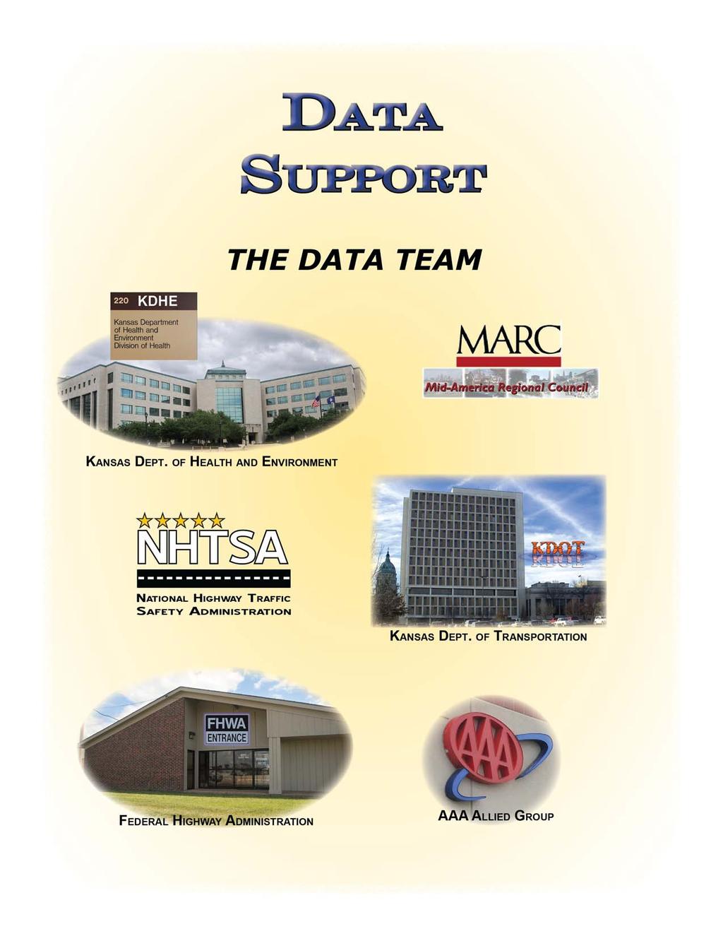
2 Data Introduction Good crash data are the backbone of road safety management. According to the American Association of State Highway and Transportation Officials, or AASHTO, strategic highway safety plans should improve data collection and, as a result, decision making. The data support team will provide the emphasis area teams and the Executive Safety Council, or ESC with the data required to craft an information-based. The data team will gather and present data to the ESC, collect and organize data at the request of other emphasis area teams, assist ESC in identifying data gaps, collection and reporting weaknesses, assist in deciding whether a need exists for additional emphasis area teams and collect data from different agencies represented on the ESC. The data team was created not only to assist in the mining and presentation of data on behalf of other emphasis area teams but also to develop performance measures, outcomes and strategies specific to data collection, storage, analysis and reporting. The team, which first met June 15, 2009, is represented by the following agencies: AAA Allied Group (AAA) Mid-America Regional Council (MARC) Federal Highway Administration (FHWA) National Highway Traffic Safety Administration (NHTSA) Kansas Department of Health and Environment (KDHE) Kansas Department of Transportation (KDOT) Wichita Area Metropolitan Planning Organization (WAMPO) 1

3 Data Collection and Storage To address highway safety problems requires data of all sorts. There are roads of many kinds with twists and turns, rises and falls. There is an array of vehicles used by drivers young and old, drunk and sober, some with cell phones, some texting, some speeding, some fully attentive. Those who design, construct and maintain the infrastructure work to make it safe. Law enforcement works at managing those who use the infrastructure and emergency services and are called on when crashes occur. So crash data include roadway geometrics, vehicles, drivers, injuries and fatalities, emergency management and more. Because of the complexity of data and the need to keep it secure, it is housed in databases maintained by various agencies. The graphic below reflects this. Below are thumbnail sketches of these data sources. CANSYS - State Highway Network Data This KDOT database contains information about the geometrics, condition and extent of the 10,000-plus miles of road in the state highway system, as well as a small percentage of off state system local roadways. It contains data on bridges, access permits and at-grade rail crossings and supports the work of various bureaus at KDOT, as well as of the FHWA and Kansas Legislature. CANSYS is maintained by the KDOT Geometric and Accident Data Unit, or GAD. 2
4 NUSYS - Non-State Classified Network Data This KDOT database contains information about roads classified as collector and above within the 40 areas in Kansas designated as urban by the U.S. Census Bureau. NUSYS is a central repository of geometric inventory information on off state system local roadways and is used to produce required federal reports. It provides answers to questions posed by the FHWA, Kansas Legislature, KDOT management and employees, and other state agencies. NUSYS is also maintained by GAD. KCARS - Kansas Crash & Analysis Reporting System KCARS contains records of all reportable crashes in Kansas from 1990 to the present. The data in KCARS are provided to KDOT by law enforcement agencies. The data includes any field that is listed on the Kansas Motor Vehicle Accident Report and recorded by law enforcement. Like CANSYS and NUSYS, KCARS is maintained by GAD and provides answers to questions posed by the FHWA, Kansas Legislature, KDOT management and employees and other state agencies. Vital Statistics - Death Certificates The Office of Vital Statistics within the KDHE supplies KDOT, at KDOT s request, with records that permit the coding of fatal crashes. The information helps researchers understand the cause and nature of injuries suffered in crashes, and the time that elapses between injury and death. To query vital statistic data go to: Driver Records The Driver Records database is hosted by the Kansas Department of Revenue Division of Motor Vehicles (DMV). It contains the records of all licensed drivers in Kansas. The file depends on many sources. For example, KDOT provides crash records to the database and the court system supplies adjudication information. At this writing, the DMV was revising the database. When the database is finished it will provide those interested in traffic safety with a more complete picture of specific drivers. It is anticipated that this information will improve public safety and maximize the impact of traffic-safety resources. Traditionally, traffic record data have been housed in isolated repositories. However, in June 2005, an interagency committee, the Traffic Records Coordinating Committee, or TRCC, began developing a statewide traffic records system. The statewide traffic records system will allow state and local agencies to access data by bringing together information that is now housed in KDOT, KDHE, the Kansas Department of Revenue, or KDOR, the Kansas Bureau of Investigation, or KBI and the Kansas Board of Emergency Medical Services, or KBEMS. The result will be a more complete picture of traffic safety in Kansas. The data team would like to work with the TRCC to promote and expand use of: The Kansas Law Enforcement Reporting System, or KLER The Electronic Traffic Citation Program, or ecitations The Report and Police Impaired Drivers System, or RAPID Each of these systems are discussed in more detail throughout the plan. ecitations - Statewide Electronic Traffic Citations Program The Kansas Criminal Justice Information System (KCJIS) and the Kansas Traffic Records Coordinating Committee (TRCC) have identified the 3
5 need for a design and plan for implementing a statewide electronic traffic citations program; commonly referred to as ecitations. Electronic Traffic Citations, or ecitations, are the way of the future for the issuance of traffic citations, the storage of related information, and the dissemination to numerous authorized users. It contemplates a near-paperless, seamless process from the time of the traffic stop through court disposition of the traffic citation. Briefly, the law enforcement officer making the stop records information on the driver and the driver s vehicle, either through a scanner or manually, into a laptop or handheld computer. Driver and vehicle information is uploaded (populated) into a citation form on the officer s computer, either from information scanned from the barcodes and/or magnetic stripes on the driver s license and vehicle registration or an external source such as the KDOT/KDMV, KBI, or NCIC. Time and location information can be imputed through the use of drop down menus, search words, or automatically populated from GPS or other location software. Officer and court information can be populated into the citation automatically from defaults pre-set by the officer at the start of the officer s shift. This leaves only a few pieces of information to be entered by the officer, such as the violation(s), code number(s), and fine amount(s). An ecitation system provides a multitude of benefits to each of the agencies identified above and to the public at large including decreasing the time of traffic stops and issuance of traffic tickets, increasing the accuracy of the data collected, eliminating the need for the LEAs, the Courts, and the Prosecutors offices to each enter the same citation data into their RMSs, and the automatic collection and analysis of data used to improve public safety and the roadways. RAPID - Report and Police Impaired Drivers In 2009, the Kansas DUI Commission, a multi-disciplinary state commission tasked with studying driving under the influence (DUI), recommended the creation of a tracking system to consolidate access to an offender s DUI history as well as modifications to existing systems to facilitate this tracking. The goal of the system to Report and Police Impaired Drivers (RAPID), is to enhance available data sharing mechanisms and make improvements enabling a better and more efficient process for prosecutors, courts and law enforcement to prosecute and track DUI offenders from arrest through prosecution, sentencing, probation and monitoring. This system must leverage existing criminal history repositories at Kansas Bureau of Investigation (KBI), resources available in the Kansas Criminal Justice Information System (KCJIS), and other existing state repositories to deploy a secure web-based system for improving DUI prosecution in the state of Kansas. KLER - Kansas Law Enforcement Reporting System The Kansas Highway Patrol (KHP) developed KLER, a field-based reporting system, which incorporates data from more than 15 reports, including KDOT crash forms, KBI incident forms and KDOR insurance forms. Law-enforcement officials use it to complete and view critical records on mobile laptop computers in their cars during traffic and crash stops. Eventually, KLER will include in its records a new statewide uniform traffic e-citation system. To learn more about the KLER System and its benefits, go to The SHSP data support team would like to work with the TRCC in promoting and expanding use of KLER. The expansion would require additional training and education for law enforcement officers and administrators emphasizing the importance of electronic crash reporting. SafetyNet and KCrash 4
6 The KHP maintains SafetyNet and KCrash for federal reporting purposes and state use. KHP supplies data on inspections and collisions to SafetyNet. SafetyNet was developed, and is supported, by the Federal Motor Carrier Safety Administration (FMCSA). The KHP is the lead agency for state participation in the Motor Carrier Safety Assistance Program, which focuses on roadside inspections. The KHP is also required to document federally reportable collisions. There are three criteria for these: a fatality involving a commercial motor vehicle (CMV); an injury collision involving a CMV that requires immediate medical attention away from the scene; or a collision with a CMV resulting in disabling property damage to at least one unit. The KCrash program has accelerated the filing of collision reports with FMCSA. It facilitates the electronic filing of SafetyNet reports, in place of paper forms. The KHP receives electronic copies of all collision reports involving a CMV to determine whether they meet federal reporting requirements. Paper copies of collision reports involving a CMV are converted to an electronic format by KDOT. KCrash screens all state highway system crash reports in order to populate the required SafetyNet fields before they are forwarded to FMCSA. Observational Seat Belt Survey and Observational Distracted Driving Survey Every year, KDOT Traffic Safety section and its partners collect data across the state on seatbelt usage rates and driver distraction rates. Methodology of Adult Survey - based on the federal guidelines in the Uniform Criteria manual. The Kansas survey is now performed at 544 sites on 3 different road types in 35 randomly selected counties which encompass 85% of the population of Kansas. The survey is conducted in June and July. The 2011 survey observed more than 65,000 drivers and passengers. Methodology of Child Survey - based on the guidelines used in the adult survey. The Kansas survey is performed at 350 sites where children are transported (i.e. day cares, department stores, elementary and middle schools) in 20 randomly selected counties which encompass 85% of the population of Kansas. The survey is conducted in March, April and May. The 2011 survey observed more than 19,000 children. View the survey results here: Trauma Registry The trauma registry system is organized to facilitate a multidisciplinary response to those who suffer trauma related injuries during car crashes or other events. The trauma registry houses data on trauma patients from all Kansas hospitals. The data guide systemic improvements that reduce morbidity and mortality related to traumatic events. Registry data are used by emergency medical service personnel, hospital staff and the KDHE staff to identify injury trends, prioritize needs, and implement and evaluate prevention strategies. For more information on KDHE's Trauma Program go to: KEMSIS - The Kansas EMS Information System KEMSIS is data system that captures the condition of patients and the treatments they receive before they arrive at a hospital. KEMSIS is a voluntary reporting system whose elements mirror those in the National Emergency Medical Service Information System dataset. Services utilize this information for quality improvements, equipment decisions, staffing adjustments, unit locations and treatment modalities. The system also provides an electronic patient care report for hospitals. As of June 2010, 55 emergency medical services and 23 hospitals were filing reports with KEMSIS. For more information, go to: FARS - Fatality Analysis Reporting System 5
7 FARS is a database funded by the NHTSA and open to the public on its website. It contains records of all fatal crashes in Kansas. To be included in FARS, a crash must involve a motor vehicle traveling on a trafficway customarily open to the public and result in the death of a vehicle occupant, or of a non-motorist, within 30 days of the crash. The FARS file contains descriptions of each fatal crash reported. Each case has more than 150 coded data elements that characterize the crash, the vehicles and the people involved. To view fatality data, go to 6

8 The Five Percent Solution KDOT s approach to reduce the number of fatal or disabling crashes is to start by identifying those stretches of roadways that produce the highest incidence of them. In 2005, federal legislation, the Safe, Accountable, Flexible, Efficient Transportation Equity Act: A Legacy for Users, or SAFETEA-LU, created the Highway Safety Improvement Program, or HSIP. Its goal was to raise public awareness of highway safety needs and challenges and reduce fatalities and serious injuries. HSIP required Kansas, starting in 2007, to submit an annual report describing no less than 5 percent of its highway system that, according to crash data, was in the greatest need of safety improvement. For KDOT, this Report is more than just a federal requirement, but a useful list of locations across the state that can lead to further traffic studies, road safety audits, and even projects. This list is posted annually on the FHWA's website and shared with relevant roadway owners. For the state's most recent Five Percent Report, issued in 2012, KDOT divided the Report into three sections, each with its own methodology and results: non-state rural routes, segments, and intersections (rural intersections, urban intersection & ramp terminal intersections). The final list includes 16 rural county routes, 84 miles from the state highway system, and 60 intersections. To view the 2012 Five Percent Report, go to 7


9 Data Analysis Two tools are particularly useful for analyzing the data found in state and federal databases. SafetyAnalyst: Network Screening Tool KDOT and 20 other state transportation departments pooled funds to develop SafetyAnalyst, a software that can analyze safety data. KDOT and many of its peers are now in the process of implementing the software, which includes a network screening tool, diagnosis tool, countermeasure selection and evaluation tools, economic appraisal tool and priority ranking tool. The Network Screening Tool identifies sites with potential for safety improvement. Networkscreening algorithms are used to identify locations of the following types of sites with potential for safety improvement: Sites with higher-than-expected accident frequencies which may indicate the presence of safety concerns that are potentially correctable in a cost-effective manner, and Sites whose accident frequencies are not higher than expected, given the traffic volumes and other characteristics present at the site, but which nevertheless experience sufficient numbers of accidents that may potentially be improved in a cost-effective manner. In addition, the network screening tool can identify sites with high accident severities and with high proportions of specific accident or collision types. The network screening algorithms focus on identifying spot locations and short roadway segments with potential for safety improvement, but also include the capability to identify extended route segments. Network screening and all other SafetyAnalyst algorithms can consider specific accident severity levels (fatalities and serious injuries, fatalities and all injuries, property-damage-only) or all severity levels combined. At this time, SafetyAnalyst can only analyze safety data for the 10,000-plus miles in the state highway system. Local Roadway Analysis This is a method for discovering stretches of road off the state highway system with high crash rates. KCARS supplies the data, and KDOT uses an analytical method that s compatible with the data available. The method has allowed it to rank counties in terms of the number of crashes from 2007 to 2011 on the three rural functional classifications of road outside the state highway system. Barriers to a fine-grained analysis of crashes on local roads come from incomplete or inconsistent data. Mapping a crash location requires one of two data points: a linear referencing system (LRS) location or a latitude and longitude. KDOT is responsible for 10,000 miles of state highway. The 8

10 state system s crash records include LRS data. Many of the 130,000 miles of local roads managed by individual cities, counties and townships lack locational data because they have neither county mile posts nor a geo-coded road inventory. This results in analytical challenges. For the local roads that do not have a local referencing system, KDOT must assign each crash a latitude and longitude manually. Through the years, many off-system roads have accumulated multiple names. Different agencies and local residents refer to roads by different names. New roads are added every year, and it s a challenge to maintain a complete inventory. Despite these barriers, KDOT is producing a list of potential sites for improvement for the annual Five Percent Report: 9

11 Goals and Strategies The data support team has chosen five goals as the focus of its efforts. It seeks to 1. Coordinate the Data Needs of the Kansas 2. Improve data analysis capability to better inform decision makers 3. Train those who create, input and utilize crash data 4. Map all crashes statewide using GIS tools 5. Systematic Reporting The challenge is to identify the strategies that will have the greatest impact on improving the availability, accuracy, and efficiency of data and data analysis. Goal 1: Coordinate the Data Needs of the Kansas New Strategy: Identify and analyze outstanding variables related to crashes that occur away from intersections and don t involve animals, using the Kansas 2010 Five Percent Report Background: KDOT is required by SAFETEA-LU to report annually on the top five percent of state highway miles linked to fatal or serious injury crashes. When the reports from 2007 through 2010, each referencing 1,500 locations, were compared, about 700 locations recurred. Of these 700, 146 do not include an intersection. The crashes at those 146 locations may have resulted from roadway departure. Plans are to analyze those crashes to see whether that s true. Method: research Costs: none Lead agency and contact: KDOT, Highway Safety Unit Challenges: securing accurate and timely data Target date: ongoing Future Strategies: Link crash data to the trauma registry Pursue implementation of a Crash Outcome Data Evaluation System Develop a tool that helps local jurisdictions and regional safety coalitions to access and analyze crash data Develop a methodology to identify high-frequency crash corridors on local roadways 10


12 Goal 2: Improve data analysis capability to better inform decision makers New Strategies: Create an intersection inventory to support crash analysis Background: The FHWA defines an intersection as a planned point of conflict in the roadway system. A quarter of all crash fatalities in Kansas occur at intersections, but there is too little data on existing intersections. One problem is that there s no identification system for individual intersections. Creating unique identifiers for intersections would allow better crash reporting and data collection. The only intersections we have reliably identified and coded are system to system intersections, such as where one state highway intersects another. GIS allows the mapping of intersections, but that information can t be integrated with other data without a linear referencing system. Such data gaps impede our ability to analyze intersection crashes. GAD has begun identifying and collecting data about specific intersections, using KDOT s video-log. The goal is to identify and characterize all intersections in terms of more than 25 data elements, including the type of traffic control present at the intersection, the number of legs, directions of travel and pavement type. Method: project Costs: additional staff Lead agency and contact: KDOT, GAD Unit Challenges: ensuring additional staff Target date: fall 2013 Create a horizontal curve inventory to support crash analysis Background: According to the FHWA, horizontal curves are those that change the alignment or direction of the road (as opposed to vertical curves, which change the slope). More than 25 percent of fatal crashes are associated with a horizontal curve, and the vast majority of these crashes involve roadway departure. The average crash rate for horizontal curves is about three times that of other types of highway segments. However, available data on existing curves is not thorough. As with intersections, the problem is that there s no identification system for individual curves. Creating unique identifiers for curves would allow better crash reporting. Once curves are identified in this way, data can be collected. All the curves to be identified are part of the state highway system. Data collected include curve location, length, advisory speed (if present) and radius. GIS allows the mapping of curves, but the mapping of curves can t be integrated with other data without a linear referencing system. Such data gaps impede the ability to analyze crashes at curves. Method: project Costs: additional staff 11

13 Lead agency and contact: KDOT, GAD Unit Challenges: ensuring additional staff Target Date: fall 2013 Use SafetyAnalyst to couple data analysis with engineering solutions Background: In addition to SafetyAnalyst's ability to scan the highway system for crash hot spots through the Network Screening Tool, SafetyAnalyst, using statistical techniques, can perform detailed crash analysis recommend possible engineering countermeasures for specific locations. KDOT has begun to use SafetyAnalyst to: view detailed site analysis summarizing crash patterns and overrepresented crash variables view diagnoses that recommend engineering countermeasures; suggest cost/benefit appraisals of proposed countermeasures; suggest project prioritization Method: software Costs: annual license fees Lead agency and contact: KDOT, Highway Safety Unit Challenges: importing, processing and calibrating Kansas crash, roadway and traffic volume data for SafetyAnalyst use Target date: ongoing Future Strategies: Educate transportation professionals about the Highway Safety Manual published by AASHTO To view more information about the Highway Safety Manual, go to 12
 Unit is currently working on: continued enhancements to the Accident Coding Manual continued ad hoc (personal) consultation via phone and email continued communication via")

14 Goal 3: Train those who create, input and utilize crash data Current Strategies: Continue to provide training to law enforcement on the use and importance of the crash reporting form KDOT's Geometric and Accident Data (GAD) Unit is currently working on: continued enhancements to the Accident Coding Manual continued ad hoc (personal) consultation via phone and continued communication via Facebook and Twitter concerning accident coding development of a training video continued communication through the quarterly newsletter: Continue to provide training for officials in local government so they can understand and use crash data in their safety-related decision making [See more information in the Local Roads Support Chapter] Continue to promote electronic reporting of crash reports at city and county level Approximately 60,000 crash reports are processed annually, with 50% submitted in paper form and 50% submitted electronically. Paper reports, however, require 85% of the resources with electronic requiring 15% of the resources. There are approximately 500 law enforcement agencies in the state, yet at this time only 101 agencies submit reports electronically. While this does not represent 50% of the agencies it is close to being 50% of the reports sent to KDOT. 13


15 The TRS estimates the paper reports at $7.25/record and electronic reports at $1.50/record. This means that each electronic submission saves the State of Kansas $5.75. With approximately 30,000 crash reports still being submitted in paper-form each year, the savings for the state and taxpayers are significant. Parties interested in becoming KLER users or wishing further details are encouraged to contact the following: KHP IT Helpdesk at Future Strategies: If additional funding were to become available, KDOT would like to offer live training to law enforcement around the state 14

16 Goal 4: Map all crashes statewide using GIS tools Current Strategies: Complete geo-coding (assignment of latitude and longitude) of crashes on local roads Background: The GAD Unit at KDOT has been working to geo-code and geo-locate all crashes in Kansas. While CANSYS is able to support the geo-location of crashes on state highways, another method is being developed to geo-code crashes located on nonstate highways and locally administered roads. The geo-coding of crashes relies on information provided by crash reports. Unfortunately, at this time, longitude and latitude are not initially captured in crash reports and must be inferred or found indirectly. At the time this chapter was being written, the geo-coding of crash data for 2004, 2006, 2007 and 2008 was complete. Geo-coding must still be completed for 2005 and 2009 todate. 15
 fatality data for the following quarters:")
: January 1st through December 31st The annual Dashboard Report contains annual")
.")

17 Goal 5: Systematic Reporting Current Strategies: Create and post Quarterly Dashboard Report Background: The quarterly Dashboard Report contains year-to-date preliminary (not officially closed out) fatality data for the following quarters: Quarter One: January 1st through March 31st Quarter Two: January 1st through June 30th Quarter Three: January 1st through September 30th Quarter Four (Annual Report): January 1st through December 31st The annual Dashboard Report contains annual preliminary fatality data from January 1st through December 31st. The Report can also be generated ad-hoc as requested by the Executive Safety Council (ESC). The Report presents either quarterly or annual fatality counts compared to the previous year. These figures are then further broken down statewide and at the district level by the emphasis areas outlined in the SHSP or as requested by the ESC. Dashboard Reports can be viewed here: 16
DRAFT DRAFT DRAFT. Please sent your questions, comments and suggestions to Dave Brown at:
 DRAFT DRAFT DRAFT This document is a rough draft beginning of the Strategic TSIS Plan for the five year period 2011-2015. It is published on www.safehomealabama.gov for the purpose of obtaining any comments
An Introduction to the. Safety Manual
 An Introduction to the Highway Safety Manual An Introduction to the HIGHWAY SAFETY MANUAL Table of Contents Section 1: HSM Overview... 1 What is the Highway Safety Manual?... 1 How is the HSM Applied?...
NEW YORK STATE TRAFFIC SAFETY INFORMATION SYSTEMS STRATEGIC PLAN: FFY 2018
 NEW YORK STATE TRAFFIC SAFETY INFORMATION SYSTEMS STRATEGIC PLAN: FFY 2018 Submitted by New York State Governor s Traffic Safety Committee Empire State Plaza Albany, New York 12228 Chuck DeWeese, Assistant
MONITORING IMPLEMENTATION AND PERFORMANCE
 12 MONITORING IMPLEMENTATION AND PERFORMANCE The FAST Act continues the legislation authorized under MAP-21, which created a data-driven, performance-based multimodal program to address the many challenges
New York State TraCS at the Traffic Records Forum. July, 2010
 New York State TraCS at the Traffic Records Forum July, 2010 New York State TraCS Sgt. Jim Daily New York State Police Field Command Technology Unit The Problem - 1999 Paper Process Handwritten reports
ROAD ACCIDENT DATA BASE: THE CASE OF CACADU DISTRICT MUNICIPALITY ABSTRACT
 ROAD ACCIDENT DATA BASE: THE CASE OF CACADU DISTRICT MUNICIPALITY S O MOHAMMED and F J J LABUSCHAGNE Transport Systems and Operations, Built Environment, CSIR, Pretoria 0001 SMohammed@csir.co.za; FLabuschagne@csir.co.za
STATE OF KANSAS TRAFFIC RECORDS ASSESSMENT MARCH 21 25, National Highway Traffic Safety Administration Technical Assessment Team
 STATE OF KANSAS TRAFFIC RECORDS ASSESSMENT MARCH 21 25, 2005 National Highway Traffic Safety Administration Technical Assessment Team Larry Holestine Leslie Nelson-Taullie Langston A. Spell Carol Wright
Wisconsin County/City Traffic Safety Commission Guidelines
 Wisconsin County/City Traffic Safety Commission Guidelines These guidelines have been developed by the WisDOT Bureau of Transportation Safety in continued support of the Traffic Safety Commissions across
The Power of Data Integration
 The Power of Data Integration Building a Quality Crash Record through Data Collaboration, Coordination and Integration Lynn Peterson Secretary Cam Gilmour Deputy Secretary Nadine Jobe Crash Data and Reporting
AASHTO s Highway Safety Manual and Performance Measures / Targets
 AASHTO s Highway Safety Manual and Performance Measures / Targets Dr. Anthony Kane Director of Engineering and Technical Services Wednesday October 26, 2011 Bom dia damas e cavalheiros Talk Overview Highway
Management. VA SITE Annual Meeting June 27, 2013 Jay Styles Performance and Strategic t Planning Manager, Business Transformation Office
 VDOT and MAP-21 Performance Management VA SITE Annual Meeting June 27, 2013 Jay Styles Performance and Strategic t Planning Manager, Business Transformation Office Overview Map-21- How is VDOT Preparing?
Safety. Introduction. Total System
 Safety Introduction Ohio is the 35 th largest state in the nation based on geographic size, however it carries the 5 th largest total traffic volume and the 4 th largest truck traffic volume. With such
LOCATION AND DESIGN DIVISION
 VIRGINIA DEPARTMENT OF TRANSPORTATION LOCATION AND DESIGN DIVISION INSTRUCTIONAL AND INFORMATIONAL MEMORANDUM GENERAL SUBJECT: Design Exceptions / Waivers SPECIFIC SUBJECT: Design Exception Request Form
Randy Romanski. Steven T. Parker. October 24, Madison, Wisconsin. WisDOT Bureau of Transportation Safety
 2016 Mid-Continent Research Symposium Session 4-C Safety - Innovations in the Use of Data to Enhance Law Enforcement Activities Randy Romanski WisDOT Bureau of Transportation Safety Steven T. Parker UW-Madison
Geometric Design: Past, Present, and Future
 A2A02: Committee on Geometric Design Chairman: Daniel B. Fambro Geometric Design: Past, Present, and Future DANIEL B. FAMBRO, Texas A&M University JOHN C. COLLINGS, Delcan Corporation ROBERT DELLA VEDOVA,
APPENDIX A: SHORT-TERM PROJECT DEPLOYMENTS
 APPENDIX A: SHORT-TERM PROJECT DEPLOYMENTS Page 1 of 15 ST-01: I-95 ITS DEPLOYMENT (DE STATE LINE TO AIRPORT) PROJECT DESCRIPTION AND SCOPE: Project will address gaps in ITS device coverage on I-95 from
FMCSA IT Workshop Salt Lake City, Utah. Overview, Collaboration, and the Mobile Client
 FMCSA IT Workshop Salt Lake City, Utah Overview, Collaboration, and the Mobile Client Jeff Hall FMCSA Program Manager Anthony Rahner SAIC Program Manager Brenda Lantz Systems Engineering Team U.S. Department
GUARDRAIL WARRANTS FOR LOW VOLUME ROADS
 74 GUARDRAIL WARRANTS FOR LOW VOLUME ROADS Louis B. Stephens, P.E. INTRODUCTION Low volume roads present many challenges to highway engineers and public administrators. Although, by definition, these facilities
RIDOT S Statewide Roadway and Asset Data Collection Project
 RIDOT S Statewide Roadway and Asset Data Collection Project GIS-T Conference 2017 Shane White Rhode Island DOT; Daniel Behnke DTS Accent image here Primary Image here RDIP Technical Assistance Started
THAT Council adopt the Congestion Management Strategy as outlined in this report
 RR3 ADMINISTRATIVE REPORT Report Date: May 2, 2017 Contact: Winston Chou Contact No.: 604.873.7913 RTS No.: 011564 VanRIMS No.: 08200020 Meeting Date: May 16, 2017 TO: FROM: SUBJECT: Vancouver City Council
Assessment Program for Kentucky Traffic Records
 Transportation Kentucky Transportation Center Research Report University of Kentucky Year 2015 Assessment Program for Kentucky Traffic Records Lenahan O Connell Eric R. Green Reginald R. Souleyrette University
2 Purpose and Need. 2.1 Study Area. I-81 Corridor Improvement Study Tier 1 Draft Environmental Impact Statement
 2 Purpose and Need 2.1 Study Area Interstate 81 (I-81) is relied upon for local and regional travel and interstate travel in the eastern United States. It extends 855 miles from Tennessee to New York at
KAW CONNECTS EXECUTIVE SUMMARY
 Executive Summary Page E-1 Introduction KAW CONNECTS EXECUTIVE SUMMARY The Kansas Department of Transportation (KDOT) and the Kansas Turnpike Authority (KTA) have both recognized the need to plan for the
TRAFFIC SAFETY PROGRAM IMPLEMENTATION. A Step-by-Step Guide for Law Enforcement
 TRAFFIC SAFETY PROGRAM IMPLEMENTATION A Step-by-Step Guide for Law Enforcement 1 Identify Problems, Set Goals Motor vehicle crashes are a leading cause of injury-related death in the United States; however,
2017 Highway Safety Improvement Program Call
 2017 Highway Safety Improvement Program Call The Highway Safety Improvement Program (HSIP) is for highway safety projects that eliminate or reduce the number of fatalities and serious injuries on all public
Massachusetts Division 55 Broadway, 10th Floor Cambridge, MA 02142
 , U.S. Department of Transportation Federal Highway Administration Massachusetts Division 55 Broadway, 10th Floor Cambridge, MA 02142 October 6, 2006 Luisa Paiewonsky, Commissioner Massachusetts Highway
Appendix B. Benefit-Cost Technical Memorandum
 Appendix B Benefit-Cost Technical Memorandum This Page Left Blank Intentionally MEMORANDUM TO: FROM: Michael Kalnbach MnDOT District 1 Project Manager Graham Johnson, PE DATE: September 2, 2014 RE: TH
Work Zone Safety Performance Measures for Virginia
 Work Zone Safety Performance Measures for Virginia http://www.virginiadot.org/vtrc/main/online_reports/pdf/16-r1.pdf YOUNG-JUN KWEON, Ph.D., P.E. Senior Research Scientist Virginia Transportation Research
RAIL-DOT INSTITUTIONAL MITIGATION STRATEGIES
 RAIL-DOT INSTITUTIONAL MITIGATION STRATEGIES CONSULTANT TEAM STARISIS CORPORATION svarma@insight.rr.com Gordon Proctor & Associates goproctor@wowway.com Michael L. Bradley & Associates Consulting L.L.C.
Chapter 1.0 Introduction
 Chapter 1.0 Introduction 1.1 Background Interstate 81 runs from Danbridge, Tennessee to the US/Canada border, connecting the six states of Tennessee, Virginia, West Virginia, Maryland, Pennsylvania, and
Performance Based Practical Design (PBPD)
") Performance Based Practical Design (PBPD) 2016 ODOT D08 LPA Day John R. Kasich, Ohio Governor Jerry Wray, ODOT Director PBPD PBPD Presenter Katherine DeStefano, P. E. District 08 Design Engineer ODOT D08
Performance Based Practical Design (PBPD) 2016 ODOT D08 LPA Day John R. Kasich, Ohio Governor Jerry Wray, ODOT Director PBPD PBPD Presenter Katherine DeStefano, P. E. District 08 Design Engineer ODOT D08
AGENDA ITEM #13: MAP-21/FAST ACT SAFETY PERFORMANCE MEASURES AND TARGETS Keith Nichols, HRTPO
 AGENDA ITEM #13: MAP-21/FAST ACT SAFETY PERFORMANCE MEASURES AND TARGETS Keith Nichols, HRTPO Recent federal surface transportation legislation established that States and Metropolitan Planning Organizations
Wyoming Highway Patrol. Strategic Plan Wyoming Department of Transportation
 Wyoming Highway Patrol Strategic Plan 2011-2013 Wyoming Department of Transportation 2011-2013 Strategic Plan Colonel Jess Oyler Adminstrator Wyoming Highway Patrol 2011-2013 Strategic Plan Table of Contents
Florida Transportation Systems Management and Operations. Strategic Plan
 Florida Transportation Systems Management and Operations Final: Version 2 December 13, 2013 Prepared for: Florida Department of Transportation Intelligent Transportation Systems Program 605 Suwannee Street,
Chapter 10 Goals, Objectives + Policies
 Chapter 10 Goals, + Policies Warehouse on Nestle Way near I-78 114 115 10.1 ESTABLISHMENT OF CONSISTENT GOALS 10.2 NATIONAL FREIGHT GOALS The Lehigh Valley s freight transportation investment decisions
1RUWKZHVW#:LFKLWD 0DMRU#,QYHVWPHQW#6WXG\
 1RUWKZHVW#:LFKLWD 0DMRU#,QYHVWPHQW#6WXG\ Executive Summary 3UHSDUHGýIRUã 3UHSDUHGýE\ã.DQVDVý'HSDUWPHQWýRI 7UDQVSRUWDWLRQ,QýDVVRFLDWLRQýZLWKã (DUWKý7HFKý,QFï EXECUTIVE SUMMARY Introduction This Northwest
TRANSPORTATION, DEPARTMENT of
 Annual Performance Progress Report (APPR) for Fiscal Year (2008-2009) Proposed KPM's for Biennium (2009-2011) Original Submission Date: 2009 Finalize Date: 9/30/2009 2008-2009 KPM # 2008-2009 Approved
- FACT SHEET - THE GUIDING PRINCIPLES
 THE GUIDING PRINCIPLES The General Plan begins with seven ideas that together create a vision for the City s future. When the City approved the General Plan in 1994, these idea were dubbed the Seven Guiding
National Traffic Incident Management Coalition. Improving Traffic Incident Management Together
 National Traffic Incident Management Coalition Improving Traffic Incident Management Together Promoting a National Agenda for Traffic Incident Management Why is Traffic Incident Management Important? Incidents
OREGON DEPARTMENT OF TRANSPORTATION Annual Performance Progress Report (APPR) for Fiscal Year
 for Fiscal Year") Annual Performance Progress Report (APPR) for Fiscal Year 2005-06 Due: September 30, 2006 Submitted: September 29, 2006 To obtain additional copies of this report, contact the Department of Transportation
Annual Performance Progress Report (APPR) for Fiscal Year 2005-06 Due: September 30, 2006 Submitted: September 29, 2006 To obtain additional copies of this report, contact the Department of Transportation
GEOMETRIC DESIGN CRITERIA for Non-freeway Resurfacing, Restoration, and Rehabilitation Projects
 GEOMETRIC DESIGN CRITERIA for Non-freeway Resurfacing, Restoration, and Rehabilitation Projects SEPTEMBER 1989 Arkansas State Highway and Transportation Department GEOMETRIC DESIGN CRITERIA for Non-freeway
Operations in the 21st Century DOT Meeting Customers Needs and Expectations
 Operations in the 21st Century DOT Meeting Customers Needs and Expectations 1 Purpose of this Meeting: Share Thoughts & Discuss Challenges brought about by the changing transportation environment and public
Save seconds. Save minutes. Save lives. SafetyNet CAD is scalable to fit your agency s needs, whether you have a single dispatcher or 10,000.
 SafetyNet Suite SafetyNet CAD Save seconds. Save minutes. Save lives. Largest Installation 16 One customer can boast of 7 years with no downtime SafetyNet CAD s largest installation serves more than million
CHAPTER 1: INTRODUCTION/ GOALS AND OBJECTIVES
 CHAPTER 1: INTRODUCTION/ GOALS AND OBJECTIVES 1.1: INTRODUCTION ABOUT THE FREDERICKSBURG AREA METROPOLITAN PLANNING ORGANIZATION (FAMPO) Established in 1992, the Fredericksburg Area Metropolitan Planning
Technical Methods Part 2
 Technical Methods Part 2 Performance Measurement in Transportation Planning Leading for results means that performance must be planned, not just reported Learning Objectives Describe a sample technical
Evaluating Design Alternatives using Crash Prediction Methods from the Highway Safety Manual
 Evaluating Design Alternatives using Crash Prediction Methods from the Highway Safety Manual Andrew Ooms November 2012 Outline Safety Overview Current practices Safety Fundamentals Introduction the Highway
FY Unified Planning Work Program. Kalamazoo Area Transportation Study 5220 Lovers Lane, Suite 110 Portage, MI (269)
") FY 2018 FY Unified Planning Work Program Kalamazoo Area Transportation Study 5220 Lovers Lane, Suite 110 Portage, MI 49002 (269) 343-0766 www.katsmpo.org [This page intentionally left blank.] FY 2018 Unified
FY 2018 FY Unified Planning Work Program Kalamazoo Area Transportation Study 5220 Lovers Lane, Suite 110 Portage, MI 49002 (269) 343-0766 www.katsmpo.org [This page intentionally left blank.] FY 2018 Unified
NCHRP 20-7 Guide to Benchmarking Operations Performance Measures Incident Duration - Pilot Test Results
 NCHRP 20-7 Guide to Benchmarking Operations Performance Measures Incident Duration - Pilot Test Results 4.2 Incident Duration As incident management systems are maturing in many metropolitan areas, incident
TRANSPORTATION, DEPARTMENT of
 Annual Performance Progress Report (APPR) for Fiscal Year (2007-2008) Proposed KPM's for Biennium (2009-2011) Original Submission Date: 2008 2007-2008 KPM # 1 2007-2008 Approved Key Performance Measures
TRAFFIC INCIDENT MANAGEMENT SYSTEM (TIMS)
") TRAFFIC INCIDENT MANAGEMENT SYSTEM (TIMS) GUIDELINES 1. Purpose A. Ensure that an Ohio Turnpike and Infrastructure Commission (OTIC) Guideline exists to manage traffic backups and travel delays. B. Ensure
TRAFFIC INCIDENT MANAGEMENT SYSTEM (TIMS) GUIDELINES 1. Purpose A. Ensure that an Ohio Turnpike and Infrastructure Commission (OTIC) Guideline exists to manage traffic backups and travel delays. B. Ensure
INTELLIGENT TRANSPORTATION SYSTEMS SUMMARY
 Genesee County Shaping our Transportation Future Together 2035 Long Range Transportation Plan INTELLIGENT TRANSPORTATION SYSTEMS SUMMARY What is an Intelligent Transportation System? An Intelligent Transportation
Use of TMC Data for Performance Measurement and Improving Operations. National Rural ITS Conference August 25, 2014 Ming Shiun Lee URS Corporation
 Use of TMC Data for Performance Measurement and Improving Operations National Rural ITS Conference August 25, 2014 Ming Shiun Lee URS Corporation 1 Presentation Outline Motivations Performance Measures
Current Trends in Traffic Congestion Mitigation
 Current Trends in Traffic Congestion Mitigation April 24, 2009 NCSL Spring Forum Washington, DC Jeff Lindley Associate Administrator, Office of Operations Federal Highway Administration U.S. Department
EXISTING AND FUTURE FREIGHT GOODS MOVEMENT ASSESSMENT
 Technical Memorandum EXISTING AND FUTURE FREIGHT GOODS MOVEMENT ASSESSMENT Prepared by: April 2014 TABLE OF CONTENTS 1. Introduction... 3 1.1 Study Purpose... 3 1.2 Data Reference List... 3 2. Data sources...
Interactive Highway Safety Design Model (IHSDM) Traffic Records Forum Biloxi, MS October 28,
 Traffic Records Forum Biloxi, MS October 28,") Interactive Highway Safety Design Model (IHSDM) Traffic Records Forum Biloxi, MS October 28, 2012 1 Agenda Welcome and Introductions IHSDM A Quantitative Approach to Evaluating Highway Safety IHSDM Workflow
Interactive Highway Safety Design Model (IHSDM) Traffic Records Forum Biloxi, MS October 28, 2012 1 Agenda Welcome and Introductions IHSDM A Quantitative Approach to Evaluating Highway Safety IHSDM Workflow
Louisiana Road And Bridge Conditions Threatened By $12.5 Billion Transportation Funding Backlog
 Louisiana Road And Bridge Conditions Threatened By $12.5 Billion Transportation Funding Backlog Published on April 21, 2010 in Construction News and Daily Dirt Boost In Transportation Funding Needed To
This privacy policy (the 'conditions') was last amended in May 2016.
 was last amended in May 2016.") ARVAL PRIVACY POLICY This privacy policy (the 'conditions') was last amended in May 2016. These conditions generally apply to your relationship with Arval in conjunction with your use of Arval's services
ARVAL PRIVACY POLICY This privacy policy (the 'conditions') was last amended in May 2016. These conditions generally apply to your relationship with Arval in conjunction with your use of Arval's services
incode Incode Public Safety Records Management System Accurate Information When It Matters Most a tyler public safety solution
 incode a tyler public safety solution Incode Public Safety Records Management System Accurate Information When It Matters Most With unified data sharing in place... the court can print case files as a
Status of Highway Safety Manual Implementation. October 2015
 Status of Highway Safety Manual Implementation October 2015 Agenda NCHRP Project 17-50 Overview Project Objective Panel members and support states Project Deliverables to Date Status of HSM Implementation
Chapter 1 Introduction
 Chapter 1 Introduction KEY POINTS The amount and value of freight are critical components of the overall economic health of Missouri. Missouri s multimodal freight system supports the movement of trucks,
University of Kentucky 1 Southeastern Transportation Center Safety Performance in a Connected Vehicle Environment. FIGURE 1: V2V and V2I Connectivity
 PROBLEM STATEMENT The US Department of Transportation has advised planning agencies across the country to begin considering how their local transportation systems will function in a connected vehicle environment.
Future Iowa Safety Analysis/Analytics An evolutionary leap forward, the missing link, and/or something else entirely?
 Future Iowa Safety Analysis/Analytics An evolutionary leap forward, the missing link, and/or something else entirely? Michael D. Pawlovich, Ph.D., P.E. Traffic Safety/Crash Data Engineer Iowa Department
Traffic Safety Analysis of Utah County Highways using SafetyAnalyst. Peter Crawford Kelly
 Traffic Safety Analysis of Utah County Highways using SafetyAnalyst Peter Crawford Kelly A project submitted to the faculty of Brigham Young University in partial fulfillment of the requirements for the
2016 Mid-Continent Transportation Research Symposium, October 24-25, Donna Brown-Martin, Director Bureau of Planning and Economic Development
 2016 Mid-Continent Transportation Research Symposium, October 24-25, 2016 Donna Brown-Martin, Director Bureau of Planning and Economic Development Why the State Freight Plan is Important to You Vision,
TCATS October 12-Michigan Works 5:30-7pm. NATS October 19-Niles District Library 6-7:30pm
 Goal Development Workshop TCATS October 12- Works 5:30-7pm NATS October 19-Niles District Library 6-7:30pm SAFETEA-LU Goals 2035 TwinCATS Goals 2030 TwinCATS Goals 1. Support the economic vitality of the
NCDOT Overview. Nick Tennyson, Chief Deputy Secretary March 4, 2015
 NCDOT Overview Nick Tennyson, Chief Deputy Secretary March 4, 2015 Overview Major Functions of DOT Board of Transportation Highway System Overview Construction- Road Building Process Operations and Maintenance
NCHRP 08-36, Task 104 Performance-Based Planning and Programming Pilots
 NCHRP 08-36, Task 104 Performance-Based Planning and Programming Pilots Joe Guerre and Kelsey Ahern Cambridge Systematics 115 South LaSalle Street, Suite 2200 Chicago, IL 60603 Julie Lorenz Burns & McDonnell
MAP 21 Freight Provisions and Seaports
 MAP 21 Freight Provisions and Seaports September 20, 2012 American Association of Port Authorities 703.684.5700 www.aapa-ports.org 3 New Freight Eligibility in Core Highway Formula Programs Surface Transportation
Mobility and System Reliability Goal
 Mobility and System Reliability Goal Provide surface transportation infrastructure and services that will advance the efficient and reliable movement of people and goods throughout the state. Background:
THE COMMONWEALTH OF MASSACHUSETTS NON-NHS BRIDGE R&R POLICY
 THE COMMONWEALTH OF MASSACHUSETTS Number: P-92-010 Date: 10-08-92 - ) HIGHWAY DEPARTMENT FROM: NON-NHS BRIDGE R&R POLICY The purpose of this Engineering Directive is to formally notify Department Personnel
WHITE PAPER. Technology Trends for Road User Safety in Public Sector. Abstract
 WHITE PAPER Technology Trends for Road User Safety in Public Sector Abstract Owing to the high number of traffic accidents caused by commercial trucks, ensuring road safety is a major concern for governments.
The Cost Savings Potential of Sustainability Practices
 The Cost Savings Potential of Sustainability Practices The Sustainability Triple Bottom Line The Triple Bottom Line (TBL) means addressing Environmental, Economic and Social Equity dimensions of a project
Florida Traffic Safety Information System
 Florida Traffic Safety Information System Strategic Plan 2012-2016 prepared for Florida Department of Transportation prepared by Cambridge Systematics, Inc. 1566 Village Square Boulevard, Suite 2 Tallahassee,
Preparing our Roadways for Connected and Automated Vehicles. 70th Annual Ohio Transportation Engineering Conference Bob Edelstein
 Preparing our Roadways for Connected and Automated Vehicles 70th Annual Ohio Transportation Engineering Conference Bob Edelstein Agenda Overview Intelligent Network Management Emerging Vehicle Technology
Business Plan for FY14 FY15
 Business Plan for FY14 FY15 Commissioner s Message May 2013 The Executive Team and I are pleased to present the new Business Plan for FY 2014-15. This plan builds on the key priorities to deliver our mission:
Interchange Workshop Report (August 2004)
") U.S. Highway 14 Corridor Study New Ulm to North Mankato Table of Contents Section Interchange Workshop Report (August 2004) Page 1. Introduction and Next Steps 1 2. Interchange Workshop Participants &
U.S. Highway 14 Corridor Study New Ulm to North Mankato Table of Contents Section Interchange Workshop Report (August 2004) Page 1. Introduction and Next Steps 1 2. Interchange Workshop Participants &
The Indian Nations Council of Governments (INCOG) 2035 Plan: Roadways Element
 2035 Plan: Roadways Element") Roadways The Indian Nations Council of Governments (INCOG) The Indian Nations Council of Governments is the designated regional planning organization for the Tulsa Transportation Management Area (TMA).
Roadways The Indian Nations Council of Governments (INCOG) The Indian Nations Council of Governments is the designated regional planning organization for the Tulsa Transportation Management Area (TMA).
A MODAL COMPARISON OF DOMESTIC FREIGHT TRANSPORTATION EFFECTS ON THE GENERAL PUBLIC EXECUTIVE SUMMARY. November 2007
 A MODAL COMPARISON OF DOMESTIC FREIGHT TRANSPORTATION EFFECTS ON THE GENERAL PUBLIC EXECUTIVE SUMMARY November 2007 Prepared by CENTER FOR PORTS AND WATERWAYS TEXAS TRANSPORTATION INSTITUTE 701 NORTH POST
2015 ATSSA Traffic Expo Report
 2015 ATSSA Traffic Expo Report February 8-10, 2015 Tampa, Florida By: Victor Lund, St. Louis County Traffic Engineer Submitted: February 11, 2015 Sunday, February 8, 2015 Power Talk Grassroots Advocacy:
MAINE TRANSPORTATION BY THE NUMBERS:
 MAINE TRANSPORTATION BY THE NUMBERS: Meeting the State s Need for Safe and Efficient Mobility OCTOBER 2012 202-466-6706 www.tripnet.org Founded in 1971, TRIP of Washington, DC, is a nonprofit organization
Appendix D: Functional Classification Criteria and Characteristics, and MnDOT Access Guidance
 APPENDICES Appendix D: Functional Classification Criteria and Characteristics, and MnDOT Access Guidance D.1 Functional classification identifies the role a highway or street plays in the transportation
Since the Vision 2000 effort under taken in 1995, ODOT has operated under a Mission,
 , and ODOT s Updated, and Since the Vision 2000 effort under taken in 1995, ODOT has operated under a, Vision, and. These were updated in 2000 and are updated again here by Senior Leadership to reflect
Identify challenges IFTA presents to carriers and the impact it has on carriers.
 White Paper Understanding IFTA Get Smart about IFTA The International Fuel Tax Agreement Executive Summary: Interstate motor carriers have to deal with a wide array of government regulations that demand
I N V O I C E. Support AASHTO s FY 2016 participation in all Engineering Technical Service Programs.
 AASHTO Innovation Initiative $ 6,000 PLEASE RETURN A COPY OF THE INVOICE WITH YOUR CHECK. YOUR CANCELLED CHECK IS YOUR RECEIPT. AASHTO Product Evaluation Listing (APEL) $ 1,200 PLEASE RETURN A COPY OF
STATE OF MINNESOTA Office of the State Auditor
 STATE OF MINNESOTA Office of the State Auditor Rebecca Otto State Auditor METRO TRANSIT MINNEAPOLIS, MINNESOTA AGREED-UPON PROCEDURES FOR THE YEAR ENDED DECEMBER 31, 2011 Description of the Office of the
REGIONAL ITS ARCHITECTURE FOR CENTRAL MASSACHUSETTS
 Commonwealth of Massachusetts REGIONAL ITS ARCHITECTURE FOR CENTRAL MASSACHUSETTS Deval L. Patrick Timothy P. Murray Richard A. Davey Governor Lieutenant Governor Secretary & CEO FINAL REPORT December
for Law Enforcement KVE Developed by the Kentucky Transportation Center University of Kentucky in cooperation with the
 A Checklist for Law Enforcement Fire & Rescue EMS CRASH SITE Towing KYTC KVE Emergency Management Developed by the Kentucky Transportation Center University of Kentucky in cooperation with the Kentucky
Prepared for the ESRI Public Sector Conference April 11-13, 2017, West Palm Beach, Florida
 Prepared for the ESRI Public Sector Conference April 11-13, 2017, West Palm Beach, Florida By: John Lee, PhD Student, Ga. Tech Phoenix Associates Consulting, Inc. Urban Planning Professionals 1609 Lenox
FLEET MANAGEMENT SOLUTIONS
 FLEET MANAGEMENT SOLUTIONS ABOUT US Fleet management isn t just about tracking the location of your company s vehicles. With Fleet Management by Acadian Total Security, you can increase productivity, safety
Rapid City Area Metropolitan Planning Organization OPERATIONS PLAN
 Rapid City Area Metropolitan Planning Organization OPERATIONS PLAN Prepared for the Rapid City Area Metropolitan Planning Organization Endorsed by the Executive Policy Committee of the Rapid City Area
USING A SIMULATION ENVIRONMENT FOR DYNAMIC TOLL ANALYSIS
 USING A SIMULATION ENVIRONMENT FOR DYNAMIC TOLL ANALYSIS ABSTRACT Robert Kerns and Darryn Paterson Transurban, USA 1421 Prince Street, Suite 200 Alexandria, Virginia 22314 571-527-2050; rkerns@transurban.com;
NJDOT: Asset Management Strategies and Tools
 NEW JERSEY DEPARTMENT OF TRANSPORTATION NJDOT: Asset Management Strategies and Tools Wednesday, October 1, 2014 Afternoon Session (1:45pm 2:30pm) Presenters Michael Castaldo New Jersey Department Of Transportation
The Three C s of Urban Transportation Planning
 The Three C s of Urban Transportation Planning Edward G. W etzel Engineer of Transportation Policy Port of New York Authority The need for continuing, comprehensive, urban transportation planning on a
REQUEST FOR PROFESSIONAL SERVICES
 REQUEST FOR PROFESSIONAL SERVICES The City of Lander is currently soliciting proposals from consultants who can offer a complete and accurate assessment of the condition of the City of Lander s street
Connected vehicles and other advanced safety features can be effective in reducing, and maybe eliminating, these fatalities.
 1 2 3 Michigan has made impressive strides over the past decade in reducing the number of traffic fatalities on our roads. However, over the past couple of years, the trend of sharp declines in fatalities
CHAPTER 4 GRADE SEPARATIONS AND INTERCHANGES
 CHAPTER 4 GRADE SEPARATIONS AND INTERCHANGES 4.0 INTRODUCTION The ability to accommodate high volumes of intersecting traffic safely and efficiently through the arrangement of one or more interconnecting
KANSAS WORK ZONE SAFETY AND MOBILITY PROCESSES AND PROCEDURES
 KANSAS WORK ZONE SAFETY AND MOBILITY PROCESSES AND PROCEDURES Bureau of Transportation Safety and Technology 700 SW Harrison, Topeka, KS 66603 July 30, 2008 Definitions Significant Project All Federal-aid
Innovations in Central Data Management for Truck Compliance and Mobility - Vehicle Information in Motion
 Michael Wieck International Road Dynamics, Inc. 7908 South Niagara Way, Centennial, CO 80112 303.905.7008 michael.wieck@irdinc.com Abstract Truck Compliance monitoring has matured in the US and elsewhere
WM2008 Conference, February 24-28, 2008, Phoenix, AZ. Commodity Flow Study Clark County, Nevada, USA
 Commodity Flow Study Clark County, Nevada, USA - 8402 Sheila Conway, Ph.D. Urban Environmental Research LLC 10100 West Charleston Boulevard Suite 200 Las Vegas, NV 89135 Irene Navis, AICP Planning Manager