Interchange Justification Report (IJR) I-75 at Bethlehem Road Henry County
|
|
|
- Andrea Stanley
- 6 years ago
- Views:
Transcription

1 Interchange Justification Report (IJR) I-75 at Bethlehem Road Henry County

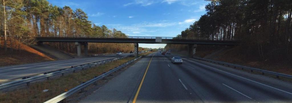
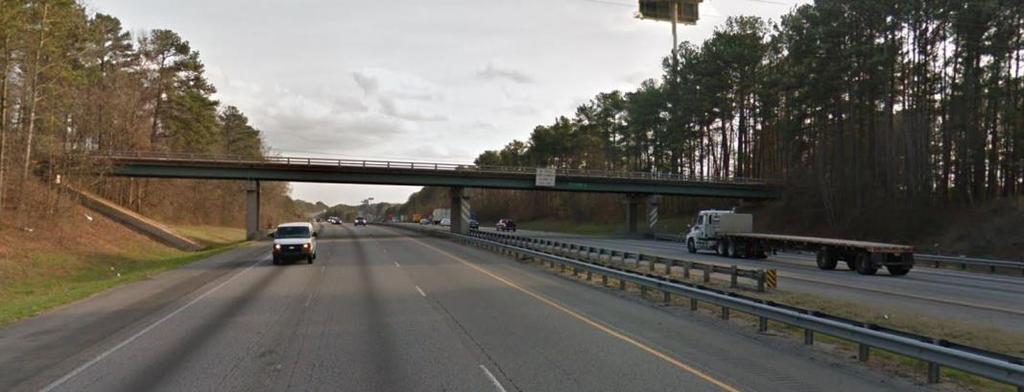
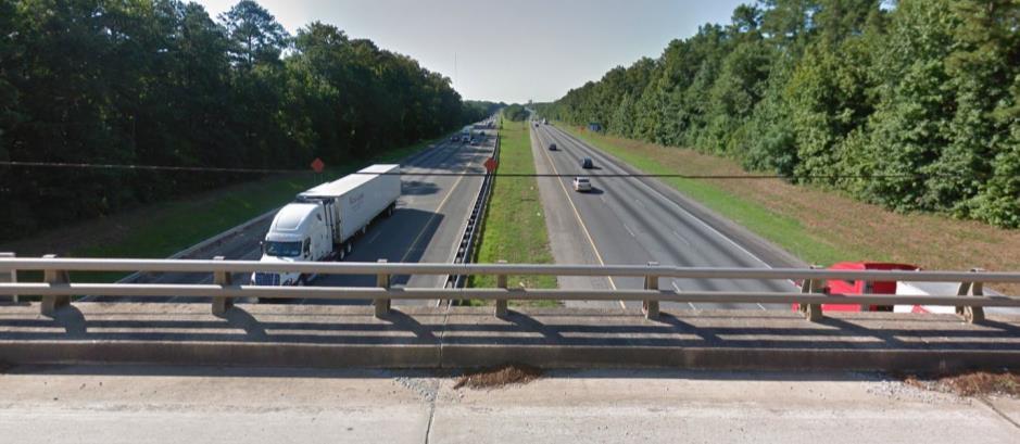
2 IJR Study/Analysis Area Exit 216: SR 155 Bethlehem Road Exit 212: Bill Gardner Pkwy
3 Planning Background ARC 2040 Regional Transportation Plan (RTP) 2017 New Interchange Project AR-955: Long Range (2040), $25M Henry Co Joint County/Cities Transportation Plan 2016 New Interchange Project R-72(A): Mid-Range ( ), $47M Atlanta Regional Freight Mobility Plan Update 2016 New interchange was Tier 1 recommendation needed for access and mobility within the McDonough/Henry freight cluster I-75 Interchange Feasibility Study 2015 Accepted by GDOT, documented need for new interchange
4 Project Purpose and Need Address Congestion/Growth/Safety Population Growth in Henry County: ( ): 218, ,691 = 61% Increase Employment Growth in Henry County: ( ): 68, ,413 = 46% Increase Improve Access/Economic Development Study Area Industrial Development Existing: 25M square feet Planned/Underway: 15M square feet Increasing Freight Demand ARC estimates a 56% increase in freight traffic by 2040 Driven by expansion of Port of Savannah and Panama Canal GDOT Commercial Vehicle Lane (CVL) project to support freight demand

5 Planned Area Development 6 Lambert Farms 5 King Mill* 1 Locust Grove-Clayco Phases I* & II 4 Trammel Crow Site 7 Midland Logistics* 2,3 Norfolk Southern Intermodal & Warehousing * Development under construction
6 Planned Area Development Development Name Development Type Size Daily Trips Generated Lambert Farms Warehousing/Distribution 4,817,200 sf 8,093 King Mill* Warehousing/Distribution 3,048,300 sf 5,121 Locust Grove-Clayco Phases I & II* Warehousing/Distribution 4,089,993 sf 6,886 Trammel Crow Site Warehousing/Distribution 1,190,160 sf 1,999 Midland Logistics* Warehousing/Distribution 669,732 sf 1,125 Norfolk Southern Warehousing Warehousing/Distribution 1,846,500 sf 3,102 SUBTOTAL 15,670,885 sf 26,326 Norfolk Southern Intermodal Site Intermodal Truck Terminal 60 Acres 4,914 TOTAL 31,240
7 Adjacent Transportation Improvements Project Project Type GDOT PI# / ARC # Total Cost Construction Date SR 155 from I-75 to Bill Gardner Pkwy Widening / N/A $72M 2029 SR 155 from I-75 to SR 42/US 23 Widening / HE- 113 $42M 2022 Bill Gardner Pkwy from SR 155 to I- 75 Widening /HE126 B $20M 2026 I-75 Commercial Vehicle Lanes (NB) from I-475 to SR 155 Widening $723M 2025

8 Interchange Spacing GDOT Interchange Spacing Guidelines Area Minimum Average Classification Spacing Spacing Urban 1 mile 2 miles Suburban 2 miles 4 miles Rural 2 miles 8 miles Study Area Spacing Existing: 3.44 miles With New Interchange: 2.87
9 Crash Analysis SR 155 from SR 42 to Bill Gardner Pkwy (3.4 miles) Urban Minor Arterial Year No. of Crashes Crash Rate* Statewide Average Crash Rate No of Injury Accidents Injury Accident Rate* Statewide Injury Accident Rate , , ,319 Not Available Not Available Bill Gardner Pkwy from SR 42 to SR 155 (3.84 miles) Urban Minor Arterial Year No. of Crashes Crash Rate* Statewide Average Crash Rate No of Injury Accidents Injury Accident Rate* Statewide Injury Accident Rate ,107 Not Available Not Available
10 Preferred Interchange Alternative

11 Preferred Interchange Alternative

12 Connection with GDOT CVL Project
13 Basic Freeway Segments IJR Traffic Analysis Analysis of one-way, uninterrupted freeway (interstate) segments Ramp Junctions Analysis of merge (on-ramp) and diverge (off-ramp) junctions Weave Segments Analysis of freeway segments where two or more traffic streams cross paths. Not applicable to this study. Intersections Analysis of signalized and un-signalized intersections. Particular attend given to intersection at interstate ramps.
 LOS is a letter designation on a declining scale from A to F.")
14 Level of Service (LOS) IJR Traffic Analysis LOS is a qualitative measure used to describe traffic flow on a transportation facility (freeway, intersection, ramp junction, arterial, etc.) LOS is a letter designation on a declining scale from A to F. LOS A represents free-flow conditions and LOS F represents gridlock conditions LOS D or better considered acceptable in urban areas.
15 2017 Existing Conditions 2017 Existing Freeway Segments LOS C or Better Ramp Junctions LOS C or Better Intersections LOS D or Better at Interchanges
16 Future Conditions: Traffic Projections 2025 deemed appropriate Opening Year for interchange by GDOT Could open to traffic earlier than 2025 Traffic Projection Methodology Background Traffic Growth Area Development Trips Future Traffic Volumes
17 Future Conditions: Traffic Projections Background Traffic Growth SURFACE STREETS TC Station Location Description Compound Annual Growth SR 20 West of Westridge Pkwy 17,250 16,670 20,020 20,470 21,900 22,700 22, % SR 20 East of Regency Plaza Blvd 17,780 23,380 22,980 22,720 22,700 22,200 22, % SR 155 East of King Mill Rd 14,340 14,090 16,590 16,530 17,400 18,000 20, % SR 155 South of Greenwood Industrial Blvd 17, % Greenwood Industrial Pkwy South of Bethlehem Bottoms Rd - 1,090 1,070 1,090 3,640 3,790 3, % Bethlehem Rd East of I 75-1,110 1,090 1,110 1,110 1,150 1, % SR 42 North of Bethlehem Rd 8,670 8,500 11,940 11,860 14,000 15,100 14, % Bill Gardner Pkwy West of Lester Mill Rd 6,120 5,910 6,320 6,460 6,460 6,950 9, % Bill Gardner Pkwy East of Lester Mill Rd % Bill Gardner Pkwy East of Tanger Blvd % SR 42 South of Bill Gardner Pkwy % INTERSTATE 75 Weighte d Average 1.76% I-75 2 mi N of SR colwell Rd % I 75 South of SR , , , , , , , % I75 North of Bethlehem Rd 89,980 83,820 84,610 84,610 88,500 88,500 89, % Weighte d Average 0.45%
18 Future Conditions: Traffic Projections Area Development Trips Trips assigned to roadway network for: No-Build (no new interchange) Build (new interchange)
19 2025 No-Build and Build Conditions 2025 No-Build Freeway Segments LOS D or Better Ramp Junctions LOS D or Better Intersections LOS E & F at Interchanges 2025 Build Freeway Segments LOS D or Better Ramp Junctions LOS D or Better Intersections LOS D or Better at Interchanges
20 2045 No-Build and Build Conditions 2045 No-Build Freeway Segments LOS D or Better Ramp Junctions LOS D or Better Intersections LOS E & F at Interchanges 2045 Build Freeway Segments LOS D or Better Ramp Junctions LOS D or Better Intersections LOS D or Better at Interchanges

21 Environmental Screening Ecological Resources Jurisdictional Waters

22 Environmental Screening Cultural Resources History & Archaeology

23 Environmental Screening Community Resources
24 IJR Results/Conclusions Requests for new interstate access must address the two FHWA Policy Requirements: FHWA Policy #1: Operational Analysis An operational and safety analysis has concluded that the proposed change in access does not have a significant adverse impact on the safety and operation of the Interstate facility. The proposed interchange at Bethlehem Road would not have an adverse impact on the safety and operation of I-75. In fact, the proposed interchange would improve safety and operations for adjacent interchanges and surface streets.
25 IJR Results/Conclusions FHWA Policy #2: Access Connections & Design The proposed access connects to a public road only and will provide for all traffic movements. The proposed interstate access would connect to an existing public road (Bethlehem Road) and would provide for all traffic movements.
26 IJR Results/Conclusions By balancing the traffic and access needs of the study area between three interchanges rather than two, the proposed interchange at Bethlehem Road would: Provide much-needed congestion relief to the SR 155 and Bill Gardner Pkwy Improve safety and traffic operations for all users while meeting the mobility and access needs of study area business and residents Support economic development by facilitating efficient movement of freight into and out of the study area
27 We are here Schedule/Next Steps Bethlehem Road at I-75 Interchange Project Schedule Activity Prepare IJR GDOT/FHWA Review Concept Development/Report Environmental Analysis Preliminary Engineering Final Design ROW Acquisition GDOT Pre-Award Activities Construction Public Information Open House Interchange Open to Traffic
28 Project Critical Paths: Schedule/Next Steps Concept Development/Environmental Studies Preliminary/Final Engineering Meeting with ARC to get the project programmed in the Transportation Improvement Program (TIP)
INTERACTIVE HIGHWAY SAFETY DESIGN MODEL (IHSDM)
") INTERACTIVE HIGHWAY SAFETY DESIGN MODEL (IHSDM) TSITE 2016 Winter Meeting Nashville, TN February 25, 2016 AGENDA Project History IHSDM: Background & Overview IHSDM: Interstate 24 Model IHSDM: Interstate
INTERACTIVE HIGHWAY SAFETY DESIGN MODEL (IHSDM) TSITE 2016 Winter Meeting Nashville, TN February 25, 2016 AGENDA Project History IHSDM: Background & Overview IHSDM: Interstate 24 Model IHSDM: Interstate
Locust Grove Distribution Center 700 Price Road, Bldg. 100 Locust Grove, GA 30248
 1,000,993 SF Spec Building Property Highlights Locust Grove Distribution Center is located in Locust Grove, Georgia. The future 311-acre business park is strategically located less than one mile to exit
Final Recommendations Identification of Improvements, Strategies, and Solutions
 Identification of Improvements, Strategies, and Solutions Prepared by: December 2015 TABLE OF CONTENTS 1. Introduction... 1 1 2. Freight Policy Recommendations... 2 1 3. Freight Infrastructure Recommendations...
Appendix D: Functional Classification Criteria and Characteristics, and MnDOT Access Guidance
 APPENDICES Appendix D: Functional Classification Criteria and Characteristics, and MnDOT Access Guidance D.1 Functional classification identifies the role a highway or street plays in the transportation
LOCATION AND DESIGN DIVISION
 VIRGINIA DEPARTMENT OF TRANSPORTATION LOCATION AND DESIGN DIVISION INSTRUCTIONAL AND INFORMATIONAL MEMORANDUM GENERAL SUBJECT: Interstate, NHS Non-Interstate and Non-NHS (IJR / IMR Guidance) SPECIFIC SUBJECT:
PLAN 2040 Regional Transportation Plan Update. Final Recommendations. Transportation and Air Quality Committee March 13, 2014
 PLAN 2040 Regional Transportation Plan Update Final Recommendations Transportation and Air Quality Committee March 13, 2014 TIP/RTP Update Milestones Official public comment period closed February 21 Final
2 Purpose and Need. 2.1 Study Area. I-81 Corridor Improvement Study Tier 1 Draft Environmental Impact Statement
 2 Purpose and Need 2.1 Study Area Interstate 81 (I-81) is relied upon for local and regional travel and interstate travel in the eastern United States. It extends 855 miles from Tennessee to New York at
INTERSTATE CORRIDOR PLANNING
 INTERSTATE CORRIDOR PLANNING Prioritization of Corridor Studies July 29, 2015 Importance of the Interstate System Texas is an integral part of the national interstate system. The interstate system provides
Conclusions & Lessons Learned
 What is a DDI Recommended Practices Traffic Operations Analysis Geometric Design FHWA Review Conclusions & Lessons Learned It s not about you, it s about the public Developed by Access Utah County
WELCOME IL 47. Community Advisory Group Meeting #5 Waubonsee Community College Wednesday, May 31, 2017
 WELCOME IL 47 Community Advisory Group Meeting #5 Waubonsee Community College Wednesday, May 31, 2017 MEETING PURPOSE MEETING AGENDA 1. Welcome/Introduction 2. Review Previous Public Involvement 3. Process/Schedule
THE PROJECT. Executive Summary. City of Industry. City of Diamond Bar. 57/60 Confluence.
 THE PROJECT A freeway segment ranked 6th worst in the Nation, with levels of congestion, pollution and accidents that are simply unacceptable and which have Statewide and National implications. Executive
The New Highway Capacity Manual 6 th Edition It s Not Your Father s HCM
 The New Highway Capacity Manual 6 th Edition It s Not Your Father s HCM Tom Creasey, PE, PhD Principal, Stantec Consulting Services Inc. Chair, TRB Highway Capacity and Quality of Service Committee Presented
NW La Center Road/I-5 Interchange Improvement Project (MP 16.80)
") FINAL DRAFT - NW La Center Road/I-5 Interchange Improvement Project (MP 16.80) La Center, Washington February 2015 FINAL DRAFT - NW La Center Road/I-5 Interchange Improvement Project (MP 16.80) La Center,
FINAL DRAFT - NW La Center Road/I-5 Interchange Improvement Project (MP 16.80) La Center, Washington February 2015 FINAL DRAFT - NW La Center Road/I-5 Interchange Improvement Project (MP 16.80) La Center,
APPENDIX B. Public Works and Development Engineering Services Division Guidelines for Traffic Impact Studies
 APPENDIX B Public Works and Development Engineering Services Division Guidelines for Traffic Impact Studies Revised December 7, 2010 via Resolution # 100991 Reformatted March 18, 2011 TABLE OF CONTENTS
SR 9/I-95 Interchange at 45th Street PD&E Study Palm Beach County, Florida FPID No.: FAP No.: ETDM No.
 Palm Beach County, Florida Palm Beach Metropolitan Planning Organization April 217 Project Study Area LIMITS: SR 9/I-95: from S of 45th Street to N of 45th Street 45th Street: From Village Boulevard to
NORTHWEST CORRIDOR PROJECT. NOISE TECHNICAL REPORT 2015 Addendum Phase IV
 Noise Technical Report 2015 Addendum NOISE TECHNICAL REPORT 2015 Addendum PREPARED FOR: Federal Highway Administration and Georgia Department of Transportation PREPARED BY: Parsons Brinckerhoff Project
CHAPTER 4 GRADE SEPARATIONS AND INTERCHANGES
 CHAPTER 4 GRADE SEPARATIONS AND INTERCHANGES 4.0 INTRODUCTION The ability to accommodate high volumes of intersecting traffic safely and efficiently through the arrangement of one or more interconnecting
3.0 REVIEW OF PREVIOUS STUDIES
 3.0 REVIEW OF PREVIOUS STUDIES This section of the highlights the significant features from previous plans and studies that could impact the development of the I-20 East Transit Initiative. Much of the
FOR INTERSTATE 81 AND ROUTE 37 INTERCHANGE FREDERICK COUNTY, VIRGINIA MILEPOST 310
 INTERCHANGE MODIFICATION REPORT FOR INTERSTATE 81 AND ROUTE 37 INTERCHANGE FREDERICK COUNTY, VIRGINIA MILEPOST 310 PREPARED BY: VIRGINIA DEPARTMENT OF TRANSPORTATION STAUNTON DISTRICT DECEMBER 13, 2006
Twin Cities Regional Truck Corridors Study. MnDOT Metro Freight Studies Roundup
 Twin Cities Regional Truck Corridors Study MnDOT Metro Freight Studies Roundup February 3, 2017 Study Background Transportation Policy Plan Goal: The regional transportation system supports the economic
The Folded Interchange: An Unconventional Design for the Reconstruction of Cloverleaf Interchanges
 The Folded Interchange: An Unconventional Design for the Reconstruction of Cloverleaf Interchanges I. ABSTRACT Keith A. Riniker, PE, PTOE This paper presents the Folded Interchange design and compares
Central Phoenix Transportation Framework Study
 Central Phoenix Transportation Framework Study Study Area 2013, All Rights Reserved. 1 Agenda Introductions Work Products Feedback on previous products Draft products for Planning Partner review SR-30
1RUWKZHVW#:LFKLWD 0DMRU#,QYHVWPHQW#6WXG\
 1RUWKZHVW#:LFKLWD 0DMRU#,QYHVWPHQW#6WXG\ Executive Summary 3UHSDUHGýIRUã 3UHSDUHGýE\ã.DQVDVý'HSDUWPHQWýRI 7UDQVSRUWDWLRQ,QýDVVRFLDWLRQýZLWKã (DUWKý7HFKý,QFï EXECUTIVE SUMMARY Introduction This Northwest
FLORIDA DEPARTMENT OF TRANSPORTATION Planning and Environmental Management Office INTERCHANGE MODIFICATION REPORT
 FLORIDA DEPARTMENT OF TRANSPORTATION Planning and Environmental Management Office INTERCHANGE MODIFICATION REPORT District 2 1109 South Marion Avenue Lake City, FL 32025-5874 INTERSTATE 10 (SR 8) / SR
Members of the Board of Directors. Laurena Weinert, Clerk of the Board
 COMMITTEE TRANSMITTAL July, 06 To: From: Subject: Members of the Board of Directors Laurena Weinert, Clerk of the Board Update on the State Route Improvement Project Between Interstate 0 and Interstate
TRAFFIC & TRANSPORTATION COMMISSION AGENDA REPORT
 TRAFFIC & TRANSPORTATION COMMISSION AGENDA REPORT AGENDA ITEM #4 T/T MTG: 092616 DATE: SEPTEMBER 26, 2016 TO: TRAFFIC & TRANSPORTATION COMMISSION FROM: BENJAMIN CHAN, P.E, T.E., DEPUTY PUBLIC WORKS DIRECTOR
National Governors Association
 National Governors Association Roundtable Presentation April 2, 2001 Dr. Christine Johnson Director, ITS Joint Program Office Program Manager, FHWA Operations 1 Congestion is a critical problem Transportation
3 INTERSTATES. The Carolina Crossroads Project Team Welcomes You
 The Carolina Crossroads Project Team Welcomes You 3 INTERSTATES + 12 = KEY INTERCHANGES We re here to: Discuss the Carolina Crossroads I-20/26/126 Corridor Project Gather your input on study issues We
Exit 73 I-29 Interchange Modification Justification Study
 xit 73 I-29 Interchange Modification Justification tudy Introduction Figure 1 shows the location of xit 73. This interchange is proposed to be the connecting point of the ast and West Corridors to I-29.
The Secrets to HCM Consistency Using Simulation Models
 The Secrets to HCM Consistency Using Simulation Models Ronald T. Milam, AICP David Stanek, PE Chris Breiland Fehr & Peers 2990 Lava Ridge Court, Suite 200 Roseville, CA 95661 r.milam@fehrandpeers.com (916)
AMPO Annual Conference Session: Performance (Part 1) October 18, 2017 Savannah, GA
 October 18, 2017 Savannah, GA") AMPO Annual Conference Session: Performance (Part 1) October 18, 2017 Savannah, GA Introduction: North Jersey Transportation Planning Authority NJTPA Congestion Management Process Study Goals Analysis
AMPO Annual Conference Session: Performance (Part 1) October 18, 2017 Savannah, GA Introduction: North Jersey Transportation Planning Authority NJTPA Congestion Management Process Study Goals Analysis
500 Interchange Design
 500 Interchange Design Table of Contents 501 Interchange Design... 5-1 July 2015 501.1 General... 5-1 501.2 Interchange Type... 5-1 501.2.1 General... 5-1 502 Interchange Design Considerations... 5-2 502.1
SR 29 Project Development & Environment Study. Presentation to SR 29 Stakeholders Advisory Committee. January 23, 2014
 SR 29 Project Development & Environment Study Presentation to SR 29 Stakeholders Advisory Committee January 23, 2014 Purpose and Need Enhancing Economic Competitiveness Improving Emergency Evacuation Capabilities
CLASS I RAIL CSX & Norfolk Southern
 INDUSTRIAL PARK ±2,700 Acres CLASS I RAIL CSX & Norfolk Southern PORT OF SAVANNAH Rail & Highway Access Industrial Park & Logistics Hub Highlights & Services SAVANNAH GATEWAY INDUSTRIAL HUB Savannah Gateway
5.3 Air Quality and Greenhouse Gas Emissions
 5. NEPA 5.3 Air Quality and Greenhouse Gas Emissions For a comprehensive discussion of the Project s affected environment and cumulative impacts as it relates to air quality and greenhouse gas (GHG) emissions,
Tier 1 Recommendations October 30, 2017
 Tier 1 Recommendations October 30, 2017 Page Left Intentionally Blank Bristol District B.2 B.9 Need Tier 1 District Needs Need Description Within the Bristol MPO, the I-81 interchanges in Abingdon have
Past, Present, and Future
 The Highway Capacity Manual: Past, Present, and Future HCM Chronology 1 st Ed.: 1950 BPR/HRB/GPO (147 Pgs) 1957 Highway Research Board Bulletin 167 2 nd Ed: 1965 TRB Special Report 87 (411 pgs) 1980 TRB
Chapter 3 - Goals, Objectives, & Strategies
 Chapter 3 - This chapter presents goals, objectives, and strategies that have been developed as part of the Richmond Area MPO 2026 Long-Range Transportation Plan (LRTP) update. Strategies have been developed
SECTION III - REGIONAL ARTERIAL SYSTEM. The Regional Arterial System is a subcomponent of a broader regional thoroughfare system.
 SECTION III - REGIONAL ARTERIAL SYSTEM SYSTEM IDENTIFICATION The Regional Arterial System is a subcomponent of a broader regional thoroughfare system. The NCTCOG Regional Thoroughfare Plan (RTP) recognizes
CITY OF JACKSONVILLE 2030 MOBILITY PLAN STUDY UPDATE GOALS, OBJECTIVES, AND PERFORMANCE MEASURES PREPARED FOR: CITY OF JACKSONVILLE
 CITY OF JACKSONVILLE 2030 MOBILITY PLAN STUDY UPDATE GOALS, OBJECTIVES, AND PERFORMANCE MEASURES 3.20.2017 PREPARED FOR: CITY OF JACKSONVILLE 55 Railroad Row White River Junction, VT 05001 802.295.4999
A Unique Application of Railroad Preemption with Queue Mitigation at a Roundabout Interchange
 A Unique Application of Railroad Preemption with Queue Mitigation at a Roundabout Interchange Jeromy Grenard, PE, PTOE American Structurepoint Hardik Shah, PE, PTOE American Structurepoint Roundabouts
HB2 Implementation Policy Guide
 report HB2 Implementation Policy Guide prepared for Commonwealth Transportation Board date August 1, 2015 6.0 Appendix A: Safety Measures Table 6.1 Safety Factor Measures Summary ID Measure Name Weight
Logistics Park Kansas City (LPKC) Edgerton, KS. Infrastructure, Development And Transportation. September 30, 2013
 Edgerton, KS. Infrastructure, Development And Transportation. September 30, 2013") Logistics Park Kansas City (LPKC) Edgerton, KS Infrastructure, Development And Transportation September 30, 2013 LPKC Location LPKC Intermodal Facility Progress Photo courtesy of Superior Bowen Asphalt.
Logistics Park Kansas City (LPKC) Edgerton, KS Infrastructure, Development And Transportation September 30, 2013 LPKC Location LPKC Intermodal Facility Progress Photo courtesy of Superior Bowen Asphalt.
The Policies section will also provide guidance and short range policies in order to accomplish the goals and objectives.
 4 Goals & Objectives INTRODUCTION The 2015-2040 MTP preserves and promotes the quality of life and economic prosperity of the MAB by providing a transportation system consistent with the regional goals.
September Public Meetings. Developing a Blueprint for the Corridor
 September Public Meetings Developing a Blueprint for the Corridor Study Background Study initiated by the Commonwealth Transportation Board (CTB) and administered by VDOT in association with VDRPT. Addresses
Chapter 1. Proposed Project. 1.1 Introduction
 Chapter 1 Proposed Project 1.1 Introduction The Riverside Transportation Commission (RCTC), California Department of Transportation (Caltrans), and the Federal Highway Administration (FHWA), propose to
TRANSPORTATION IMPACT STUDIES
 January 28, 2009 POLICIES AND PROCEDURES FOR TRANSPORTATION IMPACT STUDIES Related to Highway Occupancy Permits Pennsylvania Department of Transportation Bureau of Highway Safety and Traffic Engineering
South Dakota Department of Transportation. Interchange Modification Justification Report. Interstate 90 Exit 44 (Bethlehem Road - Piedmont)
") South Dakota Department of Transportation Interchange Modification Justification Report Interstate 90 Exit 44 (Bethlehem Road - Piedmont) February 28, 2014 Prepared By: SDDOT Office of Project Development
South Dakota Department of Transportation Interchange Modification Justification Report Interstate 90 Exit 44 (Bethlehem Road - Piedmont) February 28, 2014 Prepared By: SDDOT Office of Project Development
Working with Transportation Concurrency Exception Areas
 Working with Transportation Concurrency Exception Areas September 2006 Presented by the Florida Department of Transportation Working with Transportation Concurrency Exception Areas Volume 1, September
Charlotte Region HOV/HOT/Managed Lanes Analysis. Technical Memorandum Task 1.3 EVALUATION CRITERIA
 Charlotte Region HOV/HOT/Managed Lanes Analysis Technical Memorandum Task 1.3 EVALUATION CRITERIA October 23, 2007 TABLE OF CONTENTS 1.0 EVALUATION PROCESS -------------------------------------------------------------------------------------------
LOCATION AND DESIGN DIVISION
 VIRGINIA DEPARTMENT OF TRANSPORTATION LOCATION AND DESIGN DIVISION INSTRUCTIONAL AND INFORMATIONAL MEMORANDUM GENERAL SUBJECT: Design Exceptions / Waivers SPECIFIC SUBJECT: Design Exception Request Form
Congestion Management Process Update
 report Congestion Management Process Update prepared for Houston-Galveston Area Council prepared by Cambridge Systematics, Inc. 10415 Morado Circle, Building II, Suite 340 Austin, TX 78759 with Alliance
Mobility and System Reliability Goal
 Mobility and System Reliability Goal Provide surface transportation infrastructure and services that will advance the efficient and reliable movement of people and goods throughout the state. Background:
AREAWIDE BRIDGE REPLACEMENT AND REHABILITATION
 CECIL COUNTY 2018 TRANSPORTATION IMPROVEMENT PROGRAM AREAWIDE BRIDGE REPLACEMENT AND REHABILITATION DESCRIPTION: On-going program to provide major upgrades to state owned bridges that are structurally
Woodburn Interchange Project Transportation Technical Report
 Final Report Woodburn Interchange Project Transportation Technical Report Prepared for Oregon Department of Transportation April 212 Prepared by DKS Associates Contents Methodologies... 4 Volume Development...
Appendix K. Detroit River International Crossing Study Air Quality Impact Analysis Technical Report Addendum
 Appendix K Detroit River International Crossing Study Air Quality Impact Analysis Technical Report Addendum Detroit International River Crossing Air Quality Impact Analysis Technical Report Addendum November
3.14 TRANSPORTATION AND TRAFFIC
 3.14 TRANSPORTATION AND TRAFFIC 3.14.1 INTRODUCTION This section presents an overview of the existing traffic and circulation system in the area surrounding the project site. It also discusses the potential
PROJECTS. The KIPDA MPO s Central Location
 PROJECTS Freight The economy of the Louisville KY-IN) Metropolitan Planning Area MPA), similar to that of the United States as a whole, is largely dependent on the efficient, reliable, and safe movement
Cartersville-Bartow County Metropolitan Planning Organization. Long-Range Regional Transportation Plan Project Evaluation Process
 Cartersville-Bartow County Metropolitan Planning Organization Long-Range Regional Transportation Plan Project Evaluation Process Joint Policy Committee & Transportation Coordinating Committee Meeting September
SR 417 Extension. June 2003 INTRODUCTION AND HISTORY PROJECT SCOPE AND PURPOSE STUDY OBJECTIVE STUDY PHASES
 Planning Feasibility Study June 2003 INTRODUCTION AND HISTORY The SR 417 Extension Study was a yearlong effort undertaken by Florida s Turnpike Enterprise to investigate the feasibility of a new toll road
CHAPTER 12 TRANSPORTATION. Introduction Setting Impacts and Mitigation Measures of the 2015 Plan Alternatives
 CHAPTER 2 TRANSPORTATION Introduction Setting Impacts and Mitigation Measures of the 205 Plan Alternatives CHAPTER 2 TRANSPORTATION INTRODUCTION This chapter presents the traffic impact analysis conducted
Blacklands Corridor Feasibility Study
 Blacklands Corridor Feasibility Study Public Meeting May 13, 2014 The Atrium at the Granville Arts Center 300 N. Fifth Street, Garland, Texas 1 Overview Welcome and Public Involvement Efforts Amanda Wilson
EXISTING AND FUTURE FREIGHT GOODS MOVEMENT ASSESSMENT
 Technical Memorandum EXISTING AND FUTURE FREIGHT GOODS MOVEMENT ASSESSMENT Prepared by: April 2014 TABLE OF CONTENTS 1. Introduction... 3 1.1 Study Purpose... 3 1.2 Data Reference List... 3 2. Data sources...
Exclusive Facilities for Trucks in Florida: An Investigation of the Potential for Reserved Truck Lanes and Truckways on the State Highway System
 Exclusive Facilities for Trucks in Florida: An Investigation of the Potential for Reserved Truck Lanes and Truckways on the State Highway System Stephen L. Reich, Janet L. Davis, Anthony J. Ferraro, and
Utilizing Transportation Data for Low Cost Safety Improvements
 Utilizing Transportation Data for Low Cost Safety Improvements Samuel Sturtz Transportation Planner Iowa Department of Transportation samuel.sturtz@dot.iowa.gov Photo Credits: Ken West- Kenneth G. West
I-10 CORRIDOR IMPROVEMENTS STAGE 0 FEASIBILITY STUDY STATE PROJECT NUMBER H FEDERAL AID PROJECT NUMBER H004100
 JULY 2016 I-10 CORRIDOR IMPROVEMENTS STAGE 0 FEASIBILITY STUDY STATE PROJECT NUMBER H.004100 FEDERAL AID PROJECT NUMBER H004100 EAST BATON ROUGE AND WEST BATON ROUGE PARISHES, LOUISIANA Section TABLE OF
Section 3-01 General Concepts, Design Standards and Design Exceptions TABLE OF CONTENTS
 Section 3-01 General Concepts, Design Standards and Design Exceptions TABLE OF CONTENTS GENERAL CONCEPTS...2 General...2 Design Vehicle...2 Driver Expectancy...2 Design Speed...2 Sight Distances...3 Exhibit
I-10 KENDALL EXTENSION. Open House
 I-10 KENDALL EXTENSION Open House The environmental review, consultation, and other actions required by applicable Federal environmental laws for this project are being, or have been, carried-out by TxDOT
San Francisco Freeway Corridor Management Study (SF FCMS)
") Item 6 Enclosure B Plans and Programs Committee March 17, 2015 San Francisco Freeway Corridor Management Study (SF FCMS) Phase 1 Findings and Recommendations Agenda Item 6 SAN FRANCISCO COUNTY TRANSPORTATION
Item 6 Enclosure B Plans and Programs Committee March 17, 2015 San Francisco Freeway Corridor Management Study (SF FCMS) Phase 1 Findings and Recommendations Agenda Item 6 SAN FRANCISCO COUNTY TRANSPORTATION
Houston Galveston Area Council Congestion Management Process
 Houston Galveston Area Council Congestion Management Process APPENDIX G of the 2035 Regional Transportation Plan Update Prepared for: Houston-Galveston Area Council Transportation Department 3555 Timmons
Since the Vision 2000 effort under taken in 1995, ODOT has operated under a Mission,
 , and ODOT s Updated, and Since the Vision 2000 effort under taken in 1995, ODOT has operated under a, Vision, and. These were updated in 2000 and are updated again here by Senior Leadership to reflect
US 70 Corridor James City Project Update. Craig Young, Three Oaks Engineering US 70 Corridor Commission May 21, 2015
 US 70 Corridor James City Project Update Craig Young, Three Oaks Engineering US 70 Corridor Commission May 21, 2015 Presentation Overview Improving the US 70 Corridor The Project Team Where Are We Today?
Geometric Design: Past, Present, and Future
 A2A02: Committee on Geometric Design Chairman: Daniel B. Fambro Geometric Design: Past, Present, and Future DANIEL B. FAMBRO, Texas A&M University JOHN C. COLLINGS, Delcan Corporation ROBERT DELLA VEDOVA,
TRAFFIC PROGRAM ACCESS MANUAL Edition WYDOT ACCESS MANUAL 0
 TRAFFIC PROGRAM ACCESS MANUAL 2014 Edition WYDOT ACCESS MANUAL 0 WYDOT ACCESS MANUAL WYDOT ACCESS MANUAL TABLE OF CONTENTS CHAPTER I INTRODUCTION PAGE INTRODUCTION 1 ACCESS MANAGEMENT 2 FUNCTIONAL ROAD
Functional Classification Comprehensive Guide. Prepared by
 Functional Classification Comprehensive Guide Prepared by June 6, 2014 INTRODUCTION PURPOSE OF DOCUMENT The intent of this document is to provide a comprehensive guide to Virginia Department of Transportation
I-10 CONNECT. Public Meeting #1
 I-10 CONNECT Public Meeting #1 The environmental review, consultation, and other actions required by applicable Federal environmental laws for this project are being, or have been, carried-out by TxDOT
Overall project. The $288 million Phase 2 DesignBuild project starts construction. this spring, with completion by December 31, 2016
 Overall project Johnson County Gateway Interchange Project Improvements 87th Street The $288 million Phase 2 DesignBuild project starts construction this spring, with completion by December 31, 2016 Phase
Background Study Goals and Objectives
 Professional Services CONSULTANT Contract Advertisement Number 19614 FM # 437949-1-22-01 City of Hialeah Freight Mobility Implementation Plan Scope of Services Background Florida s Freight Mobility and
APPENDIX A TIER 1 ANALYSIS
 SPN H.004100 FEASIBILITY STUDY APPENDIX A TIER 1 ANALYSIS 040-012-042AH Appendices Lead Sheets PROVIDENCE STATE PROJECT. H.004100 The following worksheets analyze various project alternatives at various
Air Report. Project Information PPTA/LAP. Traffic Data I-495 NORTHERN SECTION SHOULDER USE. Project Number: , C501, P101 UPC:
 Air Report Project Information Project Name: I-495 NORTHERN SECTION SHOULDER USE Project Number: 0495-029-123, C501, P101 UPC: 105130 Route Number: 495 Project Limit - From: South of Old Dominion Drive
3. STATION SPACING AND SITING GUIDELINES
 3. STATION SPACING AND SITING GUIDELINES The station spacing and siting guidelines are summarized in Table 3-1. Table 3-1 also includes benchmark information for local transit service and express bus as
South Sounder Capital Improvements Program
 South Sounder Capital Improvements Program Subarea South King/Pierce Primary Mode Commuter Rail Facility Type Infrastructure Improvement Length Version Draft ST3 Plan Date Last Modified March 28, 2016
ITEM 8 Action May 17, 2017
 ITEM 8 Action May 17, 2017 Approval of Maryland Department of Transportation (MDOT) Additional Project Submission for the Out-Of-Cycle Air Quality Conformity Analysis for the Amendment to the 2016 CLRP
Operations in the 21st Century DOT Meeting Customers Needs and Expectations
 Operations in the 21st Century DOT Meeting Customers Needs and Expectations 1 Purpose of this Meeting: Share Thoughts & Discuss Challenges brought about by the changing transportation environment and public
1.1 Purpose of the Project
 Chapter 1 Purpose and Need for East Link Project 1.1 Purpose of the Project The purpose of the East Link Project is to expand the Sound Transit Link light rail system from Seattle to Mercer Island, Bellevue
Transportation and Works Department The Regional Municipality of York Yonge Street Newmarket, Ontario L3Y 6Z1
 TRANSPORTATION IMPACT STUDY (TIS) GUIDELINES FOR DEVELOPMENT APPLICATIONS Transportation and Works Department The Regional Municipality of York 17250 Yonge Street Newmarket, Ontario L3Y 6Z1 August, 2007
MAINE TRANSPORTATION BY THE NUMBERS:
 MAINE TRANSPORTATION BY THE NUMBERS: Meeting the State s Need for Safe and Efficient Mobility OCTOBER 2012 202-466-6706 www.tripnet.org Founded in 1971, TRIP of Washington, DC, is a nonprofit organization
Intelligent Transportation Systems Master Plan
 Space Coast Transportation Planning Organization Intelligent Transportation Systems Master Plan April 15, 2014 Version 1.0 Prepared for: Space Coast Transportation Planning Organization 2725 Judge Fran
C. Alternatives There are a number of possible solutions to address the need for improvements along the I-64 corridor. The goals of the study
 A. Description of the Proposed Action The Virginia Department of Transportation (VDOT), in cooperation with Federal Highway Administration (FHWA), has evaluated options to improve the 75 mile long Interstate
Interactive Highway Safety Design Model (IHSDM) Traffic Records Forum Biloxi, MS October 28,
 Traffic Records Forum Biloxi, MS October 28,") Interactive Highway Safety Design Model (IHSDM) Traffic Records Forum Biloxi, MS October 28, 2012 1 Agenda Welcome and Introductions IHSDM A Quantitative Approach to Evaluating Highway Safety IHSDM Workflow
Interactive Highway Safety Design Model (IHSDM) Traffic Records Forum Biloxi, MS October 28, 2012 1 Agenda Welcome and Introductions IHSDM A Quantitative Approach to Evaluating Highway Safety IHSDM Workflow
Northwest State Route 138 Corridor Improvement Project
 Northwest State Route 138 Corridor Improvement Project Los Angeles County, CA DISTRICT 7- LA- 138 (PM 0.0/36.8); DISTRICT 7- LA- 05 (PM 79.5/83.1); DISTRICT 7- LA- 14 (PM 73.4/74.4) 265100/ 0700001816
Qualitative Hot Spot Analysis for PM2.5 February 4, 2008
 Technical Guidance for TG-POL-01-08 Qualitative Hot Spot Analysis for PM2.5 February 4, 2008 This technical guidance provides general guidelines for performance of a qualitative hot spot analysis for particulate
Tri-Cities Transportation Study Area Congestion Management System Operations Plan
 Tri-Cities Transportation Study Area Congestion Management System Operations Plan Executive Summary This report is update to the report developed in 1997. Federal regulations require that a Congestion
3.6 GROUND TRANSPORTATION
 3.6.1 Environmental Setting 3.6.1.1 Area of Influence The area of influence for ground transportation consists of the streets and intersections that could be affected by automobile or truck traffic to
Updating Virginia s Statewide Functional Classification System. Briefing to MPOs, PDCs, and Local Governments
 Updating Virginia s Statewide Functional Classification System Briefing to MPOs, PDCs, and Local Governments October 15 & 19, 2012 Functional Class 101 Shelton s FC Game Research Phase Today s Review New
The Indian Nations Council of Governments (INCOG) 2035 Plan: Roadways Element
 2035 Plan: Roadways Element") Roadways The Indian Nations Council of Governments (INCOG) The Indian Nations Council of Governments is the designated regional planning organization for the Tulsa Transportation Management Area (TMA).
Roadways The Indian Nations Council of Governments (INCOG) The Indian Nations Council of Governments is the designated regional planning organization for the Tulsa Transportation Management Area (TMA).
DRAFT Congestion Management Process Keeping the Region Moving Efficiently, Reliably, and Safely
 Congestion Management Process Keeping the Region Moving Efficiently, Reliably, and Safely February 28, 2017 Prepared by the Tri-County Regional Planning Commission 3135 Pine Tree, Suite 2C Lansing, Michigan
Access Management Manual December 2003
 Access Management Manual December 2003 2003 Texas Department of Transportation Published by the Design Division (DES) All rights reserved Access Management Manual December 2003 Manual Notices Manual Notice
INSIDE THIS ISSUE. mctrans.ce.ufl.edu VOLUME 64 \\ OCTOBER Streets Heat Map Freeways Animation HSM Supplement
 mctrans.ce.ufl.edu INSIDE THIS ISSUE McTrans Center University of Florida Civil & Coastal Engineering PO Box 116585 Gainesville, FL 32611-6585 Streets Heat Map Freeways Animation HSM Supplement Phone:
Funding Intelligent Transportation Systems in the Los Angeles Region
 Funding Intelligent Transportation Systems in the Los Angeles Region 2017 ITS California Annual Meeting Ed Alegre, PTP Los Angeles County Metropolitan Transportation Authority (Metro) Los Angeles Region