South Dakota Interstate Corridor Study. Phase I Summary Report
|
|
|
- Jayson Joseph
- 5 years ago
- Views:
Transcription
1 South Dakota Interstate Corridor Study Phase I Summary Report December 2000 Prepared for: South Dakota Department of Transportation 700 East Broadway Avenue Pierre, South Dakota Prepared by: Kirkham Michael Consulting Engineers Felsburg, Holt & Ullevig 9110 West Dodge Road 7951 E. Maplewood Ave., Ste 200 Omaha, Nebraska Englewood, Colorado 80111
2 : Phase I Table of Contents Introduction... 1 Geometric Analysis... 2 Mainline Geometric Summary... 2 Interchange Geometric Summary... 3 Accident Analysis... 4 High Accident Locations... 4 Detailed Interchange Accident Analysis... 5 I-29: Exit st Street, Sioux Falls... 5 I-29: Exit 207 US 12, Summit... 6 I-90: Exit 60 US 16B, Rapid City... 6 I-90: Exit 58 Haines Avenue, Rapid City... 6 I-29: Exit 81 Maple Street/Russell Street, Sioux Falls... 6 I-90: Exit 30 US 14A, Sturgis... 6 I-29: Exit th Street, Sioux Falls... 7 I-229: Exit 6 10 th Street, Sioux Falls... 7 I-90: Exit 59 Lacrosse Street, Rapid City... 8 I-90: Exit 400 I-90/I-229 Interchange, Sioux Falls... 8 Capacity Analysis... 8 Interstate Mainline Capacity Analysis... 9 Interchange Capacity Analysis...10 Interchange Analysis Summaries...13 Western South Dakota, I-90: Milepost 8 to Milepost I-90: Exit 8 - McGuigan Road, Spearfish...13 I-90: Exit 10 - US 85 North, Spearfish...13 I-90: Exit 12 - Jackson Boulevard, Spearfish...13 I-90: Exit 14 US Highway 14A, Spearfish...13 I-90: Exit 17 - US 85 South, Deadwood...14 I-90: Exit 23 - SD 34, Whitewood...14 I-90: Exit 30 - US 14A, Sturgis...14 I-90: Exit 34 - Black Hills National Cemetery...14 I-90: Exit 37 Pleasant Valley Road, Sturgis...14 I-90: Exit 40 - Tilford Road, Tilford...15 I-90: Exit 44 - Bethlehem Road, Piedmont...15 I-90: Exit 46 - Elk Creek Road, Piedmont...15 I-90: Exit 48 - Stagebarn Canyon, Piedmont...15 Rapid City, I-90: Milepost 51 to Milepost I-90: Exit 51 - Black Hawk Road, Black Hawk...15 I-90: Exit 55 - Deadwood Avenue, Rapid City...16 I-90: Exit 59 - LaCrosse Street, Rapid City...16 I-90: Exit 60 - East North Street, Rapid City...16 I-90: Exit 61 - Elk Vale Road, Rapid City...17 I-90: Exit 63 - SD 230, Duster s Corner...17 I-90: Exit 66 - Ellsworth Road, Ellsworth AFB...17 I-90: Exit 67 - Spruce Street, Ellsworth AFB...17 Mitchell, I-90: Milepost 330 to Milepost Page i
3 : Phase I I-90: Exit 330 South Ohlman Street, Mitchell...18 I-90: Exit 332 SD 37, Mitchell...18 Southeastern South Dakota, I-29: Milepost 0 to Milepost I-29: Exit 1 - Dakota Dunes, North Sioux City...18 I-29: Exit 2 - North Sioux City...19 I-29: Exit 4 - McCook Lake, North Sioux City...19 I-29: Exit 9 SD 105, Jefferson...19 Sioux Falls, I-29: Milepost 62 to Milepost I-29: Exit 62 US 81, Canton...20 I-29: Exit 64 SD 44, Worthing/Lennox...20 I-29: Exit 68 C.R. 116, Lennox/Parker...20 I-29: Exit 71 C.R. 100, Tea/Harrisburg...20 I-29: Exit 73 C.R. 106, Tea...20 I-29: Exit 75 I-229, Sioux Falls...21 I-29: Exit st Street, Sioux Falls...21 I-29: Exit th Street, Sioux Falls...22 I-29: Exit 80 Madison Street, Sioux Falls...22 I-29: Exit 81 Maple/Russell Street, Sioux Falls...23 I-29: Exit 82 Benson Road, Sioux Falls...23 I-29: Exit 83 SD 38, Sioux Falls...23 I-29: Exit 86 C.R. 130, Renner/Crooks...23 I-29: Exit 94 C.R. 114, Baltic...24 Sioux Falls, I-229: Milepost 1 to Milepost I-229: Exit 1 Louise Avenue, Sioux Falls...24 I-229: Exit 2 Western Avenue, Sioux Falls...24 I-229: Exit 3 Minnesota Avenue, Sioux Falls...25 I-229: Exit 4 Cliff Avenue, Sioux Falls...25 I-229: Exit 5 26 th Street, Sioux Falls...26 I-229: Exit 6 10 th Street, Sioux Falls...26 I-229: Exit 7 Rice Street, Sioux Falls...26 I-229: Exit 9 Benson Road, Sioux Falls...27 Sioux Falls, I-90: Milepost 387 to Milepost I-90: Exit 387 C.R. 151, Hartford West...27 I-90: Exit SD 38, Hartford East...27 I-90: Exit 395 Marion Road, Sioux Falls...27 I-90: Exit 396 I-29, Sioux Falls...27 I-90: Exit 399 Cliff Avenue, Sioux Falls...28 I-90 Exit 400 I-229, Sioux Falls...28 I-90 Exit 402 Powder House Road, Sioux Falls...28 I-90: Exit 406 SD 11, Brandon...29 I-90: Exit 410 C.R. 105, Valley Springs...29 Northeastern South Dakota, I-29: Milepost 129 to Milepost I-29: Exit 129 C.R. 26, Brookings...29 I-29: Exit 132 US 14, Brookings...29 I-29: Exit 133 US 14 Bypass, Brookings...30 I-29: Exit 177 US 212, Watertown...30 I-29: Exit 180 US 81, Watertown...30 Page ii
4 : Phase I I-29: Exit 207 US 12, Summit...30 Summary of Probable Construction Costs...31 List of Tables Table 1. Interstate Mainline Deficient Bridges... 3 Table 2. High Accident Interchanges... 5 Table 3. LOS Criteria for Basic Freeway Sections... 9 Table 4. Interstate Mainline Traffic and Level of Service...10 Table 5. Existing Traffic Capacity Analysis...10 Table 6. Year 2010 Interchange Capacity Analysis...11 Table 7. Year 2020 Interchange Capacity Analysis...12 Table 8. I-90 Summary of Probable Construction Costs...32 Table 9. I-29 Summary of Probable Construction Costs...33 Table 10. I-229 Summary of Probable Construction Costs...34 Page iii
5 : Phase I Introduction The South Dakota Department of Transportation retained the services of Kirkham Michael Consulting Engineers and Felsburg, Holt & Ullevig to conduct an analysis of several segments of the interstate system located throughout the State of South Dakota. The study will be conducted in two phases. Phase I, summarized in this report, includes a review of the roadway geometrics, accident history, the forecasting of traffic volumes for the Years 2010 and 2020 and the evaluation of existing and future levels of service at the interchanges within the study corridors. As a result of the findings from this Phase I report, a total of 26 interchanges were identified for further analysis. Phase II of the study will include the development of detailed geometric layouts of these interchanges, and a review of the projected traffic operations associated with the interchange design. In some cases, additional traffic counts will be obtained to evaluate traffic operations along the crossroad corridor through the interchange. Access management in the vicinity of the interchange will also be considered during Phase II. It should be noted that the inclusion of an interchange in the Phase II portion of the analysis does not automatically indicate that it is one of the high priority locations for reconstruction. It simply means that there was a need for some additional design and/or analysis. In many cases, the information developed in Phase I was adequate to determine what improvements are required at that interchange. Ten segments of the interstate system in South Dakota were evaluated as a part of this Phase I study, representing 148 miles, 60 existing interchanges and 4 proposed interchanges. The interstate segments evaluated include: Western South Dakota I-90 Milepost 8 to Milepost 48 Rapid City I-90 Milepost 49 to Milepost 67 Mitchell I-90 Milepost 330 to Milepost 333 Southeastern South Dakota I-29 Milepost 0 to Milepost 10 Sioux Falls I-29 Milepost 62 to Milepost 95 I-229 Milepost 0 to Milepost 10.8 I-90 Milepost 387 to Milepost 412 Northeastern South Dakota I-29 Milepost 131 to Milepost 134 I-29 Milepost 177 to Milepost 181 I-29 Milepost 207 Page 1
6 : Phase I Geometric Analysis The existing geometric features of the interstate mainline and interchanges within the study corridors identified above were reviewed to determine if they met current design criteria. These design features included such items as the travel lane width, shoulder widths, design speed, degree of curve, clear zone, inslope, superelevation, bridge width, vertical clearance, vertical curves and grades. At the interchanges, the analysis also included cross road features such as stopping sight distance, ramp intersection sight distance and access control. Desirable values for these roadway elements were based on the South Dakota Department of Transportation Roadway Design Manual and A Policy on Geometric Design of Highways and Streets, published by AASHTO. Mainline Geometric Summary The interstate mainline segments along I-90, I-29 and I-229 identified above were reviewed using information available on the as-built plans from when the interstate was constructed. The interstate system consists of two lanes in each direction, with the exception of the segment of I- 29 between Exits 83 and 84 in the Sioux Falls area, where three lanes are provided in each direction. Tables summarizing the mainline geometric analysis are included in the Appendix. The most common geometric deficiency that occurs along most of the interstate segments is the inslope. Typically, it ranges from a slope of 4:1 to 5:1, versus the desirable slope of 6:1. Another very frequent deficiency is the locations with a longitudinal grade of less that 0.5%. Neither of these items warrants reconstruction of the interstate, and should be able to be addressed at the time of pavement reconstruction. Several of the interstate segments on I-90 in the Black Hills region, and one segment of I-29 near North Sioux City, contain horizontal curves that exceed a desirable 2 15 curve. These curves range in size from 2 30 to The most notable geometric feature on the interstate corridors evaluated is bridges with substandard widths. In many cases, these bridges are only 30 wide, and should be reconstructed to provide a 40 wide clear roadway. In addition, several bridges are classified as functionally obsolete or structurally deficient according to their sufficiency rating. A statement of probable costs was prepared for the removal and reconstruction of these bridges along the study corridors. The quantities and costs shown in the following tables are based on conceptual design of the structures and do not include earthwork, mobilization, traffic control, concrete approach slab, or other incidental roadway costs. Bridges that have a structure width of 38 were not included in this cost estimate unless they were identified as functionally obsolete or structurally deficient. A total of 77 bridges were identified in this analysis, with a total construction cost estimate of $42.8 million. The breakdown of bridges with various roadway segments is shown in the Page 2
7 : Phase I following table. More detailed information regarding the location and size of each structure are provided in the Appendix. Table 1. Interstate Mainline Deficient Bridges Interstate Segment Number of Bridges Construction Cost I-90: Milepost 8 to Milepost $9.6 million I-90: Milepost 330 to Milepost $17.5 million I-29: Milepost 0 to Milepost $12.0 million I-229: Milepost to Milepost 10 4 $3.7 million Interchange Geometric Summary The review of the interchange geometrics identified several design elements that were consistently applied at the time of the majority of the interstate construction. Typically, the travel lane width on the ramps was constructed at 18, instead of the 19 desirable under today s criteria. Similarly, the majority of the right shoulders on the ramps were constructed at a width of 3 instead of 4. In many cases, the superelevation rate on the ramps exceeds the desirable 4% cross slope. The inslopes on the ramps were typically constructed at a slope of 4:1, which is within the acceptable range of allowable slopes, however, it does not meet the current design criteria of 6:1 slopes. Compliance with the remainder of the geometric features varied from interchange to interchange. The design features that do not meet the desirable design criteria are summarized in the tables provided in the Appendix. The actual geometric checklists for each interchange can be found in the analysis notebooks along with each interchange summary report. Page 3
8 : Phase I Accident Analysis In conjunction with the analysis of the Interstate 90, 29 and 229 corridors in South Dakota, a methodology was developed for calculating the accident rate at individual freeway interchanges using the traffic volume and accident information for each interchange which was provided by the South Dakota Department of Transportation (SDDOT). The methodology consisted of calculating a weighted accident rate per million vehicles entering (MEV) the interchange. Accident data were provided by SDDOT in the form of a three-year ( ) data summary sheet for each interchange. The data summary provided a categorization of fatal, injury, and property damage traffic accidents occurring within the interchange limits during the three-year period. The interchange limits include mainline, ramps, and crossroad segments between the ramp merge/diverge points and between the crossroad ramp intersections. A point rating system of 12 points for a fatal crash, 3 points for an injury crash, and 1 point for a property damage crash was applied to the data. Based on this point system, a 3-year weighted accident sum was established for each interchange. This methodology is described in detail in the Appendix. By dividing the weighted accident sum by the MEV value, a 3-year crash rate was then calculated for each interchange. To re-emphasize, the accident history focused on the three-year period between 1997 and The crash rate calculations are summarized in Table 1 of the Appendix. The interchanges in the study area are ranked according to crash rate. High Accident Locations After the calculation of each interchange crash rate, it was necessary to determine which interchanges could be considered high accident locations. The methodology identified in the Manual of Transportation Engineering Studies, published by the Institute of Transportation Engineers in 1994, was used to identify the high accident locations. That methodology states that a high accident location is defined as those locations that have a 3-year weighted accident crash rate greater than the mean rate for all locations, plus a constant times the standard deviation for all locations. At the 90% confidence level, that constant is The mean rate for all locations was calculated to be 1.23, and the standard deviation for all locations was calculated to be With these values, the corresponding crash rate that determines high accident locations is 2.12 weighted accidents per million entering vehicles. Using these criteria, a total of 10 interchanges were identified as high accident locations. These interchanges are summarized in the following table. Page 4
9 : Phase I Table 2. High Accident Interchanges Number of Accidents by Type Weighted Crash Rate Year 3-Year Interchange Fatal Injury PDO Total Accidents (Wtd. Acc./MEV) I-29: I-29: I-90: I-90: I-29: I-90: I-29: I-229: I-90: I-90: Detailed Interchange Accident Analysis Individual accident records for each of these interchanges were then obtained from the SDDOT to identify accident locations and trends. Collision diagrams were developed for each interchange to aid in the process of evaluating accident types. A brief summary of each interchange is provided below. I-29: Exit st Street, Sioux Falls A detailed accident analysis was conducted at this interchange to determine if any accident trends are present that could be addressed by the development of alternative interchange concepts. The predominate accident types at this interchange are rear-end and left turn or right angle accidents. The most prominent location for rear-end accidents is on 41 st Street. At the northbound off-ramp intersection, 26 rear-end accidents occurred in the eastbound direction during the three-year evaluation period. Another 8 rear-end accidents were recorded in the westbound direction. Nine additional rear-end accidents were recorded in the eastbound direction on 41 st Street approaching the southbound ramp intersection. The next predominate accident type at this interchange is the rear-end accidents on the offramps. A total of 29 rear-end accidents occurred during the three-year period, with 17 accidents on the southbound off-ramp, and 12 accidents on the northbound off-ramp. The other major accident type observed included the left turn and right angle accidents at the intersections, as would be expected on a heavily traveled facility. Eight right angle accidents occurred at the southbound ramp intersection, and a total of 17 right angle and left turn accidents at the northbound ramp intersection. Page 5
10 : Phase I I-29: Exit 207 US 12, Summit The high accident rate at this interchange is due primarily to the low volume at the interchange and one fatal accident during the 3-year analysis period. A review of the detailed accident records showed that this fatality was associated with a snowmobile crossing the mainline of the interstate. The remaining accidents failed to indicate any trends associated with the geometric configuration of the interchange. Most of the accidents occurred during snow and ice conditions. I-90: Exit 60 US 16B, Rapid City Most of the crashes at this interchange occurred during wet, icy, or snow-packed roadway conditions. Investigation of detailed accident reports indicated a large number of crashes on the eastbound I-90 bridge over US Highway 16B. The majority of these accidents occurred during slippery roadway conditions. Several crashes involved vehicles losing control during slippery roadway conditions at the westbound I-90 off ramp to US Highway 16B. I-90: Exit 58 Haines Avenue, Rapid City This intersection was not evaluated since it was under construction in the summer of I-29: Exit 81 Maple Street/Russell Street, Sioux Falls The predominate accident types at this interchange are rear-end and out of control accidents. The number of intersections and various turning movements required within the interchange area, along with the large volumes, appear to play a role in these types of accidents. The most prominent location of rear-end accidents is at the southbound off-ramp intersection with Maple Street and Russell Street. A total of 9 rear-end accidents occurred during the three-year evaluation period. The other predominate accident type at this interchange is out of control vehicles. A total of 25 out of control vehicle accidents occurred during the three-year period. Eleven of these were on I- 29 northbound, near the area where the northbound on-ramp from Russell Street merges with the mainline. These accidents may be associated with the 4E curve on the northbound mainline in this area. Eight more out of control vehicles were involved in accidents on or near the I-29 southbound exit to Russell Street. Most of these accidents occurred during inclement weather conditions, with snow or ice on the roadway. This analysis indicates that there may be some geometric features that contribute to these accidents The remainder of the accident types observed included the left turn and right angle accidents at the intersections, as would be expected on a heavily traveled facility. One other observation was that a number of accidents at the merge point for the I-29 southbound on-ramp were sideswipes, with vehicles merging onto the interstate or from vehicles on the interstate changing lanes to avoid a vehicle entering from the on-ramp. I-90: Exit 30 US 14A, Sturgis Based on a 3-year crash rate, this interchange ranks 6 th of the 62 interchanges evaluated in the study. This is due in part to the one fatal crash that occurred during the study period. A significant number of crashes occurred during icy roadway conditions along the mainline I-90 Bridge over US Highway 14A. Vehicles negotiate a horizontal curve when crossing this bridge, and a total of 19 vehicles lost control and crashed along the mainline bridge during the study Page 6
11 : Phase I period. Adjustments to the geometric configuration of the interchange may be required to address this particular safety problem. I-29: Exit th Street, Sioux Falls The predominate accident types at this interchange are rear-end and left turn or right angle accidents. A total of 54 rear-end accidents occurred during the three-year evaluation period at the two ramp intersections. The largest number occurred on the northbound off-ramp, with 22 accidents during that time frame, compared to only 4 accidents on the southbound off-ramp. Westbound rear-end accidents at the west ramp intersection were also relatively high, with a total of 11 accidents. The other predominate accident type at this interchange is associated with the turning movements at the ramp intersections. A total of 33 left turn and right angle accidents were reported during the three-year period. The northbound off-ramp contained 12 right angle accidents, while the southbound off-ramp experienced 7 right angle accidents. Six left turn accidents occurred with eastbound left turns at the northbound off-ramp, and 8 westbound left turn accidents at the southbound off-ramp intersection. I-229: Exit 6 10 th Street, Sioux Falls There were two major accident types at this interchange present during the three-year analysis period. There were a total of 11 sideswipe accidents near the area where the southbound onramp merges with southbound I-229. The majority of these accidents appeared to be related to construction activity that restricted southbound I-229 to one lane. There may have been some visibility restrictions associated with the placement of construction signing and barricades that contributed to these accidents. The other prominent accident type at this interchange is rear-end accidents. The northbound offramp experienced a total of 15 rear-end accidents during the three year study period. On 10 th Street, 11 rear-end accidents were observed for westbound vehicles, and 8 rear-end accidents for eastbound vehicles. These types of accidents may be attributed to driver unfamiliarity with the traffic movements at a single point interchange. If a driver is inattentive, the right turn on yield may result in a vehicle stopping quickly to yield to a conflicting movement, resulting in a rear-end collision. The proximity of the adjacent access points on 10 th Street may also contribute to these accidents, even though the access is limited to right-in/right-out movements. The location of the traffic signals at the interchange should also be reviewed to determine if the signal head placement could be modified slightly to improve visibility for drivers. One other accident condition observed at this interchange is worthy of mention. There were several out of control accidents on I-229 underneath the single point interchange bridge. Icy conditions were cited in almost every case. The size of the bridge required to accommodate the turning movements at this single point interchange creates a large area under the structure that does not receive much direct sunlight. During inclement weather, this area is likely to be one of the first sections of interstate mainline to experience icing conditions. It is also likely to be one of the last to clear up, and is susceptible to freeze/thaw conditions. The area under the bridge Page 7
12 : Phase I should be monitored to determine if in fact there is a problem with icy conditions. If so, it merits special attention during inclement weather. The accident rate at this interchange should continue to be monitored. It is anticipated that the accident rate will decline as drivers become more familiar with the traffic movements at a single point interchange. The construction related accidents appeared to have an impact on the accident rate as well. Removing the 11 sideswipe accidents at the southbound merge with I-229 reduces the accident rate enough to drop this interchange out of the high accident locations. I-90: Exit 59 Lacrosse Street, Rapid City A review of the detailed accident records at this interchange revealed that 28 of the 67 crashes occurred at the eastbound ramp terminal intersection. This indicates that problems may exist with the geometric configuration of this intersection. In particular, the sight distance available to vehicles approaching the intersection may be deficient. The heightened accident count at this intersection warrants further investigation. I-90: Exit 400 I-90/I-229 Interchange, Sioux Falls The predominate accident type at this interchange is out of control vehicle accidents that occurred during inclement weather. A total of 24 out of control vehicle accidents occurred during the three-year evaluation period, with 7 of those on the westbound to southbound loop ramp. This represents 73% of the total 33 accidents at this interchange. The weight associated with the fatal accident appears to have vaulted this interchange into the high accident group. The only other accident type at this interchange that indicates any trend at all is rear-end accidents on the northbound to eastbound ramp. However, only 4 rear-end accidents were reported on this ramp during the three-year period. Since most of the out of control accidents occurred during inclement weather conditions, with snow or ice on the roadway, there may be some correlation with the superelevation rates provided on the ramps. This interchange is the only one evaluated that contains superelevation rates as high as 7.0% on the direct ramps, and 8.0% on the loop ramps. The alternative concepts developed for this interchange should include reduced superelevation rates in line with current design criteria. In addition, this interchange should receive extra attention for snow removal and sand and gravel application during periods of inclement weather. Capacity Analysis The Year 2010 and 2020 traffic projections for the interstate mainline, along with the existing volumes, are provided in the Appendix. The traffic projections for the interchange turning movements are provided with each interchange summary analysis. Page 8
13 : Phase I Interstate Mainline Capacity Analysis The design criteria for acceptable traffic operations on the interstate mainline is level of service LOS C. According to the 1997 Highway Capacity Manual (HCM), the determination of level of service is based on the maximum density of traffic on that freeway segment, defined as the number of passenger cars/mile/lane (pc/mi/ln) for a given free-flow speed. The level of service can also be determined by the minimum travel speed on a segment, the maximum service flow rate in passenger cars/hour/lane (pcphpl), and a maximum v/c ratio. Since the areas of concern with regard to traffic volumes and capacity of the interstate system is limited to the urban areas within South Dakota, a free-flow speed of 55 mph was selected. Table 3-1 from the 1997 HMC is shown below. At LOS C, the maximum service flow rate on the interstate is 1,320 pcphpl, which calculates to 5,280 vehicles per hour (vph) for a basic four-lane interstate segment. In the urban areas, the volume of traffic that occurs during the PM peak hour was observed to range from approximately 8.5% to 9.5%. Applying this same percentage range to the maximum service flow rate, an average daily traffic (ADT) range of 55,600 vehicles per day (vpd) to 62,100 vpd for LOS C is calculated. Table 3. LOS Criteria for Basic Freeway Sections Level of Service Max. Density (pc/mi/ln) Min. Speed (mph) Max. Service Flow Rate (pcphpl) Max. v/c Ratio Free-Flow Speed = 55 mph A B C , D , E , F variable variable variable variable Source: 1997 Highway Capacity Manual, Table 3-1, p The traffic volumes, v/c ratio and level of service for the interstate segments are shown in the Appendix. A review of the traffic volumes on the interstate mainline segments evaluated indicates that a four-lane section will provide level of service C or better through the Year However, by the Year 2020, there are a few segments of interstate that are projected to operate at LOS D, based on the traffic forecasts. These segments are summarized in the table below. The portion of I-29 from Exit 75 (I-29/I-229) through Exit 81 (Maple/Russell) is projected to operate at LOS D in the Year 2020 with a four-lane interstate section. The next segment to the Page 9
14 : Phase I north, between Exit 81 and Exit 83 (SD 38) is projected to be very close to LOS D at that time as well. There are a couple of segments on I-229 that are also projected to operate at LOS D based on a four-lane section. However, the current design-build project on I-229 will provide a third auxiliary lane from Exit 1 (Louise Avenue) to Exit 9 (Benson Road). It should be noted that the interstate from Exit 9 to the I-90 interchange is one of the segments that is projected to operate at LOS D in the Year Based on this analysis, it is recommended that when the I-90/I-229 interchange is reconstructed, a third lane in each direction of I-229 should be added at that time. Table 4. Interstate Mainline Traffic and Level of Service Segment Existing Year 2010 Year 2020 Interstate 29 ADT v/c LOS ADT v/c LOS ADT v/c LOS Exit 75 Exit 77 24, B 37, C 57, D Exit 77 Exit 78 32, B 45, C 63, D Exit 78 Exit 79 36, B 54, C 68, D Exit 79 Exit 81 32, B 46, C 60, D Interstate 229 Exit 4 Exit 5 26, B 43, C 57, D Exit 9 I -90 9, A 43, C 57, D Interchange Capacity Analysis The capacity analysis performed on the interchanges was based on the assumption that existing lane configurations and traffic control would remain unchanged through the Year The results of these analyses, based on existing 2010 and 2020 traffic volumes are depicted in Tables 5, 6, and 7. This methodology provides an indication of those interchanges that will experience congestion and delay if improvements are not constructed. The analysis indicated only a few locations where existing or projected levels of service were determined to be at LOS D or worse. Table 5. Existing Traffic Capacity Analysis Interchange Maple/Russell NB Off-Ramp w/ Stop SB Off-Ramp I-29: Exit 81 C F F Under existing traffic volumes, only the ramp intersections of Exit 81 at the Maple Street/Russell Street interchange are presently determined to be operating at unacceptable levels of service. Both of the off-ramp intersections at this interchange are presently unsignalized. Page 10
15 : Phase I For the Year 2010 traffic volumes, a few additional locations were projected to operate at LOS D or worse. It should be noted that for all cases, the mainline movements are at acceptable levels, and the ramp intersections are the movements that trigger identification as capacity problems. On I-29, the southbound off-ramp at Exit 2 in North Sioux City is projected to operate at LOS E. At Exit 132 in Brookings, the northbound off-ramp intersection is projected to operate at LOS F. The interchange at Exit 81 in Sioux Falls again shows up as a capacity concern, even with the addition of traffic signals at the northbound off-ramp intersection. Table 6. Year 2010 Interchange Capacity Analysis Interstate Mainline Movements Intersection Movements Interchange NB or EB Diverge NB or EB Merge SB or WB Diverge SB or WB Merge NB or EB Off-Ramp SB or WB Off-Ramp I-29: Exit 2-North Sioux City B B B B C E I-29: Exit 132-Brookings A A A A F C I-90: Exit 55-Rapid City B B B B F C I-90: Exit 61-Rapid City C B B B F F I-229: Exit 5-Sioux Falls - B B - F D Maple/Russell NB Off-Ramp w/ Signal SB Off-Ramp I-29: Exit 81-Sioux Falls F B F On I-90, two interchanges in the Rapid City area were projected to have unacceptable levels of service in the Year The EB off-ramp intersections at Exit 55 (Deadwood Avenue) and Exit 61 (Elk Vale Road) are both projected to operate at LOS F. In addition, the WB off-ramp intersection at Exit 61 is projected to operate at LOS F. I-229 through Sioux Falls contains one interchange that is projected to operate at unacceptable levels in the Year The northbound off-ramp intersection at Exit 5 (26 th Street) is projected to operate at LOS F. For the Year 2020, traffic operations at the same interchanges listed above will continue to decline as traffic volumes grow. In addition, three new interchanges are projected to exceed capacity by the Year Page 11
16 : Phase I Table 7. Year 2020 Interchange Capacity Analysis Interstate Mainline Movements Intersection Movements Interchange NB or EB Diverge NB or EB Merge SB or WB Diverge SB or WB Merge NB or EB Off-Ramp SB or WB Off-Ramp I-29: Exit 2-North Sioux City B B B B E F I-29: Exit 132-Brookings A A A A F E I-29: Exit 177-Watertown A A A A F D I-90: Exit 55-Rapid City B C B B F D I-90: Exit 61-Rapid City C C C C F F I-90: Exit 406-Brandon B B B B D F I-229: Exit 2-Sioux Falls C E I-229: Exit 5-Sioux Falls - B C - F E Maple/Russell NB Off-Ramp w/ SB Off-Ramp I-29: Exit 81-Sioux Falls F Signal F F On I-29, the NB off-ramp at Exit 177 (US 212) in Watertown is projected to operate at LOS F. Exit 406 (SD 11) near Brandon will experience LOS F at the westbound off-ramp intersection. On I- 229, the SB off-ramp intersection at Exit 2 (Western Avenue) in Sioux Falls will experience congestion and delay, with LOS E projected. Page 12
17 : Phase I Interchange Analysis Summaries Each interchange was evaluated to determine if improvements are required to address geometric deficiencies, accident frequency or capacity constraints. The information included in this section provides a brief summary of the analysis and recommendations from each interchange. More detailed discussion of the analysis for each interchange can be found in the separate Technical Appendix notebooks. Small scale drawings identifying the proposed improvements for each interchange are included at the end of this section. Western South Dakota, I-90: Milepost 8 to Milepost 48 I-90: Exit 8 - McGuigan Road, Spearfish The City of Spearfish is proposing that a diamond interchange be constructed at McGuigan Road and Interstate 90. The construction of an interchange at this location will provide an alternative access route for truck traffic presently utilizing the Exit 10 interchange for access to and from the City of Spearfish. I-90: Exit 10 - US 85 North, Spearfish The interchange located at Exit 10 on I-90 does not require any significant improvements to accommodate the Year 2010 or Year 2020 traffic volume projections. However, significant accident history led to interchange improvement recommendations in the 1992 Interchange Justification Report prepared for the City of Spearfish. These recommendations are consistent with observations made during this analysis. The eastbound interchange ramps should be realigned to improve separation from the twin bridge structures over I-90 and improve approach grades to the intersection. Old US Highway 14, in turn, should be realigned to improve intersection separation with the ramp terminal intersection. Due to existing terrain constraints, such as Spearfish Creek, realigning Old US Highway 14 may not be practical. One alternative solution could be the construction of a cul-de-sac along Old U.S. Highway 14. This option, along with other alternatives, will be evaluated in greater detail in Phase II of this study. I-90: Exit 12 - Jackson Boulevard, Spearfish The interchange located at Exit 12 on I-90 does not require any significant improvements to accommodate the Year 2010 or Year 2020 traffic volume projections. The geometric deficiencies are minor, and can be corrected at the time of pavement replacement. Currently, this interchange does not provide access to the north; the cross-road terminates at the interchange. If and when development occurs to the north, access and intersection spacing should be reviewed in more detail. The accident analysis indicates that there are no apparent safety improvements required. I-90: Exit 14 US Highway 14A, Spearfish This interchange does not require any significant improvements to accommodate the Year 2010 or Year 2020 traffic volume projections. The geometric deficiencies are minor, and can be corrected at some future date. The accident analysis indicates that there are no apparent safety improvements required. Page 13
18 : Phase I I-90: Exit 17 - US 85 South, Deadwood This interchange I-90 does not require any significant improvements to accommodate the Year 2010 or Year 2020 traffic volume projections. The geometric deficiencies are minor, and can be corrected at the time of pavement reconstruction. The accident analysis indicates that there are no apparent safety improvements required. A planned unit development was recently proposed for the area that surrounds Exit 17; however, it did not win approval of the voters in a recent election. If development occurs to the north of the interchange, the existing intersection on the north side of the interchange should be relocated to achieve the minimum control of access. I-90: Exit 23 - SD 34, Whitewood The interchange located at Exit 23 on I-90 does not require any significant improvements to accommodate the Year 2010 or Year 2020 traffic volume projections. The geometric deficiencies are minor, and can be corrected at the time of pavement reconstruction. The accident analysis indicates that there are no apparent safety improvements required. I-90: Exit 30 - US 14A, Sturgis The interchange located at Exit 30 on I-90 does not require any significant improvements to accommodate the Year 2010 or Year 2020 traffic volume projections. The accident analysis indicates that some traffic safety improvements to the mainline are recommended. These improvements include increased mainline radii through the interchange with new bridges over the cross street. Improvements to Ramps A and B are recommended as well, including new bridges over the railroad tracks. These improvements will address deficient horizontal and vertical geometrics, and inadequate taper rates. Realignment of the service roads north and south of the interchange could be considered to increase intersection spacing. However, such a realignment would likely impact several buildings north of the interchange and require a railroad crossing south of the interchange. I-90: Exit 34 - Black Hills National Cemetery This interchange does not require any significant improvements to accommodate the Year 2010 or Year 2020 traffic volume projections. The accident analysis indicates that there are no apparent safety improvements required. Ramp geometric deficiencies are minor and could be addressed through a regular maintenance program or when pavement condition warrants replacement. In order to improve cross road geometric deficiencies (which are primarily related to close intersection spacing), the interchange would need to be replaced. Without the support of increased demand or a history of accidents, it is not recommended to replace the interchange at this time. I-90: Exit 37 Pleasant Valley Road, Sturgis This interchange does not require any significant improvements to accommodate the Year 2010 or Year 2020 traffic volume projections. The accident analysis indicates that there are no apparent safety improvements required. Ramp geometric deficiencies are minor and could be addressed through a regular maintenance program or when Page 14
19 : Phase I pavement condition warrants replacement. In order to improve cross road geometric deficiencies and ramp vertical deficiencies, the interchange would need to be replaced. Without the support of increased demand or a history of accidents, it is not recommended to replace the interchange at this time. I-90: Exit 40 - Tilford Road, Tilford This interchange does not require any significant improvements to accommodate the Year 2010 or Year 2020 traffic volume projections. The geometric deficiencies are minor, and can be corrected at the time of pavement reconstruction. The accident analysis indicates that there are no apparent safety improvements required. I-90: Exit 44 - Bethlehem Road, Piedmont The interchange located at Exit 44 on I-90 does not require any significant improvements to accommodate the Year 2010 or Year 2020 traffic volume projections. The accident analysis indicates that there are no apparent safety improvements required. The geometric deficiencies are minor, and can be corrected at the time of pavement reconstruction. Separating the south frontage road from the ramps is a recommended improvement. This interchange will be evaluated in greater detail in Phase II of this study. I-90: Exit 46 - Elk Creek Road, Piedmont The interchange located at Exit 46 on I-90 does not require any significant improvements to accommodate the Year 2010 or Year 2020 traffic volume projections. The accident analysis indicates that there are no apparent safety improvements required. The geometric deficiencies are minor, and can be corrected at the time of pavement reconstruction. Separating the frontage roads from the ramps is a recommended improvement. The north side frontage road could be constructed to the north of the railroad and avoid at-grade crossings of the railroad. This interchange will be evaluated in greater detail in Phase II of this study. I-90: Exit 48 - Stagebarn Canyon, Piedmont This interchange does not require any significant improvements to accommodate the Year 2010 or Year 2020 traffic volume projections. The accident analysis indicates that there are no apparent safety improvements required. The geometric deficiencies are minor, and can be corrected at the time of pavement reconstruction. It is recommended that the frontage road in the northeast quadrant be realigned to separate it from the existing ramp/cross street intersection. This interchange will be evaluated in greater detail in Phase II of this study. Rapid City, I-90: Milepost 51 to Milepost 67 I-90: Exit 51 - Black Hawk Road, Black Hawk The interchange located at Exit 51 on I-90 does not require improvements to accommodate the Year 2010 or Year 2020 traffic volume projections. The accident analysis indicates that there are no apparent accident patterns. Although the data does not reflect a significant crash pattern at Exit 51, observations made by the Page 15
20 : Phase I SDDOT regional office suggest that a history of severe accidents exists. Further research will be conducted in Phase II of this study to evaluate the traffic safety characteristics of the Exit 51 interchange. Most geometric deficiencies are minor, and can be corrected at the time of pavement reconstruction. The mainline I-90 horizontal curves are currently programmed for replacement, which will improve design speeds and potentially reduce the accident potential. The cross street approach from the ½ diamond to the at-grade railroad crossing is deficient and warrants improvement. A long-term plan of this connection could include a grade separated crossing of the railroad or reconfiguration of the interchange. A single point interchange may be a viable concept for this interchange. The accident history and capacity do not support this significant of an improvement at this time. The improvements to the horizontal and vertical alignment of the cross street as it approaches the railroad crossing are recommended. This interchange will be evaluated in greater detail in Phase II of this study I-90: Exit 55 - Deadwood Avenue, Rapid City Based on existing lane geometry and traffic control, the interchange ramp terminal intersections are projected to operate at LOS F and D by the Year Traffic signals at the interchange ramp terminals would improve intersection operations and are therefore recommended. The accident analysis indicates that there are no apparent safety improvements. Geometric deficiencies, including substandard lane widths, right shoulder widths, inslopes, and vertical K-values are pervasive on all interchange ramps. The approach and exit tapers are deficient for all ramps, and the vertical grades along the westbound ramps exceed the desirable maximum of five percent. It is recommended that they be reconstructed. Access control could be improved with a realignment of the frontage road on the east side. This interchange will be evaluated in greater detail in Phase II of this study. I-90: Exit 59 - LaCrosse Street, Rapid City The interchange located at Exit 59 (Lacrosse Street) on I-90 does not require any significant improvements to accommodate the Year 2010 or Year 2020 traffic volume projections. The geometric deficiencies are minor, and can be corrected at the time of pavement reconstruction. Multiple access points are present in close proximity to the interchange ramp terminals. The accident patterns suggest an incident history that may be related to these accesses. It is recommended that an access management plan be prepared for this interchange area that reviews opportunities to consolidate access or to limit these accesses. The access adjacent to the interchange will be evaluated in greater detail in Phase II of this study. I-90: Exit 60 - East North Street, Rapid City The interchange located at Exit 60 has been reviewed in greater detail with the I- 90/East North Street Interchange Reconstruction Concept Study and the 1992 supplement as prepared by Kirkham Michael and Associates for the SDDOT. The study has recommended reconstruction of the interchange to provide safety improvements and to provide a north connection to the interchange. Two concepts were shortlisted with that Page 16
21 : Phase I study; and a third has been developed with this study. These interchange alternatives will be evaluated in greater detail in Phase II of this study. The feasibility of extending Eglin Street over to East North Street will also be reviewed in greater detail in Phase II. I-90: Exit 61 - Elk Vale Road, Rapid City Based on existing lane geometry and traffic control, the interchange ramp terminal intersections are both projected to operate at LOS F by the Year Traffic signals would improve intersection operations and are therefore recommended. Additional turning lanes will also be required at the intersections. There is limited sight distance available to westbound vehicles looking to the south from the north ramp terminal intersection. The sight distance is limited primarily by the narrow width of the cross-road bridge over mainline I-90. The widening of this structure to accommodate additional turning lanes and the installation of traffic signals at the ramp terminal intersections would likely improve this situation. The remaining geometric deficiencies are minor, and can be corrected at the time of pavement reconstruction. The accident analysis indicates that there are no apparent safety improvements required. This interchange would be the northern terminus of the Heartland Expressway when this regional roadway concept is implemented. At that time, the goal for more free-flow traffic patterns may justify reconfiguration of the interchange. This interchange will be evaluated in greater detail in Phase II of this study. I-90: Exit 63 - SD 230, Duster s Corner The interchange located at Exit 63 on I-90 does not require any significant improvements to accommodate the Year 2010 or Year 2020 traffic volume projections. There are no geometric deficiencies that warrant reconstruction. The accident analysis indicates that there are no apparent safety improvements required. The interchange provides only directional movements to/from the west. Should a full movement interchange become a desire of Box Elder or the SDDOT, as supported by land use planning and growth trends, a concept has been developed and attached for reference. I-90: Exit 66 - Ellsworth Road, Ellsworth AFB The interchange located at Exit 66 on I-90 was reviewed in great detail in numerous previous studies the Ellsworth Air Force Base Joint Land Use Study, the Box Elder Area Transportation Network Planning Study, and the Exit 67 / I90 Interchange Justification Study. The results of these studies were to replace this interchange with a new interchange at exit 67, one mile to the east. Ramps and CR 223 would be removed at this location. I-90: Exit 67 - Spruce Street, Ellsworth AFB The proposed interchange located at Exit 67 on I-90 was reviewed in great detail in numerous previous studies the Ellsworth Air Force Base Joint Land Use Study, the Box Elder Area Transportation Network Planning Study, and the Exit 67 / I90 Interchange Justification Study. The recommendation of these studies was to replace the Exit 66 interchange with a new interchange at exit 67, one mile to the east. The preferred interchange concept includes a partial cloverleaf with a loop ramp in the Page 17
22 : Phase I southeast quadrant to provide free flow movement to the large eastbound to northbound demand. Mitchell, I-90: Milepost 330 to Milepost 332 I-90: Exit 330 South Ohlman Street, Mitchell The cross road (South Ohlman Street) of the interchange located at Exit 330 on I-90 is programmed for reconstruction to a five-lane section within the next few years. The other geometric deficiencies of the remaining ramps are relatively minor, and can be corrected at the time of pavement reconstruction for the ramps. There are not any apparent safety issues identified in the accident analysis. I-90: Exit 332 SD 37, Mitchell Traffic volumes at this interchange are projected to increase significantly due to the Spring 2000 opening of the Cabela s retail store, located in the southwest quadrant of the interchange. In addition to Cabela s, other major commercial development along SD 37 are planned, including a Wal-Mart Superstore to the south of I-90. To accommodate the traffic volumes, temporary traffic signals were installed in the spring of The analysis indicated that with the addition of traffic signals at the ramp intersections, the interchange will provide acceptable levels of service through the Year However, as traffic volumes on SD 37 grow, additional traffic signals may be required along the corridor. Consideration should be given to reconstructing the interchange with a single point configuration, which would increase the signal spacing from approximately 450 between the northern ramps and the next major intersection, to approximately 800. Current traffic counts along SD 37 and at the interchange will be conducted during Phase II of this study to fully evaluate traffic operations in the area. The geometric deficiencies of the interchange ramps are relatively minor, and could be corrected at the time of pavement reconstruction for the ramps, if the diamond interchange configuration is maintained. There are not any apparent safety issues identified in the accident analysis. Southeastern South Dakota, I-29: Milepost 0 to Milepost 10 I-29: Exit 1 - Dakota Dunes, North Sioux City This interchange was recently constructed to provide access to I-29 for the Dakota Dunes development. The geometric features of the interchange were designed in accordance with current standards. The capacity analysis of the interchange indicates that the existing configuration will accommodate the projected turning movements. Traffic signals will be installed in the near future at the northbound off-ramp intersection with the crossroad. It appears that this will be the only improvement required at the interchange to accommodate the projected traffic volumes. Page 18
23 : Phase I I-29: Exit 2 - North Sioux City The interchange located at Exit 2 on I-29 is a tight diamond configuration. Improvements were recently constructed at this interchange, including the installation of traffic signals at the ramp intersections and the construction of dual right turn lanes for the northbound off-ramp. The reconstruction of this interchange will be capacity driven with the southbound ramps exceeding capacity by 2010 and the northbound ramp by The pavement is relatively new and the structures on I-29 have good life remaining. Due to the tight diamond configuration and development adjacent to the interchange, ultimately, it is recommended that this interchange be reconstructed as a single point interchange to improve the geometric deficiencies and to accommodate the growth in traffic volumes. I-29: Exit 4 - McCook Lake, North Sioux City The interchange located at Exit 4 is likely to be reconstructed approximately 1,400 north to align with a future dike road. As I-29 continues to the north, the alignment converges with Military Road on the east, as well as the railroad that parallels the roadway. The analysis indicates that a diamond interchange configuration will accommodate the projected traffic volumes. The diamond interchange concept also allows the future dike road to maintain its proposed alignment. Grade separation of the railroad and Military Road is necessary due to the proximity of I-29. A single point interchange concept was also developed for this location. However, due to the grades involved and the need for the cross road to travel over the interstate, the construction costs for the single point interchange are considerably higher. This interchange is ready to proceed into preliminary design. The improvements are programmed for the Year The concepts evaluated in this analysis are intended to provide alternatives for further detailed design, either in Phase II of this study or as a separate project, moving into preliminary design. I-29: Exit 9 SD 105, Jefferson The interchange at Exit 9 on I-29 is a tight diamond configuration, with the crossroad skewed to the interstate mainline. The geometric deficiencies at this interchange are relatively minor, and should not require reconstruction of the interchange in the near future. In addition, the capacity analysis indicates that the diamond interchange configuration with stop sign control on the off-ramps will operate acceptably through the Year A diamond interchange concept was developed that satisfies current design criteria. In addition to the reconstruction of the interchange ramps, the crossroad bridge over I-29 should also be reconstructed at that time to increase the vertical curve length and to provide full width shoulders. There is a proposal for a future bypass, which would travel north from Jefferson, through this Exit 9 interchange, and continue to the east to tie in with US 75. If this alignment is selected, the traffic forecasts and recommended improvements at this interchange must be reviewed at that time. Page 19
24 : Phase I Sioux Falls, I-29: Milepost 62 to Milepost 94 I-29: Exit 62 US 81, Canton The interchange located at Exit 62 on I-29 contains a loop in the northwest quadrant to accommodate the westbound to southbound turning movements. This loop ramp provides less than a 30 mph design speed and should be removed. Based on the capacity analysis, it appears that the loop is not required to provide adequate capacity. A standard diamond configuration will provide adequate capacity through the Year The twin bridges on US 18 over the interstate are listed as functionally obsolete, and should be replaced in the near future. They also provide substandard clearance for the I- 29 mainline. At the time of reconstruction, the bridges should be widened to provide 4 left and 8 right shoulders. The other geometric deficiencies of the remaining ramps are relatively minor, and can be corrected at the time of pavement reconstruction. There are not any apparent safety issues identified in the accident analysis. I-29: Exit 64 SD 44, Worthing/Lennox The interchange located at Exit 64 on I-29 does not require any significant improvements to accommodate the Year 2010 or Year 2020 traffic volume projections. The geometric deficiencies of the ramps are minor, and can be corrected at the time of pavement reconstruction. Reconstruction to a standard diamond interchange meeting current design criteria is not necessary. The geometric analysis indicates that the bridge over I- 29 should be widened to provide full width shoulders to improve the ramp intersection sight distance. It is recommended that the bridge be widened when it is time to redeck the bridge. I-29: Exit 68 C.R. 116, Lennox/Parker The interchange located at Exit 68 on I-29 does not require any significant improvements to accommodate the Year 2010 or Year 2020 traffic volume projections. The interchange was recently reconstructed and meets all current design criteria. There are not any apparent safety issues identified in the accident analysis. I-29: Exit 71 C.R. 100, Tea/Harrisburg The interchange located at Exit 71 on I-29 does not require any significant improvements to accommodate the Year 2010 or Year 2020 traffic volume projections. The geometric deficiencies of the ramps are minor and can be corrected at the time of pavement reconstruction, with the exception of the ramp intersection sight distance. The existing bridge over I-29 is only 24 wide, which means that shoulders are not provided. Right of way has been secured for the construction of a diamond interchange that will satisfy current design criteria. I-29: Exit 73 C.R. 106, Tea The interchange located at Exit 73 on I-29 is programmed for reconstruction in A single point interchange design was developed by TranSystems Corporation in October 1999 to be constructed at this location. Page 20
25 : Phase I I-29: Exit 75 I-229, Sioux Falls The interchange located at Exit 75 on I-29 is the system interchange with I-229. It is programmed for some maintenance and repair work in A full cloverleaf interchange concept was developed by TranSystems Corporation in October The concept provides access to the west of I-29. Collector-distributor (CD) roads are shown along I-229 through the interchange. The bridges on I-29 over I-229 will require reconstruction to accommodate the CD roads. The concept was developed to permit construction of a partial cloverleaf interchange, with the ability to add the movements to and from the west at a future date, if desired. The 41 st Street Corridor Study, conducted for the City of Sioux Falls, indicates that the construction of a full movement interchange with extended access to the west would divert traffic from 41 st Street, thereby improving traffic operations on that corridor. I-29: Exit st Street, Sioux Falls The interchange located at Exit 77 is the highest rated accident location of the 62 interchanges evaluated as a part of this study. In addition, the capacity analysis indicates that by the Year 2020, traffic operations at the southbound off-ramp will be at level of service E. There are several geometric deficiencies present at this interchange, however, they are mostly minor in nature, and should not contribute to the high accident rate. The geometric features will be corrected at the time a new interchange is constructed. Several options for improving traffic operations at the interchange of I-29 and 41st Street have been explored in the 41st Street Corridor Study, Phase I Report, completed in December 1999 for the City of Sioux Falls. In the draft Phase II Report, completed in May 2000, two concepts were carried forward from the Phase I Report. The first concept consists of a split diamond interchange with a new bridge over I-29 at 43rd Street, and a frontage road system connecting 41st and 43rd Streets. The second option consists of the construction of a half diamond interchange at 49th Street, which is unlikely to be approved by either FHWA or SDDOT, but was allowed for further study. The ramps would be constructed on the south side of 49th Street, providing a northbound off-ramp and a southbound on-ramp. The report indicates that this concept would reduce some traffic on 41st Street and provide alternate access to the Empire Mall. Two concepts were evaluated as a part of this study. The first is a modification of the design provided in the draft 41 st Street Corridor Study, Phase II Report. It consists of split diamond interchanges at 49th and 41st Street, connected by one-way frontage roads on each side of I-29. This concept provides acceptable traffic operations through the Year 2020, and results in some diversion of traffic from 41st Street as a result of the new access provided at 49th Street. The right of way impacts associated with the construction of this concept are considerable, due to the proximity of development along Page 21
26 : Phase I the interstate corridor, and specifically in the southwest quadrant of the 49th Street interchange. The second concept considered is a single point interchange. This concept was developed due to the limited amount of right of way available, the heavy turning movements at the interchange and the large volume of through traffic on 41st Street. This concept was also determined to provide acceptable traffic operations through the Year The decision on which concept to construct will be based on the determination of the overall network needs for the area. The single point interchange maintains current traffic patterns, while the addition of the ramps south of 49th Street will create some diversion in trips as a result of the new connection. I-29: Exit th Street, Sioux Falls The interchange located at Exit 79 on I-29 is programmed for reconstruction in the Year The segment of 12 th Street, from I-29 to Marion Road is also programmed for widening to a six-lane section in the Year I-29 will be widened to three lanes in each direction from 41 st Street (Exit 77) to SD 38 (Exit 83) at that time as well. The recommended concept for reconstruction of this interchange is a single point interchange. Due to the proximity of adjacent development, particularly on the west side of the interstate, and the projected traffic volumes, it was determined that a single point interchange would have the least impact on adjacent development and still provide adequate capacity to accommodate the heavy turning movements. The need to provide dual left turn lanes on 12 th Street will require that 12 th Street be widened to six lanes through the interchange area. The proximity of the active railroad located north of 12 th Street requires the existing bridges to be widened to provide acceptable taper lengths. A new interchange on I-29 at Madison Street (1 mile north) is proposed for construction. The interchange justification study for the new interchange will be completed in the fall of If approved, this interchange will provide an alternate route to divert traffic from 12 th Street and reduce congestion on the 12 th Street corridor. I-29: Exit 80 Madison Street, Sioux Falls The proposed interchange located at Exit 80 on I-29 will be studied in greater detail in an interchange justification study, which will be conducted concurrently with Phase II of this study. The justification study will be completed in October Two concepts were developed for this location, a partial cloverleaf interchange with the loop ramp provided in the northwest quadrant, and a single point interchange. The lake created by the quarry in the northeast quadrant may limit the ability to construct a direct northbound on-ramp. In addition, the depth of the quarry in the southwest quadrant may impact the feasibility of the construction of the northbound off ramp. A single point interchange concept was also developed for evaluation. The single point Page 22
27 : Phase I interchange concept does not impact the two quarries, and minimizes the impact to the farmstead in the southwest quadrant. I-29: Exit 81 Maple/Russell Street, Sioux Falls The Maple Street/Russell Street interchange with I-29 has been considered for reconstruction since the time of the Sioux Falls I-29/I-229/I-90 Corridor Study, completed in August Several concepts were developed for consideration as a part of that study. However, those concepts did not consider the realignment of the Maple Street/Russell Street connection to provide a direct movement. Based on a review of the existing and projected traffic movements through this area, it appears that there is considerable demand for this to be the through movement. As a result, there is an opportunity to construct a much more conventional interchange type that is more in line with driver expectations and that can accommodate the heavy turning movements that are present at this interchange. Three concepts were evaluated for this interchange. The first is a partial cloverleaf interchange with loop ramps provided in the northwest and southeast quadrants. The second is also a partial cloverleaf interchange, with the loop ramp provided only in the northwest quadrant. The final concept evaluated is a single point interchange. All three of these concepts were determined to provide acceptable traffic operations through the Year 2020 traffic forecasts. It is recommended that this interchange be evaluated in more detail during Phase II of this study. Consideration should be given to such issues as progression and traffic operations along the arterial roadway with the various signalized intersection locations. In addition, right of way impacts should be evaluated in greater detail. The amount of right of way required for the partial cloverleaf concepts is considerably more that for the single point interchange. I-29: Exit 82 Benson Road, Sioux Falls A proposed interchange located at Exit 82 on I-29 will be studied in greater detail in an interchange justification study, which will be conducted concurrently with Phase II of this Study. I-29: Exit 83 SD 38, Sioux Falls The interchange located at Exit 83 on I-29 will have traffic signals installed in the summer of The capacity analysis indicates that the only improvement required at this interchange beyond the installation of traffic signals is the construction of a separate right turn lane on the northbound off-ramp. The geometric deficiencies of the ramps are very minor, and can be corrected at the time of pavement reconstruction. The frontage roads located approximately 300 to the east and west of the ramp intersections will be removed in the near future. I-29: Exit 86 C.R. 130, Renner/Crooks The interchange located at Exit 86 on I-29 does not require any significant improvements to accommodate the Year 2010 or Year 2020 traffic volume projections. The ramp Page 23
28 : Phase I pavement was recently reconstructed, which addressed the geometric deficiencies. The accident analysis indicates that there are no apparent safety improvements required. I-29: Exit 94 C.R. 114, Baltic The interchange located at Exit 94 on I-29 does not require any significant improvements to accommodate the Year 2010 or Year 2020 traffic volume projections. The geometric deficiencies are minor, and can be corrected at the time of pavement reconstruction. The accident analysis indicates that there are no apparent safety improvements required. A standard diamond interchange was developed for this location to identify the potential impacts. Sioux Falls, I-229: Milepost 1 to Milepost 9 I-229: Exit 1 Louise Avenue, Sioux Falls The interchange located at Exit 1 on I-229 does not require any significant improvements to accommodate the Year 2010 or Year 2020 traffic volume projections. The major modification recommended is the elimination of the southbound left turn from Louise Avenue to northbound I-229 by the construction of a raised median. This left turn volume is currently approximately 500 vehicles per hour, and is projected to grow even larger. The loop ramp located in the southwest quadrant can accommodate this heavy turning movement, which will greatly improve traffic operations at the signalized intersection with the northbound ramps. An analysis was also conducted to determine the impact of eliminating the westbound free right turn from the southbound off-ramp to northbound Louise Avenue. The high volume of traffic making this right turn indicates that dual right turn lanes should be considered. With dual right turns, which allow turns only during a protected phase, the intersection is projected to operate at LOS B and C in the Years 2010 and 2020, respectively. I-229: Exit 2 Western Avenue, Sioux Falls The interchange located at Exit 2 on I-229 will require some minor improvements to provide the capacity to accommodate the Year 2020 traffic volume projections. The geometric deficiencies of the ramps are minor, with the exception of the K values and the stopping sight distance provided, and can be corrected at the time of pavement reconstruction. The ramp profiles should be improved at that time as well. A very heavy right turn movement is present from the I-229 southbound off-ramp onto northbound Western Avenue. It is recommended that dual right turn lanes be constructed to accommodate this heavy turning movement by the Year In addition, the construction of a southbound right turn lane from Western Avenue onto the I-229 southbound on-ramp will also help to improve traffic operations. Page 24
29 : Phase I I-229: Exit 3 Minnesota Avenue, Sioux Falls The interchange located at Exit 3 on I-229 does not require any significant improvements to accommodate the Year 2010 or Year 2020 traffic volume projections. The geometric deficiencies of the ramps are minor, and can be corrected at the time of pavement reconstruction. A single point interchange concept was developed for this location to determine if the configuration would work well as a replacement for the existing diamond interchange. A single point interchange provides additional distance from the left turn movements at the interchange to the service road and driveways located north of the interstate. However, access control on Minnesota Avenue is still a key issue. The 41 st Street Corridor Study Phase II Report, completed in May 2000, indicates that three options are under consideration for relocation of the intersection of South Grange Drive with Minnesota Avenue further to the north. The connection of South Grange Drive to 43 rd Street would provide the most separation and would result in improved traffic operations in the vicinity of the interchange. If a median is constructed on Minnesota Avenue, the existing intersection could be left in place to provide right-in/right-out access. Traffic operations should be monitored at the access to the Yankton Trail Park and soccer fields south of the interstate. If necessary, the construction of a median on Minnesota Avenue would restrict this access to right-in/right-out. Left turning vehicles would have to divert to the access located on 57 th Street, which provides a crossing of the Big Sioux River. I-229: Exit 4 Cliff Avenue, Sioux Falls The interchange located at Exit 4 on I-229 does not require any significant improvements to accommodate the Year 2010 or Year 2020 traffic volume projections. The geometric deficiencies of the ramps are minor, and can be corrected at the time of pavement reconstruction. Access control along Cliff Avenue is an important element with respect to traffic operations through the interchange. Several access points are located immediately north of the intersection with the southbound off-ramp. To the south of the interchange, primary access to the soccer fields on the west side of Cliff Avenue is provided. During soccer events, the volume of traffic using this access point significantly impacts traffic operations on Cliff Avenue. Recently, a request was made for consideration of modifying the bicycle trail access located immediately south of the interchange to allow access to a camp. The proximity of this access point to the signalized ramp intersection would create driver confusion, disrupt traffic flow on Cliff Avenue, and create additional conflict points at this intersection. Access control should be maintained as much as possible within 300 of the ramp intersections. Page 25
30 : Phase I I-229: Exit 5 26 th Street, Sioux Falls The interchange located at Exit 5 on I-229 contains some significant geometric deficiencies. Primarily, the radius provided on Ramps C, G and F are considerably below the 35 mph design criteria. Three concepts were developed to eliminate these features. The first concept consists of replacing the southbound on and off ramps with direct connections to 26 th Street, similar to one half of a diamond interchange. The southbound off-ramp should be kept as close to the mainline as possible due to the proximity of the residential neighborhood in the northwest quadrant. The northbound ramps would remain in their present configuration in this concept. The second concept is the same as the first, with the addition of a direct northbound on-ramp to replace the loop ramp. The final concept developed is a single point interchange with 26 th Street. The skew angle between 26 th Street and I-229 makes the design of a single point interchange a bit more difficult than normal. While the capacity analysis indicates that all of the concepts will provide acceptable traffic operations through the Year 2020, with traffic signals on the ramp terminals, the single point interchange is preferred since it requires only one signal at the interchange. The impacts to adjacent properties in the northwest quadrant and environmental considerations in the northeast quadrant are similar for the second concept and the single point interchange. The life span of the bridges over the Big Sioux River and the ability to widen these structures will be investigated in Phase II of this study. I-229: Exit 6 10 th Street, Sioux Falls The interchange located at Exit 6 on I-229 was reconstructed as a single point interchange in As a result, all of the geometrics at the interchange satisfy current design criteria. The capacity analysis indicates that this configuration will provide acceptable levels of service through the Year The accident analysis identified this interchange as one of the high accident locations in the state. An evaluation of the individual accident records indicates that a number of the accidents were associated with construction and lane restrictions on I-229 through the interchange area and rearend accidents on 10 th Street and the northbound off-ramp. These rear-end accidents are likely associated with driver unfamiliarity with this interchange configuration. Accident history at this interchange should continue to be monitored to determine if the accident rate is decreasing over time. I-229: Exit 7 Rice Street, Sioux Falls The loop ramps on the interchange located at Exit 7 on I-229 have a radius of 160, which is below a 30 mph design speed. The location of the railroad immediately south of Rice Street limits the options for alternative interchange concepts. Current traffic counts were not available for both of the ramp intersections with Rice Street at the time of the Phase I analysis. Traffic counts will be obtained at these frontage road intersections during Phase II of this study in order develop Year 2010 and 2020 traffic forecasts and to analyze traffic operations and progression at the interchange and along Rice Street Page 26
31 : Phase I through the interchange area. Only minor improvements to the interchange will be evaluated. I-229: Exit 9 Benson Road, Sioux Falls The interchange located at Exit 9 on I-229 does not require any significant improvements to accommodate the Year 2010 or Year 2020 traffic volume projections. The interchange geometrics satisfy current design criteria and the accident analysis indicates that this is a relatively low accident location. Sioux Falls, I-90: Milepost 387 to Milepost 410 I-90: Exit 387 C.R. 151, Hartford West The interchange located at Exit 387 on I-90 does not require any significant improvements to accommodate the Year 2010 or Year 2020 traffic volume projections. The geometric deficiencies of the ramps are minor, and can be corrected at the time of pavement reconstruction. There are not any apparent safety issues identified in the accident analysis. I-90: Exit SD 38, Hartford East This interchange is adequate to accommodate the future traffic volumes. However, the radii of the two loop ramps provide a design speed of less than 30 mph. A new partial cloverleaf interchange was developed, with a radius of 330 provided for the loop ramps. The interstate mainline will be reconstructed in The concept will be reviewed at that time. I-90: Exit 395 Marion Road, Sioux Falls A new interchange is proposed for the Marion Road crossing of I-90, located approximately one mile west of I-29. The City of Sioux Falls completed the Interstate 90 and Marion Road Interchange Justification Study in December The study recommends a typical diamond interchange. The proposed typical section on Marion Road through the interchange is a five-lane section, with a center two-way left turn lane. Traffic signals will be required at the north ramp intersection by the Year However, with the lane configuration indicated in the justification study, the projected level of service in the Year 2020 is LOS E. It may be necessary to provide dual left turn lanes on either the northbound or westbound direction. Consideration will be given to providing loop ramps on the north half of the interchange to accommodate the heavy left turn movements. This concept will be explored in Phase II of this study. I-90: Exit 396 I-29, Sioux Falls Exit 396 on I-90 is the full cloverleaf system interchange with I-29. The capacity analysis indicates that it does not require any significant improvements to accommodate the Year 2010 or Year 2020 traffic volume projections. However, the radii provided on the loop ramps are only 205, which is well below a 30 mph design speed. In addition, the weaving distance provided between the loop ramps does not meet current design criteria. The other geometric deficiencies are relatively minor, and can be corrected at the time of reconstruction. In an effort to address the geometric issues, a full cloverleaf Page 27
32 : Phase I interchange that meets current design criteria was developed for this system interchange. The capacity analysis indicates that this concept will accommodate the future traffic volumes. The accident analysis ranked this interchange 12 th of the 62 interchanges evaluated. Since it did not meet the criteria of a high accident location, the individual accident records at this interchange were not reviewed. I-90: Exit 399 Cliff Avenue, Sioux Falls The capacity analysis conducted for the interchange located at Exit 399 (Cliff Avenue) on I-90 does not require any significant improvements to accommodate the Year 2010 or Year 2020 traffic volume projections. However, the westbound off-ramp currently backs up onto the mainline during certain periods. As traffic volumes grow, even though the signalized intersections are projected to provide acceptable traffic operations, the queuing problem will continue. It may be desirable to construct a separate right turn lane on the westbound off-ramp to increase the capacity and storage length available on the ramp. Ultimately, it may be necessary to construct a single point interchange at this location to address these deficiencies, to reduce the number of signals along Cliff Avenue and to provide improved traffic operations and progression. Access control along Cliff Avenue should also be addressed at the time of improvements. Current traffic counts will be obtained at the adjacent intersections during Phase II of this study in order to analyze traffic operations and turning movements along Cliff Avenue. I-90 Exit 400 I-229, Sioux Falls The system interchange of I-90 and I-229 will accommodate the projected traffic volumes through the Year The two key issues at this interchange are providing access to the north and addressing the geometric deficiencies of the ramps. This interchange was identified as one of the high accident locations, due primarily to the number of out of control accidents during inclement weather and one fatal accident. A full cloverleaf interchange was developed that will provide access to and from the north. The concept also provides larger, constant radius loop ramps. The superelevation rates on all of the ramps can be reduced, which may help reduce the number of out of control accidents. The proposed full cloverleaf interchange could be constructed in phases, with the ramps for movements to and from the north added at a later time as warranted by growth and development. I-90 Exit 402 Powder House Road, Sioux Falls The interchange located at Exit 402 on I-90 may be the northern terminus of an East Side corridor. The East Side Corridor Study Report, completed in March 1999 depicted that the cross road will be improved to a four-lane divided section with a raised median, separate left and right turn lanes at the ramp intersections, and traffic signalization. A standard diamond interchange with ramps that satisfy current design criteria was developed, along with the proposed typical cross road section. Based on this concept, the interchange will provide acceptable traffic operations through the Year Page 28
33 : Phase I I-90: Exit 406 SD 11, Brandon The interchange located at Exit 406 on I-90 does not require any significant improvements to accommodate the Year 2010 or Year 2020 traffic volume projections. However, there are a few geometric deficiencies that should be considered along with reconstruction of the interchange. Due to the proximity of the farmstead located in the northeast quadrant of the interchange, a partial cloverleaf interchange that satisfies current design criteria was developed for this location. A standard diamond interchange was also developed as an alternative. Five-lane sections are currently provided on each side of I-90 on SD 11 (Powder House Road). The section of SD 11 between the ramps should be widened to match the five-lane section. A potential new access point on I-90 has been discussed in the proximity of mile reference marker 404. If this interchange is constructed, some diversion of traffic from Exit 406 would be anticipated. The eastbound off-ramp capacity analysis shows that a traffic signal would be needed to improve intersection operations by the Year I-90: Exit 410 C.R. 105, Valley Springs The interchange located at Exit 410 on I-90 does not require any significant improvements to accommodate the Year 2010 or Year 2020 traffic volume projections. The vertical curve on the bridge over I-90 does not meet current design standards, and provides limited sight distance at the ramp intersections. The speed limit across the interstate has been reduced to 25 mph due to the limited sight distance. While this may not drive reconstruction of the interchange, it should be corrected at the time of reconstruction of the ramps. A diamond interchange that satisfies current design criteria was developed for this location. Northeastern South Dakota, I-29: Milepost 129 to Milepost 207 I-29: Exit 129 C.R. 26, Brookings The City of Brookings is proposing that an interchange be constructed at the cross road located 3 miles south of U.S. 14 (Exit 132). There is a considerable amount of growth to the southern portions of the City, which is anticipated to continue over the next 20 years. The major concern is protecting the right of way necessary to construct the interchange. The construction of an interchange at this location will not only serve the development on the south side of Brookings, it will also divert some of the traffic from Exit 132 by providing an alternative route that is less congested. I-29: Exit 132 US 14, Brookings The interchange located at Exit 132 on I-29 does not require any significant improvements to accommodate the Year 2010 or Year 2020 traffic volume projections. The geometric deficiencies of the ramps are minor, and can be corrected at the time of pavement reconstruction. The projected turning volumes at the ramp intersections indicate, from the capacity analysis, that the installation of traffic signals will be warranted prior to the Year With the installation of traffic signals, the interchange Page 29
34 : Phase I is projected to operate at acceptable levels of service. In addition to the traffic signalization, it is recommended that the southbound right turn lane on Ramp D be constructed to provide 200 of storage. There is also concern about pedestrian access across I-29, once the new ice rink and the new events facility are constructed on the east side of the interstate. I-29: Exit 133 US 14 Bypass, Brookings The interchange located at Exit 133 on I-29 does not require any significant improvements to accommodate the Year 2010 or Year 2020 traffic volume projections. The geometric deficiencies of the ramps are minor, and can be corrected at the time of pavement reconstruction. There are not any apparent safety issues identified in the accident analysis. Control at access should be extended to limit future access points near the interchange. I-29: Exit 177 US 212, Watertown The interchange located at Exit 177 on I-29 does not require any significant improvements to accommodate the Year 2010 or Year 2020 traffic volume projections. From the capacity analysis, traffic signalization at the northbound ramp intersection will be required prior to the Year The geometric deficiencies of the ramps are minor, and can be corrected at the time of pavement reconstruction. Ultimately, it may be necessary to construct a single point interchange at this location to reduce the number of signals along US 212, and to provide signal spacing that will better accommodate traffic operations and progression along the highway. Current traffic counts will be obtained at these frontage road intersections during Phase II of this study in order to analyze traffic operations and progression along US 212 through the interchange area. Pedestrian traffic through the interchange was also identified as an important issue. I-29: Exit 180 US 81, Watertown The interchange located at Exit 180 on I-29 does not require any significant improvements to accommodate the Year 2010 or Year 2020 traffic volume projections. The geometric deficiencies of the ramps are minor, and can be corrected at the time of pavement reconstruction. There are not any apparent safety issues identified in the accident analysis. I-29: Exit 207 US 12, Summit The interchange located at Exit 207 on I-29 does not require any significant improvements to accommodate the Year 2010 or Year 2020 traffic volume projections. The geometric deficiencies are minor, and can be corrected at the time of pavement reconstruction. A new diamond interchange designed to meet current standards is proposed for this location at the time the old interchange has served its useful life. Although the accident analysis of this interchange indicates that it is one of the high accident locations, a detailed review of the accident records revealed that the fatal accident at this interchange was due to a snow mobile crossing the mainline of the interstate. The low volumes at this interchange vaulted it into the high accident location category. Page 30
35 : Phase I Summary of Probable Construction Costs For each interchange improvement identified in Phase I, a statement of probable construction costs was developed. This information is included with the detailed analysis of each interchange in the separate Technical Appendix notebooks. The table below summarizes those probable construction costs. The costs shown are based on conceptual design for budgetary purposes. More detailed costs will be developed in the next phase of design. Right of way and relocation costs are not reflected with this estimate. They would be in addition to the costs shown in the following tables. Page 31
36 : Phase I Table 8. I-90 Summary of Probable Construction Costs Interchange Interstate 90 Proposed Improvement Probable Construction Cost Exit 8 New diamond interchange $2,600,000 Exit 10 Various interchange modifications $2,600,000 Exit 30 Reconstruct diamond interchange $6,110,000 Exit 44 Frontage road realignment $600,000 Exit 46 Frontage road realignment $2,000,000 Exit 48 Frontage road realignment $1,000,000 Exit 51 Foothills Road reconstruction $200,000 Exit 55 Reconstruct diamond interchange $4,600,000 Exit 59 Access control $30,000 Exit 60 Construct diamond interchange $7,700,000 Construct partial cloverleaf interchange $9,600,000 Construct single point interchange $9,200,000 Exit 61 Crossroad improvements and signalization $3,100,000 Exit 67 New partial cloverleaf interchange $8,100,000 Exit 332 Crossroad improvements and signalization $404,000 Construct single point interchange $5,467,000 Exit 390 Construct partial cloverleaf interchange $3,851,000 Exit 396 Construct full cloverleaf interchange $11,351,000 Exit 399 Construct single point interchange $4,852,000 Exit 400 Construct full cloverleaf interchange $11,244,000 Exit 402 Reconstruct diamond interchange $6,962,000 Exit 406 Construct partial cloverleaf interchange $4,465,000 Reconstruct diamond interchange $4,282,000 Exit 410 Reconstruct diamond interchange $3,829,000 Page 32
37 : Phase I Table 9. I-29 Summary of Probable Construction Costs Interchange Interstate 29 Proposed Improvement Probable Construction Cost Exit 2 Construct single point interchange $4,374,000 Exit 4 Reconstruct diamond interchange $6,240,000 Construct single point interchange $9,382,000 Exit 9 Reconstruct diamond interchange $6,126,000 Exit 62 Various interchange modifications $417,000 Reconstruction of bridges $2,564,000 Exit 64 Various bridge improvements $1,209,000 Exit 71 Reconstruct diamond interchange $4,208,000 Exit 73 Construct single point interchange $7,328,000 Exit 75 Construct partial cloverleaf interchange $12,970,000 Construct full cloverleaf interchange $18,270,000 Exit 77 Construct split diamond interchange $10,033,000 Construct single point interchange $9,337,000 Exit 79 Construct single point interchange $9,689,000 Exit 80 Construct single point interchange $8,519,000 Exit 81 Construct partial cloverleaf interchange 2/loops $10,040,000 Construct partial cloverleaf interchange 1/loop $9,675,000 Construct single point interchange $12,308,000 Construct signalized intersection $1,194,000 Exit 83 Construct right turning lane $30,000 Exit 129 Construct partial cloverleaf interchange $6,144,000 Exit 132 Installation of traffic signal and turn lane $365,000 Construct loop ramp $7,018,000 Exit 177 Installation of traffic signal and turn lanes $380,000 Construct single point interchange $5,057,000 Exit 207 Reconstruct diamond interchange $2,730,000 Page 33
38 : Phase I Table 10. I-229 Summary of Probable Construction Costs Interchange Interstate 229 Proposed Improvement Probable Construction Cost Exit 1 Construct raised median and turn lanes $118,000 Exit 2 Construct turn lanes $141,000 Exit 3 Construct single point interchange $5,564,000 Exit 5 Construct two ramps $6,800,000 Construct three ramps $8,512,000 Construct single point interchange $7,595,000 Page 34
39 Appendices Appendix A Appendix B Appendix C Appendix D Appendix E Appendix F Appendix G Alternative Interchange Concepts Glossary of Terms Existing Mainline Geometric Condition Analysis Deficient Mainline Structure Summary Existing Interchange Geometric Condition Analysis Accident Analysis Capacity Analysis
40 Appendix A Alternative Interchange Concepts Appendix A
41 Alternative Interchange Concepts Index Western South Dakota I-90: Exit 8 - McGuigan Road, Spearfish I-90: Exit 10 - US 85 North, Spearfish I-90: Exit 30 - US 14A, Sturgis I-90: Exit 44 - Bethlehem Road, Piedmont I-90: Exit 46 - Elk Creek Road, Piedmont I-90: Exit 48 - Stagebarn Canyon, Piedmont Rapid City I-90: Exit 51 - Black Hawk Road, Black Hawk I-90: Exit 55 - Deadwood Avenue, Rapid City I-90: Exit 60 - East North Street, Rapid City - Diamond Interchange I-90: Exit 60 - East North Street, Rapid City - Partial Cloverleaf Interchange I-90: Exit 60 - East North Street, Rapid City - Single Point Interchange I-90: Exit 61 - Elk Vale Road, Rapid City I-90: Exit 63 - SD 230, Duster s Corner I-90: Exit 67 - Spruce Street, Ellsworth AFB Mitchell I-90: Exit 330 South Ohlman Street, Mitchell - Traffic Signalization I-90: Exit 332 SD 37, Mitchell - Traffic Signalization I-90: Exit 332 SD 37, Mitchell - Single Point Interchange Southeastern South Dakota I-29: Exit 2 - SD 105, North Sioux City I-29: Exit 4 - McCook Lake, North Sioux City - Diamond Interchange I-29: Exit 4 - McCook Lake, North Sioux City - Single Point Interchange I-29: Exit 9 - SD 105, Jefferson Sioux Falls Sioux Falls I-29: Exit 62 US 81, Canton I-29: Exit 64 SD 44, Worthing/Lennox I-29: Exit 71 C.R. 100, Tea/Harrisburg I-29: Exit 73 C.R. 106, Tea I-29: Exit 75 I-229, Sioux Falls I-29: Exit st Street, Sioux Falls - Half Diamond and Split Diamond I-29: Exit st Street, Sioux Falls - Split Diamond with Frontage Roads I-29: Exit st Street, Sioux Falls - Single Point Interchange I-29: Exit th Street, Sioux Falls Appendix A
42 Alternative Interchange Concepts Index (continued) I-29: Exit 80 Madison Street, Sioux Falls - Partial Cloverleaf Interchange I-29: Exit 80 Madison Street, Sioux Falls - Single Point Interchange I-29: Exit 81 Maple/Russell Street, Sioux Falls - Partial Cloverleaf Interchange w/ 2 Loops I-29: Exit 81 Maple/Russell Street, Sioux Falls - Partial Cloverleaf Interchange w/ 1 Loop I-29: Exit 81 Maple/Russell Street, Sioux Falls - Single Point Interchange I-29: Exit 94 C.R. 114, Baltic I-229: Exit 1 Louise Avenue, Sioux Falls I-229: Exit 2 Western Avenue, Sioux Falls I-229: Exit 3 Minnesota Avenue, Sioux Falls I-229: Exit 5 26 th Street, Sioux Falls - SB Ramps I-229: Exit 5 26 th Street, Sioux Falls - SB Ramps w/ NB Ramp I-229: Exit 5 26 th Street, Sioux Falls - Single Point Interchange I-90: Exit SD 38, Hartford East I-90: Exit 395 Marion Road, Sioux Falls I-90: Exit 396 I-29, Sioux Falls I-90: Exit 399 Cliff Avenue, Sioux Falls I-90: Exit 400 I-229, Sioux Falls I-90: Exit 402 Powder House Road, Sioux Falls I-90: Exit 406 SD 11, Brandon - Partial Cloverleaf Interchange I-90: Exit 406 SD 11, Brandon - Diamond Interchange I-90: Exit 410 C.R. 105, Valley Springs Northeastern South Dakota Northeastern South Dakota I-29: Exit 129 C.R. 26, Brookings I-29: Exit 132 US 14, Brookings - Traffic Signalization I-29: Exit 132 US 14, Brookings - Partial Cloverleaf Interchange I-29: Exit 177 US 212, Watertown - Traffic Signalization I-29: Exit 177 US 212, Watertown - Single Point Interchange I-29: Exit 207 US 12, Summit Appendix A
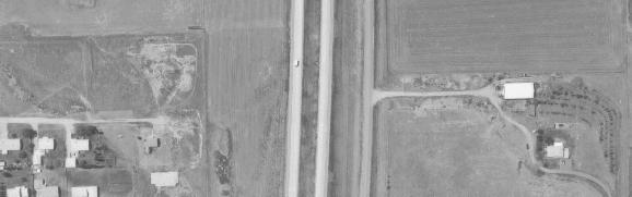

43
44
45
46
47
48
49
50
51
52
53
54
55


56
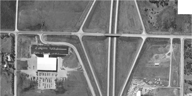
57
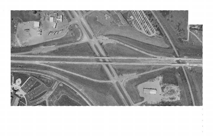
58
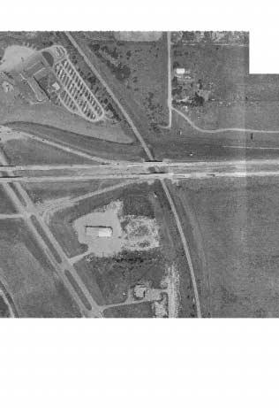
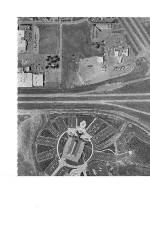
59
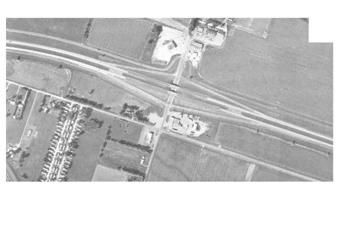
60
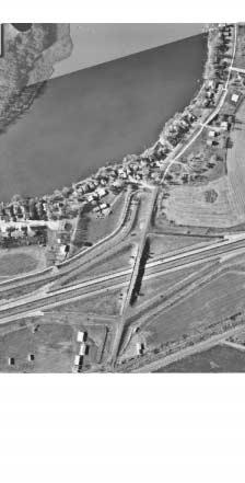
61
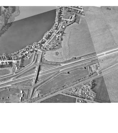

62
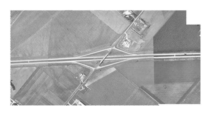
63
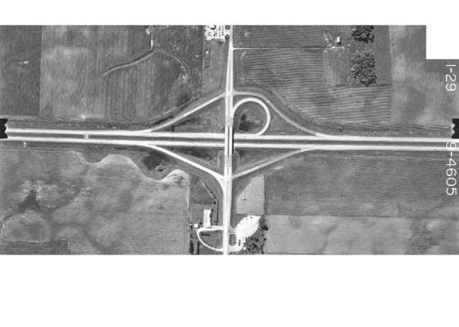
64
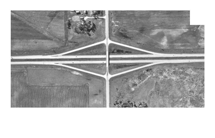
65
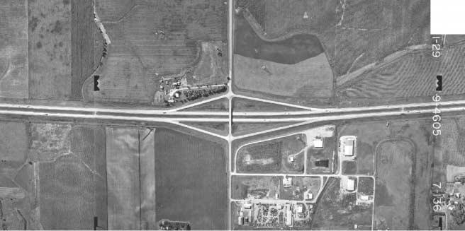
66
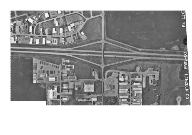
67
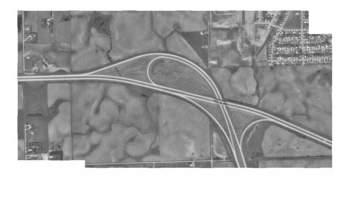
68
69

70
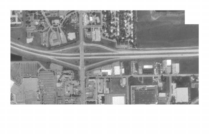
71
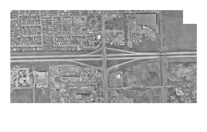
72
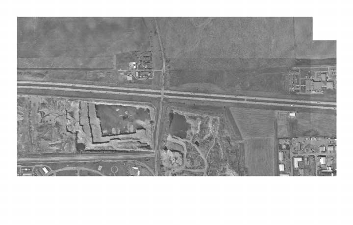
73
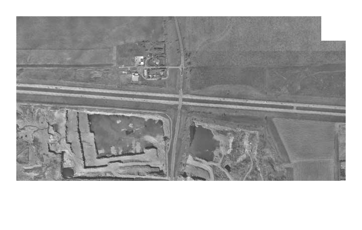
74
75
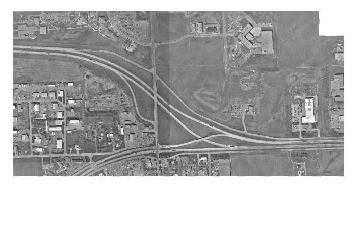
76
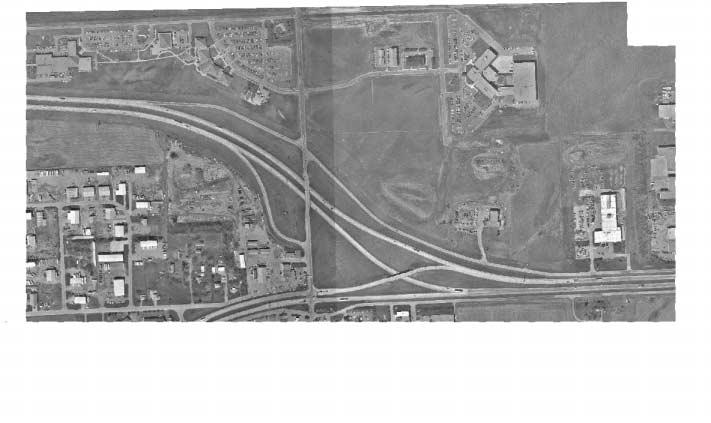
77
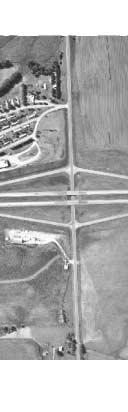
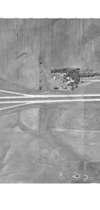
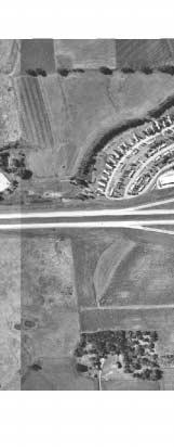

78
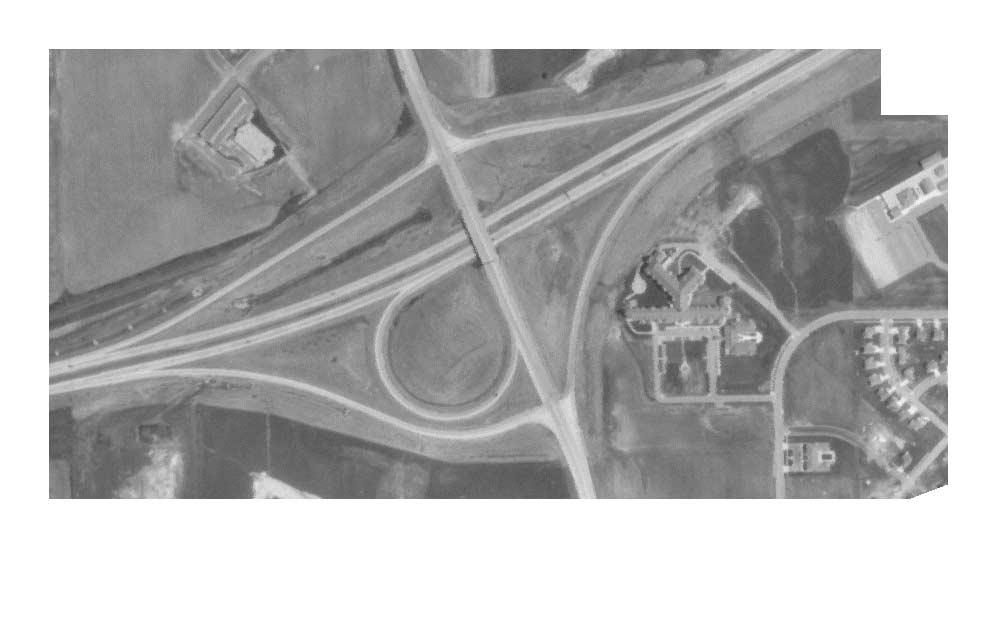
79
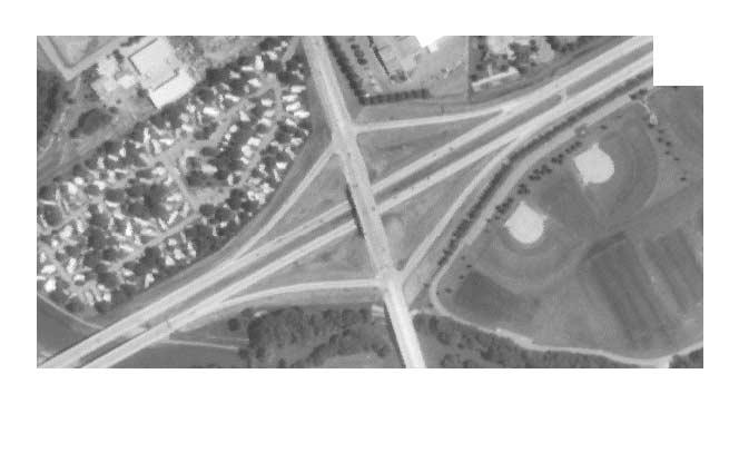
80
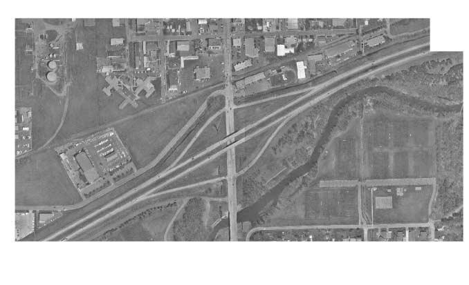
81
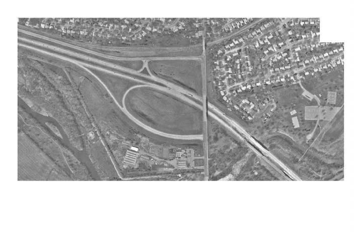
82
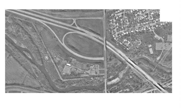
83
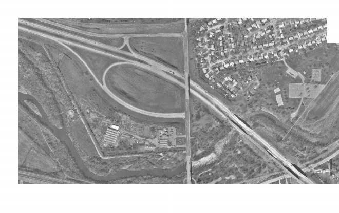
84
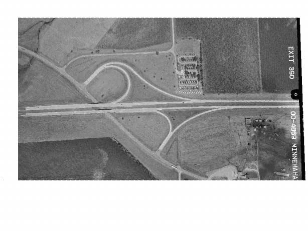
85
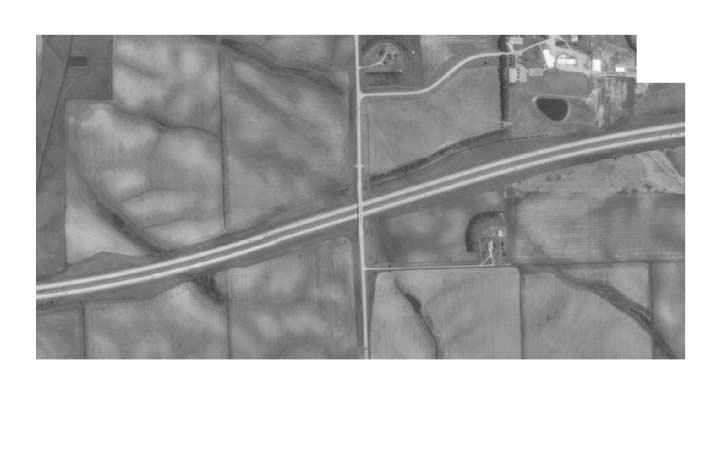
86
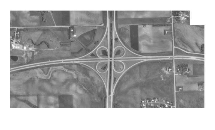
87
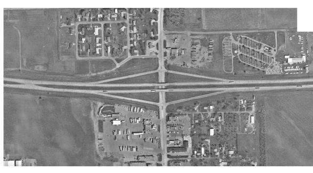
88
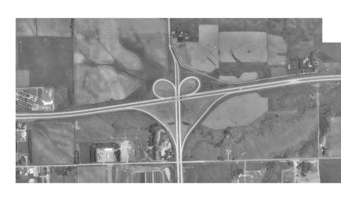
89
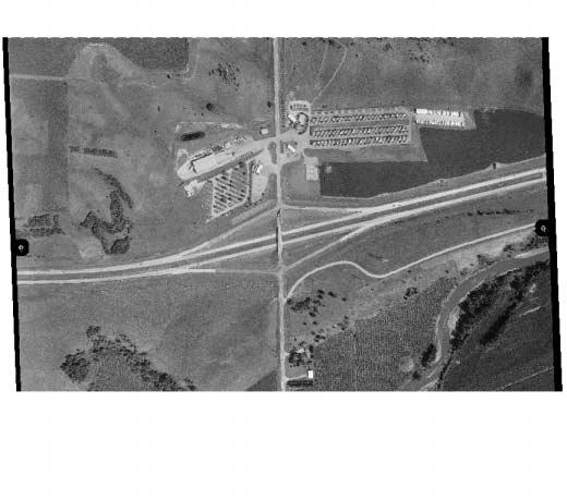
90
91
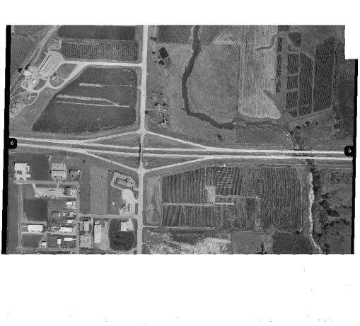
92
93
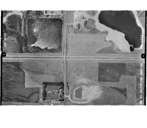
94
95
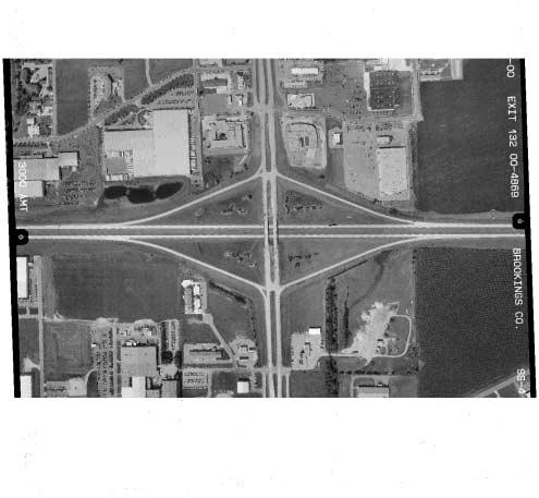
96
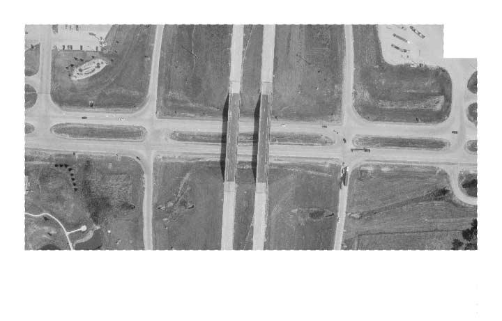
97
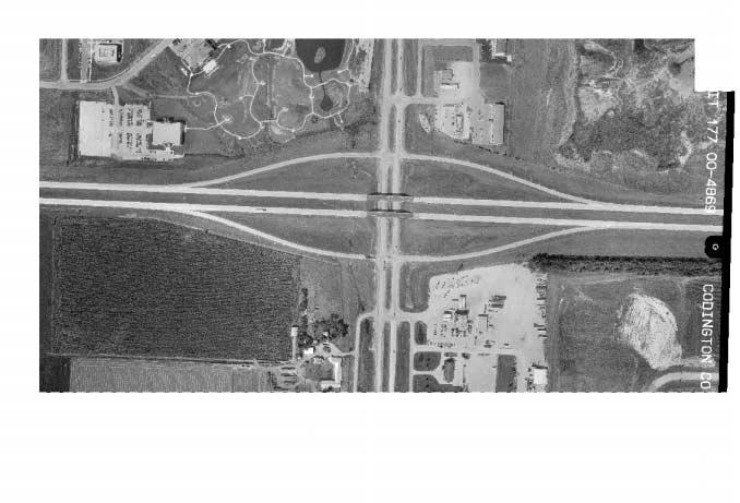
98
99
South Dakota Department of Transportation. Interchange Modification Justification Report. Interstate 90 Exit 44 (Bethlehem Road - Piedmont)
") South Dakota Department of Transportation Interchange Modification Justification Report Interstate 90 Exit 44 (Bethlehem Road - Piedmont) February 28, 2014 Prepared By: SDDOT Office of Project Development
South Dakota Department of Transportation Interchange Modification Justification Report Interstate 90 Exit 44 (Bethlehem Road - Piedmont) February 28, 2014 Prepared By: SDDOT Office of Project Development
FOR INTERSTATE 81 AND ROUTE 37 INTERCHANGE FREDERICK COUNTY, VIRGINIA MILEPOST 310
 INTERCHANGE MODIFICATION REPORT FOR INTERSTATE 81 AND ROUTE 37 INTERCHANGE FREDERICK COUNTY, VIRGINIA MILEPOST 310 PREPARED BY: VIRGINIA DEPARTMENT OF TRANSPORTATION STAUNTON DISTRICT DECEMBER 13, 2006
DRAFT. SR-60 7 th Avenue Intersection Control Evaluation (ICE) I-605 Corridor Improvement Project (CIP) I-605/SR-60 EA# 3101U0
 I-605 Corridor Improvement Project (CIP) I-605/SR-60 EA# 3101U0") SR-60 7 th Avenue Intersection Control Evaluation (ICE) I-605/SR-60 EA# 3101U0 October 9, 2017 Contents 1 Purpose of ICE Memo... 1 2 Background... 1 3 Existing Interchange Deficiencies... 1 4 Context Sensitive
SR-60 7 th Avenue Intersection Control Evaluation (ICE) I-605/SR-60 EA# 3101U0 October 9, 2017 Contents 1 Purpose of ICE Memo... 1 2 Background... 1 3 Existing Interchange Deficiencies... 1 4 Context Sensitive
I 75 PD&E STUDIES TABLE OF CONTENTS DTTM, TECHNICAL REPORT No. 2 TABLE OF CONTENTS
 TABLE OF CONTENTS DTTM, TECHNICAL REPORT No. 2 TABLE OF CONTENTS SECTION PAGE NO. SECTION TITLE NO. EXECUTIVE SUMMARY -------------------------------------------------------------------- ES-1 1.0 INTRODUCTION
APPENDIX B. Excerpts from the October 2002 Conceptual Alternatives Report
 APPENDIX B Excerpts from the October 2002 Interstate 83 and PA Route 921 The objective for the SR 921 interchange site was to study alternatives for construction of a new interchange. There are no short-term
I-35/80 Operations Study: Douglas Avenue to NW 86 th Street FOR
 : Douglas Avenue to NW 86 th Street FOR Iowa Department of Transportation City of Urbandale City of Grimes February 7, 2013 FINAL Prepared by: HR Green, Inc. HR Green Project Number: 40110031 TABLE OF
US 14 EIS (New Ulm to N. Mankato) Interchange and Intersection Type Comparison
 Interchange and Intersection Type Comparison") T E C H N I C A L M E M O R A N D U M US 14 EIS (New Ulm to N. Mankato) Interchange and Intersection Type Comparison PREPARED FOR: Mn/DOT District 7 PREPARED BY: CH2M HILL DATE: March 27, 2007 This technical
T E C H N I C A L M E M O R A N D U M US 14 EIS (New Ulm to N. Mankato) Interchange and Intersection Type Comparison PREPARED FOR: Mn/DOT District 7 PREPARED BY: CH2M HILL DATE: March 27, 2007 This technical
2 Purpose and Need. 2.1 Study Area. I-81 Corridor Improvement Study Tier 1 Draft Environmental Impact Statement
 2 Purpose and Need 2.1 Study Area Interstate 81 (I-81) is relied upon for local and regional travel and interstate travel in the eastern United States. It extends 855 miles from Tennessee to New York at
VIII. LAND USE ISSUES
 VIII. LAND USE ISSUES The & Route 57 Land Use and Circulation Study (Land Use Study, Figure 6) was completed for the Town of Clay in November 1999 (Clough, Harbour & Associates). This study investigated
Military Highway Interchange
 III. Military Highway Interchange Deficiencies Design Challenges Proposed Alternatives III.1.2 Volumes & Operations Figure III.2: Existing Volumes displays the existing volumes for the Military Highway
TRANSPORTATION PROJECT REPORT DRAFT CONCEPTUAL ACCESS MODIFICATION PROPOSAL OCTOBER 2002
 TRANSPORTATION INTERSTATE 87 INTERCHANGE 11A TOWN OF MALTA SARATOGA COUNTY, NY DRAFT CONCEPTUAL ACCESS MODIFICATION PROPOSAL OCTOBER 2002 PROJECT REPORT NEW YORK STATE DEPARTMENT OF TRANSPORTATION JOSEPH
CHAPTER 4 GRADE SEPARATIONS AND INTERCHANGES
 CHAPTER 4 GRADE SEPARATIONS AND INTERCHANGES 4.0 INTRODUCTION The ability to accommodate high volumes of intersecting traffic safely and efficiently through the arrangement of one or more interconnecting
Community Advisory Committee Meeting No. 2. June 22, 2006
 Community Advisory Committee Meeting No. 2 June 22, 2006 Introductions The Study Team KDOT Wichita Partners Consultants CAC members Overview Today s Agenda Opinion Survey Study Status Starting Concept
M D 355 [FR E D E R IC K R O A D] OVER
![M D 355 [FR E D E R IC K R O A D] OVER](/thumbs/79/79553721.jpg "M D 355 [FR E D E R IC K R O A D] OVER") M D 355 [FR E D E R IC K R O A D] OVER LITTLE BENNETT CREEK MAINTENANCE OF TRAFFIC ALTERNATIVE ANA LYSIS Prepared by: INTRODUCTION The purpose of this report is to present the results of traffic analyses
M D 355 [FR E D E R IC K R O A D] OVER LITTLE BENNETT CREEK MAINTENANCE OF TRAFFIC ALTERNATIVE ANA LYSIS Prepared by: INTRODUCTION The purpose of this report is to present the results of traffic analyses
500 Interchange Design
 500 Interchange Design Table of Contents 501 Interchange Design... 5-1 July 2015 501.1 General... 5-1 501.2 Interchange Type... 5-1 501.2.1 General... 5-1 502 Interchange Design Considerations... 5-2 502.1
I-81 CORRIDOR IMPROVEMENT STUDY
 EXECUTIVE SUMMARY REPORT I-81 CORRIDOR IMPROVEMENT STUDY Submitted to: PENNSYLVANIA DEPARTMENT OF TRANSPORTATION DISTRICT 4-0 55 Keystone Industrial Park Dunmore, PA 18512 August 2007 CONTENTS Contents
GRE PID 80468
 Assessment of Feasible Alternatives Prepared for Ohio Department of Transportation 505 South SR 741 Lebanon, OH 45036-9518 December 2011 One Dayton Centre, Suite 1100 One South Main Street Dayton, OH 45402
NW La Center Road/I-5 Interchange Improvement Project (MP 16.80)
") FINAL DRAFT - NW La Center Road/I-5 Interchange Improvement Project (MP 16.80) La Center, Washington February 2015 FINAL DRAFT - NW La Center Road/I-5 Interchange Improvement Project (MP 16.80) La Center,
FINAL DRAFT - NW La Center Road/I-5 Interchange Improvement Project (MP 16.80) La Center, Washington February 2015 FINAL DRAFT - NW La Center Road/I-5 Interchange Improvement Project (MP 16.80) La Center,
FINAL PROJECT PRIORITIZATION PLAN FOR THE NM 599 CORRIDOR
 FINAL PROJECT PRIORITIZATION PLAN FOR THE NM 599 CORRIDOR PROJECT NO. WIP-599-1(102) CONTROL NO. D5SF2 APRIL 2010 Prepared for: New Mexico Department of Transportation Northern Design Bureau P.O. Box 1149
WELCOME. Public Meeting for I-35 / I-44 Interchange. October 6, 2015
 WELCOME Public Meeting for I-35 / I-44 Interchange October 6, 2015 TEAM INTRODUCTIONS PURPOSE OF THIS MEETING is to present the alternative alignments for the I-35/I-44 and I-35/NE 63rd Street Interchanges
CHAPTER 3 SCOPE SUMMARY
 CHAPTER 3 SCOPE SUMMARY GENERAL The SDDOT is an active member of AASHTO to share common national design standards for the state highway system. The AASHTO Task Force on Geometric Design has completed the
Interchange Workshop Report (August 2004)
") U.S. Highway 14 Corridor Study New Ulm to North Mankato Table of Contents Section Interchange Workshop Report (August 2004) Page 1. Introduction and Next Steps 1 2. Interchange Workshop Participants &
U.S. Highway 14 Corridor Study New Ulm to North Mankato Table of Contents Section Interchange Workshop Report (August 2004) Page 1. Introduction and Next Steps 1 2. Interchange Workshop Participants &
Vicinity Map. Interstate 605 (I-605) and State Route 91 (SR-91) in Los Angeles County
 and State Route 91 (SR-91) in Los Angeles County") 07 - LA - 605 - PM 2.87/PM 6.36 07 - LA - 91 - PM 14.10/PM 19.81 Vicinity Map N On Routes Interstate 605 (I-605) and State Route 91 (SR-91) in Los Angeles County I-605 between Excelsior Dr UC (PM 6.36)
07 - LA - 605 - PM 2.87/PM 6.36 07 - LA - 91 - PM 14.10/PM 19.81 Vicinity Map N On Routes Interstate 605 (I-605) and State Route 91 (SR-91) in Los Angeles County I-605 between Excelsior Dr UC (PM 6.36)
500 Interchange Design
 500 Interchange Design Table of Contents 501 Interchange Design... 1 501.1 General... 1 501.2 Interchange Type... 1 501.2.1 General... 1 502 Interchange Design Considerations... 2 502.1 Determination of
INTERCHANGE MODIFICATION REPORT
 INTERSTATE 75 AND STATE ROAD 884 (COLONIAL BOULEVARD) INTERCHANGE LEE COUNTY, FLORIDA INTERCHANGE MODIFICATION REPORT Prepared for: Florida Department of Transportation District One May 2017 Interchange
FLORIDA DEPARTMENT OF TRANSPORTATION Planning and Environmental Management Office INTERCHANGE MODIFICATION REPORT
 FLORIDA DEPARTMENT OF TRANSPORTATION Planning and Environmental Management Office INTERCHANGE MODIFICATION REPORT District 2 1109 South Marion Avenue Lake City, FL 32025-5874 INTERSTATE 10 (SR 8) / SR
Exit 73 I-29 Interchange Modification Justification Study
 xit 73 I-29 Interchange Modification Justification tudy Introduction Figure 1 shows the location of xit 73. This interchange is proposed to be the connecting point of the ast and West Corridors to I-29.
Conclusions & Lessons Learned
 What is a DDI Recommended Practices Traffic Operations Analysis Geometric Design FHWA Review Conclusions & Lessons Learned It s not about you, it s about the public Developed by Access Utah County
The Folded Interchange: An Unconventional Design for the Reconstruction of Cloverleaf Interchanges
 The Folded Interchange: An Unconventional Design for the Reconstruction of Cloverleaf Interchanges I. ABSTRACT Keith A. Riniker, PE, PTOE This paper presents the Folded Interchange design and compares
MEMORANDUM: INITIAL CONCEPTS SUMMARY
 MEMORANDUM: INITIAL CONCEPTS SUMMARY INTRODUCTION This memo presents a summary of initial concepts that have been identified as development of the project study has progressed, along with a recommendations
2017 TIGER DISCRETIONARY GRANT APPLICATION
 2017 TIGER DISCRETIONARY GRANT APPLICATION Spokane International Airport Spokane, WA APPENDIX D 2015 Airport Drive Couplet at Spotted Road Airport Drive Couplet at Spotted Road April 2015 Prepared for:
LAS VEGAS STREET RAILROAD CROSSING RR/PUC CONNECTION AND PRELIMINARY DESIGN
 LAS VEGAS STREET RAILROAD CROSSING RR/PUC CONNECTION AND PRELIMINARY DESIGN Prepared for: City of Colorado Springs Prepared by: Felsburg Holt & Ullevig 508 South Tejon Street Colorado Springs, CO 80903
CHAPTER 5 PARALLEL PARKWAY CORRIDOR IMPROVEMENTS
 HPTER 5 PRLLEL PRKWY ORRIDOR IMPROVEMENTS nother key area within the Village West study area is the Parallel Parkway corridor. This chapter focuses on the segment of Parallel Parkway between 106 th Street
IH 30/IH 35E Reconstruction Project Pegasus Final Technical Memorandum - Evaluation of Conceptual Alternatives Task 7.5
 MEMO TO: Timothy Nesbitt, P.E. DATE: August 26, 2002 FROM: SUBJECT: Sandy Wesch-Schulze, P.E., AICP IH 30/IH 35E Reconstruction Project Pegasus Final Technical Memorandum - Evaluation of Conceptual Alternatives
RAPID CITY ARTERIAL SAFETY STUDY. Prepared for: City of Rapid City 300 Sixth Street Rapid City, South Dakota DRAFT.
 RAPID CITY ARTERIAL SAFETY STUDY Prepared for: City of Rapid City 300 Sixth Street Rapid City, South Dakota 57701 DRAFT Prepared by: Felsburg Holt & Ullevig 6300 South Syracuse Way, Suite 600 Centennial,
Chapter GRADE SEPARATIONS & INTERCHANGES
 Chapter 9 GRADE SEPARATIONS & INTERCHANGES 2012 ODOT Highway Design Manual Grade Separations And Interchanges 9.1 GENERAL INFORMATION There are three types of roadway intersections: intersections at-grade,
WOO-SR Feasibility Study (PID 90541) Feasibility Study Report April 22, 2011
 Feasibility Study Report April 22, 2011") TABLE OF CONTENTS EXECUTIVE SUMMARY... 1 CHAPTER 1: INTRODUCTION... 5 1.1 Study Purpose and background... 5 1.2 Study Approach... 6 1.3 Study Area... 6 CHAPTER 2: DESCRIPTIONS OF ALTERNATIVES... 7 2.1
TABLE OF CONTENTS EXECUTIVE SUMMARY... 1 CHAPTER 1: INTRODUCTION... 5 1.1 Study Purpose and background... 5 1.2 Study Approach... 6 1.3 Study Area... 6 CHAPTER 2: DESCRIPTIONS OF ALTERNATIVES... 7 2.1
CLA /10.54, PID Project Description:
 Project Description: The proposed project will consist of widening IR 70 to three lanes from Enon Road (SLM 06.75) to the US 68 interchange ramps (SLM 10.55). IR 70 is a component of the Strategic Highway
GEOMETRIC DESIGN CRITERIA for Non-freeway Resurfacing, Restoration, and Rehabilitation Projects
 GEOMETRIC DESIGN CRITERIA for Non-freeway Resurfacing, Restoration, and Rehabilitation Projects SEPTEMBER 1989 Arkansas State Highway and Transportation Department GEOMETRIC DESIGN CRITERIA for Non-freeway
Conceptual Design Report
 Conceptual Design Report I-244/Arkansas River Multimodal Bridge Tulsa, Oklahoma Prepared for the Oklahoma Department of Transportation Prepared by: August 2009 I-244 / ARKANSAS RIVER MULTIMODAL BRIDGE
Woodburn Interchange Project Transportation Technical Report
 Final Report Woodburn Interchange Project Transportation Technical Report Prepared for Oregon Department of Transportation April 212 Prepared by DKS Associates Contents Methodologies... 4 Volume Development...
5/11/2016 SR 15 SECTION 088 CSVT SOUTHERN SECTION SR 15 SECTION 088 CSVT SOUTHERN SECTION AGENDA
 PUBLIC OFFICIALS MEETING MAY 11, 2016 AGENDA I. INTRODUCTIONS V. CURRENT PROJECT STATUS VI. PROJECT SCHEDULE VII. UPCOMING ACTIVITIES VOPEN DISCUSSION & QUESTIONS IX. ACTION ITEMS 1 A. Bridge Lighting
Rapid City, SD HDR Project No RE: Replacement of Existing I-190 Twin Bridges at I-190/Silver Street Interchange, Rapid City, SD
 To: Steve Gramm, SDDOT Memo From: HDR Project: SDDOT I-190 Silver Street Interchange Study Rapid City, SD HDR Project No. 000000000137390 Date: December 27, 2011 RE: Replacement of Existing I-190 Twin
I-10 CORRIDOR IMPROVEMENTS STAGE 0 FEASIBILITY STUDY STATE PROJECT NUMBER H FEDERAL AID PROJECT NUMBER H004100
 JULY 2016 I-10 CORRIDOR IMPROVEMENTS STAGE 0 FEASIBILITY STUDY STATE PROJECT NUMBER H.004100 FEDERAL AID PROJECT NUMBER H004100 EAST BATON ROUGE AND WEST BATON ROUGE PARISHES, LOUISIANA Section TABLE OF
Appendix B Highway 407 Interchange Review - Cochrane Street Area
 Appendix B Highway 407 Interchange Review - Cochrane Street Area AECOM 300 ater Street hitby, ON, Canada L1N 9J2 www.aecom.com Memorandum To Michael May, P.Eng., Town of hitby Page 1 CC Subject Greg Hardy,
LOCATION AND DESIGN DIVISION
 VIRGINIA DEPARTMENT OF TRANSPORTATION LOCATION AND DESIGN DIVISION INSTRUCTIONAL AND INFORMATIONAL MEMORANDUM GENERAL SUBJECT: Interstate, NHS Non-Interstate and Non-NHS (IJR / IMR Guidance) SPECIFIC SUBJECT:
I 95 EXPRESS LANES SOUTHERN TERMINUS EXTENSION TRAFFIC OPERATIONS AND SAFETY ANALYSIS REPORT
 I 95 EXPRESS LANES SOUTHERN TERMINUS EXTENSION TRAFFIC OPERATIONS AND SAFETY ANALYSIS REPORT February 2016 INTERSTATE 95 EXPRESS LANES SOUTHERN TERMINUS EXTENSION PROJECT Commonwealth of Virginia Virginia
Exit 61 to Exit 67 Corridor Study
 63 67 61 90 Exit 61 to Exit 67 Corridor Study submitted to: The South Dakota Department of Transportation in conjunction with: City of Box Elder The Rapid City Area MPO and The Federal Highway Administration
FY STATEWIDE TRANSPORTATION IMPROVEMENT PROGRAM New Jersey Department of Transportation Project Descriptions ($ millions)
") FY 2018-2027 WIDE TRANSPORTATION IMPROVEMENT PROGRAM ADA Central, Contract 3 DBNUM: 15419 / UPC: 154190 This contract will bring projects into compliance with current ADA design requirements that could
FY 2018-2027 WIDE TRANSPORTATION IMPROVEMENT PROGRAM ADA Central, Contract 3 DBNUM: 15419 / UPC: 154190 This contract will bring projects into compliance with current ADA design requirements that could
PROJECT STUDY REPORT. Cal Poly Pomona Senior Project
 06/2014 PROJECT STUDY REPORT (Cal Poly Pomona Senior Project) For Conceptual Approval of an Interchange Improvement And Cooperative Agreement with The City of Lake Elsinore for completion of Project Approval
University Region FY 2023 Final Scoping Package
 September 30, 2016 University Region FY 2023 Final Scoping Package I-496/US-127 Scoping From I-96 to the I-496/US- 127 Interchange CS 33045 JN 126442 I-496/US-127 STUDY EXECUTIVE SUMMARY UNIVERSITY REGION
9.0 I-26 & I-526 Interchange Improvements
 9.0 I-26 & I-526 Interchange Improvements The I-26 & I-526 System-to-System interchange currently consists of a combination of directional and loop ramps providing for all movements from one Interstate
Environmental Consequences and Mitigation
 Chapter 4 Environmental Consequences and Mitigation 4.1 Introduction This chapter provides a detailed description of the impacts (and indirect impacts where applicable) associated with the alternatives
CHAPTER 8: I-71 ACCESS IMPROVEMNETS
 CHAPTER 8: I-71 ACCESS IMPROVEMNETS I-71 Access Improvements were a separate and distinct part of the overall Uptown Transportation Study. This Part B work is fully documented in the Planning Study Report
FY STATEWIDE TRANSPORTATION IMPROVEMENT PROGRAM New Jersey Department of Transportation Project Descriptions ($ millions)
") FY 2018-2027 WIDE TRANSPORTATION IMPROVEMENT PROGRAM NY Susquehanna and Western Rail Line Bicycle/Pedestrian Path DBNUM: NS9803 / UPC: 058018 The 4.8 mile New York, Susquehanna, and Western Railway (NYS&W)
FY 2018-2027 WIDE TRANSPORTATION IMPROVEMENT PROGRAM NY Susquehanna and Western Rail Line Bicycle/Pedestrian Path DBNUM: NS9803 / UPC: 058018 The 4.8 mile New York, Susquehanna, and Western Railway (NYS&W)
FINAL REPORT GUIDELINES FOR PRELIMINARY SELECTION OF THE OPTIMUM INTERCHANGE TYPE FOR A SPECIFIC LOCATION
 FINAL REPORT GUIDELINES FOR PRELIMINARY SELECTION OF THE OPTIMUM INTERCHANGE TYPE FOR A SPECIFIC LOCATION Nicholas J. Garber, Ph.D. Faculty Research Scientist and Professor of Civil Engineering Michael
TRAFFIC SAFETY EVALUATION. Using the Highway Safety Manual and the Interactive Highway Safety Design Model. I 15 Dry Lakes Design Exception
 TRAFFIC SAFETY EVALUATION Using the Highway Safety Manual and the Interactive Highway Safety Design Model I 15 Dry Lakes Design Exception Prepared for: Nevada Department of Transportation Safety Engineering
St. Francis Drive through the City of Santa Fe Corridor Study
 VIII. ENGINEERING AND ENVIRONMENTAL EVALUATION INTERSECTION IMPROVEMENTS SOUTHERN For the southern end of the corridor, traffic volumes are expected to increase over existing levels. The Phase A Report
Engineering Design Services for Safety Improvements along CR 476 from the Hernando County Line to US 301 (SR 35) Sumter County, Florida
 Sumter County, Florida") Engineering Design Services for Safety Improvements along CR 476 from the Hernando County Line to US 301 (SR 35) Sumter County, Florida November 7, 2014 SUBMITTED BY: Dewberry Bowyer-Singleton 520 South
Engineering Design Services for Safety Improvements along CR 476 from the Hernando County Line to US 301 (SR 35) Sumter County, Florida November 7, 2014 SUBMITTED BY: Dewberry Bowyer-Singleton 520 South
DDI s Can Move More Than Cars. Alex Ariniello. Presentation for the ITE Western District Annual Meeting. July, 2016 in Albuquerque, New Mexico
 DDI s Can Move More Than Cars Alex Ariniello Presentation for the ITE Western District Annual Meeting July, 2016 in Albuquerque, New Mexico In January, 2016, a Diverging Diamond Interchange (DDI) opened
Consideration of a Diverging Diamond Interchange in Saskatchewan. Paul H. A. Steel, Project Manager, M. Eng., P.Eng., Tetra Tech EBA Inc.
 Consideration of a Diverging Diamond Interchange in Saskatchewan Paul H. A. Steel, Project Manager, M. Eng., P.Eng., Tetra Tech EBA Inc. Terry Schmidt, P.Eng., MBA, Senior Project Director, Tetra Tech
Traffic Impact Study Guidelines. City of Guelph
 Traffic Impact Study Guidelines City of Guelph April 2016 Engineering and Capital Infrastructure Services Infrastructure, Development & Enterprise 1 Carden Street Guelph, Ontario Canada N1H 3A1 Page 1
I-64 Peninsula Shoulder Usage Evaluation. Eric Stringfield VDOT Hampton Roads Transportation Planning April 3, 2013
 I-64 Peninsula Shoulder Usage Evaluation Eric Stringfield VDOT Hampton Roads Transportation Planning April 3, 2013 Briefing Purpose Evaluation Area / Existing Conditions Code and Policy Engineering Facts
I-95 Corridor Study Phase II Highway Element
 I-95 Corridor Study Phase II Highway Element FAMPO Policy Committee July 16, 2018 1 I-95 Phase 2 Study Final Report A final report is being created to document the findings of the I-95 Phase 2 Study and
January 16, Rhode Island Energy Facilities Siting Board 89 Jefferson Boulevard Warwick, Rhode Island 02888
 INVENERGY 196 January 16, 2019 Rhode Island Energy Facilities Siting Board 89 Jefferson Boulevard Warwick, Rhode Island 02888 Re: Clear River Energy Center Invenergy Docket No. SB-2015-06 When Invenergy
Adaptation of HERS-ST Models for the South Carolina Interactive Interstate Management System
 Adaptation of HERS-ST Models for the South Carolina Interactive Interstate Management System presented to the Transportation Research Board HERS Modeling and Data Integration Conference presented by William
LANDSIDE FACILITIES AIRLINE TERMINAL FACILITIES INVENTORY 5.0 INTRODUCTION C H A P T E R 1 CHAPTER 5
 C H A P T E R 1 INVENTORY AIRLINE TERMINAL FACILITIES INVENTORY CHAPTER 5 LANDSIDE FACILITIES 5.0 INTRODUCTION This chapter focuses on the landside circulation and access system at the Spokane International
LOCATION AND DESIGN DIVISION
 VIRGINIA DEPARTMENT OF TRANSPORTATION LOCATION AND DESIGN DIVISION INSTRUCTIONAL AND INFORMATIONAL MEMORANDUM GENERAL SUBJECT: Design Exceptions / Waivers SPECIFIC SUBJECT: Design Exception Request Form
THE PROJECT. Executive Summary. City of Industry. City of Diamond Bar. 57/60 Confluence.
 THE PROJECT A freeway segment ranked 6th worst in the Nation, with levels of congestion, pollution and accidents that are simply unacceptable and which have Statewide and National implications. Executive
Diverging Diamond Interchanges in Michigan
 2015 MDOT / ACEC Partnering Workshop Diverging Diamond Interchanges in Michigan Lori Swanson MDOT Oakland TSC John Katers OHM Advisors Chris Van Norwick MDOT Grand Region Rob Leppala TranSystems Topics
Goleta Ramp Metering Study
 DRAFT Technical Memorandum Goleta Ramp Metering Study Subtasks 2.1 and 2.2: Data Collection and Existing Baseline Analysis June 5, 2017 DRAFT Technical Memorandum Goleta Ramp Metering Study Subtasks 2.1
PROCEDURES FOR NEW OR REVISED FREEWAY ACCESS IN ARKANSAS
 PROCEDURES FOR NEW OR REVISED FREEWAY ACCESS IN ARKANSAS June 2011 PROCEDURES FOR NEW OR REVISED FREEWAY ACCESS IN ARKANSAS June 2011 Prepared by: Arkansas State Highway and Transportation Department
Route 7 Connector Ramp MODIF IE D I N T ER C H A N G E M OD IFICATIO N R E PO RT TRA N S F O R M I : I N S ID E THE BE LTWAY
 STATE PROJECT NUMBER: 0066-96A-493,P101, C501, B686; UPC: 110629 FEDERAL PROJECT NUMBER: NHPP-066-1(356) FAIRFAX COUNTY, VIRGINIA TRA N S F O R M I - 6 6 : I N S ID E THE BE LTWAY Route 7 Connector Ramp
Beltline Interchange Range of Alternatives Screening Summary Memo
 Range of Alternatives Screening Summary Memo (Concurrence Point #2 from the Agency Coordination Plan) (I-39/90 and US 12/18 Interchange) Dane County, Wisconsin WisDOT Project ID 1007-10-02 Table of Contents
TABLE OF CONTENTS TABLE OF CONTENTS... I APPENDICES... III LIST OF EXHIBITS... V LIST OF TABLES... VII LIST OF ABBREVIATED TERMS...
 Amendment No. 2 to Reclamation Plan 2006-01 Traffic Impact Analysis TABLE OF CONTENTS TABLE OF CONTENTS... I APPENDICES... III LIST OF EXHIBITS... V LIST OF TABLES... VII LIST OF ABBREVIATED TERMS... IX
Going/Greeley Interchange Enhancements for Truck Operations
 Going/Greeley Interchange Enhancements for Truck Operations City of Portland Table of Contents What Is The Problem?.1 What Is The Purpose Of The Study?...1 Review Of Alternatives.1 Table: Estimated Cost
MEMORANDUM. Date: July 14, 2006 Project #: To: US 97 & US 20 Refinement Plan Steering Committee
 MEMORANDUM Date: July 14, 2006 Project #: 6389 To: US 97 & US 20 Refinement Plan Steering Committee From: Sonia Hennum, P.E., Andrew Cibor, E.I.T., & Julia Kuhn, P.E. Project: US 97 & US 20 Refinement
Jim Alexander Director of Design and Engineering, Southwest Light Rail Transit Project
 Memorandum Date: January 15, 2014 To: CC: From: Subject: Jim Alexander Director of Design and Engineering, Southwest Light Rail Transit Project Paul Danielson, P.E. Project Manager, Southwest Light Rail
EXECUTIVE SUMMARY. The IP developed the following purpose and need statement for the Part B I-71 Access Improvement Study.
 EXECUTIVE SUMMARY The Ohio-Kentucky-Indiana Regional Council of Governments (OKI) has conducted the with the following purpose: Develop a comprehensive transportation plan for the Uptown area that serves
Oklahoma Department of Transportation Environmental Programs Division Office Fax
 Oklahoma Department of Transportation Environmental Programs Division Office 521-3050 Fax 522-5193 Documented Categorical Exclusion (DCE) for I-40: Pavement Reconstruction and Added Lanes from the Douglas
Project Prioritization for Urban and Rural Projects TEAM CONFERENCE March 7, 2018
 Project Prioritization for Urban and Rural Projects 2018 TEAM CONFERENCE March 7, 2018 Challenge Limited funding for transportation improvements requires strategic selection of projects to ensure resource
Alternatives Evaluation Report. Appendix C. Alternatives Evaluation Report
 s Evaluation Report Appendix C s Evaluation Report I-35W North Corridor Project EA Minnesota Department of Transportation Final Project s Report I-35W North Corridor Preliminary Design Project Report Version
On behalf of the Carolina Crossroads project team we thank you for taking the time to attend this meeting.
 On behalf of the Carolina Crossroads project team we thank you for taking the time to attend this meeting. Located in the heart of South Carolina, the I-20/26/126 Corridor is the crossroads of the state
Section 3-01 General Concepts, Design Standards and Design Exceptions TABLE OF CONTENTS
 Section 3-01 General Concepts, Design Standards and Design Exceptions TABLE OF CONTENTS GENERAL CONCEPTS...2 General...2 Design Vehicle...2 Driver Expectancy...2 Design Speed...2 Sight Distances...3 Exhibit
APPENDIX B. Public Works and Development Engineering Services Division Guidelines for Traffic Impact Studies
 APPENDIX B Public Works and Development Engineering Services Division Guidelines for Traffic Impact Studies Revised December 7, 2010 via Resolution # 100991 Reformatted March 18, 2011 TABLE OF CONTENTS
Traffic Analysis. Appendix I
 FHWA #T-A000(18) / NHDOT #13742 Bow Concord Improvements Appendix I Traffic Analysis The traffic analysis for the project was conducted using the Bow-Concord Traffic Microsimulation Model prepared specifically
Truck Route Access Evaluation: Norfolk Southern Rail Terminal, Louisville, Site #1767
 Transportation Kentucky Transportation Center Research Report University of Kentucky Year 1999 Truck Route Access Evaluation: Norfolk Southern Rail Terminal, Louisville, Site #1767 Lisa Aultman-Hall Kenneth
WELCOME IL 47. Community Advisory Group Meeting #5 Waubonsee Community College Wednesday, May 31, 2017
 WELCOME IL 47 Community Advisory Group Meeting #5 Waubonsee Community College Wednesday, May 31, 2017 MEETING PURPOSE MEETING AGENDA 1. Welcome/Introduction 2. Review Previous Public Involvement 3. Process/Schedule
A three-stage process was implemented in order to develop and evaluate the project concepts and provide recommendations for the project.
 MEMORANDUM TO: FROM: Highway 36/Rice Street PMT Mark Benson DATE: March 23, 2009 RE: Selection of a Preferred Alternative SEH No. 105803 The purpose of this memorandum is to document the process for selecting
Public Meeting. US Highways 18 & 281 and SD Highway 50 From Douglas County Line to SD46 Charles Mix County
 Public Meeting US Highways 18 & 281 and SD Highway 50 From Douglas County Line to SD46 Charles Mix County Cary Cleland Road Design Engineering Supervisor January 17, 2017 Project Limits US18/US281 US281
BCEO TRAFFIC IMPACT STUDY GUIDELINES
 BCEO TRAFFIC IMPACT STUDY GUIDELINES February 2006 TABLE OF CONTENTS INTRODUCTION..... i TRAFFIC IMPACT STUDY STRUCTURE... 1 WHEN IS A TRAFFIC IMPACT STUDY NEEDED?..... 1 STUDY AREA, SITE PLAN & HORIZON
Rivers Edge Alternative Urban Areawide Review (AUAR) Traffic Study
 Traffic Study") Appendix F Rivers Edge Alternative Urban Areawide Review (AUAR) Traffic Study Prepared by Westwood Professional Services, Inc. for City of St. Paul Park Grey Cloud Island Township October 14, 2003 Introduction
Appendix F Rivers Edge Alternative Urban Areawide Review (AUAR) Traffic Study Prepared by Westwood Professional Services, Inc. for City of St. Paul Park Grey Cloud Island Township October 14, 2003 Introduction
Overall project. The $288 million Phase 2 DesignBuild project starts construction. this spring, with completion by December 31, 2016
 Overall project Johnson County Gateway Interchange Project Improvements 87th Street The $288 million Phase 2 DesignBuild project starts construction this spring, with completion by December 31, 2016 Phase
CHAPTER 1 PROPOSED PROJECT
 CHAPTER 1 PROPOSED PROJECT 1.1 INTRODUCTION The California Department of Transportation (Caltrans), in cooperation with the Los Angeles County Metropolitan Transportation Authority (Metro), propose to
Appendix B. Benefit-Cost Technical Memorandum
 Appendix B Benefit-Cost Technical Memorandum This Page Left Blank Intentionally MEMORANDUM TO: FROM: Michael Kalnbach MnDOT District 1 Project Manager Graham Johnson, PE DATE: September 2, 2014 RE: TH
TABLE OF CONTENTS. Section Section 2 Alternative A...7 Section 2 Alternative B...7
 TABLE OF CONTENTS I. General Description...................................................... 3 II. Need for Project.......................................................... 3 III. Adjacent Projects........................................................
1000 Performance Based Project Development (PBPD)
") Table of Contents 1000 Introduction... 1 1001 Application to the PDP... 1 1001.1 Planning... 2 1001.2 Preliminary Engineering... 3 1001.3 Design... 3 1002 Evaluation of PBPD Options... 4 1002.1 General...
Table of Contents 1000 Introduction... 1 1001 Application to the PDP... 1 1001.1 Planning... 2 1001.2 Preliminary Engineering... 3 1001.3 Design... 3 1002 Evaluation of PBPD Options... 4 1002.1 General...
HALDIMAND COUNTY DESIGN CRITERIA SECTION T TRAFFIC IMPACT STUDY GUIDELINES
 HALDIMAND COUNTY DESIGN CRITERIA SECTION T TRAFFIC IMPACT STUDY GUIDELINES Revised 2015 TRAFFIC IMPACT STUDIES PAGE 1 T 1.00 T 1.01 INTRODUCTION TRAFFIC IMPACT STUDY One of Haldimand County s key objectives
Informational Brochure. Proposed Interchange. Interstate Route 295 (I-295) AT Greenville Avenue (State Route 5) Town of Johnston, Rhode Island
 AT Greenville Avenue (State Route 5) Town of Johnston, Rhode Island") Informational Brochure Proposed Interchange OF Interstate Route 295 (I-295) AT Greenville Avenue (State Route 5) Town of Johnston, Rhode Island October 5, 2016 Department of Transportation Two Capitol
Informational Brochure Proposed Interchange OF Interstate Route 295 (I-295) AT Greenville Avenue (State Route 5) Town of Johnston, Rhode Island October 5, 2016 Department of Transportation Two Capitol
7 Transportation Improvement strategies
 7-1 7 Transportation Improvement strategies Based on analyses conducted during the course of the /I-10 Feasibility Study, it was determined that various alternatives for improving the entire corridor to