The Port ENC a proposal for a new port related ENC standard. The EFFORTS project
|
|
|
- Katherine Collins
- 5 years ago
- Views:
Transcription
 standard and data")
1 The Port ENC a proposal for a new port related ENC standard Combined 20 th TSMAD and 2nd DIPWG Meeting 3 to 7 May 2010 (Rostock, Germany) The EFFORTS project A general remark: Port ECDIS was the EFFORTS work package synonym we defined a proposal for new Port ENC (PENC) standard and data set!! 2 1


2 The EFFORTS project Project acronym: EFFORTS Project title: Effective Operation in Ports The Subproject 1 Navigation in Ports aims at the improvement of safety and efficiency of navigation in ports considering decreasing manoeuvring space (vessel size in relation to fairways and basins) versus increasing traffic and vessel sizes. 3 The Port ECDIS story starts with the question: Why a Port ECDIS?! 4 2


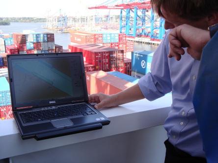
3 Why a Port ECDIS Port ENC?! Ports are the hubs of global trade and the most challenging areas with the highest level of special requirements regarding safe and ease of navigation, manoeuvring, berthing etc. including the highest level of special requirements Harbor Masters, Pilots, Ship's Officers, Tug Operators, Port Maintenance Operators have, to organize and realize safe and ease vessel traffic for transport execution! Safe and efficient arrival/departure for ships and their cargo is most crucial for ports! 5 Why a Port ECDIS Port ENC?! Increase of vessel sizes, Very Large Container Carrier (VLCCs) less harbour and manoeuvre space, Minimum Under Keel Clearance and special requirements for minimum dredging call for the highest level of accuracy and reliability of digital chart information for navigation in fairways and ports currently not being met by equipment according to SOLAS V Carriage requirements! Very Large Cruise Liner 6 3


4 Why a Port ECDIS Port ENC?! ship operations in ports docking 7 Why a Port ECDIS Port ENC?! less manoeuvre space vessel berthing Hasenpusch / Hafen Hamburg 8 4
, which meets IMO/SOLAS V carriage")
 The")

5 Why a Port ECDIS Port ENC?! less manoeuvre space bulk vessel turning and docking Hasenpusch / Hafen Hamburg 9 Why a Port ECDIS Port ENC?! Masters and pilots approaching a seaport use an Electronic Chart Display and Information System (ECDIS), which meets IMO/SOLAS V carriage requirements by using official maritime ENC s to obtain the required navigational information they need. The common IHO ECDIS standard for maritime ENC s supports navigation in the open sea, coastal areas and in seaports (like the Port of Hamburg) The Inland ECDIS standard for Inland ENC s (IENCs) was developed for navigation on inland waterways and uses the same accuracy and quality definitions like the maritime ECDIS standard but without meeting the requirements ports have regarding precise navigational, manoeuvring, berthing, turning, docking, maintenance, up to-dateness, scale and accuracy aspects! 10 5
6 Why a Port ECDIS Port ENC?! Port ENC requirements for navigation, manoeuvring and for the port maintenance go far beyond the current maritime ECDIS and Inland ECDIS standards regarding: up-to-dateness quality accuracy large scale charts chart features/objects and attributes reliability of hydrographic data (Bathymetry) and geographic data (Topography). Hasenpusch / Hafen Hamburg 11 Why a Port ECDIS Port ENC?! For Port operations special requirements must be fulfilled with respect to vertical and horizontal accuracy. This is normally achieved by using modern sensor technology. The same accuracy must be inherent in the underlying electronic charts. This type of source data (e.g., topographic and hydrographic data) should be made available by the Port Authorities using a standardized data format Port ENC standard. Hasenpusch / Hafen Hamburg 12 6
7 Why a Port ECDIS Port ENC?! At present, there is no standard or extensions considering the special requirements of port operations! That call for a specific Port ECDIS Port ENC. A Port ENC is needed!! result of the Port ECDIS questionnaire 13 Why a Port ECDIS Port ENC?! The Port ENC Standard should be an independent but complementary standard to maritime ENC and Inland ENC. The development of a Port ENC standard focuses on high precision operations in ports. A Port ENC intended to align with the ongoing developments for maritime and Inland ENCs. ( IHO S100 Standard, Maritime Spatial Data Infrastructure MSDI.) Port ENC data should serve as the missing link between maritime and Inland ENCs. 14 7
8 Why a Port ECDIS Port ENC?! Using a Port ENC as the base, it s possible to overlay other types of information to improve the interoperability of harbour-related tasks. ship manoeuvres and docking by Pilots using Portable Piloting Units (PPUs) incuding a precise Port ENCs Port Authority dredging and maintenance activities at channels, piers and berthes can use the PENC s 15 Why a Port ECDIS Port ENC?! ECDIS data are not only used onboard but also in: Vessel Traffic Services (VTS) / Vessel Traffic Management and Information Systems (VTMIS) Route planning application Marine Simulators (ship handling, tug simulator ) Besides ECDIS more and more applications have been developed, they are use ENCs (Electronic Navigational Chart) as backdrop information And on base of ECDIS technology (GIS) it will be possible to link, combine or overlay other information to improve the interoperability of harbour related tasks. 16 8
9 IHO Standards (S-57 & S-44) 17 IHO Standards (S-57 & S-44) IHO Standards do not provide significant topographic source data for integration in ENCs. No dedicated accuracy requirements are defined that apply for different navigational purposes / categories (e.g., port operations) Within ENCs and Inland ENC s, the IHO S-57 Zone of Confidence (ZOC) assessment is used to describe the quality of bathymetric data, but it is not used for topographic data! 18 9
10 IHO Standards (S-57 & S-44) S57 ECDIS definitions (Zone of Confidence - Bathymetry) highest level Bath, UK, Sept IHO S44 Ed. 5 new - Minimum Standards for Hydrographic Surveys - February 2008 used for the Port of Hamburg S57 ECDIS ZOC +/- 5m versus IHO S44 Special Order +/- 2m Mismatch between IHO S57 ECDIS Requirements and S44 Special Order! quay walls, bridges, locks etc.?! Bath, UK, Sept
, it meets all the relevant ENC related standards and fulfils the requirements for maritime navigation, but the ENC is")
11 IHO Standards (S-57 & S-44) One example is the official BSH - ENC of the Port of Hamburg. Produced and issued by BSH (Federal Maritime and Hydrographic Agency / Germany), it meets all the relevant ENC related standards and fulfils the requirements for maritime navigation, but the ENC is too small in scale, does not have any bathymetric detail, not showing up-to-date information and poorly defined horizontal accuracy for topographic features such as quay walls, piers, pontoons, etc. 21 Comparison HPA Basis Port ENC - BSH ENC BSH ENC-cell Port of Hamburg Federal Maritime and Hydrographic Agency name: DE date: scale: 1: small scale!! accuracy: S-57 Object Class: M_QUAL attribut: CATZOC = B (3) ±50m 22 11


! 24 12")
12 IHO Standards (S-57 & S-44) Comparison the official maritime ENC and the Port ENC 23 IHO Standards (S-57 & S-44) Comparison the official maritime ENC and the Port ENC Result: the official maritime ENC is not suitable for special operations within the port area the official BSH - ENC has a different purpose to meet (usage band 5 - harbour)! 24 12
13 The EFFORTS Work Package Port ECDIS - tasks 25 The EFFORTS Work Package Port ECDIS - tasks Task 1 Potential user requirements structured questionnaire Task 2 - Port ENC - Technical specification accuracy; precision of topography and aids of navigation; special new Port ENC objects (features and attributes); precise 3D depth information using Digital Terrain Models (DTM) technologies; 3D reference DTM (the Channel Reference Model CRM) Task 3 Prototype of a Port ENC Port ENC dataset of the Port of Hamburg, including precise Port ENC chart data, so named gridded bathymetry (in BAG format), bathymetric ENC's (benc) and a 3D channel reference model (CRM). Task 4 Testing of prototype(s) Tests on board of a HPA survey vessel; test using a PPU on board of a container vessel, functional tests onboard of a Trailer Suction Hopper Dredger (TSHD) and during docking process of a cruise liner
 which also includes AIS, Radar, VTMIS, Route Planning, dredging information, river and port basin maintenance")
14 The EFFORTS Work Package Port ECDIS - tasks Task 5 Defining requirements for follow-up developments and standardization (Port ENC - Roadmap). The Port ENC can be used as base information within a PORTIS (Port Information System) which also includes AIS, Radar, VTMIS, Route Planning, dredging information, river and port basin maintenance information, current and velocity, tidal information etc. Follow-up work to enhance the prototype, widen its application and organise standardisation was described. Port ENC can also be used in Marine Simulators (ship handling, tug simulator ) The outcome should be a proposal and comprehensive concept as basis and input for European / international standardization proved by validation and functional tests in the Port of Hamburg
 Precise ENC Base Chart Gridded Bathymetric Model [BAG] Channel Reference Model [CRM] Port ENC Overlay Chart maritime ENC Objects Inland ENC")
15 Gradation of the S-57 ENC products Standard exist maritime ENC (ENC) Product ID 1 Standard exist Inland ENC (IENC) Product ID 10 + Port ENC (PENC) new objects/features Port ENC (PENC) Product ID Port ENC components Port ENC Bathymetric ENC (benc) Precise ENC Base Chart Gridded Bathymetric Model [BAG] Channel Reference Model [CRM] Port ENC Overlay Chart maritime ENC Objects Inland ENC Objects Port ENC Objects Bathymetric Surface Outline Channel Reference Model Outline As part of the EFFORTS project, there are a number of new port specific objects, as well as requirements for the accuracy of these objects. These new requirements will ensure that the Port ENC makes the most accurate data available to the port users. The use of gridded bathymetry, channel outlines and channel depth model data will allow the users of the Port ENC to have an accurate and up to date 3 D information of the depth situation within the port. This will improve both, safety of navigation as well as port maintenance
16 D Potential users and requirements (structured questionnaire, study) D Port ENC specification (documents) D Port ENC prototype (software and dataset) including a Port ENC viewer D Tests with Port ENC prototype (based on basic dataset) and evaluation of tests (report) D Port ENC follow-up requirements (document) 31 D Potential users and requirements (structured questionnaire, study) Result: All the answers are reflecting exact the impression we had and why we are thinking, a precise Port ENC is necessary and a benefit for port navigation, manoeuvring and maintenance work! For Port operations a new port related dataset, a Port ENC, is needed and required (known request and the result of the Port ECDIS questionnaire)
17 D Potential users and requirements (structured questionnaire, study) What is left uncovered? high accuracy charts (for using RTK-DGPS, local RTK - DGPS services deliver cm accuracy, position must fulfil or be better than IHO - S44 Special Order) large scale information (1:500 up to 1:5000) with up to date information including special objects / features for port navigation and operation such as e.g. fenders etc. 3 D possibilities (Grid / Raster / TIN) a designed / constructed channel reference model (CRM) e.g. for dredged areas. 33 D Port ECDIS (Port ENC) specification (documents) Definition of present Data Quality in Standards used for ENC data (S57 versus S44 standard) Study about data quality in the following standards: IHO maritime ECDIS Inland ECDIS IHO S44 - Standards for Hydrographic Surveys 34 17
18 D Port ECDIS (Port ENC) specification (documents) Port ENC Feature Cataloque - description of the Port ENC features 35 Port ENC bathymetric data quality suggestion CATZOC accuracy S44 Ed. 5 (new) Minimum Standards for Hydrographic Surveys February 2008 Hydrographic survey batacc represents the IHO S44 SO 36 18
19 Port ENC geographic data quality suggestion CATZOC accuracy topacc Zone A 37 Port ENC geographic data quality suggestion CATZOC accuracy topacc Zone B 38 19
20 Port ENC encoding guide representation and symbolisation 39 Port ENC encoding guide 40 20

21 Port ENC encoding guide CATZOC accuracy representation and symbolisation Port ENC highest quality level Port ENC second highest quality level 41 Port ENC encoding guide representation and symbolisation 42 21


22 new Port ENC objects (examples) connection rod and radar refector bridge clearance 43 new Port ENC objects (examples) quay ladder fender double bollard berth name & nominal depth fender line 44 22

23 new Port ENC objects (examples) dredge field Port ENC product specification 46 23
 prototype (based on basic dataset) and evaluation of tests")

24 D Tests with Port ECDIS (Port ENC) prototype (based on basic dataset) and evaluation of tests (report) Remark: All the tests running very successful Delivering very promising results Demonstrating the outstanding quality and accuracy of the developed Port ENC!! 47 D Tests - PPU and accuracy test on board of survey vessel Deepenschriewer II Port ENC test 48 24


25 D Tests - PPU and accuracy test on board of survey vessel Deepenschriewer II Port ENC test 49 D Tests - PPU and accuracy test on board of survey vessel Deepenschriewer II "bow print" 50 25


26 D Tests - PPU and accuracy test on board of survey vessel Deepenschriewer II bow Port ENC test 51 D Tests - functional test during docking manoeuvre 7Cs ORCA Master Onboard ENC (inaccurate) Port ENC (precise) 52 26


 54 27")
27 D Tests - functional test during docking manoeuvre 7Cs ORCA Master 53 D Tests - functional test onboard of a TSHD (Trailer Suction Hopper Dredger) 54 27

 PENC same position!! 56 28")
28 D Tests - functional test onboard of a TSHD (Trailer Suction Hopper Dredger) Official maritime ENC 55 D Tests - functional test onboard of a TSHD (Trailer Suction Hopper Dredger) PENC same position!! 56 28
")
 Container")


29 D Tests - PPU (Marimatech) test onboard of a Container vessel (VLCC) Container Vessel Yang Ming Uberty (Lenght 333.5m - Breadth 42.8m - Draught: 11.0m). 57 D Tests - PPU test onboard of a Container vessel (VLCC) 58 29


 60")
30 D Tests - PPU test onboard of a Container vessel (VLCC) 59 D Tests - PPU test onboard of a Container vessel (VLCC) 60 30

 61 4 Tests -")

31 D Tests - PPU test onboard of a Container vessel (VLCC) 61 D Tests - functional test as base information in a VTMIS ATLAS Maritime Security GmbH 62 31


32 D Tests - functional test as base information in a VTMIS ATLAS Maritime Security GmbH 63 Innovative aspects 64 32
33 Innovative aspects The new standard takes into account the different accuracy definitions of S57- ECDIS / Inland ECDIS and also of IHO S44 IHO Standards for Hydrographic Surveys and defines a new Port ENC accuracy definition / class. Accuracy of ENC data m_aenc and the characteristic of these object = combined bathymetric and topographic accuracy meta objects > batacc and topacc) 65 Innovative aspects The proposed Port ENC standard has a far higher density of information, allowing more precise navigation / manoeuvring et cetera. The proposed Port ENC standard introduces additional data models and includes information not available in current standards, like 3D - gridded bathymetry ( in BAG format) and 3D - channel reference model (CRM) and supports the benc (bathymetric ENC) allowing new usages. New data representations allow for new visualization methods (3D) and new functionality for better data analysis
34 Innovative aspects The Port ENC could be a core component for e-navigation 67 Implementation of results within the port industry and beyond 68 34
35 Implementation of results within the port industry and beyond Harbour Masters, Pilots and Captains of the arriving and departing vessels, Port Authorities, TUG operators and other organisations, they work on port water area related maintenance tasks (e.g. dredging ), they all need and can use the higher accuracy and additional information of the Port ENC. They can navigate and work more easily, safely and precise within the PENC covered area (river, access channel, port basin, turning basin ). The new within the Port ENC presented information fills the current ECDIS - Inland ECDIS data lack. 69 Implementation of results within the port industry and beyond If more and more data becomes available in the proposed PENC standard, the data can be used for numerous other GIS driven approaches like: Vessel Traffic Service (VTS), Vessel Traffic Management and Information System (VTMIS) IALA - PAWSA (Port and Waterways Safety Assessment) Integrated Navigation Systems (INS) Portable Pilot Units (PPU s) Risk Management Accident Analysis Port planning / strategy Port Maintenance (dredging, embankment monitoring.) Tug and maritime simulation Route planning Harbour Rescue Coordination Port services (stowage, logistics, public transport management etc.) 70 35

36 the Port ENC & the Port ECDIS viewer - examples 71 the Port ENC & the Port ECDIS viewer - examples 72 36

37 Port ENC the Base Port Chart ENC & the Port ECDIS viewer - examples 73 Port ENC the Base Port Chart ENC & the Port ECDIS viewer - examples 74 37


38 Port ENC Bathymetric ENC (benc) Chart thebase Port ENC & the Port ECDIS viewer - examples 75 Port ENC Gridded Data [BAG] Chart thebase Port ENC & the Port depth ECDIS viewer - examples absolute 76 38


39 Port ENC Chart thebase Port ENC & Gridded Data [BAG] thesafety Portdepth ECDIS viewer - examples 77 Port ENC Channel Reference Chart thebase Port ENC & the Port ModelECDIS viewer - examples 78 39

 CRM Port vs.")

40 Gridded Data Port ENC Bathymetric [BAG] the Base Port Chart ENC & ENC the (benc) CRM Port vs. depth ECDIS viewer - examples 79 3 D view Bathymetry 80 40


41 3 D view Channel Reference Model 81 3 D view Bathymetry versus CRM 82 41
42 D Port ECDIS (Port ENC) follow-up requirements (document) 83 D Port ECDIS (Port ENC) followup requirements (document) If you have some additional requirements or new ideas, please let us know!! 84 42
43 We informed about the project: IHO - International Hydrographic Organisation IMO - International Maritime Organization Open ECDIS Organisation Inland ENC Harmonization Group EC - European Commission - Directorate-General Energy and Transport UN/ECE - Economic Commission for Europe of the United Nations CCNR - Central Commission for Navigation on the Rhine DC - Danube Commission IAPH - Head Office (Tokyo) - International Association of Ports and Harbors IAPH - Europe Office (Rotterdam) IHMA - International Harbour Masters' Association EHMC - European Harbour Masters' Committee PIANC - International Navigation Association BMVBS - Federal Ministry of Transport, Building and Urban Affairs, Germany IALA - International Association of Marine Aids to Navigation and Lighthouse Authorities IMPA - International Maritime Pilots Association EMPA - European Maritime Pilot's Association EMSA - European Maritime Safety Agency 85 The Port ENC proposal for a new standard 86 43
44 The Port ENC proposal for a new standard The successful result of the EFFORTS work package Port ECDIS could be only a proposal and comprehensive concept for a new Port ENC standard!! It can be currently only a first step! 87 Developing a Port ECDIS - a challenge mastered Final statement It must be reliable and clear, that the harbour master, the pilot, the captain and all other user can trust the topographic and bathymetric information within the Port ENC! So the Port ENC can be used as reference system for navigation! "If the vessel sails on land the positioning of the vessel is inaccurate, not the Port ENC!" 88 44
45 Developing a Port ECDIS - a challenge mastered Thank you for your attention!! 89 Kontaktdaten on behalf of the HPA Hamburg Port Authority AöR Neuer Wandrahm Hamburg Germany Phone.: Mobile: Dieter.Seefeldt[at]DieSee.com 90 45
The Port ENC part of e-navigation, RIS, VTS, AIS Results of the integrated EU research project EFFORTS
 The Port ENC part of e-navigation, RIS, VTS, AIS Results of the integrated EU research project EFFORTS September 13-16, 2011, New Orleans, Louisiana, USA The integrated EU research project EFFORTS (May
How to handle actual requirements of ENC users and data producers in the Port of Hamburg. 29th October 2013
 How to handle actual requirements of ENC users and data producers in the Port of Hamburg 29th October 2013 How to handle actual requirements of ENC users and data producers in the Port of Hamburg Contents
Port ENCs delivering Enhanced Situational Awareness. Caroline Levey Operations Director OceanWise
 Port ENCs delivering Enhanced Situational Awareness Caroline Levey Operations Director OceanWise Introduction Challenges for Ports Why use a Port or Bathymetric ENC Case Studies Brent Delta Clydeport Southampton
Using Port ENCs for Decision Support. Caroline Levey Operations Director OceanWise
 Using Port ENCs for Decision Support Caroline Levey Operations Director OceanWise Introduction Challenges for Ports Why use a Port or Bathymetric ENC Simple steps to create PENC/bENC Case Studies Brent
Inland Electronic Navigation Chart production at the Flemish Hydrography (Flanders - Belgium)
") Inland Electronic Navigation Chart production at the Flemish Hydrography (Flanders - Belgium) Dumollin Jasmine, Belgium Flemish Ministry of Mobility and Public Works, Agency for Maritime and Coastal Services,
Inland Electronic Navigation Chart production at the Flemish Hydrography (Flanders - Belgium) Dumollin Jasmine, Belgium Flemish Ministry of Mobility and Public Works, Agency for Maritime and Coastal Services,
e-navigation: Do we need the IMO SIP? Dr Edward Hosken Head of Technical Engagement
 e-navigation: Do we need the IMO SIP? Dr Edward Hosken Head of Technical Engagement www.admiralty.co.uk edward.hosken@ukho.gov.uk When did you last use Google Maps? A can t live without it tool But nobody
e-navigation Frequently Asked Questions
 e-navigation Frequently Asked Questions 1. What is e-navigation? e-navigation is an International Maritime Organization (IMO) led concept based on the harmonisation of marine navigation systems and supporting
FLUSSINFORMATIONSSYSTEME IM EUROPÄISCHEN VERGLEICH RIVER INFORMATION SERVICES IN EUROPE. von / by Cas Willems
 FLUSSINFORMATIONSSYSTEME IM EUROPÄISCHEN VERGLEICH RIVER INFORMATION SERVICES IN EUROPE von / by Cas Willems 1 Introduction In the transport branch and definitely in inland shipping the use of information
e-navigation and practical applications to monitor and improve the Marine Transportation System
 e-navigation and practical applications to monitor and improve the Marine Transportation System TRB-CMTS R&D Conference 26 June 2012 Diagnosing the Marine Transportation System: Measuring Performance and
STATUS QUO REPORT ON ENC ACTIVITIES
 NETWORK OF DANUBE WATERWAY ADMINISTRATIONS South-East European Transnational Cooperation Programme STATUS QUO REPORT ON ENC ACTIVITIES RO - ACN Document ID: Activity: 5.2 Author / Project Partner: Date:
Maritime Navigation and Information Services MarNIS i.r.t. River Information Services
 Maritime Navigation and Information Services MarNIS i.r.t. River Information Services Lea Kuiters Technical Coordinator of MarNIS Why MarNIS on a Smart Rivers conference? RIS paved the way for MarNIS Co-modality
SECTION 1: CURRICULUM SUMMARY. 1. Occupational Information. 1.1 Associated Occupation. 1.2 Occupation or Specialisation Addressed by this Curriculum
 SECTION 1: CURRICULUM SUMMARY 1. Occupational Information 1.1 Associated Occupation 315401: Air Traffic Controller 1.2 Occupation or Specialisation Addressed by this Curriculum 315401001: Vessel Traffic
Inland ENC Development and Standardization
 Inland ENC Development and Standardization Anthony R. Niles U.S. Army Corps of Engineers ERDC Topographic Engineering Center Alexandria, Virginia USA Dr. Lee Alexander Center for Coastal and Ocean Mapping
MARIN Seminar "VTS, een uitdagende toekomst"
 MARIN Seminar "VTS, een uitdagende toekomst" Toekomstige VTS-systemen Dominic Jarvis Sarnia Maritime b.v. Wageningen 23 april 2010 VTS definition a service implemented by a competent authority, designed
e-navigation & River Information Services Inland Waterways Users Board Meeting Pittsburgh, PA 06 June 2012
 e-navigation & River Information Services Inland Waterways Users Board Meeting Pittsburgh, PA 06 June 2012 Brian Tetreault US Army Corps of Engineers Engineer Research & Development Center Coastal and
e-navigation and it s applicability to inland waterways
 e-navigation and it s applicability to inland waterways Brian Tetreault U.S. Army Corps of Engineers ERDC Coastal and Hydraulics Laboratory e-navigation International definition (IMO, IALA): e-navigation
NELI Inland Navigation and Ports Course - curriculum -
 Cooperation-Network for logistics and nautical education focusing on Inland Waterway Transport in the Danube corridor supported by innovative solutions NELI Inland Navigation and Ports Course - curriculum
INFORMATION BULLETIN No. 51
 Bulletin No. 51 Revision No. 08 Issue Date 14 Nov 2017 Effective Date 14 Nov 2017 INFORMATION BULLETIN No. 51 ECDIS, Nautical Charts and Publications Guidance and Instructions for Bahamas Recognised Organisations,
Benefits of cooperation at the EU level:
 : Symposium on test areas for autonomous ships Benefits of cooperation at the EU level: ad hoc group on MASS - VTS angle 9 May 2018 Jacob Terling Maritime Safety DG MOVE D.2 Introduction Development towards
Bulgarian Vessel Traffic Management and Information System and Education and Training of VTS Personnel in Bulgaria
 Bulgarian Vessel Traffic Management and Information System and Education and Training of VTS Personnel in Bulgaria Chavdar Alexandrov Nikola Vaptsarov Naval Academy, Varna, 9026, Bulgaria E-mail: ch.alexandrov@nvna.eu
Conversion table working groups Name working group Old number New number Conception des barrages mobiles et de barriers anti-tempêtes PIANC WG 101
 Conversion table working groups Name working group Old number New number Conception des barrages mobiles et de barriers anti-tempêtes PIANC WG 101 Guidelines for environmental impacts of vessels InCom
ST PETERSBURG MAY 12 th 16 th 2008
 6 TH CONGRESS of the THE INTERNATIONAL HARBOUR MASTERS ASSOCIATION ST PETERSBURG MAY 12 th 16 th 2008 1 Recent Developments and Applications of DUKC Technology By Dr. W T. O Brien, Executive Director,
Follow up of Industry Input Workshop 24/05/18 Update 20/08/18
 Follow up of Industry Input Workshop 24/05/18 Update 20/08/18 Done Business process and appendix Done Scope of data, based on process & appendix Done Selecting standardization bodies Done - Functional
ACCSEAS: The Future of e-navigation in the North Sea Region
 ACCSEAS: The Future of e-navigation in the North Sea Region Dr Alwyn I. Williams ACCSEAS Project Manager e-navigation Underway North America Vallejo, California, USA 3 rd April 2014 Shipping Challenges
MARITIEME AUTORITEIT SURINAME
 MARITIEME AUTORITEIT SURINAME National Report 12th MEETING OF THE MESO AMERICAN AND CARIBBEAN SEA HYDROGRAPHIC COMMISSION (MACHC) 5 th -9 th December 2011 Basseterre, St. Kitts Content 1. The Maritime
Jens Schröder-Fürstenberg BSH, Germany
 Bringing Land and Sea Together Jens Schröder-Fürstenberg BSH, Germany Background Technological development New user groups 2008 Danish National Survey and Cadastre Improve cooperation between hydrographic
Promoting RIS at a Pan-European Level Activities and Lessons Learned
 Barthold Van Acker Chair of UNECE Working Party on Inland Water Transport (SC.3) Promoting RIS at a Pan-European Level Activities and Lessons Learned Fifth CCNR RIS Workshop 17 November 2017, Strasbourg
GALILEO based Maritime Applications in Rostock and the Baltic Sea region
 Maritime Simulation Centre Warnemünde Title of Presentation GALILEO based Maritime Applications in Rostock and the Baltic Sea region Prof. Dr. Knud Benedict Hochschule Wismar Fachhochschule für Technik
PIANC Commission Working Group Report Reviews
 PIANC Commission Working Group Report Reviews EnviCom Working Group report details Initial review: conclusion * If identified as potentially sensitive, please highlight the particular areas of potential
OPERATIONS SEAFARER CERTIFICATION GUIDANCE NOTE SA MARITIME QUALIFICATIONS CODE VTS
 Page 1 of 9 Compiled by Approved by Chief Examiner Syllabus Committee: 22 November 2012 OPERATIONS SEAFARER CERTIFICATION GUIDANCE NOTE SA MARITIME QUALIFICATIONS CODE VTS Page 2 of 9 KNOWLEDGE, UNDERSTANDING
Enhancing Data Resolution to Improve Maritime Safety
 Enhancing Data Resolution to Improve Maritime Safety Pacific Northwest Waterways Association 2014 Annual Convention October 15 17 th, Vancouver, WA Jon Dasler, PE, PLS, CH Director of Marine Services,
efarled Beslutningsstøttesystemer Ombord
 efarled Beslutningsstøttesystemer Ombord Foredrag på Maritim Innovasjon 2007 28. november 2007 DnV, Høvik Morten Zachrisen Utvikling, DP & Navigasjon Kongsberg Maritime 1 efarled Implementation on Onboard
WEB BASED OPERATIONAL SYSTEM FOR OPTIMIZING SHIP TRAFFIC IN DEPTH CONSTRAINED PORTS by
 WEB BASED OPERATIONAL SYSTEM FOR OPTIMIZING SHIP TRAFFIC IN DEPTH CONSTRAINED PORTS by Simon B. Mortensen 1, Franz Thomsen 1, Alex Harkin 1, Senthil Kumar Shanmugasundaram 1, Claus Simonsen 2 and Robert
Contact Program Coordinator NMMT Working Group Holger Klindt
 emir is an open initiative of the German maritime industry for improving safety and efficiency in maritime transportation systems. emir provides a framework for engineering, validation, verification, and
BS 6349:Part 1.1: 1: General Code of practice for planning and design for operations. David Veale
 : 1: Principal Technical Expert for Marine Facilities Engineering Shell Projects and Technology OCIMF Representative on CB502 OCIMF The Oil Companies OCIMF mission is to be the International Marine Forum
E-navigation from theory to practical applications. Jon Leon Ervik Head of Department
 E-navigation from theory to practical applications Jon Leon Ervik Head of Department Development? Flight cockpit User friendly? Technical opportunities? Technical opportunities? Opportunities in e-navigation
MTS Resilience: enavigation Best Practices
 MTS Resilience: enavigation Best Practices Transforming the Marine Transportation System: A Vision for R&D TRB Conference 2C Panel: Safety and Security Bahar Barami, Ph.D. Senior Economist Volpe Center,
S-100 PROPOSAL FOR ONLINE DATA EXCHANGE. Why do we need it? How do we achieve it?
 S-100 PROPOSAL FOR ONLINE DATA EXCHANGE Why do we need it? How do we achieve it? vs. Static Data Static Data Collect all Information first -> Build a dataset Process data as a whole Mostly PULL Continuously
High Accuracy PPU s. Capt. Joost Mulder Chairman Dutch Pilots Corporation (NLc) EMPA conference Bergen, Norway
 EMPA conference Bergen, Norway") High Accuracy PPU s and how they can improve safety in navigation and piloting Capt. Joost Mulder Chairman Dutch Pilots Corporation (NLc) EMPA conference Bergen, Norway 11-5-2017 High Accuracy PPU s and
High Accuracy PPU s and how they can improve safety in navigation and piloting Capt. Joost Mulder Chairman Dutch Pilots Corporation (NLc) EMPA conference Bergen, Norway 11-5-2017 High Accuracy PPU s and
THE 30 th IAPH WORLD PORTS CONFERENCE
 Enabling Trade. Energizing The World THE 30 th IAPH WORLD PORTS CONFERENCE 7-12 May 2017 Bali Nusa Dua Convention Center, Bali - Indonesia The Port of Hamburg: A Track Record Wolfgang Hurtienne Hamburg
Clustering the Motorways of the Sea, Århus, 12 April 2011
 Clustering the Motorways of the Sea, Århus, 12 April 2011 MONALISA develops Motorways of the Sea, contains eco efficient e navigation solutions and supports the EU Strategy for the Baltic Sea Region MONALISA
Marine Mobile Service Identifiers
 Draft Proposal on Marine Mobile Service Identifiers page 1 of 5 Marine Mobile Service Identifiers 1. Since 2000 AIS equipment has been applied onboard inland navigation vessels, and the onshore Vessel
BUSINESS PLAN CEN/TC 15 INLAND NAVIGATION VESSELS EXECUTIVE SUMMARY
 Page: 1 BUSINESS PLAN CEN/TC 15 INLAND NAVIGATION VESSELS EXECUTIVE SUMMARY Business Environment The proportion of goods transported within the EU by inland navigation vessels is approximately 6.9 % (2015).
Innovative Geospatial Solutions towards a Sustainable Maritime Trade
 Innovative Geospatial Solutions towards a Sustainable Maritime Trade Celine ROUX, Australia Key words: Cartography, GNSS/GPS, hydrography, positioning, risk management, standards, environment protection,
Ulf Siwe Sea Traffic Management & the MONALISA 2.0 Project Innovating the Maritime Transport
 Ulf Siwe Sea Traffic Management & the MONALISA 2.0 Project Innovating the Maritime Transport https://www.youtube.com/watch?v=8vsswv29uua Taking maritime transport into the digital age The vision is to
Project Data Sheet BASIC PROJECT DATA. Full project title: Vessel Traffic Management Information System Phase 3. Short project title: (acronym)
") BASIC PROJECT DATA Full project title: Vessel Traffic Management Information System Phase 3 Short project title: (acronym) VTMIS-3 Project logo: Project website: https://www.vtmis3.eu/en/ Project ID: PA1A014
BASIC PROJECT DATA Full project title: Vessel Traffic Management Information System Phase 3 Short project title: (acronym) VTMIS-3 Project logo: Project website: https://www.vtmis3.eu/en/ Project ID: PA1A014
What does it take? An Example of Hamburg Port
 HPA-Bildarchiv: Andreas Schmidt -Wiethoff An Intelligent Port in the Digital Era What does it take? An Example of Hamburg Port Baltic Ports Conference 2018, 17 May 2018 Dr. Phanthian Zuesongdham Head of
Use of ITS technologies for multimodal transport operations River Information Services (RIS) transport logistics services
 transport logistics services") Available online at www.sciencedirect.com Procedia - Social and Behavioral Sciences 48 ( 2012 ) 622 631 Transport Research Arena Europe 2012 Use of ITS technologies for multimodal transport operations
Available online at www.sciencedirect.com Procedia - Social and Behavioral Sciences 48 ( 2012 ) 622 631 Transport Research Arena Europe 2012 Use of ITS technologies for multimodal transport operations
Inland Electronic Nautical Charts
 Inland Electronic Nautical Charts IIC Technologies 2 Content Specific characteristics of Waterways Major diferences between ENCs and IENCs Various users Different usages, scales and chart scheeming Inland
Revisiting the role of ports in a digital supply chain trough cooperation and collaboration
 Tino Klemm IAPH - THE 30TH WORLD THE PORTS CONFERENCE 30 th IAPH WORLD PORTS CONFERENCE 7-12 May 2017 Bali Nusa Dua Convention Center, Bali - Indonesia Revisiting the role of ports in a digital supply
Baltic Marine Environment Protection Commission
 Baltic Marine Environment Protection Commission Expert Working Group for Mutual Exchange and Deliveries of AIS & Data Stockholm, Sweden, 7-8 June 2017 AIS EWG 28-2017 Document title Sea Traffic Management
tech nical failure Feasibility real-time simulation Operations feasibility Safety Assessment and ranking Tool (SMART)
") SAFETY ASSESSMENT IN PORTS C van der Tak J. H. de Jong MSCN/MARIN P.O.Box 28, 6700 AA Wageningen 1 INTRODUCTION Public safety awareness and the related distribution of responsibilities to local authorities
SAFETY ASSESSMENT IN PORTS C van der Tak J. H. de Jong MSCN/MARIN P.O.Box 28, 6700 AA Wageningen 1 INTRODUCTION Public safety awareness and the related distribution of responsibilities to local authorities
SafePilot Piloting with one touch
 Trelleborg MARINE SYSTEMS SafePilot Piloting with one touch The Smarter Approach Transferring know-how for smarter LNG The smarter approach for a more efficient port Materials best practice for a smarter
BANGLADESH NATIONAL HYDROGRAPHIC REPORT
 BANGLADESH NATIONAL HYDROGRAPHIC REPORT FOR THE 9 TH NIOHC MEETING SEYCHELLES 25 TH 26 TH FEBRUARY 2009 1 CONTENTS 1. Hydrographic Office 2. Surveys 3. New Charts & Updates 4. New Publications & Updates
The PortCDM concept in application
 The PortCDM concept in application Mathias Karlsson, Researcher, RISE Viktoria Trond Andersen, Senior Advisor, RISE Viktoria & Harbour Master, Port of Stavanger 2017-10-10 Agenda What is port collaborative
DFO-Science Canadian Hydrographic Service (CHS) Mariners Workshop 2017 January 25-26, 2017 Vancouver, BC, Canada Denis Hains, Director General CHS &
 Mariners Workshop 2017 January 25-26, 2017 Vancouver, BC, Canada Denis Hains, Director General CHS &") DFO-Science Canadian Hydrographic Service (CHS) Mariners Workshop 2017 January 25-26, 2017 Vancouver, BC, Canada Denis Hains, Director General CHS & Hydrographer General of Canada Overview Canadian Hydrographic
DFO-Science Canadian Hydrographic Service (CHS) Mariners Workshop 2017 January 25-26, 2017 Vancouver, BC, Canada Denis Hains, Director General CHS & Hydrographer General of Canada Overview Canadian Hydrographic
PRIMAR RENC Guidelines and Specifications for approval of Pay As You Sail services version 2.0
 PRIMAR RENC Guidelines and Specifications for approval of Pay As You Sail services 23.06.2011 version 2.0 Contents 1. Introduction...3 2. References...4 3. Summary...4 4. Approval Process...4 5 Distributor
3.1 Publishable summary A summary description of project context and objectives
 3.1 Publishable summary 3.1.1 A summary description of project context and objectives NEWS (Development of a Next generation European Inland Waterway Ship and logistics system) project is supported by
Kick-off Meeting of the Working Groups for Priority Area 1a of the EUSDR Bucharest, Romania 27 October 2011
 EU Strategy for the Danube Region Priority Area 1a To improve mobility and multimodality: Inland waterways Kick-off Meeting of the Working Groups for Priority Area 1a of the EUSDR Bucharest, Romania 27
AIDS TO NAVIGATION SYSTEMS ON INLAND WATERWAYS AS AN ELEMENT OF COMPETITIVENESS IN ULCV TRAFFIC
 International Journal for Traffic and Transport Engineering, 2017, 7(1): 1-18 DOI: http://dx.doi.org/10.7708/ijtte.2017.7(1).01 UDC: 656.614.3.025.4 AIDS TO NAVIGATION SYSTEMS ON INLAND WATERWAYS AS AN
Data supply chain certification - quality monitoring and indication for e-navigation solution reliability
 Data supply chain certification - quality monitoring and indication for e-navigation solution reliability Michael Bergmann MBA AFNI AFRIN Director Maritime Industry President Supported by Evelin Engler
International Conference VISIONS AND OPPORTUNITIES FOR THE TRANSPORT NETWORK Inland Navigation and River-Sea Shipping in the Baltic Sea Region
 International Conference VISIONS AND OPPORTUNITIES FOR THE TRANSPORT NETWORK Inland Navigation and River-Sea Shipping in the Baltic Sea Region 6 November 2018, Brussels Victoria IVANOVA, UNECE UNECE CENTRE
Electronic reporting in inland navigation
 Electronic reporting in inland navigation Status and outlook overview Jos van Splunder, Chair of the ERI-Expertgroup CCR RIS Workshop, 18.10.2011 (Brussels) Agenda Introduction Status overview Outlook
Project cargo Pre-Planning for Heavy Lift Transport
 TechC@RE project cargo RISK FOCUS Project cargo Pre-Planning for Heavy Lift Transport No Heavy Lift transportation goes entirely according to plan! Deviations are normal as it is about a project and not
MARINE CARTOGRAPHY AND DATA PROCESSING. IHO Category B Programme
 MARINE CARTOGRAPHY AND DATA PROCESSING IHO Category B Programme Class of 2016 THE TRAINING TEAM 150 years of Cartographic experience SUBJECT MATTER EXPERTS Law of the Sea Marine Law Intellectual Property
Vessel Traffic Management & Information System. Ultimate extension for perfect coordination
 Vessel Traffic Management & Information System Ultimate extension for perfect coordination Application Vessel Traffic Management & Information System CUSTOMIZED VESSEL DATA WINDOW invtmis serves the needs
Recommendation on Standards for Training and Certification of VTS Personnel. IALA Recommendation V-103 May 1998
 Recommendation on Standards for Training and Certification of VTS Personnel IALA Recommendation V-103 May 1998 2 May 1998 IALA Recommendation on Standards for Training and Certification of VTS Personnel
Legal aspects and liability issues concerning autonomous shipping
 Legal aspects and liability issues concerning autonomous shipping E-Navigation underway 2018 24th 26th January 2018 Matti K Eronen, LL.M. Legal Councel The presentation Conclusions 2 About automatization
Data Supply Chain Certification
 Data Supply Chain Certification DQWG11 - Eivind Mong Agenda Data Quality Definitions Basic SD Voyage Centric Extension Sensor Data Michael Bergmann, 2016 Data Supply Chain Certification 2 1 1. Data Quality
Welcome to the New Age. Digitalization of Seaports. Baltic Ports Conference 2017 Hendrik Roreger Head of Business Intelligence, Hamburg Port Authority
 HPA-Bildarchiv: Andreas Schmidt -Wiethoff Welcome to the New Age Digitalization of Seaports Baltic Ports Conference 2017 Hendrik Roreger Head of Business Intelligence, Hamburg Port Authority 01 The New
Implementation of River Information Services in Serbia
 EU Danube Region Strategy: Technical Secretariat for Priority Area 1a: To improve mobility and multimodality: Inland waterways Working Group 4: "River Information Services" Implementation of River Information
Smart Ports and smart infrastructure Big data and simulations. Jan Egbertsen, , Delft
 Smart Ports and smart infrastructure Big data and simulations Jan Egbertsen, 18.11.2016, Delft Game changers in logistics 2 The world of logistics is changing Internationals hubs Individual transports
Are you ready for the new ECDIS regulations? Your nine stage guide to meeting the revised SOLAS requirements
 Are you ready for the new ECDIS regulations? Your nine stage guide to meeting the revised SOLAS requirements Stage 1. Identify key SOLAS compliance dates for your fleet What steps are you taking towards
CHARTS AND PUBLICATIONS MANAGEMENT
 CHARTS AND PUBLICATIONS MANAGEMENT Content: Page Automatic supply 3 Semi-automatic supply 4 Alterations Information 4 Other services 4 Digital charts and publications 6 ChartCo 10 2 of 10 Dear shipowners,
Priority Setting Process For Hydrographic Surveys Page 1 of Parameter 1 - Quality of Survey Data Currently Available... 9
 Priority Setting Process For Hydrographic Surveys Page 1 of 25 Contents 1 Scope... 4 2 Related Standards... 4 Symbols (& Abbreviated Terms)... 5 4 Prioritising Parameters... 6 5 Weighting... 7 6 Issuing
An Introduction to PRIMAR Minika Bjørge, RENC Manager
 An Introduction to PRIMAR Minika Bjørge, RENC Manager Operated by the Norwegian Hydrographic Service FREEDOM TO CHOOSE Content About PRIMAR RENC Data Coverage PRIMAR Services PRIMAR Distribution RENC?
Charting of Irish Waters Membership of the IHO. Michael Purcell Nautical Surveyor Marine Survey Office Department of Transport. NMCI 08 Nov
 Charting of Irish Waters Membership of the IHO Michael Purcell Nautical Surveyor Marine Survey Office Department of Transport NMCI 08 Nov 2007 1 Topics SOLAS Requirements IHO membership. Irish Hydrographic
RECOMMENDATION ON ELECTRONIC CHART DISPLAY AND INFORMATION SYSTEM FOR INLAND NAVIGATION (INLAND ECDIS)
") ECONOMIC COMMISSION FOR EUROPE INLAND TRANSPORT COMMITTEE Working Party on Inland Water Transport RECOMMENDATION ON ELECTRONIC CHART DISPLAY AND INFORMATION SYSTEM FOR INLAND NAVIGATION (INLAND ECDIS)
ECONOMIC COMMISSION FOR EUROPE INLAND TRANSPORT COMMITTEE Working Party on Inland Water Transport RECOMMENDATION ON ELECTRONIC CHART DISPLAY AND INFORMATION SYSTEM FOR INLAND NAVIGATION (INLAND ECDIS)
Safety of LNG-Shipping around Ports and Terminals
 Safety of LNG-Shipping around Ports and Terminals Jos T.M. van Doorn and Johan H. de Jong, MARIN Introduction The design of port lay-outs and terminals suitable for LNG-carriers has to meet exceptionally
AISM IALA. IALA Recommendation V-103 (May, 1998) Standards for. Training and Certification of VTS Personnel. First Edition, 12 March 1998
 Standards for. Training and Certification of VTS Personnel. First Edition, 12 March 1998") AISM IALA IALA Recommendation V-103 (May, 1998) on Standards for Training and Certification of VTS Personnel First Edition, 12 March 1998 2 IALA Recommendation V-103, May, 1998 IALA Recommendation V-103,
AISM IALA IALA Recommendation V-103 (May, 1998) on Standards for Training and Certification of VTS Personnel First Edition, 12 March 1998 2 IALA Recommendation V-103, May, 1998 IALA Recommendation V-103,
e-navigation Development in Russia, industry View
 E-Navigation Underway 2013 Sergey Cherepanov Deputy Managing Director Transas Technologies Ltd. e-navigation Development in Russia, industry View 1. Major navigation activities Major government funded
V International Seminar on Port Engineering, Concepción, Chile. Site Selection & Design of Marine Terminals
 V International Seminar on Port Engineering, Concepción, Chile Site Selection & Design of Marine Terminals by Dr C. Skipper 1, Captain Stephen Gyi 2 ABSTRACT This paper considers the site selection and
Linking modes of transportation makes modal shift possible
 Press release 2016 financial year: cargo handling by inland waterway and rail up 4.7% to over 630,000 tonnes; Container traffic +12.3 %; new pier for hotel ships Linking modes of transportation makes modal
Inland waterway transport - European policy framework and challenges
 Inland waterway transport - European policy framework and challenges Joint Statement on Inland Navigation and Environmental Sustainability in the Danube River Basin Kick-off meeting, Orth an der Donau,
IHC TRAINING INSTITUTE DREDGE TRAINING ROYALIHC.COM /SERVICES/TRAINING
 ROYALIHC.COM /SERVICES/ IHC INSTITUTE DREDGE IHC INSTITUTE LOOK BEYOND YOUR HORIZON Educating your crew to open up the full potential of your vessel and equipment trainers with extensive experience in
ECDIS Electronic Chart Display and Information System
 ECDIS Electronic Chart Display and Information System Content Rules & Regulations ECDIS Configuration and features Electronic Navigation Charts ECDIS Training Service Voyage Planning Tools Paperless Navigation
Worldwide and Route-specific Coverage of Electronic Navigational Charts
 International Journal on Marine Navigation and Safety of Sea Transportation Volume 1 Number 2 June 2007 Worldwide and Route-specific Coverage of Electronic Navigational Charts E. Vanem, M.S. Eide & R.
e-navigation workshop
 e-navigation workshop EU initiatives related to the integration of the maritime information systems 1 17 and 18 October 2012 Haugesund, Norway Lazaros Aichmalotidis Head of Unit C.2 Vessel traffic and
Status on the IMO e-navigation process
 Status on the IMO e-navigation process E-Nav Underway February 2017 John Erik Hagen, Regional Director NCA IMO e-nav decisions (MSC 95) 1. Guidelines on standardised modes of operation, S mode - approved
Report of the Port Authority
 Report of the Port Authority REPORT OF THE PORT AUTHORITY 1 Foreword by executive board 2 The port in brief 3 About the Port Authority 4 Customer 5 Area and space 6 Traffic and accessibility 7 Environment
REPORT OF THE STANDING COMMITTEE ON NAVIGATION AND OPERATIONS
 REPORT OF THE STANDING COMMITTEE ON NAVIGATION AND OPERATIONS The meeting of the Standing Committee on Navigation and Operations was held on Thursday, April 21, 2016, in Ottawa, Ontario and co-chaired
Electronic Chart Display and Information Systems for navigational safety in maritime transportation
 Electronic Chart Display and Information Systems for navigational safety in maritime transportation Erik Vanem, Magnus S. Eide, Rolf Skjong Presented at the E-navigation Conference, Oslo 17 October 2007
National Report of Finland
 National Report of Executive Summary This Report highlights the main activities and achievements of the Finnish Hydrographic Office since NHC 62 th Conference in April 2018. - Finnish Hydrographic Office
The IHO Logo or other identifiers shall not be used in any derived product without prior written permission from the IHO Secretariat.
 Copyright International Hydrographic Organization [2017] This work is copyright. Apart from any use permitted in accordance with the Berne Convention for the Protection of Literary and Artistic Works (1886),
submitted by DIRECTORATE GENERAL OF SEA TRANSPORTATION OF THE REPUBLIC OF INDONESIA
 submitted by DIRECTORATE GENERAL OF SEA TRANSPORTATION OF THE REPUBLIC OF INDONESIA 7TH COOPERATION FORUM UNDER THE COOPERATIVE MECHANISM ON SAFETY OF NAVIGATION AND ENVIRONMENTAL PROTECTION IN THE STRAITS
REDUCTION OF GHG EMISSIONS FROM SHIPS
 E MARITIME ENVIRONMENT PROTECTION COMMITTEE 74th session Agenda item 7 8 March 2019 Original: ENGLISH REDUCTION OF GHG EMISSIONS FROM SHIPS Draft MEPC resolution that invites Member States to encourage
Basic information about design and conduct of marine dredging operations in the Russian Federation, including environmental aspects
 MINISTRY OF TRANSPORT OF THE RUSSIAN FEDERATION FEDERAL AGENCY OF MARITIME AND RIVER TRANSPORT FSU STATE MARINE POLLUTION CONTROL, SALVAGE & RESCUE ADMINISTRATION OF THE RUSSIAN FEDERATION (SMPCSA) Basic
A guide to. the complete ecdis solution from transas
 A guide to the complete ecdis solution from transas Complete ecdis solution One supplier. All the answers With navigation at the very heart of your dayto-day business, you need one supplier who has all
SESAME Straits Update on the Straits Traffic Management system
 SESAME Straits Update on the Straits Traffic Management system 40 th Tripartite Technical Experts Group Meeting Singapore 7 8 Oct 2015 Presented by Capt Chong Jia Chyuan Controller, Vessel Traffic Management
Business Plan. New inland navigation service in Sweden. Activity: WP 4, Activity 3 Version: Final Date: 15/10/2018. Johan Lantz Avatar Logistics AB
 Business Plan New inland navigation service in Sweden Activity: WP 4, Activity 3 Version: Final Date: 15/10/2018 Johan Lantz Avatar Logistics AB EMMA Report CONTENT Inland navigation service business plan