ON THE MOVE SOUTHERN CALIFORNIA DELIVERS THE GOODS
|
|
|
- Tobias Dorsey
- 5 years ago
- Views:
Transcription


1 ON THE MOVE SOUTHERN CALIFORNIA DELIVERS THE GOODS Comprehensive Regional Goods Movement Plan and Implementation Strategy
2 ON THE MOVE SOUTHERN CALIFORNIA DELIVERS THE GOODS Comprehensive Regional Goods Movement Plan and Implementation Strategy final report prepared for The Southern California Association of Governments prepared by Cambridge Systematics, Inc. with Arellano Associates Diverse Strategies for Organizing, Inc. Economics and Politics, Inc. ICF International Leachman and Associates METRANS Transportation Center University of Southern California and California State University at Long Beach Public Financial Management, Inc. URS Corporation Wiltec, Inc. February 2013
3 The preparation of this report was financed in part through grants from the United States Department of Transportation (U.S. DOT). The contents of this report reflect the views of the Consultant who is responsible for the collection of facts and data presented herein, as well as the reasonable assessment of such facts and data. The contents do not necessarily reflect the official views or policies of SCAG or DOT. This report does not constitute a standard, specification or regulation.
4 Table of Contents 1. Goods Movement and Southern California A Vision for a World Class System What is Goods Movement in Southern California? A Vision for the Future of Goods Movement in Southern California Building Southern California s Goods Movement System for the Next Century What Drives Goods Movement in the SCAG Region Introduction The Goods Movement System The Existing Regional Highway System The Existing Regional Rail System Seaports Regional Air Cargo Border Crossings Regional Warehouse and Distribution Space Existing and Future Conditions and Needs of the Southern California Goods Movement System Highways Rail Ports Imperial County Border Crossings Airports Warehousing Summary of Deficiencies and Needs
5 SCAG Regional Goods Movement Study 5. Environmental/Community Issues and Needs Air Quality The Policy Context and Challenges Health Impacts Non-Air Environmental and Community Impacts Summary of Critical Environmental Goals and Challenges The Regional Goods Movement Plan Introduction Summary of Strategies The Regional Clean Freight Corridor System Zero and Near-Zero Emission Truck Transportation Truck Bottleneck Relief Projects San Pedro Bay and Hueneme Ports Access Highway Projects and Border Crossing Projects Mainline Rail Capacity Enhancements On-Dock Rail Yard Enhancements and Port-Area Railroad Improvement Projects Outside of Marine Terminals Near-Dock Rail Yard Enhancements Rail-Highway Grade Separations RTP Goods Movement Project List Goods Movement Has Significant Economic Benefits Economic Impacts of the EWFC Economic Impacts of the Rail Grade Separation Projects and Rail Mainline Capacity Improvements Conclusions about the Economic Impacts of Major Goods Movement Investments in the SCAG Region Paying for the Plan Introduction East-West Freight Corridor and I-15 Freight Corridor (EWFC) Rail Capacity and Improvements Program Truck Bottleneck Relief Projects, Intermodal Terminal Capacity Improvements (On-Dock and Near-Dock), and Other Truck Corridor and Access Improvements for Major Goods Movement Facilities Discussion of Policy Issues and Actions ii
6 9. Paving the Path Forward What We Have Learned Key Accomplishments of the Comprehensive Regional Goods Movement Plan and Implementation Strategy Where Do We Go From Here? Completing Implementation of the Comprehensive Regional Goods Movement Plan and Implementation Strategy Conclusions iii
7
8 List of Tables 2.1 Key SCAG Manufacturing Industries and Globalization Indices Modal Expenditures on Transportation by Manufacturing Industries Household Income per Capita in Current Dollars Not Adjusted for Inflation Intra-Regional Daily Truck Trips Generated by Industry Type Population and Employment in SCAG Region 2010, 2020, and Transportation Profiles for the Retail Trade, Wholesale Trade, and Transportation and Warehousing Industries Estimated Capacity of Intermodal Rail Yards Total Value Transported by Truck January-November Total Value Transported by Freight Trains at Calexico January-November Profile of Warehousing Facilities in the SCAG Region (2009) Occupied Warehousing Facilities (2009) By County Available Space for Warehousing (2009) By County Summary of Occupied, Available, and Total Warehousing Space By County, 2009 (includes facilities of 50,000 square feet and larger)
9 SCAG Regional Goods Movement Study 3.8 Summary of Undeveloped and Total Warehousing Space by County 2009 (includes facilities of 50,000 square feet and larger) Daily Truck Trips (Origins) by Market and by County Maximum Daily Truck Traffic Volumes (5-Axle Trucks) for the Most Significant Truck Routes in the SCAG Region, High-Priority Truck Bottlenecks/Congested Areas in the SCAG Region Warehouse Square Footage and Manufacturing Employment along East-West Highways Maximum Trains Volumes on Major Railroad Mainlines 2010 and Estimates of the Volume of Container Lifts and 20-Foot Equivalent Units (TEUs) by Market Type for 2010 and Summary of Required Track Capacity on BNSF San Bernardino Subdivision South and West of Colton Crossing Summary of Required Track Capacity on Lines North and East of West Colton Summary of Required Track Capacity on UP Lines East of Pomona Summary of Required Track Capacity on UP Lines West of Pomona for Status Quo and Modified Status Quo Alternatives Summary of Required Track Capacity on UP Lines West of Pomona for Alternatives 1a, 1b, and Vehicle Hours of Delay per Day at At-Grade Crossings by Line Segment and Percent Growth, 2010 and San Pedro Bay Ports Container Terminal Capacity (TEUs) at Full Build Out (and Projected Year of Completion) and with Current Entitlements Adjusted Summary Statistics for Commercial Vehicles by Trip Direction Estimates of Warehouse Supply and Demand (Square Feet) Submarkets in Priority Order of Occupied, Vacant, and Developable Space Ozone and PM 2.5 Nonattainment Areas Within the SCAG Region Baseline Emissions from Heavy-Duty Vehicles and Locomotives in South Coast Air Basin Tons per Day vi
10 5.3 Baseline Emissions from Heavy-Duty Vehicles and Locomotives in SCAG Region Tons per Day Implementation Schedule for State Truck and Bus Rule Number of Equivalent Automobiles a Function of Vehicle Type and Speed SCAG Regional Goods Movement Strategies, Benefits, and Key Analyses Conducted and Data Used Benefits of the EWFC Warehouse Square Footage and Manufacturing Employment Characteristics of the Potential East-West Freight Corridors Projected Warehousing Space and Current Manufacturing Employment Measures of Effectiveness Comparison of Alternative EWFC Alignments Vehicle Emissions Reduction in SCAB as a Result of the EWFC Assumes 100 Percent Clean Trucks (Tons per Day) Estimated Fleet Size from Percent Clean Trucks On Corridor Summary of Capital Costs Assuming 100 Percent Clean Trucks (Millions) Summary of Operating Costs Assuming 100 Percent Clean Trucks (Millions) Trucks Agency Major Implementation Actions Initially Identified Truck Bottleneck Relief Projects High-Priority Truck Bottlenecks in the SCAG Region with No Planned Project Estimated Cost of Mainline Rail Improvements Millions of Nominal Dollars POLB and POLA Rail Infrastructure Projects Outside Marine Terminals and Costs POLB and POLA On-Dock Rail Projects and Costs Proposed Grade Separations in SCAG Region Financially Constrained Plan, By Project Final 2012 RTP Goods Movement Project List Present Value of Benefits Related to EWFC, Dollars in Billions, Total Economic Impact of EWFC vii
11 SCAG Regional Goods Movement Study 7.3 SCAG Region s Employment Impact Distribution Due to EWFC Economic Impact of Grade Separation, Rail, and Intermodal Improvements Total Job Distribution Due to Grade Separation, Rail, and Intermodal Improvement in the SCAG Region EWFC/I-15 Freight Corridor Cost Estimates and Phasing Plan EWFC Capital Funding Sources EWFC Freight Corridor Toll Rates Cash Flow Projections for High-Cost Assumptions Revenues and Capital, O&M, and Debt Service Expenditures Millions of Dollars Cash Flow Projections for Low-Cost Assumptions Revenues and Capital, O&M and Debt Service Expenditures Millions of Dollars EWFC Beneficiaries and Key Benefits EWFC Beneficiaries and Cost Responsibility Mainline Rail Capacity Expansion Projects and Costs Nominal Dollars Rail Capacity and Improvement Program Capital Funding Sources Rail Capacity Program Beneficiaries and Key Benefits Rail Capacity Program and Cost Responsibility Truck Bottlenecks and Access Improvements Costs Major Beneficiaries of the Truck Corridors and Access Improvements Program viii
12 List of Figures 1.1 Industry Contribution to GRP by the Goods Movement Dependent Sectors 2010 (in Billions of 2010 Dollars) Goods Movement in the Economy Industry Contribution to GRP by the Goods Movement-Dependent Sectors 2010 (in Billions of 2010 Dollars) Industry Contribution to Employment by Goods Movement-Dependent Sectors 2010 (thousands of jobs) Value of Containerized Trade through San Pedro Bay Ports FY Top Manufacturing Sector Trade Splits 2010 (in Billions of 2010 Dollars) San Pedro Bay Ports Container Forecast in Millions of TEUs Loaded San Pedro Bay Ports Imports (in Thousands of TEUs) Market Shares, GDP Growth by Country 2010 to Q Share of Global Manufacturing Output 1980 to Annual Average Manufacturing Employment (in thousands) Manufacturing Contribution to GRP by Subsector In Billions of 2010 Dollars
13 SCAG Regional Goods Movement Study 2.12 Sales Output of SCAG-Based Manufacturing Industries Forecast Productivity Gains in the Manufacturing Sector, (Thousands of 2010 Dollars) SCAG Region Building Permits Issued Average Real Annual Growth Rates by Major Goods Movement Dependent Sectors The SCAG Regional Goods Movement System Top Regional Truck Highways Manufacturing Concentrations along Key Goods Movement Highway Corridors Warehouse Clusters and the Regional Highway System Railroad Main Lines and Yards in SCAG Region The Alameda Corridor Major Rail Subdivisions by Segment in the SCAG Region Map of Port of Los Angles Terminals Map of Port of Long Beach Terminals Port of Hueneme Terminals Major Truck Routes in Imperial County Top 10 Commodities Traded through Imperial County POEs by Trucks Imperial County Rail Lines Top 10 Commodities Traded through Imperial County POEs by Rail Occupancy of Warehousing Facilities in the SCAG Region Square Feet Number of Occupied Warehousing Facilities (2009) By County Square Footage of Occupied Warehousing Facilities (2009) By County Number of Available Warehousing Facilities (2009) By County x
14 3.19 Square Footage of Available Warehousing Facilities (2009) By County Occupied and Available Warehouses in the SCAG Region Warehouse Development Potential (Square Feet) on Vacant But Suitable Industrial Land in SCAG Region (186.2 Million) Daily Truck Trips by Type and by County Growth of Truck Traffic on Major Freeways 2008 to Map of High-Priority SCAG Region Truck Bottlenecks/Congested Areas Mean Total Annual Heavy-Duty Truck Accidents on Key Regional Corridors Rail Intermodal Market Split in SCAG Region (in millions of Annual TEUs) Peak Day Train Volumes by Segment 2010 to Map of Regional Grade Crossing Locations Northbound Average Border Crossing Times by Crossing Type and POE Historical Air Cargo Air Basins in the SCAG Region Goods Movement NO x and PM 2.5 Emissions in South Coast Air Basin by Source Goods Movement NO x and PM 2.5 Emissions in South Coast Air Basin by Source Heavy-Duty Truck Emission Standards by Model Year Emission Standards for Line-Haul Locomotives NO x Reduction Targets and Projected Regional Totals Truck Noise Levels as a Function of Speed Effect of Heavy Truck Percentage on Traffic Noise Level Freight Train Noise Levels (FRA 2006) xi
15 SCAG Regional Goods Movement Study 6.1 I-710 Freight Corridor Freight Corridor System with the Preferred Alignment for East-West Freight Corridor Methodology to Select an EWFC Recommended Alignment Initial Candidate East-West Freight Corridor Alignments Warehouse Square Footage along SR 60 Five-Mile Buffer Potential Users of the East-West Freight Corridor Screenlines Defined for the EWFC Analysis The EWFC Analysis Influence Area Map of High-Priority SCAG Region Truck Bottlenecks/Congested Areas and Location of Existing Planned Projects that Could Help Relieve Bottlenecks Locations of Truck Bottlenecks with No Planned Projects Regional Railroad Mainlines and Major Track Segments Schematic of Status Quo Routing of Union Pacific Trains Schematic of Modified Status Quo Routing of Union Pacific Trains Project Site Area for Southern California International Gateway (SCIG) Terminal Project Project Site Area for Intermodal Container Terminal Facility (ICTF) Modernization and Expansion Project Proposed Grade Separations in SCAG Region Financially Constrained Plan Goods Movement Project List Roadway Access to Major Goods Movement Facilities (A) and Future Initiative That Could Serve Goods Movement (J) Goods Movement Project List Freight Corridor System (B) and Initially Identified Truck Bottleneck Relief Projects (I) Goods Movement Project List Off-Dock and Near-Dock Intermodal Yard Projects (D), Mainline Rail (E), and Rail-Highway Grade Separations (H) Goods Movement Project List On-Dock Rail (F) and Rail Access Improvements to Port of Long Beach and Port of Los Angeles (G) xii
16 7.1 Distribution of Economic Expansion Due to EWFC Employment Impact Distribution between Freight-Dependent and Non-Freight-Dependent Industries Due to EWFC Distribution of Economic Expansion Due to Grade Separation, Rail, and Intermodal Improvements Employment Impact Distribution between Freight-Dependent and Non-Freight-Dependent Industries Due to Grade Separation Project, Rail, and Intermodal Improvement Origins and Destinations of Truck Traffic within Five Miles of the Freight Corridor System xiii

 Comprehensive Regional Goods Movement Plan and Implementation Strategy, a four year effort to collect data,")


17 Goods Movement and Southern California A Vision for a World Class System 1This report presents a long-range comprehensive plan for the goods movement system in Southern California. The plan is designed to ensure that the region can continue to play a critical role in the global supply chain while meeting regional economic goals, addressing critical mobility challenges, preserving the environment, and contributing to community livability and quality of life. The plan is the final product of the Southern California Association of Governments (SCAG) Comprehensive Regional Goods Movement Plan and Implementation Strategy, a four year effort to collect data, conduct analysis, and engage with regional, statewide, and national stakeholders covering multiple aspects of the region s goods movement system. This chapter provides an introduction to goods movement in Southern California, and discusses the importance of goods movement to the region s economy and quality of life. The chapter also lays out a vision for what the Southern California goods movement system can become as it continues to evolve to meet the needs of residents, shippers, carriers, and a wide range of public and private sector stakeholders. 1.1 What is Goods Movement in Southern California? Goods movement and freight transportation are essential to support the SCAG region s economy and quality of life. Put simply, goods movement is the wide array of activities that are involved in moving products from producers to consumers. Whether carrying imported goods from the San Pedro Bay Ports to regional distribution centers, supplying materials for local manufacturers, or delivering consumer goods to SCAG residents, the movement of freight provides the goods needed to sustain regional industries and consumers on a daily basis. This report describes goods movement in Southern California first in terms of the functions it serves as it supports the local and national economy; and second in terms of the modal systems that comprise the inter-related web of infrastructure that is needed to deliver goods movement services. Understanding both the functions and the corresponding modal systems of the regional goods movement system is critical to identifying strategies that meet the needs of system users and maximize regional benefits. Goods Movement Functions in Southern California The goods movement system in Southern California has many different types of users and each of these user groups supports different aspects of the regional and national economy. Chapter 2 of this report describes four key functions that gods movement serves that benefit different freight system users in Southern California:
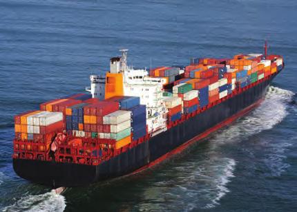
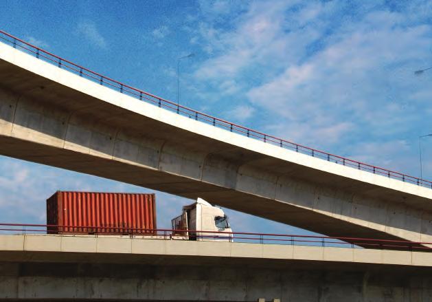
18 SCAG Regional Goods Movement Study Supports Regional Manufacturing Southern California is the leading manufacturing center in the U.S. 1 and regional manufacturers reach a mix of international, domestic, and local customers and suppliers by accessing the region s goods movement system. As such, the goods movement system is a lifeline between the region s export base and its markets. Serves the Needs of Local Business and Consumers Like any metropolitan region of its size, a substantial amount of goods movement in the SCAG region involves providing goods and services to residents and local businesses. Activities that generate the most truck traffic in the region include services and deliveries to households, parcel pickup, and delivery at local businesses, and deliveries from warehouse and distribution centers to retail establishments. Even if there were no international trade system in Southern California, goods movement would continue to serve a critical role in the region s economy and quality of life. Provides Access to International Gateways The SCAG region is the nation s premier international gateway supporting international trade through its seaports, international airports, and international land border crossings. These facilities are a critical link between the U.S. economy and the Pacific Rim, one of the world s fastest growing trade lanes. Supports a Thriving Logistics Industry The confluence of a world class transportation system and access to a large consumer market, both within the region and in nearby Western states, has made Southern California a choice location for national and regional distribution of a wide variety of products. Growth in logistics-based businesses has created a new and diverse source of employment and economic growth. The Goods Movement System in Southern California Over the last century, the public and private sectors have invested in goods movement infrastructure in Southern California that has been the envy of the world. Chapter 3 describes the goods movement system in more detail, but in summary, the key modal elements of this system include: Interstates, highways and local roads that carry the highest volumes of truck traffic of any roads in the state (including I-710, I-605, SR-60, SR-91, I-5, I-10, I-15, and I-210) and provide critical last mile connections to regional ports, manufacturing facilities, intermodal terminals, warehouse and distribution centers, and retail outlets. Class I railroads that have some of the busiest mainlines in the country and that operate six major intermodal terminals, including the nation s most active intermodal terminal, the Burlington Northern Santa Fe Railroad s (BNSF), Hobart Yard. Seaports that include the largest container port complex in the U.S. (the Ports of Los Angeles and Long Beach) and the niche Port Hueneme, in Ventura County, that handles automobiles, fresh fruit, and produce. Air cargo facilities including Los Angeles International Airport (LAX) and Ontario International Airport (ONT), that together handled over 96 percent of the region s air cargo in International land border crossings in Imperial County, which includes the Calexico East-Mexicali II port-of-entry, the fifth busiest commercial crossing along the U.S. Mexico border. 2 1 Los Angeles County Economic Development Center, Keyser Center for Economic Research, Manufacturing: Still a Force in Southern California, U.S. Bureau of Transportation Statistics, Border Crossing/Entry Data, accessed June,

19 A warehouse and distribution center complex that includes over 800 million square feet of warehousing space throughout the six-county region, and the potential to expand to over one billion square feet with development of additional land already zoned for this type of development. 1.2 A Vision for the Future of Goods Movement in Southern California Goods Movement Challenges Forward-thinking leaders in business and government helped create the goods movement system that Southern Californians enjoy today. They had a vision of Southern California as a world leader in commerce and a major exchange point for international culture as businesses from across the globe traded via the region s port, airport, and border crossing facilities. Today, goods movement is so woven into the fabric of life in Southern California that it is easy to take for granted that it will continue to deliver benefits to the regional and national economies without any coordinated planning on the part of regional, state, and national stakeholders. But goods movement in Southern California faces serious challenges and just proceeding with the status quo is not an acceptable choice for the region. Some of the challenges ahead include: Growth in freight traffic on all modes and growing conflicts with passenger transportation on shared infrastructure threatens the efficiency and safety of the region s transportation systems. Growth in the SCAG region s population and Gross Regional Product (GRP) (which is expected to more than double over the next 25 years 3 ) are major drivers of growth in regional freight demand. In addition, the U.S. will continue to see growth in Pacific Rim trade and Southern California port cargo is expected to triple by In response to this growth, regional truck vehicle miles traveled (VMT) are anticipated to grow by more than 80% 5 and the region s major truck corridors will experience increasing delays if no action is taken. Freight train volumes are expected to more than double and intermodal lift volumes will grow by more than 140%. 6 Air cargo growth is also expected to grow by over 160% by If the SCAG region can creatively accommodate this growth it can reap significant economic benefits. The consequence of not planning for this growth will mean businesses will waste time and money dealing with congestion, logistics businesses that provide good jobs will look to other goods movement hubs that can provide more efficient infrastructure, and there will be growing conflicts between goods movement users and passenger traffic. Difficulty meeting healthy air quality standards continues to challenge technology developers, system operators, and environmental regulators. The SCAG region has moved aggressively over the past several decades to address serious air quality concerns and has made much progress. But goods movement is growing in importance as a source of emissions and will require even more aggressive efforts to bring new technologies and improved operations to the task of cleaning the air. Nitrogen oxides (NO x) and fine particulate matter (PM 2.5) emissions can cause serious health effects including asthma and other respiratory ailments, increased stress, and increased cancer risk. 3 SCAG, Regional Transportation Plan/Sustainable Communities Strategy, April Tioga Group and IHS Global Insight, San Pedro Bay Container Forecast Update, prepared for the Ports of Long Beach and Los Angeles, July SCAG, Op cit. 6 Ibid. 7 Ibid. 1-3

 today to 80 ppb by 2023 with a future deadline of 75 ppb by approximately")
20 SCAG Regional Goods Movement Study Much of the SCAG region does not meet Federal PM 2.5 and ozone (created from the combination of NO x and volatile organic compounds in the atmosphere) standards. While a combination of regulatory programs, incentive programs to switch to cleaner technologies, and improved operations by goods movement service providers continue to reduce emissions from goods movement, the goalposts keep moving as more is learned about the health effects of these pollutants. In the South Coast Air Basin, 8 there is a strict deadline to reduce ozone concentration from 107 Parts per billion (ppb) today to 80 ppb by 2023 with a future deadline of 75 ppb by approximately Further, EPA is likely to propose a future standard that will bring this down to ppb. In addition to the impacts that failure to reach these goals will have on human health, this failure would also trigger Federal sanctions such as curtailment of transportation funds. This improvement in air quality must occur against the backdrop of growth in goods movement demand already described. The South Coast Air Quality Management District (SCAQMD) estimates that with all adopted future regulations and the implementation of known clean technologies in the rail, marine, and air sectors, 2030 ozone sources will contribute emissions at levels that will not meet the standards. Efforts to introduce zero emission goods movement technologies wherever possible will be critical to meeting these proposed future standards. Conflicts between expanding goods movement activities and growing communities will require new solutions to land use planning and urban design. As goods movement and passenger movement share increasingly constrained infrastructure and goods movement activities and residential/commercial activities rub up against each other in increasingly dense urban areas, conflicts will inevitably arise. In addition to the region s air quality concerns and congestion on the region s road, rail, and airport facilities, goods movement can contribute to safety challenges; excessive noise, vibration, or lighting concerns; and pavement deterioration. Goods movement oriented industries such as construction, warehousing, manufacturing, logistics, and port and harbor facilities can result in localized impacts and can create situations of incompatible land uses. In order for goods movement to continue to grow, it must do so as a good neighbor, adopting approaches that reduce conflicts and mitigate impacts. The Goods Movement Vision Southern California can meet these challenges with the same creativity, innovation, and leadership that has made it one of the world s premier goods movement centers. Working with its public and private partners, SCAG has established a vision for a regional goods movement system through the Comprehensive Regional Goods Movement Plan and Implementation Strategy. Goods Movement Vision Statement A world-class, coordinated Southern California goods movement system that accommodates growth in the throughput of freight to the region and nation in ways that support the region s economic vitality, attainment of clean air standards, and the quality of life for our communities 8 Los Angeles, Orange, and non-desert portions of Riverside and San Bernardino Counties. 9 The attainment deadline for the 75 ppb standard (adopted in 2008) has not yet been established by U.S. EPA, but is expected to be by approximately
21 This vision reflects the important role goods movement plays in the regional economy, the need to provide a modally diverse and highly efficient system that can handle substantial growth, and a need to do so in an environmentally sustainable way. Some of the highlights of how this vision was turned into specific objectives for the development of the Plan are presented below. Goods Movement is Fundamental to the SCAG Economy and Plays a Vital Role in the State and National Economy Understanding the importance of goods movement to the economy, the Plan was developed with the following economic objectives. The Plan should ensure that local business have access to the transportation services they need so that they can grow and thrive in Southern California. The Comprehensive Regional Goods Movement Plan and Implementation Strategy identified local industries/economic sectors that generate much of the demand for goods movement services. These goods movement-dependent industries including manufacturing, wholesale and retail trade, construction, and transportation/warehousing employ over 2.9 million people in Southern California and contributed $249 Billion to Gross Regional Product (GRP)(Figure 1.1). Some of these businesses, particularly national manufacturing firms and consumer products distributors (who maintain large import warehouses and national distribution centers in the region), form much of Southern California s export base. These businesses consider many factors in making location and expansion decisions and transportation cost and service reliability are among those factors. Ensuring that the future system can meet the needs of these businesses is a critical objective of the Goods Movement Plan. The Plan should promote system improvements that will keep the costs of goods and services to the region s residents at a reasonable level. A substantial fraction of goods movement demand in Southern California is associated with providing goods and services to local residents. According to the SCAG Heavy-Duty Truck (HDT) model, over 40% of the region s heavy-duty truck trips are associated with this type of activity. If the region s highway system cannot accommodate the anticipated growth in demand for trucking related to these types of goods and services, costs will go up as truck drivers spend more time in traffic and the owners and operators of these fleets need to use more trucks at lower levels of utilization in order to serve their local customers. A major objective of the Plan is to reduce overall truck delay on key truck routes in order to keep these transportation costs down for the benefit of local businesses and residents. 1-5
22 SCAG Regional Goods Movement Study Figure 1.1 Industry Contribution to GRP by the Goods Movement Dependent Sectors 2010 (in Billions of 2010 Dollars) Wholesale Trade 50 7% Service Industries % Goods-Movement Dependent Industries % Manufacturing 91 13% Retail Trade 46 6% Transportation and Warehousing 22 3% Construction 27 4% Utilities 10 1% Forestry, Fishing, Related Activities, Mining and Other 3 0 <1% 0% Source: REMI PI+ v Model Data. The Plan should ensure that Southern California can continue to be the leading gateway for Pacific Rim trade. The tremendous growth in container trade through the Ports of Los Angeles and Long Beach that were experienced over the last 30 years is the story of expansion of Asian economies and the growing importance of Pacific Rim trade. By the mid-1980s, as Asian trade began to boom, West Coast port share of containerized trade exceeded that of the Atlantic Coast for the first time and by 2007, West Coast ports held a 55 percent share of U.S. containerized trade. 10 The infrastructure of rail lines and intermodal terminals and warehouse and distribution centers in Southern California supported this growth and ensured efficient delivery of imports throughout the U.S. at lower costs to U.S. consumers. While recent investments in the Panama Canal expansion, port infrastructure, and new warehouse and distribution facilities have accompanied port of entry diversification for many of the nation s largest importers, continuing growth in Asian trade is likely to drive demand for Southern California s ports. Both China and Southeast Asia are expected to continue as the fastest growing regions for U.S. import trade over the next 20 years but just as exciting is the prospect for growing exports to China as its middle class grows and general incomes rise. U.S. export trade with China is expected to grow at a rate of 5.8 percent per year between 2010 and 2020 and at 3.3 percent per year from 2020 to Ensuring that Southern California has the port and inland transportation infrastructure necessary to handle this growth is important for the nation, as trade through Southern California s container ports supports over 3.37 million jobs throughout the U.S. 12 This international trade activity is also important to the regional economy, creating good paying jobs in the logistics services sector as well as new opportunities for both import and export-oriented firms in Southern California. A major objective of the Goods Movement Plan is to ensure that those jobs stay in Southern California by providing the modern, high efficiency transportation connections that meet the needs of the nation s importers and exporters. 10 U.S. Bureau of Transportation Statistics, America s Container Ports: Freight Hubs That Connect Our Nation to Global Markets, June Tioga Group and IHS Global Insight, San Pedro Bay Container Forecast Update, Prepared for the Ports of Long Beach and Los Angeles, July BST Associates, Trade Impact Study,

23 The vision underlying the Plan that reflects these objectives includes: A focus on markets. The Plan identifies key local industries, including manufacturing, trade, and logistics and identifies key corridors where these industries are located. It ensures that improvements are focused in these corridors and system performance meets the needs of these critical users. Continued expansion of and accessibility to international trade hubs balancing the needs of local and national tradeoriented businesses. The Plan supports capacity improvements in marine terminals, intermodal terminals, railroad mainlines, and roadway access routes to the seaports, airports, and land border crossings that makeup the region s trade transportation system. Focus on intraregional systems that connect distribution centers with population centers. The Plan envisions a core Freight Corridor that connects concentrations of goods movement activity and which is dominated by intraregional truck traffic. This is supported by a strong program to identify and resolve major truck bottlenecks on all of the region s major truck corridors. A Healthy and Balanced Southern California Economy Will Lead to Growth That Should Be Addressed with Multimodal Solutions and a Mix of Capacity Expansion and Operational Improvements The forecasts that underlie this Plan are based on continued expansion of the Southern California economy, albeit at a more modest rate than has occurred over the last 25 years. Accommodating this growth will require meeting the following system performance objectives: The Plan should ensure fluid movement of goods and people consistent with user expectations for a world class transportation system. A major objective of the Plan is to allow for growth without deterioration in the overall performance of the goods movement system. The Plan should ensure that rail volumes can double without exceeding delay levels beyond what they were in Analysis of options for addressing truck delay through the development of a freight corridor through the center of the region suggests the potential to reduce truck delay in this major center of goods movement activity by over 6 million hours per year. The Plan should reduce conflicts between goods movement and people movement leading to a safer system. Currently, there are more than 2,700 truck-involved accidents per year on the key regional goods movement truck corridors 13 and an average of 8 accidents per year at road-rail crossing throughout the region 14. The Plan envisions greater separation of passenger and goods movement in order to make the system safer for all users. The vision underlying the Plan that reflects these objectives includes: A focus on multimodal solutions. The Plan recognizes that the strength of the region s goods movement system is the variety of high quality modal services. Strategies ensure that the highest and best use can be made of these interconnected modal systems. The strategies proceed from an understanding that different goods movement functions and markets demand different modal solutions. 13 Data averaged for the period January 1, 2005 December 31, 2009 from the Statewide Integrated Traffic Reporting System (SWITRS), California Highway Patrol. 14 Data averaged over the period January 2006 December 2010, Federal Railroad Administration. 1-7

24 SCAG Regional Goods Movement Study Creative approaches to shared use corridors. The Plan recognizes that passengers and freight are increasingly using shared infrastructure despite having vastly different operations and capacity needs. This can lead to conflicts that reduce the efficiency of the system and lead to safety issues. The Plan promotes concepts that separate passenger and freight movements where possible. The Goods Movement System Can and Must Expand its Operations in Ways That Provide For a Healthy Environment and Livable Communities In order to address concerns about the impact of goods movement growth on air quality and community livability, the Plan was developed to meet the following objectives: The Plan should provide for the lowest emission modal options possible. Whenever there is the potential for modal competition, the strategies in the Plan should ensure that shippers and carriers are able to use the cleanest available modal alternatives. The Plan should support development of clean goods movement technologies. There are exciting new developments in goods movement technology that have promise for significantly reducing environmental impacts. Government commitment that is demonstrated through provision of market-based incentives, elimination of regulatory uncertainty, and public investments in supporting infrastructure can help promote the application of these clean goods movement technologies. The Plan should mitigate neighborhood and community impacts to the maximum extent possible. As goods movement activity expands, planning should look to minimize the impacts on adjacent communities by selecting the least intrusive alignments for new facilities, seeking shared-use corridors (e.g., rail and truck, transportation and utility), and separating modal system conflicts. The vision underlying the Plan that reflects these objectives includes: Continued development of near-zero and zero-emission technologies. The Plan vision is to move rapidly to adopt clean fuels in the short-run and to transition to zero-emission systems as technology readiness and cost feasibility are demonstrated. An aggressive program of technology research, development, and demonstration aimed at zeroemission truck and rail technologies is a major element of this vision. Separating road and rail crossings in key corridors. As rail traffic grows, these crossings divide communities and create safety hazards, both through delays to emergency vehicles and through potential accidents at the crossings. 1.3 Building Southern California s Goods Movement System for the Next Century Twenty-five years from now, the goods movement system in the SCAG region is envisioned to include bold new capacity enhancements, including new and expanded railyards, additional main line railroad tracks, expanded and modernized port terminals, truck-only lanes along the I-710 and the East-West Freight Corridor connecting I-710 to I-15, and a modern Gerald Desmond Bridge. The new system will also include critical bottleneck relief projects on major freeways and operational improvements such as traveler information systems and GPS technology to reduce truck delays. Multiple grade separations on railroad main lines will provide significant traffic congestion relief throughout the region. The system will also show significant progress in reducing emissions from goods movement sources, including the introduction of near-zero and zero-emission vehicles. The SCAG region will continue to lead the nation and the world in the application of innovative strategies for goods movement that realize the vision embodied in this Plan. 1-8

25 What Drives Goods Movement in the SCAG Region 2.1 Introduction The trade and transportation system in the SCAG region is of vital regional and national significance. By linking together international gateways, regional warehousing and manufacturing facilities, and local businesses, this system helps to ensure both the diversity and vitality of the regional, statewide, and national economies. The system plays a number of different roles in the region and it is important to understand these roles, how they relate to each other, and how they might evolve in the future. In addition, understanding these different roles can provide important insights into the types of needs and issues that must be addressed and the types of stakeholders that will be affected. As illustrated in Figure 2.1 the interaction between goods movement and the economy involves three overlapping concepts. First, there are industry sectors that rely on the goods movement system. These industries are referred to as the goods movement-dependent industries in this report. These industries create jobs and economic activity in Southern California and they rely on the goods movement system to bring supplies and distribute products. When we measure the economic impacts of goods movement activity, we are often referring to impacts on these industries. The goods movement-dependent industries trade in various markets. A simple way of looking at these markets is their geographic location international, domestic, and local. But within these geographic markets, it is also important to understand modal markets and submarkets. Modes compete with each other in certain markets but not in others. For example, air cargo is a market for high value time sensitive products carried long distances. Rail, which carries lower value products shipped in large Figure 2.1 Goods Movement in the Economy shipments tends not to compete directly with air cargo in most markets. Within modal markets, there are also submarkets that are highly specialized to meet the distribution needs of particular types of shippers. For example, the distinctions between inland point intermodal (IPI), transload, and pure domestic intermodal rail sub-markets are described in more detail later in this chapter. Finally, the trade and transportation system in Southern California provides functions that serve the needs of goods movementdependent industries trading in various markets. These functions provide a convenient way of describing the economic effects and importance of goods movement in the Southern California economy.
26 SCAG Regional Goods Movement Study The trade and transportation system provides four key functions for the region: Provides Access to International Gateways Southern California is the nation s premier international gateway the large regional consumer market, the nation s largest port complex, major air cargo facilities, international land border crossings, and a vast supply of warehouse facilities have made it one of the nation s largest centers for distribution of imported consumer products. The importance of the region s gateways in connecting consumer goods manufactured in Asia with U.S. markets has been well-documented and the system s importance in supporting the flows of containerized goods continues to grow. In 2010 alone, maritime and air cargo valued at $414 billion moved through the Los Angeles Customs District and another $10.4 billion moved through the region s international border crossings. Supports Regional manufacturing Activities Even at the height of the recession, the U.S. remained the world s largest manufacturing economy and Southern California continued to be a critical manufacturing hub. According to Los Angeles County Economic Development Corporation (LAEDC), 1 in 2009 the Southern California region was the third-largest manufacturing center in the country, trailing only the states of California and Texas as a whole. In 2010, manufacturing activities contributed approximately $84 billion of the region s Gross Regional Product (GRP) and serve both international and domestic markets. Serves the Needs of Local Businesses and Residents Like most metropolitan areas of its size, a substantial amount of the region s goods movement activity is associated with local pickup and delivery activity, construction, utilities, and other service activities. Virtually all of this local activity takes place in trucks. While much of the region s international trade system supports the global supply chains of national and multinational companies, approximately 25 percent of the imports moving through the San Pedro Bay ports are destined for final consumption within the region. Although this is a small percentage, it does represent almost 2 million TEUs, nearly all of which uses the region s highway system for final delivery. Supports a Thriving Logistics Industry. The logistics industry in the SCAG region (which includes transportation, warehousing, logistics services, and other sectors) has become an important component of the regional economy. Collectively, these industries rely on all portions of the region s trade and transportation system, from ocean shipping and air freight (for international supply chains), to trucking (for intraregional shipments and drayage moves), and even courier services and warehousing activity (to support both international trade and local delivery of consumer goods). Taken together, these four functions serve a broad base of regional industries, many of which are critically important to the overall economic vitality of the SCAG region. This is particularly true for goods movement dependent industries, or those that rely on transportation infrastructure and services to receive raw supplies and manufactured goods and to send refined or finished products to market. Industries like manufacturing, construction, retail and wholesale trade, and transportation and warehousing are important contributors to the SCAG regional economy and rely on the regional trade and transportation system and all the functions it serves. In the SCAG region alone, these goods movement dependent industries account for 34 percent of both the region s GRP and total employment, as shown in Figures 2.2 and Manufacturing: Still a Force in Southern California, Los Angeles County Economic Development Center, Kyser Center for Economic Research,
27 Figure 2.2 Industry Contribution to GRP by the Goods Movement Dependent Sectors 2010 (in Billions of 2010 Dollars) Service Industries % Goods Movement Dependent Industries % Manufacturing 91 13% Wholesale Trade 50 7% Retail Trade 46 6% Transportation and Warehousing 22 3% Construction 27 4% Utilities 10 1% Mining 3 <1% Forestry, Fishing, Related Activities, and Other 0 0% Source: REMI PI+ v1.2.4 Model Data. Figure 2.3 Industry Contribution to Employment by Goods Movement Dependent Sectors, 2010 (thousands of jobs) Retail Trade % Construction 393 5% Service Industries 5,332 65% Goods Movement Dependent Industries 2,901 35% Wholesale Trade 436 5% Transprotation and Warehousing 311 4% Utilities 25 0% Manufacturing % Mining 18 Forestry, Fishing, Related 0% Activities and Other 24 0% Source: REMI PI+ v1.2.4 Model Data. The following sections provide more detail on the four critical functions of the goods movement system and their relationship to the overall regional economy by describing: 2-3
28 SCAG Regional Goods Movement Study The regional industries that rely on different functions the system provides and how these industries contribute to the regional economy; The collection of transportation services that these industries utilize; and The economic and market factors that are driving industry growth or decline. Taken together, this information will help describe the link between key industries and transportation needs and, more importantly, set the stage for describing how investments in the regional trade and transportation system will impact regional economic vitality. The four major functions described in this section will also provide a framework that is used throughout this report to explain the relationships between the goods movement system and the industries served. In Section 3, the four functions help describe how specific elements of the multimodal infrastructure in the SCAG region serve regional, national and global industries and how the infrastructure is connected in multimodal systems to serve industrial supply chains. In Section 4, the four functions frame the discussion of how economic growth in specific industry sectors and markets creates specific demand on modal systems and the implications this has for performance of the system. If the regional goods movement system cannot serve these functions effectively in a manner that is efficient and safe and which contributes to environmental health and community livability it will have major implications for the regional, national, and global economy. Function #1: Provides Access to International Gateways As noted earlier, the Southern California trade and transportation system seaports, airports, border crossings, and the highways and rail corridors that connect them to inland markets is the country s premier international gateway and a key element of regional, national, and international supply and distribution chains. The region s seaports alone handle a significant percentage of all containerized shipments entering and departing the United States as well as significant volumes of bulk and break-bulk shipments, such as agricultural goods, petroleum products, and automobiles. The region s airports play a similar role, connecting far-flung markets for high-value, time-sensitive freight shipments. Clearly, the SCAG region ports are critical nodes in the global supply chain and have important national and international impacts. As shown in Figure 2.4, the international trade function of the region s trade and transportation system helps to generate more than 3 million jobs nationwide. 2-4

29 Figure 2.4 Value of Containerized Trade through San Pedro Bay Ports FY 2011 International Trade Total $311 Billion Source: Note: Port of Long Beach, Port of Los Angeles, and Alameda Corridor Transportation Authority. Updated data for this figure became available after publication of the Summary Report. The updated data has been included in this figure. Equally important are the impacts the presence of these gateways has on the local and regional economy. Combined, the region s three seaports (Port of Los Angeles, Port of Long Beach, and Port of Hueneme), two international airports (Los Angeles International and Ontario International), and one commercial land border crossing (Calexico East Mexicali II) make significant contributions to the regional economy by providing: Over 60,000 direct jobs at the ports, airports, and border crossings themselves; More than 1.6 million trade-related jobs throughout the SCAG region; and Over $30 billion in local, state, and Federal tax revenue. 2 Many of these impacts are attributable to the region s importance as a gateway for inbound international trade and the presence of these ports, airports, and border crossings is critical in helping the region attract and retain international-traderelated industries like those involved in wholesale or retail trade or logistics and warehousing. However, the region s international-trade-related infrastructure also is important for outbound or exported trade. Outbound movements are often considered wealth-generating freight because they are associated with an inflow of dollars to regional businesses. The region s manufacturing industries are particularly reliant on export services. Nearly $60 billion worth of exports are sent to other parts of the world each year, particularly from the transportation equipment, computer/electronics, and machinery sectors, as shown in Figure Ports of Los Angeles and Long Beach. 2-5
30 SCAG Regional Goods Movement Study Figure 2.5 Top Manufacturing Sector Trade Splits 2010 (in Billions of 2010 Dollars) Billions of Constant 2010 Dollars Exports to Rest of US Exports to Rest of World Imports from Rest of US Imports from Rest of World Self Supply Source: REMI PI+ v Model Data. Transportation Services Businesses and industries that rely on international trade require a variety of transportation services. International trade goods that move through the San Pedro Bay Ports rely heavily on the highway and rail systems to serve locally destined and non-locally destined cargo, respectively. Other ports of entry, including the region s major cargo airports and the international border crossing, rely heavily on trucks. Containerized imports to the region are handled in a variety of ways depending on the cargo type, ultimate destination, and other logistics factors. However, there are three primary types of import cargo channels, described below, each of which has different impacts on the region s transportation system. Inland Point Intermodal (IPI). This cargo is moved intact in the original marine container from the overseas origin to the inland U.S. destination via rail on a single ocean carrier bill of lading. The destinations for the cargo are generally far from the SCAG region (over 500 miles). IPI cargo may be loaded at on-dock rail terminals at the Ports of Los Angeles or Long Beach or they may be drayed by truck to near-dock (approximately 4 miles from the ports) or offdock rail terminals, where they are loaded on trains. At the destination end of the trip, the containers are picked up at rail terminals and delivered by dray trucks to their final destinations. It has been estimated that IPI imports amounted to about 38 percent of total loaded imports at the San Pedro Bay Ports in
31 Transload. Transloading involves unloading a marine container at a facility and then reloading the cargo into a larger domestic container or trailer, usually 53-feet in length, which is then either delivered via truck or rail. Typically, the original marine container is driven by a dray truck from the ports to an import warehouse/transloading facility within the SCAG region where the containers are unloaded and then reloaded in the larger domestic containers or trailers. These domestic trailers are then driven either to an intermodal railyard, where they are loaded on trains, or driven to their final destination. In many cases, other value-added activities occur at these transload facilities, generating jobs and economic activity in the SCAG region (this will be described further in the discussion of the logistics industries later in this chapter). A portion of transloaded cargo is reloaded immediately using a cross-dock facility, but most are warehoused in Southern California for some time before reshipment. Local without Intent to Transload. This is cargo in marine containers that is delivered to local warehouses for local consumption within the greater region (Southern California, Southern Nevada, Arizona, New Mexico, and southern portions of Utah and Colorado). These locations are best served by the San Pedro Bay ports because they provide the lowest landside transportation costs. These movements are handled nearly exclusively by truck. Why do Shippers Transload? To better manage inventory and to minimize sales forecast errors. To consolidate high demand product into a minimal number of containers to expedite unloading at destination. To save on transportation costs when the inland location has limited export volume, leaving ocean carriers to reposition empty marine containers. To perform value-added services on products to make them store-ready or easier to handle upon arrival at destination. Growth Drivers International trade is expected to grow in the next several decades, although recovery from the global recession will be slow, particularly for imports. Containerized trade through the San Pedro Bay Ports has been set back six to seven years, as shown in Figure 2.6, but will see stronger growth by This growth will be driven by improved economic conditions in the U.S. 3 San Pedro Bay Container Forecast Update,
32 SCAG Regional Goods Movement Study Figure 2.6 San Pedro Bay Ports Container Forecast in Millions of TEUs Source: San Pedro Bay Container Forecast Update, Tioga Group, Inc. and Global Insight, The eventual rebound also will be driven by emerging world economies, which will create products for export to the U.S. and elsewhere but will also create demand for exports from the U.S. to meet the needs of an emerging middle class. The effects of the worldwide economic downturn have not been evenly spread across countries (see Figure 2.8). Together, the growth rates of developed countries have slowed considerably, and have begun to turn negative for the Eurozone (through the second quarter of 2012). Meanwhile, the economies in the developing world, particularly China, India, and Russia, while currently experiencing reduced growth, are still growing by 7.6, 5.3, and 4.0 percent, respectively, through mid Figure 2.7 Loaded San Pedro Bay Ports Imports (in Thousands of TEUs) Market Shares, 2011 Local No Intent to Transload 1,544, 22% Inland Point Intermodal 2,712, 38% Transload 2,876, 40% Source: Cambridge Systematics analysis for POLA/POLB. 2-8
33 Figure 2.8 GDP Growth by Country 2010 to Q Q Q Q Q Q Q Q Q Q Q2 Brazil Canada China Euro Area India Mexico Russia United States Source: Trading Economics.com. Function #2: Supports Regional Manufacturing In contrast to much of the dicussion about the decline of domestic manufacturing and the outsourcing of manufacturingrelated jobs to lower-wage countries, the United States share of total global manufacturing output has held relatively contstant over the last 30 years, as shown in Figure And Southern California remains one of the leading manufacturing centers in the U.S., with total employment exceeding 799,000 and total contribution to GRP of more than $91 billion. The region s trade and transportation system underpins this important component of the regional economy by providing connections to regional, national, and global suppliers and markets. 4 Manufacturing: Still a Force in Southern California, Los Angeles County Economic Development Center, Kyser Center for Economic Research,

34 SCAG Regional Goods Movement Study Figure 2.9 Share of Global Manufacturing Output 1980 to 2009 Source: United Nations. Overall manufacturing employment in the SCAG region dwarfs that of many states, even those considered to be manufacturing powerhouses, like Ohio, Illinois, Pennsylvania, and Michigan (see Figure 2.10). 2-10
35 Figure 2.10 Annual Average Manufacturing Employment (in thousands) Source: Note: Los Angeles County Economic Development Center. SCAG Region includes counties of Los Angeles, Orange, Riverside, San Bernardino, and Ventura. The region s manufacturing footprint is large and diverse and contributes significantly to GRP, as shown in Figure Figure 2.11 Manufacturing Contribution to GRP by Subsector In Billions of 2010 Dollars Motor Vehicles, Bodies and Trailers, and Parts Manufacturing, $2.9, 3% Furniture and Related Product Manufacturing, $3.1, 4% Apparel Manufacturing, $3.4, 4% Beverage and Tobacco Product Manufacturing, $3.5, 4% Other Manufacturing Sectors, $14.0, 15% Computer and Electronic Product Manufacturing, $15.0, 17% Chemical Manufacturing, $11.3, 12% Source: Plastics and Rubber Product Manufacturing, $3.7, 4% Machinery Manufacturing, $4.2, 5% Food Manufacturing, $5.8, 6% REMI PI+ v Model Data. Miscellaneous Manufacturing, $7.5, 8% Fabricated Metal Product Manufacturing, $8.5, 9% Other Transportation Equipment Manufacturing, $8.5, 9% 2-11
36 SCAG Regional Goods Movement Study This manufacturing activity supports both globalized (e.g., computer/electronics, apparel, leather products) and nonglobalized industries (e.g., food, beverages, chemicals), as rated by the Kyser Center for Economic Research Globalization Index. Table 2.1 shows the major manufacturing industries in the region, their overall contribution to GRP, and their globalization index. Table 2.1 Key SCAG Manufacturing Industries and Globalization Indices Industry Contribution to SCAG GRP Globalization Index Computers/Electronics $14.5 billion Chemicals $8.6 billion 88.1 Miscellaneous $8.6 billion Transportation Equipment $8.6 billion Fabricated Metals $7.2 billion 50.0 Food $5.3 billion 26.5 Machinery $4 billion Source: Manufacturing in Southern California, Los Angeles County Economic Development Corporation, March This global/nonglobal mix is reflected in the sales output of SCAG s manufacturing industries, which show an even split between international and domestic customers, with the balance being distributed locally. 5 Figure 2.12 Sales Output of SCAG-Based Manufacturing Industries 2010 Local 25% Domestic 38% International 38% Source: REMI PI+ v Model Data. 5 Output: The amount of production, including all intermediate goods purchased as well as value added (compensation and profit). Output can also be thought of as sales or supply. The components of Output are Self Supply and Exports (Multiregions, Rest of Nation, and Rest of World). Demand: The amount of goods and services demanded by the local region (imports plus self supply). Self-Supply = Demand Imports = Output Exports. 2-12
37 The mix of manufacturing activities in the SCAG region is important for a few reasons. First, it helps provide employment at several different levels of the regional workforce. Manufacturing in globalized industries, like aerospace or computers/electronics, typically involves design and testing (rather than assembly) and provides relatively few jobs with relatively high wages. Conversely, nonglobal industries provide more jobs at the lower end of the wage scale, although they still tend to be attractive, well-paying blue-collar jobs that often do not require advanced degrees. Second, the wide range of suppliers already in the region actually acts as a catalyst to attract additional activity (and jobs) to the region. The SCAG region can offer efficient access to both global markets and suppliers, which is an important element in any business attraction and retention strategy. Finally, the diversity of the manufacturing sector helps make the region more resistant to (though clearly not immune to) global downturns and competitive pressures. This makes for a more resilient regional economy and helps to stabilize the workforce. Transportation Services The mix of manufacturing activities in the region also is important from a transportation perspective, as regional manufacturers are heavily dependent on all parts of the transportation system to reach their diverse markets. Modal choice is a complicated decision, dependent on a variety of factors, including product characteristics, supply chain needs, and mode availability. In the SCAG region, the modal dependency of the manufacturing industry (summarized in Table ) reflects the diverse nature of suppliers and markets for manufactured products. Higher-value manufactured goods depend on international supply chains to provide raw materials and serve markets for finished products. This is reflected in the 27.3 percent of total expenditures ($3.9 billion dollars) spent on air transportation of goods, as well as 10.1 percent of expenditures ($1.5 billion) on courier services. Domestic shipments move via highway and on rail. This is reflected by the 20.5 percent of expenditures ($2.9 billion) spent on truck and the 20.4 percent ($2.9 billion) spent on rail. Table 2.2 Modal Expenditures on Transportation by Manufacturing Industries 2010 Mode Annual Spending (In-House and Outsourced) Millions of 2010 Dollars Percent of Total Truck $2, % Rail $2, % Air $3, % Water $2, % Courier $1, % Warehousing and Storage $ % Total $14, % Source: 2011 U.S. DOT Bureau of Economic Analysis Transportation Satellite Accounts (Using 1997 Data). 6 Note that this data are based on national accounts data, rather than region specific data. Additionally, this table focuses on direct spending, i.e., direct requirements per dollar of industry output, at producer s prices. It does not include indirect or induced effects. 2-13
38 SCAG Regional Goods Movement Study As a whole, manufacturing industries are increasingly adopting just-in-time inventory strategies that are focused on delivering goods as needed, with very little inventory requirements. Though this strategy lowers the costs of carrying inventory, it requires a high level of flexibility from suppliers, and responsiveness in the supply chain. Goods that are part of just-in-time supply chains are extremely time-sensitive, as missing parts may cause disruptions in the manufacturing process. Therefore, even lower-value products are increasingly dependent on efficient and reliable freight movement. Growth Drivers Although the region s manufacturing sector is projected to lose 205,000 employees between 2010 and 2035 (a reduction of 26 percent), its contribution to GRP is expected to increase by 60 percent over the same time period due to productivity gains and continuing shifts to higher value products. Increasing pressure for competitively priced manufactured products is leading manufacturers to improve productivity, either by investing in new technology and updated equipment, or using temporary and seasonal labor. 7 As shown in Figure 2.13, regional output per employee in the manufacturing sector is expected to grow substantially from a 2010 figure of about $322,000 output per employee to a 2035 value of over $658,000 per employee. Figure 2.13 Forecast Productivity Gains in the Manufacturing Sector, in Thousands of 2010 Dollars Labor Productivity Source: REMI PI+ v Model Data. Labor productivity is output per employee. Continued productivity improvements even though coupled with reductions in total employment will result in increasing demand for transportation services in this sector. 7 Kyser, Jack. Manufacturing in Southern California. Los Angeles County Economic Development Corporation. March
39 Function #3: Serves the Needs of Local Businesses and Residents As noted previously, every major metropolitan area generates a substantial amount of goods movement and truck activity that serves the region s population and local businesses. This includes final delivery of consumer goods to retail outlets, but also includes service trucking (e.g., plumbing, home repair) and construction trucking which may not involve moving goods, but does have important economic and transportation benefits and impacts. In the SCAG region, this activity represents a significant element of overall freight demand and truck volume due to the sheer size of the region, the number of households and businesses, and the resulting levels of construction and service activity. Much of the demand for goods and services is related to activity in the consumer economy. As the number of households and the level of disposable incomes rise, the demand for retail goods and services rise apace. The SCAG region already is home to just over 18 million people, or about 48 percent of the entire population of the State of California. 8 And household incomes in the region have grown about 0.8 percent per year since 1979, as shown in Table 2.3. Table 2.3 Household Income per Capita in Current Dollars (not Adjusted for Inflation) Area CAGR CAGR California 33,404 33,896 34,049 34,975 36,887 38,731 41,518 43,211 44,003 41,034 41,893 43, % 2.3% Imperial County 18,971 20,381 22,220 22,753 23,116 23,831 24,874 26,055 27,648 27,408 27,503 28, % 3.0% Los Angeles County 29,878 31,523 32,080 32,995 34,534 36,498 39,610 41,273 42,881 40,111 41,025 42, % 2.8% Orange County 38,357 38,901 39,888 41,793 44,301 47,417 51,359 52,342 52,720 48,624 48,760 50, % 2.4% Riverside County 24,528 25,586 25,854 26,528 27,416 28,563 30,039 30,720 30,842 28,865 29,029 29, % 1.4% San Bernardino County 22,624 23,953 24,414 25,298 26,443 27,481 28,607 29,765 30,220 28,995 29,192 29, % 2.1% Ventura County 34,296 34,726 35,081 36,886 39,464 41,742 44,735 46,634 46,634 43,607 44,226 45, % 2.6% Source: Bureau of Economic Analysis. Construction-related activity also is an important element of the regional economy and a significant contributor to overall transportation demand. In 2010, construction-related activities employed 393,000 people in the region and contributed $27 billion to SCAG s GRP. And this activity appears primed for growth. While Southern California was hit very hard by the housing market collapse, there are recent signs of a nascent turnaround. Between 2009 and 2010, the number of building permits issued in the region grew by more than 17.5 percent and between 2010 and 2011, the number of permits issued grew by more than 21 percent. 8 (last accessed on July 3, 2011). 2-15
40 SCAG Regional Goods Movement Study Figure 2.14 SCAG Region Building Permits Issued Number of Permits 100,000 90,000 93,716 90,954 80,000 78,543 78,404 70,000 68,204 60,000 50,000 56,049 58,580 50,867 40,000 30,000 20,000 27,504 15,001 17,632 21,472 10, Source: Southern California Association of Governments. Transportation Services Local distribution of goods as well as service and construction-related activity- is completely dependent on trucks. Approximately 21 percent of the goods entering the region through the San Pedro Bay ports are distributed (and ultimately consumed) locally. 9 In addition, household and construction-related land uses generate approximately 60 percent of the region s intra-regional truck traffic. 10 Table 2.4 provides a breakdown of the types of land uses/industry types that generate intra-regional truck trips in the SCAG region. While light-heavy trucks account for a larger percentage of the truck trips involving these economic sectors than they do for total truck trips, household (i.e., consumer- and service-related) and construction-related activity still generate a significant amount of heavy-heavy duty truck activity within the region. 9 Leachman and Associates, Port and Modal Elasticity Study, Phase II. 10 While agricultural trucking is not considered urban goods movement, most of the trucking related to these land uses comes from construction and quarry activity (which supports construction) and is driven by growth in housing and employment. 2-16
41 Table 2.4 Intra-Regional Daily Truck Trips Generated by Industry Type Land Use Light HDT Trip Ends Medium HDT Trip Ends Heavy HDT Trip Ends Total Trip Ends Percent of Total Trip Ends Households 91,426 28,644 45, ,175 16% Construction 11 44,608 43,185 39, ,498 13% Governments 7,534 3,832 3,767 15,133 1% Source: SCAG Heavy Duty Truck Model, Note: Light-heavy trucks (HDT) have a gross vehicle weight rating (GVWR) of 8,500-14,000 lbs. Medium HDT have a GVWR of 14,001-33,000 lbs. Heavy HDT have a GVWR of over 33,000 lbs Growth Drivers As discussed above, the demand for goods and services is related to activity in the consumer economy and both total population and total employment are expected to grow between now and As shown in Table 2.5, by 2035, the SCAG population is anticipated to grow by 23 percent to just over 22 million people. 12 This growing population will be accompanied after an initial slow period by healthy job creation. Like many of its neighbors, California has suffered since 2007 as a result of the global recession, with employment declining by 1.3 percent in 2008 and by 6 percent in Though unemployment rates in the state as a whole will remain high in the foreseeable future, employment in the SCAG region is projected to climb steadily from 9.4 million jobs in 2010 to 12.4 million jobs by 2035 an increase of 32 percent (Table 2.5). Table 2.5 Population and Employment in SCAG Region 2010, 2020, and 2030 Name Change ( ) Percent Change ( ) Compound Annual Growth Rate ( ) Total Population (000s) 18,046 19,654 22,182 4,136 23% 0.8% Total Employment (000s) 9,363 10,930 12,356 2,993 32% 1.1% Source: REMI PI+ v Model Data. Growth also is expected in the construction industry, which is expected to add nearly 11,000 jobs by 2035 (2.79 percent) and increase its contribution to GRP by over $1 billion (4.06 percent). The continued rebound in the housing sector, coupled with and construction and repair of infrastructure (as recommended in this plan and the recently adopted 2012 Regional Transportation Plan/Sustainable Community Strategy (2012 RTP/SCS), will also create demand in this sector. 11 Includes agriculture and mining movements, which are small contributors in the SCAG region. 12 SCAG RTP, Growth Forecast Appendix, page California Regional Progress Report, November
42 SCAG Regional Goods Movement Study Function #4: Supports a Thriving Logistics Industry Because of the Southern California region s importance as an international gateway, a manufacturing hub, and a large consumer market, the region supports a thriving logistics service industry. This industry includes a wide variety of specific services, including procurement/sourcing, material handling, packaging, inventory control, security, and other functions. In the SCAG region, logistics service industries supports three broad segments of the regional economy: Retail trade, or the sale of goods for personal and household use. This industry is heavily focused on serving the local and regional market with about 86 percent of its sales conducted regionally. Retail trade is the final step in the production and distribution of goods and logistics services are often required to manage inventory, provide final packaging, and distribute goods to retail outlets. Retail trade activities provide 895,000 jobs in the region and account for $46 billion of total GRP. Wholesale trade, or the sale of large amounts of goods to industrial, commercial, or institutional users (i.e., not consumers). Wholesale trade in the SCAG region also is focused locally, with the bulk of its sales (75 percent) to local markets, with smaller amounts destined for other U.S. locations or international locations (9 and 16 percent, respectively). The regional logistics industry supports wholesale trade by providing repacking, redistribution, and sorting services. These movements often involve raw materials or inputs to larger manufacturing activities. Wholesale trade activities provide 436,000 jobs in the region and account for $50 billion of total GRP. Transportation and warehousing, which, as the name implies, provides transportation, storage, and inventory control services. The transportation and warehousing industry in the SCAG region reflects a diverse set of markets/customers based locally, nationally, and globally. Thirty-one percent of the sales output from this industry is local, 48 percent is in other U.S. regions, and 21 percent is international. The transportation and warehousing sector relies on the local transportation system to connect to markets, but also to connections to other U.S. markets and international markets. Transportation and warehousing activities provide 311,000 jobs in the region and account for $22 billion of total GRP. Again, like other industries, the condition and performance of the region s trade and transportation system provides a critical foundation that supports this large and growing segment of the regional economy. Transportation Services Each of these industry sectors uses the region s transportation system in different ways, as described below and shown in Table 2.6: Retail trade is heavily dependent on trucking, spending approximately 65 percent of its total transportation expenditures on trucking services. Trucking (as opposed to rail or air cargo modes) allows door-to-door service that is important for the retail industry, and is often the choice for local distribution services. The global reach of wholesale trade supply chains, as well as local and domestic delivery needs, also is reflected in the modal expenditures of the wholesale industry. This industry is a heavier user of ocean containers and airfreight compared to the retail trade industry, reflecting the more global nature of wholesale trade activities. At the same time, this industry makes use of local and national trucking services, as well as truck and small package services. Companies in the transportation and warehousing sector have high dependence upon highways, railroads, and water/marine, and medium dependence upon air to deliver service to customers as reflected by the data. As shown in Table 2.6, the transportation and warehousing sector spent 43 percent of its 2010 transportation expenditures on truck, with 23 percent spent on air, 20 percent on courier, and 6 percent on rail. 2-18
43 Table 2.6 Transportation Profiles for the Retail Trade, Wholesale Trade, and Transportation and Warehousing Industries Industry Trade Split of SCAG Regional Output Supply Chain Characteristics Percent Spending on Different Transportation Modes (In-House and Outsourced) Int l Dom Local Truck Rail Air Water Couriers Total 2010 Spending (billions of 2010 Dollars) Retail Trade <1% 14% 86% 65% 5% 15% 7% 5% $8 Wholesale Trade 16% 9% 75% 27% 23% 19% 17% 9% $26 Transportation and Warehousing 21% 48% 31% 43% 6% 23% 4% 20% $93 Source: REMI PI+ v Model Data, and 2011 US DOT Bureau of Economic Analysis Transportation Satellite Accounts (Using 1997 percentage split data). Growth Drivers Growth in the logistics services industry will be driven by a variety of factors. Continued growth in population, employment, international trade, and manufacturing activities, described earlier, will contribute to demand for transportation, warehousing, and other logistics services. In addition, employment and output growth in the retail and wholesale trade sectors, as shown in Figure 2.15 below, will also drive demand for logistics services. And as shown in Figure 2.15, these industries are expected to grow, both in terms of overall employment and in output. Figure 2.15 Average Real Annual Growth Rates by Major Goods Movement Dependent Sectors % 3.50% 3.00% 2.50% 2.00% 1.50% 1.00% 0.50% 0.00% 3.60% GDP Growth 2.90% 0.20% 0.40% Employment Growth Wholesale Trade Retail Trade Source: REMI PI+ v1.2.4 Model Data. These and other factors will create demand in the transportation and warehousing industry, which is expected to add 112,000 jobs by 2035 (36 percent) and increase its contribution to GRP by $16 billion (73 percent). 2-19


44 The Goods Movement System The goods movement system in the SCAG region is a complex series of interconnected infrastructure components designed to serve the goods movement functions and markets described in the previous section. While the system is often described in terms of its modal components, it must function as an integrated whole with efficient intermodal connections. Shippers and receivers of goods look at the end-to-end performance of the regional goods movement system to determine how well it meets their needs. This includes consideration of costs to use the system, the throughput and velocity of goods moving through the system, and the reliability of the system. What makes the SCAG region attractive as a center for goods movement activity is the variety of modal alternatives; access to key goods movement centers within the region; connections to local, national, and international customers and suppliers; and high-quality intermodal connections. The goods movement system in the SCAG region is owned and operated by a mix of public and private sector organizations. In addition, many elements of the system share capacity with passenger traffic. Understanding how the mix of owners, operators, and users interact is an important aspect of understanding how the goods movement system functions. This is described in more detail in Section 4. The remainder of this section describes the key elements of the existing regional goods movement system. Figure 3.1 is a map showing the major components of this system. 3.1 The Existing Regional Highway System Defining the SCAG Truck Highway System The SCAG region has about 53,400 total road miles, which includes local roads, arterials, and connector facilities, as well as 1,630 miles of highways and Interstates. 1 This roadway system provides mobility for truck trips of all types whether they are trips to deliver raw materials to local businesses and industry; trips to bring goods to the region s large consumer base; or trips associated with the movement of international goods through the Ports of Los Angeles, Long Beach, and Hueneme, Los Angeles and Ontario International Airports, and land border crossings with Mexico. 1 (last accessed on December 10, 2010).
45 SCAG Regional Goods Movement Study Figure 3.1 The SCAG Regional Goods Movement System 3-2
 data. 2 Figure 3.2 shows the highways that have segments with five-axle daily truck counts that exceed 5,000 trucks per day.")
46 Although currently there is no dedicated truck highway system, it is possible to identify those highways that carry the highest average truck volumes using the Caltrans Average Annual Daily Truck Traffic (AADTT) data. 2 Figure 3.2 shows the highways that have segments with five-axle daily truck counts that exceed 5,000 trucks per day. Sections of I-710, I-605, SR 60, and SR 91 carry the highest volumes of truck traffic in the region (over 25,000 trucks per day in 2008). Other major components of the regional highway network also serve significant numbers of trucks, including I-5, I-10, I-15, and I-210 (sections of each carry over 20,000 trucks per day). More detail about current and projected truck volumes on these major highways is presented in Chapter 4. While most of the discussion of the goods movement highway system in this section focuses on the roadway infrastructure, other important elements of the highway modal system include the trucks that carry the goods as well as the fleets and businesses that provide the trucking services. The two insert boxes on pages 3-5 and 3-6 ( What is a Truck and Trucking Fleets ) describe each of these elements of the highway modal system. The discussion of the types of trucks that operate on the system depicts the different types of equipment; types of goods movement functions each performs; and how the different classifications of trucks are related to air quality regulation and the analysis of congestion on the regional road system. The second insert box describes different types of trucking fleets and the types of commercial roles of these fleets
47 SCAG Regional Goods Movement Study Figure 3.2 Top Regional Truck Highways Goods Movement Functions Served by the Region s Highway System The manner in which the region s highway system serves each of the previously introduced goods movement functions is described below. It is important to keep in mind that most of the key roadways in the region serve multiple functions and this is taken into account in the following discussion. The regional roadway system also can be thought of as providing the connecting tissue that ties together the multimodal freight transportation system in Southern California, providing critical last mile connections to intermodal terminals, marine terminals, airports, border crossings, warehouses, and distribution centers, as well as manufacturing facilities. Critical routes connecting this intermodal system are described later in this section. 3-4
 which fall under three categories:")


48 What is a Truck? Trucks involved in goods movement are often referred to in this report as heavy-duty vehicles (HDV) which fall under three categories: light-heavy, medium-heavy, and heavy-heavy. These three categories, used by the U.S. Environmental Protection Agency and the California Air Resources Board for emission standards, are classified based on the gross vehicle weight rating of the truck. The Federal Highway Administration classifies trucks in a slightly different way, based on the number of axles that the truck has and the configuration of the truck. The diagram below shows how these different truck classifications relate to each other and also depicts typical examples of the different types of trucks that fall in each category. From an air quality and traffic perspective, emissions and congestion impacts are contributed by all of the heavy duty vehicle types. Class 8, the heaviest truck category, is what many people think of when they think about trucks. Tractor-trailers are primarily engaged in long-haul freight transportation and intermodal freight connections. However, HDVs also include vehicles that are strictly speaking, not engaged in the movement of goods, such as utility trucks, large tow trucks, and large SUVs. ARB Weight Class Light-Heavy Duty Medium- Heavy Duty Heavy-Heavy Duty Class 2b 8,501-10,000 lbs 2 Axles Passenger Vans and SUVs Class 4 14,001-16,000 lbs 2 or 3 Axles Parcel Delivery Trucks, All Buses Class 6 19,501-26,000 lbs 3 Axles Single Unit Trucks Class 8a 33,001-60,000 lbs 3 or 4 Axles Single Trailer Trucks, Tractor- Trailers Examples Class 3 10,001-14,000 lbs 2 Axles Pickups, Panels, Vans Class 5 16,001-19,500 lbs 2 Axles, 6 tires (dual rear tires) Single Unit Trucks Class 7 26,001-33,000 lbs 4 or more Axles Single Unit Trucks Class 8b > 60,000 lbs 5 or more Axles Single or Multiple Trailers, Tractor- Trailers 3-5
 and private fleets.")
49 SCAG Regional Goods Movement Study Trucking Fleets An important component of the highway goods movement system is the fleets and trucks that provide the transportation services. Trucking fleets generally fall into two broad categories: for-hire fleets (often referred to as motor carriers) and private fleets. For-hire fleets, as their name suggests, are carriers that haul freight for other businesses. For-hire motor carriers also are further categorized into Truckload (TL) and Less-Than-Truckload (LTL) carriers, where the former engage in shipping only a single customer s goods in a single truck, and the latter engage in shipping multiple customers goods in a single truck. For-Hire Trucking (TL/LTL) For the SCAG region, tonnage from TL companies is estimated at about 393 million tons, or 48 percent of total freight tonnage for inbound, outbound, and intra-scag region traffic. Within the U.S., TL revenue is about $310 billion per year, which translates to roughly 40 percent of total transportation revenue and close to 50 percent of truck revenue. As a result, TL trucking is a dominant trucking transportation choice. The LTL component of the industry is much smaller. LTL tonnage is just over 11 million tons for the SCAG region (inbound, outbound, intrastate), or about 1 percent of total freight tonnage. In the United States, the higher value of most LTL shipments generates revenues of about $50 billion annually to account for approximately 6 percent of total revenue and 7 percent of truck revenue. Because of the nature of the trucking business, the trucking industry is dominated by a few large trucking companies that perform mainly TL service. Specifically, there are about 360,000 companies with truck fleets in the U.S., but 96 percent of these companies operate fewer than 28 trucks. The remaining few companies operate the vast majority of trucks on the road today. Some of the key players include J.B. Hunt, Swift Transportation, Schneider International, YRC Worldwide Inc., and Werner Enterprises. Each of these companies operate upwards or close to 10,000 trucks, and many more trailers. Private Trucking Private trucking firms, which are manufacturers, retailers and other businesses, handle more than 407 million tons of cargo each year, representing more than 50 percent of total freight tonnage in the SCAG region, thus making it the most dominant transportation mode. On average, in the U.S., more than 37 percent of total transportation revenue and nearly 45 percent of truck revenue come from private trucking firms. Examples of private trucking firms include large food/beverage retailers and many other grocery store chains. Sources: All U.S. statistics are from the American Trucking Association Report on Trucking and the Economy, All SCAG-specific statistics are analyzed using 2007 TRANSEARCH data. 3-6

50 Trucking Support for Regional Manufacturing. As described in Section 2, Southern California remains the leading manufacturing center in the U.S. While the region provides many non-transportation advantages to manufacturers (such as access to a large consumer market), access to efficient and reliable transportation contributes to the attractiveness of the region for certain types of manufacturing. Trucking connections to suppliers and markets are an important element in many manufacturing supply chains. These involve both intraregional connections to clusters of related businesses (often referred to as supply chain ecosystems ) and long-haul corridors. It is not at all surprising to see that regional manufacturing is largely located along key freight corridors in order to make connections to the Interstate system, intermodal rail facilities, and air cargo facilities. Figure 3.3, illustrates the locations of major manufacturing facilities along selected key goods movement highway corridors. While Section 4 provides additional discussion of how manufacturers use key highway corridors in the region, it is useful to note that: Approximately 15 percent of the truck traffic on the key east-west corridors (SR 91, SR 60, I-10, and I-210) originates or is destined for manufacturing facilities; and Approximately 13 percent of the truck traffic on I-5, the most critical north-south goods movement corridor in the region, originates or is destined for manufacturing facilities. Figure 3.3 Manufacturing Concentrations along Key Goods Movement Highway Corridors 3-7
51 SCAG Regional Goods Movement Study Another critical roadway function that supports regional manufacturing is the ability to make interregional connections. The Interstate highway system serves as the primary connection between Southern California and national markets and suppliers although several state routes also are important. The corridors which carry the highest volume of truck traffic at the regional boundaries include: I-5 at both the northern and southern boundaries of the region; I-15 in San Bernardino County; I-40; I-10; and SR 111 at the international border. These interregional corridors are also important to regional and national distribution centers that are components of growing logistics activities in Southern California. Support for Local Businesses and the Consumer Economy. It is difficult to identify a specific set of roads that tie together the vast network of goods movement dependent businesses in the retail, wholesale trade, construction, and service industries throughout Southern California. In fact, it is precisely because of trucking s flexibility to travel anywhere it is needed that helps drive the high percentage of the region s goods movement activity that occurs using trucks. Arterial highways throughout the region provide direct connections into commercial centers and residential areas that allow for deliveries to stores, homes, construction sites, and service businesses. Nevertheless, for this system to function effectively, it must rely on a core set of highways that facilitate east-west and north-south connections. These are similar to the routes that support regional manufacturing but also include roads serving population clusters, such as I-405 on the west side of the region. Access to International Gateways. Major international gateways in Southern California include the three seaports (Ports of Los Angeles, Long Beach, and Hueneme), Los Angeles International Airport (LAX), and the commercial border crossing of Calexico East-Mexicali II in Calexico. Each of these relies on roadway connections. The I-710 freeway offers direct access to the San Pedro Bay Ports complex, as well as points north and almost every major east-west highway corridor. The I-710 also provides a primary access corridor to the intermodal rail terminals that handle the majority of international intermodal cargo (ICTF, Hobart Yard, and East Los Angeles Yard); marine terminals at the Port of Long Beach; and major concentrations of warehouses, transloading facilities, and logistics service providers in the Gateway Cities subregion. Similarly, the I-110 provides access to certain marine terminals at the Port of Los Angeles. In addition, the local arterial roadway system plays a critical role providing last mile connections to the San Pedro Bay Ports and intermodal terminals. State Route 47 (SR 47)/SR 103 near the San Pedro Bay Ports is an example of this type of facility. There are three bridges connecting the freeway system to Terminal Island: Vincent Thomas Bridge on the west, Commodore Schuyler F. Heim Bridge on the north, and Gerald Desmond Bridge on the east. The results of a port truck origin-destination survey conducted in 2010 for the Comprehensive Regional Goods Movement Plan and Implementation Strategy revealed the following concerning major access routes to the San Pedro Bay Ports: Over 50 percent of the port truck trips use I-710; 10 percent to 15 percent of the port truck trips use I-110; Approximately 10 percent of the port truck trips use Alameda Street and port-area roads; Approximately 10 percent of the port truck trips use SR 47 (Terminal Island Freeway) and port-area roads; and 15 percent to 20 percent use other combinations of roads or did not respond. 3-8
52 The primary access route to the Port of Hueneme (the third international seaport in the SCAG region) is U.S. 101, along with the secondary routes of SR 126 and SR 1. As specified in the City of Oxnard s General Plan, the preferred arterial access route for trucks is Hueneme Road and Rice Avenue. Air cargo facilities at LAX also provide a major international gateway in the SCAG region. Two of the largest air cargo complexes at LAX are the Imperial Cargo Complex and the Century Cargo Complex. These facilities are located along West Century Boulevard and SR 90 (Imperial Highway), which, along with La Cienega Boulevard (connecting Century Boulevard and Imperial Highway), were identified by Los Angeles Department of Transportation as the major arterial truck routes serving air cargo at LAX. Major freeway connections are provided by I-405 and I Highway connections to the international border crossing in Calexico are described later in the section on border crossing infrastructure. Support to the Logistics Industry. Logistics-related infrastructure in the SCAG region consists primarily of trucking terminals, transload and cross-dock warehouses, import warehouses, and regional/national distribution centers. Trucking terminals are locations where large, primarily for-hire trucking fleets park and service their trucks. They also may perform sort and consolidation/deconsolidation operations. Transload and cross-dock warehouses are particular types of facilities operated by logistics service providers where consolidation/deconsolidation of import cargoes takes place. Import warehouses are generally larger warehouses where imported goods may be stored until the owner of the goods determines what market area is in need of these products. Regional distribution centers (RDC) are large warehouses from which products are distributed to retail outlets throughout a greater region of the U.S. (e.g., many RDCs in Southern California serve southwestern U.S. markets in California, Arizona, Nevada, and Utah). While this classification of different types of warehouses and logistics facilities is a convenient way of describing logistics operations, individual warehouses may perform multiple operations. Owners of transload and cross-dock facilities generally prefer locations near the seaports and airports (subregions such as the South Bay Cities and the Gateway Cities in Southern California) whereas large modern import warehouses and RDCs are frequently found in the San Gabriel Valley and Inland Empire with access to long-haul Interstate corridors. As shown in Figure 3.4, many of the region s warehouse and distribution facilities are clustered along key goods movement highway corridors. The map illustrates the importance of several major highway facilities in the region as access routes supporting logistics activities: I-405 provides access to clusters of air cargo facilities where sorting and consolidation/de-consolidation activities occur near LAX. I-710 provides access to logistics service providers, truck terminals, and transload facilities serving the San Pedro Bay Ports, as well as providing connections to the warehouse concentrations in Downtown Los Angeles and East Los Angeles. Approximately 15 percent of the region s warehousing space is located within a five-mile corridor along I-710. I-5 provides access to warehouse clusters in the Gateway Cities subregion and in areas in northern Orange County (such as warehousing clusters in Anaheim). These warehouses serve a mix of uses. East-west corridors, including SR 60 and I-10, provide access to major warehouse clusters in the San Gabriel Valley (especially in the City of Industry) and the Inland Empire (including major concentrations in Ontario, Fontana, and Mira Loma). These tend to be larger modern warehouses that include many large trucking terminals, air cargo facilities near Ontario Airport, import warehouses, and RDCs. SR 60 is a primary access route to many of these locations with over 50 percent of the region s warehouse space located in a corridor within five miles of the highway. 3 The City of Los Angeles Transportation Profile, Los Angeles Department of Transportation,
53 SCAG Regional Goods Movement Study Figure 3.4 Warehouse Clusters and the Regional Highway System 3.2 The Existing Regional Rail System Description of the Regional Rail System The SCAG region is served by two Class I railroads: Union Pacific Railroad (UP) and Burlington Northern Santa Fe Railway (BNSF). In addition, there are three Class III railroads: Pacific Harbor Line (PHL), Los Angeles Junction Railway (LAJ), and the Ventura County Railroad (VCRR). PHL provides rail transportation, maintenance, and dispatching services within the San Pedro Bay Ports area. The VCRR connects the Port of Hueneme to the UP Coast main line in Oxnard. VCRR is a subsidiary short-line railroad that is part of RailAmerica s Sunset Division. RailAmerica began operating on the Ventura County Railway in The VCRR currently extends for just over 12 miles on four branches serving the industrial areas of south Oxnard, the Port of Hueneme, and Naval Base Ventura County Port Hueneme Division. It connects with the Union Pacific Railroad (UPRR) Coast Main Line in downtown Oxnard. 4 The LAJ provides industrial switching services in the Cities of Vernon, Maywood, Bell, and Commerce. The LAJ provides connections to both UP and BNSF

54 Figure 3.5 provides a map illustrating the railroad mainlines and rail yards that comprise the existing regional freight railroad system in the SCAG region and the accompanying inserts provide definitions of some key rail terms that are used throughout this section. Figure 3.5 Railroad Main Lines and Yards in SCAG Region 3-11


55 SCAG Regional Goods Movement Study What is the difference between an Intermodal Train and a Carload Train? Trains may haul bulk material, intermodal containers, general freight, or specialized freight in purposedesigned cars. Intermodal trains carry cargo in containers (often referred to as containers-on-flat-car or COFC) or in trailers (often referred to as trailers-on-flat-car or TOFC). Containers are standardized reusable steel boxes used for the efficient, safe storage and movement of miscellaneous consumer products and they can be double-stacked to increase carrying capacity. These trains are called intermodal because the cargo is delivered to the railroad by another mode (usually truck or ship) and the trailers or containers are loaded onto the trains. Carload trains are railroad freight shipments that are neither intermodal nor handled in unit train service. Bulk products and automobiles are typically shipped via unit trains (trains that carry one type of product) and are thus not considered carload trains. Traditionally, manufactured goods in North America are carried in boxcars, essentially a versatile railroad box that has side doors that are used to carry general freight. In addition to general freight and consumer products, railroads also are a primary means of carrying bulk cargo, which includes dry bulk (coal, grain) and liquid bulk (petroleum, milk, gaseous commodities). Dry bulks are usually carried in hopper cars which are open-top and liquid bulk are carried in tank cars. In addition, there are also several type of cargo not suited for containerization or bulk, and therefore they are carried in specialized cars. These include automobiles (stacked in auto-racks), steel plates (coil cars), and temperature-sensitive materials (refrigerator cars/reefers). The San Pedro Bay Ports are served by the Alameda Corridor, which was completed in The Alameda Corridor has three main tracks, 10 miles of which are lowered in a trench between SR 91 and approximately 25 th Street near downtown Los Angeles (see Figure 3.6). All harbor-related trains (i.e., trains that originate or are destined for the on-dock and neardock terminals) of the UP and the BNSF use the Alameda Corridor to access regional rail mainlines that begin near downtown Los Angeles. These trains do not pick up or drop off rail cars at the downtown intermodal terminals but continue on to locations in the interior U.S. The Alameda Corridor was developed in order to consolidate rail traffic from four previously separate rail lines into a single corridor and to eliminate at-grade crossings that divided communities along those rail lines. This improved train speeds, increased capacity, and mitigated impacts on communities. The Alameda Corridor eliminated all of the at-grade crossings between the Ports and the intermodal railyards located on Washington Boulevard (BNSF s Hobart Yard and UP s East Los Angeles Yard). 3-12

56 Figure 3.6 The Alameda Corridor Source: Alameda Corridor Transportation Authority. To transition from the Alameda Corridor to the Alhambra Subdivision, the UP utilizes trackage rights over Metrolink s East Bank Line, which runs parallel to the Los Angeles River on the east side of downtown Los Angeles. There are no grade crossings on the East Bank line. The UP Los Angeles Subdivision terminates at West Riverside Junction where it joins the BNSF San Bernardino Subdivision. The BNSF San Bernardino Subdivision continues north of Colton Crossing and transitions to the BNSF Cajon Subdivision. The Cajon line continues north to Barstow and Daggett, and then east toward Needles, California and beyond. UP trains exercise trackage rights over the BNSF Subdivision from West Riverside Junction to San Bernardino and over the Cajon Subdivision from San Bernardino to Daggett, which is a short distance east of Barstow. The UP Alhambra Subdivision and the BNSF San Bernardino Subdivision cross at Colton Crossing in San Bernardino County. East of Colton Crossing, the UP Yuma Subdivision passes through the Palm Springs area, Indio, and to Arizona and beyond (see Figure 3.7). Within the SCAG region, the UP also operates on the Coast Mainline, which serves as a connection between the City of Oxnard and all major west coast destinations. As the only intercity freight rail provider in the city, this line provides an important link for the delivery of goods out of Oxnard (see Figure 3.7). 3-13
57 SCAG Regional Goods Movement Study Figure 3.7 Major Rail Subdivisions by Segment in the SCAG Region There are six intermodal terminals operated by the Class I railroads in the SCAG region: 1. Hobart Yard in Commerce (operated by BNSF); 2. San Bernardino Yard (operated by BNSF); 3. East Los Angeles Yard (ELA) at the west end of the UP Los Angeles Subdivision (operated by UP); 4. Los Angeles Transportation Center (LATC) at the west end of the UP Alhambra Subdivision (operated by UP); 5. City of Industry (COI) on the UP Alhambra Subdivision (operated by UP); and 6. Intermodal Container Transfer Facility (ICTF) near the south end of the Alameda Corridor (operated by UP). In addition, both UP and BNSF operate trains hauling marine containers that originate or terminate at on-dock terminals within the Ports of Los Angeles and Long Beach. In addition to these intermodal terminals, there are railyards that serve carload traffic of various types in the SCAG region. UP also has a large carload freight classification yard at West Colton (at the east end of the Alhambra Subdivision). A large auto unloading terminal is located at Mira Loma (midway between Pomona and West Riverside on the Los Angeles Subdivision). 3-14
58 Rail System Capacity As will be discussed in Section 4, there is expected to be significant growth in rail traffic in the SCAG region over the next 25 years. Clearly, rail plays an important role in providing efficient long-haul movements (both in terms of energy efficiency and emissions) for a number of key markets at lower costs than would be possible by truck. The goods movement system in the SCAG region demonstrates how the different modes complement each other and work together to provide a system that uses each mode to its greatest advantage. In order for rail to continue to play its role in this system, it will be critical to ensure there is sufficient capacity in terminals and on mainline tracks. The capacity constraints that the region may face in the future are discussed in the next section but to set the stage for this discussion it is useful to provide a picture of the capacity of the current system. Mainline capacity. In general, a mainline track has capacity for approximately 50 trains per day. For example, the Alameda Corridor with three tracks has an estimated capacity of about 150 trains per day. Intermodal trains (containers and trailers on flatcars) typically vary in length from between 6,000 feet and 10,000 feet; however, the trend in the future is toward longer trains up to about 12,000 feet. Unit bulk, unit auto, and carload trains are typically 5,000, 6,500, and 6,000 feet in length, respectively. The BNSF San Bernardino Subdivision has at least two main tracks. There are segments of triple track between Hobart and Fullerton. The BNSF recently completed a third main track from San Bernardino to the summit of the Cajon Pass. The UP Alhambra Subdivision is mostly single-track, while the UP Los Angeles Subdivision has two main tracks west of Pomona and a mixture of one and two tracks east of Pomona. North from West Colton, UP operates the single-track Mojave Subdivision to Northern California and Pacific Northwest points. This line closely parallels the BNSF Cajon Subdivision as the two lines climb the south slope of the Cajon Pass. Connections are afforded at Keenbrook and Silverwood to enable UP trains to enter/exit the main tracks of the BNSF Cajon Subdivision. Beyond Silverwood to Palmdale, the UP Mojave Subdivision has very little train traffic. East from Colton Crossing, UP operates its transcontinental Sunset Route main line, also known as the UP Yuma Subdivision. The line now has two main tracks the entire distance to Indio. East of Indio, the Sunset Route still has stretches of single track, but construction of a second main track is underway. North of downtown Los Angeles, the UP operates the Coast Line through the San Fernando Valley and north through Ventura County. The capacity of an intermodal yard is typically measured in lifts per year, the number of containers or trailers that can lifted onto or off of rail cars over the course of year. Terminal Capacity. The existing estimated capacities of the railroad intermodal yards in the SCAG region are listed in Table
59 SCAG Regional Goods Movement Study Table 3.1 Estimated Capacity of Intermodal Rail Yards 2010 Name Facility Type Railroad Data Year Yard Capacity (Lifts) Southern California City of Industry Off-Dock UPRR ,000 East Los Angeles Off-Dock UPRR ,000 Hobart Off-Dock BNSF ,700,000 Intermodal Container Transfer Facility (ICTF) Near-Dock UPRR ,000 Los Angeles Transportation Center (LATC) Off-Dock UPRR ,000 Port of Los Angeles (POLA)/Port of Long Beach (POLB) On-Dock Intermodal Facilities On-Dock BNSF/UPRR N/A N/A San Bernardino Off-Dock BNSF ,000 Source: Ports of Los Angeles/Long Beach, Multicounty Goods Movement Action Plan, 2008; I-710 Railroads Goods Movement Study, 2009; San Joaquin Valley Goods Movement Study and Consultant Analysis Markets Served by the Regional Rail System The freight rail system in the SCAG region provides critical services to shippers and receivers of particular types of commodities that travel long distances (typically over 500 miles for intermodal markets). As such, the regional rail system serves all four of the major goods movement markets and functions discussed throughout this report: Regional Manufacturing. Regional manufacturers use the rail system to obtain supplies and to ship particular commodities. Top manufacturing industries that are particularly dependent on rail for shipping products from the region include apparel, transportation equipment, chemical and allied products, plastics and rubber products, and furniture and fixtures manufacturing. 5 All of these industries are among the top 10 manufacturing industries in terms of contribution to regional GDP, and the commodities they produce are among the top 10 commodities shipped by rail. There is a network of industrial rail spurs that connect manufacturing facilities with the railroad mainlines throughout the region. These commodities are often shipped as loose carload traffic though manufacturers are increasingly using intermodal service, particularly for shipping finished consumer products. Local Businesses and Consumer Economy. Because the SCAG region hosts the two largest container ports in the U.S., many imported consumer products used in the area come directly to regional markets by truck from the seaports and do not utilize the rail system for local distribution. However, a variety of consumer and business products are shipped by intermodal rail from manufacturers in other parts of the U.S. for retail distribution in the SCAG region. For example, a major consumer of rail intermodal service in the SCAG region is United Parcel Service, which receives intermodal service from BNSF (Hobart Yard). The region also receives shipments of automobiles from the Midwest by rail at auto ramps in San Bernardino and Mira Loma. Construction supplies are another product category that is heavily dependent on rail and serves the local business and consumer economy. International Gateways. Rail access has been a major factor in the attractiveness of the San Pedro Bay Ports for importers. Most rail traffic generated by the San Pedro Bay Ports is intermodal container traffic that falls into the two 5 Cambridge Systematics, Inc. analysis based on IHS Global Insight TRANSEARCH Commodity Flow database for Southern California and REMI PI+ version model data for Southern California. 3-16
60 market categories described in Section 2 IPI and transload. Rail (IPI plus transload) carries approximately 65 percent of the containerized cargo imported through the San Pedro Bay Ports. IPI currently represents about 38 percent of the ports containerized imports and is handled at on-dock, near-dock, and off-dock rail terminals. Transload cargo carried by rail to inland destinations is estimated to comprise roughly 27 percent of San Pedro Bay Ports containerized imports and is loaded at intermodal rail yards throughout the region. Rail connections to the Port of Hueneme are also important to accommodate the significant number of automobiles passing over its docks. More detailed descriptions of rail infrastructure serving the seaports is presented later in this section while additional descriptions of the cargo characteristics and volumes of rail traffic generated at the ports is provided in Section 4. Rail does not provide any significant level of service to other types of international gateways in the SCAG region. Cargo moving to and from LAX moves relatively short distances and in small shipments that are not economical for rail service and there is limited rail access at the international land border crossing at Calexico. Logistics Industry. Access to rail connections is an important aspect of the logistics services provided in the SCAG region. Logistics service providers (LSPs) handle substantial amounts of international cargo in transload operations that deliver domestic containers and trailers to intermodal rail yards throughout the region. A number of major retail chains and consumer products manufacturers operate large import warehouses and distribution centers in the Inland Empire and often must connect with the inland intermodal terminals in the SCAG region. 3.3 Seaports The SCAG region is home to three deepwater ports: the San Pedro Bay Ports of Los Angeles and Long Beach, and the Port of Hueneme in Ventura County. The Ports of Los Angeles and Long Beach are the two largest container ports (by volume) in the United States. Combined, the San Pedro Bay Ports in 2010 were the world s eighth busiest container port complex by container volume, after Shanghai (China), Singapore, Hong Kong, Shenzhen (China), Busan (South Korea), Ningbo (China), and Guangzhou (China). 6 The Port of Hueneme specializes in automobiles, fresh fruit and produce, and other break bulk and project cargo Port of Los Angeles The Port of Los Angeles has nine container terminals with four on-dock rail yards (see Figure 3.8). 7 One of the terminals (Berths ) is currently not leased. The Port also has eight liquid bulk terminals, one automobile terminal, three break bulk terminals, three dry bulk terminals, and a cruise terminal with three berths. The Port comprises 4,200 acres of land, with 1,634 acres of container terminals. Current entitlements (i.e., development with existing approvals) would allow container terminal acreage to increase to 1,737 acres. According to the Port s master plans with full build-out, acreage will expand to 2,165 acres. 6 American Association of Port Authorities: Berth 100 (WEST BASIN CONTAINER TERMINAL). Berths (WEST BASIN CONTAINER TERMINAL). Berths (TRANS PACIFIC CONTAINER SERVICE CORP). (TraPac). Berths (PORT OF LOS ANGELES CONTAINER TERMINAL). Berths (YUSEN CONTAINER TERMINAL). Berths (EVERGREEN CONTAINER TERMINAL). Berths (APL TERMINAL/GLOBAL GATEWAY SOUTH). Berths (APM TERMINALS/PIER 400). Berths (CALIFORNIA UNITED TERMINALS). 3-17

61 SCAG Regional Goods Movement Study Figure 3.8 Map of Port of Los Angles Terminals Source: Port of Los Angles ( 3-18
62 Plans for expansion at the Port of Los Angeles include: A deep-water petroleum bulk liquid marine offloading and storage facility with related storage facilities at Berth 408 on Terminal Island; Expansion of the TraPac container terminal at Berths in the West Basin of Los Angeles Harbor (improvements include a new on-dock rail yard); Expansion of the APL terminal at Pier 300; Expansion of the TI West/Evergreen Terminal at Berths ; Creation of a new container terminal called Pier 500 adjacent to Pier 400; and Leasing of the terminal at Berths Port of Long Beach The Port of Long Beach has six container terminals, five of which have on-dock rail yards (see Figure 3.9). 8 A seventh container terminal on Pier S is under construction. The Port also has seven liquid bulk terminals, eight break bulk and rollon and roll-off terminals, seven dry bulk terminals, and one cruise terminal. The POLB comprises 3,200 acres of land 9 (1,371 acres of which is container terminals). Current entitlements (i.e., development with existing approvals) would allow container terminal acreage to increase to 1,523 acres. According to the Port s master plans, with full build-out, container terminal acreage will expand to 1,703 acres. Plans for expansion at the Port of Long Beach include: New 160-acre container terminal at Pier S (under construction); Middle Harbor redevelopment, which will combine two existing terminals and construct a new on-dock rail yard; Gerald Desmond Bridge replacement project, which will raise the vertical clearance of the bridge from 150 feet to 200 feet and provide a total of six lanes of traffic; Pier G modernization, which includes construction of a new terminal administration and operations complex, new maintenance and repair facility, and a new on-dock rail yard; Long Beach Harbor dredging to aid navigation and to safely contain contaminated sediments; and On-dock Rail Support Facility to facilitate on-dock rail use and to eliminate rail bottlenecks. 8 Pier T Berths T130-T140 (TOTAL TERMINALS, INC.). Pier G Berths G226-G236 (INTERNATIONAL TRANSPORTATION SERVICE). Pier F Berths F6-F10 (LONG BEACH CONTAINER TERMINAL). Pier J Berths J243-J247, J266-J270 (PACIFIC CONTAINER TERMINAL). Pier A Berths A88-A96 (SSA TERMINALS). Pier C Berths C60-C62 (SSA TERMINALS)
: South Terminal One continuous 1,800-linear-foot, deep-draft, concrete piling wharf which provides three 600-foot berths, Berth Numbers 1, 2, and 3.")
63 SCAG Regional Goods Movement Study Figure 3.9 Map of Port of Long Beach Terminals Source: Port of Long Beach ( Port of Hueneme The Port of Hueneme consists of the following facilities (see Figure 3.10): South Terminal One continuous 1,800-linear-foot, deep-draft, concrete piling wharf which provides three 600-foot berths, Berth Numbers 1, 2, and 3. One 379-linear-foot concrete piling, shallow-draft, wharf (18 MLLW) is at the west end of this terminal adjacent to the entrance channel. North Terminal One continuous 1,450-linear-foot concrete piling wharf which provides two 700-foot deep-draft berths, Berth Numbers 4 and 5, designed to accommodate Roll-on Roll-off operations. These berths support the auto terminal operations. Berth 5 is also a heavy-lift berth. Reefer Shed 1A 70,735 square feet, 10 truck docks. 3-20
64 Reefer Shed 1B 63,196 square feet, 14 truck docks (Reefer sheds operated by NYKCool USA, Inc.). Reefer Shed 3 83,000 square feet of refrigerated space, 552,960 of refrigerated space, 18 truck docks (Reefer shed operated by Del Monte Fresh Produce NA, Inc.). Figure 3.10 Port of Hueneme Terminals 3-21
65 SCAG Regional Goods Movement Study The Port has dedicated approximately 34-acres of terminal land for the use by its automobile customers. The Port has contracts with three vehicle distribution companies for the handling of vehicles at the Port: BMW of North America, Wallenius-Wilhelmsen Logistics (WWL), and Global Automobile Processing, Services, Inc. (GAPS). These companies process the vehicles prior to delivery to dealers and coordinate their inland transportation. The Port of Hueneme has 223,000 square feet of refrigerated terminal space available for fresh fruit importers and exporters. Bananas and fresh fruit comprise the single largest commodity type handled at the Port of Hueneme. In 1998, the District entered into a lease for the distribution of liquid fertilizer. Today, Yara North America, one of the world s largest fertilizer suppliers, operates a state-of-the-art automated terminal at the Port of Hueneme for distribution of fertilizer to the agriculture industry in the area surrounding the Port Regional Air Cargo Markets Served by the Regional Air Cargo System While the Southern California air cargo system serves all of the major market segments in the region to some degree, it provides this service to a fairly narrow range of products. However, these products are very high-value, time-sensitive products that represent the output and supplies for critical industries in the region (such as electronics and computer components, high-value agriculture, and scientific and medical instrumentation). The express package and parcel services provided to the service business and consumer economy and consumer products such as high-value food stuffs, electronics, and apparel also are often moved by air cargo. Los Angeles International Airport (LAX) is the principal international air freight gateway for the region and in 2008 was the 11 th largest international gateway in the U.S. (by value) of any mode and the third leading air cargo gateway (by value) behind New York s JFK International Airport and the combined Chicago Gateway of O Hare International and Midway Airports. 11 The leading export commodity group through LAX is vegetables, fruit, and nuts. Base metals; computer equipment; photo, science, and medical instruments; paper and pulp products; plastics; prepared foodstuffs; and aircraft products are other leading export commodities many of which, as noted in Section 2, are the output of leading manufacturing industries in the region. The leading import commodities are apparel, computer equipment, audio and video media, fish, office machinery, textiles, footwear, vehicles, instrumentation, and electronic components General Description of the Regional Air Cargo System There are six commercial airports that handle air cargo in the SCAG region. Together, these airports handled over 2.1 million tons of air cargo in Los Angeles International (LAX) and Ontario International (ONT) handle the vast majority of this cargo almost 96 percent. The majority of the remaining air cargo moves through Bob Hope (BUR), Long Beach (LGB), John Wayne (SNA), and Palm Spring International Airport (PSP). The share handled by the remaining airports combined was significantly less than 0.1 percent in Air cargo handled at the region s airports is served by a mix of commercial passenger carriers (often, referred to as belly cargo ), integrated carriers (such as Federal Express and United Parcel Service (UPS)) who provide integrated air and truck service, and air cargo carriers. Both LAX and Ontario International Airport provide all three of these types of air cargo carriage. As described previously in the section about highway access, LAX has a large cargo operation that includes the 98-acre Century Cargo complex, the 57.4-acre Imperial Cargo complex, the Imperial Cargo Center, and a number of terminals on the south side of the airport. Ontario International Airport has almost three acres of cargo building and office America s Freight Transportation Gateways: Connecting Our Nation to Places and Markets Abroad, Bureau of Transportation, U.S. Department of Transportation. 3-22
66 space to support all-cargo, airline belly cargo, and air mail. UPS has a 156-acre West Coast Distribution Center adjacent to the airport. There also is a 94-acre site in the northwest corner of the airport proposed for a new air cargo development. In addition to these existing operations, there are three airports in the regions that have plans for significant expansion of air cargo operations. The March Air Force Base/March Inland Port (MIP) has capability to handle significant air cargo operations. Forecasts in the 2012 SCAG RTP project that MIP could be the third largest air cargo airport in the region by The San Bernardino International Airport (SBD) is aggressively marketing itself as a cargo facility. It can provide expedited Customs clearance, significant space for new development, excellent freeway access, and a Foreign Trade Zone. The Southern California Logistics Airport (SCL) in the northwest corner of the City of Victorville is envisioned to be a domestic and international air cargo facility, with a 4,740-acre business complex, including manufacturing, industrial multimodal, and office facilities. 3.5 Border Crossings The SCAG region hosts international truck and rail border crossings with Mexico in Imperial County. There are currently three land ports-of-entry (POE) in the county that process commercial truck traffic Calexico West-Mexicali I, Calexico East- Mexicali II, and Adrade-Los Algodones. However, the vast majority of trucks (approximately 99 percent), which handle most of the trade flow between the U.S. and Mexico, cross the border at Calexico East-Mexicali II. 12 This POE is located approximately 130 miles east of San Diego and 60 miles west of Yuma, Arizona. The port includes nine passenger lanes, four pedestrian lanes, and three commercial lanes (including one FAST lane). As shown in Figure 3.11, the Calexico-East Mexicali II POE is connected to the regional freight truck network via State Route 7 (SR 7), which directly serves the POE and connects to Interstate 8 (I-8). State Route 86 (SR 86) is the major truck corridor connecting Calexico the rest of the SCAG region. The POE is open from 3 a.m. to midnight Monday through Friday and 6 a.m. to midnight on Saturdays and Sundays. 12 U.S. Department of Transportation, Bureau of Transportation Statistics, Transborder Surface Freight Data. 3-23
 are moved by truck (see Table 3.")
67 SCAG Regional Goods Movement Study Figure 3.11 Major Truck Routes in Imperial County Source: Caltrans, 2010a. The vast majority of goods crossing the border in Imperial County (by value) are moved by truck (see Table 3.3). Table 3.2 Total Value Transported by Truck January-November 2010 Value ($ million) Andrade Calexico West Calexico East POE Total Mexico to the U.S. $0.0 $0.0 $6,007.2 $6,007.2 U.S. to Mexico $0.3 $134.2 $5,394.7 $5,529.2 Total $0.3 $134.2 $11,401.9 $11,536.4 Source: U.S. Department of Transportation, Bureau of Transportation Statistics, Transborder Surface Freight Data. 3-24
68 Figure 3.12 shows the top commodities traded by truck through the Imperial County POEs. Figure 3.12 Top 10 Commodities Traded through Imperial County POEs by Trucks 2010 Electrical Machinery; Equipment and Parts Computer-Related Machinery and Parts Vehicles Other than Railway Measuring and Testing Instruments Plastics and Articles Edible Vegetables and Roots Articles of Iron and Steel Special Classification Provisions Miscellaneous Articles of Base Metals Glass $0 $1 $2 $3 $4 Billions Source: U.S. Department of Transportation, Bureau of Transportation Statistics, Transborder Surface Freight Data. As compared to trucking, a relatively small amount of goods move by rail across the international borders in the SCAG region. As shown in Figure 3.13, the UPRR has a branch line that connects to the border at Calexico and moves north to the El Centro Branch line and ultimately connects to the Sunset mainline in Niland. The Carrizo Gorge Railway (CSRY) owns rights on a small section between the San Diego County line and Plaster City but this line is not currently operational. Table 3.4 shows the value of rail traffic crossing the border at Calexico (which is almost all export traffic from the U.S. to Mexico) and Figure 3.14 shows the top 10 commodities traded by rail. There has been an increase in integration of the U.S.-Mexico border in the Imperial County-Mexicali region since the implementation of the North American Free Trade Agreement (NAFTA). This has changed logistics practices at the border and fostered growth in maquiladora activity. As already noted, most of the merchandise flows in the region are made by truck and most move to and from export-oriented manufacturing and maquiladora industries. 3-25
 Andrade Calexico Calexico East POE Total Mexico to the U.S. $0.0 $0.0 $36.3 $36.3 U.S. to Mexico $0.")
69 SCAG Regional Goods Movement Study Figure 3.13 Imperial County Rail Lines Source: SD Freight Rail Consulting. Table 3.3 Total Value Transported by Freight Trains at Calexico January-November 2010 Value ($ millions) Andrade Calexico Calexico East POE Total Mexico to the U.S. $0.0 $0.0 $36.3 $36.3 U.S. to Mexico $0.0 $103.1 $260.7 $363.8 Total $0.0 $103.1 $297.0 $400.1 Source: U.S. Department of Transportation, Bureau of Transportation Statistics, Transborder Surface Freight Data. 3-26
70 Figure 3.14 Top 10 Commodities Traded through Imperial County POEs by Rail 2010 Mineral Fuels; Oils and Waxes Cereals Animal or Vegetable Fats and Oils Computer-Related Machinery and Parts Paper and Paperboard Iron and Steel Malts; Starches and Inulin Food Residues and Waste Plastics and Articles Electrical Machinery; Equipment and Parts $0 $20 $40 $60 $80 $100 $120 Millions Source: U.S. Department of Transportation, Bureau of Transportation Statistics, Transborder Surface Freight Data. 3.6 Regional Warehouse and Distribution Space As has already been discussed, warehousing and distribution facilities have become an increasing important component of the global supply chain infrastructure and the integration of these facilities with the rest of the goods movement infrastructure is critical to supply chain performance. An example of this type of integration is the location of transloading and crossdocking facilities near the San Pedro Bay ports and intermodal rail facilities to allow for rapid processing of imports before they are moved to inland locations via intermodal rail. As supply chains become more and more sophisticated and warehousing space becomes more specialized, movements of products among warehouses within the SCAG region. An example is useful to help visualize why this integration between different types of warehouses and the other modal systems is so important. Take the case of a large big box retail chain with distribution facilities in the SCAG region. This company may be purchasing products directly from suppliers in Asia and bringing these products into the Ports of Los Angeles and Long Beach. Some of the products may be shipped directly by IPI to distribution facilities in other parts of the country. Others may be drayed to transload or cross-dock facilities near the port and then drayed to near-by intermodal facilities for shipment to distribution facilities throughout the U.S. In some cases, this transloading activity is handled by a logistics services provider. Some of the product may be drayed to regional distribution centers in the SCAG region for distribution in the greater region. These larger regional distribution centers tend to be located in the Inland Empire and need to be accessible from major highway corridors linking the ports and the Inland Empire as well as being accessible to the interstate system for delivery to other Southwestern states. The regional distribution center may also be receiving products from ports in other parts of the U.S. or from U.S. manufacturers in other parts of the country. Some of these domestic products may be shipped by rail to domestic intermodal yards in the Inland Empire or the San Gabriel Valley and will need to be delivered to the regional distribution center by truck. This big box retail chain may also be purchasing supplies from an 3-27
71 SCAG Regional Goods Movement Study original equipment manufacturer (OEM) who has its own similar network of warehouses and distribution facilities. This example illustrates the need for a diverse stock of warehousing with different physical configurations and technology applications and the need for access to different modal connections based on the particular functions that individual warehouses perform. It also illustrates the amount of movement that occurs among warehouses in the SCAG region. Operators of the most modern, technologically sophisticated warehouses in the region report that product move through these warehouses at a very rapid paces, in some cases moving through the facilities in a matter of hours where product might sit for weeks 20 years ago. This high velocity logistics system requires highly reliable modal connections and efficient modal connections. The SCAG region has an extensive network of warehouse and distribution facilities. These facilities provide a variety of functions, including cargo storage, cross-docking, and value added services (such as sorting, labeling, tagging, etc.). The different types of warehouses and their locations around the region (relative to the highway system) was discussed earlier in this section in the context of roadway access. The major warehouse and distribution functions described earlier were transloading, cross-docking, import warehousing, and regional distribution centers. It also was noted that these warehouse and distribution facilities support a wide range of logistics services and value added operations. These include: Stacking products on pallets for shipping to final destinations; Shrink-wrapping; Sorting for final destination shipping; Quality inspection; Pick and pack for shipments to customers; Processing returns for customers; Product repairs; Verification of shipping manifests; and Light finishing operations for manufactured products. In addition, some regional manufacturers maintain warehouse and product storage/distribution operations that are integrated with their manufacturing facilities. The type and physical configuration of modern warehousing in the SCAG region, as is true elsewhere in the world, is undergoing a transformation. 13 Modern warehouses will have fewer loading doors, higher clear height, and more employee parking (expanding the overall footprint) and will be highly automated with GPS, RFID, high speed sorting equipment, sensors, and robotics. This has been accompanied by workforce evolution such as: Transformation of the retail workforce into a logistics workforce (especially as more retail activity is conducted online); Highly skilled supply chain technicians are in demand; Workers need technology skills; and Increasing demand for clerical skills (PC/communications skills). 13 Information in this paragraph is drawn from a presentation by B. J. Patterson, President/CEO of Pacific Mountain Logistics, presented to the SCAG Goods Movement Subcommittee, October 29,
72 As described in Chapter 2, the combination of a plentiful and diverse warehouse supply and a logistics workforce is already producing economic benefits for the region that are expected to continue if the performance demands of the logistics sector continue to be met. The remainder of this section describes the existing warehouse supply. Chapter 4 presents an analysis of current and future demand for warehouse space in the region. The degree to which warehouse supply can meet demand is, to some degree, a function of a number of variables that are related to how that space is used and includes factors such as: The amount of floor area space within the structure that is used to store product as compared to the amount that is used for aisles, storage of technological components, and office space; Stacking height; Turnover rate and inventory practices; and The degree to which product needs to be moved multiple times to different warehouses in the region. These factors and their interaction with demand forecasts for future warehousing space are discussed in Chapter Summary of Existing Space In 2008, there were a total of 4,695 warehousing facilities 14 in the SCAG region (Table 3.5 and Figure 3.15). Of these, 84.8 percent (3,983) were occupied and 15.2 percent (712) were available (vacant or occupied but becoming vacant). The 4,695 facilities represent 837,689,768 square feet of warehouse space. They cover 1,463,925,978 square feet of land representing an average 57.1 percent floor area ratio (FAR). A total of 693,842,860 square feet, or 82.8 percent, were occupied and 143,846,908 square feet, or 17.1 percent, were available. Table 3.4 Profile of Warehousing Facilities in the SCAG Region (2009) Status Facilities (Number) Percentage Share Facilities (Square Feet) Percentage Share Land (Square Feet) Percentage Share Occupied 3, % 693,842, % 1,164,574, % Available % 142,771, % 299,351, % Total Existing 4, % 836,614, % 1,463,925, % Source: SCAG Regional Goods Movement Plan and Implementation Study. Existing Supply of Warehouse Facilities (Task 5, Deliverable #1, Part 1). September 22, Data on warehousing facilities were developed as part of the Comprehensive Regional Goods Movement Plan and Implementation Strategy using a combination of county assessor records and commercial real estate data from Lee & Associates. The assessors used various parcel classifications that included warehouses but may also have included light industry. A line-by-line review of the data were conducted to eliminate self-storage facilities, named manufacturing facilities under a certain size, named agricultural facilities in outlying areas, and buildings determined to be too small to conduct goods movement operations. See Cambridge Systematics/Economics & Politics Technical Memorandum, Existing Supply of Warehouse Facilities (Task 5, Deliverable #1, Part 1), September 22,
73 SCAG Regional Goods Movement Study Figure 3.15 Occupancy of Warehousing Facilities in the SCAG Region (2009) Square Feet Available 142,771,74 17% Occupied 693,842,860 83% Occupied Space Of the 3,983 occupied warehouse facilities, the largest shares are in Los Angeles (51.8 percent) and San Bernardino (16.5 percent) counties, followed by Riverside (12.8 percent) and Orange counties (9.3 percent) (Table 3.6 and Figure 3.16). As a share of the regional total of warehousing square footage, San Bernardino County and Riverside County represent 23.7 percent and 19.7 percent, respectively, while Los Angeles County accounts for 44.8 percent (Table 3.6 and Figure 3.17). The facilities in San Bernardino and Riverside counties tend to be larger, newer and built with more recent technology. Table 3.5 Occupied Warehousing Facilities (2009) By County County Number of Facilities Facilities (by square feet) Land Area (by square feet) Imperial % 7,273, % 11,364, % Los Angeles 2, % 310,696, % 471,368, % Orange % 34,488, % 77,493, % Riverside % 136,421, % 213,157, % San Bernardino % 164,716, % 328,323, % Ventura % 40,246, % 62,885, % Total 3, % 693,842, % 1,164,574, % Source: SCAG Regional Goods Movement Plan and Implementation Study. Existing Supply of Warehouse Facilities (Task 5, Deliverable #1, Part 1). September 22,
74 Figure 3.16 Number of Occupied Warehousing Facilities (2009) By County Los Angeles 2,063 52% Imperial 47 1% Ventura 339 9% Orange 369 9% Riverside % San Bernardino % Figure 3.17 Square Footage of Occupied Warehousing Facilities (2009) By County Los Angeles 310,696,717 45% Imperial 7,273,270 1% Orange 34,488,034 5% Ventura 40,246,918 6% Riverside 136,421,050 19% San Bernardino 164,716,871 24% 3-31
75 SCAG Regional Goods Movement Study Available Space Of the 712 available warehouse facilities (defined as either vacant or occupied but on the market), the largest shares were in Los Angeles (40.3 percent) and San Bernardino (29.2 percent) counties, followed by Riverside (14.7 percent) and Orange (12.6 percent) (Table 3.7 and Figure 3.18). In terms of square footage the inland counties again had higher shares with San Bernardino at 37.3 percent and Riverside at 23.1 percent, while Los Angeles had 28.2 percent and Orange had 9.2 percent (Table 3.7 and Figure 3.19). Table 3.6 Available Space for Warehousing (2009) By County County Number of Facilities Facilities (by square feet) Land Area (by square feet) Imperial N/A 0.0% 1,075, % N/A 0.0% Los Angeles % 40,289, % 75,446, % Orange % 13,116, % 25,718, % Riverside % 32,958, % 63,032, % San Bernardino % 53,316, % 126,910, % Ventura % 3,091, % 8,243, % Total % 143,846, % 299,351, % Source: SCAG Regional Goods Movement Plan and Implementation Study. Existing Supply of Warehouse Facilities (Task 5, Deliverable #1, Part 1). September 22, Note: Assessor data from Imperial County did not include vacant parcels. Figure 3.18 Number of Available Warehousing Facilities (2009) By County Los Angeles % Ventura 22 3% Orange 90 13% Riverside % San Bernardino % 3-32
76 Figure 3.19 Square Footage of Available Warehousing Facilities (2009) By County Los Angeles 40,289,109 28% Ventura 3,091,632 2% San Bernardino 53,316,426 38% Orange 13,116,570 9% Riverside 32,958,011 23% Table 3.8 summarizes, for each county, the occupied and available (vacant or occupied but becoming vacant) facilities as determined in this study. 15 Table 3.7 Summary of Occupied, Available, and Total Warehousing Space By County, 2009 (includes facilities of 50,000 square feet and larger) County Occupied Space (square feet) Available Space (square feet) Total (square feet) Imperial 7,273, % N/A 7,273,270 Los Angeles 310,696, % 40,289, % 350,985, % Orange 34,488, % 13,116, % 47,604, % Riverside 136,421, % 32,958, % 169,379, % San Bernardino 164,716, % 53,316, % 218,033, % Ventura 40,246, % 3,091, % 43,338, % Total 693,842, % 142,771, % 836,614, % Source: SCAG Regional Goods Movement Plan and Implementation Study. Existing Supply of Warehouse Facilities (Task 5, Deliverable #1, Part 1). September 22, Note that these data only include facilities of 50,000 square feet and above. 3-33
77 SCAG Regional Goods Movement Study Figure 3.20 is a map of the SCAG region showing the location of occupied and available warehouses in Southern California. Figure 3.20 Occupied and Available Warehouses in the SCAG Region Developable Land Based on a review of available land that is zoned industrial, the analysis indicated that the SCAG region (Imperial, Los Angeles, Orange, Riverside, San Bernardino, and Ventura counties) could hold another million square feet of warehousing and distribution buildings (Table 3.9 and Figure 3.21). This assumes no other land, such as agricultural sites, is converted to industrial. The largest share of these potential facilities would be in Riverside County (60.0 million square feet, 32.2 percent) and San Bernardino County (57.5 million square feet, 30.9 percent). Next would be Los Angeles County (50.8 million square feet, 27.3 percent). Imperial County ranked fourth (10.9 million square feet, 5.8 percent), followed by Ventura County (4.0 million square feet, 2.1 percent) and Orange County (3.1 million square feet, 1.7 percent). Importantly, within each county, the vast majority of the potential space is in outlying desert areas: San Bernardino (74.9 percent), Los Angeles (71.5 percent), Riverside (67.5 percent), and Imperial (100.0 percent). 3-34
78 Table 3.8 Summary of Undeveloped and Total Warehousing Space by County 2009 (includes facilities of 50,000 square feet and larger) County Undeveloped Suitable Space (square feet) Total Existing Space (square feet) Imperial 10,855, % 8,348, % Los Angeles 50,769, % 350,985, % Orange 3,105, % 47,604, % Riverside 60,066, % 169,379, % San Bernardino 57,514, % 218,033, % Ventura 3,962, % 43,338, % Total 186,274, % 837,689, % Figure 3.21 Warehouse Development Potential (Square Feet) on Vacant But Suitable Industrial Land in SCAG Region (186.2 Million) Los Angeles 50,769,558 27% Imperial 10,855,366 6% Ventura 3,962,787 2% Orange 3,105,882 2% San Bernardino 57,514,418 31% Riverside 60,066,788 32% 3-35
79 Existing and Future Conditions and Needs of the Southern California 4Goods Movement System The goods movement system in Southern California must undergo significant improvement if it is going to meet the needs of users, support economic growth, and address environmental and community concerns. The projected growth in freight transportation in the region is significant, but the system s performance and capacity are lagging behind. This chapter presents current conditions and forecasts of freight traffic by mode, and outlines the compelling reasons for taking action to address capacity needs. The analysis of freight traffic and needs is presented with reference to major markets that drive demand for goods movement services and to the four major functions that were presented in Chapter 2. This helps to illustrate how current and projected conditions will affect the users of the system and those who depend on it for delivering goods from suppliers and to markets. Chapter 3 described how the different modal elements of the SCAG goods movement system serve the different functions that were introduced in Chapter 2. In this chapter, we describe the volume of traffic on each of the modal systems and how this is related to the modal markets and submarkets that drive demand for goods movement, how growth in these markets will affect future traffic levels, and how this growth will affect future system performance. As appropriate, modal system performance will also be related to the broader functions of the goods movement system which are: Supporting regional manufacturing activities; Providing access to international gateways; Serving the needs of local business and residents; and Supporting a thriving logistics industry. The chapter is organized as follows: highways, rail lines and yards, ports, airports, border crossings, and warehouses. However, it is important to keep in mind when reviewing conditions and projections for modal systems that they are linked together to serve the key goods movement functions. Thus, the condition of intermodal connections is also important to the overall performance of the goods movement system. 4.1 Highways Truck Traffic Markets as Drivers of Truck Traffic Demand Mirroring the diversity of the SCAG regional economy, the truck traffic on the SCAG regional highway system represents many different submarkets. In this chapter, these submarkets are defined based on how they are represented in the SCAG Heavy-Duty Truck (HDT) Model, the principal tool used in this study to estimate truck traffic volumes on each roadway.
80 SCAG Regional Goods Movement Study Table 4.1 illustrates a breakdown of daily truck trips in the SCAG region in 2008 by the submarket segments as described by the SCAG HDT Model. The SCAG HDT model was originally developed in 1997 and was one of the first metropolitan truck models to recognize the role that different trucking submarkets play in generating truck traffic. Different components of the model represent the different truck trip generation and trip flow patterns of each of the submarkets. Over the years since the model was first developed, different trucking submarkets have been added to the original model structure. In addition to substantial new data collection and improvements to the model logic, the updates to the SCAG HDT model developed for the Comprehensive Regional Goods Movement Strategy and Implementation Plan included the addition of a domestic intermodal (IMX) submarket and a secondary port trip submarket model as described below. The submarket segments as defined in the HDT model and their relationship to the 4 main goods movement functions described throughout this report is presented below. Internal 1 These truck trips have both the origin and destination within the region. They are associated with functions such as local distribution and service trucking but also include some manufacturing and logistics-related traffic. As defined in the SCAG HDT model, this submarket does not include international gateway traffic associated with the region s container ports. In analysis of the users of the major truck routes in the region it is possible to further divide this submarket based on the types of industries/land uses that generate the truck trips within the region including manufacturing, wholesale and retail trade, transportation and warehousing, construction, households, agriculture, and mining/forestry/fishing. External 2 These are inter-regional trips associated with functions including manufacturing supply chains, interregional distribution of consumer products (logistics activity), and the movement of international gateway traffic that is shipped inter-regionally by truck (including shipments across the international land borders). Port These are truck trips where at least one end of the trip is at either the Port of Los Angeles or the Port of Long Beach. This includes trips involving marine containers between the ports and the intermodal rail terminals. This is all international gateway traffic. IMX These are truck trips to and from the intermodal rail terminals where the cargo is being shipped in a domestic container or trailer. This consists of shipments to and from regional manufacturers with some traffic associated with local distribution and service businesses (for example, UPS traffic that moves to and from the region by rail). This also includes international cargo that has been transloaded and moved to an intermodal terminal for inland shipment. It does not include any off-dock intermodal trips moving directly from the ports. Secondary These are truck trips involving international cargo where the cargo has already been moved from the ports to a transload, cross-dock or container storage yard. The secondary trip is the trip from the transload, cross-dock or container storage yard to another warehouse or distribution center within the region (cargo transloaded to rail is included in the IMX submarket). 1 Note that truck trips with origins or destinations at the port, intermodal terminals, and secondary port trips are not included in this category even though these types of trips often have both the origin and destination within the region. 2 Through traffic where both the origin and destination of the trip are located outside of the SCAG region are not included in the table. Also interregional truck trips associated with the ports and the intermodal terminals are not included in the table because they represent an extremely small fraction of regional truck traffic. 4-2
81 Table 4.1 Daily Truck Trips (Origins) by Market and by County, 2008 Imperial Los Angeles Orange Riverside San Bernardino Ventura Total Percent Internal 10, , ,547 94, ,621 46,244 1,011, % External 4,816 38,794 6,815 11,183 18,140 1,271 81, % Port 25 37,060 2, , , % IMX 17 3, , , % Secondary 37 11,944 1, , , % Total 15, , , , ,880 48,005 1,159,827 Percent 1.3% 56.4% 17.0% 9.3% 11.9% 4.1% Source: SCAG Heavy-Duty Truck Model, In addition to categorizing truck traffic in terms of submarkets, the HDT Model also divides truck traffic into three weight class categories consistent with the way emissions modeling for trucks is conducted by the U.S. E.P.A. and the California ARB (see Chapter 3 for more information about the types of trucks that fall into each category): Light Heavy Trucks have a gross vehicle weight rating of 8001 lbs. to 14,000 lbs; Medium-Heavy Trucks have a gross vehicle weight rating of 14,001 lbs. to 33,000 lbs; and Heavy-Heavy Trucks have a gross vehicle weight rating of over 33,000 lbs. Internal truck trips accounted for the vast majority (87 percent) of truck trips in Over 60 percent of these trips were made by light-heavy and medium-heavy trucks, whereas all of the other categories are dominated by heavy-heavy trucks. In fact, external, port, IMX, and secondary truck trips represent 27 percent of the region s heavy-heavy truck trips in 2008 but only 13 percent of total daily truck traffic. The table also shows that Los Angeles County accounted for over half (56.4 percent) of the total daily truck trips. Internal truck trips in Los Angeles County amounted to 562,841 trips per day, or 64.5 percent of all internal trips, and nearly half (48.5 percent) of all truck trips in the region. Although there is a general public perception that port-related truck trips dominate congestion, pollution, and accident-related issues associated with goods movement, this is not actually true. In fact, the ports generated only 3.7 percent of all truck trips in the region in Figure 4.1 shows the same data in bar graph form. External trips make up a larger share of the trips that have origins or destinations in Imperial, Riverside and San Bernardino Counties and port trips make up a larger share of truck trips in Los Angeles County than the overall regional share of these types of truck trips. 4-3

82 SCAG Regional Goods Movement Study Figure 4.1 Daily Truck Trips by Type and by County, 2008 Ventura San Bernardino Riverside Orange Los Angeles Internal External Port IMX Secondary Imperial 0% 20% 40% 60% 80% 100% Source: SCAG Heavy-Duty Truck Model. Understanding the growth trends underlying the four main functions for goods movement in the region is useful in forecasting future truck traffic growth and the patterns of this growth both in terms of where growth will occur and which types of trucks will experience the greatest levels of growth. Local service and distribution truck traffic (which is a major component of the internal truck submarket) should grow at rates that are similar but slightly higher than general population growth reflecting the impacts of income growth; i.e.; increased personal consumption and the related increase in trucking to serve this growing consumption. Increased use of e-commerce by consumers is also expected to impact local service and distribution driving it to higher growth rates than general population growth. Movements to and from manufacturers in the region are likely to grow more as a function of manufacturing s contribution to Gross Regional Product (GRP) than manufacturing employment (employment in manufacturing is expected to declining whereas manufacturing GRP is expected to continue to grow). Regional manufacturing is a major contributor to the external truck submarket. Port traffic in general and traffic to transload facilities, import warehouses, and regional distribution centers in particular is expected to grow at a very high rate based on projected growth in port cargo about a tripling from 2010 to The growth in transloading traffic (which generates a growing share of port-related truck traffic) is based in part on an increasing acceptance of transloading by small and medium sized importers (See Section on Rail Markets as Drivers of Demand). Growth in the region s logistics businesses is also expected to drive significant growth in inter-regional trucking activity as the Southern California continues to expand as a national and western regional distribution location. These last three trends growth in port activity, increased use of transloading (a subset of the port growth trend), and growth in logistics activities represent important trends in the regional economy. Logistics and trade related businesses will provide an increasingly important source of employment but they will also provide a growing share of regional truck traffic. The spreading out of the warehouse and logistics infrastructure along major truck corridors in the region coupled with continued growth in higher value manufacturing output that relies on high quality trucking services, will make these sectors regional manufacturing, international trade, and logistics industry activity important drivers of truck demand in the future. In fact, by 2035, external, port, IMX, and secondary port trips will grow to represent almost 24 percent of the truck trips in the region (up from just under 14 percent in 2008) and will represent over 40 percent of heavy-heavy duty truck trips. The concentration of manufacturing facilities and warehousing along the region s major central highway corridors will fuel high levels of growth in truck traffic along these corridors. As the demand characteristics of these trucking submarkets favor the use of heavy-heavy trucks which utilize more roadway capacity per vehicle than lighter trucks and autos, these demand trends should lead 4-4
83 higher levels of truck-related congestion on the major central highway corridors. These corridors will also continue to have some of the highest levels of truck-involved accidents and will be major sources of pollution from diesel fuels. The following section uses the information about market growth along particular corridors to identify which corridors have high levels of truck traffic, truck traffic growth, and congestion. This identification of corridor-level needs is an important factor in determining where and what types of strategies will be necessary to preserve goods movement mobility, ensure safe transportation, and mitigate environmental/community impacts Current and Projected Truck Traffic on Major Corridors As described in Chapter 2, trucks support each of the key goods movement functions and they carry the largest fraction of goods moved, both in terms of ton-miles and cargo value, of all of the goods movement modes. They do this on a roadway system that also carries a growing volume of passenger traffic. In order to understand where there will be growing needs for truck capacity and operational improvements, the Comprehensive Regional Goods Movement Plan and Implementation Study examined current and future truck traffic volumes on the key truck corridors, and analyzed current and future congestion levels on these corridors. As presented in Chapter 3, a system of critical truck corridors was identified by evaluating which facilities are most heavily used by trucks. A map of these corridors can be found in Chapter 3. For these 15 corridors the locations with the highest daily five-axle truck volumes in 2008 are shown in Table 4.2. The highest five-axle plus truck volume recorded in 2008 was on I-10 at the Jefferson Street/Indio Boulevard interchange near Bermuda Dunes, California. Table 4.2 Maximum Daily Truck Traffic Volumes (5-Axle Trucks) for the Most Significant Truck Routes in the SCAG Region, 2008 Route Location 2008 Annual Average Daily Truck Volume (Five-Axle Trucks) I-5 Junction SR 14 15,338 I-10 Jefferson Street/Indio Boulevard 21,526 I-15 Junction I ,379 SR 40 Barstow, Junction I-15 6,565 SR 60 Ontario, Junction SR 83 16,777 SR 91 Long Beach, Junction I ,935 U.S. 101 Los Angeles, Junction I-405 9,000 I-105 Lynwood, Junction I-710 9,491 I-110 Los Angeles, Junction SR 91 11,853 I-210 Duarte, Junction I ,649 I-215 Junction SR 60 East 9,302 I-405 Long Beach, Lakewood Blvd. Interchange 6,689 I-605 Santa Fe Springs, Junction I-5 13,861 I-710 Long Beach, Begin I ,938 SR 57 Orange, Junction I-5 and SR 22 15,010 Source: Caltrans, 4-5
.")
84 SCAG Regional Goods Movement Study Truck traffic in the region is expected to grow at a very high rate much higher than auto traffic and will use an increasing share of the region s highway capacity. Figure 4.2 shows 2008 and 2035 forecasts for all trucks (not just five-axle trucks). It is expected that total truck traffic on the major truck corridors will grow by percent between 2008 to Most of these routes are already very congested and will continue to be congested in the future. This will cause increasing delay for the trucking industry and increasing costs to shippers and ultimately to consumers. The highest volumes of truck traffic and truck traffic growth will be experienced on I-710 and SR 60 followed closely by I-210, portions of I-10, and portions of I-5. All of these segments will experience high levels of congestion in the future. They are among the most-congested truck corridors in the region. Figure 4.2 Growth of Truck Traffic on Major Freeways, 2008 to
85 4.1.3 Truck Bottlenecks As noted previously, the preponderance of truck traffic in the SCAG region is intraregional traffic. The sources of this trucking demand includes almost every aspect of economic activity in the region and thus, intraregional trucking occurs on all major highways and many connecting arterial roadways. While the demand for intraregional trucking may not be growing as rapidly as some other trucking submarkets, it represents such a large share of regional goods movement that its effects on highway system must be considered in any goods movement plan. Another approach to identifying needs for truck-related highway improvements that is more apt to account for the widespread effects of intraregional trucking is to identify bottlenecks or congestion hot spots using measured roadway speed data and truck counts. The advantage of this approach is that the speed data is more accurate for individual roadway segments than can be obtained with a regional travel demand model like the HDT Model (the volume/speed relationships in the model are based on regional averages and do not take into account actual operational conditions in a particular location). The disadvantage of using measured speed data is that it can only identify congestion hot spots for current conditions. For corridors that may not experience relatively high levels of congestion today but are anticipated to experience much higher than average levels of truck traffic growth, using current conditions is likely to underestimate bottleneck problems. The truck bottleneck analysis conducted for the Comprehensive Regional Goods Movement Plan and Implementation Study used data on roadway speeds by time period obtained from INRIX and PeMS (see call out box describing data collection for the study for an explanation of these databases) and truck volume data obtained from the Caltrans truck count database 3. Through a detailed process using these data, a set of almost 200 candidate truck bottleneck locations were identified. Daily Congested Truck Delay (DCTD) in vehicle hours was then calculated in order to rank the severity of bottlenecks, and to prioritize them according to a common scale. 4 Using the DCTD metric, congested areas/bottlenecks were ranked, and the top truck bottleneck locations were identified as high priority truck bottlenecks based on the amount of daily congested truck delay that they experience. 5 This list of highpriority truck bottlenecks was adjusted to include bottlenecks on critical corridors identified in Caltrans Corridor System Master Plans (CSMP) and several bottlenecks identified by regional stakeholders for which there was insufficient detailed speed data available in either the INRIX or PeMS databases. Approximately 50 priority truck bottlenecks were identified. This is highlighted in Table 4.3 below, and shown graphically in Figure 4.3. Improvements that address these truck bottlenecks would improve truck mobility, reduce accidents, and benefit all sectors of the economy that rely on trucking services. The benefits of a bottleneck alleviation strategy, and the types of projects that would part of this strategy, are discussed in Chapter 6 of this study. 3 Truck Traffic (Annual Average Daily Truck Traffic) on California State Highways, 2008 Booklet, published by the Traffic Data Branch of the California Department of Transportation. 4 A more detailed description of the procedures used to filter the potential bottlenecks and of the data used in the analysis is included in a white paper that is included in the appendices accompanying this report. 5 Annual congested truck delay values were computed from daily congested truck delay values using 250 days per year operation of trucks. 4-7
86 SCAG Regional Goods Movement Study Truck Data for Comprehensive Regional Goods Movement Plan and Implementation Study As part of the study, several data sources were used to assess highway system usage and performance, including commodity flow databases, traffic counts, surveys, GPS data, and road speed data. These data sources were used to improve the accuracy of the Heavy Duty Truck Model and to provide a better understanding of how goods flow in the region. The Heavy Duty Tuck Model estimates the number of truck trips by type. A complete listing of these data sources is shown below. Commodity Flow Data SCAG purchased a proprietary data base (Transearch) from IHS-Global Insight (a leading economic data firm) that provides information about the tonnage and value of goods moving in the region. The database classifies the types of goods moved, the mode used, and the origins and destinations of the movements. The data are compiled from a variety of public databases, proprietary economic models, and a rich database of truck movements provided by major national and regional motor carriers. Establishment Surveys A statistical survey of businesses throughout the region was conducted to determine the number of truck trips arriving and departing these businesses by industry type and the type of trucks that are used. Truck GPS Data Many trucking fleets now use Global Positioning Systems (GPS) to track the activity of the trucks they own. SCAG purchased these GPS data from two different vendors of these tracking systems. This provided a database that could be used to track where trucks in the region stop and what routes they use. Gate Surveys Surveys were conducted at the marine terminal gates at the Ports of Los Angeles and Long Beach to determine the origins and destinations of trucks calling at the ports at different times of day. In addition, the Plan draws on surveys of major domestic intermodal rail shippers conducted by LA Metro to determine the origin and destination patterns of trucks moving to and from the region s intermodal terminals. Logistics Surveys Surveys were conducted of shippers, logistics service providers, and licensed motor carriers who handle international marine cargo to understand their logistics practices and provide insight on where secondary port trips occur in the region. Traffic Counts An extensive program of traffic counts around the region was conducted to determine truck traffic volumes by truck type. This was supplemented with the regular count data provided by Caltrans and data from the Caltrans operated Weigh-in-Motion stations. Road Speed Data SCAG purchased an extensive set of traffic data from INRIX, a company that combines data from privately owned and reliable crowd sourcing technologies such as GPS-enabled cars and mobile devices with public data sources. The dataset includes detailed data on truck and auto speeds throughout the regional roadway system that were used along with Caltrans Performance Measurement System (PeMS) roadway detector data to identify critical truck chokepoints and congestion hot spots. 4-8
87 Table 4.3 High-Priority Truck Bottlenecks/Congested Areas in the SCAG Region Bottleneck No Data Source Hwy Dir Milepost County Annual Congested Truck Delay (ACTD) in Hours 1 INRIX 605 SB 13.8 Los Angeles 53,008 2 INRIX 5 NB Los Angeles 44,895 3 INRIX 405 NB 46.5 Los Angeles 39,674 4 INRIX 101 SB 4.1 Los Angeles 38,720 5 PeMS 5 NB Los Angeles 37,578 6 PeMS 605 NB 17.5 Los Angeles 37,288 7 PeMS 60 EB 18.3 Los Angeles 36,996 8 INRIX 110 NB 16.1 Los Angeles 33,046 9 INRIX 10 EB 25.6 Los Angeles 32, INRIX 91 WB 3.9 Los Angeles 31, PeMS 60 EB 21.6 Los Angeles 31, INRIX 110 SB 17.8 Los Angeles 30, INRIX 60 EB 19.3 Los Angeles 30, PeMS 10 WB 32.0 Los Angeles 29, INRIX 405 NB 50.8 Los Angeles 28, PeMS 60 EB 5.1 Los Angeles 28, INRIX 60 EB 8.2 Los Angeles 27, PeMS 91 WB 42.7 Los Angeles 27, INRIX 101 NB Los Angeles 25, INRIX 5 SB Los Angeles 25, PeMS 5 NB Orange 24, PeMS 605 NB 19.2 Los Angeles 23, INRIX 5 SB Los Angeles 23, INRIX 210 WB 31.0 Los Angeles 22, PeMS 60 WB 13.0 Los Angeles 22, PeMS 91 WB 40.9 Riverside 22, INRIX 5 NB Los Angeles 22, INRIX 10 WB 30.1 Los Angeles 21, INRIX 10 EB 6.6 Los Angeles 21,
88 SCAG Regional Goods Movement Study Table 4.3 High-Priority Truck Bottlenecks/Congested Areas in the SCAG Region (continued) Bottleneck No Data Source Hwy Dir Milepost County Annual Congested Truck Delay (ACTD) in Hours 30 INRIX 105 WB 12.9 Los Angeles 21, PeMS 5 NB Los Angeles 21, INRIX 60 WB 16.4 Los Angeles 20, PeMS 710 SB 17.5 Los Angeles 20, PeMS 91 WB 23.6 Orange 20, CSMP 5 SB Los Angeles NA 36 CSMP 10 EB 70.5 San Bernardino NA 37 CSMP 57 SB 12.3 Orange NA 38 CSMP 91 WB 46.9 Riverside NA 39 CSMP 210 WB 28.8 Los Angeles NA 40 Stakeholder 215 NB/SB NA San Bernardino NA 41 Stakeholder 10 EB 57.5 San Bernardino NA 42 Stakeholder 101 NB 53.2 Ventura NA 43 Stakeholder 101 NB 42.1 Ventura NA 44 Stakeholder 98 Imperial NA 45 Stakeholder Forrester Road Imperial 46 Stakeholder 8 Imperial NA 47 Stakeholder 57 NB 24.4 Los Angeles NA 48 Stakeholder 710 NB 0.5 Los Angeles NA NA Note: Annual congested truck delay values were computed from daily congested truck delay values using 250 days/year operation of trucks. 4-10

89 Figure 4.3 Map of High-Priority SCAG Region Truck Bottlenecks/Congested Areas 4-11
90 SCAG Regional Goods Movement Study Truck Safety A critical concern about growing truck traffic in the region is truck-involved accidents. According to the California Highway Patrol s Statewide Integrated Traffic Records System (SWITRS), there were 99 fatal truck-involved crashes in the SCAG region in 2009, and 2,564 truck-involved crashes that resulted in injuries 6. Each one of these accidents is tragic, disruptive, and costly. The average cost per fatal crash for commercial vehicles has been estimated at $7.2 million. 7 Safety analysis performed for this study revealed that several key highway corridors in the SCAG region have high rates of truck-involved crashes, including segments of SR 60, SR 91, and I-10. Mapping a five-year average of truckinvolved crashes 8 on key highway corridors (see Figure 4.4) reveals that SR 60 between I-605 and SR 57 has truck crashes per mile yearly, which represents the highest average annual truck crash rate of any corridor. A short segment near the intersection of SR 60 and SR 57 experiences crashes per mile yearly. In addition, there are several interchanges on key highway corridors that have relatively high crash rates, including the SR 91/I-710 and the SR 60/I-5 interchanges. According to the trucking industry, studies show that truck-involved accidents are often the result of interactions with autos where auto drivers underestimate the maneuverability of trucks. Truck drivers are generally well-trained but certain roadway geometrics (e.g., short or tightly curved-ramps, short merge-weave sections) increase the probability of incidents. These incidents tend to be among the most serious and can have significant impacts on roadway reliability. Separating trucks and autos, while at the same time addressing congestion at deficient interchanges and ramps, could save many lives Statewide Integrated Traffic Records System (SWITRS),

91 Figure 4.4 Mean Total Annual Heavy-Duty Truck Accidents on Key Regional Corridors Summary of Highway Goods Movement Needs and Deficiencies The analysis of existing and projected future conditions on the regional highway system highlights several key themes that will be the focus of goods movement strategy development as presented in Chapter 6. These themes are summarized below. High Growth In Truck Traffic On Critical Central Corridors Truck traffic in Southern California is expected to grow significantly through 2035, using an increasing share of the region s highway capacity. Truck vehicle-miles-traveled (VMT) on the regional highways is projected to grow by 80 percent between 2008 and 2035, an increase from 6.8 percent to over 10 percent of total regional VMT. Economic activity associated with regional high-value manufacturing, the growing logistics industry, and international trade will be major drivers of growth in truck traffic along these routes. The largest clusters of these activities are along the east-west corridors, namely SR 60 and I-10, as shown in Table Data is a five-year (January December 2009) average from California Highway Patrol s Statewide Integrated Traffic Records System (CHP-SWITRS) data. 4-13
92 SCAG Regional Goods Movement Study Table 4.4 Warehouse Square Footage and Manufacturing Employment Along East-West Highways East-West Highways Total Warehouse Sq. Feet (In Millions, Within 5 Miles) Warehousing Percent of Regional Total Warehousing Manufacturing Employees (in Thousands) Manufacturing Percentage of Regional Jobs SR % % I % % SR % % I % % Truck traffic from the San Pedro Bay Ports has major movements along I-710, SR 91, and SR 60. Future growth in warehousing and manufacturing around these corridors, and continuing shifts in warehousing to the Inland Empire, will lead to increasing concentrations of truck traffic growth along these routes. In the future, the highest volumes of truck traffic will be experienced on the southern part of I-710 and SR 60. Several segments of I-210, I-10, and I-5 will experience high levels of congestion and will be among the most congested truck corridors in the region. While operational efficiencies and demand management strategies may help reduce the impact of this high level of truck traffic growth in the central highway corridors, there is a need for more roadway capacity. If at least some of this capacity could be dedicated to trucks the analysis of existing and projected future conditions indicates that there would be sufficient demand to highly utilize this additional capacity. Providing a high efficiency trucking route to serve the critical trucking submarkets that are located along these corridors would provide significant benefits to the businesses that comprise these submarkets. While it will not be feasible to build dedicated truck lanes in all central corridors, focusing on providing access to key markets in addition to looking for suitable right-of-way should guide the selection of appropriate corridors in which to examine the feasibility of this type of solution. Providing For Important Intraregional Trucking Truck traffic in the region is dominated by intraregional movements that consist primarily of local service and distribution traffic throughout the region. Examples include movements that link regional distribution centers with population centers, local manufacturers and warehouses to customers, and port traffic to transload sites, import warehouses, regional distribution centers, and off-dock rail yards. Intraregional trucking represents more than 87 percent of the truck trips generated in the region. Although other modes will remain important to the SCAG region, movements by trucks will continue to be the dominant mode because of flexibility, adaptability for short haul goods movement, and general speed and reliability for moving highvalue manufactured products to support just-in-time delivery. While significant portions of port and warehouse traffic occur along the central east-west corridors, local service and distribution traffic, and some manufacturing traffic, follow a more dispersed pattern around the region. This leads to congestion hot-spots on a wide variety of corridors that are responsible for over 1 million hours of truck delay per year. In addition to the corridors described above, service and distribution traffic also moves along key north-south corridors on the west side of the region. 4-14
93 There are a variety of approaches that can be taken to address trucking related bottlenecks that range from major capacity additions to less expensive operational improvements interchanges (such as lengthening merge and weave sections or adding auxiliary lanes and spot capacity improvements). An approach to addressing the most significant regional truck bottlenecks is described further in Chapter 6. Growing Truck Traffic And Safety In The Region The growing volumes of truck traffic on the region s roadways will inevitably lead to more truck involved crashes. This chapter has shown locations on the regional roadway system that experience the greatest truck-related safety problems today and these problems will only grow worse unless action is taken. Many of the same strategies that can address the capacity needs in central corridors or the truck bottlenecks throughout the region can also be useful in improving truck safety in the region. Separating trucks and autos and improving the operational characteristics of certain high volume interchanges are potentially effective truck safety strategies that will be described in Chapter Rail The rail network in the SCAG region faces many of the same congestion and safety issues as the highway system. Without major infrastructure improvements, growth in rail traffic through 2035 will put significant strain on the railroad system. In addition to rising freight volumes, growth in commuter rail traffic will stress mainline rail capacity. Improving rail service and capacity will be critical for maintaining the region s mobility and economic competitiveness. Train traffic can also divide communities. It creates vehicular delays at crossings (including delays to emergency vehicles), increases the potential for train-auto collisions, increases train-related noise, and causes emissions from idling vehicles. Addressing these community issues is also an important priority for the region. This section discusses how growth in the various rail markets will drive demand for future rail services and affect needs for improvements to the facilities that serve them (i.e., railroad yards and the mainline rail network) Rail Markets as Drivers of Demand Chapters 2 and 3 introduced some of the key rail market concepts (intermodal versus carload, IPI versus transload intermodal) and the commodities and industries that are served by rail. In this chapter we will refer to these terms to describe the market components of rail traffic in Southern California today and in the future. Table 4.5 shows the number of trains per day in Southern California by rail market in 2010 and 2035 respectively. This information is presented for each major rail subdivision in the Southern California system. The table breaks the train traffic down in terms of intermodal container trains, unit bulk cargo trains, unit auto trains, carload train, and the two categories of passenger train (Metrolink commuter rail and Amtrak intercity trains). It should also be noted that the train volumes of each train type are for the location at which the maximum number of trains of that type occur (not the same location on the subdivision for each train type therefore, the numbers should not be added across the columns). These show that intermodal trains dominate rail service in Southern California although there continues to be an active market for bulk, auto, and carload shipments. The dominance of intermodal traffic is largely serving the international trade market, with cargo coming from the Ports of Los Angeles and Long Beach. As noted elsewhere in this report, over 70 percent of the international trade through the San Pedro Bay ports is destined for inland markets outside of the western U.S. and almost all of this cargo travels by rail to take advantage of the lower cost and high efficiency of intermodal rail service. 4-15
94 SCAG Regional Goods Movement Study Table 4.5 Maximum Trains Volumes on Major Railroad Mainlines, 2010 and 2035 Year Trains per Day Container Unit Bulk Unit Auto Carload Metrolink Amtrak 2010 UPRR LA Sub UPRR Alhambra Sub UPRR Mojave (Palmdale) Sub UPRR Yuma Sub BNSF San Bernardino Sub BNSF Cajon Sub UPRR LA Sub UPRR Alhambra Sub UPRR Mojave (Palmdale) Sub UPRR Yuma Sub BNSF San Bernardino Sub BNSF Cajon Sub Source: Cambridge Systematics, Inc., QuickTrip-TrainBuilder spreadsheet, October 25, Note: Values cannot be added because maximum values occur on different segments along each subdivision, and trains use more than one subdivision. Table 4.5 also shows that while overall rail markets are expected to experience high levels of growth, the largest share of that growth will be contributed by intermodal, again, being driven largely by growth in international trade through the ports. To understand some of the drivers behind intermodal rail growth, it is important to understand the different markets that are served by intermodal rail: inland point intermodal (IPI), transload, and domestic. Figure 4.5 shows the breakdown of total rail traffic in the SCAG region by these market segments for 2010 and As noted in Chapter 2, IPI containers are loaded either on-dock or at near-dock or off-dock rail yards. For environmental and congestion-relief reasons, it is desirable to load as many marine intermodal containers at on-dock yards as possible, but it is not possible to move 100 percent of the IPI traffic on-dock. If there is insufficient on-dock capacity, the spillover effect to near-dock and off-dock yards is more traffic on I-710 and more truck-related emissions. Trucks have a greater environmental impact per ton-mile than trains. Similarly, more near-dock rail loading reduces truck vehicle miles of travel and emissions relative to loading at off-dock terminals because near-dock rail yards are less than 5 miles from the ports, while the off-dock yards near downtown Los Angeles are about 20 miles from the ports. IPI s primary economic benefits to the region are the direct, indirect, and induced jobs and output (sales) associated with port and rail activity. It is also possible that the presence of a strong IPI market creates the volumes of traffic that justify the frequent and high quality service that all intermodal shippers in the region enjoy. In the future, intermodal terminal capacity and mainline capacity issues discussed later in this chapter are less likely to impact the IPI market than the transload or domestic intermodal markets due to the types and locations of additional capacity that the ports and railroads are planning to add to the system, but all of these markets could be affected by capacity constraints. 4-16
 IPI demand is quite sensitive to price because it is truly discretionary cargo that is if total logistics costs of shipping")
95 Figure 4.5 Rail Intermodal Market Split in SCAG Region (in millions of Annual TEUs) IPI demand is quite sensitive to price because it is truly discretionary cargo that is if total logistics costs of shipping cargo through the Southern California ports rises relative to other ports, it is easy for shippers to move their cargo through another port to avoid these costs. Even so, if there were inadequate yard and mainline capacity, shippers may have no choice but to divert this cargo to other ports. This would result in higher costs to rail shippers throughout in other parts of the U.S. and losses to the national economy. More detailed analysis of these potential impacts to the national economy are described in Chapter 7 of this report. Transloading is clearly important to the region economically because of the value-added services and employment it provides. Transloading to rail currently accounts for about 27 percent of all loaded imports through the San Pedro Bay Ports, and transloading to truck accounts for about 13 percent. Transloading is growing and that s good for the region as long as there is adequate capacity at rail yards and warehouses to serve this important market. SCAG commissioned a study of the price elasticity of demand for port and modal services at the Ports of Los Angeles and Long Beach that examined the effects of port-related fees on potential diversion of port traffic. 10 The study showed that fees would have different diversionary effects on different rail markets. The study also looked at what the effects would be if the fees were used to pursue an aggressive program of congestion relief. In the case of transloaded cargo, the congestion relief would offset some of the diversion effects associated with the higher cost fees whereas it would have little or no effect on diversion of IPI cargo. This suggests that investments in the rail system that ensure fluid movements of cargo are especially important to transload cargo. As this type of logistics activity is an important contributor to the Southern California economy, this finding indicates the importance of ensuring reliable and efficient rail access for this market. 10 Dr. Robert C. Leachman, Port and Modal Elasticity Study, Phase II, prepared for SCAG, September 14,
96 SCAG Regional Goods Movement Study It is also important to note that railroads in the SCAG region do not currently handle transloaded intermodal cargo at on-dock or near-dock terminals, whereas other ports such as the Port of Oakland and the Port of Tacoma are increasingly ensuring that they provide this capability. In thinking about the long term strategic investments needed to keep the Southern California ports competitive, it will be important to re-think whether or not strategies to ensure access to on-dock and near-dock intermodal terminals for transloaders would be desirable. As illustrated in Table 4.5 earlier in this chapter, freight rail traffic often shares limited track capacity with passenger rail traffic (Metrolink and Amtrak). Even with limited expansion of passenger services in the region, there are some potential capacity constraints identified in SCAG s Regional Rail Simulation Update prepared for the Comprehensive Regional Goods Movement Strategy and Implementation Plan. 11 As discussed later, there are several critical mainline capacity constraints in the region. When desired passenger train growth is taken into account there will be significant needs for new rail line capacity throughout the SCAG region. The remainder of the discussion of rail system needs focuses on current and future traffic levels on/at specific rail facilities, such as yards and mainline tracks. It also describes needs and deficiencies in the system that need to be addressed in order to preserve high quality rail service in the region Intermodal Rail Loadings by Market and Yard, 2010 and 2035 Chapter 3 described the intermodal rail terminals in the SCAG region and indicated their capacity. Table 4.6 shows estimates of the volume of container lifts and twenty-foot equivalent units (TEUs) by market type for 2010 and Dr. Robert C. Leachman, Regional Rail Simulation Update, Summary Report for SCAG, November
97 Table 4.6 Estimates of the Volume of Container Lifts and 20-Foot Equivalent Units (TEUs) by Market Type for 2010 and 2035 DEMAND in Lifts a IPI TL L Dom L+E Total Lifts 2010 On-Dock Yards 1,840,321 1,840,321 Off-Dock Yards 912, ,251 1,091,004 2,642,561 Total 2,752, ,251 1,091,004 4,482, On-Dock Yards 6,315,517 6,315,517 Off-Dock Yards 2,194,321 2,054,153 2,747,446 6,995,920 Total 8,509,838 2,054,153 2,747,446 13,311,437 a A lift is the movement of a container on or off of a train. DEMAND in TEUs b IPI TL L Dom L+E Total TEUs 2010 On-Dock Yards 3,312,578 3,312,578 Off-Dock Yards 1,642,151 1,917,754 3,195,640 6,775,545 Total 4,954,729 1,917,754 3,195,640 10,068, On-Dock Yards 11,683,706 11,683,706 Off-Dock Yards 4,059,494 6,162,460 8,242,338 18,464,292 Total 15,743,200 6,162,460 8,242,338 30,147,998 b TEUs are expressed in Marine TEU Equivalents, which accounts for varying cargo carrying capacity of marine containers and domestic containers and trailers. Abbreviations in the tables are: IPI: Inland Point Intermodal (includes loaded and empty containers in both directions). TL L: Transloaded Containers (Loaded Eastbound). DOM L+E: Pure Domestic Containers and Trailers (Loaded and Empty in both directions). In 2010 the San Pedro Bay Ports handled over 14 million TEUs of containerized cargo, including import loads, export loads, and empty containers. About 3.3 million TEUs were handled at on-dock rail yards, including loads and empties (23.5 percent of total port TEUs). Another 1.6 million IPI TEUs were handled at off-dock rail yards (11.7 percent of total port TEUs). An estimated 1.9 million marine TEU equivalents were transloaded to rail in 53-foot domestic containers. In addition about 3.2 million marine TEU equivalents of domestic containers and trailers (including loads and empties) were handled at off-dock yards, or approximately 24 percent of the intermodal lifts in the region. Many of the eastbound 53-foot transload containers return to the West Coast loaded with domestic cargo. Table 4.6 also shows the rail cargo allocated to on-dock and off-dock yards in 2035, based on the potential demand for on-dock shipments that could be developed at the ports to handle this on-dock intermodal demand. Included is the forecast for true domestic intermodal rail shipments. The table shows total unconstrained demand, i.e., the amount of cargo that could be expected to be shipped by intermodal rail assuming there was sufficient terminal and mainline capacity. Total demand for intermodal lifts is expected to nearly triple between 2010 and 2035, driven largely by growth in international intermodal rail movements. Transload movements are expect to experience the biggest increase (over 221 percent) while IPI volumes are projected to increase by about 209 percent. True domestic cargo movements will also grow substantially (by over 150 percent) but will decline as a share of total 4-19
98 SCAG Regional Goods Movement Study intermodal cargo moved in the region. Both of the ports and both Class I railroads have plans to build additional intermodal terminals in order to accommodate the expected demand. These projects and some of the challenges they face are discussed further in Chapter 6 as they represent important elements of the Comprehensive Regional Goods Movement Plan Rail Traffic on the Southern California Mainlines Current Conditions and Forecasted Demand Intermodal Rail Traffic In order to determine if there will be capacity expansion needs in the Southern California rail system, the Comprehensive Goods Movement Plan and Implementation Strategy started by compiling data on existing (2010) train volumes by market/train type for each Class I railroad and each mainline. Train traffic is presented in terms of trains per day. Given the projected allocations of lifts and TEUs by rail yard, it is possible to estimate the number of intermodal trains generated at those locations. This information can then be used to route the trains through the Southern California system to develop forecasts for each line segment. Additional information, such as the assumed distribution of trains by length (railroads are operating longer intermodal trains and this is leading to longer term operational efficiencies), average rail car length (depends on the mix of cars of varying lengths that make up the trains), locomotive length, number of locomotives per train, and slot utilization 12, is taken into account in developing the forecasts by line segment. Nonintermodal Rail Traffic Estimates of nonintermodal freight train volumes were based on values in the 2011 mainline rail simulation update prepared for the Comprehensive Regional Goods Movement Study by Dr. Robert Leachman. 13 This study also included simulations of the rail system to determine capacity constraints after the train forecasts were developed. Types and lengths of trains included unit bulk (5,000 feet), unit auto (6,000 feet), and carload (6,500 feet). Train counts were assigned in the same manner as intermodal trains. Passenger Trains For 2010, Amtrak and Metrolink train volumes were tabulated from published timetables. For 2035 the Mainline Rail Simulation Update (2011) obtained commuter train forecasts from Metrolink. 14 Train Traffic by Type, Length, and Segment of Track Figure 4.6 shows the estimated number of freight trains and passenger trains by segment of track for 2010 and The tables clearly show the extent of shared corridor operations by the freight railroads, Metrolink and Amtrak. 12 The slot utilization is the percentage of rail car capacity that is actually used by containers. For example, a 265-foot long, five-well rail car can carry ten 40-foot double-stacked marine containers. If only nine containers are loaded onto the car, then the slot utilization is 90 percent. For the same number of containers, a lower slot utilization implies a longer train. CS consistently assumed a slot utilization of 90 percent in this analysis. 13 Robert C. Leachman, PhD, Regional Rail Simulation Update, prepared for Southern California Association of Governments, November The MetroLink forecasts were capped at 2025 levels to limit growth in commuter rail to what was assumed to be potentially achievable with likely investments. Actual 2035 forecasts provided by Metrolink exceeded those used in this study. See Leachman, Op cit, for further detail. 4-20

99 The segment of track with the heaviest concentration of passenger trains is the BNSF San Bernardino Subdivision from Hobart to Fullerton. Figure 4.6 Peak Day Train Volumes by Segment 2010 to 2035 Sources: Southern California Association of Governments (SCAG), ESRI Shaded Relief, Tele Atlas Mainline Capacity Requirements Based on Projected Rail Demand Accommodating the projected growth in train traffic described in the previous section will require additional main line track capacity and rail-to-rail grade separations. Without such improvements, the economy of the region would suffer, international traffic would have to find other gateways into the United States, and domestic rail traffic might divert to long haul trucking, which would add to highway traffic congestion in the region. 4-21
100 SCAG Regional Goods Movement Study In 2011, SCAG published a mainline capacity study prepared for the Comprehensive Regional Goods Movement Study and Implementation Plan. 15 The analysis examined railroad infrastructure needs to accommodate operations of both freight and passenger trains in Southern California between downtown Los Angeles on the west and Barstow and Indio on the east. A major objective of this study was to determine whether current capacity would be sufficient to meet future demand and if not, what improvements to the system would be required. For the 2035 simulation, track was added to the network as necessary in order to achieve Year 2000 levels of dispatching delay, which was assumed to be an acceptable level of service. Several alternative routings for future freight and passenger train operations were also assessed in order to determine whether it would be possible to meet future demand with more limited investments but with operational changes. The study did not seek to determine what the market implications of these operational changes would be for either the freight railroads or passenger rail operators. The simulations for 2035 indicated that capacity would not be sufficient to meet all of the forecasted demand (both freight and passenger rail) and identified the need for several upgrades to the regional mainline rail system, including additional tracks on key segments as well as rail-to-rail grade separations (such as Colton Crossing). Key findings with regard to capacity requirements are shown in Tables 4.7 through The tables show the number of tracks by line segment for existing conditions (2010), the number of tracks required in 2035 (given projected demand) under the Status Quo routing, i.e., no change from current operations, and the number of tracks required in 2035 for a number of alternative routing options that are described in more detail in the report. The tables also provide information about potential changes needed at some key rail crossings and junctions. For example, on the BNSF San Bernardino Subdivision (Table 4.7) there are currently two or three mainline tracks, depending on the segment. By 2035, under Status Quo routing several segments would require additional tracks in order to keep dispatching delays down to Year 2000 levels, most notably the segment from Hobart to Fullerton which will need a total of four tracks. Another key segment is from West Riverside to Colton Crossing, a segment that is used by both UP and BNSF freight trains as well as commuter and AMTRAK trains. Under Status Quo routing the simulation indicated that four tracks would be needed in this segment as well as a flying junction at West Riverside, which would grade separate the UP and BNSF trains that currently cross at grade at that location. To avoid this congested segment through downtown Riverside, the UP could route their trains from Colton to Pomona via the Alhambra Subdivision instead. This approach is called the Modified Status Quo routing. Under this alternative routing scenario, the segment from West Riverside to Colton Crossing would need three tracks, not four, and the flying junction at West Riverside would not be required. This is an example of how the alternative routing scenarios can improve performance through operational changes, reducing the need for costly infrastructure improvements. 15 Robert C. Leachman, PhD, Regional Rail Simulation Update, prepared for Southern California Association of Governments, November Dr. Leachman developed his own forecasts of train traffic. The intermodal train forecasts in Dr. Leachman s analysis differ from the volumes reported in Section of this report, which represent a more detailed allocation of intermodal TEUs and trains to individual rail yards. 4-22
101 Table 4.7 Summary of Required Track Capacity on BNSF San Bernardino Subdivision South and West of Colton Crossing Line Segment Existing in 2010 Status Quo 2035 Alternatives 2035 BNSF Line Hobart Serapis Serapis Valley View Valley View Fullerton Junction Fullerton Junction Atwood Atwood Esperanza Esperanza Prado Dam Prado Dam West Riverside West Riverside Junction with UP At grade Flying junction At grade West Riverside Highgrove Highgrove Colton Crossing Colton Crossing At grade Separated with flying junction to UP Separated Note: A flying junction allows connecting movements to proceed without fouling the route of opposing through traffic, much like a freeway interchange. Figures express required numbers of main tracks. Bolded figures represent an increase from existing conditions. 4-23
102 SCAG Regional Goods Movement Study Table 4.8 Summary of Required Track Capacity on Lines North and East of West Colton Line Segment Existing in 2010 Status Quo 2035 Alternatives 2035 UP Yuma Subdivision Indio Colton Crossing Colton Crossing At-grade Separated Separated UP Mojave Subdivision West Colton Devore Road (Keenbrook) Devore Road (Keenbrook) Silverwood integrated with BNSF BNSF Cajon Subdivision Colton Crossing Rana Rana San Bernardino San Bernardino Verdemont Verdemont Devore Road Devore Rd. (Keenbrook) connection One-way connection One-way connection Universal connections Devore Road Cajon Cajon Silverwood Two 2.2%, one 3% Two 2.2%, two 3% Two 2.2%,one 3% Silverwood connection One connection One connection One connection Silverwood Martinez Three 2.2% Four 2.2% Four 2.2% Martinez Mojave Narrows Mojave Narrows Barstow Note: One connection indicates only two out of four possible connecting movements are feasible. Universal connections indicates all four possible connecting movements are feasible. Figures express required numbers of main tracks. Percentages express track gradients. Bolded figures represent an increase from existing conditions. 4-24
103 Table 4.9 Summary of Required Track Capacity on UP Lines East of Pomona UP Los Angeles Subdivision Line Segment Existing in 2010 Status Quo 2035 Alternatives 2035 West Riverside Streeter Streeter Arlington Arlington Limonite Limonite Bon View Bon View Pomona UP Alhambra Subdivision Colton Crossing Rancho (West Colton) Jct. with Mojave Subdivision at Rancho (West Colton) Partial Flying Full Flying Full Flying Rancho Riverside Avenue Riverside Avenue South Fontana South Fontana Pomona Pomona route connections At-grade cross-overs At-grade cross-overs Metro-link fly-over (except Alt. 2) Note: A flying junction allows connecting movements to proceed without fouling the route of opposing through traffic, much like a freeway interchange. A partial flying junction partially eliminates conflicts between through and connecting movements. A fly-over is a grade-separated crossing of rail lines. Movements connecting between routes by using at-grade crossovers block through traffic. Figures express required numbers of main tracks. Bolded figures represent an increase from existing conditions. 4-25
104 SCAG Regional Goods Movement Study Table 4.10 Summary of Required Track Capacity on UP Lines West of Pomona for Status Quo and Modified Status Quo Alternatives Line Segment Existing in UP Los Angeles Subdivision Pomona Redondo 2 2 UP Alhambra Subdivision Pomona City of Industry 1 2 City of Industry Alhambra 1 1 Alhambra Yuma Junction 2 2 Yuma Junction Pasadena Junction 1 1 Metrolink crossing at Pasadena Junction At grade At grade Pasadena Junction Ninth St. 2 2 Ninth St. Redondo connection 1 1 Note: Figures express required numbers of main tracks. Bolded figures represent an increase from existing conditions. The simulation study also evaluated alternative routing scenarios for UP lines west of Pomona, involving both UP freight trains and Metrolink passenger trains. For details on those options (alternatives 1a, 1b, and 2), refer to the detailed Regional Rail Simulation Update. 4-26
105 Table 4.11 Summary of Required Track Capacity on UP Lines West of Pomona for Alternatives 1a, 1b, and Existing in 2010 Alt 1a Alt 1b Alt 2 Los Angeles Subdivision Pomona Roselawn Roselawn Bartolo Bartolo Pico Rivera Pico Rivera Redondo Alhambra Subdivision Pomona City of Industry City of Industry Alhambra Alhambra Yuma Junction Yuma Junction Pasadena Junction Metrolink crossing at Pasadena Junction At grade At grade At grade Fly-over Pasadena Junction Ninth St. Junction Ninth St. Junction Redondo connection Note: A fly-over is a grade-separated crossing of rail lines. Figures express required numbers of main tracks. Bolded figures represent an increase from existing conditions Grade Crossing Current and Projected Conditions Grade crossings can be the source of significant delay to the traveling public, can hinder the movement of emergency vehicles, and also pose a serious risk of collisions between trains and vehicles. Furthermore, idling vehicles at grade crossings emit more pollution than when they are moving. Grade crossings can also block emergency vehicles in life-threatening situations. As illustrated in the previous sections, railroad traffic is expected to increase dramatically between now and If nothing is done to alleviate the congestion at the blocked crossings, there would be serious impacts to the region s mobility, economy, environment, and quality of life. As part of the Comprehensive Regional Goods Movement Plan and Implementation Strategy, a model for estimating vehicular delays at highway-railroad grade crossings was developed. For individual streets crossing the rail line, the model predicts gate down times, vehicle hours of delay per day, and average peak hour delay per vehicle. A more detailed description of the methodology can be found in the Appendix, Grade Crossing Impact Documentation, 2010 and 2035, prepared for SCAG by Cambridge Systematics. Grade crossing delays have been computed for all crossings between downtown Los Angeles and Barstow on the north and Indio on the east. The results for each mainline are summarized in Table Detailed results by crossing are available in Grade Crossing Impact Documentation, 2010 and It is notable that grade crossing delays are expected to increase by an average of 269 percent between 2010 and 2035 for all lines combined. To put this in perspective, a doubling of delay is a 100 percent increase. A tripling of delay is a 200 percent increase, and a quadrupling of delay is a 300 percent increase. 4-27
 1,049")
106 SCAG Regional Goods Movement Study Figure 4.7 Map of Regional Grade Crossing Locations Table 4.12 Vehicle Hours of Delay per Day at At-Grade Crossings by Line Segment, and Percent Growth, 2010 and 2035 BNSF Subdivisions Percent Growth San Bernardino (Hobart to San Bernardino) 1,049 4, % Cajon (San Bernardino to Barstow) % Subtotal BNSF 1,134 4, % UP Subdivisions Alhambra (LATC to Colton Crossing) a 643 1, % Los Angeles (East Los Angeles Yard W. Riverside) a 287 1, % Combined Segment (Alhambra and LA Subdivisions, Pomona and Montclair Area) % Yuma (Colton Crossing to Indio) % Subtotal UP 1,227 4, % Total 2,361 8, % a Excluding combined segment of Los Angeles and Alhambra subdivisions in Pomona and Montclair area. 4-28
107 4.2.7 Summary of Rail Needs, Deficiencies, and Opportunities By 2035 significant improvements to the railroad system in the SCAG region will be required to accommodate projected passenger and freight rail demand. These needs include: Additional on-dock and off-dock rail yard capacity. Even with expanded on-dock capacity, there will be IPI cargo that cannot be loaded on-dock because of the destination (there may be insufficient cargo on-dock to build a train and it may be more feasible to ship the cargo out of an off-dock yard where it can be combined with domestic cargo going to a similar destination) or other factors. With continued expansion of transload markets, there will also be increased demand for intermodal yard capacity for domestic cargo and this will likely require expansion of existing off-dock yards. Expanded mainline track capacity. Grade separations to mitigate traffic delays at grade crossings. The proposed plan for these improvements is discussed in Chapter 6. Major segments of track will need to be double or triple tracked, flying junctions will need to be installed at various locations, and the Colton Crossing will need to be separated. With train traffic projected to nearly triple by 2035, significant improvements to regional railyard capacity will also be required, including the construction of on-dock and near-dock intermodal terminals. Multiple grade separations will need to be built to reduce congestion, accidents, and emissions in the region. The most significant driver of need for expanded intermodal rail terminal capacity in the region is the growth in portrelated traffic. Both Inland Point Intermodal (IPI) and transload traffic are projected to almost triple over the forecast period, consistent with the growth in overall volumes of marine cargo growth. While the significant growth in transloading to rail is in part the result of increase in import cargo volume, it also reflects the increased use of transloading in global supply chains. If the region is able to accommodate this growth by investing in intermodal terminal capacity and track improvements, there are substantial economic benefits as transloading not only increases economic activity associated with logistics services and warehousing, but also creates other opportunities for valueadded services. Although true domestic intermodal and non-intermodal rail traffic is not expected to grow as rapidly as the port-related traffic (about 2 percent per year for domestic and non-intermodal), it is important to accommodate this growth as it provides access to markets for local manufacturers and brings important products into the region (e.g.,, food products, construction materials, and other domestic goods, etc.). The need for increased mainline capacity will be driven by a number of factors. Similar to intermodal terminal capacity, the projected growth in port traffic is one of the largest contributors to the need for increased mainline capacity. The region s desire for increased commuter rail will also be a major driver for capacity improvements. On some segments of the BNSF mainline, passenger traffic is projected to grow by 60 percent-100 percent. It may be tempting to look at this analysis and see the opportunity to limit rail investments to those that will support only the most economically attractive rail traffic from a regional policy perspective. For example, one strategy might be to try to use public investment to limit rail traffic to transloaded intermodal traffic (which brings with it jobs in logistics and value-added warehousing), domestic intermodal (serving local consumer markets and manufacturing), and commuter rail. This is likely to be a risky strategy. There is fierce national competition for import and export maritime trade with East and Gulf Coast ports hoping that the expansion of the Panama Canal will allow them to recapture market share previously lost to West Coast ports. The Canadian Federal Government has been working with ports and provincial governments to increase its market share of Pacific Rim trade and there are several potentially 4-29
108 SCAG Regional Goods Movement Study significant projects in Mexico. 16 The UP and BNSF both consider the Southern California rail system to be a critical part of their respective networks and they will invest and price to keep market share in the face of these competitive pressures. These railroads have already made significant investments in the Southern California rail system. However, the railroads will prioritize their investments and in order to ensure that all of the needs identified in this chapter are met (IPI, transload, domestic intermodal, carload, and passenger rail terminal and mainline capacity requirements and grade crossing improvements) and to advance safety and environmental objectives, there will need to be broad regional partnerships. Chapter 6 describes the types of investments that could constitute a package of improvements that would maximize the benefits of the Southern California rail system for the public and private sectors. 4.3 Ports The San Pedro Bay (SPB) Ports continue to be the dominant choice for port of entry for Pacific Rim trade with the U.S. and the demand for these ports is expected to continue to grow. Even with the revised cargo forecasts prepared in 2009, demand is expect to reach port capacity by Chapter 2 described many of the reasons why this growth in port activity is important to the SCAG region s economy. As noted in the discussion of rail issues, this port of entry with well-functioning infrastructure is also critical to the larger U.S. economy. Current capacity at the ports is constrained and efforts will need to be undertaken to expand capacity if the future demand is to be met. This chapter discusses the various port improvement projects that are contemplated. Access to the San Pedro Bay ports is likely to become a more significant issue in the future. As noted already in the discussion of rail, there is unlikely to be sufficient rail yard capacity to handle all of the growth in intermodal cargo. While it is desirable to have as much of this cargo loaded on-dock as possible, it is unlikely that all port cargo could ever be loaded on-dock (see discussion in Section previously). This is because the railroads need to load destination-specific trains, and there is often not enough destination-specific volume generated at any one terminal to build a unit train. Thus, containers from multiple marine terminals going to one destination (e.g., Memphis) are often combined at near-dock or off-dock rail yards. Transloading today occurs primarily outside port property. As already noted, other West Coast ports, such as the Port of Tacoma and the Port of Oakland, are creating options for transloading on port property with access to on-dock or near-dock rail as a strategy to enhance port competitiveness. Given the demand for space for port operations at the Southern California ports, however, transloading is likely to continue to be an off-dock activity. Nonetheless, there is likely to be demand for as much as 11.7 million TEUs to be loaded on-dock by 2035 with the remainder to be accommodated at off-dock yards. Given the demand for rail capacity for both domestic and passenger rail, there is not likely to be sufficient mainline capacity to handle all the demand for rail access to the SPB ports. While it is not clear how the railroads and ocean liners would handle potential shortfalls in rail capacity (see Chapter 7 for a further discussion of the benefits of continued investment in rail capacity), the impacts of access needs are an important consideration in planning for the growth in port cargo. Highway access to the ports is also an issue. The number of truck trips entering and leaving the San Pedro Bay ports every day is expected to grow by 144 percent to 134,200 trips per day by The biggest impact this is likely to have is on the I-710 corridor but as warehouse demand begins to move farther to the Inland Empire over the next 20 years, port-related traffic on the east-west corridors is likely to increase. As these routes become more congested, port drayage drivers will make fewer turns per day. This will have the combined effect of reducing their incomes and/or increasing drayage costs. 16 SCAG, Port Activity and Competiveness Tracker, February
109 All of these access problems will occur in a period when the SPB ports will be facing more competition from other West Coast ports (including Canadian and Mexican ports) and all water routing of traffic to the East and Gulf Coasts through an improved Panama Canal. The container forecast study completed in 2009 for the San Pedro Bay ports predicted a 5.9 percent reduction in imports and a 5.4 percent reduction in exports by 2030 due to the Panama Canal improvements. The following sections describe in more detail the growth expected for Southern California ports and the implications for infrastructure investment Demand Forecasts for Containerized Cargo In 2009, the San Pedro Bay Ports published a major update to their long range forecast of containerized cargo. 17 The previous forecast, which was prepared in 2007, was adjusted to account for the effects of the recent recession. The 2009 forecast predicted a slower growth rate than the 2007 forecast, but the results for 2035 were the same. The previous forecast predicted the ports would reach capacity by 2023, but the new forecast states it will take until 2035 to reach 39 million TEUs at which point further growth would be constrained by available terminal capacity. This was based on estimates of potential capacity, assuming that each port completed all of the terminal and access improvements identified in their respective master plans. However, since the 2009 forecast was published, the San Pedro Bay Ports reduced their 2035 capacity estimate from 43.2 million TEUs to 39.4 million TEUs. As shown in Table 4.13, with current entitlements 18 the ports could reach 34.6 million TEUs per year by At full build out, the San Pedro Bay Ports could accommodate 39.4 million TEUs per year by To reach this full capacity, the San Pedro Bay Ports will need to invest in terminal expansion (see Table 4.13) and landside access improvements will be required. 17 IHS Global Insight and the Tioga Group, San Pedro Bay Container Forecast Update, July Entitlements refer to developments that have received necessary approvals. The completion schedules for new developments varies but it is expected that they would all be completed by
110 SCAG Regional Goods Movement Study Table 4.13 San Pedro Bay Ports Container Terminal Capacity (TEUs), At Full Build Out (and projected year of completion) and with Current Entitlements Full Build Current Entitlements POLB Acres Capacity Completion Acres Capacity Completion Pier A 230 1,785, ,785,000 Pier C , ,000 Pier D/E/F 322 3,320, ,320, Pier G 295 3,229, ,229, Pier J 256 2,440, ,440,000 Pier S 150 1,800, Pier T 380 4,422, ,422,000 Total POLB 1,703 17,578,000 1,523 15,778,000 POLA Acres Capacity Completion Acres Capacity Completion Pier ,171, ,171,000 Pier ,206, ,153,000 Berths ,200, ,382,000 Berths ,459, ,459,000 Berths ,111, Berths ,244, ,244, Berths ,389, ,389, Total POLA 2,165 21,780,000 1,737 18,798,000 Both Ports 3,868 39,358,000 3,260 34,576,000 Source: Ports of Los Angeles and Long Beach Ports Highway and Rail Network Needs In order to accommodate the projected demand shown in the previous section, the Ports of Los Angeles and Long Beach are working to improve the highway and rail network within the port complex. Included are major investments for the Gerald Desmond Bridge, I-110/C Street interchange improvements, on-dock rail yards, and rail infrastructure outside of the terminals. The proposed projects are shown in more detail in Chapter
111 4.4 Imperial County Border Crossings Current and Projected Demand As described in Chapter 3, the primary commercial border crossing in the SCAG region is the Calexico East-Mexicali II border crossing. According to traffic counts compiled for use with the SCAG HDT model, there were approximately 1,253 trucks on an average daily basis on SR 7 at the border crossing in A recent study of the San Diego/ Imperial freight gateways projected that truck flows at the Calexico East commercial crossing would increase at an average annual rate of 3.8 percent, meaning truck traffic at the border crossing would increase by almost 274 percent by Rail traffic at the Imperial County border crossing represents much smaller traffic volumes (about 9,700 rail cars annually) but growth rates are expected to be similarly robust (3.3 percent average annual growth to 2050). While capacity constraints are not reported to be a primary concern today at the border crossing itself, there are truck related congestion issues as trucks move to/from the border through the cities of Brawley and Westmoreland. 20 If growth as projected is realized, there will likely be roadway capacity issues at the border crossing in the future Current Conditions and Identified Deficiencies SCAG recently conducted a study of border crossing conditions at the regional international ports-of-entry in Imperial County. 21 The study provides one of the most up to date assessments of the performance and reliability of international border crossings in the SCAG region. The study collected data on border crossing times and compared the results with other U.S.-Mexico border crossings. The 2008 study Improving Economic Outcomes by Reducing Border Delays conducted by the U.S. Department of Commerce compared average border crossing times in the northbound direction for the five busiest truck crossing at the U.S.-Mexico border Laredo, El Paso, Otay Mesa, Nogales, and Hidalgo. The SCAG effort compared the recent data collected in the northbound direction at the Calexico East Mexicali II border crossing, the primary commercial port-of-entry in Imperial County, with the other five crossings analyzed in the U.S. Department of Commerce Study. The results are shown in Figure San Diego and Imperial Valley Gateway Study, Working Final Copy, prepared for San Diego Association of Governments by HDR/Decision Economics in association with Cambridge Systematics IHS-Global Insight, SD Freight Rail Consulting, and Crossborder Group, March Ibid. 21 Goods Movement Border Crossing Study and Analysis, HDR Decision Economics, prepared for SCAG, June
112 SCAG Regional Goods Movement Study Figure 4.8 Northbound Average Border Crossing Times by Crossing Type and POE Border-Crossing Time (in minutes) Calexico El Paso Laredo Otay Mesa Nogales Hidalgo All Trips FAST Lanes Loaded Lanes Empty Lanes Calexico ranks fourth (out of six) for aggregate trips, FAST lane crossing, and loaded general lane crossings and third in empty lane crossings. The five other crossings are the busiest at the U.S.-Mexico border and process a larger numbers of trucks than Calexico. When this is taken into account, Calexico s average performance does not compare favorably. Table 4.14 provides some additional information about performance and reliability for both the northbound and southbound truck crossings at Calexico. 4-34
113 Table 4.14 Adjusted Summary Statistics for Commercial Vehicles by Trip Direction Adjusted Statistic Northbound Southbound Mean 0:48 0:55 Standard deviation 0:35 0:52 Minimum 0:06 0:02 Maximum 3:24 4:34 10 th percentile 0:16 0:11 90 th percentile 1:35 2:10 50 th percentile 0:39 0:36 The data show that southbound crossings take longer and are generally less reliable than northbound crossings. However, these data may reflect some operational changes that were occurring on the Mexican side of the border when the data were collected and may have compromised performance and reliability. It is also unclear from the data the degree to which the issues that contribute to performance problems at Calexico are related to operations as opposed to infrastructure issues. However, it is possible to gain some insight into this issue from a series of interviews that were conducted with manufacturers and logistics companies that operate at the Calexico border crossing. Manufacturing companies interviewed for the study overwhelmingly mentioned unreliability of the border crossing times as a major issue. They also often mentioned traffic congestion around the POEs. Approximately 44 percent of the respondents believed the cause of delay had to do with military checkpoints in Mexico. Logistics companies also identified unreliability of crossing times as a critical issue but they identified four factors that they felt were responsible for this unreliability: 1) infrastructure concerns (need for more lanes); 2) dispatch management practices by logistics firms (wait until close-of-business to dispatch); and 3) need for more personnel at inspection sites; and 4) hours of operations issues. There are a number of opportunities to address the infrastructure issues that are discussed later in the section of this report describing the Comprehensive Regional Goods Movement Plan. Other findings from the study included: An overwhelming majority of the trade conducted through Imperial County s land POEs corresponds to goods moved between California and Baja California and includes a large amount of maquiladora movements. In fact, the study showed that industrial parks in Mexicali are an important generator of cross-border truck trips. These movements are important to both state s economies. The study validated the fact that currently most of the cross-border movements are local in nature and used economic models to measure the impacts of border crossing delays on the regional economy (which was high). With increasing interest in near-sourcing opportunities for products destined to the U.S. market, ensuring that goods movement flows are efficient and without delays will also become an increasingly important issue for the national economy. Given the significant delays that the study measured in both directions and the significance of these delays to the regional economy, efforts should continue to find solutions to this problem. The study measured truck drivers and logistics companies willingness to pay tolls as a means to generate funds for improvements that 4-35
114 SCAG Regional Goods Movement Study would lead to reductions to delay. It was determined that POE users are willing to pay tolls to improve bordercrossing times and reliability in the northbound direction. In the northbound direction, the study found that there are a number of measures that could be taken to reduce queues based on analysis of the degree to which queues are related to queuing or inspection. These improvements could include adding more lanes in Mexicali both on the approach and within the POE. Improving signage could also help to reduce delays. However, the study also found that potential improvements resulting from these measures are likely to be limited to the amount of time spent in inspections. Other long term policy, operational, and capacity options were suggested in the study and readers are referred to the study for more details. 4.5 Airports Air Cargo Forecast Air cargo forecasts estimate 5.6 million tons of air cargo moving through SCAG regional airports by 2035 (an average annual growth rate of 2.4 percent). A significant portion of this growth is anticipated to come from exports, which have been growing much more rapidly than imports. In fact, between 2006 and 2010, Southern California international air cargo exports grew 8.1 percent, while imports dropped by 9.3 percent. Chapter 3 describes the types of export products that are shipped through LAX and this information coupled with information about the local manufacturing sector in the region presented in Chapter 2 provides a good picture of the importance of air cargo to the regional economy. Air cargo in the SCAG region grew quickly in the previous two decades, increasing from 921,800 tons in 1979 to 2.87 million tons in However (and also shown in Figure 4.9), there has been a downward trend since then for various reasons including the events of September 11, 2001, the steep economic recession beginning in 2007, and the increased diversion of domestic air cargo to ground transport modes (many express packages that can be delivered overnight by truck our now shipped by truck instead of air cargo). 22 Information in this section is from SCAG s Regional Transportation Plan Aviation and Airport Ground Access Appendix. 4-36

115 SCAG Regional Goods Movement Study Figure 4.9 Historical Air Cargo Source: RTP/SCS, Aviation and Airport Ground Access Appendix, Southern California Association of Governments, April International versus Domestic Air Cargo The overall downward trend since 2000 has been entirely due to declining domestic air cargo. Much of the domestic air cargo is handled by integrated carriers including FedEx, ABX Air, and UPS, with the remainder carried in the belly of commercial air carriers: At LAX, FedEx handled 46 percent of the domestic air cargo in 2010, ABX Air (which provides air service for DHL) handled 7 percent, and UPS handled 4 percent, meaning that 57 percent of the air cargo market share is captured by integrated carriers. At ONT, UPS handled 60 percent of the domestic air cargo in and FedEx handled 32 percent, meaning that 92 percent of the air cargo market share is captured by integrated carriers. 23 Market share data is only for January through October. 4-37
116 SCAG Regional Goods Movement Study Of the domestic air cargo at LAX not handled by the integrated carriers, the majority (27 percent of all domestic air cargo in 2010) was handled by five scheduled airlines: American, Continental, Delta, United, and US Airways. A relatively small amount of the remainder was handled by other scheduled airlines (Alaska, Southwest, etc.). International air cargo, on the other hand, reached a peak in 2007, declined in 2008 and 2009 with the recession, then recovered in 2010 to slightly below the 2007 peak. It seems likely that international air cargo will continue to grow in the future, although the traffic for the first seven months of 2011 was about 3 percent below the level for the corresponding period in Almost all international air cargo moves through Los Angeles International Airport (LAX). Over 82 percent of the international air cargo at LAX is handled by scheduled passenger airlines or their cargo divisions that operate freighter aircraft. Ontario International Airport (ONT) handles a very small proportion (about 3 percent in 2010) and the other airports essentially none. It should be noted that the distinction between domestic and international cargo relates to the destination of the flight carrying that cargo, not the final destination of the shipment. For example, if FedEx put an international shipment on a flight from LAX to its hub at Oakland International Airport, where it was put on an international flight, that shipment would be counted as domestic cargo at LAX. The air cargo forecasts presented in this chapter anticipate continued dominance of the Southern California air cargo market by LAX and ONT. While substantial growth is forecast for LAX than 2009 conditions (the base year for forecasting), growth compared to 2005 peak volumes is relatively modest by Existing air cargo facilities (described in Chapter 3) appear to be sufficient for the foreseeable future. Also as described in Chapter 3, ONT does have plans for expansion with a new air cargo facility on a 94-acre site in the northwest corner of the airport. Warehousing In 2008, the SCAG region had about 837 million square feet of warehousing space, of which about 694 million were occupied and about 143 million were available (vacant or about to become vacant). In addition, it was estimated that another 186 million square feet could be added on suitably zoned vacant land (mostly in the High Desert areas of the SCAG region). The characteristics and locations of this warehouse space were described in Chapter 3. Forecasts of warehousing space were made through These forecasts differentiated between warehouse space need to serve port-related cargo versus purely domestic cargo. A detailed description of the methodology used to estimate port and non-port relate warehouse space is presented in a technical memorandum prepared for the Comprehensive Regional Goods Movement Plan and Implementation Strategy. 24 Some of the key assumptions included: Warehousing space is only needed for local imports or transloaded imports and the percentages of total cargo that falls into this category is all non-ipi loaded import containers as provided by the ports in their forecasts of cargo growth. The volume of containerized goods is calculated based on the dimensions of a TEU and it is assumed that on average, 90 percent of the space within a container. Approximately 10 percent of the cargo needing warehousing is moved from warehouse to warehouse within the region before being shipped to customers or out of the region. 24 SCAG, Industrial Space in Southern California: Future Supply and Demand for Warehousing and Intermodal Facilities, Final Task 5 Report, September These forecasts were made based on assumed port growth to million TEUs by In 2012 the ports reduced their forecast of 2035 throughput to million TEUs. 4-38
117 Based on interviews with major warehouse developers and operators in the region, it was estimated that approximately 23 percent of the floor area in a warehouse is devoted to storage and the remainder is devoted to moving goods, providing value-added services and administration. It is assumed that on average, warehouses operate at 75 percent of full capacity. It is assumed that the average ceiling height of warehouses in the region is 27 feet (based on interviews with warehouse operators). While the turnaround time for warehouse inventory varies widely depending on the function of the warehouse, it was estimated that on average there is complete turnaround of the cargo in warehouses every month (i.e., 12 times per year). Once these assumptions were used to estimate the total current demand for space for port-related cargo, this demand was subtracted from the currently occupied warehouse space to determine the space needed for domestic goods. This demand was assumed to grow at the same rate as projected domestic commodity movements for the region as provided by HIS Global Insight in their Transearch database. The rate of growth commodity flows varied by time period but was generally between 2.1 and 3.0 percent per year. Port-related warehouse square footage in 2008 was estimated at 102 million square feet. It was estimated that 307 million square feet of port-related warehousing space would be needed in the year Nonport-related warehouse square footage in 2008 was estimated at 591 million square feet. By 2035, the demand for nonport-related warehousing is projected to reach 943 million square feet based on domestic cargo shipments in the SCAG region. This amounts to 1,250 million square feet of port and nonport-related warehouse square footage demanded in Given the assumed growth rates in cargo, the region would run out of suitably zoned vacant land in about the year At that time, forecasts show that the demand for warehousing space will be approximately 1,023 million square feet. The aggregate 2035 forecast of warehouse space for port- and nonport-related cargo was developed as part of the Comprehensive Regional Goods Movement Plan and Implementation Strategy. Expected aggregate growth in regional cargo was then determined and allocated to subregions. It was assumed that growth would occur in a logical sequence (i.e., as subregions closer to the urban core become saturated, future development would jump to the next logical subregions until the supply of vacant industrial-zoned land runs out). The aggregate forecasts are shown in Table
118 SCAG Regional Goods Movement Study Table 4.15 Estimates of Warehouse Supply and Demand (Square Feet) Year TEUs/Year TEUs/Yr Using Warehouse Space in Region a Total Port- Related Warehouse Square Feet Required Percent Port- Related Non-port Occupied Square Feet Total Occupied Port and Non- Port Square Feet 2008 actual 14,337,801 4,565, ,082,701 15% 591,760, ,842, actual 11,816,592 3,762,994 84,132,118 13% 578,615, ,747, ,814,000 4,080,618 91,233,496 14% 565,763, ,997, ,550,015 4,315,002 96,473,797 15% 553,196, ,670, ,329,677 4,563, ,024,858 16% 540,908, ,933, ,155,647 4,826, ,905,626 16% 557,214, ,119, ,030,754 5,104, ,136,234 17% 574,011, ,147, ,958,000 5,400, ,738,070 17% 591,314, ,052, ,829,867 5,677, ,945,612 17% 609,139, ,084, ,749,827 5,970, ,495,571 18% 627,501, ,997, ,720,669 6,280, ,407,800 18% 643,520, ,928, ,745,348 6,606, ,703,346 18% 659,948, ,651, ,827,000 6,950, ,404,521 19% 676,795, ,199, ,883,394 7,287, ,925,869 19% 694,072, ,998, ,994,893 7,641, ,839,546 19% 711,790, ,630, ,164,507 8,013, ,167,005 20% 729,961, ,128, ,395,422 8,405, ,930,909 20% 745,471, ,402, ,691,000 8,818, ,155,201 21% 761,311, ,467, ,937,941 9,215, ,033,208 21% 777,488, ,521, ,245,459 9,631, ,342,517 21% 794,009,216 1,009,351, ,616,627 10,068, ,104,994 22% 810,880,794 1,035,985, ,054,674 10,526, ,343,644 22% 828,110,869 1,063,454, ,563,000 11,006, ,082,670 23% 845,707,058 1,091,789, ,145,182 11,510, ,347,537 23% 864,320,511 1,121,668, ,804,983 12,038, ,165,037 23% 883,343,633 1,152,508, ,546,363 12,593, ,563,363 24% 902,785,441 1,184,348, ,373,488 13,175, ,572,183 24% 922,655,150 1,217,227, ,158,000 13,743, ,277,606 25% 942,962,179 1,250,239,785 Growth ,820,199 9,177, ,194, ,202, ,396,925 Ratio: 2035/ Growth ,274,606 6,456, ,351, ,889, ,241,653 a Including TEUs moving twice; i.e., a container that is sent from the ports to a warehouse and then is later sent to another warehouse in the region. 4-40
119 Over time, warehousing space directly or indirectly impacted by activities at the San Pedro Bay Ports will affect twenty-five Southern California submarkets identified as part of this effort (Table 4.16). These are shown in priority order together with the amount of occupied space, vacant existing space and developable space. Priority order refers to the rough sequence in which increases or decreases in port and off-port activity will impact each of these submarkets. Thus, the South Bay market will likely be impacted before the I-710 corridor market, while the Imperial County market would be the last place to feel any activity. The term rough is used because the market does not always work in a smooth geographic fashion with the excess demand for space in one area overflowing exactly into the next priority subregion. Table 4.16 Submarkets in Priority Order of Occupied, Vacant, and Developable Space Priority County Submarket Occupied Vacant Developable Total Available 1 Los Angeles South Bay 55,222,927 5,730,730 1,723,183 62,676,840 2 Los Angeles Mid I ,339,348 3,145, ,273 24,985,491 3 Los Angeles Central Los Angeles 78,121,132 10,064, ,966 88,689,252 4 Los Angeles ,174,480 8,571, ,298 63,847,316 5 Los Angeles San Gabriel 74,710,961 9,570,002 3,641,972 87,922,935 6 San Bernadino Westend SB 83,553,302 21,204,109 3,480, ,165,524 7 Orange West Orange 6,844,239 2,664, ,432 9,923,308 8 Los Angeles I-5 20,674,648 2,231,773 5,783,759 28,690,180 9 Ventura Port Hueneme 18,362, ,845 2,169,614 21,509, Riverside West Riverside 77,666,478 10,408,022 9,528,375 97,602, San Bernadino East SB Valley 66,182,417 28,816,656 13,879, ,878, Riverside March JPA 27,412,126 20,007,359 21,649,981 69,069, Orange Orange Airport 13,976,430 4,846,335 1,516,831 20,339, Orange North Orange 12,018,265 5,349, ,668 17,741, Ventura 118 8,934,654 1,027, ,849 10,895, Ventura ,540,581 1,004, ,738 12,248, Orange South Orange 1,649, , ,951 2,706, Riverside SW Riv. County 15,457, ,294 6,270,262 22,174, Riverside Pass 3,543,654 2,025,336 2,870,080 8,439, San Bernadino High Desert 14,961,152 3,295,661 40,154,546 58,411, Los Angeles North Los Angeles 5,453, ,647 38,516,107 44,943, Ventura 126 2,409,068 82, ,585 2,648, Riverside Coachella 12,341,197 71,000 19,748,090 32,160, Imperial South Imperial 6,789, ,245 10,303,800 18,018, Imperial North Imperial 484, , ,565 1,185,504 Total 693,822, ,846, ,274,798 1,023,873,
120 SCAG Regional Goods Movement Study The last year in which there is sufficient space available to fully allow the distribution of the demand for space in the various submarkets is In 2028, there is space to barely distribute the demand but it requires unrealistically low vacancy rates and heavy dependence on Imperial County locations. It is important to acknowledge that the existence and timing of future shortages in warehouse space in Southern California are dependent on a number of key assumptions. Some reflect current practices in warehouse operations that are already changing. Some of these trends could significantly reduce demand for space. At this time, these changes in warehouse operations practices have only been documented anecdotally and further study and monitoring of trends will be important if the region is to ensure that the warehouse sector has sufficient land supply to meet future demand in the logistics sector. Some of the observed changes that could reduce demand for warehouse space would include: Modern warehouses have much higher building height and thus contain more storage space. Warehouses are more highly automated and may be using space more efficiently. Order fulfillment rates and modern information technology used for inventory controls are leading to ever short cycle time for inventory. The assumption that warehouse cargo turns every month may be too conservative in the future. Domestic cargo growth rates may be overly optimistic given the slow pace of economic recovery and changing consumption patterns. This would not eliminate the longer term demand for warehouse space. However, it might push shortages out into the future. On the other hand, there are also assumptions that may lead to even greater demand for space. Most analysis of global supply chains makes it very difficult to track the flows of imported products once they enter the domestic supply chain. It is very likely that a higher percentage of goods move from warehouse to warehouse within the region (from Original Equipment Manufacturers (OEM) warehouses to retailers warehouses) than is assumed in the forecasts for future warehouse demand. As, already noted, periodic updating of these forecasts based on monitoring trends will be important for determining impacts on industrial land supply needs. Calculations were made of the share of each submarket s internal space usage that went to port and non-port activities. This shows the degree of specialization in each area: In 2008, only 14.7 percent of regional warehouse demand is related to handling port cargo whereas this increases to 21.9 percent of regional warehouse demand by This is due to the faster rate of growth in international cargo relative to domestic cargo. This change in the mix of overall demand for warehousing space is likely to be reflected in the degree to which particular submarkets can specialize in the type of cargo that they handle. Nonetheless, there is a high degree of specialization in certain submarkets that remains throughout the forecast period. This is important because this specialization already does and may continue to affect the origin-destination patterns of truck traffic moving to and from these submarkets (and where highway access routes will be needed). For example, extreme specialization is shown in South Bay. There, the share of total space that is devoted to port-related uses remains above 95 percent throughout the forecast period indicating the importance of good roadway connections between the port and these concentrations of warehouse. The reverse is true in the outlying deserts which largely remain at 0 percent port and 100 percent nonport. Warehouses in these locations are much more likely to serve as national and regional distribution centers and will need good connections to the interstate system. The share of port-related cargo increases in areas nearest to the San Pedro Bay ports between 2008 and Examples of the increase in port-related cargo handled in these areas include an increase from 22.1 percent to 29.7 percent in the Mid-I-710 submarket and an increase from 11.1 percent to 19.1 percent in the Central Los Angeles submarket. Farther from the ports, but not in the desert areas, the increases in the share of port-related cargo handled tends to grow even faster as more land is available. For example, the port-related share of cargo is expected to grow from 7.1 percent to 23.2 percent in the San Bernardino County West end submarket, from 7.1 percent to 29.2 percent in the East San Bernardino Valley submarket, and from 6 percent to 28.6 percent in the March JPA submarket. 4-42
121 Here again, we see the current tendency of the market to move outward to build space where land is available and port and nonport users following as their need for space grows. 4.7 Summary of Deficiencies and Needs All of the modal elements that comprise the goods movement system in the region are expected to experience significant growth over the next 25 years. As noted in Chapter 2, this growth is linked to the expansion of the regional population and its demand for goods and services, continuation of the region s role as a major manufacturing center, increasing international trade, and the benefits to global supply chains of using the region s ports, airports, and logistics services. Ultimately, this growth is the result of a growing and healthy economy. But without addressing the need to expand the system, ensure modal options and connectivity, and address safety concerns, this growth and its benefits cannot be achieved. The highway system will require investments and improvements to meet the growing demands placed on it by trucking. Trucking serves all goods movement markets and truck VMT is expected to grow much more rapidly than auto VMT. The highest concentrations of truck traffic and the highest rates of growth in truck traffic are seen in the region s industrial core and gateway regions. Links between the San Pedro Bay ports and industrial warehouses, between industrial enclaves and warehousing in the San Gabriel Valley, San Bernardino County and Riverside County need accessibility to the region s population centers as well as inter-regional connectivity. Truck safety is also a critical concern in these corridors. As will be discussed in Chapter 6, the system of truck lanes that has been incorporated in the plan has the potential to make a major contribution to addressing these concerns. But a truck lane system alone cannot address all of the congestion-related trucking needs in the region. Addressing congestion hot spots along key truck corridors is another strategy that needs to be considered. Growth in rail traffic will require expansion of intermodal terminal capacity and additional mainline track capacity. The greatest driver in rail traffic growth will be increased international trade but there will also be substantial growth in domestic rail freight. The region also has plans to significantly expand commuter rail, often in the same corridors as the freight system is expanding. In order to make maximum use of the rail system where it can complement the regional trucking system, a series of investments have been identified. The private Class I railroads will make some of these investments on their own but there are other cases, particularly where there is sharing of track between passenger and freight railroads, where there will also be a need to share the expense between public and private sectors. Accommodating this increase in train traffic will also require grade-separations at many crossings where delays and safety issues will become more severe in the future. Forecasts of international trade suggest that there will be significant growth in demand for cargo movements through the San Pedro Bay ports and that even with increased investments in marine terminals, the ports will reach capacity by To realize the benefits of this demand, the region will need to invest in supporting infrastructure access improvements to the port, rail terminal and mainline capacity investments, and warehouse and distribution centers. While SCAG, the county transportation commissions, and other transportation facility owners and operators will have a major role to play in ensuring that investments are made in the transportation infrastructure, local land use decisions will largely dictate how warehouse and distribution center supply will evolve. Given the strong connections that are needed between transportation infrastructure and industrial/warehouse land supply, regional transportation stakeholders should continue to emphasize this linkage in transportation plans and should use tools such as project prioritization incentives, potential application of sustainable communities strategies, and development of land use guidance documents focusing on industrial land supply issues. Chapter 6 presents a visionary system plan to address many of these goods movement needs while helping the region meeting its economic, environmental, and livability goals. 4-43
122 Environmental/ Community Issues and Needs 5.1 Air Quality The Policy Context and Challenges In Southern California, goods movement and air quality are inextricably linked. Much of the SCAG region (and nearly all of the urbanized area) does not meet Federal air quality standards. Goods movement is a major source of emissions that contribute to these regional air pollution problems. Goods movement also contributes to localized air pollution hot spots that can have adverse human health impacts. Air quality is regulated under the Federal Clean Air Act. The Clean Air Act requires the U.S. EPA to establish National Ambient Air Quality Standards (NAAQS) for pollutants considered harmful to public health and the environment. These pollutants include ozone, particulate matter, carbon monoxide, nitrogen dioxide, sulfur dioxide, and lead. The two air pollutants of greatest concern in Southern California are ozone and particulate matter. Ground-level ozone, often called smog, is formed through chemical reactions between oxides of nitrogen (NO x ) and volatile organic compounds (VOC) in the presence of sunlight. NO x emissions are formed in the combustion chamber of internal combustion engines due to the high pressures and temperatures. Diesel engines are a major source of NO x, and thus a major contributor to ozone formation. Particle pollution is made up of a number of components, including acids (such as nitrates and sulfates), organic chemicals, metals, and soil or dust particles. Particulate matter is formed during combustion of fossil fuels and also is created when emissions of NO x or sulfur oxides react with other compounds in the atmosphere to form particles. In addition, road dust and tire and brake wear cause particulate pollution. The size of particles is directly linked to their potential for causing health problems, so particulate matter is often defined as particles less than 10 micrometers in diameter (PM 10 ) or less than 2.5 micrometers in diameter (PM 2.5 ); the latter is termed fine particulate matter. The air quality standards set limits to protect public health, including the health of sensitive populations such as people with asthma, children, and the elderly. The EPA designates an area as nonattainment if it has violated (or contributed to a violation of) the NAAQS. In 2004, the EPA designated nonattainment areas throughout the country that exceeded the health-based standards for 8-hour ozone. The 8-hour ozone nonattainment areas are classified as Extreme, Severe 15, Serious, Moderate, or Marginal according to the severity of air pollution and time allowed to attain the NAAQS. The South Coast Air Basin is one of two nonattainment areas in the nation designated as Extreme (the other is the San Joaquin Valley). The other ozone nonattainment areas in the SCAG region are Ventura County, Western Mohave area, Coachella Valley, and Imperial County; they are designated from Moderate to Severe 15 as shown in Table 5.1. The South Coast Air Basin and a portion of Imperial County also are designated PM 2.5 nonattainment areas. Because the South Coast Air Basin has the worst air
123 SCAG Regional Goods Movement Study quality problems in the SCAG region and is home to roughly 90 percent of the SCAG region population, it receives the most attention in this section. Table 5.1 Ozone and PM 2.5 Nonattainment Areas Within the SCAG Region Current U.S. EPA Name Severity Classification Ozone Nonattainment Areas (8-hour standard) South Coast Air Basin Extreme 2024 Coachella Valley (portion of Riverside County) Severe Ventura County Serious 2013 Moderate 2010 Western Mojave (portion of Los Angeles and San Bernardino Counties) Required Attainment Date Imperial County Moderate 2010 PM2.5 Nonattainment Areas (2006 standard) South Coast Air Basin N/A Imperial County (portion) N/A For state air quality management purposes, the California Air Resources Board (ARB) has divided the State into air basins; air basins within the SCAG region are shown in Figure 5.1. While not regulated under the NAAQS, goods movement also is a source of hazardous air pollutants, also known as air toxics. Air toxics can cause serious adverse health effects even in low quantities. The U.S. EPA and Federal Highway Administration (FHWA) have identified six priority Mobile Source Air Toxics: acetaldehyde, acrolein, benzene, 1,3-butadiene, diesel particulate matter (DPM), and formaldehyde. The multiple pollutants and emissions sources make it challenging to solve Southern California s air quality problems. Strategies to address one pollutant or emissions source may not be effective for other pollutants and sources. For example, particulate filters can successfully reduce PM emissions from vehicle exhaust; they do not affect the PM formed by tire and brake wear, the secondary particulates that form in the atmosphere, or NO x emissions. Some control measures for NO x will help reduce ozone formation and secondary particulate formation, but not affect direct emissions of diesel PM or tire and brake wear PM. Moreover, the need to reduce CO 2 emissions to address global climate change (discussed below) adds additional complexity to solving these challenges. CO 2 emissions are directly linked to the amount of fuel burned and generally are not affected by traditional engine and exhaust measures for controlling NO x and PM. 5-2

 Figure 5.2 shows the sources of goods movement NO x and PM 2.")
124 Figure 5.1 Air Basins in the SCAG Region Current and Future Emissions Considering emissions from all sources, goods movement currently is responsible for about 47 percent of NO x emissions in the region and about 18 percent of all PM 2.5 emissions. (Road dust is the largest single source of PM 2.5 emissions.) Figure 5.2 shows the sources of goods movement NO x and PM 2.5 emissions in the South Coast Air Basin in Heavyduty trucks contribute 75 percent of the NO x emissions and 61 percent the PM 2.5 emissions from goods movement. Oceangoing vessels are responsible for 12 percent of NO x and 27 percent of PM 2.5 goods movement emissions. Freight trains contribute 7 percent of NO x and 4 percent of PM 2.5 goods movement emissions. 5-3
125 SCAG Regional Goods Movement Study Figure 5.2 Goods Movement NO x and PM 2.5 Emissions in South Coast Air Basin by Source 2008 NOx Emissions, 2008 PM2.5 Emissions, 2008 Ocean Going Vessels 12% Harbor Craft 5% Cargo Handling Equipment 2% Light HD 15% Trains 7% Medium HD 13% Heavy HD 46% Harbor Craft 6% Cargo Handling Equipment 2% Light HD 5% Trains 4% Ocean Going Vessels 27% Medium HD 12% Heavy HD 44% Source: Note: South Coast Air Quality Management District. Heavy-Duty Trucks are classified as Light-Heavy Duty (8,501-14,000 lbs. gross vehicle weight), Medium-Heavy Duty (14,001-33,000 lbs. gross vehicle weight, and Heavy-Heavy Duty (33,001+ lbs. gross vehicle weight). In the future, emissions from goods movement are expected to drop, primarily as a result of Federal and state emissions regulations. Over the next decade, the introduction of trucks meeting Federal emission standards, accelerated by ARB s Statewide Truck and Bus Rule (described in the following section), will cause a dramatic reduction in heavy-duty vehicle (HDV) emissions. In the South Coast Air Basin, NO x emissions from HDVs are expected to drop 74 percent between 2008 and 2023, as shown in Table 5.2. By 2023, nearly all trucks will comply with the most stringent existing emissions standards, although emissions are projected to slowly rise after 2023 due to growth in vehicle-miles-traveled (VMT). However, HDV NO x emissions in 2035 are still projected to be 75 percent below 2008 levels. As with NO x emission, PM 2.5 emissions from heavy-duty vehicles are expected to drop dramatically over the next decade, falling 70 percent between 2008 and 2023 and then rising slightly by 2035 due to VMT growth. Locomotive NO x emissions are projected to decline more slowly than truck emissions because the introduction of cleaner locomotives will occur more gradually and their benefits will be offset by growth in railroad activity. Between 2008 and 2035, freight locomotive NO x emissions are projected to decline by 37 percent. Fine particulate emissions from locomotives will drop more rapidly, largely because of the near-term PM benefits of the U.S. EPA locomotive rebuild requirements (discussed in the Locomotive Regulations section), which do not affect NO x. Compared to 2008, PM 2.5 emissions from freight locomotives will be 56 percent lower in
126 Table 5.2 Baseline Emissions from Heavy-Duty Vehicles and Locomotives in South Coast Air Basin (tons/day) Heavy Duty Vehicles NOx Emissions PM2.5 Emissions Light-Heavy Duty Medium-Heavy Duty Heavy-Heavy Duty Total HDV Change from % -75% -70% -61% Locomotives a Line-Haul Switcher Class 2/ Passenger Total Locomotive Total Freight Locomotive Change from 2008 (Freight) -8% -37% -26% -56% Source: Heavy duty vehicle emissions from South Coast Air Quality Management District, Draft 2012 Air Quality Management Plan; Locomotive emission based on Draft 2012 Air Quality Management Plan and ICF International analysis. a Locomotives generally fall into three broad categories based on their intended use. Switch locomotives, typically less than 2,500 horsepower (hp), are the least powerful locomotives, used in freight yards to assemble and disassemble trains or for short hauls of small trains. Passenger locomotives are powered by engines of approximately 3,000 hp. Line-haul locomotives are the most powerful locomotives and are used to move freight trains over long distances. Class 2/3 refers to small railroad companies, including those that serve the ports and other local facilities. Table 5.3 shows similar emissions estimates for the entire six-county SCAG region. The expected future changes in heavyduty truck and locomotive emissions are similar to those for the South Coast Air Basin. 5-5
127 SCAG Regional Goods Movement Study Table 5.3 Baseline Emissions from Heavy-Duty Vehicles and Locomotives in SCAG Region (tons/day) Heavy Duty Vehicles NOx Emissions PM2.5 Emissions Light-Heavy Duty Medium-Heavy Duty Heavy-Heavy Duty Total HDV Change from % -70% -68% -57% Locomotives a Line-Haul Switcher Class 2/ Passenger Total Locomotive Total Freight Locomotive Change from 2008 (Freight) -7% -36% -25% -56% Source: Heavy duty vehicle emissions from SCAG analysis using EMFAC2011; Locomotive emission based on South Coast Air Quality Management District, Draft 2012 Air Quality Management Plan and ICF International analysis. a Locomotives generally fall into three broad categories based on their intended use. Switch locomotives, typically less than 2,500 horsepower (hp), are the least powerful locomotives, used in freight yards to assemble and disassemble trains or for short hauls of small trains. Passenger locomotives are powered by engines of approximately 3,000 hp. Line-haul locomotives are the most powerful locomotives and are used to move freight trains over long distances. Class 2/3 refers to small railroad companies, including those that serve the ports and other local facilities. In the future, the goods movement sector will account for a slightly smaller share of total emissions in Southern California, as goods movement emissions will decline more rapidly than other sources. By 2035, goods movement will make up about 44 percent of regional NO x and 9 percent of PM 2.5 emissions. Considering only goods movement sources, because of the large drop in NO x emissions from heavy duty trucks, trucks will be responsible for a smaller share of goods movement NO x emissions in 2035 than presently, as shown in Figure 5.3. The contribution by ships will increase significantly, from 12 percent in 2008 to 25 percent in The shares of goods movement PM 2.5 emissions by mode will not change significantly, as PM 2.5 emissions from all sources will decline at roughly the same rate. 5-6
128 Figure 5.3 Goods Movement NO x and PM 2.5 Emissions in South Coast Air Basin by Source 2035 NOx Emissions, 2035 PM2.5 Emissions, 2035 Trains 5% Trains 13% Harbor Craft 7% Cargo Handling Equipment 2% Ocean Going Vessels 25% Light HD 11% Heavy HD 36% Medium HD 6% Ocean Going Vessels 35% Harbor Craft 5% Medium HD Light HD 10% 10% Heavy HD 34% Cargo Handling Equipment 1% Source South Coast Air Quality Management District. As noted above, Federal and state regulations are expected to cause a decline in goods movement emissions in coming years. While there are many regulations affecting emissions from trucks, trains, and ships, a handful of key regulations will have the greatest impacts. These regulations are summarized below Truck Regulations All new trucks must meet emission standards set by the U.S. EPA. The current standards applicable to heavy-duty trucks (i.e., those with a gross vehicle weight greater than 8,500 pounds) took effect fully for model year 2010 and new trucks. These standards reflect a 90 percent or greater reduction in emissions as compared to the standards in effect for model years 2006 and earlier. Figure 5.4 illustrates these emissions standards, which are expressed in grams of pollutant per brake horsepower-hour. ARB also has the authority to regulate emissions from new motor vehicles sold in California. ARB s emissions standards for new heavy-duty vehicles have been identical to the U.S. EPA standards for more than a decade. 5-7
129 SCAG Regional Goods Movement Study Figure 5.4 Heavy Duty Truck Emission Standards by Model Year NO x Standards grams per bhp-hr PM Standards grams per bhp-hr Turnover of the truck fleet is slow, so the U.S. EPA emission standards for new trucks would normally take several decades to have full effect. In California, however, the introduction of low emission trucks is being accelerated by state regulation. In 2008, ARB approved the statewide in-use Truck and Bus Rule, the most far-reaching diesel emission regulation in the State s history. Unlike EPA emissions standards, the ARB rule applies to existing vehicles already on the road. The rule targets most in-use trucks in the State over 14,000 pounds GVWR (i.e., medium-heavy duty and heavy-heavy duty trucks). The regulation calls for the phase-in of best available control technology (BACT) for PM and NO x between 2011 and There are special provisions that can delay the clean-up requirements (e.g., for small fleet owners and owners of agricultural vehicles); however, by 2023 all medium-heavy and heavy-heavy duty diesel vehicles must have a 2010 model year engine or equivalent far sooner than would occur under natural turnover rates. 1 Depending on their age and condition, trucks and engines that do not meet these standards are likely to be either scrapped or sold to fleets that do not operate in California. Table 5.4 shows the implementation schedule. 1 See for more details. 5-8
130 Table 5.4 Implementation Schedule for State Truck and Bus Rule Lighter Trucks (14,000-26,000 Pounds GVW) Heavier Trucks (Over 26,000 Pounds GVW) Engine Year Replacement Date Engine Year Requirements 1995 and older January 1, 2015 Pre-1994 No requirements until 2015, then 2010 engine 1996 January 1, No requirements until 2016, then 2010 engine 1997 January 1, PM filter from 2012 to 2010, then 2010 engine 1998 January 1, PM filter from 2012 to 2010, then 2010 engine 1999 January 1, PM filter from 2012 to 2010, then 2010 engine 2003 and older January 1, No requirements until 2023, then 2010 engine January 1, Meets final requirements January 1, Locomotive Regulations Like trucks, Federal emission standards apply to locomotives. In 1998, and amended in 2008, the U.S. EPA created several tier standards for locomotive engines. The standards apply to all newly manufactured and remanufactured locomotives used in line-haul, passenger, and switcher service within the United States. An exception applies to locomotives originally manufactured before 1973, which are not subject to emissions standards. For new locomotives, the Tier 2 standards took effect beginning in Tier 3 and Tier 4 standards take effect beginning in 2012 and 2015, respectively. The reduction required under Tier 4 emission standards are akin to the 2007/2010 heavy-duty truck standards and will likely necessitate the use of after-treatment technologies (e.g., diesel particulate filters and selective catalytic reduction) by locomotive manufacturers. Tier 3 locomotives are now available; Tier 4 locomotives are not likely to be available before Figure 5.5 Emission Standards for Line-Haul Locomotives NO x Standards Line-Haul grams per bhp-hr PM Standards Line-Haul grams per bhp-hr Tier 0 (pre-2001) 7.4 Tier 1 (2002) Tier 2 (2005) Tier 3 (2012) 1.3 Tier 4 (2015) Tier 0 (pre-2001) 0.45 Tier 1 (2002) 0.2 Tier 2 (2005) 0.1 Tier 3 (2012) 0.03 Tier 4 (2015) In 1998, ARB developed a Memorandum of Understanding (MOU) with the two Class I railroads that operate in California, Union Pacific (UP) and Burlington Northern Santa Fe (BNSF). The MOU includes provisions for early introduction of clean locomotives, with requirements for a locomotive fleet average in the South Coast Air Basin equivalent to EPA s Tier 2 locomotive standard by The railroads have complied with this requirement. 5-9
131 SCAG Regional Goods Movement Study ARB also signed a 2005 agreement with UP and BNSF that requires the railroads to significantly reduce diesel emissions in and around rail yards in California. Among the most important elements of the agreement include: 1) a statewide idlingreduction program; 2) health risk assessments for all major rail yards; 3) community and air district involvement in the preparation of risk assessments, enforcement of agreement provisions, and the evaluation and development of measures to further reduce impacts on local communities. In 2010, ARB proposed further binding voluntary commitments to reduce diesel PM emissions at four rail yards: BNSF San Bernardino, BNSF Hobart, UP Commerce, and UP ICTF/Dolores. The agreement would set a maximum level of emissions starting in 2011 that could not be exceeded, regardless of the level of growth that occurs at the rail yards. Compared to the 2005 baseline, this agreement would require a percent reduction in diesel PM emissions by 2015 and an 85 percent reduction by ARB currently is considering revisions to the 2010 commitments. These revisions would establish enforceable emission caps and other requirements, tracking mechanisms, and deadlines to further reduce harmful diesel PM through 2020.The revisions would not change the diesel PM emission caps for each rail yard Other Significant Regulations and Programs Ocean Going Vessels At-Berth Auxiliary Engine Regulation. In 2007 ARB adopted regulations to reduce emissions from ocean going vehicles (OGV) while in port. The OGV At-Berth Regulation targets emissions from auxiliary OGV engines and mandates emissions reductions through the use of shore power or other control technologies to achieve the same level of reductions. The regulations apply to container ships, refrigerated cargo (reefer) ships, and cruise ships. The compliance thresholds for this regulation increase gradually between 2010 and 2020 to ease the retrofit burdens on fleet operators and terminals. Starting January 2010, all vessels with shore power capability must use shore power if it is available at berth. Starting in 2014, 50 percent of a ship fleet s port visits must use shore power, increasing to 70 percent in 2017 and 80 percent in As of the end of 2011, the Port of Los Angeles has 12 berths electrified, with 12 more to be done by Port of Long Beach had 4 berths electrified by the end of 2011, with another 20 berths scheduled to be electrified by Shore power currently is being supplied to approximately 30 percent of container ships at the Port of Los Angeles and 12 percent at the Port of Long Beach. OGV Low-Sulfur Fuel Regulation. In 2008 ARB adopted regulations to limit emissions from OGVs within 24 nautical miles of the California coastline. These regulations require ship operators to switch from heavy fuel oil to marine distillate fuels when within California waters. In the first phase, which went into effect July 2009, OGVs must operate on marine gas oil with less than 1.5 percent sulfur or marine diesel oil with less than 0.5 percent sulfur. Starting January 2012 the Phase 2 standards call for ships to operate on marine gas oil or marine diesel oil with less than 0.1 percent sulfur. As a result of this regulation, PM emissions from OGVs along the California coastline are expected to fall dramatically. Under the Phase 2 standards, PM 2.5 emissions will be 83 percent lower than baseline levels. The regulation will have small NO x benefits. San Pedro Bay Ports Clean Air Action Plan (CAAP). In 2006, the Ports of Los Angeles and Long Beach enacted the Clean Air Action Plan to identify opportunities to reduce air pollution from port activities. The goal of the CAAP, renewed and updated in 2010, is to reduce NO x emissions by 22 percent, SO x by 93 percent, and diesel particulate matter (DPM) by 72 percent relative to 2005 emissions. In addition, the update adds a health-risk reduction standard with the aim to reduce DPM in neighboring residential communities by 85 percent by year The CAAP includes provisions for reducing emissions from all sources within the port or engaged in port activities, including heavy-duty vehicles (Clean Trucks Program), ocean-going vessels, cargo handling equipment, harbor craft, locomotives, and construction activities. The emissions regulations described above for trucks, locomotives, and ships will go a long way toward reducing the environmental footprint of the goods movement sector. In 2035, NO x and PM emissions from all Southern California goods movement will be less than half what it was in Yet the emission reductions will still not be sufficient to meet regional air quality standards, and air pollution hot spots will persist in locations of intensive goods movement activity. Advanced technologies will be needed to further reduce emissions from goods movement. 5-10
132 5.1.5 Low Emission Technologies for Trucks To achieve significant emission reductions from heavy-duty trucks beyond those required under current emission standards will require deployment of advanced technologies that currently are not used on most trucks sold today. Four promising technologies are: advanced natural gas engines, hybrid-electric trucks, plug-in hybrid-electric trucks, and battery electric trucks. While these technologies are commercially available today in some capacity, their production volumes are small and they currently may be suitable only for niche applications. Advanced Natural Gas Technologies Originally deployed in niche applications, heavy-duty natural gas vehicles (NGV) have the performance characteristics to be applied in a number of goods movement applications. The potential for heavy-duty NGVs in the regional-haul market is highlighted by the 700 natural gas trucks deployed at the San Pedro Bay Ports since 2009 as part of the Clean Trucks Program. As part of funding from the American Recovery and Reinvestment Act (ARRA) of 2009 approximately $150 million was awarded for 18 projects involving compressed natural gas (CNG) or liquefied natural gas (LNG), several of which are in the SCAG region. Local projects include drayage truck and LNG corridor initiatives operated by SCAQMD, and LNG truck deployment project operated by SANBAG. 2 Hybrid Truck Technologies Hybrid trucks, including electric hybrids and hydraulic hybrids in various configurations, are a nascent but growing sector of the truck manufacturing industry. The market for hybrid trucks (and buses) has been accelerated significantly with the implementation of the Hybrid Truck and Bus Voucher Incentive Project (HVIP) in California, administered by ARB. The HVIP helped deploy more than 650 vehicles in the first year of the program (nearly 20 percent of the estimated hybrid truck population) with approximately $19 million in awards. While hybrid electric vehicles are considered viable for all goods movement applications, hydraulic hybrids are best suited to stopand-start applications such as refuse haulers or delivery trucks. Plug-In Hybrid Technology Plug-in hybrid technology advances the configuration of hybrid electric vehicles. In the case of plug-in technology, however, the battery is generally larger and the user can plug the vehicle in to draw energy from the grid. Initiatives from the California Energy Commission are funding projects to implement PHEV trucks in the pick-up and heavy-duty sectors. Plug-in hybrid electric vehicles are suitable for all goods movement applications. Due to operational requirements and battery technology, the most appropriate markets in the near term will be in the smaller heavy-duty vehicles (e.g., Class 3-5). If the cost and weight of batteries are reduced, then plug-in hybrid electric vehicles will transition to heavier vehicle classes (e.g., Class 6-8). Battery Electric Trucks Battery electric vehicles replace the entire engine and drive train of a conventional vehicle with an electric motor and generator, powered by a battery pack. Battery electric trucks could run entirely on battery packs that are charged when the vehicle is plugged into the grid and via regenerative braking, or possibly using an onboard hydrogen fuel cell. In other options, these trucks could receive power from an external power source in the roadway, such as an overhead catenary system or through electromagnetic induction from a contact-less power system embedded in the roadway. Electric vehicles have a number of advantageous characteristics, including smoother operation due to the electric motor; lower maintenance costs due to fewer moving parts than a conventional combustion engine vehicle; potential for reduced operating costs depending on the price of electricity and the displaced fuel; and zero tailpipe emissions and reduced greenhouse gas emissions on a lifecycle basis. Currently, manufacturers such as Navistar are offering battery-electric trucks in the Class 3 LHDT and off-road yard hostler categories. Battery electric trucks are expected to improve as battery technology develops further. More information on the emissions benefits and costs of these technology options is included in Sections 6.9 and For more information on these awards, see
133 SCAG Regional Goods Movement Study Low Emission Technologies for Locomotives 3 New locomotive technologies include cleaner-burning locomotive engines, locomotives powered by multiple smaller engines (GenSets), and locomotive and infrastructure upgraded to new fuels, notably electrification. Benefits can be derived by replacing older units with cleaner units or remanufacturing older units to the standards of new locomotives. Technologies include: Tier 4 Line-Haul Locomotives Beginning in 2015, new locomotives will be required to meet Tier 4 emissions standards, which reduce NO x emissions by 76 percent and PM emissions by 70 percent compared to current Tier 3 standards. These locomotives, which rely on exhaust after treatment technologies and engine improvements to achieve the more stringent standards, currently are under development but not yet deployed. The U.S. EPA projects that by 2023, 34 percent of the nationwide Class I line-haul fleet will be Tier 4. Electrified Line-Haul Locomotives and Infrastructure Railroad electrification would enable freight trains to be moved using electric rather than diesel locomotives, resulting in potentially large reductions in Southern California locomotive emissions. There are several technology options for electrification, including straight-electric locomotives with overhead catenary, dual-mode locomotives with overhead catenary, and a linear synchronous motor (LSM) system. Other technologies also are in development with the potential to replace diesel engines. Electrification would reduce locomotive emissions in two ways: first, by changing the power source to a cleaner-burning fuel, that is, switching from diesel fuel for a conventional locomotive to natural gas electrical generation; second, by shifting the location of the emissions to the power plant, which may or may not be located within the South Coast Air Basin. Chapter 6 provides a more detailed discussion of the status of rail electrification technologies, their relative strengths and weaknesses, and a detailed analysis of their potential applicability to the rail system in Southern California. Tier 4 Single-Engine-Locomotive Switchers Switcher locomotives are often Tier 0 and pre-tier 0 units that have been retired from line-haul operation. Rail yard emissions can be reduced by replacing these high-emission locomotives with Tier 4 switcher locomotives that rely on clean engines and exhaust after treatment to meet the most stringent EPA standards. Tier 4 switchers are scheduled to be introduced between 2015 and The costs of Tier 4 singleengine switcher locomotives have not been clearly established. The U.S. EPA estimates the cost of Tier 4 line-haul locomotives at $3 million each. While switcher locomotives have smaller engines and less power than line-hauls, the costs of each loco type are assumed to be comparable. GenSet Switchers UP and BNSF currently operate 61 GenSet switchers within the South Coast Air Basin. GenSets are powered by a bank of three nonroad engines typically found in off-road heavy-duty equipment such as construction, mining, and cargo handling equipment. The U.S. EPA regulates nonroad engine emissions using a Tier structure more stringent than locomotive engine standards. Further, GenSets can achieve efficient operation at low loads by idling one or more engines, while single-engine locomotives are much less efficient at low speeds. Battery-Electric Locomotives New technologies are being explored that would incorporate batteries into the design of a diesel-electric locomotive or use a battery tender car that would be connected to the locomotives to provide power to their electric motors. Batteries could be charged from electricity produced by the on-board diesel engines, or through regenerative breaking. While these technologies are not commercially available today, they appear to have good potential for technological feasibility. 3 Two technical memoranda are provided in the appendices to this report which contain additional detail on low-emission locomotive options, Task 8.3 Analysis of Freight Rail Electrification in the SCAG Region (April, 2012), Cambridge Systematics and SCAG and Task 10.2 Evaluation of Environmental Mitigation Strategies (April,,2012), ICF International and SCAG. 5-12
134 Climate Change Policy and GHG Emissions The California legislature has enacted several policy tools to reduce the state s greenhouse gas (GHG) emissions. Foremost amongst these is the Global Warming Solutions Act of 2006 (AB 32), which establishes programs to reduce California s GHG emissions to 1990 levels by In developing a Scoping Plan to meet these goals, ARB has identified a suite of reduction measures targeted at transportation, energy, industry, agriculture, and other sectors. Specific to goods movement, measures include provisions for high-efficiency freight trucks. The Low Carbon Fuel Standard (LCFS) was enacted by executive order S-1-07 and requires at least a 10 percent reduction of the carbon intensity of transportation fuels by The LCFS is identified as an early action item by ARB in AB 32. The standard is applied to fuels on a lifecycle basis, which includes upstream emissions from production, refining, transportation, and in-use (i.e., tailpipe) emissions. Lastly, the Sustainable Communities and Climate Protection Act of 2008 (SB 375) creates a framework in which local agencies develop GHG mitigation plans to meet regional emissions targets. These Sustainable Communities Strategy plans focus broadly on transportation, land-use, and community development issues. However, SB 375 has little impact on goods movement, as it primarily targets emissions from passenger cars. The major GHGs from transportation sources are carbon dioxide (CO 2 ), methane (CH4), and nitrous oxides (N 2 O), with CO 2 accounting for roughly 95 percent of the global warming impact. The truck and locomotive emission regulations described above will have little effect on GHG emissions. Therefore, in contrast to NO x and PM 2.5, CO 2 emissions from trucks and locomotives are projected to rise steadily in the future under a business-as-usual scenario. The technologies used by manufacturers to comply with NO x and PM emission standards, such as diesel particulate filters and selective catalytic reduction, do not affect CO 2 emissions. Truck CO 2 emissions are projected to increase 57 percent by 2035, while locomotive CO 2 emissions will more than double. Note that Federal fuel economy and CO 2 emissions standards for heavy-duty trucks have just been established for the first time and will result in as much as a 20 percent reduction in GHG emissions per truck. The effects of these new standards on GHG emissions by vehicle type and calendar year are not clear at this point and therefore have not been incorporated into baseline estimates. In spite of commitments to reducing GHG emissions both in California and around the world, emissions already have reached a level that will trigger irreversible changes to the climate. Although scientists are still working to forecast the localized effects of this global change, many of the resulting impacts stand to affect Southern California s goods movement. For example, sea levels are projected to rise by 31 to 69 inches by 2100 relative to the year 2000, depending on the rate of warming and speed at which glaciers melt. 4 Highway and rail assets located in coastal areas will be more susceptible to flooding, and may be permanently inundated in the long-term future. Goods movement by marine transport also may face changes in navigation, for example, around waterway bridges with reduced clearance given the rise in sea level and around channels with restricted accessibility given changes in sedimentation. Sea level rise also will increase the impacts of storm surge on coastal infrastructure, which could interrupt services that the goods movement sector depends on. Warming will likely impair the integrity and accessibility of transportation infrastructure and the service of vehicle fleets, hindering the movement of goods. In California, temperature is projected to increase 1.8 F to 5.4 F by the mid-21 st century, and by 3.6 F to 9 F by end of century. 5 Higher temperatures can soften road pavement or cause it to buckle; trains may need to reduce speed on steel rails to prevent buckling at higher temperatures, and roads and rails may require more frequent maintenance. Heat waves are expected to become as much as 20 times more frequent by the end of the 21 st century than at the end of the 20 th century. During prolonged periods of high temperatures, overheating and tire deterioration are 4 Caltrans Climate Change Workgroup (2011). Guidance on Incorporating Sea Level Rise. California Department of Transportation. Available at: 5 Cayan, D., M. Tyree, M. Dettinger, H. Hidalgo, T. Das, E. Maurer, P. Bromirski, N. Graham, and R. Flick (2009). Climate Change Scenarios and Sea Level Rise Estimates for the California 2009 Climate Change Scenarios Assessment. A paper from the California Climate Change Center. August CEC F. 5-13
135 SCAG Regional Goods Movement Study likely to increase the frequency of vehicle breakdowns. More frequent heat waves may also pose worker health risks and interfere with construction activities. California is projected to face variable and highly uncertain precipitation in the future, which will likely result in both heavy rainfall events and droughts. Projections from climate models disagree on whether California will become wetter or drier under future changes in climate, but they generally predict that dry periods in between precipitation will become longer. 6 Droughts are likely to increase the risk of forest fires, causing closures of roads and rail and damages to transportation infrastructure. When they occur, heavy rainfall events are likely to cause flooding of roadways and railways, and in some cases, erosion or mudslides Gap Between Projected Emissions and Air Quality Attainment Goals As discussed above, the NO x and PM emission reductions that will accrue due to Federal and state regulations are significant. But they are not likely to be sufficient to meet regional air quality goals as stipulated in the Federal Clean Air Act. Preliminary estimates by South Coast Air Quality Management District (SCAQMD) suggest that the region s 2023 NO x carrying capacity is approximately 120 tons per day (tpd) to meet the current Federal ozone standard. The two projected largest sources of NO x emissions, heavy-duty vehicles and off-road equipment, are expected to emit more than 100 tpd together in When combined with ships and locomotives (more than 50 tpd together) and other sources such as aircraft and stationary engines, SCAQMD projects that 2023 NO x emissions will far exceed the region s carrying capacity in 2023 without additional control measures. 6 Cayan, D., M. Tyree, M. Dettinger, H. Hidalgo, T. Das, E. Maurer, P. Bromirski, N. Graham, and R. Flick (2009). Climate Change Scenarios and Sea Level Rise Estimates for the California 2009 Climate Change Scenarios Assessment. A paper from the California Climate Change Center. August CEC F. 5-14
136 Figure 5.6 NO x Reduction Targets and Projected Regional Totals Source South Coast Air Quality Management District. 5.2 Health Impacts Air pollution contributes to serious adverse health effects and environmental effects. As discussed above, NO x reacts with volatile organic compounds (VOC) to form ground-level ozone, commonly known as smog. Ground-level ozone can trigger a variety of health problems, including aggravated asthma, reduced lung capacity, and increased susceptibility to respiratory illnesses like pneumonia and bronchitis. People with respiratory problems are most vulnerable, but even healthy people who are active outdoors can be affected when ozone levels are high. Many scientific studies have linked breathing PM to a series of significant health problems, including aggravated asthma, difficult breathing, chronic bronchitis, myocardial infarction (heart attacks), and premature death. Increases in particulate matter levels are associated with increased hospital admissions and emergency room visits for people with heart and lung 7 Figure shows preliminary estimates of baseline NOX emissions in 2023 with benefit of adopted emission standards and programs, and emission reductions needed to attain 80 ppb and 75 ppb National Ambient Air Quality Standards for ozone (attainment required in 2023 and 2032, respectively). 5-15
137 SCAG Regional Goods Movement Study disease, and increased work and school absenteeism. The size of particles is directly linked to their potential for causing health problems. Small particles pose the greatest problems because they can get deep into the lungs, and some may even get into the bloodstream. Diesel particulate matter is of particular concern because it is widely believed to be a human carcinogen when inhaled. In addition to the U.S. EPA, a number of other agencies have identified the serious health effects of diesel exhaust. 8 SCAQMD s Multiple Air Toxics Exposure Study III (MATES-III) study found that 70 percent of the air pollution inhalation cancer risk in the region was caused by diesel particulate matter, most of which comes from goods movement sources. 5.3 Non-Air Environmental and Community Impacts While air quality is the most significant environmental concern associated with goods movement, other impacts can also influence the health and quality of life of individuals near goods movement operations. These include noise impacts, vibration, light and other visual impacts, and land use impacts Noise Impacts Excess noise can affect quality of life. Persistent excess noise can take a toll on mental health and cognitive functioning. At high levels, noise can become a more significant health risk. Hearing damage can occur when individuals are exposed to noise levels of 80 decibels (db), which is approximately the noise level of heavy truck traffic. Goods movement has significant noise impacts within the region. The primary sources are trucks, including freeway and idling, and locomotives, including line-haul and rail yards. Heavy trucks produce more sound than medium trucks and automobiles. Table 5.6 equates noise from heavy trucks to medium trucks and autos in terms of equivalent vehicles. For example, one heavy truck traveling at 35 mph produces a sound level equivalent to 19.1 automobiles. As speed increases, tire/ pavement noise becomes predominant, which reduces the difference in noise level between trucks and automobiles. The sound produced by one truck traveling at 65 mph is equivalent to the sound of 8.9 automobiles. Table 5.6 Number of Equivalent Automobiles a Function of Vehicle Type and Speed Number of Automobiles that Would Produce an Equivalent Noise Level as: Speed (mph) 1 Heavy Truck 1 Medium Truck Source: Based on TNM Noise Emission Levels, Caltrans These agencies include the National Institute for Occupational Safety and Health, the International Agency for Research on Cancer, the World Health Organization, California EPA, and the U.S. Department of Health and Human Services. 5-16
138 The extent to which truck movement can affect noise sensitive land uses is a function of many factors, including: The distance from the truck movement to the sensitive use, the number of trucks, and the speed of trucks; The context the effect of trucks is more pronounced in a quiet rural setting versus a noisy urban setting; and The time of day people are more sensitive to noise during nighttime hours. Figure 5.6 shows the noise level generated by heavy trucks traveling at various speeds. This illustrates that, above 25 mph, higher trucks speeds cause higher noise levels. The figure also illustrates how an increase in truck volume will increase noise levels. Figure 5.7 Truck Noise Levels as a Function of Speed Sound Level at 50 Feet (hourly Leq-dBA) Speed (mph) 50 Truck/Hour 25 Trucks/Hour 10 Trucks/Hour Source: Calculation using FHWA s Traffic Noise Model (TNM) version 2.5. Assuming that absorptive ground such as grass is located between the roadway and a receiver, the rate of sound attenuation is about 4.5 dba per doubling of distance. For example, Figure 5.6 indicates that the sound level of 50 trucks per hour traveling at 40 mph is 64 dba at 50 feet. The sound level at 100 feet would be 59.5 dba and the sound level at 200 feet would be 55 dba. Figure 5.7 shows how the percentage of heavy trucks influences overall traffic noise levels on a roadway with 2,000 vehicles per hour. Noise levels were calculated using FHWA s Traffic Noise Model (TNM) Version 2.5. As discussed above, the difference between the noise levels generated by automobiles and trucks is more pronounced at slower speeds. This is reflected in Figure 5.7, where the percentage of trucks has a greater influence on overall noise levels when traffic is traveling at slower speeds. 5-17
139 SCAG Regional Goods Movement Study Figure 5.8 Effect of Heavy Truck Percentage on Traffic Noise Level Sound Level at 50 Feet (Hourly Leq, dba) Heavy Truck Percentage 65 mph 45 mph 25 mph Source: Calculation using FHWA s Traffic Noise Model (TNM) version 2.5. Similar to traffic on a highway, trains traveling on a track are considered to be a line source (i.e., from a linear rather than stationary location) 9 and sound attenuates at a rate of about 4.5 db per doubling of distance. Figure 5.8 shows the noise level at 100 feet from the track produced by a freight train with two locomotives and 2,000 feet of cars. Noise levels were calculated using the Federal Railroad Administration s (FRA) Chicago Regional Environmental and Transportation Efficiency (CREATE) train noise model The source of the noise is assumed to be a line, as opposed to a single point. 10 CREATE stands for Chicago Region Environmental and Transportation Efficiency Program. FRA developed a noise model for this program that has broad applicability. 5-18
140 Figure 5.9 Freight Train Noise Levels (FRA 2006) Sound Level at 100 Feet (Hourly Leq, dba) Trains/Hour 5 Trains/Hour 1 Train/Hour Train Speed (mph) Train horns are also a source of noise associated with trains. The extent to which trains and train yard activity can affect noise sensitive land uses is a function of many factors including: The distance from the trains or yard to the sensitive use, the number of trains, and the speed of trains; The context the effect of trains is more pronounced in a quiet rural setting versus a noisy urban setting; and The time of day people are more sensitive to noise during nighttime hours. The data presented above indicates that there is potential for noise impacts to occur near train tracks and train yards. Strategies to mitigate noise impacts are discussed in Section Vibration Impacts Ground vibration is an oscillatory motion of the soil particles with respect to the equilibrium position. Because trucks are supported on spring suspension and pneumatic tires, ground vibration is rarely an issue with truck movement. Exceptions to this occur when there is a significant discontinuity in the roadway surface. In this situation, a truck hitting the discontinuity can generate a ground vibration pulse that may be perceptible at nearby residences. In contrast to trucks, moving freight trains can be a significant source of ground vibration. Although trains are supported on spring suspension, the high axle loads and steel-to-steel contact between the wheels and rails can result in significant energy being imparted into the ground. The speed of the train and the condition of the wheels and track are significant factors in the ground vibration that is generated. Freight trains can cause ground vibration that exceeds the 75 VdB impact threshold for infrequent events (less than 70 events per day) for residences within about 150 feet of a track. Vibration generated by trucks and trains attenuates over distance similar to how sound attenuates with increasing distance from the source. In general, it is rare that transportation-related ground vibration results in building damage, and transportation-related vibration is not likely to cause adverse health effects. Strategies to mitigate vibration impacts are discussed in Section
141 SCAG Regional Goods Movement Study Light and Other Visual Impacts A goods movement facility can have negative visual, or aesthetic, impacts if it degrades the existing scenic qualities or visual character of a site (e.g., if new infrastructure affects a scenic vista or blocks views of valued resources, such as trees, rock outcroppings, and historic buildings). These types of impacts are usually limited to rural areas or cases in which a new highway is being constructed. New railroad lines could have similar impacts. Freight trains with double-stacked container cars can reach a height of up to 20 feet, reducing views of scenic vistas. Goods movement terminals, such as rail yards or distribution centers, can have visual impacts because of containers stacked on-site. Unlike ports and rail yards, which are limited to a select few locations, warehouses and distribution centers are scattered throughout Southern California (see Section 3.6), some in close proximity to residential areas. As a result, many communities may be affected by the visual impacts of these goods movement facilities. Truck routes, rail yards, and other goods movement facilities may also have aesthetic impacts when they create substantial light or glare, which could adversely affect day or nighttime views in the area. The degree of aesthetic impact depends on the characteristics of the scenic landscape enjoyed by the adjacent community before construction, and the change after construction. A freeway project might have little aesthetic impact if it is built level with the terrain with appropriate landscaping, or it could have significant aesthetic impact if it is built with an elevated roadway or overpasses and lacks appropriate mitigation measures. There are, however, a number of mitigation strategies that can be applied to elevated roadways and overpasses and significant progress in developing these techniques have occurred in recent urban design. Strategies to reduce visual impacts are discussed in Section Land Use Issues Encroachment is a broad term used to describe the conflicts caused when different land uses (such as a factory and a new housing development) are brought into close contact, and suffer negative impacts from each other s operations. Encroachment is a growing issue in the SCAG region, as increasing population and industrial activity both seek room to expand in an already densely populated urban region. In the SCAG region, encroachment has led to impacts to industry, SCAG residents, and the natural environment. In certain areas, encroachment has brought incompatible land uses into close contact with each other. This means that residents may experience negative impacts of goods movement, such as air, noise, and light pollution impacts discussed above, as well as traffic and safety impacts. Given its wide distribution across the SCAG region, the expected growth in warehouse development, in particular, has the potential to lead to incompatible land uses and negative community impacts (see Section 4.6). Encroachment can also limit the ability of vital industries and goods movement facilities to expand. For example, all four urban air carrier airports in Los Angeles and Orange Counties LAX, Bob Hope, Long Beach, and John Wayne are highly constrained and have little room to expand. This is due in part to encroachment by surrounding communities and to legal agreements and ordinances. The collective acreage of these four airports amounts to 5,540 acres, which is less than 17 percent of the 34,000 acres of Denver International and less than the 7,700 acres of Chicago O Hare. When new or expanded goods movement facilities are proposed for areas of the region that already are developed, they must be designed in a context sensitive manner, employing multiple strategies to minimize air emissions, noise, and visual impacts. Encroachment can also drive the conversion of goods movement land towards higher-value uses (such as residential). This is especially prevalent at the outer edges of the SCAG region, as population continues to expand. While this can minimize land use conflicts, the retreat of freight land uses from population centers could hinder economic development by reducing economic activity and weakening the region s economic diversity. It could also mean that goods movement sector jobs are pushed farther from potential workers for those jobs. 5-20
142 5.4 Summary of Critical Environmental Goals and Challenges In summary, this section highlights both recent environmental progress and continuing environmental challenges for SCAG s goods movement system. Air quality has historically been the most pressing environmental issue for goods movement, contributing substantially to ozone and particulate matter air pollution problems that are among the nation s worst. Together, government regulation and industry investment are resulting in dramatic reductions in air emission from trucks, locomotives, ships, and cargo handling equipment. For example, the SCAG region heavy-duty truck NO x and PM emissions in 2035 will be percent lower than today, despite steady growth in VMT. NO x and PM emissions from freight locomotives will be percent lower than today. Yet the need to protect public health and attain air quality standards demands even greater emissions reductions than those projected for the region. Federal air quality standards for ozone and particulate matter have been getting more stringent. Scientists have gained a better understanding of the adverse health effects of air pollution, particularly diesel particulate matter, which has focused attention on locations of intensive goods movement activity such as ports, rail yards, warehouses, and highways. The threat of global climate change adds another challenge for goods movement. Many of the measures that were used in the past to control NO x and PM emissions have little or no effect on CO 2, the most important greenhouse gas. By 2035, truck CO 2 emissions are projected to be 57 percent higher than today and freight train CO 2 emissions will more than double. Other environmental effects of goods movement noise, vibration, visual impacts are expected to persist as freight activity grows in a densely populated metro area. While the impacts of incompatible land uses can potentially be avoided in locations of new development on the urban edge, new or expanded goods movement facilities in developed area will need to rely on a variety of strategies to minimize conflicts. Solving the complex and interrelated environmental issues surrounding goods movement will require new approaches and advanced technologies. It will require that new highway and rail projects incorporate sophisticated environmental mitigation strategies, and that the public agencies and freight industry work cooperatively to build and operate a goods movement system that is both efficient and clean. Section 6 discusses how each element of the Regional Goods Movement Plan addresses the environmental concerns raised in this section. 5-21
143 The Regional Goods 6Movement Plan 6.1 Introduction As described in Chapter 4, the demand for goods movement in the SCAG region is expected to grow dramatically over the next 25 years. Without major investments in new projects, this growth will strain the existing capacity of the transportation system, resulting in increased delay to motorists and shippers, higher cargo delivery costs, more accidents, and elevated levels of air pollution. If not addressed, these problems could threaten the region s economic competitiveness and reduce the quality of life for its residents. The Regional Goods Movement Plan represents a bold, comprehensive strategy for providing transportation system capacity that will protect the SCAG region s role as the U.S. s primary gateway for international trade and foster continued growth in goods movement-dependent industries, while reducing congestion, emissions, and accidents. In this regard, the Plan represents a balanced approach that promotes economic growth and job creation while protecting the region s environment. 6.2 Summary of Strategies The Goods Movement Plan is designed to meet regional goals and to address the key transportation challenges brought on by dramatic growth in demand for trucking and rail services. (Chapter 1 describes regional goals and Chapter 4 describes the challenges.) Projects recommended in the Goods Movement Plan fall into several major categories: Highway Strategies Regional Clean Freight Corridor System (Section 6.3). Zero and Near-Zero Emission Truck Transportation (Section 6.4). Truck Bottleneck Relief Projects (Section 6.5). San Pedro Bay and Hueneme Ports Access Highway Projects and Border Crossing Projects (Section 6.6).
144 SCAG Regional Goods Movement Study Railroad Strategies Mainline Rail Capacity Enhancements (Section 6.7). On-Dock Rail Yard Enhancements and Port-Area Rail Infrastructure Improvements (Section 6.8). Near-Dock Rail Yard Enhancements (Section 6.9). Rail-Highway Grade Separations (Section 6.10). For each strategy, Table 6.1 provides a brief description, lists benefits in terms of addressing regional goods movement challenges, and identifies the key analyses conducted and data sources that were used to evaluate the strategy. The primary challenges facing the goods movement system include transportation capacity, congestion and delay; cost of doing business; air quality; and safety. In the remaining sections of this chapter, the following are described for each strategy: 1. Project Description; 2. Benefits; 3. Evaluation; and 4. Next Steps. The Evaluation subsection describes the analysis performed as part of this study to evaluate options and to arrive at recommendations. However, some of the projects have been evaluated outside of this study process, such as the neardock rail yard projects. Details on the evaluation of those projects are more appropriately found in environmental documents and studies performed by the project sponsors. 6-2
145 Table 6.1 SCAG Regional Goods Movement Strategies, Benefits, and Key Analyses Conducted and Data Used Strategy Description Benefits Key Analyses Highway Strategies Regional Clean Freight Corridor System (RCFCS) A series of truck only lanes (two in each direction) extending from the San Pedro Bay Ports via I-710, connecting to an East-West alignment that generally parallels SR 60, and continuing on to I-15 and I-10 in Ontario. East of I-710, the current preferred alignment runs adjacent to UPRR Los Angeles Subdivision from I-710 to I-605, elevated above the San Jose Creek from I-605 to SR 57, parallel to SR 60 from SR 57 to I-15, and then parallel to I-15 from SR 60 to I-10. (See related section below regarding Zero- Emission vehicles.) Benefits of the I-710 component of the RCFCS include: Reduced congestion on I-710; Reduced potential for truck-auto accidents by separating trucks form automobiles; and Reduced emissions. Benefits of the East-West Freight Corridor segment of the RCFCS include: Truck delay reduction of 11% in the influence area; a All traffic delay reduction of 4.3% in the influence area; a Truck volume reduction of 82% on SR 60 (the route parallel to the corridor); Reduced truck/automobile accidents (up to per year in some segments); and SR 60 parallel corridor serves local markets: it is within 5 miles of 50% of the region s warehousing square footage a, and 27% of the region s total manufacturing employment. a Map of influence area is shown in Figure 6.8. I-710 Corridor analyzed through DEIR/DEIS. For the EWFC, a multistep analysis of multiple potential corridor alignments was conducted. This included: Right-of-Way assessment: Documented the land uses along each potential corridor alignment. Focused on impacts to sensitive land uses such as: residential areas, parks, schools, natural waterways. Market assessment: Quantified the corridor s proximity to warehousing and manufacturing businesses (using GIS and InfoUSA). Heavy-Duty Truck model: Nine model runs were completed with the SCAG HDT model. They allowed for the quantification of delay reduction and traffic benefits of the alternative alignments. Safety assessment: Quantified truck-involved incidents along key highway corridors using SWITRS (Statewide Integrated Traffic Records System). 6-3
146 SCAG Regional Goods Movement Study Table 6.1 SCAG Regional Goods Movement Strategies, Benefits, and Key Analyses Conducted and Data Used (continued) Strategy Description Benefits Key Analyses Highway Strategies Near-Zero and Zero- Emission Truck Transportation The 2012 RTP introduces a four-phased action plan with key milestones to advance research, development, and deployment of new near-zero and zero-emission technologies. The four phases reach from 2012 to 2035, and include: Phase 1: Project scoping and evaluation of existing work; Phase 2: Evaluation, deployment, and prototype demonstrations; Phase 3: Initial deployment and operational demonstration; and Phase 4: Full-scale demonstrations and commercial deployment. A zero-emission truck system also is a critical feature of the Regional Clean Freight Corridor System. A systems analysis was conducted to determine how a zero-emission truck system could work on the East-West Freight Corridor component of the Regional Clean Freight Corridor System and emissions reductions from this application were calculated: 100% zero-emission truck utilization removes: 4.7 tons of NOx, 0.16 tons of PM2.5, and 2,401 tons CO2 daily. A detailed systems analysis was conducted to determine the potential costs and benefits of a zero-emission freight corridor system. Prior to conducting the systems analysis, alternative zero-emission technologies were evaluated to determine potential applicability and readiness for the freight corridor. Analysis built on existing work to quantify the potential of zero-emission technologies to move cargo, as well as previously completed analysis of appropriate zero-emission truck technologies. This included work completed by partners such as the Ports of Los Angeles/Long Beach, CALSTART, and others. Quantified the impacts of the full conversion of truck fleet using the freight corridor to zeroemission vehicles (using EMFAC and emissions factors from the California ARB). 6-4
147 Table 6.1 SCAG Regional Goods Movement Strategies, Benefits, and Key Analyses Conducted and Data Used (continued) Strategy Description Benefits Key Analyses Highway Strategies Truck Bottleneck Relief Projects A coordinated truck bottleneck relief strategy, targeting the region s worst truck bottlenecks in a cost-effective manner. Includes a wide variety of projects that can address bottlenecks, including: Auxiliary lanes; Ramp metering; Extension of merging lanes; Ramp and interchange improvements; Capacity enhancements; and Maintenance/resurfacing projects. Analysis revealed that the top 50 congested areas/bottlenecks contribute over one million hours of truck delay annually to SCAG roadways. Addressing these bottlenecks could yield substantial delay reduction, as well as associated emissions reduction and safety benefits. Five-step bottleneck assessment included: Defined key truck highways: Based on truck volumes and travel patterns. Defined priority truck bottlenecks: Using INRIX, PeMS, and Caltrans AADT data. Identified planned improvement projects: Gathered from RTP lists, stakeholder interaction, FTIP and CSMP project lists. Compared priority bottlenecks to known/ identified project concepts. Overlaid map of bottlenecks with the project map, and determined which bottleneck projects are top priority. Developed new project concepts for several bottlenecks where no projects already are in the pipeline. Also examined potential lower cost strategies for certain high-priority bottlenecks that could provide interim improvements while larger projects await full funding. 6-5
148 SCAG Regional Goods Movement Study Table 6.1 SCAG Regional Goods Movement Strategies, Benefits, and Key Analyses Conducted and Data Used (continued) Strategy Description Benefits Key Analyses Highway Strategies San Pedro Bay and Hueneme Ports Access Projects and Border Crossing Projects Several capital improvement projects designed to improve the landside access to the San Pedro Bay Ports and Port Hueneme. These projects are included in the RTP, including long-range improvement projects, as well as others that already are underway. They include: Gerald Desmond Bridge replacement. South Wilmington Grade Separation. I-110/SR 47 Interchange and John S. Gibson Intersection/NB I-110 Ramp Access. C Street/I-110 Access Ramp Improvements. Hueneme Road widening between Ventura Road and Rice Avenue. Calexico East Port of Entry Expansion Reduces delay to autos and trucks in the vicinity of the ports. Projects also reduce emissions and accidents. Supports access to the San Pedro Bay Port complex, the largest deepwater port in the U.S., and to the Port of Hueneme, the only deepwater port between Los Angeles and the Bay Area. Reduces delays at U.S./Mexico border. Identified through previous traffic and environmental studies and plans conducted by the ports. 6-6
149 Table 6.1 SCAG Regional Goods Movement Strategies, Benefits, and Key Analyses Conducted and Data Used (continued) Strategy Description Benefits Key Analyses Railroad Strategies Mainline Capacity Enhancements On-Dock Rail Yard Enhancements and Port Area Rail Infrastructure Improvements A coordinated set of main line capacity enhancements, driven by projected levels of train traffic along the UP and BNSF main lines. Specifically, projects will include: Implementation of the Modified status quo routing for UP trains, where trains would use the Alhambra Subdivision between Pomona and Colton instead of the Los Angeles Subdivision from Pomona to W. Riverside and the BNSF San Bernardino Subdivision from W. Riverside to Colton. Installing a second, third, or fourth main track on specific segments of UP and BNSF main lines. Addition of crossovers, bridges, and culverts (support infrastructure). Upgrading junctions to facilitate smoother transitions. Implementation of $2.5 billion of rail improvements that have been identified by the Ports of Los Angeles and Long Beach. The projects are designed to facilitate an increase in on-dock rail service, to reduce railroad delay and limit conflicts with highway traffic. Specifically, projects include: On-dock rail support facilities; Cerritos Channel Bridge; Third track in several locations; Grade separations in several locations; Track realignment projects; and Rail yard support/improvement projects. Reduction of projected 2035 regional train delay to year 2000 levels. Provision of sufficient main line capacity to handle projected 2035 demand. Maintenance of SCAG region s competitive position as U.S. s principal gateway for international containerized cargo. Reduction in truck trips from the ports to downtown railyards, as well as associated congestion, emissions, and accidents. Recommendations are drawn from the 2011 Regional Mainline Rail Study, which included analysis such as: Simulation of current and future freight and passenger rail activity (using a proprietary model owned by Dr. Leachman of Leachman and Associates, LLC). Simulation of revised Modified Status Quo routing of UP trains. Estimated costs for each project. Estimate portion of 2035 TEUs that would utilize on-dock dock facilities (demand estimation). Allocation of marine TEUs to on-dock rail yards. Estimate fraction of total intermodal lift demand that could be satisfied by new on-dock capacity relative to total lift capacity in the Southern California intermodal terminal system. Utilized work completed by the Ports of Los Angeles and Long Beach to document the need for and prioritization of internal improvement projects. 6-7
150 SCAG Regional Goods Movement Study Table 6.1 SCAG Regional Goods Movement Strategies, Benefits, and Key Analyses Conducted and Data Used (continued) Strategy Description Benefits Key Analyses Railroad Strategies (continued) Near-Dock Rail Yard Enhancements Rail-Highway Grade Separations A strategy to create additional lift capacity at near-dock rail facilities. This would result in improved rail accessibility to port operations, and would result in reduced truck VMT and associated emissions. Specifically, projects that comprise this strategy include: Intermodal Container Transfer Facility (ICTF) modernization project. Southern California International Gateway (SCIG): development of a new near-dock facility. Construction of grade separations at priority atgrade rail crossings throughout the SCAG region. Reduction in truck trips from the ports to downtown railyards, as well as associated congestion, emissions, and accidents. Elimination of 5,782 vehicle hours of delay per day at grade crossings by Elimination of 71 at-grade crossings (and associated safety concerns). Reduction of 22,789 pounds of CO2, NOx, and PM2.5 emissions per day (from vehicles idling at crossings). Estimate of portion of 2035 TEUs that would utilize near-dock and off-dock facilities (demand estimation). Allocation of marine TEUs to near-dock and off-dock rail yards and determination of new on-dock and near-dock capacity that would satisfy demand for all intermodal rail markets in the region. Analysis/research into the ICTF and SCIG projects, including information drawn from their environmental review processes. Estimate of vehicular delay at regional rail crossings (using train volumes by length and speed, and vehicle traffic counts and forecasts). Calculation of emissions reductions at each crossing (using vehicular delay data and emission rates for vehicles at idle). Determination of five-year average of accidents at the at-grade rail crossings. 6-8

151 6.3 The Regional Clean Freight Corridor System Project Description The Regional Clean Freight Corridor System (RCFCS) is a proposed series of truck-only lanes (two in each direction) extending from the San Pedro Bay Ports to I-15 and then north along I-15 to I-10 in the Inland Empire. It is composed of two major segments: I-710 Truck Corridor (see Figure 6.1) from the San Pedro Bay Ports to the rail yards near downtown Los Angeles. The estimated cost of the I-710 Corridor project (including mixed flow lanes and truck lanes) is $5.6 billion. A Draft Environmental Impact Report (DEIR) for the project was released in July East-West Freight Corridor (EWFC) from the northern terminus of the I-710 Truck Corridor to I-15 and then north along I-15 to I-10. Estimated cost for the project is $16.15 billion. Figure 6.1 I-710 Freight Corridor Figure 6.2 shows the entire freight corridor system with the preferred alignment of the EWFC. From I-710, the preferred EWFC alignment is adjacent to the Union Pacific Railroad Los Angeles Subdivision to I-605; then it would be elevated above the San Jose Creek Flood Control Channel to SR 57; then it would run parallel to SR 60 to I-15; and then it would run north along I-15 to I

152 SCAG Regional Goods Movement Study Figure 6.2 Freight Corridor System with the Preferred Alignment for East-West Freight Corridor The RCFCS would consist of two truck-only lanes in each direction and would be separated from mixed flow lanes. Wherever possible, the truck-only lanes would be constructed at-grade (to reduce construction costs) although there will be major elevated segments (e.g., over the San Jose Creek) in order to avoid right-of-way constraints. The RCFCS will feature zero or near-zero local emissions operations and will provide a platform for the introduction of new zero-emission truck technologies. (See more detailed description of this aspect of the corridor in the Section 6.4.) The purpose of the RCFCS is to increase roadway capacity for trucks along heavily traveled corridors, and to reduce congestion, accidents, and emissions. As demonstrated in Chapter 3, there are major concentrations of manufacturing, warehouse, and logistics facilities along I-710, many of the major east-west freeway corridors into the Inland Empire and along parts of I-15 close to San Bernardino. The highest concentration of these activities is along a corridor within five miles of SR 60. Chapter 4 also shows that I-710, all of the East-West Corridor options, and I-15 have high levels of truck traffic currently, and are expected to experience high levels of growth. In addition, several of these corridors have among the highest levels of truck-involved accidents of any corridors in the region and the State. Separating truck and auto traffic to the maximum extent possible through the development of a freight corridor system should have significant safety benefits for the region. The idea of a system of truck lanes serving Southern California s major truck corridors has been discussed regionally for more than 15 years. Feasibility studies and major corridor studies that have evaluated truck-only lane options have been 6-10
153 conducted over that period of time for SR 60, I-710, and I-15 and some version of the truck lane system has appeared in several regional transportation plans. In 2008, LA Metro in partnership with a number of regional stakeholder agencies initiated an EIR/EIS for the I-710 portion of the Freight Corridor system. The draft EIR/EIS was released for public comment in July When the Comprehensive Regional Goods Movement Plan and Implementation Strategy was initiated there were three main technical questions that needed to be addressed in order to advance the freight corridor strategy: Does a freight corridor system still appear to provide sufficient benefits in light of the most pressing goods movement needs of the region? Where should the alignment be for the East-West segment of the system? At the conclusion of the Multi-County Goods Movement Action Plan and the development of the 2008 RTP, there was no regional consensus on where the most appropriate alignment should be. How should clean technologies be included in the plan for the freight corridor system? There were vague ideas of a corridor that would encourage the use of clean truck technologies and the 2012 RTP envisioned these as being alternative fuel trucks. There also was a proposal in the 2008 RTP to build a high-speed container transport system (at the time, a Maglev system was envisioned) that would very likely be built in a similar corridor as the freight corridor system. The high-speed container transport system would be electrified in some way and would thus be a zero local emission system. The work of the Comprehensive Regional Goods Movement Plan and Implementation Strategy focused on analysis and further development of the East-West segment of the freight corridor system and the zero or near-zero emission characteristics. The following critical conclusions have been reached that will advance the Regional Clean Freight Corridor System: A Freight Corridor System is still an important and much needed strategy to meet goods movement needs in the region. The analysis showed the potential to serve major goods movement markets that are critical to the region. It also showed that a freight corridor would experience high levels of use if built in any of the potential East-West corridors. The freight corridor system would substantially reduce truck delay in a large area of influence within the region, would also reduce general congestion and have positive impacts on parallel freeways and arterials, and would eliminate a significant number of truck-auto crashes. The best candidate alignments for an EWFC segment would be in the SR 60 corridor. This corridor would provide high levels of truck usage comparable to or exceeding those that would be achieved in other potential corridors and would achieve the highest levels of overall delay reduction for trucks and autos of any candidate corridors. It would effectively serve international trade markets, interregional markets for the region s manufacturers and national/ regional distribution centers, as well as local markets for the region s manufacturers, retailers, and other local businesses. In fact, the highest share of the region s warehouse and manufacturing space is within a five-mile corridor centered along SR 60. It would alleviate several hot spots that have high levels of truck delay and truckinvolved crashes. In addition, there are several possibilities for non-freeway alignment segments that could provide improved access to industrial areas and reduce the potential for residential property takings. The RCFCS also represents an opportunity to promote zero-emission technology and there are several technology options that can be incorporated directly into the freight corridor infrastructure. This approach to a Clean Freight Corridor System is more effective than one with two parallel systems a freight corridor and a high-speed container transport system. Two parallel systems would compete for the same markets and would be more costly than a freight corridor system that incorporates both objectives a dedicated freight movement corridor with zero-emission features. The technologies that are emerging for electrifying trucks would allow the system to retain many of the flexible features of the current truck/highway mode of goods movement. Locating the EWFC within the SR 60 corridor would provide access to a significant concentration of origins-destinations for goods movement that are within five miles of SR 60, an advantage given potential range limitations of zero-emission trucks. 6-11
154 SCAG Regional Goods Movement Study Benefits The benefits of the I-710 Truck Corridor (the initial component of the RCFCS) are described in the I-710 DEIR/DEIS. Readers are encouraged to review that document. Key benefits of the EWFC segment are listed in Table 6.2. Table 6.2 Benefits of the EWFC Category of Benefit Estimated Impact of the EWFC Mobility Truck delay reduction of approximately 11%. All traffic delay reduction of approximately 4.3%. Reduces truck volumes on general purpose lanes 42-82% reduction on SR 60. Safety Reduced truck/automobile accidents (up to per year on some segments). Environment 100% zero-emission truck utilization removes 4.7 tons on NOx, 0.16 tons of PM2.5, and 2,401 tons of CO2 daily. Community Preferred alignment has least impact on communities. Reduces traffic on other freeways. Zero-emission technology (ZET) reduces localized health impacts. Economic Supports mobility for goods movement industries, which comprise 34% of SCAG regional economy and jobs Evaluation The approach to evaluating alternative alignments for the EWFC is illustrated in Figure 6.3. Some alignments were either eliminated or modified through successive screening and analysis to narrow the range of options that were subjected to the more detailed travel demand modeling for mobility benefits. The ideal EWFC would provide significant mobility, emissions reduction, and safety benefits while minimizing costs and right-of-way impacts. Non-freeway alignments (e.g., rail lines and electric power transmission corridors) were evaluated as well as freeway corridors. Preliminary screening of options involved assessing proximity to warehousing and manufacturing facilities, operational characteristics (e.g., grades) and ROW impacts. This led to the identification of several hybrid alternatives. Measures of Effectiveness (MOE) were then evaluated for the hybrid alternatives, including vehicle miles of travel (VMT), vehicle hours of delay (VHD) and vehicle hours of travel (VHT). 6-12


155 Figure 6.3 Methodology to Select an EWFC Recommended Alignment Substantial analysis of the EWFC and various alignment options was conducted as part of the study. The approach was to start with an overall assessment of the freight transportation needs in the candidate East-West corridor, including an analysis of current and projected volumes of truck traffic, current and projected levels of overall congestion in these corridors, and safety concerns. Much of this information was presented in Chapter 4. This established the need for a Freight Corridor System. Detailed data on the benefits and performance of alternative alignments were evaluated as well. Conceptual engineering was used to evaluate localized right-of-way constraints. Potential Alignments The alternative alignments considered in the study are shown in Figure

156 SCAG Regional Goods Movement Study Figure 6.4 Initial Candidate East-West Freight Corridor Alignments Of these alignments, three were non-freeway alignments: UPRR-Adjacent Alignment The advantage of the UPRR-adjacent alignment is that by following the railroad ROW, the alignment is close to industrial users and away from residential properties (more on this is presented in the discussion of proximity to markets and ROW constraints). The UPRR representatives have indicated that the alignment would need to be outside of railroad ROW because there is insufficient space within their existing ROW. The UP also expressed concerns about safety with a freeway immediately adjacent to railroad tracks. The consultant team examined this ROW for its full extent between I-710 and I-15 and determined that the amount and cost of industrial property takings that would be required would likely make this infeasible as the sole alignment. Instead it was determined that it might be suitable to use a portion of this alignment as a connection between I-710 and the primary alignment somewhere in the vicinity of the connection between I-605 and SR 60. The exact location of this portion of the alignment and how it would combine with other alignment segments is described in more detail in the discussion of the analysis of ROW impacts. San Jose Creek Alignment The San Jose Creek is a flood control channel maintained by the U.S. Army Corps of Engineers and the Los Angeles County Department of Public Works. Portions are soft-bottomed creek but much of the channel is concrete and runs through industrial areas within the City of Industry. This alternative was identified in discussions with the City of Industry after initial ROW constraints analysis was conducted. In discussions with Los Angeles County Department of Public Works (LACDPW) it was learned that there may be a need to expand the channel and there also are portions of the concrete segments that are in need of improvement/ reconstruction. It may be possible to make these improvements to the flood control channel in a manner that is consistent with the development of a Freight Corridor elevated above the channel. There may be other ROW constraints/issues associated with this alignment that are discussed later in this section. 6-14

157 Southern California Edison Transmission Corridor SCE owns a transmission corridor that runs east-west roughly parallel to SR 60 and SR 91. There is very little developed property along segments of this ROW, suggesting that it might be compatible with a Freight Corridor alignment. However, the ROW runs through very mountainous terrain and examination of the grades throughout this ROW suggest that it would not be suitable for development as a Freight Corridor. Proximity to Markets Much of the discussion and rationale provided for the Freight Corridor System provided in the Multi- County Goods Movement Action Plan and the 2008 RTP focused on the need to serve port truck traffic. However, a major finding of the Regional Comprehensive Goods Movement Plan and Implementation Strategy was that while port activity and international trade are important to the region, it represents a relatively small (but fast-growing) component of regional truck traffic. In order for the RCFCS to provide economic benefits to the region while addressing general mobility, safety, air quality, and livability issues, it needed to be located close to major goods movement markets, such as manufacturing and warehouse facilities. This became a major criterion for determining the benefits of the EWFC for particular alignments. Proximity to Warehousing and Manufacturing As noted in Chapter 2, the region supports a significant logistics industry that includes not only port-related warehousing but national and regional distribution centers for domestic distribution. The region also is one of the leading manufacturing centers in the country. Proximity to these markets would improve access and maintain attractiveness of the region for these activities. The SR 60 alignment is an excellent choice based on its proximity to these key markets. Figure 6.5 shows the clustering of occupied and available warehouses within five miles of SR 60, as well as the locations of undeveloped land that could be used for warehousing. As shown in Table 6.3, 50 percent of the warehousing square footage in the region is within five miles of SR 60. Figure 6.5 Warehouse Square Footage along SR 60 Five-Mile Buffer 6-15
158 SCAG Regional Goods Movement Study Table 6.3 Warehouse Square Footage and Manufacturing Employment Characteristics of the Potential East-West Freight Corridors Projected Warehousing Space and Current Manufacturing Employment East-West Highway/ Alignments Warehousing Total Warehouse Square Feet (Millions, within Five Miles) Percent of Regional Total Warehousing Manufacturing Employees (In Thousands) Manufacturing Percent of Regional Jobs UPRR Line % % SR % % I % % SR % % I % % SCE % N/A N/A Right-of-Way (ROW) Constraints While a detailed ROW constraints and impact analysis will need to be conducted as part of any future corridor feasibility study or EIR/EIS, a planning-level ROW constraints analysis was conducted in order to determine potential impacts of the EWFC and to refine alignment concepts. The objective was to identify alignments with the potential to minimize the need for residential property takings in order to construct the project. The planning-level ROW analysis was conducted for the following alignment alternatives. I-10; SR 60; UPRR-adjacent; SR 91; San Jose Creek; and Two hybrid alternatives that connected I-710 and SR 60: 1) SR 91 to I-605 to SR 60 and 2) I-105 to I-605 to SR 60. The approach was to develop three generic conceptual cross-sections: 1. At-grade to the outside of the any existing freeway, 2. Elevated to the outside of any existing freeway, and 3. Elevated in the median of any existing freeway. A footprint was developed for each of these cross-sections that determined the necessary ROW width and general location of the ROW relative to existing freeway alignments. The SR 60 Truck Lane Feasibility Study was used to determine the cross-section characteristics for different segments of SR 60 and the same logic was then applied to the other corridors based on the general configuration and constraints of the ROW in order to determine an appropriate cross-section for each segment of the alignment. This allowed for apples-to-apples comparisons of potential ROW impacts. It is important to note that this approach does not guarantee that the actual footprint of a Freight Corridor could not be developed with less impact than that suggested by this analysis just as it is possible that ROW impacts could be greater than projected here (particularly at interchange or ramp locations). However, the approach does provide a method of comparing alternatives. Once the footprint was determined for each segment of the alignment, GoogleEarth aerial maps were used to overlay the 6-16
159 footprint on the alignment and determine if the alignment could be accommodated within existing public ROW or if it would require partial or complete takings of residential or industrial properties. The analysis revealed several significant features of the alignment options that led to the development of a hybrid alignment capturing some of the best features of the available ROW. All of the alignment options require property takings, including residential property takings. Of all the freeway alignments, SR 60 had the least amount of residential property takings and the greatest opportunity to stay within the existing ROW. The UPRR-adjacent alignment would require minimal residential property takings but would require substantial industrial property takings along its entire extent. The San Jose Creek alignment could be accommodated with the least impact on residential property and without the need for as much expensive property acquisition as would the UPRR-adjacent alignment. There are potentially sensitive recreational land uses at the west end of this alignment that will likely require further investigation. Connections to the I-710 Freight Corridor and to SR 60 east of SR 57 would need to be developed and these also have potential impacts on neighborhoods close to the alignment that require further engineering investigation. The ROW constraints analysis concluded that the most effective approach to developing an EWFC from a ROW perspective would be to develop a hybrid alignment that included the San Jose Creek as a central feature. Looking at the potential options for connecting to the San Jose Creek alignment in the east and in the west, the best options appear to be a connection along the UPRR-adjacent alignment in the west (which would minimize residential property impacts while reducing the amount of industrial property that would need to be acquired) and either connecting to SR 60 somewhere in the vicinity of SR 57 (in or around the City of Diamond Bar) or ending the Freight Corridor at SR 57. The City of Industry conducted an engineering feasibility study of the San Jose Creek alignment and came up with a conceptual engineering plan for an elevated structure that would meet the geometric requirements of a freeway and would ensure the hydraulic integrity of the flood control channel. This is the basis for the cost and financial analysis provided in Chapter 8. The consultant team examined several options for engineering the UPRR alignment and the connection at SR 57. Clearly, further engineering and environmental work is needed to refine the design and alignment concepts and to ensure that property impacts are kept to a minimum, but the ROW analysis suggests that there are potential alignments within the SR 60 corridor for which this can be done. Potential Users of the East-West Freight Corridor The SCAG Heavy Duty Truck (HDT) model was used to analyze which markets would be served by the EWFC. This analysis was conducted at three representative locations along the preferred corridor alignment, as shown Figure 6.6. Most of the trucks that would use the exclusive truck lanes would be heavy trucks. Trucks remaining on the general purpose lanes would be primarily those serving local service and distribution markets and would be the smaller trucks. Figure 6.6 also shows the percentage of trucks that consist of port, interregional, and manufacturing trips. The chart shows that port trucks constitute a larger share of the traffic at the west end of the EWFC than at the east end. Evaluating Mobility Benefits Mobility benefits were evaluated for five hybrid alignments along with a sixth alignment consisting of SR 91 from I-710 to I

160 SCAG Regional Goods Movement Study Figure 6.6 Potential Users of the East-West Freight Corridor 6-18
161 Table 6.4 compares several Measures of Effectiveness (MOE) for six alternative corridors. This table numbers the six alternative corridors and these numbers are used to refer to the alternatives in the discussion that follows. MOE Truck Volumes The number of trucks attracted to the EWFC is a key indicator of the system s performance. All of the alternatives are forecast to carry high volumes of truck traffic. Alternatives 1, 3, and 5 are each forecast to carry the highest truck volumes higher than any of the adjacent freeways would carry in the absence of truck lanes. Imaginary lines, referred to as screenlines, were drawn to intersect each of the six alternative corridors. The locations of these screenlines are shown in Figure 6.7. Daily truck volumes range from about 55,000 to 76,800 at Screenline 1, from 51,500 to 57,800 at Screenline 2 and from 47,900 to 60,400 at Screenline 3. Alt. 1 (UPRR/San Jose Creek/SR 60 [long]) generally carries the second- or third-highest daily truck volumes at all three screenlines (58,000 at Screenline 1; 55,300 at Screenline 2; and 60,400 at Screenline 3). The amount of truck traffic on the EWFC would exceed that of any parallel corridor if the freight corridor were not built. This indicates a high level of demand that can be captured by any of the alignments. Delay Benefits In order conduct an analysis of delay benefits, an area of influence that picked up the impacts on all of the potential East-West corridors was identified. The influence area was intentionally developed to be very large in order to include all of the alignments that were evaluated and most of the trips that traverse the central core of the region. The consequence is that even small changes (on the order of a few percentage points) in any of the key mobility indicators would suggest a relatively large impact. This is shown in the map in Figure 6.8. The UP/San Jose Creek/60 alignment (Alternative 1) provides the greatest benefit to all highway users with a projected delay reduction of -4.3 percent. As noted, over this large an area, this is a significant delay reduction. MOE 2 Impacts on Delay All Traffic The best performing alternative (Alt 1) shows a -4.3 percent reduction in delay for all traffic. Alternative 2 results in a 1 percent increase in delay for all traffic in the study area. MOE 3 Impacts on Delay Heavy-Heavy Truck Traffic Alternative 1 performs well with a reduction in Heavy-Heavy truck delay of -10 percent. MOE 4 Impacts on Parallel Corridors All of the SR 60 corridors perform better on this MOE than does SR 91. In the case of the UP/San Jose Creek/60 alignment there is significant diversion from SR 60 (as much as 82 percent reduction in SR 60 truck volumes) and I-10 (as much as 39 percent reduction in I-10 truck volumes) and also some small diversion from I-210 (as much as 17 percent reduction in I-210 truck volumes) and SR 91 (as much as 19 percent reduction in SR 91 truck volumes). The SR 60 alignments also reduce truck volumes on parallel arterials by roughly 20 percent. While the SR 91 alignment would reduce truck volumes on SR 91 general purpose lanes by as much as 80 percent it would have little impact on SR 60 (22 percent 24 percent reduction), I-10 (10 percent 14 percent reduction), or I-210 (3 percent 9 percent reduction). 6-19
162 SCAG Regional Goods Movement Study Table 6.4 Measures of Effectiveness Comparison of Alternative EWFC Alignments ID East-West Corridor a, b Truck Volumes Delay (All Traffic) Delay (HH Truck Traffic) Impact on Parallel Routes Summary/Key Points 1 UPRR Adjacent to San Jose Creek Channel to SR 60 2 UPRR Adjacent to San Jose Creek Channel Terminating at SR 57 3 SR 60 to San Jose Creek Channel to SR 60 Carries the second highest truck volumes within 5% of Alt. 5. Reduces truck traffic on SR 60 by 65-85%. Shows greatest reduction in total delay for all traffic (-4.3%) in influence area, as well as high reduction (-10%) for heavy-heavy truck delay. Results in negative traffic impacts 18% more traffic on SR 60 east of SR 57. Shows increase in total delay for all traffic (1%) in influence area, as well as medium reduction (-7%) for heavy-heavy truck delay. Carries the same truck volumes as Alt. 1 within 5% of Alt. 5. Reduces truck traffic on SR 60 by 70-85%. Shows high reduction in total delay for all traffic (-3.7%) in influence area, as well as high reduction (-9%) for heavy-heavy truck delay. 4a 4b SR 91 to I-605 to San Jose Creek Channel to SR 60 I-105 to I-605 to San Jose Creek Channel to SR 60 Carries lower truck volumes than Alt. 1, 3, 4b and 5. Shows greatest heavy-heavy truck delay reduction (-10.9%), but fairly low (-1.3%) overall total delay for all traffic. Shows high heavy-heavy truck delay reduction (-10.7%), but fairly low (-1%) total delay for all traffic. 5 SR 91 Carries the most trucks at all screenlines up to 57,780 (two-way volumes). Has little impact on parallel freeway east of SR 57. Shows high heavy-heavy truck delay reduction (-10.5%), but fairly low (-1%) total delay for all traffic. a Corridors are listed geographically from North to South. b Unless otherwise noted, every alignment connects to I-15. Key: Whole Circle= High Rating, Half Filled-In Circle = Medium Rating, and Non-Shaded Circle= Low Rating. 6-20


163 Figure 6.7 Screenlines Defined for the EWFC Analysis Figure 6.8 The EWFC Analysis Influence Area 6-21
164 SCAG Regional Goods Movement Study Summary of Alignment Evaluation While each of the alternative alignments that were evaluated in the Regional Comprehensive Goods Movement Plan and Implementation Strategy have their strengths and weaknesses, the SR 60 alignments, and in particular the UPRR-adjacent/ San Jose Creek/SR 60 alignment provides the highest overall performance. It meets all of the major objectives established for a freight corridor and would bring significant benefits to users and non-users alike. It provides the best access to key goods movement markets, it would require the least residential property takings, and it would offer significant mobility benefits (high truck usage, high truck mobility benefits, high overall mobility benefits, diversion of large numbers of trucks from parallel facilities). It would improve safety by separating trucks and autos in a corridor with some of the highest crash rates for trucks with autos of any corridor in the region. And in a zero-emission configuration (see Section 6.4), it would provide large reductions in diesel emissions Next Steps The I-710 Corridor Improvement Project currently is undergoing environmental review. A draft EIR/EIS was released for public review in July LA Metro plans to revise and recirculate the DEIR/DEIS in the spring of The EWFC will require more detailed engineering and a DEIR/DEIS. To date, a lead agency for this project has not been identified. It is recommended that LA Metro and SANBAG collaborate on the institutional arrangements for future study and ultimate implementation. Suggestions for alternative institutional arrangements are presented in Chapter 9. There also is additional engineering feasibility work needed for certain portions of the preferred alignment and some of this work could proceed prior to the initiation of a DEIR/DEIS. This is described further in Chapter
165 6.4 Zero and Near-Zero Emission Truck Transportation 1 A key element of the Regional Comprehensive Goods Movement Plan and Implementation Strategy is to develop, to the extent possible, a zero or near-zero emission goods movement system using advanced technologies. This will advance the vision of green goods movement adopted by regional stakeholders. The region faces a major challenge as it tries to meet future National Ambient Air Quality Standards for ozone and PM 2.5 and the inability to meet these standards could lead to serious regulatory sanctions and loss of critical transportation funding in addition to harmful health effects. Developing a strategy that actively promotes zero-emission goods movement will allow the region to advance the rest of its goods movement vision and realize the economic benefits of a growing and efficient goods movement system. Linking zero-emission technologies to the regional freight corridor system allows this system to act as a platform for the introduction of electrified trucks that could eventually be adopted throughout the region. There already are advanced technologies that have near to midterm potential and building elements of the zero-emission strategy into the freight corridor system plan sends a message to manufacturers and trucking fleets that the region is taking steps to help build demand for new technologies as they move closer to market readiness Project Description The I-710 Freight Corridor would likely be the first application of a zero-emission truck technology on a corridor level. Beyond the I-710, zero-emission technology also has been proposed for the EWFC. Although a decision on the specific zero-emission technology has not been made, discussion about promising technology options are provided later in this chapter Benefits For the South Coast Air Basin, implementing a zero-emissions truck technology on the EWFC would result in estimated percentage reductions in NO x, PM 2.5, and CO 2 of 5.4 percent, 4.8 percent, and 3.4 percent, respectively, in Table 6.5 shows the emission reductions in five-year increments for the years 2020, 2025, 2030, and The table does not include the effects of implementing zero-emissions trucks on the I-710 corridor. Since all of the electric/battery truck options are assumed to achieve zero local emissions, the emissions benefits of each technology option considered in this report would be the same. 1 As part of the Comprehensive Regional Goods Movement Plan and Implementation Strategy, the consultant team also conducted an evaluation of rail electrification options for Southern California. The conclusions of that evaluation suggest that freight rail electrification systems would need further development before they would be feasible. In addition, electrification of the system in Southern California would not be as operationally feasible as would electrification of a longer distance intercity rail corridor. The zero-emission research, development, and demonstration program recommended as a strategy in the Comprehensive Regional Goods Movement Plan and Implementation Strategy calls for continued study and development of zero or near-zero emission technologies for rail. The complete analysis of rail electrification can be found in the appendices to this report, Task 8: Analysis of Freight Rail Electrification in the SCAG Region, Final Technical Memorandum, Cambridge Systematics, Inc. January
166 SCAG Regional Goods Movement Study Table Vehicle Emissions Reduction in SCAB as a Result of the EWFC Assumes 100 Percent Clean Trucks (Tons per Day) Light Heavy-Duty Trucks (LHD) Medium Heavy-Duty Trucks (MHD) Heavy Heavy-Duty Trucks (HHD) Daily Total VMT of Electric/ Battery Trucks Daily Emissions Reduction Daily Total VMT of Electric/ Battery Trucks Daily Emissions Reduction Daily Total VMT of Electric/ Battery Trucks Daily Emissions Reduction Daily Total VMT of Electric/ Battery Trucks Daily Emissions Reduction NOx PM2.5 CO2 NOx PM2.5 CO2 NOx PM2.5 CO2 NOx PM2.5 CO2 346, , , , , , , , ,404, ,482 1,514, ,599 1,625, ,724 1,735, ,043 Total 1,946, ,739 2,099, ,876 2,252, ,023 2,405, ,401 Percent of 2035 SCAB HDV Total 5.4% 4.8% 3.8% Source: Notes: EMFAC 2007, modified for recession effects and ARB Truck and Bus Rule; 2035 VMT numbers derived from preliminary version of the 2012 update to the SCAG Regional Transportation Plan (RTP) model; Annual VMT Growth from MCGMAP used to derive interim year values. Does not include emissions benefits as a result of I-710 truck lanes. This is an important consideration, since cost estimates include infrastructure, truck, and O/M costs, including I-710. The emissions estimates are based on South Coast Air Quality Management District standards for heavy-duty trucks (33,000 pounds to 60,000 pounds). Emission calculations are based on the most conservative (highest) scenario. Emissions Factors from 2007 (EMFAC) model, South Coast Air Quality Management District, Heavy-Heavy-Duty On-Road Vehicles (Scenario Years 2007 to 2026). 6-24
167 6.4.3 Evaluation Prior Studies of Zero-Emission Goods Movement Studies Over the last few years there has been a significant evolution in thinking about the functional requirements for a zeroemission freight system. SCAG s 2008 RTP incorporated a zero-emission goods movement strategy involving a High- Speed Regional Transport (HSRT) system based on high performance and environmentally sensitive alternatives. Previous concepts focused on a fixed-guideway system, utilizing magnetic levitation technology that would link the San Pedro Bay Ports with an inland port facility. This system was envisioned as being distinct from the Freight Corridor system, which was identified in the 2008 RTP as a Clean Truck Corridor. A Request for Concepts/Solutions (RFCS) was issued in June 2009 by The Port of Long Beach, in conjunction with the Port of Los Angeles and the Alameda Corridor Transportation Authority (ACTA), to solicit interest from industry in provision of a Zero-Emission Container Movement System (ZECMS) to transport containerized cargo between the Ports and near-dock intermodal facilities. Development, delivery, and operation via public-private partnership, at no cost to the Ports or ACTA, were essential to the project. The Port of Long Beach entered into an agreement with the University of Southern California, Keston Institute for Public Finance and Infrastructure to assemble an independent panel of experts to review and comment on submissions received in response to the RFCS. Major findings and conclusions from the Keston Report are summarized below: 1. The concept of a ZECMS was identified as being well within the realm of technological feasibility, and that potentially viable technologies either already exist or could be available within a relatively short timeframe. 2. None of the proposed technology/systems met the minimum requirement of technological readiness with an equivalent to having an actual system completed with any similarity to that proposed in the ZECMS. 3. The hybrid diesel truck had achieved actual system completion through test and demonstration. 4. A ZECMS would have difficulty competing economically with conventional truck drayage, in light of the rapid advances being made in hybrid electric vehicles and an inherent flexibility and scalability. 5. The panel recommended that the San Pedro Bay ports and ACTA terminate the process of procurement at that time. In 2008/2009, when LA Metro and partner agencies began work on the EIR/EIS for the I-710 Corridor improvements a major goal of the funding partners and the communities in the Gateway Cities was to incorporate zero-emissions technology into the final alternative. Therefore, an evaluation was conducted of zero-emission options for this corridor. In addition to automated fixed guideway systems, which had been the focus of most of the previous studies, the I-710 Alternative Goods Movement Technology Study also examined electric and/or battery powered trucks. Some of the conclusions reached in the I-710 study included: a) Automated fixed guideway systems require fixed infrastructure and right-of-way that would interfere with the future growth and efficiency of the ports and intermodal terminals because they would require a large number of loading and unloading points that would need to be physically separated from the truck and rail loading and unloading locations. This would take up valuable land at the marine terminals land that is needed to accommodate future growth. b) Some form of electric and/or battery truck technology would enable the greatest flexibility for interfacing with existing terminal facilities and enabling future growth. 6-25
168 SCAG Regional Goods Movement Study The integration of the I-710 Truck Corridor and electrified truck technology was a critical change in direction for regional programs to introduce zero-emission technologies and led to three important conclusions: 1. The HSRT fixed guideway system and the Clean Truck Freight Corridor system outlined in the 2008 RTP would have competed for many of the same goods movement markets, reducing the likelihood that either could have generated sufficient demand in competition with the other to justify the costs of the infrastructure investment. 2. The electrified truck option provides much greater flexibility and broader applications to an array of goods movement markets than would the fixed guideway systems. This allows the Zero-Emission Freight Corridor to play a role as a commercialization platform for zero-emission goods movement technology in the region. 3. There is substantial technology development work underway to deliver electric and hybrid-electric trucks to market and there is a high likelihood that these technologies will start to become commercially available in the timeframe envisioned for the Freight Corridor System. As a result of these conclusions, SCAG undertook a further review of the technology developments and status of zeroemission truck technologies. The results of this review are summarized in the following sections and presented in the appendices. 2 Zero-Emission Freight Corridor System Concept and Evaluation Based on the technology evaluation, the consultant team conducted a high-level screening of technology configurations, focusing on electric/battery truck technologies, to determine the degree to which these configurations could meet a basic set of system requirements: Maintaining existing terminal/freight facility operations; Ability to meet planned freight corridor operations; Ability to enter and exit the freight corridor seamlessly; and Produce zero local emission. Based on this high-level screening, the most responsive electric/battery truck technologies to the requirements of a freight corridor envisioned for the Los Angeles Basin are: 100 Percent Battery Truck These trucks would operate on battery power both on and off of the freight corridor, thus producing zero local emissions. These trucks would not require any specialized infrastructure on the freight corridor, and would not impact existing operations because they would operate almost identically to current standard trucks, and would have the ability to enter and exit the freight corridor seamlessly. Electromagnetic Induction Plus Battery Truck These trucks would receive power from an embedded power source while on the freight corridor, and would operate on battery power while off the freight corridor, thus producing zero local emissions. There would be no physical contact between the truck and the power source embedded within the pavement of the freight corridor. This would allow for the free movement of the trucks while operating on the freight corridor, thereby not impacting existing terminal//freight facility operations and freight corridor operations. The trucks would have the ability to enter and exit the freight corridor seamlessly with no impact to existing operations. Overhead Catenary System Plus Battery Truck These trucks would receive power from an overhead catenary line while operating on the freight corridor, and would operate on battery power while off the freight corridor, thus producing zero local emissions. Although this does still require some contact with a power source, it does not have 2 Technical Memorandum, Task 8 New Technology Alternatives for Line-Haul Freight: Technology Review, URS Corporation, November
169 the safety issues, nor does it have the infrastructure restrictions that would be associated with a third-rail-powered system. In addition, the catenary wires would not need to extend into terminals because the trucks could operate on battery power within freight facilities. Therefore, the trucks would not impact existing terminal operations and freight corridor operations. Both the electromagnetic induction and overhead catenary system technologies are forms of wayside power meaning the power supply for the vehicle while it operates on the freight corridor comes from an electricity source that is part of the roadway and not part of the vehicle. A system concept of operations was then developed for each of the three promising technology configurations and a system operational and cost analysis was conducted to compare the different configurations. The basic system assumptions can be summarized as follows: Off Freight Corridor Operations The analysis of proximity to markets that was conducted during the screening of freight corridor alignments showed that the SR 60 corridor alignments (including the UP-Adjacent alignment and the San Jose Creek alignment) had a substantial number of warehouse, manufacturing, and truck terminals within 10 minutes travel time of the freight corridor. This established a basic operating assumption for the system. It would be possible to extend the range of the electrified trucks by providing fast-charge battery charging stations (requiring technology development) and by allowing for the use of hybrid-electric technologies (not fully zero local emissions). On Freight Corridor Operations Electric motor/battery trucks were assumed to operate on battery power during all operations. This would require trucks to have a greater battery life than current existing battery-powered vehicles. This would likely require recharging after every trip or the ability to swap out batteries. In the former case, larger fleets of trucks would be required because of the low utilization levels of trucks that would be out of commission charging after every trip. In the latter case, additional expense would be incurred for multiple batteries for each truck. This problem could be alleviated if there are further advances in battery technology in the form of faster battery recharging or significantly higher battery capacities. Electromagnetic Induction Plus Battery Trucks would be powered by an electric traction power supply embedded in the roadway. Off the corridor, the trucks would operate on battery power. If the electromagnetic induction systems can be developed to provide sufficient power to drive the trucks and charge batteries while on the corridor, this could keep the electric trucks operational at all times (without requiring off-corridor charging stations) as long as the destinations off-corridor are relatively close to the corridor (as previously noted). Overhead Catenary System Plus Battery Trucks would allow trucks to be powered by wayside power through the connection of a pantograph or trolley pole connected to overhead power lines. It is assumed that electric/battery trucks would have the ability to recharge their internal batteries while connected to the overhead catenary system. The biggest issues for this type of system would be the ability to quickly and seamlessly detach and attach the pantograph as the trucks move on and off the corridor, vertical clearance requirements on the freight corridor to accommodate the overhead catenary lines, and potential safety issues with regard to unintended contact between the overhead wires and standard vehicles traveling on the freight corridor. Freight Corridor Infrastructure Requirements The 100 Percent Battery Trucks would not require any additional corridor infrastructure or right-of-way but would require the construction of off-corridor charging stations. The Electromagnetic Induction Plus Battery Truck system would require power cables embedded within the freight corridor roadway. Installing these cables into the roadbed at the time the freight corridor is constructed would help minimize costs (also making this technology less applicable to existing infrastructure). This would not necessarily be an issue for the Overhead Catenary System, which could be added to the freight corridor (or any other existing highway) after it was built. Both the Electromagnetic Induction and the Overhead Catenary Systems would require that power substations be built along the freight corridor and this would need to be accounted for in defining rightof-way requirements. System Operational Analysis A system operational analysis and an evaluation of benefits and costs of a zero-emission freight corridor system was developed for each of the three most promising technology configurations. One of the greatest areas of uncertainty in the analysis is the degree of market penetration of zero-emission trucks at any given time in the future. The availability of 6-27
170 SCAG Regional Goods Movement Study infrastructure (like a zero-emission freight corridor), the existence of market-based incentives (such as the purchase incentive programs that were offered as part of the San Pedro Bay ports Clean Truck Program), increasing costs of conventional fuels, and/or regulatory requirements could all act to help increase the rate at which zero-emission technologies are adopted by the private sector. At some point, when sufficient market penetration has occurred, it would be possible to restrict access to the freight corridor to zero-emission trucks. The analysis conducted for the Comprehensive Regional Goods Movement Plan and Implementation Strategy considered two different scenarios one in which initial operation of the freight corridor would allow access by both zero-emission and conventional trucks (users of the freight corridor were assumed to be split 50 percent for each category) and a second in which all users of the freight corridor are assumed to be zero-emission trucks. The analysis also assumed initial operation of the freight corridor in Only the results of the 100 percent zero-emission freight corridor are presented in this report. 3 Fleet Size. The analysis used data from the SCAG Heavy-Duty Truck Model runs that were conducted to evaluate performance of the EWFC alignments in order to determine the number of trucks that would be required to complete the number of trips implied by the average daily truck vehicle miles of travel and vehicle hours of travel, accounting for layover time for charging. In the case of electric motor/battery trucks, the number of trucks needed would be double the number needed for the electromagnetic induction and overhead catenary systems because the electric motor/battery trucks would need to go out of service for long periods of time during the day for recharging. Based on current electric/battery truck quick-charge technology, it is assumed that electric motor/battery trucks would need to charge approximately four hours for every 120 miles, 4 and this charge time would be added to the layover time for each truck. Thus, owners would get lower levels of utilization from these trucks. As noted previously, the development of higher capacity batteries or fast-recharge systems could change this requirement. But these technologies would presumably come at an additional cost as compared to the battery and charging systems assumed for this analysis. Allowing for the operation of hybrid electric vehicles would also eliminate the need for the larger fleet size in the case of the electric motor/battery trucks but this would not achieve zero local emissions. The number of trucks that would be needed for each technology configuration is presented in Table 6.6. Table 6.6 Estimated Fleet Size from Percent Clean Trucks On Corridor Year Daily VHT on Truck Corridor Daily VHT off Truck Corridor a Daily Number of Electric/ Battery System Trucks Required Electromagnetic Induction/ Battery Truck or Overhead Catenary System/ Battery Truck Electric Motor/ Battery Truck ,600,771 4,246,845 16,349 32, ,899,683 4,599,389 17,706 35, ,198,594 4,951,933 19,064 38, ,497,506 5,304,477 20,421 40,842 Note: Assumes 50 minutes VHT off of the truck corridor for each trip, including estimated layover and off-corridor travel time. a Derived from a preliminary version of the 2012 update to the SCAG RTP) model. 100 percent of total VHT assumed, given 100 percent clean trucks. 3 4 Ibid. Based on current Balqon Technology available. Balqon Corporation, Nautilus XE30, web site: accessed September 13,
171 Capital Costs. A summary of the capital costs for the three electric/battery truck system is presented in Table 6.7. Costs are calculated in year 2010 dollars and based on 1) recent component costs for similar projects; 2) cost estimates from advanced technology vendors from the Zero-Emission Container Movement Systems Study conducted for the Port of Long Beach; 5 and 3) information found during the technology review. Capital cost elements included: Traction power facilities (not applicable to electric motor/battery trucks) Costs include power substations that are spaced based on the total number of trucks required. It was assumed that substations are located at intervals along the freight corridor to provide even distribution of power, approximately every 1.5 to 2 miles and that there would be different power requirements for the electromagnetic induction and overhead catenary systems. Recharge stations (only applicable to electric motor/battery trucks) Due to limited information about recharging system requirements for trucks, the size and costs in this analysis were based on that of recharging stations developed by Nissan for their electric car system. 6 It is assumed that there would be four main recharging station sites along the freight corridor. Utilities (primarily power system connections). Professional Services (such as engineering). Vehicles Incremental vehicle costs (estimated costs of a zero-emission truck less the cost of a standard diesel truck) are estimated based on cost of batteries into the future. Table 6.7 Summary of Capital Costs Assuming 100 Percent Clean Trucks (Millions) Year Electromagnetic Induction/ Battery Truck Overhead Catenary System/ Battery Truck Electric Motor/ Battery Truck 2020 $1,523 $1,809 $2, $109 7 $109 $ $109 $109 $ $109 $109 $ URS Corporation and Cambridge Systematics, Port of Long Beach Zero Emission Container Movement System Study, Gizmag.com web site. Coxworth, Ben. Nissan Introduces EV Charger to Hit the Market, web site: October 20, The analysis assumes linear growth in the size of the ZEV truck fleet with the same number of new trucks purchased every five years as traffic grows and older vehicles are replaced. While it is likely that prices of ZEVs will decline as the market for ZEVs increases and economies of scale are achieved, no data were available on what types of cost reductions could be achieved in the future. Thus, constant per vehicle costs are assumed in the analysis. 6-29
172 SCAG Regional Goods Movement Study Operating and Maintenance Costs. The operating costs (Table 6.8) are based on electric power costs and power structure maintenance. Truck maintenance costs are assumed to be the same as with current diesel trucks. There are two basic components of the O&M cost estimates: Incremental Energy Costs/Savings (negative numbers indicate savings) Electric power costs were estimated using a mid-demand scenario for industrial electricity rates provided by staff from the California Energy Commission (CEC). 8 These costs (between cents per kwh) were multiplied by the truck power requirements to determine the total energy costs under an electrified scenario. Power Structure Maintenance (not applicable to electric motor/battery trucks) Power structure maintenance is based on recently completed operating and maintenance cost estimates for light-rail projects in California. Because limited information is available for the power structure, maintenance costs of an electromagnetic induction system and overhead catenary system are the same. 9 Table 6.8 Summary of Operating Costs Assuming 100 Percent Clean Trucks (Millions) Year Electromagnetic Induction/ Battery Truck Overhead Catenary System/ Battery Truck Electric Motor/ Battery Truck 2020 $(273) $(336) $(363) 2025 $(261) $(332) $(364) 2030 $(288) $(368) $(404) 2035 $(304) $(393) $(434) Note: Negative Numbers Indicate Operating Savings. The negative operating costs shown in Table 6.8 indicate a savings (negative incremental costs) relative to the costs of diesel trucks. This is due primarily to the lower costs of energy to power the electric vehicles Summary of Electric Truck Evaluation The evaluation of electric truck options suggest that there are potentially feasible options for developing a zero or near-zero emission system for operation on the freight corridor. While initial capital costs of such a system would be high, the operating cost savings would eventually payback these costs (within seven or eight years for the wayside power systems). Currently, the economics favor the wayside power systems but this is due largely to the limitations of current battery technology. Electric motor/battery trucks would require the construction of new charging infrastructure and would require the purchase of replacement batteries for use while one set of batteries is recharging and the other is in use. In the long-run, there are a number of technologies that would not require wayside power that might prove more economical and more flexible. The emissions reduction potential of any of the technologies would be substantial and should justify a more active public role to help build the market for zero-emission truck technology. The analyses conducted for the I-710 EIR/EIS suggests that electrified trucks have much greater flexibility to serve many different truck markets than would a fixed 8 9 CEC staff estimates were developed through For 2023 through 2035, electricity prices were grown by applying the compound annual growth rate of prices from Please note that this is not an official CEC forecast of electricity prices. Rates through 2022 were generated by staff utilizing the E3 Calculator. Based on costs for maintenance of the overhead catenary system power structures from the Santa Clara Valley Transportation Authority s (VTA) light-rail operating and maintenance model. Santa Clara Valley Transportation Authority, Light-Rail System Analysis,
173 guideway system and the analysis of the EWFC suggests that there are large potential truck markets located along the alignment that are well within the range of current batteries Next Steps SCAG and its air quality partner agencies have developed a plan and implementation mechanisms (e.g., funding and regulatory mechanisms) to deploy zero and near-zero emission truck technologies as part of a long-term freight system. This program includes a collaborative program of research, development, and demonstration (RD&D) working with private sector technology developers and users. The main elements of this implementation plan are presented in the Table 6.9. Table 6.9 Trucks Agency Major Implementation Actions Year(s) Agency Agency Action 2012 SCAG Incorporate footprint for regional truck lanes to accommodate potential use of wayside power in financially constrained 2012 RTP. Include funding to support truck and wayside power evaluation and demonstration efforts into financially constrained RTP. Implement plan of advocacy to secure action by Federal or other governments where required to implement any related elements of the SIP or RTP; include evaluation of impacts of zero-emission technologies on national priorities, (e.g., energy security, energy cost certainty, interstate transportation, climate protection) SCAG, with AQMD/ ARB on SIP Evaluate potential truck technology implementation and funding mechanisms, including: regulatory requirements; incentives (local, state, Federal, interstate cooperative); differential tolls; and publicprivate partnerships. Evaluate potential funding mechanisms for truck infrastructure (e.g., wayside power), including Federal, state, local government funding; tolling; public-private partnerships; and electric utility funding of corridor construction SCAG, with AQMD/ ARB on SIP Resolve need for wayside power infrastructure for trucks on I-710 and other corridors beyond near-dock railyards, including East-West corridor; decision would be based upon whether zero and near-zero emission technologies would have sufficient range without wayside power. If wayside power is needed, incorporate such technology description into RTP constrained plan and next major SIP. Develop and incorporate recommendations regarding type of funding and implementation mechanisms (including infrastructure needed) into RTP constrained plan and next major SIP, including: Strategy description and timeframe for any rules; and Strategy description, potential funding sources and timeframe for any incentives. 6-31
174 SCAG Regional Goods Movement Study 6.5 Truck Bottleneck Relief Projects Project Description Chapter 4 identified 50 locations that represent areas with particularly high levels of truck delay. These locations are described in Chapter 4 and in this chapter as the region s highest priority truck bottlenecks Benefits Analysis revealed that the top 50 congested areas/bottlenecks contribute over one million hours of truck delay annually to SCAG roadways. In a recent analysis of critical issues affecting the trucking industry conducted by the American Transportation Research Institute (ATRI), traffic congestion ranked near the top in 2011 after being less of a concern in as a result of the economic downturn. 10 Besides causing delays to other highway users, heavy truck congestion results in wasted labor hours and fuel. In 2010, it was estimated that the cost of truck congestion in 439 major urban areas was approximately $23 billion. 11 Truck congestion in urban areas within the SCAG region resulted in approximately $2.6 billion in costs. 12 Given that driver wages and fuel costs represent over 50 percent of total motor carrier costs, truck congestion has major impacts on the bottom line of the trucking industry. Truck bottlenecks are also emission hot spots, and generally have significantly degraded localized air quality caused by increased idling from passenger vehicles and trucks. Addressing these bottlenecks could yield substantial delay reduction, as well as associated emissions reduction and safety benefits Evaluation 13 Chapter 4 described the process used in the Comprehensive Regional Goods Movement Plan and Implementation Strategy to identify the 50 top truck bottlenecks in the SCAG region. Development of the truck bottleneck relief strategy had several elements: Identify projects already in the pipeline that may address the bottleneck. Identify projects that are not already in the pipeline but that have been identified in other studies and that could address the bottlenecks. Interview regional stakeholders/members of the Comprehensive Regional Goods Movement Study and Implementation Plan Steering Committee to identify other projects that might be in various phases of study to determine if any have the potential to address priority truck bottlenecks. Identify bottlenecks for which there are no planned projects and develop project concepts for at least a sample of the highest priority bottlenecks. Once a complete list of potential projects was identified they were mapped in GIS along with the bottlenecks that already have been described in Chapter 4 (see Figure 6.9). Table 6.10 lists the locations of these bottlenecks Texas Transportation Institute 2011 Urban Mobility Report. 12 Texas Transportation Institute 2011 Urban Mobility Report. Urban areas as defined in the report include Los Angeles-Long Beach-Santa Ana, Riverside-San Bernardino, Lancaster-Palmdale, Bakersfield, Indio-Cathedral City-Palm Springs, and Oxnard-Ventura. 13 A more detailed description of the bottleneck evaluation process is described in a white paper that is included in the appendices to this final report. 6-32
175 Table 6.10 Initially Identified Truck Bottleneck Relief Projects Map ID County Project Description I.1 Imperial Widen SR 98 from V.V. Williams Avenue to Ollie Avenue and intersection improvements of SR 98 and Cesar Chavez from 2 to 4 lanes (Phase 1B). Timeframe (Short, Medium, Long) I.2 Imperial Widen SR 98 from Ollie Avenue to Rockwood Avenue from four to six lanes. S I.3 Imperial Widen SR 98 from All American Canal to V.V. Williams Avenue from two to four lanes. M I.4 Imperial Widen SR 98 from All American Canal to Dogwood Road from two to four lanes. M I.5 Imperial SR 98 or Jasper Road from SR 111 to SR 7: widen and improve to four/six lanes. L I.6 Imperial Forrester Road Corridor (Proposed SR 86): widen and improve to four-lane arterial from I-8 to SR 78. I.7 Imperial Reconstruct I-8 interchange at Imperial Avenue from a two-lane to a four-lane diamond-type overcrossing; realign and reconstruct on- and off-ramps, and provide access to Imperial Avenue south of I-8. I.8 Imperial Widen SR 115 from I-8 to Evan Hewes Highway. L I.9 Los Angeles Westbound I-210: connect and converge Altadena Drive on-ramps into a single on-ramp. M I.10 Los Angeles I-210 westbound at Lake Avenue: construct center drop ramp with two drop ramps to serve HOV and general purpose vehicles heading toward SR 134. I.11 Los Angeles Westbound I-210: connect and converge Santa Anita Avenue on-ramps into a single on-ramp. I.12 Los Angeles I-210: construct westbound auxiliary lane from Santa Anita Avenue to Baldwin Avenue and eastbound auxiliary lane from Santa Anita Avenue to Huntington Drive. I.13 Los Angeles I-210: modify Rosemead Boulevard/Michilinda Avenue interchange; converge westbound I-210 on-ramps. I.14 Los Angeles I-210: modify north side of I-210 at Baldwin Avenue interchange and eliminate collectordistributor. I.15 Los Angeles I-110: in Los Angeles from 8 th Street on-ramp to I-110/I-10 connector construct northbound and southbound auxiliary lanes and modify ramps; convert existing southbound auxiliary lane to optional lane and modify ramps; I-110 northbound Harbor Freeway, from north end of 12 th Street undercrossing to north end of the 7 th Street undercrossing, add storage lane on the mainline and reconstruct ramp. I.16 Los Angeles I-710: reconstruct I-710 interchanges at I-5, at I-405, at SR 91, and at I-105. As part of the I-710 Corridor Program proposing four truck lanes (ports to rail yards), 10 mixed-flow lanes (ports to SR 60). I.17 Los Angeles I-405: in Los Angeles from La Tijera Boulevard to Jefferson Boulevard add auxiliary lane. S I.18 a Los Angeles Other potential relief projects concept plans under review. L I.19 Orange SR 57: add one mixed-flow lane northbound between Orangewood Avenue and Katella Avenue. I.20 Ventura U.S. 101: in Thousand Oaks; improvements at various locations between Los Angeles County line and Moorpark Road; convert auxiliary lanes to mixed-flow lanes, add one lane in each direction by shifting centerline northwards and widening on northbound side, realign ramps, construct soundwalls, widen three bridges (Hampshire Road, Conejo School, and Moorpark Road) on north side; improve U.S. 101/SR 23 Connectors. S S M M M M M M S S M S 6-33
: reconstruct and widen from four to six lanes and reconstruct/widen interchanges and ramps. I.")
176 SCAG Regional Goods Movement Study Table 6.10 Initially Identified Truck Bottleneck Relief Projects (continued) Map ID County Project Description I.21 Riverside SR 91 from Magnolia Avenue to between Merced Drive and Fillmore Street (PM 10.6 to 11.6): reconstruct and widen from four to six lanes and reconstruct/widen interchanges and ramps. I.22 San Bernardino I-10 Tippecanoe Avenue interchange add eastbound off-ramp auxiliary lane from Waterman Avenue on-ramp to Tippecanoe Avenue off-ramp and widen bridge (noncapacity). Timeframe (Short, Medium, Long) I.23 San Bernardino Improve I-10 interchange at Mt. Vernon Avenue. M I.24 San Bernardino Improve I-10 interchange at Mountain View Avenue. M M S Notes: a Project I.18 is not mapped. Projects not listed in the order of priority. Short-term (S) ( ); Medium-term (M) ( ); and Long-term (L) ( ). Figure 6.9 Map of High-Priority SCAG Region Truck Bottlenecks/Congested Areas and Location of Existing Planned Projects that Could Help Relieve Bottlenecks 6-34
177 Once the bottlenecks and projects lists and maps were completed, the next step was to identify which priority bottlenecks may be addressed by existing or planned projects. The process followed these steps: Determine proximity of projects to bottlenecks The first step was to identify any highway projects that add capacity, improve interchanges, or make operational improvements in the vicinity of a particular bottleneck. Specifically, a highway project within a mile of a bottleneck segment was flagged as one that may address that bottleneck pending further review. In some cases, there were multiple projects that could affect a single bottleneck. Individually review bottlenecks and projects to determine whether a project may help mitigate the bottleneck Traffic operations specialists analyzed specific bottlenecks and associated projects to determine if a project could have an impact on a specific bottleneck. The outcome of this analysis is a list of bottlenecks and associated projects that may mitigate the impacts of the bottleneck. For bottlenecks that have no associated projects, new project concepts have been developed. Of the original list of high-priority truck bottlenecks, there were seven locations for which no planned project was identified. These locations are presented in Table 6.11 and correspondingly mapped in Figure Table 6.11 High-Priority Truck Bottlenecks in the SCAG Region with No Planned Project Bottleneck No Highway Direction Project Limits County Annual Total Truck Hours of Delay (ATTD) in Hours SB From Western Avenue to Echo Park Avenue Los Angeles 38, WB From Paramount Blvd. to S. Acacia Avenue Los Angeles 31, NB From CA 60/Soto Street to N. Alameda Street Los Angeles 25, SB From E. Olympic Blvd. to E. Washington Blvd. Los Angeles 25, SB From E. 4 th Street to Grande Vista Avenue Los Angeles 23, EB From Venice Blvd. to I-110/Harbor Freeway Los Angeles 21,

178 SCAG Regional Goods Movement Study Figure 6.10 Locations of Truck Bottlenecks with No Planned Projects Legend High-Priority Truck Bottlenecks/ Congested Areas Of these, three stand out as particularly regionally significant truck bottlenecks due to the high volumes of truck traffic and the associated truck delay. These are the two locations on I-5 (Bottlenecks 19 and 20) and the bottleneck on SR 91 in the vicinity of I-710 (Bottleneck 10). Upon further investigation, it was determined that project concepts have been developed at both of these. The bottleneck at the SR 91/I-710 interchange has been studied as part of the LA Metro/Gateway Cities Council of Governments I-605 Congestion Hot Spots Study and project concepts were identified upon review of the preliminary engineering studies of this interchange. The bottlenecks along I-5 in the vicinity of the I-710 interchange are being evaluated as part of a study by Caltrans and LA Metro of I-5 between I-605 and I-710 and project concepts have been developed that would address the two bottlenecks. Further detail on these bottlenecks and project concepts is available in a technical memorandum prepared by URS Corporation for the Comprehensive Regional Goods Movement Plan and Implementation Strategy (see appendices) Next Steps Truck bottleneck relief projects will be further evaluated by individual subregions. For example, LA Metro is in the process of contracting for Phase 2 of the Gateway Cities COG Transportation Strategic Plan. The scope of work includes mesoscopic simulation of the entire Gateway Cities subregion and microscopic simulation of individual corridors and projects. This will help complete traffic engineering and project definition of several of the projects. A number of the projects do not have fully 14 SCAG Regional Goods Movement Study Truck Bottleneck Locations, URS Corporation, August
179 committed funding and will continue to seek funding as they move closer to construction. By identifying these projects as truck bottleneck relief projects they may become eligible for increased Federal share of funding or they may become eligible for funds that become available through a future national freight program. 6.6 San Pedro Bay and Hueneme Ports Access Highway Projects and Border Crossing Projects Project Description The following major port-access highway projects are included in the Plan: Gerald Desmond Bridge Replacement. South Wilmington Grade Separation. I-110/SR 47 Interchange and John S. Gibson Intersection/NB I-110 Ramp Access. C Street/I-110 Access Ramp Improvements. Hueneme Road widening between Ventura Road and Rice Avenue. The expansion of the Calexico East Port of Entry is also included in the plan. Gerald Desmond Bridge Replacement One of the most significant highway projects proposed for the port area is the replacement of the Gerald Desmond Bridge. The Gerald Desmond Bridge is the primary link from Terminal Island to the Long Beach Freeway (I-710). The new bridge, excluding approach structures, would be 2,000 feet long, and it would be elevated 200 feet above the Mean High Water Line (MHWL) of the Back Channel. The existing bridge, with 150 feet of vertical clearance, is not tall enough to accommodate the latest generation of container vessels. In July 2012 the Port of Long Beach Harbor Commission approved a $649.5 million design-build contract for the project. The full cost of the project is estimated at $1,001,617. I-110/SR 47 Interchange and John S. Gibson Intersection/NB I-110 Ramp Access On the Los Angeles side of the harbor the I-110/SR 47 Interchange and John S. Gibson Interchange/NB I-110 Ramp Access project is intended to greatly improve traffic flow and reduce accidents at these major interchanges. The project will cost an estimated $35.05 million. C Street/I-110 Access Ramp Improvements The project is located in Wilmington on the C Street/Harbor Freeway (I-110) off-ramp. The project will make modifications to the northbound on-ramp and off-ramp; and realign Harry Bridges Boulevard. The project is necessary to improve the existing poor level of service, nonstandard weaving distance, and traffic circulation and operation in the area. The total project cost is estimated to be about $23.98 million. South Wilmington Grade Separation The project is located in South Wilmington, between Fries Avenue and Marine Avenue and between Harry Bridges and Pier A Street. The project will construct a grade separation. The project is required to relieve excessive delay, minimize traffic congestion, reduce queues, and improve air quality caused by multiple existing at-grade railroad crossings of the West Basin Rail Line that connects to the Alameda Corridor. When a train is present, it completely blocks access to the South Wilmington. This project will enable unimpeded vehicular access to the entire South Wilmington area as well as enable the maximized usage of an existing and proposed on-dock rail yards thus resulting in fewer truck trips on the region s streets and highways. The total project cost is estimated to be about $ million. 6-37
180 SCAG Regional Goods Movement Study Hueneme Road Widening between Ventura Road and Rice Avenue Hueneme Road is a preferred access route for trucks to/from the Port of Hueneme, as specified in the Cities of Port Hueneme/Oxnard Truck Traffic Study 15. The project involves widening the road from two to four lanes between Ventura Road and Rice Avenue. Calexico East Port of Entry Expansion The proposed project is to increase the number of commercial vehicle inspection lanes and booths from the existing 3 to 6 lanes and booths; and widen bridge over the All-American Canal, which serves as U.S./Mexico Border. The estimated project cost is $90 million Benefits Gerald Desmond Bridge Replacement The replaced Gerald Desmond bridge is expected to have the following benefits: a) reduced uphill grades will reduce incidence of very slow moving heavy trucks; b) added shoulders can be used in case of breakdown and emergency; c) shifting of traffic at intersections in the area reduces the number of conflicting movements; d) speed limit on the bridge will increase from 45 mph to 55 mph; e) the bridge is expected to reduce delay by 143 vehicle-hours of delay per day; and f) the emissions are estimated to be reduced by about 410 pounds per day. I-110/SR 47 Interchange and John S. Gibson Intersection/NB I-110 Ramp Access This project will reduce congestion and reduce accidents by eliminating weaving between the slow-moving, on-ramp traffic from San Pedro and the fast-moving bridge traffic from Long Beach to improve the connection between the SR 47 and I-110 Freeway. This additional lane will continue to the John S. Gibson off-ramp with two lanes from the existing one lane, thus improving the intersection capacity with an overall improved level of service (LOS). Overall, the project benefits include improved safety, traffic conditions, traffic circulation and operation and air quality. C Street/I-110 Access Ramp Improvements This project will improve the flow of traffic from the I-110 Freeway ramps at C Street by consolidating two closely spaced intersections and facilitating heavy right-turn volumes with free-flowing turn lanes. Improved connectivity to the designated National Highway Intermodal Connectors of Figueroa Street and Harry Bridges Boulevard is another benefit. Several stakeholders will benefit from this improvement, including Trapac, Yang Ming, and China Shipping Terminals, as well as the community. Overall, the project benefits include improved safety, traffic conditions, traffic circulation and operation and air quality. South Wilmington Grade Separation The project benefits include: a) existing and future peak period hour levels of service will improve from an unacceptable F to A; b) provide grade-separated access so that the movement of trucks and trains do not impede each other; and c) improve safety by removing potential conflict between trains and vehicles. Hueneme Road Widening between Ventura Road and Rice Avenue The widening of Hueneme Road will reduce traffic congestion caused by trucks, including trucks accessing the Port of Hueneme. Calexico East Port of Entry Expansion The project will significantly reduce delay for vehicles crossing the U.S./Mexico border. 15 Cities of Port Hueneme/Oxnard Truck Traffic Study, Final Report, IBI Group, prepared for SCAG, June 5,
181 6.6.3 Evaluation These projects were evaluated by the projects sponsors, including the Port of Long Beach, Port of Los Angeles, and Port of Hueneme. A final EIR/EA is available for the Gerald Desmond Bridge Replacement Project Next Steps Project sponsors are proceeding with project funding and implementation. 6.7 Mainline Rail Capacity Enhancements Project Description As described in Chapter 4, freight rail traffic is expected to increase significantly by 2035, driven largely by growth in container traffic at the ports, but also due to expanding domestic commerce. The projection of rail traffic warrants significant improvements to the railroad mainlines in the region. The recommended improvements and their projected costs are shown in Table Provided below is a brief description of each project: The Colton crossing rail-to-rail grade separation involves elevating the east-west Union Pacific tracks over the north-south BNSF line. This project is funded by a $33.8 million TIGER I grant, $91 million from Prop 1B TCIF, and railroad funds. Improvements to the BNSF Cajon Subdivision include installing a third main track and a fourth main track on specific segments, exceptional earthmoving, crossovers, and bridges across multiple culverts. Improvements to the BNSF San Bernardino Subdivision include a third main track, as well as a fourth main track along the Hobart to Fullerton segment. Caltrans has provided $121.8 million for the triple tracking from Serapsis (MP 151.1) to Valley View (MP 158.7). Improvements to the UP Mojave Subdivision include a second main track over a key segment and a flying junction at Rancho (W. Colton). Improvements to the UP Alhambra Subdivision include double tracking key segments and route connections in Pomona. There are no improvements recommended for the UP Yuma Subdivision or the UP Los Angeles Subdivision
182 SCAG Regional Goods Movement Study Table 6.12 Estimated Cost of Mainline Rail Improvements Millions of Nominal Dollars Mainline Rail Improvements Estimated Costs Colton rail-to-rail grade separation $243.6 BNSF Cajon Subdivision Barstow to Keenbrook $762.1 BNSF San Bernardino Subdivision Colton Crossing to Redondo Junction $1,188.7 UP Mojave Subdivision Devore Road to West Colton (including Rancho Flying Junction) $522.0 UP Alhambra Subdivision West Colton to City of Industry $376.1 UP Los Angeles Subdivision $0.0 UP Yuma Subdivision $0.0 Total Mainline Rail Improvements $3,092.4 Source: Estimates based on Robert C. Leachman, Regional Rail Simulation Update Summary Report, prepared for SCAG, November Estimates consistent with Modified Status Quo Alternative. Colton Crossing grade separation cost updated from $116 million (Leachman) to $208 million in 2010 (SANBAG) ( Estimates have been inflated to nominal dollars using 3.2 percent annual inflation rate Benefits The proposed mainline track improvements will provide sufficient mainline capacity to handle projected 2035 demand in freight and passenger rail traffic. The projects are also designed to reduce projected 2035 regional train delay to year 2000 levels. By providing sufficient capacity for projected levels of rail traffic the Plan helps to maintain the SCAG region s competitive position as the nation s principal gateway for international containerized cargo. As discussed in more detail in Section 6.7.3, the Plan also recommends the rerouting of several UP trains between Pomona and Riverside, which would result in reduced conflicts between trains in the most congested segment of track through downtown Riverside. The rerouting of UP trains would also mean that an estimated $670 million in track improvements on the UP line between Pomona and Riverside could be avoided Evaluation The Regional Rail Simulation Update Summary Report 17 evaluated the mainline capacity requirements for projected levels of train traffic in 2035 on the BNSF and UP lines. Computer simulation techniques were used to evaluate the required improvements in rail capacity necessary to meet projected volumes. Projected train delays in 2035 were compared to those occurring in In the simulation model, track improvements (mostly the addition of track, e.g., going from two main tracks to three main tracks) were added to the 2035 network so that train delays would not exceed 2000 levels. The regional railroad network is shown in Figure Major segments of track are identified. 17 Robert C. Leachman, Regional Rail Simulation Update Summary Report, prepared for SCAG, November,

183 Figure 6.11 Regional Railroad Mainlines and Major Track Segments Track requirements depend on how many trains are routed on the various lines of the BNSF and UP. BNSF trains use only one corridor, but UP operates on two main corridors east of downtown Los Angeles. The UP Alhambra and Los Angeles Subdivisions are used to some extent as a paired double track, with eastbound trains operating via the Los Angeles Subdivision from Redondo Junction or East Los Angeles to West Riverside, and then via trackage rights over BNSF through Riverside up to Colton. (See Figure 6.12 depicting Status Quo routing of UP trains.). Because of the locations of certain terminals, however, about a fourth of the UP trains must move against the current of traffic. For example, auto trains terminating at Mira Loma must use trackage rights over BNSF Colton West Riverside and then operate westbound over the Los Angeles Subdivision to Mira Loma. 6-41

184 SCAG Regional Goods Movement Study Figure 6.12 Schematic of Status Quo Routing of Union Pacific Trains Source: Robert C. Leachman, Regional Rail Simulation Update Summary Report, prepared for SCAG, November, The Inland Empire Main Line Rail Study 2010 Update evaluated alternative routing strategies for UP trains to meet the following goals: Save capital costs; Reduce risks and impacts; Reduce train volumes through the worst bottleneck (Riverside-Colton); Avoid the most costly line expansion (UP Pomona-Riverside line); Separate Metrolink from heavy UP traffic; and Route freight lines where most environmentally friendly (but sustain service to all rail terminals). A complete description of the various routing alternatives can be found in the Regional Rail Simulation Update Summary Report. One option studied is referred to as the Modified Status Quo, which is depicted in Figure In this scenario, operations west of Pomona are the same as in the Status Quo (i.e., most UP trains follow a one-way loop westbound on the Alhambra Subdivision and eastbound on the Los Angeles Subdivision). East of Pomona, however, under the Modified Status Quo routing, trains that do not have to use the Los Angeles Subdivision (such as Mira Loma-bound auto trains) are routed via the Alhambra Subdivision from Pomona to West Colton. For the train forecast used in the study, the Modified Status Quo alternative reduces the total through train counts in 2035 through downtown Riverside and downtown San Bernardino by 41 and 10 trains per day, respectively. This alternative concentrates about 92 percent of UP through train movements via West Colton versus only 8 percent via the UP Los Angeles Subdivision through Riverside. 6-42


185 Figure 6.13 Schematic of Modified Status Quo Routing of Union Pacific Trains Source: Robert C. Leachman, Regional Rail Simulation Update Summary Report, prepared for SCAG, November There are a number of key advantages to the Modified Status Quo routing scenario: Routing trains via the UP Los Angeles Subdivision involves use of trackage rights over the BNSF San Bernardino Subdivision between Colton Crossing and West Riverside. This is the most heavily utilized line segment in the Los Angeles Basin. Expansion of the capacity of this segment to accommodate 2035 traffic levels is relatively difficult and expensive under the Status Quo alternative, requiring a fourth main track plus flying junctions to enter and exit BNSF tracks. Moreover, double-tracking the remaining portions of the UP Los Angeles Subdivision would be very costly, involving duplication of the lengthy Santa Ana River bridge and significant property-taking and earth removal in Riverside. The cost of mainline rail improvements under Modified Status Quo routing is $670 million less costly than the improvements needed under Status Quo routing. Expansion of capacity along the UP Alhambra Subdivision between West Colton and Pomona is much less costly and is consistent with UP s stated capital investment plans. Shifting UP trains operating between Cajon Pass and Pomona off the BNSF line and the UP Los Angeles Subdivision and onto the UP Mojave and UP Alhambra Subdivisions reduces conflicts between Metrolink commuter trains and UP freight operations. For these reasons, the mainline track improvements associated with the Modified Status Quo alternative are included in the SCAG 2012 RTP/SCS. It is recognized, however, that only the UP controls the actual routing of UP trains Next Steps The Colton Crossing is under construction. UP and BNSF will proceed with other track improvements when warranted by traffic levels. The freight railroads will also continue to negotiate with Metrolink regarding shared use of railroad corridors. There will also be continued discussions between the railroads and the California High-Speed Rail Authority regarding a coordinated implementation strategy for rail improvements. 6-43
186 SCAG Regional Goods Movement Study 6.8 On-Dock Rail Yard Enhancements and Port-Area Railroad Improvement Projects Outside of Marine Terminals Intermodal lift capacity and port-area rail facilities are critical aspects of railroad infrastructure in Southern California. There is insufficient intermodal lift capacity at existing intermodal terminals in the region to accommodate the projected growth in combined international and domestic intermodal traffic (see Chapter 4). This section discusses significant improvement projects that have been proposed for new on-dock yards and related support facilities at the Ports. Section 6.9 discusses major improvements to near-dock yards. Since a substantial amount of the growth in demand will come from port growth, on-dock and near-dock terminal capacity expansion is critical. Building these proposed terminal expansion projects will allow more of the port cargo to be loaded ondock, significantly reducing truck traffic to off-dock facilities and associated emissions and community impacts. The demand for intermodal lifts is expected to nearly triple from approximately 4.5 million lifts in 2010 to 13.3 million lifts in These figures include demand for three markets: Inland Point Intermodal (IPI) containers, transloaded containers, and pure domestic containers. The Plan includes significant improvements to on-dock and near-dock rail yards to accommodate the demand for IPI railroad traffic (marine containers moved by rail without transloading). It is clearly beneficial from an environmental standpoint to accommodate IPI demand as close to the ports as possible. On-dock yards eliminate the need for trucking of containers altogether. As discussed in Section 6.9, near-dock yards require a short 5-mile dray from the ports, but they eliminate longer trips (over 20 miles) to the off-dock yards near downtown Los Angeles. Therefore, the Plan recommends significant expansion of on-dock and near-dock intermodal rail yards. Accommodating total demand (including transload and pure domestic demand) may require increased capacity of off-dock yards, including Hobart Yard, East Los Angeles Yard, Los Angeles Transportation Center (LATC), and City of Industry Yard. Just as the near-dock yards and modernized on-dock yards will use wide-span gantry cranes for greater efficiency, these off-dock yards could install the same type of equipment to increase capacity without necessarily requiring more land Project Description The Ports of Los Angeles and Long Beach have plans for major expansion of their on-dock yards and related facilities. These projects are primarily designed to facilitate on-dock rail service for containerized cargo; however, the rail infrastructure projects outside of marine terminals also reduce delay and increase efficiency for non-container trains; (e.g., bulk trains and automobile trains). For each port, Table 6.13 lists rail access projects outside of marine terminals and Table 6.14 lists on-dock rail projects. Total estimated costs are shown for each category of project. 6-44
187 Table 6.13 POLB and POLA Rail Infrastructure Projects Outside Marine Terminals and Costs POLB Rail Infrastructure Projects Outside Marine Terminals Costs (Millions) Pier F Support Yard b Track Realignment At Ocean Boulevard Pier B Street Realignment (Phase 1) Terminal Island Wye Track Realignment Reconfiguration of CP Mole Navy Mole Road Storage Rail Yard Pier B Rail Yard (Phase II 9 th Street) Pier B Rail Yard (Phase III 10 th /12 th Street) POLA Rail Infrastructure Projects Outside of Marine Terminals West Basin Rail Access Improvements Pier 400 Second Lead Track Grand Total POLB and POLA Rail Infrastructure Projects Outside of Marine Terminals $1,537.9 Source: Port of Los Angeles and Port of Long Beach. Table 6.14 POLB and POLA On-Dock Rail Projects and Costs POLB On-Dock Rail Projects Costs (Millions) Pier G New North Working Yard Pier G South Working Yard Rehabilitation Middle Harbor Terminal Rail Yard (3 phases) Pier A On-Dock Rail Yard Exp. to Carrack Pier A On-Dock Rail Yard East of Carrack Pier S On-Dock Rail Yard Pier J On-Dock Rail Yard Reconfiguration Pier G Metro Track Improvements POLA On-Dock Rail Projects Pier 400 On-Dock Rail Expansion (Phase I) Pier 300 On-Dock Rail Expansion Pier 400 On-Dock Rail Expansion (Phase II) West Basin Rail Project TOTAL POLB and POLA On-Dock Rail Projects $998.1 Source: Port of Los Angeles and Port of Long Beach. 6-45
188 SCAG Regional Goods Movement Study Benefits The principal benefit of on-dock rail service is that it avoids the trucking of containers to off-dock rail yards, thus reducing traffic congestion, fuel consumption, accidents, and air pollution. In addition, on-dock rail also saves the cost of drayage. A typical 8,000-foot intermodal train carries foot containers. Every train eliminates the truck trips associated with moving these 280 containers, including associated bobtail and bare chassis moves Evaluation The Ports have evaluated the benefits of on-dock rail use in several recent EIRs, including the Middle Harbor Redevelopment Project 18 and Berths (APL) Container Terminal Project Next Steps The Port of Long Beach currently is evaluating the impacts of the Pier B On-Dock Rail Support Facility, and a draft EIR is expected to be released in early Near-Dock Rail Yard Enhancements Project Description The Plan includes two major near-dock 20 rail yard projects: BNSF has proposed to build a new near-dock rail yard known as the Southern California International Gateway (SCIG). It is proposed to have a capacity of 1.5 million lifts per year. UP has proposed to expand the capacity of the existing Intermodal Container Transfer Facility (ICTF) from 800,000 lifts currently to 1.5 million lifts per year. The Port of Los Angeles has released the Draft Environmental Impact Report/Environmental Impact Statement (DEIR/DEIS) for the SCIG project, 21 and the ICTF Joint Powers Authority currently is preparing the DEIR/DEIS for the ICTF project. 22 The SCIG project is planned to have a maximum capacity of 1.5 million lifts or 2.8 million TEUs. 23 It would be located approximately four miles to the north of the Ports, primarily on Los Angeles Harbor District land in the City of Los Angeles, although portions of the proposed project would also be located on nearby land in the cities of Carson and Long Beach (Figure 6.14). BNSF would operate the SCIG Project under a 30-year lease from approximately 2016 to Near-dock refers to rail yards that are located within about 5 miles from the ports. Off-dock usually refers to rail yards that are further than five miles from the ports, but near- and off-dock yards are sometimes referred to as off-dock The ICTF Joint Powers Authority (JPA) is a public entity created by the Cities of Long Beach and Los Angeles in 1983 to oversee the development and operation of the ICTF. 23 When describing intermodal volumes and capacities for a terminal that handles marine containers both lifts and TEUs are used as units of measure. This is because TEU is a commonly accepted unit of measure for container volumes. However, marine containers come in different sizes (20-foot, 40-foot, and 45-foot lengths) so a 40-foot container is actually 2 TEUs. Lifts measures the actual number of containers or trailers lifted onto trains. Thus a 40-foot container would represent one lift and 2 TEUs. Since intermodal yards load a mix of different sizes of containers, and average of 1.875TEUs per lift is used to convert between two units. 6-46
 is an existing near-dock intermodal rail facility located approximately five miles from the POLA and the POLB, at the terminus of State Route 103 (SR")
189 Figure 6.14 Project Site Area for Southern California International Gateway (SCIG) Terminal Project Source: Port of Los Angeles web site: The Intermodal Container Transfer Facility (ICTF) is an existing near-dock intermodal rail facility located approximately five miles from the POLA and the POLB, at the terminus of State Route 103 (SR 103), the Terminal Island Freeway (See Figure 6.15). 24 The existing ICTF is located on 148 acres of POLA land subleased by Union Pacific from the Joint Powers Authority (JPA) and with other supporting uses located in the City of Carson, either purchased or leased from the Watson Land Company. 24 Intermodal Container Transfer Facility Joint Powers Authority s web site for Intermodal Container Transfer Facility Modernization (ICTF) Project: (last accessed on February 6, 2012). 6-47

190 SCAG Regional Goods Movement Study Figure 6.15 Project Site Area for Intermodal Container Terminal Facility (ICTF) Modernization and Expansion Project Source: ICTF JPA. Union Pacific has proposed to modernize and expand the ICTF. The railroad company expects that the ICTF project will increase the annual average number of container lifts handled from truck to rail transportation from the present 800,000 per year to a projected 1.5 million per year, or 2.8 million TEUs. Despite this increase in capacity, the ICTF s operational footprint will shrink under the proposed Project to 177 acres from its current 233-acre area. UP has proposed that project construction would occur in multiple stages of approximately four to six months each. Starting in 2017, construction would take approximately three years with completion by
191 6.9.2 Benefits The SCIG and ICTF would have similar benefits. The projects would significantly reduce truck traffic on I-710. Marine containers would be trucked only about five miles from the ports as opposed to over 20 miles from the ports to BNSF s Hobart Yard and UP s East Los Angeles Yard near downtown Los Angeles. This reduces congestion, accidents, and air pollution. The projects would also increase the use of the Alameda Corridor for the efficient and environmentally sound transportation of cargo between the San Pedro Bay Ports and the rest of the U.S. The facilities would also help to maintain the San Pedro Ports competitive position relative to other gateways for international cargo. In addition, these projects will use the latest intermodal yard technology, including electric wide-span gantry (WSG) cranes would substantially increase container transfer efficiency and dramatically reduce air emissions and noise generation Evaluation Both projects are undergoing detailed environmental review through the formal CEQA process Next Steps The SCIG DEIR has been re-circulated and the ICTF DEIR is being prepared. The ICTF DEIR should be released in early Rail-Highway Grade Separations Project Description At-grade railroad crossings pose several problems for communities in terms of delay to motor vehicles (including emergency vehicles), noise from train whistles, emissions from idling vehicles waiting for trains to pass, and the potential for accidents. Persistent delays at rail crossings can also have a negative effect on the business climate of an area. Seventy-one grade separation projects, totaling $5.6 billion, are included in the financially constrained plan and are listed in Table 6.15 and mapped in Figure The table shows the estimated timeframe for completion: short-term ( ), medium-term ( ), or long-term ( and beyond). 6-49
192 SCAG Regional Goods Movement Study Table 6.15 Proposed Grade Separations in SCAG Region Financially Constrained Plan, By Project Sequence No. County Project Description Timeframe (Short, Medium, Long) 1 Los Angeles Valley View Avenue S 2 Los Angeles Reeves Avenue S 3 Los Angeles South Wilmington Area (bounded by Harry Bridges Boulevard to the north, Pier A Street to the south, Fries Avenue to the west, and Marine Avenue to the east) 4 Los Angeles Mission Boulevard a S 5 Los Angeles Greenwood Avenue M 6 Los Angeles Baldwin Avenue (in City of El Monte) S 7 Los Angeles Ramona Street S 8 Los Angeles Mission Road S 9 Los Angeles Del Mar Avenue S 10 Los Angeles San Gabriel Boulevard S 11 Los Angeles Puente Avenue M 12 Los Angeles Nogales Street S 13 Los Angeles Turnbull Canyon Road M 14 Los Angeles Fairway Drive M 15 Los Angeles Fairway Drive M 16 Los Angeles Fullerton Road M 17 Los Angeles Hamilton Boulevard M 18 Los Angeles Durfee Avenue M 19 Los Angeles Del Amo Boulevard S 20 Los Angeles Passons Boulevard Recently Completed 21 Orange Kraemer Boulevard S 22 Orange Lakeview Avenue S 23 Orange Placentia Avenue Undercrossing S 24 Orange Raymond Avenue S 25 Orange State College S 26 Orange Tustin Avenue/Rose Drive S 27 Orange Jeffery Road Recently Completed 28 Orange Orangethorpe Avenue S 29 Riverside Auto Center Drive S 30 Riverside Iowa Avenue S 31 Riverside Magnolia Avenue S 32 Riverside Mary Street S 33 Riverside McKinley Street (engineering only) L 34 Riverside Clay Street S 35 Riverside Riverside Avenue S 36 Riverside Streeter Avenue S 37 Riverside Avenue 52 S S 6-50
193 Table 6.15 Proposed Grade Separations in SCAG Region (continued) Financially Constrained Plan, By Project Sequence No. County Project Description Timeframe (Short, Medium, Long) 38 Riverside Avenue 56 S 39 Riverside Sunset Avenue S 40 Riverside Chicago Avenue L 41 Riverside Pierce Street L 42 Riverside Bellgrave Avenue L 43 Riverside Madison Street L 44 Riverside Spruce Street L 45 Riverside Jurupa Road L 46 Riverside Tyler Street L 47 Riverside Joy Street L 48 Riverside Adams Street L 49 Riverside Viele Avenue L 50 Riverside California Avenue L 51 Riverside 22 nd Street L 52 Riverside San Gorgonio Avenue L 53 Riverside Hargrave Street L 54 Riverside Avenue 62 L 55 Riverside Avenue 66 L 56 Riverside 3 rd Street L 57 San Bernardino Glen Helen Parkway S 58 San Bernardino Green Tree Boulevard Extension (engineering only) New Crossing M 59 San Bernardino Lenwood Road S 60 San Bernardino Palm Avenue S 61 San Bernardino Laurel Street S 62 San Bernardino Mt. Vernon Avenue S 63 San Bernardino Main Street L 64 San Bernardino North Vineyard Avenue S 65 San Bernardino South Milliken Avenue S 66 San Bernardino South Archibald Avenue S 67 San Bernardino Campus Avenue L 68 San Bernardino Hunts Lane S 69 San Bernardino San Antonio Avenue L 70 San Bernardino Ramona Avenue at State Street Recently Completed 71 Ventura Rice Avenue/Fifth Street S a Mission Boulevard in Pomona is not a highway-rail grade separation. It separates SR 71 from Mission Boulevard. Note: Projects are not listed in order of priority. 6-51
194 SCAG Regional Goods Movement Study Figure 6.16 Proposed Grade Separations in SCAG Region Financially Constrained Plan 6-52
195 Benefits As part of the SCAG RTP/SCS, grade separation needs and benefits were identified and evaluated. Table 6.15 summarizes the benefits of the 71 proposed grade separations in the region. If these projects had been in place in 2010, a total of 1,356 vehicle hours of delay per day (VHDD) could have been avoided. If constructed these projects could result in a reduction of 5,782 VHDD by 2035, or an average of 81.4 VHDD per project. The project with the largest estimated reduction in VHDD is McKinley Street in Riverside County. Additional detail about these calculations are included as an appendix to this report. The 71 projects also have the potential for lowering emissions from idling vehicles. By 2035, emissions from NO x, PM 2.5, and CO 2 could be reduced by 22,789 g/day combined if all the projects were built Evaluation Cambridge Systematics At Grade model was used to compute the vehicle hours of delay at all grade crossings between downtown Los Angeles and Barstow to the north and Indio to the east for 2010 and Details of the calculations and methodology are available in a technical memorandum on grade crossing delays. 25 Delay at a grade crossing depends on the number, length and speed of trains, as well as the number of vehicles crossing the tracks and the number of lanes available for storing traffic queues. Intermodal (container) train volumes were estimated using Cambridge Systematics Train Builder Model, which allocates containers and trailers to individual rail yards. The model then builds trains of various lengths which are then assigned to mainline rail tracks in the region. Estimates of nonintermodal freight trains and passenger trains were also made and assigned to tracks. The combined effects of all freight and passenger trains on grade crossing delays were then evaluated Next Steps Various agencies and individual jurisdictions have responsibility for building grade separations in the SCAG region. They will continue to seek necessary funding for implementation RTP Goods Movement Project List Table 6.16 is a listing of the final Goods Movement Project List. Figures 6.17 to 6.20 show maps of the locations of these projects. 25 Cambridge Systematics, Inc., Technical Memorandum: Documentation of SCAG Grade Crossing Impacts Assessment, 2010 and 2035, May 22,
196 SCAG Regional Goods Movement Study Table 6.16 Final 2012 RTP Goods Movement Project List Map ID County Project Description A. Roadway Access to Major Goods Movement Facilities A.1 Los Angeles I-5: Phase 1 of 3 in Santa Clarita from SR 14 to Pico Canyon/Lyons Avenue in the southbound direction and from SR 14 to Gavin Canyon Road in the northbound direction; construct truck climbing lanes. A.2 Los Angeles I-5: Phases 2 and 3 of 3 in LA/Santa Clarita: Phase 2 (northbound from SR 14 to Weldon Canyon Road; construct HOV lane) and Phase 3 (from SR 14 to Parker Road Overcrossing; construct HOV, truck, and auxiliary lanes. A.3 Los Angeles SR 47 Expressway: replacement of Schuyler Heim Bridge (Segment 1) to include 2 through lanes and 1 auxiliary lane northbound; and 3 through lanes and 1 auxiliary lane southbound; ACTA completing preliminary engineering (PE), right-of-way (ROW), and design support during construction; bridge replacement no additional lanes added. Construct expressway (Segment 2 ACTA only) and 2- lane flyover (Segment 3 ACTA only). A.4 Los Angeles SR 47: replacement of Schuyler Heim Bridge to include 2 through lanes and 1 auxiliary lane northbound; and 3 through lanes and 1 auxiliary lane southbound. A.5 Los Angeles Widen and reconstruct Washington Boulevard from western city boundary at Vernon (350 feet west of Indiana Street) to I-5 at Telegraph Road; widen from 2 lanes to 3 lanes in each direction, increase turn radius and medians, upgrade traffic signals and street lighting, and improve sidewalks. A.6 Los Angeles Ocean Boulevard, from the Los Angeles River over Union Pacific Railroad (UPRR) and Back Channel, to 0.1 mile east of SR 47; replace 5 lane existing Gerald Desmond Bridge with new 6 lane bridge (3 lanes in each direction); other improvements include construction of new approach structures and roads, reconstruction of the existing horseshoe interchange ramp connectors, reconstruction of the existing connectors to SR 710, and reconstruction of 2 ramp connections to Pico Avenue. A.7 Los Angeles Olympic Boulevard and Mateo Street Goods Movement Improvement Phase II; improvement of freeway access by widening westbound Olympic Boulevard between Mateo Street and Santa Fe Avenue for a right-turn lane and northbound Mateo Street between Olympic Boulevard and Porter Street for increased curb return. A.8 Los Angeles At I-110 northbound at John S. Gibson Boulevard northbound ramps and northbound SR 47/I-110 Connector; widen SR 47 to northbound I-110 Connector from 1 to 2 lanes from SR 47 PM 0.72 (Station ) just west of Front Street on-ramp; additional through lane continues on northbound I-110 and ends just north of the John S. Gibson off-ramp; widen northbound I-110/John S. Gibson onramp to improve access to freeway and intersection of John S. Gibson/I-110 northbound ramps with improved turn radii and re-striping. Project Cost ($YOE, in Thousands) Timeframe (Short, Medium, Long) $131,000 S $410,000 S $416,800 S $278,993 S $32,000 S $1,001,617 S $4,421 S $35,051 S 6-54
197 Table 6.16 Final 2012 RTP Goods Movement Project List (continued) Map ID County Project Description A.9 Los Angeles I-110 C Street Access Ramps Improvement: improve flow of traffic from I-110 on/off-ramps at C Street by consolidating 2 closely spaced intersections into 1. A.10 Los Angeles Reconstruct SR 60/Grand Avenue Interchange widen Grand Avenue: add 1 though lane southbound (2 existing), add 1 through lane northbound (3 existing); replace Grand Avenue Overcrossing, add eastbound loop on-ramp, construct additional eastbound through lane from Grand Avenue trap lane to SR 57 add lane, add 2 bypass ramp connectors, add auxiliary lanes eastbound and westbound from east of and west of the junction of the confluence. Project Cost ($YOE, in Thousands) Timeframe (Short, Medium, Long) $23,980 S $257,900 L A.11 Los Angeles I-605 Corridor Hot Spot interchanges in Gateway Cities. $3,200,000 M A.12 Los Angeles I-710 Early Action Projects. $687,000 M A.13 Los Angeles Construction of interchange at SR 47/Navy Way. $47,800 S A.14 Los Angeles New westbound SR 47 on- and off-ramps at Front Street just west of the Vincent Thomas Bridge and eliminate the existing non-standard ramp connection to the Harbor Boulevard off-ramp. Front Street north of the new intersection will be modified to provide 2 northbound lanes, 2 southbound lanes and an exclusive right-turn lane. Front Street south of the new intersection will be modified to provide 1 northbound lane, 2 northbound left-turn lanes and 2 southbound lanes. A.15 Los Angeles Alameda Street between I-10 and Seventh Street in City of Los Angeles. Project will provide congestion relief, improve mobility/reduce conflicts, and improve safety for both automobiles and trucks by providing intersection improvements, new signalization improvements and left turn only signals. Project will also remove abandoned rail lines, repair pavement, add new street lighting, and construct pedestrian improvements. $23,800 L $7,132 S A.16 Orange SR 57 truck climbing auxiliary lane from Lambert Road to Los Angeles County line. $124,600 L A.17 Orange Add 1 mixed flow lane on northbound SR 57 from 0.4 mile north of SR 91 to 0.1 mile north of Lambert Road (5.1 miles) (SR 91/Orangethorpe Avenue to Yorba Linda Boulevard segment). A.18 Orange Add 1 mixed flow lane on northbound SR 57 from 0.4 mile north of SR 91 to 0.1 mile north of Lambert Road (5.1 miles) (Yorba Linda Boulevard to Lambert Road segment). A.19 Orange Connect existing auxiliary lane through interchanges on westbound SR 91 between SR 57 and I-5 with intelligent transportation systems (ITS) elements. A.20 Orange I-5 from El Toro Road truck bypass to SR 55: add 1 mixed flow lane in each direction and merging improvements. A.21 Orange SR 57 northbound: widen existing 4 mixed flow lanes to 5 mixed flow lanes from 0.3 miles south of Katella Avenue to 0.3 miles north of Lincoln Avenue. $72,208 S $73,243 S $73,400 S $298,025 M $41,086 S 6-55
198 SCAG Regional Goods Movement Study Table 6.16 Final 2012 RTP Goods Movement Project List (continued) Map ID County Project Description A.22 Orange SR 91: add 1 mixed flow lane eastbound between SR 91/SR 55 Connector and SR 241 and westbound between SR 241 and Imperial Highway; modify westbound on-ramps from Lakeview Avenue to improve merge (add auxiliary lane between northbound SR 55 and eastbound SR 91 onramp and Lakeview Avenue off-ramp). A.23 Orange SR 91: add 1 mixed flow lane eastbound; improve interchange at SR 91/SR 55 and Lakeview Avenue; operational, no increase in capacity. Project Cost ($YOE, in Thousands) Timeframe (Short, Medium, Long) $85,986 S $355,764 M A.24 Orange I-5: add 1 lane in each direction (SR 57 to SR 91). $336,904 L A.25 Orange SR 91 westbound (SR 55 through Tustin Avenue interchange) extend lane and reconstruct auxiliary lane. A.26 Orange SR 91 in Orange County: add a westbound mixed flow lane from SR 241 off-ramp to Gypsum Canyon Road and auxiliary lanes in each direction between SR 241 and Orange County/Riverside County line. See Riverside County for additional improvements. A.27 Orange SR 91 eastbound lane addition between SR 241 and SR 71, and improve northbound SR 71 Connector from SR 91 to standard 1 lane and shoulder width. A.28 Orange I-5: add 2 mixed flow lanes in both direction from Avery Parkway to Alicia Parkway; extend second HOV lane from El Toro Road to Alicia Parkway in both directions; and reconfigure interchanges at Avery Parkway and La Paz Road. A.29 Orange SR 55: add 1 mixed flow lane in each direction and fix chokepoints from I-405 to SR 22; add 1 auxiliary lane in each direction between select on/off ramps through project limits (I-405 to SR 91). $41,930 S $173,728 S $77,575 S $558,700 M $343,055 M A.30 Orange I-405: add 1 mixed flow lane in each direction from I-5 to SR 55 to improve merging. $374,540 M A.31 Orange I-405: add 1 mixed flow lane in each direction from SR 73 to I-605. $1,694 M A.32 Orange I-405: construct fourth northbound through lane on Beach Boulevard at I-405 interchange and remove off-ramp on I-405 at Beach Boulevard (northeast corner of Beach Boulevard and Edinger Avenue). A.33 Riverside On I-10 near Beaumont: add/construct new eastbound truck climbing lane from San Bernardino County line to I-10/SR 60 junction. A.34 Riverside On SR 60 near Beaumont: construct new eastbound and westbound truck lanes from Gilman Springs Road to 1.6 miles west of Jack Rabbit Trail. $1,500 S $26,000 M $100,000 S A.35 Riverside Construct new interchange at I-10/SR 60 junction/split. $184,464 L A.36 Riverside On Van Buren Boulevard near March Air Reserve Base: widen from 4 to 6 lanes from approximately 0.5 miles west of I-215 to Barton Street. $6,700 S 6-56
199 Table 6.16 Final 2012 RTP Goods Movement Project List (continued) Map ID County Project Description A.37 San Bernardino A.38 San Bernardino A.39 San Bernardino I-10/Cherry Avenue interchange reconstruction replace overcrossing, widen overhead and widen interchange from Slover Avenue to Valley from 4 to 6 lanes with double left-turns to ramps. I-15/I-215 interchange improvements Devore Interchange south of Glen Helen Parkway to north of Kenwood Avenue and I-215 from south of Devore Road Interchange to I-15 ( ); add 1 mixed flow lane in each direction to existing 3 mixed flow lanes from 3,800 feet south of Glen Helen Parkway to 3,100 feet north of I-215 Interchange; add 1 deceleration lane from 3,200 feet south of I-15/I-215 interchange off-ramp to southbound Devore on I-215. Project Cost ($YOE, in Thousands) Timeframe (Short, Medium, Long) $84,090 S $324,273 S On I-10: Add a truck climbing lane from Live Oak Avenue to Riverside County Line. a $30,000 L A.40 Ventura U.S. 101: in Oxnard at Rice Avenue (Santa Clara Avenue); reconstruct interchange. $83,977 S A.41 Ventura Hueneme Road from Oxnard city limits to Rice Road widen from 2 to 4 lanes. $6,953 L A.42 Ventura Hueneme Road from Saviers Road to Arcturus Avenue widen from 2 to 4 lanes. $3,179 S A.43 Imperial Widen SR 111 from SR 98 to I-8 with interchange improvements. $997,259 L A.44 Imperial Expansion of the Calexico East Port of Entry the proposed project is to increase the number of commercial vehicle inspection lanes and booths from the existing 3 to 6 lanes and booths; and widen bridge over the All-American Canal, which serves as U.S./Mexico Border. a $90,000 L Subtotal Roadway Access to Major Goods Movement Facilities $11,528,327 B. Freight Corridor System B.1 Los Angeles I-710 Corridor User-fee Backed Capacity Enhancement widen to 5 mixed flow plus 2 dedicated lanes for clean technology trucks (in each direction) and interchange improvements, from Ocean Boulevard in Long Beach to the intermodal railroad yards in Commerce/Vernon. $5,580,000 L B.2 Various East-West Freight Corridor Segment 1 (UPRR Adjacent Segment). $2,413,086 L B.3 Various East-West Freight Corridor Segment 2 (SR 60 Adjacent). $9,102,359 L B.4 Various East-West Freight Corridor Segment 3 (SR 60 Adjacent). $3,777,816 L B.5 Various I-15 Freight Corridor (Initial Segment). $856,570 L Subtotal Freight Corridor System $21,729,
200 SCAG Regional Goods Movement Study Table 6.16 Final 2012 RTP Goods Movement Project List (continued) Map ID County Project Description C. Zero-Emission Technology C.1 Los Angeles Zero-Emission Container Movement: near-term technology demonstration and initial deployment. Demonstration by 2013; initial deployment by Project Cost ($YOE, in Thousands) Timeframe (Short, Medium, Long) $35,000 M Subtotal Zero-Emission Technology $35,000 D. Off-Dock and Near-Dock Intermodal Yard Projects D.1 San Track and intermodal yard improvements (Phases 1 through 4). $673,305 L D.2 Bernardino Southern California Logistics Airport (SCLA) rail service from Air Expressway approximately 5 miles north of Colusa Road between Phantom East and Mojave River put in new rail line from BNSF to SCLA (for freight); project in connection with new intermodal/multimodal facility on SCLA property. $250,000 S D.3 Los Angeles Near-dock railyard improvements/intermodal facilities (SCIG/ICTF). $1,000,000 S Subtotal Off-Dock and Near-Dock Intermodal Yard Projects $1,923,305 E. Mainline Rail E.1-A to E.1-N Various E.2 San Bernardino Rail package mainline rail capacity expansion: Colton rail-to-rail grade separation BNSF Cajon Subdivision; Barstow to Keenbrook BNSF San Bernardino Subdivision; Colton Crossing to Redondo Junction UP Mojave Subdivision; Devore Road to West Colton (including Rancho Flying Junction) UP Alhambra Subdivision; West Colton to City of Industry UP Los Angeles Subdivision; UP Yuma Subdivision. Colton Crossing: in Colton from 0.2 miles (0.3 KM) west of Rancho Avenue to 0.9 miles (1.5 KM) east of La Cadena Drive; construct railroad to railroad grade separation; (Cost included in the Rail package mainline rail capacity expansion). E.3 Orange BNSF Line 10 miles of triple track from Fullerton to Orange/Riverside County line; (Same as Atwood to Fullerton and Esperanza to Fullerton); (Cost included in the Rail package mainline rail capacity expansion). $3,092,400 $201,994 S $70,000 L Subtotal Mainline Rail $3,092,400 F. On-Dock Rail Los Angeles Other In-Port Mainline (On-Dock Railyards): F.1-LB Pier G New North Working Yard. S F.2-LB Pier G South Working Yard Rehabilitation. M F.3-LB Middle Harbor Terminal Rail Yard (3 Phases). M 6-58
201 Table 6.16 Final 2012 RTP Goods Movement Project List (continued) Map ID County Project Description Project Cost ($YOE, in Thousands) Timeframe (Short, Medium, Long) F.4-LB Pier A On-Dock Rail Yard Expansion To Carrack. TBD F.5-LB Pier A On-Dock Rail Yard East of Carrack. TBD F.6-LB Pier S On-Dock Rail Yard. TBD F.7-LB Pier J On-Dock Rail Yard Reconfiguration. TBD F.8-LB Pier G Metro Track Improvements. S F.9-LA Pier 400 On-Dock Rail Yard Expansion (Phase 1). L F.10-LA Pier 300 On-Dock Rail Yard Expansion. L F.11-LA Pier 400 On-Dock Rail Yard Expansion (Phase II). L F.12-LA West Basin ICTF Rail Yard Expansion (Phase 1) TraPac On-Dock Rail Project. S Subtotal On-Dock Rail $998,100 G. Rail Access Improvements to Port of Long Beach and Port of Los Angeles G.1 Los Angeles Port Truck Traffic Reduction Program: West Basin Railyard. Intermodal railyard connecting Port Of LA with Alameda Corridor to accommodate increased loading of trains at the port, reducing truck trips to off-dock railyards. S - Los Angeles Ports Rail System (Outside Marine Terminals): G.2-LA Pier 400 Second Lead Track L G.3-LB G.4-LB G.5-LB G.6-LB G.7-LB Pier B Street Realignment Pier B Street Intermodal Railyard Expansion. Project will expand Pier B Street Intermodal Railyard to facilitate additional rail shipments and realign and widen Pier B Street. Pier F Support Yard this project provides storage tracks on the Pier F Road cul-de-sac, which are useful for support functions such as set out of bad order rail cars and possibly engine tie-up. Track Realignment at Ocean Blvd this project will create improved lead tracks to the Metropolitan Stevedoring Co. (Metro) rail yard and to Pier F on-dock rail yard. Terminal Island Wye Track Realignment this project will provide for double tracking the south leg of the Wye to accommodate simultaneous train switching moves from these various activities on Terminal Island. Reconfiguration of Control Point (CP) Mole the new control point at the Mole will enable increased train speeds and reduced train delays caused by manual switch operations. S S S TBD TBD 6-59

 expansion of Pier B Street intermodal railyard.")
202 SCAG Regional Goods Movement Study Table 6.16 Final 2012 RTP Goods Movement Project List (continued) Map ID County Project Description G.8-LB Navy Mole Road Storage Yard the proposed project includes three new tracks along the west side of Pier T. This project will also involve relocating the existing utilities. Project Cost ($YOE, in Thousands) Timeframe (Short, Medium, Long) TBD G.9-LB Pier B Rail Yard (Phase II 9 th Street Alternative) expansion of Pier B Street intermodal railyard. S G.10-LB Pier B Rail Yard (Phase III 10 th /12 th Street Alternative) expansion of Pier B Street intermodal railyard. M Subtotal Rail Access Improvements to Port of Long Beach and Port of Los Angeles $1,537,900 H. Rail-Highway Grade Separations H.1 to H.71 Various Rail Package Grade Separations (see detailed list). $5,568,900 Subtotal Rail-Highway Grade Separations $5,568,900 - I. Bottleneck Relief Projects I.1 to I.22 Various Goods Movement Bottleneck Relief Strategy. b $5,000,000 Subtotal Bottleneck Relief Projects $5,000,000 J. Future Initiative That Could Serve Goods Movement J.1 Los Angeles/ San Bernardino High Desert Corridor $6,925,029 M Subtotal Future Initiative That Serve Goods Movement $6,925,029 TOTAL GOODS MOVEMENT PROJECTS $58,338,792 Note: Projects not listed in the order of priority. Projects A.11, A.12, A.39, C.1, D.1, and G.1 are not mapped. a All projects are included in Regional Transportation Plan/Sustainable Communities Strategy (RTP/SCS) adopted on April 4, 2012, except Project IDs A.39 and A.44; Inclusion of these projects in the RTP/SCS are subject to future amendments. b The RTP/SCS includes an estimate of $5 billion for goods movement bottleneck relief strategies. See examples of initially identified truck bottleneck relief projects. 6-60
 and Future Initiative")
203 Figure 6.17 Goods Movement Project List Roadway Access to Major Goods Movement Facilities (A) and Future Initiative That Could Serve Goods Movement (J) Note: Project Identification corresponds to Project Listing. 6-61
 and Initially Identified Truck Bottleneck Relief")
204 SCAG Regional Goods Movement Study Figure 6.18 Goods Movement Project List Freight Corridor System (B) and Initially Identified Truck Bottleneck Relief Projects (I) Note: Project Identification corresponds to Project Listing. 6-62
, Mainline Rail (E), and")
205 Figure 6.19 Goods Movement Project List Off-Dock and Near-Dock Intermodal Yard Projects (D), Mainline Rail (E), and Rail-Highway Grade Separations (H) Note: Project Identification corresponds to Project Listing. 6-63
 and Rail Access Improvements to Port of Long Beach and Port of Los")
206 SCAG Regional Goods Movement Study Figure 6.20 Goods Movement Project List On-Dock Rail (F) and Rail Access Improvements to Port of Long Beach and Port of Los Angeles (G) Note: Project Identification corresponds to Project Listing. 6-64
207 Goods Movement Has Significant Economic Benefits Chapter 2 of this report provides a discussion of the role that goods movement plays in Southern California s economy and Chapter 6 describes the mobility, safety, and environmental benefits of the goods movement strategies that are proposed in the Comprehensive Regional Goods Movement Plan and Implementation Strategy. This chapter examines how these mobility, safety, and environmental benefits translate into economic impacts in the region, contributing to growth in GRP and employment, and how these impacts are distributed across the economy. This chapter also presents analysis of the benefits of goods movement investments for the national economy as a whole. For this Plan, economic impact analysis was conducted for two packages of regionally significant projects. 1 These packages are: 1. The EWFC and 2. The complete rail improvements package, including the mainline capacity projects and the railroad crossing grade separation projects. Economic impact is measured as changes in economic activity in a given region arising from a project or a change in policy. It can be expressed in terms of various economic variables, including Gross Regional Product, sales (output), employment, and personal income (earnings). Reduction in transportation cost and improved connectivity to domestic and international markets arising from transportation system capacity expansion or elimination of choke points increases output of firms (especially manufacturing and distribution industries that ship to markets outside of the region) and increases demand for key factors of production, including labor, materials, equipment, and supporting downstream activities which are supplied by other local and nonlocal firms. This chain of activities leads to local economic expansion through increased employment, personal income, and business profits. Generally, a total assessment of economic impacts includes three different impact types: direct, indirect, and induced. 1. Direct Impacts. Direct impacts associated with transportation system improvements are the direct effects of changes in output (sales) or production cost and spending in key economic industries, including wholesale and retail trade, manufacturing, and transportation and logistics. For instance, the direct effect of improved roadways to a manufacturing firm is the reduced cost of transportation and inventory. 1 The economic impact analysis was conducted using an economic modeling tool developed by Regional Economic Models, Inc. (REMI). The modeling tool, PI+, is often referred to generically in this report as REMI or the REMI model. PI+ is a modeling tool that allows the user to analyze how investments or policies that change business costs create changes in demand for different industries products and how these changes trickle through the rest of the economy.
208 SCAG Regional Goods Movement Study 2. Indirect Impacts. As business sales increase, demand for key input materials also increases. Therefore, the indirect impact associated with increased business sales by those industries directly affected by a transportation improvement (output) is estimated or referred to as increase in demand (purchases) for key input materials by firms that are the direct suppliers to the directly affected businesses. For example, increased construction activities increase the demand (purchases) for steel, concrete, timber, fuel, etc. Consequently, spending on factors of production stimulates expansion of businesses downstream in the production chain. This expansion of downstream businesses is considered to be the indirect impacts. 3. Induced Impacts. Direct and indirect impacts are the sources of induced impacts, which normally constitute the largest portion of total impacts. As businesses expand through direct and indirect impacts, wages and salaries, and other forms of business income also are increased. This increase in personal income leads to increased purchases by households. Changes in output, employment, and income stemming from household consumption of goods and services are induced impacts. Similar to indirect impacts, increases or decreases in personal consumption also lead to increases or decreases in business sales (output). This chain of activities also translates into changes in employment and income. If the region fails to make appropriate investments in the goods movement system, it will miss out on economic growth opportunities. Reducing roadway congestion for trucks will help keep the costs of goods and services down and allow for growth of local businesses and personal consumption. It also will make the region more competitive in national and global markets. Likewise, investment in the regional rail system will allow continued growth in the marine ports and associated logistics businesses. The remaining sections of this chapter present the results of the analysis of each of the two regionally significant goods movement project packages. 7.1 Economic Impacts of the EWFC In order to evaluate the economic impacts of the EWFC, it was necessary to determine how the project would directly affect users and nonusers of the freight corridor and how these effects would translate into decreases or increases in out-of-pocket costs. The direct economic effects of the EWFC that were estimated include: 2 Travel time reductions for trucks and autos and associated reductions in business costs for users of trucking and commuters using autos; Improvements in reliability that reduce the needs of businesses to carry safety stocks of inventory; Reduced operating costs for trucks and autos associated with reduced fuel and maintenance costs; and Reduced emissions and associated economic benefits from improved health and the general attractiveness of the region as a place to live. There also are likely to be significant safety benefits associated with separating trucks and autos. However, these might be offset to some extent by increased overall VMT and higher speeds. For this analysis, we assumed no safety benefits. The present value of these direct benefits over the first 32 years after the initial operating segment (IOS) of the corridor is completed are presented in Table A more complete description of the methodology and data inputs used to estimate the economic impacts of the EWFC is presented in a technical memorandum prepared for the Comprehensive Regional Goods Movement Plan and Implementation Strategy, Economic Analysis of Proposed Investments, Cambridge Systematics, Inc., December
209 Table 7.1 Present Value of Benefits Related to EWFC, Dollars in Billions, 2012 Region Travel Time and Reliability Vehicle Operating Costs Emission Toll Revenue SCAG (0.04) Source: Cambridge Systematics Analysis. Estimation of Economic Impacts The direct benefits described above were allocated to their various beneficiaries using data from the travel demand models and several other sources 3 and the REMI model was used to simulate the total direct, indirect, and induced economic impacts of the project. These economic impacts are of the types described previously. The results of the REMI simulation are summarized in Table 7.2. The proposed EWFC is expected to stimulate economic expansion of $134.5 billion (GDP) and create about 818,000 job-years in the United States as a whole over the 32-year study horizon. Table7.2 Total Economic Impact of EWFC Economic Variable SCAG Region Total U.S. Job-Years (Thousand) Private Non-Farm Government Subtotal Gross Regional/Domestic Product (Dollars in Billions, 2012) Private Non-Farm Government Subtotal Source: REMI, Cambridge Systematics Analysis. 3 Ibid. 7-3
210 SCAG Regional Goods Movement Study Economic Impact of EWFC on SCAG Region From Table 7.2 and Figure 7.1, the SCAG region s economy is the largest beneficiary of the East-West Freight Corridor (EWFC). The EWFC is expected to stimulate economic expansion of $97.4 billion dollars in the SCAG region, representing 72 percent of total economic expansion in the United States. Figure 7.1 Distribution of Economic Expansion Due to EWFC Contribution to (Job-Years, GRP) GRP ($ Billion, 2012) Job-Years (Thousand) United States SCAG Region Figure 7.2 and Table 7.3 show the distribution of economic impacts that result from the EWFC project by industry sector. About 39 percent of the economic expansion and 32 percent of total jobs generated are in the freight-dependent industries. This is roughly equivalent to the share of total regional economic activity that these industries represent. This may seem counterintuitive for a goods movement project but there are several explanations that illustrate how widespread the economic impacts of goods movement projects are. The EWFC creates significant benefits for the trucks using the corridor and the businesses they serve. But it also benefits other trucks in the influence area due to reduced congestion and delays on parallel highways, arterials, and local roads. The trucks operating in the influence area (not direct users of the freight corridor) serve all kinds of businesses. While many of the non-freight-dependent businesses spend less on transportation as a fraction of their total business costs relative to freight-dependent businesses, they represent over 65 percent of the SCAG region s economy. So reduced costs to these non-freight-dependent businesses and the associated indirect benefits represent a significant majority of the economic benefits of the EWFC. The EWFC also generates benefits for autos in the influence area due to reduced general congestion as trucks shift to the freight corridor. This reduces out-of-pocket expenses for commuters and increases disposable income. This increase in income is spent on consumer products and services and generates economic benefits in the non-freightdependent businesses that provide these products and services. All of the direct and indirect benefits of the EWFC create induced spending by consumers. The products and services they consume are provided mostly by the non-freight-dependent industry sectors. 7-4
211 Figure7.2 Employment Impact Distribution between Freight-Dependent and Non-Freight-Dependent Industries Due to EWFC % 90% 80% 70% 60% 50% 40% 30% 20% 10% 0% Job-Years GRP Freight Dependent Industries Non-Freight Dependent Industries Source: REMI, Cambridge Systematics Analysis. The EWFC is expected to generate and support a total of 593,860 job-years in the SCAG region over the project horizon. From Table 7.3, professional and technical services (67,100 job-years), retail trade (65,900 job-years), and construction (52,400 job-years) industries are the three top industries where most jobs are generated and supported. This distribution reflects the patterns described above with respect to how benefits are distributed among freight-dependent and non-freightdependent sectors. 7-5
212 SCAG Regional Goods Movement Study Table 7.3 SCAG Region s Employment Impact Distribution Due to EWFC Industry Job-Years (Thousand) Percent Change Relative to Baseline Forecast Forestry, Fishing, Related Activities, and Other % Mining % Utilities % Construction % Manufacturing % Wholesale Trade % Retail Trade % Transportation and Warehousing % Information % Finance and Insurance % Real Estate and Rental and Leasing % Professional and Technical Services % Management of Companies and Enterprises % Administrative and Waste Services % Educational Services % Health Care and Social Assistance % Arts, Entertainment, and Recreation % Accommodation and Food Services % Other Services, a except Public Administration % Government Total % Source: REMI, Cambridge Systematics Analysis. a Other services include repair and maintenance, personal and laundry services, membership associations and organizations, and private households. 7-6
213 7.2 Economic Impacts of the Rail Grade Separation Projects and Rail Mainline Capacity Improvements The estimation of economic impacts resulting from the complete package of rail grade separation projects and rail mainline capacity improvements involved a number of different methodologies. As in the case of the EWFC, the first step involved estimation of the direct economic effects of the investments. In the case of the grade separation projects, the following direct benefits were estimated: 4 Travel time savings for autos and trucks that would otherwise be delayed at crossings. It was assumed that there are much higher auto delay reductions than truck delay reductions based on the average vehicle mix on the types of roads that cross railroad mainlines. Reduced fuel costs from idling vehicles. Safety benefits due to reduced crashes of vehicles and trains. The benefit of reducing crashes is valued based on the severity of the types of crashes that would be eliminated (using historical data on crash severity). Emission benefits from reduced vehicle idling at crossings. The calculation of direct economic benefits of improving rail mainline capacity involved more complex procedures and assumptions. Based on projected freight movements in the SCAG region, inadequate investment in the rail network would lead to severe congestion on the network, thus causing delay and unreliability in freight delivery as well as increasing shipper cost. In fact, at a certain level of rail traffic, current capacity would be insufficient to handle the traffic and the region s rail-related goods movement and commuter rail would not be able to expand further. Thus, the economic impacts of investment in additional rail capacity focuses on estimating the amount of additional economic activity that would occur in the SCAG region as a result of being able to accommodate additional rail traffic. These benefits are increased economic activity at the ports and rail yards, increased logistics activity associated with transload cargo, and reduced costs to domestic rail shippers who might otherwise have to use higher cost trucking. For the purposes of this analysis, it is assumed that users of the rail system would share the benefits of expanded capacity in proportion to their contribution to overall demand for that capacity. The direct economic impacts were estimated for each of the freight rail market segments in the region: Direct benefits from increased IPI traffic are associated with the increased activity at the Ports (increased marine terminal operations) and rail yards that handle this traffic. The increased employment in these activities associated with expanded cargo volumes at the ports (the increased number of IPI containers that would be handled) was estimated based on the increase in rail capacity and the IPI share of demand that was presented in Chapter 4. Direct benefits from increased transload traffic also are associated with increased activity at the Ports and rail yards but also include increased demand for logistics service providers offering transloading services and drayage trucking to and from the transload sites. On a per TEU basis, the local transload activities (and therefore the direct economic benefits) are greater than those of the IPI traffic. Direct benefits from increases in true domestic traffic are associated with reduced costs to shippers who would otherwise have to use more expensive trucking. It is assumed that unlike IPI and transload traffic, which could be diverted to other ports if capacity were not available at the San Pedro Bay Ports, true domestic rail is serving local 4 As noted for the EWFC, a more detailed discussion of the methodology, data inputs, and assumptions for the rail impact analysis are provided in the Economic Analysis tech memo already cited. 7-7
214 SCAG Regional Goods Movement Study consumers and businesses that would have to find another way to transport their goods. Trucking (the likely alternative mode) is more expensive on a per ton-mile basis than rail. Estimation of Economic Impacts From Table 7.4, improvement in the SCAG rail network will result in an overall economic expansion of $64.0 billion (GDP) in the United States over the study period. About 94 percent ($60.4 billion) of this expansion is due to private sector activities, while the remaining 6 percent is attributed to the public sector activities. The overall U.S. economic gain from the rail investment program is less than that of the EWFC but the costs of the program also are lower (with differences in economic impacts being similar on a percentage basis to the difference in costs). There are two other important considerations to keep in mind when comparing the economic impacts of the EWFC and the rail capacity improvements: 1. In the case of the rail capacity improvements, the assumption is that the demand for the cargo movements on Southern California s rail system could be satisfied by diverting the cargo to another port(s) and using rail capacity available at other port (s). Thus from a national perspective, that diversion represents a transfer of economic activity from one region to another so the net economic effect is generated only by considering the cost differential to shippers of moving good through another more expensive distribution gateway. Of course, if diversion is substantial (as it would be under these scenarios), it would be likely to require significant investments in new port and rail infrastructure that could add new costs to moving goods through these other port regions. This is not taken into account in the modeling because other port regions costs and investments are not included (only direct changes in the SCAG region are modeled). The analysis does not address landside constraints at other ports to determine if there would be severe obstacles to accommodating the diverted demand. 2. A substantial fraction (over 67 percent) of the cost of the rail improvement package is associated with the grade separation investments. These projects generate relatively small, but important, direct benefits as compared with their costs. The benefits they do create in terms of improved safety and reduced community impacts of large increases in rail traffic are critical mitigations. The analysis assumes that there are no operational benefits to the railroads from the grade separations and thus, no impacts on delay that would constitute direct benefits to railroads and their customers. More detailed simulation modeling of rail operations might identify at least some operational benefit that is not being taken into account. However, because of the impact mitigation (non-economic) benefits of the grade separation projects, they are included as an integral component of the overall rail improvement program. It also is noteworthy that the economic benefits of the rail improvement program to the SCAG region are larger than the benefits to the nation as a whole. This may seem counterintuitive at first but can be explained when considering the economic transfer effects just described. The SCAG region benefits substantially (in relative terms) because the investments attract economic activity at the Ports, rail yards, and in local logistics businesses. But since most of this direct economic activity could go elsewhere in the United States, these direct gains for the SCAG region are really not a direct gain for the U.S. economy. It is only the incremental benefit of moving through a lower cost logistics system in Southern California that creates benefits for the national economy. The correct way of viewing the economic impacts of the rail improvement package is to consider that SCAG regional benefits are roughly equivalent to national benefits not that the SCAG regional benefits are all the benefits that the nation receives. The expected economic expansion nationally is expected to generate and support 399,300 job-years, 90 percent of which is attributed to private sector activities. 7-8
215 Table 7.4 Economic Impact of Grade Separation, Rail, and Intermodal Improvements Economic Variables SCAG Region United States Job-Years (Thousands) Private Non-Farm Government Gross Regional Product (Dollars in Billions) Private Non-Farm Government Source: REMI, Cambridge Systematics Analysis. Economic Impact of Grade Separation, Rail, and Intermodal Improvement on SCAG Region Over the study period, the gross regional product or economic expansion of the SCAG region is estimated to be $67.0 billion (Table 7.4). About $65 billion (97 percent) of SCAG economic expansion is due to private sector activities, while the remaining accounts for public sector activities in the SCAG region. The economic expansion translates into 768,800 jobyears over the study horizon (see Figure 7.3). Unlike EWFC, the combined investment in grade separations and rail capacity generates 60 percent of total jobs and 58 percent of economic expansion in the freight-dependent industries of SCAG (see Figure 7.4). The relatively high impact on the freight-dependent industries is mainly attributed to the indirect (services to the productive and nonproductive sectors) and induced impacts associated with the transportation industry. These indirect impacts flow from the fact that almost all of the direct economic impacts are experienced by the port, rail, trucking, and logistics service providers. In the case of the EWFC, there were substantial direct benefits that are experienced by non-freight users of the highway system (as a result of reduced general congestion in the influence area). 7-9
216 SCAG Regional Goods Movement Study Figure 7.3 Distribution of Economic Expansion Due to Grade Separation, Rail, and Intermodal Improvements Job-Years (Thousand) GRP ($Billion, 2012) SCAG Region United States Figure 7.4 Employment Impact Distribution between Freight-Dependent and Non-Freight-Dependent Industries Due to Grade Separation Project, Rail, and Intermodal Improvement Contribution to (Job-Years, GRP) 100% 90% 80% 70% 60% 50% 40% 30% 20% 10% 0% Job-Years GRP Freight Dependent Industries Non-Freight Dependent Industries A total of 768,800 job-years, comprising 720,100 and 48,600 private and public sector jobs respectively are generated and supported to accommodate economic expansion in the SCAG region. As shown in Table 7.5, Transportation and Warehousing accounts for 247,280 job-years, while Construction, and Administrative and Waste Services account for 80,260 and 59,700 job-years, respectively. Industry variations in transport spending and productive change account for varied impacts across industry. 7-10
217 Table 7.5 Total Job Distribution Due to Grade Separation, Rail, and Intermodal Improvement in the SCAG Region Industry Job-Years (Thousand) Percent Change Relative to Baseline Forecast Forestry, Fishing, Related Activities, and Other % Mining % Utilities % Construction % Manufacturing % Wholesale Trade % Retail Trade % Transportation and Warehousing % Information % Finance and Insurance % Real Estate and Rental and Leasing % Professional and Technical Services % Management of Companies and Enterprises % Administrative and Waste Services % Educational Services % Health Care and Social Assistance % Arts, Entertainment, and Recreation % Accommodation and Food Services % Other Services, except Public Administration % Government % Total % Source: REMI, Cambridge Systematics Analysis. 7-11
218 SCAG Regional Goods Movement Study 7.3 Conclusions about the Economic Impacts of Major Goods Movement Investments in the SCAG Region The economic impact analysis of major goods movement investments conducted for the Comprehensive Regional Goods Movement Plan and Implementation Strategy leads to several key conclusions: Economic impacts of both highway and rail investments in the region will have significant economic benefits over the lives of the projects that will exceed costs. These benefits cut across all sectors of the economy and are both regional and national in scope. The nature of economic benefits and the industry sectors that are affected are different for the EWFC and the rail improvement package. The EWFC, by creating additional capacity for trucks in a highly congested roadway network, reduces congestion and improves safety for all highway users within a fairly large influence area. This distribution of economic benefits looks very similar to the distribution of total economic activity across industry sectors in the region. The direct benefits of rail capacity improvements are almost entirely focused in the goods movement sectors and this pattern holds true for indirect benefits. The share of benefits that are experienced locally versus those that are more national in scope also differ between the two projects. National shares of the benefits are greater in the case of the rail improvement project as compared to the EWFC improvements. However, in both cases, these national benefits are primarily to businesses located outside of the region. Various approaches to capture this value in project financing will be challenging but important. Overall, this analysis of economic impacts provides important information about the benefits that will need to be considered in assigning cost responsibility when paying for the projects. This is the subject of the next chapter of the report which describes funding and financing strategies and associated issues for the Comprehensive Regional Goods Movement Plan and Implementation Strategy. 7-12
219 Paying for the Plan 8.1 Introduction This chapter outlines possible financing strategies for the Comprehensive Regional Goods Movement Plan and Implementation Strategy. The financing strategies were developed with several objectives: Use the most appropriate Federal, state, local, and private funding sources to ensure effective projects and equitable allocation of costs, benefits, and risks; Capitalize on available and pending state and Federal revenue sources; and Form public private partnerships whenever feasible and appropriate to attract private sector investment. The analysis of financing strategies was structured around three major packages of projects: The East-West Freight Corridor and the I-15 portion of the Freight Corridor System. 1 The package includes the EWFC with an alignment roughly paralleling SR 60 from the I-710 to I-15. It also includes a freight corridor on I-15 between SR 60 and I-10. In the remainder of the chapter this package is referred to as the EWFC for convenience even though it includes the I-15 segment of the regional freight corridor system. Rail System Improvement Projects. The Rail System Improvement Projects include all of the rail capacity improvements proposed for the BNSF Railway (BNSF) and Union Pacific Railroad (UP) mainlines and the 71 proposed projects that would eliminate at-grade rail and highway crossings along the most heavily traveled rail lines. Truck Bottleneck Relief Projects, Intermodal Terminal Capacity Improvements (On-Dock and Near-Dock), and Other Truck Corridor and Access Improvements to Major Goods Movement Facilities. This is a large package of varied projects. It includes several major highway capacity improvement projects (e.g., the I-710 Freight Corridor and the High Desert Corridor) and over 40 projects that relieve truck bottlenecks. Other highway projects would improve interchanges, widen streets, repair bridges, add truck climbing lanes, and improve access to the San Pedro Bay ports, the Port of Hueneme, and the Imperial County international ports of entry. The rail projects included in the package are on-dock and near-dock intermodal terminal capacity improvements and rail access improvements at the San Pedro Bay ports. 1 The I-710 portion of the Freight Corridor System was not included in this package of projects because LA Metro has been developing a funding package for this portion of the Freight Corridor System as it is likely to be the first portion of the Freight Corridor System to be developed and is a candidate for one of Metro s public-private partnership initiatives.
220 SCAG Regional Goods Movement Study The private sector will benefit directly from all three packages through lower truck- and rail-shipping costs, more costeffective and reliable supply chains, and a stronger competitive position in domestic and global markets. The public sector will benefit from all three packages through reduced roadway congestion and community impacts, reduced rail system congestion, from the growth in jobs and tax revenues generated by a productive and growing economy, and from a strengthening of the region as the nation s premier international trade gateway. An analysis of these benefits and economic impacts of these projects was presented in Chapters 6 and 7. It is anticipated that the public sector will take a lead role in funding and implementing many of the projects under these packages for the following reasons: First, the public sector owns and operates the regional highway and local road systems, and it has a critical interest in the capacity and performance of the rail system as the region s key provider of freight transportation for long-distance domestic and international trade. Second, the public sector can bear the upfront costs and risks. A number of the projects in the plan, such as the EWFC and the mainline rail expansions, are high-cost projects that will require billions of dollars of investment over many years. These and a number of the smaller projects are also high-risk projects in that they must address complex community and economic development issues and comply with extensive, legally mandated environmental reviews. The public sector can accommodate the long-term risks of undertaking major regional freight projects; few private sector firms can take on such risks. Finally, the public sector will have a lead role in these projects because the public sector has the financing mechanisms to pay for the investments and taxing power to recapture the benefits of the projects. The transportation and economic benefits of these initiatives will be realized over decades by road and rail users and the many businesses and communities inside and outside the region that depend on safe and cost-effective goods movement. The benefits will accrue at local, regional, state, and national levels; to the public and private sectors; and within the private sector, to freight carriers, shippers, receivers, and their suppliers. It is difficult for a private sector firm to capture a stream of revenue from such a diverse group of beneficiaries, but the public sector can do so through motor fuel and vehicles user fees, tolls, other user fees, and sales taxes. However, the public sector financing strategies for each package must ensure an appropriate and equitable distribution of benefits, costs, and risks: those who benefit should pay in reasonable proportion to their benefits. A consensus on the allocation of cost responsibility between the public and private sectors and among Federal, state, and local governments will be critical to gaining support for the goods movement plan. This chapter outlines initial financing strategies for each of the goods movement plan packages. It summarizes the anticipated costs and funding sources, the likely distribution of benefits, and the probable allocation of cost responsibilities. The financing strategies are intended to illustrate how potential revenue streams can be used to fund the projects so that the allocation of cost responsibility is roughly equivalent to the distribution of benefits. However, not all of these revenue streams are available today and many of those that are available are limited in the degree to which they can be used to fund specific types of projects. The discussion of each financing strategy includes identification of critical financial policy issues that are relevant to that particular package. These issues are brought together at the conclusion of the chapter with a discussion of the underlying policy issues and a call to action to ensure that the necessary funding mechanisms are in place as the region moves ahead with implementation of the Comprehensive Regional Goods Movement Plan and Implementation Strategy. 8-2
221 8.2 East-West Freight Corridor and I-15 Freight Corridor (EWFC) Package Cost The analysis of the EWFC assumes that the truck lanes will be completed in four phases over a 10-year period beginning in 2022 and ending in The cost of the corridor is estimated at $12.4 billion to $16.2 billion depending on alignment and design. Table 8.1 lists the length, construction period, and range of costs of each segment of the project. Table 8.1 EWFC/I-15 Freight Corridor Cost Estimates and Phasing Plan Segment Description Length (Centerline Miles) Construction Timeframe Cost (Billions) 1 I-710 to I-605/SR $2.4 2 I-605/SR 60 to SR 60/SR $5.3-$9.1 3 SR 60/SR 57 to I $3.8 4 I-15 to I $0.9 Total $12.4-$16.2 Package Funding Sources Table 8.2 sets out the anticipated funding sources for the EWFC package. The financing strategy anticipates funding half or more of the capital costs through bonds and loans that would be paid back with toll revenues. The balance of the capital cost would be funded through a combination of local, state, and Federal transportation funds, tax revenues, and equity investments by private sector partners. The revenue from truck tolls is the same for either alignment of Segment 2 since the choice of alignment doe not change the volume of truck traffic. However, if lower costs can be realized, then more of the capital cost can be covered by toll revenues and Federal loans, substantially reducing the need for direct Federal, state, and local funding. Table 8.2 EWFC Capital Funding Sources Funding Sources Amount (Billions) Share Toll Revenue Bonds $ %-39.5% State and Local Sources $1.3-$ %-26.3% TIFIA Loan $4.2-$ %-33.7% Federal Transportation Funds $1.4-$ %-17.3% Equity Investments $ %-5.1% Total Capital Sources $12.4-$ % The current sources and possible future sources of funding for the EWFC are as follows: 8-3
222 SCAG Regional Goods Movement Study Toll Revenue Bonds The bond issues provide $4.9 billion in proceeds. The bonds would be issued as senior toll revenue bonds in 2022, 2035, and The proceeds would fund the construction of the segments and be repaid with revenue from the tolls on the truck lanes. To reduce the cost of capitalized interest for the project and the required annual debt service coverage, the State could provide a pledge or backstop for the toll bonds and any Federal loans in the form of a road user fee or an e-commerce tax. These options are described further under the state and local revenue sources. State support would reduce the required debt service coverage (compared to debt payable only from toll revenue) and increase the amount of funding that could be leveraged by the project. For the purposes of this plan, it is anticipated that upon completion of the first segment in 2025, a toll of $0.84 per mile would be collected during peak periods and a toll of $0.42 per mile would be collected during off-peak periods. The tolls would be applied to each of the subsequent segments as they are opened to traffic. The tolls would increase by 2 percent annually; in 2060 the tolls would be $1.68 per mile during peak periods and $0.84 per mile during off-peak periods. The revenue projections anticipate that truck traffic in the toll lanes will also increase by approximately 2 percent annually until 2035, when the truck lanes reach capacity. Table 8.3 lists the anticipated tolls by 5-year period through Table 8.3 EWFC Freight Corridor Toll Rates Peak Period Off-Peak Year Per Mile Full Length Per Mile Full Length 2025 $0.84 $5.89 $0.42 $ $0.93 $38.63 $0.46 $ $1.03 $45.73 $0.51 $ $1.13 $50.49 $0.57 $ $1.25 $55.75 $0.63 $ $1.38 $61.55 $0.69 $ $1.52 $67.96 $0.76 $ $1.68 $75.03 $0.84 $37.51 The toll rates are based on a travel time savings analysis and estimated value of time for truckers of $80 per hour (2010$). 2 Truckers using the EWFC would see time savings relative to traveling on more congested parallel route and would compare the value of these time savings to the tolls that would be charged. The SCAG HDT model was used to estimate the number of truck users who would see sufficient time savings to justify paying the tolls and traffic and revenue estimates were developed based on the model results. 2 Memorandum documenting Truck Value of Time Assumptions, prepared by Michael Fischer for I-710 Tolling Working Group, January 19, 2011, in support of toll analysis for the I-710 EIR/EIS. Value of time data draw heavily on research by the American Transportation Research Institute (ATRI), An Analysis of the Operational Costs of Trucking, December 2008 (adjusted by Washington State DOT for use in statewide freight analysis) and Southern California truck drayage rates compiled by Southern California representatives of Grubb & Ellis for a February 2010 presentation to the Distribution Managers Association of Southern California. 8-4
223 State and Local Sources State and local funding for the EWFC could be drawn from a number of potential sources, including: State Transportation Programs The future of the State Highway Account (SHA) is uncertain; however an adjustment to the existing state excise tax rate could be made to enable funding of freight projects through the State Transportation Improvement Program (STIP). SCAG s Regional Transportation Plan/Sustainable Communities Strategies (RTP/SCS) assumes an additional $0.15 per gallon state gasoline tax (also applicable to federal rates) starting in 2017 to 2024, which would provide additional revenue for the state transportation programs and be used to support freight projects. GARVEE Bond Proceeds The State could allocate a portion of its formula share of annual federal-aid highway funds to the EWFC project, but the State also has the option of issuing Grant Anticipation Revenue Vehicle (GARVEE) bonds against those federal funds. GARVEE bonds allow states to issue debt backed by future federal-aid highway revenues. The state would be responsible for debt repayment. Mileage-Based Road-User-Fee Revenues Mileage-based fee programs charge automobile and truck drivers for their use of roadways based on the number of miles they travel. Mileage-based or vehicle miles-of-travel (VMT) fees have been proposed as a supplement or replacement for motor fuel taxes because the revenue yield from motor fuel taxes has been declining relative to vehicle-miles of travel as car and truck engines have become more fuel efficient. With VMT fees, road users pay in direct proportion to their use of roadways, and the fees can be adjusted to account for the time of day, the type of road, the weight and size of vehicle, the type of engine and fuel, and the level of roadway congestion. Vehicle-miles of travel are used today to apportion truck registration and motor fuel taxes, with the tax revenues distributed in proportion to the total miles accrued by trucking firms within each state. States are testing VMT fee systems, looking for approaches that are cost-effective to use and administer, but also protect driver privacy. SCAG s 2012 RTP/SCS assumes that a mileage-based road-user fee would be adopted to replace the motor fuel tax beginning in This would generate substantial revenues for the region and the financing strategy for the EWFC package assumes that some of this funding would be available to help pay a portion of the costs of the Freight Corridor System. Warehouse Business-Tax Revenues It may be appropriate to levy a business tax on warehousing, distribution and logistics firms that benefit from the faster and more reliable truck travel times provided by the EWFC/I-15 project. In California, a business tax can be levied on all businesses in a similar trade, subject to two-thirds voter approval by the city, county or special district electorate. Several of the cities in the region currently levy a variety of business taxes. Such taxes are usually based on the square footage of building space occupied by a firm. Over 500 million square feet, or 50 percent, of the region s warehouse and distribution center supply is within 5 miles of SR 60. If a warehouse business tax were levied to help pay for goods movement infrastructure, it would be appropriate to apportion a significant share of the revenues to the EWFC project. Infrastructure Financing Districts California cities and counties have had authority since 1990 to create infrastructure financing districts (IFDs) to fund local infrastructure improvements. IFDs can divert an incremental portion of property tax revenues for 30 years to fund improvements including highways and transit projects. IFDs have been used very sparingly probably because of the cumbersome process for formation and the fact that redevelopment agencies were also authorized to divert incremental property tax revenues. Although the State eliminated redevelopment agencies in 2011, local governments can still establish IFDs to support infrastructure investments that benefit local businesses and economic development. The cities surrounding the proposed EWFC project could form one or more IFDs to partially fund the project. IFD funds would go towards pay-as-you-go capital costs. As with the redevelopment authorities, creation of an IFD would require a two-thirds voter approval; however, the State Legislature has considered bills that would either eliminate or reduce the voter approval thresholds to 55 percent (Senate Bill 214 Wolk, Assembly Bill 2144 Perez). Although these bills were not enacted, there has been continuous policy dialogue about the need for changes to existing IFD law for implementation. As the impact of eliminating redevelopment agencies becomes better understood, modifications to tax increment allocations may be more palatable to the state and local jurisdictions. 8-5
224 SCAG Regional Goods Movement Study E-Commerce Tax Revenues California law requires that residents pay a tax on the purchase amount of goods and services when their order is placed (or price and terms of the sale are negotiated) over the internet, an extranet, an EDI network, by electronic mail or over similar on-line systems. The e-commerce tax rate is equal to the sales tax rate. As of September 2012, the State also requires out-of-state and internet retailers who are part of a commonly controlled group or who work through California affiliates to pay a use tax. The State estimates that this recent change in law will result in an additional $260 million in revenue for FY A portion of this e-commerce revenue could reasonably be dedicated to transportation purposes given the high volume of e-retailing and distribution businesses in California and the SCAG region and e-retailing industry s dependence on fast, reliable, and cost-effective goods movement. If e-commerce revenues were used solely for transportation and if those revenues were allocated in proportion to population, then the SCAG region would receive an estimated $3.1 billion through TIFIA Loan The TIFIA program (authorized by the Transportation Infrastructure Finance and Innovation Act) provides federal credit assistance to nationally or regionally significant surface transportation projects, including highway, transit and rail projects. The program is designed to fill market gaps and leverage substantial private co-investment by providing projects with supplemental or subordinate debt. The program offers more flexible repayment terms and more favorable interest rates than other lenders. TIFIA loan proceeds are assumed to contribute between $3.6 billion and $4.2 billion in funding for the project. Debt payments would be made over a 35-year period from 2030 to The loan would be repaid with toll and interest revenue after payment of debt service on the senior toll revenue bonds. The amount of the TIFIA loan is constrained by the net amount of toll revenues that can be generated by the EWFC project and the debt service coverage requirement. Congress recently renewed the TIFIA program, increasing the amount of money available for loans and credit guarantees while also raising the maximum TIFIA loan amount to 49 percent of eligible project cost from 33 percent. However, the net toll revenues projected for the EWFC project will only support a TIFIA loan equivalent to 33 percent of the project cost. Federal Transportation Program Funds Congress reauthorized the Federal surface transportation programs in July The legislation Moving Ahead for Progress in the 21 st Century Act (MAP-21) maintains current Federal transportation funding levels (adjusted for inflation) for the Federal fiscal years 2013 and The EWFC project financing strategy assumes that the State will continue to receive Federal transportation funds for the next several or more years at levels consistent with what California has received under the previous transportation bills. The longer-term outlook for Federal transportation funding is less clear, but Congress laid the groundwork in MAP-21 for what might eventually become a national freight program. MAP-21 calls for the establishment of a national freight policy and goals, designation of a national freight network, development of a national freight strategic plan, compilation of a freight transportation condition and performance report, and encouragement of state freight plans. It also provided for a higher Federal contribution to the construction of high-priority transportation projects, including freight projects. The new guidelines allow up to 95 percent (compared to the current 90 percent) Federal funding for Interstate Highway projects and 90 percent (compared to 80 percent) on other federal-aid eligible projects. This opens up the possibility of future funding for nationally and regionally significant freight projects such as the EWFC project. Equity Investments The EWFC assumes that a public-private partnership owner/operator would make an equity contribution of between $600 to $635 million to fund upfront expenditures in exchange for return-on-investment income from future residual toll and local revenues. The investor would receive all toll revenue after senior toll revenue bond and TIFIA debt service payments, with up to an 11 percent annual return on contributed equity. Payments to the equity investor would be made over a 49-year period ending in The involvement of a private party also has the potential to lower life-cycle project costs. 8-6
225 Tables 8.4 and 8.5 detail the projected revenues and the anticipated capital, operations, maintenance, and debt service expenditures by year for the high-cost and the low-cost estimates of project costs to illustrate a range of potential financing options depending on project costs. Table 8.4 Cash Flow Projections for High-Cost Assumptions Revenues and Capital, O&M, and Debt Service Expenditures Millions of Dollars Revenues Expenditures State and Local Sources MAP 21 Toll Revenues Bond Proceeds TIFIA Proceeds Equity Contribution Interest Earnings 1 Capital Costs Operating Costs Bond Debt Service TIFIA Debt Service Equity Return 2022 $ 74.4 $ $ $ 2,803.0 $ $ $ $ 1,795.5 $ $ $ $ , , , , , , , , , , , , , , $ 9,793.6 $ 2,800.0 $ 22,306.2 $ 4,897.8 $ 3,609.2 $ $ $ 16,149.8 $ 3,491.6 $ 13,237.3 $ 9,954.7 $ 2, Includes release of debt service reserve fund. 8-7
226 SCAG Regional Goods Movement Study Table 8.5 Cash Flow Projections for Low-Cost Assumptions Revenues and Capital, O&M and Debt Service Expenditures Millions of Dollars Revenues Expenditures State and Local Sources National Freight Program Toll Revenues Bond Proceeds TIFIA Proceeds Equity Contribution Interest Earnings 1 Capital Costs Operating Costs Bond Debt Service TIFIA Debt Service Equity Return $ $ $ 2,803.0 $ $ $ $ 1,376.6 $ $ $ $ $ , , , , , , , , , , , , $ 6,625.0 $ 1,359.9 $ 22,306.2 $ 4,897.8 $ 4,172.4 $ $ $ 12,398.1 $ 3,491.6 $ 13,237.3 $ 9,715.7 $ 2, Includes release of debt service reserve fund. 8-8
227 Package Benefits The major beneficiaries of the EWFC and their key benefits are listed in Table 8.6. Regional beneficiaries primarily road users, businesses, and communities in the SCAG region are differentiated from national beneficiaries to allow comparisons in the next sections of who benefits and who pays. Table 8.6 EWFC Beneficiaries and Key Benefits EWFC Beneficiaries Regional Economy National Economy Roadway Users Truckers General Motorists Ports and Local and Regional Businesses Communities, the Region and the State National/International Businesses Federal Government Key Benefits Reduced travel time and driver and fuel costs; More predictable travel times to meet pick-up and delivery windows; and Better equipment utilization. Reduced travel time and driver and fuel costs; Reduce driver stress because of separation of autos and trucks; and Fewer truck-involved crashes. More cost effective and reliable supply chains and distribution networks; Lower cost of doing business in LA region; and Improved competitiveness in national and global markets, especially for e-retailers who stage distribution out of the region. Reduced air pollution and greenhouse gas (GHG) emissions; Lower losses from fatalities, injuries and property damage in truck-involved crashes; and More economically competitive economy generating jobs and tax revenues. More cost effective and reliable supply chains; and Lower cost of locating and expanding business in Southern California. Improved access to and from the nation s largest international container port and trade gateway; Improved NHS (freight system) capacity and connectivity; and Sustained economic growth in the nation s 2nd largest metropolitan region. The analysis of economic benefits, reported in Chapter 7, estimates that 70 percent of the long-run direct and indirect economic benefits of the EWFC will accrue to the region and 30 percent to the rest of California and the nation. By sector, the analysis estimates that 95 percent of the benefits will accrue to the private sector (e.g., highway users, businesses, and equity investors) and 5 percent to the public sector (through increased revenues, etc.). Package Cost Responsibility Financial analysis for the EWFC involved allocating cost responsibility to the various beneficiary groups as a first approximation of who would pay for the EWFC through their purchase of goods and services, user fees, as well as direct and indirect taxes. Table 8.7 shows the estimated cost responsibility of the major beneficiaries of the EWFC. The cost responsibility is determined by looking at who actually pays for each of the proposed revenue sources. 8-9
228 SCAG Regional Goods Movement Study Table 8.7 EWFC Beneficiaries and Cost Responsibility EWFC Beneficiaries Cost Responsibility Regional Economy Highway Users $4.9 billion in truck lane tolls National Economy City/County Governments Businesses $3.6 to $4.2 billion in TIFIA loan repayments $3.4 to $0.4 billion in regional VMT road user fees $0.6 billion in Infrastructure Financing District property taxes $0.6 to $0.1 billion in interest earnings on surplus toll revenues $0.15 to $0.25 billion in warehouse business taxes Federal Government $2.8 to $1.4 billion in USDOT highway program grants Private Investors $0.60 to $0.63 billion in equity investments The allocation of cost responsibility suggests that about 85 percent of the costs would be borne regionally and 15 percent nationally (by the Federal government and private equity investors). By sector, about 80 percent of the costs would be borne by the private sector (e.g., Highway users, businesses, equity investors) and 20 percent by the public sector (e.g., city, county and Federal government). The estimates of who benefits and who pays are first approximations, but comparison of the benefits and cost responsibilities suggests that for the financing strategy presented in this report (which takes into account potential availability of the different funding sources as well as attempting to match who pays with who benefits) the region is contributing a large share and the nation a small share in relation to their anticipated benefits. Restructuring the financing strategy to better balance benefits and costs would require a greater Federal contribution, which would in turn require a greater Federal commitment to funding projects of national and regional significance such as the EWFC. The impediments to obtaining more federal funding are discussed in the final section of this chapter, which deals with the underlying policy actions. 8.3 Rail Capacity and Improvements Program Package Costs As described in Chapter 6, the rail capacity and improvements program would add rail capacity along the BNSF and UP mainlines and eliminate at-grade rail-rail and road-rail crossings along the most heavily traveled rail lines. The program has two major elements: expansion of mainline rail capacity with an estimated cost of $3.1 billion; and separation of existing, atgrade, road-rail crossings with an estimated cost of $5.6 billion. The cost of the rail improvement program is estimated at $8.7 billion over 20 years. Table 8.8 lists the estimated costs of the key projects. 8-10
229 Table 8.8 Mainline Rail Capacity Expansion Projects and Costs Nominal Dollars Capacity Enhancement Estimated Costs (Millions) Colton rail-to-rail grade separation BNSF Cajon Subdivision $243.6 BNSF San Bernardino Subdivision third and fourth mainline tracks Barstow to Keenbrook $762.1 UP Mojave Subdivision second main track Colton Crossing to Redondo Junction $1,188.7 UP Alhambra Subdivision double tracking Devore Road to West Colton (including Rancho Flying Junction) $522.0 West Colton to City of Industry UP Los Angeles Subdivision $376.1 Total $3,092.4 The grade separation portion of the rail capacity program is intended to reduce vehicle delays at road-rail at-grade crossings and reduce pollutant emissions from automobiles and diesel locomotives forced to idle in stopped traffic at existing at-grade crossings. As noted earlier, the estimated costs of the grade separation program is $5.5 billion. Funding Sources Table 8.9 lists the anticipated funding sources for the rail capacity improvements program. Approximately $2.7 billion or 31 percent of the $8.7 billion is committed and programmed for funding in SCAG s 2013 Federal Transportation Improvement Program (FTIP). Committed funds include a mix of local funds, state funds from the Trade Corridor Improvement Fund bond issue, and some federal funding from TIGER grants. The financial analysis addressed the unfunded portion of the rail expansion projects by issuing $1.3 billion in Metrolink revenue bonds (that would need to be supported by pledges of resources from the county transportation commissions, potentially through a supplemental regional/ local sales tax initiative(s)) and the Class I railroads contributing $1.7 billion. The unfunded portion of the grade separation program could be funded by using $2.1 billion from port and shipper contributions, $0.497 million from city/county transportation commission contributions, and $0.632 million from Federal grant funding. Table 8.9 Rail Capacity and Improvement Program Capital Funding Sources Funding Sources Amount (Millions) Rail Expansion Railroad Contributions $1,658.8 Metrolink Revenue Bonds $1,305.1 State Grants $94.7 Federal Grants $33.8 Grade Separations Port/Shipper Contribution $2,092.4 Committed Funds $2,298.0 City Contribution $497.0 Federal Contribution $631.6 Total $8,
230 SCAG Regional Goods Movement Study Package Benefits The major beneficiaries of the rail capacity program and their key benefits are listed in Table Table 8.10 Rail Capacity Program Beneficiaries and Key Benefits Rail Program Beneficiaries Regional Economy National Economy Key Benefits From mainline rail capacity expansion projects: Ports Metrolink Communities, Region, the State, and Local Businesses From grade separation projects: Auto and Truck Drivers Businesses Communities Increased throughput at the ports; Reduced congestion and delays within the port terminals and at the port gates; Stronger competitive position relative to Canadian, Mexican, and US Gulf and East Coast ports; Sufficient future rail capacity to maintain and increase share of Pacific Rim import/export trade; and Additional port and distribution industry jobs. Additional commuter rail capacity and services; Reduced rail congestion and schedule delays; and Better equipment utilization. Growth in logistics jobs for low and middle income residents due to port growth; and Lower transportation costs for domestic shippers of consumer goods leading to lower costs for consumers in the region. Reduced delays at rail grade crossings; and Reduced local trucking costs. More cost effective and reliable supply chains and distribution networks; Lower cost of doing business in SCAG region; and Improved competitiveness in national and global markets, especially for e-retailers that stage distribution out of the region. Less truck traffic congestion, reduced AQ and GHG emissions; Improved public safety; and From mainline rail capacity expansion projects: Class I Railroads Importers and Exporters Federal Government Enhanced community cohesion. Future capacity to expand transcontinental intermodal rail service and compete costeffectively with all-water/panama Canal shipping; Reduced risk of delays and crashes at rail/rail grade crossings; and Improved network velocity. Lower rail intermodal shipping costs; and More competitive freight transportation services; e.g., transcontinental intermodal rail versus containership via Panama Canal. Maintain and improve the capacity of the POLA/LB as a critical international trade gateway; Expand national freight rail system capacity and connectivity; and Sustain economic competitiveness and development. 8-12
231 The analysis of economic benefits of this package of improvements reported in Chapter 7 is more complex than in the case of the EWFC and raises some different issues. Most of the direct benefits and a large share of the total benefits to the SCAG region are the result of economic activities associated with the ability of the San Pedro Bay ports to grow to meet demand. This generates logistics-related jobs in various economic sectors. Without the rail capacity investments, this activity would be lost to other port regions. From a national perspective, this loss to the SCAG region is simply a transfer from one region to another. But the consequences to the national economy of this shift to other regions would be higher transportation costs for shippers. Investments in the Southern California rail system directly benefit shippers by allowing them to continue taking advantage of the lower costs associated with the Southern California logistics system. The gains in economic activity in the SCAG region also generate indirect and induced economic gains in the rest of the U.S. In total, the economic gains nationally are roughly equivalent to the economic gains in the SCAG region. 3 By sector, the analysis estimates that about 97 percent of the benefits will accrue to private sector (e.g., highway users, businesses, and equity investors) and only 3 percent to the public sector through increased revenues, better passenger rail service, etc. Cost Responsibility Allocating cost responsibility to the beneficiary groups provides a first approximation of who will pay for the rail capacity program. The results are summarized in Table Table 8.11 Rail Capacity Program and Cost Responsibility Rail Capacity Beneficiaries Regional Economy Ports/Shippers Cost Responsibility $2,092.4 million from shippers in port access fees $197.9 million for grade separations near the ports from port fees in direct and indirect port use and access fees County Governments $2,100.1 million from committed grade separation project funding City Governments Metrolink State $497.0 million from roadway funds $1,287.3 million from revenue bonds for rail expansion $70.0 million from state rail programs National Economy Railroads $1,735.1 million from capital investment revenues Federal Government $631.6 million from U.S. DOT highway/rail grade separation and freight program grants The allocation of cost responsibility based on the initial financial analysis above suggests that 75 percent of the costs would be borne by the region (e.g., ports/shippers, city, county, state, Metrolink) and 25 percent by the railroads and the Federal government. By sector, about 50 percent of the costs would be borne by the private sector (e.g., ports, shippers, and railroads) and 50 percent by the public sector (e.g., city and county governments, Metrolink, and the Federal government). 3 While national economic benefits of the rail program are roughly equivalent to SCAG region benefits, it is not technically accurate to say that SCAG region benefits are 50% of total national benefits. In the case of the rail benefits analysis, the SCAG region benefits cannot be added directly to the national benefits (see Chapter 7 for a more detailed discussion). 8-13
232 SCAG Regional Goods Movement Study A comparison of the cost responsibility and benefits suggests that the public sector is bearing a greater share of the costs than it derives in benefits. This occurs because the public sector accrues most of the relatively high cost of grade separation projects. The grade separations benefit the communities abutting the rail lines through reductions in automobile and truck delays at crossing, fewer engine emissions and better safety; however, the aggregate value of these benefits is modest compared to the public costs incurred and the private benefits realized. As with the EWFC corridor, this imbalance argues for greater railroad and Federal funding of grade crossings reflecting the greater private sector and national benefits created by the rail capacity program. MAP-21 identifies grade separation projects as eligible for increased federal share of funding, but there is no appropriation of new money to fund this increased share. It is also not clear how grade separation projects will be treated in the creation of the National Strategic Freight Network, since most of the SCAG region s grade separation projects are on local roads and not on the Interstate system. A potential mechanism that could provide additional federal funding for the freight rail component is a federal tax credit on private investment for new freight infrastructure (potentially coupled with grade separation initiatives). Several federal legislators have recognized the need to address an identified shortfall in the nation s rail infrastructure spending, in addition to rail capital needs driven by regulations for safety purposes, and have introduced legislation that would have created a 25 percent tax credit for businesses that make expenditures for new rail capital. A comparable tax credit would facilitate the financing of the rail investments identified in this plan. Additional federal funding could also be provided through subsidized loans from the existing TIFIA (as analyzed for the EWFC) or Railroad Rehabilitation and Improvement Financing (RRIF) programs. The financing plan for the freight rail improvements includes both Metrolink debt financing and private rail investments. Because of the potential for the federal loans to offer a lower interest cost (depending on the relative level of US Treasury interest rates) and flexible repayment terms that can defer debt service payments, the loans may be more suitable in comparison to a Metrolink tax-exempt financing or freight rail corporate financing. Another national policy issue raised by the proposed rail funding package is the approach to addressing port/shipper contributions. One option that has been considered in the past is a container or other user fee, similar to the fees that are currently charged for the Alameda Corridor. The Ports of Los Angeles and Long Beach had, in recent years, developed an Infrastructure Cargo Fee program to pay for a clearly identified set of infrastructure improvements in the Harbor District, but this fee has never been implemented because of concerns about competitive impacts in the wake of severe drops in import volumes during the height of the recent recession. SCAG s own recent studies have determined that a locally imposed container fee would have a much greater effect to divert rail traffic to other West Coast ports than previously thought, although this diversion would vary by market. 4 To reduce these diversionary impacts, a national fee program would need to be adopted, although even a national fee could carry risks with respect to competition with Canadian and Mexican ports. Members of the Marine Transportation System National Advisory Committee (MTNSAC) continue to debate the pros and cons of a national fee system even though no such fee was incorporated in MAP-21. The issue of port fees is a question that would be more appropriately addressed at the national level. 4 Port and Modal Elasticity Study, Phase II, Leachman & Associates, prepared for SCAG,
233 8.4 Truck Bottleneck Relief Projects, Intermodal Terminal Capacity Improvements (On-Dock and Near-Dock), and Other Truck Corridor and Access Improvements for Major Goods Movement Facilities Package Costs The final financing strategy addresses all of the remaining projects in the Comprehensive Regional Goods Movement Plan and Implementation Strategy. This package includes improvements at locations of major truck bottlenecks, truck corridor improvements, intermodal terminal capacity improvements, and other projects improving access to major goods movement facilities. This is a very diverse package of projects described in Chapter 6 with a variety of funding sources already committed. Yet there is also a significant gap in funding that needs to be filled if these packages are to be implemented. The cost of these projects is estimated at $33.5 billion. For the purposes of this report, the projects are organized into three packages: I-710 truck lane improvements; roadway access improvements to major goods movement facilities and truck bottleneck relief; and rail improvements at the ports to reduce truck congestion. Table 8.12 summarizes the anticipated costs of the major elements in the three packages. Table 8.12 Truck Bottlenecks and Access Improvements Costs Truck Bottlenecks and Access Improvements Cost (Millions) I-710 Truck Lanes $5,580 Roadway Access to Major Goods Movement Facilities $11,528 High Desert Corridor Access Improvements $6,925 Truck Bottlenecks Relief $5,000 Rail Access at POLALB $1,538 On-Dock Rail $998 Off- and Near-Dock Intermodal Terminal Access $1,923 Zero-Emission Container Movement Pilot $35 Total $33,528 Package Funding Sources Approximately $4.054 billion (or 12 percent) of the estimated $ is funded. The potential sources of funding for this program generally parallel those for the EWFC and include revenue bonds, state and federal grants and loan guarantees, mileage-based road-user fees, business taxes, infrastructure financing districts, etc. Package Benefits The major beneficiaries of the truck corridors and access improvements program and their key benefits are shown in Table
234 SCAG Regional Goods Movement Study Table 8.13 Major Beneficiaries of the Truck Corridors and Access Improvements Program Truck Bottlenecks/Access Program Beneficiaries Regional Economy National Economy Roadway Users Truckers Ports and Local and Regional Businesses Communities, the Region, and the State National/International Businesses Federal Government Key Benefits Reduced travel time, driver and fuel costs; More predictable travel times to meet pick-up and delivery windows; and Better equipment utilization. General Motorists Reduced travel time and fuel costs; and Improved roadway safety. Reduced local delivery, interplant and intermodal drayage trucking costs; Better access to suppliers and customers in region; and Lower cost of doing business in the region. Reduced air pollution and greenhouse gas (GHG) emissions; and More economically competitive economy generating jobs and tax revenues. Lower cost of locating and expanding business in Southern California. Sustained economic growth in the nation s 2 nd largest metropolitan region. Because of the diversity of projects and funding sources in this program, a detailed cost allocation analysis was not attempted for the Comprehensive Regional Goods Movement Plan and Implementation Strategy. However, the distribution of benefits and allocation of cost responsibilities for highway projects should parallel the distribution for the EWFC and the distribution of benefits and allocation of costs for the rail terminals and rail access improvements should parallel those of the mainline rail capacity and grade separation improvement program. Therefore similar funding and financing strategies should be pursued. 8.5 Discussion of Policy Issues and Actions Goods movement is central to the economic well-being of the region, and the region is a critical international trade gateway and national distribution center. Goods movement warrants greater local and regional investment, but also national investment. However, local, regional, and national investment in freight transportation has not kept pace with the growth in the economy and freight transportation demand. This section explores the reasons why investment in the goods movement system has lagged nationally and the issues that must be addressed to successfully fund the Comprehensive Regional Goods Movement Plan and Implementation Strategy. The key impediments to greater investment in goods movement are: the shortage of Federal transportation funds, the lack of a national freight transportation policy, the need for new sources of state and local funding, and the goal of equitably allocating the costs, benefits, and risks of goods movement projects between the public and private sectors. Shortage of Federal Transportation Funds The EWFC, and especially mainline rail improvements, would benefit the national economy as well as the SCAG region, but significant Federal funding for such projects, even when they improve national and international trade flows, is unlikely. Federal transportation user fees and tax receipts no longer cover program outlays with the current gap estimated at about 8-16
235 $8 billion annually and projections for the gap to double over the next decade. As a result, fewer Federal funds have been available to state and local governments for freight projects. Growth in motor fuel tax revenues, the major source of funding for federal transportation programs, has been declining. Motor fuel tax revenues are tapering off because Congress has not increased or indexed the Federal motor fuel tax since A dollar of fuel tax revenue collected today buys less than two-thirds of what it did in And as motorists switch to more fuel efficient cars, they are consuming less gas and paying less in motor fuel taxes, further reducing revenue yield. There is no political consensus as yet on increasing or replacing the gas tax. In the interim, Congress is transferring funds from general tax revenues (about $35 billion to date) to make up the shortfall in motor fuel tax revenues. The decline in motor fuel tax revenues has reduced the funds available to states through Federal formula grants as well as special and discretionary grants. Formula grants are distributed to each state on the basis of factors such as population, miles of roadway, and vehicle miles of travel. The major grant programs are the Interstate Maintenance, National Highway, and Surface Transportation programs. These programs directly benefit highway freight transportation, but most of the available funds are being applied to existing Interstate Highway System and National Highway System roadways and bridges, many of which were built in the 1970s and are now reaching the end of their effective service life. Relatively little formula grant money is available for new highway freight projects. Special and discretionary grants are monies set aside from the Federal Highway Trust Fund (and general revenue) by Congress for specific purposes. These grants can be awarded to state and local governments on a competitive basis or at discretion of the Secretary of Transportation. Examples are Projects of National and Regional Significance program and TIGER grant programs, both of which funded projects that improved freight movement within and between modes. However, the pool of funds available for special and discretionary grants has been shrinking because Congress has mandated that almost all the Highway Trust Fund revenues be redistributed back to the states through formula grants, leaving relatively little funding for discretionary grants. In MAP-21, which reauthorized the Federal surface transportation programs, the annual appropriation bills have reduced the funding for a number of the special and discretionary programs or rescinded them altogether. The discretionary grant programs have also been affected by public pressure on Congress to reduce earmarking. It had become common practice for Congress to mandate that special and discretionary funds be spent on specific projects. Congress has now adopted the general position that if it cannot allocate special funds through earmarks, then the Administration (and accordingly the U.S. DOT) should not have that politically favorable option either. This has led to further curtailment of special and discretionary grant programs for transportation projects. Congress has partially compensated for the shortfall in grant funds by increasing the government s loan and credit guarantee program. The leading example of this is the TIFIA program, which provides Federal funds to provide backup financial support to state and local government transportation projects in the form of loan and credit guarantees. (The Federal loan guarantees provided for the Alameda Corridor project were the prototype for the TIFIA program.) TIFIA funding was significantly expanded under MAP-21, with the total obligation ceiling lifted from $122 million per year in recent years to nearly $1 billion per year in 2013 and The allowable Federal cost share was raised from 33 to 49 percent (but in practice is expected to stay at about 33 percent to stretch funds). Goods movement projects are eligible, including rail, intermodal terminals, and terminal access projects. However TIFIA and related loan and credit guarantee programs are designed to complement and leverage not replace state and local funds. Congress has the options of increasing motor fuel taxes to sustain the Highway Trust Fund; substituting new user fees, such as a national vehicle-mileage fee, for current motor fuel taxes; introducing a value-added tax on business freight transactions, as done in Europe; or diverting more general revenues to transportation. Congress willingness to pursue one or more of these options depends on how it sees the future Federal role in freight transportation. 8-17
236 SCAG Regional Goods Movement Study Lack of a National Freight Transportation Policy State and local governments, industry, and the freight transportation sectors increasingly argue that the nation needs more investment in its freight transportation systems to maintain competitiveness in national and global markets. However, there is no clear Federal policy today on funding national freight transportation systems. The Federal government has taken widely differing roles in freight transportation. The transcontinental railroad was built by the private sector in public-private joint venture with the Federal government. The Interstate Highway System was built by the states in a public-public venture led by the Federal government. To accomplish the deregulation of the commercial transportation industry in the 1980s and salvage airlines and railroads sliding into bankruptcy, the Federal government disengaged itself from economic and rate regulation of the industry after almost 100 years of direct oversight. With the ISTEA legislation in 1991, the Federal government effectively declared the end of the Interstate Highway construction program, devolving control of transportation investment decisions to state and local government. ISTEA gave state and local governments a new mandate to address freight issues, but provided few specific tools to do so and left open the question of an appropriate Federal role. Effective Federal contributions to nationally significant freight projects such as the classes of projects needed in the SCAG region will require both policy and program direction. MAP-21 began the debate on role of Federal government in the freight transportation system of the 21 st Century. It calls for designation of a National Freight Network, including a 30,000-mile primary freight network, but does not address the door-to-door needs of today s supply chains nor does it address metropolitan freight movement which is critical to making supply chains function and industries economically competitive. It provides little change to the current formula grant programs and, while there is room for interpretation, is generally highway-centric and not yet explicitly multimodal. Finally, there are no dedicated freight funds. MAP-21 provides a positive nod in the right direction and a foundation for directing more funds to national freight needs in the future, but does not provide a national policy and program direction today. The full draft of MAP-21 envisioned a national freight program to drive economic development, but it may take two or more reauthorization cycles to evolve. Congress recognizes the linkage between freight and economic development, but in the short term, there is little support for a new Federal program, no strategy yet to replace diminishing fuel tax revenues, and no sustainable consensus on appropriate Federal, state and local roles. In this environment, NextMAP will be shaped by the experience of states and regions with efforts such as the SCAG Comprehensive Regional Goods Movement Plan and Implementation Strategy. Need for New Sources of State and Local Funding Short of Congressional action to provide significant new Federal funding for freight projects, the SCAG region s public agencies and private freight stakeholders must look beyond current funding sources. As with the Federal government, states have the option of increasing state motor fuel taxes and sales taxes. While further increases in motor fuel taxes may be considered, the financing strategies focus on other revenue sources, especially those that might better match user fees to user benefits. These sources include port access and use fees (e.g., gate fees), general traffic and truck lane toll revenues, vehicle-miles of travel (VMT) road user fees, improvement district assessments, e-commerce taxes, and warehouse business taxes. Some of these sources could be initiated locally with little or no state action while others would require state action. 8-18
237 Equitable Allocation of the Costs, Benefits, and Risks of Goods Movement Projects The final policy consideration in selecting financing strategies for goods movement improvements is cost responsibility. A key political consensus underlying U.S. transportation policy is that users of the transportation system should as a general rule bear most of the responsibility of paying for the system. For freight transportation, the expectation is that the private sector should bear most of the costs because the private sector (e.g., shippers, carriers, terminal operators, etc.) controls most the freight transportation. But the public sector has a large role in freight transportation because it owns and operates most highway and road networks and therefore has a major interest in freight transportation and projects that improve goods movement. The public sector invests in freight transportation to: Enable economic growth by increasing productivity, trade, and access to resources, markets, and labor. Ensure network continuity and connectivity across geographic regions and political jurisdictions. Achieve economies and synergies of scale. Public sector investment often supplements private sector investment in freight systems to advance both public and private services. Defray risk. The cost of large transportation projects, the complexity of achieving political consensus on their design, environmental clearance, and construction, the potential for disruption by natural events and war, and the need to realize benefits over a long economic life cycle often exceed the risk-capacity of the private sector. Ensure equity in who pays and who benefits. The railroads are a closed network, allowing railroad companies to closely control who uses rail services and how much they pay. By contrast, the highway system (with the exception of a relatively small proportion of tolled highway miles) is largely an open system, which makes it difficult to ensure that all users pay their fair share. In the U.S., highways are a public good, open for common use, and the public role in establishing, collecting, and enforcing motor fuel taxes, is both a financing strategy and means of reducing the number of free riders and ensuring that costs are borne by all users in some proportion to use. Remedy externalities. The impacts of building and operating freight systems are felt as air, noise, and water pollution, environmental and community disruption, greenhouse gas emissions, fatalities, property damage, etc. Many of these costs cannot be readily measured and allocated to individual carriers or vehicles and reflected in the price of freight and other transportation services charged to shippers and consumers. Here again, the public sector has an interest and role in minimizing impacts and defraying their costs by participating the projects and regulating who pays and who benefits. Where the public sector takes a role in freight transportation, financing strategies must consider how the costs, benefits, and risks are allocated between the public and private sectors and among private sector freight system users. The consensus on the proper allocation of cost responsibility for investments in freight transportation has shifted with the changing public sector roles in transportation. There is a growing recognition that investment in freight transportation is important for economic development and many individual projects serve as examples of how the public sector can participate in the freight transportation system, but to date there is no consensus on an acceptable allocation or methods to calculate benefits, costs, and risk. 8-19
238 SCAG Regional Goods Movement Study Conclusions For the first time in MAP-21, Federal surface transportation legislation calls for the development of a national freight network and a national freight policy and plan. This is an important step forward and one that can benefit goods movement in the SCAG region. However MAP-21 leaves many issues unresolved. It does not provide significant new sources of Federal funding to help close the gap in funding for nationally significant and strategic freight projects. It does not go far enough in creating credit mechanisms within the TIFIA program and other credit support programs to leverage the substantial local contributions that Southern California is already making to improving its infrastructure and it does not address funding issues, such as cargo fees and other user fees, that would be more effectively implemented within a national planning and policy context. As provisions of MAP-21 are implemented over the next several years, there will be opportunities to shape federal goods movement policy and fill the gaps in the existing program. The SCAG region s stakeholders must actively engage in this process. There are also a number of funding and financing issues that must be addressed at the state and local level. Caltrans is working on a Freight Mobility Plan Update that will be based largely on regional goods movement plans. The Comprehensive Regional Goods Movement Plan and Implementation Strategy identifies state and regional funding needs that should be in the statewide plan. The State made a major down payment on its goods movement future with the TCIF program. But the difficult financial environment facing Sacramento suggests that such a bold funding and financing approach is unlikely to be repeated anytime soon. But, there are a number of other funding sources and fee systems identified in this chapter that could be used to fund freight projects. Many of these funding and financing options will require state action. SCAG regional stakeholders should work with Caltrans to develop appropriate policy statements and actions at the state level to support these local funding initiatives. The Comprehensive Regional Goods Movement Plan and Implementation Strategy establishes an approach to financing projects that allocates cost responsibility in rough proportion to the distribution of benefits between public and private stakeholders and between national and state/local stakeholders. The region s stakeholders should work with their Federal and State partners to ensure that these policy principles are incorporated into any new funding initiatives that are developed in the future. 8-20
239 Paving the Path Forward The Comprehensive Regional Goods Movement Plan and Implementation Strategy builds on almost two decades of work to develop an understanding of the role and needs of goods movement in Southern California. The Plan used as its starting point, the Multi-County Goods Movement Action Plan but went beyond this prior work in several key areas: The analysis included a very deep focus on the linkage between goods movement and the regional economy. This led to a much stronger emphasis on the importance of understanding key goods movement markets and functions and a stronger connection between the strategies and the markets they serve. This should help increase the economic benefits of the strategies that were developed for the Plan. The analysis includes a more in-depth analysis of economic impacts of the strategies than has been included in previous goods movement planning efforts. There were significant improvements to goods movement analysis tools and a wealth of data were collected that can be mined for future goods movement studies. The regional heavy-duty truck (HDT) model was improved with new components added that address port secondary movements and domestic intermodal truck trips. The model also now allows for the ability to track different truck markets as a way of producing a more refined understanding of which goods movement markets will most benefit from highway improvements. New technologies (truck GPS) and data sources were used that improved modeling information and also provide the basis for conducting more detailed operational analysis of truck movements. The study produced a more comprehensive understanding of warehouse space and demand and its relationship to industrial land supply. Building on this information, the region can begin to look at how changes in warehouse configurations and operations will affect future supply imbalances. The data also shows for the first time how important domestic trade is to warehouse demand in the SCAG region and can be linked to future studies of the role of the region as a national distribution center. In the long run, these data can also help SCAG play a regional coordinating role with respect to establishing rational industrial land use policies that benefit the region as a whole. The study conducted some of the most in-depth analysis of zero-emission technology options that have been conducted for the region and identified some possible pathways for introducing these technologies. A comprehensive review of zero-emission highway technologies was conducted along with an analysis of a potential implementation strategy and operational approach. A similar analysis was conducted for zero-emission and near zero-emission rail technologies. General feasibility evaluations of these technologies were also conducted. Detailed analysis was conducted of the East-West Freight Corridor option including right-of-way evaluations, demand analysis, emissions, analysis, and market analysis in order to identify the most feasible alignments and operating characteristics. This sets the stage for continued project development including future engineering feasibility studies of particular alignment concepts and environmental review of alternatives.
240 SCAG Comprehensive Regional Goods Movement Plan and Implementation Strategy A strategy was introduced to address truck bottlenecks. This was a first attempt to understand the impacts of congestion hot spots that have particularly high levels of truck delay and to determine how projects already in the pipeline and new concepts would help mitigate these bottlenecks. A re-evaluation of mainline rail and intermodal terminal capacity was conducted based on updated demand and capacity data. A consistent evaluation framework was used to assess vehicle delay, safety, and emissions impacts at rail-road at-grade crossings that allows for a relative comparison of grade separation needs. Efforts were initiated to forge a regional coalition to support a comprehensive package of rail improvements. While most of these improvement needs were already identified prior to initiation of this study, the Plan provided an on-going forum for key stakeholders to interact and discuss rail program needs going forward. A framework for evaluating freight financing options using principles of allocating cost responsibility for funding based on benefits accrued was introduced and some critical gaps in available financing mechanisms were identified. This should help provide some focus to future regional policy positions on national freight policy as the federal surface transportation bill re-authorization discussions begin again in the near future. The Comprehensive Regional Goods Movement Plan and Implementation Strategy points a way to the future. Much work remains, including: There is additional engineering and environmental analysis that needs to be done to refine the EWFC alignment and to continue the process of project development. Continuing discussions need to take place between Metrolink and the Class I railroads to establish what level of future demand can be accommodated on shared-use corridors. The completion of the California Statewide Rail Plan creates another opportunity to review potential implementation strategies to ensure that the region has adequate capacity for both passenger and freight rail growth. Environmental processes that are currently underway to select alternatives for much needed intermodal terminal capacity expansion (both on-dock and near dock) need to be completed. Partnerships have been forming between local agencies and the private sector (technology developers and users) to develop a comprehensive research, development, and demonstration program that will lead to commercialized zeroemission technologies. This Plan will be implemented over the next decade with key milestones that have been identified in the SCAG RTP/SCS. More active engagement and funding from the Federal government will also be needed to help advance this program. As described in the previous chapter, there are substantial funding and financing needs for the goods movement projects. One of the biggest gaps is what is needed at the federal level. This includes clear direction on how the National Strategic Freight Network will be designated and how improvements and maintenance of this system will be undertaken. In addition to direct funding for freight projects of national significance, there are a number of projects on last mile connectors and general freight access that are particularly difficult to fund with local sources because of the difficulty freight projects have competing with passenger projects for these limited funds. Federal and state grant-in-aid programs should be an important component of this funding. Finally, there are opportunities to enhance various tools that can leverage private sector and local revenue streams through changes in existing credit support programs, tax credits, and various forms of user fees. Some of these opportunities will require federal and state actions to change the existing rules or create new programs. Some of these opportunities were identified and described in the previous chapter. The remainder of this concluding chapter is divided into two sections. The first section summarizes some of the key findings of the Plan (What We Have Learned). This is followed by a brief discussion of some of the critical next steps that need to be taken to ensure that the strategies described in this Plan are fully implemented in the future. 9-2
241 9.1 What We Have Learned Key Accomplishments of the Comprehensive Regional Goods Movement Plan and Implementation Strategy Goods Movement is Critical to the Region s Economy and Serves a Diverse Set of Functions, Markets and Industries The focus on markets and functions in the Comprehensive Regional Goods Movement Plan and Implementation Strategy guided the identification of critical multi-modal corridors and modal connections as well as guiding the selection of strategies. While previous goods movement plans focused heavily on understanding the impacts and implications of rapidly expanding international trade (and developing strategies to help cope with the associated freight traffic and community and environmental impacts), this Plan took a broader view of the linkages between goods movement and the regional economy. The Plan identified critical goods movement dependent industries that generated over $249 billion in GRP (35%of the regional total) and 2.9 million jobs in These industries trade in various markets and are supported by a goods movement system that provides four major functions: Providing access to international gateways Supporting regional manufacturing Serving local businesses and consumers Supporting a thriving logistics industry. The Plan demonstrated the importance of each of these functions and showed the relationship of key elements of the goods movement infrastructure to these functions including how growth in demand for these functions will lead to system improvement needs. Truck Markets and the Selection of Strategies The enhanced understanding of goods movement markets developed in the Comprehensive Regional Goods Movement Plan and Implementation Strategy was critical to the development of the Plan strategies. For example, our understanding of truck markets made it clear that while the previously planned freight corridor system will provide value by serving the large and rapidly growing truck flows through the central core of the region, the markets for this freight corridor system are not primarily international traffic trying to move through the region to reach inland locations, as many had previously assumed. While port traffic does dominate demand for the I-710 portion of the Freight Corridor System, the fraction of trucks using the EWFC that are port trucks declines markedly moving east along the corridor. Whereas segments between I-710 and I-605 would have almost 60 percent of the users being port trucks, between Grove and Archibald Avenue in San Bernardino County, this percentage drops to 24 percent without any appreciable drop in the total volume of trucks using the Freight Corridor. Trucks serving inter-regional domestic trade, local distribution and warehousing, and regional manufacturing make up a substantial amount of demand for trucks on the EWFC. This linkage to markets was a major factor in selecting the recommended corridor alignment for the EWFC, as over 50 percent of regional warehousing space and 27 percent of regional manufacturing employment is in a corridor within 5 miles of the highest potential alignment. Analyzing the geography of demand for the EWFC also informed the development of a zero-emission technology option for the corridor. In the 2008 RTP, it was assumed that a high speed zero-emission system using a fixed guideway was part of the plan, independent of the truck lane system that was also planned for the region. Understanding markets made it clear that these two parallel systems would compete for the same traffic and that the two strategies should be merged into a single strategy. During work on the I-710 EIR/EIS, it had already been determined that a fixed guideway system lacked many advantages as compared to zero-emission truck options. Market analysis of the EWFC confirmed this conclusion by showing that there were no obvious nodes in the system that could provide demand centers for a fixed guideway system and that trucks provided a level of flexibility that would be needed to appeal to the user market. The EWFC analysis 9-3
242 SCAG Comprehensive Regional Goods Movement Plan and Implementation Strategy conducted for the Comprehensive Regional Goods Movement Plan and Implementation Strategy also showed that it might be possible to build a system with wayside power either embedded within or over the roadway to provide power to electric trucks that could charge batteries on the corridor and operate off of these batteries after they leave the corridor. There is a sufficient market of origins and destinations for these trucks within 5 miles of the corridor such that the range limitations of current battery technology would not be a problem in this configuration. This is illustrated in Figure 9.1. While no specific zero-emission technology has been selected at this time, this observation about the linkage between markets, alignment selection, and technology illustrates the type of planning which can be done with the information compiled for the Comprehensive Regional Goods Movement Plan and Implementation Strategy. The analysis of truck markets and goods movement functions also made it clear that the Comprehensive Regional Goods Movement Plan and Implementation Strategy needed to address a broader set of truck market needs than could be addressed through a single freight corridor system. Simply put, trucks are everywhere in the region serving every goods movement function and every goods movement dependent industry. In fact, over 87 percent of the truck trips generated in the region in 2008 were associated with short-haul intra-regional trucking serving households, local retailers and wholesalers, construction, regional manufacturing and other local pickup and delivery activities. It was also observed that truck delay at congestion hot spots on many of the region s truck corridors are major problems for a wide array of industries and a program to address these truck bottlenecks is needed. Truck congestion in urban areas within the region resulted in $2.6 billion in costs from wasted labor and fuel. The truck bottleneck relief strategy developed for the Comprehensive Regional Goods Movement Plan and Implementation Strategy identified a number of projects already in the pipeline as well as some new project concepts that could help mitigate congestion costs to the region. Raising the priority of the existing projects by taking into account these goods movement benefits as well as the general mobility benefits is important. 9-4

243 Figure 9.1 Origins and Destinations of Truck Traffic Within Five Miles of the Freight Corridor System. Rail Intermodal Markets and Future Needs Working alongside parallel efforts by the ports, the Comprehensive Regional Goods Movement Plan and Implementation Strategy developed a more refined understanding of the various rail intermodal markets in the region which are comprised of Inland Point Intermodal (IPI), transload, and true domestic traffic. The first two markets are associated with international trade traffic and are estimated to represent over 68 percent of the region s intermodal rail traffic in This share is anticipated to top 73 percent of the regional intermodal traffic by Transloading is growing as a logistics strategy and this has implications for demand for warehouse space and demand for intermodal terminal capacity. Analysis conducted for this Plan and other parallel efforts showed that without expansion of intermodal terminal capacity in the region (both on-dock and off-dock), there will be insufficient capacity and the losses to the regional economy would be significant. While much attention has been paid to ensuring that there will be sufficient terminal capacity to handle growth in IPI demand (through expansion of on-dock and near-dock capacity), less was understood about how growth in transload demand would be accommodated. Since transloaded cargo is shipped in domestic trailers and containers, it is hard to distinguish this traffic from true domestic cargo. Knowing how much of the region s domestic cargo is transload cargo and the relative growth rate of transload as compared to true domestic traffic, suggests that overall domestic intermodal traffic in the region (transload plus true domestic) may be growing at a faster rate than most previous forecasts have shown. This could put strains on existing domestic intermodal terminals. 9-5
ON THE MOVE SOUTHERN CALIFORNIA DELIVERS THE GOODS
 ON THE MOVE SOUTHERN CALIFORNIA DELIVERS THE GOODS Comprehensive Regional Goods Movement Plan and Implementation Strategy ON THE MOVE SOUTHERN CALIFORNIA DELIVERS THE GOODS Comprehensive Regional Goods
What Drives Goods Movement in the SCAG Region
 What Drives Goods Movement in the SCAG Region 2.1 Introduction The trade and transportation system in the SCAG region is of vital regional and national significance. By linking together international gateways,
Goods Movement Challenges. Opportunities. Solutions. Hasan Ikhrata Director of Planning & Policy Southern California Association of Governments
 Goods Movement Challenges. Opportunities. Solutions Hasan Ikhrata Director of Planning & Policy Southern California Association of Governments The Regional Planning Agency for Southern California 15 th
Technical Memorandum 3 Executive Summary Existing Conditions and Constraints Presentation. March 22, 2006
 Technical Memorandum 3 Executive Summary Existing Conditions and Constraints Presentation March 22, 2006 MCGMAP Overview Develop a: Goods Movement Action Plan M A X I M I Z E S Mitigation of communities'
Importance of Railroad,Trucking, and Warehousing Data in Public Sector Decision Making
 Importance of Railroad,Trucking, and Warehousing Data in Public Sector Decision Making Presented to TRB Workshop on Measuring the Transportation System from a Supply Chain Perspective Gill V. Hicks Cambridge
Comprehensive Regional Goods Movement Plan and Implementation Strategy Study Introduction and Overview
 Comprehensive Regional Goods Movement Plan and Implementation Strategy Study Introduction and Overview presented to Regional Goods Movement Steering Committee SCAG s Consulting Team: Cambridge Systematics,
ON THE MOVE SOUTHERN CALIFORNIA DELIVERS THE GOODS
 ON THE MOVE SOUTHERN CALIFORNIA DELIVERS THE GOODS Comprehensive Regional Goods Movement Plan and Implementation Strategy The preparation of this report was financed in part through grants from the United
Chapter 4 Future Demand Forecasts
 Chapter 4 Future Demand Forecasts This chapter summarizes the work done under Task 4 to build the Action Plan, which is further described in Tech Memos 4a (Freight Demand) and 4b (System Performance Report).
SOUTHERN CALIFORNIA DELIVERS THE GOODS
 SOUTHERN CALIFORNIA DELIVERS THE GOODS SOUTHERN CALIFORNIA DELIVERS THE GOODS gateway to the n Southern California s freight infrastructure from ships and ports to rails and roads is integral to our nation
TRANSPORTATION RESEARCH BOARD
 TRANSPORTATION RESEARCH BOARD Data and Tools for Linking Goods Movement, Air Quality, and Transportation Infrastructure Decisions June 2-3, 2009 Overview of the Model Improvement Plan for the SCAG Heavy-Duty
RDEIR/SDEIS Traffic Forecasting Key Assumptions Update
 RDEIR/SDEIS Traffic Forecasting Key Assumptions Update presented to the Corridor Advisory Committee August 22, 2013 Traffic Forecasting Assumptions RDEIR/SDEIS Planning Horizon Year Socio-Economic Inputs
Truck Management ` Strategies in Los Angeles
 Truck Management ` Strategies in Los Angeles Susan Bok, AICP Senior Transportation Planner Los Angeles Department of Transportation NACTO Chicago Workshop May 11-12, 2009 Context Population Downtown LA
Economic Perspective PACIFIC RIM TRADE
 Economic Perspective PACIFIC RIM TRADE Presented by Lee Harrington Vice Chairman LAEDC and WTCA LA Long Beach China Conference April 25, 2006 TOP 5 SOUTHERN CALIFORNIA TRADE PARTNERS 1995 Japan $37.2 China
Summary of Technical Memoranda 6a, 6b, and 7 for the Stakeholder Advisory Group. July 25, 2007
 1 Summary of Technical Memoranda 6a, 6b, and 7 for the Stakeholder Advisory Group July 25, 2007 2 Presentation Overview 1. Review of the Multi-County Goods Movement Action Plan (MCGMAP) study area and
ORDINANCE NO. HD- AN ORDINANCE OF THE BOARD OF HARBOR COMMISSIONERS OF THE CITY OF LONG BEACH AMENDING ORDINANCE NO. HD-1357, DESIGNATED
 ORDINANCE NO. HD- AN ORDINANCE OF THE BOARD OF HARBOR COMMISSIONERS OF THE CITY OF LONG BEACH AMENDING ORDINANCE NO. HD-, DESIGNATED TARIFF NO., BY ADDING SECTION, AN INFRASTRUCTURE CARGO FEE OFFICE OF
Strategic Transportation Plan FOCUS ON TRANSIT
 Strategic Transportation Plan FOCUS ON TRANSIT Presented to: Gateway Cities Service Council Presented by: Jerry Wood, GCCOG Director of Transportation and Engineering COG2013\2013 - POWER POINTS for JRW
RDEIR/SDEIS Traffic Forecasting Key Assumptions Update
 RDEIR/SDEIS Traffic Forecasting Key Assumptions Update presented to the Technical Advisory Committee August 21, 2013 Traffic Forecasting Assumptions RDEIR/SDEIS Planning Horizon Year Socio-Economic Inputs
Presentation Topics The Alameda Corridor Project Corridor Performance Goods Movement Challenges
 1 Presentation Topics The Alameda Corridor Project Corridor Performance Goods Movement Challenges 2 Ports of Los Angeles and Long Beach Largest port complex in the U.S. Fifth largest in the world Highest
Texas Freight Mobility Plan. Chapter 1: Introduction
 Texas Freight Mobility Plan Chapter 1: Introduction Draft August 8, 2014 The Texas Freight Mobility Plan (the Freight Plan) gives Texas a road map for boosting our economic growth potential through a solid
TEXAS FREIGHT MOBILITY PLAN 2017
 TEXAS FREIGHT MOBILITY PLAN 2017 Texas Transportation Commission September 28, 2017 Overview of the Texas Freight Mobility Plan 2016 Plan First multimodal freight mobility plan Identified freight network,
WHILE LOCAL COMMUNITIES MAY NOT BE ABLE TO DIRECTLY INFLUENCE THE EQUIPMENT USED ON NEARBY RAIL CORRIDORS, LOCAL COMMUNITIES
 WHILE LOCAL COMMUNITIES MAY NOT BE ABLE TO DIRECTLY INFLUENCE THE EQUIPMENT USED ON NEARBY RAIL CORRIDORS, LOCAL COMMUNITIES CAN TAKE STEPS TO REDUCE THE EXPOSURE OF LOCAL RESIDENTS TO LOCOMOTIVE EXHAUST.
Effects of the Panama Canal Expansion on Texas Ports and Highway Corridors. executive summary
 executive summary prepared for Texas Department of Transportation Government and Business Enterprises Division prepared by October 2006 www.camsys.com Executive Summary Key Findings The proposed expansion
Economic Development Planning, Summary 30
 Economic Development Planning, Summary 30 Unless otherwise noted, summaries represent findings and analyses by the listed source, not by Morrison Institute for Public Policy or Arizona State University.
FACT SHEETS LOS ANGELES COUNTY
 FACT SHEETS LOS ANGELES COUNTY WHAT IS THE REGIONAL TRANSPORTATION PLAN/ SUSTAINABLE COMMUNITIES STRATEGY (RTP/SCS) Every four years the Southern California Association of Governments (SCAG) prepares a
Intermodalism -- Metropolitan Chicago's Built-In Economic Advantage
 May 1, 2015 Intermodalism -- Metropolitan Chicago's Built-In Economic Advantage CMAP's regional economic indicators microsite features key measures of metropolitan Chicago's economy and, where applicable,
6.0 CONGESTION HOT SPOT PROBLEM AND IMPROVEMENT TRAVEL DEMAND MODEL ANALYSIS
 6.0 CONGESTION HOT SPOT PROBLEM AND IMPROVEMENT TRAVEL DEMAND MODEL ANALYSIS 6.1 MODEL RUN SUMMARY NOTEBOOK The Model Run Summary Notebook (under separate cover) provides documentation of the multiple
Gateway Infrastructure Development Programs in Urban Centers on the west coast of North America
 November 16, 2011 Gateway Infrastructure Development Programs in Urban Centers on the west coast of North America Capacity Improvements Congestion & Air Emissions Mitigation & Community Amenities Mark
NALEO ANNUAL CONFERENCE JUNE 24, Hasan Ikhrata, Executive Director Southern California Association of Governments
 NALEO ANNUAL CONFERENCE JUNE 24, 2016 Hasan Ikhrata, Executive Director Southern California Association of Governments What is SCAG? Nation s Largest Metropolitan Planning Organization (MPO) 38,000 Square
Appendix B. Commodity Flow Profile
 Appendix B 1.0 Introduction The overall goal of the Kansas Department of Transportation (KDOT) Statewide Freight Plan is to develop a set of infrastructure, operational, and institutional recommendations
BNSF Railway. The West Coast is the Best Coast. Fred Malesa. Vice President International Marketing Oct. 11, 2011
 BNSF Railway The West Coast is the Best Coast Fred Malesa Vice President International Marketing Oct. 11, 2011 All slides are copyright 2011. Burlington Northern Santa Fe Corporation and BNSF Railway Company.
TECHNICAL MEMORANDUM I-710 EIR/EIS INITIAL FEASIBILITY ANALYSIS (IFA) TECHNICAL APPENDIX WBS TASK ID:
 TECHNICAL APPENDIX WBS TASK ID:") FINAL REPORT TECHNICAL MEMORANDUM I-710 EIR/EIS INITIAL FEASIBILITY ANALYSIS (IFA) TECHNICAL APPENDIX WBS TASK ID: 165.10.09 Prepared for Los Angeles County Metropolitan Transportation Authority December
FINAL REPORT TECHNICAL MEMORANDUM I-710 EIR/EIS INITIAL FEASIBILITY ANALYSIS (IFA) TECHNICAL APPENDIX WBS TASK ID: 165.10.09 Prepared for Los Angeles County Metropolitan Transportation Authority December
FACT SHEETS SAN BERNARDINO COUNTY
 FACT SHEETS SAN BERNARDINO COUNTY WHAT IS THE REGIONAL TRANSPORTATION PLAN/ SUSTAINABLE COMMUNITIES STRATEGY (RTP/SCS) Every four years the Southern California Association of Governments (SCAG) prepares
Paying for the Plan. The analysis of financing strategies was structured around three major packages of projects:
 Paying for the Plan 8.1 Introduction This chapter outlines possible financing strategies for the Comprehensive Regional Goods Movement Plan and Implementation Strategy. The financing strategies were developed
I-710 Project Committee Meeting
 Los Angeles County Metropolitan Transportation Authority I-710 Project Committee Meeting January 29, 2009 Meeting Expectations Review I-710 planning context Concur on a port cargo forecast scenario to
Regional Goods Movement Planning in the Bay Area
 M E T R O P O L I T A N T R A N S P O R T A T I O N C O M M I S S I O N Regional Goods Movement Planning in the Bay Area Matt Maloney, Principal September 17, 2015 Metropolitan Transportation Commission
INTERNATIONAL GREEN FREIGHT WORKSHOP: HOW GOVERNMENT CAN SUPPORT BUSINESS
 INTERNATIONAL GREEN FREIGHT WORKSHOP: HOW GOVERNMENT CAN SUPPORT BUSINESS Pam O Connor Council Member, International Council for Local Environmental Initiatives October 3, 2018 THE REGIONAL GOODS MOVEMENT
GULF COAST RAIL DISTRICT VISION FOR REGIONAL RAIL
 GULF COAST RAIL DISTRICT VISION FOR REGIONAL RAIL OCTOBER 2014 Cover photographs courtesy of Top left - Mike Bates TABLE OF CONTENTS MISSION... 1 INTRODUCTION... 1 VISION STATEMENT... 1 BACKGROUND... 2
Port Cargo Scenarios Reviewed
 Los Angeles County Metropolitan Transportation Authority Overview of Technical Studies Presented to I-710 Corridor Advisory Committee January 21, 2009 Los Angeles County Metropolitan Transportation Authority
7. FREIGHT TRANSPORTATION AND ECONOMIC CONDITIONS
 7. FREIGHT TRANSPORTATION AND ECONOMIC CONDITIONS Oklahoma s economy has become more diverse over the past few decades. Since the oil price collapse in the mid-1980s and the subsequent U.S. recessions,
Operations Analysis using Simulation Modeling to Evaluate Capacity Requirements. for Direct Intermodal Rail Facilities at the Port of Long Beach
 Operations Analysis using Simulation Modeling to Evaluate Capacity Requirements for Direct Intermodal Rail Facilities at the Port of Long Beach Beth C. Kulick Sr. Professional, TranSystems Corporation
Once known as warehousing and distribution, the process
 Map III-2.3 Proposed Agile Port Industrial Area AGILE PORT INDUSTRIAL AREA PLAN Once known as warehousing and distribution, the process of moving goods to market has evolved dramatically. No longer is
Rail Freight and Passenger
 Take Care of the System Critical Investments in the areas of: Rail Freight rehabilitate rail bridges o Rail Bridge Inventory Database... $0.5 - $1.0 million (one time) Rail Freight rail replacement and
Southern California Leadership Council POSITION PAPER
 A NEW, PRIVATELY FINANCED SOUTHERN CALIFORNIA TRADE CORRIDOR SYSTEM Southern California has become a global leader in trade and logistics. Over 44% of the waterborne trade in the U.S. moves through our
Approaches to managing freight in metropolitan areas
 Approaches to managing freight in metropolitan areas City Logistics Research: A Trans-Atlantic Perspective EU-US Transportation Research Symposium No. 1 May 2013 Genevieve Giuliano University of Southern
Performance Measure Evaluation of Port Truck Trip Reduction Strategies
 Performance Measure Evaluation of Port Truck Trip Reduction Strategies Michael J. Fischer (Contact Author) Principal Cambridge Systematics, Inc. 555 12 th Street, Suite 1600 Oakland, CA 94617 510-873-8700
Los Angeles County Metropolitan Transportation Authority (Metro) California Department of Transportation (Caltrans) Districts 7, 8, 11 & 12
 California Department of Transportation (Caltrans) Districts 7, 8, 11 & 12") Prepared for: Los Angeles County Metropolitan Transportation Authority (Metro) Orange County Transportation Authority (OCTA) Riverside County Transportation Commission (RCTC) San Bernardino Associated
Prepared for: Los Angeles County Metropolitan Transportation Authority (Metro) Orange County Transportation Authority (OCTA) Riverside County Transportation Commission (RCTC) San Bernardino Associated
Chapter 1 Introduction
 Chapter 1 Introduction KEY POINTS The amount and value of freight are critical components of the overall economic health of Missouri. Missouri s multimodal freight system supports the movement of trucks,
ORDER NO. An Order of the Board of Harbor Commissioners of the City of Los Angeles amending the Port of Los Angeles Tariff No. 4.
 ORDER NO. An Order of the Board of Harbor Commissioners of the City of Los Angeles amending the Port of Los Angeles Tariff No. 4. FINDINGS 1. On July 12, 1989, the Board of Harbor Commissioners of the
Rail Intermodal Keeps America Moving
 Rail Intermodal Keeps America Moving Association of American railroads March 2018 Summary Rail intermodal the movement of shipping containers and truck trailers on railroad flat cars has been growing rapidly
Chapter 8 - The Decision-Making Process
 Chapter 8 - The Decision-Making Process KEY POINTS One of the most important products of this Missouri State Freight Plan is a consistent process to prioritize freight investments (projects). The process
Transportation, Freight Mobility and Ports in Megacities Martin Wachs, Director. Transportation, Space & Technology Program
 Transportation, Freight Mobility and Ports in Megacities Martin Wachs, Director Transportation, Space & Technology Program Logistics Logistics is the art and science of managing and controlling the flow
TEXAS FREIGHT MOBILITY PLAN: DRAFT KEY POLICY RECOMMENDATIONS
 TEXAS FREIGHT MOBILITY PLAN: DRAFT KEY POLICY RECOMMENDATIONS Texas Freight Advisory Committee Midland August 14, 2014 Draft Key Policy Recommendations August 14, 2014 2014 Freight Mobility Plan Recommendations
Goods Movement COLLABORATIVE AND PLAN. Arthur L. Dao, Alameda CTC Executive Director ALAMEDA COUNTY TRANSPORTATION COMMISSION. September 17, 2015
 ALAMEDA COUNTY TRANSPORTATION COMMISSION Goods Movement COLLABORATIVE AND PLAN A presentation to the California Marine Affairs and Navigation Conference Arthur L. Dao, Alameda CTC Executive Director 1
TECHNICAL MEMORANDUM I-710 RAILROAD GOODS MOVEMENT STUDY WBS TASK ID:
 FINAL TECHNICAL MEMORANDUM I-710 RAILROAD GOODS MOVEMENT STUDY WBS TASK ID: 160.10.50 Prepared for Los Angeles County Metropolitan Transportation Authority February 3, 2009 2020 East First Street, Suite
Los Angeles Area Chamber of Commerce, 08/05/14
 Los Angeles Area Chamber of Commerce, 08/05/14 Overview California s global trade position Trade Corridors Improvement Fund (TCIF) Federal and State Encouragement & Requirements California Freight Advisory
Northeast Rail Operations Study (NEROps)
") I-95 Corridor Coalition Northeast Rail Operations Study (NEROps) Phase I Final Report Executive Summary June 2007 Northeast Rail Operations Study (NEROps) Phase I Final Report Executive Summary Prepared
I-95 Corridor Coalition Northeast Rail Operations Study (NEROps) Phase I Final Report Executive Summary June 2007 Northeast Rail Operations Study (NEROps) Phase I Final Report Executive Summary Prepared
THE PROJECT. Executive Summary. City of Industry. City of Diamond Bar. 57/60 Confluence.
 THE PROJECT A freeway segment ranked 6th worst in the Nation, with levels of congestion, pollution and accidents that are simply unacceptable and which have Statewide and National implications. Executive
MAP 21 Freight Provisions and Seaports
 MAP 21 Freight Provisions and Seaports September 20, 2012 American Association of Port Authorities 703.684.5700 www.aapa-ports.org 3 New Freight Eligibility in Core Highway Formula Programs Surface Transportation
Environmental Improvement and Goods Movement in Los Angeles. Martin Wachs, Director Transportation, Space, & Technology Program, RAND Corporation
 Environmental Improvement and Goods Movement in Los Angeles Martin Wachs, Director Transportation, Space, & Technology Program, RAND Corporation Sustainability: Progress, But Still Much To Do Have spent
INLAND DISTRIBUTION LOGISTICS PRESENTATION TO AMERICAN ASSOCIATION OF PORT AUTHORITIES
 INLAND DISTRIBUTION LOGISTICS PRESENTATION TO AMERICAN ASSOCIATION OF PORT AUTHORITIES November 19, 2009 1 About CenterPoint Properties» Experienced Infrastructure and Transportation-Related Industrial
Regional Performance Measures Annual Progress Report TPO Board - 2/4/2016 Presentation by: Chris Wichman, Senior Planner
 2015 TPO Board - 2/4/2016 Presentation by: Chris Wichman, Senior Planner Overview History and definition of performance-based planning & programming Review of 2015 TPO Board Action Requested 2 History
Freight and Rail Stakeholder Webinar. January 7, 2014
 Freight and Rail Stakeholder Webinar January 7, 2014 Agenda Modal Needs Baseline Revenue Modal Scenarios Website Statewide Freight Plan Statewide Rail Plan Jeff Carroll MULTIMODAL TRANSPORTATION NEEDS
ITS NEWS. Building Southern California s Goods Movement System for the Next Century. Gateway Cities. I-710 Zero Emissions Freight Corridor
 Building Southern California s Goods Movement System for the Next Century Gateway Cities ITS NEWS Summer 2013 I-710 Zero Emissions Freight Corridor PAGE 4 FRATIS Demonstration Advances PAGE 10 ALSO IN
Freight Transportation Megatrends
 Freight Transportation Megatrends Copyright 2006 Global Insight, Inc. Freight Demand Modeling: Tools for Public-Sector Decision Making Conference Paul Bingham Global Insight, Inc. Washington, DC September
CentrePort Canada Canada s First Tri-Modal Inland Port and Foreign Trade Zone
 CentrePort Canada Canada s First Tri-Modal Inland Port and Foreign Trade Zone Diane Gray, President and CEO CentrePort Canada Inc. June 2012 1 Key Trends to Capitalize On 2 Augment existing relationships
Inland Port Cargo Complex
 Inland Port Cargo Complex Regional Approach for Ports A statewide improvement Connects five plus seaports Promotes connectivity utilizing existing transportation network Improves rail efficiencies Relocates
Port of Los Angeles Presentation to the Los Angeles Investors Conference March 19, 2018
 Port of Los Angeles Presentation to the Los Angeles Investors Conference March 19, 2018 1 Today s Focus Introduction to the Port of Los Angeles Market Position & Cargo Volumes Capital Improvement Program
TRANSPORTATION RELATIONSHIP TO OTHER ELEMENTS OF THE PLAN AND COUNTY REGULATIONS VISION FOR TRANSPORTATION PLANNING ROAD NETWORK SECTION 7
 TRANSPORTATION Like many growing western counties, Douglas County focuses on one of the most integral elements in land-use planning: transportation. The primary purpose of a transportation network is to
The Southwest Mega Region. Mark Pisano SCAG Executive Director
 The Southwest Mega Region Mark Pisano SCAG Executive Director Uneven and Inequitable Growth Patterns Population change per square mile 1990-2000 POPULATION CHANGE, 2000-2050 LOSS GAIN >15% 5% 5% >100%
NAFTA at 20 Infrastructure Overview. Tamara A. Nelsen Senior Director of Commodities Illinois Farm Bureau
 NAFTA at 20 Infrastructure Overview Tamara A. Nelsen Senior Director of Commodities Illinois Farm Bureau Overview U.S. infrastructure overview NAFTA s impact on trade and trade corridors NAFTA freight
Port of Los Angeles. America s Port Harbor Transportation Club June 20, 2013 Kathryn McDermott
 Port of Los Angeles America s Port 2013 Harbor Transportation Club June 20, 2013 Kathryn McDermott Sea/Tac Battle for Discretionary Cargo Prince Rupert Eastern Canada NY/NJ OAK Norfolk LA/LB Savannah
2017 Freight System Plan
 2017 Freight System Plan Washington State Freight Advisory Committee (WAFAC) Meeting April 21, 2017 MP 1 Introductions WAFAC members are participating: at WSDOT headquarters (Olympia) over the phone MP
Chapter 3 Existing Conditions and Constraints
 Chapter 3 Existing Conditions and Constraints Chapter 3 summarizes the work done under Task 3 to build the Action Plan, that is further described in Tech Memo 3. This chapter identifies the key factors
TEXAS FREIGHT MOBILITY PLAN. Greater Houston Freight Committee Kick-Off Meeting
 TEXAS FREIGHT MOBILITY PLAN Greater Houston Freight Committee Kick-Off Meeting July 11, 2016 Overview of Texas Freight Mobility Plan The Freight Plan is TxDOT's first multimodal transportation plan that
Union County Freight Profile
 Union County Freight Profile 2040 Freight Industry Level Forecasts ABOUT THIS PROFILE The NJTPA has developed a set of alternative freight forecasts to support transportation, land use, and economic development
Essex County Freight Profile
 Essex County Freight Profile 2040 Freight Industry Level Forecasts ABOUT THIS PROFILE The NJTPA has developed a set of alternative freight forecasts to support transportation, land use, and economic development
Administrative Draft Predecisional Do Not Cite
 TABLE OF CONTENTS 1. INTRODUCTION... 2 2. PROJECT OVERVIEW... 3 3. BENEFITS... 4 4. PROJECT ALTERNATIVES... 5 5. PROJECT DESCRIPTION... 6 PARSONS i October 2013 1. INTRODUCTION The U.S. west coast is a
MEDIO CREEK BUSINESS PARK
 MEDIO CREEK BUSINESS PARK! Medio Creek Business Park is planned to be a 2.5 million square foot industrial park located on 300 acres at IH-35 and SW Loop 410 in southwest San Antonio. The property is strategically
CHAPTER 5: TRANSPORTATION
 CHAPTER 5: TRANSPORTATION GOAL 12: TRANSPORTATION BACKGROUND SUMMARY INTRODUCTION Albany s location and transportation facilities provide excellent advantages for commerce and economic development. Albany
Ports play a critical role in the national transportation system, providing the access
 THE HONORABLE JAMES L. OBERSTAR CHAIRMAN COMMITTEE ON TRANSPORTATION AND INFRASTRUCTURE REMARKS TO THE AMERICAN ASSOCIATION OF PORT AUTHORITIES MARCH 23, 2010 I would like to thank the American Association
PORT INLAND DISTRIBUTION NETWORK SOUTH JERSEY SITE EVALUATION AND FEASIBILITY DEVELOPMENT STUDY. EXECUTIVE SUMMARY July 2003
 PORT INLAND DISTRIBUTION NETWORK SOUTH JERSEY SITE EVALUATION AND FEASIBILITY DEVELOPMENT STUDY NEW JERSEY DEPARTMENT OF TRANSPORTATION AND THE DELAWARE VALLEY REGIONAL PLANNING COMMISSION EXECUTIVE SUMMARY
INTELLIGENT TRANSPORTATION SYSTEMS APPENDIX
 INTELLIGENT TRANSPORTATION SYSTEMS APPENDIX Southern California Association of Governments ADOPTED APRIL 2012 INTELLIGENT TRANSPORTATION SYSTEMS Introduction 1 Existing System Description 1 Existing System
FREIGHT CORRIDORS AND GATEWAYS: DEVELOPMENT APPROACH AND EVALUATION CRITERIA COMPARISON IN NORTH AMERICA AND THE EUROPEAN UNION
 FREIGHT CORRIDORS AND GATEWAYS: DEVELOPMENT APPROACH AND EVALUATION CRITERIA COMPARISON IN NORTH AMERICA AND THE EUROPEAN UNION Juan Carlos Texas A&M Transportation Institute Introduction International
FHWA Programs Supporting Freight
 FHWA Programs Supporting Freight Institute for Trade and Transportation Studies Conference Office of Operations 1200 New Jersey Avenue S.E. Washington, D.C. 20590 www.ops.fhwa.dot.gov/freight Jeff Purdy,
Analyst: Meilin C. Pierce Spring Recommendation: Hold Target Stock Price (12/31/2016): $120
: $120") Recommendation: Hold Target Stock Price (12/31/2016): $120 1. Reasons for the Recommendation My recommendation is to hold Union Pacific Corporation (UNP) because my forecast shows that the stock is currently
Recommendation: Hold Target Stock Price (12/31/2016): $120 1. Reasons for the Recommendation My recommendation is to hold Union Pacific Corporation (UNP) because my forecast shows that the stock is currently
Planning for Container Growth Along the Houston Ship Channel and other Texas Seaports. TxDOT Project
 Planning for Container Growth Along the Houston Ship Channel and other Texas Seaports TxDOT Project 0-5068 Robert Harrison Center for Transportation Research February 3, 2007 Project Scope Analyze current
Mobility and System Reliability Goal
 Mobility and System Reliability Goal Provide surface transportation infrastructure and services that will advance the efficient and reliable movement of people and goods throughout the state. Background:
As an alumnus of the program, I can tell you that I ve been well-served by the training.
 Thank you. I m honored to be here, for the AAPA s Executive Management Conference, to have the opportunity to address such a distinguished group of port professionals. As an alumnus of the program, I can
Future of Transportation in Florida
 Future of Transportation in Florida Florida Transportation Commission Meeting of the Modes February 12, 2007 Bob Romig, Director Office of Policy Planning Florida Department of Transportation Key Trends
The Gerald Desmond Bridge is a critical piece
 (Right:) The Gerald Desmond Bridge today. The bridge was not designed to handle today s typical daily traffic of 58,000 to 68,000 vehicles. The replacement bridge is projected to carry 30 million vehicle
PROPERTY OVERVIEW HEAVY INDUSTRIAL LIGHT INDUSTRIAL TRANSPORTATION AMENITIES LOCATION WHERE BUSINESS HAPPENS
 HEAVY INDUSTRIAL LIGHT INDUSTRIAL TRANSPORTATION AMENITIES LOCATION PROPERTY OVERVIEW WHERE BUSINESS HAPPENS COLUMBIA BUSINESS CENTER Columbia Business Center (CBC) is the premier industrial business park
PROJECTS. The KIPDA MPO s Central Location
 PROJECTS Freight The economy of the Louisville KY-IN) Metropolitan Planning Area MPA), similar to that of the United States as a whole, is largely dependent on the efficient, reliable, and safe movement
California s Freight Patterns
 Revised May 2001 California s Freight Patterns CHRISTOPHER E. FERRELL SONGJU KIM ELIZABETH DEAKIN University of California Transportation Center 108 Naval Architecture Bldg. Berkeley CA 94720-1782 ceferrell@yahoo.com
INDIANA S INTERMODAL MANAGEMENT SYSTEM Stephen C. Smith Planning Manager, Transportation Planning Division Indiana Department of Transportation
 96 INDIANA S INTERMODAL MANAGEMENT SYSTEM Stephen C. Smith Planning Manager, Transportation Planning Division Indiana Department of Transportation Indiana is in the process of developing an Intermodal
THE TRANSPORTATION OF IMPORTED CONTAINERIZED GOODS
 THE TRANSPORTATION OF IMPORTED CONTAINERIZED GOODS Introduction The supply chains for many consumer goods have become global and rely extensively on fast, reliable and flexible transportation as a key
1. Reasons for Recommendation
 Recommendation: BUY Target Stock Price (12/31/2015): $148 1. Reasons for Recommendation Union Pacific Corporation will continue to lead the railroad industry in the years to come with continuous expansion
Summary. Freight transportation in New England
 This memo is preliminary in nature and subject to revision and review. Any views expressed are not necessarily those of the Federal Reserve Bank of Boston or the Federal Reserve System. To: Carrie Conaway,
Chapter 5 Economic and Environmental Issues and Constraints
 Chapter 5 Economic and Environmental Issues and Constraints This chapter describes the logistics industry s role in generating jobs and economic activity within the study region and identifies the environmental
3.6 GROUND TRANSPORTATION
 3.6.1 Environmental Setting 3.6.1.1 Area of Influence The area of influence for ground transportation consists of the streets and intersections that could be affected by automobile or truck traffic to
AASHTO Policy Papers Topic IX: Freight
 1 AASHTO Policy Papers Topic IX: Freight Approved 4/22/02 IX-1. The U.S. DOT and AASHTO should jointly sponsor development of a freight planning capacity building process. Up to $10 million annually should