Connecting Land Use & Transportation
|
|
|
- Jonas Simon
- 5 years ago
- Views:
Transcription
1 Connecting Land Use & Transportation 2010 APA Upper Midwest Planning Conference Mankato, Minnesota Presented by: Gina Mitchell, AICP Bryan Nemeth, PE, PTOE Bolton & Menk, Inc. 1
2 Outline Developing a land use & transportation vision Planning & forecasting Types & tools Findings Pulling it all together what does it mean? 2


3 Developing p g a Vision Where does your community see itself when it is fully developed? Land use versus transportation What comes first, the chicken or the egg? 3

 along major highway Can your land use vision accomplish your")
4 Developing a Vision Community plans often includemultiple goals that compete with each other Charming, historic, pedestrian friendly downtown Homes near natural amenities Economic development (jobs & retail) along major highway Can your land use vision accomplish your goals? 4
5 Planning & Forecasting Basic components of transportation forecasts Land Use Households Population Employment (retail & non retail) Transportation Regional i l& local lsystem (public roads, transit routes) Route characteristics (functional class, speed, capacity) Origin destination ii d i i information, i trip rates Travel Behavior Inventory 5


6 Planning & Forecasting Types of Tools & When to Use Them Large Scale Region/State APO/MPO County/Local Transportation Plans Corridor Analysis Travel Demand Forecasting Small Scale Development Building Traffic Impact Studies Intersection Analysis ITE Trip Generation Macroscopic Highway Capacity Manual Analysis Microscopic Simulation Mesoscopic Traffic Operations 6


7 Planning & Forecasting Travel Demand Forecasting Travel Demand Models The use of tools that integrate land use, socioeconomic characteristics & travel patterns to provide traffic forecasts Basic inputs Census Bureau Short Form: Households, Population; Long Form: Income, Vehicle Ownership, Mode Choice, Origin Destination Data; LEHD: Employment Origin Destination Data Travel Behavior Inventory, Mode Choice, Trip Length, Number of Trips, Vhil Vehicle Ownership Roadway Characteristics Lanes, Functional Classification, Speed, Capacity 7
8 Planning & Forecasting Travel Demand Forecasting Methodology Shortest Travel Time Trip Generation Distribution Mode Choice Assignment Determine Alternate Path or Mode Congestion & Travel Time Increase What are the findings/info it provides? Traffic forecasts based on preferred routes Areas of Congestion 8


9 Planning & Forecasting ITE Trip Generation Determination of trips to & from a site based on development characteristics Basic inputs Development type & size (units, square feet, students, etc.) Methodology Trip rates based on historical data What are the findings/info it provides? Enter/exit trips based on the appropriate trip rates Trips applied to transportation network 9


10 Planning & Forecasting Traffic Operations Highway Capacity Manual lanalysis (macrosimulation) Peak hour assessment of the capacity of a transportation system Microsimulation Assessment of a transportation system through the replication of each traffic element. Basic inputs Traffic volumes, vehicle composition, driver behavior, lanes, speed limits, signal timings, traffic control What are the findings/info it provides? Operational analysis of existing system The effects of changes in traffic elements or the transportation system 10


11 Planning & Forecasting Which forecasting tool do I use? Depends on Size of proposed development Regional significance Number of impacted intersections Insert hammer, screwdriver, wrench 11
12 Traffic Planning & Forecasting Forecasting Operations Generally Sometimes Minimally Travel Macro Micro ITE Trip Demand (HCM & (Corsim Generation Models Synchro) & Vissim) Relative Cost Agency Involvement Local Development XX XX Regionally Significant Development XXX XXX Intersection X XX Interchange XXXX XXXX Local Corridor XX X Regional Corridor XXXX XXXX City Transportation Plan (<5,000 pop.) City Transportation Plan (5,000 to 10,000 pop.) Large City/Regional Transportation Plan (>10,000 pop.) XXX XXXX XXXXX XXX XXXX XXXXX Bolto on & Men nk, Inc. 12
13 Pulling it all Together Developing plans Think holistically don t complete one element at a time Don t let one element get too far ahead of the others Technical analysis findings need to be fed back into the planning process Identify who should pay for improvements? Update capital improvements plan (CIP) Growth pays py for itself 13
14 14 Pulling it all Together
15 Pulling it all Together Evaluating land uses Use/Intensity reduce trip generators along highways & distribute some within residential areas Other community s goals provide alternative routes & develop plan to fund 15
16 16 Pulling it all Together
17 17 Pulling it all Together
18 Pulling it all Together Evaluating land uses & development proposals Is it the right use? Is the right intensity? How does it fit with the rest of the community s goals? If improvements are necessary, who is going to pay & when? 18


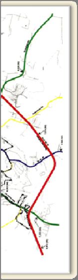
19 Existing & Planned Residential Growth Existing Commercial Planned Commercial 19
20 Questions Connecting Land Use & Transportation 2010 APA Upper Midwest Planning Conference Mankato, Minnesota Gina Mitchell, AICP menk.com Bryan Nemeth, PE, PTOE menk.com Bolton & Menk, Inc. (952)
8.0 Chapter 8 Alternatives Analysis
 8.0 Chapter 8 Alternatives Analysis The primary purpose for using CORSIM in the context of this manual is to guide the design process and program delivery. To this point in the manual, you have been given
The Secrets to HCM Consistency Using Simulation Models
 The Secrets to HCM Consistency Using Simulation Models Ronald T. Milam, AICP David Stanek, PE Chris Breiland Fehr & Peers 2990 Lava Ridge Court, Suite 200 Roseville, CA 95661 r.milam@fehrandpeers.com (916)
Multi-Resolution Traffic Modeling for Transform 66 Inside the Beltway Projects. Prepared by George Lu, Shankar Natarajan
 Multi-Resolution Traffic Modeling for Transform 66 Inside the Beltway Projects Prepared by George Lu, Shankar Natarajan 2017 VASITE Annual Meeting, June 29, 2017 Outline Transform I-66 Inside the Beltway
CHAPTER 2: MODELING METHODOLOGY
 CHAPTER 2: MODELING METHODOLOGY 2.1 PROCESS OVERVIEW The methodology used to forecast future conditions consisted of traditional traffic engineering practices and tools with enhancements to more accurately
SERPM 7/DTA Application FSUTMS Users Group Meeting
 SERPM 7/DTA Application FSUTMS Users Group Meeting Ana Elias, PhD, PE, PTOE Leigh Ann White, PE, PTOE June, 2015 www.jacobs.com worldwide Agenda 1. Mesoscopic Modelling and Cube Avenue Principles 2. Background
Urban Transport Modeling (based on these two sources)
") Urban Transport Modeling (based on these two sources) A Transportation Modeling Primer May, 1995 Edward A. Beimborn Center for Urban Transportation Studies University of Wisconsin- Milwaukee http://www.uwm.edu/dept/c
Urban Transport Modeling (based on these two sources) A Transportation Modeling Primer May, 1995 Edward A. Beimborn Center for Urban Transportation Studies University of Wisconsin- Milwaukee http://www.uwm.edu/dept/c
9. TRAVEL FORECAST MODEL DEVELOPMENT
 9. TRAVEL FORECAST MODEL DEVELOPMENT To examine the existing transportation system and accurately predict impacts of future growth, a travel demand model is necessary. A travel demand model is a computer
SONG - Homework #2. Transportation Network Development System Analysis. The main objectives of this assignment are to help student
 SONG - Homework #2 Transportation Network Development System Analysis The main objectives of this assignment are to help student learn to draw implications of alternative policies on transportation network
Multilevel transport model for transport analysis of CIVITAS DYNAMO tasks
 Multilevel transport model for transport analysis of CIVITAS DYNAMO tasks Summer University Developing Mobility 2.0 systems and services Palma (Mallorca), 4-6 November 2015 Jacek Oskarbski Gdańsk University
From Policy to Reality
 From Policy to Reality Updated ^ Model Ordinances for Sustainable Development 2000 Environmental Quality Board 2008 Minnesota Pollution Control Agency Funded by a Minnesota Pollution Control Agency Sustainable
6.0 CONGESTION HOT SPOT PROBLEM AND IMPROVEMENT TRAVEL DEMAND MODEL ANALYSIS
 6.0 CONGESTION HOT SPOT PROBLEM AND IMPROVEMENT TRAVEL DEMAND MODEL ANALYSIS 6.1 MODEL RUN SUMMARY NOTEBOOK The Model Run Summary Notebook (under separate cover) provides documentation of the multiple
Access Operations Study: Analysis of Traffic Signal Spacing on Four Lane Arterials
 Mn/DOT Access Management Guidelines Background Technical Report Access Operations Study: Analysis of Traffic Signal Spacing on Four Lane Arterials November 2002 Minnesota Department of Transportation Office
Corridor Planning Standards + Potential Performance Measures
 Corridor Planning Standards + Potential Performance Measures January 17, 2007 1. Transportation improvements should connect people with potential places of employment and regional activity centers, particularly
MULTIMODAL TRANSPORTATION IMPACT STUDY GUIDELINES
 MULTIMODAL TRANSPORTATION IMPACT STUDY GUIDELINES 1 st Edition City of San Luis Obispo 2035 Circulation Element 1 Table of Contents Introduction... 2 Process... 2 When Impact Studies Are Required... 3
DRAFT MEMORANDUM DATE: 10/06/2017
 DATE: 10/06/2017 FROM: TO: SUBJECT: DRAFT MEMORANDUM Paul Silberman, P.E., PTOE, Sabra, Wang & Associates, Inc. Elisa Mitchell, P.E., Sabra, Wang & Associates, Inc. Laura Hodgson, LEED AP, Montgomery County
Contents i Contents Page 1 A New Transportation Plan Community Involvement Goals and Objectives... 11
 Contents i Contents 1 A New Transportation Plan... 1 Why develop a new plan?... 1 What area does the LRTP focus on?... 2 Why is this LRTP important?... 3 Meeting Requirements for Transportation Planning...
1. Introduction. 1.1 Project Background. ANTONY JOHNSTONE Transport Associate Aurecon
 ANTONY JOHNSTONE Transport Associate Aurecon Antony.johnstone@aurecongroup.com RAFAEL CARVAJAL Operational Modelling and Visualisation Coordinator Main Roads WA Rafael.CARVAJALCIFUENTES@mainroads.wa.gov.au
Work Zone Impacts. Basic Concept 1/6/2011. What is a WZ Impact Assessment? Module 5
 Work Zone Impacts Module 5 What is a WZ Impact Assessment? WZ Impact Assessment is the process of understanding the safety and mobility impacts of a road construction or maintenance project Basic Concept
Transportation Model Report
 1. Introduction The traffic impacts of the future developments in the IL130/High Cross Road corridor for different scenarios were analyzed using a Travel Demand Model (TDM). A four step modeling process
CITY OF CLOVIS Traffic Impact Study Guidelines
 CITY OF CLOVIS Traffic Impact Study Guidelines CLOVIS, A WAY OF LIFE Approved August 25, 2014 City Council Resolution 2014-79 Prepared by City of Clovis Engineering Division Steve White, City Engineer
A.M. Peak Hour P.M. Peak Hour Land Use Intensity Daily Total In Out Total In Out. Shopping Center 236,160 SF
 April 23, 218 Mr. Michael Berenbom LANE4 Property Group, Inc. 475 Central Street Kansas City, MO 64112 RE: Dear Mr. Berenbom, French Market Trip Generation Overland Park, Kansas As requested, Priority
Lesson 2. Principles of. Transportation. Land Use 2-1
 Lesson 2 Principles of Transportation & Land Use 2-1 Learning Outcomes Explain transportation s impact on land use and development patterns, including historical growth patterns Explain how land use patterns
Project Prioritization for Urban and Rural Projects TEAM CONFERENCE March 7, 2018
 Project Prioritization for Urban and Rural Projects 2018 TEAM CONFERENCE March 7, 2018 Challenge Limited funding for transportation improvements requires strategic selection of projects to ensure resource
Using Traffic Signal System Performance Measures to Evaluate, Prioritize, and Sell
 Using Traffic Signal System Performance Measures to Evaluate, Prioritize, and Sell ITS Texas 2016 Annual Meeting Brian A. Moen, P.E. City of Frisco bmoen@friscotexas.gov Tel: (972) 292-5450 Curtis Jarecki,
UPTOWN TRAFFIC IMPACT ANALYSIS
 UPTOWN TRAFFIC IMPACT ANALYSIS This memorandum summarizes the results of the traffic analysis conducted to evaluate the traffic operations of the intersections along Post Oak Boulevard within Uptown Houston
Appendix 1. Problem Identification for MoTI Business Cases
 Guidelines for Preparing MoTI Business Cases Appendix 1 Problem Identification for MoTI Business Cases Prepared By: Planning and Programming Branch Infrastructure Department BC Ministry of Transportation
Technical Memorandum. 720 SW Washington Suite 500 Portland, OR dksassociates.com. DATE: July 12, 2017
 Technical Memorandum DATE: July 12, 2017 TO: Kay Bork City of Veneta Bill Johnston, AICP Oregon Department of Transportation Christina McDaniel-Wilson, PE Oregon Department of Transportation Keith Blair,
TRAFFIC PLANNING & ENGINEERING. Part of a diversified family of solutions. jmt.com
 TRAFFIC PLANNING & ENGINEERING Part of a diversified family of solutions jmt.com Services Travel Demand Forecasting Traffic Analysis Modeling Traffic Data Collection Traffic Studies Traffic Signal Design
APPENDIX TRAVEL DEMAND MODELING OVERVIEW MAJOR FEATURES OF THE MODEL
 APPENDIX A TRAVEL DEMAND MODELING OVERVIEW The model set that the Central Transportation Planning Staff (CTPS), the Boston Region Metropolitan Planning Organization s (MPO) technical staff, uses for forecasting
GUIDE FOR THE PREPARATION OF TRAFFIC IMPACT STUDIES
 GUIDE FOR THE PREPARATION OF TRAFFIC IMPACT STUDIES Adopted by Town Council on November 25, 2008 Prepared By: HNTB Engineering Department Planning Department TABLE OF CONTENTS I. INTRODUCTION... 1 II.
Database and Travel Demand Model
 Database and Travel Demand Model 7 The CMP legislation requires every CMA, in consultation with the regional transportation planning agency (the Metropolitan Transportation Commission (MTC) in the Bay
Webinar Series for Comprehensive Plan Updates. Transportation Overview
 Webinar Series for Comprehensive Plan Updates Transportation Overview Presented by Michael Larson and Mark Filipi August 18, 2016 2040 Transportation Policy Plan Adopted January 14 th, 2015 Multimodal
AN INTEGRATED TRANSPORTATION PLANNING AND OPERATIONS MODEL FOR MEMPHIS, TENNESSEE
 AN INTEGRATED TRANSPORTATION PLANNING AND OPERATIONS MODEL FOR MEMPHIS, TENNESSEE Jeffery Karafa, Mihalis M. Golias, Martin Lipinski Department of Civil Engineering & Intermodal Freight Transportation
Applying Micro-simulation i tools for Project Development- University of Florida Traffic Seminar Jaimison Sloboden, PE RS&H
 Applying Micro-simulation i tools for Project Development- Documentation ti & QA/QC University of Florida Traffic Seminar Jaimison Sloboden, PE RS&H Overview Principles Types of Projects Correctly Scoping
LINKING LAND FORM AND DEVELOPMENT LOCATION TO MULTIMODAL TRAVEL DEMAND: CASE STUDIES OF TRANSPORTATION AND LAND USE STUDIES IN DELAWARE
 0 0 0 0 LINKING LAND FORM AND DEVELOPMENT LOCATION TO MULTIMODAL TRAVEL DEMAND: CASE STUDIES OF TRANSPORTATION AND LAND USE STUDIES IN DELAWARE CORRESPONDING AUTHOR: Scott Thompson-Graves, P.E., PTOE Whitman,
CHAPTER 7. TRAVEL PATTERNS AND TRAVEL FORECASTING
 CHAPTER 7. TRAVEL PATTERNS AND TRAVEL FORECASTING TRAVEL PATTERNS Northwest Arkansas has experienced unprecedented growth in population and employment in the past 25 years. The economic vitality and diversity
2.0 ACCESS OBJECTIVES, PRINCIPLES AND STRATEGIES
 2.0 ACCESS OBJECTIVES, PRINCIPLES AND STRATEGIES Early in the development of the Access Control Plan update project, it was important for the project team to develop initial objectives of what access management
Apply DynusT Model for Incident Management along Loop 101 Corridor
 Apply DynusT Model for Incident Management along Loop 101 Corridor Lili(Leo) Luo, P.E. ITS/Safety Engineer Sarath Joshua, P.E. ITS/Safety Program Manager What do Transportation Models do? Help us answer
Transit Signal Priority in the Denver Metro. Bart Przybyl, P.E., PTOE
 Transit Signal Priority in the Denver Metro Bart Przybyl, P.E., PTOE BACKGROUND DRCOG Denver Regional Council of Governments RTD Regional Transportation District (Transit Authority) 2007 DRCOG/RTD Transit
ALBION FLATS DEVELOPMENT EXISTING TRAFFIC CONDITIONS AND POTENTIAL IMPACTS
 EXISTING TRAFFIC CONDITIONS AND POTENTIAL IMPACTS FINAL REPORT SEPTEMBER 2010 TABLE OF CONTENTS 1.0 INTRODUCTION 1 2.0 EXISTING TRAFFIC CONDITIONS 2 3.0 FUTURE TRAFFIC CONDITIONS 3 4.0 POTENTIAL IMPACTS
MOBILITY AND ALTERNATIVES ANALYSIS
 6 MOBILITY AND ALTERNATIVES ANALYSIS BACK OF SECTION DIVIDER 6.0 Mobility and Alternatives Analysis Travel demand analysis provides a framework for the identification of transportation facilities and services
MEMORANDUM #4. DATE: November 4, Warrenton TSP Project Management Team. Ray Delahanty, AICP, DKS Associates Kate Petak, EIT, DKS Associates
 MEMORANDUM #4 DATE: November 4, 2015 TO: FROM: SUBJECT: Warrenton TSP Project Management Team Ray Delahanty, AICP, DKS Associates Kate Petak, EIT, DKS Associates Warrenton Transportation System Plan Update
AMPO Annual Conference Session: Performance (Part 1) October 18, 2017 Savannah, GA
 October 18, 2017 Savannah, GA") AMPO Annual Conference Session: Performance (Part 1) October 18, 2017 Savannah, GA Introduction: North Jersey Transportation Planning Authority NJTPA Congestion Management Process Study Goals Analysis
AMPO Annual Conference Session: Performance (Part 1) October 18, 2017 Savannah, GA Introduction: North Jersey Transportation Planning Authority NJTPA Congestion Management Process Study Goals Analysis
Chapter 4: Transportation and Land Use
 Chapter 4: Transportation and Land Use Transportation and land use together make possible the wide range of destination opportunities in the region. Transportation provides the connections, and, in turn,
Modeling Traffic Flow under Emergency Evacuation Situations: Current Practice and Future Direction
 Modeling Traffic Flow under Emergency Evacuation Situations: Current Practice and Future Direction Kevin D. Moriarty Research Assistant Transportation Engineering November 16, 2006 Overview Introduction
DISTRICTWIDE CONTINUING SERVICES TRAFFIC FORECAST AND ANALYSIS SUPPORT CONTRACT
 DISTRICTWIDE CONTINUING SERVICES TRAFFIC FORECAST AND ANALYSIS SUPPORT CONTRACT I. Overview and Purpose The Department requires professional planning and engineering consultant services of traffic forecast
McTAVISH ROAD INTERCHANGE A ROUNDABOUT SOLUTION. Tim Blackburn, P.Eng., Urban Systems Ltd.
 McTAVISH ROAD INTERCHANGE A ROUNDABOUT SOLUTION Tim Blackburn, P.Eng., Urban Systems Ltd. Jose Pinto, P.Eng., P.T.O.E., McElhanney Consulting Services Ltd. Paper Prepared for Presentation at the Innovation
CITY OF DRAPER TRAFFIC IMPACT STUDY DESIGN GUIDELINES
 CITY OF DRAPER TRAFFIC IMPACT STUDY DESIGN GUIDELINES June 1, 2012 Draper City Traffic Impact Study Guidelines Table of Contents Introduction... 1 Traffic Impact Classification Levels... 1 Analysis Approach
Sustainable Transportation & Land Use Integration Study
 Sustainable Transportation & Land Use Integration Study Stakeholders Group Meeting Two Includes additions made after meeting March 28, 2011 Hot Topics: Emerging themes, technologies, and techniques Outline
SABRA, WANG & ASSOCIATES, INC. Engineers Planners Analysts
 SABRA, WANG & ASSOCIATES, INC. Engineers Planners Analysts TECHNICAL MEMORANDUM TO: FROM: Mr. Eric Graye, Planning Supervisor, Functional Planning and Policy Division, Montgomery County Planning Department
APPENDIX B. Public Works and Development Engineering Services Division Guidelines for Traffic Impact Studies
 APPENDIX B Public Works and Development Engineering Services Division Guidelines for Traffic Impact Studies Revised December 7, 2010 via Resolution # 100991 Reformatted March 18, 2011 TABLE OF CONTENTS
January 17, Ron Waldthausen Platte Valley LLC 1378 Promontory Bluff View Colorado Springs, CO 80921
 LSC TRANSPORTATION CONSULTANTS, INC. 545 East Pikes Peak Avenue, Suite 210 Colorado Springs, CO 80903 (719) 633 2868 FAX (719) 633 5430 E mail: lsc@lsctrans.com Website: http://www.lsctrans.com January
TRANSPORTATION DEMAND FORECASTING INFORMATION SESSION
 GTA WEST CORRIDOR PLANNING AND EA STUDY-STAGE STAGE 1 TRANSPORTATION DEMAND FORECASTING INFORMATION SESSION JUNE 2008 Topics for this Session 1. The Challenge of Growth 2. Overview of GTAW Study 3. The
The Policies section will also provide guidance and short range policies in order to accomplish the goals and objectives.
 4 Goals & Objectives INTRODUCTION The 2015-2040 MTP preserves and promotes the quality of life and economic prosperity of the MAB by providing a transportation system consistent with the regional goals.
City of Berkeley. Guidelines for Development of Traffic Impact Reports
 Office of Transportation (OOT) City of Berkeley Guidelines for Development of Traffic Impact Reports Office of Transportation, City of Berkeley 1 1. Overview These guidelines provide a framework to help
Travel Demand Forecasting User Guide
 Travel Demand Forecasting User Guide A Supplement to the Regional Transitway Guidelines Metropolitan Council February 2012 This document supplements the Project Development, Leadership, and Oversight discussion
INNOVATIVE INTERSECTIONS. Terrell Hughes, PE Conceptual Planning Manager VDOT Transportation and Mobility Planning Division
 INNOVATIVE INTERSECTIONS Terrell Hughes, PE Conceptual Planning Manager VDOT Transportation and Mobility Planning Division Current Tools Common Project Solutions Traffic Signalization Widening Projects
and Unmet Need: Methodology and Results
 2 Demand and Unmet Need: Methodology and Results Projecting unmet park-and-ride need is the key indicator for park-and-ride expansion. There is gross demand and net new demand (also known as unmet need)
DISTRICTWIDE PLANNING AND ENVIRONMENTAL MANAGEMENT SERVICES CONTRACT
 DISTRICTWIDE PLANNING AND ENVIRONMENTAL MANAGEMENT SERVICES CONTRACT I. Purpose The Department requires professional engineering and planning consultant services to identify, evaluate, and develop conceptual
Develop Guidelines for Access Management in Las Vegas
 Develop Guidelines for Access Management in Las Vegas Project Team Dr. Mohamed Kaseko, PI Las Vegas, NV 89154-4015 702-895-1360 Dr. Hualiang Teng, Co-PI 702-895-4940 Dr. Zong Z. Tian, P.E., Co-PI Department
Congestion Management Process (CMP)
") Congestion Management Process (CMP) Introduction The Congestion Management Process (CMP) is a systematic, data-driven, and regionally accepted approach that aims to improve the performance of the transportation
Congestion Management Process (CMP) Introduction The Congestion Management Process (CMP) is a systematic, data-driven, and regionally accepted approach that aims to improve the performance of the transportation
HORIZON 2030: Plan Projects November 2005
 Horizon PROJECTS 2030 Projects 10-1 10-2 The Horizon 2030 Project Information section is comprised of individual project information in alphabetical order by project name. The information provided for
Traffic Data Quality Analysis. James Sturrock, PE, PTOE, FHWA Resource Center Operations Team
 Traffic Analysis James Sturrock, PE, PTOE, FHWA Resource Center Operations Team Source Material Traffic Measurement http://ntl.bts.gov/lib/jpodocs/repts_te/14058.htm Seven DEADLY Misconceptions about Information
Greenhouse Gas Emission Reduction Strategies
 Greenhouse Gas Emission Reduction Strategies 2011 ITE Quad Conference April 18 19, 2011, Embassy Suites; Lynnwood, WA Victor L. Sl Salemann, PE Senior Associate David Evans and Associates Bellevue, WA
Highway and Freight Current Investment Direction and Plan. TAB September 20, 2017
 Highway and Freight Current Investment Direction and Plan TAB September 20, 2017 Today s Topics Where are we now, what are the current issues? Where do we want to go? How will we get there? What are the
New Mexico Statewide Model
 New Mexico Statewide Model Fifth Largest State in land area 2005 Population 1.97 million 42% of state in Albuquerque and Santa Fe area Outside urban areas population density very low New Mexico Planning
Traffic generated by future approved, planned or potential development activity.
 IV. FUTURE CONDITIONS IV.A. Development of Future Year Traffic Forecasts In order to assess future roadway conditions, traffic projections were developed based on several sources: Growth in existing through
TRANSFORM66: OUTSIDE THE BELTWAY
 TRANSFORM66: OUTSIDE THE BELTWAY Concession Fee Project Eligibility *Required Entry PARTI GENERAL INFORMATION 1.1 Applicant Information Please indicate the jurisdiction or agency that is submitting this
Rapid Transit in Winnipeg. Winnipeg TOD Summit November 17, 2014
 Rapid Transit in Winnipeg Winnipeg TOD Summit November 17, 2014 Presentation Overview Rapid Transit (RT) in Winnipeg What is RT? What are our RT plans? Near term Longer term Comments re: TOD OurWinnipeg
Alexandria Area Transportation Study. Douglas County Comprehensive Plan - Transportation January 14, 2010
 Alexandria Area Transportation Study Douglas County Comprehensive Plan - Transportation January 14, 2010 Project Partners Mn/DOT Douglas County City of Alexandria Study Area Location Map (Includes the
Findings of the Stakeholder Survey
 Findings of the Stakeholder Survey Strategic Plan for COG/TPB Model Development Task Order 15.2 presented by Cambridge Systematics, Inc. John (Jay) Evans, P.E., AICP presented to COG/TPB Travel Forecasting
2010 REGIONAL TRANSPORTATION MODEL UPDATE
 2010 REGIONAL TRANSPORTATION MODEL UPDATE Final Report April, 2016 Prepared by the Pioneer Valley Planning Commission The analysis in this report was completed after the adoption of the Regional Transportation
The London Land-Use and Transport Interaction Model (LonLUTI)
") The London Land-Use and Transport Interaction Model (LonLUTI) October 2014 Contents 3 Introduction 4 Why do we need transport models? 6 TfL s suite of models 8 What is LonLUTI? 12 How was LonLUTI developed?
The London Land-Use and Transport Interaction Model (LonLUTI) October 2014 Contents 3 Introduction 4 Why do we need transport models? 6 TfL s suite of models 8 What is LonLUTI? 12 How was LonLUTI developed?
Regional Travel Demand Management Plan
 Regional Travel Demand Management Plan Adopted October 2009 Quality for life Regional Travel Demand Management Plan Adopted October 2009 For more information, contact: Greater Wellington 142 Wakefield
Chapter #9 TRAVEL DEMAND MODEL
 Chapter #9 TRAVEL DEMAND MODEL TABLE OF CONTENTS 9.0 Travel Demand Model...9-1 9.1 Introduction...9-1 9.2 Overview...9-1 9.2.1 Study Area...9-1 9.2.2 Travel Demand Modeling Process...9-3 9.3 The Memphis
CITY OF VALLEJO PUBLIC WORKS DEPARTMENT TRAFFIC IMPACT Analysis/Study GUIDELINES
 The City Engineer, under the authority of the Public Works Director and recommendations from the Traffic Engineer, will make the final decision on the need for a traffic study. The purpose of the traffic
VelociRFTA BRT. Roaring Fork Transportation Authority. Webinar: Transit Planning with a Land Use Lens. August 23, 2011
 VelociRFTA BRT Roaring Fork Transportation Authority Webinar: Transit Planning with a Land Use Lens August 23, 2011 David Johnson, AICP RFTA Director of Planning RFTA Service Summary 70-Mile Corridor 75,000
Comparison of Queue Lengths Estimations at AWSC Intersections using Highway Capacity Software, Sidra Intersection, and SimTraffic
 Comparison of Queue Lengths Estimations at AWSC Intersections using Highway Capacity Software, Sidra Intersection, and SimTraffic Daniel Lai May 2, 2009 Characteristics of an All-Way Stop Controlled (AWSC)
TSM&O STUDIES & IMPROVEMENT STRATEGIES IN MID-ATLANTIC
 TSM&O STUDIES & IMPROVEMENT STRATEGIES IN MID-ATLANTIC 2017 TRAFFIC & SAFETY CONFERENCE Barry Brandt, PE, PTOE Agenda Background Maryland Statewide TSM&O Methodology Analysis Hot Spot Identification Evaluate
FUTURE BUS RAPID TRANSIT PLANS
 ATTACHMENT 1 Preferred Configuration Saskatoon Bus Rapid Transit - Preferred Configuration FUTURE BUS RAPID TRANSIT PLANS Plan For Growth Transportation Plan BRT Plan October 2017 saskatoon.ca/engage 1
4: Transportation and Land Use
 Chapter Figure 4-1: Recent development has brought more housing and mixed use Downtown Minneapolis - looking north from E 15th Street at the Grant Street / 11th Street exit 4: Transportation and Land Use
Using the Federal Transit Administration (FTA) Simplified Trips-on-Project Software (STOPS) for Transit Demand Estimation
 Simplified Trips-on-Project Software (STOPS) for Transit Demand Estimation") Using the Federal Transit Administration (FTA) Simplified Trips-on-Project Software (STOPS) for Transit Demand Estimation presented to 2014 ITE Mid-Colonial District and Mid-Atlantic Section Annual Meeting
Using the Federal Transit Administration (FTA) Simplified Trips-on-Project Software (STOPS) for Transit Demand Estimation presented to 2014 ITE Mid-Colonial District and Mid-Atlantic Section Annual Meeting
COMPARISON OF SPUI & TUDI INTERCHANGE ALTERNATIVES WITH COMPUTER SIMULATION MODELING
 COMPARISO OF SPUI & TUDI ITERCHAGE ALTERATIVES WITH COMPUTER SIMULATIO MODELIG Matthew J. Selinger, PTOE William H. Sharp, PTOE ABSTRACT There are numerous technical papers and reports discussing the operations
ACTION REQUESTED Staff recommends forwarding the following comments to Ada County for the above listed application:
 To: Mayor and City Council From: Patricia Nilsson, AICP, Comprehensive Planning Manager Date: February 4, 2010 Subject: Ada County Referral 200600219 CPA Dry Creek Ranch BACKGROUND Dry Creek Ranch is a
Guidelines for the Submission of a Transportation Study Level 2
 Guidelines for the Submission of a Transportation Study Level 2 For Site Development Applications in the City of North Vancouver Transportation Group, City of North Vancouver Engineering, Parks & Environment
TRANSFORM66: OUTSIDE THE BELTWAY
 TRANSFORM66: OUTSIDE THE BELTWAY Concession Fee Project Eligibility *Required Entry PARTI GENERAL INFORMATION 1.1 Applicant Information Please indicate the jurisdiction or agency that is submitting this
Appendix D. Tier 2 Final Environmental Assessment I-66 Transportation Technical Report
 Tier 2 Final Environmental Assessment I-66 Transportation Technical Report Appendix D Travel Demand Model & Post Processing Methodology & Assumptions Technical Memorandum FINAL AUGUST 2016 TECHNICAL MEMORANDUM
Loop 289 Corridor Study Phase I
 2008 Loop 289 Corridor Study Phase I Hongchao Liu, Pavan Evuri, and Hao Xu Multidisciplinary Research in Transportation Texas Tech University August 2008 TABLE OF CONTENTS LIST OF TABLES... III LIST OF
 Goals (not listed in any particular order) System Maintenance: Roadways, bike and pedestrian infrastructure, and transit systems that are rehabilitated, complete, and maintained in a state of good repair.
GUIDELINES FOR TRAFFIC IMPACT ANALYSIS (ZONING PETITIONS)
") GUIDELINES FOR TRAFFIC IMPACT ANALYSIS (ZONING PETITIONS) (A) INTENT This Section is intended to help ensure that new development does not adversely affect the capacity of streets and intersections to
GUIDELINES FOR TRAFFIC IMPACT ANALYSIS (ZONING PETITIONS) (A) INTENT This Section is intended to help ensure that new development does not adversely affect the capacity of streets and intersections to
Interstate 66 Tier 1 Environmental Impact Statement Public Hearing
 Interstate 66 Tier 1 Environmental Impact Statement Public Hearing 1 Project Corridor Study Process / Tiering Approach Tier 1 EIS focuses on broad issues - Purpose and need - Mode / Technology choice -
Use of Microsimulation to Convey Access Management Techniques
 Use of Microsimulation to Convey Access Management Techniques 6 th National Access Management Conference Kansas City, MO August 30, 2004 Mike Curtit, PE Missouri Department of Transportation Technical
November 8, RE: Harrah s Station Square Casino Transportation Analysis Detailed Traffic Impact Study Review. Dear Mr. Rowe:
 November 8, 2006 Mr. Glenn Rowe, P.E. Pennsylvania Department of Transportation Bureau of Highway Safety and Traffic Engineering Commonwealth Keystone Building 400 North Street, 6 th Floor Harrisburg,
ELEMENT M GROWTH MANAGEMENT
 Growth Management ELEMENT M GROWTH MANAGEMENT GOAL: To ensure that growth and development are integrally planned with, and phased concurrently with, the City of Irvine s ability to provide an adequate
GUIDELINES FOR SELECTING TRAVEL FORECASTING METHODS AND TECHNIQUES
 GUIDELINES FOR SELECTING TRAVEL FORECASTING METHODS AND TECHNIQUES Maren Outwater and Jeff Doyle, RSG, 55 Railroad Row, White River Junction, VT 05001 maren.outwater@rsginc.com, jeff.doyle@rsginc.com ABSTRACT
Travel Demand Modeling At NCTCOG
 Travel Demand Modeling At NCTCOG Arash Mirzaei North Central Texas Council Of Governments For University of Texas at Arlington ITE Student Chapter March 9, 2005 Agenda Background DFW Regional Model Structure
Will County Freight Advisory Council Meeting. April 11, 2017
 Will County Freight Advisory Council Meeting April 11, 2017 1 Agenda Summary of Last Meeting Plan Progress and Update Performance Measures Break-Out Discussion Projects and Project Evaluation Criteria
City of Brantford Chapter 3 TABLE OF CONTENTS
 Chapter 3 The Land Use & Transportation Connection TABLE OF CONTENTS 3.1 THE LAND USE & TRANSPORTATION LINK... 1 3.2 POPULATION & EMPLOYMENT GROWTH FORECASTS... 3 3.2.1 Proposed Places to Grow Plan Forecasts
Preliminary Assessment of Interchange Concepts. Seven Corners Task Force March 11, 2014
 Preliminary Assessment of Interchange Concepts Seven Corners Task Force March 11, 2014 Presentation overview Introduction Concept selection and refinement Future volume development and assignment Preliminary