ABBREVIATION. International Civil Aviation Organization
|
|
|
- Lora Candice Patterson
- 5 years ago
- Views:
Transcription
1 ABBREVIATION WB ICAO GMS_CBTA HCMC HNC ĐBSCL BOT BTO BT PPP TEU DWT NH1A World Bank International Civil Aviation Organization Agreater MeKong Subregional Agreement on Facilitation ò cross-border transport of good and people Hochiminh City Hanoi City MeKong Delta Build Operation - Tranfer Build Tranfer - Operation Build Tranfer Public Private Partnership Twenty-foot equivalent units Deadweight tonnage National highway No 1A NH51 National highway No 51 ITS VEC TEDI FS Pre - FS Intelligent transport system Vietnam Expressway Corporation Transport Engineering Desing Inc Feasibility Study Pre - Feasibility Study 1
2 1.1 OVERVIEW Background CHAPTER 1: GENERAL INTRODUCTION The Vietnamese economy in 2010 showed remarkable resilience against a background of uncertainty in the global economy following the global financial crisis. GDP showed increasing growth rates in three successive quarters, 5.8% in quarter 1; 6.4% in quarter 2 and 7.2% in quarter 3. According to the World Bank (WB) in October 2010, Vietnam s economy grew at an annual rate of 6.5% in 2010, which is high compared to WB s predicted global growth rates of 3.5% in 2010 and 3.3% in 2011, and is comparable to the rate of 6.7% recorded for East-Asia Pacific (excluding China). Also according to WB, direct overseas investment in 2010 increased, reaching US$7.6 billion compared with US$6.9 billion in 2009, as a result of continued improvement in the Vietnamese economic environment. However, inherent shortcomings in infrastructure, economic institutions and human resources remain as obstacles to future economic growth. These limitations are clearly identified by the Vietnamese Government which is making strong efforts to address these issues. Through Decision 678/QD-KHDT of 13 May 2010, the Ministry of Planning and Investment issued a list of projects for investment promotion. Accordingly, the Ministry of Transport is responsible for issuing details of the specified projects with the aim of attracting investment into the field of transportation for the period of Targets for socio-economic development In the period , the general target of socio-economic development of Vietnam Government is summarized as follows: Rapid and sustainable economic development based on changing the structure of the economy, improving quality, effectiveness, competitiveness and integration into the global economy; Setting the foundations to enable the country to become an industrialized country by 2020; Quickly increase scientific and technological content in products; Improving and enhancing quality of education, training and development of human resources. Improving living standards, especially for the poor and ethnic minority groups, and in mountainous and remote areas; Strengthening measures to protect the environment and actively responding to the threat of climate change; Maintaining firm political stability, national defense, social order and safety. On the basis of the general targets mentioned above, specific duties to be implemented include: - Stabilizing the macro economy, innovation in the model for growth, improving quality, effectiveness, and sustainable development. Continuing to refine the socialistoriented market mechanism. Creating an equal, transparent, stable and open trading environment. Removing obstacles to production. Encouraging development in each economic sector, and ensuring that the state plays its key role in managing the economy. - Improving educational and training quality, quality of human resources; paying special attention to development of high-quality human resource for key economic sectors; quickly increasing the percentage of skilled labour. 2
3 - Speeding up technological development and transfer; encouraging development of firms operating in high-technology applications in the industrial, agricultural, service and administrative management sectors. Focus on technology transfer and its application through economic, investment and international trading activities. - Strongly developing infrastructure, especially selected large-scale infrastructure works, particularly for transport and urban infrastructure. - Broadening and enhancing the effectiveness of external and international integration. - Improving the quality of life and health of the people, ensuring social equality; prevention of social evils. Preserving and promoting diversity of culture and values of the community of all ethnic groups; developing sports to strengthen spiritual and physical health of the people, at the same time upgrading the position of Vietnam in the international and regional arena. - Properly and effectively using natural resources. Strengthening environmental protection and improvement activities. Actively preventing and limiting the impacts of damage to the environment, effectively responding to climate change. - Improving the efficiency and working capacity of the government. Speeding up administrative and judicial reform. Preventing corruption, red tape and wastefulness Attracting capital investment in traffic infrastructure The Government has endeavored to facilitate investment in transport infrastructure as the basis for industrialization, modernization and socio-economic development. However, there will continue to be a shortage of capital available to the Government throughout the next 5 years with regard to planned investment in the transport sector. The Government has expressed its wish to invite private sector capital investment, including foreign investment, in projects in Vietnam using forms such as Public Private Partnership (PPP), Build Operation Transfer (BOT), and Build Transfer (BT). Under the Ministry of Transport s investment plan, capital requirement for projects in the period is about 800 trillion dong, or around US$40 billion. This includes highway projects such as Quang Ngai Quy Nhon expressway (35 trillion dong); Quy Nhon Nha Trang expressway (30 trillion dong); Hanoi 4 th Ring Road (65 trillion dong). In the aviation sector, projects include Chu Lai international airport (38 trillion dong); Long Thanh airport (103 trillion dong). In the rail sector, projects include Bien Hoa Vung Tau railway (15 trillion dong); bauxite mining railway Dak Nong Binh Thuan (14.5 trillion dong); Ho Chi Minh city Can Tho railway (28.8 trillion dong). In the sea port sector, projects for construction of 2 wharves in Cai Mep Thi Vai ports complex (Ba Ria Vung Tau) have investment scale less than US$100 million, whilst investments in Da Nang international port and Van Phong International Transshipment Port have been prioritized for private investors in the form of PPP. This document aims to provide necessary information to potential investors in transport infrastructure in Vietnam in the period Specific information on the projects will be provided by the, Ministry of Transport, at 80 Tran Hung Dao street, Hanoi... 3
4 1.2 LIST OF PROJECTS MENTIONED IN THE DOCUMENT No. Project Reference documents Carried out by A Road Ha Noi Lang Son Expressway Hanoi Ha Long Expressway Ha Long Mong Cai Expressway Eastern North - South Expressway Ninh Binh Thanh Hoa section Thanh Hoa Ha Tinh section Quang Tri Hue Da Nang (Cam Lo Tuy Loan) section Cam Lo La Son section La Son Tuy Loan section Quang Ngai Quy Nhon section Quy Nhon Nha Trang section Dau Giay Phan Thiet section Draft final report, Feasibility Study Consortium of Oriental Consultants Co. Ltd., Mott MacDonald Singapore, and APECO. (June 2010) Feasibility Study Report TEDI (2005) TEDI Early-term report, setting up project for works TEDI (2010) TEDI construction investment End-term report setting up project for works TEDI (2010) TEDI construction investment End-term report setting up project for works construction investment Mid-term report - setting up project for works construction investment End-term report setting up project for works construction investment End-term report setting up project for works construction investment Project proposal Specific planning for Eastern North-South Expressway Draft final report for setting up project for works construction investment TEDI (03/2011) TEDI (03/2011) Construction Survey- Design and Consultancy Company Ministry of Defense (Truong Son Consultancy) Construction Consultancy JSC 533 (2009) TEDI (2009) Consortium of ALMEC (Japan) and TEDI (2010) Document supplied by TEDI TEDI Project Management Unit of Ho Chi Minh Road Construction Consultancy JSC 533 TEDI TEDI 4
5 11 Upgrading, improving national road 1 La Son Lang Co section and Report of project proposal TEDI (2010) TEDI Phu Gia highway tunnel, Phuoc Tuong 12 Dau Giay Da Lat Report setting up the project for works TEDI (2010) TEDI construction investment 13 Hanoi 4 th Ring Road Draft end-term report setting up the project for works construction TEDI (2010) TEDI investment 14 Hanoi 5 th Ring Road Project proposal TEDI TEDI 15 HCMC 3 rd Ring Road Specific planning 16 HCMC 4 th Ring Road B Aviation Report of project for investment in works construction 17 Chu Lai airport Master plan 18 Long Thanh airport Master plan 19 C Upgrading and improving Phu Bai airport Railway Improving Hanoi Noi Bai Railway Hai Van railway tunnel Bien Hoa Vung Tau railway Southern West Lake Ngoc Khanh Lang Planning Brief report of project Pre - Feasibility Study Mid-term report setting up project for works construction investment Pre - Feasibility Study TEDI SOUTH (April 2010) TEDI SOUTH (July 2010) Airport Design and Construction Consultancy One - member Co. Ltd... Airport Engineering Consultancy and Services JSC (AEC) (7/2009) Consultants Investment & Construction Company (2004) TEDI South (2011) Consultants Investment Ministry of Transport of Vietnam Collected by TEDI Viet Nam Civil Aviation Administration of Vietnam Collected by TEDI Viet Nam Civil Aviation Administration of Vietnam Project Management Unit of Railway Transport Safety Viet Nam Railway Administration Collected by TEDI Viet Nam Railway 5
6 D Hoa Lac railway Shipping line Van Phong international transshipment port Hai Phong Port (Lach Huyen Port) Specific planning & Construction Company (December 2005). Portcoast Consultant (05/2006). Administration Vietnam maritime Administration Specific planning TEDI TEDI 6
7 CHAPTER 2: THE PLANNED VIETNAMESE TRANSPORT SYSTEM 2.1 EXPRESSWAY The Prime Minister issued Decision 1734/QD-TTg on December 1, 2008 approving a plan for the Vietnamese Transport System until 2020 with the vision beyond This plan establishes an expressway network with 22 sections having total length 5,873km, with details as follows: North South expressway Two routes with total length 3,262km + Eastern North South expressway with length 1,941km + Western North South expressway with length 1,321km Northern expressways Seven routes around Hanoi capital region with total length 1,099km: + Lang Son Bac Giang Bac Ninh, 30km + Hanoi Hai Phong, 105 km + Hanoi Viet Tri Lao Cai, 264km + Noi Bai Ha Long Mong Cai, 294km + Hanoi Thai Nguyen Cho Moi (Bac Kan), 90km + Lang Hoa Lac Hoa Binh, 56km + Ninh Binh Hai Phong Quang Ninh, 160km Central region Western Highlands expressway Three routes with total length of 264km: + Hong Linh (Ha Tinh) Huong Son (Ha Tinh), 34km + Cam Lo (Quang Tri) Lao Bao (Quang Tri), 70km + Quy Nhon (Binh Dinh) Pleiku (Gia Lai), 160km Southern expressways Seven routes with total length of 984km: + Bien Hoa (Dong Nai) Vung Tau (Ba Ria Vung Tau), 34km + Dau Giay (Dong Nai) Da Lat (Lam Dong), 209km + Ho Chi Minh City Thu Dau Mot (Binh Duong) Chon Thanh (Binh Phuoc), 69km + Ho Chi Minh City Moc Bai (Tay Ninh), 55km + Chau Doc (An Giang) Can Tho Soc Trang, 200km + Ha Tien Rach Gia (Kien Giang) Bac Lieu, 225km + Can Tho Ca Mau, 150km in length 7
8 Ring Roads for Ha Noi and Ho Chi Minh City + Hanoi City: 3 rd Ring expressway, 56 km; 4 th Ring expressway, 125km + Ho Chi Minh City: 3 rd Ring expressway, 83km On January 21, 2010, the Prime Minister issued Decision 140/QD-TTg approving the specific planning of Eastern North South expressway, connecting Hanoi and Can Tho with length 1,811km, including 16 route sections having width 4 8 lanes, and total investment cost of over 300 trillion dong. The Decision comprehensively covers both completed and planned projects, and forms the basis for Ministries, departments and local governments to establish the required construction, land use, and other relevant planning. 8
9 Figure 1: The Planned Expressway Network in Vietnam 9
10 2.2 RAILWAY The Prime Minister issued Decision 1686/QD-TTg on November 20, 2008 approving the development plan for the railway network in Vietnam until 2020, and a strategy for its development until 2050, and Decision 136/QD-TTg on September 10, 2009 approving a modified development plan for the railway network in Vietnam until 2020 and its strategy until The planned investment in railway infrastructure accordingly is as follows: Construction completion of the following items by 2020: + Repairing, improving existing routes + Some North South railways, Yen Vien Pha Lai Ha Long Cai Lan railway, Bien Hoa Vung Tau, Lao Cai Hanoi Hai Phong railway, Dong Dang Hanoi railway, Dak Nong Binh Thuan railway (for bauxite exploitation), Di An Loc Ninh railway, Vung Ang Mu Gia railway, restoring Thap Cham Da Lat railway, study on construction of Dong Ha Lao Bao railway, railways connected with seaport, industrial zones, economic zones, newlyformed mines: Hai Phong international port, Van Phong international transshipment port, Cai Mep Thi Vai port, Thach Khe iron mine, Western Highlands bauxite mine etc ; key railway network: Hanoi (Eastern ring), Ho Chi Minh City (Western ring), Hai Phong, Da Nang, Dieu Tri; completing some main urban and inter-regional railways of Hanoi capital and Ho Chi Minh city. Construction completion of the following items by 2030: + Western highland railway network including the main axes: Da Nang Kon Tum Dak Lak Buon Ma Thuat Chon Thanh Ho Chi Minh city and other branch routes such as Buon Ma Thuat Tuy Hoa, Dak Nong Binh Thuan. + The remaining route on the North South railway network + Urban railways in Ho Noi city and Ho Chi Minh City + Coastal Railway Nam Dinh Thai Binh Hai Phong Quang Ninh, Ha Long Mong Cai. + Routes such as Lang Son Quang Ninh (Mui Chua), Nam Dinh Thinh Long, My Ly Tan Ky etc. Hanoi Ho Chi Minh City high-speed railway A consortium of Vietnamese and Japanese engineering consultants has completed prefeasibility study reports on construction of Hanoi Ho Chi Minh city high-speed railway. In summary: - Starting point is Hanoi city and the ending/terminating point is Ho Chi Minh city with total length 1,555km - Main design criteria of the route: 1435mm gauge, double track railway, design speed 350km/h, design load: P16, ballastless, rail: 60kg/m, Power supply: AC 25kV 50Hz with automatic transformers, ATC signal system, digital control railways stations including 3 at existing station locations, 12 stations near to existing stations and 10 stations located in newly planned areas. 10
11 - Construction plan: until 2020, Hanoi Vinh and Nha Trang Ho Chi Minh city sections to be put into operation; Vinh Da Nang section in 2030 and Da Nang Nha Trang in
12 Figure 2: The Planned Railway Network in Vietnam 12
13 2.3 SEA PORTS The Central region: Improving and expanding ports: Cua Lo port to receive vessels to 10,000 DWT, capacity 4 6 million tons/ year; Nghi Son port to receive vessels to 10,000 DWT, capacity 5 6 million tons/ year for at general cargo wharf; vessels to 30,000 DWT, capacity 4 million tons per year at cement area; and vessels 80, ,000 DWT, capacity 12 million tons/ year at gasoline area; Vung Ang port to receive vessels to 30,000 DWT, capacity million tons/ year; Chan May port to receive vessels to 30,000 50,000 DWT; Da Nang port group: Tien Sa port to receive vessels to 30,000 DWT, Lien Chieu port to receive vessels to 50,000 DWT, to increase the capacity of the port group to million tons per year; Quy Nhon port to receive vessels to 30,000 DWT, capacity 8 9 million tons/ year; Ba Ngoi port to receive vessels to 30,000 DWT, capacity 2.5 million tons/ year; Nha Trang port to receive vessels to 20,000 DWT, capacity 1 million tons/ year; Dung Quat port to receive vessels to 30,000 DWT at general cargo wharf, 20,000 DWT for crude oil and 30,000 40,000 DWT for refined products, with total capacity of the port group of million tons per year; Constructing Ky Ha port to serve Chu Lai open economic zone; Studying construction of Van Phong International Transshipment Port for container-ships of 4,000 6,000 TEU and oil tankers of 240,000 DWT. The Southeastern region: Concentrating on construction of 3 sea port groups including: - Sea port group of Ho Chi Minh city includes Sai Gon port (Sai Gon river), Nha Be port (Nha Be river), Cat Lai port (Dong Nai rover), Hiep Phuoc port (Soai Rap river) serving direct import / export commodities of Ho Chi Minh City and southern key economic zones: capacity of port group: 35 million tons/ year, receiving ships of all goods such as bulk goods to 25,000 DWT, container vessels to 20,000 DWT, liquid goods to 30,000 DWT, passenger ships to 50,000 DWT. From , Sai Gon port s function is changed into a port for tourism, entertainment. Investment is to be made at Cat Lai, Hiep Phuoc, and Nha Be ports to take over the function of the innercity ports, and at the same time to serve industrial and processing zones along Dong Nai, Nha Be, and Soai Rap rivers. - Dong Nai sea port group includes Dong Nai port (Dong Nai river), Phu Huu port (Long Tau Nha Be rivers), Ong Keo port (Long Tau river), Go Dau A and B port, Phuoc An port (Thi Vai river) serving industrial zones in Dong Nai province. The capacity of the sea port group is 24 million tons/ year, receiving vessels of 30,000-30,000 DWT. - Ba Ria Vung Tau sea port group includes Go Dau C port, Phu My port, Cai Mep port (Thi Vai river), Vung Tau port (Ben Dinh Sao Mai ), Dinh river port (Dinh river). The port group is clesignated as an international port group serving both industrial zones in the locality and supporting the sea port groups at Ho Chi Minh city and Dong Nai. The capacity of the sea port group is 41 million tons/ year, ports on Thi Vai river are capable of receiving cargo carriers, bulk carriers of 50,000-70,000 DWT, container ships of 50,000 80,000 DWT, liquid tankers of 80, ,000 DWT, and passenger ships of 100,000 GRT. Mekong Delta region: 13
14 Expanding, improving Can Tho port (including Hoang Dieu, Cai Cui and Tra Noc areas) to become the key port for the Mekong delta capable of receiving vessels 15,000 20,000 DWT, capacity of the port group is 7 million tons/ year; expanding, improving local seaports such as My Tho (Tien Giang) for vessels of 3,000 5,000 DWT; Vinh Thai (Vinh Long) for vessels of 3,000 DWT, My Thoi (An Giang) for vessels of 5,000DWT, Cao Lanh (Dong Thap) for vessels of 3,000 DWT, Nam Can Ca Mau for vessels of 3,000 5,000 DWT, Hon Chong (Kien Giang) for vessels of 3,000 5,000DWT; newly-constructing Dai Ngai port (Soc Trang) for vessels of 10,000 DWT, Tra Cu (Tra Vinh) for vessels of 5,000DWT, Ham Luong (Ben Tre) for vessels of 5,000 DWT, Can Giuoc (Long An) for vessels of 20,000DWT, An Thoi (Phu Quoc) for vessels of 5,000 DWT. Studying construction of a deep-water sea port for the Mekong delta region. 14


15 Figure 3: The Planned Network of Sea Ports in Vietnam 15
16 2.4 AIRPORTS Until 2020: By 2020, it is planned to have 26 operational airports including 10 international airports at Noi Bai, Cat Bi, Phu Bai, Da Nang, Chu Lai, Cam Ranh, Tan Son Nhat, Long Thanh, Can Tho, Phu Quoc; and 16 domestic airports at Dien Bien Phu, Na San, Lao Cai, Quang Ninh, Gia Lam, Vinh, Dong Hoi, Phu Cat, Tuy Hoa, Pleiku, Buon Ma Thuat, Lien Khuong, Rach Gia, Ca Mau, Con Son, and Vung Tau. - Small-scale airports, specialized airports and helicopter landing areas: studying, planning to construct airport to serve helicopters, small-scale fixed wing aircraft in remote areas and provinces without airports such as Lai Chau, Cao Bang, Lang Son, Kon Tum, Dak Nong, Thanh Hoa, Ha Tinh, Quang Tri, Binh Thuan, An Giang in order to meet the development demands and development plans of areas and localities. During the period until 2020, priority is given to planning and construction of Lai Chau airport (Lai Chau province), Cao Bang (Cao Bang province), and Phan Thiet (Binh Thuan province). Until 2030: - Continuing to develop existing airports including the 10 international airports of Noi Bai, Cat Bi, Phu Bai, Da Nang, Chu Lai, Cam Ranh, Tan Son Nhat, Long Thanh, Can Tho, Phu Quoc and 16 domestic airports of Dien Bien Phu, Na San, Lao Cai, Quang Ninh, Gia Lam, Vinh, Dong Hoi, Phu Cat, Tuy Hoa, Plei Ku, Buon Ma Thuat, Lien Khuong, Rach Gia, Ca Mau, Con Son, and Vung Tau. Studying the location, scale of the second international airport in Ha Noi Capital in case passenger demand exceeds 50 million passengers per year. If the demand requires, it is possible to develop some airports in Lai Chau, Cao Bang, and Phan Thiet into airports during this period. - During this period, continuing to study, plan, newly construct of small-scale airports to serve for helicopters, air-taxi, general aviation activities in provinces and cities without airports. - International airports: + Continuing the phased development of Long Thanh international airport as an alternative to Tan Son Nhat international airport to become the principal airport in the southern region, and the largest airport in the country. The airport reaches 4F level following ICAO standard with total capacity million passengers per year. + To expand Noi Bai international airport to the south by constructing a third runway, parallel taxi ways and aprons, terminal T3 with capacity million passengers per year; freight capacity of million tons per year; aircraft maintenance center and related infrastructure. In the period after 2020, Noi Bai international airport is planned to reach 4F level following ICAO standard and level-1 military airport. Total capacity is 50 million passengers per year. + To invest and expand to serve passengers and freight in Cat Bi international airport to meet the capacity of 4 5 million passengers per year and ,000 tons of freight per year; Improving guiding device to meet CAT-II standard of ICAO. + Investing, capacity expansion of Da Nang international airport to serve Da Nang city and the Central region in general. The capacity of Da Nang international airport reaches million passengers per year and 250, ,000 tons of freight per year in the period of
17 + To expand passenger facilities in Phu Bai international airport to capacity of 4 5 million passengers per year and ,000 tons of freight per year; Improving control system to meet CAT-II standard of ICAO. + Continuing to invest and develop Chu Lai international airport to become a cargo transport center for the region by construction of a second runway (4,000m x 60m), terminal with capacity of 5 million tons per year, passenger capacity of 4 million passengers per year. + To investin in expanding the passenger facilities at Cam Ranh international airport to capacity of 4 5 million passengers per year and ,000 tons of commodities per year; Improving control system to meet CAT-II standard of ICAO. + Investing and expanding the passenger facilities at Can Tho international airport to capacity of 4 5 million passengers per year and 40 50,000 tons of commodities per year; Improving navigation equipment to meet CAT-II standard of ICAO. + Prioritizing to develop Phu Quoc International Airport as a tourism, transport and trading center, upgrading it to accommodate B747 or equivalent with capacity 6 million passengers per year and 3,000 tons of commodities per year. - Domestic airports: Continuing to invest, expand and enhance the capacity of domestic airports, in particular those near tourism, economic growth areas such as Quang Ninh, Cam Ranh, Lien Khuong, Phu Quoc, Con Son and Ca Mau... 17
18 Figure 4: The Planned Airports in Vietnam 18
19 2.5 RECOMMENDED INVESTMENT MODES The Vietnamese Government issued Decree 108/2009/ND-CP on November 27, 2009 regulating the sectors, conditions, regulations and procedures for investment, investment incentives; and the rights and obligations of contracting parties for BOT, BTO, and BT forms of contract. In this decree, the Government aims at promoting private sector involvement in the construction, operation, and management of projects for new construction or upgrading of transport infrastructure such as highways, road bridges, road tunnels, ferries; railways, railway bridges, railway tunnels; airports, seaports, river ports; along with other investment in projects in other sectors such as fresh water supply; drainage; waste water, waste collection and treatment; power generation and transmission lines. The Vietnamese Government also issued Decision 71/2010/QD-TTg on November 9, 2010 on pilot regulations for investment in the form of Public Private Partnerships (PPP) to establish cooperation modes between State and private entities, and to set up a clear and transparent legal framework to attract private sector investment in infrastructure. One of the key features of PPP is the provision by the State of financial support to projects with marginal financial viability in order to ensure their financial feasibility and to attract investors. 2.6 LIST OF RELEVANT LEGAL DOCUMENTS - Law on Construction 16/2003/QH11 of November 26, 2003; - Law on Land 13/2003/QH11 of December 10, 2003; - Law on Enterprise 60/2005/QH11of November 29, 2005; - Law on Investment 59/2005/QH11 of November 29, Law 38/2009/QH 12 amending and supplementing some articles of laws related to law on capital construction of June 19, 2009; - Decree 108/2009/ND-CP of November 27, 2009 by the Government on investment by BOT, BTO, and BT forms; - Decree 12/2009/ND-CP of February 12, 2009 by the Government on managing construction and investment projects, amended and supplemented by the Decree 83/2009/ND-CP of October 15, 2009; - Decision 71/2010/QD-CP of November 9, 2010 by the Prime Minister issuing the pilot regulations of investment in the form of Public Private Partnership. - Decision 412/QD-TTg of April 11, 2007 by the Prime Minister on approval of a portfolio of some important traffic infrastructure projects for the period until Decision 1290/QD-TTg of September 26, 2007 by the Prime Minister issuing a national list of projects calling for international investment in the period Decision 1734/QD-TTg of December 1, 2008 by the Prime Minister on approval of the development plan for Vietnam expressways to 2020 and a strategy after Decision 21/QD-TTg of January 8, 2009 by the Prime Minister on approval of a development plan for air transport until Decision 35/2009/QD-TTg of March 3, 2009 by the Prime Minister on approval of a transport development strategy for Vietnam until 2020 and orientation until Decision 1327/QD-TTg of August 24, 2009 by the Prime Minister on approval of road development plan for Vietnam until 2020 and orientation until
20 - Decision 136/QD-TTg of September 10, 2009 by the Prime Minister on approval of adjustment of the development strategy for railway transport in Vietnam until 2020 and orientation until Decision 1601/QD-TTg of October 15, 2009 by the Prime Minister of approval of a maritime transport development plan for Vietnam until 2020 and orientation until Decision 2190/QD-TTg of December 24, 2009 by the Prime Minister on approval of a seaport network development plan for Vietnam until 2020 and orientation until Decision 140/QD-TTg of January 21, 2010 by the Prime Minister on approval of detailed planning of the Eastern North South expressway. 20


21 CHAPTER 3: SPECIFIC PROJECT INFORMATION 21
22 A. ROAD PROJECTS 22
23 TECHNICAL STANDARDS FOR EXPRESSWAYS 1. TECHNICAL STANDARDS 1.1. Principal technical standards Technical standards for expressways in Vietnam are stipulated in Vietnam Standard TCVN 5729 Expressways Specifications for Design In accordance with the above standard, there are four grades of expressway: - Grade 60 has design speed of 60km/h - Grade 80 has design speed of 80km/h - Grade 100 has design speed of 100km/h - Grade 120 has design speed of 120km/h Type B expressways have grades 60, 80, 100 whilst type A expressways only have grades 80, 100, and 120. Grade 60, 80 are only applied in difficult terrain such as mountain, high hill, and other limited regions, grade 100 is only applied to hill and grade 120 to delta areas. Some main technical standards are summarized as follows: No. Technical standard Design grade Design speed V (km/h) Width of 1 lane (m) Width of median strip (m) Width of emergency stopping lane (m) Min. curve radius (Rmin, m) Max. vertical slope (imax, %) Min. convex vertical curve radius (m) Min. concave vertical curve radius (m) Some other technical standards relevant to design are as follows: + Highway Specifications for design TCVN ; + Urban road - Specifications for design TCXDVN 104: 2007; + Rural road Design Standard 22 TCN ; + Bridge design standard 22TCN ; + Flexible pavement design procedure 22TCN ; + Hard pavement design procedure 22TCN ; + Procedure for surveying, designing embankments on soft ground 22 TCN And applicable codes, procedures published by the State and Ministry of Transport. 23
24 Reference to procedures, codes, guidelines of other countries may also be permitted for design of expressways in Vietnam Some key points relating to technical standards Cross-section - In accordance with the Vietnam Standard, lane width for expressways grade 60 is 3.50m, and for grades 80, 100 and 120 it is 3.75m. Lane width of 3.75m is also applied in some countries such as Russia, China, and Malaysia. This lane width should be applied for expressways grade 80, 100 and grade 120 consistently on the whole expressway network of Vietnam. - Median strip widths of 2.5m (3.0m) and 1.5m (0.75) are applied depending on speed grade and type of median strip (with and without cover), and with or without arranging support. In staged construction, this median strip includes reserve land for future expansion. In urban areas and areas with high land prices and limited funds for land acquisition, it is necessary to use the possible narrowest median width and to limit the design speed accordingly. - Emergency stopping lane: Width of emergency stopping lane is 3.0m for grade 100 and 120 which may be considered wide (width of emergency stopping lane in France is m; in Japan m; in Malaysia 2.50m; in Russia m; and in US 3.05m). It is necessary to consider reduction in width of the emergency stopping lane to reduce land area for cost saving. Typical cross-section of highway with 6 lanes, grade Interchanges - Capacity of expressways depends on arrangement of intersections. Arranging and planning of interchanges must be based on predicted traffic demand and may be phased, with some interchanges tobe when traffic demand increases. Vietnam generally applies toll fees for trunk roads, so it is generally necessary to select interchange types appropriate to a closed toll collection system. 24
25 2. SOME TECHNIQUES APPLIED TO EXPRESSWAY CONSTRUCTION It is encouraged to apply modern methods in the survey, design and construction of expressways Survey and design Survey - Using total stations with automatic data logging, and processing of data to create a digital terrain model which will allow study and comparison of different alignment alternatives. - Preparation of 3-D digital map. - Using satellite imagery or aerial photographs to view natural conditions over the corridor and to select the optimal alternative Design a) Longitudinal section design In general, as in developed countries, longitudinal section is usually low to reduce construction volume and ensure harmony (a high embankment option tends to act as a dyke), saving operation cost of vehicles, etc. However, Vietnam is still a largely agricultural country having not yet completed industrialization modernization, and it is necessary to arrange solutions to reestablish crossings (underpasses or overpasses) appropriate to the transport demand Drainage cluverts Underpass crossing Underpass crossing Longitudinal section of high embankment Drainage cluverts Over walling pass Longitudinal section of low embankment 25


,")
26 Typical cross-section of underpass crossing b) Soft soil treatment Some bridge forms that may be applied to overpass crossings Many expressways in Vietnam cross areas of soft soils. It is necessary to treat soft soil foundations in order to ensure the stability of the embankment. Widely used soft soil treatment methods in Vietnam are: vertical wick drain (PVDs), sand drains, compacted sand piles, sand piles, soil cement columns, load reduction platform, overpass etc. Soil foundation treatment by soil cement pile 26
 Alternatives in hilly")


27 Soil foundation treatment by vertical wick drain Soil foundation treatment by load reduction platform c) Alternatives in hilly terrain For highways in hilly or mountainous terrain, it is necessary to apply appropriate solutions of viaduct, tunnel, and to provide measures to ensure slope stability and durability of deep cuttings and high embankment... Currently, there are many active and passive methods used for slope stabilization, such as: soil nails, rock bolts and anchors, geotextile and vegetation / grassing, etc. 27

28 d) Bridge, tunnel works Bridge works requires selection of optimal span arrangement and type to meet constraints of geometry, topography, geology, hydrology, etc at the location. In urban areas appropriate aesthetic form is required. Preferred structure types are those permitting centralized production and which are familiar to domestic contractors; for example simple span structures using Super T girder, I girder with pre-stressed. For longer spans it is encouraged to adopt modern and advanced technologies for economy, and to shorten construction schedule for key works. Structure alternatives familiar to domestic contractors include PC box girder constructed by balanced cantilever method /2= /2= @3750= @3750= % tim tuyõn 2.0% bª t«ng asphalt t= 70mm líp phßng n íc t= 4mm @1875=3750 4@2400=9600 2@1875= Typical cross-section of simple span bridge 28
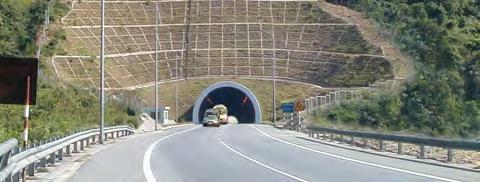
29 % % H c 1 Drive piling foundation cäc khoan nhåi d=1.5m 4000 tim tuyõn hoµn thiön c 2 c @4500= @4500= Typical cross-section of PC box girder bridge for long spans Typical cross-section of overpass at intersection, hollow slab girder, continuous span When considering tunnel works on the route, it is required to note characteristics of excavation method, geologic condition, measures to deal with underground water, crosssection, impact on ambient environment, etc. Removal of emergency stopping lane in tunnels may be permitted to reduce construction cost. 29
30 R R LµN CAO TèC 750 R % R Crosssection of tunnel works through mountain for highway with 6 lanes, grade without emergency stop lane e) Traffic safety and traffic management facilities Traffic signs and road markings must comply with regulations in the Greaer Mekong Subregional Agreement on Facilitation of cross-border transport of goods and people, and Asian Highway Design Standards. Signs must be highly reflective, easily visible in the dark and low visibility conditions. Standard traffic safety and ITS equipment are used for management and operation of the expressways. Some of the following technologies may be applied for traffic management: - Traffic counting using automatic sensors; - Static weighbridges or weigh-in-motion; Environmental monitoring stations for exhaust gas, noise, visibility etc. (in tunnels); - Automatic traffic or speed monitoring cameras; - Variable messaging systems for indicating speed limits according to criteria: traffic jam, accident, rain, low visibility, etc. and automatic detection systems; 30


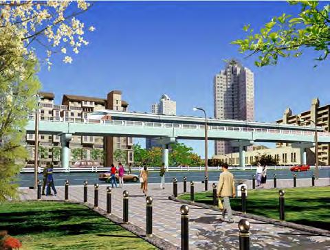
31 Intelligent transport system To manage the expressway network in Vietnam, it is anticipated to arrange one Operations Center in each of the Northern, Southern and Central regions. These regional operation centers would coordinate with operators of each expressway section to ensure overall management monitoring and management Construction Highway operations center 31

32 For construction planning, it is suggested to note: - Planning and division of the works based on the following principles: + Accessibility based on the existing road / transport network, suitable transport distance + Consideration of the strengths, capacity and experience of domestic contractor - Paying attention to key works tasks, especially bridges with special structures, interchanges, and technical issues affecting construction schedule - especially soft soil treatment. - Applying typical structures (culverts, solid slab bridges with span less than 20 m), manufacture in pre-casting yards (semi-finished products), transport, installation at site to ensure quality, schedule and aesthetic appearance of the works. For simple span structures with longer length (30-40m), using typical structure types, and encouraging the use of pre-cast elements. - Works such as communication system, toll station, management and administration building, lighting system, traffic safety facilities may be prepared as a single works package for an entire expressway section. 32
33 A.1. HANOI LANG SON EXPRESSWAY PROJECT Information about the project is summarized based on the Pre-feasibility Study (Pre-FS) Report for Hanoi Lang Son Highway Project by TEDI in 2005 and the Feasibility Study (FS) draft final report by Oriental Consultants Co., Ltd in June A.1.1. Name of the Project Hanoi Lang Son Expressway Construction Investment Project A.1.2. Background and necessity of the project National Highway 1A is the arterial north-south route in Vietnam. Lang Son Hanoi section has already been improved and upgraded to meet standard level III with 2 lanes for Lang Son Bac Ninh section, and Bac Ninh Hanoi Section has 6 lanes with free flow interchanges. However, Lang Son Bac Ninh Section is not expected to meet future traffic demand and does not yet offer a high-speed route with the level of safety provided by an expressway. National Highway 1A, Lang Son to Hanoi Section is part of the trans-asia road network approved by the Government of Vietnam. On the Chinese side, Nam Huu Highway (Nam Ninh Huu Nghi Quan) has been operational as 4-lane expressway since December Except for the section from Tan Dinh (Bac Giang) to Hanoi which has been planned as a 6- lane road, land clearance and social impact present obstacles to upgrading of the existing National Highway 1A from Lang Son to Bac Giang to expressway standard. Hence it is considered necessary to construct on a new alignment separate from the existing National Highway 1A. A.1.3. Project objectives, scope and location A Project Objectives Forming an expressway connecting the Vietnam China Border to Hanoi City for regional and international socio-economic development A Project Location - Start point: Huu Nghi Border Gate in Lang Son province at the Vietnam China border, km1+800 NH1A - End point: South of Nhu Nguyet Bridge (km NH1A) in Bac Ninh Province The project lies in Lang Son, Bac Giang and Bac Ninh provinces. The alignment is shown in the following figure. 33
34 Alignment of Hanoi Lang Son Expressway 34
35 A Traffic Forecast The forecast traffic volume by vehicle type for 2016, 2026 and 2036 between each pair of interchanges is shown in the following table. Traffic Forecast for Hanoi Lang Son Expressway Năm 2016 IC00- IC01- IC02- IC03- IC04- IC05- IC06- IC07- IC08- IC09- IC10- IC11- IC01 IC02 IC03 IC04 IC05 IC06 IC07 IC08 IC09 IC10 IC11 IC12 Motor cycle Auto vehicles Small bus Big bus Small truck Two axle truck Three axle truck Truck with more than 4 axles Năm 2026 IC00- IC01- IC02- IC03- IC04- IC05- IC06- IC07- IC08- IC09- IC10- IC11- IC01 IC02 IC03 IC04 IC05 IC06 IC07 IC08 IC09 IC10 IC11 IC12 Motor cycle Auto vehicles Small bus Big bus Small truck Two axle truck Three axle truck Truck with more than 4 axles Năm 2036 IC00- IC01- IC02- IC03- IC04- IC05- IC06- IC07- IC08- IC09- IC10- IC11- IC01 IC02 IC03 IC04 IC05 IC06 IC07 IC08 IC09 IC10 IC11 IC12 Motor cycle Auto vehicles Small bus Big bus Small truck Two axle truck Three axle truck Truck with more than 4 axles A Scope and technical standards Road type: Expressway type A Design speed: km/h Cross section: - Section from km1+800 to km NH1A: 4-lane highway, width of road base B = m - Tan Dinh Section (km NH1A) south of Nhu Nguyet Bridge (km ): This section follows the alignment of the new NH1A (already constructed), which was 35
36 planned for expansion to 6 lanes. Cross section of this section is 6-lane highway, grade 120, with width of pavement of 33m. In the first stage, construct the outer 4 lanes and reserve land in the median for 2 lanes in the final stage. A.1.4. Related Projects In addition to the expressway and railway works already constructed from Nam Ninh to Huu Nghi Border gate on the Chinese side, related projects include: - Planned development of Huu Nghi Border Gate area; - Urban, residential projects; industrial parks, economic zones, etc in Lang Son and Bac Giang; - Planning, construction of cities, towns along the route; - Hanoi Lang Son Railway Project: Starting study of railway near highway A.1.5. Content of the Project A Road New expressway construction from km1+800 to km NH1A, length of about 109km with 4 lanes, grade km/h; width of pavement Bn = m. Section from Tan Dinh (km NH1A) to the south of Nhu Nguyet Bridge (km ) along existing NH1A, total length of about 22km expanded to form highway with 6 lanes, grade 120; width of pavement Bn = 33.0 m; In the first stage, constructing 4 lanes at two sides and reserving 2 lanes in the median for the final stage. Total length of highway is about 131km. A Interchanges There are a total of 11 interchanges planned on the route. Summary of Interchanges No. Interchange Location Interchange type Crossing road 1 Interchange km3+500 Km3+500 Trumpet NH1B 2 Interchange km8+800 Km8+800 Trumpet Connection to NH1A 3 Interchange km Km Double Trumpet NH4B 4 Interchange km Km Half clover NH1A 5 Interchange km Km Half clover NH1A 6 Interchange km Km Double Trumpet NH279 7 Interchange km Km Double Trumpet Hoa Lac Road 8 Interchange km Km Double Trumpet Access to Met Town 9 Interchange km Km Half clover NH Interchange km Km Double Trumpet NH31 11 Interchange km Km Trumpet NH1 A Structures 36
37 - 39 throughway bridges with total length 5,065 m; - 28 overpasses with total length 2,376 m - 1 tunnel length 750 m for 4 lanes (no emergency stopping lane) - 34 underpasses for local roads / pedestrian movement A Operation a. Tolling Closed tolling system. - 2 throughway toll gates at km and km toll gates at interchanges b. Intelligent Transport System (ITS) Intelligent Transport System (ITS) shall be applied in the Hanoi Lang Son Highway c. Administration Center and service areas - one highway administration center; one service station each side A.1.6 Technical details - Road base shall be excavated deeply, embanked slope to prevent scour - Pavement will be class A1, asphalt concrete with roughness layer, elastic modulus E yc > = 205 MPa - Bridge works in the route use PC I girders; length L=24-33 m. Xuong Giang Bridge km has span arrangement and Nhu Nguyet Bridge km has span arrangement 4x x33 by PC box girder constructed by balanced cantilever method. - Tunnel cross section is oval oviform shape, constructed by drill and blast method with NATM (New Austrian Tunneling method) - Intelligent transport system shall be applied in Hanoi Lang Son Highway A.4.7 Total Investment Estimated total investment for the Project is about US$ 1.14 billion. Item Cost ($US million) 1. Construction and equipment Land acquisition and compensation Provisional expenses Others 99.8 A.1.8 Project Impact Economic Impact Total Investment 1,
38 Opportunities for tourism, industrial development; Industrial and urban development will be promoted due to the improved transport infrastructure. Employment opportunities will attract unskilled workers in the region. Natural conditions - Land to be acquired is about 457 hectares - Topography will be changed due to project cut / fill earthworks - Existing drainage network will be altered - Flooding might increase locally - Dust, noise and exhaust gas levels will likely increase during the construction and operational stages. There is risks of localized pollution, of social and cultural impacts, and effect on agricultural production. - Ecosystems along the route will be significantly affected, although mainly consisting of agricultural land. Impact on industries, sectors and localities - To develop inter-regional transport; - To meet the demand for transport in the local area; - To connect industrial zones, sea ports, cultural and economic centers; - To support and speed up the socio economic development of Vietnam and the region; - To reduce journey time and accidents; - To contribute to the completion of the planned expressway network A.1.9 Proposed Project owner (Investor) Vietnam Expressway Corporation (VEC) established in October 2004, is a state-owned enterprise operated under direct control and supervision of the Ministry of Transport (MOT). VEC is the owner and operator of selected expressways in Vietnam. In June 2010, in accordance with Document 963/TTg-DMDN, the Prime Minister agreed to establish Vietnam Expressway Corporation on the basis of re-organizing former Vietnam Expressway Corporation (actually the legal status was previously a company rather than a corporation, despite the English name). The Corporation will operate in form of the parent subsidiary company, in which the parent company is one-member limited company under the Ministry of Transport. VEC currently has four expressways under construction: Cau Gie Ninh Binh (50km), Noi Bai Lao Cai (244 km) and Ho Chi Minh City Long Thanh Dau Giay (51 km) and a further four projects under planning and design. Total initial chartered capital of VEC at the time of establishment in 2004 was about US$ 52.6 million, transferred from the Ministry of Finance and toll revenue from some national highways; together with the tolling rights of 2 toll stations at Cau Gie and Phu Dong for coccssional 10 years. As of 31 December 2009, charter capital of VEC was US$ 55.2 million. VEC has issued corporate bonds to finance construction of Cau Gie Ninh Binh expressway, and land acquisition of Noi Bai Lao Cai expressway. 38
39 A.1.10 Schedule Estimated start of construction is 2014, with opening to traffic in A.1.11 Sustainability of Project Hanoi Lang Son expressway is in the expressway network plan approved by the Prime Minister in Decision 1734/QD TTg of 01 December 2008 and investment list for the period of the Government. 39
40 A.2 NOI BAI HA LONG EXPRESSWAY PROJECT Project information is summarized based on the Initial Report; preparation stage of construction investment project prepared by TEDI in A.2.1 Name of the Project Noi Bai Ha Long Expressway Construction Investment Project A.2.2 Background and necessity of the project Noi Bai Thang Long Expressway Project has been studied by the Ministry of Transport since 1996 in accordance with Decision 3134/KHDT of 25 November As the request of Ministry of Transport in Decision 1368/GTVT of 23 April 2002, the Prime Minister has approved the pre-feasibility study of the Project in Document 1167/CP CN of 30 September In order to develop the Project in accordance with approved pre-feasibility study, following mobilization of foreign capital for the construction of Noi Bai Bac Ninh Section, on 05 November 2002, the Ministry of Transport issued Decision 3605/QD GTVT allowing preparation of a feasibility study for the Project under the BOT method, focusing in the first stage on the Chi Linh Ha Long section. In 2003, the Ministry of Transport approved the technical design of Chi Linh Ha Long section; however, the project was subsequently suspended. From 2005, a Consortium of Quang Tay Investment Limited Corporation and Quang Tay International Technical Economic Cooperation Company China has completed the procedures for investment on Noi Bai Thang Long Highway under BOT method. After receiving approval by the Vietnamese Government and competent agencies, the investor prepared a Project Proposal in accordance with the law of Decree 78/2007/ND-CP of 11 May 2007 on investment under the BOT form. Project Proposals shall be completed and submitted for approval by the Ministry of Transport, the Vietnam Road Administration (now called Directorate for roads of Vietnam ), local authorities of areas crossed by the road. After cosulting for the agreement of the local authorities and relevant ministries, Ministry of Transport approved the Proposal for the first stage of Noi Bai - Ha Long Expressway Project under the BOT investment method by Decision 228/QD BGTVT of 23 January To implement the approved Project Proposal, the investor has prepared the construction investment project for Noi Bai Ha Long Expressway. A.2.3 Project Objectives, Scope and Location A Project Objectives Forming an expressway connecting Hanoi and Ha Long for regional and international socio economic development. A Project Location - Starting point: intersection between Highway No, 18 and Bac Thang Long Noi Bai Road (consistent with the development plan for Lang Son Hanoi Hai Phong Quang Ninh economic corridor to 2020 approved by the Prime Minister in Decision 98/2008/QD-TTg of 11 July 2008). 40
41 - Ending point: Tieu Giao Intersection (km 109 Highway 18) in Ha Long Ward Ha Long City The Project includes construction of link roads to attract traffic from Highway No. 18 The alignment is shown in the following figure. 41
42 Alignment of Noi Bai - Ha Long Expressway 42
43 The route crosses the following cities and provinces: Hanoi, Bac Ninh, Hai Duong and Quang Ninh. A Traffic Forecast The forecast traffic volume is shown in the following table: Section Traffic volume Unit: PCU / day and night Noi Bai Bac Ninh 8,368 15,093 26,230 37,908 Bac Ninh - Chi Linh 7,644 14,917 25,927 36,156 Chi Linh Uong Bi 10,225 19,133 40,963 46,634 Uong Bi Ha Long 14,163 25,687 42,241 57,345 A Scope and Technical Standards Road type: Expressway type A Design speed: km/h Cross section: 6 lane highway with width of road base B = m A.2.4 Related Projects Related projects in the area include: - National Highway No. 18 Improvement Project Section Noi Bai Bac Ninh: this project has been completed with width four lanes - Hanoi 3 rd and 4 th Ring roads: the feasibility study has been completed; - Hanoi 5 th Ring road: feasibility study has been prepared; - Noi Bai Airport Terminal 2: feasibility study has been prepared; - Nhat Tan Bridge Project and connecting expressway from Nhat Tan Bridge to Noi Bai Airport: construction is in progress; - Hanoi Thai Nguyen Expressway: construction in progress - Ha Long Mong Cai Expressway Project: feasibility study for this Project has been completed; - Urban, residential projects; industrial parks, economic zones, etc; - Planning, construction of cities, towns along the route; - Yen Vien Pha Lai Railway Project: construction in progress. A.2.5 Content of the Project A Road Upgrading of 31 km of four lane Noi Bai Bac Ninh Highway to six lane expressway; new construction of 113 km of six lane expressway. Total length of expressway is about 144 km 43
44 A Interchanges A total of 11 interchanges are planned on the route. Summary of Interchanges No. Interchange Location Crossing Road 1 Interchange km Km0+210 Bac Thang Long Noi Bai 2 Interchange km 6 = 150 Km6+150 NH3 3 Interchange km Km Hanoi Thai Nguyen expressway 4 Interchange km Km DT Interchange with Hanoi 4 th ring road Planned interchange under Hanoi 4 th ring road 6 Interchange km Km NH 1A 7 Interchange km Km NH 18 8 Interchange km Km NH 37 9 An Sinh Interchange Km Nam Mau Interchange Km Tieu Giao Interchange Km A Structures - 5 big size river bridges with total length of 2,127 m; 34 small and medium river bridges with total length 1,540 m; - 3 railway bridges with total length of 865 m - 4 viaducts with total length of 616 m; - 11 overpasses at interchanges with total length of 2,982 m; 4 overpasses of the expressway with total length of 170 m; 3 provincial road overpasses with total length of 390m; 6 other overpasses with total length of 107m; - 2 tunnels: Dong Bong Hill L 600 m and Dong San Hill L = 1,200 m - In hilly areas underpasses for pedestrians and light traffic will be provided on average every 500 1,000 m. A Operation d. Tolling Closed tolling system. - two throughway toll gates at the two ends of the route; - 14 toll gates at interchanges 44
45 e. Intelligent Transport System (ITS) Intelligent Transport System (ITS) shall be applied in the Noi Bai Ha Long Highway f. Administration Center and services areas - one highway administration center; one service station each side Expected expressway facilities will include: + Emergency telephones: arranged both sides (on the grass verge) with average spacing 5 km; Located close to major bridges and interchanges as a priority; + Parking areas along the route: arranged both sides with average spacing of 25km. This is small scale parking area (maximum 1 to 3 vehicles); provided by widening the road base locally without provision of additional services; + Services areas: arranged both sides with the average spacing 50 km including fuel station, repair workshop, parking areas, toilets and restaurants. A.2.6 Technical details - Road base shall be deeply excavated and embanked for preventing erosion - Soft soil treatment provided according to height of embankment, depth of soft ground and permitted settlement. - Pavement will be asphalt concrete with roughness layer, elastic modulus E yc > = 191 MPa - Bridge works use PC I girders; big river bridges use PC box girder constructed by balanced cantilever method. For interchange structures hollow slab superstructure may be applied. - Tunnel cross section is oval oviform shape, constructed by drill and blast method with NATM (New Austrian Tunneling method) - Intelligent transport system shall be applied in Noi Bai Ha Long Highway A.2.7 Total Investment Estimated total investment for the Project is about 20.6 trillion Dong. Item Cost (Billion VND) 1. Construction and equipment 14, Land acquisition and mine detection 1, Project Management, design consultancy and pre construction works etc 1, Contingency 3,844 - Physical contingency Price contingency 3,008 Total Investment 20,558 (Approval Decision for Project Proposal by MOT 228/QD-BGTVT of 23 January 2009) A.2.8 Schedule 45
46 Preparation completed in 2015 and construction commencing in A.2.9 Project Impact a) Project Effectiveness for Investors In accordance with regulations of Vietnamese Government Decree 108/2009/ND-CP, BOT Investors receive the following support and incentives: + corporate income tax incentives as stipulated by legislation on corporate income tax. + Goods imported for implementing their projects are entitled to preferences under legislation on export duties and import duties. + exemption from land use fees with respect to the area of land assigned by the State; or will be exempt from land rental for the whole duration of implementation of its project. + Project Execution Enterprises shall be facilitated full and suitable collection of revenue and legal fees from operation of the project. If necessary, Enterprises can require the state owned authorities to support toll collection or other revenue from project business. + Investors can partially or totally transfer rights and obligations in accordance with the Project Contract. + Competent authorities and foreign investors can agree the use of foreign law as the governing law for the following cases: a) Project Contract; b) Contracts for which the performance is guaranteed by competent authorities. This is provided that such agreements are not contrary to the provisions of Vietnamese law. b) Economic, environmental and social impacts of the Project to industries, sectors and localities Economic Impact Opportunities for tourism, industrial development. Industrial and urban development will be promoted due to the improved transport infrastructure. Employment opportunities will attract unskilled workers in the region. Natural conditions - Topography will be changed due to project cut / fill earthworks - Existing drainage network will be altered - Flooding might increase locally - Dust, noise and exhaust gas levels will likely increase during the construction and operational stages. There is a risk of localized pollution, of social, cultural impacts, and effect on agricultural production. Impacts on industries, sectors and localities - To develop inter-regional transport; - To meet the demand for transport in the local area; - To connect industrial zones, sea ports, cultural and economic centers; - To support and speed up the socio economic development of Vietnam and the region; 46
47 - To reduce journey time and accidents; - To contribute to the completion of the planned expressway network. A.2.10 Proposed Project owner (Investor) The Project shall be implemented by a BOT Investor - Capital shall be arranged by investors for the execution of the Project; capital can be mobilized from many sources in accordance with Vietnamese Law; equity of investor shall be not lower than the amount specified in Article 5 of Decree 108/ND-CP for Projects with total investment over 1,500 Billion Vietnam Dong; - For projects with total investment capital up to 1,500 Billion Vietnam Dong, the ratio of equity of the Project Enterprise must not be lower than 15% of the capital. - For projects with total investment capital over 1,500 Billion Vietnam Dong, the ratio of equity of the Project Enterprise shall not be lower than 10% of the capital. - Contractor shall be obliged to mobilize investment capital under the Contract to meet the agreed Project schedule. - Total capital of the State for this Project shall not exceed 49% of Investment capital of the Project. A.2.11 Sustainability of Project Hanoi Lang Son expressway is in the expressway network plan approved by the Prime Minister in Decision 1734/QD TTg of 01 December 2008 and investment list for the period of the Government. 47
48 A3. HA LONG MONG CAI EXPRESSWAY PROJECT Information about the project is summarized based on the Initial Report; preparation stage of the construction investment project prepared by TEDI in 2010 A.3.1 Name of the Project Ha Long Mong Cai Expressway Construction Investment Project A.3.2 Background and necessity of the project Ha Long Mong Cai Expressway is one highway route in the planned expressway network in Vietnam. The road is in the Northeast of the country with total length 150 km in Quang Ninh province. The highway links Ha Long City with the economic centers of the Province and with Mong Cai City the international border gate with China. In national terms, Ha Long Mong Cai expressway connects Quang Ninh province to the expressway network and hence links with Hanoi and the south. With regards to connections with China, the Ha Long Mong Cai expressway connects with Noi Bai Ha Long and Hanoi Lao Cai expressways to form an east - west traffic axis in the North, which is part of the bilateral Vietnam China Connectivity Initiative on Two Corridors and one Economic Belt. In terms of location, Ha Long Mong Cai expressway is a second road in parallel with the existing National Highway 18 crossing the mountainous areas in the East of Quang Ninh Province. This is a resource-rich coastal area with above average economic growth relative to the national average. A.3.3 Project Objectives, Scope and Location A Project Objectives Forming an expressway connecting Ha Long City to Mong Cai regional and international socio-economic growth. A Traffic Forecast The forecast traffic volume is shown in the following table. Section Traffic volume (PCU / day and night) Ha Long Mong Duong 17,473 25,575 36,643 51,864 Mong Duong Tien Yen 5,996 9,693 15,017 22,256 Tien Yen Mong Cai 5,136 8,266 12,753 18,835 A Scope and technical standards Road type: Expressway type A Design speed: 120 km/h Cross section: 6-lane highway with width of road base B = 35 m - Ha Long Mong Duong section (L = 37km) with six lanes 48
49 - Mong Duong Mong Cai ( L = 103 km) shall be divided for construction; in stage 1, it will be developed with four lanes (B = 27.5 m) ; in the second stage, it shall be completed with six lanes (B = 35 m) A Project Location - Starting point: Son Duong intersection on Noi Bai Ha Long Highway at km ; - Ending point: km at Bac Luan Border Gate; Ending point of the construction: at present, the project for Bac Luan Bridge and access road is under preparation with four lane width, from the new Bac Luan Bridge to provincial road No Thus, construction limit of the expressway project shall be to km at the end point of the new Bac Luan Bridge project (crossing with provincial road No. 335) Total length: km The route is entirely within Quang Ninh province, and crosses the districts of: Hoanh Bo, Ba Che, Tien Yen, Dam Ha, Hai Ha and Cam Pha Township, Mong Cai City. 49
50 Alignment of Ha Long Mong Cai Expressway 50
51 A.3.4 Related Projects Related projects include: - Upgrading and Improvement of National Highway No. 18 Section Mong Duong Mong Cai: completed - Noi Bai Ha Long Highway: feasibility study has been prepared - Upgrading and improvement of National Highway No. 18 C: under implemented - Urban, residential projects; industrial parks, economic zones, etc - Planning, construction of cities, towns along the route; - Planning and Projects in Van Don Economic Zone A.3.5 Content of the Project A Road New expressway construction 37 km from Ha Long to Mong Duong with width six lanes. Mong Duong Mong Cai section has length of 103 km, with four lanes in the first stage, and six lanes in the final stage. A Interchanges Summary of Interchanges No. Name Location Interchange type Note I Alternative I 1 Son Duong km Start point 2 Dong Cao km Local Road 3 Bang Tay km Provincial Road Dong Tam km Highway 4B 5 Quang An km Local Road 6 Quang Moi km Local Road 7 Quang Nghia km Highway 18 8 Hai Hoa km Provincial Road 335 II Alternative II 1 Son Duong km Start point 2 Dong Cao km Local road 3 Bang Tay km Provincial Road Dong Chau km Highway 4B 5 Quang Tan km Local Road 6 Quang Long km Local Road 7 Quang Thanh km Highway 18 51
52 8 Hai Hoa km Provincial Road 335 III Alternative 3 1 Son Duong km Start point 2 Dong Cao km Local road 3 Bang Tay km Provincial Road Dong Tam km Highway 4B 5 Dam Ha km Local Road 6 Quang Trung km Local Road 7 Hai Hoa km Provincial Road 335 A3.5.3 Structures Works on the throughway: + Alternatives I: 39 bridges with total length of 3,022 m + Alternatives II: 35 bridges with total length of 3,713 m + Alternatives III: 42 bridges with total length of 6,180 m - Tunnels: Alternative I crosses a high mountainous area, and in order to improve the design speed consistent with the overall design speed of the route ( km/h), tunnel options are studied through Bang Nau and Dong Va hills with estimated tunnel lengths: + Bang Nau tunnel: L = 800 m + Dong Va tunnel: L = 300 m A Operation Two throughway toll gates and nine toll gates at interchanges are planned. Mainline toll gates would be located at km (Mong Duong Cam Pha Township) and at km (Dam Ha small town Dam Ha District) There are three service areas at spacing km. A.3.6 Total Investment Estimated total investment for the Project is 20,558 billion Dong. Item Cost (Billion VND) 1. Construction and equipment 19, Management, investment consultancy and other 2, Land acquisition and compensation 1, Contingency 6,410 - Physical contingency 2,289 52
53 - Price contingency 4,121 A.3.7 Project Impact a) Project Effectiveness for Investors Total Investment 29,304 In accordance with regulations of Vietnamese Government Decree 108/2009/ND-CP, BOT Investors receive the following support and incentives: + corporate income tax incentives as stipulated by legislation on corporate income tax. + Goods imported for implementing their projects are entitled to preferences under legislation on export duties and import duties. + exemption from land use fees with respect to the area of land assigned by the State; or will be exempt from land rental for the whole duration of implementation of its project. + Project Execution Enterprises shall be facilitated full and suitable collection of revenue and legal fees from operation of the project. If necessary, Enterprises can require the state owned authorities to support toll collection or other revenue from project business. + Investors can partially or totally transfer rights and obligations in accordance with the Project Contract. + Competent authorities and foreign investors can agree the use of foreign law as the governing law for the following cases: a) Project Contract; b) Contracts for which the performance is guaranteed by competent authorities. This is provided that such agreements are not contrary to the provisions of the prevcriling law in Vietnam. b) Economic, environmental and social impacts of the Project to industries, sectors and localities Economic Impact Opportunities for tourism, industrial development. Industrial and urban development will be promoted due to the improved transport infrastructure. Employment opportunities will attract unskilled workers in the region. Natural conditions - Topography will be changed due to project cut / fill earthworks - Existing drainage network will be altered - Flooding might increase locally - Dust, noise and exhaust gas levels will likely increase during the construction and operational stages. There is a risk of localized pollution, of social, cultural impacts, and effect on agricultural production. Impacts on industries, sectors and localities - To develop inter-regional transport; - To develop inter-regional transport; - To meet the demand for transport in the local area; - To connect industrial zones, sea ports, cultural and economic centers; 53
54 - To support and speed up the socio economic development of Vietnam and the region; - To reduce journey time and accidents; - To contribute to the completion of the planned expressway network A.3.8 Proposed Project owner (Investor) The Project shall be implemented by a BOT Investor. - Capital shall be arranged by investors for the execution of the Project; capital can be mobilized from many sources in accordance with Vietnamese Law; equity of investor shall be not lower than the amount specified in Article 5 of Decree 108/ND-CP for Projects with total investment over 1,500 Billion Vietnam Dong; - For projects with total investment capital up to 1,500 Billion Vietnam Dong, the ratio of equity of the Project Enterprise must not be lower than 15% of the capital. - For projects with total investment capital over 1,500 Billion Vietnam Dong, the ratio of equity of the Project Enterprise shall not be lower than 10% of the capital. - Contractor shall be obliged to mobilize investment capital under the Contract to meet the agreed Project schedule. - Total capital of the State for this Project shall not exceed 49% of Investment capital of the Project. A.3.9 Schedule Estimated start of construction in 2015, opening to traffic in A.3.10 Sustainability of Project Ha Long Mong Cai expressway is in the expressway network plan approved by the Prime Minister in Decision 1734/QD TTg of 01 December 2008 and investment list for the period of the Government. 54
55 A.4 NORTH SOUTH EXPRESSWAY, SECTION NINH BINH CITY THANH HOA Project information is summarized based on the Final Report of North South Expressway Project, Section Ninh Binh City Thanh Hoa prepared by TEDI in March A.4.1 Name of the Project North South Expressway, section Ninh Binh City Thanh Hoa Construction Investment Project. A.4.2 Background and necessity of the project Due to the elongated shape of the country, provision of transport infrastructure on the northsouth axis is key to the socio economic development of the whole country. National Highway 1A is the principal North South route, but it traverses many residential areas with width of two lanes, with resulting limitations for the transport of goods and passengers. Increasing traffic congestion and a high rate of traffic accidents limit the economic development of the affected provinces, and of the whole country. At present, Phap Van (Hanoi) Cau Gie expressway running parallel to National Highway 1A has been put into operation. Cau Gie Ninh Binh expressway is under construction. The section is from Ninh Binh City Thanh Hoa is the next section, and its proximity to the capital ensures high traffic levels. To meet future traffic demand, by Decision 412/QD TTg of 11 April 2007, the Prime Minister approved the investment list of some important traffic infrastructure projects in the period to North South Highway, section Ninh Binh Thanh Hoa is included in the list. The project was also included in the List of projects calling for investment capital under the BOT form in transport sector issued with Decision 2667/QD-BGTVT on 30 August A.4.3 Project Objectives, Scope and Location A Project Objectives Forming the next section of the North-South Expressway connecting with Cau Gie Ninh Binh section which is nearing completion of construction, as part of the gradually construction of the overall Eastern North South Expressway, and in accordance with approved expressway network plan. To improve the transport capacity of the North-South corridor, to resolve traffic congestion and to contribute for the socio economic development of the region and of the whole country. A Project Location - Start point: from Cao Bo intersection (km ), Y Yen District, Nam Dinh Province. - End point: At the north portal of Mong Ga Mountain tunnel, Truong Lam Commune (km ), Tinh Gia District, Thanh Hoa Province (6.5 km south of the end point of the route) giao với đường trục quy hoạch Khu kinh tế Nghi Sơn (nút giao Nghi Sơn) tại Km (khớp nối với điểm đầu dự án đường cao tốc Thanh Hóa Hà Tĩnh đang lập dự án đầu tư), cách điểm cuối đoạn tuyến này trong quy hoạch chi tiết khoảng 1km về phía nam. The studied route crosses the following provinces: Nam Dinh, Ninh Binh and Thanh Hoa. 55
56 The alignment is shown in the following figure. A Traffic Forecast The forecast traffic volume is shown in the following table. No. Year Ninh Binh Tam Diep Section Tam Diep Bim Son Section Traffic volume Bim Son Ha Trung Section Ha Trung Thanh Hoa Section Unit: PCU / day and night Thanh Hoa Nong Cong Section Nong Cong Nghi Son Section ,870 30,897 36,203 50,203 26,124 36, ,257 32,700 38,779 53,752 29,074 38, ,069 41,084 40,488 59,198 43,148 54, ,211 72,520 64,644 74,812 60,876 77, ,071 86,206 82,846 87,484 63,586 89, ,123 98, ,992 99,255 65,908 99,925 A Scope and Technical Standards Road type: Expressway type A Design speed: km/h (100 km/h is applied for section crossing Tam Diep range) Cross section: - Final stage: six lanes, width of road base B = 35 m - First stage: four lanes in the middle, with remaining road base to be constructed in the final stage. 56


57 Alignment of Ninh Binh Thanh Hoa Expressway 57
58 A.4.4 Related Projects Related projects in the area include: - Cau Gie Ninh Binh expressway project: under construction - Thanh Hoa Ha Tinh expressway Project; - North South railway Project, section Hanoi Vinh; - Project for upgrading and improvement of National Highway 47, Thanh Hoa City section; - Planning for construction of Thanh Hoa airport at Hai Ninh Commune, Tinh Gia District, Thanh Hoa Province; - Urban, residential projects; industrial parks, economic zones, etc; - Planning, construction of cities, towns along the route; - Planned economic and industrial zones along the route A.4.5 Content of the Project A Road New construction of expressway from Cao Bo intersection (km ) at Cao Bo Commune, Y Yen District, Nam Dinh Province (the end point of Cau Gie Ninh Binh expressway which is under construction) to the north portal of Mong Ga Mountain tunnel (km ) in Truong Lam Commune, Tinh Gia District, Thanh Hoa Province (the start point of Thanh Hoa Ha Tinh expressway project which is under investment project preparation). tới điểm giao với đường trục quy hoạch Khu kinh tế Nghi Sơn (nút giao Nghi Sơn) tại Km (khớp nối với điểm đầu dự án đường cao tốc Thanh Hóa Hà Tĩnh đang lập dự án đầu tư) Width of six lanes, design speed km/h, width of road base B = 35 m. In the first stage, four lanes will be constructed in the center, with widening to the outside for the final stage. Total length; km A Interchanges Summary of Interchanges No. Name Location Interchange type Crossing road 1 Cao Bo Interchange km Half clover Highway 10 2 Khanh Thuong Interchange km Trumpet Ninh Binh City ring road 3 Xuan Mai Interchange km Trumpet Highway 1A 4 Yen Thinh Interchange km Trumpet Highway 12B 5 Gia Mien Interchange KM Trumpet Provincial Note In the second stage 58
59 road Ha Linh Interchange km Trumpet Highway Dong Xuan Interchange km Trumpet Highway 47 8 Trung Chinh Interchange km Trumpet Highway 45 9 Nghi Son Interchange km Trumpet Nghi Son Urban Zone A Structures - 27 throughway bridges with total length 11,570 m; - 36 overpasses with total length 7,343 m - 2 tunnels, total length of 920 m (one of 240 m and one of 680m) for six lanes expressway (without emergency stopping lane); - 34 underpasses for local roads / pedestrian movement A Operation a. Tolling Closed tolling system. - 2 throughway toll gates at km and km sub toll gates at interchanges b. Intelligent Transport System (ITS) Intelligent Transport System (ITS) shall be applied in the Ninh Binh Thanh Hoa Highway c. Administration Center and service areas - one administration center; two service stations, and four parking areas along the route (each side to include two stations) A.4.6 Technical details - Road crosses zones of soft soil to be treated by sand drains. - Pavement will be class A1, asphalt concrete with roughness layer, elastic modulus E yc > = 210 MPa - Bridge works in the route use PC I girders; PC box girders, Super T girders. Some large bridges include Trai Me Bridge ( x40 + 2x x ), Dong Thinh (16x x40), Ha Giang (39+6x ( ) x40+39), Vinh An (39 +6x x40+39), Nui Do (39+7x x40 +39) are planned as pre-stressed reinforced concrete box girders constructed by balanced cantilever. Yen My bridge ( x x x x ) is proposed with an extradosed main span and super T approaches. - Tunnel cross section is oval oviform shape, constructed by drill and blast method with NATM (New Austrian Tunneling method) - Intelligent transport system shall be applied in Ninh Binh Thanh Hoa Expressway 59
60 A.4.7 Total Investment Estimated total investment for the Project is 32,329 billion Dong. Item Cost (Billion VND) 1. Construction and equipment 21, Land acquisition and compensation 1, Project Management, design consultancy etc. 2, Contingency 6,634 Total Investment 32,329 A.4.8 Preliminary feasibility analysis of the Project (economic and financial) The results of preliminary economic feasibility analysis are as follows. 1.Net present value (NPV) Indicator Unit Value Billion Vietnam Dong 4, Benefit / cost ratio (B/C) Time for capital return Years Internal economic rate of return (EIRR) % A.4.9 Project Impact Economic Impact Opportunities for tourism, industrial development. Industrial and urban development will be promoted due to the improved transport infrastructure. Employment opportunities will attract unskilled workers in the region. Natural conditions - Topography will be changed due to project cut / fill earthworks - Existing drainage network will be altered - Flooding might increase locally - Dust, noise and exhaust gas levels will likely increase during the construction and operational stages. There is a risk of localized pollution, of social, cultural impacts, and effect on agricultural production. Impacts on industries, sectors and localities - To develop inter-regional transport; - To meet the demand for transport in the local area; - To connect industrial zones, sea ports, cultural and economic centers; 60
61 - To support and speed up the socio economic development of Vietnam and the region; - To reduce journey time and accidents; - To contribute to the completion of the planned expressway network A.4.10 Schedule Estimated start of construction in 2014 and opening to traffic in A.4.11 Sustainability of Project North South Expressway, section Ninh Binh Thanh Hoa expressway is in the expressway network plan approved by the Prime Minister in Decision 1734/QD TTg of 01 December 2008 and investment list for the period of the Government. 61
62 A.5 NORTH SOUTH EPRESSWAY, SECTION THANH HOA HA TINH Project information is summarized based on the middle Report of Nghi Son Section (Thanh Hoa) Bai Vot (Ha Tinh) conducted by TEDI in March A.5.1 Name of the Project Nghi Son (Thanh Hoa) Bai Vot (Ha Tinh) Expressway Construction Investment Project A.5.2 Background and necessity of the project Due to the elongated shape of the country, provision of transport infrastructure on the northsouth axis is key to the socio economic development of the whole country. National Highway 1A from Huu Nghi Quan to Nam Can with total length of 2,298 km has been improved and upgraded by 2008 to meet level III highway with two lanes. Some sections cross cities, towns, and sections near large urban areas and have width 4 6 lanes. Ho Chi Minh highway is the north-south highway in the West which has been constructed in the first stage from Hoa Lac to Tan Canh with two lanes. However, because the route passes through underdeveloped areas in terms of socio economic conditions and having lower population density, it does not yet attract as much traffic as National Highway 1A. The North South expressway in the East is considered for investment as the key traffic axis of the country, as well as playing a role in the international transport network. To date about 70 km of the North-South Expressway has been put into operation (Phap Van Cai Gie, Ho Chi Minh City Trung Luong); other sections are in progress: Cau Gie Ninh Binh, Dau Giay Long Thanh, Trung Luong My Thuan; and other sections are in the preparation for investment of which Nghi Son (Thanh Hoa) Bai Vot (Ha Tinh) section is one. Investment in construction of Nghi Son Hong Linh expressway will reduce travel distance and travel time to Hanoi and the provinces in the Northern Central Region (Thanh Hoa, Nghe An, Ha Tinh), opening up investment opportunities into the local area, and meeting passenger and freight transport demand between the Northern Region with Northern Central Region. It will enhance the creation and development of urban, industrial, economic and tourism centers along the route. A.5.3 Project Objectives, Scope and Location A Project Objectives To build the next expressway section following on from the Ninh Binh Thanh Hoa section whose which is under preparation in order to gradually complete the North South Expressway. To improve the transport capacity of the North - South corridor, to resolve congestion and contribute to the socio economic development of the region and of the whole country. A Project Location - Start point: điểm giao với đường trục quy hoạch Khu kinh tế Nghi Sơn (nút giao Nghi Sơn) tại Km (khớp nối với điểm đầu dự án đường cao tốc Thanh Hóa Hà Tĩnh đang lập dự án đầu tư) - End point: (km of North South Expressway): At the interchange with National Highway 8A in Duc Thinh Commune, Duc Tho District, Ha Tinh Province. The route passes through the provinces of Thanh Hoa, Nghe An, and Ha Tinh. 62
63 The alignment is shown in the following figure. A Traffic Forecast The forecast traffic volume is shown in the following table. Unit: PCU / day and night Alternative Section Alternative 1: collection of fees of twice times as regulations Alternatives 2: Collection of 1000 VND/ km Nghi Son Thai Hoa 17,083 29,969 43,316 62,956 78,678 98,402 Thai Hoa Highway 48 16,677 29,455 43,171 63,279 77,002 93,702 Highway 48 Highway 7 16,422 29,116 42,959 63,387 78,730 97,789 Highway 07 - Highway 46 16,498 29,120 42,749 62,775 78,198 97,429 Highway 46 Highway 8 10,258 19,466 28,489 41,695 54,360 70,881 Nghi Son Thai Hoa 8,996 12,835 26,132 63,222 68,468 88,087 Thai Hoa Highway 48 6,940 10,443 23,644 53,533 66,268 82,104 Highway 48 Highway 7 6,030 9,400 22,849 55,552 71,194 91,326 Highway 07 - Highway 46 6,606 10,092 23,564 55,061 71,176 92,050 Highway 46 Highway 8 3,584 5,534 13,194 31,455 45,287 65,466 A Scope and Technical Standards Road type: Expressway type A Design speed: 120 km/h (level 100 to apply for section in hilly terrain) Cross section: - Final stage: six lanes, width of road base B = m - First stage: four lanes with width of road base B = m; large bridges and tunnels shall have six lanes; remaining bridges shall have suitable cross section for extension in the final stage. 63
64 Alignment of Thanh Hoa Ha Tinh Expressway 64
65 A.5.4 Related Projects Related projects in the area include: - North South expressway, Ninh Binh Thanh Hoa section, under investment project preparation - Planning of industrial and economic areas such as: Nghi Son Economic Area, planning of Nam Thanh Bac Nghe Area. A.5.5 Content of the Project A Road New construction of expressway from : điểm giao với đường trục quy hoạch Khu kinh tế Nghi Sơn (nút giao Nghi Sơn) tại Km (khớp nối với điểm đầu dự án đường cao tốc Thanh Hóa Hà Tĩnh đang lập dự án đầu tư) (end point of Ninh Binh Thanh Hoa section) to the interchange with National Highway 8A in Duc Thinh Commune, Duc Tho District, Ha Tinh Province with total length of km. Width of six lanes, design speed 120 km/h (tunnel sections shall have design speed 100 km/h); width of road base B = m. Total length: km Planned staged construction: - First stage: from the start point to the interchange with Highway 46 from Vinh City, having width of 4 lanes and width of road base B = m; large bridges and tunnels will have six lanes; the remaining bridges shall have suitable cross section for widening in the final stage. Constructed length in this stage is km - Second stage: from the interchange with Highway 46 from Vinh City to the end point (intersection with Highway 8A), with width four lanes, width of road base B = m; large bridges and tunnels shall have six lanes; remaining bridges shall have suitable cross section for widening in the final stage. Construction length in this stage is km - Third stage: widening of the whole route to six lanes A Interchanges A total of 7 interchanges are planned on this section, of which the interchange with National Highway 8A is an at-grade intersection in the first stage. Summary of Interchanges No. Name Location Crossing road 1 Quynh Vinh km Connection Road of Dong Hoi Port Highway 1A Thai Hoa Township 2 Dien Doai km Highway 48 (Yen Ly Thai Hoa) 3 Dien Cat km Highway 7 (Dien Chau Do Luong) 4 Dien Loi km N2 Road Tho Loc Industrial Zone Spacing (km)
66 5 Nghi Phuong km N5 Road - Nam Cam Industrial Zone 6 Hung Tay km 45( Highway 46 from Vinh City (Cua Lo Thanh Chuong) 7 Duc Thinh km Highway 8 (Hong Linh Pho Chau) A Structures - 24 throughway bridges with total length 8,328 m; - 15 overpasses at interchanges with length 2,455 m; - 3 tunnels with total length 3,100 m - 8 overpasses and 44 underpasses. A Operation a. Tolling Closed tolling system. - one throughway toll station; 4 toll gates at the main interchanges and 4 sub toll gates b. Intelligent Transport System (ITS) Intelligent Transport System (ITS) shall be applied in the Thanh Hoa Ha Tinh Highway c. Administration Center and service areas - one highway administration center; 1 maintenance center - two service areas and 4 parking areas (both sides of the road) A.5.6 Technical details - Road crosses zones of soft soil to be treated by sand drains. - Pavement will be class A1, asphalt concrete with roughness layer, elastic modulus E yc > = 205 MPa - Bridge works use super T girder and hollow slab superstructure. - Tunnel cross section is oval oviform shape, constructed by drill and blast method with NATM (New Austrian Tunneling method) - Intelligent transport system shall be applied in Thanh Hoa Ha Tinh Highway A.5.7 Total Investment Estimated total investment for the Project is 30,469 billion Dong. 66
67 Items First stage (Billion VND) Completion Stage (Billion VND) Total (Billion VND) 1. Construction and equipment 2. Land acquisition and compensation 3. Project Management, design consultancy etc. 16,274 2,970 19,244 1,884 1,884 1, , Contingency 6, ,031 Total Investment 26,144 4,325 30,469 A.5.8 Project Impact Economic Impacts Opportunities for tourism, industrial development. Industrial and urban development will be promoted due to the improved transport infrastructure. Employment opportunities will attract unskilled workers in the region. Natural conditions - Topography will be changed due to project cut / fill earthworks - Existing drainage network will be altered - Flooding might increase locally - Dust, noise and exhaust gas levels will likely increase during the construction and operational stages. There is a risk of localized pollution, of social, cultural impacts, and effect on agricultural production. Impacts on industries, sectors and localities - To develop inter-regional transport; - To meet the demand for transport in the local area; - To connect industrial zones, sea ports, cultural and economic centers; - To support and speed up the socio economic development of Vietnam and the region; - To reduce journey time and accidents; - To contribute to the completion of the planned expressway network A.5.9 Schedule Estimated start of construction in 2014 and opening to traffic in A.5.10 Sustainability of Project 67
68 North South Expressway, section Thanh Hoa Ha Tinh is in the expressway network plan approved by the Prime Minister in Decision 1734/QD TTg of 01 December 2008 and investment list for the period of the Government. 68
69 A.6 NORTH SOUTH EXPRESSWAY, SECTION CAM LO LA SON Project information is summarized based on the Final Report on preparation of Investment Project prepared by Truong Son Survey Design Consultant Construction Co Ministry of Defense (Truong Son Consultant). A.6.1 Name of the Project Project on construction of Ho Chi Minh Highway in Cam Lo La Son Section A.6.2 Background and necessity of the project In order to continue on the path of industrialization, urbanization and international integration, development of a network of modern core infrastructure is essential. Road transport especially the highway sector plays an important role in the industrialization and urbanization of the country. The country has two longitudinal highway axes; Highway 1A in the East and Ho Chi Minh Highway in the West. Due to increasing transport demand, some sections in Highway 1A have been expanded or bypasses constructed at residential areas, cities and towns. This includes sections such as Bac Giang Hanoi, Phap Van Cau Gie Ninh Binh Thanh Hoa, Quang Ngai by-pass, Hue City by-pass and Ho Chi Minh City Can Tho Section etc. Ho Chi Minh highway is the longitudinal axis in the West which has been constructed in the first stage from Hoa Lac to Ngoc Hoi with width of two lanes. However, because Vietnam is narrow in the Central region, the two axes may merge into one for the section from Ha Tinh to Da Nang. Construction of Cam Lo La Son expressway will reduce congestion on Highway 1A, reduce the impact of regular flooding on Highway 1A which occurs during the rainy season, and enhance the socio economic development of the whole country. A.6.3 Project Objectives, Scope and Location A Project Objectives Forming an expressway section from Cam Lo La Son section to reduce congestion on Highway 1A, and to form one part of the North South expressway in the East as approved by Decision 140/QD-TTg of 21 January It will connect with La Son Tuy Loan expressway section, and hence to Da Nang Quang Ngai expressway section, and key economic zones in the Central Region. It will contribute to the effectiveness of the overall expressway axis, and ensure benefit to the provinces of Quang Tri, Thua Thien Hue in particular. Construction of the section will mitigate problems of regular flood, and a high rate of traffic accidents on the existing Highway 1A. A Project Location - Starting point: Cam Lo (km /Highway 9), Quang Tri Province - Ending point: La Son (km / Provincial Road 14B, Thua Thien Hue Province. The project includes construction of link roads from Trieu Hai Farm (Quang Tri) to km on Highway 1A. The project is located in Quang Tri and Thua Thien Hue provinces, and the alignment is shown on the following figure. 69
70 Alignment of Cam Lo La Son Expressway 70
71 A Traffic Forecast The forecast traffic volume is shown in the following table: No. Year Average GDP growth rate Traffic volume Unit: PCU / day and night High GDP growth rate ,391 20, ,236 30, ,242 39, ,969 52,276 A Scope and Technical Standards Road type: Expressway type A Design speed: 80 km/h Cross section: four lane highway with width of road base B = 24 m A.6.4 Related Projects Related projects in the area include: - Project for extension of Highway 1A Lang Co La Son Section; - Ho Chi Minh Highway, La Son Tuy Loan Section: under technical design - Report on investment of Ho Co Bi in Phong Dien District, Thua Thien Hue Province - Report on investment of Ho Ta Trach irrigation works in Ta Trach River, Huong Thuy District, Thua Thien Hue Province under the Program for Huong River water resources development - Thanh Tan spa and resort in Phong Son Commune, Phong Dien District, Thua Thien Hue Province - Hoa My Military areas, Phong Dien District and Thuy Phuong Military areas, Huong Thuy District, Thua Thien Hue Province. A.6.5 Content of the Project A Road - New construction of expressway from Cam Lo Quang Tri Province to La Son Thua Thien Hue with four lane width and design speed of 80 km/h, width of road base B = 24 m. The total length of the route is 103 km. In the first stage, road, bridge and culverts will be constructed with four lane width, and in the second stage the road would be widened to six lanes. - Construction of road link from Trieu Hai Farm (Quang Tri) to km on Highway 1A to road standard level III for mountainous area, with two lanes, and width of road base B = 9 m. Total length of the road link is 11.6 km. A Interchanges - In the highway route, built 06 connected intersections and 07 directly connected intersection 71
72 - On the link road at-grade intersections are planned. A Structures - 49 bridges of which 10 large bridges; 33 medium bridges and 06 small bridges; A Operation a. Tolling Closed tolling system. - toll gates, parking areas, service area and management center. - Intelligent Transport System (ITS) shall be applied in the route A.6.6 Technical details - For sections crossing flood prone areas, embankment slopes should be protected by XM precast concrete slab M200 with dimensions 40x40x5 cm up to the flood level plus 50 cm. In areas prone to regular flooding, slope of road base shall be consolidated by closed slab; unless otherwise, it shall be made of open slab. - Due to the mountainous terrain and varied geology, combined with high rainfall, deep cut slopes require use of solutions such as use of retaining walls, drainage ditches, hard facings, geotextile and vegetation (vetiver grass) in design. - ITS shall be applied in the whole route - Tunneling may be constructed by drill and blasting. A.6.7 Total Investment Estimated total investment for the Project is about 16.0 trillion Dong in which: Item Cost (Billion VND) + Construction and equipment 10,364 + Land acquisition and compensation Project Management, design consultancy and pre construction works etc + Other expenses Contingency 4,323 A.6.8 Preliminary analysis of feasibility of the Project (economic and financial aspects) The results of preliminary economic feasibility analysis are as follows. 1.Net present value (NPV) Indicator Unit Value Billion Vietnam Dong 2. Benefit / cost ratio (B/C) Time for capital return Years Internal economic rate of return (EIRR) % A.6.9 Project Impact
73 Economic Impacts The Project will improve transport infrastructure to meet demand, and promote socio economic development in the West of Quang Tri, Thua Thien Hue and Da Nang provinces. Jobs for local people will be created during both construction and operations phases. Natural conditions - Air quality: during construction, earthworks and truck movement will give rise to dust; - Surface water quality: the expressway crosses the catchment areas of many rivers and streams. Erosion during construction may lead to reduced water quality... - Ecosystem: The road crosses many forested areas, especially plantations. Attention is required during the dry season to avoid forest fires. The route crosses areas which were sprayed with agent orange during the war against the US. Social environmental impact - Productive land for economic crops such as sugar cane, pomelo, rubber and eucalyptus will be lost. - Employment of workers during construction will provide short term economic opportunities, but also risks such as local price inflation, pollution and health effects. A.6.10 Proposed Project owner (Investor) At present, there is no proposed investor for the Project. A.6.11 Sustainability of Project Cam Lo La Son expressway is in the expressway network plan approved by the Prime Minister in Decision 1734/QD TTg of 01 December 2008 and investment list for the period of the Government. 73
74 A.7 NORTH-SOUTH EXPRESSWAY, SECTION LA SON TUY LOAN Project information is summarized based on the end-term report on investment preparation by Truong Son Survey Design Consultant Construction Co Ministry of National Defense (Truong Son Consultant). A.7.1 Name of the Project North-South expressway Section La Son Tuy Loan. A.7.2 Background and necessity of the project In order to continue on the path of industrialization, urbanization and international integration, development of a network of modern core infrastructure is essential. Road transport especially the highway sector plays an important role in the industrialization and urbanization of the country. The country has two longitudinal highway axes; Highway 1A in the East and Ho Chi Minh Highway in the West. Due to increasing transport demand, some sections in Highway 1A have been expanded or bypasses constructed at residential areas, cities and towns. This includes section such as Bac Giang Hanoi, Phap Van Cau Gie Ninh Binh Thanh Hoa, Quang Ngai by-pass, Hue City by-pass and Ho Chi Minh City Can Tho Section etc. Ho Chi Minh highway is the longitudinal axis in the West which has been constructed in the first stage from Hoa Lac to Ngoc Hoi with width of two lanes. However, because Vietnam is narrow in the Central region, the two axes may merge into one for the section from Ha Tinh to Da Nang. Construction of Cam Lo La Son expressway will reduce congestion on Highway 1A, reduce the impact of regular flooding on Highway 1A which occurs during the rainy season, and enhance the socio economic development of the whole country. A.7.3. Project Objectives, Scope and Location A Project objectives Construction of La Son Tuy Loan and Cam Lo La Son expressway sections will form a high speed link on both the Ho Chi Minh Highway as well as the Eastern North-South Expressway. It will provide a connection to Da Nang Quang Ngai Expressway, giving improved access to the key economic zones of the Central region. It will contribute to the effectiveness of the overall expressway axis, and ensure benefit to the provinces of Thua Thien Hue and Da Nang in particular. Construction of the section will mitigate problems of regular flood, and a high rate of traffic accidents on the existing Highway 1A. A Project Location - Start point: La Son (km4+500/dt14b), Thua Thien Hue Province. - End point: Tuy Loan, Da Nang City (km23+909, National Highway 14B) which is the start point of Da Nang Quang Ngai Expressway. The Project includes construction of a link road from La Son (km 4+500/DT14B) to km on National Highway 1A. The route is located in Thua Thien Hue and Dang Nang City. The alignment is shown on the following figure. 74
75 Alignment of La Son Tuy Loan Expressway 75
76 A Traffic forecast The forecast traffic volume is shown in the following table. Year Average GDP growth rate Traffic volume Unit: PCU/day and night High GDP growth rate ,550 21, ,211 34, ,748 45, ,659 60,033 A Scope and Technical standards - Section La Son La Hy and section Hoa Lien Tuy Loan: Road type: Expressway type B Design speed: 80km/h Cross section: 4-lane expressway with width of road base B = 24m. - Section La Hy Hoa Lien: A.7.4 Related Projects Road type: Expressway type B Design speed: 60km/h Cross section: 4-lane expressway with width of road base B= 23m. Related projects in the area include: - Da Nang Quang Ngai Expressway (commenced detailed design). - Cam Lo La Son Expressway - 500kV power line branch No. 2 through Thua Thien Hue and Da Nang City. - Hoa Bac Military area located in Da Nang City. - Bach Ma National park. A.7.5 Content of the project A Road - New construction of expressway from La Son located in Thua Thien Hue to Tuy Loan (start point of Da Nang Quang Ngai Expressway) with four lane width, and design speed from 60 to 80 km/h, width of road base B = 23-24m. The expressway length is 79km of which 53km has design speed of 60km/h. - New construction of 4.7km link road from La Son (km4+500/dt14b) to km on National Highway 1A to road standard grade III for plain areas, with 2 lanes, road base width B = 12m. A Interchanges 76
77 - On the expressway, building 02 connected intersections and 06 in-line intersections. - On the link road at-grade intersections are planned. A Structures - 66 bridges including 27 large bridges, 36 medium bridges and 03 small bridges. - 1 tunnel at Mui Trau with length 280m having 2 separate tunnels, one for each direction, each with width 11.8m. A Operation - Toll gates, parking areas, service areas, management center. - On the expressway, there is an intelligent traffic system (ITS). A.7.6 Technical details - For sections crossing flood prone areas, embankment slopes should be protected by XM precast concrete slab M200 with dimensions 40x40x5 cm up to the flood level plus 50 cm. In areas prone to regular flooding, slope of road base shall be consolidated by closed slab; unless otherwise, it shall be made of open slab. - Due to the mountainous terrain and varied geology, combined with high rainfall, deep cut slopes require use of solutions such as use of retaining walls, drainage ditches, hard facings, geotextile and vegetation (vetiver grass) in design. - ITS shall be applied in the whole route - Tunneling may be constructed by drill and blasting. A.7.7 Total investment Estimated total investment for the Project is about 15.3 trillion Dong in which: Item Cost (billion VND) + Construction and equipment 10,382 + Land acquisition and compensation Project management 43 + Construction consultancy: Other expenses Contingency 3,432 A.6.12 Preliminary analysis of project feasibility (economic and financial) The results of preliminary economic feasibility analysis are as follows. Indicator Unit Value 1.Net present value (NPV) Billion dong Benefit / cost ratio (B/C) Time for capital return Year Internal economic rate of return (EIRR) %
78 A.7.8 Project Impact Economic impact The Project will improve transport infrastructure to meet demand, and promote socio economic development in the western area of Thua Thien Hue and Da Nang provinces. Jobs for local people will be created during both construction and operations phases. Natural conditions - Air quality: during construction, earthworks and truck movement will give rise to dust; - Surface water quality: the expressway crosses the catchment areas of many rivers and streams. Erosion during construction may lead to reduced water quality... - Ecosystem: The road crosses many forested areas, especially plantations. Attention is required during the dry season to avoid forest fires. The route crosses areas which were sprayed with agent orange during the war against the US. Impact on social environment - Productive land area for economic crops such as sugar cane, Artocarpus Heterphyllus, Citrus Grandis Osbek, rubber trees and Eucalyptus Camaldulensis Dehn, etc. will be lost. - Employment of workers during construction will provide short term economic opportunities, but also risks such as local price inflation, pollution and health effects. - Traditional culture of local ethnic groups may be affected when contacting new cultures and lifestyle. Impact on cultural heritage and tourism - Bach Ma Nature Reserve has biodiversity value and both a site for tourism and scientific research on environmental ecology. The project will provide improved access for tourism. A.7.9 Proposed Project owner (Investor) At present, there is no proposed investor for the Project. A.7.10 Project s stability Cam Lo La Son expressway forms part of the Ho Chi Minh Highway approved by the Government under Decision 242/QD-TTg of 15 February In addition, this expressway section was approved for detailed planning as part of the Eastern North-South Expressway approved by the Government under Decision 140/QD-TTg of 21 January
79 A.8 NORTH-SOUTH EXPRESSWAY, SECTION QUANG NGAI QUY NHON Project information is summarized based on the project Proposal by 533 Construction Consultant Joint Stock Company prepared in A.8.1 Name of the Project North-South Expressway project Section Quang Ngai Quy Nhon. A.8.2 Background and necessity of the project At present, the national highway network in the Central region, connecting provinces from Da Nang- Quang Ngai Binh Dinh Khanh Hoa relies almost entirely on the north-south axis of National Highway 1A which has width of 2 lanes. With economic development, National Highway 1A becomes more and more of a constraint to efficient transport. This will apply particularly to the section Quang Ngai Quy Nhon once Da Nang Quang Ngai expressway becomes operational by Under Decision 1290/QD-TTg of 26 September 2007 the Government issued a national list of projects, inviting foreign investment for the period of , and by Decision 412/QD- TTg of 11 April 2007 the Prime Minister approved an investment list of projects for key and essential infrastructure targeted by The North-South Expressway is expected to be completed before A.8.3 Project Objectives, Scope and Location A Project Objectives Construction of Quang Ngai Quy Nhon which will connect with Da Nang Quang Ngai expressway, serving the socio-economic development of the key economic zone in the Central region and forming part of the Eastern North-South Expressway. A Project Location - Start point: km corresponding to the end point of Da Nang Quang Ngai Expressway at km (Da Nang Quang Ngai expressway chainage), located 1km south of DT Project end point has intersection with Quy Nhon Plei Ku Expressway and intersection with National Highway No. 19 at km The route crosses Quang Ngai and Binh Dinh provinces, and the alignment is shown on the following figure. 79
80 Alignment of Quang Ngai Quy Nhon Expressway 80
81 A Traffic Forecast The forecast traffic volume is shown in the following table. Year A Scope and Technical Standards Road type: Expressway type A Traffic volume , , , , ,110 Design speed: 80km/h-100km/h (80km/h for sections in steep terrain). Unit: CPU/day and night Cross section: 4-lane expressway with width of road base B = m (road base width of 25m for design speed of 80km/h). A.8.4 Related Projects Related projects in the area include: - Da Nang Quang Ngai Expressway (commenced detailed design) - North-South Express Railway - Quy Nhon Plei Ku expressway - National Highway No. 19 Upgrading and Improvement project - Existing Hanoi HCMC (Reunification) Railway A.8.5 Content of the project A Road - New construction of expressway from end point of Da Nang Quang Ngai expressway at km (Da Nang Quang Ngai expressway chainage), located 1km south of DT625 to km on National Highway No The expressway length is approximately km of type A expressway, design speed from 80km/h to 100km/h and road base width B = 25m 25.5m. A Interchanges Five grade separated interchanges are planned for the route. 81
82 No. Location Type Crossing road District 1 km Half clover National Highway No km Trumpet Provincial road 3 km Trumpet Provincial road 4 km km A Structures Half clover Half clover DT630 DT river bridges with total length of 4,099m types of overpasses with total length of 4,137m. - Underpasses for local roads / pedestrian movement A Operation Toll gates, parking areas, service area and management center. On the expressway, there is an intelligent traffic system (ITS). A.8.6 Technical details Mo Duc District, Quang Ngai Province Duc Pho District, Quang Ngai Province Hoai Nhon District, Binh Dinh Province Phu Cat District, Binh Dinh Province Phu Cat District, Binh Dinh Province - The highway will mainly run on embankment. Sections crossing flood-prone areas will be built to a suitable elevation and the slopes protected against erosion. For sections in steep terrain, it may be necessary to build the carriageways on separate alignments to reduce construction cost... - Pavement will be class A1, asphalt concrete with roughness layer, elastic modulus E yc > = 200 MPa. Cement stabilized base course is proposed. - Bridge works in the route use PC I girders; concrete box girders. Major structures are An Lao bridge (crossing An Lao and Kim Son rivers) with span arrangement 3x33+( )+4x33, Kim Son bridge with span arrangement and Song Con Bridge with span arrangement 5x33+(56+3x90+56)+5x33 each with concrete box girder constructed by balanced cantilever method. - The overpasses will mainly use prestressed reinforced concrete I-girders, and cast in situ prestressed reinforced concrete box girder. - Intelligent traffic system is applied on the whole highway express line from Quang Ngai to Quy Nhon. 82
83 A.8.7 Total investment Estimated total investment for the Project is 30,022 billion Dong. Item Cost (Billion VND) 1. Construction and equipment 18, Land acquisition and compensation 3, Project Management, design consultancy etc. 2, Contingency 5,233 Total Investment 30,022 A.8.8 Primary feasibility analysis of the Project Indicator Unit Value 1.Net present value (NPV) Billion dong Benefit / cost ratio (B/C) Time for capital return Year Internal economic rate of return (EIRR) % 13,03 A.8.9 Project Impact Economic impact Implementation of the project will considerably improve transport infrastructure in the affected provinces, and help in meeting road transport demand. This will promote socioeconomic development both at a local and national scale, and will contribute to poverty reduction in the central region. Natural environment - Air quality: earthworks and transport of materials risk causing dust nuisance. - Surface water quality: the road crosses many rivers and streams, and earthworks and materials transport during construction risks causing increased turbidity of water courses. - Scour and erosion: cut slopes formed by the construction will lead to increased risk of erosion, washout, and slope stability problems. Impact on social environment - Productive land for economic crops such as sugar cane, jack-fruit, rubber and eucalyptus will be lost. - The road generally runs through foothills and wet rice paddies. It has the potential to affect local communities through separation of communities; separating of the community from facilities such as markets, medical centers; Separating farmers from their fields, students from schools etc. - Employment of workers during construction will provide short term economic opportunities, but also risks such as local price inflation, pollution and health effects. 83
84 A.8.10 requirements about capacity of investor who is expected to assigned to implement the project, including finance capacity At current, there is no expectation about the investor for implementing project. A.8.11 Proposed Project owner (Investor) At present, there is no proposed investor for the Project. A.8.12 Sustainability of the project The Quang Ngai Quy Nhon expressway is in the expressway network plan approved by the Prime Minister in Decision 1734/QD TTg of 01 December 2008, and in the Prime Minister s approval of the detailed planning of the North South Expressway Decision140/QD- TTg of 21 January The project is also in the Government list of projects calling for investment in period
85 A.9 NORTH-SOUTH EXPRESSWAY, SECTION QUY NHON-NHA TRANG Project information is summarized based on the detailed planning of North-South Expressway Eastern side approved by the Prime Minister in Decision 140/QD-TTG of 21/01/2010. A.9.1 Name of the Project North-South Expressway section Quy Nhon - Nha Trang. A.9.2 Background and necessity of the project The road network in the Central region, connecting the provinces from Da Nang - Quang Ngai - Binh Dinh - Khanh Hoa has only one north-south route, National Highway 1A, which is a 2-lane highway. Continued economic development of the region and the country is leading to increased transport demand, and pressure on National Highway No.1. Detailed design of the Da Nang Quang Ngai expressway has commenced, and a project proposal has been made for Quang Ngai Quy Nhon section. The current project forms the next section of expressway. A.9.3 Project Objective, Scale and Location A Project Objectives To form the next expressway section connecting with Quang Ngai - Quy Nhon section, in order to promote economic and social development of the Central key economic region and to contribute to completion of the North - South expressway - Eastern side. A Project Location - start point: connecting with the end point of Quang Ngai Quy Nhon Expressway. - end point: intersection with provincial road (provincial road 2), at Dien Tho, Dien Khanh, Khanh Hoa Province. The total length is about 215 km passing the provinces of Binh Dinh, Khanh Hoa, and Phu Yen. The alignment is shown in the following figure. 85
86 Alignment of Quy Nhon Nha Trang Expressway 86
87 A Traffic Forecast According to the detailed planning of the North South Expressway, Quy Nhon- Nha Trang section has a forecast traffic volume in 2030 of 29,103 PCU/day and night. A Scope and Technical Standards Road type: Expressway type A Design speed: 80 km/h -100 km/h (80km/h for sections in steep terrain. Cross section: 4-lane expressway with width of road base B=25m-25.5m (road base width 25m for design speed of 80 km/h) A.9.4 Related Projects Related projects in the area include: - Quang Ngai Quy Nhon express highway. - North South high-speed railway. - Existing Hanoi HCMC (Reunification) Railway A.9.5 Content of the Project A Road New construction of expressway from the end point of Quang Ngai Quy Nhon expressway to Nha Trang. The length is about 215 km of type A expressway type, design speed 80km/h 100 km/h, base width B = 25m-25.5m. A Interchanges Eight grade separated interchanges are planned for the route. No. Name Crossing road 1 Start point interchange Quy Nhon Pleiku expressway 2 Van Canh interchange 3 Provincial road 642 interchange Provincial road Provincial road 643 interchange Provincial road National highway 25 interchange National highway 25 6 Interchange with planned road Planning road 7 Van Gia interchange Planning road 8 National highway 26 interchange National highway 26 A Structures - River bridges, overpasses at crossing road and at interchanges. - Underpasses for local roads / pedestrian movement A Operation Toll gates, parking areas, service area and management center. 87
88 To arrange intelligent traffic system (ITS). A.9.6 Total investment Estimated total investment for the Project according to the recommended plan is 35,905 billion Dong. A.9.7 Schedule It is hoped to complete Quy Nhon Nha Trang expressway section before A.9.8 The stability of project Project of North South Expressway, section Quy Nhon Nha Trang is in the expressway network plan approved by the Prime Minister in Decision 1734/QD TTg of 01 December 2008, and in the Prime Minister s approval of the detailed planning of the North South Expressway Decision140/QD-TTg of 21 January
89 A.10 NORTH-SOUTH EXPRESSWAY, SECTION DAU GIAY-PHAN THIET Information of the project is summarized based on the draft final report on investment project formulation jointly prepared by ALMEC Company (Japan) and Transport Engineering Design Incorporated (TEDI) in A.10.1 Name of the Project Dau Giay-Phan Thiet Expressway construction investment project A.10.2 Background and necessity of the project Completion of the Dau Giay-Phan Thiet Expressway would create an expressway running from Phan Thiet to Can Tho, linking the Central Region and the Southern key Economic zone. It would shorten the distance and reduce the journey time from Ho Chi Minh City to the provinces and central tourism areas of the South Central Coast (Binh Thuan, Ninh Thuan, and Nha Trang) which are rapidly growing tourist destinations. It would create an improved investment climate for the Central Region, meet transport demand for passenger and goods between the key area of the Southern key Economic zone and the Southeast Region and Central Coast. It would create favorable conditions for acceleration of establishment and development of industrial zones, and marine ecotourism areas in Binh Thuan, Ninh Thuan and Khanh Hoa. Completion of the project would result in an expressway with length around 400km from Phan Thiet to Can Tho and linking the major economic centers, air, rail and port hubs of the Southern Key economic zone. It is an important factor in improving connectivity and supporting socio-economic development of the Central Region and the Southern Region. A.10.3 Objectives, scope and location of the project A Project Objectives Objectives of the establishment of Dau Giay-Phan Thiet Expressway are: to reduce journey times from Ho Chi Minh City to tourist areas on the South Central Coast; to overcome traffic congestion and reduce traffic accidents on National Highway No.1A (NH1A); to meet demand for transport of passengers and goods between the key area of the Southern key Economic zone and the Southeast Region and Central Coast; to create favorable conditions to accelerate establishment and development of industrial zones, marine ecotourism areas of Binh Thuan, Ninh Thuan and Khanh Hoa; create favorable conditions to improve the finish and step-by-step implementation of the transport plan defined in the Vietnam Expressway Network Master Plan for 2020 and vision toward A Project Location - Start point: km of Ho Chi Minh City-Long Thanh-Dau Giay Expressway. - End point: crossing point on road from NH1A to My Thach (Ba Bau), about 2.58km from NH1A. The project is located in Dong Nai and Binh Thuan provinces. The alignment is shown in the following figure. A Traffic Forecast Forecast traffic volume for the case of with the project, and the case without the project are shown below. 89
90 Year Scenario Toll Fee (US Cent / PCU-km) With project 5 5 Unit: Thousand PCU / day and night) Road Expressway NH1 Dong Nai Province Binh Thuan Province Without project 5 NH With project 5 5 Expressway NH Without project 5 NH With project 10 Without project With project Expressway NH1 Expressway NH1 Expressway NH Without project 10 NH With project Expressway NH ??? Without project 15 NH
91 Alignment of Dau Giay Phan Thiet Expressway 91
92 A Scope and Technical Standards Road type: Expressway type A Design speed: 120km/h Cross-section: First phase 4 lane highway with width of road base B = m. Final phase 6 lane highway width of road base B = 33m 35m. A.10.4 Related Projects - Ho Chi Minh City Long Thanh Dau Giay Expressway is under construction - North-South railway - Planned irrigation works such as: Vong River Dam, Dams at: Gia Mang, Gia Ui, Oi Stream. Gieng River, Dinh River, Phan River, Ta Mon, Tan Lap, Du Du, etc. - Planned 500kV transmission lines such as Phu My-Song May line, Vanh Tan-Song May line. A.10.5 Content of the project A Road - Construction of expressway from Dau Giay to Phan Thiet, length about 98.7km, with 6 lanes. In the first stage 1, construct 4 lanes only. A Interchanges A total of 7 interchanges are planned on the route. Summary of Interchanges No. Mile Intersection type Road 1 km0+000 Trumpet Ho Chi Minh city-long Thanh-Dau Giay Expressway 2 km Trumpet National Highway 56 3 KM Trumpet Road to Vong River Dam 4 km Trumpet Provincial road km Double Trumpet NH1A 6 km Trumpet Provincial road km Trumpet National Highway 55 A Structures - 15 river bridges with total length 640.1km - 12 overpasses at interchanges with total length 1,044 m - 19 overpasses - 15 underpasses for pedestrians and light traffic. A Operation a. Tolling 92
93 Closed tolling system. - 2 throughway toll gates and 6 toll gates at interchanges. - 6 toll management offices (one as operation and management building/ control center) b. Intelligent Transportation Systems (ITS) Intelligent Transportation Systems (ITS) is applied c. Administration Center and service areas - 1 operation and maintenance center at the intersection with NH1A - 1 service area at km rest areas A.10.6 Technical details - Pavement is deepened, embanked, consolidated slope for avalanche and erosion protection. - Pavement will be asphalt concrete with roughness layer, elastic modulus E yc 210MPa. - Bridge works use mainly PC I girders, beam-lab bridges for river crossings, and frame and box-girder spans for intersection bridges. - ITS is applied for the expressway line A.10.7 Total investment Estimated total investment for the Project is about 22.5 trillion Dong. Unit: Billion VND No. Item Stage 1 Stage 2 Total I Construction and equipment 9,662 1,827 11,489 II III Land acquisition and compensation Project management, consultancy and other costs 2,090 2,090 1, ,723 IV Contingency 2, ,303 V Total Investment (excluding loan interest) Loan interest in the construction phase Total Investment (including loan interest) 15,987 2,627 18,605 2,410 1,549 3,959 18,388 4,176 22,564 A.10.8 Preliminarily analysis of project feasibility (economic and financial) 93
94 - Results of calculating EIRR of the project for each scenario are as follows: Scenario 1 Scenario 1 Scenario 2 14,5% 13,4% 12,3% - Results of calculating FIRR of the project for each scenario are as follows: A.10.9 Project Impact Positive impacts Scenario 1 Scenario 2 Scenario 3 7,4% 9,3% 8,2% - Road construction will bring direct benefit for road users of 4 provinces/cities Ho Chi Minh City, Dong Nai, Binh Thuan and Phan Thiet. Over 11 million people will benefit from the project. The project is expected to give positive impact and contribution to the long-term economic growth of provinces/cities, and of the country, bringing improved standard of living to people in the project affected area. - Main benefits of the project are reduction of transportation cost, and improved economic exchange and movement within the project area. - The project is expected to create improved access to markets, improved communications and provision of materials serving agricultural production. It will create investment opportunities and employment, making a contribution to increased income of residents in the project area. It will have a positive impact on women through improved access to markets, education and essential services. - The project will create employment particularly during the construction phase, assisting poverty reduction for households near the project. - Main social benefits include developing commerce and markets, creating an opportunity for women to participate in productive activities, purchase and trade of goods and services. Negative impacts - Land acquired for the project will require the removal and resettlement of 172 households, together with the loss of residential land, agricultural land and income sources of affected households. Other potential negative impacts include impact on health, and social impact due to the influx of workers during construction. A Proposed Project owner (Investor) The project promoter is Bitexco which is a private Vietnamese company. Following the results of previous studies, Dau Giay Phan Thiet Expressway project has been considered suitable for implementation under the PPP mechanism, and selected as a pilot project for implementation. This has required development of mechanisms for assessment of project market value, viability gap funding mechanism, and a competitive method for selection of the investor and pricing which is being carried out with the support of the World Bank. A Schedule Estimated date for opening to traffic is
95 A Sustainability of the project North South Expressway, section Dau Giay Phan Thiet is in the expressway network plan approved by the Prime Minister in Decision 1734/QD TTg of 01 December 2008 and Decision140/QD-TTg of 21 January
96 A.11 IMPROVEMENT AND UPGRADING OF NATIONAL HIGHWAY NO.1A, LA SON - LANG CO SECTION AND PHU GIA - PHUOC THUONG HIGHWAY TUNNEL Information of the project is summarized based on the project proposal report prepared by TEDI in A.11.1 Name of the Project Project for improving and upgrading National highway No.1A, La Son-Lang Co Section and Phu Gia-Phuoc Thuong highway tunnel. A.11.2 Context, necessity of the project At present NH1A, La Son-Lang Co Section has 2 lanes with sections through 02 mountain passes at Phu Gia and Phuoc Thuong, leading to congestion on the steep inclines, a high rate of traffic accidents, and long journey times on the road. According to Vietnam Road Transportation Development Plan for 2020 and vision toward 2030 approved by Prime Minister in Decision 1327/QD-TTg of 28 August 2004, National highway No.1 from Huu Nghi Quan (Lang Son) to Nam Can (Ca Mau) is 2,434 km long and should be upgraded to standard level III with 2 lanes; with expansion of some sections with high traffic flow to standard level II with 4 lanes; replacement of all weak bridges; construction of by-passes to urban areas; and completion of highway tunnels at Phu Gia and Phuoc Thuong passes (Thua Thien Hue), and Ca pass (Phu Yen). On 10 October 2007, the Ministry of Transport received Document 7032/VPCP-CN of the Government Office on investment for the project of improving and upgrading National highway no.1a, La Son-Lang Co Section and Phu Gia-Phuoc Thuong highway tunnel under the form of a BOT contract, and the Prime Minister approved the policy of using Phu Bai toll gate to recover the invested capital. In implementation of the instruction of Deputy-Prime Minister Hoang Trung Hai and in accordance with Decree 108/2009/ND-CP, the Ministry of Transport issued Decision 4107/QD-BGTVT of 26 December 2007 and assigned the Directorate for Roads of Vietnam to sign a BOT contract of the project for improving and upgrading National highway No.1A, La Son-Lang Co Section and Phu Gia-Phuoc Thuong highway tunnel, and to implement formulation of the project proposal. A.11.3 Objectives, scope and location of the project A Project Objectives The objective is to improve and upgrade National highway no.1a, La Son-Lang Co Section and construct two highway tunnels to improve traffic safety and remove the bottlenecks at the mountain passes. Implementation of the project will contribute to socio-economic development of Thua Thien Hue Province in particular, and of the Central Key Economic Zone in general. It will promote trade and tourism between the central areas of Hue and Da Nang (Hue imperial city, Chan May-Lang Co Port, Hoi An, Da Nang Port), and improve the potential for tourism development of the area. A Project Location - Start point: there are two options for the location of the start point: + Option 1: km (NH1A), at the end of the 4-lane section in Phu Bai Town. + Option 2: km (NH1A), La Son three-way crossroads between NH1A and DT15. 96
97 - End point: km /nh1a, at the start of the 4-lane section in Lang Co Town, Thua Thien-Hue Province. Length of the alignment for Option 1 is 48.4 km, and 37.8 km for Option 2. The project is located in the province of Thua Thien-Hue. A Traffic Forecast The forecast traffic volume in La Son Lang Co section is shown in the following table. (Unit: PCU/day and night) No. Type of vehicles Light truck 663 1,018 1,507 2,231 3,237 4,696 2 Medium truck ,576 4,420 5,555 7,201 3 Heavy truck 428 1,157 1,472 2,526 3,175 4,116 4 Heavy truck >3 axles ,011 1,270 1,646 5 Car 796 1,752 2,837 4,930 8,107 13,565 6 Small passenger car 882 1,583 2,137 3,095 4,240 5,913 7 Large passenger car 838 1,195 1,750 2,562 3,692 5,318 8 Motorbike 1,415 2,079 2,653 3,386 3,739 4,128 Total 5,940 11,269 15,520 24,162 33,015 46,583 97
98 Alignment of NH1A La Son Lang Co Highway Improvement 98
99 A Scope and Technical Standards Road type: Highway level II - Plain Design speed: 100km/h. For Phuoc Thuong and Phu Gia Tunnels, design speed is 80km/h (equal to road level II, plain) Cross section: - Section before Phu Gia tunnel: widening of NH1A to 4 lanes for motorized traffic, 2 simple lanes (each 5.5 m wide), sidewalk, B = 54m. In Stage 1, upgrade and expand NH1A with 4 lanes for motorized vehicles, 2 simple lanes (each 2.5 m wide), sidewalk, B = 22.5m. - Section though Lang Co tourism area (end of Phu Gia tunnel to start of Hai Van tunnel): Widening to 4 lanes for motorized traffic, B = 36m. In Stage 1, upgrade and expand to 4 lanes for motorized traffic, 2 simple lanes (each 2.5 m wide), sidewalk, B = 22.5m. A.11.4 Related Projects Related projects in the area include: - North South Expressway, Cam Lo-Da Nang Section - La Son-Nam Dong Road - Chan May-Lang co economic Zone - Industrial zones such as Phu Bai, Phong Dien, Tu Ha - Bach Ma Eco-tourism area A.11.5 Content of the Project A Road Improve, upgrade and expand NH1A (2 lanes) from km to km (starting at the end of the 4-lane section in Lang Co Town, Thua Thien-Hue Province) to standard Level II with 4 lanes for motorized traffic, 2 simple lanes (each 2.5 m wide), sidewalk. Total length is 48.4km. A Intersections Intersections in the project are at-grade intersections. A Structures - Widening of 11 river bridges, of which 1 large one, 9 medium ones and 4 small ones. - 8 new river bridges, of which 3 medium ones and 5 small ones. - 1 bridge carrying the railroad and NH1A (km ) with length 359.4m. - 2 tunnels: Phuoc Thuong Tunnel (km ) with length 400m, Phu Gia tunnel (km ) with length 500m each with a separate tunnel for each direction, each tunnel with width 11.5m. In stage 1, it is possible to single tunnels carrying two-way traffic. A Operation According to State policy, the project will use toll revenue from Phu Bai toll gate to recover capital. Phu Bai toll gate location may be adjusted or removed, with possible construction of a new toll gate close to Phu Gia tunnel or Phuoc Thuong tunnel. 99
100 A.11.6 Technical details - For tunnel works, single two-way tunnels are to be constructed in stage 1, and additional tunnels constructed to carry one-way traffic in stage 2. Tunnel construction is by drill and blast method and NATM. - Main span structure of throughway bridges is PC girder, and the road / rail bridge at km has span arrangement with super tee girders. Pavement will be class A1 asphalt concrete, elastic modulus E yc 210MPa. E yc 160Mpa. A.11.7 Total investment Estimated total investment for the Project according to various options is as follows: No. Investment solution Total investment (billion VND) 1 Solution 1 3,524 2 Solution 2A 2,952 3 Solution 2B 2,885 Investment content Unit: Million VND Full investment full length of project 4-lane tunnel - newly constructed bridges Full length of project 2-lane tunnel - newly constructed bridges Full length of project 2-lane tunnel - newly constructed bridge for expanded section, retaining existing bridges 4 Solution 3 2,470 5 Solution 4 1,081 6 Solution 5 1,451 Not construct 10km beginning section - 2 lane tunnel - newly constructed bridges for expanded section, retaining existing bridges Construct 2 highway tunnels, 2-lane tunnels, tunnel approaches Construct 2 highway tunnels, 2-lane tunnels, tunnel approaches, and connecting section between two highway tunnels. A.11.8 Preliminary feasibility analysis of the Project (economic and financial) Because scope and total investment of solutions 2a and 2b have negligible difference, solution 2a can be used for calculation. - Analysis results of economic efficiency of solutions are as follows: Indicators PA-1 PA-2a PA-3 PA-4 PA-5 Net present value NPV (billion dong) Economic Internal Rate of Return E-IRR (%) Capital recovery time T (year) 123, , , ,044 87,
101 Benefit/Cost ratio (B/C) Analysis result of financial efficiency of solutions are as follows: Indicators PA-1 PA-2a PA-3 PA-4 PA-5 Net present value NPV (billion dong) Financial Internal Rate of Return FIRR (%) -3,510,616-2,823,402-2,228, , , % 3.77% Benefit/Cost ratio (B/C) A.11.9 Project Impact a) Efficiency of the project for Investor In accordance with regulations of Vietnamese Government Decree 108/2009/ND-CP, BOT Investors receive the following support and incentives: + corporate income tax incentives as stipulated by legislation on corporate income tax. + Goods imported for implementing their projects are entitled to preferences under legislation on export duties and import duties. + exemption from land use fees with respect to the area of land assigned by the State; or will be exempt from land rental for the whole duration of implementation of its project. + Project Execution Enterprises shall be facilitated full and suitable collection of revenue and legal fees from operation of the project. If necessary, Enterprises can require the state owned authorities to support toll collection or other revenue from project business. + Investors can partially or totally transfer rights and obligations in accordance with the Project Contract. + Competent authorities and foreign investors can agree the use of foreign law as the governing law for the following cases: a) Project Contract; b) Contracts for which the performance is guaranteed by competent authorities. This is provided that such agreements are not contrary to the provisions of Vietnamese law. b) Socio-economic, environmental and social impacts of the project to industries, sectors and localities Economic Impact Opportunities for tourism, industrial development. Industrial and urban development will be promoted due to the improved transport infrastructure. Employment opportunities will attract unskilled workers in the region. Natural conditions - Existing drainage network will be altered - Dust, noise and exhaust gas levels will likely increase during the construction and operational stages. There is a risk of localized pollution, of social, cultural impacts, and effect on agricultural production. 101
102 Impacts on industries, sectors and localities - To develop inter-regional transport; - To develop inter-regional transport; - To meet the demand for transport in the local area; - To connect industrial zones, sea ports, cultural and economic centers; - To support and speed up the socio economic development of Vietnam and the region; - To reduce journey time and accidents; A Proposed Project owner (Investor) The Project shall be implemented by a BOT Investor. - Capital shall be arranged by investors for the execution of the Project; capital can be mobilized from many sources in accordance with Vietnamese Law; equity of investor shall be not lower than the amount specified in Article 5 of Decree 108/ND-CP for Projects with total investment over 1,500 Billion Vietnam Dong; - For projects with total investment capital up to 1,500 Billion Vietnam Dong, the ratio of equity of the Project Enterprise must not be lower than 15% of the capital. - For projects with total investment capital over 1,500 Billion Vietnam Dong, the ratio of equity of the Project Enterprise shall not be lower than 10% of the capital. - Contractor shall be obliged to mobilize investment capital under the Contract to meet the agreed Project schedule. - Total capital of the State for this Project shall not exceed 49% of Investment capital of the Project. A Schedule Preparation for investment and construction are expected to be completed early Commencement of works is expected to be in the second quarter, A Sustainability of the project The project is listed in Vietnam Road Transportation Development Plan for 2020 and vision towards 2030 approved by the Prime Minister in Decision 1327/2002/QD-TTg of 24 August
103 A.12 DAU GIAY- DA LAT EXPRESSWAY Project information is summarized based on the investment planning report prepared by TEDI in A.12.1 Name of the Project Dau Giay Lien Khuong Highway. A.12.2 Background and necessity of the project Day Giay Da Lat highway is one of 7 routes planned for investment on the national highway network in the South according to the expressway network plan approved by the Prime Minister in Decision 1734/QD TTg of 01 December Ho Chi Minh city Long Thanh Dau Giay expressway is currently under construction and Dau Giay Phan Thiet and Bien Hoa Vung Tau expressways are under investment planning. Therefore, to improve connectivity between Lam Dong, Dong Nai, Ho Chi Minh city, and Vung Tau; and links between the Southern area and Tay Nguyen it is proposed to invest in construction of Dau Giay Da Lat expressway. This would help achieve the State s objectives for Construction of a complete and reasonable highway road network, meeting the demands of long-term development of the country in order to become an primarily industrial country by National Highway No.20 has poor alignment and is constrained by high slopes; hence overtaking on the 2-lane road is dangerous leading to long journey times and a high level of accidents. To improve the situation, the section from Lien Khuong airport to the foot of Prenn mountain has been upgraded to 4 lanes with length 19.2 km as a BOT project on June However, to meet the requirements of increasing traffic and to provide a uniform standard of highway on the network, completion of Dau Giay Da Lat expressway is necessary. A.12.3 Project Objectives, Scope and Location A Project Objectives Construction of highway from Dau Giay (connecting with Ho Chi Minh city Long Thanh Dau Giay expressway) to Da Lat providing a high speed link between Ho Chi Minh city and Da Lat, and to the Tay Nguyen area; To improve transport connection with urban areas along National Highway No. 20 to serve the development of area s economy and society. A Project Location - Start point: About km on National road 1A (National Highway No.1A), at the end point of Ho Chi Minh city Long Thanh Dau Giay expressway, about 2.7km north of Dau Giay (in Xuan Thanh commune, Thong Nhat district, Dong Nai province). - End point: About km on the highway from Lien Khuong airport to the foot of Prenn Mountain, Lam Dong province. The alignment is located in Dong Nau and Lam Dong provinces. The alignment is shown in the following figure. A Traffic Forecast The forecast traffic volume is shown in the following table. 103
104 No. Year Dau Giay Bao Loc Traffic volume Unit: PCU / day and night Bao Loc Lien Khuong ,474 9, ,370 17, ,782 22, ,788 38, ,790 44,056 A Scope and Technical Standards Type of road: Expressway type A Design speed: 120km/h, and km/h for sections at Chuoi Mountain, Bao Loc Mountain Cross section: 4 lanes, width of road base B = 27.5m. A.12.4 Related Projects Related projects in the area include: - Ho Chi Minh city Long Thanh Dau Giay expressway - Dau Giay Phan Thiet expressway - National Highway No. 20, 27, 28 upgrading and improvement project - North South high speed railway project - Phan Rang Thap Cham Da Lat railway line - Da Lat Ninh Thuan railway line - Lien Khuong airport 104
105 Alignment of Dau Giay Dalat Expressway 105
106 A.12.5 Content of the Project A Road New construction of expressway from Dau Giay (connecting to Ho Chi Minh Long Thanh Dau Giay expressway) to km on the highway from Lien Khuong airport to the foot of Prenn Mountain, with 4 lanes. Total length is about 200km. A Interchanges A total of 11 grade separated interchanges are planned, of which one is included in Ho Chi Minh Long Thanh Dau Giay expressway project. Summary of Interchanges No. Name Location Crossing road Note 1 Dau Giay km0+000 National Highway No. 1 2 Suoi Nho km DT.763 Constructed in the project of Long Thanh Dau Giay 3 Cao Cang km DT. Cao Cang To Tan Phu forestation yard 4 Tan Phu km District road 5 Madagui km DT.721 To Da M Ri Town 6 D Mri km District road To D Mri fall 7 Loc Phat km National Highway No.55 8 Tan Chau km National Highway No Lang Hanh km District road 10 Lien Nghia km National Highway No Lien Khuong km Lien Khuong Prenn highway road A Structures - 61 bridges with total length of 15,477m, of which 20 viaducts. - Underpasses and overpasses for movement of residents. A Operation a. Tolling Closed tolling system. - 2 throughway toll stations at the beginning and the end. According National Assembly to 106
107 - 10 toll gates at interchanges b. Intelligent Traffic System (ITS) Intelligent Traffic System (ITS) is applied on the whole line of Dau Giay Da Lat. c. Administration Center and service areas - one highway administration center located at the main toll gate - two service areas at km (Dinh Quan district, Dong Nai province) and km (Di Linh district, Lam Dong province) - four management centers at 50-60km spacing A.12.6 Technical details - For deep cuttings slope protection is required. - Pavement will be class A1, asphalt concrete with roughness layer, elastic modulus E yc > = 190Mpa - Major throughway bridges will be continuous structures such as box girder; others will apply simple span girders such as super tee. Overbridges in urban areas will use cast in situ hollow slab continuous girders, and in other areas super tee or I girders. A.12.7 Total Investment Estimated total investment for the project is 39,007 billion Dong, in which: - Construction and equipment: billion Dong. - Land acquisition and compensation: 3,622 Billion Dong. - Project Management, design consultancy: 4,051 billion Dong. - Contingency: 7,428 billion Dong. A.12.8 Project Impact Economic Impacts Opportunities for tourism, industrial development. Industrial and urban development will be promoted due to the improved transport infrastructure. Natural conditions - Topography will be changed due to project cut / fill earthworks - Existing drainage network will be altered - Flooding might increase locally - Dust, noise and exhaust gas levels will likely increase during the construction and operational stages. There is a risk of localized pollution, of social, cultural impacts, and effect on agricultural production. 107
108 A.13 HANOI 4 TH RING ROAD Project information is summarized based on the investment planning report prepared by TEDI in A.13.1 Name of the Project Hanoi 4th Ring Road Project. A.13.2 Background and necessity of the project The current and planed traffic network of Hanoi is a system of radial routes such as National Highway Nos.1A, 2, 3, 5, 6, 32, and the Lang Hoa Lac expressway, together with four ring roads. Ring roads No 1 and No 2 are nearly complete and the 3rd Ring Road is currently under construction. According to the city urban development masterplan, Hanoi will be connected to adjacent urban areas such as: Mieu Mon Xuan Mai Hoa Lac Son Tay, Ha Dong, Thuong Tin, Phuc Yen, Xuan Hoa, Soc Son, Bac Ninh, Nhu Quynh, Pho Noi via radial arterial routes (national highways, highways, urban arterials), with interconnection via ring roads. The general planning of Hanoi capital for 2020 has been approved and amended by the Prime Minister in Decision 108/1998/QD-TTg of 20/06/1998, in which it was written Completion of construction of Ring road 1 and 2, and research and prepare to open the 4th Ring Road. According to the accompanying planning draft, 4th Ring Road runs from the proposed Thuong Cat bridge southwards from the Red River, close to the railway to Ba La intersection (the South of Ha Dong now) to connect to Thanh Tri bridge. The transport planning for Hanoi until 2020 was made and submitted to the Government by the Ministry of Transport in 2003, and included preliminary alignment and scale of this ring road. A.13.3 Project Objectives, Scope and Location A Project Objectives Construction of Hanoi 4th Ring Road would play a role as a circumferential road distributing traffic between radial routes to Hanoi such as National Highway Nos. 1, 2, 3, 5, 32, and Lang Hoa Lac expressway. A Project Location - Forms a complete ring road having nominal start point at km3+695 on the Noi Bai Lao Cai expressway in Thanh Xua Commune, Soc Son District, Hanoi. - The alignment passes through 4 provinces of Hanoi, Hung Yen, Bac Ninh and Bac Giang provinces. The alignment is shown in the following figure. A Traffic Forecast The forecast traffic volume is shown in the following table. 108
109 Unit: PCU / day and night Section National Highway No. 3 National Highway No.2 National Highway No.2 National Highway No.32 National Highway No.32 National Highway No.6 National Highway No.1N National Highway No.5 National Highway No.5 National Highway No.1B National Highway No.1B National Highway No.18 National Highway No.18 National Highway No.3 9,716 15,931 25,093 34,121 45,131 13,169 22,458 33,076 45,624 60,896 13,016 23,917 34,647 47,198 62,408 15,760 24,222 35,329 48,336 63,732 15,954 26,471 38,279 51,653 68,039 6,944 13,777 24,644 35,804 46,413 6,069 13,521 23,467 34,658 44,944 National Highway No. 18 Noi Bai Bac Ninh 8,378 15,120 26,274 37,875 48,961 A Scope and Technical Standards South section of NH18: Road Type: Expressway type A Design speed: 100km/h Cross section: 6 lane highway with service roads width of road base B = 120 m. North section of National Highway No.18: Road Type: Highway Class II Design speed: 100km/h Cross section: 6 lane highway with width of road base B = 36 m. 109
110 Alignment of Hanoi 4 th Ring Road 110
111 A.13.4 Related Projects Related projects in the area include: - Hanoi Lao Cai expressway (under construction) - Hanoi Thai Nguyen expressway (under construction). - Phap Van Cau Gie upgrading to expressway (under planning). - Hanoi Hai Phong expressway (under construction). - Me Linh municipal axis highway. - National Highway No. 6 Ha Dong - Xuan Mai highway project. - Noi Bai Ha Long expressway (under planning). A.13.5 Content of the project A Road New construction of Hanoi s 4 th ring road as a class A expressway (6 lanes plus service roads) with nominal start point at km3+695 on Noi Bai Lao Cai expressway. The proposed route has total length of km, of which 98 km is on the section south of National Highway No. 18 having 6 throughway lanes plus service roads, km for the north section of National Highway No.18 with 6 throughway lanes, and a 38.5 km section uses the existing National Highway No. 18. A Interchanges There a total of 11 proposed grade separated interchanges as follows. No. Location Crossing road 1 km km3+695 Hanoi Lao Cai expressway 2 km6+435,53 km6+909 Main Axis road Me Linh municipal 3 km km3+500 National Highway No.32 4 km km Lang Hoa Lac expressway 5 km km National road 6 6 km km Phap Van Gie highway 7 km Hanoi Hai Phong Expressway 8 km km National Highway No.5 9 km km National Highway No km km Noi Bai Ha Long expressway 11 km km Hanoi Thai Nguyen expressway A Structures - 15 large bridges with total length of 12,987m of which 3 river crossings including: + Hong Ha bridge (km ) crossing the Red River with span arrangement of 2 x 370m to provide navigation clearance, together with continuous and simple span approach spans giving total bridge length of 4,958m. 111
112 + Me So bridge (km ) crossing the Red River 1 km upstream of Me So ferry. The main span is proposed as 120 m, together with continuous and simple span approach spans giving total bridge length of 2,647m. + Duong River bridge (km ) located west of the existing Ho bridge. The main span is proposed as 120m, together with approach spans giving total bridge length of 1,329m medium bridges with total length of 520m over-bridges. - Pedestrian bridges and underpasses would be arranged at intervals of around 1 km in order to maintain existing crossing roads. A Operation It is required to arrange an intelligent traffic system (ITS) for the project. A.13.6 Technical details - Soft ground treatment would be required for each section according to the embankment height and depth and nature of the soft soils. - Three very large bridges using cable-stayed or concrete box girder main spans. - Pavement will be class A1, asphalt concrete with roughness layer, elastic modulus E yc > = 190MPa. - Consideration of methods for reducing noise impact will be required close to residential areas. - An intelligent traffic system would be installed on Hanoi 4 th Ring Road. A.13.7 Total Investment Estimated total investment for the project is 58,184 billion Dong. Item Cost (billion VND) + Construction 35,590 + Equipment Land acquisition and compensation 5,762 + Project management, design consultancy etc. 3,620 + Contingency 12,601 A.13.8 Preliminary analysis of feasibility of the Project (economic and financial aspects) The results of preliminary economic feasibility analysis are as follows. Indicator Unit Value 1. Net present value NPV Billion Vietnam Dong Benefit /Cost ratio (B/C) Time for capital return T (years) Years Internal economic rate of return (EIRR) A.13.9 Project Impact %
113 a) Efficiency of the project for Investor In accordance with relevant regulations of the Vietnamese Government Decree 108/2009/ND- CP, BOT Investors receive the following support and incentives: + Corporate income tax incentives as stipulated by legislation on corporate income tax. + Goods imported for implementing their projects are entitled to preferences under legislation on export duties and import duties. + Exemption from land use fees with respect to the area of land assigned by the State; or will be exempt from land rental for the whole duration of implementation of its project. + Project Execution Enterprises shall be facilitated full and suitable collection of revenue and legal fees from operation of the project. If necessary, Enterprises can require the state owned authorities to support toll collection or other revenue from project business. + Investors can partially or totally transfer rights and obligations in accordance with the Project Contract. + Competent authorities and foreign investors can agree the use of foreign law as the governing law for the following cases: a) Project Contract; b) Contracts for which the performance is guaranteed by competent authorities. This is provided that such agreements are not contrary to the provisions of the Vietnamese law. b) Socio-economic, environmental and social impacts of the project to industries, sectors and localities Economic Impact Opportunities for tourism, industrial development. Industrial and urban development will be promoted due to the improved transport infrastructure. Employment opportunities will attract unskilled workers in the region. Natural conditions - Surface and underground water quality may be affected due to the construction process. - Changes to existing drainage system; - Dust, noise and exhaust gas levels will likely increase during the construction and operational stages. There is a risk of localized pollution, of social, cultural impacts, and effect on agricultural production. Impacts on industries, sectors and localities - To develop inter-regional transport; - To meet the demand for transport in the local area; - To connect industrial zones, sea ports, cultural and economic centers; - To support and speed up the socio economic development of Vietnam and the region; - To reduce travelling time and accidents; A Schedule 113
114 The project is divided into 5 sub-projects with schedule as follows. No. Sub-project/ section Implementation progress 1 Section in Hanoi City - Priority No. 1: Section National Highway No. 32 and 6 - Priority No. 2: + Section of National Highway No. 6 Me So Bridge + Expressway section Hanoi Lao Cai - National Highway No Section Me So Bridge km 79 (at the end of Hung Yen Province) 3 Section km 79- National highway No. 1A (Hanoi Lang Son) 4 Section National Highway No. 18 National Highway No Section National Highway No. 3 Hanoi Lao Cai Expressway A Sustainability of the project Expected to commence in 2011 with 3 year construction period Completing before 2015 Completing before 2015 Completing before 2015 Completing before 2015 In the period of In the period of Proposed Investor Him Lam Joint Stock Company Hanoi 4 th Ring road project is included in the overall planning of Hanoi Capital transport masterplan, and Hanoi Capital Region Masterplan approved by the Government in Decisions 90/2008/QD-TTg of 09 July 2008 and 490/QD-TTg of 05 May
115 A.14. HANOI 5 TH RING ROAD Project information is summarized based on the Summary Report and Proposal of Hanoi 5 th Ring Road prepared by TEDI. A.14.1 Name of the Project Hanoi 5 th Ring Road Project A.14.2 Background and necessity of the project Hanoi 5 th Ring Road has been approved by the Government under the Hanoi Capital Region masterplan for 2020 and vision to 2050, and the Hanoi Capital transport masterplan for 2020 under Decisions 490/QD-TTg of 05/5/2008, and 90/2008/QD-TTg of 09/07/2008. Details of the Hanoi 5 th Ring Road have been updated in the Hanoi Capital Region Masterplan for 2030 and vision to 2050 which has been submitted to the Government for approval. In order to complete planning of transport infrastructure for Hanoi, the Ministry of Transport allowed the preparation of a Project Proposal. Until now, the Project Proposal is still under preparation and has not yet been completed. A.14.3 Project Objectives, Scope and Location A Project Objectives Hanoi 5 th Ring Road is a circumferential arterial route for the capital and for the region. Implementation of the project would contribute to completion of a systematic road network for the metropolitan area region, and by providing a bypass alternative would reduce traffic and congestion on city roads. A Project Location - Nominal starting point: km0+000 at km on Hanoi Lao Cai Expressway located in Son Loi Commune, Binh Xuyen District, Vinh Phuc Province; - The project is situated in 8 provinces and cities of Vinh Phuc, Hanoi, Hoa Binh, Ha Nam, Hai Duong, Bac Giang and Thai Nguyen. The alignment is shown in the following figure. 115
116 Alignment of Hanoi 5 th Ring Road 116
117 A Traffic Forecast The forecast traffic volume is shown in the following table. No. Section Unit PCU/day and night Traffic Vinh Yen Son Tay (Hanoi) 34,789 48,580 2 Son Tay Te Tieu (Hoa Binh) (Ho Chi Minh Highway) 25,172 37,132 3 Te Tieu Phu Ly (Ha Nam) 7,998 17,684 4 Phu Ly Hung Yen 19,584 46,893 5 Hung Yen Hai Duong 12,272 24,236 6 Hai Duong Bac Giang 1,492 28,468 7 Bac Giang Song Cong (Thai Nguyen) 7,151 31,454 8 Song Cong Vinh Yen (Vinh Phuc) 5,463 22,130 A Scope and technical standards Road type: Expressway Grade I and Grade II Highway Design speed: 100 km/h 120 km/h Cross section: four lanes (grade II) and six lanes (Grade I). Scope and technical standards of each section of the ring road are shown in the following table. No. Scope of sections of Hanoi 5 th Ring Road Section Length (km) Highway class Number of lanes 1 Vinh Yen Vinh Thinh 26 II 4 2 Vinh Thinh Bridge Ho Chi Minh highway 3 Section matching with Ho Chi Minh Highway to Te Tieu 13.5 II I 6 4 Te Tieu Phu Ly (Ha Nam) 34 I, II Phu Ly City Hung Yen 28 II 4 6 Hung Yen Chi Linh (Hai Duong) 63.5 I 6 7 Chi Linh Song Cong (Thai Nguyen) 70.5 II 4 8 Song Cong Vinh Yen (Vinh Phuc) 38.5 II 4 Total A.14.4 Related Projects 117
118 Related projects in the area include - Noi Bai Lao Cai expressway project - National Highway No. 32 project; - Ho Chi Minh Highway Project - Hoa Binh Hoa Lac Expressway project; - Expansion project of National Highway No. 1A - Road construction project connecting two expressways of Gie Bridge Ninh Binh and Hanoi Hai Phong at km 150; - Hanoi Hai Phong Expressway project; - Noi Bai Ha Long Expressway Project; - Hanoi Thai Nguyen Expressway; A.14.5 Content of the Project A Road Building a new route and upgrading and expanding some existing sections to form double belt-line road with 6-lane scope. Total length of the route is about 335km A Interchanges There are a total of 11 grade-separated interchanges planned with high-level roads. No. Location Crossing road 1 km Hanoi Lao Cai Expressway 2 km National Highway No km Ho Chi Minh Highway 4 km Hoa Binh Hoa Lac Expressway 5 km Ho Chi Minh Highway 6 km National Highway No. 1A 7 km Intersection between Gie Bridge Ninh Binh Expressway and Hanoi Hai Phong Expressway 8 km Hanoi Hai Phong Expressway 9 km Noi Bai Ha Long Expressway 10 km National Highway No. 1A 11 km Hanoi Thai Nguyen Expressway A Structures On the proposed route there are two very large river crossings of the Red River: Vinh Thinh, and Thai Ha bridges which would be included on the project connecting Hanoi Hai Phong Expressway with Gie Bridge Ninh Binh Expressway; and on the project for the connecting road between Ha Nam and Thai Binh. 118
119 A.14.6 Total Investment Estimated total investment for the project is 35,120 billion Dong. No Section Vinh Yen Vinh Thinh Vinh Thinh Bridge Ho Chi Minh Highway Section using Ho Chi Minh highway Te Tieu Phu Ly (Ha Nam) Phu Ly City Hung Yen Hung Yen chi Linh (Hai Duong) Chi Linh Song Cong (Thai Nguyen) Song Cong Vinh Yen (Vinh Phuc) Length (km) Cost (billion VND) 26 3,530 Notes Excluding expense for Vinh Thinh Bridge ,650 New construction , Total ,120 A.14.7 Proposed Project owner (Investor) Constructed under Ho Chi Minh Highway project Excluding cost of upgrading project on National Highway No. 32B for section Cho Dau Ba Da Included in project connecting Cau Gie Ninh Binh Expressway and Hanoi Hai Phong Expressway, and connecting road between Ha Nam and Thai Binh ,530 New construction ,580 New construction ,780 New construction Some sections are already identified for construction using state budget, such as the section using Ho Chi Minh Highway; the section under the project for a connecting road between Cau Gie Ninh Binh and Hanoi- Hai Phong expressway; the section on the project for a connecting road between Ha Nam and Thai Binh; and Vinh Thinh Bridge Project. The remaining sections have no specified investors. These remaining sections may be considered for investment under BT, BOT forms to enable early implementation. A Sustainability of the project Hanoi 5 th Ring Road project is included in the overall planning of Hanoi Capital transport masterplan, and Hanoi Capital Region Masterplan approved by the Government in Decisions 90/2008/QD-TTg of 09 July 2008 and 490/QD-TTg of 05 May
120 A.15 HO CHI MINH CITY 3 rd RING ROAD Information about the project is summarized based on Decision 2119/TTr-BGTVT of April 13, 2011 by the Ministry of Transport approving specific planning of Ho Chi Minh City 3rd Ring Road. A.15.1 Name of the Project Investment project for construction Ho Chi Minh City 3rd Ring Road. A.15.2 Background and necessity of the project The Prime Minister issued Decision 101/QD-TTg on January 22, 2007 approving development planning of the transportation network in Ho Chi Minh City to 2020 and its vision after 2020, Decision 1734/QD-TTg of December 1, 2007 approving development planning of Vietnam expressway network to 2020 and its vision after 2020; Decision 35/2009/QD-TTg on March 3, 2009 approving adjustment of the Development Strategy for Transport to 2020, and its vision to 2030; Decision 24/QD-TTg of January 6, 2011 approving adjustment of the general planning for construction on Ho Chi Minh to 2025, Decision 06/2011/QD-TTg on January 24, 2011 approving development planning of the Southern key economic zone to 2020 and orientation towards These decisions included Ho Chi Minh City 3rd Ring Road as a key element of the inter-regional transportation system, mitigating traffic congestion in Ho Chi Minh City. A.15.3 Project objectives, scope and location A Project Objectives The 3rd Ring Road will contribute to completion of a comprehensive transport network for Ho Chi Minh City and the region. The ring road will link existing and planned radial highways, reducing the volume of through traffic passing through the urban area, and promoting economic development by provision of a functional and effective transport network. A Project Location - Starting point: km on Ben Luc Long Thanh expressway (Nhon Trach). - Ending point: interchange between HCMC Trung Luong and Ben Luc Long Thanh expressways. The proposed ring road has total length of 89.3km of which 73km is of new construction, and 16.3km is uses of the My Phuong Tan Van road (invested by Binh Duong Province). The route passes through Ho Chi Minh city, and the provinces of Dong Nai, Binh Duong and Long An. In addition, in order to ensure the effectiveness of the ring road, it is proposed to construct a connecting road between the 3rd Ring Road and Asia Highway route at the Thu Duc intersection. Total length of the connecting road is about 4km. The alignment is shown in the following figure. 120
121 Alignment of Ho Chi Minh City 3 rd Ring road 121
122 A Traffic Forecast The forecast traffic volume is shown in the following table. Unit: PCU day and night Section Section 1: Ben Luc Long Thanh (Nhon Trach) to National Road 1 in the East (Tan 41,788 55,865 70,435 82,325 Van). Section 2: National road 22 (Hoc Mon) to Ho Chi Minh City Trung Luong (Ben 37,609 50,279 63,392 74,093 Luc) highway Section 3: national road 1A in the East (Tan Van) to National road 22 (Hoc Mon) 35,520 47,486 59,870 69,977 A Scope and technical standards HCMC 3rd Ring Road: Road type: urban highway with class 80 and 100. Design speed: (km/h). Cross section: 6 or 8 lanes with frontage roads on both sides and corridors for trees, public utilities, and reserves for future widening. + 6 lanes: Throughway of 6 lanes (3 lanes each way, 3.75m/lane width), frontage roads of 4 lanes (two lanes for each way, 3.5m/lane in width.). Total width of roadbed: m + 8 lanes: Throughway of 8 lanes (four lanes each way, 3.75m/lane width), frontage roads of 4 lanes (two lanes each way, 3.5m/lane width.) Total width of roadbed: m - The section connecting from Thu Duc intersection to 3rd Ring Road: Road type: Level-III road (TCVN ). Design speed: 80 (km/h). Cross section: 4 lanes for motorized vehicles and 02 lanes for non-motorized / 2-wheeled vehicles. - Frontage road: Road type: local road (TCXDVN ) or level-iv road (TCVN ). Design speed: (km/h). Cross section: 2 lanes for non-motorized / 2-wheeled vehicles. A.15.4 Related Projects Related projects include: - Expressway projects: Ben Luc Long Thanh, Ho Chi Minh City Long Thanh Dau Giay, Ho Chi Minh City Thu Dau Mot Chon Thanh, Ho Chi Minh City Moc Bai, Ho Chi Minh City Trung Luong; - National highway projects: National road 1A, National Road 1K, National Road 13, National road 22 and radial main road TL10; 122
123 - Railway projects: Sai Gon Nha Trang railway; Trang Bom Hoa Hung railway; existing South North railway; Di An Loc Ninh railway; Tan Thoi Hiep Trang Bang railway; - Industrial areas: Tan Hiep industrial area (Ho Mon, Ho Chi Minh City); My Yen Tan Buu industrial area. A.15.5 Contents of the project A Road HCMC 3rd Ring Road is planned with total length of 89.3 km, with 6-8 lanes, and road bed width of 67.0 m m. New construction length is about 73km, and the section of existing road My Phuoc - Tan Van is 16.3 km long. A Interchanges There are a total of 10 interchanges planned on the route. Summary of Interchanges No. Crossing road Location 1 Ben Luc Long Thanh expressway Km Ho Chi Minh City Long Thanh Dau Day expressway Km National road 1A Km National road 1K Km Ho Chi Minh City Thu Dau Mot Chon Thanh highway Km National road 13 Km Ho Chi Minh City Moc Bai highway Km National road 22 Km Main road TL10 Km Ho Chi Minh City Trung Luong expressway Km In addition, there are 5 railway crossings on the route as shown below: A No. Railways Location 1 Sai Gon Nha Trang Km Trang Bom Hoa Hung Km Existing North South railway Km Di An Loc Ninh Km Tan Thoi Hiep Trang Bang Km Structures - Two big river crossings with total length of 3,902m, 11 medium and small bridges with total length of 1,017m. 123
124 In addition, interchange ramp bridges, and crossing road bridges will be constructed on the site of existing and planned roads. Pedestrian bridges and overpasses shall be built in sections with high population density. A.15.6 Technical details - Where sections of high embankment are required, they will be designed for stability and with countermeasures against erosion. Where possible, embankment of limited height will be constructed on foundation without use of special treatment measures in order to reduce cost... - Pavement will be of asphalt concrete class A1. Pavement design will be made for each stage of the investment project. - Structures: structures will be of reinforced concrete and prestressed reinforced concrete on reinforced concrete pile foundations. A.15.7 Total investment Estimated total investment of the project is about 55,805 billion dong. No. Description Estimated costs (billion VND) 1 Construction and equipment 36,919 2 Management, investment consultancy, other 5,418 3 Land acquisition and compensation 4,967 4 Contingency 9,301 5 Total 55,805 The above total costs shall not include financing charges (interest to be paid during construction). A.15.8 Project Impact Economic Impact Completion of the project will encourage further development of Ho Chi Minh City and its neighboring provinces, both in the vicinity of the road, but in the region in general. This includes benefit to industries such as materials production, manufacturing, and logistics, as well as benefit of improved transport for leisure purposes, promotion of urban development. Improved transport infrastructure will permit development of suburbs and satellite cities, relieving some of the transport pressures and environmental problems in the city. Natural conditions -- Topography will be changed due to project cut / fill earthworks - Existing drainage network will be altered - Flooding might increase locally - Dust, noise and exhaust gas levels will likely increase during the construction and operational stages. There is a risk of localized pollution, of social, cultural impacts, and effect on agricultural production. Impacts on industries, sectors of localities 124
125 To develop inter-regional transport; To meet the demand for transport in the local area; To connect industrial zones, sea ports, cultural and economic centers; To support and speed up the socio economic development of Vietnam and the region; To reduce journey time and accidents; To contribute to the completion of the city s planned transport network A.15.9 Proposed Project owner (Investor) - My Phuong Tan Van section with length 16.3km the project owner is Binh Duong Provincial People s Committee. - Some sections have been approved by the Prime Minister for investment as BOT projects. - The remaining sections shall are proposed for investment by BOT, BT, BTO and PPP methods, by ODA or using capital mobilized from other capital. - Project owners are required to comply with the regulations of Decree 108/2009/ND-CP of November 27, 2009 on investment by BOT, BT, BTO methods and Decision 71/2010/QD-CP of November 9, 2010 on pilot regulations for investment through public private partnerships. A Schedule The proposed schedule for the project is as follows. No. 1 2 Section Ben Luc Long Thanh (Nhon Trach) national road 1 (Tan Van) National road 22 Ho Chi Minh City Trung Luong Section. Length (km) Total investment (billion VND) Schedule of phase ,749 Completed by ,375 3 Binh Chuan National road ,814 A Sustainability of Project In the period of In the period of The HCMC 3rd Ring Road is included in the transport development plan for Ho Chi Minh city s to 2020, the adjusted general planning for Ho Chi Minh City approved by the Prime Minister in decision 101/QD-TTg of January 22, 2007 and Decision 24/QD-TTg of January 6, The project is also included in the Government s list of transport sector projects calling for investment in the period
126 A.16. HO CHI MINH CITY 4 TH RING ROAD Project information is summarized based on the Investment report for HCMC 4th Ring Road Construction prepared by Southern Design Consultant and Transportation Joint Stock Company (TEDI South) in July A.16.1 Project name Investment Project of HCMC 4th Ring Road Construction A Background, necessity of the project According to the Master Plan for Urban Development in Vietnam to the year 2020 approved by the Prime Minister in Decree 10/1998/QD of January 23 rd 1998, Ho Chi Minh City is a national urban center and is the central urban area in the key economic area in the South. To play its role as the key urban area, it is necessary to invest in an appropriate transport network for the city and surrounding region. The ring road was initially identified in the Development planning for transportation in Ho Chi Minh City for 2010 which was approved by the Government. According to the project plan, the 4th Ring Road is identified as an urban ring road but also as an interregional road aiming to reduce traffic pressure on the downtown area and promoting development in the suburbs and neighboring centers. The project aims not only to meet the needs of HCMC, but also the transport needs of the entire key economic area in the South. A Project Objectives, Scope and Location A Project Objectives The ring road will play an important function in the network by providing links between existing radial routes, and reducing traffic demand inside the city. It will improve transport to satellite cities, industrial zones and industrial groups. The ring road will also give the possibility of diversion of traffic from overloaded radials to other less congested parts of the network. A Project Location - Starting point: Phu My urban area (crossing with Bien Hoa Vung Tau highway) - Ending point: at Hiep Phuoc harbor (Nha Be District, Ho Chi Minh City) The proposed route has total length 196.5km and passes through cities and provinces of HCM City (20.3km), Ba Ria Vung Tau (17.3km), Dong Nai (46.9km), Binh Duong (44km) and Long An (68km). The alignment is shown in the following figure. 126
127 Alignment of HCMC 4 th Ring Road 127
128 A Traffic Forecast The forecast traffic volume is shown in the following table. Unit: PCU/day No Section NH1 (Dong Nai) to NH13 (Binh Duong) 27,352 36,566 46,103 53,886 2 NH13 (Binh Duong) to NH22 (HCM City) 34,190 45,708 57,629 67,357 3 NH22 (HCM City) to HCM Trung Luong expressway (Long An) 4 HCMC Trung Luong expressway (Long An) to Hiep Phuoc (HCM City) 5 Bien Hoa Vung Tau expressway (Ba Ria Vung Tau) to NH1 (Dong Nai) A Scope and Technical Standards 30,771 41,137 51,866 60,621 37,333 54,855 76,937 83,893 32,481 43,423 54,747 63,898 Road Type: Urban highway Design speed: (km/h) Cross section: 6 or 8 lanes + 6 lanes: 6 lane throughway (3 lanes each direction, lane width 3.75m), service roads 4 lanes (2 lanes each direction, lane width 3.5m). Total road base width is 68.50m. + 8 lanes: 8 lane throughway (4 lanes each direction, lane width 3.75m), service roads 4 lanes (2 lanes each direction, lane width 3.5m). Total road base width 76.00m. A Related Projects Related projects in the area include: - Ports: Hiep Phuoc (Long An) - Long Thanh International airport - Industrial zones and urban areas in the Southeast of Ba Ria Vung Tau - Expressway projects: Bien Hoa Vung Tau, Ho Chi Minh City Long Thanh Dau Tay, Ho Chi Minh City Trung Luong Can Tho, Ben Luc Long Thanh. - National highway projects: national highway N2 -Railway projects: Ho Chi Minh City National Highway Loc Ninh, Ho Chi Minh City National Highway Tay Ninh Phnom Penh, Ho Chi Minh City National Highway My Tho. A Content of the project A Road The 4th Ring Road has length 196.5km, 6-8 lanes, and 68.5m -76.0m width. A Interchanges A total of 27 grade separated interchanges are proposed at crossings with arterial roads (expressways, national and some provincial roads). In addition, there are around 50 crossings of provincial roads and smaller where grade separation would be provided but without interchange capability. Proposed interchange locations are shown in the following table. 128
129 Interchange 1. Interchange with expressway - Bien Hoa Vung Tau (Phu My Urban zone, Ba Ria Vung Tau) - HCM City Long Thanh Dau Giay (Long Thanh District, Dong Nai Province) - HCM City Thu Dau I Binh Phuoc (Ben Cat District, Binh Duong Province) - HCM City Tay Ninh Cambodia (Cu Chi District, HCM City) - HCM City Trung Luong Can Tho (Ben Luc District, Long An Province) 2. Interchange with National Highway - NH1 in the East (Trang Bom District, Dong Nai Province) Type of intersection 4-HC 4-HC 4-HC 4-HC 4-HC 4-HC - NH13 (Ben Cat District, Binh Duong Province) 4-HC - NH22 (Cu Chi District, Binh Duong Province) 4-HC - NH N2 (Hoa Duc District, Long An Province) 3-HC - NH1 in the West (Ben Luc District, Long An Province) 4-HC - NH50 (Can Giuoc District, Long An Province) 4-HC 3. Interchange with Provincial Road - DT 767 (Vinh Cuu District, Dong Nai Province) 4-KHC - DT 768 (Vinh Cuu District, Dong Nai Province) 3-KHC - DT 746 (Tan Uyen District, Binh Duong Province) 3-KHC - DT 747 (Tan Uyen District, Binh Duong Province) 4-KHC - DT 742 (Tan Uyen District, Binh Duong Province) 4-KHC - DT 741 (Ben Cat District, Binh Duong Province) 4-KHC - DT 748 (Tan Uyen District, Binh Duong Province) 4-KHC - DT 744 (Tan Uyen District, Binh Duong Province) 3-KHC - DT 15 (Cu Chi District, Ho Chi Minh City ) 4-KHC - DT 14 (Duc Hoa District, Ho Chi Minh City ) 3-KHC - DT 10 (Duc Hoa Town, Ho Chi Minh City ) 3-KHC - Tay Bac Curve line (Duc Hoa District, HCM City) 3-KHC - DT 826 (Can Giuoc District, Long An Province ) 4-KHC Note 129
130 4. Cross with 3 national railways: - HCM City Loc Ninh National highway KLT - HCM City Tay Ninh Phnom Penh national highway KLT - HCM City My Tho National Highway KLT Note: - 4-HC: Completed Inter-level Connection Crossroad - 3-HC: Completed Inter-level Connection Three-way crossroad - 4-KHC: Uncompleted Inter-level Connection Crossroad - 3-KHC: Uncompleted Inter-level Connection Three-way crossroad - KLT: Disconnected intersections A Structures - 4 large bridges with total length is 2,110m, 10 medium bridges with total length 1,895m, and small bridges with the total length is 240m viaducts at intersections with total length 3,800m - Underpasses for local roads / pedestrian movement with total length 900m. A.16.6 Technical details - High embankment may require treatment of the foundation soils to ensure stability and to control settlement. - Pavement will be of class A1, asphalt concrete. Construction would be planned in stages with reuse of the existing pavement base layers at each stage and addition of asphalt concrete surface course. Pavement elastic modulus would be Eyc 207 MPa for the expressway, and Eyc 160Mpa for service roads. - Bridge works will use prestressed reinforced concrete box girders constructed by balanced cantilever method for big bridges with spans of 40m-120m, or steel concrete truss with span 80m-120m or combined reinforced concrete steel trusses those are constructed by axial tension with span of 60m-80m. For medium bridges, simple prestressed reinforced concrete girders will be is used; and for small bridges prestressed reinforced concrete or precast reinforced concrete deck slab is used. A Total investment Estimated total investment for the Project based on prices in the February 2010 is 79,401 billion Dong. Item Cost (billion VND) Construction 60,608 Land acquisition and compensation 2,483 Project management cost, investment consultant cost etc 9,091 Expected cost 7,218 A.16.8: Project Impact Total 79,
131 Economic impact Construction of the ring road will promote economic development in HCMC and the surrounding provinces. This includes benefit to industries such as materials production, manufacturing, and logistics, as well as benefit of improved transport for leisure purposes, promotion of urban development. Improved transport infrastructure will permit development of suburbs and satellite cities, relieving some of the transport pressures and environmental problems in the city. Natural conditions - Topography will be changed due to project cut / fill earthworks - Existing drainage network will be altered - Flooding might increase locally - Dust, noise and exhaust gas levels will likely increase during the construction and operational stages. There is a risk of localized pollution, of social, cultural impacts, and effect on agricultural production. Impact on industries, sectors and localities - To develop inter-regional transport; - To meet the demand for transport in the local area; - To connect industrial zones, sea ports, cultural and economic centers; - To support and speed up the socio economic development of Vietnam and the region; - To reduce travelling time and accidents; - To contribute to the completion of the city s planned transport network A.16.9: Proposed Project owner (Investor) At present, there is no proposed investor for the Project. A Schedule The proposed phasing of the project is shown in the following table. No Section Length (km) Timing 1 Section 1: from NH1 (Dong Nai) to NH13 (Binh Duong) After Section 2: from NH13 (Binh Duong) to NH13 (Ho Chi Minh City) 3 Section 3: from NH22 (Ho Chi Minh City) to HCM City Trung Luong expressway (Long An) 4 Section 4: from HCM City Trung Luong expressway (Long An) to NH1(Dong Nai) 5 Section 5: from Bien Hoa Vung Tau expressway (Ba Ria-Vung Tau) to NH1 (Dong Nai) A Sustainability of Project After After After
132 HCMC 4th Ring Road is included in the Planning of transportation development of Ho Chi Minh City for 2020 and vision to 2020, and the HCMC Masterplan, which were approved by the Prime Minister in Decrees 101/QD-TTg of January 22 nd 2007 and 24/QD-TTg of January 06 th The project is also included in the investment list for the period of the Government. 132
133 B. AVIATION PROJECTS 133
134 B.1 CHU LAI INTERNATIONAL AIRPORT Project information is summarized based on the Master plan for Chu Lai International Airport for 2015 with vision to 2025 which was prepared by the Airport Design and Construction Consultancy ADDCC in May B.1.1. Name of the Project Chu Lai International Airport. B.1.2. Background and necessity of the project Chu Lai Airport (CHK) is a public airport currently controlled by the Vietnam Air force. It plays important roles both for commercial use and defense. The airport is located in the key economic zone of the Central Region between Ky Ha seaport (Quang Nam Province) and Dung Quat Industrial Zone (Quang Ngai Province). Due to its strategic geographical location it has been selected for development and will play a key role in the regional economy. Until recently the airport was under the control of the Ministry of Defense and was not equipped for civilian use. Since 2001 investment has begun in basic infrastructure to serve civil aviation needs. However, further substantial investment is required in order to upgrade facilities to meet its role as an international airport. B.1.3 Project Objectives, Scope and Location B Project Objectives To upgrade Chu Lai Airport to function as an International Airport, serving both civil and military use. B Location Chu Lai International Airport is located 25km southeast of Tam Ky town, Quang Ngai Province, adjacent to the existing road NH1A. The airport location is shown in the following figure. 134
135 Location map of Chu Lai International Airport 135
136 B Demand forecast The transport demand forecast and associated infrastructure requirements of the airport are summarized in the following table. No Criteria Year International product transshipment (tons/year) 1,500,000 5,000, Passenger transport (time / passenger / year) 3. Passengers / peak hour 4. Aircraft movements / year 5. International 1,423,000 2,550,000 Domestic 825,000 1,550,000 Total 2,248,000 4,100,000 International 560 1,000 Domestic Total A380F (HH) 10,000 33,333 A380F-300 2,588 4,546 B A321 4,583 8,611 Total 17,171 46,490 Aircraft / peak hour A380F (HH) A380F B A Total Aircraft parking Airport runway Level control CATII/ ICAO 8. Emergency and fire protection 10/ICAO 10/ICAO 9. Number of Airport staff Number of runways Code of Airport 4F 4F 12. Military airport 1 1 B.1.4. Content of the Project B Airport planning - Airport runway: including 2 parallel and independent runways 136
137 + By 2015, the current airport runway remains (dimension 3,048m 60m); begin construction of a new airport runway 14L-32R dimensions 4,000m 60m capable of receiving A380 (F), A , B , A321 etc. + By 2025: new airport runway 14L-32R with dimension of 4,000m 60m capable of receiving A380(F), A , B , A321, existing runway changed to a parallel taxiway. - System of taxiways + By 2015: the taxiway system is synchronized with the airport runway 14R-32 including: 01 parallel taxiway, 07 connecting taxiways, 20 basic taxiways. + By 2025: the taxiway system is synchronized with the airport runway 14L-32 including: 01 parallel taxiway, 07 connecting taxiways, 20 basic taxiways and 2 connecting taxiways linking the East and West zones. - System of aircraft parking: By 2015, apron is provided for 25 aircraft. By 2025 it is expanded to 46 aircraft. B Planning of airport functional capacity - Passenger terminal: by 2025, a terminal is built with capacity of 2,248,000 passengers/year. By 2025, a new terminal is built to increase the capacity by 4,100,000 passengers/year. The terminal is built with 2 levels to serve international and domestic flights. - Cargo terminal: By 2015, a cargo terminal is built with capacity of 1.5 million tons/year. By 2025 the capacity is improved with 5 million tons/year. - Management: by 2015, an airport operations center is built. B Area planning of technical services - Airport area: By 2025, available airport area is used - Emergency and fire protection: Level 10 (according to the ICAO level) - Outdoor parking: by 2015 parking spaces for 256 cars are provided, by 2025 for 400 cars. - Medical center: new construction by 2015 to meet demand of Catering: Aircraft catering: new construction by 2015 to meet demand of Fuel supply: by 2015 capacity will reach 17,845m 3, by 2025 the capacity is increased to 42,884m 3. Refueling method: recharge nozzle - Planning of electric supply: it is taken from the 500kV electric line and one stand-by generator 2,500KVA. By 2015, capacity will reach 60,000kVA; by 2025 the capacity is increased to 120,000 KVA - Planning of water supply: water supply is taken from the Chu Lai new urban area. By 2015 a water plant will be built with the capacity of 1,600-2,210m 3 /day, by 2025, the capacity is increased to reach 11,373m 3 /day - Planning of water drainage: by 2015 open channels, sewers and Canals will be built in the East zone, by 2025 they will be built in the west zone. Industrial waste water will be treated before releasing into the surface water drainage system. - Protection wall: it will be build by
138 B Communications, Navigation, Surveillance, Air Traffic Management - Signal system: + By 2015: ILS signal system will be built for runway 14L-32R, and will achieve grade CAT- II at the end of 32R and achieve grade CAT-I at the end of 14L. - ILS landing equipment: by 2015 ILS landing equipment will be built to synchronize with construction of the east zone, by 2025 new ILS landing equipment will be built to synchronize with construction of the west zone. -ATC Control flight management center: it will be built in the period of VSAT station: it will be built by VOR/DME guiding station: by 2015 a guiding station will be built in the East zone and by 2025 one more station will be built in the West zone. - Station K1: by 2015 station K1 will be built in south of runway 14L-32R, by 2025 one more station will be built south of runway 14LR-32L B Airport Access and internal roads - Axial highway of port: by 2015 the highway will be expanded to the East including 12 lanes. - Highway of HKDD: by 2015 a highway will be built in order to synchronize with the airport runway in the East, 02 levels and 23m of width. By 2025 a highway will be built in order to synchronize with the airport runway in the West, 02 levels and 23m of width. - Internal roads: by 2015 one internal road will be built in the East with width 10.5m. By 2025 one more internal road will be built in the West with width 10.5m - Service road (Ring Road): by 2015 one service road will be built in order to connect with KHDD in the East with width 3.5m. By 2025 one more service road will be built to connect with KHDD in the West. - Car parking: by 2015 car parking in front of the terminal will be built to provide 328 parking spaces, by 2025 it will be expanded to provide 541 parking spaces. B.1.5 Total Investment Estimated total investment for the project is 11,469 billion Dong. - Period to 2015: 4,902 billion Dong - Period to 2025: 6,567 billion Dong B.1.6 Project Impact Economic impact The economy of the project area and the key economic sectors of the Middle Region will be improved dramatically with increased opportunities for industry, tourism, transportation services. Job opportunities will be created both directly and indirectly. Environmental impact - Noise levels and air quality of the surrounding areas will be influenced by increased aircraft and vehicle traffic. - Surface water and underground water may be polluted unless proper treatment is applied to waster and surface water drainage. Impact on industries, sectors and localities 138
139 - To meet traffic demand and transportation needs of the key economic area of the Middle Region and of the whole country - To support and develop socioeconomic sectors of the key economic area of the Central Region and the whole country - To contribute to completion of the national network of airports B.1.7 Sustainability of the project The project is included in the Masterplan for development of the national airport system which is approved by the Prime Minister. The planning of the Chu Lai International Airport is also approved by the Prime Minister in Decree 543/QD-TTg of May/13 th
140 B.2 LONG THANH INTERNATIONAL AIRPORT Project information is summarized based on the Summary report of the Final report on the Master plan for Long Thanh International Airport which was prepared by Japan Airport Consultant Company in August B.2.1 Name of the Project Long Thanh International Airport B.2.2 Background and the necessity of the project Tan Son Nhat International Airport (TSN) port is the international gateway airport to the Southern Region of Vietnam. It is located 7 km from the center of the city center and is surrounded by residential areas. This gives rise to urgent problems of noise pollution and traffic safety that need to be resolved, meanwhile passenger and cargo volumes continue to increase. Tan Son Nhat International Airport is predicted to reach its design capacity during the period and will then begin to experience operational difficulties in meeting peak demand. Options for increasing the capacity are limited. Thesefore, the Government has planned for many years to construct a new international airport as the principal gateway to the southern region, situated at Long Thanh in Dong Nai province. B.2.3 Project Objectives, Scope and Location B Project Objective To construct of a new international airport at Long Thanh to Level 4F of the ICAO Standard, to operate as a major and competitive airport in south-east Asia. B Project Location Long Thanh International Airport is located in Long Thanh District, Dong Nai Province. The location is shown on the following figure. 140
141 Location of Long Thanh International Airport 141
142 B Demand forecast The transport demand of the proposed airport is summarized in the following table: Year Passengers (thousand) Cargo (tones) International Domestic Total International Domestic Total ,229 7,011 13, , , , ,132 9,296 18, , , , ,712 12,387 25, , , , ,165 16,256 33, , , , ,081 21,434 44, , ,725 1,202, ,292 25,075 52, , ,949 1,430, ,760 28,961 60,720 1,044, ,947 1,672, ,336 32,945 69,281 1,198, ,327 1,920, ,722 36,759 77,482 1,346, ,661 2,158,733 B Scale and technical standards It is planned to develop Long Thanh International Airport to Level 4F of the ICAO Standard with capacity of 100 million passengers/year. B.2.4 Related Projects Related projects in the area include: - Ho Chi Minh City Long Thanh Dau Giay expressway (under construction) - Bien Hoa Vung Tau expressway (under investment project planning) - HCMC 4th Ring Road (under planning, for completion by 2030) - Ho Chi Minh City Nha Trang expressway (under planning for completion by 2030) - Urban railway Thu Thiem Nhon Trach Long Thanh Airport (planned for completion after 2030) - Bien Hoa Vung Tau Railway (under investment project planning) B.2.5 Contents of the project B Development phases Long Thanh International Airport is planned for development in the following phases: - Period : Phase 1 + build two parallel runways to the north + build terminals with capacity 25 million passengers per annum (MPA) and 1.2 million tons per annum (MTA) + build the airport city including stations, commercial and industrial zones, and an aviation academy. - Period : Phase 2 + build additional runway and related taxiways 142
143 + expand terminal capacity to 52 million passengers per annum and 1.5 million tons per annum + expand the airport city - Period : Phase 2 is operational; all commercial flights operate from Long Thanh International Airport - After 2035: capacity is expanded. B Airport planning The airport is planned in 3 phases in accordance with development periods of the airport including: the first period to 2030 (25 MPA), the second period 2035 (52 MPA) and the final period (100 MPA). In addition, interim targets for opening of the airport by 2020 (19MPA) are also planned Specific data in each period is shown in the following table: Completion Airport runway Length 4.000m -Width -Width of boundary Taxiways -Width -Width of boundary B Terminal planning 60m 7.5m in each boundary According to demand 25m 17.5m in each boundary The terminal capacity and other criteria for each period of development are shown in the following table: Item Completion Aerobridge stands Remote stands Long-term stands Control station and technical station Remote stands 9,000 m 2 9,000 m 2 9,000 m 2 9,000 m 2 VIP terminal 10,000 m 2 10,000 m 2 10,000 m 2 10,000 m 2 Passenger Terminal 207,000 m 2 320,000 m 2 441,000 m 2 721,000 m 2 Cargo terminal 60,000 m 2 60,000 m 2 60,000 m 2 60,000 m 2 143
144 Stores of forwarding agent Areas of forwarding agent 131,100 m 2 177,900 m 2 313,100 m 2 1,092,100 m 2 11,000 m 2 14,000 m 2 25,000 m 2 85,000 m 2 Apron for cargo aircraft Department of airport police Department customs of 8,000 m 2 10,400 m 2 18,5000 m 2 63,600 m ,500 m 2 4,100 m 2 5,700 m 2 6,900 m 2 Security guardroom 2,900 m 2 3,300 m 2 4,200 m 2 5,100 m 2 Temporary room detention Bomb containment isolation unit 8,100 m 2 12,150 m 2 16,200 m 2 28,350 m 2 8,000 m m 2 1,300 m 2 2,000 m 2 Dog training area 10,000 m 2 10,000 m 2 10,000 m 2 1,500 m 2 Airport fire service 600 m m 2 1,500 m 2 9,600 m 2 Fire and rescue training area. Landscape protection area A/S, L/S protection area Airport management and operation 4,800 m 2 4,800 m 2 9,600 m 2 20,000 m 2 20,000 m 2 20,000 m 2 20,000 m 2 26,000 m 2 26,000 m 2 26,000 m 2 26,000 m 2 67,500 m 2 13,300 m 2 17,700 m 2 35,900 m 2 140,700 m 2 Charter services 26,900 m 2 35,600 m 74,300 m 2 132,000 m 2 Restaurant for airport staff 30,000 m 2 38,000 m 2 76,000 m 2 72,500 m 2 Health care center 13,800 m 2 18,200 m 2 38,000 m 2 72,500 m 2 Aerographic center 1,590 m 2 1,770 m 2 3,500m 2 6,820 m 2 Aircraft hangars Aircraft apron maintenance maintenance 1,700 m 2 1,700 m 2 1,700 m 2 1,700 m 2 456,000 m 2 741,000 m 2 969,00 m 2 1,140,000 m 2 Compass rose 10,000 m 2 10,000 m 2 10,000 m 2 10,000 m 2 Engine area maintenance 10,000 m 2 10,000 m 2 10,000 m 2 10,000 m 2 144
145 Ground support equipment store Ground support equipment maintenance area Fuel station for ground support equipment 20,600 m 2 28,500 m 2 52,900 m 2 87,600 m 2 20,000 m 2 24,000 m 2 42,000 m 2 87,600 m 2 20,000 m 2 20,000 m 2 30,000 m 2 68,000 m 2 Food processing area 51,000 m 2 69,300 m 2 110,700 m 2 40,000 m 2 Aviation fuel area 20,000 m 2 26,000 m 2 61,000 m 2 212,100 m 2 Hygiene operator 900 m m 2 1,500 m 2 111,000 m 2 Near car parking 29,500 m 2 36,800 m 2 64,500 m 2 2,400 m 2 Far car parking 45,000 m 2 56,300 m 2 99,000 m 2 103,400 m 2 Parking lot of aviation staff 4,000 m 2 5,250 m 2 11,000 m 2 158,300 m 2 Taxi station 7,8000 m 2 7,800 m 2 17,000 m 2 20,750 m 2 Bus station 6,000 m 2 7,000 m 2 12,000 m 2 24,000 m 2 Car hire services 13,000 m 2 17,600 m 2 36,500 m 2 69,200 m 2 B Communications, Navigation, Surveillance, Air Traffic Management - Air traffic management system: air traffic control station (station ATC) will be located near the terminal. Airport operations includes the management of 2 sides of the airport runway with 4 positions for each airport (air control, ground movement control, training position, and apron control) - Communications, navigation, surveillance (CNS) system including: + Information Equipment of air-to-ground frequency Automatic Message Handling System (AMHS) and terminal equipment AIS (Aviation Information System) Voice Control and Cassette System (VCCS) Automatic Information Services at the airport (D-ATIS) Telecommunication connection + Guiding + Supervision Doppler Microwave Omni directional Radio /Distance Measure Equipment (DVOR/DME) Precision Landing System (ILS) Ground-Based Augmentation system (GABS) PSR/MSSR Mode S ADS-B Lading Station (dependent supervision Broadcast) 145
146 A-SMGCS -Meteorological observation System -The airport lighting system is summarized in the following table No Item Unit Quantity 1 Precision approach light system set 8 2 Two ends light system PAPI set 8 3 Boundary light of airport runway set 4 4 Threshold light of airport runway (including boundary light)/end light set 8 5 Signal light of airport runway set 4 6 Light of landing area set 8 7 Boundary light of taxiways system 1 8 Signal light of running system system 1 9 Signal light of taxiways system 1 10 Stop light system 1 11 Air bag and barrier warning light set 1 12 Light of landing area No 13 Warning light of airport area No B Facility planning - Water supply system is taken from the water supply pipeline 2,000 mm diameter which has been built recently along NH51. - Waster water treatment system: waste water is treated in the sewage treatment plant which is planned to exclusively serve Long Thanh airport, situated inside the airport perimeter. The sewage water treatment process will apply modern technology (activated sludge or oxidation ditch system). After treatment, discharge water will flow into the surface water drainage system or available water drainage system. -Liquefied gas supply system (PLG): PLG system will be provided for Long Thanh Airport to serve restaurants, canteen and other cooking areas. PLG supply is available close to the airport. -Ventilation and air conditioning system: one central air-conditioning system is planned. - Electrical power supply system: 2 electric power sources are proposed including electrical substation of Long Thanh Airport (2 40MVA) which will be built in 2015 and Loc An Binh Son electrical substation (1 40MVA) which will be built in Communication network: The system will include communication lines, cable system, high security LAN and other features such as biometric sensors, vision sensor, penetration sensors, detecting devices for luggage, display monitors, technical software etc 146
147 B Airport Access Phase 1: Access via Ho Chi Minh - Long Thanh Dau Giay expressway, and provincial highway 25C. Final phase: Access via Ho Chi Minh - Long Thanh Dau Giay expressway, provincial highway 25C and HCMC 4 th ring road. B.2.6 Total Investment Estimated total investment for the project in phase 1 is US$ 6,048 million. Item Cost ($US million) Construction cost: 4,346.5 Consultant cost (10%): Expected cost (10%): VAT and other taxes (15%): B.2.7 Preliminary analysis of feasibility of the Project (economic and financial aspects) The results of preliminary economic analysis of the project show an EIRR of 21.1 %. This result is higher than the socially required rate of return (around 10%-12%) of public projects in Vietnam. Therefore the project has been considered feasible from the economic perspective. The sensitivity analysis results are shown in the following table. Turnover rate of aviation fee EIRR subject to sensitivity analysis Implementation cost 80% 90% 100% 110% 120% 40% 23.6% 21.1% 20.8% 19.7% 18.7% 45% 23.7% 22.2% 20.9% 19.8% 18.8% 50% 23.9% 22.4% 21.1% 19.9% 19.0% 55% 24.1% 22.5% 21.2% 20.1% 19.1% 60% 24.3% 22.7% 21.4% 20.3% 19.3% The results of preliminary financial analysis of the project show an FIRR of 4.1%. This does not demonstrate financial viability as a stand-alone investment. Therefore a combination government and private sector finance, together with the support of concessional loans may be required. The analysis of sensitivity by changing the turnover rate of aviation fee and implementation cost is shown as following table: 147
148 Turnover rate of aviation fee B.2.8 Project Impact Economic impact FIRR subject to sensitivity analysis Implementation cost 80% 90% 100% 110% 120% 10% 4.1% 3.5% 2.9% 2.4% 1.9% 45% 4.8% 4.1% 3.5% 2.9% 2.5% 50% 5.5% 4.8% 4.1% 3.6% 3.1% 55% 6.3% 5.5% 4.9% 4.3% 3.8% 60% 7.2% 6.4% 5.7% 5.1% 4.6% The construction of Long Thanh International Airport will have a strongly positive impact on the regional, and potentially the national economy due to an improved environment for growth in trade, tourism and investment. The project will bring large numbers of employment opportunities to the area, both during the development and operational phases. Natural conditions - The project would cause some social impact due to land acquisition, although most of the site is currently rubber plantation. - The project would cause negative impact on air quality, and noise levels during construction, and operations. - Soil erosion may increase due to construction operations. - Forecast noise levels due to aircraft movements are expected to exceed permitted thresholds in 2030 if mitigating measures cannot be taken. Impact on industries, sectors and localities - The project will help to meet traffic demand for passengers and freight in the project area and in the region. - The project will support development of the key economic region in the South, and in the whole nation - The project will contribute to completion of the national network of airports B.2.9. Schedule It is proposed to complete phase 1 and put the airport into use by B.2.10 The stability of the project The project is included in masterplan for development of the national airport system approved by the Prime Minister. 148
149 B.3 UPGRADING OF PHU BAI INTERNATIONAL AIRPORT Project information is summarized based on the planning report for Phu Bai International Airport, Thua Thien- Hue Province prepared by Airport Engineering Consultancy And Services Joint stock company. B.3.1 The project name Project for upgrading of Phu Bai International Airport B.3.2 Background and the necessity of the project Phu Bai International Airport plays an important role in the aviation sector in Vietnam, and is ranked fourth by passenger volume. As a key airport for the tourism industry, Phu Bai is rated as having high efficiency and service quality. According to the Airport Transport Development Plan for 2020 with vision to 2030, Phu Bai Airport provides domestic and inter-regional flights among Northern Northern and Central Southern Regions. The airport is both a civilian and military airport. The airport is rated 4E under ICAO code, and as a second grade military airport. It can provide 24 hour operation of B777 Aircraft or similar. Phu Bai Airport has significant advantages due to its location in the Central region key economic zone with great potential for tourism, with particularly high levels of international visitors. Favorable topographic and geological conditions have permitted extending and upgrading the airport to 4D or 4E grade (under ICAO code) capable of receiving mediumsized planes such as: A-320, A-321, B777, and B etc. With the role and position described above, Phu Bai Airport is key to the economic development of Thu Thien Hue Province. B.3.3 Project Objectives, Scope and Location B Project Objectives Develop Phu Bai as an international Airport serving both civil and military flights. B Location Phu Bai International Airport is situated in Huong Thuy District, Thua Thien Hue Province. The airport location is shown on the following figure. 149
150 Location of Phu Bai International Airport 150
151 B Demand forecast The transport demand forecast for Phu Bai International Airport is shown in the following table. No. Indicator Unit 1 The total number of passengers - Domestic passengers - International passengers Forecast Persons/year 3,000,000 5,000,000 7,000,000 9,000,000 Persons/year 2,830,000 4,680,000 6,550,000 8,400,000 Persons/year 170, , , ,000 2 Cargo tons 50,000 80, , ,000 3 Peak levels - Passenger/rush hour - Aircraft movements / peak hour - Aircraft movements / peak day - Aircraft movements / year Persons/hour 1,500 2,000 3,000 4,000 Movements / hour Movements / day Movements / year ,000 50,000 60,000 70,000 B.3.4 Content of the project B Airport planning The Airport is capable of receiving such aircrafts as Airbus A320/A321, Boeing 767, Boeing LR and similar planes. - Landing and take-off runway: Extend take-off runway number one to 3,048 m x 45 m by After 2030, build landing runway number two with dimensions 3,800 m x 45 m. - Taxiways: one 3,048 long parallel taxiway and six connecting taxiways by After 2020, extend the parallel taxiway to 3,800 in length and build a new connecting taxiway. - Apron: Use modern apron by 2020, then add further apron capacity to 43 stands by B Planning of airport functional capacity 151
152 - Passenger terminal: by 2020 build a passenger terminal with capacity 2,000 passengers/peak hour. Expand its capacity to 4,000 passengers/peak hour by Cargo terminal: build a cargo terminal with capacity 100,000 tons/year by Expand to 200,000 tons/year by Airport management and operations area: develop the following by 2020: + The office for airport authorities: land area of 2,000 m 2 + Customs office: land area of 2,000 m 2 + Immigration police office: land area of 3,500 m 2 + Traffic police office: land area of 2,500 m 2 + Medical quarantine office: land area of 2,000 m 2 + Animals and plants quarantine office: land area of 2,000 m 2 + Airport fire service: land area of 2,500 m 2 By 2030: investment and construction subject to demand - Technical services and airport commerce: by 2020 invest and construct following items: + Charter services: land area of 5,400 m2. + Airport offices: land area of 6,670m2. + Aircraft maintenance area: land area of 11,400m2. + Catering center: land area of 3,000m2 + Waster water treatment station: land area of 25,000m2 + Meteorology Information Area: land area of 4,000 m2 + Aviation fuel area: land area of 25,000 m2, Capacity: 900-1,000 m3 By 2030: investment and construction subject to demand: - Air Traffic Control Station, Flight Training Center, and Center for Information, Meteorology and flight management equipments. - Commercial Services Center: total land area of 21,000m2 subject to demands for investment in offices for lease, hotels, restaurants, supermarkets, cultural center, sports center, conference center, exhibition center, post office and other services. - Airport access: by 2020 construct the following items: + Expressway interchange and four-lane divided highway as access road + Internal road + Car parking: by 2020 with area 62,000m2, and 111,200 m2 by Electricity supply: sourced from national grid with capacity of 12,660 kva by 2020 and that of 17,230 kva by Water supply: build water supply station with capacity 1,800 m3/day increasing to 2,200 m3/day by Drainage: waste water is locally treated. 152
153 - Protection barriers: complete protection barriers by B.3.5 Total Investment Estimated total investment for the project is 12,571 billion Dong. In which: B.3.6 Project Impact - By 2020: 6,087 billion Dongs : 6,484 billion Dong Economic impact The economy of Thua Thien Hue Province as well as that of the Central Region key economic zone will grow due to improved transport facilities which are critical to the tourism industry. Investment in the airport will create employment opportunities. Natural conditions - Air quality will reduce locally due to the effect of aircraft and ground vehicles. - Underground and surface water sources may be polluted by airport construction and operations. - Increased noise levels due to aircraft movements will negatively affect the quality of life of nearby residents. Impact on industries, sectors and localities - The project will help to meet traffic demand for passengers and freight in the in the Central region key economic zone. - The project will support development in the key economic region in the Center. - The project will contribute to completion of the national network of airports B.3.7 The stability of the Project The project is included in masterplan for development of the national airport system approved by the Prime Minister. The development plan for Phu Bai International Airport was also approved by Prime Minister in Decision 129/QĐ-TTg of 17 th July
154 C. RAILWAY PROJECTS 154
155 C1. UPGRADING OF HANOI NOI BAI RAILWAY Project information is summarized from the summary report on the project for upgrading Hanoi Noi Bai railway line C.1.1 Name of the Project The project for upgrading Hanoi Noi Bai railway line C.1.2 Background and the necessity of the project Noi Bai International Airport is not currently served by rail access, and as passenger demand increases there is a need for a mass transit link to the capital. Bac Hong Van Dien railway forms part of the national railway system and links Yen Lien Lao Cai railway and Hanoi Ho Chi Minh City railways. It was built and has been in use since 1987 with double track railway on 1435 mm standard rail gauge, and design load T26. The proposed project is to upgrade the Ngoc Hoi-Bac Hong (Dong Anh district) railway to express standard, and construct an additional 8km rail from Bac Hong to Noi Bai International Airport C.1.3 Project Objectives, Scope and Location C Project Objective Construction of Ngoc Hoi Noi Bai Airport dual track railway of 1435m standard railway gauge C Project Location - Start point: Ngoc Hoi Station - End point: The Western area of Noi Bai Airport The railway has the total length of 47km and is located within the limits of Hanoi City. The alignment is shown in the following figure. 155
156 Alignment of Ngoc Hoi Noi Bai Airport Railway 156
157 C Demand forecast Estimated passenger volume of Ngoc Hoi Noi Bai Airport railway is indicated in the following table. Year C Scope and Technical Standards Railway gauge: twin track railway of 1435mm standard railway gauge (study the possibility of using a combination of 1435mm railway gauge and 1000mm railway gauge for use by freight trains). Design speed: 130km/h. Electrification: AC 25kV. C.1.4 Content of the Project C Trackwork Upgrading of Ha Dong Bac Hong (Tang My) railway with length 29.7 km and construct new Bac Hong Noi Bai Airport railway with length 8 km. The line would connect Bac Hong to the western part of Noi Bai Airport, conforming to the detailed masterplan for Noi Bai Airport prepared by Northern Airport Authority. The new airport railway station would be incorporated into the current airport expansion which is under construction, and would also be provided with an underground pedestrian link to National Highway No.18. Implementation is planned in two phases: C Stations Phase 1 ( Noi Bai Airport Ha Dong) Daily passengers (trips) Peak hour volume (passengers) (Passengers / hour / direction) Phase 2 ( Noi Bai Airport Ngoc Hoi) Daily passengers (trips) - Phase 1: Upgrade Ha Dong Bac Hong railway and construct Bac Hong Noi Bai line as twin track 1435 gauged railway (study the possibility of using a combination of 1435mm and 1000mm gauges). Estimated completion date is Phase 2: On completion of Ngoc Hoi station, the link would be extended from Dong Da to Ngoc Hoi station after Seven stations will be established and linked to Ngoc Hoi station as follows: Peak hour volume (passengers) (Passengers / hour / direction) ,100 2,400 62,600 2, ,200 2,800 75,900 3, ,400 3,400 91,700 3,800 + Noi Bai Airport, terminal station at Passenger terminal T1: new construction. + Noi Bai Airport, terminal station at Passenger terminal T2: new construction. 157
158 + New Station number one (near Thang Long Industrial park): new construction. + New Station number two (near Southern Thang Long bus station): new construction. + Phu Dien Station: to be improved and upgraded + New Station number three (near the crossing with railway line number five): new construction. + Ha Dong Station (to be improved and upgraded) It is noted that Ha Dong Station is to be designed in Number one urban railway line Construction Project. - The passenger capacity is estimated based on 180 passengers/carriage (standing passengers at four passengers/m 2 ) - Train operation is planned from 0600 to 2400 (18 hours). C Operation Plan The operation plan of the railway is summarized in the following table. Alignment Item Phase 1 Noi Bai Airport Ha Dong Total length of 37 km (8 km new railway + 29 km existing railway) Design speed 120km/h 130km/h Railway Double track railway in sections Passenger volume - peak hour (estimated for four carriage trains) Passenger volume off peak (estimated for four carriage trains) Number of trains 180 x 4 x 4 x 3 = 8640 (Passengers/direction/hour) 180 x 4 x 4 x 15 = (Passengers/direction/hour) Estimated: 8 trains (6 trains operating / 2 trains standby) Phase 2 Noi Bai Airport Ngoc Hoi Total length of 47 km (8km new railway + 39 km existing railway) Double track railway for full line 180 x 4 x 6 x 3 = (Passengers/direction/hour) 180 x 4 x 4 x 15 = (Passengers/direction/hour) Estimated: 12 trains (10 trains operating / 2 trains standby) C.1.5 Total investment Estimated total investment for the Project is 13,076 billion Dong, equivalent to US$ 681 million (at exchange rate 19,200 VND = 1 $US). In which: - Phase 1: US$ million - Phase 2: US$ million 158
159 C.2 HAI VAN RAILWAY TUNNEL Project information is summarized based on the pre-feasible study report on Hai Van Railway Tunnel (Hanoi Ho Chi Minh City railway) made by Investment & Construction Consultancy Company in C.2.1 Name of the project The project for investment in Hai Van Railway Tunnel. C.2.2 Background and necessity of the project The railway passing through Hai Van Pass runs along the coast from Lap An lagoon to Kim Lien Gulf and was constructed in the 20 th century as a single track meter gauge railway based on the French design standard of The capacity is limited, and average speed of trains is less than 15 km/h. The existing railway section passing through Hai Van pass (from Lang Co railway station at km to +800 Kim Lien-km776) is km long. The section has 133 curves (of which 10 with R 150m, 9 with R 200m), comprising 62% of the section length. The steepest gradient is ip = 1.7%, and slope sections make up 60% of the section length. There are 06 long tunnels totaling 2,252m in length and many bridges, retaining walls and culverts on the route. Track is P43 rail which is worn and must be replaced every 6 months, on double concrete block sleepers with steel ties. In recent years, Vietnam Railways has proposed a number of solutions to improve the capacity of this section by strengthening traction, renovating signals, and setting up signal stations. However, with these solutions, the capacity of the section is only pairs of trains per day, sufficient for demand until Meanwhile, in the key central economic region, especially around Hue - Da Nang, many industrial zones, resorts and sea ports have been developed, which rely on the regions transport infrastructure, in particular on the railway section passing through Hai Van Tunnel. Upgrading of the section of railway at Hai Van Pass was among the projects approved in Decision 1686/QD-TTg of November 20, 2008 on the development strategy of Vietnam rail transport to 2020 and a vision to 2050, and Decision 136/QD-TTg of September 10, 2009 on adjustment of the development strategy of Vietnam rail transport to 2020 and orientation until C.2.3 Project Objectives, Scope and Location C Project Objectives Construction of Hai Van railway tunnel to improve speed and capacity of rail transport on this bottleneck section, minimizing travel time through Hai Van pass, and ensuring safe yearround travel. C Project Location - Start point: behind Hoi Mit bridge at km (based on Thong Nhat railway chainages) in Thua Thien Hue. - End point: Kim Lien railway at km (based on Thong Nhat railway chainages) in Da Nang city. The alignment is shown in the following figure. 159
160 Alignment of Hai Van Railway Tunnel 160
161 C Traffic Forecast Estimated transport demand of goods and passengers in 2020 for sections of Hanoi Ho Chi Minh City railway are shown as follows. No. Section Goods (Ton/year) Passengers (passengers/year) 1 Vinh Dong Hoi 7,844,945 7,931,085 2 Dong Hoi Hue 7,490,530 7,729,240 3 Hue Da Nang 7,587,255 8,385,510 4 Da Nang Quang Ngai 7,892,760 7,159,840 5 Quang Ngai Dieu Tri 7,618,280 7,045,960 C Scope and technical standards To construct a railway through Hai Van tunnel with meter gauge track. Tunnel cross section is based on a single meter gauge track, with a bypass cavern in the centre (to allow increased train frequency without providing a second tunnel), and use of electric locomotives. In addition the project includes construction of one new station, improvement of one station, and construction of new roads and bridges at each end of the tunnel. The main technical standards of the project are presented in the following table: No. Technical factors 1000mm track 1435mm track I For the tunnel and track in the tunnel 1 Maximum design speed (km/h), V max Minimum gradient in the tunnel ( o / o ) Cross slope of track bed in the tunnel ( o / o ) Vertical curve radius (m) 5,000 5,000 5 Type of locomotive Diesel - Electric Diesel - Electric 6 Clearance B; H (m) - Single track B=4.00; H=5.30 B=4.88; H= Double track B=7.80; H=5.30 B=9.08; H= Rail weight (continuous welded type) P50 P50 8 Ballast-less track formation structure Reinforced concrete Reinforced concrete 9 Dimensions of shelters for workers in the tunnel 2mx2.2mx1m 2mx2.2mx1m 10 Cavern for materials, equipments in the tunnel Yes Yes 11 Artificial ventilation system No No 12 Lighting system (for maintenance) Yes Yes 13 Tunnel guard house No No II Bridges 14 Design load level
162 - Abutment, pier T22 T22 - Span T16 T16 15 Design speed (km/h) Unlimited Unlimited 16 Design flood elevation frequency (%) 1 1 III Track 17 Track level Mainly Mainly 18 Speed (km/h), V max Limited gradient i p ( % ) Design load for superstructure and infrastructure T16, T18 T16, T18 21 Minimum curve radius (m) Point switch (tg α) 1/12 1/12 23 Rail P50 P50 24 Compact, flexible coupling tie Prestressed concrete Prestressed concrete 25 Ballast stone thickness (cm) Clearance B=4.00; H=5.30 B=4.88; H=6.55 C.2.4 Related Projects - Plan to move Da Nang Station and relating works out of Da Nang City centre. - Expansion project for national highway in section La Son Lang Co. - Ho Chi Minh highway project in section Cam Lo Tuy Loan. C.2.5 Content of the project C Trackwork To construct a single track meter gauge line (B=5.7m) from the end of Hoi Mit bridge km (Thong Nhat Railway chainage) to Kim Lien station km (Thong Nhat Railway chainage), with length of approximately km; C Technical details - 1 railway tunnel with length 9,850m, cross section for 1000mm single track with passing cavern at the midpoint. - 6 bridges including Hoi Mit bridge (L=55m), Hoi Can Bridge (L=71m) and Hoi Dua bridge (L=30m) north of the Northern portal and bridges km (L=50m), bridge km (L=71m), crossover km (L=42m) south of the Southern portal. All bridges use prestressed reinforced concrete girders. - 1 new passing station (An Cu station) and improvement of 01 station (Kim Lien station) to be buitt kv low voltage substations to be provided one at each end of the tunnel. C.2.6 Total investment Estimated total investment of the project is: million USD (of which construction cost is million USD).
163 C.2.7 Project Impact Economic Impact Construction of a new rail tunnel at Hai Van pass would increase the goods and passenger capacity of the North-South railway, and reduce journey times. This would promote an increased market share for rail transport over other transport modes, and would aid the development of the trans-asian railway network. Environmental Impacts The Hai Van railway tunnel project is expected not to have significant negative environmental impacts. Some impacts might include: - Exhaust gas from construction equipments. However, as the area is sparsely populated, this impact is not significant; - Disposal of waste water during construction; - Reduced scenic and tourism value compared to the existing rail line. C.2.8 The stability of the Project The project is totally in line with Rail Transport Development Strategy up to 2020 and vision to 2050 which has been approved by the Prime Minister.
164 C.3 BIEN HOA VUNG TAU RAILWAY Project information is summarized based on the project interpretation study implemented by Transport Engineering Design Incorporated South (TEDI South) in C.3.1 Name of the Project The investment project for Bien Hoa Vung Tau Railway line C.3.2 Background and necessity of the project There is currently no rail connection to the petrochemical center of Ba Ria Vung Tau, and to the new deep water port complex of Cai Mep Thi Vai. In particular it is intended that the port complex will become the principal gateway port to the southern region of Vietnam, and a lack of a rail link access would limit the extent of the efficiency benefits that the new port can offer, and limit the geographical extent of the potential market for the port. The Ministry of Transportation assigned consultant Southern Transportation Design and Consultation Company (now known as TEDI-South) to prepare a pre-feasibility study on construction of a rail line from the existing rail line at Bien Hoa, to the port complex at Cai Mep Thi Vai. The study was approved by MOT in Document 530/KH-ĐT of 12 th March 1997 and by the Prime Minister in Document 291/VP-CN of 27 th March Subsequently in June 2000, TEDI South prepared a feasibility study report. On 30 th August 2007, Ministry of Transportation in Decision 2667/QĐ-BGTVT included Bien Hoa Vung Tau Project in the list of projects seeking BOT investment. The Japan External Trade Organization (JETRO) further commissioned a feasibility study, and in Document No.1780/QĐ-BGTVT of 19 th June 2008 the Ministry of Transportation instructed the Vietnam Railway Adiministration to prepared an investment project under Vietnamese regulations based on the JETRO study recommendations for construction of Bien Hoa Vung Tau Railway. C.3.3 Project Objectives, Scope and Location C Project Objective Construction of a new 1435 gauge railway for passenger and freight transport between Bien Hoa and Vung Tau. The Project coveres the construction of a single track 1435mm gauge railway to Thi Vai Port and double track 1435 gauge lines to Cai Mep Port, improvement and new construction of stations, depot for maintenance of, rolling stock and other necessary equipment. C Project Location - Starting point: + The start point (freight station): Trang Bom station + The start point (passenger station): Bien Hoa station (under Hoa Hung Trang Bom railway). - Ending point: + Ending point (freight station): Vung Tau goods station at Ben Dinh Sao Mai port + Ending point (passenger station): Vung Tau passenger station In addition, the Project covers branch lines to Cai Mep Port and Thi Vai Port
165 The Project is located in Dong Nai province and Ba Ria - Vung Tau province. The alignment is shown in the following figure:

166 Alignment of Bien Hoa Vung Tau Railway 166
Vietnam seaport system. PHAM ANH TUAN Deputy General Director Portcoast Consultant Corporation
 1 Vietnam seaport system PHAM ANH TUAN Deputy General Director Portcoast Consultant Corporation 4 LARGE INFRASTRUCTURE PROJECT CONFERENCE 2018 BUILD FOR LIFE HCMC - OCTOBER, 2018 PRESENTED BY: PHAM ANH
SOCIALIST REPUBLIC OF VIETNAM Independence - Freedom - Happiness No. 355/QD-TTg Hanoi, February 25 th 2013 DECISION
 THE PRIME MINISTER -------- SOCIALIST REPUBLIC OF VIETNAM Independence - Freedom - Happiness ---------------- No. 355/QD-TTg Hanoi, February 25 th 2013 DECISION APPROVING THE ADJUSTED STRATEGY FOR VIETNAM
DECISION Approving a program to strengthen and upgrade the sea dyke system From Quang Ngai to Kien Giang
 PRIME MINISTER ------- No: 667/QD-TTg SOCIALIST REPUBLIC OF VIETNAM Independence - Freedom - Happiness -------------- Hanoi, 27 2005 2009 DECISION Approving a program to strengthen and upgrade the sea
Vietnam Sea-Ports Sector Overview
 TAN VIET SECURITIES INCORPORATION (TVSI) 5 th Floor, HANESC Bld.152 Thuy Khue Str., Tay Ho, Hanoi, Vietnam Phone: 04 728 0921 Website: www.tvsi.com.vn Fax: 04 728 0920 Email: info@tvsi.com.vn Vietnam Sea-Ports
Pham Huy Toan Branch of Viet Nam Maritime Administration in Ho Chi Minh City
 Pham Huy Toan Branch of Viet Nam Maritime Administration in Ho Chi Minh City Yangon, 09 Octorber 2018 10/10/2018 1 Institution Contents 1 National Maritime Transport Strategy Infrastructures and operation
The Red River Delta Transport Development Program
 Vietnam-Japan Joint Program Evaluation Study Chapter 2 The Red River Delta Transport Development Program 2-1 Overview of Vietnam s Transport Sector Vietnam s transport sector provides a full range of transport
SOCIALIST REPUBLIC OF VIETNAM Independence - Freedom - Happiness No.: 1037/QĐ-TTg Hanoi, June 24, 2014 DECISION
 THE PRIME MINISTER -------- SOCIALIST REPUBLIC OF VIETNAM Independence - Freedom - Happiness --------------- No.: 1037/QĐ-TTg Hanoi, June 24, 2014 DECISION APPROVAL OF REVISED VIETNAM PORT SYSTEM PLANNING
NEW FEED-IN- TARIFF MECHANISM FOR VIETNAMESE SOLAR ENERGY PROJECTS
 BRIEFING NEW FEED-IN- TARIFF MECHANISM FOR VIETNAMESE SOLAR ENERGY PROJECTS FEBRUARY 2019 THE VIETNAMESE GOVERNMENT HAS CONSIDERED NEW SOLAR FEED-IN-TARIFFS WHICH WILL BE IN PLACE FOR APPROXIMATELY TWO
Lessons Learned: NAMA development in Vietnam
 Lessons Learned: NAMA development in Vietnam Dr. Huynh Thi Lan Huong Director of Climate Change Research Center Institute of Meteorology, Hydrology and Environment Ministry of Natural Resources and Environment,
TRANSPORT INFRASTRUCTURE DEVELOPMENT & LEGAL FRAMEWORK ON PPP INVESTMENT OF VIET NAM
 TRANSPORT INFRASTRUCTURE DEVELOPMENT & LEGAL FRAMEWORK ON PPP INVESTMENT OF VIET NAM Total investment capital required: US$44bn + From State Budget: US$28.9bn (65.7%) for: Contribute to capital of BOT
PORT AND LOGISTICS INFRASTRUCTURE IN VIETNAM, OPPORTUNITES FOR COOPERATIVE DEVELOPMENT. MSc. NGUYEN XUAN TINH Busan, Oct 2018
 PORT AND LOGISTICS INFRASTRUCTURE IN VIETNAM, OPPORTUNITES FOR COOPERATIVE DEVELOPMENT MSc. NGUYEN XUAN TINH Busan, Oct 2018 Vietnam IMO s member state Area: 331.699 km² EEZ: 1million km² Population: 96,566,780
Asia: Water Opportunity Workshop
 Business Opportunities in Water & Wastewater in Vietnam Asia: Water Opportunity Workshop Nguyen Dang Anh Thi Consultant Energy, Environment & Sustainability 15 th September 2017 CONTENTS I. Vietnam: key
PPP in Vietnam- Current Status & Prospect VFCEA. Prof. Dr(sr). PHAM HONG GIANG Vietnam Federation of Civil Engineering Associations
. PHAM HONG GIANG Vietnam Federation of Civil Engineering Associations") PPP in Vietnam- Current Status & Prospect VFCEA Prof. Dr(sr). PHAM HONG GIANG Vietnam Federation of Civil Engineering Associations PPP What is it? It s a cooperative venture between the government & the
PPP in Vietnam- Current Status & Prospect VFCEA Prof. Dr(sr). PHAM HONG GIANG Vietnam Federation of Civil Engineering Associations PPP What is it? It s a cooperative venture between the government & the
OVERVIEW OF RURAL WATER SUPPLY IN VIETNAM
 OVERVIEW OF RURAL WATER SUPPLY IN VIETNAM Le Thieu Son Director NCERWASS Hanoi, July 2016 General Information: Location: South East Asian region The Capital: Hanoi City Area: about 331,000 km 2 Population
Saigon Newport Holding Company 2
 August, 2009 Popula)on: 86.21 millions people GDP 2008: 1477717 billions VND GDP growth: 4.59 % ( first 9 months of 2009 ) Q1: 3.11%; Q2: 4.46%; Q3: 5.76% GDP by sector: Agriculture 22.1%, Industry 39.73%,
6 EVALUATION OF PROJECT SECTIONS
 6 EVALUATION OF PROJECT SECTIONS 6.1 Introduction The main objective of this chapter is to evaluate the North-South Expressway projects (with other expressway projects) by applying scientific methods.
The potential, orientation of Vietnamese port system
 International Journal of Recent Engineering Research and Development () The potential, orientation of Vietnamese port system Van Trung Tran, Danh Chan Nguyen Ho Chi Minh University of Transport Abstract:
Vietnamese ports: Capacity and development orientation
 International Journal of Recent Engineering Research and Development () Vietnamese ports: Capacity and development orientation Phuoc Quy Phong Nguyen, Van Huong Dong Ho Chi Minh University of Transport
SOCIALIST REPUBLIC OF VIET NAM Independence - Freedom - Happiness No. 13/2008/QD-BGTVT Hanoi, August 6, 2008
 THE MINISTER OF SOCIALIST REPUBLIC OF VIET NAM TRANSPORT Independence - Freedom - Happiness ----- ---------- No. 13/2008/QD-BGTVT Hanoi, August 6, 2008 DECISION NO. 13/2008/QD-BGTVT OF AUGUST 6, 2008,
Vietnamese ocean shipping: Potential, Orientation, and Application
 International Journal of Recent Engineering Research and Development () Vietnamese ocean shipping: Potential, Orientation, and Application X. Nam Chu 1, X. Phuong Nguyen 2, V. Vang Le 2, T. H. Van Nguyen
VUNG TAU PETRO JSC 2013
 VUNG TAU PETRO JSC 2013 INVESTMENT HIGHLIGHTS The demand of petroleum port and depot in Vietnam is currently very high, especially in the South All current petroleum ports in Vietnam are small in terms
MSMEs' Competitiveness and Innovation in the Digital Age
 2016/ISOM/SYM/013 Session IV MSMEs' Competitiveness and Innovation in the Digital Age Submitted by: OECD Symposium on Priorities for APEC 2017 Ha Noi, Viet Nam 8 December 2016 SYMPOSIUM ON APEC 2017 PRIORITIES
Low Carbon Development and Nationally Appropriate Mitigation Action - Status and the Development of Wind and Waste NAMA
 Low Carbon Development and Nationally Appropriate Mitigation Action - Status and the Development of Wind and Waste NAMA Dr. Huynh ThiLanHuong Director of Climate Change Research Center Institute of Meteorology,
Japanese ODA loan. Ex-ante Evaluation
 Japanese ODA loan Ex-ante Evaluation 1. Name of the Project Country: The Socialist Republic of Viet Nam Project: North-South Expressway Construction Project (Ben Luc Long Thanh Section)(II) L/A signed
Japanese ODA. Ex-ante Evaluation
 Japanese ODA Ex-ante Evaluation 1. Name of the Project Country: The Socialist Republic of Vietnam Project: North-South Expressway Construction Project (Da Nang Quang Ngai Section) (I) (II) (III) L/A signed
Implementation Status & Results Vietnam Second Transmission and Distribution Project (P084871)
") losure Authorized Public Disclosure Authorized Public Disclosure Authorized Public Disclosure Authorized The World Bank Implementation Status & Results Vietnam Second Transmission and Distribution Project
losure Authorized Public Disclosure Authorized Public Disclosure Authorized Public Disclosure Authorized The World Bank Implementation Status & Results Vietnam Second Transmission and Distribution Project
3 Classification of post items to the letters according to their size (Conv., art. 14; Regs., art. RL 121.2) No
 No") Currency : VNÐ Basic services Mail classification system (Conv., art. 13.3; Regs., art. RL 120) 1 Based on speed of treatment of items (Regs., art. RL 120.2): 1.1 Priority and non-priority items may weigh
Currency : VNÐ Basic services Mail classification system (Conv., art. 13.3; Regs., art. RL 120) 1 Based on speed of treatment of items (Regs., art. RL 120.2): 1.1 Priority and non-priority items may weigh
PETROVIETNAM The Partner of Choice
 November 2013 PETROVIETNAM The Partner of Choice Vietnam National Oil & Gas Group Website: http://english.pvn.vn/invest/ Outline Petrovietnam - Overview Exploration & Production Gas Industry Refining &
A Comparative Analysis of Domestic Patent Applications of South-East Asian Countries using Harschman-Herfindahl Index
 A Comparative Analysis of Domestic Patent Applications of South-East Asian Countries using Harschman-Herfindahl Index Tetsuo TOMITA Ginga Naigai Patent Office, Tokyo, Japan Email: GCC02224@nifty.ne.jp
Infrastructure Roads At the end of 2008, Vietnam's road system was about 223,290 km long, 17,295 km of which were national roads at the best
 Infrastructure Roads At the end of 2008, Vietnam's road system was about 223,290 km long, 17,295 km of which were national roads at the best conservation status (83,5% paved). Barely one quarter of the
Japanese ODA loan. Ex-ante Evaluation
 Japanese ODA loan Ex-ante Evaluation 1.Name of the Project Country: The Socialist Republic of Vietnam Project: North-South Expressway Construction Project (Da Nang Quang Ngai Section)(I) L/A signed on:
Urban Governance Challenges: Evidence and Implication from PAPI
 Urban Governance Challenges: Evidence and Implication from PAPI Jairo Acuña-Alfaro Policy Advisory, Public Administration Reform and Anti-Corruption UNDP Viet Nam jairo.acuna@undp.org Presentation prepared
VIE: Mong Duong 1 Thermal Power Plant
 7 th Independent Monitoring Report September 2011 VIE: Mong Duong 1 Thermal Power Plant Prepared by the Development Research and Consultancy Center (DRCC) for Viet Nam Electricity (EVN) Thermal Power Project
VIETNAM INFRASTRUCTURE
 VIETNAM - INFRASTRUCTURE This report was produced by the Business Centre of The British Business Group Vietnam (BBGV) with references from sources believed to be accurate and reliable at the time of publishing.
WORKSHOP ON STRENGTHENING INTERGRATED INTERMODAL TRANSPORT CONNECTIVITY FOR SOUTHEST AND SOUTH-SOUTHWEST ASIA
 MINISTRY OF TRANSPORT VIET NAM MARITIME ADMINISTRATION LOGO WORKSHOP ON STRENGTHENING INTERGRATED INTERMODAL TRANSPORT CONNECTIVITY FOR SOUTHEST AND SOUTH-SOUTHWEST ASIA Presenter: Dr. Trịnh Thế Cường
March Prepared for: The Ministry of Economy, Trade and Industry
 STUDY ON ECONOMIC PARTNERSHIP PROJECTS IN DEVELOPING COUNTRIES IN FY2010 STUDY ON THE SECOND MY THUAN BRIDGE CONSTRUCTION PROJECT FINAL REPORT March 2011 Prepared for: The Ministry of Economy, Trade and
VIETNAM SEAPORTS ASSOCIATION. Secretary report. at the Annual Meeting /09/2009 Phan Thiet City
 VIETNAM SEAPORTS ASSOCIATION Secretary report at the Annual Meeting 2009 10/09/2009 Phan Thiet City Based on the decision of the recent VPA Executing Committee meeting on June 25, 2009 at Saigon Port,
Cao trình đập bê tông trọng lực vị trí I
 F-31 Hình S4.3 Cao trình đập bê tông trọng lực vị trí I F-32 Hình S4.4 Mặt cắt điển hình đập bê tông trọng lực vị trí I F-33 Hình S4.5 Bố trí khoan phụt đập bê tông trọng lực vị trí I Description Quantity
Lam Du Son Vice President of EVN, Vietnam
 BRIEF INTRODUCTION TO ELECTRICITY SECTOR IN VIET NAM Lam Du Son Vice President of EVN, Vietnam I. OVERVIEW OF VIETNAM ELECTRICITY SECTOR. A. EVN Electricity of Vietnam Established in 994. Main responsibility
Institutionalizing the Integrated Management of Viet Nam s Coasts and Islands
 PSC Meeting of GEF/UNDP Project on Scaling up SDS-SEA Implementation 2018 Institutionalizing the Integrated Management of Viet Nam s Coasts and Islands Ta Dinh Thi Director General Viet Nam Administration
INTRODUCTION OF SHORT-HAUL TRANSPORTATION
 INTRODUCTION OF SHORT-HAUL TRANSPORTATION SHORT-HAUL TRANSPORTATION SERVICE Bac Ky s container trucking fleet is one of the three biggest in Northen Vietnam with a total of 90 trucks and 160 trailers.
TECHNICAL ADVANCES IN CONSTRUCTION OF TRANSPORT INFRASTRUCTURE IN VIETNAM AND THE REQUIREMENT FOR STEEL MATERIAL
 WORKSHOP ON SUSTAINABLE DEVELOPMENT OF THE IRON AND STEEL INDUSTRY IN ASIA 2018 TECHNICAL ADVANCES IN CONSTRUCTION OF TRANSPORT INFRASTRUCTURE IN VIETNAM AND THE REQUIREMENT FOR STEEL MATERIAL Associate
NEWS LETTER OF JUNE,2008
 NEWS LETTER OF JUNE,2008 1..,? 2006 1 1, Decree No 149/2005/ND-CP Appendix. MOT(Minist of Trade).. APPENDIX I LISTS OF DOMAINS IN WHICH INVESTMENT IS PARTICULARLY ENCOURAGED AND DOMAINS IN WHICH INVESTMENT
Your reliable investment location
 DEEP C INDUSTRIAL CLUSTER Your reliable investment location Hanoi Haiphong Expressway Tan Vu Lach Huyen Road & Bridge Lach Huyen Deep Sea Port New Cat Bi International Airport Dinh Vu Industrial Zone Overview
LIST OF CONSTRUCTION MATERIALS COMPANIES IN VIETNAM
 LIST OF CONSTRUCTION MATERIALS COMPANIES IN VIETNAM 1 COSEVSO 19 - Cement Company / Midland Construction Corporation Add: Hoa Khuong Commune, Hoa Vang District, Da Nang City Phone: 84-511-378 0329 Fax:
RESULTS FOR SEMESTER II THE ACADEMIC YEAR
 Class: Movers 1.1 1 TRAN TUE ANH 8,9 9,4 10,0 9,2 10,0 9,6 8,7 9,5 9,4 High Distinction 2 TRAN HOANG DUY BAO 9,9 10,0 10,0 9,4 10,0 9,8 8,7 8,5 9,5 High Distinction 3 PHAM DUY CUONG 8,6 9,6 10,0 9,1 10,0
PPP Policies and Potential PPP projects in waste treatment and water supply in Vietnam
 SOCIALIST REPUBLIC OF VIETNAM MINISTRY OF PLANNING AND INVESTMENT Public Procurement Agency Ministry of Planning and Investment of 4 th ASEAN Connectivity Forum PPP Policies and Potential PPP projects
STRATEGY OF VIETNAM TOWARDS ADDRESSING ENVIRONMENT AND CLIMATE RISKS
 STRATEGY OF VIETNAM TOWARDS ADDRESSING ENVIRONMENT AND CLIMATE RISKS BUI CACH TUYEN, Assoc. Prof. Dr. Director General Vietnam Environment Administration ENVIRONMENT AND CLIMATE Vietnam has been facing
UN-EU GUIDELINES FOR FINANCING OF LOCAL COSTS IN DEVELOPMENT CO-OPERATION WITH VIET NAM. Version 2013
 UN-EU GUIDELINES FOR FINANCING OF LOCAL COSTS IN DEVELOPMENT CO-OPERATION WITH VIET NAM Version 2013 ISSUED BY UN AGENCIES IN VIET NAM, THE EU DELEGATION TO VIET NAM AND THE MINISTRY OF PLANNING AND INVESTMENT
Site analysis for automotive production in Vietnam
 Site analysis for automotive production in Vietnam by Frank Schoeninger How does the decision-making process of a global OEM look like? Which facts and figures are crucial for the production location selection?
Briefing on Drought on Mekong Delta
 2016/SOM3/EPWG/016 Agenda Item: 9.3 Briefing on Drought on Mekong Delta Purpose: Information Submitted by: Viet Nam 10 th Emergency Preparedness Working Group Meeting Lima, Peru 15-16 August 2016 THE 10
Study on Economic Partnership Projects. in Developing Countries in FY2007. Socialist Republic of Vietnam. ( Project Operation Approach )
") Study on Economic Partnership Projects in Developing Countries in FY2007 Study on Da Nang-Quang Ngai Expressway Project in the Socialist Republic of Vietnam ( Project Operation Approach ) SUMMARY March
Study on Economic Partnership Projects in Developing Countries in FY2007 Study on Da Nang-Quang Ngai Expressway Project in the Socialist Republic of Vietnam ( Project Operation Approach ) SUMMARY March
PAPI 2010 HA TINH PROFILE. The Viet Nam Governance and Public Administration Performance Index. Introduction: What is PAPI?
 The Viet Nam Governance and Public Administration Performance Index PAPI 2 HA TINH PROFILE Introduction: What is PAPI? Contents Introduction: What is PAPI? Overall PAPI scores for Dimensional Performance
Viet Nam Urban Development Policies/Strategies toward adaptation for climate change
 Viet Nam Urban Development Policies/Strategies toward adaptation for climate change MOC: DR.PHAM KHANH TOAN; DR. PHAN VAN BO; DR. TRAN THI LAN ANH MONRE: DR. NGUYEN LANH EXPERT GROUP MEETING ON MAINSTREAMING
2.3 CBTI Development. 1) Asian Highway History of Asian Highway 7)
 Asian Highway History of Asian Highway 7)") 2.3 CBTI Development 1) Asian Highway History of Asian Highway 7) The Asian Highway project started in the 1950s with the aim of developing the international land transport network as was achieved with
2.3 CBTI Development 1) Asian Highway History of Asian Highway 7) The Asian Highway project started in the 1950s with the aim of developing the international land transport network as was achieved with
MOIT FiT Circular No. 02 Decision No. 39
 Renewable Energy Vietnam Client Alert January 2019 For further information, please contact: Fred Burke +84 28 3520 2628 frederick.burke@bakermckenzie.com Dang Chi Lieu +84 24 3936 9341 chilieu.dang@bakermckenzie.com
Decentralized Trade Support Services for Strengthening the Competitiveness of Vietnamese SMEs
 Decentralized Trade Support Services for Strengthening the Competitiveness of Vietnamese SMEs NGUYỄN T. MINH THÚY Deputy National Program Director 6/2016 Content Introduction Figures Highlighted/Lessons
Overview of Water Environmental Pollution in Vietnam
 Overview of Water Environmental Pollution in Vietnam Nguyen Thi Hue Institute of Environmental Technology (IET), Vietnamese Academy of Science and Technology(VSAT). 18-Hoang Quoc Viet R., Caugiay distr.,hanoi,vietnam
PROJECT INFORMATION DOCUMENT (PID) CONCEPT STAGE Report No.: AB4343 Project Name. VIETNAM: Haiphong Urban Transport Project Region
 CONCEPT STAGE Report No.: AB4343 Project Name. VIETNAM: Haiphong Urban Transport Project Region") Public Disclosure Authorized Public Disclosure Authorized Public Disclosure Authorized Public Disclosure Authorized PROJECT INFORMATION DOCUMENT (PID) CONCEPT STAGE Report No.: AB4343 Project Name VIETNAM:
Public Disclosure Authorized Public Disclosure Authorized Public Disclosure Authorized Public Disclosure Authorized PROJECT INFORMATION DOCUMENT (PID) CONCEPT STAGE Report No.: AB4343 Project Name VIETNAM:
5 MASTER PLAN. 5.1 Approach and Planning Considerations. Objectives 1
 5 MASTER PLAN 5.1 Approach and Planning Considerations Objectives 1 The Master Plan is a ten-year plan that gives a more concrete direction to the country s transport system and services. It has the long-term
Chapter 3 Present Situation and Development Plans of Roads and Railways
 Chapter 3 Present Situation and Development Plans of Roads and Railways 3.1 Present situation of roads and railways 3.1.1 Road and railway network in the Red River Delta (1) Highways and roads From managerial
Haiphong International Container Terminal Co., Ltd. The First & Best Deep-water Terminal In The North Of Vietnam
 Haiphong International Container Terminal Co., Ltd. The First & Best Deep-water Terminal In The North Of Vietnam HICT - A HEARTFELT, INNOVATIVE & CARING TERMINAL 1 Container Throughput in Vietnam 2012-2017
Vietnam Industrial & Logistics Real Estate Market Update Mr. Greg Ohan
 Vietnam Industrial & Logistics Real Estate Market Update Mr. Greg Ohan Deputy CEO September 2018 AGENDA 01 BW Industrial Development Intro 02 Recent Headlines - Industrial & Logistics 03 Market Update
Newsletter. Banking & Finance Tokyo. ASEAN Infrafinance Legal Update (Vol. 5) The Latest Trend in Vietnamese PPP Framework
 The Latest Trend in Vietnamese PPP Framework") Banking & Finance Tokyo Newsletter May 2015 ASEAN Infrafinance Legal Update (Vol. 5) The Latest Trend in Vietnamese PPP Framework I. Infrastructure Development and PPP Framework in Vietnam According to
Banking & Finance Tokyo Newsletter May 2015 ASEAN Infrafinance Legal Update (Vol. 5) The Latest Trend in Vietnamese PPP Framework I. Infrastructure Development and PPP Framework in Vietnam According to
Japanese ODA loan. Ex-ante Evaluation
 Japanese ODA loan Ex-ante Evaluation 1. Name of the Project Country: The Socialist Republic of Viet Nam Project: Lach Huyen Port Infrastructure Construction Project (I) L/A signed on: November 2, 2011
University of Agriculture & Forestry - Hue University. Châu Thành court, Cai Lậy court & Sắc Tứ pagoda, Tiền Giang
 No. PN Project title Implementing agency 1 6 2 8 3 10 4 18 5 22 6 34 7 40 8 44 9 47 Reducing greenhouse gases by promoting the use of "Advanced cooking table" model Development of environment-friendly
DECISION MINISTER OF TRANSPORT
 MINISTRY OF TRANSPORT ------- SOCIALIST REPUBLIC OF VIETNAM Independence - Freedom - Happiness --------------- No. 337/QD-BGTVT Hanoi, August 9, 4 DECISION APPROVAL FOR DETAILED PLANNING FOR SEAPORTS IN
Current status of exploitation and utilization of mineral water and hot water resources in South central Vietnam
 Current status of exploitation and utilization of mineral water and hot water resources in South central Vietnam By: Nguyen Thac Cuong Department of Science and Technology Ministry of Natural Resources
The actual situation of the port system in Vietnam
 WWJMRD 2017; 3 (11): 122-126 www.wwjmrd.com International Journal Peer Reviewed Journal Refereed Journal Indexed Journal UGC Approved Journal Impact Factor MJIF: 4.25 e-issn: 2454-6615 Tan Phong Nguyen
U versity. University
 SHARE SHARE. LEARN.. NETWORK www.vietnamsupplychain.com Directory U versity D ctory Directory Directory 2 www.vietnamsupplychain.com GENERAL INFORMATION Ho Chi Minh city has 41 universities and colleges
11 Aug Daily Procurement News of Vietnam
 Daily Procurement News of Vietnam Search Dau-Thau Online Daily Procurement News of Vietnam Procurement items Equipment procurement 10 Vehicles, machinery, equipment 10 Automobile supply 10 Automobile supply
7. LANGUAGES/ DEGREE OF PROFICIENCY English Excellent
 CIRICULUM VITAE 1. NAME Huynh Thi Lan Huong 2. DATE OF BIRTH 10 March 1971 3. NATIONALITY Vietnamese 4. EDUCATION B. Eng., (Hydrology and Environment), Hanoi University of Water Resources, Hanoi, Vietnam,
Monitoring and Evaluation of Government Performance in Viet Nam
 Monitoring and Evaluation of Government Performance in Viet Nam Jairo Acuña-Alfaro Policy Advisor, Public Administration Reform and Anti-Corruption UNDP Viet Nam jairo.acuna@undp.org Twitter: @acuna_jairo
Tourism Human Resources Develoment in Phu Quoc, Vietnam
 Tourism Human Resources Develoment in Phu Quoc, Vietnam Phan Quan Viet Ph.D. Van Lang University, Vietnam Received: September 12, 2018 Accepted: September 28, 2018 Published: November 12, 2018 doi:10.5296/ber.v8i4.13887
02 Overview of. Vietnam
 02 www.viglaceraip.com Overview of Vietnam Macroeconomic indicators Vietnam ranks the first of the sustainable political regime and social security in the world and the third of the dynamic developed economy
C O M PA N Y P R O F I L E
 COMPANY PROFILE CONTENTS 4 7 10 12 13 14 16 Highlighted Figures Company Overview Subsidiaries & Affiliated Companies Our Technology Our Partners Our Leadership Team Our Core Competencies DNP WATER WWW.DNPWATER.VN
Abnormal Behavior of Storm and Tropical Cyclones That Hit Viet Nam
 2017/SOM3/EPWG/028 Agenda Item: 13.7 Abnormal Behavior of Storm and Tropical Cyclones That Hit Viet Nam Purpose: Information Submitted by: Viet Nam 12 th Emergency Preparedness Working Group Meeting Ho
Embassy of Denmark in Vietnam 2 / 10
 Date July 2015 1. Keywords... 2 2. Abstract... 2 3. Introduction... 2 4. Sector Overview... 3 5. Government policy... 7 6. Opportunities for Danish companies... 8 7. Conclusion... 8 Transport, Logistics,
Chapter 4 Confirmation on Project Scope and Validity Existing Transmission Line and Substations in Southern Region. Pitoong Hoa Binh Thuong Tin
 Chapter 4 4.5 ASSOCIATED TRANSMISSION LINE AND SUBSTATIONS 4.5.1 Existing Transmission Line and Substations in Southern Region In Vietnam, the national power transmission lines have three voltage level:
EXPERIENCE OF URBAN DEVELOPMENT AND CLIMATE CHANGE ADAPTATION IN DA NANG CITY
 VIET NAM DA NANG Lessons from ACCCRN in Viet Nam Series EXPERIENCE OF URBAN DEVELOPMENT AND CLIMATE CHANGE ADAPTATION IN DA NANG CITY Lessons from the urbanization process of Hoa Tien and Hoa Chau communes,
Objectives and Methodology of the Study
 Chapter 1 Objectives and Methodology of the Study 1-1 Background to the Study In response to growing awareness of the importance of donor-partner cooperation in tackling development challenges and global
SALINITY INTRUSION TREND IN RIVER AND CANAL SYSTEMS AND SOME PREVENTION METHODS IN BEN TRE PROVINCE
 Vietnam-Japan Estuary Workshop 2006 August 22 nd -24 th, Hanoi, Vietnam SALINITY INTRUSION TREND IN RIVER AND CANAL SYSTEMS AND SOME PREVENTION METHODS IN BEN TRE PROVINCE TRAN THI XUAN MY 1 AND NGUYEN
FLOOD MANAGEMENT IN THE RED THAI BINH RIVER BASIN VIET NAM
 FLOOD MANAGEMENT IN THE RED THAI BINH RIVER BASIN VIET NAM By Dr. To Trung Nghia Director of Institute of Water Resources Planning Chief of the Red Thai Binh RBO Office E-mail: iwrp.hanoi@hn.vnn.vn INTRODUCTION
Open Year (if available) Number of Berth
 Number of Berth") Port Name Total Throughput (2003, TEU) Terminal Name Open Year (if available) Number of Length Containerisation International Yearbook Manila Manila International CT 5 1300 11-14.5 (CIY) 2004 Manila South
Port Name Total Throughput (2003, TEU) Terminal Name Open Year (if available) Number of Length Containerisation International Yearbook Manila Manila International CT 5 1300 11-14.5 (CIY) 2004 Manila South
VIETNAM NATIONAL COAL-MINERAL INDUSTRIES. Dr. Trần Xuân Hòa CEO OF VINACOMIN
 VIETNAM NATIONAL COAL-MINERAL INDUSTRIES HOLDING CORPORATION LTD. COAL EXPORT AND THE FUTURE IN VIETNAM Dr. Trần Xuân Hòa CEO OF VINACOMIN 1 Brief Introduction to VINACOMIN Vietnam National Coal-Mineral
Warmest Greeting from Saigon Newport Corporation
 Warmest Greeting from Saigon Newport Corporation N 1. Vietnam: Attractive Investment Destination 2. Saigon Newport Corporation Overview 3. Port Network 4. Logistics Network 5. Sea Transport & Offshore
14 Aug Daily Procurement News of Vietnam
 Daily Procurement News of Vietnam Search Dau-Thau Online Daily Procurement News of Vietnam Procurement items Equipment procurement 8 Vehicles, machinery, equipment 8 Automobile supply 8 Automobile supply
ACTIVITY REPORT OF NEWCHOICE SOCIAL MARKETING PROJECT Under the Health and Family Planning Program Phase 4
 ACTIVITY REPORT OF 2007 NEWCHOICE SOCIAL MARKETING PROJECT Under the Health and Family Planning Program Phase 4 Hanoi, January 2008 I. Project Results and Status: A. Objective 1: Improve awareness and
Ex-Post Evaluation of Japanese Technical Cooperation Project The Project on the Improvement of Port Management System
 Vietnam Ex-Post Evaluation of Japanese Technical Cooperation Project The Project on the Improvement of Port Management System External Evaluator: Nobuyuki Kobayashi, OPMAC Corporation 0. Summary This project
21 Aug Daily Procurement News of Vietnam
 Daily Procurement News of Vietnam Search Dau-Thau Online Daily Procurement News of Vietnam Procurement items Equipment procurement 9 Vehicles, machinery, equipment 9 Ambulance supply 9 Automobile supply
ASIAN DISASTER REDUCTION CENTER Visiting Researcher Program (FY2017B)
") JAPAN, 2018 ASIAN DISASTER REDUCTION CENTER Visiting Researcher Program (FY2017B) Viet Nam Country Report 2017 ADRC visiting researcher PHAM HONG THANH Disaster Management Policy And Technology Center
JAPAN, 2018 ASIAN DISASTER REDUCTION CENTER Visiting Researcher Program (FY2017B) Viet Nam Country Report 2017 ADRC visiting researcher PHAM HONG THANH Disaster Management Policy And Technology Center
FLOOD MANAGEMENT IN THE RED THAI BINH RIVER BASIN
 FLOOD MANAGEMENT IN THE RED THAI BINH RIVER BASIN 1. INTRODUCTION OF THE RED THAI BINH RIVER BASIN The Red Thai Binh river basin (RRB) is situated at 20 to 30 30 of the north latitude, 100 to 107 10 of
Cai Lan Port Investment JSC (CPI) was founded in 2007 with three members who are Vinalines, Quang Ninh Port and Ha Noi General Import Export JSC
 was founded in 2007 with three members who are Vinalines, Quang Ninh Port and Ha Noi General Import Export JSC") CAI LAN PORT INVEST JOINT STOCK COMPANY Your Reliable Partner COMPANY HISTORY Cai Lan Port Investment JSC (CPI) was founded in 2007 with three members who are Vinalines, Quang Ninh Port and Ha Noi General
CAI LAN PORT INVEST JOINT STOCK COMPANY Your Reliable Partner COMPANY HISTORY Cai Lan Port Investment JSC (CPI) was founded in 2007 with three members who are Vinalines, Quang Ninh Port and Ha Noi General
The Current State of River Basins in Vietnam Pollution and Solution
 The Third WEPA International Forum on Water Environmental Governance 23-24 October 2008, Malaysia The Current State of River Basins in Vietnam Pollution and Solution Hoang Duc Hanh 1, Nguyen The Dong 2
P ov o i v nc n i c al a C o C m o p m e p t e itive v n e e n ss s s Ind n e d x e x P I C
 Provincial Competitiveness Index PCI 2009 Trần Hữu Huỳnh Organization of the presentation Results of PCI 2009 Highlights in Vietnam s business environment from firms responses in PCI 2009 survey PCI and
LIST OF PROJECTS CALLING FOR INVESTMENT AT INVESTMENT PROMOTION CONFERENCE 2018
 PEOPLE S COMMITTEE OF CAN THO CITY DEPARTMENT OF PLANNING AND INVESTMENT SOCIALIST REPUBLIC OF VIETNAM Independence - Freedom - Happiness DRAFT LIST OF PROJECTS CALLING FOR INVESTMENT AT INVESTMENT PROMOTION
A connection icon: Cao Lanh bridge. Mr. Phan Duy Lai Deputy General Manager Cuu Long CIPM
 1 2 A connection icon: Cao Lanh bridge Mr. Phan Duy Lai Deputy General Manager Cuu Long CIPM THE ICONIC CONNECTION PROJECT: CAO LANH BRIDGE 4 CONTENT 1. INTRODUCTION 2. PREPARATION OF THE PROJECT THE FIRST
To: Ministry of Planning and Investment
 MINISTRY OF TRANSPORT SOCIALIST REPUBLIC OF VIETNAM Independence-Freedom-Happiness --------------- ------------------ Ref. No. 4398/BGTVT-QLDN Hanoi, April 21, 2016 Re: report on follow-ups of comments
Study on Private-Initiative Infrastructure Projects. in Developing Countries in FY2008. Study on the Improvement Project of Rail Freight
 Study on Private-Initiative Infrastructure Projects in Developing Countries in FY2008 Study on the Improvement Project of Rail Freight Transport for Hanoi - Hai Phong in the Socialist Republic of Viet
The matter of environmental pollution in domestic waterway transportation in Vietnam
 The matter of environmental pollution in domestic waterway transportation in Vietnam X. Phuong Nguyen, V. Huong Dong, P. Q. Phong Nguyen Ho Chi Minh University of Transport No.2, D3 Road, Binh Thanh District,