O Street Arterial Corridor Study
|
|
|
- Byron Lambert
- 5 years ago
- Views:
Transcription


1 Prepared for: Weld County Public Works Department P.O. Box H Street Greeley, Colorado Prepared by: Felsburg Holt & Ullevig 6300 South Syracuse Way, Suite 600 Centennial, CO Principal: Christopher J. Fasching, P.E Project Manager: Jeffery W. Dankenbring, P.E. FHU Reference No October 2008
2 TABLE OF CONTENTS Page I. INTRODUCTION A. Preface B. Project Background and Study Purpose C. Study Process D. Public Input II. EXISTING AND FUTURE CONDITIONS A. Planning Context of Road B. Collected Data Information C. Cache la Poudre River National Heritage Area (CLPRNHA) III. IDENTIFICATION OF ALTERNATIVES A. Design Parameters B. Construction and Right-of-Way Schedule C. Generation of Alternatives IV. EVALUATION OF ALTERNATIVES A. Corridor Alternatives B. 83 rd Avenue and O Street Intersection C. Summary of Evaluation V. RECOMMENDATIONS A. Alignment B. Study Implementation Process C. Arterial Implementation Process LIST OF FIGURES Figure 1. Figure 2. Page Study Area Work Plan and Schedule Figure 3. Land Use/Environmentally Sensitive Areas Figure 4. Corridor Alternatives Figure rd Avenue and O Street Intersection Alternatives Figure 6. Preferred Alternative Figure 7. Typical Cross-Sections LIST OF TABLES Table 1. Evaluation Matrix - Average of Committee Scoring Table 2. Evaluation Matrix Rankings (1st, 2nd, 3rd, 4th) October 2008
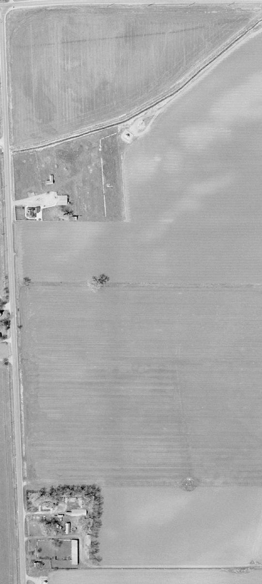
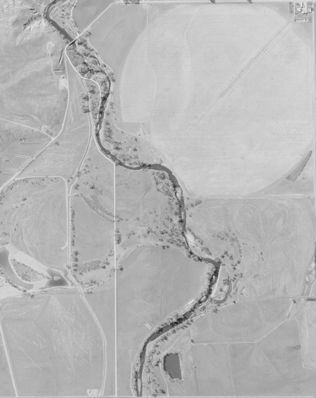
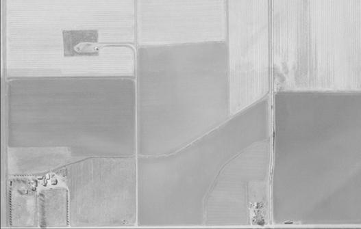
3 I. INTRODUCTION A. Preface Weld County's transportation system is intended to provide for the safe and efficient movement of goods throughout the county. Transportation planning is crucial to the County s future success including the local and surrounding municipalities. Success can only be achieved with an effective transportation system. The planning process goes well beyond looking at the existing needs of the transportation system; it must look well into the future to identify the needs and uses for years to come. B. Project Background and Study Purpose The purpose of this study is to establish a preferred alignment for an east-west arterial roadway between Greeley and Windsor that will extend the existing O Street to the west from the intersection of 83 rd Avenue to State Highway 257 at Crossroads Boulevard thus providing a regional connection to Interstate 25. This proposed arterial will improve the east-west connectivity within the study area and provide alternatives for motorists to US Highway 34 (US 34) and State Highway 392 (SH 392). It is recognized that long-term eastwest travel within the region cannot be efficiently served by US 34 and SH 392, and there is a genuine need to provide an additional east-west arterial road. Adopted plans have identified this additional facility to be O Street connecting with Crossroads Boulevard. This connection affects three jurisdictions including Windsor at the west end of the connection, Weld County (in which most of the new facility lies), and Greeley whose jurisdiction incorporates O Street further east of 83 rd Avenue. This roadway is recognized in Greeley s Transportation Plan as well as the North Front Range s Transportation Plan as a regional route. By identifying a preferred route at this time, this study will serve as a guide for Weld County and the local agencies within the project corridor to preserve rights-of-way for the arterial so that it may be constructed as needed. Planning for this roadway now will allow it to be implemented in an orderly fashion and will allow for minimized impacts in the future. The study location for this connection is shown in Figure 1. The western two miles of the corridor alignment has been defined through Windsor s planning efforts as far east as Weld County Road 23 (WCR 23), so this effort specifically focuses on the two-mile segment between WCR 23 and 83 rd Avenue. It is important to realize that this effort is a planning effort. The intent is to conduct just enough schematic design to assess alignment alternatives for the sake of preserving right-of-way. There is currently no funding to construct this roadway, and the necessary funds may not come to fruition for many years. Figure 1. Study Area Page 1 October 2008

4 C. Study Process The study initiated with an extensive data collection effort to better understand the opportunities and the constraints within the study area. Comprehensive plans and transportation plans from the communities located within the study area were compiled and reviewed; parcel ownership information was collected; known development plans were assembled; environmental data compiled by the County was mapped; and other relevant information was assessed. With this information and with input from the public (including representatives of the local entities), alternative alignment routes were considered for the corridor. These alternatives were then evaluated based on a number of factors including: roadway geometry, impacts to the communities, input from the community, environmental impacts, safety, constructability and construction costs. The results of this evaluation process were then discussed with the local entity representatives, and a preferred route was preliminarily identified. The preferred route was presented to the public for comment, and additional refinements of the preferred route were made. The results of the study were then assembled into this report. Figure 2 shows the work plan and schedule. D. Public Input Local entities including the Town of Windsor and the City of Greeley have been actively involved with this planning process since its beginning. A Local Agency Advisory Group, comprised of representatives of the local governments, met four times throughout the study to provide input on data needs, the identification of alternatives, and the evaluation of those alternatives. Input from these entities has been important in the selection of the preferred route. The general public has also been an integral part of this process. An initial open house for the project was scheduled for May 22, 2008, but had to be postponed to June 10, 2008 due to a tornado impacting the area west of the project study area and Windsor on May 22, The initial open house was conducted to receive input from the public on concerns, issues, and opportunities for potential routes through the project area. Over 30 people attended the initial open house for the project. A second and final open house for the project was held in August 19, 2008 to receive input from the public on the preliminary preferred route; again over 30 people attended. Figure 2. Work Plan and Schedule In order to ensure maximum public involvement for both open house meetings, notification was sent to all of the property owners within the study area (approximately 300 total notices were mailed), press releases were issued by the City of Greeley and a notice was posted on the involved agencies web sites. The findings and recommendations shown in this report will be presented to the Board of County Commissioners for consideration of adoption. Page 2 October 2008
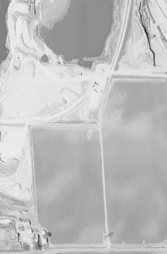
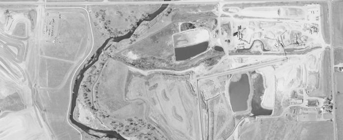
5 II. EXISTING AND FUTURE CONDITIONS A. Planning Context of Road The full extension of O Street connecting State Highway 257 with US Highway 85 is a recognized improvement in the area long-range planning including the City of Greeley s and the Town of Windsor s long range plan. The North Front Range Metropolitan Planning Organization s (NFRMPO) long range transportation plan was updated in December 2007, and the O Street/Crossroad Boulevard arterial road was identified as a Tier 1 roadway within the US Highway 34 corridor, meaning that it should be given some priority with respect to regional arterial improvements and the funding thereof. Regionally, the eastwest travel demand cannot simply be served by only US Highway 34 and State Highway 392 as growth continues to occur; an additional major east-west road between these two state facilities is also needed according to these agencies long-range plans. From Interstate 25, Crossroads Boulevard has been built as far east as State Highway 257. East of this point, Windsor has established an alignment for two additional miles as part of their planning efforts. The missing piece relative to planning this roadway is the next segment to the east extending from Weld County Road 23 to 83 rd Avenue. East of 83 rd Avenue, O Street is planned to be improved and widened to four lanes when traffic volumes warrant additional lanes. The existing curves in O Street between 59 th Avenue and 35 th Avenue will also be improved when traffic volumes warrant these improvements. GIS information obtained from the County included the following: Parcel Boundaries Planned Land Uses Existing Floodplain Limits Jurisdictional Boundaries Aerial Photography This information was subsidized with field observations that collected other pertinent data required for this study such as: Existing Utility Information (including Gas and Oil Features) Residence and Other Structure Locations Drainageways and Drainage Facilities (Ditches, Pipes, etc.) These areas are shown on Figure 3. Most of the environmental areas are concentrated around the Cache La Poudre River. B. Collected Data Information The information that was collected during the data collection process served as the basis for creating and evaluating alternative alignments. The sources of the data collection were Weld County, local municipalities, and the Colorado Division of Wildlife. Available existing land use plans, transportation plans and specific development plans were compiled as well as aerial photography, right-of-way and parcel ownership information, environmental considerations, and United States Geological Survey (USGS) topographic information. All of this information was assembled to determine the physical characteristics of the study area. As part of the data collection effort, several comprehensive plans and transportation plans from the communities in the corridor were collected. The plans include the following: Greeley Comprehensive Transportation Plan (June 2002) The North Front Range 2035 Regional Transportation Plan (December 2007) Windsor Transportation Study (November 1999) (Windsor) 2006 Update of 2002 Comprehensive Plan (Adopted January 2007) Existing environmentally sensitive areas were obtained from the County s GIS department that revealed floodplains in the immediate area. In addition, the primary environmental consideration in this study is the impact to a residential use located just west of the O Street and 83 rd Avenue intersection where the Firestein s house has existed for many years. Page 3 October 2008
6 C. Cache la Poudre River National Heritage Area (CLPRNHA) The portion of the Cache la Poudre River, which is located adjacent to the study area, is designated as a National Heritage Area. The Cache la Poudre River National Heritage Area (CLPRNHA) was the first National Heritage Area designated west of the Mississippi River. The CLPRNHA includes a planning designation within the 100-year flood plain of the Cache la Poudre River and extends west along the Cache la Poudre River into Larimer County to the edge of the Roosevelt National Forest and east along the Cache la Poudre River beyond Greeley approximately ¼ mile west of the confluence with the South Platte River. The Poudre Heritage Alliance (PHA), a non-profit organization, was established to guide programs and activities for the CLPRNHA as part of its management function. The law that established the CLPRNHA states that the PHA s role and authority is limited to interpretation, education, and preservation programs. The law establishing the CLPRNHA expressly forbids the PHA from owning or regulating water and/or property rights. For this study, the PHA should be considered a stakeholder in terms of planning for this transportation project. Future design and planning activity should include coordination with the PHA. Historical and archaeological resources (collectively referred to as cultural resources) that are considered to be significant are afforded protection by federal legislation including the National Historic Preservation Act of 1966 (as amended) and Section 4(f) of the US Department of Transportation Act of 1966 (as amended). Cultural resources are evaluated for significance in terms of eligibility for inclusion on the National Register of Historic Places (NRHP). To be considered significant, cultural resources must generally be more than 50 years old, possess sufficient integrity, and meet one or more of the NRHP evaluation criteria as specified in 36 Code of Federal Regulations (CFR) 60. In addition to cultural resources, publicly owned parks, recreation area, and wildlife/waterfowl refuges are also afforded protection under Section 4(f) of the US Department of Transportation Act of Based on preliminary coordination with Amy Pallante, National Historic Preservation Act Section 106 Coordinator for the Colorado Historical Society (CHS)/Office of Archaeology and Historic Preservation (OAHP) regarding the status of the CLPRNHA as a National Heritage Area (CHS/OAHP, 2004), the CLPRNHA as a planning designation does not automatically qualify as being eligible for inclusion on the NRHP. Publicly owned parks, recreation area, and wildlife/waterfowl located within the CLPRNHA are afforded protection under Section 4(f) of the US Department of Transportation Act of 1966; however, the CLPRNHA is considered a planning designation rather than a publicly owned park, recreation area, and/or wildlife/waterfowl refuges and would not be significant; and therefore, would not be afforded protection under Section 4(f) of the US Department of Transportation Act of Page 4 October 2008


7
8 III. IDENTIFICATION OF ALTERNATIVES A. Design Parameters Basic design parameters were established for this study in developing alternatives. These parameters were discussed with the local agency group, and it was agreed that some flexibility should be exercised in certain areas pending the nature of the surroundings. Design parameters were determined as follows: Classification is a major arterial road Right-of-way width is a minimum of 140 feet (Additional right-of-way may be required for auxiliary lanes at major intersections that turn north-south). This roadway, in its entire length, will pass through three different jurisdictions, so the roads specific cross-section may vary along its length. The anticipated typical cross-sections are shown in Figure 7. The design speed for this proposed arterial is anticipated to be 55 MPH. Construction of this arterial will be dependant on new development and may require that half of the typical section or two lanes be built initially with the entire roadway being built as traffic demands increase and warrant additional lanes. Two primary alignment alternatives were considered for the entire two-mile corridor, and then one of these alignments had several sub-alternatives in the vicinity of the 83 rd Avenue and O Street intersection. One of the overall corridor alternatives was to maintain a relatively straight alignment of O Street (heading west from 83 rd Avenue) to tie into Crossroads Boulevard near Great West Drive. The other overall corridor alterative included routing the east-west arterial up from 83 rd Avenue to Weld County Road 64.5, which is one-half mile north of O Street extended. Heading west, this second corridor alignment would then shift back south to tie into Crossroads Boulevard near Great West Drive. Figure 4 shows the corridor alternatives considered in this study. The straight alignment shown in Figure 4 included several sub-alternatives, all focused on the 83 rd Avenue and O Street intersection. Figure 5 shows these sub-alternatives. Besides the straight through version, three other alignments were identified in an attempt to bypass the existing homes and other surrounding features. Two alignments were identified around the north side of the Firestein s residences and one around the south side of the residences, labeled Alternative A, B C and D. Each of these alternatives is explained in detail later in this report as part of the evaluation. B. Construction and Right-of-Way Schedule At this point in time, there is no specific schedule for purchasing rights-of-way and constructing this arterial. The construction schedule for this arterial route will be highly dependent on the growth patterns in the area. Weld County and the local agencies within the project corridor will use this study as a basis to obtain rights-of-way for the arterial as development occurs. Road rights-of-way will either be acquired through landowner dedication or purchased by the governing agency. Furthermore, development in the area will be required to participate in road improvements based upon specific traffic impacts. The County and local agencies within the project corridor will ultimately be responsible for those portions not funded by developments. C. Generation of Alternatives Several alignment alternatives were identified for the project area. The alternatives were generated based on input received from the public and the local agencies. Initial alternatives were sent to the local agencies for comment and they were then refined. Developing new alternatives and refinements of existing alternatives has been an ongoing effort given the additional public and local agency input. The alternatives that were considered in this study are shown on Figures 4 and 5. Page 6 October 2008
9


10
11 IV. EVALUATION OF ALTERNATIVES The alternative analysis was conducted in two phases to compare corridor alternatives and then to compare sub-alternatives at the 83 rd Avenue and O Street intersection. The same considerations were used in both alternatives. These include: Community Input - Refers to the general public opinion for the alternative alignments simply measured as favorable or not. Community Impacts - Right-of-Way Impacts is a measure of the amount and number of severed parcels, proximity impacts, and/or displaced residences that would be required of existing and future developments in order to construct the alternative. Current and Future Development Impacts is a measure of consistency with current and future residential and commercial development plans. Geometrics - Geometrics are a measure on how well the alternative achieves the preferred design criteria established by the local agencies. Safety - Safety is a measure of expected conflict points for the traveling public and improvement of existing problems or high accident locations. Environmental Impacts - Refers to unfavorable impacts to known environmental conditions. This would include a measure of the alternative s impact on the existing flood plain and/or existing drainage facilities. This would also include any impacts to known existing historical buildings or sites or mining hazards. Construction Costs - Construction Cost is a relative comparison of costs to construct the alternative. These factors were the cornerstone of the evaluation process. Each factor was discussed by the sevenmember committee, but each member individually scored the alternatives for each criterion listed above. More specifically, members rated each alternative on a scale of one to five (one being best), and scores for the six criteria above were simply summed as a means for members to identify their individual preferred alternatives. Committee members were made up of representatives from Weld County, Greeley, Windsor, and Felsburg Holt & Ullevig. A. Corridor Alternatives As mentioned, two corridor alternatives were considered in this study. One maintained a straight alignment along O Street (Alternative 1) while the other made use of 83 rd Avenue up to Weld County Road 64.5 (heading east to west) and then shifting back south at approximately Weld County Road 23.5 to the future Crossroads Boulevard alignment (Alternative 2). From the analysis, all seven of the committee members unanimously choose Alternative 1, which maintains the alignment along O Street. From the Committee s scoring, the following summarizes the Committee s thoughts in evaluating these alternatives. Community Impact/Input The scoring for these areas was mixed among the Committee. While Alternative 1 would impact the existing couple of homes just west of the 83 rd Avenue and O Street intersection, Alternative 2 would impact the Shiloh neighborhood as well as residents living along Weld County Road While Alternative 2 could make use of existing roadways already in place, there would still need to be additional rights-of-way needed, and a greater number of homes would be disturbed by Alternative 2 as opposed to Alternative 1. However, Alternative 1 requires an entire take of several houses. It should be noted that long-range plans include extending 83 rd Avenue straight north across the Great Western Railroad in the proximity of Weld County Road 64.5, potentially via a grade-separated crossing. Establishing a safe intersection between Weld County Road 64.5 and 83rd Avenue will create some extreme challenges due to 83 rd Avenue likely needing to be elevated. Even if left at-grade, an intersection between major roadways likes these are envisioned to be in the future creates a safety issue when located very close to a railroad crossing. Besides the geometric challenges, both the Railroad and the Public Utilities Commission would need to accept and approve any future roadway crossing configuration of the railroad; establishing Weld County Road 64.5 as part of a major east-west arterial facility will add significant complication to any future railroad crossing configuration, perhaps to the point of being cost-prohibited. The average score for Alternative 1 was 2.5, and the score for Alternative 2 was approximately 3.7 (averaging Community Input and Impacts together). Geometrics The scoring for each member consistently favored Alternative 1. The straighter alignment allows for improved design speeds along the corridor. In addition, Alternative 1 does not take drivers out of direction, heading east to west, when considering that this road ultimately will connect with Crossroads Boulevard which is south of the O Street alignment. There would also be issues with rights-of-way between the Shiloh neighborhood and the railroad line. The average score for Alternative 1 was 1.0, and for Alternative 2 it was 3.9. Safety This was another area where the Committee felt that Alternative 1 was a clear winner over Alternative 2. Far fewer curves, less length of road, and better access management were among the considerations of the Committee, which favored Alternative 1. Average score for Alternative 1 was 1.1 and 4.0 for Alternative 2. Environmental Impacts This was not a major differentiator with respect to scoring the two corridor alternatives. There were some minor differences in members preferences, but all scoring was 3 or better. Average score for Alternative 1 was 1.9, and for Alternative 2 it was 2.1. Construction Costs Conceptual cost estimates for the two corridor alternatives slightly favor Alternative 1. Alternative 2 has a cost of approximately $8.3 million while Alternative 1 has a cost of $7.1 million. Committee member scoring was quite variable in terms of this difference as different members placed a different weight on the $1.2 million difference, but every member favored Alternative 1. Average score for Alternative 1 was 1.3, and for Alternative 2 it was 3.7. The final result of this corridor evaluation effort was the selection to not utilize Weld County Road 64.5 and 83 rd Avenue as a means of providing east-west continuity in this area. Maintaining the alignment on approximately O Street is the preferred alignment from the Committee members, and this was a unanimous decision. The next steps include analyzing the sub-alternatives at the 83 rd Avenue and O Street intersection. Page 9 October 2008
12 B. 83 rd Avenue and O Street Intersection Four sub-alternatives were considered at the 83 rd Avenue and O Street intersection. The intent with these alternatives is to consider alignments that might be less impactful to the existing homes just west of 83 rd Avenue. Clearly, there are tradeoffs when considering alternatives, so the Committee worked through the same grading process using the six criteria. Table 1 shows an evaluation matrix for this analysis in which the scoring of all the Committee members have been averaged. Table 1. Evaluation Matrix - Average of Committee Scoring Alternative A Alternative B Alternative C Alternative D (Green Alignment) (Red Alignment) (Yellow Alignment) (Blue Alignment) Community Input Evaluation Criteria Scoring (1-5, 1 best) Scoring (1-5, 1 best) Scoring (1-5, 1 best) Scoring (1-5, 1 best) General Public Opinion of Alternative Votes Received at Public Open House Community Impacts Right-of-way Impacts Current and Future Development Impacts Geometrics Average for Community Impacts Design Criteria Achieved Safety Safety Environmental Impacts Flood Plain/Drainage Facilities/Historical Buildings/Mining Hazards Construction Cost Construction Cost $2,140,000 $1,290,000 $1,490,000 $2,390,000 The criteria are scored from 1 to 5 with 1 being the best. Page 10 October 2008
13 Alternative A (Green Alignment) Community Input Did not receive any votes during Public Open House (Negative Impact) Community Impacts Does not Require Relocations of any Residences (Positive Impact) Shifts O Street North Away from Existing Residences (Positive Impact) Bisects Future Mining Operations Area for Aggregate Industries (Negative Impact) Realigns Access to Beverlee Allison parcel (Negative Impact) Impacts the existing residence of Beverlee Allison with headlight glare (Negative Impact) Geometrics Achieves Established Design Criteria (Positive Impact) Safety Creates out-of-direction travel to the north (Negative Impact) Environmental Impacts Does not have any known environmental impacts (Positive Impact) Construction Costs Ranks 3 rd in anticipated construction costs of the four alternatives (Negative Impact) Does not utilize existing right-of-way/roadway; therefore, construction costs is higher (Negative Impact) Alternative B (Red Alignment) Community Input Only received 1 vote during Public Open House (Negative Impact) Community Impacts Does not require relocations of any residences (Positive Impact) Does not bisect future mining operations area for Aggregate Industries (Positive Impact) Utilizes a majority of the existing right-of-way for O Street (Positive Impact) Does become in close proximity to northern Ruth Firestien residence (Negative Impact) Geometrics Does not achieve Design Criteria (40 mph posted speed limit) (Negative Impact) Safety Shifts current O Street alignment slightly to the north with reverse horizontal curves (Positive Impact) Environmental Impacts Does not have any known environmental impacts (Positive Impact) Construction Costs Ranks 1 st in anticipated construction costs of the four alternatives (Positive Impact) Alternative C (Yellow Alignment) Community Input Received 3 votes during Public Open House (Negative Impact) Community Impacts Does not bisect future mining operations area for Aggregate Industries (Positive Impact) Utilizes a majority of the existing right-of-way for O Street (Positive Impact) Adversely impacts both Ruth Firestien s residences (Negative Impact) Geometrics Achieves Established Design Criteria (Positive Impact) Safety Accommodates driver expectancy with a straight roadway and connection to the west (Positive Impact) Environmental Impacts Does not have any known environmental impacts (Positive Impact) Construction Costs Ranks 2 nd in anticipated construction costs of the four alternatives (Positive Impact) Alternative D (Blue Alignment) Community Input Received the most votes at the Public Open House (Positive Impact) Community Impacts Does not Require Relocations of any Residences (Positive Impact) Shifts O Street south away from existing residences (Positive Impact) Impacts existing asphalt batch plan of Aggregate Industries (Negative Impact) Geometrics Does not achieve Design Criteria (45 mph posted speed limit) (Negative Impact) Safety Creates out-of-direction travel to the south (Negative Impact) Environmental Impacts Is on the fringe of the flood plain limits (Positive Impact) Construction Costs Ranks 4 th in anticipated construction costs of the four alternatives (Negative Impact) Does not utilize existing right-of-way or roadway; therefore, construction costs is higher (Negative Impact) Page 11 October 2008
14 C. Summary of Evaluation The Committee considered all of the above points as well as others in their deliberations, in choosing a preferred alternative. From these proceedings, members were asked to rank their alternative preference. Table 2 shows the results of this process. From this, Alternative C was identified by the Committee to be the preferred alignment. This alternative would maintain O Street in a straight alignment continuing west from 83 rd Avenue. Table 2. Evaluation Matrix Rankings (1st, 2nd, 3rd, 4th) Alternative A Alternative B Alternative C Alternative D (Green Alignment) (Red Alignment) (Yellow Alignment) (Blue Alignment) Committee Member Committee Member Committee Member Committee Member Committee Member Committee Member Committee Member Average Ranking (lowest score is preferred) th 3rd 1st 2nd PREFERRED ALTERNATIVE Page 12 October 2008
15 V. RECOMMENDATIONS A. Alignment Upon completion of the evaluation process, the local agency committee settled on a preferred alternative that included maintaining a straight alignment along O Street heading west from 83 rd Avenue. The Committee s preference for this alignment was driven by the safety associated with maintaining a straight alignment and by the relatively lower cost, also due to maintaining a straight alignment. However, the notion of realigning O Street to the south at 83 rd Avenue (Alternative D) to avoid several homes just west of 83 rd Avenue should not be entirely dismissed. The Committee s preferred alignment is shown in Figure 6, and typical cross-sections are shown in Figure 7. B. Study Implementation Process The results of this study are simply to provide a guide to assist in the future design and preservation of this road facility s right-of-way. There is not any funding at this time identified to see the construction of this road come to fruition in the near future. The funding sources are unknown, and it could be many years before any roadway construction begins. C. Arterial Implementation Process At this point in time, there is no specific schedule for the construction of this arterial. The construction schedule will be highly dependent on the growth and development that occurs in the area. Weld County and the municipalities within the project corridor will use this study as a basis to preserve rights-of-way for the arterial as development occurs. Rights-of-way not preserved through the development process may be purchased as needed. Furthermore, it is anticipated that developments adjacent to the arterials will be responsible for the construction as a means to mitigate their impacts. Based on conceptual cost estimates that were prepared for this study, it is anticipated that construction for this arterials could be approximately $3 to $4 million per mile. The County and local municipalities in the corridor will be responsible for those portions not funded by developments. Page 13 October 2008


16
17