Conference : Mandalay without traffic jam
|
|
|
- Lynn Miles
- 5 years ago
- Views:
Transcription

1 Conference : Mandalay without traffic jam What urgent solutions for Mandalay s transportation system FASEP study Mandalay 15/06/15
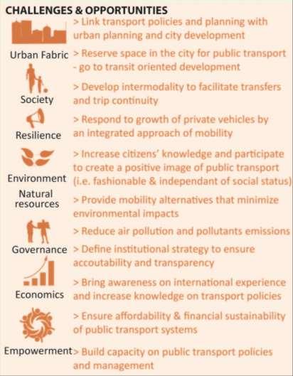
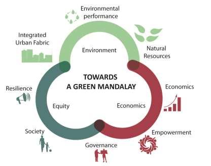
2 SAFEGE mission and context SAFEGE mission: A contribution to the global plan focusing on public transport solutions 1. Context appraisal: urban and transport situation and trends 2. Proposition of draft urban and transport global strategy 3. Selection of a priority corridor and of a transport technology 4. Prefeasibility of the selected line 2
3 Contents Introduction A vision for the city A multimodal strategy Towards a mass transit master plan A first mass transit line to be studied 3
4 Contents Introduction A vision for the city A multimodal strategy Towards a mass transit master plan A first mass transit line to be studied 4


5 THE METHOD ANALYSE UNDERSTAND IMAGINE THE ORGANISATION OF MOBILITY IMAGINE / DESIGN THE CITY INVENT THE PUBLIC TRANSPORT NETWORK BEST ADAPTED TO THE CITY 5
6 Contents Introduction A vision for the city A multimodal strategy Towards a mass transit master plan A first mass transit line to be studied 6


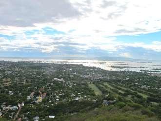


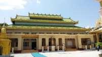
7 Mandalay: a vision for the future MYANMAR 7


8 3 scales UNDERSTANDING THE LAND, THE CITY MANDALAY FOCUS POINT OF THE NORTH OF MYANMAR CENTER OF A LARGE URBAN AREA NATIONAL SUBURBAN URBAN Myitkyina Kale India Lashio China Sittwe Naypyitaw Yangon 8


9 A central city UNDERSTANDING THE LAND, THE CITY MANDALAY A CENTER FOR Economy Administration Culture Transport Tourism Religion 9

10 North-South axis UNDERSTANDING THE LAND, THE CITY Mandalay: a linear urban area contained between the river and the hills The city is developed on a North-South axis along the Irrawaddy River 10

11 Population density 2014: population 1.4 million 2040: 2.5 in the Greater Mandalay? 4 million in a larger area? 11
12 Mandalay urban structure today Residential high density (> 10,000 pop./km²) Residential lower density (< 10,000 pop./km²) Present city center Industrial developments 12
13 Towards a sustainable Mandalay URBAN TRANSPORT 13


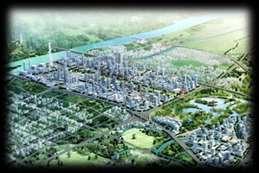
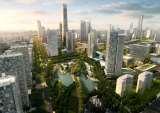
14 Inventing the future sustainable Mandalay MASTERED DEVELOPMENT FOR A SUSTAINABLE CITY PROTECTED ZONE; AGRICULTURE FOOD FOR THE CITY URBAN AND LANDSCAPE ARRANGEMENT ALONG THE RIVER NEW BUSINESS CENTER OF MANDALAY URBAN DEVELOPMENT TOURISM DEVELOPMENT NEW CBD Contain and organize urban development Structure the city to promote exchanges and limit the infrastructures: short distances city Preserve the environment and agricultural capital: short circuit food Prepare the tools of economic development (business center, tourism developments, exhibition area etc.) 14


15 Inventing the future sustainable Mandalay Urban haute couture Knitting the future city along a major axis 15


16 Inventing the future sustainable Mandalay The development of the new city as a mirror to the historic heritage The Palace The composition axis The new business district 16
17 Inventing the future sustainable Mandalay The old The new All foundational elements of the city connected along a structuring transport axis 17


18 Inventing the future sustainable Mandalay TODAY TOMORROW NEW CBD 18
19 Contents Introduction A vision for the city A multimodal strategy Towards a mass transit master plan A first mass transit line to be studied 19


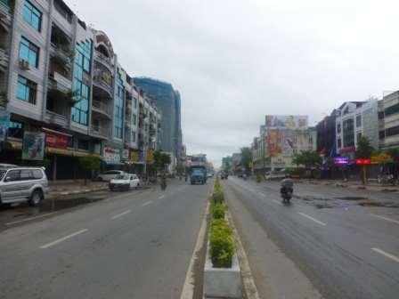
20 The bus network Main bus corridors outside the Zay Cho 84 th street backbone 20
 Freight services Myitkyina (2) Naba (2) ShweBo (2) Lashio (2) Lashio (2) Mongywa (2) Madaya (2) Pakokku (2) Lashio Bagan (4) Thazi")
21 Railway system Railway services and trip times Services Trip time Mandalay - Paleik 1 hr 15 Mandalay - Shwekyetyet 1 hr Mandalay - Madaya 3 hr 45 Mandalay Thayezay 1 hr 55 Madaya Thayezay 1 hr Daily running trains Passenger services Myitkyina (12) Freight services Myitkyina (2) Naba (2) ShweBo (2) Lashio (2) Lashio (2) Mongywa (2) Madaya (2) Pakokku (2) Lashio Bagan (4) Thazi (2) Sagaing Myitkyina Railway stations Railway lines Daily passengers (400) Naypyitaw Yangon Yangon (8) Yangon (4) 21


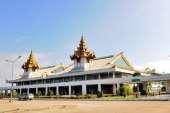
22 Intercity bus stations 3 main intercity bus terminals ThiRiMandalar to be relocated PyiGyi MyatShin ChanMyaShwePyi (KyelSelkan) 22
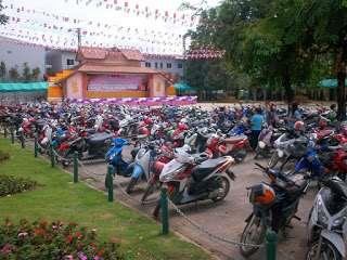
 677,000 2-wheel vehicles in the city 450,000 motorcycles and 225,000 bicycles?")
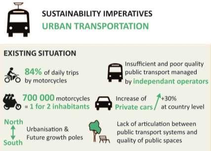
23 Car and motorbikes ownership Source: Road Transport Administration Department August ,000 private vehicles : +30% passenger cars in Myanmar 7 cars for every 1,000 citizens (Vietnam: 14, Thailand: 270) 677,000 2-wheel vehicles in the city 450,000 motorcycles and 225,000 bicycles? Motorization and mobility Mobility estimates About 2 million daily trips 20% Urban trips per mode (estimates) 7.5% 2.5% Motorcycle Bicycle Car Urban bus 70% Potential evolutions 2040: about 4 million daily trips (walking excluded) Car ownership much higher What objectives for future public transport share? 23

24 Objectives for public transport share 30% 45% Objective for Mandalay? 60% 60% 25% 55% 17% 2% ~Mandalay today A reasonable objective for public transport share: 30% 1.2 million daily trips by public transport, 20 times more than today! A challenge! How to make it possible? 24

25 Solutions are multimodal Mass transit Ring roads Transit-oriented development Traffic management Coordination with trains and intercity buses Transport hubs Public transport improvement Traffic calming Regulated congestion Parking policy in the center Fares, information, comfort, institutional issues etc. Sustainable development Pedestrianfriendly environment 25

26 A multimodal strategy for Mandalay COHERENT ORGANIZATION OF THE MOBILITY Multimodal concept Main road network Mass transit level 1 Mass transit level 2 A mass transit network with 2 levels No through-traffic inside the city 26 Priority for public transport inside the ring road Access restrictions for cars and motorbikes in some central / strategic areas? 26
27 Contents Introduction A vision for the city A multimodal strategy Towards a mass transit master plan A first mass transit line to be studied 27
: no level crossing But still well integrated in the city Opportunity of the railway system A railway network that covers the main corridors,")
28 Mass transit level 1 for Mandalay Characteristics of a first level of mass transit for Mandalay: High-capacity system (> 15,000 passengers/hour/direction) Able to go out of the city Separated from other traffics (cars, motorcycles, buses, pedestrians): no level crossing But still well integrated in the city Opportunity of the railway system A railway network that covers the main corridors, both inside the city and towards Sagaing, Southern extensions etc. A relatively low number of trains, leaving large capacities to insert urban and suburban trains An infrastructure to be renewed, possibly with 3 or 4 rails to accommodate to different gauges (meter and standard) + electric power supply + new signaling system and of course new vehicles! Urban train concepts Many cities have developed railway systems that serve as a metro in the city and as a suburban train outside, sharing tracks with long distance and freight trains on some sections Generally only some of the trains go out of the city (e.g. 1 out of 3) because more transport capacity is needed inside the city These systems can be called metro, tram-train, light rail, regional express network etc. Sagaing Airport area Northern developments Old CBD New CBD Southern developments Path 28
")


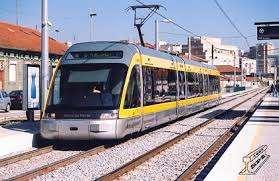
29 Example of Porto Metro (Portugal) Use of existing railways Covered station In the city Open air station 29


30 URBAN AND SUBURBAN METRO Elevated section 30

 or Bus with a High Level")

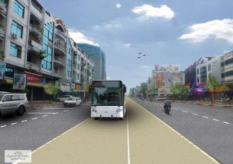
31 Mass transit level 2 for Mandalay Characteristics of a second level of mass transit for Mandalay: An intermediate level between the metro and the bus network Capacity of 3000~5000 passengers/hour/direction Easy integration in the main arterials (~70 ft / 22 m wide) Catchment areas complementary to the 1 st level Much lower cost than the metro Possibility of faster implementation than the metro Bus-based solutions Bus Rapid Transit (BRT) or Bus with a High Level of Service (BHLS) concepts Bus-based solution but with fully different image and performances than usual bus lines Segregated site, qualitative vehicles, priority at junctions, stations with comfort / information / ticketing, street integration Station 31


32 Bus with a High Level of Service Bus-based solution but with fully different image and performances than usual bus lines 32


33 Needs for mass transit connections Patheingyi Sagaing Airport area New CBD Sagaing Airport 33


34 Proposed mass transit master plan Multimodal concept Metro services Typical headways Existing Central station 4 minutes in the city Metro line 1 Metro line 2 BRT/BHLS Myo Haung New central station Metro on existing railway alignment Long distance train station relocated in Myo Haung Intercity bus stations relocated on mass transit lines Sagaing New alignment Elevated metro in the street Airport area 34


35 A coherent urban and transport vision for the future 35
36 Contents Introduction A vision for the city A multimodal strategy Towards a mass transit master plan A first mass transit line to be studied 36


37 BHLS: the bus with a high level of service COMMERCIAL SPEED FREQUENCY, REGULARITY URBAN INTEGRATION COMFORT IMAGE SAFETY ACCESSIBILITY INTERMODALITY 37

38 BHLS components ADDITIONAL SERVICES TRANSFERS INTERMODALITY SOFT MODES SHELTERED STATION WITH TICKET DISTRIBUTION & CONTROL REAL-TIME INFORMATION PRIORITY AT JUNCTIONS ADAPTED FARES ACCESSIBILITY FALLBACK MANAGEMENT COMFORTABLE FEEDERS SAFE CLEAN COMMUNICATION ITS PARK-AND- RIDE TICKETING LOGO GRAPHIC IDENTITY MULTIPLE DOORS ACCESSIBILITY 38


39 Sustainable future Mandalay city and coherent public mass transit network Photos of the different street widths x1 lane 2x2 lanes 2x3 lanes 30 THE ROAD MATRIX OF THE BHLS LINES 39

40 A BHLS network with three lines 40


41 A BHLS first line Serving hotspots (market, administrative center, education areas, industrial zone) and high-density areas Possibility of fast implementation 41


42 FASEP French Grant Program May 2015 Mandalay BHLS pilot line Pre feasibility study Initial Phase
 : at the terminus of BHLS line 12")
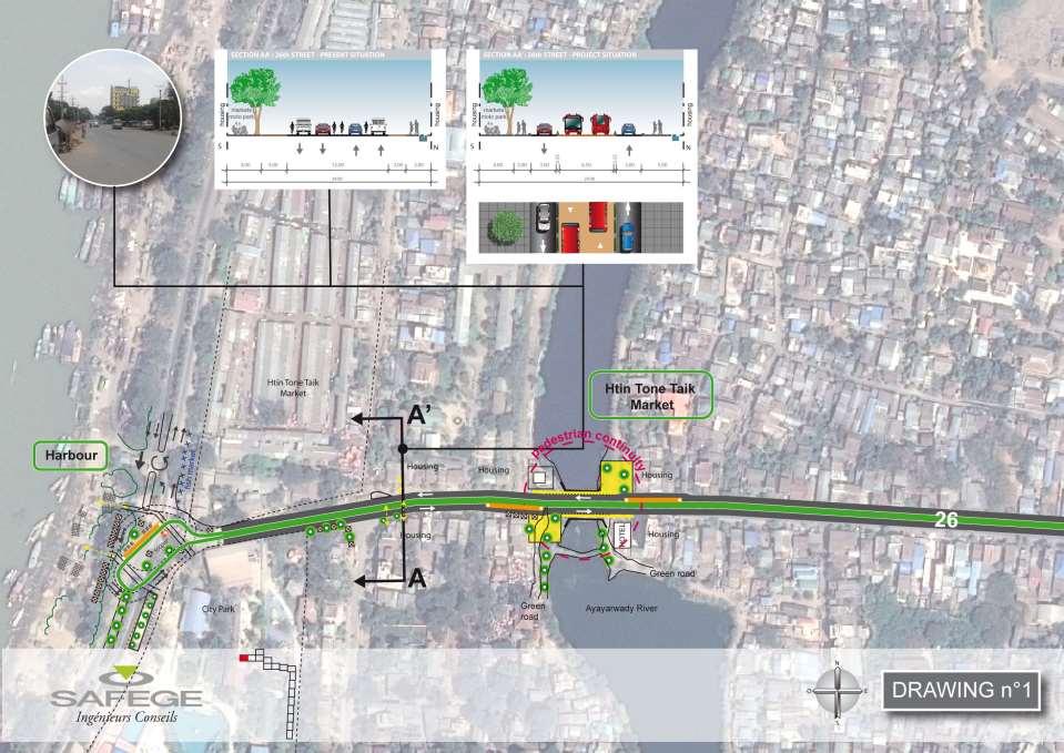
43 1 st BHLS LINE : parking and ride 1.P+R Strategy and assumption Assumption : 10% access to the MRT/BHLS by motorcycle Hierarchical strategy 2.Motorcycle P+R Mass transit level Mass transit level 1: about 18,750m² parking space Mass transit level 2: about 6,250m² parking space BHLS Network 6 XL (1,250 m²) : at the terminus of BHLS line 12 L/M (400 to 800 m²) : at the strategic hubs 24 S (200 m²) : at the others stations out of the new heart city center Kipping de vision of the network and an intermodal system 43
44
45
46

47


48 Synthesis of the global vision for an attractive and sustainable Mandalay A planned new development A planned public transport network NEW MANDALAY CITY METRO NETWORK BHLS NETWORK TRAFFIC ORGANISATION + RING ROAD FULL PUBLIC TRANSPORT NETWORK MULTIMODAL INTERCHANGE NODES 48


 SHORT TERM BUS REORGANIZATION AND BUS")
 BRT LINE STUDIED AT PREFEASIBILITY")
49 Short term solutions with a long term vision Existing Central station Myo Haung New central station Route / alignment to be confirmed Sagaing Airport area LONG TERM MASS TRANSIT NETWORK (URBAN TRAIN / METRO + BHLS) SHORT TERM BUS REORGANIZATION AND BUS LANES MEDIUM TERM FIRST MASS TRANSIT LINE (BHLS) BRT LINE STUDIED AT PREFEASIBILITY LEVEL 49

50