Strategic Transportation Plan FOCUS ON TRANSIT
|
|
|
- Arlene Cain
- 5 years ago
- Views:
Transcription

1 Strategic Transportation Plan FOCUS ON TRANSIT Presented to: Gateway Cities Service Council Presented by: Jerry Wood, GCCOG Director of Transportation and Engineering COG2013\ POWER POINTS for JRW Prez\GC SERVICE COUNCIL, \GC SERVICE COUNCIL -STP-TRANSIT , pptx November 14, 2013

, the largest container port complex in the U.S.")
2 Context for Gateway Cities The Gateway Cities Council of Governments (GCCOG) is a sub-regional association of public agencies representing 28 cities, LA County and POLB and serving more than 2.2 M residents in Southeast LA County. GATEWAY CITIES AREA GCCOG s role is to provide regional leadership by: Improving Mobility Advancing Technology Improving Air Quality Addressing Housing Needs Preserving and Enhancing Open Spaces Job Creation and Economic Revitalization GCCOG is anchored by POLB and Port of Los Angeles (POLA), the largest container port complex in the U.S. and the dominant port of entry for Pacific Rim trade with the U.S. The San Pedro Bay ports handle about 45% of the nation s imports and the demand is expected to grow. A 300% increase in container volumes is projected by With a 300% increase in container volumes projected by 2035, traffic congestion and air quality issues in Gateway Cities communities will be impacted. For the future, efficient Goods Movement will require collaborative efforts between ports, rail yards, warehouses and transloading in order to have cost-effective, environmentally safe, and useful mobility options and congestion relief benefits. A priority for GCCOG is to coordinate with stakeholders to find community-friendly solutions for all transportation issues and air quality/health issues, focused on safety, improvement and access to all transportation, transit facilities, as well as bicycle and pedestrian options. GCCOG LOCATION IN REGIONAL CONTEXT SOUTHERN CALIFORNIA POLA / POLB Artesia Avalon Bell Bellflower Bell Gardens Cerritos Commerce Compton Cudahy Downey Hawaiian Gardens Huntington Park Industry La Habra Heights La Mirada Lakewood Long Beach Lynwood Maywood Montebello Norwalk Paramount Pico Rivera Santa Fe Springs Signal Hill South Gate Vernon Whittier Port of Long Beach (POLB) Unincorporated LA County
3 The STP is developing a unified, subregional multimodal transportation improvement strategy. Background and Purpose For more than 15 years, the GCCOG and Metro (in cooperation with other agencies) have prepared numerous transportation studies for projects and programs in the Gateway Cities sub-region. However, there are multiple transportation projects that are in, or pass through Gateway Cities and also impact the area s transportation system. Previously, all transportation studies have studied projects individually, with minimal coordination or understanding of how they might relate to or impact each other and affect the economic resources of the local communities. As part of the I-605/SR-91/I-405 Hot Spots Feasibility Study, Metro and the GCCOG began to analyze the interrelationships between all transportation projects proposed in the subregion, resulting in high level assessment and the beginning of the Strategic Transportation Plan. Moving forward, the STP is building on prior work and providing a framework for future transportation infrastructure investments and priorities (utilizing Measure R as a primary fund source and as leverage) in Gateway Cities to ensure that mobility goals and congestion relief benefits are met in the most cost effective manner across all transportation modes. The GCSTP is based on the analysis of the inter-relationships of all proposed and potential transportation projects and their impacts to the local communities (including an analysis of economic impacts and benefits) leading to a funding and financing plan and an implementation strategy, including economic development and revenue enhancement strategies for the communities. Based on the findings of the GCSTP, GCCOG and Metro staff will develop recommendations on a number of projects to be advanced utilizing sub-regional Measure R funds. The GCSTP will determine scope of the work and associated costs for each project. The GCCOG Board will then set priorities based on the availability of funds and the proposed projects scope and costs. 3

4 2013/14 REGIONAL TRANSPORTATION PROJECTS 4
5 The Strategic Transportation Plan (STP) will analyze all transportation modes, including... Arterial Highways Freeways Local and Regional Transit Park & Ride Lots Active Transportation Goods Movement & Logistics Transportation Technologies (ITS) Truck Enforcement, with the following: Goods Movement Impacts Storm Water Treatment Demographic Analysis ALL TRANSPORTATION MODES Funding & Financing Strategies Air Quality & Public Health New Technologies Analysis, Coordination & Collaboration Regional Coordination + Collaboration Gateway Cities Neighbors OCTA South Bay Cities COG San Gabriel Valley COG City of Los Angeles Others Partner Agencies/Stakeholders Caltrans SCAG LA County Ports of LA & Long Beach Others 5


6 How to Achieve STP Goals Integrate existing transportation plans & studies Refine project ideas & identify new projects Develop tools to analyze systemwide interactions The STP is developing a unified, subregional multimodal transportation improvement strategy. 6

7 Integrate Existing Projects Corridor Studies I-405 Corridor Cherry Ave interchange MTA express lanes Truck enforcement site Coordination with Orange County & SBCCOG I-405/SR-91/I-605 Congestion Hot Spots Feasibility Study Project Study Reports I-710 Corridor DEIR coordination & update Freight corridor I-5 interchange SR-91 interchange Truck enforcement site I-5 Corridor Improvements I-105 Alameda St Interchange SR-710 North Study Arterial Network 7
8 Integrate Existing Projects Commuter Rail & Goods Movement Projects LOSSAN Rail Corridor + HSR Metrolink Plans Metro Blue & Green Line Plans Park & Ride Lot Expansions ECO/ Pacific Electric Transit Corridor Gold Line Extension Alternatives East-West Freight Corridor Technology Plan for Goods Movement SCIG, ICTF and Other Logistics Facilities Gerald Desmond Bridge Replacement ICTF/SCIG 8


9 Integrate Other Subregional Efforts Air Quality & Health Air Quality Action Plan I-710 Air Quality/Health Risk Assessment SB 375 Sustainable Communities Strategy Technology Deployment Arterial & Freeway Smart Corridors Freight Data Warehouse Traveler Information Automated Truck Research Truck Enforcement Zero-Emission Truck Corridor Drayage dispatchers will have access to freight focused traveler information resources. Drayage drivers will know of traffic conditions at the port before they start their trip via 511 in both English and Spanish. Radio traffic reporters will have access to more accurate information than ever before. Third party vendors can use the data from the data warehouse to create Apps for their customers. TECHNOLOGY PROJECTS Freight TIS and Data Warehouse Freight Traveler Information Dissemination Arterial Smart Corridors Freeway Smart Corridors Automated Truck Research Container Moves Productivity Improvement Technology systems within the ports improve efficiency through the Gateway Cities region. An enhanced enforcement network creates a safer environment. Planners can use the data archived in the data warehouse to better plan for goods movement. Navigation and traffic data vendors will have access to more accurate and timely information. Truck Enforcement Network System 9


10 Refine & Identify New Projects Master Plan for Arterial Highways New Arterial Highways & Safety Projects Active Transportation Master Plan New Transit & Park-and-Ride Analyses Assessments of New Truck / ITS Projects 10
11 Strategic Transportation Plan (STP) Focus on Transit Analysis
 West Bank alternative East Bank alternative")
12 STP MAJOR TRANSIT PROJECTS & IMPROVEMENTS KEY EcoRapid Transit (Orange Line Development Authority) West Bank alternative East Bank alternative 12
13 TRANSIT & PARK-N-RIDE ASSESSMENT Assessments Include: All existing bus and rail services Metro, Long Beach Transit, Metrolink, Amtrak, LADOT, OCTA, 14 others 16 existing Park-n-Ride facilities Metro, Caltrans, Metrolink, city facilities 7 Park-n-Ride projects Several planned and possible transit projects Planned improvements to LOSSAN corridor rail and Metrolink service Gold Line Eastside Transit Corridor Phase 2 extension Possible Gold Line extension to Orange Possible increases in Green and Blue Line service Possible EcoRapid Transit General improvements to MetroRapid Planned Long Beach Eastern Transit Corridor Connection (bus) Planned Huntington Park Downtown Shopper Shuttle (trolley) Possible Atlantic Boulevard Corridor transit As well as capacity and utilization information Transit - Existing and future service frequency, capacity, ridership - Auto trip reduction - Identification of capacity issues Park-n-Ride - Existing and future capacity and utilization - Identification of capacity issues Assessment will also evaluate the effects of substantially increasing existing transit frequency and capacity. 13


14 GATEWAY CITIES LOCAL & RAPID BUS SERVICES This figure shows the relative position of local and rapid bus services in the greater Gateway Cities area. Existing and projected bus ridership figures were developed with input into the Transit Assessment and Maximum Transit Assessment Reports. 14
15 MAXIMUM TRANSIT SCENARIO ASSESSMENT The Gateway Cities Maximum Transit Scenario Assessment consists of an inventory of existing transit services and a sketch-level analysis of the potential effects of greatly increased subregional transit service in the Gateway Cities. This scenario illustrates how expanded transit service might affect ridership, transit utilization, and effects on automobile travel and other modes. It applies sketch-planning analysis on a route-by-route basis to estimate ridership and potential modal effects. The assessment relied on current and historic data from existing public documents, transit provider interviews, and analysis using widely accepted transit factors. The analysis considered three scenarios: Existing. Existing Conditions No Build. Continuation of 2013 transit service levels, but increased population and employment consistent with regional and statewide growth forecasts; and Maximum Transit. Aggressive service frequency improvements for existing transit, robust new transit route and service offerings, and increased population and employment consistent with regional and statewide growth forecasts. 15


16 MAXIMUM TRANSIT FIGURES Gateway Cities Ridership by Type of Transit (2013 to 2035) Peak-Hour Seated Transit Capacity and Utilization by Transit Type The major transit ridership trends are as follows: Existing transit services, including local bus, express bus, light rail, and heavy rail, serve about 318,780 passengers in the Gateway Cities each weekday; The 2035 No Build scenario has projected average weekday subregional transit ridership of about 352,950 by the year 2035, which is an 11-percent increase over existing conditions; and The 2035 Maximum Transit scenario increases weekday transit ridership in the Gateway Cities to 462,700, a 45- percent increase over existing conditions, and a 31- percent increase over No build conditions. Proposed light rail improvements offer the greatest increase in ridership. Weekday Personal Vehicle Trip Reduction 16


17 SOURCE OF NEW TRANSIT TRIPS Each new passenger attracted to transit due to service improvements can be thought of as shifting from one of a number of prior travel modes. The table on this page shows the approximated prior travel mode for new weekday transit trips under 2035 Maximum Transit conditions: 2035 Maximum Transit Source of New Weekday Transit Trips by Mode 17

18 MAXIMUM TRANSIT SUMMARY The Gateway Cities Maximum Transit Scenario Assessment concludes the following: 18
19 PARK-AND-RIDE This table reflects the most recent available parking demand from existing conditions. Daily Parking Demand & Utilization Rates by Park-and-Ride Facility Growth in parking demand at each lot is equivalent to expected growth in ridership on the primary transit line served by each facility. Based on these assumptions, parking demand across all 19 facilities would increase by 23 percent from existing conditions to the 2035 Maximum Transit scenario. Existing and forecasted utilization varies by facility, but six lots show demand exceeding capacity in the 2035 Maximum Transit scenario. The assessment estimates an average utilization rate across all 19 facilities of 83% under the 2035 Maximum Transit scenario. 19


: 20")
20 PARK-AND-RIDE DATABASE The Park-and-Ride Assessment involved four scenarios: Excerpt from Park-and-Ride Database: Excerpt from Park-and-Ride Lot Utilization and VMT Detail (continued): 20


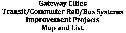
21 TRANSIT PROJECTS & COSTS FIGURE 21
22 Thank You! Questions? Jerry R. Wood Director of Transportation and Engineering Gateway Cities Council of Governments c) 714/ w) 714/