South Central Valley Sustainable Goods Movement Overview
|
|
|
- Shana Richardson
- 5 years ago
- Views:
Transcription

1 South Central Valley Sustainable Goods Movement Overview

2 Kern County Progress on Air Quality In addition, as of 2018 Kern no longer has to report on the Carbon Monoxide standard which it has been in attainment of since Source: California Air Resources Board iadam data Days/ year

 5% - Housing & Transit (job access, walking) Transportation")
 are economic growth related. http://www.countyhealthrankings.")
3 Central Valley Counties Health Ranking Consistently at or Near the Worst Since 2010 Estimated Weights of Transportation Related Factors on Health Ranking: 4% - Exercise (walking, biking) 8% - Employment (economic growth) 8% - Income (economic growth) 2.5% - Air (vehicle emissions) 5% - Housing & Transit (job access, walking) Transportation Related Factors Affect Less than 30% of the region s health ranking and more than half (16%) are economic growth related.
4 Investment in More Efficient, Reliable Transportation Especially for Goods Movement Drives the Economy Greater economic opportunities More jobs Need for more production The upward economic spiral Investment in transportation Efficient transportation Expanded market area and lower distribution cost Increased demand Lower cost for consumers

5 Think Global

6 Future U.S. Growth Concentrations


7 California s Emerging Trucking Center Bay Area/ Sacramento 10 Million consumers Central California 6 Million consumers Southern California 22 Million consumers


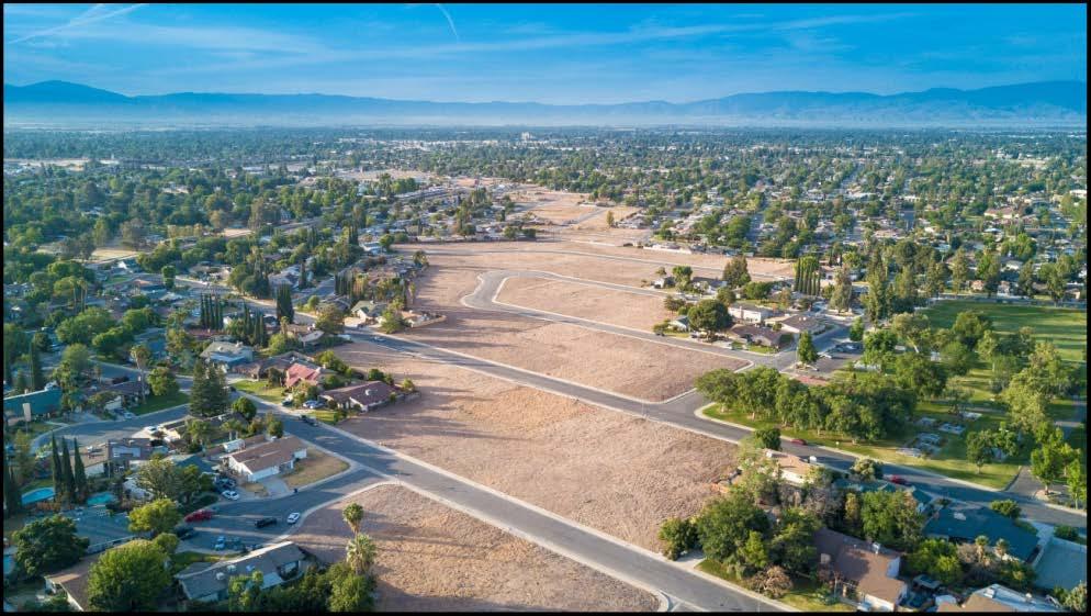
8 Kern s Emerging West U.S. Freight Hub Complex Wonderful Industrial Park/ Freight Hub South Delano Tejon Ranch Commerce Center


9 South Delano Union Pacific Cold Connect, Sears Logistics, Wonderful Halos Citrus Processing Woollomes Ave Wonderful Halos Citrus Schuster Rd Sears Logistics 1994 Union Pacific Cold Connect Food Train Terminal 2009 Browning Rd Pond Rd


10 Tejon Ranch Commerce Center Catepillar DC 2013 Tejon Outlets 2013 MJR DC 2017 Famous Footware DC 2011 Wonderful Co DC 2005 Dollar General DC 2012 IKEA DC 2003

11 Shafter West U.S. Freight Hub & Wonderful Industrial Park miles of rail sidings owned by City of Shafter, longest is 2 miles w/ switches to main line at both ends. Essendant DC 2018 Bakers Hughes 2012 Phase I Complete Container Spaces Ross Dress For Less DC 2015 FedX Ground 2016 Bakersfield Pipe & Supply 2015 Weatherford Corod Mfg Plant 2012 MRC Global 2017 American Tire DC Smith-Mi Swaco 2012 Formica DC 2006 Target DC 2003 Hillman Group DC 2004 To 2009 To BNSF Mainline
 Planned Industrial Planned Industrial Existing Container Yard (CY) N.W. Bakersfield To LA/LB Ports and points East To To LA/LB Ports and points East")
12 Shafter West U.S. Freight Hub 12 Square Miles of Vacant Industrial/Commercial land To To Port of Oakland Downtown Shafter Proposed Industrial Expansion To Port of Oakland Shafter s 2 Planned Intermodal Containerized Freight Facilities Wonderful Industrial Park Planned Industrial 7 th Standard Rd (4 lanes) Planned Industrial Planned Industrial Existing Container Yard (CY) N.W. Bakersfield To LA/LB Ports and points East To To LA/LB Ports and points East
13 Basic Concept: Container Load Matching Before Project After Project Distribution Center Ag Processing Facility Distribution Center Ag Processing Facility Inland Container Yard Seaport Seaport
14 More Efficient Load Matching Variations A. Virtual Container Yard (needs public cloud supply chain solutions and/or block chain solutions) Distribution Center Empty Ag Processing Facility B. Exchange Empty Container/Chassis for needed ocean carrier type, and/or for cleaning Distribution Center Ag Processing Facility C. Rail Shuttle Concept Challenge (Need 300 containers per ship headed to inland port and similar volume of exports going back with competitive pricing from a class 1 RR and/or additional government investment) Distribution Ag Processing Center Empty Facility Inland Container Yard Inland Intermodal Container Yard Seaport Seaport Seaport

 2008 analysis")
15 Rail vs. Truck = 10 Fold GHG Reduction Waterborne Rail Reduction in trucking BTUs/ton-mile Heavy Duty Truck Rail vs. Truck = 7 Fold NOX Reduction (Shafter Example) 2008 analysis


16 Average Savings = 127 truck VMT per container trip = Less Emissions + Less Wear & Tear on Roads + Less Congestion


17 The Bottleneck is at the Ports How do you get 300 containers bound for DCs in the Central Valley from a single ship at the right pier with access to the right rail line, that is also willing to take on export containers from the Central Valley?


18 To Get Industry s Interest Talk Market Share/Branding Government Fees & Incentives vs. Protecting Business Market Share Government Funds Marketing Campaign for Consumers to Purchase Products Shipped Sustainably (Like SmartWay or Energy Star, sort of a LEED program for goods movement). Menu Based Approach - Let Business Pick Which Sustainable Shipping Strategies They Want to Use Participating Businesses are licensed to Market their Products as Being Shipped the Smart Way or Green Seal Certified. Government Certification Regularly For Use of Marketing & Promotional Materials Other branding and certification resources proprietary product for supply chain tracking EPA Branding Used by Walmart Trucking Efficiency is a an industry organization focused on reducing fuel use by the trucking industry. trucking-efficiency/ Non- Transportation Certification Branding Examples
19 Highway Infrastructure Projects Supporting More Sustainable Goods Movement
 Shafter")
20 West Corridor Bypasses Busiest Segment of 99 South of Sacramento Shifts 3,000 Trucks Per Day From 99 to I-5 South of Bakersfield (partially funded) Shafter Freight Hub

21 Centennial Corridor Project Phases: Re-designation of SR 58 Shafter Freight Hub North Corridor West Corridor

22 Centennial Project at the North-South/ East-West Crossroads Connecting National Trucking Corridors I-5, I-15, I-40 & Others Adapted from hwa.dot.go v/freigh T/freight_a nalysis/faf/i ndex.htm 2040


23 SR 58: 1000 More Trucks/Day in Last 7 yrs. Bay Area s Share of Trucks Doubles 7,587 Trucks/Day Caltrans Truck AADT 20% Bay Area ,588 Trucks/Day Caltrans Truck AADT 10% Bay Area (15% Westbound, 6% Eastbound) 2016 Big Data Analysis Truck Diversion Study _truck_study.pdf

24 Centennial Corridor Project Will Reduce Travel between I-40/I-580 by an Average of 12 Mi. for 8000 Trucks Per Day by 2038 Distances based on Google Maps - March com/maps/dir/calif ornia+58,+californi a/interstate+580,+c alifornia/

25 Centennial Connector Project for Major Intermodal Goods Movement Region Kern Council of Governments- March 2016

26 Centennial Connector Project: Shifts 1,500 trucks Per day off the Busiest Segment of SR 99 South of Sacramento to I-5, Including Another 100 Trucks Per Day N. of Bakersfield to I-5 and up to 8,000 T.P.D. by future

27 Connecting Environmental Justice (EJ) Community with a Class I Bike Trail to Recreational Parkway, University and HSR Station Central Bakersfield Major Land Uses Kern Council of Governments- March 2016 EJ Areas based on U.S. EPA EJSCREEN -
28

29 Emerging Cleaner Trucking Fleet Technologies Frito-Lay has 40 Tesla Trucks on Order!
30 Other Kern Freight Related Projects Preserve and expand existing Rail Freight (SJVRR, Borax, Soda Ash, Ag Chemicals) 58 Truck Climbing Lanes near 223 and Interchange at W. bound Weigh Station 58 Truck Stops at E. Tehachapi Blvd Interchange Ramp Improvements I-5 Request to Move S. Bound Truck Stop at Tejon W.I.M. Facility. I-5 Truck Climbing Lanes at Grapevine South Metro Bakersfield Corridor Connecting I-5, 99 & 58 (adopted specific plan line) 3 more Rail Siding Turnouts on UP/BNSF Tehachapi Pass Senator Beall Proposal for HSR to Build Separate Parallel Tunnel over Tehachapi Pass for Conventional Freight Trains to Reduce Freight Travel Time and Generate Revenue Many other projects.