Sustainable Transportation & Land Use Integration Study
|
|
|
- Caitlin Joseph
- 5 years ago
- Views:
Transcription


1 Sustainable Transportation & Land Use Integration Study Stakeholders Group Meeting Two Includes additions made after meeting March 28, 2011
2 Hot Topics: Emerging themes, technologies, and techniques
3 Outline Emerging Values and Themes Emerging Opportunities Knowledge Base Planning and Analysis Tools Transit Modes and Services Management Strategies Before You Dot
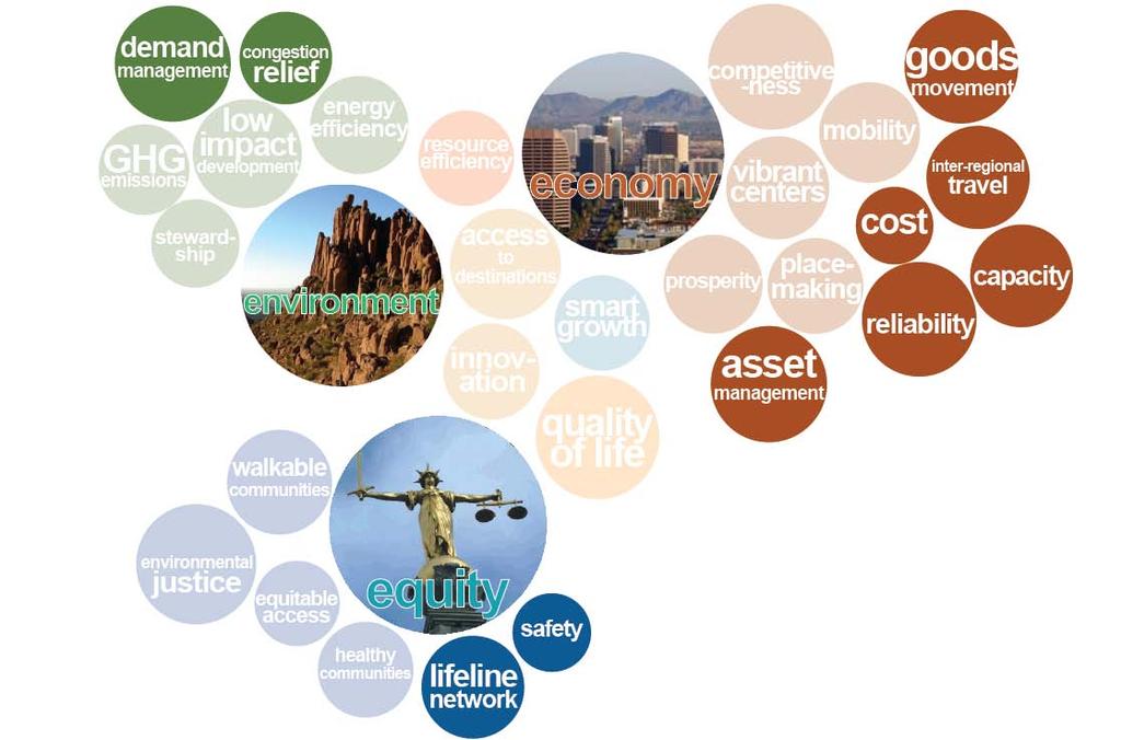
4 Emerging Values The Three E s Environment Economy Sustainable Transportation Equity
5 Emerging Themes

6 Emerging Themes Implications Focus on walkable communities Search for long-term value Premium on solutions with co-benefits Questioning established techniques, creating new ones
7 Established Themes
8 Emerging Themes
9 Emerging Opportunities Knowledge Base Planning and Analysis Tools Transit Modes and Services Management Strategies


10 Knowledge Base: Research Findings


11 Knowledge Base: Research Findings
12 Knowledge Base: Research Findings National data from CTOD on station areas: Number of residents and workers Density Transit accessibility Household income Monthly housing and transportation costs Commute mode Vehicle Miles Traveled and more


13 Knowledge Base: Research Findings

14 Knowledge Base: Research Findings

15 Knowledge Base: Research Findings


 2640 block")
16 Knowledge Base: Research Findings Fatalities from road accidents decrease as roadway network connectivity increases Odds of Dying in a Road Accident based on Intersection Density* *Given that an injury occurred (Data from Dr. Norman Garrick, University of Connecticut and Dr. Wesley Marshall, University of Colorado- Denver) 2640 block perimeter 1920 block perimeter 1125' block perimeter
17 Knowledge Base: Top 10 Research Findings 1.Regional accessibility is more important than local design 2.Strategies work in bundles 3.Pricing is powerful 4.Congestion stimulates non-drive trips 5.Land use effects take time
18 Knowledge Base: Top 10 Research Findings 6. Non-work trips are increasing even in peak hour 7. Connectivity has many benefits 8. TOD is under-supplied 9. Density matters, but isn t enough 10.Job location and density are key
19 Knowledge Base: Top 10 Again 1. Regional accessibility 2. Strategy bundles 3. Powerful pricing 4. Congestion Good 5. Land use effects slow 6. More non-work trips 7. Connectivity good 8. TOD under-supplied 9. Density matters 10.Jobs are key (Also discussed at workshop): Integration at all scale

20 Planning and Analysis Tools Travel Demand Modeling Sketch Planning Models Place Types Street Types Performance Measures Form-based Codes LEED-ND Certification
21 Tools: Travel Demand Modeling Overcoming limitations of conventional 4-step models including: Insensitivity to small area characteristics Insensitivity to design features Introducing activity-based models simulating household decision making Combining different modeling techniques: Travel demand modeling Operational simulations Scenario planning Using results as input to decision processes


22 Tools: Scenario Planning Travel demand modeling with increased sensitivity to design features Applications at all scales

23 Tools: Performance Measures Transportation-Focused Cross-cutting
24 Tools: Transportation Performance Measures Comprehensive Plan Performance Measures: Pasadena, CA Livability Pedestrian Environmental Quality Index (PEQI) Bicycle Environmental Quality Index (BEQI) Sustainability Vehicle Miles Traveled Mode Share Housing + Transportation Cost index Accessibility Walk Score Driver experience Travel Time on Select Routes
25 Tools: Performance Measures Cross-cutting
26 Tools: Place Types Classify districts, towns, cities and larger areas to identify their land use and transportation system characteristics For making investment, planning and management decisions that support sustainable transportation


27 Tools: Place Types TOD Context Sensitive Solutions Form Based Codes Blueprint Planning


28 Tools: Place Types / TOD


29 Tools: Place Types / TOD


30 Tools: Street Types Classify, design and manage streets based on: Modal accommodation Connectivity: local, city, region Setting for urban activity Function as public spaces Other

31 Tools: Form-based Codes Graphically address: Building facades Building massing and form: Regulate streetscapes and blocks Practice based on principles of urbanism


32 Tools: LEED-ND Pre-reqs and Points 12 prerequisites, such as: Smart Location Walkable Streets Compact Development Connected and Open Community Certified Green Building

33 New Opportunities: Transit Modes and Services High Speed Rail Bus Rapid Transit (full-on and hybrid) Modern Streetcar Clean transit vehicles: Electrification of diesel rail Electric/CNG/hybrid buses Carshare Bikeshare

34 Transit Modes and Services Distance and stop spacing by transit mode over 10-Minute Travel Time / Modern Streetcar Feet 1,000 Feet

35 Bus Rapid Transit Fast Exclusive lanes Signal priority Prepaid fares Easy on-and-off Easy to use Simple route Few stops Branded vehicles Rail-like stations with amenities Feeder network Coordinated land use planning

36 High Speed Rail Convenient Connects city centers Competitive with air travel for interregional trips Economic Impact Brings major employers and sources of investment closer together

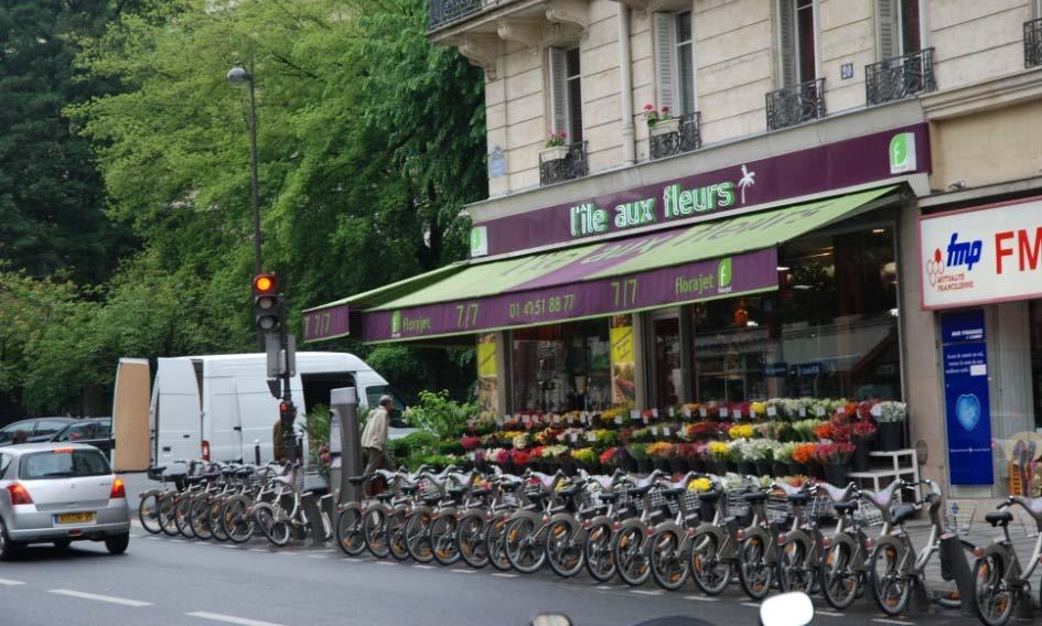
37 Carshare and bikeshare


38 Clean(er) fuels and vehicle technologies Urban Quality Benefits Environment Affordability Parking


39 Management Strategies ITS Traffic calming Shared space Congestion Pricing Parking Management More

40 Intelligent Transportation Systems Transportation Camp Brainstorming: how to use recent advances in technology to improve mobility more immediately and at a lower cost than has ever been possible in the past Web 2.0 Mobile computing Open source software Open data and APIs Spatial analysis

41 Traffic Calming Techniques: Speed tables, speed humps Narrow travel lanes Curves

42 Space and Time Management Downtown Streetscape: Livermore, California Image: Freedman Tung & Sasaki

43 Space and Time Management

44 Shared space Reducing regulation and separation

45 Parking Management Rationalizing parking - Pay for use - Smart pricing: increasing availability when you need it - Easy payment - Revenue spent in district where collected

46 Emerging Themes
47 Dot Choice On the Menu How to Dot Dot Talk Show
48 Before You Dot What should be the defining features of Sustainable Transportation in the MAG region? Are values, themes or tools most important? What ideas are compelling and easily communicated? What will help the region move forward with investigations, decision-making, and successful implementation?

49 Dot Menu Included at the Workshop

50 Dot Menu Included at the Workshop (continued)
51 Dot Menu What we missed (added at the workshop) Themes Higher Density High Density Corridors Bike Paths/Facilities Land Use Controls Cost Effective Asset Management Higher Density Bike Paths/Facilities High Density Tools and Techniques Bicycle and Pedestrian Network Public Private Partnerships Local Bus Service