TRANSPORTATION RESEARCH BOARD. A New Functional Classification System to Aid Contextual Design. Monday, February 5, :00-3:30PM ET
|
|
|
- Bethany Woods
- 5 years ago
- Views:
Transcription
1 TRANSPORTATION RESEARCH BOARD A New Functional Classification System to Aid Contextual Design Monday, February 5, :00-3:30PM ET

2 The Transportation Research Board has met the standards and requirements of the Registered Continuing Education Providers Program. Credit earned on completion of this program will be reported to RCEP. A certificate of completion will be issued to participants that have registered and attended the entire session. As such, it does not include content that may be deemed or construed to be an approval or endorsement by RCEP.
3 Purpose Discuss NCHRP Report 855. Learning Objectives At the end of this webinar, you will be able to: Describe the concepts of the Expanded Functional Classification System Identify required steps for implementing classification Describe design flexibility within the classification Understand how to balance multimodal solutions
4 NCHRP Report 855: An Expanded Functional Classification System for Highways and Streets NCHRP Project 15-52
5 NCHRP is a State-Driven Program Sponsored by individual state DOTs who Suggest research of national interest Serve on oversight panels that guide the research. Administered by TRB in cooperation with the Federal Highway Administration.


6 Practical, ready-to-use results Applied research aimed at state DOT practitioners Often become AASHTO standards, specifications, guides, syntheses Can be applied in planning, design, construction, operations, maintenance, safety, environment
7 Today s Speakers Nick Stamatiadis, University of Kentucky John Donahue, Washington State DOT Brian Shunk, Pennsylvania DOT Fred Dock, City of Pasadena, CA
8 Implementing the Expanded Functional Classification System at WSDOT John P Donahue, PE, AICP Design Analysis and Policy Manager February 5, 2018
9 Overview Practical solutions is the framework The evolution of context and design policy Adapting the expanded functional classification An example of context and performance 2


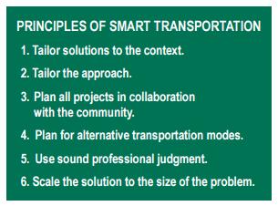
10 A path forward in a congested world: Practical Solutions What is Practical Solutions? Addressing congestion within available resources Creating transportation investments rather than just fixing a problem Emphasizing stewardship /state of good repair not just delivering projects Operating safely, efficiently, managing demand... then adding capacity Focusing on... the Right Investment... in the Right Location... at the Right Time 3
11 A framework for investment decisions Policy Direction Manage Assets Identify Needs Assess Alternative Strategies Refine Solutions Assign Resources Develop Funded Solutions Implement Solutions RCW Results Washington Results WSDOT strategic plan Operate and maintain multimodal system and agency resources to meet performance objectives at the lowest cost Identify performance targets for all policy goals Understand critical corridors Build strategies with partners Consider least cost strategies first Integrated scoping Safety Operations Demand Management Capital Other Investments reviewed across funding programs to synchronize for best performance Solutions are defined addressing performance gaps (at the lowest cost) Implement or construct Practical Planning Practical Design 4
12 Evolution of Design Policy 5
")

13 Design Policy (prior to 2015) Design Matrices Past practice 6
 Basis of")

14 Design Policy (Today) Basis of Design Basis of Design Roadmap Current Practice

15 Design Policy (new in 2017) Basis of Design Evaluate Design Controls Consider the Context 8
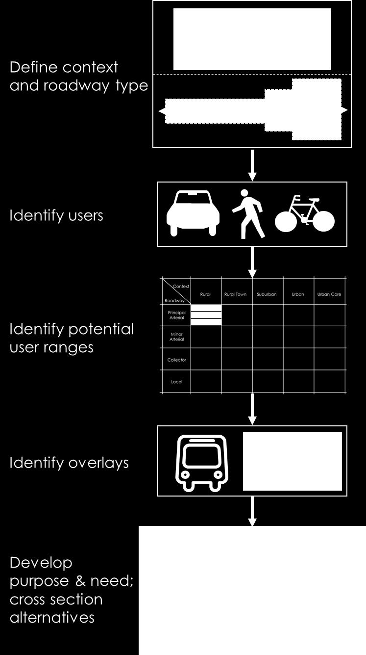
16 Using the Expanded Functional Classification at WSDOT Context Modes Design Control Land use Rural Suburban Urban Urban core Transportation Vehicles Bicycles Pedestrians Freight Transit Design Considerations Freight Transit Modal Accommodation Vehicles Bicycles Pedestrians Modal Priority

17 Using the Expanded Functional Classification Land use Rural Suburban Urban Urban Core
18 Using the Expanded Functional Classification Factor Land Use Density Density Density Density Setback Setback Others Criteria Land uses within ½ mi of roadway Housing units / acre Jobs / acre Intersections per sq. mi. Typical building height Typical building setback Parking (on street or off street) Project specific Context Indicators

19 Using the Expanded Functional Classification Transportation Route types (Vehicles)
20 Using the Expanded Functional Classification Transportation Route Type Citywide Connector Neighborhood Connector Local Connector Description Links major activity centers Regional bike route Significant commute/ recreational route. Feeds citywide connectors Links local activity centers Feeds higher order connectors Provides internal neighborhood connections Shorter length Route types (Bicycles)
21 Using the Expanded Functional Classification Transportation Route Type Description P-1 Pedestrians are or absent P-2 Low volume measured in peds per day P-3 Medium volume measured in peds per hour P-4 High volume could be measured in peds per subhour Route types (Pedestrians)

22 Using the Expanded Functional Classification Modal Accommodation The Initial Modal Accommodation Level
 Freight corridor Local SOV reduction goal Availability of transit Presence of bikes and peds Other Final Factors affecting")
23 Using the Expanded Functional Classification Modal Accommodation Adjusting the Vehicle Accommodation Level Initial Traffic speed Mobility measure (LOS) Freight corridor Local SOV reduction goal Availability of transit Presence of bikes and peds Other Final Factors affecting design

24 Using the Expanded Functional Classification Modal Accommodation Adjusting the Bicycle Accommodation Level (Final) Initial Bicycle planning Destinations Transit stops Alternative routes Vehicle speed Truck/Vehicle/Bike volumes Other Factors affecting design Final

25 Using the Expanded Functional Classification Modal Accommodation Adjusting the Pedestrian Accommodation Level (Final) Initial Pedestrian planning Destinations Transit stops Block length Vehicle speed Pedestrian volumes Other Factors affecting design Final
26 Basis of Design Context in 2015
27 Basis of Design Context in 2017

28 Context and Modal Accommodation Report 16

29 Context and Modal Accommodation Report 16
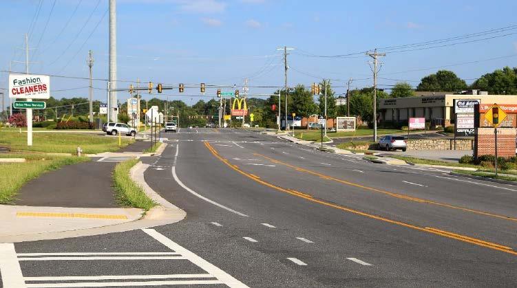
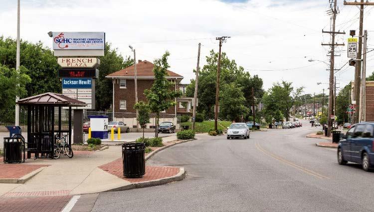
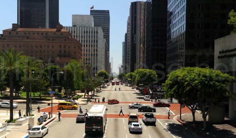
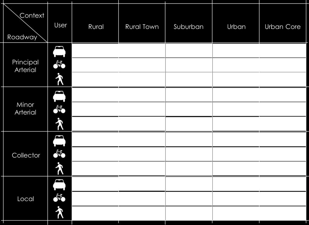
30 Context Documentation Workflow Basis of Design Task Context / Modal Priority needed SME work Context and Modal Accommodation Report (CMAR) CMAR Rollup Basis of Design Section 2 and 3 Concurrence Project Advisory Team 17

31 Basis of Design Example: Basis of Design roles
32 Using the Expanded Functional Classification Design Policy Highlights Context and modal priority has been updated Data sources and tools (GIS and local plans) Context and Modal Accommodation Report template Tools/guidance are integrated with Basis of Design Training underway Reviewing additions/changes for 2018

33 Supporting Multimodal Design Modal Accommodation and Priority
34 Implementing the Expanded Functional Classification System at WSDOT John P Donahue, WSDOT Development Division Design Analysis and Policy Manager (DonahJo@wsdot.wa.gov) Karena Houser, WSDOT Multimodal Planning Division Planning Innovations Manager (HouseK@wsdot.wa.gov) Kyle Miller, WSDOT Multimodal Planning Division Transportation Planning Specialist (MilleK@wsdot.wa.gov )
35 NCHRP Development of a Context Sensitive Functional Classification System for More Flexibility in Geometric Design Nikiforos Stamatiadis University of Kentucky
36 Research Objective Review traditional functional classification scheme Revise functional classification scheme to facilitate contextual design Examine potential impacts of revised scheme on other areas
37 Existing Classification Shortcomings Lack of Land use recognition Balancing modal needs Recognition of suburban context Recognition of rural community Main Streets Encouragement of generalized design solutions
38 New Classification Objectives Primary Expand context definition beyond urban and rural Allow for multi-modal prioritization/ accommodation Secondary Consider function in the overall network Ease of use Relate directly to FHWA/AASHTO functional classification
39 What Should FCS Determine? Roadway network needs Contextual constraints User accommodations Vehicular speeds and mobility Bicycle separation Pedestrian activity Special use needs (Transit/Freight)


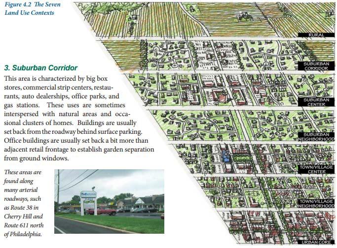
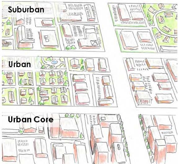
40 Rural Context Types Rural Town Five contexts Defining elements Density Land use Building setbacks Suburban Urban Urban Core
41 Roadway Types Existing terms Defining element Network function Connectivity Expressways/Freeways* Principal Arterial Minor Arterial Collector Local Corridors of national importance providing long distance travel Corridors of regional importance connecting large centers of activity Corridors of local importance connecting centers of activity Roadways providing connections between arterials and local roads All other roads
42 Bicycle Networks Network connectivity Citywide Connector Neighborhood Connector Local Connector Citywide/Regional connections or connections to major activity centers or regional bike routes stretching over several miles attracting high bike volumes Neighborhood or sub-area connections allowing access to higher order facilities or local activity centers Local connections of short length providing internal connections to neighborhoods or connect to higher order facilities
43 Pedestrian Networks Individual area context Localized facilities Urban areas across contexts Suburban areas
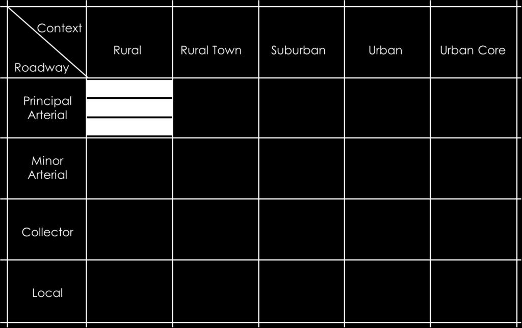
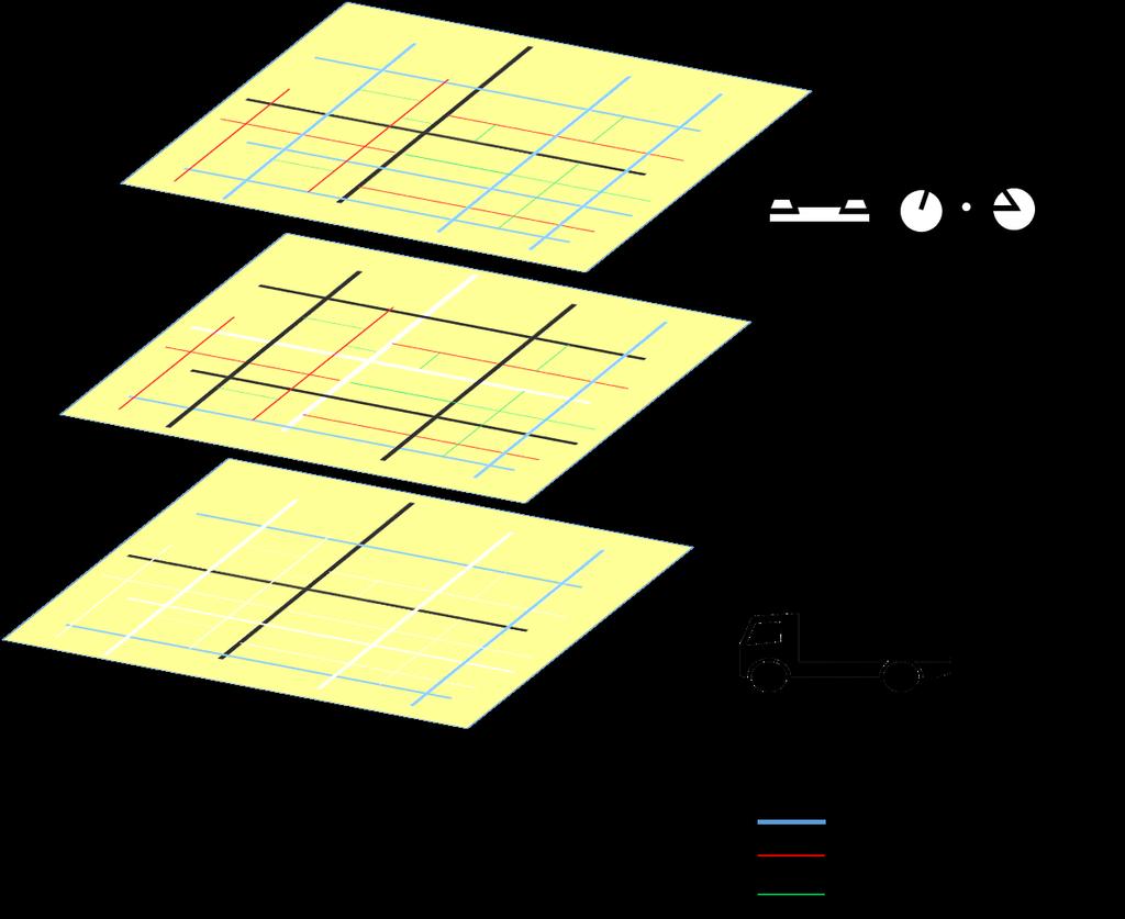
44 Expanded-FCS Matrix
45 Driver Accommodation Speed Low Medium High Access levels Low Medium High Mobility levels Low Medium High


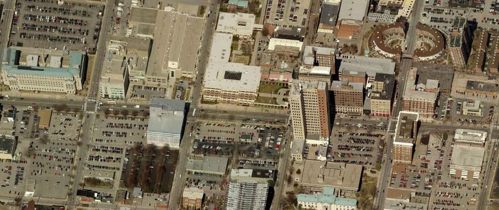
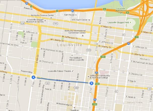
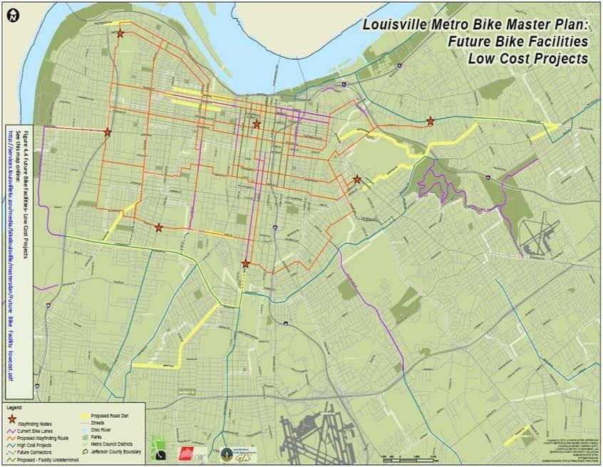
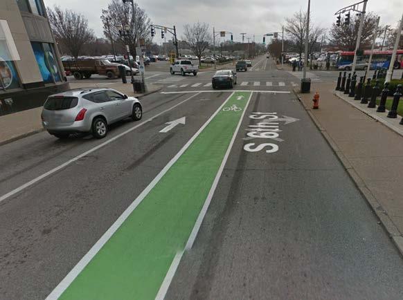
46 Expanded-FCS Driver Accommodation Speed, Mobility and Accessibility levels: H: High; M: Medium; L: Low

47 Expanded-FCS Driver Accommodation Speed, Mobility and Accessibility levels: H: High; M: Medium; L: Low
48 Bicyclist Accommodation Separation L: Low shared use M: Medium dedicated space H: High separated facility
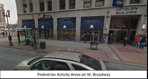
49 Pedestrian Accommodation Traffic P1 (Rare/Occasional) P2 (Low) P3 (Medium) P4 (High) Sidewalk width * Minimum Wide Enhanced Separation
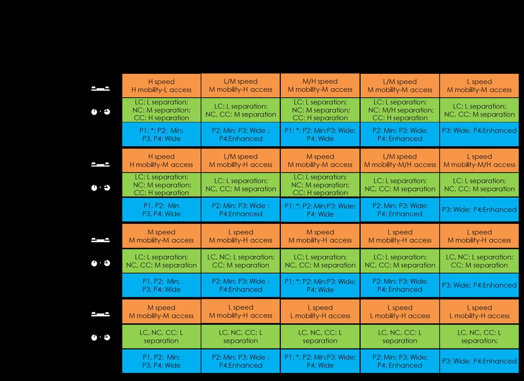
50 Expanded-FCS Matrix
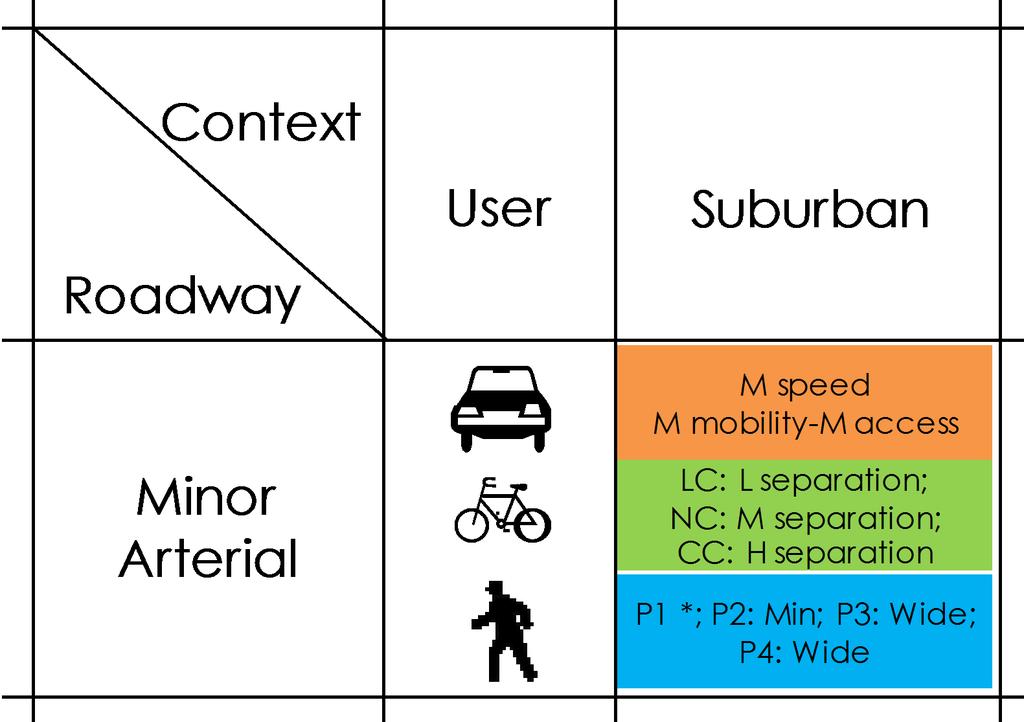
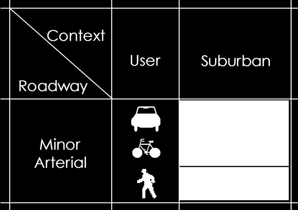
51 Expanded-FCS Composite Cell
52 Overlays
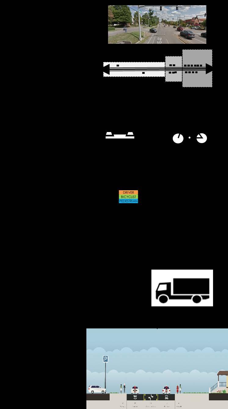
53 Application


54 While it is easily understood that all users must be accommodated within the transportation system, all roads cannot be all things to all people.
55 Design Considerations and Interactions Caution regarding use of paired minimum design elements Evaluate alternate routes Lower target speeds/mobility
56 Case Study - Louisville, KY
57
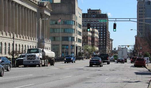
, and residential uses; offstreet parking and")
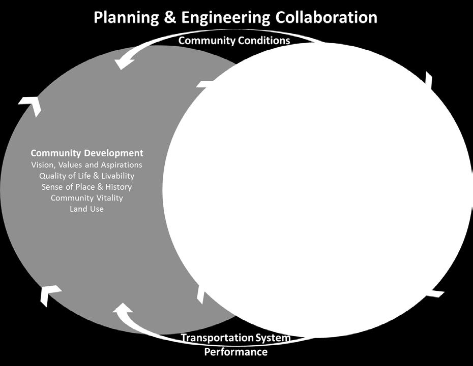
58 Milepoint Density Land use Setbacks Expanded FCS High density, multistory and high-rise buildings; highest density within the corridor Commercial, institutional (court houses and government offices), and residential uses; offstreet parking and parking structures Small setbacks with wide sidewalks and enhanced pedestrian facilities (benches, street furniture and pedestrian plazas) Urban Core
59
60

61 Truck route Bus routes

62 Existing Cross Section
63 Expanded FCS Cross Section
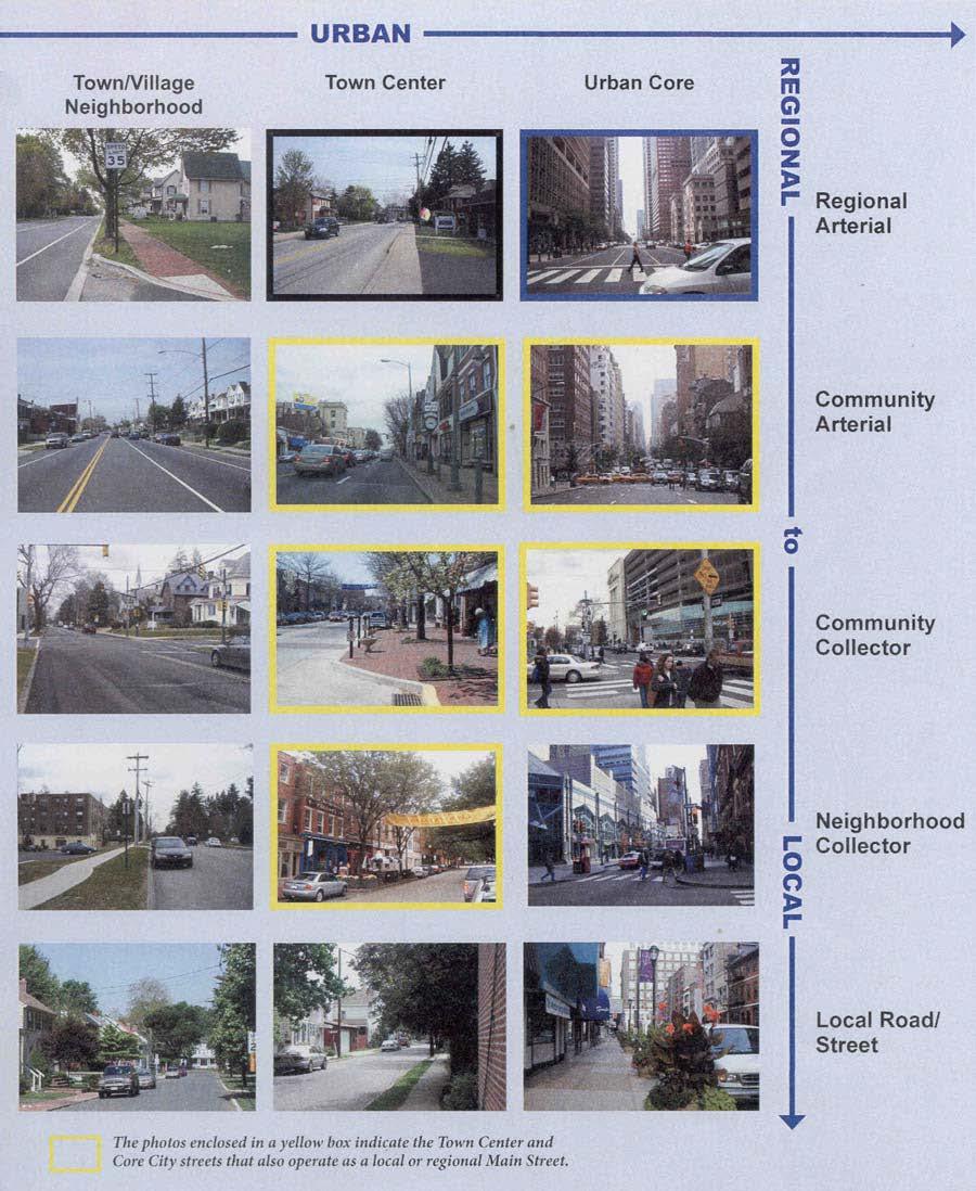
64 Status Web document (NCHRP 855) Green Book update Context concepts Discussion Chapter 1 Pilot state implementation Other guides ITE CSS Practitioner s Guide FL DOT Complete Streets Handbook
65 Questions


66 TRB Webinar: A New Functional Classification System to Aid Contextual Design Pennsylvania s Approach to Contextual Integration February 5, 2018

67 THE ROAD TO RISK MANAGEMENT EXPANDED FUNCTIONAL CLASSIFICATION SYSTEM UNDERSTANDING THE CONCEPT


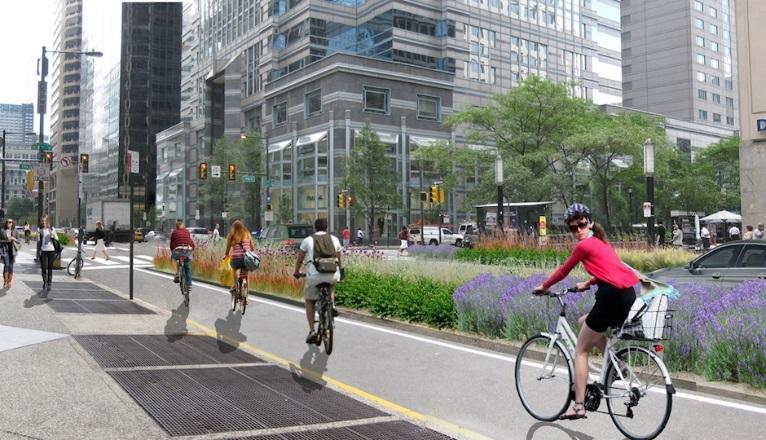
68 What Does an Arterial Look Like? One Size Fits All Photo courtesy of STUDIO BRYAN HANES

69 Understanding the Concept The Concept - Context Based Multimodal Approach Requires understanding of the function of the roadway within its current and expected future context and the needs of the potential roadway users.


70 PennDOT s Context Based Design Goal Safety, Access, and Mobility Livability and Context -preserving scenic, aesthetic, historic, and environmentally sensitive areas Enhance the Quality of Life for Pennsylvania Communities

71 PennDOT s CSS History Discussed: - A collaborative project development process - Community Involvement - Flexibility in Design - Project Implementation & Network Maintenance and Operation - Safety and Risk Management Guide Book and Statewide Training in 2008


72 PennDOT s CSS History Published 2008 Integrates planning and design of streets to foster sustainable and livable communities
73 2-5 Smart Transportation Guidebook Context

74 Design Manual Context

75 Selecting Design Values Table for each classification Regional Arterial Community Arterial Community Collector Neighborhood Collector Local Road/Street


76 EXPANDED FUNCTIONAL CLASSIFICATION SYSTEM STEPS TO IMPLEMENTATION

77 Know What is Needed for an Effective Transportation Network Enable safe, convenient and comfortable travel for all residents Improve network connectivity for all modes and address gaps Focus on providing access to key destinations Align project designs with the goals articulated in state, regional, and local plans

78 Involve Planning Partners

79 Retool Geometric Design Manual

80 Statewide Team Every District and Central Office - Portfolio Managers, Plans Engineers, Design Services Engineers, Liaison Engineers/Project Managers, Roadway Design Engineers, and Project Development Engineers FHWA Pennsylvania Division


81 Context Change From 7 to 5 Contexts

82 Functional Classification Limited Access Freeway Regional Arterial Community Arterial Community Collector Neighborhood Collector Local Road/Street Limited Access Expressway Arterial Collector Local Road/Street

83 EXPANDED FUNCTIONAL CLASSIFICATION SYSTEM UNDERSTANDING DESIGN FLEXIBILITY

84 Statewide Discussion PennDOT Project Managers Meeting November 6 7, 2017


85 Discussion Item Typical Sections No dimensions Cross slope determined by drainage needs Mode accommodation as needed

86 Discussion Item Vehicle Table

87 Discussion Item Shoulder Width
88 Discussion Item Project Documentation Flexibility creates an environment for designers to use engineering judgement rather then picking numbers. Flexibility creates the need to Document the Decision Making Process - Documenting and communicating assumptions and decisions reduces misunderstandings and wasted work Provide a clear understanding of the project Understand who is responsible for the final decision Document decisions and why they were made. If approvals are required, obtain them and keep with the documentation. How is your documentation done?

89 EXPANDED FUNCTIONAL CLASSIFICATION SYSTEM BALANCE MULTIMODAL SOLUTIONS
90 Multimodal Decision Correlation Matrix Overlays* for: Bicycle Pedestrian Transit Freight Plain People Community Considerations Complete Rewrite New * Overlays may not exactly replicate design parameter tables


91 Bicycle Considerations VOLUME vehicles per day 8k 7k 6k 5k 4k 3k 2k 1k 5' 4' 3' 2' 3' SPEED miles per hour Rural, Rural Town, and Suburban Bicycle Considerations Rural Town, Urban, and Urban Core Bicycle Considerations

92 EXPANDED FUNCTIONAL CLASSIFICATION SYSTEM IMPLEMENTATION CHALLENGES


93 Challenges to the Change Getting past the That s the way it s always been done. Creating an environment for designers to use engineering judgement rather then picking numbers. Attaining by-in on engineering criteria. Reaching all audiences for training.

94 Lessons Learned Get upper management by-in from the outset. Use a control group. Be ready to address unanticipated issues. It takes longer then you think!
95 Contact Information Brian E. Shunk, P.E. Project Development Engineer PennDOT - Bureau of Project Delivery 400 North Street 7 th Floor Harrisburg, PA Phone: bshunk@pa.gov


96 Today s Participants Fred Dock, City of Pasadena, fdock@cityofpasadena.net Nikiforos Stamatiadis, University of Kentucky, nick.stamatiadis@uky.edu John Donahue, Washington State Department of Transportation, donahjo@wsdot.wa.gov Brian Shunk, Pennsylvania Department of Transportation, bshunk@pa.gov
97 Get Involved with TRB Getting involved is free! Join a Standing Committee ( Become a Friend of a Committee ( Networking opportunities May provide a path to become a Standing Committee member For more information: Create your account Update your profile
98 Get involved with NCHRP Suggest NCHRP research topics Volunteer to serve on NCHRP panels Lead pilot projects and other implementation efforts at your agency For more information:
99 Receiving PDH credits Must register as an individual to receive credits (no group credits) Credits will be reported two to three business days after the webinar You will be able to retrieve your certificate from RCEP within one week of the webinar