Global Monitoring for Environment and Security
|
|
|
- Beverly Wilkins
- 5 years ago
- Views:
Transcription
1 Global Monitoring for Environment and Security Dr. Stephan Lechner Director Joint Research Centre The European Commission s in-house science service Serving society, stimulating innovation, supporting legislation
2 GMES is a joint initiative of the European Commission and the European Space Agency, which aims at achieving an autonomous and operational Earth observation capacity. Sentinel 1: all-weather, day and night radar imaging for land and ocean services. Launch in 2013 Sentinel 2: high-resolution optical imaging for land services and information for emergency services. Launch end 2012 Sentinel 3: ocean and global land monitoring services. Launch end 2012 Sentinel 4: embarked as a payload upon a Meteosat Third Generation Satellite, will provide data for atmospheric composition monitoring. Launch in 2017 Sentinel 5: data for atmospheric composition monitoring. It will be embarked on a post-eumetsat Polar System spacecraft. Launch in 2019 Sentinel 6: high precision altimetry missions following the Jason-2 satellite. GMES security is aimed at civil security. A considerable stimulus for the economy with value added services developed on an open platform. 2
3 GMES Budget Between 2014 and 2020 GMES will require an estimated budget of 4,455 M USD, of which: 831 M USD for the services; 267 M USD for the in situ component; 3,356 M USD (ESA estimates) for the space component. 3


4 The GMES security pilot project: G-MOSAIC Duration: Consortium: >30 partners Total budget: 11,6 M USD Aims: Support Intelligence & Early Warning Contributing to the analysis of the causes leading to regional crises, such as weapons proliferation, fight for natural resources, population pressure, land degradation, and illegal activities. Support Crisis Management & Operations Contributing to support the planning for EU intervention during crises, the EU intervention itself and citizen repatriation during crises, the crisis consequences management, reconstruction & resilience. 4

5 GMES Initial Operations: Emergency Management Services Rush mode products On demand Standardized Hours-days Reference maps Disaster response maps Delineation maps Grading maps event Validation Non-rush mode products On demand Based on user needs Weeks-months Reference maps Pre-disaster situation maps Examples: Hazard exposure Risk status Evacuation plans Reference maps Post-disaster situation maps Examples: Post disaster needs assessment Reconstruction monitoring IDP monitoring 5


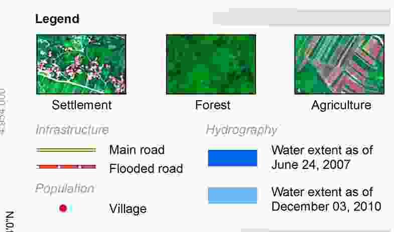
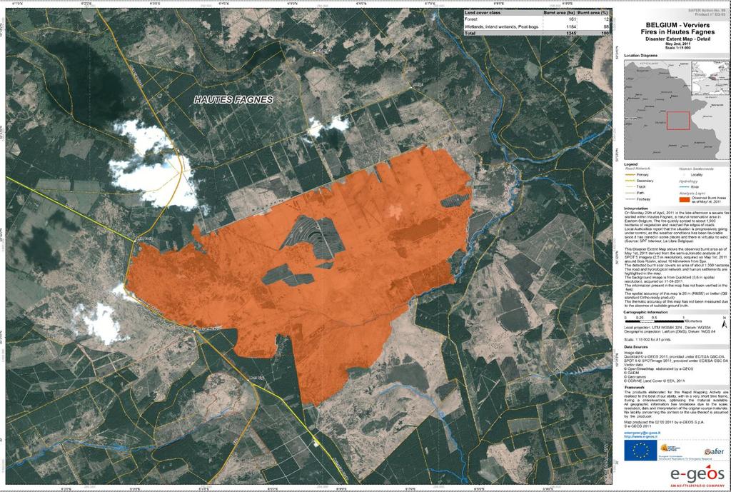
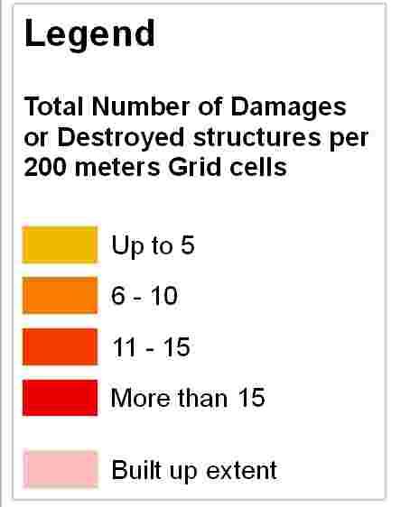
6 Rush mode products examples 6


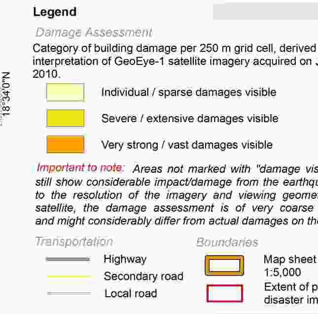
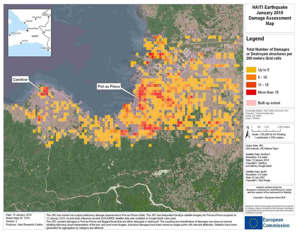
7 Non-rush mode products examples Postdisaster map IDP camps Mogadishu, Somalia, 2011 Pre-disaster map Hazard Dike failure scenario, Hunza River, Pakistan April / May
8 Economic & societal benefits of GIO-EMS Emergency response Support to coordination between actors Support to logistics Dimensioning the distribution of effort +effectiveness Preparedness Hazard & exposure analysis risk analysis Risk analysis better planning Risk analysis prevention measures Recovery Prioritization of intervention better/more efficiency Quantitative damage estimation dimensioning of donations Monitoring of reconstruction effectiveness of donation use } } +efficiency minimize loss of life and damage 8

9 GMES plans for Key priority areas supported by GMES: Marine Services Emergency Response Land Services Security Atmosphere Services 9
10 JRC Conclusions: From Science to Policy JRC has developed a considerable know-how in satellite images automated information extraction algorithms. JRC is strongly contributing to automated crisis management by offering specialized products and services developed together with top scientific and institutional partners, and with the involvement of the relevant users communities. Remote sensing is an essential asset for security; the JRC analytical and scientific work has significantly improved the exploitation of its potential. 10