TABLE OF CONTENTS PAGE NUMBER. Executive Summary Why Variable Pricing? What Was Studied? User Surveys Air Quality Analysis User And Equity Analysis
|
|
|
- Bertina Nelson
- 6 years ago
- Views:
Transcription
1


2
3 TABLE OF CONTENTS PAGE NUMBER Executive Summary Why Variable Pricing? What Was Studied? User Surveys Air Quality Analysis User And Equity Analysis Findings Scenario 1 Base Case Scenario 2 Detoll Scenario 3 Cruise Card Discount Scenario 4 Time-Of-Day Discount Scenario 5 Combined Cruise Card/Time-Of-Day Discount Conclusions ES-1 ES-2 ES-3 ES-3 ES-5 ES-6 ES-7 ES-7 ES-7 ES-7 ES-8 ES-8 ES-8 Chapter 1 Introduction 1-1 Purpose and Scope 1-1 Report Structure 1-3 Chapter 2 Existing Conditions 2-1 Traffic Profile 2-1 Daily Traffic Variations 2-1 Hourly Traffic Variations 2-2 Distribution of Traffic by Vehicle Class 2-4 Mainline Plaza Operations 2-5 Transaction Time Data 2-5 Mainline Plaza Traffic Queuing 2-7 Traffic Count Data 2-10 Ramp Counts 2-10 Chapter 3 Market Survey 3-1 Description of Survey 3-1 Summary of Travel Patterns And Trip Characteristics 3-3 Travel Pattern Summary 3-3 Trip Purpose Distribution 3-3 Trip Frequency Distribution (Number of Trips Per Week) 3-4 Vehicle Occupancy Distribution 3-4 February, 2010
4 TABLE OF CONTENTS (CONT D) PAGE NUMBER Vehicle Classification Summary 3-5 Electronic Toll Collection Participation 3-6 Current Electronic Toll Collection Users 3-6 Likelihood to Participate in Cruise Card Program 3-8 Willingness And Ability to Shift Travel Time 3-10 Use of Surveys 3-12 Chapter 4 Methodology 4-1 Modeling Approach 4-2 Global Demand Estimates 4-2 Stated Preference Survey 4-4 Market Share Model 4-4 Reassigning Market Share Model Results to Global 4-5 Plaza Queuing Analysis (TOLLSIM) 4-5 Air Quality Analysis 4-6 Basic Assumptions 4-8 Chapter 5 Findings 5-1 Scenario 1 No Build 5-2 Traffic And Toll Revenue Impacts 5-2 Plaza Conditions 5-3 Scenario 2 Toll-Free 5-6 Traffic And Toll Revenue Impacts 5-6 Plaza Conditions 5-9 Scenario 3 Cash/Cruise Card Differential Pricing 5-11 Traffic and Toll Revenue Impacts 5-11 Plaza Conditions 5-14 Scenario 4 Time-Of-Day Variable Pricing 5-17 Traffic and Toll Revenue Impacts 5-17 Plaza Conditions 5-21 Scenario 5 Combined Time-Of-Day/Cruise Card Pricing 5-24 Traffic and Toll Revenue Impacts 5-24 Plaza Conditions 5-28 Air Quality Impacts 5-31 CO Microscale Model Results 5-31 February, 2010
5 TABLE OF CONTENTS (CONT D) PAGE NUMBER Regional Air Quality Assessment 5-32 Toll User and Equity Analysis 5-35 Chapter 6 Conclusions and Further Considerations 6-1 Summary of Findings 6-2 Scenario Scenario Scenario Scenario Scenario Issues for Further Consideration and Discussion 6-6 Appendix A - Air Quality Assessment for GA 400 Pricing Study Appendix B Potential Policies and Issues on Variable Pricing Appendix C GA 400 Tollway User and Equity Analysis February, 2010
6 ILLUSTRATIONS FIGURE FOLLOWS PAGE ES-1 Total Hourly Transactions ES-1 ES-2 Willingness of GA 400 Cash Users ES-3 ES-3 Willingness of GA 400 Users to Shift Travel Time ES-4 ES Aggregate Northbound ES-8 ES Aggregate Southbound ES-8 ES Aggregate Northbound ES-8 ES Aggregate Southbound ES Facility Location Map Daily Traffic Variations Passenger Car Hourly Traffic Variations Commercial Vehicle Hourly Traffic Variations Vehicle Class Distribution Cash Lanes Vehicle Class Distribution Cruise Lanes Georgia 400 Ramp Count Stations I-285 Ramp Count Data Glenridge Perimeter Connector Ramp Count Data Buckhead Loop NE Ramp Count Data Sidney Marcus Blvd. Ramp Count Data Sample Hand-Out Survey Card Sample Mail-Out Survey Card Trip Purpose of GA 400 Market Survey Respondents Trip Frequency of GA 400 Market Survey Respondents Vehicle Occupancy of GA 400 Market Survey Respondents Vehicle Classification of GA 400 Market Survey Respondents Cruise Card Participation By Time of Day Patrons Responding Positively to Possession of Cruise Card but Traveling in Cash Lane Cruise Card Participation Assuming $10.00 Enrollment Fee Cruise Card Participation Assuming No Enrollment Fee Willingness to Shift Travel Time Modeling Approach Market Share Model Calculation Process 4-4 February, 2010
7 ILLUSTRATIONS (CONT D) FIGURE FOLLOWS PAGE 4-3 Scenario 3 Cash/Cruise Card Differential Cash - $0.75 Cruise Card - $ Scenario 4a (Peak Periods) Time of Day Discount Cash - $0.75 Peak Hour Cruise Card - $0.75, Peak Shoulder Cruise Card - $ Scenario 4b (Shoulder Peak Periods) Time of Day Discount Cash $0.75 Peak Hour Cruise Card - $0.75, Peak-Shoulder Cruise Card - $ Scenario 5a (Peak Periods) Cruise Card/Cash Differential Plus Time of Day Discount Cash - $1.00 Peak Hour Cruise Card - $0.75, Peak-Shoulder Cruise Card - $ Scenario 5b (Shoulder Peak Periods) Cruise Card/Cash Differential Plus Time of Day Discount Cash - $1.00 Peak Hour Cruise Card - $0.75, Peak-Shoulder Cruise Card - $ GA 400 Toll Plaza Storage Lane Measurements (Northbound) Hourly Volume Tolled Versus Toll-Free Average Speeds Tolled Versus Toll-Free AM3 Corridor Impact Map Hourly Traffic Volumes Scenario 3 Versus Base Cruise Card Lanes Speed Analysis Scenario 3 (2010) Cruise Card Lanes Speed Analysis Scenario 3 (2020) Hourly Traffic Volumes Scenario 4 Versus Base (2010) Hourly Traffic Volumes Scenario 4 Versus Base (2020) Cruise Card Lanes Speed Analysis Scenario 4 (2010) Cruise Card Lanes Speed Analysis Scenario 4 (2020) Hourly Traffic Volumes Scenario 5 Versus Base (2010) Hourly Traffic Volumes Scenario 5 Versus Base (2020) Cruise Card Lanes Speed Analysis Scenario 5 (2010) 5-28 February, 2010
8 ILLUSTRATIONS (CONT D) FIGURE FOLLOWS PAGE 5-14 Cruise Card Lanes Speed Analysis Scenario 5 (2020) Daily VOC Emissions for 2010 and Daily NOx Emissions for 2010 and PM2.5 Emissions for 2010 and Daily NOxEmissions for 2020 and GA 400 Market Area Aggregate Northbound Aggregate Southbound Aggregate Northbound Aggregate Southbound 6-1 February, 2010
9 TABULATIONS TABLE PAGE ES-1 Summary of Pricing Scenarios ES Summary of Pricing Scenarios Summary of Transaction Times (in Seconds) Thursday, November 15, Observed Vehicle Queues Per Lane AM GA 400 Mainline Toll Plaza Wednesday, November 14, Observed Vehicle Queues Per Lane PM GA 400 Mainline Toll Plaza Wednesday, November 14, GA Hour Ramp Counts 11/27/ /28/ Vehicle Occupancy of GA 400 Market Survey Respondents Vehicle Classification of GA 400 Market Survey Respondents Cruise Card Participation Assuming $10.00 Enrollment Fee Cruise Card Participation Assuming No Enrollment Fee Willingness and Ability of Survey Respondents to Shift Their Travel Time Average Weekday Transactions and Revenue Estimated Average Weekday Queue Lengths and Delay Base Case with 2 Dedicated Cruise Card Lanes Estimated Weekday Transaction and Toll Revenue Impacts Corridor Travel Time and Speed Impacts Estimated 2010 Weekday Transaction and Toll Revenue Impacts Scenario Estimated 2020 Weekday Transaction and Toll Revenue Impacts Scenario Estimated Average Queue Length and Plaza Delay Scenario Estimated 2010 Weekday Transaction and Toll Revenue Impacts Scenario Estimated 2020 Weekday Transaction and Toll Revenue Impacts Scenario Estimated Average Queue Length and Plaza Delay Scenario Estimated 2010 Weekday Transaction and toll Revenue Impacts Scenario February, 2010
10 TABULATIONS (CONT D) TABLE PAGE 5-12 Estimated 2020 Weekday Transaction and Toll Revenue Impacts Scenario Estimated Average Queue Length and Plaza Delay Scenario One Hour CO Concentrations Summary of Change in Daily Emissions for Ozone Standard Summary of Change in Daily Emissions for PM2.5 Standard Demographic Characteristics of North and South Market Areas Total Market Area Demographic Comparison Chart 5-37 February, 2010
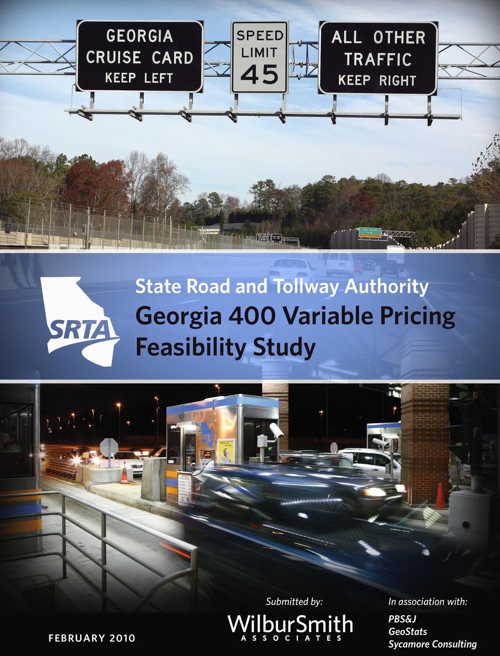
11 EXECUTIVE SUMMARY The Value Pricing Pilot Program is a U.S. Department of Transportation Federal Highway Administration-funded program for the evaluation and implementation of variable pricing projects throughout the nation. SRTA is proud to be one of 15 recipients of FHWA VPPP funds. All aspects of the Variable Pricing were funded through an FHWA grant. No toll revenues or operating funds were used in the conduct of this study. The Georgia 400 Variable Pricing Facility Study was conducted between January of 2007 and June of 2009 by principal consultant Wilbur Smith Associates, in conjunction with PBS&J, GeoStats, and Sycamore Consulting. The purpose of this study is to determine the potential benefits and challenges of the institution of variable pricing on GA 400 and to provide the State Road and Toll Authority and its planning partners with the tools necessary to make informed decisions regarding the future of mobility in this corridor. A comprehensive study of existing conditions was undertaken to understand both the need for and the potential impacts of variable pricing. This helped establish the baseline conditions that would be targeted, such as which hours were experiencing capacity shortfalls, and which hours had additional capacity available (see Figure ES-1). 6,000 Figure ES -1 Total Hourly Transactions (average weekday) Average Hourly Transactions 5,000 4,000 3,000 2,000 1,000 Northbound Southbound 0 0:00 2:00 4:00 6:00 8:00 10:00 12:00 14:00 16:00 18:00 20:00 22:00 February, 2010 Page ES-1
12 Extensive field studies were performed covering everything from traffic volumes to transaction times at the plaza, by method of payment. All of this data was used to verify the various models that went into the development of the Variable Pricing Findings. WHY VARIABLE PRICING? The Georgia 400 toll facility carries approximately 112,000 vehicles per day and provides a critical link between the northern portion of the Atlanta Bypass (I-285) and I-85. As greater Atlanta s transportation needs grow, so do the demands on GA 400. It is vital to regional mobility to ensure that the facility continues to offer travelers a fast, direct route to their destination today and well into the future. While variable pricing has many definitions and means of implementation, the goal is the same: to use pricing as a tool to manage motorist behavior and overall demand. In the case of the GA 400 toll facility, efforts are focused on eliminating congestion at peak periods of the day, due to overall demand, as well as ensuring that the plaza has the ability to efficiently process toll customers. While this can be achieved through the physical addition of travel lanes or toll collection infrastructure, such an undertaking would be prohibitively expensive and does not address the region s long-term transportation needs. The Variable Pricing seeks to address congestion and the overall quality of service provided to the Atlanta region by: Encouraging increased participation in the SRTA Cruise Card electronic toll collection program, thereby increasing efficiency of operations at the toll plaza and reducing any congestion or delays Encouraging travel in off-peak hours and making use of capacity currently available during less busy times of the day Improving localized and regional air quality through the lessening of congestion February, 2010 Page ES-2
13 WHAT WAS STUDIED? The five scenarios identified in ES-1 were specifically developed to address each of these strategies through variable pricing, both independently and in combination with one another. The goal of value pricing is not to increase revenues. Rates were specifically selected to achieve the above goals while remaining as close to the current tolls as possible. In each scenario, toll road patrons are offered the opportunity to continue to use the road at the current base rate of $0.50 per transaction. Table ES-1 Summary of Pricing Scenarios Scenario Scenario Cruise Card Number Name Cash (1) Off-Peak Peak (2) 1 No-build (base-case) $0.50 $0.50 $ Detoll Cruise Card Discount Time of Day Discount Combined Cruise Card and 5 Time of Day Discount (1) Cash customers are not eligible for time-of-day pricing discounts (2) Peak hours are between 7:00 AM and 9:00 AM and between 4:00 PM and 6:00 PM Peak traffic was found to occur from 7:00 a.m. to 9:00 a.m. and from 4:00 p.m. to 6:00 p.m. in both directions. Time of day pricing scenarios were developed to shift traffic from these congested periods to the hour before and the hour after the peak, referred to as the shoulder hours. A study of baseline conditions also found a relatively low usage of Cruise Card electronic toll collection (ETC) and additional capacity in the dedicated Cruise Card lanes. Scenarios were developed to take advantage of the speed of the ETC transaction and the available capacity. USER SURVEYS User surveys were developed to gauge the GA 400 patrons willingness to shift time periods and payment types at various levels of discount. Since the overall objective of this study is to shift facility patrons to different methods of payment and travel times, the data gathered at this stage is central to the rest of the study. The surveys also collected extensive data on the respondents travel habits including trip frequency, purpose, origin, destination, and more. Approximately 42,000 surveys were distributed and 7.4 percent were returned. From these surveys two key inputs to the study February, 2010 Page ES-3

14 were developed. With respect to the willingness to shift to Cruise Card, 43.1 percent of cash customers surveyed indicated that they would be likely to get a Cruise Card if there was a $10 enrollment fee and a 25 percent toll discount. With larger discounts, that willingness to shift to ETC increased to a maximum of 80.1 percent of those surveyed responding favorably to a 75 percent discount. A shift of even 10 percent of existing cash customers to ETC payment can significantly alter the operation profile of the plaza. Figure ES-2 Willingness of GA 400 Cash Users to Switch to Cruise Card Responses regarding willingness to shift travel times were also developed from the returned surveys and are illustrated in Figure ES-3. While the ability of most individuals to change their schedule is limited, shifts of up to 15 minutes were viewed favorably by up to 47.6 percent of survey respondents. Larger discounts carried a greater willingness to shift, while larger time shifts became less likely at all discount rates. February, 2010 Page ES-4

15 Figure ES-3 Willingness of GA 400 Users to Shift Travel Time AIR QUALITY ANALYSIS Each of the five pricing scenarios tested has an impact on travel patterns and characteristics both on the GA 400 toll facility as well as the region at large. The air quality analysis employs a methodology consistent with regional conformity determination procedures and emission factors from ARC s Envision 6 Regional Plan Update and was conducted at the plaza level (Hot Spot Analysis) and the regional level. Based on the Hot Spot analysis, all scenarios except for Scenario 2, the detoll scenario, would result in a decrease in carbon (CO) concentrations at the plaza from current conditions in comparison to the base case. On a regional basis, only Scenario 2 has a substantial impact. Due to the removal of the toll and the corresponding increase in total vehicle miles traveled, there is an increase from the base case in volatile organic compounds (VOC) of approximately 1.5 daily tons. There is a corresponding increase in nitrogen-based pollutants (NOx) and particulate matter (PM2.5) as well. Scenarios 3, 4 and 5 each have a very small impact on VOC, NOx, and PM2.5 ranging from the slightly negative to the slightly positive. Complete results at 2010 and 2020 levels under varying plaza February, 2010 Page ES-5
16 configurations for all five scenarios can be found in the study documentation. USER AND EQUITY ANALYSIS The GA 400 toll facility attracts trips from all over the Greater Metro Atlanta area representing disparate populations, each with unique demographic and social attributes. The user and equity analysis undertaken as part of this study identifies demographic profile of current users and separates them into Cruise Card and cash-paying customers. It is important to note that user composition and equity is primarily a function of the geographic distribution of jobs and populations. The equity analysis concludes: The tollway provides access to higher-income employment centers in the region as evidenced by the higher average income demographic of the tollway users Households with a lower average income are more likely to use the cash option Minority populations are more likely to use the cash option Lower participation rates by some populations are likely related to the geospatial variability of employment centers in the region The equity analysis does not provide an analysis of each of the five scenarios. Rather, the purpose of this study is to provide the information needed for decision makers to determine if any individual group or groups of people are disproportional affected by the various pricing structures. If necessary, equity issues can be mitigated in the ultimate formulation any pricing policy that may be adopted. February, 2010 Page ES-6
17 FINDINGS Ultimately, the purpose of this study is to develop strategies for reducing congestion and improving mobility, both in the present and as the Atlanta region s transportation needs grow. The traffic and toll revenue impacts, plaza operational impacts, air quality impacts, and equity issues can all be found in the full study documentation available at the study web site or by contacting SRTA. Scenarios 3, 4, and 5 all have net positive revenue impacts which could be used to help offset the cost of implementation and operations. Scenarios 3, 4, and 5 allow operations to continue at or better than current levels through The findings regarding reduction of congestion at the toll plaza are as follows: SCENARIO 1 - BASE CASE Under the base-case forecast, traffic volumes are expected to increase on GA 400 by approximately 0.4 percent per year between the assumed implementation year of 2010 and Regional growth is greater, but two factors serve to diminish demand on the facility. First, traffic growth is high enough that conditions on the facility degrade substantially during peak hours, making the toll facility less desirable. At the same time, improvements to competing facilities keep growth on GA 400 relatively low. SCENARIO 2 - DETOLL The purpose of this scenario was to illustrate the degradation in the level of service that would occur on the toll facility, the potential impacts on regional traffic characteristics, and the resulting air quality impacts if tolls were removed. Under this scenario, total daily volume increases by 18.2 percent, dramatically reducing travel speeds to as low as 16 miles per hour and adding as much as 9 minutes to travel between I-85 and I-285 via GA 400. Local and arterial roads do improve slightly from the increased volume using GA 400, but this is minor in comparison to the degradation in service on the toll facility. SCENARIO 3 CRUISE CARD DISCOUNT Under this scenario, total volume is reduced from the base case by less than 1.0 percent due to the increase in the cash toll. However, the corresponding increase in ETC transactions greatly reduces the transaction time at the plaza and eliminates queuing for cash customers. As a result, the toll plaza s overall capacity is effectively increased along with the level of service for all users. Under this scenario, one cash lane in each direction would need to be converted to a dedicated Cruise Card lane. February, 2010 Page ES-7
18 Revenues are increased by 14.9 percent and could be used to offset the cost of implementation and operations. SCENARIO 4 - TIME-OF-DAY DISCOUNT By offering a discounted toll rate to ETC patrons in all but the peak hours of operation, this scenario aims to encourage travel at less congested times of day. As illustrated in the Figure ES-4, Scenario 4 achieves this by increasing traffic in the shoulder hours and reducing traffic in the peak hours. In 2010, AM peak volumes are reduced by 5.3 percent with PM peak traffic reduced by 5.5 percent. With both peaks now spread over eight hours instead of being concentrated into a four-hour period, service at the plaza is improved as delays decrease and queues dissipate more rapidly. This scenario also requires the conversion of one cash lane in each direction to a dedicated ETC lane. Revenues are increased by 24.6 percent and could be used to offset the cost of implementation and operations. SCENARIO 5 - COMBINED CRUISE CARD/TIME-OF-DAY DISCOUNT This scenario offers the largest conversion of users to ETC payment, the greatest reduction in peak hour volumes, and the most effective means of distributing demand over the course of the day. In 2010, AM peak volumes are reduced by 8.1 percent with PM peak traffic reduced by 7.8 percent. Cruise Card transactions are increased by 75.4 percent and queuing is nearly eliminated. An increase in revenue of 30.6 percent could be used to offset the cost of implementation and operations demand over the course of the day. Comparative graphical representations of the total traffic volume impacts by period and direction of travel are presented as Figures ES-4 through ES-7. These figures are for illustrative purposes and correspond to the traffic and revenue impacts reported in the body of the main study documentation. CONCLUSIONS The intent of this study is not to make recommendations but rather to provide SRTA and its planning partners with the tools needed to make informed decisions about the operations of the GA 400 toll facility. The benefits of each scenario need to be carefully weighed against the costs and the impacts upon current facility patrons. For a complete review of data collection, methodology, and findings please review the pertinent section of the full study documentation that follows. February, 2010 Page ES-8
19 GA / / Portrait.ppt Georgia 400 Variable Pricing Shoulder Peak 6,500 Base Case Scenario 2 6,000 Sceanrio 3 Sceanrio 4 Sceanrio 5 5,500 5,000 Transactions 4,500 4,000 3,500 3,000 2,500 6:00 7:00 8:00 9:00 10:00 11:00 12:00 13:00 14:00 15:00 16:00 17:00 18:00 19: AGGREGATE NORTHBOUND FIGURE ES-4
20 GA / / Portrait.ppt Georgia 400 Variable Pricing Shoulder Peak 6,500 Base Case Scenario 2 6,000 Sceanrio 3 Sceanrio 4 Sceanrio 5 5,500 5,000 Transactions 4,500 4,000 3,500 3,000 2,500 6:00 7:00 8:00 9:00 10:00 11:00 12:00 13:00 14:00 15:00 16:00 17:00 18:00 19: AGGREGATE SOUTHBOUND FIGURE ES-5
21 GA / / Portrait.ppt Georgia 400 Variable Pricing Shoulder Peak 6,500 Base Case Scenario 2 6,000 Sceanrio 3 Sceanrio 4 Sceanrio 5 5,500 5,000 Transactions 4,500 4,000 3,500 3,000 2,500 6:00 7:00 8:00 9:00 10:00 11:00 12:00 13:00 14:00 15:00 16:00 17:00 18:00 19: AGGREGATE NORTHBOUND FIGURE ES-6
22 GA / / Portrait.ppt Georgia 400 Variable Pricing Shoulder Peak 6,500 Base Case Scenario 2 6,000 Sceanrio 3 Sceanrio 4 Sceanrio 5 5,500 5,000 Transactions 4,500 4,000 3,500 3,000 2,500 6:00 7:00 8:00 9:00 10:00 11:00 12:00 13:00 14:00 15:00 16:00 17:00 18:00 19: AGGREGATE SOUTHBOUND FIGURE ES-7
23 CHAPTER 1 INTRODUCTION PURPOSE AND SCOPE Initially introduced under the 1998 federal Transportation Equity Act for the 21st Century (TEA-21), the Value Pricing Pilot Program (VPPP or Pilot Program) was established to encourage the study and implementation of congestion mitigation through value pricing. The VPPP was renewed in each subsequent surface transportation spending bill, most recently the Safe, Accountable, Flexible, Efficient Transportation Equity Act: A Legacy for Users (SAFETEA-LU) of Within the FHWA solicitation for participation, the goals of the program are described as follows: By shifting some trips to off-peak periods, to mass transit or other higher-occupancy vehicles, or to routes away from congested facilities, or by encouraging consolidation of trips, value pricing charges are intended to promote economic efficiency both generally and within the commercial freight sector, and to achieve congestion reduction, air quality, energy conservation, and transit productivity goals. The Georgia State Road and Toll Authority (SRTA) was one of the fifteen state, regional, and local government agencies to be awarded grants under this program. On behalf of the SRTA, Wilbur Smith Associates began a study of the feasibility and impacts of the institution of value pricing on the Georgia 400 toll facility (see Figure 1-1) in The following report represents the culmination of more than two years of study and the combined efforts of Wilbur Smith Associates and our partners; PBS&J, GeoStats, and Sycamore Consulting. February, 2010 Page 1-1

24 GA / / Portrait.ppt Georgia 400 Variable Pricing FACILITY LOCATION MAP FIGURE 1-1
25 WSA considered five alternative pricing scenarios at the Georgia 400 mainline plaza. The underlying objectives of these scenarios were twofold: To encourage increased participation in the SRTA Cruise Card electronic toll collection program, thereby increasing efficiency of operations at the toll plaza and reducing any congestion or delays; and To encourage travel in off-peak hours and thereby further manage demand in the overall Georgia 400 corridor through the introduction of price differentials between peak and off-peak hours. Neither this study nor the recommendations that stem from it are intended as a means to increase toll revenues. While some additional revenue is generated through the introduction of value pricing scenarios, the principal goal is to disperse congestion and improve the operating environment at the plaza. A summary of the five scenarios is shown below in Table 1-1. All five scenarios assume no increase in rates for ETC users during offpeak hours. Discounts are limited to ETC patrons in the time-of-day scenarios due to the operational difficulties of applying such pricing to cash. WSA also included a detoll scenario in which all costs and capacity constraints associated with the GA 400 toll plaza are removed. Table 1-1 Summary of Pricing Scenarios Scenario Scenario Cruise Card Number Name Cash (1) Off-Peak Peak (2) 1 No-build (base-case) $0.50 $0.50 $ Detoll Cruise Card Discount Time of Day Discount Combined Cruise Card and 5 Time of Day Discount (1) Cash customers are not eligible for time-of-day pricing discounts (2) Peak hours are between 7:00 AM and 9:00 AM and between 4:00 PM and 6:00 PM For purposes of this assessment, it was assumed that peak periods would be limited to 7:00 9:00 a.m. and 4:00 6:00 p.m., on weekdays only. This presumes that off-peak ETC rates would apply all day on weekends. Again, the higher cash rates associated with each scenario were assumed to be in effect for cash paying passenger cars at all times. February, 2010 Page 1-2
26 REPORT STRUCTURE The principal components of this study include extensive data collection addressing the operating characteristics of the GA 400 toll facility and plaza, a survey of GA 400 patrons, a traffic and toll revenue impacts analysis, a public involvement and outreach component, an equity analysis, an operational analysis, and an air quality impacts assessment. The following report provides a comprehensive overview of each of the analyses which compose the impacts evaluation study. Chapter 2 presents a profile of the current operating characteristics of the GA 400 toll facility and plaza. Collected as input into the modeling process, the data is presented here to provide a clear operating profile and to present the baseline conditions as they exist today. Chapter 3 presents the details and results of the survey effort conducted at the toll plaza and provides detailed information on the travel patterns and characteristics of the GA 400 toll facility patron. Chapter 4 addresses the methodology employed in the development of the impacts analysis as well as critical assumptions and parameters used by WSA. This chapter also provides additional detail as to how the data presented in Chapters 2 and 3 was incorporated into the process. Chapter 5 presents the results of the traffic and toll revenue impacts analysis as well as a summary of the findings of the air quality impacts analysis performed by PBS&J and the equity analysis performed by GeoStats. The full text of the PBS&J and GeoStats documents is provided in the report appendix. February, 2010 Page 1-3
27 CHAPTER 2 EXISTING CONDITIONS Prior to examining the potential impacts of variable pricing on GA 400, historical and baseline operating conditions on the GA 400 toll facility needed to be established. The following chapter presents data assembled by Wilbur Smith Associates during the course of our work on the Georgia 400 VPPP study. Metrics collected for analysis include: historical traffic growth; when and where peak traffic occurs; and how these factors affect total travel time on the facility. This document presents baseline characteristics at the corridor level, including total annual traffic, as well as seasonal, daily, and hourly variations. Data is also analyzed at the plaza level, providing detail on plaza operations. Plaza data was gathered through field studies and includes a queuing analysis, a transaction time analysis, and an analysis of payment type by time of day and vehicle class. Developing a detailed profile of GA 400 traffic and operating characteristics is critical to evaluating the potential impacts of a variable pricing program. Response to the implementation of a variable pricing program is directly related to overall increases in traffic and delay, and would likely fluctuate in response to the varying peaking patterns on GA 400 by month and day of the week. TRAFFIC PROFILE As stated above, understanding GA 400 traffic and operating characteristics is a critical element when studying the impacts of a variable pricing program. As such, the traffic profile at the GA 400 mainline toll plaza was reviewed based on daily variations, hourly variations, and vehicle mix. DAILY TRAFFIC VARIATIONS The review of daily traffic variations was performed using the 14-day counts, conducted by lane, which were performed between December 4 th, and 18 th, Daily variations in total traffic are shown in Figure 2-1. As February, 2010 Page 2-1
28 shown, volumes remain relatively stable throughout the week, gradually increasing from a weekday low of approximately 125,000 on Monday to a weekday high of approximately 134,000 on Friday. Traffic then tapers off significantly on weekend days with Saturday and Sunday representing approximately 76.1 percent and 62.0 percent of the weekday average. The daily variation in traffic observed is fairly typical of a commuter oriented facility such as GA , ,000 Figure 2-1 Daily Traffic Variations GA 400 Mainline Toll Plaza Tolled Transactions 120, ,000 80,000 60,000 40,000 20,000 0 Mon Tue Wed Thu Fri Sat Sun HOURLY TRAFFIC VARIATIONS Hourly traffic variations were also reviewed to better understand the peaking patterns experienced at the at the mainline toll plaza. Weekday traffic data collected between December 4 th and December 18 th were summarized and reviewed as part of the hourly traffic data review. The data was reviewed by direction and vehicle type. The weekday passenger car hourly peaking pattern observed at the toll plaza is shown below in Figure 2-2. As shown, in both directions, traffic peaks both in the AM and PM hours. Both directions observe peak traffic during the hour beginning at 8:00 a.m. Traffic then declines before increasing again throughout the afternoon and early evening hours. The observed variation in commercial vehicle traffic by hour was quite different from the passenger car traffic pattern. For the most part, commercial vehicle traffic increased through the morning hours before February, 2010 Page 2-2
29 peaking in the early afternoon, as shown in Figure 2-3, and then declining in the late afternoon and evening hours. Commercial vehicle traffic was significantly higher in the northbound direction. Figure 2-2 Passenger Car Hourly Traffic Variations GA 400 Mainline Toll Plaza 6,000 5,000 Northbound Southbound Tolled Transactions 4,000 3,000 2,000 1, :00 AM 1:00 AM 2:00 AM 3:00 AM 4:00 AM 5:00 AM 6:00 AM 7:00 AM 8:00 AM 9:00 AM 10:00 AM Figure 2-3 Commercial Vehicle Hourly Traffic Variations GA 400 Mainline Toll Plaza Northbound Southbound 11:00 AM 12:00 PM 1:00 PM 2:00 PM 3:00 PM 4:00 PM 5:00 PM 6:00 PM 7:00 PM 8:00 PM 9:00 PM 10:00 PM 11:00 PM Tolled Transactions :00 AM 1:00 AM 2:00 AM 3:00 AM 4:00 AM 5:00 AM 6:00 AM 7:00 AM 8:00 AM 9:00 AM 10:00 AM 11:00 AM 12:00 PM 1:00 PM 2:00 PM 3:00 PM 4:00 PM 5:00 PM 6:00 PM 7:00 PM 8:00 PM 9:00 PM 10:00 PM 11:00 PM February, 2010 Page 2-3
30 DISTRIBUTION OF TRAFFIC BY VEHICLE CLASS The distribution of GA 400 mainline traffic was also reviewed based on vehicle class. The same traffic count data was used in the analysis. Because the data was available, vehicle distributions were analyzed individually for both cash and Cruise Card lanes. Figure 2-4 shows the cash lane distribution of traffic according to vehicle type. As shown, in the cash lanes, the distribution of passenger cars versus commercial vehicles remains relatively consistent throughout the week. Overall, commercial vehicles account for approximately 12 percent of traffic in the cash lanes. As shown in Figure 2-5, commercial vehicles account for a very small percentage of total traffic in the Cruise Card lanes at the GA 400 mainline toll plaza. Over the course of the week, commercial vehicles account for approximately 1 percent of total Cruise Card lane traffic. Figure 2-4 Vehicle Class Distribution Cash Lanes GA 400 Mainline Toll Plaza 90,000 80,000 Cash Lanes PC CV Tolled Transactions 70,000 60,000 50,000 40,000 30,000 20,000 10,000 0 Mon Tues Wed Thurs Fri Sat Sun February, 2010 Page 2-4
31 Figure 2-5 Vehicle Class Distribution Cruise Lanes GA 400 Mainline Toll Plaza Tolled Transactions 70,000 60,000 50,000 40,000 30,000 20,000 10,000 Cruise Lanes PC CV 0 Mon Tues Wed Thurs Fri Sat Sun MAINLINE PLAZA OPERATIONS Several field studies were conducted for this study at the GA 400 mainline toll plaza focusing on volume patterns, queue lengths, and transaction times. These variables play an important role in determining the potential effectiveness of a variable pricing program. For example, a shift of vehicles out of peak hours would reduce the overall queue length thereby increasing the efficiency and value of the toll facility. Similarly, moving a portion of toll-paying patrons to a more efficient method of toll collection such as ETC would reduce transaction times and positively impact queue length and total travel time. Combinations of the two may have compounding impacts. Establishing a baseline for each of these variables is a necessary step in indentifying how to best implement and the potential impacts of a value pricing program. TRANSACTION TIME DATA A field survey of transaction times was performed at the GA 400 mainline toll plaza on November 15, Observations were made for both the AM peak (7:00 to 9:00 a.m.) and the PM peak (4:00 to 6:00 p.m.) in all manned and automatic coin machine (ACM) lanes for southbound and northbound traffic. The vehicle class was recorded, as well as the method of payment, including exact change for manned and ACM lanes, cash with February, 2010 Page 2-5
32 change made in manned lanes, and Cruise Card ETC in all non-dedicated lanes; and the amount of time that passed from the time the front bumper of the vehicle entered the stall to the time the rear bumper cleared the toll gate. As shown below in Table 2-1, AM transaction times, in the northbound direction, were substantially higher than those in the southbound direction. For northbound passenger cars, paying with exact change in an ACM lane, the median transaction time was 7.6 seconds. For passenger cars paying exact change in a manned lane, the median transaction time was 7.3 seconds. For passenger cars needing change in a manned lane, the median transaction time was 8.5 seconds. The same classes and payment types in the southbound direction were 5.6, 5.8, and 7.2 seconds, respectively. Passenger car transaction times in the PM period demonstrate the same directional disparity. The disparity also applies to commercial vehicles. Overall, average transaction times for commercial vehicles were greater than those of passenger cars. Table 2-1 Summary of Transaction Times (in Seconds) Thursday, November 15, 2007 Automatic Coin Machine Attended Exact Change Change Made Automatic Coin Machine Attended Exact Change Change Made Commercial Passenger Commercial Passenger A.M. (6-10) Northbound Average Transaction Time Median Transaction Time Mininum Transaction Time Maximum Transaction Time Sample Size Average Transaction Time Median Transaction Time Mininum Transaction Time Maximum Transaction Time Sample Size P.M. (3-7) Northbound A.M. (6-10) Southbound P.M. (3-7) Southbound Average Transaction Time Median Transaction Time Mininum Transaction Time Maximum Transaction Time Sample Size Average Transaction Time Median Transaction Time Mininum Transaction Time Maximum Transaction Time Sample Size February, 2010 Page 2-6
33 MAINLINE PLAZA TRAFFIC QUEUING Queue length analyses were carried out on November 14, 2007, between 6:30a.m. and 10:00a.m., and again between 3:00 p.m. and 7:00 p.m. The purpose of the queuing analysis was to determine the total number of vehicles waiting, in any one lane, at any given time. Data was collected in the northbound and southbound directions. Lane operation characteristics including attended or unattended, as well as gate position, were recorded. The results for the AM and PM peak periods are presented by lane in Tables 2-2 and 2-3, respectively. Queue lengths in the AM period were greatest in the northbound direction of travel, peaking between 7:30 a.m. and 9:00 a.m. The longest queue was observed in lane 3 at 8:20 a.m. with a total queue length of 35 vehicles. In the southbound direction queue length trended very slightly upward throughout the morning. However, unlike traffic in the northbound direction, southbound queues remained fairly short in length, demonstrated little variance, and experienced no significant peaking. The longest queue in the AM southbound travel lanes was 10 vehicles at 10:00 a.m. Observed queue lengths were shorter in the PM hours, when observed traffic queues reached a maximum length of 14 vehicles in southbound attended lanes 20 and 21 at 3:00 p.m. Northbound queues reached a maximum of 10 vehicles at 5:10 p.m. in unattended (ACM) lane 4. Though longer queues were observed in the southbound direction of travel than in the northbound, queue lengths were considerably more balanced across both directions of travel when compared to the AM period. February, 2010 Page 2-7
34 Table 2-2 Observed Vehicle Queues Per Lane - AM GA 400 Mainline Toll Plaza - Wednesday, November 14, 2007 Vehicles Queued Per Lane Time Southbound Northbound Begin Lane 15 Lane 16 Lane 17 Lane 18 Lane 19 Lane 20 Lane 21 Lane 8 Lane 7 Lane 6 Lane 5 Lane 4 Lane 3 Lane 2 6:30 AM :40 AM :50 AM :00 AM :10 AM :20 AM :30 AM X :40 AM :50 AM :00 AM :10 AM :20 AM :30 AM :40 AM :50 AM X 15 9:00 AM X :10 AM :20 AM :30 AM :40 AM :50 AM :00 AM Lane Operations Legend: Attended Coin Machine X = Lane Closed Gate locked in the open position February, 2010 Page 2-8
35 Table 2-3 Observed Vehicle Queues Per Lane - PM GA 400 Mainline Toll Plaza - Wednesday, November 14, 2007 Vehicles Queued Per Lane Time Southbound Northbound Begin Lane 15 Lane 16 Lane 17 Lane 18 Lane 19 Lane 20 Lane 21 Lane 8 Lane 7 Lane 6 Lane 5 Lane 4 Lane 3 Lane 2 3:00 PM :10 PM :20 PM :30 PM :40 PM :50 PM :00 PM X :10 PM :20 PM X :30 PM :40 PM :50 PM :00 PM :10 PM :20 PM :30 PM :40 PM :50 PM :00 PM :10 PM :20 PM :30 PM :40 PM X :50 PM :00 PM Lane Operations Legend: Attended Coin Machine X = Lane Closed Gate locked in the open position February, 2010 Page 2-9
36 TRAFFIC COUNT DATA Traffic count information is used in the calibration of the travel demand model and helps establish predominant travel patterns and traffic movements. Traffic counts were taken on the GA 400 mainline; principal contributing and competing arterials; and all GA 400 interchange ramps, from I-85 north to I-285. Due to the quantity and varying levels of direct relevance, not all counts are presented in this report. Complete count sets have been provided to SRTA and are available upon request. The following section presents GA 400 ramp counts between the I-85 and I- 285 interchanges. RAMP COUNTS Ramp traffic counts were conducted on November 27 th and 28 th, Counts were performed at the GA 400 interchanges with I-285, Glenridge Perimeter Connector, Buckhead Loop NE, and Sidney Marcus Boulevard NE. Each count location is identified in Figure 2-6 and detailed in Table 2-4. Figures 2-7 through 2-10 illustrate hourly volumes for each reciprocal movement. As shown in Figure 2-6, data was collected on the interchange ramps permitting travel to and from the south, between GA 400 and I-285. Traffic entering GA 400 from I-285 westbound and exiting GA 400 to I- 285 eastbound was observed to peak between 8:00 and 9:00 a.m. The two ramps were found to experience very similar hourly traffic variation, as shown in Figure 2-7 Traffic on the two remaining ramps between I-285 and GA 400, south of the interstate, demonstrated a significantly different hourly traffic profile. As shown in Figure 2-7, traffic exiting GA 400 to I-285 westbound peaked both in the AM and PM peak periods, although traffic volume, in the PM peak, was greater by approximately 150 vehicles. While significantly less traffic used the on-ramp between I-285 eastbound and GA 400 southbound, peak traffic of roughly 400 vehicles was observed during the hour beginning at 11:00 a.m.. This count location displayed patterns significantly different that what would be expected under normal circumstances may represent a malfunctioning count unit or special circumstances taking place during the time of the counts. The hourly traffic variations for each of the four interchange ramps between GA 400 and the Glenridge Perimeter Connector count stations 5 through 8 are presented in Figure 2-8. The two ramps serving traffic to and from the north (count stations 8 and 5) were observed to experience February, 2010 Page 2-10
37 GA / / Portrait.ppt Georgia 400 Variable Pricing W.B. On Ramp E.B. On Ramp E.B. Off Ramp W.B. Off Ramp S.B. Off Ramp 5 8 N.B. On Ramp Glenridge Connector S.B. On Ramp 6 7 N.B. Off Ramp S.B. Off Ramp 9 12 N.B. On Ramp Buckhead Loop S.B. On Ramp N.B. Off Ramp N.B. On Ramp S.B. Off Ramp Sidney Marcus Blvd. GEORGIA 400 RAMP COUNT STATIONS FIGURE 2-6
38 Table 2-4 GA Hour Ramp Counts 11/27/ /28/2008 Hour Station 1 Station 2 Station 3 Station 4 Station 5 Station 6 Station 7 Station 8 Station 9 Station 10 Station 11 Station 12 Station 13 Station 14 Sidney Sidney I-285 WB I-285 EB I-285 EB I-285 WB Glenridge Glenridge Glenridge Glenridge Buckhead Buckhead Buckhead Buckhead Marcus Marcus On On Off Off SB Off SB On NB Off NB On SB Off SB On NB Off NB On NB On SB Off 0: : : : : : : : , , ,592 1,134 8: , , , ,662 1,219 1,817 1,405 9: , , ,497 1,114 10: , , , : , ,172 1,034 1, : ,384 1,131 1,199 1,090 1, : ,258 1,258 1,108 1,282 1, : ,252 1,351 1,046 1,320 1, : ,268 1,073 1, ,470 1,399 1,270 16: ,367 1, ,634 1,435 1,659 17: , ,176 1, ,933 1,452 1,850 18: , ,568 1,403 1,731 19: , ,105 1,141 1,361 20: , : : : February, 2010 Page 2-11
39 GA / / Portrait.ppt Georgia 400 Variable Pricing WB On Ramp EB Off Ramp 700 Traffic :00 AM 1:00 AM EB On Ramp WB Off Ramp 2:00 AM 3:00 AM 4:00 AM 5:00 AM 6:00 AM 7:00 AM 8:00 AM 9:00 AM 10:00 AM 11:00 AM Time 12:00 PM 1:00 PM 2:00 PM 3:00 PM 4:00 PM 5:00 PM 6:00 PM 7:00 PM 8:00 PM 9:00 PM 10:00 PM 11:00 PM Traffic :00 AM 1:00 AM 2:00 AM 3:00 AM 4:00 AM 5:00 AM 6:00 AM 7:00 AM 8:00 AM 9:00 AM 10:00 AM 11:00 AM 12:00 PM Time 1:00 PM 2:00 PM 3:00 PM 4:00 PM 5:00 PM 6:00 PM 7:00 PM 8:00 PM 9:00 PM 10:00 PM 11:00 PM I-285 RAMP COUNT DATA FIGURE 2-7
40 GA / / Portrait.ppt Georgia 400 Variable Pricing 1,600 1,400 1,200 NB On Ramp SB Off Ramp 1,000 Traffic ,600 1,400 12:00 AM 1:00 AM SB On Ramp NB Off Ramp 2:00 AM 3:00 AM 4:00 AM 5:00 AM 6:00 AM 7:00 AM 8:00 AM 9:00 AM 10:00 AM 11:00 AM Time 12:00 PM 1:00 PM 2:00 PM 3:00 PM 4:00 PM 5:00 PM 6:00 PM 7:00 PM 8:00 PM 9:00 PM 10:00 PM 11:00 PM 1,200 1,000 Traffic :00 AM 1:00 AM 2:00 AM 3:00 AM 4:00 AM 5:00 AM 6:00 AM 7:00 AM 8:00 AM 9:00 AM 10:00 AM 11:00 AM 12:00 PM Time 1:00 PM 2:00 PM 3:00 PM 4:00 PM 5:00 PM 6:00 PM 7:00 PM 8:00 PM 9:00 PM 10:00 PM 11:00 PM GLENRIDGE PERIMETER CONNECTOR RAMP COUNT DATA FIGURE 2-8
41 GA / / Portrait.ppt Georgia 400 Variable Pricing 2,250 2,000 1,750 NB On Ramp SB Off Ramp 1,500 Traffic 1,250 1, ,250 2,000 1,750 12:00 AM 1:00 AM SB On Ramp NB Off Ramp 2:00 AM 3:00 AM 4:00 AM 5:00 AM 6:00 AM 7:00 AM 8:00 AM 9:00 AM 10:00 AM 11:00 AM 12:00 PM Time 1:00 PM 2:00 PM 3:00 PM 4:00 PM 5:00 PM 6:00 PM 7:00 PM 8:00 PM 9:00 PM 10:00 PM 11:00 PM 1,500 Traffic 1,250 1, :00 AM 1:00 AM 2:00 AM 3:00 AM 4:00 AM 5:00 AM 6:00 AM 7:00 AM 8:00 AM 9:00 AM 10:00 AM 11:00 AM 12:00 PM Time 1:00 PM 2:00 PM 3:00 PM 4:00 PM 5:00 PM 6:00 PM 7:00 PM 8:00 PM 9:00 PM 10:00 PM 11:00 PM BUCKHEAD LOOP NE RAMP COUNT DATA FIGURE 2-9
42 GA / / Portrait.ppt Georgia 400 Variable Pricing 2,250 2,000 1,750 NB On Ramp SB Off Ramp 1,500 Traffic 1,250 1, :00 AM 1:00 AM 2:00 AM 3:00 AM 4:00 AM 5:00 AM 6:00 AM 7:00 AM 8:00 AM 9:00 AM 10:00 AM 11:00 AM 12:00 PM Time 1:00 PM 2:00 PM 3:00 PM 4:00 PM 5:00 PM 6:00 PM 7:00 PM 8:00 PM 9:00 PM 10:00 PM 11:00 PM SIDNEY MARCUS BLVD. RAMP COUNT DATA FIGURE 2-10
43 varying peak hours. At count station 5, the southbound off-ramp, traffic peaked between 7:00 and 8:00 a.m. at just over 1,000 vehicles. The northbound on-ramp experienced peak traffic levels during the 4:00 to 5:00 p.m. hour, when over 1,350 vehicles were counted. Peak hours on the ramps to and from the south of the Glenridge Perimeter Connector (count stations 6 and 7) were quite similar to the northbound patterns. Exiting traffic peaked during the 8:00 to 9:00 a.m. hour, while southbound traffic entering GA 400 peaked during the 5:00 to 6:00 p.m. hour. For the most part, observed hourly traffic variations at the Buckhead Loop NE interchange ramps were similar to the variations described above for the Glenridge Perimeter ramp. Traffic count data for stations 9 through 12 are presented in Figure 2-9. Traffic exiting southbound GA 400 at Buckhead Loop NE peaked during the hour beginning at 9:00 a.m.. Traffic making the reverse movement, which used the northbound on-ramp, peaked during the hour beginning at 5:00 p.m. Traffic to and from the south (count stations 10 and 11) experienced a similar peaking trend. GA 400 northbound traffic exiting at Buckhead Loop NE peaked during the AM period at approximately 1,650 vehicles. Traffic using the southbound on-ramp from Buckhead Loop NE experienced an earlier PM peak than was observed at other locations. Peak hour traffic at count station 10 was found to peak from 2:00 to 3:00 p.m. at nearly 1,400 vehicles. This count location displayed patterns significantly different that what would be expected under normal circumstances may represent a malfunctioning count unit or special circumstances taking place during the time of the counts. Traffic data collected at count stations 13 and 14, the southbound off-ramp and northbound on-ramp at Sidney Marcus Blvd., are presented in Figure Traffic was observed to experience significant peaking based on the time of day. Peak traffic was observed on the northbound on-ramp during the hour beginning at 8:00 a.m. Traffic on the off-ramp demonstrated peaking in both the AM and PM periods, although traffic volumes during the PM peak were significantly greater than was observed during the AM peak. February, 2010 Page 2-12
44 CHAPTER 3 MARKET SURVEY This chapter presents the findings of the Origin/Destination and Market Survey, which examined the trip characteristics of motorists travelling on the tolled portion of GA 400 between I-85 and I-285. The GA 400 surveys were conducted on November 28, 2007 as a handout survey at the GA 400 toll plaza as well as via mail. Mailout surveys were conducted between December 3, 2007 and January 8, The following is a summary of the resulting data collected. This data was used to refine travel demand modeling efforts used to forecast future travel demand. DESCRIPTION OF SURVEY The GA 400 Market Survey was conducted as both a handout and a mailout survey in order to gather information on the travel patterns of both cash users and Electronic Toll Collection (ETC) users. Both the handout and mailout survey forms were in the form of standard business reply postcards, return postage paid. Survey questions were designed to determine the customers willingness and ability to shift their times of travel based on possible discounted toll rates. Additional questions addressed the specific origin and destination of their trip, trip purpose, trip frequency, vehicle occupancy, and vehicle class. While the two survey forms are quite similar, the handout surveys included an additional question regarding the likelihood of participation in the Cruise Card program in response to a discounted ETC toll and/or availability of timeof-day pricing. The handout and mailout surveys are presented in Figures 3-1 and 3-2, respectively. The handout surveys were conducted on November 28, 2007 at the GA 400 toll plaza between the Lenox Road and Glenridge Connector Interchanges. The toll plaza has nine lanes in each direction. Four lanes on either side of the plaza have booths for attendants and can either be manned by toll collectors or configured for collection of exact change. Three lanes in each direction are configured for Automatic Coin Machine February, 2010 Page 3-1
45 GA / / Figs 3-1 and 3-2.ppt Georgia 400 Variable Pricing STATE ROAD & TOLLWAY AUTHORITY Dear GA 400 Customer: The State Road & Tollway Authority is collecting information on travel patterns to plan for future transportation improvements on GA 400. Your cooperation will help us better serve your GA 400 travel needs. Please complete this postage-paid form and mail it back at your earliest convenience. The information you provide will be used for internal transportation planning purposes only and will be kept strictly confidential. Thank you for your participation. A. How many people, including yourself, were in the vehicle when you were handed this card? B. Please circle the type of vehicle you were driving when you were handed this card. 1. Motorcycle 2. Passenger Car 3. Pickup Truck / Van / SUV 4. Single Unit Truck (More than 4 wheels) 5. Bus 6. Tractor Trailer C. Where did this trip begin in this direction? Please be as specific as possible. Street Address, Nearest Intersection or Major Landmark City, Village, Town State Zip Code D. What was the primary purpose of this trip? (Circle one) 1. To / from work 2. Shopping 3. School 4. Recreational / Social / Vacation 5. Company business 6. Personal business E. Where did you end this trip (In this direction) after you received this questionnaire? (Should not be the same answer as Question C) Street Address, Nearest Intersection or Major Landmark City, Village, Town State Zip Code F. How often do you make this exact trip in this direction? (Circle one) 1. Less than once per month 2. 1 to 2 times per month 3. Once per week 4. 2 to 4 times per week 5. Five or more times per week G. Approximately how much time did you save on this trip, in this direction, by using GA 400? Minutes H. Please indicate the zip code of your home residence. I. Do you currently participate or plan to participate in the Cruise Card program? (Circle one) 1. Yes 2. No J. If you answered no to Question I, and recognizing that there is a one time $10.00 fee to obtain a Cruise Card transponder, would you consider participating in the Cruise Card program if there was a price difference between cash and Cruise Card of 25%, 50% or 75% for Cruise Card participants? (One check mark per row) Possible Toll Difference 25% (check one) 50% (check one) 75% (check one) Definitely Participate Probably Participate Probably Not Participate Definitely Not Participate K. If you answered no to Question I, and Cruise Card transponders were provided for free, would you consider participating in the Cruise Card program if there was a price difference between cash and Cruise Card of 25%, 50% or 75% for Cruise Card participants? (One check mark per row) Possible Toll Difference 25% (check one) 50% (check one) 75% (check one) L. Are you able and willing to shift your travel time if the toll were lower? This could reduce peak period congestion and helpus provide better service. If there was a toll price difference between peak and off-peak hours offered to Cruise Card customers, please indicate the maximum amount (If any) you would shift your travel time for a 25%, 50% or 75% lower toll. (One check mark per row) Minutes I would shift my travel time. Possible Toll Reduction 25% (check one) 50% (check one) 75% (check one) Definitely Participate Would Not Shift Up To 15 Minutes Probably Participate Up To 30 Minutes Probably Not Participate Up To 1 Hour Definitely Not Participate Over 1 Hour STA DAY DIR HOUR A B D F G H I J K L SAMPLE HAND-OUT SURVEY CARD FIGURE 3-1
46 GA / / Figs 3-1 and 3-2.ppt Georgia 400 Variable Pricing STATE ROAD & TOLLWAY AUTHORITY Dear GA 400 Customer: The State Road & Tollway Authority is collecting information on travel patterns to plan for future transportation improvements on GA 400. Your cooperation will help us better serve your GA 400 travel needs. When answering the survey below, please consider a most recent trip on GA 400 that occurred on a weekday (Mon.-Fri.) between the hours of 6:00 am 10:00 am or 2:00 pm to 7:00 pm. Please complete this postage-paid form and mail it back at your earliest convenience. The information you provide will be used for internal transportation planning purposes only and will be kept strictly confidential. Thank you for your participation. A. Please indicate the time of day you began this one-way trip. : a.m. p.m. Please indicate a.m. or p.m. Hour Minutes B. What was your direction of travel? (Circle one) 1. Northbound - Toward I Southbound - Toward I-85 C. Please indicate the day this one-way trip was made. (Circle one) 1. Mon 2. Tue 3. Wed 4. Thur 5. Fri D. How many people, including yourself, were in the vehicle when you made this most recent trip on GA 400. E. Please circle the type of vehicle you were driving when you made this most recent trip on GA Motorcycle 2. Passenger Car 3. Pickup Truck / Van / SUV 4. Single Unit Truck (More than 4 wheels) 5. Bus 6. Tractor Trailer F. Where did this most recent GA 400 trip begin in this direction? Please be as specific as possible. Street Address, Nearest Intersection or Major Landmark City, Village, Town State Zip Code G. What was the primary purpose of this trip? (Circle one) 1. To / from work 3. School 2. Shopping 4. Recreational / Social / Vacation 5. Company business 6. Personal business H. Where did you end this most recent GA 400 trip in this direction? (Should not be the same answer as Question F) Street Address, Nearest Intersection or Major Landmark City, Village, Town State Zip Code I. How often do you make this exact trip in this direction? (Circle one) 1. Less than once per month 2. 1 to 2 times per month 3. Once per week 4. 2 to 4 times per week 5. Five or more times per week J. Approximately how much time did you save on this trip, in this direction, by using GA 400? Minutes K. Please indicate zip code of your home residence. L. Are you able and willing to shift your travel time if the toll were lower? This could reduce peak period congestion and help us provide better service. If there was a toll price difference between peak and off-peak hours offered to Cruise Card customers, please indicate the maximum amount (if any) you would shift your travel time for a 25%, 50% or 75% lower toll. (One check mark per row) Minutes I would shift my travel time. Possible Toll Reduction 25% (check one) 50% (check one) 75% (check one) Would Not Shift Up To 15 Minutes Up To 30 Minutes Up To 1 Hour Over 1 Hour STA DAY DIR HOUR B C D E G I J K L SAMPLE MAIL-OUT SURVEY CARD FIGURE 3-2
47 (ACM) operation only. The availability and method of payment (attended or automatic) of any of these lanes varies by time of day. The remaining two lanes on either side of the plaza are dedicated to Cruise Card ETC customers where transactions are carried out via electronic transponders and can be passed through at highway speeds. Surveys were handed out in both the north and southbound directions of travel between 7:00 a.m. and 7:00 p.m. Surveys were distributed to every other driver passing through attended and automatic toll booths. Cruise Card customers passing through these lanes were polled as well. A total of 21,108 handout survey cards were distributed; of these a total of 1,687 cards or 8.0 percent were returned. Cards were then reviewed for a minimum of complete information before being declared usable and included in the final data set. In total 1,571 cards were considered usable approximately 7.4 percent of all distributed handout surveys. For the plaza s four high-speed Cruise Card lanes, no surveys were handed out for operational and safety reasons. Instead, a database of Cruise Card patrons who had used the plaza on the day on which handout surveys were conducted was compiled. Participants were chosen from the heaviest hours of travel; the period between 6:00 a.m. and 10:00 a.m. and the period between 2:00 p.m. and 7:00 p.m. The names and addresses of these customers were kept strictly confidential and were only provided to a small subset of personnel working with SRTA under a confidentiality agreement. Between December 3, 2007 and January 8, 2008 WSA distributed a total of 21,000 mailout survey cards to existing GA 400 Cruise Card account holders. Of the 3,143 distributed mailout cards returned, 14.6 percent or 3,059 were considered usable. Including both the handout and mailout surveys, a total of 42,108 surveys were distributed. Of these, a total of 4,630 were returned and found to be usable, resulting in a useable return rate of 11.0 percent. Upon their return, survey questionnaires were processed, coded, and entered into a master database. From this point all trip origins and destinations were plotted via a geographic information systems (GIS) geocoding process. This procedure helps eliminate responses erroneously supplied that do not pertain to the GA 400 facility. The remainder of this Technical Memorandum presents a summary of these results. February, 2010 Page 3-2
48 SUMMARY OF TRAVEL PATTERNS AND TRIP CHARACTERISTICS TRAVEL PATTERN SUMMARY The survey asked motorists to identify the origins and destinations of their most recent trip using GA 400. According to the survey data, the most common trip origins were Atlanta, Alpharetta, and Roswell, which accounted for 46.1, 12.8, and 10.9 percent of all trips in the survey, respectively. Atlanta and Alpharetta were also the most common trip destinations, accounting for 67.1 and 10.7 percent of the total surveyed trips, respectively. TRIP PURPOSE DISTRIBUTION The purpose of a trip can influence an individual s value of time, and therefore their choice of route. The distribution of the trip purpose of survey respondents is shown in Figure 3-3. The most frequent trip purpose was To/From Work, which accounted for 68.3 percent of the indicated trip purposes. Company Business and Personal Business was the second and third most indicated trip purposes, at 12.0 and 10.5 percent, respectively. Figure 3-3 Trip Purpose of GA 400 Market Survey Respondents 68.3% 2.5% 2.7% 4.0% 12.0% To/From Work School Company Business 10.5% Shopping Recreational / Social / Vacation Personal Business February, 2010 Page 3-3
49 TRIP FREQUENCY DISTRIBUTION (NUMBER OF TRIPS PER WEEK) The distribution of trip frequencies from the GA 400 Origin/Destination and Market Survey is presented in Figure 3-4. Of all survey respondents, 51.2 percent indicated that they make a similar trip five or more times per week. Additionally, 21.4 percent of survey respondents indicated that they make a similar trip two to four times per week. These two categories total 72.6% and represent survey respondents who travel the corridor two or more times per week in which the majority of these trips are likely commuter trips, respondents traveling to and from work during the week. Figure 3-4 Trip Frequency of GA 400 Market Survey Respondents 51.2% 10.0% 9.8% 7.5% 21.4% Less Than 1 Per Month 1-2 Times per Month 1 per Week 2-4 per Week 5 or More per Week VEHICLE OCCUPANCY DISTRIBUTION The GA 400 Market Survey also asked survey respondents about their vehicle occupancy. These results are summarized in Figure 3-5 and Table 3-1, which indicate that 87.6 percent of survey respondents were motorists travelling alone. An additional 10.0 percent were travelling with two persons in the car. In total, 12.4 percent of survey respondents were travelling with one or more passengers with average vehicle occupancy of 1.2 passengers per vehicle. February, 2010 Page 3-4
50 Figure 3-5 Vehicle Occupancy of GA 400 Market Survey Respondents 87.6% 10.0% 2.4% 1 Person 2 Persons 3 or More Persons Table 3-1 Vehicle Occupancy Rates of GA 400 Market Survey Respondents Vehicle Occupancy Percent of Survey Responses 5 or More 1 Person 2 Persons 3 Persons 4 Persons Persons 87.6% 10.0% 1.4% 0.6% 0.5% VEHICLE CLASSIFICATION SUMMARY Vehicle classification is another important variable that influences key travel demand modeling inputs such as vehicle operating cost and value of time. The GA 400 Origin/Destination and Market Survey identified a majority of the vehicles driven by survey respondents as two-axle, fourtire passenger cars. These vehicles accounted for approximately 67.9 percent of the survey responses. An additional 31.5 percent of vehicles were identified as pick-up trucks, vans, and SUVs. Single unit trucks, buses, and tractor trailers made up only 0.5 percent of survey respondents. The complete traffic profile from the survey in terms of vehicle classification is illustrated in Figure 3-6 and shown in detail in Table 3-2. February, 2010 Page 3-5
51 Figure 3-6 Vehicle Classification of GA 400 Market Survey Respondents 67.9% 31.5% 0.5% Passenger Car Pickup Truck / Van / SUV Other Table 3-2 Vehicle Classification of GA 400 Market Survey Respondents Vehicle Occupancy Percent of Survey Responses Passenger Pickup Truck Single Unit Motorcycle Car / Van / SUV Truck Bus Tractor Trailer 0.3% 67.9% 31.5% 0.1% 0.0% 0.0% ELECTRONIC TOLL COLLECTION PARTICIPATION CURRENT ELECTRONIC TOLL COLLECTION USERS Data was collected regarding toll plaza activity for the day before, of, and after the handout survey was conducted. Over the course of these three days, it was observed that 42.9 percent of all transactions were carried out via Cruise Card, though actual participation rates fluctuate throughout the day and by direction. For instance, the highest hour of Cruise Card participation occurred at 7:00 a.m. in the southbound direction when electronic payment accounted for 60.4 percent of all transaction. The lowest incidence of Cruise Card participation occurred at 1:00 a.m. also in the southbound direction when electronic transactions accounted for just 18.2 percent of total transactions. Figure 3-7 illustrates toll February, 2010 Page 3-6
52 GA GA 400 Preliminary Analysis of Improvement Options GA 400 Market Survey Summary Transactions Transactions Transactions 3,500 3,000 2,500 2,000 1,500 1, ,500 3,000 2,500 2,000 1,500 1, ,000 6,000 5,000 4,000 3,000 2,000 1,000 0 Northbound 0:00 1:00 Southbound 0:00 1:00 Combined Transactions 0:00 1:00 2:00 3:00 4:00 5:00 6:00 7:00 8:00 9:00 10:00 2:00 3:00 4:00 5:00 6:00 7:00 8:00 9:00 10:00 11:00 12:00 13:00 14:00 15:00 16:00 17:00 18:00 19:00 20:00 21:00 2:00 3:00 4:00 5:00 6:00 7:00 8:00 9:00 10:00 11:00 12:00 13:00 14:00 15:00 16:00 17:00 18:00 19:00 20:00 21:00 Cash Cruise Card Cash 22:00 23:00 Cruise Card 22:00 23:00 Cash Cruise Card 11:00 12:00 13:00 14:00 15:00 16:00 17:00 18:00 19:00 20:00 21:00 22:00 23:00 CRUISE CARD PARTICIPATION BY TIME OF DAY FIGURE 3-7
53 transactions by payment type and direction throughout the day. As demonstrated, Cruise Card transactions are highest during the AM and PM peak hours; hours typically associated with commuter trips. The mailout survey was distributed only to ETC users enrolled in the GA 400 Cruise Card program. Of these enrolled ETC users, surveys were sent to those patrons passing through the plaza between 6:00 a.m. and 10:00 a.m. and the period between 2:00 p.m. and 7:00 p.m. on the day of the survey. In total, 21,000 surveys were distributed to these patrons. While all customers who received the mailout survey were enrolled in the GA 400 Cruise Card program, WSA observed that there was still moderate Cruise Card activity occurring in the cash and ACM lanes. As illustrated in Figure 3-8, 16.0 percent all respondents receiving the handout survey did have Cruise Card transponders. Because mailout recipients were chosen from the high-speed ETC lanes only, there was no possibility of duplicate responses from these users. Figure 3-8 Patrons Responding Positively to Possession of Cruise Card but Traveling in Cash Lane 84.0% 16.0% Yes, Respondent Participates in the GA 400 Cruise Card Program No, Respondent Does Not Particpate in the GA 400 Cruise Card Program February, 2010 Page 3-7
54 Referring back to Figure 3-4, approximately 80.2 percent of all users make use of the facility at least once per week, yet less than half of all users are Cruise Card program participants. As discussed later in this report, these users are excellent candidates for conversion to Cruise Card thereby improving toll-collections efficiency. LIKELIHOOD TO PARTICIPATE IN CRUISE CARD PROGRAM As part of the handout survey, those customers who are currently not enrolled in the GA 400 Cruise Card program were asked whether they would be willing to enroll if they were given a discounted toll rate as compared the cash toll rate. Survey respondents were provided with a series of toll rate discounts and asked to rate the likelihood of their joining the GA 400 Cruise Card program under each scenario. Survey respondents were asked this question twice: once assuming that there was a $10.00 enrollment fee and once assuming that there was no cost to enroll in the program. With the $10.00 Cruise Card enrollment fee intact, 37.5 percent of all respondents indicated that they would probably participate in the Cruise Card program in exchange for a 50 percent discount. Without the initial $10.00 fee, approximately 61.9 percent of all respondents would participate in the program. A breakdown by category is presented on the following page. It is important to recognize that each of these respondents is a potential additional Cruise Card customer. Regardless of whether or not a time-of-day pricing scheme is ultimately implemented, the following statistics indicate a notable opportunity for increasing Cruise Card penetration. When asked to evaluate their likelihood of enrolling in the Cruise Card program if a $10.00 enrollment fee were charged, survey responses varied widely based on the assumed toll discount amount. As shown in Figure 3-9, assuming a 25 percent discount only 13.7 percent of survey respondents stated that they would definitely participate in the program. When the assumed discount rate increased to 50 or 75 percent, survey respondents were more likely to join the program, with over 67.8 percent of respondents stating that they would definitely join given a 75 percent toll discount. Complete results are presented in Table 3-3. Please note that these statistics do not include valid surveys that provided an invalid answer to these questions. February, 2010 Page 3-8
55 Figure 3-9 Cruise Card Participation Assuming $10.00 Enrollment Fee Definitely Not Participate Probably Not Participate Probably Participate Definitely Participate 0% 10% 20% 30% 40% 50% 60% 70% 80% 25% Discount 50% Discount 75% Discount Table 3-3 Cruise Card Participation Assuming $10.00 Enrollment Fee Discount from Cash Toll Definitely Participate Probably Participate Probably Not Participate Definitely Not Participate 25 Percent Discount 13.7% 29.4% 34.1% 22.8% 50 Percent Discount 37.5% 37.0% 12.2% 13.3% 75 Percent Discount 67.8% 13.2% 7.2% 11.8% As show in Figure 3-10, survey respondents were more likely to join the program if it were assumed that no enrollment fee would be charged. Assuming a 25 percent toll discount 43.4 percent of survey respondents said that they would definitely participate in the Cruise Card program if no enrollment fee was required. This is notably higher than the 13.7 percent who said they would definitely join the program if the $10.00 fee were charged. The full survey results for this question are shown in Table 3-4. February, 2010 Page 3-9
56 Figure 3-10 Cruise Card Participation Assuming No Enrollment Fee Definitely Not Participate Probably Not Participate Probably Participate Definitely Participate 0% 10% 20% 30% 40% 50% 60% 70% 80% 90% 25% Discount 50% Discount 75% Discount Table 3-4 Cruise Card Participation Assuming No Enrollment Fee Discount from Cash Toll Definitely Participate Probably Participate Probably Not Participate Definitely Not Participate 25 Percent Discount 43.4% 27.2% 17.1% 12.3% 50 Percent Discount 61.9% 24.1% 6.9% 7.1% 75 Percent Discount 80.4% 8.6% 4.4% 6.6% WILLINGNESS AND ABILITY TO SHIFT TRAVEL TIME Both the handout and mailout components of the GA 400 Market Survey concluded by asking respondents, if able, how willing they would be to adjust the time of their trip based on possible discounted toll rates. Three discount scenarios were considered, including savings of 25, 50, and 75 percent. The survey findings for the handout survey, the mailout survey, and the combined total are shown in Table 3-5. February, 2010 Page 3-10
57 Regardless of whether respondents answered the handout survey or the mailout survey, a majority of survey respondents would not adjust their travel time assuming a 25 percent discount. Assuming a 50 percent discount, the percentage of survey respondents who would not shift their travel times decreases, on a cumulative basis, from 66.3 to 46.5 percent. Under this discount scenario, most patrons would be willing to adjust their travel time by 30 minutes or less, with only 1.3 percent willing to adjust their travel time by more than one hour. Table 3-5 Willingness and Ability of Survey Respondents to Shift Their Travel Time Mailout Survey Discount From Cash Toll Would Not Shift Up to 15 Minutes Up to 30 Minutes Up to 1 Hour Over 1 Hour Not Valid 25% Discount 68.9% 15.0% 5.3% 1.3% 0.7% 8.8% 50% Discount 47.8% 21.0% 16.8% 4.9% 1.0% 8.5% 75% Discount 44.4% 11.8% 19.0% 11.6% 5.0% 8.2% Handout Survey Discount From Cash Toll Would Not Shift Up to 15 Minutes Up to 30 Minutes Up to 1 Hour Over 1 Hour Not Valid 25% Discount 61.2% 12.4% 6.4% 2.2% 1.7% 16.1% 50% Discount 43.9% 18.2% 14.4% 4.9% 2.0% 16.6% 75% Discount 42.4% 12.5% 16.2% 10.1% 5.2% 13.6% Total Discount From Cash Toll Would Not Shift Up to 15 Minutes Up to 30 Minutes Up to 1 Hour Over 1 Hour Not Valid 25% Discount 66.3% 14.1% 5.7% 1.6% 1.0% 11.2% 50% Discount 46.5% 20.1% 16.0% 4.9% 1.3% 11.2% 75% Discount 43.7% 12.1% 18.1% 11.1% 5.1% 10.0% While increasing the assumed discount from 25 to 50 percent has a clear impact on the willingness of drivers to change their trip time, the number of people willing to take part in some sort of time-shifting discount program does not change dramatically with a larger discount. At a 75 percent discount 43.7 percent of respondents would still not shift as compared to 46.5 percent under the 50 percent discount. This seems to indicate that a certain portion of the population simply cannot shift their travel times for any number of reasons and will likely not be influenced by any discount regardless of value. However, respondents who are able and willing to participate are willing to shift a greater amount of time under the 75 percent discount scenario. Approximately twice as many respondents are willing to shift their travel times by up to one hour, while February, 2010 Page 3-11

58 almost four times the number of respondents are willing to shift over one hour. On a total basis, the amount of survey respondents willing to adjust their trip time by an hour or more increases from 5.2 to 16.2 percent. Figure 3-11 presents the cumulative results for all valid survey respondents who were willing to shift the time of their trip. Figure 3-11 Willingness to Shift Travel Time USE OF SURVEYS The survey results were used in a number of different ways. Vehicle occupancy, trip purpose, vehicle type, and trip frequency were all used to adjust basic assumptions in the regional travel demand model. Origin and destination information was used to more accurately calibrate the trips passing through the GA 400 plaza. The willingness to shift data were used in an alternate micro simulation model that was used to determine the impacts of variable pricing toll scenarios. The results arising from the micro simulation model were used to help model the air quality impacts of the changing usage profile of GA 400. February, 2010 Page 3-12
59 CHAPTER 4 METHODOLOGY The study of the introduction of variable pricing on the GA 400 toll facility touches upon many different aspect of operations, toll traffic and revenue, and positive and negative externalities resulting from potential shifts in pricing and regional traffic patterns. The overall modeling approach used in the study required the development of five independent models. These included: Regional Global Demand Model The global demand was an estimate of the total amount of traffic that would be expected to be using the GA 400 corridor, under both existing and increased tolls. These estimates were based on the socio-economic data set provided with the ARC demand model. Stated Preference Survey for Various Tolling and Discount Scenarios GA 400 users were surveyed to evaluate their willingness to shift from cash to Electronic Toll Collection (ETC) and/or to shift their time of travel. Various scenarios of toll rate combinations were tested in order to estimate sensitivity curves describing the willingness to convert to ETC and the potential of users to shift the time during the day, when they would be passing through the GA 400 toll plaza. Market Share Model This model was based on the base year count and transaction data, the results of the stated preference survey, and the growth obtained from the Global Demand Model. This model was used to estimate the reactions of toll road users to the various toll scenarios. The data was processed in a chain of sequential steps. At the end of this process, revised hourly plaza volumes per direction including the impact of ETC discounts and time-of-day shifting were obtained. The results of the market share model were used to adjust the demand data in the Global Demand Model and the revised trip tables for each scenario were reassigned to the global model. The resulting loaded networks were basis for the regional air quality modeling. February, 2010 Page 4-1
60 Plaza Queuing Model - This model used the results of the Market Share Model to evaluate the impact of the various tolling scenarios on the queuing at the cash plazas as well as the requirements for ETC lanes. Air Quality Model Using the results of the Market Share Model, the Global Demand Model and the Plaza Queuing Model analysis, air quality impacts were calculated on a regional basis and hot-spot analysis was performed for the immediate plaza area. MODELING APPROACH Figure 4-1 presents an overview of the methodology used to develop estimates of traffic and revenue for the toll scenarios. This traffic and revenue study attempts to answer the following overall questions: How much demand exists in the corridor today? How much will the demand grow in the future? What share of traffic can be expected to use the toll facility? What will drivers be willing to pay? A detailed profile of existing demand was developed as part of the study and was used to calibrate the Global Demand Model to base year conditions. This included hourly traffic profiles by travel direction, ETC versus cash payment types and traffic counts on local arterial routes which are competing routes to the toll road. This became the basic foundation of the travel demand used in the analyses. GLOBAL DEMAND ESTIMATES The corridor global traffic demand is defined as the total traffic traveling in the GA 400 corridor. Global demand estimates were prepared using trip tables from the ARC Global Demand Model. Interpolating between 2005 and 2010, a 2007 base year trip table set, for the four global demand model periods, was developed for four time periods: AM Peak (6:00 am 10:00 a.m.) Midday (10:00 am 3:00 p.m.) PM Peak (3:00 pm 7:00 p.m.) Overnight (7:00 p.m. 6:00 a.m.) These interpolated trip tables were used to develop calibration runs which were used to adjust the network to better reflect the actual count data in the project corridor. February, 2010 Page 4-2
61 GA / / Fig 4-1 & 4-2.ppt Georgia 400 Variable Pricing How Much Demand Exists? How Much Are People Willing To Pay? DATA COLLECTION Traffic Counts Toll Plaza Surveys Transaction Data VALUE OF TIME ASSUMPTIONS Mean Value Distribution STATED PREFERENCE SURVEY Assess Reaction to Variation of Tolls How Much Will Demand Grow? GLOBAL DEMAND TRIP TABLES AND ASSIGNMENTS REGIONAL TRAVEL DEMAND TABLES Corridor Growth SOV HOV 2 HOV 3+ Trucks A.M. Peak A.M. Shoulders Midday P.M. Peak P.M. Shoulders Night Market Share Model OUTPUT (Hourly Time Slices) SOCIOECONOMIC INPUTS REGIONAL DEMAND MODEL Assignments with Revised Plaza Demand Toll Diversion Cash + ETC Shift to ETC Time of Day Shift Traffic Revenue AIR QUALITY ANALYSIS HOT Spot Analysis Regional air Quality Impacts PLAZA QUEUING ANALYSIS Cash and ETC Lane Requirements MODELING APPROACH FIGURE 4-1
62 The regional travel demand model was used in two ways: to provide the base travel patterns and to develop growth characteristics for the Market Share Model. The calibration process for the regional model used for this study included the following steps: Development of trip tables for 2007 and utilization of 2010 and 2020 level trip tables for AM, midday, PM, and overnight time periods. Application of toll diversion algorithm to reflect the impact of tolling on global model assignments. Extraction of select-link trip tables per direction at the GA 400 toll plaza location Adjustment of assignment parameters including link speeds and capacities. After the calibration process, assignments were run for base year and future year conditions (2010 and 2020) to obtain growth and origindestination patterns at the plaza location. Based on the count/transaction profile at the mainline plaza, the peak hour trip tables were separated into four hourly slices in the morning and the afternoon peak, and a five-hour midday period. This disaggregation of the analysis periods was necessary to reflect the time-of-day shifting. The global demand model was modified to reflect the modeling periods: AM1 AM Pre-Peak Shoulder 6:00 7:00 a.m. AM2 AM Peak Period 7:00 8:00 a.m. A.M.3 AM Peak Period 8:00 9:00 a.m. AM4 AM Post-Peak Shoulder 9:00 10:00 a.m. MD Midday Period 10:00 am. 3:00 p.m. PM 1 PM Pre-Peak Shoulder-3:00 4:00 p.m. PM 2 PM Peak Period-4:00 5:00 p.m. PM 3 PM Peak Period-5:00 6:00 p.m. PM 4 PM Post-Peak Shoulder-6:00 7:00 p.m. NT Overnight Period -7:00 p.m. 6:00 a.m. The modeling analyses represent average weekday conditions. It was assumed that due to the lower demand and different travel purposes on weekend days and holidays, detailed analysis of the impact of the various tolling scenarios for those time, was not necessary since the general level of impact will be significantly below the average weekdays. February, 2010 Page 4-3
63 Base year and future-year (2007, 2010, and 2020) traffic assignments using the regional model were made to replicate the estimated hourly demand in the peak periods, using the travel patterns in the corridor. Among other things, these travel patterns are likely to be affected by: Forecast growth in the region The addition of new capacity to competing routes Highway improvements to other freeways in the region Changes to the ramp configurations as part of these improvements Select link trip tables for each of the time horizons, modeling periods and travel directions on GA 400 were obtained for the plaza location. This data was the basis of the Market Share Model for the 2010 and 2020 tolling scenarios. STATED PREFERENCE SURVEY The methodology employed in the development and conduct of the stated preference/market survey is covered in Chapter 3. MARKET SHARE MODEL The extracted Global Demand Model select link data, in conjunction with observed counts and the results from the Stated Preference Survey, were the basis for the calculations in the Market Share Model. The sequence of steps is shown in Figure 4-2. Based on a projection of the future demand, it was assumed that the split between ETC and cash would remain constant. The first step estimated the amount of motorists that would be willing to shift from paying cash to using an ETC transponder, based on the discount provided by the new tolling scenario. Based on the revised number of ETC trips, the number of trips within the ETC segment, with the ability and willingness to change the time when they would be passing through the mainline plaza, was estimated based on the ETC toll differential, between peak and shoulder rates. The estimated amount of traffic that would shift was then removed from the peak time slice and shifted to the appropriate shoulder time slice. The remaining ETC and cash demand, in each time slice, that was not changed due to shifting between payment method or time-of-day, was subject to a toll diversion calculation, to estimate the amount of trips that would leave the toll road due to a toll increase, in the various tolling scenarios. The elasticities, to switch the time of day for traveling the corridor, as well as the willingness to shift payment method, are dependent on the amount of discounts for non-peak travel or ETC payment, and were derived from the Stated Preference Survey. The toll diversion estimation is based on a series of toll sensitivity assignments, from the Global Demand Model, February, 2010 Page 4-4
64 GA / / Fig 4-1 & 4-2.ppt Georgia 400 Variable Pricing Existing Demand Shift from Cash to ETC Shift TOD Diversion Due To Toll Increase New Demand ETC ETC ETC ETC ETC TOD TOD TOD TOD Shift Shifted from Cash Cash Cash Cash Cash Cash Remaining Cash Diverted Demand Diverted from ETC Diverted from Cash Demand at at GA 400 Mainline Plaza Diverted Demand MARKET SHARE MODEL CALCULATION PROCESS FIGURE 4-2
65 with varying toll rates, and the corresponding change in assignment volumes at the GA 400 mainline plaza. Individual sensitivity curves, per direction, were developed for AM, PM, midday and night. Scenarios 1, the base case scenario, did not experience any redistribution of traffic or additional toll diversion. Scenario 2, the detoll scenario, eliminated the plaza and all tolling constraints. As such, neither of these scenarios required processing under the market share model. However, Scenarios 3, 4, and 5 are all unique and required that a separate methodology be developed to determine the shift of patrons amongst time periods and payment types. Figures 4-3 through 4-7 present flow charts which detail the steps taken under each model to properly segment and divert the potential GA 400 toll plaza market. REASSIGNING MARKET SHARE MODEL RESULTS TO GLOBAL Using the results from the Market Share Model, the base case select link trip tables, for each of the modeling time slices, were adjusted to reflect the revised demand. This included the time-of-day shift as well as traffic being diverted from the corridor. After processing the trip tables, new assignments, with the change in demand, were performed, using an equilibrium loading procedure, and the loaded networks were provided as input for the air quality analysis. PLAZA QUEUING ANALYSIS (TOLLSIM) The tool used for this analysis was WSA s real time toll plaza operations simulation model, TOLLSIM. The TOLLSIM model, developed by WSA, is designed to recognize the dynamic capacities at toll plazas. Capacities at toll lanes vary with the mix of vehicles using the lane, their arrival rates, their methods of payment, and the physical characteristics of the vehicle. In order to accurately reflect the dynamic capacity of each plaza, therefore, TOLLSIM recognizes the following variables: Vehicle arrival rate in 15-minute intervals Vehicle mix Number of toll lanes Types of toll lanes Payment method distribution Lane use restrictions Lane closures Transaction times by vehicle class and payment type The model is designed to simulate actual arrival patterns of vehicles into the toll plaza collection area or the plaza apron. Vehicles are assigned to the best available toll lane, based on a set of logical decisions and disaggregated demand components. As part of the simulation, the vehicles February, 2010 Page 4-5
66 GA / / Scenario 3.ppt Georgia 400 Variable Pricing Base demand Existing Cruise Card share Existing cash share New rates, cash $0.75 Cruise Card $0.50 Existing Cruise Card demand (no change in in toll rates) Pay higher cash rate (25% increase) or shift to Cruise Card (rate stays same)? New Cruise Card demand Shift to to Cruise Card Do not shift to to Cruise Card Pay higher cash rate (new cash demand) Pay higher cash rate or leave facility? Divert to to alternate route New Demand Total Diverted Trips SCENARIO 3 Cash/Cruise Card Differential Cash-$0.75 Cruise Card-$0.50 FIGURE 4-3
67 GA / / Scenario 4a.ppt Georgia 400 Variable Pricing Base demand Existing Cruise Card share Existing cash share New rates, cash $0.75, peak-hour Cruise Card $0.75, peak-shoulder Cruise Card $0.50 Pay higher Cruise Card rate (25% increase) or shift to peak- Shoulder? Shift to peak-shoulder (requires Cruise Card) Move to scenario 4b Pay higher cash rate (25% increase) or shift to peakshoulder using Cruise Card? Do not shift to to peak-shoulder Do not shift to to Cruise Card Pay higher Cruise Card rate or leave facility? Divert to to alternate route Pay higher cash rate or leave facility? Pay higher Cruise Card rate (new Cruise Card demand) Divert to to alternate route Total Diverted Trips Pay higher cash rate (new cash demand) New Demand SCENARIO 4a (PEAK PERIODS) Time of Day Discount - Cash-$0.75, Peak Hour Cruise Card-$0.75, Peak-shoulder Cruise Card-$0.50 FIGURE 4-4
68 GA / / Scenario 4b.ppt Georgia 400 Variable Pricing Base demand Existing Cruise Card share Existing cash share New rates, cash $0.75, peak-hour Cruise Card $0.75, peak-shoulder Cruise Card $0.50 Existing peak-shoulder Cruise Card demand (no change in in toll rates) Pay higher cash rate or shift to Cruise Card? Shifted from peak hour Cruise Card (Scenario 4a) Shift to to Cruise Card Do not shift to to Cruise Card New Cruise Card demand Divert to to alternate route Pay higher cash rate or leave facility Total Diverted Trips Pay higher cash rate (new cash demand) New Demand SCENARIO 4b (SHOULDER PEAK PERIODS) Time of Day Discount - Cash-$0.75, Peak Hour Cruise Card-$0.75, Peak-shoulder Cruise Card-$0.50 FIGURE 4-5
69 GA / / Scenario 5a.ppt Georgia 400 Variable Pricing Base demand Existing Cruise Card share Existing cash share cash $1.00, peak-hour Cruise Card $0.75, peak-shoulder Cruise Card $0.50 Pay higher Cruise Card rate or shift to peakshoulder Cruise Card? Shift to peak-shoulder Cruise Card (scenario 5b) Pay higher cash rate or shift to peakhour Cruise Card or shift to peak-shoulder Cruise Card? Do not shift to to peak-shoulder Shift to to peak-shoulder Cruise Card Do not shift to to Cruise Card Shift to to peak-hour Cruise Card Pay higher Cruise Card rate or leave facility? Divert to to alternate route Pay higher cash rate or leave facility? Pay higher Cruise Card rate (new Cruise Card demand) Divert to to alternate route Total Diverted Trips Pay higher cash rate (new cash demand) New Demand SCENARIO 5a (PEAK PERIODS) Cruise Card/Cash Differential Plus Time of Day Discount - Cash-$1.00, Peak Hour Cruise Card-$0.75, Peak-shoulder Cruise Card-$0.50 FIGURE 4-6
70 GA / / Scenario 5b.ppt Georgia 400 Variable Pricing Base demand Existing Cruise Card share Existing cash share cash $1.00, peak-hour Cruise Card $0.75, peak-shoulder Cruise Card $0.50 Existing peak-shoulder Cruise Card demand (no change in in toll rates) Pay higher cash rate or shift to Cruise Card? Shifted from peak hour Cruise Card and peak-hour cash (Scenario 5a) Shift to to Cruise Card Do not shift to to Cruise Card New Cruise Card demand Divert to to alternate route Pay higher cash rate or leave facility? Total Diverted Trips Pay higher cash rate (new cash demand) New Demand SCENARIO 5b (SHOULDER PEAK PERIODS) Cruise Card/Cash Differential Plus Time of Day Discount - Cash-$1.00, Peak Hour Cruise Card-$0.75, Peak-shoulder Cruise Card-$0.50 FIGURE 4-7
71 are processed and released from each toll lane based on the transaction times associated with the type of vehicle and payment type (need change, exact change, etc.). By relating the arrival rates and processing rates in each toll lane, the dynamic accumulation of queues is properly simulated. TOLLSIM allows the simulation of variations in external factors, such as patterns in vehicle arrival rates, changes in market share distribution, opening and closing toll lanes, reversal of lane direction, tandem lane operations, and the introduction of Cruise Card. The model provides output in both visual and tabular format while simulating queue build-up and dissipation through the analysis cycle. The tabular information includes data regarding average vehicle delay (in seconds) and queue length (in number of vehicles). Prior to the input of the operations variables, the physical characteristics of the toll plaza and plaza apron need to be represented as accurately as possible. Detailed measurements begin at the north and south aprons the point at which the three-lane facility begins to branch into multiple lanes to accommodate the toll booths and Cruise Card lanes. Lane geometry and facility design was measured using aerial photographs, Geographic Information Systems (GIS), and CAD software. A sample of these measurements is presented in Figure 4-8. With an accurate representation of the tolling facilities, the process of calibrating the model to observed plaza conditions was initiated. Extensive data regarding plaza operating characteristics was obtained through several field studies. This is presented in detail in Chapter 2 of this report. These variables, in conjunction with the model of the physical plaza facilities, formed the basis for the initial TOLLSIM model run. Through the adjustment of variables and over the course of multiple iterations, a TOLLSIM model calibrated to 2007 observed conditions was developed. This calibrated simulation forms the basis for all future year and alternate scenario plaza operations analyses. The results of these analyses are presented in Chapter 5. AIR QUALITY ANALYSIS The air quality analysis was conducted by PBS&J. Two levels of air quality assessment were performed on the alternative pricing scenarios proposed for GA 400. The first level focused on the microscale level while the other level focused on the evaluation of regional emissions. The purpose of microscale analysis is to determine if the proposed pricing scenarios would create a localized violation of the carbon monoxide (CO) standard. The purpose of the regional emissions analysis is to evaluate the impact of the proposed pricing scenarios would have on regional February, 2010 Page 4-6

72 GA / / Scenario 5b.ppt Georgia 400 Variable Pricing GA 400 TOLL PLAZA STORAGE LANE MEASUREMENTS (NORTHBOUND) FIGURE 4-8
73 emissions and conformity determinations for the update of the Atlanta Regional Transportation Plan. Microscale Air Quality Assessment The microscale model used to assess CO levels in the area of the toll plaza was CAL3QHC which is accepted by the EPA as a technique for assessing the air quality impact resulting from the operation of roadways. Inputs to the model were such that would provide a worst case analysis which was achieved by setting the meteorological variables to their least favorable conditions. Concentrations of CO predicted by this model can then be compared to the National Ambient Air Quality Standards (NAAQS). The emission factors used were calculated using the MOBILE 6 computer program and were predicated on traffic volumes and attributes as provided by WSA. Regional Air Quality Assessment Due to the classification of the Atlanta-metro area as a nonattainment area for several pollutants, the Atlanta Regional Commission is required to perform a conformity determination on the Long Range Transportation Plan. The methodology used to estimate the impact on mobile source emissions is identical to the methodology used by the Atlanta Regional Commission. The Project Team coordinated with Georgia Environmental Protection Division (EPD) and ARC to obtain the emission factors and setups that were used for the ARC Envision 6 Volume III Conformity Determination Report, September The emission factors were prepared using the EPA emissions model, MOBILE 6.2. Emission factors were obtained for the pollutants VOC and NOx for the analysis of the precursors that form ozone and for the pollutants PM2.5 and NOx for the analysis of PM2.5 for the years 2010 and Emission factors were obtained for speed ranges starting at 2.5 mph and continuing in 1 mile per hour increments from 3.0 mph to 60 mph. The impact of the alternative pricing scenarios were prepared and analyzed for the four individual hours of the morning and evening peak periods, in addition to the mid-day and night time periods. The congested speeds and the highway volumes were updated to reflect the impact of the various GA 400 pricing strategies. The congested speeds and highway volumes by link by time period were used to assess the emissions impact of the proposed scenarios. A complete accounting of the methodology employed by PBS&J can be found in the PBS&J technical memorandum Air Quality Assessment for the GA 400 Pricing Study. This document is reproduced and provide in full as Appendix A of this report. February, 2010 Page 4-7
74 BASIC ASSUMPTIONS The following basic assumptions are common to all methodologies employed by WSA. These assumptions do not necessarily apply to the PBS&J air quality assessment. A full accounting of assumptions under the air quality assessment can be found in the air quality analysis documentation, attached as Appendix A of this report. All results produced by WSA are predicated on the following basic assumptions, all of which are considered reasonable for purposes of this analysis: 1. Any new tolling concept would be introduced no earlier than January 2010; 2. The tolling concept, definition of tolled traffic and proposed toll rates will be as described in this report; 3. The share of commercial vehicles will not change significantly in future years; 4. Tolls collection would follow today s procedures; 5. Electronic toll operations are assumed to be actively monitored and strictly enforced to minimize potential revenue loss due to toll evasion. No adjustments have been made to toll revenue estimates included, in this report, for toll evasion and it is assumed that losses due to evasion are compensated by fines and charges for violations; 6. Estimates of annual toll revenue included in this report have not been adjusted to reflect ramp-up ; 7. All toll revenue shown represents gross toll revenue in 2007 dollars; 8. Transportation improvements assumed in the ARC model would be implemented no other competing routes or capacity improvements would be implemented, within the forecast period, and no additional general purpose lane capacity would be provided along the I-85/I-75 corridors; 9. Transit improvements will follow the assumptions within the ARC model; February, 2010 Page 4-8
75 10. Economic growth in the study corridor will generally follow the socio-economic data provided within the ARC travel demand model; 11. The proportion of Cruise Card users and cash customers will remain consistent for the base case and will not experience growth between 2010 and 2020, in the absence of an incentive or rate differential; 12. No exemptions from paying tolls will be granted to any vehicles based on criteria other than those made necessary for public safety. I.e., toll-free travel will not be granted to registered qualified car/vanpools or low emission vehicles; 13. Other non-revenue vehicles permitted to use the GA 400 corridor, including various types such as motorcycles, transit buses, DOT vehicles, etc., will not be a significant portion of GA 400 traffic; 14. The toll road will be well-maintained, efficiently operated and effectively signed and promoted to encourage maximum usage; 15. Motor fuel will remain in adequate supply and increases in price will not substantially exceed the overall rate of inflation over the long term; and 16. No local, regional or national emergency will arise which would abnormally restrict the use of motor vehicles. Any significant departure from these basic assumptions could materially influence the results of the following impact analysis study. February, 2010 Page 4-9
76 CHAPTER 5 FINDINGS The primary goals of this study are to mitigate congestion and increase the operational capacity and efficiency of the GA 400 toll facility. These goals are to be achieved by encouraging GA 400 patrons to participate in the Cruise Card electronic toll collection program; to shift from highlycongested peak travel times to less-congested periods; or a combination of the two. However, the manner in which each of the five unique scenarios affects regional travel conditions and other substantial externalities such as local and regional air quality, as well as user equity, are equally important. As such, each scenario must be judged not only by its relative effectiveness, but also by the context in which it will function. If congestion is effectively mitigated on the facility but increased demand on competing routes results in a degradation of air quality, the costs of implementing such a system may outweigh the benefits. Similarly, a toll schedule which improves operating conditions at the toll plaza by encouraging the use of Cruise Card but adversely and disproportionately affects a specific segment of the population may not ultimately be desirable. While WSA does not make policy recommendations based on these tradeoffs, all relevant data will be presented here for the benefit of the decision makers and stakeholders from which to perform an informed assessment. In the following section the relevant impacts of each scenario are presented. While each scenario presents a unique set of results, some or all of the following analyses will be presented to aid in the decision-making process; Broad impacts affecting total traffic and toll revenue Shifts in travel time and the daily demand profile Changes in the operating characteristics of the facility such as increased Cruise Card participation Improved or degraded service conditions at the toll plaza Facility specific, local, and regional air quality impacts February, 2010 Page 5-1
77 Equity issues are not addressed on a scenario-by-scenario basis due to the high-level nature of the analysis. As such, a summary of the findings of the equity analysis will be presented at the end of this chapter with the full text available in Appendix B. SCENARIO 1 NO-BUILD Scenario 1 is the no-build scenario in which no changes are made to the current configuration of the facility. Toll rates for a 2-axle passenger car remain at $0.50 for all methods of payment for all future years. Changes in the transportation network, the resulting shifts in travel patterns, and growth in overall demand and distribution are solely the result of changes in the ARC travel demand model. The purpose of this scenario is to provide a baseline against which alternative scenarios can be measured. No additional growth in Cruise Card participation has been assumed and hourly distribution of traffic as observed by WSA is assumed to remain constant. TRAFFIC AND TOLL REVENUE IMPACTS Prior to discussing baseline growth, it is critical to understand that the baseline growth rates, established in this study, are intended to provide a point from which impacts of various tolling scenarios can be measured. They are not intended to be precise forecasts of future facility demand and have not undergone the same rigorous review and refinement as a study intended for financing or budgeting purposes. As these scenarios have no alternate configurations the only comparison to be made is between 2010 and This is the baseline growth experienced by all scenarios independent of changes in toll schedule either by time of day or by payment method. As show below in Table 5-1, traffic growth on the facility between the calibration year of 2007 and the presumed implementation year of 2010 is approximately 4.2 percent per year. This substantially exceeds total regional growth across the ARC model of approximately 1.4 percent per year. However, these values were first forecast by ARC in 2005, prior to the onset of the global economic recession and during a time of fairly rapid national and regional expansion. Since that time traffic growth has slowed, as confirmed by the SRTA Annual Report for Fiscal Year 2008, which reported a decrease in traffic on the GA 400 toll facility of approximately 2.2 percent over Fiscal Year Given this recent trend, the ARC-projected growth rate is likely optimistic. However, this study is intended to develop relative impacts of various pricing regimes. The possible overestimation of traffic, February, 2010 Page 5-2
78 both regionally and on GA 400 is not so substantial as to significantly skew the relative impacts produced by this study. Table 5-1 Average Weekday Transactions and Revenue GA 400 Mainline Plaza ARC Model Year Transactions 2007 (1) CAGR (2) 2010 CAGR (2) 2020 Northbound 60, % 72, % 75,927 Southbound 64, , ,349 Total 124, , ,276 Revenue 2007 (1) CAGR (2) 2010 CAGR (2) 2020 Northbound $30, % $36, % $37,964 Southbound 32, , ,175 Total 62, , ,138 (1) WSA calibrated the ARC model to counts taken at the mainline plaza in November of Calibration at the mainline plaza is within 3.9 percent of observed values. (2) Compound Annual Growth Rate Region-wide, ARC projected growth is expected to continue at a similar pace 1.5 percent per year between 2010 and However, growth on the GA 400 facility is substantially lower averaging just 0.4 percent per year through 2020 or a net growth of 4.0 percent over 10 years. The slow pace of growth on the GA 400 toll facility after 2010 can be attributed primarily to network improvements in the facility corridor coupled with the absence of capacity and access improvements at critical locations. The addition of a system of HOV lanes and substantial capacity improvements on I-75 and I-285 to the east and west of the facility as well as capacity increases on parallel facilities, such as Lenox Road, East Roxboro Road, and additional lesser facilities, absorb much of the growth in the corridor. In addition, the existing interchanges with GA 400 at I-75 and I-285 become filled to capacity during peak periods in model year Without expansion of these interchanges, growth on the GA 400 toll facility is limited. PLAZA CONDITIONS Baseline plaza conditions were developed in 2007 through a series of field studies, conducted by WSA, and previously reported on in Chapter 2. Estimated plaza operating conditions were developed for 2010 and 2020 to serve as a basis against which alternate scenarios could be measured. A detailed description of how baseline and future year plaza conditions were developed can be found in Chapter 4. February, 2010 Page 5-3
79 Using TOLLSIM, WSA conducted a queuing and delay analysis of the base case plaza conditions in 2007, 2010 and The results of this analysis are presented in Table 5-2, by hour. Table 5-2 Estimated Average Weekday Queue Lengths and Delay Base Case with 2 Dedicated Cruise Card Lanes NORTHBOUND Average Queue Length Average Delay Hour (vehicles/lane) (seconds) Beginning :00 AM :00 AM :00 AM :00 AM :00 PM :00 PM :00 PM :00 PM SOUTHBOUND Average Queue Length Average Delay Hour (vehicles/lane) (seconds) Beginning :00 AM :00 AM :00 AM :00 AM :00 PM :00 PM :00 PM :00 PM In 2007 the GA 400 toll plaza was observed to generate the largest queues in the a.m. period, peaking at approximately 8:00 a.m. with average vehicles queues of 20 vehicles per lane and an average delay of 186 seconds. Traffic in the northbound PM period and the southbound AM and February, 2010 Page 5-4
80 PM periods generated minimal queuing with queues ranging from 0 to 4 vehicles per lane and average delays of less than 40 seconds. The lack of substantial southbound queues is likely due to the higher percentage of Cruise Card patrons traveling in that direction. By 2010, additional traffic demand results in queuing in both directions during the AM and PM peak periods. Southbound AM traffic generates average queues of 25 vehicles, resembling the traffic patterns of the northbound direction in In the northbound direction, traffic demand has increased to generate average queues of 62 vehicles from 8:00 to 9:00 a.m. and 32 vehicles from 5:00 to 6:00 p.m. Average delay time has also increased to 8.7 minutes and 4.1 minutes, respectively. Additionally, traffic demand is sufficient during the shoulder periods (9:00 to 10:00 a.m. and 6:00 to 7:00 p.m.) in the northbound direction to prevent the queues from completely dispersing. This means that vehicle queuing and increased delay times are forecast to continue into the mid-day period (10:00 to 3:00 p.m.). By 2020, average vehicle queues are projected to have doubled in many cases, accompanied by increased average delay. Southbound queues have increased to an average of 42 vehicles from 8:00 to 9:00 a.m., with an average delay of over 2.5 minutes. In the northbound direction, average queues have increased as well. During the AM period, traffic demand during the 9:00 a.m. shoulder hour has risen to add 11 vehicles to the average queue and 2.1 minutes to the average delay. As in 2010, northbound traffic demand is at a level that prevents the toll plaza from clearing the queue during the AM period. These projections are based on observed transaction times and queue lengths. This analysis assumes that growth will occur in line with ARC projections and that no additional growth in Cruise Card participation will occur in the next decade. This serves as the baseline, worst-case scenario. The scenarios that follow are intended to help alleviate congestion at the plaza, reduce transaction time, and minimize queue length. February, 2010 Page 5-5
81 SCENARIO 2 TOLL-FREE Under the toll-free scenario, it is assumed that all tolling will cease on GA 400 beginning in The plaza will be demolished and all impediments, introduced by tolling, eliminated. This scenario is purely for comparative and analytical purposes and does not indicate any plans to remove tolling before all finical obligations of the GA 400 facility are met. The function of this scenario is to illustrate the degradation in the level of service that would occur on the toll facility, the potential impacts on regional traffic characteristics, and the resulting air quality impacts. No plaza analysis was undertaken in conjunction with this scenario as there are no plaza activities to be considered. TRAFFIC AND TOLL REVENUE IMPACTS When selecting a route from origin to destination the typical motorist will consider several factors including speed/time, distance, the perceived direct nature of the route, familiarity with the route, and the cost of the trip. When modeling route choice under a cost-ratio methodology, as was employed in this study, each potential route from an origin to a destination undergoes a similar analysis. The route with the lowest cost as measured by travel time and distance is selected through an iterative process. Tolls add to this cost, so for a toll road to be selected as the preferred route the time and distance savings offered by the toll facility must overcome the cost of the toll itself. The amount of the toll, as will be explored in subsequent scenarios, helps manage the demand on that facility. If the tolls are removed, all of the time and distance savings associated with the facility remain, but with the tolls removed these advantages come at no additional cost. The result is a large increase in motorist demand on that facility. At a certain point, demand will outpace capacity and the conditions on the previously-tolled facility will begin to degrade and the advantages of the route be less or will disappear. Table 5-3 presents the hourly demand for the GA 400 toll facility under the current $0.50 toll and toll free conditions. As shown, the removal of tolls from the facility results in hourly volumes which consistently approach or exceed capacity through the day in both the northbound and southbound direction. Demand in both directions over the course of an average weekday is estimated to increase 18.2 percent. This number is limited only by the facility s inability, with very few exceptions, to carry any more traffic. February, 2010 Page 5-6
82 Table 5-3 Estimated Weekday Transaction and Toll Revenue Impacts Scenario 2 Revised Toll Rates - Cash = $0.00 & Cruise Card = $ Northbound Southbound Total Time Period $0.50 $0.00 Delta $0.50 $0.00 Delta $0.50 $0.00 Delta AM 1 (6-7a.m.) 2,434 3, % 3,789 4, % 6,223 8, % AM 2 (7-8 a.m.) 5,176 5, ,357 6, ,533 11, AM 3 (8-9 a.m.) 5,813 6, ,662 6, ,475 12, AM 4 (9-10 a.m.) 4,433 4, ,867 5, ,300 10, PM 1 (3-4 p.m.) 4,757 6, ,973 6, ,730 12, PM 2 (4-5 p.m.) 5,295 6, ,277 6, ,572 12, PM 3 (5-6 p.m.) 5,435 6, ,619 6, ,054 12, PM 4 (6-7 p.m.) 4,858 6, ,402 6, ,260 12, Off-Peak 33,897 37, ,627 36, ,524 73, Total 72,098 82, ,573 83, , , Northbound Southbound Total Time Period $0.50 $0.00 Delta $0.50 $0.00 Delta $0.50 $0.00 Delta AM 1 (6-7a.m.) 2,564 4, % 3,888 4, % 6,452 8, % AM 2 (7-8 a.m.) 5,450 5, ,495 6, ,945 11, AM 3 (8-9 a.m.) 6,122 6, ,808 6, ,930 12, AM 4 (9-10 a.m.) 4,668 5, ,994 5, ,662 11, PM 1 (3-4 p.m.) 5,009 6, ,076 6, ,085 12, PM 2 (4-5 p.m.) 5,575 6, ,388 6, ,963 12, PM 3 (5-6 p.m.) 5,723 6, ,739 6, ,462 12, PM 4 (6-7 p.m.) 5,116 6, ,516 6, ,632 12, Off-Peak 35,700 38, ,445 37, ,145 75, Total 75,927 85, ,349 85, , , February, 2010 Page 5-7
83 Figure 5-1 illustrates these impacts on an hourly basis for model year As shown, traffic follows a similar peaking pattern as in the baseline tolled scenario, but traffic plateaus in the peak hours due to saturation of available capacity. As traffic volumes approach the facility capacity (the volume-to-capacity ratio or V/C approaches or exceeds 1.0), speeds begin to fall off exponentially. The actual speeds assumed by the model are determined by the speed-flow curve which indicates the degradation in speeds as the V/C ratio rises. Figure 5-2 illustrates the speed of travel as traffic approaches the mainline plaza but prior to reducing speed in anticipation of stopping at the plaza. The following figures were developed using the speed-flow curves present in the ARC model and reflect values for the 2010 model year. During the early morning and late evening periods there is little decrease in speed from the base-case, tolled scenario. This is because the tolled and toll-free volumes are approximately the same, with one exception southbound from 7:00 p.m. to 11:00 p.m. Despite volumes, during this period, being higher under the toll-free scenario, volumes are still low enough that no significant degradation in speeds occurs. However, as traffic volumes pick up and begin to approach capacity, even small amounts of additional traffic can result in substantial reductions in speeds. In the peak hours, when the facility actually surpasses capacity, speeds can drop to as low as 10 miles per hour. In a real-world application, this translates to bumper-tobumper, stop-and-go traffic. The severity of the disparity between speeds in the tolled versus toll-free scenarios depends heavily on how much traffic was on the facility under the base case scenario. In some cases, such as travel in the southbound direction during the AM peak, conditions under a 2010 tolled scenario are already approaching capacity and speeds can fall as low as approximately 23 miles per hour. Here the detolling of GA 400 only results in an additional reduction in speeds of approximately 7 miles per hour, or a travel speed of 16 miles per hour. However, even this small increment can have significant effects on the performance of the facility. At the other extreme is the PM peak in the southbound direction of travel. Under the tolled scenario, traffic travels at speeds between 36 and 44 miles per hour. However, once tolls are removed and additional traffic is attracted speeds on the facility drop to a constant 16 miles per hour. The impacts of removing the toll on the GA 400 facility are clearly demonstrated. Additional traffic, attracted by the lack of tolls, results in a strain on the facility s capacity and a severe degradation in speeds. However, this must be viewed in a regional context and how other facilities may be affected. The attraction of additional traffic to GA 400 may have a positive impact on arterials and local roads. Conversely, roads February, 2010 Page 5-8
84 GA / / Portrait.ppt Georgia 400 Variable Pricing Northbound Traffic 7,000 6,000 Tolled Toll-Free Volume (vehicles/hour) 5,000 4,000 3,000 2,000 1, :00 2:00 4:00 6:00 8:00 10:00 12:00 14:00 16:00 18:00 20:00 22:00 Southbound Traffic 7,000 6,000 Tolled Toll-Free 5,000 Volume (vehicles/hour) 4,000 3,000 2,000 1, :00 2:00 4:00 6:00 8:00 10:00 12:00 14:00 16:00 18:00 20:00 22: HOURLY VOLUME TOLLED VERSUS TOLL-FREE FIGURE 5-1
85 GA / / Portrait.ppt Georgia 400 Variable Pricing Northbound Traffic Speed (miles/hour) Tolled Toll-Free 0.0 0:00 2:00 4:00 6:00 8:00 10:00 12:00 14:00 16:00 18:00 20:00 22:00 Southbound Traffic Speed (miles/hour) Tolled Toll-Free 0.0 0:00 2:00 4:00 6:00 8:00 10:00 12:00 14:00 16:00 18:00 20:00 22: AVERAGE SPEEDS TOLLED VERSUS TOLL-FREE FIGURE 5-2
86 that feed traffic to GA 400 may also become increasingly congested as additional motorists make their way to the facility. Table 5-3 illustrates the impacts in terms of the travel speeds during the AM period (8:00-9:00 a.m.) for the 2010 model year. For each of the route segments a map ID number is provided for reference. The numbered segments in Figure 5-3 correspond to the map ID field in Table 5-3. Note that this analysis is intended to provide a high-level impression of the effects of detolling GA 400 on the corridor. A regional travel demand model such as the ARC model is intended to develop regional impacts and travel patterns and becomes less accurate as areas of the study and traffic volumes become smaller. The following table and accompanying map should be used to develop a general sense of regional impacts and not precise speeds that are expected to result from the detolling of GA 400. As shown in Table 5-4, the detolling of GA 400 does have some minor impacts on competing and contributing routes. However, impacts are not as simple as positive or negative changes in travel times. Some routes or segments of routes will lose traffic to GA 400 while at the same time attracting additional traffic using the facility on the way to GA 400. In addition, the additional capacity created by traffic that has diverted to GA 400 may attract additional trips from smaller collector and distributor routes. The results presented in Table 5-3 are net impacts and some routes or route segments will actually gain traffic as travel patterns shift to adjust to the revised conditions on GA 400. PLAZA CONDITIONS With the toll plaza eliminated, there are no plaza conditions to report. February, 2010 Page 5-9


87 GA / / Portrait.ppt Georgia 400 Variable Pricing Riverside Mount Vernon G lenrid ge Conn Johnson Ferry Ashford Dunwoody Harts Mill 19 Pow e rs Ferry Lake Forrest Peachtree Dunwoody Johnson Ferry Johnson Ferry Fulton Co. 12 Northside 7 19 Dresden Lenox Buckhead 141 Dekalb Co. Ivy Moores Mill W Paces Ferry W Wesley E Wesley Briarcliff Sidney Marcus Lenox Lenox N Druid Hills 236 Howell Mill 75 Collier 85 Monroe Monroe Piedmont Cheshire Bridge 42 Beverly 2010 AM3 CORRIDOR IMPACT MAP FIGURE 5-3
88 Table 5-4 Corridor Travel Time and Speed Impacts Detoll GA 400 a.m.3 (8:00-9:00 a.m.) Map ID Number Facility Description Direction of Travel Segment Distance (miles) Change in Time to Traverse (minutes) Change in Travel Speeds (MPH) GA 400 I-85 to I-285 NB (4.5) GA 400 I-285 to I-85 SB (8.7) 1 GA 400 I-85 to Sydney Marcus Blvd NE NB (3.5) 1 GA 400 Sydney Marcus Blvd NE to I-85 SB (4.4) 2 GA 400 Sydney Marcus Blvd NE to Buckhead Loop NE NB (1.7) 2 GA 400 Buckhead Loop NE to Sydney Marcus Blvd NE SB (5.9) 3 GA 400 Buckhead Loop NE to Glennridge Connector NE NB (8.8) 3 GA 400 Glennridge Connector NE to Buckhead Loop NE SB (12.1) 4 GA 400 Glennridge Connector NE to I-285 NB (3.3) 4 GA 400 I-285 to Glennridge Connector NE SB (6.1) Roswell Rd. I-85 to I-285 NB 8.3 (2.0) 0.8 Roswell Rd. I-285 to I-85 SB 8.4 (2.6) Peachtree Rd. NE I-85 to W Wesley Rd. NW NB 2.1 (0.1) Peachtree Rd. NE W Wesley Rd. NW to I-85 SB (0.7) 6 Peachtree Rd. NE / Roswell Rd. NW W Wesley Rd. NW to Habersham Rd. NW NB 1.9 (0.0) Peachtree Rd. NE / Roswell Rd. NW Habersham Rd. NW to W Wesley Rd. NW SB 1.9 (0.0) Roswell Rd. NE Habersham Rd. NW to W Wieuca Rd. NE NB 1.7 (1.5) Roswell Rd. NE Wieuca Rd. NE to Habersham Rd. NW SB 1.7 (2.9) Roswell Rd. NE Wieuca Rd. NE to Mt Paran Rd. NE NB 1.4 (0.4) Roswell Rd. NE Mt Paran Rd. NE to I-285 SB 1.4 (2.4) Roswell Rd. NE Mt Paran Rd. NE to Wieuca Rd. NE NB (0.2) 9 Roswell Rd. NE I-285 to Mt Paran Rd. NE SB (0.1) Peachtree Dunwoody Rd. I-85 to I-285 NB 6.8 (3.2) 1.1 Peachtree Dunwoody Rd. I-285 to I-85 SB 6.7 (4.1) Druid Hills Rd. NE I-85 to E Roxboro Rd. NE NB (1.4) 10 Druid Hills Rd. NE E Roxboro Rd. NE to I-85 SB (0.9) 11 E Roxboro Rd. NE Druid Hills Rd. NE to Peachtree Rd. NE NB (0.7) 11 E Roxboro Rd. NE Peachtree Rd. NE to Druid Hills Rd. NE SB (1.7) 12 Peachtree Dunwoody Rd. Peachtree Rd. NE to Windsor Parkway NE NB 2.1 (1.6) Peachtree Dunwoody Rd. Windsor Parkway NE to Peachtree Rd. NE SB 2.1 (2.6) Peachtree Dunwoody Rd. Windsor Parkway NE to Glennridge Connector NE NB 1.3 (3.1) Peachtree Dunwoody Rd. Glennwood Connector NE to Windsor Parkway NE SB 1.3 (3.1) Peachtree Dunwoody Rd. Glennwood Connector NE to I-285 NB (0.4) 14 Peachtree Dunwoody Rd. I-285 to Glennwood Connector NE SB Piedmont Rd. NE I-85 to I-285 NB 7.3 (3.8) 1.8 Piedmont Rd. NE I-285 to I-85 SB (0.3) 15 Piedmont Rd. NE I-85 to E Wesley Rd. NE NB (0.2) 15 Piedmont Rd. NE E Wesley Rd. NE to I-85 SB (0.6) 16 Piedmont Rd. NE E Wesley Rd. NE to Habersham Rd. NE NB 1.9 (0.2) Piedmont Rd. NE Habersham Rd. NE to E Wesley Rd. NE SB (0.2) 17 Lake Forrest Dr NE Habersham Rd. NE to W Wieuca Rd. NE NB 1.6 (2.1) Lake Forrest Dr NE W Wieuca Rd. NE to Habersham Rd. NE SB (1.2) 18 Lake Forrest Dr NE W Wieuca Rd. NE to Mt Paran Rd. NW NB 1.2 (0.9) Lake Forrest Dr NE Mt Paran Rd. NW to W Wieuca Rd. NE SB 1.2 (0.6) Lake Forrest Dr NE Mt Paran Rd. NW to I-285 NB 1.4 (0.7) Lake Forrest Dr NE I-285 to Mt Paran Rd. NW SB 1.4 (0.2) 0.5 February, 2010 Page 5-10
89 SCENARIO 3 CASH/CRUISE CARD DIFFERENTIAL PRICING Scenario 3 introduces variable pricing based on payment type, only. In this case, Cruise Card customers are offered a discount of 33 percent over cash users at all times of the day. The principal purpose for creating a differential toll rate favorable to Cruise Card customers is to encourage electronic payment methods which have a faster transaction time and allow higher volumes of vehicles to pass through the plaza. As discussed in Chapter 2, current transaction times for cash customers are between 7.6 and 10.1 seconds, depending on whether or not change is needed. This limits the capacity of the plaza and creates queues in peak hours. But patrons paying via Cruise Card incur no transaction time and can be processed as fast as vehicles can pass through the plaza. Dedicated lanes for highway-speed tolling essentially reduce the impact of tolling to zero. The result is a less congested, more efficient plaza and increased capacity and improved travel times for the facility at large. Cash customers benefit from a higher percentage of Cruise Card patrons as well. As fewer vehicles make use of the manned and automatic coin lanes, queues are reduced further. TRAFFIC AND TOLL REVENUE IMPACTS In this scenario, cash rates increase from $0.50 to $0.75. Rates remain at $0.50 for current Cruise Card customers and any cash patrons switching to Cruise Card. The two principal impacts of this scenario from a traffic and toll revenue standpoint are an increase in revenue, and a slight decrease in total traffic. The increased revenue is a result of cash patrons who choose to continue to pay via cash at a higher rate. The decrease in total traffic comes as a result of patrons diverting to competing routes rather than paying the higher cash toll or switching to Cruise Card. As illustrated in Figure 5-4, this scenario has extremely limited impact on the hourly distribution of traffic. The only difference that can be observed between the base-case scenario and the current scenario is a slight decrease in traffic in both directions of travel throughout the day. Tables 5-5 and 5-6 present the total traffic and toll revenue impacts of Scenario 3. As indicated, the impacts of the scenario differ depending on time period. This occurs due to the fact that there are different levels of Cruise Card participation at different times of the day. As such, the proportion of cash customers available to switch to Cruise Card varies by the hour. However, in the aggregate the total number of cash customers is reduced by approximately 44.2 percent while Cruise Card transactions increase by 56.5 percent. Less than 1.0 percent of total transactions are diverted from the facility. Revenues increase by approximately 14.9 percent, which could be used to offset the cost of implementation and operations. The values in 2020 are higher, but identical in terms of relative impact. February, 2010 Page 5-11
90 GA / / Portrait.ppt Georgia 400 Variable Pricing Northbound Traffic 7,000 6,000 Current Rates Cash/Cruise Card Differntial 5,000 4,000 3,000 2,000 1, :00 1:00 2:00 3:00 4:00 5:00 6:00 7:00 8:00 9:00 10:00 11:00 12:00 13:00 14:00 15:00 16:00 17:00 18:00 19:00 20:00 21:00 22:00 23:00 Southbound Traffic 7,000 6,000 Current Rates Cash/Cruise Card Differntial 5,000 4,000 3,000 2,000 1, :00 1:00 2:00 3:00 4:00 5:00 6:00 7:00 8:00 9:00 10:00 11:00 12:00 13:00 14:00 15:00 16:00 17:00 18:00 19:00 20:00 21:00 22:00 23:00 HOURLY TRAFFIC VOLUMES SCENARIO 3 VERSUS BASE FIGURE 5-4
91 Table 5-5 Estimated 2010 Weekday Transaction and Toll Revenue Impacts Scenario 3 Revised Toll Rates - Cash = $0.75 and Cruise Card = $0.50 / $0.50 SOUTHBOUND Estimated Weekday Transactions Weekday Revenue Impacts Currrent Toll Revised Toll Net Transaction Impacts Current Revised Net Time Period Cash ETC Total Cash ETC Total Cash ETC Total Toll Toll Difference AM 1 (6-7a.m.) 1,652 2,137 3, ,839 3,767 (724) 702 (22) 1,895 2, AM 2 (7-8 a.m.) 2,124 3,233 5,357 1,194 4,135 5,329 (930) 902 (28) 2,679 2, AM 3 (8-9 a.m.) 2,305 3,357 5,662 1,295 4,336 5,631 (1,010) 979 (31) 2,831 3, AM 4 (9-10 a.m.) 2,372 2,495 4,867 1,331 3,504 4,835 (1,041) 1,009 (32) 2,434 2, PM 1 (3-4 p.m.) 2,635 1,338 3,973 1,490 2,458 3,948 (1,145) 1,120 (25) 1,987 2, PM 2 (4-5 p.m.) 2,594 1,683 4,277 1,467 2,785 4,252 (1,127) 1,102 (25) 2,139 2, PM 3 (5-6 p.m.) 2,540 2,079 4,619 1,436 3,159 4,595 (1,104) 1,080 (24) 2,310 2, PM 4 (6-7 p.m.) 2,512 1,890 4,402 1,420 2,958 4,378 (1,092) 1,068 (24) 2,201 2, Off-Peak 20,288 11,339 31,627 11,194 19,960 31,154 (9,094) 8,621 (473) 15,814 18,376 2,562 Total 39,022 29,551 68,573 21,755 46,134 67,889 (17,267) 16,583 (684) 34,287 39,383 5,097 NORTHBOUND Estimated Weekday Transactions Weekday Revenue Impacts Currrent Toll Revised Toll Net Transaction Impacts Current Revised Net Time Period Cash ETC Total Cash ETC Total Cash ETC Total Toll Toll Difference AM 1 (6-7a.m.) 1, , ,557 2,423 (659) 648 (11) 1,217 1, AM 2 (7-8 a.m.) 2,833 2,343 5,176 1,609 3,547 5,156 (1,224) 1,204 (20) 2,588 2, AM 3 (8-9 a.m.) 2,945 2,868 5,813 1,672 4,120 5,792 (1,273) 1,252 (21) 2,907 3, AM 4 (9-10 a.m.) 2,631 1,802 4,433 1,494 2,920 4,414 (1,137) 1,118 (19) 2,217 2, PM 1 (3-4 p.m.) 2,761 1,996 4,757 1,568 3,169 4,737 (1,193) 1,173 (20) 2,379 2, PM 2 (4-5 p.m.) 2,667 2,628 5,295 1,515 3,761 5,276 (1,152) 1,133 (19) 2,648 3, PM 3 (5-6 p.m.) 2,534 2,901 5,435 1,439 3,978 5,417 (1,095) 1,077 (18) 2,718 3, PM 4 (6-7 p.m.) 2,328 2,530 4,858 1,322 3,519 4,841 (1,006) 989 (17) 2,429 2, Off-Peak 21,038 12,859 33,897 11,577 21,800 33,377 (9,461) 8,941 (520) 16,949 19,583 2,634 Total 41,262 30,836 72,098 23,062 48,371 71,433 (18,200) 17,535 (665) 36,049 41,482 5,433 TOTAL Estimated Weekday Transactions Weekday Revenue Impacts Currrent Toll Revised Toll Net Transaction Impacts Current Revised Net Time Period Cash ETC Total Cash ETC Total Cash ETC Total Toll Toll Difference AM 1 (6-7a.m.) 3,177 3,046 6,223 1,794 4,396 6,190 (1,383) 1,350 (33) 3,112 3, AM 2 (7-8 a.m.) 4,957 5,576 10,533 2,803 7,682 10,485 (2,154) 2,106 (48) 5,267 5, AM 3 (8-9 a.m.) 5,250 6,225 11,475 2,967 8,456 11,423 (2,283) 2,231 (52) 5,738 6, AM 4 (9-10 a.m.) 5,003 4,297 9,300 2,825 6,424 9,249 (2,178) 2,127 (51) 4,650 5, PM 1 (3-4 p.m.) 5,396 3,334 8,730 3,058 5,627 8,685 (2,338) 2,293 (45) 4,365 5, PM 2 (4-5 p.m.) 5,261 4,311 9,572 2,982 6,546 9,528 (2,279) 2,235 (44) 4,786 5, PM 3 (5-6 p.m.) 5,074 4,980 10,054 2,875 7,137 10,012 (2,199) 2,157 (42) 5,027 5, PM 4 (6-7 p.m.) 4,840 4,420 9,260 2,742 6,477 9,219 (2,098) 2,057 (41) 4,630 5, Off-Peak 41,326 24,198 65,524 22,771 41,760 64,531 (18,555) 17,562 (993) 32,762 37,958 5,196 Total 80,284 60, ,671 44,817 94, ,322 (35,467) 34,118 (1,349) 70,336 80,865 10,530 February, 2010 Page 5-12
92 Table 5-6 Estimated 2020 Weekday Transaction and Toll Revenue Impacts Scenario 3 Revised Toll Rates - Cash = $0.75 and Cruise Card = $0.50 / $0.50 SOUTHBOUND Estimated Weekday Transactions Weekday Revenue Impacts Currrent Toll Revised Toll Net Transaction Impacts Current Revised Net Time Period Cash ETC Total Cash ETC Total Cash ETC Total Toll Toll Difference AM 1 (6-7a.m.) 1,695 2,193 3, ,913 3,865 (743) 720 (23) 1,944 2, AM 2 (7-8 a.m.) 2,179 3,316 5,495 1,224 4,242 5,466 (955) 926 (29) 2,748 3, AM 3 (8-9 a.m.) 2,364 3,444 5,808 1,327 4,449 5,776 (1,037) 1,005 (32) 2,904 3, AM 4 (9-10 a.m.) 2,434 2,560 4,994 1,368 3,594 4,962 (1,066) 1,034 (32) 2,497 2, PM 1 (3-4 p.m.) 2,703 1,373 4,076 1,528 2,522 4,050 (1,175) 1,149 (26) 2,038 2, PM 2 (4-5 p.m.) 2,661 1,727 4,388 1,505 2,858 4,363 (1,156) 1,131 (25) 2,194 2, PM 3 (5-6 p.m.) 2,606 2,133 4,739 1,473 3,241 4,714 (1,133) 1,108 (25) 2,370 2, PM 4 (6-7 p.m.) 2,577 1,939 4,516 1,457 3,034 4,491 (1,120) 1,095 (25) 2,258 2, Off-Peak 20,813 11,632 32,445 11,481 20,477 31,958 (9,332) 8,845 (487) 16,223 18,849 2,627 Total 40,032 30,317 70,349 22,315 47,330 69,645 (17,717) 17,013 (704) 35,175 40,401 5,227 NORTHBOUND Estimated Weekday Transactions Weekday Revenue Impacts Currrent Toll Revised Toll Net Transaction Impacts Current Revised Net Time Period Cash ETC Total Cash ETC Total Cash ETC Total Toll Toll Difference AM 1 (6-7a.m.) 1, , ,641 2,553 (694) 683 (11) 1,282 1, AM 2 (7-8 a.m.) 2,983 2,467 5,450 1,694 3,735 5,429 (1,289) 1,268 (21) 2,725 3, AM 3 (8-9 a.m.) 3,102 3,020 6,122 1,762 4,338 6,100 (1,340) 1,318 (22) 3,061 3, AM 4 (9-10 a.m.) 2,770 1,898 4,668 1,573 3,075 4,648 (1,197) 1,177 (20) 2,334 2, PM 1 (3-4 p.m.) 2,907 2,102 5,009 1,651 3,337 4,988 (1,256) 1,235 (21) 2,505 2, PM 2 (4-5 p.m.) 2,808 2,767 5,575 1,594 3,961 5,555 (1,214) 1,194 (20) 2,788 3, PM 3 (5-6 p.m.) 2,668 3,055 5,723 1,515 4,189 5,704 (1,153) 1,134 (19) 2,862 3, PM 4 (6-7 p.m.) 2,452 2,664 5,116 1,392 3,706 5,098 (1,060) 1,042 (18) 2,558 2, Off-Peak 22,160 13,540 35,700 12,194 22,960 35,154 (9,966) 9,420 (546) 17,850 20,626 2,776 Total 43,456 32,471 75,927 24,287 50,942 75,229 (19,169) 18,471 (698) 37,964 43,686 5,723 TOTAL Estimated Weekday Transactions Weekday Revenue Impacts Currrent Toll Revised Toll Net Transaction Impacts Current Revised Net Time Period Cash ETC Total Cash ETC Total Cash ETC Total Toll Toll Difference AM 1 (6-7a.m.) 3,301 3,151 6,452 1,864 4,554 6,418 (1,437) 1,403 (34) 3,226 3, AM 2 (7-8 a.m.) 5,162 5,783 10,945 2,918 7,977 10,895 (2,244) 2,194 (50) 5,473 6, AM 3 (8-9 a.m.) 5,466 6,464 11,930 3,089 8,787 11,876 (2,377) 2,323 (54) 5,965 6, AM 4 (9-10 a.m.) 5,204 4,458 9,662 2,941 6,669 9,610 (2,263) 2,211 (52) 4,831 5, PM 1 (3-4 p.m.) 5,610 3,475 9,085 3,179 5,859 9,038 (2,431) 2,384 (47) 4,543 5, PM 2 (4-5 p.m.) 5,469 4,494 9,963 3,099 6,819 9,918 (2,370) 2,325 (45) 4,982 5, PM 3 (5-6 p.m.) 5,274 5,188 10,462 2,988 7,430 10,418 (2,286) 2,242 (44) 5,231 5, PM 4 (6-7 p.m.) 5,029 4,603 9,632 2,849 6,740 9,589 (2,180) 2,137 (43) 4,816 5, Off-Peak 42,973 25,172 68,145 23,675 43,437 67,112 (19,298) 18,265 (1,033) 34,073 39,475 5,402 Total 83,488 62, ,276 46,602 98, ,874 (36,886) 35,484 (1,402) 73,138 84,088 10,950 February, 2010 Page 5-13
93 PLAZA CONDITIONS The evaluation of plaza conditions consists of two analyses; the capacity analysis which considers the level of performance on the dedicated Cruise Card lanes and the queuing analysis which considers the total queue length and total delay under each scenario. The capacity analysis determines if any alternate plaza configurations are needed. This information is then used in the queuing analysis. Capacity Analysis - Plaza conditions under Scenario 3 are substantially altered. The result of a large proportion of cash customers switching to Cruise Card has the effect of dramatically reducing overall transaction time and queue length. However, at this level of demand, operations in the highway-speed, dedicated Cruise Card lanes become strained. For the Cruise Card program to continue to be of benefit to SRTA patrons and facility operations, these lanes should continue to operate at certain minimum level of service. An analysis of maximum speeds through the dedicated Cruise Card lanes throughout the day was conducted based on the following assumptions; Maximum capacity per lane is 2,000 vehicles per hour The relationship between speed and volume/capacity (speed-flow curves) provided in the ARC model are an accurate representation of conditions on the GA 400 toll facility Maximum, unconstrained free-flow speed is 65 miles per hour Using the volumes and ratio of cash/cruise Card users from the Scenario 3 traffic and toll revenue analysis, conditions of the dedicated Cruise Card lanes were modeled at various times of the day. For each analysis, there is a base case under which conditions on the Cruise Card lanes are allowed to degrade as they would under the current configuration. In the expanded case, a Cruise Card lane is added when volume reaches 100 percent of capacity. While the addition of a Cruise Card lane is done at the expense of a current manned or automatic coin machine (ACM) lane, this analysis is concerned solely with the conditions in the Cruise Card lanes. The implications of the removal of a cash lane will be explored later in this section. As illustrated by Figure 5-5, speeds degrade quickly in both the northbound and southbound Cruise Card lanes in peak hours. Under Scenario 3, 2010 projected northbound Cruise Card volumes result in speeds of approximately 23 miles per hour in the Cruise Card lanes. With the addition of one extra dedicated Cruise Card lane, the speeds experienced at the same time of day, under the identical demand, fall no lower than 51 miles per hour. From observations, southbound Cruise Card February, 2010 Page 5-14
94 GA / / Portrait.ppt Georgia 400 Variable Pricing Northbound Cruise Card Lanes Speed (miles/hour) Current Configuration Expanded Configuration 0 0:45 1:45 2:45 3:45 4:45 5:45 6:45 7:45 8:45 9:45 10:45 11:45 12:45 13:45 14:45 15:45 16:45 17:45 18:45 19:45 20:45 21:45 22:45 23:45 Southbound Cruise Card Lanes Speed (miles/hour) Current Configuration Expanded Configuration 0 0:45 1:45 2:45 3:45 4:45 5:45 6:45 7:45 8:45 9:45 10:45 11:45 12:45 13:45 14:45 15:45 16:45 17:45 18:45 19:45 20:45 21:45 22:45 23:45 CRUISE CARD LANES SPEED ANALYSIS SCENARIO 3 (2010) FIGURE 5-5
95 demand is slightly higher. Under the current configuration, 2010 projected southbound Cruise Card volumes result in a low speed of approximately 23 miles per hour. The addition of one additional southbound dedicated Cruise Card lane maintains a minimum speed of approximately 44 miles per hour. Conditions in 2020 (Figure 5-6) are similar but slightly worse due to growth in total demand. Under the current configuration, minimum speeds of approximately 23 miles per hour for northbound and 16 miles per hour for southbound would occur, during the AM peak. The addition of one dedicated Cruise Card lane in each direction maintains a minimum speed of approximately 44 miles per hour in both directions. Queuing and Delay Analysis - WSA examined the effects of changes in toll structure in Scenarios 3 on queuing and delay times at the mainline toll plaza. It is important to note that the queuing analysis only addresses the cash lanes. The dedicated Cruise Card lanes do not have a transaction time or queue associated with them and are covered in terms of average speeds as presented in the capacity analysis section above. The addition of a third dedicated Cruise Card lane will typically have no impact on the queuing analysis. As such, both the queuing analysis and capacity analysis should be viewed in conjunction. Using TOLLSIM, toll plaza operations were modeled assuming the current configuration of two dedicated Cruise Card lanes and an alternate configuration of three dedicated Cruise Card lanes. It was assumed that the lane closest to the existing Cruise Card lanes would be converted into the third dedicated Cruise Card lane. Average weekday queue lengths and delay were calculated based on the volume estimates for Scenario 3 for 2010 and The results are presented in Table 5-7. As discussed, Scenario 3 offers a discount of 33 percent to patrons using Cruise Card. The resulting switch of a large number of cash users to the Cruise Card program reduces demand at the cash lanes. This reduced demand eliminates queuing and any significant delay in both directions during all time periods, regardless of whether there are two or three dedicated Cruise Card lanes. In 2020, this translates to time savings of up to 12.1 minutes with only two dedicated Cruise Card lanes and up to 34 minutes with three dedicated Cruise Card lanes. Per the capacity analysis, a third dedicated Cruise Card lane would likely be needed under this scenario. February, 2010 Page 5-15
96 GA / / Portrait.ppt Georgia 400 Variable Pricing Northbound Cruise Card Lanes Speed (miles/hour) Current Configuration Expanded Configuration 0 0:45 1:45 2:45 3:45 4:45 5:45 6:45 7:45 8:45 9:45 10:45 11:45 12:45 13:45 14:45 15:45 16:45 17:45 18:45 19:45 20:45 21:45 22:45 23:45 Southbound Cruise Card Lanes Speed (miles/hour) Current Configuration Expanded Configuration 0 0:45 1:45 2:45 3:45 4:45 5:45 6:45 7:45 8:45 9:45 10:45 11:45 12:45 13:45 14:45 15:45 16:45 17:45 18:45 19:45 20:45 21:45 22:45 23:45 CRUISE CARD LANES SPEED ANALYSIS SCENARIO 3 (2020) FIGURE 5-6
97 Table 5-7 Estimated Average Queue Length and Plaza Delay Scenario Northbound Hour Beginning Queue Length (vehicles/lane) Base Scenario 3 (w/2 lanes) Scenario 3 (w/3 lanes) Base Average Delay (seconds) Scenario 3 (w/2 lanes) Scenario 3 (w/3 lanes) 6:00 AM :00 AM :00 AM :00 AM :00 PM :00 PM :00 PM :00 PM Southbound 6:00 AM :00 AM :00 AM :00 AM :00 PM :00 PM :00 PM :00 PM Northbound Hour Beginning Queue Length (vehicles/lane) Base Scenario 3 (w/2 lanes) Scenario 3 (w/3 lanes) Average Delay (seconds) Base Scenario 3 (w/2 lanes) Scenario 3 (w/3 lanes) 6:00 AM :00 AM :00 AM :00 AM :00 PM :00 PM :00 PM :00 PM Southbound 6:00 AM :00 AM :00 AM :00 AM :00 PM :00 PM :00 PM :00 PM February, 2010 Page 5-16
98 SCENARIO 4 TIME-OF-DAY VARIABLE PRICING Scenario 4 is intended to demonstrate the impacts of time-of-day pricing alone. However, since the variable pricing discount in all scenarios is only available to Cruise Card customers, there is, in addition, a de facto incentive for cash customers to enroll in the Cruise Card program. However, unlike Scenario 3, the principal objective of Scenario 4 is to discourage travel in the peak hours of the peak period and shift traffic to the less congested shoulder hours. Shoulder hours are still high-volume hours, but have the capacity to absorb additional traffic. Conversely, the peaks of the peak hours are at or exceed capacity. If successful such a pricing scheme will move traffic out of the most congested peak hours, thereby improving travel times, and reducing plaza delay without significantly degrading traffic conditions in the shoulder periods. TRAFFIC AND TOLL REVENUE IMPACTS In this scenario, cash rates increase from $0.50 to $0.75 for the entire day. Cruise Card customers will be charged a reduced toll of $0.50 at all time of the day with the exception of the peak hours. During the peak hours (7:00-9:00 a.m. or 4:00-6:00 p.m.) they are charged $0.75 the same as cash. This is intended to discourage travel in the peak hours and shift traffic to the shoulders. Any cash patron switching to take advantage of this discount may do so by switching to Cruise Card payment and moving into the shoulder hours. The two principal impacts of this scenario from a traffic and toll revenue standpoint are an increase in revenue (somewhat higher than the increase in Scenario 3), and a slight decrease in total traffic (about 0.3 percent greater than Scenario 3). There is no incentive for cash customers who are now traveling in the peak hours (and who cannot or will not shift to other hours) to get Cruise Cards. Therefore, peak hour cash customers who cannot or will not divert to alternative routes are forced to pay the higher toll. The analysis indicates that very few drivers will leave the toll road and take an alternative route. Total diversion in 2010 is projected to be a little over 1,800 vehicles per day and in 2020 less than 1,900 vehicles per day. Tables 5-8 and 5-9 present the total traffic and toll revenue impacts of Scenario 4. The impacts of the scenario differ depending on time periods. As in Scenario 3, there are different levels of Cruise Card participation at different times of the day. As such, the proportion of cash customers available to switch to Cruise Card varies by the hour. For an average weekday in 2010, Cruise Card transactions increase by almost 25,000, over 40 percent. Cash transactions decrease by almost 27,000 or one-third. February, 2010 Page 5-17
99 Only about 1.3 percent of total vehicles leave the toll road and use alternative routes. Average weekday revenue increases by over $17,000, or nearly 25 percent, which could be used to offset the cost of implementation and operations. Approximately 70 percent of the revenue increase is from cash customers paying the increased cash rate. Existing Cruise Card users staying in the peak periods and paying the $0.75 toll account for slightly over 28 percent of the increase. For the year 2020, the absolute numbers are higher, but the percentages are virtually the same. As illustrated in Figure 5-7, for the average weekday in 2010, traffic volumes during the morning peak hours were estimated to decrease by 5.9 percent while traffic increased in the shoulder hours by 5.3 percent. For the afternoon peak hours, traffic would drop by 5.5 percent and the shoulder hours would increase by 4.1 percent. In the southbound direction, during the two morning peak hours, traffic was estimated to decrease by an average of over 360 vehicles per hour less than under current conditions. For northbound in the morning peak hours, the decrease was estimated at almost 300 vehicles per hour. Results were similar for the afternoon peak hours. Southbound the decrease was 250 vehicles per hour and northbound, an average of almost 550 vehicles per hour. The results for 2020 (Figure 5-8) were basically the same with slightly larger decreases in peak hour traffic volumes. In the cases of the northbound AM and PM peaks and the southbound AM peak the time-of-day-variable pricing appears to have achieved its goals. In all these cases, traffic was shifted out of the most congested peak hours into the less congested shoulder hours. The effect is a gentler peak that is more dispersed and less likely to result in exceeded capacity. The southbound PM peak is less successful in this regard. While traffic is shifted out of the peak hours, too much traffic is enticed into the shoulder hours. The result is that the PM southbound peak has simply been moved to one hour later than previous. February, 2010 Page 5-18
100 Table 5-8 Estimated 2010 Weekday Transaction and Toll Revenue Impacts Scenario 4 Revised Toll Rates - Cash = $0.75 and Cruise Card = $0.75 / $0.50 SOUTHBOUND Estimated Weekday Transactions Weekday Revenue Impacts Currrent Toll Revised Toll Net Transaction Impacts Current Revised Net Time Period Cash ETC Total Cash ETC Total Cash ETC Total Toll Toll Difference AM 1 (6-7a.m.) 1,652 2,137 3, ,077 4,005 (724) ,895 2, AM 2 (7-8 a.m.) 2,124 3,233 5,357 2,024 2,976 5,000 (100) (257) (357) 2,679 3,750 1,072 AM 3 (8-9 a.m.) 2,305 3,357 5,662 2,197 3,091 5,288 (108) (266) (374) 2,831 3,966 1,135 AM 4 (9-10 a.m.) 2,372 2,495 4,867 1,989 3,080 5,069 (383) ,434 3, PM 1 (3-4 p.m.) 2,635 1,338 3,973 1,490 2,625 4,115 (1,145) 1, ,987 2, PM 2 (4-5 p.m.) 2,594 1,683 4,277 2,486 1,556 4,042 (108) (127) (235) 2,139 3, PM 3 (5-6 p.m.) 2,540 2,079 4,619 2,434 1,922 4,356 (106) (157) (263) 2,310 3, PM 4 (6-7 p.m.) 2,512 1,890 4,402 1,420 3,148 4,568 (1,092) 1, ,201 2, Off-Peak 20,288 11,339 31,627 11,194 19,960 31,154 (9,094) 8,621 (473) 15,814 18,376 2,562 Total 39,022 29,551 68,573 26,162 41,435 67,597 (12,860) 11,884 (976) 34,287 42,725 8,439 NORTHBOUND Estimated Weekday Transactions Weekday Revenue Impacts Currrent Toll Revised Toll Net Transaction Impacts Current Revised Net Time Period Cash ETC Total Cash ETC Total Cash ETC Total Toll Toll Difference AM 1 (6-7a.m.) 1, , ,761 2,627 (659) ,217 1, AM 2 (7-8 a.m.) 2,833 2,343 5,176 2,730 2,181 4,911 (103) (162) (265) 2,588 3,683 1,095 AM 3 (8-9 a.m.) 2,945 2,868 5,813 2,838 2,670 5,508 (107) (198) (305) 2,907 4,131 1,225 AM 4 (9-10 a.m.) 2,631 1,802 4,433 1,494 3,157 4,651 (1,137) 1, ,217 2, PM 1 (3-4 p.m.) 2,761 1,996 4,757 1,568 3,395 4,963 (1,193) 1, ,379 2, PM 2 (4-5 p.m.) 2,667 2,628 5,295 2,566 2,439 5,005 (101) (189) (290) 2,648 3,754 1,106 PM 3 (5-6 p.m.) 2,534 2,901 5,435 2,438 2,692 5,130 (96) (209) (305) 2,718 3,848 1,130 PM 4 (6-7 p.m.) 2,328 2,530 4,858 1,322 3,758 5,080 (1,006) 1, ,429 2, Off-Peak 21,038 12,859 33,897 11,577 21,800 33,377 (9,461) 8,941 (520) 16,949 19,583 2,634 Total 41,262 30,836 72,098 27,399 43,853 71,252 (13,863) 13,017 (846) 36,049 44,971 8,922 TOTAL Estimated Weekday Transactions Weekday Revenue Impacts Currrent Toll Revised Toll Net Transaction Impacts Current Revised Net Time Period Cash ETC Total Cash ETC Total Cash ETC Total Toll Toll Difference AM 1 (6-7a.m.) 3,177 3,046 6,223 1,794 4,838 6,632 (1,383) 1, ,112 3, AM 2 (7-8 a.m.) 4,957 5,576 10,533 4,754 5,157 9,911 (203) (419) (622) 5,267 7,433 2,167 AM 3 (8-9 a.m.) 5,250 6,225 11,475 5,035 5,761 10,796 (215) (464) (679) 5,738 8,097 2,360 AM 4 (9-10 a.m.) 5,003 4,297 9,300 3,483 6,237 9,720 (1,520) 1, ,650 5,731 1,081 PM 1 (3-4 p.m.) 5,396 3,334 8,730 3,058 6,020 9,078 (2,338) 2, ,365 5, PM 2 (4-5 p.m.) 5,261 4,311 9,572 5,052 3,995 9,047 (209) (316) (525) 4,786 6,785 1,999 PM 3 (5-6 p.m.) 5,074 4,980 10,054 4,872 4,614 9,486 (202) (366) (568) 5,027 7,115 2,088 PM 4 (6-7 p.m.) 4,840 4,420 9,260 2,742 6,906 9,648 (2,098) 2, ,630 5, Off-Peak 41,326 24,198 65,524 22,771 41,760 64,531 (18,555) 17,562 (993) 32,762 37,958 5,196 Total 80,284 60, ,671 53,561 85, ,849 (26,723) 24,901 (1,822) 70,336 87,697 17,361 February, 2010 Page 5-19
101 Table 5-9 Estimated 2020 Weekday Transaction and Toll Revenue Impacts Scenario 4 Revised Toll Rates - Cash = $0.75 and Cruise Card = $0.75 / $0.50 SOUTHBOUND Estimated Weekday Transactions Weekday Revenue Impacts Currrent Toll Revised Toll Net Transaction Impacts Current Revised Net Time Period Cash ETC Total Cash ETC Total Cash ETC Total Toll Toll Difference AM 1 (6-7a.m.) 1,695 2,193 3, ,157 4,109 (743) ,944 2, AM 2 (7-8 a.m.) 2,179 3,316 5,495 2,077 3,052 5,129 (102) (264) (366) 2,748 3,847 1,099 AM 3 (8-9 a.m.) 2,364 3,444 5,808 2,252 3,171 5,423 (112) (273) (385) 2,904 4,067 1,163 AM 4 (9-10 a.m.) 2,434 2,560 4,994 2,041 3,161 5,202 (393) ,497 3, PM 1 (3-4 p.m.) 2,703 1,373 4,076 1,528 2,694 4,222 (1,175) 1, ,038 2, PM 2 (4-5 p.m.) 2,661 1,727 4,388 2,550 1,596 4,146 (111) (131) (242) 2,194 3, PM 3 (5-6 p.m.) 2,606 2,133 4,739 2,498 1,972 4,470 (108) (161) (269) 2,370 3, PM 4 (6-7 p.m.) 2,577 1,939 4,516 1,457 3,228 4,685 (1,120) 1, ,258 2, Off-Peak 20,813 11,632 32,445 11,481 20,477 31,958 (9,332) 8,845 (487) 16,223 18,849 2,627 Total 40,032 30,317 70,349 26,836 42,508 69,344 (13,196) 12,191 (1,005) 35,175 43,829 8,654 NORTHBOUND Estimated Weekday Transactions Weekday Revenue Impacts Currrent Toll Revised Toll Net Transaction Impacts Current Revised Net Time Period Cash ETC Total Cash ETC Total Cash ETC Total Toll Toll Difference AM 1 (6-7a.m.) 1, , ,856 2,768 (694) ,282 1, AM 2 (7-8 a.m.) 2,983 2,467 5,450 2,874 2,296 5,170 (109) (171) (280) 2,725 3,878 1,153 AM 3 (8-9 a.m.) 3,102 3,020 6,122 2,989 2,811 5,800 (113) (209) (322) 3,061 4,350 1,289 AM 4 (9-10 a.m.) 2,770 1,898 4,668 1,573 3,325 4,898 (1,197) 1, ,334 2, PM 1 (3-4 p.m.) 2,907 2,102 5,009 1,651 3,575 5,226 (1,256) 1, ,505 3, PM 2 (4-5 p.m.) 2,808 2,767 5,575 2,701 2,568 5,269 (107) (199) (306) 2,788 3,952 1,164 PM 3 (5-6 p.m.) 2,668 3,055 5,723 2,567 2,836 5,403 (101) (219) (320) 2,862 4,052 1,191 PM 4 (6-7 p.m.) 2,452 2,664 5,116 1,392 3,957 5,349 (1,060) 1, ,558 3, Off-Peak 22,160 13,540 35,700 12,194 22,960 35,154 (9,966) 9,420 (546) 17,850 20,626 2,776 Total 43,456 32,471 75,927 28,853 46,184 75,037 (14,603) 13,713 (890) 37,964 47,360 9,396 TOTAL Estimated Weekday Transactions Weekday Revenue Impacts Currrent Toll Revised Toll Net Transaction Impacts Current Revised Net Time Period Cash ETC Total Cash ETC Total Cash ETC Total Toll Toll Difference AM 1 (6-7a.m.) 3,301 3,151 6,452 1,864 5,013 6,877 (1,437) 1, ,226 3, AM 2 (7-8 a.m.) 5,162 5,783 10,945 4,951 5,348 10,299 (211) (435) (646) 5,473 7,724 2,252 AM 3 (8-9 a.m.) 5,466 6,464 11,930 5,241 5,982 11,223 (225) (482) (707) 5,965 8,417 2,452 AM 4 (9-10 a.m.) 5,204 4,458 9,662 3,614 6,486 10,100 (1,590) 2, ,831 5,954 1,123 PM 1 (3-4 p.m.) 5,610 3,475 9,085 3,179 6,269 9,448 (2,431) 2, ,543 5, PM 2 (4-5 p.m.) 5,469 4,494 9,963 5,251 4,164 9,415 (218) (330) (548) 4,982 7,061 2,080 PM 3 (5-6 p.m.) 5,274 5,188 10,462 5,065 4,808 9,873 (209) (380) (589) 5,231 7,405 2,174 PM 4 (6-7 p.m.) 5,029 4,603 9,632 2,849 7,185 10,034 (2,180) 2, ,816 5, Off-Peak 42,973 25,172 68,145 23,675 43,437 67,112 (19,298) 18,265 (1,033) 34,073 39,475 5,402 Total 83,488 62, ,276 55,689 88, ,381 (27,799) 25,904 (1,895) 73,138 91,188 18,050 February, 2010 Page 5-20
102 GA / / Portrait.ppt Georgia 400 Variable Pricing Northbound Traffic 7,000 6,000 Current Rates Time-of-Day Differential 5,000 4,000 3,000 2,000 1, :00 1:00 2:00 3:00 4:00 5:00 6:00 7:00 8:00 9:00 10:00 11:00 12:00 13:00 14:00 15:00 16:00 17:00 18:00 19:00 20:00 21:00 22:00 23:00 Southbound Traffic 7,000 6,000 Current Rates Time-of-Day Differential 5,000 4,000 3,000 2,000 1, :00 1:00 2:00 3:00 4:00 5:00 6:00 7:00 8:00 9:00 10:00 11:00 12:00 13:00 14:00 15:00 16:00 17:00 18:00 19:00 20:00 21:00 22:00 23:00 HOURLY TRAFFIC VOLUMES SCENARIO 4 VERSUS BASE (2010) FIGURE 5-7
103 GA / / Portrait.ppt Georgia 400 Variable Pricing Northbound Traffic 7,000 6,000 Current Rates Time-of-Day Differntial 5,000 4,000 3,000 2,000 1, :00 1:00 2:00 3:00 4:00 5:00 6:00 7:00 8:00 9:00 10:00 11:00 12:00 13:00 14:00 15:00 16:00 17:00 18:00 19:00 20:00 21:00 22:00 23:00 Southbound Traffic 7,000 6,000 Current Rates Time-of-Day Differntial 5,000 4,000 3,000 2,000 1, :00 1:00 2:00 3:00 4:00 5:00 6:00 7:00 8:00 9:00 10:00 11:00 12:00 13:00 14:00 15:00 16:00 17:00 18:00 19:00 20:00 21:00 22:00 23:00 HOURLY TRAFFIC VOLUMES SCENARIO 4 VERSUS BASE (2020) FIGURE 5-8
104 PLAZA CONDITIONS The evaluation of plaza conditions consists of two analyses; the capacity analysis which considers the level of performance on the dedicated Cruise Card lanes and the queuing analysis which considers the total queue length and total delay under each scenario. The capacity analysis determines if any alternate plaza configurations are needed. This information is then used in the queuing analysis. Capacity Analysis - As with Scenario 3, Scenario 4 attracts additional Cruise Card customers and places additional strain on the dedicated Cruise Card lanes. For the Cruise Card program to continue to be of benefit to SRTA patrons and facility operations, these lanes should continue to operate at certain minimum level of service. An analysis of maximum speeds through the dedicated Cruise Card lanes throughout the day was conducted based on the same assumptions as were used for Scenario 3; Maximum capacity per lane is 2,000 vehicles per hour The relationship between speed and volume/capacity (speed-flow curves) provided in the ARC model are an accurate representation of conditions on the GA 400 toll facility Maximum, unconstrained free-flow speed is 65 miles per hour Using the volumes and ratio of cash/cruise Card users from the Scenario 4 traffic and toll revenue analysis, conditions of the dedicated Cruise Card lanes were modeled at various times of the day. For each analysis, there is a base case under which conditions on the Cruise Card lanes are allowed to degrade as they would under the current configuration. In the expanded case, a Cruise Card lane is added when volume reaches 100 percent of capacity. While the addition of a Cruise Card lane is done at the expense of a current manned or automatic coin machine (ACM) lane, this analysis is concerned solely with the conditions in the Cruise Card lanes. The implications of the removal of a cash lane will be explored later in this section. As illustrated in Figures 5-9 and 5-10, conditions do not degrade as quickly or as severely as they do under Scenario 3. This is primarily due to the fact that the dispersal of traffic during peak hours over a longer period of time prevents the type of breakdown in speeds typically experienced during a high peak. Nonetheless, the increase Cruise Card patronage does strain the dedicated Cruise Card lanes. In the northbound direction in 2010 speeds reach their lowest point, 30 miles per hours, at approximately 6:00 p.m. Speeds do not degrade any further in 2020, but they are depressed for longer periods of time. In the southbound direction, speeds fall to approximately 44 miles per hour in the PM peak, while 2020 speeds fall as February, 2010 Page 5-21
105 GA / / Portrait.ppt Georgia 400 Variable Pricing Northbound Cruise Card Lanes Speed (miles/hour) Current Configuration Expanded Configuration 0 0:45 1:45 2:45 3:45 4:45 5:45 6:45 7:45 8:45 9:45 10:45 11:45 12:45 13:45 14:45 15:45 16:45 17:45 18:45 19:45 20:45 21:45 22:45 23:45 Southbound Cruise Card Lanes Speed (miles/hour) Current Configuration Expanded Configuration 0 0:45 1:45 2:45 3:45 4:45 5:45 6:45 7:45 8:45 9:45 10:45 11:45 12:45 13:45 14:45 15:45 16:45 17:45 18:45 19:45 20:45 21:45 22:45 23:45 CRUISE CARD LANES SPEED ANALYSIS SCENARIO 4 (2010) FIGURE 5-9
106 GA / / Portrait.ppt Georgia 400 Variable Pricing Northbound Cruise Card Lanes Speed (miles/hour) Current Configuration Expanded Configuration 0 0:45 1:45 2:45 3:45 4:45 5:45 6:45 7:45 8:45 9:45 10:45 11:45 12:45 13:45 14:45 15:45 16:45 17:45 18:45 19:45 20:45 21:45 22:45 23:45 Southbound Cruise Card Lanes Speed (miles/hour) Current Configuration Expanded Configuration 0 0:45 1:45 2:45 3:45 4:45 5:45 6:45 7:45 8:45 9:45 10:45 11:45 12:45 13:45 14:45 15:45 16:45 17:45 18:45 19:45 20:45 21:45 22:45 23:45 CRUISE CARD LANES SPEED ANALYSIS SCENARIO 4 (2020) FIGURE 5-10
107 low as 37 miles per hour. Aside from the base-case scenario, Scenario 4 shows the least amount of strain and degradation of speed on the dedicated Cruise Card lanes. However, the level of service desired in such a facility varies by agency, and even a very small decrease in service may not be tolerable. As in Scenario 3, WSA conducted this analysis assuming one additional Cruise Card lane for reference. In all years, times of day, and direction of travel, this additional lane allows the dedicated Cruise Card lanes to operate at or near free-flow speeds. The lowest speeds projected during peak hours are approximately 51 miles per hour. Queuing and Delay Analysis - Similar to Scenario 3, WSA conducted a TOLLSIM analysis of queuing and delay times at the mainline toll plaza under Scenario 4. The TOLLSIM analysis was conducted assuming both two dedicated Cruise Card lanes and three dedicated Cruise Card lanes. It is important to note that the queuing analysis only addresses the cash lanes. The dedicated Cruise Card lanes do not have a transaction time or queue associated with them and are covered in terms of average speeds as presented in the capacity analysis section above. The addition of a third dedicated Cruise Card lane will typically have no impact on the queuing analysis. As such, both the queuing analysis and capacity analysis should be viewed in conjunction. It was assumed that the mainline lane closest to the existing Cruise Card lanes would be converted into the third dedicated Cruise Card lane. WSA estimated the average weekday queue lengths and average delay under Scenario 4 for 2010 and 2020, which are presented for both the two and three lane scenarios in Table With only two dedicated Cruise Card lanes, estimated average queues are nearly eliminated in the southbound direction and reduced in the northbound direction. During the AM period, average queue lengths from 8:00 9:00 a.m. in 2010 are reduced from 62 vehicles under the base model to 36 vehicles under Scenario 4. Similarly, average queue lengths during the same hour are reduced from 91 vehicles under the base model to 68 vehicles under Scenario 4. Additionally, the difference in traffic demand between the base case scenario and Scenario 4 allows the northbound queues to begin to clear during the shoulder hours. While these reductions in queue length are significant, motorists are still projected to experience average delays of 5.5 minutes in 2010 and 9.0 minutes in With three dedicated Cruise Card lanes, motorists are projected to see some reductions in average queue lengths and average delay time compared to a comparable base case scenario. However, average queue lengths and vehicle delay with three dedicated Cruise Card lanes are 3-4 times greater than with only two lanes. For example, average northbound February, 2010 Page 5-22
108 Table 5-10 Estimated Average Queue Length and Plaza Delay Scenario Northbound Hour Beginning Queue Length (vehicles/lane) Base Scenario 4 (w/2 lanes) Scenario 4 (w/3 lanes) Base Average Delay (seconds) Scenario 4 (w/2 lanes) Scenario 4 (w/3 lanes) 6:00 AM :00 AM :00 AM ,045 9:00 AM :00 PM :00 PM :00 PM :00 PM Southbound 6:00 AM :00 AM :00 AM :00 AM :00 PM :00 PM :00 PM :00 PM Northbound Hour Beginning Queue Length (vehicles/lane) Base Scenario 4 (w/2 lanes) Scenario 4 (w/3 lanes) Average Delay (seconds) Base Scenario 4 (w/2 lanes) Scenario 4 (w/3 lanes) 6:00 AM :00 AM :00 AM ,311 9:00 AM ,603 3:00 PM :00 PM :00 PM :00 PM Southbound 6:00 AM :00 AM :00 AM :00 AM :00 PM :00 PM :00 PM :00 PM February, 2010 Page 5-23
109 delay time from 8:00 9:00 a.m. in 2010 under Scenario 4 is 2.8 minutes less than the comparable base case scenario, but over three times as great as the same scenario with only two dedicated Cruise Card lanes. This is because mainline toll plaza capacity has been reduced by converting one cash lane into a dedicated Cruise Card lane. In fact, when an existing cash lane is converted into a dedicated Cruise Card lane, mainline toll plaza capacity is diminished enough that developed queues do not completely clear during the shoulder periods and remain into the off peak hours. As the capacity analysis does not indicate an urgent need for a third dedicated Cruise Card lane and given the disruptive nature of such an addition to cash collections, this alternate configuration is not recommended for Scenario 4. SCENARIO 5 COMBINED TIME-OF-DAY/CRUISE CARD PRICING Scenario 5 is a combined pricing scheme, offering discounts to patrons using Cruise Card as well as time-of-day discounts. In Scenario 3 the primary intent is to encourage cash users to convert to Cruise Card. As demonstrated, this provides significant benefits in the form of higher speeds and more capacity at the mainline toll plaza. In Scenario 4 motorists are encouraged to avoid traveling at the busiest times of the day by being offered a lower rate at all other times of the day. Scenario 5 seeks to capture the benefits of both. Moreover, by combining the two approaches motorists will have access to even larger discounts which should compound the effect of time-of-day pricing and Cruise Card incentives. TRAFFIC AND TOLL REVENUE IMPACTS In this scenario, cash rates increase to $1.00. Cruise Card customers will be charged the full $0.75 toll if they travel during the peak hours (7:00 through 9:00 a.m. or 4:00 through 6:00 p.m.). If they shift their travel to the shoulder hours (6:00 through 7:00 a.m., 9:00 through 10:00 a.m., 3:00 through 4:00 p.m., or 6:00 through 7:00 p.m.) or any other non-peak hour they will pay the discount toll of $0.50. The two principal impacts of this scenario from a traffic and toll revenue standpoint are a significant increase in revenue, and a slight decrease in total traffic (less than 2 percent from current conditions). There is an incentive for cash customers who are now traveling in the peak hours (and who cannot or will not shift to other hours) to get Cruise Cards, since the peak hour Cruise Card toll is only $0.75. The analysis indicates that very few drivers will leave the toll road and take an alternative route. Total diversion in 2010 is projected to be a less than 2,500 vehicles per day and in 2020 less than 2,600 vehicles per day. February, 2010 Page 5-24
110 Tables 5-11 and 5-12 present the total traffic and toll revenue impacts of Scenario 5. As in Scenarios 3 and 4, there are different levels of Cruise Card participation at different times of the day. As such, the proportion of cash customers available to switch to Cruise Card varies by the hour. For an average weekday in 2010, Cruise Card transactions increase by over 45,000, which is over 75 percent. Cash transactions decrease by almost 48,000 or almost 60 percent. Only about 2 percent of total vehicles leave the toll road and use alternative routes. Average weekday revenue increases by over $21,000, or almost 31 percent, which could be used to offset the cost of implementation and operations. Cruise Card participation increases by over 95 percent while cash tolls decrease almost 19 percent. For the year 2020, the absolute numbers are higher, but the percentages are virtually the same. In the southbound direction of travel, AM peak hour traffic is estimated to decrease by an average of 465 vehicles per hour, or approximately 8.4 percent fewer vehicles than baseline conditions. Traffic in the shoulder hours increases by an average of 259 vehicle per hour between 4.9 and 7.3 percent greater than baseline conditions. Shifts in the PM peak hours are similar in magnitude, though actual volumes are smaller. In the northbound direction AM peak traffic is reduced by an average of 427 vehicles per hour, or a reduction of approximately 7.7 percent over the base case scenario. AM shoulder hours increase by an average of 287 vehicles per hour representing volumes between 6.7 and 11.4 percent greater than the same hours under baseline conditions. Reductions in PM peak hours average 768 vehicles per hour or approximately 7.8 percent of the baseline value. Shoulder hours attract an additional 523 vehicles on average approximately 5.8 percent of the baseline volume. Shifts in 2020 are nearly identical in magnitude, though the actual volumes are slightly higher. As illustrated in Figure 5-11, the northbound AM, northbound PM, and the southbound AM peak all exhibit reduced volumes and a dispersal of peak hour traffic greater than experienced in Scenario 4. However, like Scenario 4 traffic in the southbound PM peak is not dispersed, but simply shifted to a later hour. The same pattern is observed in 2020 (Figure 5-12). In all but the case of the southbound PM peak hour, Scenario 5 accomplishes the goal of evenly distributing peak hour traffic better than Scenario 4. Also, as indicated in Tables 5-8 and 5-9, more traffic is shifted to Cruise Card than in any other scenario. February, 2010 Page 5-25
111 Table 5-11 Estimated 2010 Weekday Transaction and Toll Revenue Impacts Scenario 5 Revised Toll Rates - Cash = $1.00 and Cruise Card = $0.75 / $0.50 SOUTHBOUND Estimated Weekday Transactions Weekday Revenue Impacts Currrent Toll Revised Toll Net Transaction Impacts Current Revised Net Time Period Cash ETC Total Cash ETC Total Cash ETC Total Toll Toll Difference AM 1 (6-7a.m.) 1,652 2,137 3, ,509 4,067 (1,094) 1, ,895 2, AM 2 (7-8 a.m.) 2,124 3,233 5,357 1,203 3,702 4,905 (921) 469 (452) 2,679 3,980 1,301 AM 3 (8-9 a.m.) 2,305 3,357 5,662 1,306 3,878 5,184 (999) 521 (478) 2,831 4,215 1,384 AM 4 (9-10 a.m.) 2,372 2,495 4,867 1,521 3,586 5,107 (851) 1, ,434 3, PM 1 (3-4 p.m.) 2,635 1,338 3, ,288 4,192 (1,731) 1, ,987 2, PM 2 (4-5 p.m.) 2,594 1,683 4,277 1,488 2,442 3,930 (1,106) 759 (347) 2,139 3,320 1,181 PM 3 (5-6 p.m.) 2,540 2,079 4,619 1,457 2,790 4,247 (1,083) 711 (372) 2,310 3,550 1,240 PM 4 (6-7 p.m.) 2,512 1,890 4, ,781 4,643 (1,650) 1, ,201 2, Off-Peak 20,288 11,339 31,627 6,633 24,363 30,996 (13,655) 13,024 (631) 15,814 18,815 3,001 Total 39,022 29,551 68,573 15,932 51,339 67,271 (23,090) 21,788 (1,302) 34,287 44,805 10,518 NORTHBOUND Estimated Weekday Transactions Weekday Revenue Impacts Currrent Toll Revised Toll Net Transaction Impacts Current Revised Net Time Period Cash ETC Total Cash ETC Total Cash ETC Total Toll Toll Difference AM 1 (6-7a.m.) 1, , ,189 2,711 (1,003) 1, ,217 1, AM 2 (7-8 a.m.) 2,833 2,343 5,176 1,624 3,149 4,773 (1,209) 806 (403) 2,588 3,986 1,398 AM 3 (8-9 a.m.) 2,945 2,868 5,813 1,687 3,676 5,363 (1,258) 808 (450) 2,907 4,444 1,538 AM 4 (9-10 a.m.) 2,631 1,802 4, ,829 4,729 (1,731) 2, ,217 2, PM 1 (3-4 p.m.) 2,761 1,996 4, ,088 5,043 (1,806) 2, ,379 2, PM 2 (4-5 p.m.) 2,667 2,628 5,295 1,542 3,349 4,891 (1,125) 721 (404) 2,648 4,054 1,406 PM 3 (5-6 p.m.) 2,534 2,901 5,435 1,465 3,558 5,023 (1,069) 657 (412) 2,718 4,134 1,416 PM 4 (6-7 p.m.) 2,328 2,530 4, ,352 5,157 (1,523) 1, ,429 2, Off-Peak 21,038 12,859 33,897 6,873 26,364 33,237 (14,165) 13,505 (660) 16,949 20,055 3,107 Total 41,262 30,836 72,098 16,373 54,554 70,927 (24,889) 23,718 (1,171) 36,049 47,083 11,034 TOTAL Estimated Weekday Transactions Weekday Revenue Impacts Currrent Toll Revised Toll Net Transaction Impacts Current Revised Net Time Period Cash ETC Total Cash ETC Total Cash ETC Total Toll Toll Difference AM 1 (6-7a.m.) 3,177 3,046 6,223 1,080 5,698 6,778 (2,097) 2, ,112 3, AM 2 (7-8 a.m.) 4,957 5,576 10,533 2,827 6,851 9,678 (2,130) 1,275 (855) 5,267 7,965 2,699 AM 3 (8-9 a.m.) 5,250 6,225 11,475 2,993 7,554 10,547 (2,257) 1,329 (928) 5,738 8,659 2,921 AM 4 (9-10 a.m.) 5,003 4,297 9,300 2,421 7,415 9,836 (2,582) 3, ,650 6,129 1,479 PM 1 (3-4 p.m.) 5,396 3,334 8,730 1,859 7,376 9,235 (3,537) 4, ,365 5,547 1,182 PM 2 (4-5 p.m.) 5,261 4,311 9,572 3,030 5,791 8,821 (2,231) 1,480 (751) 4,786 7,373 2,587 PM 3 (5-6 p.m.) 5,074 4,980 10,054 2,922 6,348 9,270 (2,152) 1,368 (784) 5,027 7,683 2,656 PM 4 (6-7 p.m.) 4,840 4,420 9,260 1,667 8,133 9,800 (3,173) 3, ,630 5,734 1,104 Off-Peak 41,326 24,198 65,524 13,506 50,727 64,233 (27,820) 26,529 (1,291) 32,762 38,870 6,108 Total 80,284 60, ,671 32, , ,198 (47,979) 45,506 (2,473) 70,336 91,888 21,552 February, 2010 Page 5-26
112 Table 5-12 Estimated 2020 Weekday Transaction and Toll Revenue Impacts Scenario 5 Revised Toll Rates - Cash = $1.00 and Cruise Card = $0.75 / $0.50 SOUTHBOUND Estimated Weekday Transactions Weekday Revenue Impacts Currrent Toll Revised Toll Net Transaction Impacts Current Revised Net Time Period Cash ETC Total Cash ETC Total Cash ETC Total Toll Toll Difference AM 1 (6-7a.m.) 1,695 2,193 3, ,600 4,173 (1,122) 1, ,944 2, AM 2 (7-8 a.m.) 2,179 3,316 5,495 1,234 3,798 5,032 (945) 482 (463) 2,748 4,083 1,335 AM 3 (8-9 a.m.) 2,364 3,444 5,808 1,339 3,978 5,317 (1,025) 534 (491) 2,904 4,323 1,419 AM 4 (9-10 a.m.) 2,434 2,560 4,994 1,561 3,679 5,240 (873) 1, ,497 3, PM 1 (3-4 p.m.) 2,703 1,373 4, ,373 4,301 (1,775) 2, ,038 2, PM 2 (4-5 p.m.) 2,661 1,727 4,388 1,526 2,505 4,031 (1,135) 778 (357) 2,194 3,405 1,211 PM 3 (5-6 p.m.) 2,606 2,133 4,739 1,496 2,862 4,358 (1,110) 729 (381) 2,370 3,643 1,273 PM 4 (6-7 p.m.) 2,577 1,939 4, ,878 4,763 (1,692) 1, ,258 2, Off-Peak 20,813 11,632 32,445 6,805 24,994 31,799 (14,008) 13,362 (646) 16,223 19,302 3,080 Total 40,032 30,317 70,349 16,347 52,667 69,014 (23,685) 22,350 (1,335) 35,175 45,966 10,792 NORTHBOUND Estimated Weekday Transactions Weekday Revenue Impacts Currrent Toll Revised Toll Net Transaction Impacts Current Revised Net Time Period Cash ETC Total Cash ETC Total Cash ETC Total Toll Toll Difference AM 1 (6-7a.m.) 1, , ,306 2,855 (1,057) 1, ,282 1, AM 2 (7-8 a.m.) 2,983 2,467 5,450 1,709 3,316 5,025 (1,274) 849 (425) 2,725 4,196 1,471 AM 3 (8-9 a.m.) 3,102 3,020 6,122 1,777 3,872 5,649 (1,325) 852 (473) 3,061 4,681 1,620 AM 4 (9-10 a.m.) 2,770 1,898 4, ,032 4,980 (1,822) 2, ,334 2, PM 1 (3-4 p.m.) 2,907 2,102 5,009 1,006 4,303 5,309 (1,901) 2, ,505 3, PM 2 (4-5 p.m.) 2,808 2,767 5,575 1,623 3,528 5,151 (1,185) 761 (424) 2,788 4,269 1,482 PM 3 (5-6 p.m.) 2,668 3,055 5,723 1,543 3,746 5,289 (1,125) 691 (434) 2,862 4,353 1,491 PM 4 (6-7 p.m.) 2,452 2,664 5, ,582 5,430 (1,604) 1, ,558 3, Off-Peak 22,160 13,540 35,700 7,237 27,766 35,003 (14,923) 14,226 (697) 17,850 21,120 3,270 Total 43,456 32,471 75,927 17,240 57,451 74,691 (26,216) 24,980 (1,236) 37,964 49,581 11,618 TOTAL Estimated Weekday Transactions Weekday Revenue Impacts Currrent Toll Revised Toll Net Transaction Impacts Current Revised Net Time Period Cash ETC Total Cash ETC Total Cash ETC Total Toll Toll Difference AM 1 (6-7a.m.) 3,301 3,151 6,452 1,122 5,906 7,028 (2,179) 2, ,226 4, AM 2 (7-8 a.m.) 5,162 5,783 10,945 2,943 7,114 10,057 (2,219) 1,331 (888) 5,473 8,279 2,806 AM 3 (8-9 a.m.) 5,466 6,464 11,930 3,116 7,850 10,966 (2,350) 1,386 (964) 5,965 9,004 3,039 AM 4 (9-10 a.m.) 5,204 4,458 9,662 2,509 7,711 10,220 (2,695) 3, ,831 6,365 1,534 PM 1 (3-4 p.m.) 5,610 3,475 9,085 1,934 7,676 9,610 (3,676) 4, ,543 5,772 1,230 PM 2 (4-5 p.m.) 5,469 4,494 9,963 3,149 6,033 9,182 (2,320) 1,539 (781) 4,982 7,674 2,692 PM 3 (5-6 p.m.) 5,274 5,188 10,462 3,039 6,608 9,647 (2,235) 1,420 (815) 5,231 7,995 2,764 PM 4 (6-7 p.m.) 5,029 4,603 9,632 1,733 8,460 10,193 (3,296) 3, ,816 5,963 1,147 Off-Peak 42,973 25,172 68,145 14,042 52,760 66,802 (28,931) 27,588 (1,343) 34,073 40,422 6,350 Total 83,488 62, ,276 33, , ,705 (49,901) 47,330 (2,571) 73,138 95,547 22,409 February, 2010 Page 5-27
113 GA / / Portrait.ppt Georgia 400 Variable Pricing Northbound Traffic 7,000 6,000 Current Rates TOD/Cruise Card Differential 5,000 4,000 3,000 2,000 1, :00 2:00 4:00 6:00 8:00 10:00 12:00 14:00 16:00 18:00 20:00 22:00 Southbound Traffic 7,000 6,000 Current Rates TOD/Cruise Card Differential 5,000 4,000 3,000 2,000 1, :00 2:00 4:00 6:00 8:00 10:00 12:00 14:00 16:00 18:00 20:00 22:00 HOURLY TRAFFIC VOLUMES SCENARIO 5 VERSUS BASE (2010) FIGURE 5-11
114 GA / / Portrait.ppt Georgia 400 Variable Pricing Northbound Traffic 7,000 6,000 Current Rates TOD/Cruise Card Differential 5,000 4,000 3,000 2,000 1, :00 1:00 2:00 3:00 4:00 5:00 6:00 7:00 8:00 9:00 10:00 11:00 12:00 13:00 14:00 15:00 16:00 17:00 18:00 19:00 20:00 21:00 22:00 23:00 Southbound Traffic 7,000 6,000 Current Rates TOD/Cruise Card Differential 5,000 4,000 3,000 2,000 1, :00 1:00 2:00 3:00 4:00 5:00 6:00 7:00 8:00 9:00 10:00 11:00 12:00 13:00 14:00 15:00 16:00 17:00 18:00 19:00 20:00 21:00 22:00 23:00 HOURLY TRAFFIC VOLUMES SCENARIO 5 VERSUS BASE (2020) FIGURE 5-12
115 PLAZA CONDITIONS The evaluation of plaza conditions consists of two analyses; the capacity analysis which considers the level of performance on the dedicated Cruise Card lanes and the queuing analysis which considers the total queue length and total delay under each scenario. The capacity analysis determines if any alternate plaza configurations are needed. This information is then used in the queuing analysis. Capacity Analysis - Scenario 5 attracts a larger total proportion of Cruise Card patrons than any other scenario. This is due to the fact that not only is the discount offered at all times of the day as in Scenario 3, but the range of discounts is far greater than in Scenario 4. However, as the number of Cruise Card customers increases the capacity of the dedicated Cruise Card lanes is strained and the quality of service begins to fall off. Since ease of transaction and speed are amongst the principal benefits of the Cruise Card, Cruise Card lanes need to maintain a basic minimum level of service. An analysis of maximum speeds through the dedicated Cruise Card lanes throughout the day was conducted based on the same assumptions as were used in previous scenarios: Maximum capacity per lane is 2,000 vehicles per hour The relationship between speed and volume/capacity (speed-flow curves) provided in the ARC model are an accurate representation of conditions on the GA 400 toll facility Maximum, unconstrained free-flow speed is 65 miles per hour Using the volumes and ratio of cash/cruise Card users from the Scenario 5 traffic and toll revenue analysis, conditions of the dedicated Cruise Card lanes were modeled at various times of the day. For each analysis, there is a base case under which conditions on the Cruise Card lanes are allowed to degrade as they would under the current configuration. In the expanded case, a Cruise Card lane is added when volume reaches 100 percent of capacity. While the addition of a Cruise Card lane is done at the expense of a current manned or automatic coin machine (ACM) lane, this analysis is concerned solely with the conditions in the Cruise Card lanes. The implications of the removal of a cash lane will be explored later in this section. As illustrated in Figures 5-13 and 5-14, the impacts of Scenario 5 are somewhere in between the impacts observed in Scenarios 3 and 4. While Scenario 5 does have the increased Cruise Card participation rate seen in Scenario 3, it also has the congestion mitigating effects in peak hours as seen in Scenario 4. As such, lane conditions do degrade to the point that action may need to be taken, though the impacts are not as severe as in February, 2010 Page 5-28
116 GA / / Portrait.ppt Georgia 400 Variable Pricing Northbound Cruise Card Lanes Speed (miles/hour) Current Configuration Expanded Configuration 0 0:45 1:45 2:45 3:45 4:45 5:45 6:45 7:45 8:45 9:45 10:45 11:45 12:45 13:45 14:45 15:45 16:45 17:45 18:45 19:45 20:45 21:45 22:45 23:45 Southbound Cruise Card Lanes Speed (miles/hour) Current Configuration Expanded Configuration 0 0:45 1:45 2:45 3:45 4:45 5:45 6:45 7:45 8:45 9:45 10:45 11:45 12:45 13:45 14:45 15:45 16:45 17:45 18:45 19:45 20:45 21:45 22:45 23:45 CRUISE CARD LANES SPEED ANALYSIS SCENARIO 5 (2010) FIGURE 5-13
117 GA / / Portrait.ppt Georgia 400 Variable Pricing Northbound Cruise Card Lanes Speed (miles/hour) Current Configuration Expanded Configuration 0 0:45 1:45 2:45 3:45 4:45 5:45 6:45 7:45 8:45 9:45 10:45 11:45 12:45 13:45 14:45 15:45 16:45 17:45 18:45 19:45 20:45 21:45 22:45 23:45 Southbound Cruise Card Lanes Speed (miles/hour) :00 2:15 Current Configuration Expanded Configuration 3:30 4:45 6:00 7:15 8:30 9:45 11:00 12:15 13:30 14:45 16:00 17:15 18:30 19:45 21:00 22:15 23:30 CRUISE CARD LANES SPEED ANALYSIS SCENARIO 5 (2020) FIGURE 5-14
118 Scenario 3. In the northbound direction in 2010 speeds reach their lowest point, 28 miles per hours, at approximately 3:00 p.m. and then again at 6:00 p.m. Speeds in the southbound direction fall as low as 30 miles per hour during both the AM and PM peaks. The introduction of one additional dedicated Cruise Card lane in each direction maintains speeds that fluctuate between free flow speed and approximately 50 miles per hour. The exception is the northbound PM peak which slows to 44 miles per hour for approximately 45 minutes. Speed reductions are similar but more frequent in Queuing and Delay Analysis - WSA examined the effects of the alternate tolling structure in Scenarios 5 on queuing and delay times at the mainline toll plaza. Using TOLLSIM, toll plaza operations were modeled assuming both two dedicated Cruise Card lanes and three dedicated Cruise Card lanes. It was assumed that the mainline lane closest to the existing Cruise Card lanes would be converted into the third dedicated Cruise Card lane. It is important to note that the queuing analysis only addresses the cash lanes. The dedicated Cruise Card lanes do not have a transaction time or queue associated with them and are covered in terms of average speeds as presented in the capacity analysis section above. The addition of a third dedicated Cruise Card lane will typically have no impact on the queuing analysis. As such, both the queuing analysis and capacity analysis should be viewed in conjunction. WSA estimated the average weekday queue lengths and average delay under Scenario 5 for 2010 and 2020, presented with both two and three Cruise Card lane configurations in Table Both the peak and shoulder period discounts given to Cruise Card customers have the effect of encouraging cash users to switch to Cruise Card. As a result, there is reduced traffic demand at the mainline toll plaza. This reduced demand eliminates queuing and any significant delay in both directions during all time periods, regardless of whether there are two or three dedicated Cruise Card lanes. In 2020, this translates to time savings of up to 12.1 minutes with only two dedicated Cruise Card lanes and up to 34 minutes with three dedicated Cruise Card lanes. February, 2010 Page 5-29
119 Table 5-13 Estimated Average Queue Length and Plaza Delay Scenario Northbound Hour Beginning Queue Length (vehicles/lane) Base Scenario 5 (w/2 lanes) Scenario 5 (w/3 lanes) Base Average Delay (seconds) Scenario 5 (w/2 lanes) Scenario 5 (w/3 lanes) 6:00 AM :00 AM :00 AM :00 AM :00 PM :00 PM :00 PM :00 PM Southbound 6:00 AM :00 AM :00 AM :00 AM :00 PM :00 PM :00 PM :00 PM Northbound Hour Beginning Queue Length (vehicles/lane) Base Scenario 5 (w/2 lanes) Scenario 5 (w/3 lanes) Average Delay (seconds) Base Scenario 5 (w/2 lanes) Scenario 5 (w/3 lanes) 6:00 AM :00 AM :00 AM :00 AM :00 PM :00 PM :00 PM :00 PM Southbound 6:00 AM :00 AM :00 AM :00 AM :00 PM :00 PM :00 PM :00 PM February, 2010 Page 5-30
120 AIR QUALITY IMPACTS Air quality impacts were studied for each of the five scenarios, both at a microscale (plaza emissions), and a macroscale (regional air quality impacts) level. The following is a summary of these findings. The full report on air quality assessment can be found in Appendix A of this report. CO MICROSCALE MODEL RESULTS The GA 400 toll plaza was evaluated for the potential result in increased CO concentrations. In addition to the base year (2007), the five alternate scenarios were modeled for 2010 and The peak one hour concentrations, for the base year, as well as for the five scenarios as described above for years 2010 and 2020, are listed in Table Each of the scenarios presented the highest level of concentration at Receptor 5, which is located adjacent to the southbound lanes approaching the toll plaza. Table 5-14 One Hour CO Concentrations (parts per million) YEAR/CONFIGURATION BASE SCENARIO 2 SCENARIO 3 SCENARIO 4 SCENARIO (Existing Plaza Configuration) (Additional ORT Lane) (Existing Plaza Configuration) (Additional ORT Lane) Based on the analysis, none of the scenarios presented would result in an increase in CO concentrations from current conditions. The one hour analysis shows existing and predicted CO concentrations, based on worst case conditions. These are less than the allowed maximum of 35 ppm. Because the one hour analysis shows predicted CO concentrations are less than the allowed maximum of 9 ppm for eight hour concentrations, eight hour concentrations were not calculated. The receptors analyzed are expected to receive the highest concentrations of CO from the operations of the toll plaza. These receptors were placed at the existing right-of-way, and analysis demonstrated that pollutant concentration would not exceed federal air quality standards beyond the right-of-way limits. February, 2010 Page 5-31
121 REGIONAL AIR QUALITY ASSESSMENT The methodology used to estimate the impact the proposed pricing scenarios for the GA 400 Pricing Study has on mobile source emissions is identical to the methodology used by the Atlanta Regional Commission to estimate mobile source emissions for a conformity determination. Using regional travel demand model networks provided by WSA, the congested speeds and the highway volumes, under each alternate pricing scenario, were used to assess the emissions impact. Table 5-15 and Figures 5-15 and 5-16 summarize the daily VOC and NOx emissions for the Base and the scenarios for 2010 and 2020 for the ozone standard. The analysis shows that the largest increase in daily VOC and NOx emissions from the Base scenario is forecast for Scenario 2 in both 2010 and There is a small increase in Scenario 3, in daily VOC emissions for 2010 and 2020, and a 0.01 ton increase in daily NOx in 2010 with a 0.04 ton decrease in There are very small decreases in VOC emissions for Scenarios 4 and 5 in 2010 and very small increases in Scenario 4 has a very small increase in NOx emissions in 2010 with a small decrease in There are small decreases in NOx emissions in both 2010 and 2020 for Scenario 5. The results of the analysis show a variety of impact on emissions for the scenarios. The next step was to compare the emissions to the Motor Vehicle Emissions Budgets (MVEB). MVEB were established as part of the Atlanta Early Progress State Implementation Plan for the year These budgets are used to evaluated the emissions impact and perform the conformity determination for the Regional Transportation Plan. The emissions for all of the proposed scenarios are well under the budget. This implies that the proposed scenarios would probably not negatively impact future conformity determinations by increasing emissions significantly. Table 5-15 Summary of Change in Daily Emissions for Ozone Standard (tons per day) Scenario 2 Scenario 3 Scenario 4 Scenario 5 VOC NOx February, 2010 Page 5-32
122 Figure 5-15 Daily VOC Emissions for 2010 and 2020 (tons per day) 300 VOC MVEB = Base Scenario 2 Scenario 3 Scenario 4 Scenario 5 Figure 5-16 Daily NOx Emissions for 2010 and 2020 (tons per day) 300 NOx MVEB = Base Scenario 2 Scenario 3 Scenario 4 Scenario 5 Table 5-16 summarizes the change in daily emissions. Figures 5-17 and 5-18 illustrate the daily PM2.5 and NOx emissions, respectively. The analysis shows that the daily PM2.5 emissions increase slightly from the Base scenario for all of the scenarios in 2010 with the largest increase forecasted for Scenario 2. There is an increase in daily PM2.5 emissions for Scenario 2 in 2020 while a very small decrease is forecast for the other scenarios. There is a 2.2 ton increase in daily NOx for Scenario 2 in 2010 with a smaller increase of almost 1.0 ton forecast for For Scenarios February, 2010 Page 5-33
123 3 and 4, a small increase in daily NOx is forecast in 2010 while a small decrease is projected for Scenario 5. A decrease in NOx emissions of approximately 0.08 ton daily is forecast for Scenarios 3, 4 and 5 in Table 5-16 Summary of Change in Daily Emissions for PM2.5 Standard (tons per day) Scenario 2 Scenario 3 Scenario 4 Scenario 5 PM NOx No MVEB have been set for the PM2.5 standard. The current test is a comparison again the 2002 base year. The test is that the emissions can be no greater than base year. The emissions for all of the proposed scenarios are well under the base year test. This implies that the proposed scenarios would probably not negatively impact future conformity determinations by increasing emissions significantly. Figure 5-17 PM2.5 Emissions for 2010 and 2020 (tons per day) PM2.5 Standard = 8.22 Base Scenario 2 Scenario 3 Scenario 4 Scenario 5 February, 2010 Page 5-34
124 Figure 5-18 Daily NOx Emissions for 2010 and 2020 (tons per day) NOx Standard = Base Scenario 2 Scenario 3 Scenario 4 Scenario 5 TOLL USER AND EQUITY ANALYSIS The SR 400 Tollway User and Equity Analysis evaluates the demographics of users and non-users of the Tollway. The following is a summary of the full analysis and is meant to provide an overview of findings only. The nature of this analysis and the resulting findings are nuanced and should be considered in the context of the full analysis provided as Appendix C of this report. Results of the study indicate that the cash user and ETC market areas are similar in shape and area primarily because both are heavily influenced by tollway proximity. The cash user market area includes some pockets of users to the south of the ETC market area. The ETC market area extends further north and west of the cash user market area. While proximity to the tollway is a primary determinant of tollway usage, there are other measurable socio-economic factors that indicate users and nonusers. As expected, there is a drop off in the number of annual trips per household as the distance from the tollway increases. For purposes of analysis, the gross market area and the block groups from which all demographic data is derived has been designated either north or south market area. Market area geographies are illustrated in Figure Table 5-17 presents the basic associated demographic characteristics of the market area. Population weighted statistics take block group values for the region in question and weight them based on population. Trip weighted statistics take block group values, for the specified region, and weight them based on the number of trips. The difference is that February, 2010 Page 5-35

125 GA / / Portrait.ppt Georgia 400 Variable Pricing GA 400 MARKET AREA FIGURE 5-19
126 population statistics represent all users in the area and trip-weighted statistics represent actual users of the tollway. Table 5-17 Demographic Characteristics of North and South Market Areas North Market Area South Market Area General Characteristics Total Population 532, ,317 Number of Households 202, ,199 Median Age Average Household Size Average Family Size Population by Race White 81.59% 68.88% Black 6.10% 16.28% Asian 4.03% 3.16% Other Races 1.92% 1.94% Hispanic 6.35% 9.75% Households by Income Less than $25, % 22.04% $25,000 to $50, % 25.05% $50,000 to $75, % 17.81% $75,000 to $100, % 10.50% Over $100, % 24.61% The results of the analysis are presented in Table Summary observations indicate: The tollway provides access to high income employment centers in the region as evidenced by the higher average income demographic of the tollway users Lower average income households are more likely to use the cash option Minority populations are more likely to use the cash option Lower participation rates by some populations are likely related to the geospatial variability of employment centers in the region. Table 5-18 shows the aggregated results from the analysis. Again, these results should be viewed in the context of the full report found in Appendix C of this report. February, 2010 Page 5-36
127 Table 5-18 Total Market Area Demographic Comparison Chart Attribute Market Area (Pop. Weighted) Cash Users (Pop. Weighted) Market Area ETC Users (Trips Weighted) Market Area Non- ETC Users (Pop. Weighted) Household Income Less than $25, % 16.41% 11.61% 17.37% $25,000 to $50, % 22.30% 18.62% 23.63% $50,000 to $75, % 19.51% 17.75% 19.25% $75,000 to $100, % 13.18% 13.60% 13.49% Over $100, % 28.37% 38.42% 26.26% Avg. Family Size Median Age Race White 78.04% 69.46% 82.49% 72.23% Black 8.94% 18.08% 7.14% 11.68% Asian 3.79% 3.49% 3.45% 3.98% Other Races 1.93% 1.92% 1.84% 1.96% Hispanic 7.30% 7.06% 5.07% 10.14% February, 2010 Page 5-37
128 CHAPTER 6 CONCLUSIONS AND FURTHER CONSIDERATIONS The purpose of this study was not to develop recommendations or a preferred scenario. Rather, the intent was to provide SRTA and its planning partners with the information and tools necessary to determine the potential benefits of a variety of variable pricing approaches. The only immediate goal was to produce reasonable scenarios that could potentially be implemented and to remain as close to revenue neutral as possible. With the exception of Scenario 2 the detoll scenario each alternative provides current GA 400 patrons with the option to continue to pay the current base toll of $0.50. The scenarios vary in their impacts on total facility congestion, plaza operations and performance, toll revenues, and air quality. Furthermore, SRTA is mindful of the potential financial impacts that any change in rate structure may have on facility patrons. To that end, the equity analysis helped determine the degree to which various groups of tollway users are represented to ensure that any new toll schedule is implemented in a fair and equitable manner. While this study does not conclude with specific recommendations, certain observations have been made regarding the relative benefits and potential negative impacts of each scenario. Where applicable, each scenario summary covered traffic and toll revenue impacts, facility and operational impacts, air quality impacts, and equity issues. A graphic representation of each of the five alternate scenarios by travel time and direction of travel is shown on Figures 6-1 through 6-4, at the end of this Chapter. These figures are for illustrative purposes and correspond to the traffic and revenue impact tables presented throughout this report. With respect to equity issues, it should be noted that the equity analysis does not address or quantify the impacts of individual scenarios. Any opinions regarding equity in the following summary are purely qualitative observations raised for further discussion. February, 2010 Page 6-1
129 GA / / Portrait.ppt Georgia 400 Variable Pricing Shoulder Peak 6,500 Base Case Scenario 2 6,000 Sceanrio 3 Sceanrio 4 Sceanrio 5 5,500 5,000 Transactions 4,500 4,000 3,500 3,000 2,500 6:00 7:00 8:00 9:00 10:00 11:00 12:00 13:00 14:00 15:00 16:00 17:00 18:00 19: AGGREGATE NORTHBOUND FIGURE 6-1
130 GA / / Portrait.ppt Georgia 400 Variable Pricing Shoulder Peak 6,500 Base Case Scenario 2 6,000 Sceanrio 3 Sceanrio 4 Sceanrio 5 5,500 5,000 Transactions 4,500 4,000 3,500 3,000 2,500 6:00 7:00 8:00 9:00 10:00 11:00 12:00 13:00 14:00 15:00 16:00 17:00 18:00 19: AGGREGATE SOUTHBOUND FIGURE 6-2
131 GA / / Portrait.ppt Georgia 400 Variable Pricing Shoulder Peak 6,500 Base Case Scenario 2 6,000 Sceanrio 3 Sceanrio 4 Sceanrio 5 5,500 5,000 Transactions 4,500 4,000 3,500 3,000 2,500 6:00 7:00 8:00 9:00 10:00 11:00 12:00 13:00 14:00 15:00 16:00 17:00 18:00 19: AGGREGATE NORTHBOUND FIGURE 6-3
132 GA / / Portrait.ppt Georgia 400 Variable Pricing Shoulder Peak 6,500 Base Case Scenario 2 6,000 Sceanrio 3 Sceanrio 4 Sceanrio 5 5,500 5,000 Transactions 4,500 4,000 3,500 3,000 2,500 6:00 7:00 8:00 9:00 10:00 11:00 12:00 13:00 14:00 15:00 16:00 17:00 18:00 19: AGGREGATE SOUTHBOUND FIGURE 6-4
133 SUMMARY OF FINDINGS The following summary of findings is meant to provide a quick overview of key points derived from each scenario. They are not comprehensive and should be read in the context of the full report. For additional detail regarding each scenario, please see the appropriate section of the report. Scenario 1 Scenario 1 is the no-build scenario in which the only growth or impacts are a result of the growth forecast in the ARC travel demand model. As previously discussed, the population and employment growth forecasts, present in the ARC model, were finalized in 2005, prior to the onset of the global economic downturn and during a time of national and regional expansion. As such, ARCprojected regional growth is likely optimistic. However, the relative impacts on traffic and revenue and the manner in which pricing modifies user behavior is not dependent on growth and any impacts developed in the course of this study should be valid within a broad range of growth scenarios. As this is the baseline scenario, its primary function is to provide a measure against which other scenarios can be evaluated. As such, it cannot be said to have any particular benefits, drawbacks, or impacts. Usage characteristics of the GA 400 facility remain unchanged, while growth is solely the function of regional growth. Air quality is essentially unchanged with the exception of moderate regional growth in total vehicle miles traveled and the assumption of increased efficiency and higher emissions standards in the future motor vehicle fleet. The baseline assumptions and regional growth underlie and are inherent in all of the subsequent alternatives. However, certain observations can be made regarding future conditions at the plaza and on the facility, resulting from this baseline growth. Under the ARCproject 2010 growth rates, facility demand will grow, pushing the plaza beyond capacity. If no changes are made by the time facility demand reaches these increased levels, queues can be expected to grow, at peak hours, past 60 vehicles or more than three times as many as were observed in queue at peak hours in The level of service in the dedicated Cruise Card lanes can also be expected to degrade. Scenario 2 Scenario 2 is the detoll scenario, in which all tolls are removed from GA 400 and the plaza is eliminated. As indicated, this scenario was developed as an additional benchmark against which alternative scenarios could be compared. There are no plans to remove February, 2010 Page 6-2
134 tolls on GA 400 prior to satisfying all applicable debt obligations. The principal impact of Scenario 2, aside from the loss of all operating and maintenance funds derived from toll revenues, is an increase in total traffic demand of approximately 18.2 percent. While there are no queues under a toll-free scenario, as there is no toll plaza, total travel times increase by as much as 9 minutes and speeds fall to unacceptably low levels as a result of congestion. Given the importance of GA 400 as a principal regional north-south corridor and the daily volume of traffic carried, this would likely have an adverse impact on regional mobility. In addition, Scenario 2 is the only scenario to have a notable and adverse impact on local and regional air quality. All other scenarios have zero to negligible impacts at local and regional levels. With respect to the potential benefits, there is the clear and immediate benefit of a reduction in cost of travel in the amount of the existing toll. However, much of those direct cost savings would be offset by additional time spent in traffic. In addition, the removal of tolls on the GA 400 facility has the potential to attract traffic from other local roads. While, in theory, this could result in improved conditions on local roads, analysis indicates that this would not likely be the case. Traffic attracted from competing facilities would come from so many separate locations that the impact on any one facility would be minimal. From an equity standpoint, all users of GA 400 would equally benefit from the reduction in direct monetary cost of travel and be equally negatively impacted by increased travel times and higher levels of congestion. Lastly, in addition to the loss of toll revenues, presently used for facility operation and maintenance, there would be a cost associated with the demolition and removal of the plaza, apron, and other toll collection related facilities Scenario 3 Scenario 3, the Cruise Card discount scenario, has a substantial impact on plaza operations. Unlike Scenarios 4 and 5, Scenario 3 does not affect user behavior, only method of payment. The same hourly profile would continue, with traffic peaking in the AM and PM periods. However, by increasing the number of patrons using Cruise Card, transaction times are substantially reduced and queuing eliminated. While user behavior is not affected, the expanded use of ETC effectively expands the capacity of the facility to accommodate future growth and improve level of service. Air quality impacts are negligible at both a local and regional level. With respect to the costs associated with this scenario, due to the increased number of Cruise Card transactions, at least one cash lane in each direction of travel, would need to be converted to a dedicated Cruise Card lane. Additional costs of implementation would include February, 2010 Page 6-3
135 the development of a public education and marketing campaign to make patrons aware of the potential savings, expanded operations to handle increased Cruise Card applications, and the necessary operational, accounting, and back office changes that would need to be made to accommodate a differential toll rate. From an equity standpoint, this scenario only impacts current cash users. Since this group tends to have a lower average income considerations would need to be made with respect to transponder costs. Other toll agencies have addressed these issues by using any new revenues to supplement or completely compensate cash patrons for the cost of transponder. That being said, once a transponder is obtained, all current patrons would be able to qualify for the existing $0.50 toll rate with no other change in travel behavior. Scenario 4 The time-of-day discount scenario, which encourages travel during less congested times of day by offering a discounted toll rate to ETC patrons, results in two distinct impacts. First, due to the fact that obtaining the discount requires Cruise Card, there is a shift of patrons from cash to ETC payment. This shift is smaller than under Scenario 3, since the discount is only applicable during part of the day, but some of the benefits of increased Cruise Card usage are captured under this scenario. The principal benefit of this scenario is to attract trips from the peak hours, when the plaza and facility are most stressed, to the shoulder hours, where additional capacity currently exists. As a result, peak periods are less congested and more evenly distributed, over the course of four hours. However, unlike Scenario 3, queuing is not entirely eliminated and, under certain configurations, is actually made worse than Scenario 1. With the current plaza configuration, the increase in ETC transactions would result in degradation in level of service in the Cruise Card lanes, below the established threshold of 70 percent of free-flow speed, and queues would be reduced by 30 to 50 percent in the cash lanes. Conversely, if cash lanes were converted to dedicated Cruise Card lanes to accommodate the additional ETC transactions, there would not be enough cash lanes for the remaining cash transactions, resulting in queues more than double baseline conditions with wait times estimated to be as long as 17 minutes. Therefore, there is a very delicate balance between the need for capacity to process cash and ETC transactions, if a swing of just a few percent in favor of either cash or ETC could change these results significantly. Even with the potential for these extreme queues, air quality impacts at the plaza and regional level are negligible. February, 2010 Page 6-4
136 Costs of implementation include all of those indicated under Scenario 3, with the addition of variable message signs, placed well in advance of all major points of access to the GA 400 facility, to alert patrons to the present cost. The marketing and public education efforts would likely be more substantial given the greater complexity of the toll schedule, and the back office and operational enhancements would likely be more complex and costly, as well. With respect to equity, in order to qualify for this discount, patrons must switch to Cruise Card as well as change their travel times. While the ability to switch to Cruise Card and possible remedies were discussed under Scenario 3, changing one s travel time may not be as feasible. The ability to shift travel time depends greatly on one s job or family situation and may be correlated with income. Some additional study would need to be undertaken to determine if the ability to switch would be universal across all demographics. Scenario 5 Scenario 5 combines the benefits of Scenarios 3 and 4. With potential savings as much as $0.50 over cash rates, this scenario attracts the largest percentage of new Cruise Card patrons. As discussed, the benefit of additional Cruise Card patrons in sufficient numbers is improved efficiency at the plaza and greater effective capacity. In addition, the time-of-day differential attracts traffic from the peak hours into the shoulders, reducing congestion at the plaza and spreading demand over a greater period of time. This has both immediate benefits as well the long term benefits of providing expanded capacity for future growth without the need to expand the facility. Like Scenarios 3 and 4, air quality impacts at the local and regional levels are negligible. While the benefits of Scenario 5 are the most substantial of the scenarios studied, the associated costs are also likely to be the greatest. All of the implementation costs noted in Scenarios 3 and 4 would be incurred under this scenario. However, under this scenario there are actually three different toll rates as opposed to the two rates under previous alternatives. The combined complexity of the time-of-day pricing and Cruise Card discount would require even greater efforts, with respect to marketing, education, signage, operations, training, and back office applications. With respect to equity, Scenario 5 is identical to Scenario 4 in that a patron wishing to obtain the deepest discount would need to enroll in the Cruise Card program as well as shift travel times. However, under Scenario 5, the monetary disparity between the highest and lower toll February, 2010 Page 6-5
137 is the greatest. While the same equity issues exist, they may be exacerbated by the higher price differential. ISSUES FOR FURTHER CONSIDERATION AND DISCUSSION The following points are meant to raise some of the key points of this study as well as to introduce some concepts indirectly related to the analysis carried out by WSA and the rest of the consulting team. Regardless of the current economic conditions, pricing strategies will have an impact on motorist behavior and facility operations. Clearly the state of the economy does have some effect such as the individual s desire to pursue discounts as well as the total number of vehicles on the road. However, traffic would need to be reduced many times more than has been seen through this current downturn to change the market dynamics of facility pricing. Without any change in pricing to manage demand, alteration of plaza configuration, or overall facility expansion, the GA 400 toll facility will become increasingly congested and eventually exceed capacity. At this point the utility of the corridor will be greatly diminished. While not part of this study, WSA did observe that bottlenecks at I-285 and I-85 significantly contribute to congestion on the facility. Since the toll plaza has a metering effect, if the tolls are removed, the increased traffic demand would worsen congestion, further degrading the facility. Small shifts in user behavior can have large operational impacts. Encouraging additional ETC through pricing is likely to have the lowest cost of implementation would have the most immediate and noticeable impacts on GA 400 operations. February, 2010 Page 6-6
138 Appendix A Air Quality Assessment for GA 400 Pricing Study
139 Technical Memorandum Air Quality Assessment for the GA 400 Pricing Study Introduction The Clean Air Act, which was amended in 1990, requires the Environmental Protection Agency (EPA) to set National Ambient Air Quality Standards (NAAQS) (40 CFR part 50) for pollutants considered harmful to public health and the environment. The Clean Air Act established two types of national air quality standards. Primary standards set limits to protect public health, including the health of "sensitive" populations such as asthmatics, children, and the elderly. Secondary standards set limits to protect public welfare, including protection against decreased visibility, damage to animals, crops, vegetation, and buildings. The EPA Office of Air Quality Planning and Standards (OAQPS) has set NAAQS for six principal pollutants, which are called "criteria" pollutants. They are listed below. National Ambient Air Quality Standards 1 Primary Standards Secondary Standards Pollutant Level Averaging Time Level Averaging Time Carbon 9 ppm 8-hour None Monoxide (10 mg/m 3 ) 35 ppm (40 mg/m 3 ) 1-hour Lead 0.15 µg/m 3 Rolling 3-Month Average Same as Primary 1.5 µg/m 3 Quarterly Average Same as Primary Nitrogen Dioxide Particulate Matter (PM 10 ) Particulate Matter (PM 2.5 ) Ozone Sulfur Dioxide ppm (100 µg/m 3 ) Annual (Arithmetic Mean) Same as Primary 150 µg/m 3 24-hour Same as Primary 15.0 µg/m 3 Annual (Arithmetic Mean) Same as Primary 35 µg/m 3 24-hour Same as Primary ppm (2008 std) 8-hour Same as Primary 0.08 ppm (1997 std) 8-hour Same as Primary 0.12 ppm 1-hour Same as Primary (Applies only in limited areas) 0.03 ppm Annual (Arithmetic Mean) 0.14 ppm 24-hour 0.5 ppm (1300 µg/m 3 ) 3-hour (1) Units of measure for the standards are parts per million (ppm) by volume, milligrams per cubic meter of air (mg/m 3 ), and micrograms per cubic meter of air (µg/m 3 )
140 Two levels of air quality assessment were performed on the alternative pricing scenarios proposed for GA 400. The first level focused on the microscale level while the other level focused on the evaluation of regional emissions. The purpose of microscale analysis is to determine if the proposed pricing scenarios would create a localized violation of the carbon monoxide (CO) standard. The purpose of the regional emissions analysis is to evaluate the impact of the proposed pricing scenarios would have on regional emissions and conformity determinations for the update of the Atlanta Regional Transportation Plan. Microscale Air Quality Assessment Methodology The microscale model used to assess CO levels in the area of the toll plaza was CAL3QHC which is accepted by the EPA as a technique for assessing the air quality impact resulting from the operation of roadways. Inputs to the model were such that would provide a worst case analysis which was achieved by setting the meteorological variables to their least favorable conditions. Concentrations of CO predicted by this model can then be compared to the NAAQS. The receptors modeled for this analysis were placed in six locations, at the existing right-of-way line 1) at the southbound toll plaza, 2) at the northbound toll plaza, 3) adjacent to the southbound lanes leaving the toll plaza, 4) adjacent to the northbound lanes approaching the toll plaza, 5) adjacent to the southbound lanes approaching the toll plaza, and 6) adjacent to the northbound lanes leaving the toll plaza. Microscale Model Input Parameters The emission factors used were calculated using the MOBILE 6 computer program and can be found in Table 1. Traffic numbers used as input for the model were provided by Wilbur Smith Associates and can be found in the attached CAL3QHC output files. Meteorological inputs to the model were those that would give the worst case CO concentrations for the project at the intersecting cross street identified in the previous section. The wind angle to the roadway was placed at 5 increments with a wind speed of one meter per second. Stability Class F with peak hour traffic volumes was used as the worst case stability condition for the one-hour analysis. A mixing cell height of 1000 meters and a surface roughness factor of 175 centimeters were used. Background CO concentrations are considered to be a small portion of the total input to the microscale analysis (approximately 1 part per million [ppm]). This value is added to the air quality dispersion modeling results. 2
141 Table 1 Emission Factors Microscale Analysis Speed Year mph mph mph CO Microscale Model Results The GA 400 toll plaza was evaluated for the potential result in increased CO concentrations. In addition to the base year (2007), five scenarios for years 2010 and 2020 were modeled: Scenario 1 - This is the no-build scenario. Tolls remain at a base of $0.50 in both 2010 and Scenario 2 - This is the detoll scenario. Scenario 3 - Cruise Card discount only. The base toll is raised to $0.75 but reduced to $0.50 for customers using Cruise Card. Scenario 4 - Time of day pricing scenario. Only Cruise Card patrons are eligible for this discount. Cash customers pay a base toll of $0.75 regardless of time of day. Cruise Card customers pay $0.50 at all times with the exception of the peak periods when they pay a base rate of $0.75. Scenario 5 - Combined ETC discount and time of day discount. Cash rates are $1.00 at all times. ETC rates are $0.50 during all but peak hours when they increase to $0.75. The peak one hour concentrations for the base year as well as for the five scenarios as described above for years 2010 and 2020 are listed in Table 2. Each of the scenarios presented the highest level of concentration at Receptor 5 which is located adjacent to the southbound lanes approaching the toll plaza. Table 2 One Hour CO Concentrations (parts per million) Year Base Scenario 2 Scenario 3 Scenario 4 Scenario Existing Plaza Configuration Additional ORT Lane
142 Year Base Scenario 2 Scenario 3 Scenario 4 Scenario Existing Plaza Configuration Additional ORT Lane Based on the analysis, none of the scenarios presented would result in an increase in CO concentrations from current conditions. The one hour analysis shows existing and predicted CO concentrations, based on worst case conditions, are less than the allowed maximum of 35 ppm. Because the one hour analysis shows predicted CO concentrations are less than the allowed maximum of 9 ppm for eight hour concentrations, eight hour concentrations were not calculated. The receptors analyzed are expected to receive the highest concentrations of CO from the operations of the toll plaza. These receptors were placed at the existing rightof-way, and analysis demonstrated that pollutant concentration would not exceed federal air quality standards beyond the right-of-way limits. Regional Air Quality Assessment The methodology used to estimate the impact the proposed pricing scenarios for the GA 400 Pricing Study has on mobile source emissions is identical to the methodology used by the Atlanta Regional Commission to estimate mobile source emissions for a conformity determination. The impact of the alternative pricing scenarios were prepared and analyzed for the four individual hours of the morning and evening peak periods, in addition to the mid-day and night time periods. Regional highway networks were prepared for the following time periods. AM peak hour 1 6:00 am to 6:59 am AM peak hour 2 7:00 am to 7:59 am AM peak hour 3 8:00 am to 8:59 am AM peak hour 4 9:00 am to 9:59 am Mid-day 10:00 am to 2:59 pm PM peak hour 1 3:00 pm to 3:59 pm PM peak hour 2 4:00 pm to 4:59 pm PM peak hour 3 5:00 pm to 5:59 pm PM peak hour 4 6:00 pm to 6:59 pm Evening 7:00 pm to 5:59 am The congested speeds and the highway volumes were updated to reflect the impact of the various GA 400 pricing strategies. The congested speeds and highway volumes by link by time period were used to assess the emissions impact of the proposed scenarios. 4
143 Background The 20-county Atlanta region has been classified as nonattainment for both the eight-hour ozone and the PM2.5 standard by the United States Environmental Protection Agency. Ozone is a primary component of smog and a powerful respiratory irritant when formed in the lower atmosphere. Ozone is not emitted directly from any source; it is formed when Nitrogen Oxides (NOx) and Volatile Organic Compounds (VOC) combine in the atmosphere in the presence of sunlight. Air pollution control strategies are aimed at controlling NOx and VOC, since they are precursors to ozone formation. The eight-hour ozone nonattainment area encompasses the previous 13-county one-hour ozone nonattainment area plus seven additional "ring" counties: Barrow, Bartow, Carroll, Hall, Newton, Spalding, and Walton. The United States Environmental Protection Agency (USEPA) also designated 20 whole counties and two partial counties near the metropolitan Atlanta area as nonattainment under the annual fine particulate matter (PM2.5) standard. Particulate matter, or PM, is the term for particles found in the air, including dust, dirt, soot, smoke, and liquid droplets. The primary source of concern in air quality emissions analysis is direct motor vehicle PM emissions, both from the combustion process and from tire and brake wear; and a precursor to PM formation in the atmosphere, NOx. Particles less than 2.5 micrometers in diameter (PM2.5) are referred to as "fine" particles and are believed to pose the greatest health risks. The PM2.5 nonattainment area encompasses the previous 13-county one-hour ozone maintenance area plus seven additional ring counties: Carroll, Bartow, Hall, Barrow, Walton, Newton, and Spalding counties; and parts of Heard and Putnam counties As a result of these classifications of nonattainment, the Regional Metropolitan Planning Organization, Atlanta Regional Commission is required to perform a conformity determination on the Long Range Transportation Plan. The purpose of this effort is to ensure that future transportation improvements do not degrade the air quality. When analyzing future transportation improvements, the sponsors of the proposed projects will analyze the potential impact the project has on emissions to evaluate the potential impact on future conformity determinations 5
144 Emission Factors The Project Team coordinated with Georgia Environmental Protection Division (EPD) and ARC to obtain the emission factors and setups that were used for the ARC Envision 6 Volume III Conformity Determination Report, September The emission factors were prepared using the EPA emissions model, MOBILE 6.2. Emission factors were obtained for the pollutants VOC and NOx for the analysis of the precursors that form ozone and for the pollutants PM2.5 and NOx for the analysis of PM2.5 for the years 2010 and Emission factors were obtained for speed ranges starting at 2.5 mph and continuing in 1 mile per hour increments from 3.0 mph to 60 mph. The factors are listed in the ARC Envision 6 Volume III Conformity Determination Report, September The emissions factors utilized for this effort were those that were developed for the 13 county area. The assumptions that were utilized in the preparation of the emission factors for the pollutants for the analysis of both ozone and PM2.5 are in the Appendix. Emission Results for Pollutants for Ozone for 2010 Emissions for the precursors for Ozone, VOC and NOx are estimated for an average summer weekday condition. Emissions have been prepared in grams per day and then converted to tons per day for the final analysis. The results from the emissions analysis for VOC emissions for 2010 are listed in Table 3. The detailed emissions by time of day are listed in the Appendix. The largest increase in VOC emissions from the Base occurs in Scenario 2 with an increase of 1.5 daily tons. This increase can be expected since the toll on GA 400 has been removed which has resulted with an increase in daily vehicle miles travelled. A very small increase in VOC emissions of approximately.009 tons per day is forecasted to occur between the Base and Scenario 3. Small decreases in VOC emissions are forecasted between the Base and Scenarios 4 and 5. Table 3 VOC Emissions for 2010 by Time Period (grams per day) 2010 Base Scenario 2 Scenario 3 Scenario 4 Scenario 5 AM 30,145, ,136, ,147, ,141, ,125,295.8 MD 31,329, ,310, ,332, ,332, ,333,068.9 PM 39,338, ,755, ,341, ,336, ,341,123.1 NT 18,371, ,361, ,370, ,371, ,371,
145 2010 Base Scenario 2 Scenario 3 Scenario 4 Scenario 5 Total 119,183, ,564, ,191, ,181, ,170,584.3 Daily Tons Change in Daily Tons The NOx emissions for 2010 are listed in Table 4. The largest increase in NOx emissions from the Base is again forecasted for Scenario 2 with an increase of 2.13 tons per day. NOx emissions for Scenario 3 and 4 are forecasted to increase slightly from.003 to.01 ton per day. There is a small decrease in emissions of.006 tons in Scenario 5. Table 4 NOx Emissions for 2010 by Time Period (grams per day) 2010 Base Scenario 2 Scenario 3 Scenario 4 Scenario 5 AM 47,865, ,850, ,866, ,863, ,856,489.5 MD 54,942, ,920, ,947, ,947, ,948,710.1 PM 61,652, ,621, ,653, ,642, ,646,819.1 NT 34,505, ,504, ,508, ,515, ,508,784.0 Total 198,966, ,897, ,975, ,969, ,960,802.7 Daily Tons Change in Daily Tons Emission Results for Pollutants for Ozone for 2020 The results from the emissions analysis for VOC emissions for 2020 are listed in Table 5. The largest increase in VOC emissions from the Base occurs in Scenario 2 with an increase of approximately.85 daily tons. This increase can be expected since the toll on GA 400 has been removed. A very small increase in VOC emissions of approximately.03 tons per day is forecasted to occur between the Base and Scenarios 3, 4 and 5. Table 5 VOC Emissions for 2020 by Time Period (grams per day) 2020 Base Scenario 2 Scenario 3 Scenario 4 Scenario 5 AM 15,283, ,280, ,295, ,293, ,293,
146 2020 Base Scenario 2 Scenario 3 Scenario 4 Scenario 5 MD 15,872, ,860, ,875, ,875, ,873,425.3 PM 20,071, ,862, ,089, ,084, ,093,814.4 NT 9,215, ,209, ,213, ,212, ,212,670.9 Total 60,442, ,213, ,473, ,467, ,473,550.8 Daily Tons Change in Daily Tons The results from the emissions analysis for NOx emissions for 2020 are listed in Table 6. NOx emissions are forecasted to increase from the Base in Scenario 2 with an increase of.79 daily tons. NOx emissions are forecasted to decrease slightly, approximately.04 tons per day between the Base and Scenarios 3, 4 and 5. Table 6 NOx Emissions for 2020 by Time Period (grams per day) 2020 Base Scenario 2 Scenario 3 Scenario 4 Scenario 5 AM 16,919, ,912, ,914, ,912, ,911,666.3 MD 19,344, ,330, ,333, ,333, ,332,250.8 PM 21,894, ,638, ,890, ,889, ,891,412.6 NT 11,924, ,920, ,909, ,912, ,909,729.3 Total 70,084, ,801, ,049, ,048, ,045,059.0 Daily Tons Change in Daily Tons Emission Results for Pollutants for PM2.5 for 2010 Emissions for PM2.5 are estimated for an average annual weekday condition. The detailed emissions by time of day are in the Appendix. The results from the emissions analysis for PM2.5 emissions for 2010 are summarized in Table 7. Again, the largest increase in PM2.5 emissions from the Base occurs in Scenario 2 with an increase of approximately.05 daily tons. This increase can be expected since the toll on GA 400 has been removed which has resulted in an increase in daily vehicle miles of travel. A very small increase in PM2.5 8
147 emissions of approximately.0002 tons per day is forecasted to occur between the Base and Scenarios 3, 4, and 5. Table 7 PM2.5 Emissions for 2010 by Time Period (grams per day) 2010 Base Scenario 2 Scenario 3 Scenario 4 Scenario 5 AM 1,010, ,010, ,010, ,011, ,010,958.9 MD 1,116, ,115, ,116, ,116, ,116,481.7 PM 1,296, ,339, ,296, ,296, ,296,441.2 NT 667, , , , ,908.5 Total 4,091, ,133, ,091, ,091, ,091,790.3 Daily Tons Change in Daily Tons Table 8 summarizes the changes in NOx emissions for 2010 for the analysis of PM2.5. NOx emission factors for the evaluation of PM2.5 analysis are estimated slightly differently than the factors for the ozone evaluation. NOx emissions for PM2.5 analysis are estimated for an average annual weekday scenario while NOx emissions for ozone evaluation are based on an average summer weekday condition. These differences in emission factors and time periods explain why the results listed in Table 8 are different from than those listed in Table 4. Table 8 NOx Emissions for 2010 by Time Period (grams per day) 2010 Base Scenario 2 Scenario 3 Scenario 4 Scenario 5 AM 50,191, ,175, ,192, ,190, ,184,419.2 MD 57,784, ,761, ,788, ,788, ,790,740.6 PM 64,615, ,661, ,615, ,604, ,608,429.8 NT 36,275, ,273, ,279, ,286, ,278,876.4 Total 208,866, ,872, ,875, ,869, ,862,466.0 Daily Tons Change in Daily Tons Emission Results for Pollutants for PM2.5 for
148 Table 9 summarizes the change in PM2.5 emissions for the various scenarios for An increase of.032 daily tons is forecasted between the Base and Scenario 2. A very small decrease in emissions is forecasted for the Scenarios 3, 4, and 5. Table 9 PM2.5 Emissions for 2020 by Time Period (grams per day) 2020 Base Scenario 2 Scenario 3 Scenario 4 Scenario 5 AM 669, , , , ,029.2 MD 747, , , , ,253.8 PM 859, , , , ,257.3 NT 443, , , , ,471.9 Total 2,719, ,748, ,719, ,719, ,719,012.2 Daily Tons Change in Daily Tons Table 10 summarizes the change in NOx emissions for the various scenarios for Similar to the previous results, a small increase of.0317 daily tons is forecasted between the Base and Scenario 2. A very small decrease in emissions is forecasted for the Scenarios 3, 4, and 5. Table 10 NOx Emissions for 2020 by Time Period (grams per day) 2020 Base Scenario 2 Scenario 3 Scenario 4 Scenario 5 AM 19,073, ,065, ,054, ,054, ,054,243.7 MD 20,445, ,430, ,433, ,433, ,432,056.8 PM 24,224, ,115, ,204, ,200, ,202,169.7 NT 12,615, ,610, ,599, ,602, ,599,650.2 Total 76,358, ,222, ,293, ,290, ,288,120.4 Daily Tons Change in Daily Tons
149 Summary of Emissions Analysis Table 11 and Figures 1 and 2 summarize the daily VOC and NOx emissions for the Base and the scenarios for 2010 and 2020 for the ozone standard. The analysis shows that the largest increase in daily VOC and NOx emissions from the Base scenario is forecasted for Scenario 2 in both 2010 and There is a small increase in Scenario 3 in daily VOC emissions for 2010 and 2020 and a.01 ton increase in daily NOx in 2010 with a.04 ton decrease in There are very small decreases in VOC emissions for Scenarios 4 and 5 in 2010 with very small increases in Scenario 4 has a very small increase in NOx emissions in 2010 with a small decrease in There are small decreases in NOx emissions in both 2010 and 2020 for Scenario 5. The results of the analysis show a variety of impact on emissions for the scenarios. The next step is to compare the emissions to the Motor Vehicle Emissions Budgets (MVEB). MVEB were established as part of the Atlanta Early Progress State Implementation Plan for the year These budgets are used to evaluated the emissions impact and perform the conformity determination for the Regional Transportation Plan. The emissions for all of the proposed scenarios are well under the budget. This implies that the proposed scenarios would probably not negatively impact future conformity determinations by increasing emissions significantly. Table 11 Summary of the Change in Daily Emissions for the Ozone Standard (tons per day) Scenario 2 Scenario 3 Scenario 4 Scenario 5 VOC NOx
150 Figure 1 Summary of Daily VOC Emissions for 2010 and 2020 (tons per day) VOC MVEB = Base Scenario 2 Scenario 3 Scenario 4 Scenario Figure 2 Summary of Daily NOx Emissions for 2010 and 2020 (tons per day) NOx MVEB = Base Scenario 2 Scenario 3 Scenario 4 Scenario Table 12 summarizes the change in daily emissions while Figures 3 and 4 illustrate the daily PM2.5 and NOx emissions for the Base and the scenarios for 2010 and 2020 for the PM2.5 standard. The analysis shows that the daily PM2.5 emissions increase slightly from the Base scenario for all of the scenarios in 2010 with the largest increase forecasted 12
151 for Scenario 2. There is an increase in daily PM2.5 emissions for Scenario 2 in 2020 while a very small decrease is forecasted for the other scenarios. There is a 2.2 ton increase in daily NOx for Scenario 2 in 2010 with a smaller increase of almost 1.0 ton increase forecasted for For Scenarios 3 and 4, a small increase in daily NOx is forecasted in 2010 while a small decrease is forecasted for Scenario 5. Approximately a.08 ton daily decrease in NOx emissions is forecasted for Scenarios 3, 4 and 5 in No MVEB have been set for the PM2.5 standard. The current test is a comparison again the 2002 Base Year. The test is that the emissions can be No Greater than Base Year. The emissions for all of the proposed scenarios are well under the base year test. This implies that the proposed scenarios would probably not negatively impact future conformity determinations by increasing emissions significantly. Table 12 Summary of the Change in Daily Emissions for the PM2.5 Standard (tons per day) Scenario 2 Scenario 3 Scenario 4 Scenario 5 PM NOx
152 Figure 3 Summary of Daily PM2.5 Emissions for 2010 and 2020 (tons per day) PM2.5 Standard = Base Scenario 2 Scenario 3 Scenario 4 Scenario Figure 4 Summary of Daily NOx Emissions for 2010 and 2020 (tons per day) NOx Standard = Base Scenario 2 Scenario 3 Scenario 4 Scenario
153 TECHNICAL APPENDIX Assumptions for the Preparation of Emission Factors Listing of Detailed Emissions by Time Period 15
154 Assumptions for the Preparation of the Emission Factors for Ozone Analysis Emissions Factor Model: MOBILE Eight Hour Ozone Standard MOBILE Inputs (13-county portion) o Average hourly temperature and relative humidity and average daily barometric pressure for the 10 highest ozone days, o Stage II refueling Started in 1992 Three phase in years 81% efficiency o Anti-tampering program Started in 1982 Covers model years All LDG vehicle types are covered Annual program 97% compliance Catalyst removal only o I/M Program Exhaust and Evaporative (OBD and gas cap pressure test) for 1996 and newer vehicles - Began in Annual inspection required - Computerized test and repair OBD Exhaust - Computerized test and repair OBD & GC - Evaporative - Applies to all LDG vehicle types - Three year grace period - 3% waiver rate for all vehicles Exhaust test - 0% waiver rate for all vehicles Evaporative test - 97% compliance Exhaust and Evaporative test for vehicles - Began in Annual inspection required - Computerized test and repair ASM 2525/5015 Phase-in Exhaust - Computerized test and repair GC Evaporative - Applies to all LDG vehicle types - 3% waiver rate for all vehicles Exhaust - 0% waiver rate for all vehicles Evaporative - 97% compliance - 25 year and older model years are exempt o Fuel - Phase 2 Low Sulfur, Low RVP Georgia Gasoline4 o 2002 regional fleet age distribution Derived from R.L. Polk & Co. registration data for 13-county area Applied to 15 of the 16 MOBILE composite vehicle classifications LDV, LDT1, LDT2, LDT3, LDT4, HDV2B, HDV3, HDV4, HDV5, HDV6, HDV7, HDV8, HDBS, HDBT, MC - Default for HDV8B o Default VMT fractions Assumptions for the Preparation of the Emission Factors 16
155 for PM2.5 Analysis Emissions Factor Model: MOBILE PM2.5 Standard MOBILE Inputs (13-county portion) o Annual averages of the hourly average temperature and relative humidity for each hour of each month; and annual average of the daily average barometric pressure for each month; Stage II refueling Started in 1992 Three phase in years 81% efficiency Anti-tampering program Started in 1982 Covers model years All LDG vehicle types are covered Annual program 97% compliance Catalyst removal only o I/M Program Exhaust and Evaporative (OBD and gas cap pressure test) for 1996 and newer vehicles - Began in Annual inspection required - Computerized test and repair OBD Exhaust - Computerized test and repair OBD & GC - Evaporative - Applies to all LDG vehicle types - Three year grace period - 3% waiver rate for all vehicles Exhaust test - 0% waiver rate for all vehicles Evaporative test - 97% compliance Exhaust and Evaporative test for vehicles - Began in Annual inspection required - Computerized test and repair ASM 2525/5015 Phase-in Exhaust - Computerized test and repair GC Evaporative - Applies to all LDG vehicle types - 3% waiver rate for all vehicles Exhaust - 0% waiver rate for all vehicles Evaporative - 97% compliance - 25 year and older model years are exempt o c) Fuel 2002 Base Year: Annual average sulfur and Reid Vapor Pressure (RVP) based on caps in Georgia's Low Sulfur, Low RVP gasoline marketing rule (June September) and on the monthly sulfur and RVP values in US EPA's National Mobile Inventory Model (NMIM)10 database (October May) 2010 and later: Phase 2 Low Sulfur (30ppm) Georgia Gasoline year-round; annual average RVP based on caps in Georgia s gasoline marketing rule (June- September) and on the monthly RVP values in the NMIM database (October- May) 17
156 Diesel sulfur: average of the monthly values in US EPA's NMIM database for each analysis year o 2002 regional fleet age distribution Derived from R.L. Polk & Co. registration data for 13-county area Applied to 15 of the 16 MOBILE composite vehicle classifications LDV, LDT1, LDT2, LDT3, LDT4, HDV2B, HDV3, HDV4, HDV5, HDV6, HDV7, HDV8, HDBS, HDBT, MC - Default for HDV8B o Default VMT fractions 18
157 Ozone Standard Detailed Emissions by Time Period for 2010 Base Scenario 2 Scenario 3 Scenario 4 Scenario VMT VHT VOC NOX VMT VHT VOC NOX VMT VHT VOC NOX VMT VHT VOC NOX VMT VHT VOC NOX AM1 7,660, , ,371, ,044, ,661, , ,370, ,048, ,660, , ,371, ,046, ,671, , ,380, ,055, ,676, , ,383, ,063,270.4 AM2 11,191, , ,326, ,041, ,184, , ,324, ,036, ,192, , ,329, ,044, ,181, , ,314, ,028, ,175, , ,304, ,021,487.0 AM3 11,975, , ,112, ,027, ,969, , ,108, ,019, ,975, , ,110, ,025, ,963, , ,101, ,013, ,958, , ,088, ,002,342.8 AM4 10,103, , ,334, ,751, ,100, , ,333, ,747, ,102, , ,335, ,750, ,115, , ,345, ,766, ,118, , ,348, ,769,389.3 MD 45,192, ,198, ,329, ,942, ,173, ,196, ,310, ,920, ,199, ,198, ,332, ,947, ,199, ,198, ,332, ,947, ,201, ,198, ,333, ,948,710.1 PM1 13,056, , ,688, ,303, ,506, , ,057, ,808, ,057, , ,694, ,307, ,068, , ,708, ,316, ,072, , ,706, ,319,994.9 PM2 13,441, , ,113, ,793, ,889, , ,489, ,298, ,441, , ,118, ,796, ,430, , ,103, ,781, ,425, , ,100, ,776,449.6 PM3 13,852, , ,570, ,318, ,309, , ,953, ,846, ,851, , ,561, ,310, ,841, , ,547, ,294, ,836, , ,550, ,293,280.5 PM4 12,137, , ,965, ,236, ,523, , ,254, ,668, ,138, , ,967, ,239, ,147, , ,976, ,250, ,153, , ,984, ,257,094.1 NT 27,040, , ,371, ,505, ,029, , ,361, ,504, ,040, , ,370, ,508, ,041, , ,371, ,515, ,040, , ,371, ,508,784.0 Total 165,652, ,119, ,183, ,966, ,345, ,205, ,564, ,897, ,659, ,120, ,191, ,975, ,660, ,119, ,181, ,969, ,659, ,117, ,170, ,960,802.7 Daily Tons Detailed Emissions by Time Period for 2020 Base Scenario 2 Scenario 3 Scenario 4 Scenario VMT VHT VOC NOX VMT VHT VOC NOX VMT VHT VOC NOX VMT VHT VOC NOX VMT VHT VOC NOX AM1 8,889, , ,695, ,165, ,883, , ,693, ,161, ,885, , ,695, ,164, ,898, , ,699, ,167, ,901, , ,701, ,169,083.7 AM2 12,980, , ,230, ,622, ,975, , ,230, ,622, ,975, , ,235, ,622, ,963, , ,230, ,617, ,959, , ,229, ,615,347.1 AM3 13,882, , ,653, ,982, ,874, , ,650, ,980, ,876, , ,654, ,980, ,864, , ,650, ,977, ,860, , ,648, ,975,087.1 AM4 11,717, , ,703, ,149, ,713, , ,705, ,147, ,710, , ,708, ,147, ,721, , ,712, ,150, ,726, , ,714, ,152,148.4 MD 53,006, ,445, ,872, ,344, ,972, ,444, ,860, ,330, ,005, ,447, ,875, ,333, ,005, ,447, ,875, ,333, ,996, ,447, ,873, ,332,250.8 PM1 15,187, , ,949, ,441, ,739, , ,153, ,635, ,183, , ,955, ,440, ,193, , ,958, ,443, ,203, , ,962, ,447,224.0 PM2 15,616, , ,173, ,614, ,165, , ,377, ,809, ,613, , ,171, ,613, ,602, , ,166, ,610, ,600, , ,168, ,609,953.1 PM3 16,098, , ,409, ,813, ,644, , ,634, ,011, ,092, , ,414, ,811, ,077, , ,411, ,805, ,071, , ,411, ,804,166.1 PM4 14,053, , ,538, ,025, ,516, , ,696, ,182, ,052, , ,547, ,026, ,060, , ,548, ,030, ,063, , ,551, ,030,069.4 NT 31,470, , ,215, ,924, ,452, , ,209, ,920, ,452, , ,213, ,909, ,451, , ,212, ,912, ,451, , ,212, ,909,729.3 Total 192,900, ,188, ,442, ,084, ,938, ,305, ,213, ,801, ,847, ,202, ,473, ,049, ,840, ,200, ,467, ,048, ,837, ,203, ,473, ,045,059.0 Daily Tons
158 PM2.5 Standard Detailed Emissions by Time Period for 2010 Base Scenario 2 Scenario 3 Scenario 4 Scenario VMT VHT PM 2.5 NOX VMT VHT PM2.5 NOX VMT VHT PM2.5 NOX VMT VHT PM 2.5 NOX VMT VHT PM2.5 NOX AM1 7,660, , , ,508, ,661, , , ,512, ,660, , , ,509, ,671, , , ,519, ,676, , , ,527,861.8 AM2 11,191, , , ,667, ,184, , , ,662, ,192, , , ,670, ,181, , , ,654, ,175, , , ,648,017.2 AM3 11,975, , , ,681, ,969, , , ,672, ,975, , , ,680, ,963, , , ,667, ,958, , , ,656,717.4 AM4 10,103, , , ,333, ,100, , , ,328, ,102, , , ,331, ,115, , , ,348, ,118, , , ,351,822.8 MD 45,192, ,198, ,116, ,784, ,173, ,196, ,115, ,761, ,199, ,198, ,116, ,788, ,199, ,198, ,116, ,788, ,201, ,198, ,116, ,790,740.6 PM1 13,056, , , ,048, ,506, , , ,572, ,057, , , ,051, ,068, , , ,060, ,072, , , ,064,792.0 PM2 13,441, , , ,549, ,889, , , ,072, ,441, , , ,551, ,430, , , ,536, ,425, , , ,531,110.5 PM3 13,852, , , ,085, ,309, , , ,632, ,851, , , ,077, ,841, , , ,061, ,836, , , ,059,503.5 PM4 12,137, , , ,932, ,523, , , ,383, ,138, , , ,935, ,147, , , ,946, ,153, , , ,953,023.8 NT 27,040, , , ,275, ,029, , , ,273, ,040, , , ,279, ,041, , , ,286, ,040, , , ,278,876.4 Total 165,652, ,119, ,091, ,866, ,345, ,205, ,133, ,872, ,659, ,120, ,091, ,875, ,660, ,119, ,091, ,869, ,659, ,117, ,091, ,862,466.0 Daily Tons Detailed Emissions by Time Period for 2020 Base Scenario 2 Scenario 3 Scenario 4 Scenario VMT VHT PM2.5 NOX VMT VHT PM2.5 NOX VMT VHT PM2.5 NOX VMT VHT PM2.5 NOX VMT VHT PM2.5 NOX AM1 8,889, , , ,623, ,883, , , ,621, ,885, , , ,620, ,898, , , ,626, ,901, , , ,626,984.8 AM2 12,980, , , ,195, ,975, , , ,194, ,975, , , ,191, ,963, , , ,186, ,959, , , ,184,955.2 AM3 13,882, , , ,542, ,874, , , ,538, ,876, , , ,537, ,864, , , ,531, ,860, , , ,530,029.7 AM4 11,717, , , ,711, ,713, , , ,710, ,710, , , ,705, ,721, , , ,710, ,726, , , ,712,274.0 MD 53,006, ,445, , ,445, ,972, ,444, , ,430, ,005, ,447, , ,433, ,005, ,447, , ,433, ,996, ,447, , ,432,056.8 PM1 15,187, , , ,033, ,739, , , ,262, ,183, , , ,028, ,193, , , ,032, ,203, , , ,036,167.1 PM2 15,616, , , ,197, ,165, , , ,429, ,613, , , ,192, ,602, , , ,188, ,600, , , ,187,319.1 PM3 16,098, , , ,384, ,644, , , ,612, ,092, , , ,377, ,077, , , ,370, ,071, , , ,367,547.9 PM4 14,053, , , ,609, ,516, , , ,810, ,052, , , ,606, ,060, , , ,608, ,063, , , ,611,135.6 NT 31,470, , , ,615, ,452, , , ,610, ,452, , , ,599, ,451, , , ,602, ,451, , , ,599,650.2 Total 192,900, ,963, ,719, ,358, ,938, ,005, ,748, ,222, ,847, ,966, ,719, ,293, ,840, ,966, ,719, ,290, ,837, ,966, ,719, ,288,120.4 Daily Tons
159 Appendix B Potential Policies and Issues on Variable Pricing
160 Technical Memorandum Variable Pricing Potential Policies and Issues June, 2009 TECHNICAL MEMORANDUM TO: STATE ROAD & TOLLWAY AUTHORITY FROM: Greg Dailer, PBS&J DATE: June 17, 2009 RE: Potential Policies and Issues on Variable Pricing Executive Summary PBS&J has reviewed and studied a number of variable pricing projects that have been implemented or planned to date. This memo is to provide SRTA with a list of potential policies and issues for consideration to ensure a successful variable pricing project implementation. Variable pricing is a market or demand based strategy designed to encourage a shift of peak period travel to off-peak period travel, or to less-congested routes, or to alternative modes. It uses basic economic theory and utilizes price setting to balance demand and supply. It has been shown to be a very good tool to better utilize the existing facility capacity and maintain the level of service (LOS) for the customer at the same time. Policy and Operational Considerations at the GA 400 Plaza 1. Variable Pricing Goals - SRTA must decide on the goals of any Variable Pricing program. SRTA can strive to reach three goals through variable pricing at the GA 400 plaza. a. Congestion at the plaza is restricted to the cash lanes. By applying a Variable Price to the cash lanes as an increased rate (such as a 50% increase to $0.75) at the plaza during the peak hours SRTA would encourage cash customers to use the plaza during off-peak hours. This would also have an impact on operations both for the customers and the toll collectors, because now the customer would have to deposit 3 quarters rather than two, and the toll collectors could be required to make change more often. Without proper advance notification to both customers and toll collectors, this will no doubt initially cause congestion to worsen. However, once the customers have started to change their travel time or changed over to Cruise Card, the congestion will be reduced at the plaza. b. Increased Cruise Card participation By applying the rate increase to only cash customers, SRTA would encourage cash customers to become Cruise Card customers and move them to the uncongested Cruise Card express lanes. Once this change over begins to take hold the results would increase the plaza s overall operational efficiencies. c. Revenue Maximization The increases in peak period prices for some if not all customers would likely have a positive revenue impact. This is particularly true for a facility with toll rates unchanged for 15 years. 2. Toll Rates After determination of the purpose of variable pricing, development of a proper time of day rate table is the core of the program. This requires a combined effort of a toll sensitivity analysis and roadway traffic flow data study. PBS&J Page 1 of 11
161 Technical Memorandum Variable Pricing Potential Policies and Issues June, 2009 It will likely be necessary to adjust rates periodically to achieve proper traffic level, ETC participation and revenue goals. The public would have to be prepared for periodic changes, and the frequency of structural changes should be limited and on regular intervals, perhaps every 6 months or every year. Changes may go up or down. 3. Signage SRTA would need to provide and operate Variable Message Signs (VMS) on other facilities in advance of the entrances onto Georgia 400, to allow customers to make decisions and to inform customers what the current toll rate is for cash customers. These signs are part of the essential communications link with the customer. Some VMS can also be used to provide information defining peak periods and providing contact information for Cruise Card. SRTA would have to install the VMS at several locations including but not limited to the following: on I-285 prior to making the southern movement; on GA 400 prior to the Lenox Road connector; on the Lenox Road NE prior to making the northern movement onto GA 400; and on the Glennridge Connector prior to making the southern movement. 4. Media and Public Relation Policy SRTA should develop a communications model to inform its customers of the congestion pricing program and the options available to them to avoid the premium toll rate and congestion. This can be done through news paper ads and articles, brochures, the IVR, VMS, and toll collectors. The Media campaign should also address additional violation enforcement activities and potential fees for violating. 5. V-Toll Consideration - Video Toll (V-Toll) as a payment option can also be considered. However, it should be a requirement that V-Toll customers must register and establish a V-Toll account with payment options and a prepaid balance. V-Toll transactions cost more to process, so a surcharge should be applied on top of regular tolls, which may offset the peak period incentive. It will provide the customers with more flexibility with respect to payment options. However, it may also pose some potential issues. The accuracy of Optical Character Recognition (OCR) processing has always been an issue with V-Toll operation. Even though the OCR technology is rapidly improving, there is still no such system on the road today which guarantees a 100% success rate. Bad weather, dirt, improper license plate mounting and camera failures all can cause problems for a successful read. When the image quality decreases, the Back Office has to proceed with the manual review. As a result, additional labor cost is incurred. If the image is absolutely unreadable, the toll agency has to bear the revenue loss. 6. System Capabilities The System must be able to accommodate rate changes at the lane level and at the Back Office level. The system needs to be able to process the rate change for the cash lanes during the defined peak period, and provide an audit trail for the money collected and traffic processed. If the V-Toll process is initiated the Back Office must be able to accommodate these transactions and rate differentials if they are implemented. PBS&J Page 2 of 11
162 Technical Memorandum Variable Pricing Potential Policies and Issues June, Violation Enforcement With the implementation of the variable pricing at the plaza, SRTA could possibly experience an increase in the violation rates in the express lanes. So, SRTA should be prepared to process additional video enforcement images and violation citations. SRTA should also consider the possibility of using a police patrol for immediate enforcement if the violation rates go beyond a certain limit during the peak periods. 8. Potential Impact to Surrounding Roadway Network SRTA must be mindful of what the impact of increased through-put at the plaza has on the operations of the rest of the GA 400 and the associated roads. Parallel roads that would likely be affected are Roswell Road to the west of GA 400 and Peachtree Dunwoody Road to the east. To the north there are the ramps to I-285 and the continuation of the GA 400 through the communities of Sandy Spring, the Perimeter Center, and Roswell. To the south there are the ramps to Buckhead and Lenox Mall, the Sidney Marcus Boulevard ramps to the Lindberg area, and the connection to I-85. PBS&J Page 3 of 11
163 Technical Memorandum Attachment A Variable Pricing Additional Information, Discussion and Projects June, 2009 ATTACHMENT A VARIABLE PRICING ADDITIONAL INFORMATION, DISCUSSION AND PROJECTS General Variable Pricing 1. Time of Day Variable Pricing Under time of day variable pricing operation, the toll rates will vary by time of day in order to recognize the variations in peak and off-peak traffic conditions throughout the day. While the peak periods hourly rate may change from hour to hour, many off-peak periods hourly rates stay the same. Generally speaking, tolls are higher during the peak travel hours and lower during off-peak or shoulder hours. This encourages motorists to travel during less congested periods which aid the traffic flow during the peak periods. It s seen as a common practice for the variable pricing projects. Time of Day Variable Pricing Operations The toll collection operation under time of day variable pricing will be similar to the conventional toll road operation, as the static toll rate table is preloaded onto the lane controllers. The traffic management center should have the capability to override the toll rate table in case of severe congestion and incident response coordination. During the early stage of the project, the traffic flow and peak period congestion level needs to be closely monitored, and the rate table adjustments need to be made accordingly until it reaches the optimum level. Some notable existing time of day variable pricing projects are: o New Jersey Turnpike The New Jersey Turnpike is a 148-mile facility with 29 interchanges, including the Hudson County Newark Bay Extension, Pearl Harbor Memorial Turnpike Extension and the Western Spur 1. It s one of the most heavily traveled highways in the nation, with average daily trips exceeding 500,000 vehicles. A time of day variable pricing program was launched in the fall of 2000, which is the same time as EZ-Pass technology was deployed by the New Jersey Turnpike Authority. Preliminary data at that time showed the proportion of daily traffic accounted for the morning peak dropped from 14% to 13.8%, and the afternoon s peak traffic decreased from 14.7% to 14.3% 2. The program offers a discount to E-ZPass customers during the off-peak hours, but the discount only applies to 2-axle passenger cars. With peak hours being from 7:00am to 9:00am and from 4:30pm to 6:30pm, an off-peak trip could save between $0.20 and $1.60 depending on the distance traveled 3. PBS&J Page 4 of 11
164 Technical Memorandum Attachment A Variable Pricing Additional Information, Discussion and Projects June, 2009 o Port Authority of New York and New Jersey The Port Authority has operated a time of day variable pricing program since The scheme has been implemented on the following facilities: George Washington Bridge, Lincoln Tunnel, Holland Tunnel, Goethals Bridge, Outerbridge Crossing, and Bayonne Bridge. The peak hours are from 6:00am to 9:00am and from 4:00pm to 7:00pm on weekdays, and from 12:00pm to 8:00pm on weekends. All other times are considered as off-peak hours. The off-peak discount applies to the E-ZPass customers during the off-peak hours, ranging from $1-$2 for passenger cars to $3-$6 for commercial vehicles depending on the number of axles. A special discount has also been offered to trucks only during the overnight hours, from midnight to 6:00am on weekdays 4. An initial study showed a traffic drop of 7% during the morning peak hours and 4% for the afternoon peak hours, two months into program implementation 5. o Transportation Corridor Agencies The Transportation Corridor Agencies is a joint entity by San Joaquin Hills Transportation Corridor Agency and Foothill/Eastern Transportation Corridor Agency, formed by the California state legislature in The current 67-mile barrier system is composed by 5 mainline and 21 ramp plazas on Toll Road (TR) 73, TR 241, TR 261, and TR 133. The time of day variable pricing program initially took effect in October 2005 at two mainline toll plazas only, Catalina View on TR 73 and Tomato Springs on TR 241. A study showed the program would affect less than 16% of all transactions and generate an additional $1.3 million in toll revenue at Catalina View mainline plaza 6. Today, the variable pricing program is offered to both cash and FasTrak customers at 3 mainline and 1 ramp plaza locations. The off-peak discounts are offered between $0.25 to $1.00 depending on the method of payment, cash vs. FasTrak. At three locations on TR 73 and TR 241, the peak periods are from 7:00am to 9:00am Northbound and from 4:00pm to 7:00pm Southbound on weekdays.. In contrast, the peak period schedule is completely opposite at the mainline plaza on TR 261 because of different rush hour traffic direction. o LeeWay Bridge Tolling Interoperable with SunPass and E-Pass systems, LeeWay is an electronic toll collection system operated by Lee County, Florida on three bridges: Cape Coral Bridge, Midpoint Memorial Bridge, and Sanibel Causeway Bridge. A time of day variable pricing program was introduced in 1997 to give only LeeWay ETC users a discount during the off-peak hours. This had a dual incentive, first to encourage users to become ETC customers and second to provide an incentive for off-peak travel. The current discount rate is at 25%, and the off-peak hours are defined as from 6:30am to 7:00am, from 9:00am to 11:00am, from 2:00pm to 4:00pm, and from 6:30pm to 7:00pm, Monday through Friday 7. During the program evaluation, the data collected indicated there was a significant shift of travel out of the peak hours for LeeWay users. The off-peak hours experienced a significant increase in traffic, while traffic decreased during peak periods. Meanwhile, the PBS&J Page 5 of 11
165 Technical Memorandum Attachment A Variable Pricing Additional Information, Discussion and Projects June, 2009 cash customers show little change in travel behavior since the variable pricing program applies to the ETC customers only 8. o State Route 91 The State Route 91 Express Lanes project is approximately a 10-mile section of urban commuter freeway which opened in December SR-91 was the most congested route in California, carrying over 250,000 vehicles daily with a typical peak period delay of minutes. The project was funded totally by private sources through the California Private Transportation Company for approximately $126 million. The facility is currently owned and operated by the Orange County Transportation Authority. A FasTrak transponder is required for SOV motorist to use the facility. The variable tolls range from $1.25 to $9.55 depending on the time of day, as of 04/01/ o Stockholm Congestion Charge On July 31, 2006, the city of Stockholm launched a 7-month congestion charge trial program. The program was approved by Stockholm City Council on June 2, 2003 with a capital budget of $278 million. The congestion charging zone was approximately eleven and a half square miles with 18 entry/exit locations. RFID transponders and V-Toll technologies were both deployed at these locations. The charge was applied every time to a vehicle crossed the zone from 6:30 am to 6:30 pm, Monday through Friday. Depending on the time of day, the charge varied approximately between $1.50 and $3.00. During the trial, an average daily traffic reduction of 22% was observed 10. On August 1, 2007, the trail program was approved by voters to become a permanent operation in the city of Stockholm. o London Congestion Charge The London Congestion Charge is one of most successful value pricing projects to date. It was implemented on February 17, 2003 in an approximate eight and a half square mile area in central London. A daily flat fee of 5 was initially charged to all vehicles entering or moving in the zone between 7:00 am to 6:30 pm, Monday through Friday, with exceptions of motorcycles, military vehicles, emergency vehicles, handicap vehicles, taxis and buses. Transport for London (TfL) estimates the congestion within the zone was cut by 15-22% with the number of vehicles reduced by 10-15% 11. The fee was increased to 8 in July 2005 to keep up with the congestion growth. The size of zone has nearly doubled with the Western Extension opening on February 19, The enforcement standard is extremely complex and strict, as a fine of 150 can be levied if an individual or business fails to pay within 28 days. PBS&J Page 6 of 11
166 Technical Memorandum Attachment A Variable Pricing Additional Information, Discussion and Projects June, Dynamic Variable Pricing Unlike the time of day algorithm, dynamic pricing requires the system to adjust toll rates based on the information received in real time. Such information may include traffic volumes, vehicle speeds, associated roadway congestion level and the rates required to manage demand. Generally speaking, tolls are higher when roadways are more congested and lower when roadways are less congested. This encourages motorists to travel during less congested periods and allows less restricted traffic flow during the congested periods. The toll rate will change as needed in real time. Only a very few High Occupancy Toll (HOT) lane facilities around the country have adopted or been adopting fully Dynamic Variable Pricing practice. Dynamic Pricing System Needs Generally, the software used to trigger toll rate changes can be very complex and needs to be well calibrated to achieve the optimum results. The system is designed to pick a proper rate from a predefined toll schedule based on inputs received. The criteria on how the system chooses toll rates in order to maintain the LOS can be very broad. The decision making here not only relies on real time traffic data feed, but also requires the system to make a short-term traffic flow projections based on this data. Providing reliable and uninterruptable traffic data is extremely important. Besides receiving the traffic data from locations near the toll point, the system may also require the traffic data feed from the whole facility and some surrounding roadways to make accurate traffic flow projections. Depending on the existing level of field traffic monitoring devices, additional ITS device deployment may be necessary. Once all proper data feed channels are established, the system can dynamically set a toll rate based on its predefined algorithm. The rate should be able to change as often as every few minutes depending on traffic flow conditions. Dynamic Pricing Operations Toll collection under dynamic pricing may pose new challenges for operations. First, a traffic operations center is needed to monitor system function and make toll schedule overrides as necessary. Under circumstances like roadway incidents and field device malfunctioning, the system may interpret the data feed improperly and need a manual override by traffic operation management staff. Second, the existing traffic detection system needs to be evaluated and additional field device deployment may be needed. As an example, in order to accommodate the traffic monitoring needs at traffic operation center, Pan-Tilt-Zoom (PTZ) CCTV video surveillance cameras need to be spaced at one per mile throughout the facility to ensure visual coverage. Third, the dynamic toll rate signage needs to be strategically deployed. The signs need to be located prior to toll facility s entrances, which gives the motorists an option to use or not use the facility based on the congestion level and price charged. Fourth, back-office processing will become more complicated. A customer could potentially be charged with a different toll rate each time he/she travels the facility. It needs to be clearly stated when and how the toll charges were applied in the customer s monthly statement to avoid potential confusion and complaints. In addition, the system may require time delays to PBS&J Page 7 of 11
167 Technical Memorandum Attachment A Variable Pricing Additional Information, Discussion and Projects June, 2009 accommodate vehicles that have already entered the toll facility under a toll rate that is different from the rate being implemented based on the congestion level. Some notable implementations include: o MnPass Express Lanes After nearly ten years of research, education, outreach and several unsuccessful attempts, Minnesota Department of Transportation opened its first 13-mile section of HOT lanes on I-394 in May, While transit buses, HOV 2+, and motorcycles can use the facility for free, SOV motorists have to have a MnPass transponder to pay toll while driving on I-394 MnPass Express Lanes. The program utilizes dynamic pricing to maintain traffic flow in Express Lanes at about 50 to 55 mph. The toll rate can be changed as often as every three minutes. The average peak period fee varies between $0.50 and $4.50, with a possible maximum charge of $8.00 during a severe congestion period 12. o I-95 Express In an effort to improve mobility for motorists and transit users in south Florida, the Florida Department of Transportation (FDOT) proposed a HOT lane project on I-95. The project is approximately 21 miles and extends from I-395 in Miami- Dade County to I-595 in Broward County. It s a coordinated operation among FDOT District 4, District 6 and Florida s Turnpike Enterprise (FTE). The plan is to utilize the shoulder room and restripe the existing one HOV lane to two HOT lanes in each direction. The estimated time saving is up to 25 minutes during the peak travel periods, and the facility will be maintaining an operating speed of 50 MPH at all times 13. The toll on HOT lanes will vary depending on time of day initially, and switch to fully dynamic pricing upon the FTE s toll system replacement completion. Transit buses and registered HOV 3+ vehicles can use the facility free of charge. The SunPass transponder will be required for all vehicles using the facility. o I-15 Express Lanes The I-15 Express Lanes is now a 16-mile distance-based dynamic pricing system located in the center median of I-15 between Kearny Mesa and Rancho Bernardo in the City of San Diego 14. The new system, launched in March, 2009, recalculates the toll rate every few minutes to ensure traffic to flow freely. FasTrak customers (solo drivers) accessing the Express Lanes pay tolls based on the distance traveled and the rate posted at entry location. The initial 8-mile facility first opened to traffic in December The facility is comprised of two reversible carpool lanes with concrete barriers. It opens to southbound traffic in the morning and to northbound traffic in the evening during the weekdays, and to northbound only for the weekends. PBS&J Page 8 of 11
168 Technical Memorandum Attachment A Variable Pricing Additional Information, Discussion and Projects June, Variable Pricing on HOT Lane Projects In many congested urban metropolitan areas today, the High Occupancy Vehicle (HOV) lane implementation has become a strategy to relieve the highway traffic congestion. In an effort to utilize the HOV facility more effectively and efficiently, to sell the excess capacity on the existing HOV lanes and create HOT lanes has proven feasible and practical. The toll collection on a HOT lane facility can only be done reasonably through Electronic Toll Collection (ETC) or Video Toll (V-Toll) because of non-stop and high speed traffic. While the Single Occupancy Vehicle (SOV) motorist is required to pay, HOV 2+ or HOV 3+, depending on the business rules, still can use the facility for free. The demand for the excess capacity on the HOT lane facility will fluctuate quite a bit between off-peak hours and peak hours based on the congestion level on the General Purpose (GP) lanes. As a result, the Variable Pricing scheme is necessary to maintain the LOS on the HOT lanes. For a HOT lane operation, SRTA may consider making tag registration a mandatory requirement for all vehicles using the facility, regardless the vehicle type and the vehicle occupancy. There could be four general categories of tags: 1) HOV tags; 2) Discount program tags; 3) Non-revenue tags; and 4) Regular toll tags. 1) HOV tags: upon request and approval, HOV tags can be issued to the carpooling motorists for a minimum fee. When these tags are read on a HOT lane facility, the system will recognize their special coding, so it will be free-ofcharge. If the vehicle does not meet the occupancy requirements on a HOT lane facility, HOV2+ or HOV 3+ depending on the business rules, it s a violation and will be assessed a heavy fine. At the same time, this type of tag can also be loaded with cash value and operated in the same way as a regular toll tag. This facilitates the tag being read at a conventional toll facility, like GA 400 Extension, such that the customer will be charged like a regular Cruise Card. 2) Discount program tags: one of objectives for a variable pricing program is to reduce pollution and improve air quality. One option to achieve this objective is to promote the use of low-emission / environment-friendly (hybrid) vehicles. SRTA can consider offering special discount program tags to the hybrid vehicle owners. These tags work just like regular toll tags: they are required to load cash value and will be charged once they are read. However, the system will recognize their special coding and apply an appropriate discount as specified in the business rules. 3) Non-revenue tags: this type of tag is designed for special vehicles that are excluded from any type of tolls, either HOT lanes or conventional toll facilities. These vehicles may include transit buses, policy patrol cars, fire trucks, emergency vehicles, military vehicles, and governmental vehicles. The main PBS&J Page 9 of 11
169 Technical Memorandum Attachment A Variable Pricing Additional Information, Discussion and Projects June, 2009 purpose of this type of tag deployment is to track facility usage by non-revenue vehicles and avoid unnecessary violation processing. 4) Regular toll tags: these are no different from the current Cruise Card tags. The SOV motorists who wish to use HOT lane facility will follow the same requirements as GA 400 Extension s. Since the ETC lanes at GA 400 Extension are only used by 37.5 % of all traffic according to 2004 data 15, the mandatory tag requirements on the HOT lane facility could help increase the tag penetration in the region. An effective violation enforcement system (VES) is the foundation for any type of value pricing program if the program is meant to succeed. The video VES and highway patrol operation are the two most common and effective tools in violation enforcement operations today. According to the HOT lane project experience around the county, there could be four types of potential violations: 1) toll violation, 2) tag violation, 3) classification violation and 4) occupancy violation. 1) Toll violation: motorists may not have a tag as required or try to avoid a tolling point by driving across lines into General Purpose (GP) lanes before reaching the toll gantry. When a tag is mandatory and V-Toll is not offered as a payment option, a vehicle that doesn t trigger a valid tag read when passing under toll gantry will be treated as a potential violator. The VES should be able to capture a license plate image and start violation processing. A concrete barrier between HOT lane and GP lane may not be always available due to room and cost considerations, so some motorists may be willing to drive across the double lines into GP lanes before reaching the toll gantry. The enforcement for this type of violation has to rely on highway patrol through heavy fines. For example, MnPass charges a minimum $142 for a toll violation on the Express Lanes. 2) Tag violation: this type of violation may occur when discount program tags are offered. Some motorists may try to use a hybrid vehicle tag on a regular emission vehicle to take advantage of the discount rate. The VES should be coded to run a verification process when the discount tags are read. The vehicle license plate number recorded by the camera should match what is in the account profile; otherwise the violation process shall begin. 3) Classification violation: the HOT lane facility normally only allows for 2-axle passenger cars due to safety concerns, except special non-revenue vehicles, such as transit buses. The vehicle classification devices, such as overhead profiler and smart loops, need to be installed at selected locations to monitor classification violation. The violation processing needs to be initiated when an over-class vehicle is detected even if the system has a valid tag read. 4) Occupancy violation: this is specific to HOV registered vehicles. Current vehicle occupancy detection technology, such as thermo imaging or in-vehicle PBS&J Page 10 of 11
170 Technical Memorandum Attachment A Variable Pricing Additional Information, Discussion and Projects June, 2009 occupant detection is not sufficiently developed to provide a reliable means of enforcement. Occupancy based violation enforcement needs to rely on visual monitoring by highway patrol officers. The special enforcement tag reader can be equipped on the patrol vehicle. If it signals the nearby vehicle has a HOV coded tag but only one driver can be physically seen, the patrol officer can start pursuing the potential occupancy violation. However, the process can be difficult to implement depending on adequacy of shoulder room width for a patrol vehicle to operate and if the passenger vehicle s window is too dark to see through. If SRTA is going to operate a HOT lane project, we suggest the following: Reference 1) Adopt a time of day variable pricing scheme. The time of day operational complexity is minimal compared to fully dynamic variable pricing. The actual toll collection operation will be similar to what is at GA 400 Extension plaza today. 2) Establish a traffic operation center. A HOT lane operation center is needed to monitor the traffic, coordinate incident response, and make toll rate overrides when necessary. 3) Make tag registration a mandatory requirement for using the facility. The Cruise Card tag should be a mandatory requirement to use the facility, which will help to increase the regional ETC penetration. A number of existing and future toll projects will benefit from this policy, including the GA 400 Extension. 1 New Jersey Turnpike Authority. 2 Federal Highway Administration. 56dc ?OpenDocument 3 New Jersey Turnpike Toll Schedule. 4 The Port Authority of NY & NJ. 5 Source: Victoria Transport Policy Institute. 6 The Toll Roads. 7 LeeWay. 8 North Central Texas Council of Governments. Regional Value Pricing Corridor Evaluation and. 9 The Orange County Transportation Authority Congestion Charging Secretariat Executive Office City of Stockholm Transport for London Minnesota Department of Transportation Source: 14 SANDAG Source: State Road and Tollway Authority PBS&J Page 11 of 11
171 Appendix C GA 400 Tollway User and Equity Analysis

172 GA 400 Tollway User and Equity Analysis By GeoStats, LP in support of the Georgia State Road and Tollway Authority GA 400 Variable Pricing Project conducting by Wilbur Smith, Associates. November 11, Executive Summary The GA 400 Tollway User and Equity Analysis report evaluates the demographics of users and non-users of the tollway. Results will help SRTA to understand their current user characteristics and the potential equity issues that may arise if tolling changes are considered. The tollway is a fairly short segment of the overall Atlanta freeway system. However, the tollway is the most direct access route to downtown for the northern suburbs. The tollway also connects the city of Atlanta (and southern suburbs) with major Figure 1 - SR 400 Tollway Location shopping and employment centers. Users of the GA 400 toll plaza come from all over the country as evidenced by surveys and ETC account addresses. However, the majority of trips passing through the toll plaza originate from a focused service region that extends from I-20 to Hall County along SR 400 and I-75/85. Key Equity Analysis Issues: Where is the core ETC market What are the demographics of GA 400 users that live south of the tollway? What are the demographics of GA 400 users that live north of the tollway? What are the socio-economic differences between the cash users and ETC users? What are the socio-economic differences between the GA 400 users and the population of people that do not own ETCs but live in the core service area? How do these user demographics compare with the rest of the region? Primary Study Databases: The cash user home ZIP codes as defined in the Toll Plaza Cash Lane Study conducted by Noble Insight, Inc. in 2005 The ETC account information for all 2007 trips 2000 Census Data 1

173 Analysis Steps: Locate cash user ZIP codes Locate ETC accounts registered to addresses in residential areas Define the core GA 400 tolling service area Generate demographic profiles Compare demographic differences Results of the study indicate that the cash user and ETC market areas are similar in shape and area primarily because both are heavily influenced by tollway proximity. The cash user market area includes some pockets of users to the south of the ETC market area. The ETC market area extends further north and west of the cash user market area. While proximity to the tollway is a primary determinant of tollway usage, there are other measurable socioeconomic factors that indicate users and non-users. Further discussion about these observations can be found in Sections 3.5 and 3.6. As expected, there is a drop off in the number of annual trips per household as the distance from the tollway increases. 1.2 The GA 400 toll service area In order to determine the socio-economic profile of the GA 400 tollway, the toll service areas had to be determined. The service area for cash users were identified by the list of Most Active Cash Lane ZIPs provided in the Toll Plaza Cash Lane Study report conducted by Noble Insight, Inc in The ETC service area was identified through analysis of the billing addresses and annual trip history for 2007 account holders. Further details about how the ETC market area was created are available in section Cash users service area The cash users were identified as the Most Active Cash Lane ZIPs in the 2005 Toll Plaza Cash Lane Study report. Identifying the origins of cash users can only be identified through surveys as drivers pass through the tollway. Therefore, in comparison to ETC data, the sample size is much smaller or limited in detail. In fact, this analysis simplify identifies the cash user service area as being represented by the following ZIP codes: Figure 2 - Cash users market by ZIP Code 2
174 The cash user market space is shown in Figure 2. The solid green ZIP codes represent the cash user market space by ZIP code. The small green star is the toll both location on GA ETC user service area ETC users were identified from the SRTA ETC account database for This database included the registered address and the number of 2007 trips. It is known that some of the registered accounts and addresses are businesses, but these non-home addresses still help define the spatial extent of tollway users. The ETC account addresses were geocoded to identify the registered account location (as a single geographic point for each account) All ETC user accounts with a valid Georgia ZIP code were included in the geocoding process. PO Box address and non-georgia addresses were excluded. The results were reviewed using a statewide street database to compare the street name in the address and the street name closest to the coordinates. If the street names matched, the results were considered a street-level geocode. If the street data set did not have a street name, or returned a different street name, those coordinates were reviewed and unique coordinates were labeled assumed street geocodes. If many addresses/accounts on different streets were assigned the same coordinates by the geocoding service, those accounts were assigned the assumed ZIP Centroid status. Some addresses were assigned the exact coordinates of the center of the ZIP code, and these accounts were coded as ZIP Centroid level geocodes. All PO boxes in Georgia were assigned the coordinate for their ZIP centroid. Table 1 shows the Geocoding results by quality. The columns related to trips weight the accounts based on thei number of 2007 recorded ETC trips through the tollway. Geocoding Quality Total Accounts Table 1 Account geocoding results Total Trips % of all Accounts % of all Trips % of Geocoded Accounts % of Geocode d Trips Street Level 83,153 10,794, % 74.41% 70.13% 74.93% Assumed Street 22,208 2,321, % 16.01% 18.73% 16.12% PO Box - ESRI ZIP Centroid 2, , % 1.80% 1.95% 1.81% Assumed ZIP Centroid 9, , % 6.48% 7.87% 6.53% ZIP Centroid 1,560 88, % 0.61% 1.32% 0.61% GEOCODED SUM 118,572 14,405, % 99.30% % % Not Attempted , % 0.26% Outside of GA , % 0.19% Invalid ZIP % 0.00% Geocode Failed , % 0.25% Unlocated Sum 1, , % 0.70% Total of all Accounts 120,107 14,507, % % All geocoded ETC accounts in Georgia, including those geocoded to Assumed ZIP Centroid or ZIP Centroid Level are shown as red points in Figure 3. Figure 4 shows the same geocoded 3


175 points zoomed to the Metro Atlanta region. The maps show clear concentrations in Atlanta along the GA 400 corridor. Figure 3 - All Geocoded ETC User Accounts in Georgia Figure 4 - All Geocoded ETC User Accounts in Atlanta area Given that the account locations included both personal and business accounts, and effort was designed to exclude the business accounts for the purpose of analyzing census demographics (based on homes). After assessing the quality of the geocoding results, those deemed to be Street or Assumed Street level geocodes were overlaid on land use data obtained from the Atlanta Regional Commission. Any accounts whose coordinates were located in areas with a Residential land use were flagged as Residential accounts. These street-level, residential accounts were used as the basis for summarizing trips and were trip-weighted to develop density contours for the resulting market area. The density contours define potential boundaries of a formal service area. Figure 5 shows the resulting ETC Market Area (thick black line) that was created by creating density contours of the average number of trips per household. 87.6% of the home-based ETC trips (80.6% of accounts) have a registered address within this service area boundary. ESRI Spatial Analyst was used to generate the density contours. This result defines a service area where significant percentages of tollway users are likely. Additionally, trips were assigned to 2000 census block groups to identify high-use block groups and resulting demographics. 4
 over trip weighted block")
176 Figure 5 - ETC market area (black line) over trip weighted block groups 5

177 1.3 The GA 400 market space demographics Cash users (ZIP) Those census block groups with their center within the cash use market space ZIP codes identified in the 2005 Toll Plaza Cash Lane Study report were selected to define the evaluate the cash user demographics. Given the coarseness of the survey data (ZIP code level), some of the census blocks may not have high densities of tollway users. Without refined spatial information, however, there is no basis for sub-zip code restriction. Figure 6 shows the block groups used to generate the demographic characteristics for the cash users market area. Table 2 displays the general demographics characteristics of the Cash Users Market Area weighted by block group population. This means that those block groups with a higher population have a greater impact on the results than those with less population. Table 2 - Cash user demographics and service area Cash User Demographics General Characteristics Total Population 772,774 Number of Households 306,393 Median Age 34.4 Average Household Size 2.59 Average Family Size 3.08 Population by Race White 69.46% Black 18.08% Asian 3.49% Other Races 1.92% Hispanic 7.06% Households by Income Less than $25, % $25,000 to $50, % $50,000 to $75, % $75,000 to $100, % Over $100, % Figure Census Block Groups in cash users market area 6
 or the South Market Area (presumably north bound AM trips).")
178 1.3.2 ETC users (Address) The census block groups which have their center within the previously identified ETC market area were selected for demographic analysis. The block groups were then assigned to either the North Market Area (presumably south bound AM trips) or the South Market Area (presumably north bound AM trips). The census block groups in the ETC market area are shown in Figure 7, the North Market Area is represented in green and the South Market Area is represented in orange. Table 3 displays the demographics characteristics of the North (ETC) Market Area and the South (ETC) Market area weighted by block group population. Table 3 - Demographic Characteristics of North and South Market Areas North South General Characteristics Total Population 532, ,317 Number of Households 202, ,199 Median Age Average Household Size Average Family Size Population by Race White 81.59% 68.88% Black 6.10% 16.28% Asian 4.03% 3.16% Other Races 1.92% 1.94% Hispanic 6.35% 9.75% Households by Income Less than $25, % 22.04% $25,000 to $50, % 25.05% $50,000 to $75, % 17.81% $75,000 to $100, % 10.50% Over $100, % 24.61% Figure 7 - ETC user 2000 census block groups (divided into north and south subareas) 7

179 1.4 The trip-weighted demographic characteristics of GA 400 ETC tollway users Normalizing the trips per block group by the number of households is essential to better understand the quantity of trips generated from certain areas. Because we expect more trips to be made from those block groups with a higher population, and because block groups vary in area (size), the Figures in this section depict the trips per household for each block group. The orange and red indicate more trips per household, yellow and green indicate fewer trips per household North Market Area Assumed SB Travel Table 4 - Demographic Characteristics of the North ETC Market Area weighted by Total Trips North Market Area Demographics General Characteristics Total Population 532,389 Number of Households 202,843 Median Age 37.1 Average Household Size 2.61 Average Family Size 3.02 Population by Race White 83.83% Black 5.84% Asian 3.70% Other Races 1.85% Hispanic 4.78% Households by Income Less than $25, % $25,000 to $50, % $50,000 to $75, % $75,000 to $100, % Over $100, % Figure 8 - Number of Trips per Household by Block Group - North ETC Market Area 8

180 1.4.2 South Market Area Assumed NB travel Table 5 - Demographic Characteristics of South ETC Market Area weighted by Total Trips South Market Area Demographics General Characteristics Total Population 206,317 Number of Households 101,199 Median Age 35.6 Average Household Size 1.90 Average Family Size 2.67 Population by Race White 79.03% Black 10.51% Asian 2.82% Other Races 1.82% Hispanic 5.82% Households by Income Less than $25, % $25,000 to $50, % $50,000 to $75, % $75,000 to $100, % Over $100, % Figure 9 - Number of Trips per Household by Block Group - South ETC Market Area 9
. The orange and red indicate areas where the number of trips per household are very few, the yellow and green represent higher numbers of trips by block group.")
181 1.5 Market space demographics not represented in the GA 400 users In order to clearly show areas within the market space which generated a low number of GA 400 trips, the legend on Figure 10 has been reversed (from Section 3.4). The orange and red indicate areas where the number of trips per household are very few, the yellow and green represent higher numbers of trips by block group. As in the previous section, the trips were normalized by the number of households in the block group. Table 6 - Demographic Characteristics of ETC Market Area households with fewer than 20 trips per household in NON ETC User Demographics General Characteristics Total Population 357,271 Number of Households 145,421 Median Age 33.9 Average Household Size 2.52 Average Family Size 3.04 Population by Race White 72.23% Black 11.68% Asian 3.98% Other Races 1.96% Hispanic 10.14% % Households by Income Less than $25, % $25,000 to $50, % $50,000 to $75, % $75,000 to $100, % Over $100, % % Figure 10: Locations within ETC market area with low numbers of trips per household by block group 10
PORT OF FERNANDINA TRUCK CIRCULATION STUDY
 OCTOBER 2015 PREPARED FOR: I. Introduction... 1 II. Study Area... 1 III. Field Data Collection... 3 IV. Existing Traffic... 5 V. Truck Circulation Analysis... 8 VI. Peak Hour Intersection Analysis... 10
VIII. LAND USE ISSUES
 VIII. LAND USE ISSUES The & Route 57 Land Use and Circulation Study (Land Use Study, Figure 6) was completed for the Town of Clay in November 1999 (Clough, Harbour & Associates). This study investigated
YORK TOLL PLAZA MAINE TURNPIKE AUTHORITY AIR QUALITY REPORT. September 28, 2016 NOISE ANALYSIS REPORT MAINETURNPIKE AUTHORI TY
 NOISE ANALYSIS REPORT MAINETURNPIKE AUTHORI TY YORK TOLL PLAZA MAINE TURNPIKE AUTHORITY AIR QUALITY REPORT September 28, 2016 (Cover photograph provided by MTA) TABLE OF CONTENTS 1.0 EXECUTIVE SUMMARY...
6.0 CONGESTION HOT SPOT PROBLEM AND IMPROVEMENT TRAVEL DEMAND MODEL ANALYSIS
 6.0 CONGESTION HOT SPOT PROBLEM AND IMPROVEMENT TRAVEL DEMAND MODEL ANALYSIS 6.1 MODEL RUN SUMMARY NOTEBOOK The Model Run Summary Notebook (under separate cover) provides documentation of the multiple
Should we Expect ITS Programs to Generate Revenue?
 Should we Expect ITS Programs to Generate Revenue? ITS California Annual Meeting Carol Kuester Director, Electronic Payments September 23, 2015 Transportation Funding Needs are Tremendous 2 Neglected Improvements
I 95 EXPRESS LANES SOUTHERN TERMINUS EXTENSION TRAFFIC OPERATIONS AND SAFETY ANALYSIS REPORT
 I 95 EXPRESS LANES SOUTHERN TERMINUS EXTENSION TRAFFIC OPERATIONS AND SAFETY ANALYSIS REPORT February 2016 INTERSTATE 95 EXPRESS LANES SOUTHERN TERMINUS EXTENSION PROJECT Commonwealth of Virginia Virginia
Goleta Ramp Metering Study
 DRAFT Technical Memorandum Goleta Ramp Metering Study Subtasks 2.1 and 2.2: Data Collection and Existing Baseline Analysis June 5, 2017 DRAFT Technical Memorandum Goleta Ramp Metering Study Subtasks 2.1
Woodburn Interchange Project Transportation Technical Report
 Final Report Woodburn Interchange Project Transportation Technical Report Prepared for Oregon Department of Transportation April 212 Prepared by DKS Associates Contents Methodologies... 4 Volume Development...
9. TRAVEL FORECAST MODEL DEVELOPMENT
 9. TRAVEL FORECAST MODEL DEVELOPMENT To examine the existing transportation system and accurately predict impacts of future growth, a travel demand model is necessary. A travel demand model is a computer
TRANSFORM66: OUTSIDE THE BELTWAY
 TRANSFORM66: OUTSIDE THE BELTWAY Concession Fee Project Eligibility *Required Entry PARTI GENERAL INFORMATION 1.1 Applicant Information Please indicate the jurisdiction or agency that is submitting this
NORTHWEST CORRIDOR PROJECT. NOISE TECHNICAL REPORT 2015 Addendum Phase IV
 Noise Technical Report 2015 Addendum NOISE TECHNICAL REPORT 2015 Addendum PREPARED FOR: Federal Highway Administration and Georgia Department of Transportation PREPARED BY: Parsons Brinckerhoff Project
Regional Cashless Tolling Planning Study ASSESSMENT OF FUTURE IMPACTS TO I-76 INTERCHANGES AND ADJACENT ROADWAYS
 Regional Cashless Tolling Planning Study ASSESSMENT OF FUTURE IMPACTS TO I-76 INTERCHANGES AND ADJACENT ROADWAYS September 15, 2016 Prepared by: In association with: SPC would like to thank our Technical
M D 355 [FR E D E R IC K R O A D] OVER
![M D 355 [FR E D E R IC K R O A D] OVER](/thumbs/79/79553721.jpg "M D 355 [FR E D E R IC K R O A D] OVER") M D 355 [FR E D E R IC K R O A D] OVER LITTLE BENNETT CREEK MAINTENANCE OF TRAFFIC ALTERNATIVE ANA LYSIS Prepared by: INTRODUCTION The purpose of this report is to present the results of traffic analyses
M D 355 [FR E D E R IC K R O A D] OVER LITTLE BENNETT CREEK MAINTENANCE OF TRAFFIC ALTERNATIVE ANA LYSIS Prepared by: INTRODUCTION The purpose of this report is to present the results of traffic analyses
Future Build Alternative Traffic Forecasts and Level of Service Analysis
 4.2.10 Future Build Alternative Traffic Forecasts and Level of Service Analysis For the five Build Alternatives, study intersections within one mile of potential station locations were analyzed, as it
Military Highway Interchange
 III. Military Highway Interchange Deficiencies Design Challenges Proposed Alternatives III.1.2 Volumes & Operations Figure III.2: Existing Volumes displays the existing volumes for the Military Highway
BCEO TRAFFIC IMPACT STUDY GUIDELINES
 BCEO TRAFFIC IMPACT STUDY GUIDELINES February 2006 TABLE OF CONTENTS INTRODUCTION..... i TRAFFIC IMPACT STUDY STRUCTURE... 1 WHEN IS A TRAFFIC IMPACT STUDY NEEDED?..... 1 STUDY AREA, SITE PLAN & HORIZON
Route 7 Connector Ramp MODIF IE D I N T ER C H A N G E M OD IFICATIO N R E PO RT TRA N S F O R M I : I N S ID E THE BE LTWAY
 STATE PROJECT NUMBER: 0066-96A-493,P101, C501, B686; UPC: 110629 FEDERAL PROJECT NUMBER: NHPP-066-1(356) FAIRFAX COUNTY, VIRGINIA TRA N S F O R M I - 6 6 : I N S ID E THE BE LTWAY Route 7 Connector Ramp
Alternatives Evaluation Report. Appendix C. Alternatives Evaluation Report
 s Evaluation Report Appendix C s Evaluation Report I-35W North Corridor Project EA Minnesota Department of Transportation Final Project s Report I-35W North Corridor Preliminary Design Project Report Version
TABLE OF CONTENTS TABLE OF CONTENTS... I APPENDICES... III LIST OF EXHIBITS... V LIST OF TABLES... VII LIST OF ABBREVIATED TERMS...
 Amendment No. 2 to Reclamation Plan 2006-01 Traffic Impact Analysis TABLE OF CONTENTS TABLE OF CONTENTS... I APPENDICES... III LIST OF EXHIBITS... V LIST OF TABLES... VII LIST OF ABBREVIATED TERMS... IX
BENEFIT-COST ANALYSIS FOR ANAHEIM TIGER APPLICATION
 BENEFIT-COST ANALYSIS FOR ANAHEIM TIGER APPLICATION Report Prepared by System Metrics under contract with the Southern California Association of Governments (SCAG) August 2009 This document provides a
Estimating Work Zone Performance Measures on Signalized Arterial Arterials
 Estimating Work Zone Performance Measures on Signalized Arterial Arterials Minneapolis, MN Prepared By: Alliant Engineering, Inc. 233 Park Avenue South, Suite 300 Minneapolis, MN 55415 Prepared For: Minnesota
Chapter #9 TRAVEL DEMAND MODEL
 Chapter #9 TRAVEL DEMAND MODEL TABLE OF CONTENTS 9.0 Travel Demand Model...9-1 9.1 Introduction...9-1 9.2 Overview...9-1 9.2.1 Study Area...9-1 9.2.2 Travel Demand Modeling Process...9-3 9.3 The Memphis
AIR QUALITY TECHNICAL MEMORANDUM
 AIR QUALITY TECHNICAL MEMORANDUM AIR QUALITY TECHNICAL MEMORANDUM GOLDEN GLADES INTERCHANGE PD&E STUDY Miami-Dade County, Florida Financial Management Number: 428358-1-22-01 Efficient Transportation Decision
2004 FEASIBILITY STUDY UPDATE
 Austin-San Antonio Intermunicipal Commuter Rail District 2004 FEASIBILITY STUDY UPDATE December 2004 EXECUTIVE SUMMARY INTRODUCTION Almost 3 million people in Central Texas, living and working between
Appendix A: Project Planning and Development A-1 White Paper on Transit and the Tappan Zee Hudson River Crossing Project
 Appendix A: Project Planning and Development A-1 White Paper on Transit and the Tappan Zee Hudson River Crossing Project Purpose of White Paper White Paper on Transit and the Tappan Zee Hudson River Crossing
Vicinity Map. Interstate 605 (I-605) and State Route 91 (SR-91) in Los Angeles County
 and State Route 91 (SR-91) in Los Angeles County") 07 - LA - 605 - PM 2.87/PM 6.36 07 - LA - 91 - PM 14.10/PM 19.81 Vicinity Map N On Routes Interstate 605 (I-605) and State Route 91 (SR-91) in Los Angeles County I-605 between Excelsior Dr UC (PM 6.36)
07 - LA - 605 - PM 2.87/PM 6.36 07 - LA - 91 - PM 14.10/PM 19.81 Vicinity Map N On Routes Interstate 605 (I-605) and State Route 91 (SR-91) in Los Angeles County I-605 between Excelsior Dr UC (PM 6.36)
Highest Priority Performance Measures for the TPP
 Highest Priority Performance Measures for the TPP The following list of measures are the highest priority performance measures as identified by modal working groups. These groups consist of staff from
APPENDIX H: TRAVEL DEMAND MODEL VALIDATION AND ANALYSIS
 APPENDIX H: TRAVEL DEMAND MODEL VALIDATION AND ANALYSIS Travel demand models (TDM) simulate current travel conditions and forecast future travel patterns and conditions based on planned system improvements
Presented to : I 710 Project Committee June 30, 2011
 Presented to : I 710 Project Committee June 30, 2011 Overview Metro s Public Private Partnership (PPP) program Traffic Effects of Tolling Trucks on I 710 Statutory Authority for Tolling Interstate Highways
FHWA COST EFFECTIVENESS TABLES SUMMARY
 FHWA COST EFFECTIVENESS TABLES SUMMARY FHWA COST EFFECTIVENESS TABLES Summary... 1 Background And Summary Finding... 1 Introduction... 1 MAP-21... 2 Key Analytical Assumptions and Limitations... 2 Development
2017 TIGER DISCRETIONARY GRANT APPLICATION
 2017 TIGER DISCRETIONARY GRANT APPLICATION Spokane International Airport Spokane, WA APPENDIX D 2015 Airport Drive Couplet at Spotted Road Airport Drive Couplet at Spotted Road April 2015 Prepared for:
Air Report. Project Information PPTA/LAP. Traffic Data I-495 NORTHERN SECTION SHOULDER USE. Project Number: , C501, P101 UPC:
 Air Report Project Information Project Name: I-495 NORTHERN SECTION SHOULDER USE Project Number: 0495-029-123, C501, P101 UPC: 105130 Route Number: 495 Project Limit - From: South of Old Dominion Drive
3.6 GROUND TRANSPORTATION
 3.6.1 Environmental Setting 3.6.1.1 Area of Influence The area of influence for ground transportation consists of the streets and intersections that could be affected by automobile or truck traffic to
4. ENVIRONMENTAL IMPACT ANALYSIS 11. TRANSPORTATION AND CIRCULATION 1. TRAFFIC
 4. EVIROMETAL IMPACT AALYSIS 11. TRASPORTATIO AD CIRCULATIO 1. TRAFFIC 1. ITRODUCTIO The following section summarizes the information provided in the Traffic Impact Study, SMC Malibu Satellite Campus Project,
The Folded Interchange: An Unconventional Design for the Reconstruction of Cloverleaf Interchanges
 The Folded Interchange: An Unconventional Design for the Reconstruction of Cloverleaf Interchanges I. ABSTRACT Keith A. Riniker, PE, PTOE This paper presents the Folded Interchange design and compares
Impact of Variable Pricing on Temporal Distribution of Travel Demand
 36 Transportation Research Record 1747 Paper No. 01-2257 Impact of Variable Pricing on Temporal Distribution of Travel Demand Alasdair Cain, Mark W. Burris, and Ram M. Pendyala Despite the potential of
TRANSPORTATION PROJECT REPORT DRAFT CONCEPTUAL ACCESS MODIFICATION PROPOSAL OCTOBER 2002
 TRANSPORTATION INTERSTATE 87 INTERCHANGE 11A TOWN OF MALTA SARATOGA COUNTY, NY DRAFT CONCEPTUAL ACCESS MODIFICATION PROPOSAL OCTOBER 2002 PROJECT REPORT NEW YORK STATE DEPARTMENT OF TRANSPORTATION JOSEPH
GDOT-Office of Planning Update
 GDOT-Office of Planning Update GAMPO Conference Athens, Georgia Matthew Fowler, PTP Assistant Planning Administrator November 30, 2010 AGENDA Atlanta Region Managed Lane System Plan I-85 HOV to HOT Conversion
Active Traffic Management in Michigan. Patrick Johnson, P.E. HNTB Michigan Inc.
 Active Traffic Management in Michigan Patrick Johnson, P.E. HNTB Michigan Inc. Active Traffic Management (ATM) Active Traffic Management Strategies: Dynamic Lane Use Dynamic Shoulder Use Queue Warning
BOSTON REGION METROPOLITAN PLANNING ORGANIZATION
 PLANNING ORGANIZATIO BOSTON REGION MPO NMETROPOLITAN BOSTON REGION METROPOLITAN PLANNING ORGANIZATION Stephanie Pollack, MassDOT Secretary and CEO and MPO Chair Karl H. Quackenbush, Executive Director,
I-35/80 Operations Study: Douglas Avenue to NW 86 th Street FOR
 : Douglas Avenue to NW 86 th Street FOR Iowa Department of Transportation City of Urbandale City of Grimes February 7, 2013 FINAL Prepared by: HR Green, Inc. HR Green Project Number: 40110031 TABLE OF
LANDSIDE FACILITIES AIRLINE TERMINAL FACILITIES INVENTORY 5.0 INTRODUCTION C H A P T E R 1 CHAPTER 5
 C H A P T E R 1 INVENTORY AIRLINE TERMINAL FACILITIES INVENTORY CHAPTER 5 LANDSIDE FACILITIES 5.0 INTRODUCTION This chapter focuses on the landside circulation and access system at the Spokane International
PRICING STRATEGIES PRESENTED BY JEFFREY D. ENSOR MALAYSIA TRANSPORT RESEARCH GROUP TO THE NOVEMBER 25, 2003
 PRICING STRATEGIES PRESENTED BY JEFFREY D. ENSOR TO THE MALAYSIA TRANSPORT RESEARCH GROUP NOVEMBER 25, 2003 Outline Motivations Distance-based pricing Congestion pricing Overview Scheme types Technology
MOBILITY 2045: A FOCUS ON TRANSPORTATION CHOICE:
 Mobility 2045: The Metropolitan Transportation Plan for North Central Texas is the defining vision for the multimodal transportation system in the Dallas- Fort Worth Metropolitan Planning Area. The plan,
Access Operations Study: Analysis of Traffic Signal Spacing on Four Lane Arterials
 Mn/DOT Access Management Guidelines Background Technical Report Access Operations Study: Analysis of Traffic Signal Spacing on Four Lane Arterials November 2002 Minnesota Department of Transportation Office
13. Traffic and Transport
 13. Traffic and Transport 13.1 Executive Summary The traffic impact of the Facility has been examined for both transport of materials and staff, and with regard to the latter, accessibility of the site
35 Moving Forward. O p t i m i z a t i o n P l a n E x e c u t i v e S u m m a r y. Project # KA Johnson and Wyandotte Counties
 Moving Forward Johnson and Wyandotte Counties Project # -106-KA-2597-01 O p t i m i z a t i o n P l a n E x e c u t i v e S u m m a r y June 2013 I- Corridor Optimization Plan Executive Summary Study Purpose
CHAPTER 5 PARALLEL PARKWAY CORRIDOR IMPROVEMENTS
 HPTER 5 PRLLEL PRKWY ORRIDOR IMPROVEMENTS nother key area within the Village West study area is the Parallel Parkway corridor. This chapter focuses on the segment of Parallel Parkway between 106 th Street
Executive Summary. TCAG 2014 Regional Transportation Plan
 Executive Summary TCAG 2014 Regional Transportation Plan About Tulare County Tulare County is located in California's San Joaquin Valley (SJV)[Figure 1-1]. Tulare County is bordered by Inyo County to the
NEPA and Design Public Hearings
 NEPA and Design Public Hearings Monday, December 5, 2016 Washington-Lee High School 1301 N. Stafford Street Arlington, VA 22201 Thursday, December 8, 2016 Mary Ellen Henderson Middle School 7130 Leesburg
MOBILITY AND ALTERNATIVES ANALYSIS
 6 MOBILITY AND ALTERNATIVES ANALYSIS BACK OF SECTION DIVIDER 6.0 Mobility and Alternatives Analysis Travel demand analysis provides a framework for the identification of transportation facilities and services
OKI Congestion Management System Analysis. Data Collection Report Year 1
 OKI Congestion Management System Analysis Data Collection Report Year 1 May 2002 Prepared by the Ohio-Kentucky-Indiana Regional Council of Governments Acknowledgments Title OKI Congestion Management System
SIMULATION OF TRUCK SAFETY INSPECTION PROCEDURES AT THE TEXAS/MEXICO BORDER
 SIMULATION OF TRUCK SAFETY INSPECTION PROCEDURES AT THE TEXAS/MEXICO BORDER José Weissmann 1 and, Angela J. Weissmann 2 ABSTRACT The transportation funding bill approved by the US Congress in November
for CHART in Year 2016 Coordinated Highways Action Response Team
 Performance Evaluation and Benefit Analysis for CHART in Year 216 Coordinated Highways Action Response Team December 217 Department of Civil and Environmental Engineering The University of Maryland, College
1 DRAFT Model Capability
 1 DRAFT Model Capability As part of the evaluation of the proposed Western Distributor, additional traffic counts and travel time surveys were collected. The model was updated and refined in several areas,
Los Angeles County Congestion Reduction Demonstration Project
 Los Angeles County Congestion Reduction Demonstration Project frequently asked questions update #1 /august 2008 Los Angeles County Metropolitan Transportation Authority (Metro), California Department of
AGGREGATE ANALYSIS OF TRAVELLER ADAPTATION TO TRANSPORTATION NETWORK CHANGES - A STUDY OF THE IMPACT OF THE OPENING OF HIGHWAY
 AGGREGATE ANALYSIS OF TRAVELLER ADAPTATION TO TRANSPORTATION NETWORK CHANGES - A STUDY OF THE IMPACT OF THE OPENING OF HIGHWAY 407 Bruce R. Hellinga and David K. Tsui 2 Department of Civil Engineering
CHAPTER 2 - TRAVEL DEMAND MODEL DEVELOPMENT
 CHAPTER 2 - TRAVEL DEMAND MODEL DEVELOPMENT 2.1 EXISTING TRAVEL DEMAND MODEL In order to accurately project future year traffic volumes within this regional study area, it was first necessary to construct
Planning Group. Alternative Screening Presentations October/November Bow-Concord Interstate 93 Transportation Planning Study
 Planning Group Alternative Screening Presentations October/November 2006 Part A Schedule Planning Group 1 February 1, 2006 Planning Group 2 March 7, 2006 Introduction CSS Overview Brainstorm Problem Statement
CHAPTER 2: MODELING METHODOLOGY
 CHAPTER 2: MODELING METHODOLOGY 2.1 PROCESS OVERVIEW The methodology used to forecast future conditions consisted of traditional traffic engineering practices and tools with enhancements to more accurately
Demand Reduction Assumptions Used For Travel Demand Analysis of EIS Alternatives
 M E M O R A N D U M Demand Reduction Assumptions Used For Travel Demand Analysis of EIS Alternatives TO: FROM: Project Management Team Steve Perone/PTV America DATE: Revised: February 6, 2009 Background
FOR INTERSTATE 81 AND ROUTE 37 INTERCHANGE FREDERICK COUNTY, VIRGINIA MILEPOST 310
 INTERCHANGE MODIFICATION REPORT FOR INTERSTATE 81 AND ROUTE 37 INTERCHANGE FREDERICK COUNTY, VIRGINIA MILEPOST 310 PREPARED BY: VIRGINIA DEPARTMENT OF TRANSPORTATION STAUNTON DISTRICT DECEMBER 13, 2006
A Probabilistic Approach to Defining Freeway Capacity and Breakdown
 A Probabilistic Approach to Defining Freeway Capacity and Breakdown MATT LORENZ LILY ELEFTERIADOU The Pennsylvania Transportation Institute The Pennsylvania State University 201 Transportation Research
Traffic Analysis. Appendix I
 FHWA #T-A000(18) / NHDOT #13742 Bow Concord Improvements Appendix I Traffic Analysis The traffic analysis for the project was conducted using the Bow-Concord Traffic Microsimulation Model prepared specifically
Multi-Resolution Traffic Modeling for Transform 66 Inside the Beltway Projects. Prepared by George Lu, Shankar Natarajan
 Multi-Resolution Traffic Modeling for Transform 66 Inside the Beltway Projects Prepared by George Lu, Shankar Natarajan 2017 VASITE Annual Meeting, June 29, 2017 Outline Transform I-66 Inside the Beltway
Corpus Christi Metropolitan Planning Organization Regional Travel Speed Study Flynn Parkway, Suite 404 Corpus Christi, TX 78411
 Corpus Christi Metropolitan Planning Organization 2006 Regional Travel Speed Study Prepared for: Corpus Christi Metropolitan Planning Organization 5151 Flynn Parkway, Suite 404 Corpus Christi, TX 78411
APPENDIX B - GLOSSARY FEBRUARY 2017
 APPENDIX B - GLOSSARY FEBRUARY 2017 DENVERMOVES Transit Denver Moves: Transit - ii - APPENDIX B TRANSIT AND MOBILITY GLOSSARY Amenities, stop or station: Objects or facilities (such as a shelter, bench,
Informational Brochure. Proposed Interchange. Interstate Route 295 (I-295) AT Greenville Avenue (State Route 5) Town of Johnston, Rhode Island
 AT Greenville Avenue (State Route 5) Town of Johnston, Rhode Island") Informational Brochure Proposed Interchange OF Interstate Route 295 (I-295) AT Greenville Avenue (State Route 5) Town of Johnston, Rhode Island October 5, 2016 Department of Transportation Two Capitol
Informational Brochure Proposed Interchange OF Interstate Route 295 (I-295) AT Greenville Avenue (State Route 5) Town of Johnston, Rhode Island October 5, 2016 Department of Transportation Two Capitol
Traffic and ESAL Summary for the MnROAD Mainline. (July 1994 June 2011)
") Traffic and ESAL Summary for the MnROAD Mainline (July 1994 June 2011) Eric Peterson, EIT Graduate Engineer Minnesota Department of Transportation August 22, 2011 Executive Summary Since its construction
Traffic and ESAL Summary for the MnROAD Mainline (July 1994 June 2011) Eric Peterson, EIT Graduate Engineer Minnesota Department of Transportation August 22, 2011 Executive Summary Since its construction
Section 560 Annex (P3 Program) Progress Report. City of El Paso and U.S. Customs and Border Protection
 Progress Report. City of El Paso and U.S. Customs and Border Protection") Section 560 Annex (P3 Program) Progress Report City of El Paso and U.S. Customs and Border Protection February 2016 Strategic Goal # 7- Enhance and Sustain El Paso s Infrastructure Network 7.3. Enhance
Section 560 Annex (P3 Program) Progress Report City of El Paso and U.S. Customs and Border Protection February 2016 Strategic Goal # 7- Enhance and Sustain El Paso s Infrastructure Network 7.3. Enhance
On behalf of the Carolina Crossroads project team we thank you for taking the time to attend this meeting.
 On behalf of the Carolina Crossroads project team we thank you for taking the time to attend this meeting. Located in the heart of South Carolina, the I-20/26/126 Corridor is the crossroads of the state
Contra Costa Transportation Authority STAFF REPORT February 15, 2017 Page 2 of 3 Background MTC is expected to seek authorization from the State Legis
 Contra Costa Transportation Authority STAFF REPORT Meeting Date: February 15, 2017 Subject Summary of Issues Regional Measure 3 (RM3) Candidate Projects for Submittal to the Metropolitan Transportation
GOOD ONYA, AUSTRALIA!
 International Experiences Driving Managed Mobility GOOD ONYA, AUSTRALIA! Darren Henderson, WSP USA M1, Melbourne, VIC MANAGED FREEWAYS The most important transportation strategy you ve probably never
Summary of Impacts on Transit Ridership, The Transit Industry, Related Industries, and Energy Consumption
 Chapter IX Summary of Impacts on Transit Ridership, The Transit Industry, Related Industries, and Energy Consumption INTRODUCTION Chapter VIII reviewed the impact of various transit incentive and auto
Appendix C: GHG Emissions Model
 Appendix C: GHG Emissions Model 1 METHOD OVERVIEW The Maryland Statewide Transportation Model (MSTM) Emissions Model (EM) is a CUBE-based model that uses emission rates calculated by the MOVES2010 EPA
LAS VEGAS STREET RAILROAD CROSSING RR/PUC CONNECTION AND PRELIMINARY DESIGN
 LAS VEGAS STREET RAILROAD CROSSING RR/PUC CONNECTION AND PRELIMINARY DESIGN Prepared for: City of Colorado Springs Prepared by: Felsburg Holt & Ullevig 508 South Tejon Street Colorado Springs, CO 80903
commuting Transport Calculator
 commuting Mass Transport Calculator Guide June 2009 TABLE OF CONTENTS 1.0 INTRODUCTION 3 2.0 DIFFERENCES BETWEEN GREEN STAR RATING TOOLS 3 3.0 HOW THE CALCULATOR WORKS 3 3.1 Definition of Terms used in
THE PROJECT. Executive Summary. City of Industry. City of Diamond Bar. 57/60 Confluence.
 THE PROJECT A freeway segment ranked 6th worst in the Nation, with levels of congestion, pollution and accidents that are simply unacceptable and which have Statewide and National implications. Executive
Appendix J RFP No (Addendum No. 1)
") 3. Current State 3.1. Overview This section evaluates SRTA s current ERP configuration environment related to the following functional areas: General Ledger Budget Procurement Project Management Contract/
3. Current State 3.1. Overview This section evaluates SRTA s current ERP configuration environment related to the following functional areas: General Ledger Budget Procurement Project Management Contract/
10. PROJECT DEVELOPMENT, LEADERSHIP, AND OVERSIGHT GUIDELINES
 10. PROJECT DEVELOPMENT, LEADERSHIP, AND OVERSIGHT GUIDELINES It is important to note that the Transitway Guidelines are not intended to be prescriptive, but rather to provide a consistent basis for planning,
Congestion Management Process (CMP)
") Congestion Management Process (CMP) Introduction The Congestion Management Process (CMP) is a systematic, data-driven, and regionally accepted approach that aims to improve the performance of the transportation
Congestion Management Process (CMP) Introduction The Congestion Management Process (CMP) is a systematic, data-driven, and regionally accepted approach that aims to improve the performance of the transportation
SCS Scenario Planning
 E SCS Scenario Planning Introduction As part of the 2035 MTP/SCS process, AMBAG developed a series of land use and transportation alternative scenarios for evaluation and testing to demonstrate how the
Policy Research CENTER
 TRANSPORTATION Policy Research CENTER New Approaches to Transportation Management (Task 1) Congestion continues to be a challenge in Texas and throughout the United States, and it is increasing, leading
Jim Alexander Director of Design and Engineering, Southwest Light Rail Transit Project
 Memorandum Date: January 15, 2014 To: CC: From: Subject: Jim Alexander Director of Design and Engineering, Southwest Light Rail Transit Project Paul Danielson, P.E. Project Manager, Southwest Light Rail
Travel Time Reliability in the SLOCOG Region. October 27, 2014 San Luis Obispo Council of Governments Transportation Education Series
 Travel Time Reliability in the SLOCOG Region October 27, 2014 San Luis Obispo Council of Governments Transportation Education Series 1 Transportation Education Series - Agenda Grab Some Free Lunch!! Introductions
EFFECTIVE MANAGEMENT OF A PUBLIC- PRIVATE INFRASTRUCTURE PARTNERSHIP: A CASE STUDY
 EFFECTIVE MANAGEMENT OF A PUBLIC- PRIVATE INFRASTRUCTURE PARTNERSHIP: A CASE STUDY Highway 401/407 Interchange (East of Trafalgar Road in the Region of Halton) Ramp from Westbound Highway 407 to Westbound
Dec 20, 2007 Operations Performance Measures Conference Call
 Dec 20, 2007 Operations Performance Measures Conference Call Required Accuracy of Measures Performance Measure Traffic Engineering Transportation Planning Applications Traffic Management OPERATIONS Traveler
PRACTITIONER S HANDBOOK
 AASHTO PRACTITIONER S HANDBOOK 03 August 2016 MANAGING THE NEPA PROCESS FOR TOLL LANES AND TOLL ROADS This Handbook provides recommendations for conducting National Environmental Policy Act (NEPA) studies
Highway and Freight Current Investment Direction and Plan. TAB September 20, 2017
 Highway and Freight Current Investment Direction and Plan TAB September 20, 2017 Today s Topics Where are we now, what are the current issues? Where do we want to go? How will we get there? What are the
Apply DynusT Model for Incident Management along Loop 101 Corridor
 Apply DynusT Model for Incident Management along Loop 101 Corridor Lili(Leo) Luo, P.E. ITS/Safety Engineer Sarath Joshua, P.E. ITS/Safety Program Manager What do Transportation Models do? Help us answer
8.0 Chapter 8 Alternatives Analysis
 8.0 Chapter 8 Alternatives Analysis The primary purpose for using CORSIM in the context of this manual is to guide the design process and program delivery. To this point in the manual, you have been given
I-81 CORRIDOR IMPROVEMENT PLAN EXECUTIVE SUMMARY
 I-81 CORRIDOR IMPROVEMENT PLAN EXECUTIVE SUMMARY DECEMBER 3, 2018 Overview As a critical north-south backbone of the East Coast s freight network, the I-81 corridor is vital to the efficient movement of
I-66 Corridor Improvements Outside the Capital Beltway in Northern Virginia, USA
 15th International Conference on Managed Lanes I-66 Corridor Improvements Outside the Capital Beltway in Northern Virginia, USA Case Study for Funding of Transit Service and Transportation Demand Management
Appendix D. Tier 2 Final Environmental Assessment I-66 Transportation Technical Report
 Tier 2 Final Environmental Assessment I-66 Transportation Technical Report Appendix D Travel Demand Model & Post Processing Methodology & Assumptions Technical Memorandum FINAL AUGUST 2016 TECHNICAL MEMORANDUM
EXHIBIT A SCOPE OF SERVICES CONSULTANT SERVICES DISTRICTWIDE TRAFFIC SIGNAL RETIMING FINANCIAL PROJECT ID:
 EXHIBIT A SCOPE OF SERVICES CONSULTANT SERVICES DISTRICTWIDE TRAFFIC SIGNAL RETIMING FINANCIAL PROJECT ID: 22089863202 EXHIBIT A SCOPE OF SERVICES DISTRICTWIDE TRAFFIC SIGNAL RETIMING I. GENERAL REQUIREMENTS...
Calibration of a Micro-Simulation Model in a Large Urban Network
 in a Large Urban Network Timothy Oketch, Ph.D., P. Eng., Director, TIMCON Associates, 37 Portelli Crescent, Ajax, Ontario, LZ1 0C4, Email: TOketch@timcon.net, http://www.timcon.net (formerly Senior Project
APPENDIX B. Public Works and Development Engineering Services Division Guidelines for Traffic Impact Studies
 APPENDIX B Public Works and Development Engineering Services Division Guidelines for Traffic Impact Studies Revised December 7, 2010 via Resolution # 100991 Reformatted March 18, 2011 TABLE OF CONTENTS
for CHART Coordinated Highways Action Response Team
 Performance Evaluation and Benefit Analysis for CHART Coordinated Highways Action Response Team in Year 214 September 215 Gang-Len Chang, Professor Department of Civil and Environmental Engineering University
Chapter 3.0 Transportation Effects
 Chapter 3.0 Transportation Effects This chapter describes year 2013 and 2040 horizon year transportation conditions in the transportation study area and the potential benefits and impacts of the No Action
DDI s Can Move More Than Cars. Alex Ariniello. Presentation for the ITE Western District Annual Meeting. July, 2016 in Albuquerque, New Mexico
 DDI s Can Move More Than Cars Alex Ariniello Presentation for the ITE Western District Annual Meeting July, 2016 in Albuquerque, New Mexico In January, 2016, a Diverging Diamond Interchange (DDI) opened