The Beckett s Run Experience. Fort Wayne, Indiana
|
|
|
- Samantha Ford
- 5 years ago
- Views:
Transcription

1 The Beckett s Run Experience Fort Wayne, Indiana
2 Introductions Charlie Cochran City of Fort Wayne, Wet Weather Storm & Sewer Engineering Jason Durr, PE Christopher B. Burke Engineering, LLC 2


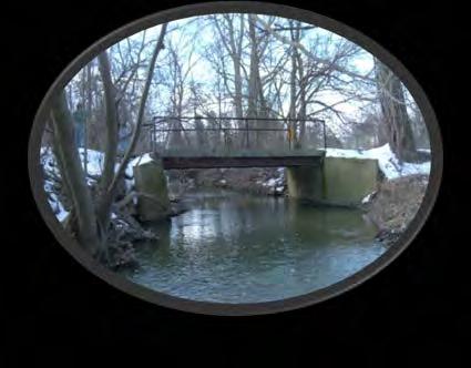
3 A Little Background Project Location map 3


4 Salomon Farm Park Master Plan Project Area 4


5 A Dangerous Problem! The existing alignment of Beckett s Run ran directly adjacent to Till Road Significant erosion and undermining of the roadway Dangerous side slopes adjacent to roadway Additional Causes for Concern: downstream flooding environmental quality of the stream 5

6 Project Objectives Primary Objective Eliminate the safety hazards and ongoing maintenance requirements by relocating Beckett s Run away from Till Road Secondary Objectives Provide space for additional lanes to be added to Till Road at a future time Provide environmental enhancements along the new stream Provide areas for future wetland mitigation Consider additional stormwater management opportunities 6
7 Additional Project Performance Criteria: A set of criteria were developed to aid in the evaluation of project alternatives in addition to satisfying the technical criteria outlined in the project objectives: Environmental Criteria Must not negatively impact the environment, recreational opportunities, or fish and wildlife resources. Institutional Criteria Acceptable to the City of Fort Wayne officials and wildlife resources. Permits must be attainable under existing federal, state, MRBC, and City permit programs. Economic Criteria Must be fundable and reduce the economic damages resulting from flood events. Must be the most economically feasible and effective solution to reduce flooding problems. 7
8 A small project, a lot of people. Even though the project site is not a large one, the complex and environmentally-sensitive nature of this project requires the involvement of a lot of parties: City of Fort Wayne Utilities Water Sanitary Storm Parks Transportation Other Utilities Electric Gas Phone Cable, etc. Permitting Agencies Indiana Department of Environmental Management Environmental Protection Agency US Army Corp of Engineers Local Soil & Water Conservation District Engineering Partners CBBEL CTL Engineering (geotech consultant) Russell Engineering / VS Engineering (surveyors) DLZ Indiana (Pedestrian Bridge / Inspection) 8
9 Who regulates what? The numerous regulatory agencies and their relative permitting processes can be daunting. IDEM and USACE 401/404 Water Quality -Required coordination the EPA IDNR Construction in a Floodway -Required for any work in a floodway IDEM Rule 5 - Required for any land disturbing activities greater than 1 acre Consideration of the time required to obtain the proper permits is an important, but easily overlooked, part of the overall project timeline. 9
10 Base Hydrologic Model HEC-HMS model based on NRCS TR-55 parameters: Watershed delineation Land Use Data Soil Data Curve Numbers Time of Concentration Reach Routing Precipitation Data Runoff Hydrograph The model was then calibrated and compared to the coordinated discharge curve from the Ungauged Streams in Allen County Coordinated Curve. Location Drainage Area (Sq. mi.) Coordinated Curve 100-Year Discharge (cfs) 10 Calibrated HEC-HMS 100-Year Peak Discharge (cfs) 2,000 feet East of SR 3 and 500 feet North of Till Road 2,250 feet upstream of Dawsons Creek Blvd Mouth ,814


11 Hydraulic Study - Reach Analysis Project Area 11
12 Hydraulic Modeling Process The data from the hydrologic model was then used to create a base hydraulic model to analyze the impacts of the proposed detention facilities. HEC-RAS Computer Model and Input Data Topographic base map and cross section location data Cross section geometry data Manning s roughness coefficients Bridge data Flow data Starting water surface elevations The model was used to develop an existing water surface profile for Beckett s Run to use for the basis of analysis for the possible alternatives. 12
13 Alternative Evaluation A preliminary grading plan and detailed hydraulic model were developed for each of 4 possible alternatives and each was evaluated based on the following: Impact of proposed detention facility on peak discharge and downstream flood elevations Possible funding opportunities Geomorphic conditions at the site Impact on storage within the existing floodplain Potential wetland creation schematics Limits of necessary property acquisition and/or easements Estimate of construction costs Permitting time frames Operation and maintenance considerations Cost/benefit analysis 13

14 And the survivor is 14
15 Project Development Design and Construction Document Process Survey Geotechnical Investigation Verified adequate wetland mitigation is provided for disturbed wetlands Reran and verified hydraulic model Adjusted plans per comments and initiated utility coordination process Designed utilities Drafted specs Adjusted plans per comments and completed fine grading Completed specifications, cost estimate QA/QC Review Completed bid documents and engineer s estimate 15

16 If it were only that easy 16

17 But finally 17
18 Selected Alternate vs. Actual 18
19 Engineer s Estimate / Bids Updated Project Estimate $2,318,000 Bids Received Atlas Exc. - $2,447,499 Fleming Exc. - $2,472,310 Ironclad Exc. - $2,482,737 Geiger Exc. - $2,498,070 Haynes Cons. - $2,893,701 Crosby Exc. - $2,998,440 Awarded to Atlas Excavating End of

20 Next Step Construction.. 20
21 Construction Milestones and Schedule Milestones Water Main relocated & construction fencing. New Channel & Coir Logs installed. Plant wetland, construct & seed the berm. Complete the bridge, fill existing ditch & install storm sewer. Schedule December 31, Existing ditch filled, storm sewer installed May, Final restoration for storm sewer construction. Delay due to redesign of east (tail) end of stream November 4, 2016 All milestones and final completion. Notice To Proceed January 20,

22 Before construction Successes Project is functioning as intended Water clarity improves throughout site Wetland growth 22


23 Feb-March, 2015 CLEARING 23


24 May, 2015 EXCAVATION 24

25 Spring, 2015 Successes Project is functioning as intended Water clarity improves throughout site Wetland growth 25


26 May, 2015 GEOWEB INSTALLATION 26


27 May-July, 2015 Plantings 27


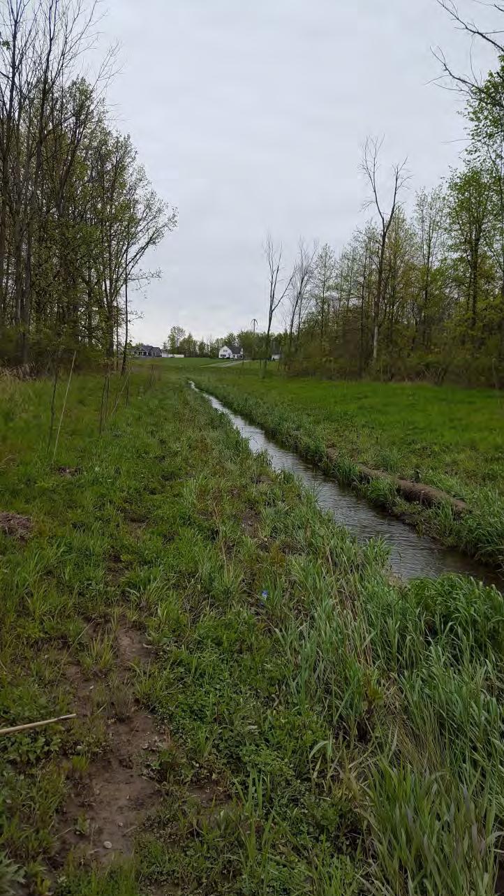
28 May-July, 2015 Plantings 28


29 May-July, 2015 Grading 29

30 30 Summer, 2015

31 July, 2015 Stop point for redesign of tail 31


32 July-October, 2015 Plantings 32

33 33 Spring, 2016


34 UTILITY COORDINATION 34


35 October, 2016 Monitoring 35


36 May, 2017 Monitoring 36


37 May, 2017 Monitoring 37


38 May, 2017 Monitoring 38


39 Monitoring May, 2017 August,


40 August, 2017 Monitoring 40
41 Challenges / Successes: Challenges during and after construction Sanitary Sewer conflict Existing Mitigation conflict Seasons changing affecting plantings and coir logs Washouts from wetlands discharging back into ditch Successes Project is functioning as intended Wetland growth Water clarity improves throughout site Aquatic Wildlife 41
42 Planning to Completion 42
43 Questions? 43