Overview of the Project R-CDTA In Vietnam
|
|
|
- Griffin Cole
- 5 years ago
- Views:
Transcription


1 Overview of the Project R-CDTA 8369 Innovative Data Collection Methods for Agricultural and Rural Statistics In Vietnam Presented by: Nguyen Hoai Nam & Chu Diem Hang Center for Informatics and Statistics, MARD, Vietnam Hanoi, 19/9/2017
2 CONTENT: I. ABOUT CIS II. OVERVIEW OF THE PROJECT III. PROJECT ACTIVITIES IV. PROJECT RESULTS V. ADVANTAGES AND DISADVANTAGES VI. RECOMMENDATION
3 I. ABOUT CENTER FOR INFORMATICS AND STATISTICS - CIS Center for Informatics and Statistics (CIS) Ministry of Agriculture and Rural Development have 4 main responsibilities: Statistics, Information technology, Information and Library. Some main activities: Implementing monthly report about agriculture production, market and export from many resources like administration reports by DARD, central technical department of MARD and Custom Office Making some surveys in agriculture, forestry and aquaculture Publishing annual statistical yearbook of agriculture and rural development Publishing many agriculture and rural development bulletins, publication Managing information technology system of Ministry of Agriculture and Rural Development. Managing database of agricultural information system of Ministry of Agriculture and Rural Development
4 II. OVERVIEW OF THE PROJECT 1. Title of the project: Innovative Data Collection Methods for Agricultural and Rural Statistics in Vietnam 2. Time of project: 2 years (from 9/ /2016) 3. Place of the project: Vietnam - Thai Binh province was selected for pilot study, with random 120 samples. - The implementing agency: Center for Informatics & Statistics (CIS), MARD. - The coordinate implementing agencies: General Statistics Office, National Institute of Agricultural Planning and Projection, Space Technology Institute, Thai Binh Department of Agriculture and Rural Development
5 II. PROJECT ACTIVITIES 1. Field survey - We have done 02 field surveys in 3/2015 and 7/2015, total 20 days. - With the selected 120 samples of 200m x 200m over 8 districts of Thai Binh province, we are required to +) Track the whole mesh and the paddy fields as well by using GPS on Ipad +) Identify which paddy belongs to whom +)Identify characteristics of the mesh (with paddy or without paddy? with other crops? With infrastructure..?). Purpose of this activity: To compare with the result of INAHOR with the input data as radar images Advantages: +) The terrain of Thai Binh is relatively flat, easy to travel in the survey. +) With using GPS, it is easy to seek the position of the meshes Disadvantages: +) So many small paddy fields inside one mesh in Thai Binh province tracking takes time, even one mesh belongs to 2 different villages +) Identification the owner of the paddy field is difficult.
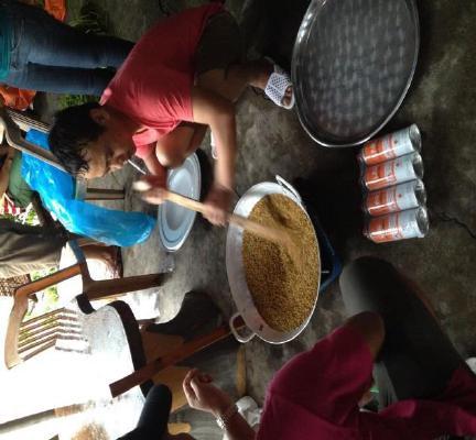
6 II. PROJECT ACTIVITIES 2. Crop cutting (1 st time) - Time: 9-10/2015 (more than 1 months) much depending on the harvesting time - Total 70 samples, each sample randomly selected 4 plots, each plot is 2,5x2,5 m. - The work is very meticulous and careful, based on the methods of experts. Purpose of the activity: To adjust the INAHOR software with input as radar images Lessons learnt: - Post-harvested rice should dried in the sun before being dried by pan on gascooker. - When implementing crop-cutting, all the harvested paddy should be gathered in one place (a big store) then we will do next steps including threshing, drying, moisture measurement, weighting and recording the results. Difficulties: - It takes a lot of time to implement this activity because it depends much on the time when rice ripe. - The weather is unexpected elements. - Some famers does not allow cutting their paddy rice, or paddy rice is too small, or beyond sample
7 II. PROJECT ACTIVITIES 3. Farmer Recall Survey - During: December 2015 to January We have surveyed 280 households for more one month with 5 teams, 5 enumerators per team. Purpose of the activity: together with the result from crop-cutting adjust the INAHOR software Advantages: The questionnaire is detailed, it includes so many good questions, easy to understand Disadvantages: - To complete the questionnaire, it takes about 3 hours and even more - Some question unable to survey as the farmers can not remember information of the crop
8 II. PROJECT ACTIVITIES 4. Training - Total 7 training courses with the following contents: +) How to apply the image and map application +) How to use INAHOR software +) How to use CAPI (Computer Assisted Personal Interviewing) +) How to use CSPro to process data +) How to make field surveys, farmer recalls, and crop-cutting - Training courses in the near future: +) Training on Geospatial Technologies and Computer Assisted Personal Interviewing for Agricultural and Rural Statistic in the Philippines +) Other online training courses


9
10 III. ADVANTAGES AND DISADVANTAGES 1. Advantages: - We had enthusiastic supports from ADB, JAXA, RESTEC and domestic agencies. - CIS has human resources in IT, statistics and administrative statistic management to compare result of the project. - Application of modern equipment (hardware, software) 2. Disadvantages: - To implement all the project activities, we have to contact and coordinate with many administrative levels: provincial/city, district, commune, village... - It takes a lot of effort, time and cost expensive... - Cultivation production in Thai Binh province is small, un-concentrated, changing by crops and unplaned difficult to plan to survey/observe.
11 IV. PROJECT RESULTS 1. New approach to advanced statistic methods especially in estimating rice production by INAHOR 2. The data of the project activities including crop cutting, famer recall survey and field survey. 3. The human from CIS, GSO, and some other organizations under MARD have improve their capacity in statistics 4. The estimation results of the INAHOR software is very close to the other results by administrative statistical report done by GSO and CIS.
12 V. RECOMMENDATION 1. The project should be piloted in the other province in Mekong Delta. 2. The estimation method should be applied for other perennial crops. 3. Training on satellite image processing (if we can). 4. INAHOR software can run on Windows OS. 5. When the project ends if we can explore satellite images for INAHOR software
13 THANK YOU SO MUCH