Applications for. Management. Agricultural Risk Management Team. The World Bank
|
|
|
- Lisa Atkins
- 5 years ago
- Views:
Transcription


1 Geospatial Technology Applications for Agricultural Risk Management Agricultural Risk Management Team Agriculture and Environmental Services Department The World Bank


2 Agricultural Risks : Cross Cutting Agenda Disasters Productivity Social Food Climate protection security change Agricultural Risks
3 Crop failure / Livestock asset loss is one of the biggest shock (poverty trap) for rural households Principal cause of transient food insecurity Major driver of GDP volatility in Ag. dependent countries Major impact on Government s fiscal balance Biggest cause of diversion of development financing, primarily for crisis response Principal source of ag. supply chain disruptions and commodity chain failures Increasingly negative impact in recent years
4
5 Geo Spatial Applications Risk Assessment Better historical information on weather and production parameters to assess risks, its consequences and prioritize risks Mitigating Real time information Early warning Agronomic advisory to farmers Vulnerability and crop suitability mapping Transfer Agricultural insurance Coping Objective trigger for impending disasters Scaling up of social safety net programs


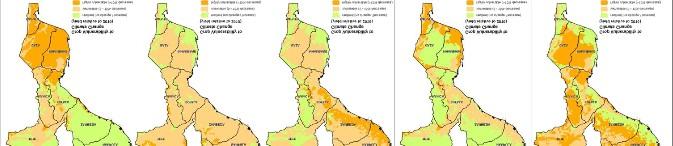
6 Mitigation: Geospatial application for early warning FEWS-NET Livelihood systems are based on subsistence agriculture and/or pastoralism, and are highly drought sensitive Conventional climate station networks are sparse and/or late reporting Satellite remote sensing and models fill the gap, and provide the basis for early detection of agricultural drought
7 Mitigation: Geospatial applications for early warning FEWS-NET
8 Mitigation: Geospatial applications for early warning FEWS-NET


9 Mitigation: Geospatial application for crop vulnerability and crop suitability
10 Mitigation: Geospatial applications for farmer advisory (e-leaf) Funded by IFAD ( ), executed by IWMI, eleaf, DLV Plant and local Partners Field-specific information on crop and water conditions and irrigation advice through Smart ICT channels to smallholders in pilot areas in Ethiopia, Egypt and Sudan (see eleaf: Supplying reliable quantitative data on water and vegetation to support sustainable water use, increase food production and protect environmental systems Spatial data converted to text-based SMS - both qualitative and quantitative info - both on-demand and weekly push
11 Mitigation: Geospatial applications for farmer advisory
12 GEOGLAM, the GEO Global Agricultural Monitoring initiative was initially launched by the GEOGLAM, the GEO Global Agricultural Monitoring initiative was initially launched by the Group of Twenty (G20) Agriculture Ministers in June 2011, in Paris. This initiative will coordinate satellite monitoring observation systems in different regions of the world in order to enhance crop production projections and weather forecasting data.
13
14


15 FESA Micro-insurance is a Meteosat based drought and excessive precipitation index insurance system developed by EARS. EARS has processed 32 year of Meteosat data to evaporation and precipitation data fields that cover the entire African continent at 3 km resolution. Based on these data, EARS designs index insurance solutions for any location in in Africa. Using its Meteosat receiving system, the company will also monitor the insurance index during the growing season and calculate and report pay-out to the insurance stakeholders.
16

17 LEAP- Livelihoods, Early Assessment and Protection The LEAP food security early warning tool converts agro-meteorological data into crop or rangeland production estimates and quantifies the financial resources needed to scale up the Productive Safety Net Programme in case of a major drought. LEAP provides a transparent and verifiable way to trigger contingent funds to enable an early response before the most severe consequences of drought affect people s lives and livelihoods. The meteorological information used in LEAP comes from satellite data and a The meteorological information used in LEAP comes from satellite data and a network of automated and conventional weather stations
18
19 Geospatial Application for Improved Agricultural Risk Management Geospatial applications have a critical role for improved risk management Key role in risk assessment and putting in place adequate risk mitigation-transfer-coping programs and strategies Some pilots projects have demonstrated the significance of geo spatial applications Scaling up of existing successful applications and testing of new applications is needed Important role in insuring resilience of agricultural systems


20 Questions/ Comments/ Concerns. Let s Discuss agrm ementforum.org/