Status and challenges of soil management in the Middle East
|
|
|
- Daniela Brooks
- 5 years ago
- Views:
Transcription
1 Status and challenges of soil management in the Middle East Managing Living Soils - Technical Workshop 5-7 December 2012 FAO Headquarters Rome, Italy Feras M. Ziadat 1

2 About ICARDA One of 15 CGIAR centres (Consultative Group on International Agricultural Research) Vision: Improved livelihoods of the resource-poor in the dry areas Geographic Mandate: non tropical dry areas Partners: National Agricultural Research Systems Advanced Research Institutes Development organizations Rural communities
3 Challenges for sustainable soil management Limited areas with detailed data High Cost to cover more areas Purity of mapping units Site-specific Management Environmental modelling Spatial and temporal changes Institutional challenges (within and among countries) Example - Jordan 3
4 Soil data for sustainable land management We need: Spatial distribution of lateral and vertical soil attributes covering large areas Alternatives to provide soil data Alternatives to facilitate collaboration among countries 4
5 Handling data scarcity and data sharing difficulties Working in Benchmark sites to represent dominant agro-ecosystems Rainfed agriculture Morocco Irrigated agriculture - Egypt Rangeland (driest) Jordan 5

6 Similarity maps for three agro-ecosystems Enable screening of similar areas for focusing Independent of location among country Coarse maps at regional level & verification at country level Allow data integration and out-scaling 6

7 Detailed Suitability maps for similar areas Use detailed data within country, but Out-scalable to other countries with similar bio-physical conditions 7

8 Alternative sources of soil information Developments in new technologies; GIS and remote sensing provide new approaches to meet the demand of resource-related modelling Regression models within subwatersheds to predict soil attributes Attribute oriented outputs Needed for current applications Reasonable cost and expandable coverage 8
9 Accuracy of the predicted soil characteristics was generally better than those derived from traditional soil map (scale 1:5,000) Chemical, physical, and soil fertility related attributes for the surface and sub-surface soils 9
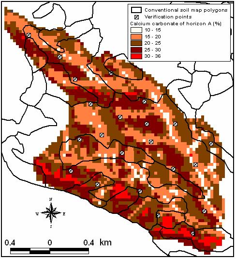
10 10


11 Application in various countries Using SRTM 90m NDVI from Satellite images Various number of observations were tested 11
12 Testing accuracy using few observations to minimize the field work and maintain accuracy 12
 Encourage applications at various levels and purposes with minimum input from the field")
13 Future Design user-friendly toolkit to predict soil attributes: Stand alone OR Sub-model within SWAT (Soil & Water Assessment Tool) Encourage applications at various levels and purposes with minimum input from the field 13

14 Example of application: suitability analysis Accuracy of the suitability classification derived from predicted soil attributes is comparable with those derived from traditional 1:10,000 soil maps Spatial distribution of suitability classes derived from the predicted soil attributes indicated more realistic pattern 14


 Semi-circular")


15 Example of application: using SWAT to investigate the impact of various SLM options Participatory implementation of SLM: Contour Stone bunds (continuous) Semi-circular stone bunds Intercropping with cover crops Valerrani system (intermittent pits) Reduced tillage or no-tillage Contour tillage Addition of organic manure Continuous contour ridges 15


16 SWAT help in developing scenarios for sustainable land management Monitoring of runoff, sediment loss, and soil nutrient loss at watershed and field levels to Combat land degradation
17 Concluding remarks Similarity and suitability analysis, soillandscape and environmental modeling are promising tools to cope with soil management challenges Provide means to facilitate within and among countries collaboration to provide regional coverage of data and information needed for sustainable soil management 17

18 Yet, long way to go Thank You 18