CHAPTER 1: AGRICULTURAL LAND BASE OF SUSSEX COUNTY
|
|
|
- Herbert Ellis
- 5 years ago
- Views:
Transcription
 on 75,496 acres (fifth in the State).")
 and 30 dairy farms (second in the State) that range")

1 CHAPTER 1: AGRICULTURAL LAND BASE OF SUSSEX COUNTY The agricultural land base of Sussex County comprises a significant portion of New Jersey s farmland. Sussex County supported 1,029 individual farms in 2002 (second in the State) on 75,496 acres (fifth in the State). Hay the County s principal crop was planted on 21,195 of these acres (second in the State). Sussex County also supports New Jersey s most notable concentration of dairy and livestock operations with 89 beef cow farms (third in the State) and 30 dairy farms (second in the State) that range over 15,974 acres (second in the State). (2002 Census of Agriculture) 1 Quantitative figures alone do not capture the full importance of Sussex County s farmland. Sussex County s agricultural lands bestow the County with a rich rural setting found nowhere else in New Jersey. Steep ridgelines abut fertile valleys offering spectacular agricultural viewsheds. Many farms in Sussex are also located near valuable natural resource and park lands. This combination creates an undeveloped, natural landscape that spans large swaths of the County. This landscape has been the living and working environment for generations of Sussex County residents, and to many, it means home. Agricultural Landscape Sussex County rests in two of New Jersey s four physiographic provinces the Appalachian Ridge and Valley province and the Highlands province. The Ridge and Valley province in Sussex County is part of a large geologic formation that extends 1,200 miles between Alabama and the St. Lawrence Valley in eastern Canada. It encompasses all of the County s area north and west of the Sparta-Waywayanda-Pochuck (Highlands) Ridge, which ranges between Byram and Vernon Townships. The Ridge and Valley Province in Sussex County is divided into two valleys by the Kittatinny Ridge, which ranges between Walpack and Montague Townships in the northern part of the County. The Kittatinny Ridge was formed when tectonic forces compressed and elevated sections of the Earth s crust and created the Appalachian Mountains. Glaciation, wind, and water have since eroded the quartzite and sandstone bedrock of the Kittatinny Ridge into its current shape and size. (1975 Sussex County Soil Survey) 2 Due to the intensity of these weathering forces and the exposed bedrock they left behind, much of the Kittatinny Ridge is unsuitable for agricultural production. Sussex County Comprehensive Farmland Preservation Plan Update May
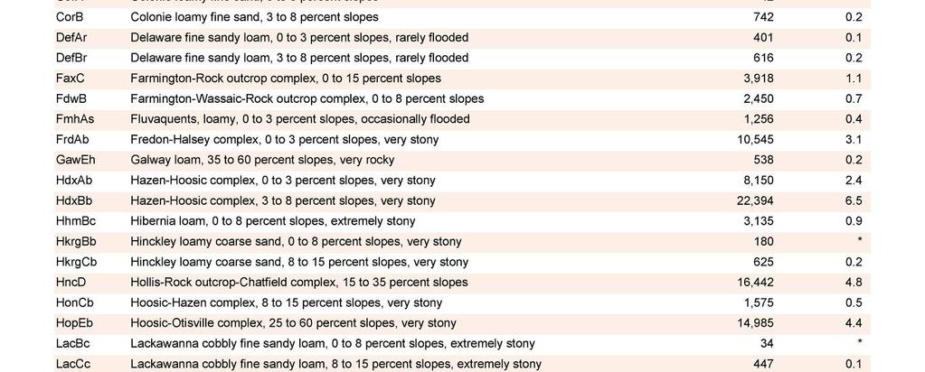
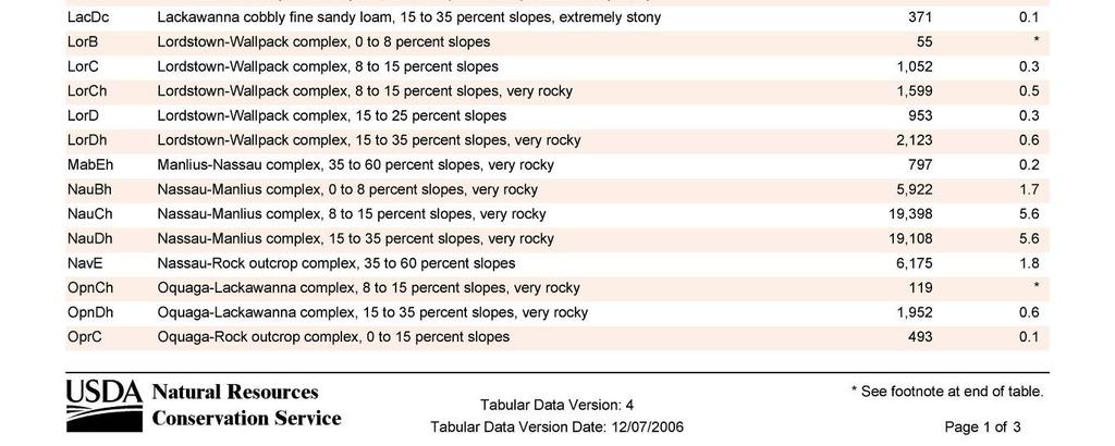
2 The Kittatinny Valley encompasses the broad swath of land between the Kittatinny and Highlands Ridgelines. This valley supports the County s principal concentration of agricultural operations. In the northeast, the rolling hills in Wantage, Frankford, and Lafayette Townships provide excellent areas for hay and livestock farms. In the southwestern Townships of Hampton, Stillwater, Fredon, and Green, the Valley becomes flatter and more suitable for farms that plant row crops such as vegetables and Christmas trees. The Kittatinny Valley is also home to the County seat Newton as well as the Boroughs of Sussex and Branchville where limited concentrations of agricultural businesses and support services are located. Outside the Kittatinny Valley, farmland in Sussex County is sparse. Some pockets of agricultural land exist in two other areas of County the Upper Delaware/Minisink Valley and the Highlands Ridgeline. Encompassing parts of Montague and Sandyston Townships, the Upper Delaware Valley rests between the Kittatinny Ridge to the east and the Delaware River to the west. The Upper Delaware Valley is primarily occupied by public open space lands, but it supports some orchards and equine operations as well. The Upper Delaware Valley is more rural than the Kittatinny Valley, and offers scenic views of almost entirely undeveloped, agricultural landscapes from the ridgelines that surround it. The Highlands Physiographic Province is characterized by Precambrian mountains of granite and gneiss bedrock with adjoining limestone valleys. In Sussex County, the Highlands Province is comprised of a long ridgeline that includes Sparta Mountain, Wawayanda Mountain, Hamburg Mountain, and Pochuck Mountain, and runs between the eastern Townships of Byram and Vernon. Small pockets of agricultural land within the Highlands Ridge contain noteworthy agricultural operations including orchards, vegetable farms, and livestock farms. However, most areas in the Sussex County Highlands are thickly forested, developed, or covered by steeply sloping terrain. Soils More than one hundred individual soil types are found throughout Sussex County. Soil types are determined by the parent bedrock material from which they were formed, the drainage characteristics they have, and the steepness of the slopes on which they are found. Soil types are also grouped into larger categories called soil series based on their parent material, chemical composition, and profile, as well as soil associations that combine similar soil series. There are more than thirty soil series that comprise eleven soil associations in Sussex County. A complete listing of the County s soils can be found at the end of this chapter. (2005 Sussex County Soil Survey) 3 The soils of Sussex County are direct reflections of the region s topography and the geological processes responsible for it. Areas that are most susceptible to the weathering influence of glacial, wind, and soil erosion such as the County s steeply sloping ridgelines and mountainsides have had most of their topsoil eroded to lower elevations. The County s valleys serve as repositories for much of this eroded soil and generally have deeper and higher quality soils. Even here, soils are generally located on gently to moderately sloping, rocky terrain. Up to 25% of the County s cultivated areas are affected Sussex County Comprehensive Farmland Preservation Plan Update May
3 by soil erosion due to topography. Sussex County s rolling landscape also serves to concentrate surface water flows into many rivers, lakes, wetlands, and their surrounding farmlands. Up to 15% of the County s tillable areas have been historically impacted by flooding. (2005 Sussex County Soil Survey) Despite the many soil limitations in Sussex County, local soils are adequate to sustain a viable agricultural industry. Farmers have successfully adapted traditional practices to fit the rolling and rocky terrain in the County. They also rely heavily on products that grow well in these soils including hay, corn, and livestock. In addition, more than 14% of the County (48,399 acres) is covered by Prime, Statewide or Unique agricultural soils (see Agricultural Soils Chart below). (Natural Resource Conservation Service, Soil Survey website) 4 Many of these acres fall within public parklands (see Soils Map), but many are actively farmed (see Candidate Qfarms Map). Abbr Soil Description Quality Erodability Acres DefAr Delaware fine sandy loam, 0 to 3 % slopes, rarely flooded Prime Potentially 401 DefBr Delaware fine sandy loam, 3 to 8 % slopes, rarely flooded Prime Potentially 616 HdxAb Hazen-Hoosic complex, 0 to 3 % slopes, very stony Prime Not high 8,150 HdxBb Hazen-Hoosic complex, 3 to 8 % slopes, very stony Prime Potentially 22,394 LorB Lordstown-Wallpack complex, 0 to 8 % slopes, forest & recreation Prime Potentially 55 PohA Pompton sandy loam, 0 to 3 % slopes Prime Not high 555 RkrB Riverhead sandy loam, 3 to 8 % slopes Prime Potentially 774 ScoA Scio silt loam, 0 to 3 % slopes Prime Not high 154 UnfA Unadilla silt loam, 0 to 3 % slopes Prime Potentially 73 WabBb Wallpack fine sandy loam, aeolian mantle, 0 to 8 % slopes, very stony Prime Potentially 63 WacB Wallpack silt loam, 3 to 8 % slopes Prime Potentially 97 CorA Colonie loamy fine sand, 0 to 3 % slopes Statewide Potentially 42 CorB Colonie loamy fine sand, 3 to 8 % slopes Statewide Potentially 742 HonCb Hoosic-Hazen complex, 8 to 15 % slopes, very stony Statewide Potentially 1,575 LorC Lordstown-Wallpack complex, 8 to 15 % slopes Statewide High 1,052 UnfB Unadilla silt loam, 3 to 8 % slopes Statewide Potentially 365 WabCb Wallpack fine sandy loam, aeolian mantle, 8 to 15% slopes, very stony Statewide High 776 WacC Wallpack silt loam, 8 to 15 % slopes Statewide High 1,331 CatbA Catden mucky peat, 0 to 2 % slopes Unique Not high 9,226 TOTAL 48,399 Source: Natural Resource Conservation Service, Soil Survey website Over 32,000 acres are covered by prime and statewide important soils of the Hazen-Hoosic Complex (2005 Sussex County Soil Survey). These soils originated from glacial outwash of slate, shale, and sandstone materials, and are generally very deep and stony. They are found primarily on mounds and slopes within the County s valleys. They exhibit moderate permeability and fertility with soils of the Hoosic series containing relatively low water capacity. Consequently, dry seasons significantly impact crop yields from these soils and many crops, especially vegetables and flowers, require extensive irrigation. Although these soils can support most crops, they are best suited for small grains, with slopes steeper than 8% appropriate only for pastures and woodlands. Sussex County Comprehensive Farmland Preservation Plan Update May
4 Many of the County s other prime and statewide important soils, including soils of the Colonie, Delaware, Riverhead, and Unadilla Series, are found within the Kittatinny Valley and the Delaware Water Gap National Recreation Area. These soils tend to be deep with good drainage and water capacity, making them excellent for a variety of crops. Soils that are commonly found near the County s waterways, such as those of the Colonie and Unadilla Series, are typically fine-grained and contain higher levels of organic matter than other soils. These fine-grained soils are suitable for a wide range of agricultural products, including vegetables and nursery crops. Coarse-grained soils, such as those of the Delaware Series, tend to be located further away from water bodies, and are more commonly planted with corn and small grains. (Natural Resource Conservation Service, Soil Survey website) The remainder of Sussex County s agricultural soils are located in areas that are not currently utilized for agriculture. Soils of the Pompton Series are found in flat plains near the Highlands Ridge that are primarily forest-covered, while soils of the Lordstown- Wallpack complex are most commonly found within the Delaware Water Gap National Recreation Area. These tend to exhibit a coarse-grained, rocky substrate with variable drainage qualities. Catden soils are associated with important natural areas within or adjacent to submerged lands. Consequently, they are poorly drained and deep with high levels of organic matter. Catden soils are primarily occupied by undeveloped wildlife conservation areas. (Natural Resource Conservation Service, Soil Survey website) Irrigated Land & Water Sources The amount of irrigated farmland in Sussex County is very small. Only 93 farms irrigated 642 acres during 2002, representing less than 10% of the County s farms and less than 1% of its farmland. (2002 Census of Agriculture) However, the irrigated acreage in Sussex County has nearly doubled since 1982 with more than three times as many farms utilizing irrigation. This trend is partly attributable to the increasing number of water-intensive agricultural operations, such as nurseries and vegetable farms, taking root in the County in areas where local soils require irrigation to support these products. Additionally, the 2002 Census year was abnormally dry, which may account for some of the irrigation increases that were observed. Limited groundwater supplies are the only available sources of water for the limited amount of irrigation that occurs in Sussex County (642 acres). Towns in the Kittatinny Valley where most of the County s irrigated acres are found Wantage, Lafayette, and Hampton Townships contain aquifers of general poor productivity. (2003 Sussex County Open Space Plan) 5 Competition for these limited groundwater resources between agriculture and other local land uses, including new residential and commercial developments, has been continually intensifying in these areas. There is a general concern that further development will limit the availability of water for agriculture in much of Sussex County. Sussex County Comprehensive Farmland Preservation Plan Update May
5 There are only a handful of farms in the County that are located within the Highlands Preservation Area and the farms utilizing limited irrigation are not located in the Highlands. Three farms in Sussex County are enrolled in the Soil and Water Conservation (8-Year Farmland Preservation) program in the Sussex County and none of these farms are located in the Highlands. As mentioned, Sussex County is 525 square miles in size and, of this, only 642 acres is utilized for agricultural irrigation. The nature of Sussex County farming is predominantly livestock and hay, both of which do not require irrigation. Very few Sussex County farmers raise vegetables, which have higher water needs, as their primary product. It is highly unlikely that there will be a significant change in agricultural practices in Sussex County to warrant groundwater consumption concerns. Farmland Trends & Statistics The size of the agricultural land base in Sussex County has remained relatively constant in recent years. The total amount of land in agricultural production (75,496 acres in 2002) has not significantly changed since 1982 (see Farmland Acreage chart below). However, the total acreage of both crop and pastureland has been steadily declining during the last twenty years. During this time, cropland has decreased by 16% while pasture land has decreased by 28%. (All statistical data was derived from the 2002 Census of Agriculture) 100,000 80,000 Sussex County Farmland Acreage: Source: Census of Agriculture 73,161 78,641 75,531 73,001 75,496 Total Farm Land Acres 60,000 40,000 20, ,258 NA 45,377 44,114 22,068 19,831 41,321 38,033 17,388 15, Total Crop Land Total Pasture Land There are a number of reasons that the overall agricultural land area has remained constant while the amounts of crop and pasturelands have decreased. Many of the farmland losses associated with development of farmland are offset when natural land in other parts of the County is cleared and tilled for agricultural use. Additionally, large residential properties often become eligible for farmland assessment status when landowners produce sufficient amounts of agricultural products. This trend has increased the number of individual farms in Sussex County (see Farms chart below), and resulted in a corresponding decrease in the average farm size (see Average and Median Farms chart below). Consequently, changes to the overall area of farmland in Sussex County have been small in recent years. Sussex County Comprehensive Farmland Preservation Plan Update May
6 1,200 1, Number of Sussex County Farms: Source: Census of Agriculture ,029 Acres Average & Median Farm Size in Sussex County: Source: Census of Agriculture Average Farm Size NA NA NA Median Farm Size Sussex County Comprehensive Farmland Preservation Plan Update May
7 Farms (#) Sussex County Farms by Size: Source: Census of Agriculture acres acres 500+ acres Simultaneously, former crop and livestock acreage is being transferred to other agricultural uses. Nurseries, floriculture operations, and equestrian facilities have become more lucrative and popular in the region and are replacing many crop and livestock farms. The overall amount of agricultural land does not change when this occurs, but the amount of crop and pasturelands declines. Increases in acreage devoted to these other agricultural uses are helping to compensate for losses in crop and livestock lands keeping the overall agricultural acreage constant. There is a general concern among farmers that an increasing amount of formerly productive farmland is being abandoned. This land remains part of the County s total agricultural land, but it is not used for pasture or crop land. Land left fallow and unmanaged promotes the spread of invasive plant species and often serves as habitat for wildlife that damages crops in nearby fields. More abandoned land also means that Sussex County farmers must increase the percentage of still active farmland that they harvest each year in order to maintain current levels of productivity. Sussex County farmers harvested crops on 27,776 in This represents a slight decrease in the total harvested acreage from previous years, but an increase in the percentage of still active cropland that was harvested (see Cropland Harvested chart below). Sussex County Comprehensive Farmland Preservation Plan Update May
8 50,000 40,000 Sussex County Cropland Harvested: Source: Census of Agriculture 41,258 45,377 44,114 41,321 38,033 Total Cropland Acres 30,000 20,000 28,579 (69.3%) 29,742 (65.5%) 29,631 (67.2%) 29,788 (72.1%) 27,776 (73.0%) Harvested Cropland (% of Total Cropland) 10, Sussex County Comprehensive Farmland Preservation Plan Update May

9 Sussex County Comprehensive Farmland Preservation Plan Update May


10 Sussex County Comprehensive Farmland Preservation Plan Update May


11 1 United States Department of Agriculture: National Agricultural Statistic Service, 2002 Census of Agriculture. Accessed June United States Department of Agriculture Soil Conservation Service in Cooperation with New Jersey Agricultural Experiment Station and Cook College, Rutgers University. Soil Survey of Sussex County, New Jersey. Washington, DC, Natural Resource Conservation Service (NRCS) Sussex County Soil Survey. Online at: Accessed September Soil Survey Staff, Natural Resources Conservation Service, United States Department of Agriculture. Official Soil Series Descriptions. Accessed June Morris Land Conservancy in Cooperation with the Sussex County Agriculture Development Board. A Comprehensive Farmland Preservation Plan for the County of Sussex. Boonton, NJ, September Sussex County Comprehensive Farmland Preservation Plan Update May