Need Additional Information? LEGAL DISCLAIMER ACKNOWLEDGEMENT:
|
|
|
- Donald Osborne
- 5 years ago
- Views:
Transcription
1
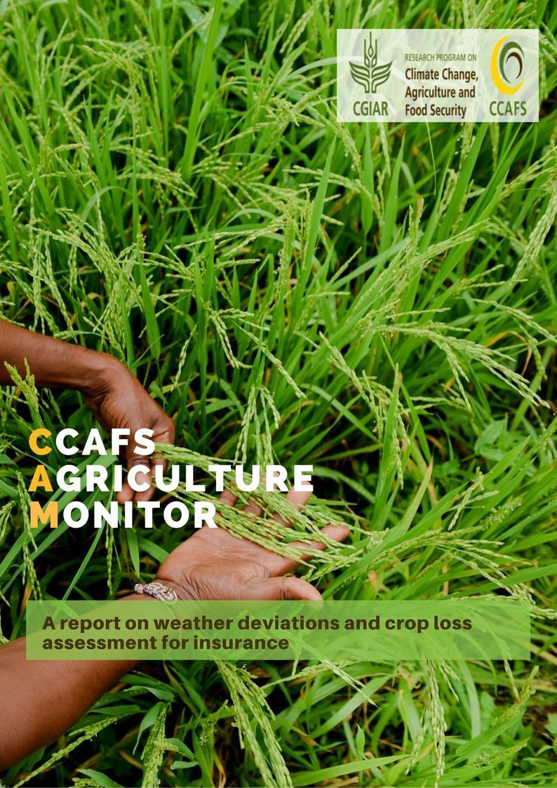
2 LEGAL DISCLAIMER This work was implemented as part of the CGIAR Research Program on Climate Change, Agriculture and Food Security (CCAFS) hosted by BISA-CIMMYT in South Asia. The views expressed in this document cannot be taken to reflect the official opinions of these organizations. The designations employed and the presentation of the material on the maps do not imply the expression of any opinion whatsoever on the part of authors concerning the legal status of any territory, area or city or of its authorities, or concerning the delimitation of its frontiers or boundaries. Care was taken in creation of the maps but there is no warrant the map or its features are either spatially or temporally accurate or fit for a particular use. CCAFS reserves all rights to the content of this document. No part of this document may be reproduced or transmitted in any form, without the prior consent of CCAFS. This document does not constitute any form of legal, accounting, tax or actuarial advice. Analysis presented in this document is based on data provided by third party sources. CCAFS accepts no responsibility for the accuracy or completeness of the underlying information of these data sources. Additionally, recipient acknowledges that any form of mathematical and/or empirical analysis and modelling (used in this document) may produce different results from actual events and/or losses; and any recommendation or assessment of risk is an expression of opinion and not a statement of fact. Any decision to rely on information presented in this document will be solely at the risk of the recipient, for which CCAFS accepts no liability. CCAFS does not claim any warranty, whether expressed or implied, in respect of any content presented in this document. CCAFS will not be liable, in any way, for any indirect or consequential loss or damage of any kind resulting from use of the information contained in this document. The authors also declare no competing financial interests. Need Additional Information? If your organization requires additional information or analysis using high resolution data for your area of interest (including other countries) then please contact us at ccafs.cam@gmail.com The periodic publication of this report can be received by through automatic mailing lists. For subscription and/or detailed analysis of the data, enquiries may be directed to: CGIAR Research Program on Climate Change, Agriculture and Food Security (CCAFS) BISA-International Maize and Wheat Improvement Centre (CIMMYT). NASC Complex, CG Block, DPS Marg, PUSA, New Delhi , India ccafs.cam@gmail.com ACKNOWLEDGEMENT: This work was implemented as part of the CGIAR Research Program on Climate Change, Agriculture and Food Security (CCAFS), which is carried out with support from CGIAR Fund Donors and through bilateral funding agreements. For details please visit The views expressed in this document cannot be taken to reflect the official opinions of these organizations. We acknowledge the use of data derived from MODIS satellite and NOAA-CPC. Correct citation Aggarwal, P.K., Shirsath, P.B., Arumugam, P., and S. Goroshi CCAFS Agriculture Monitor: A Report on Weather Deviations and Crop Loss Assessment for Insurance. CGIAR Research Program on Climate Change, Agriculture and Food Security (CCAFS) of South Asia, New Delhi, India.
3 KHARIF-2017 (INDIA) OCTOBER 2017 CONTENTS Graphical Summary- Crop Loss Assessment... 4 INTRODUCTION Weather Rainfall... 6 Rainfall Volume... 6 Rainfall Distribution... 8 Rainfall Extremes Temperature Seasonal Average Minimum Temperature (June 1-September 30, 2017) Minimum temperature deviation from long term average (June 1-September 30, ) Average Maximum Temperature (June 1-September 30, 2017) Maximum temperature deviation from long term average (June 1-September 30, ) Vegetation Condition Current Vegetation Growth Index (June 1- September 30, 2017) Deviation of current Vegetation Growth Index (June 1- September 30, 2017) from previous year.. 18 Deviation of current Vegetation Growth Index (June 1- September 30, 2017) from previous 5-year average Crop Condition Cotton Groundnut Maize Pearl Millet (Bajra) Rice Sorghum Soybean Data sources and definitions

4 OCTOBER 2017 KHARIF-2017 (INDIA) Graphical Summary- Crop Loss Assessment 4
5 KHARIF-2017 (INDIA) OCTOBER 2017 INTRODUCTION Agriculture is intricately linked with location-specific meteorological conditions. Prevalent weather and extreme events thus shape the agricultural output of the season, along with management and farmspecific characteristics. Monitoring such events becomes a fruitful pursuit for agencies and individuals involved in agricultural and allied sectors. This report presents district-level analysis of agriculture-specific indicators prevalent over India. High resolution gridded data is used to estimate near-real time crop condition and weather parameters. With temporal dimension of two weeks and district level analysis, this report can ensure consistent and extensive monitoring. It aims to build a common platform where location specific, high quality data is available with minimal time lag, to monitor weather conditions and track the progress of agriculture in the country. Seasonal data is also accompanied with summaries from start of Kharif period for overall seasonal analysis. Deviations from long term averages is presented to gauge overall climatic trends. The report is structured in three sections. First section presents weather parameters, second section describes the crop condition and crop specific conditions of prevented sowing, sowing failure and final yield estimates are described thereafter. Weather comprises of rainfall and temperature analysis. Rainfall is analyzed comprehensively by focusing on volume, distribution, extremes. Additional section of drought is also included, which presents derived parameter of Standardized Precipitation Index (SPI) from the rainfall data. Crop condition is described by Normalized Difference Vegetation Index (NDVI). MODIS derived NDVI values are used to define Vegetation Growth Index. Comparison from previous year and long-term averages enables identification of overall trends in vegetation cover. Next section on crop condition presents areas with likely chances of prevented sowing and crop failure, and finally yield loss assessment under different confidence level using multi-criteria assessment. Prevented sowing indicates areas where there are likely chances that sowing could not take place due to inadequate conditions. Similarly, sowing failure indicates areas where there are likely chances that crops could not survive due to unfavorable conditions. Mid-season adversity is also included. The indicators are derived through multi-criteria assessment using weather derivatives, remotely sensed vegetation indices and crop growth modelling. The results are relevant only for rainfed regions; and flood losses are not considered. Minimal validation and ground-truthing should be done before further use. This periodic reports can be used for further research and will aid agencies and/or individuals involved in agriculture sector. The analysis will soon be automated into a web-based portal where all the indicators and district wise data can be accessed. 5
6 OCTOBER 2017 KHARIF-2017 (INDIA) 1. Weather This section presents district level analysis of near-real time weather parameters and their deviations from historical trends. Rainfall is presented first followed by temperature. Rainfall analysis is further divided into sub-sections of Rainfall Volume, Rainfall Distribution, Rainfall Extremes and derived parameters for Drought. 1.1 Rainfall Rainfall Volume SEASONAL RAINFALL (JUNE 1- SEPTEMBER 30, 2017) The following map presents seasonal cumulative rainfall volume (in mm) over the country from start of June, Data is derived from Climate Prediction Centre of National Oceanic and Atmospheric Administration. Most of eastern and North-eastern India and parts of Western India received high rainfall greater than 1400 mm during current Kharif season. Northern India including Jammu and Kashmir and Himachal Pradesh received low seasonal rainfall of less than 400 mm. Grey areas show regions with nodata. 6
7 KHARIF-2017 (INDIA) OCTOBER 2017 SEASONAL RAINFALL DEVIATION FROM LONG TERM AVERAGE (JUNE 1- SEPTEMBER 30, ) The following map presents deviation of seasonal cumulative Kharif rainfall (%) from long-term average, over the country. Data is derived from Climate Prediction Centre of National Oceanic and Atmospheric Administration. Highest negative anomaly was observed for parts of central and western India and coastal parts of Karnataka and Kerala where rainfall anomaly was more than >-50%. Parts of North-East India, Rajasthan and Gujarat witnessed positive anomaly where Kharif rainfall anomaly was >50%. Grey areas show regions with no-data. 7
8 OCTOBER 2017 KHARIF-2017 (INDIA) Rainfall Distribution NUMBER OF RAINY DAYS (JUNE 1- SEPTEMBER 30, 2017) The following map presents number of rainy days over the country. Data is derived from Climate Prediction Centre of National Oceanic and Atmospheric Administration. Lowest number of rainy days occurred in western India, and highest number of rainy days occurred in Eastern and North-Eastern India with rainy days of more than 80. Grey areas show regions with no-data. 8
9 KHARIF-2017 (INDIA) OCTOBER 2017 MAXIMUM LENGTH OF DRY SPELLS (JUNE 1- SEPTEMBER 30, 2017) The following map presents seasonal maximum length of dry spells (in days) over the country. Data is derived from Climate Prediction Centre of National Oceanic and Atmospheric Administration. Parts of Rajasthan, Gujarat, Jammu and Kashmir, Maharashtra, Punjab and Tamil Nadu witnessed maximum dry spells with more than 20 days having dry spells. Most of eastern, and North-Eastern India had very few dry spell days. Grey areas show regions with no-data. 9
10 OCTOBER 2017 KHARIF-2017 (INDIA) Rainfall Extremes RAINFALL GREATER THAN 50 MM (JUNE 1- SEPTEMBER 30, 2017) The following map presents seasonal rainfall extremes as number of days when rainfall exceeded 50 mm over the country. Maximum rainy days were observed in Maharashtra and some regions of eastern India. Data is derived from Climate Prediction Centre of National Oceanic and Atmospheric Administration. Grey areas show regions with no-data. 10
11 KHARIF-2017 (INDIA) OCTOBER 2017 TWO DAY MAXIMUM RAINFALL (JUNE 1- SEPTEMBER 30, 2017) The following map presents seasonal two-day maximum rainfall (in mm) over the country. Data is derived from Climate Prediction Centre of National Oceanic and Atmospheric Administration. Parts of Rajasthan, Gujarat, Maharashtra received two-day maximum rainfall of more than 300 mm. Grey areas show regions with no-data. 11
12 OCTOBER 2017 KHARIF-2017 (INDIA) SEASONAL STANDARDIZED PRECIPITATION INDEX (JUNE 1- SEPTEMBER 30, 2017) The following map presents seasonal Standardized Precipitation Index, as a proxy indicator of drought over the country. Data is derived from Climate Prediction Centre of National Oceanic and Atmospheric Administration. Parts of western (Rajasthan), eastern and almost most of North-eastern Region witnessed very wet conditions throughout the Kharif season. Dry conditions were scattered all over the country, with parts of central and peninsular India (Punjab, Haryana, Rajasthan, Chhattisgarh, Orissa, Madhya Pradesh and Maharashtra) witnessing severe to extreme dry conditions. Grey areas show regions with nodata. The classification of the index is the same as used by World Meteorological Organization ( 12
13 KHARIF-2017 (INDIA) 1.2 Temperature OCTOBER 2017 Seasonal Average Minimum Temperature (June 1-September 30, 2017) The following map presents seasonal average minimum temperature (in degree Celsius) over the country. Data is derived from Climate Prediction Centre of National Oceanic and Atmospheric Administration. Most of western and Indo-Gangetic Plains had average minimum temperature greater than 25 degrees Celsius. Northern Himalayan states of Jammu and Kashmir, Himachal Pradesh, Uttaranchal and parts of north-east; had minimum temperature less than 10 degrees. 13
14 OCTOBER 2017 KHARIF-2017 (INDIA) Minimum temperature deviation from long term average (June 1-September 30, ) The following map presents seasonal Minimum temperature deviation from long term average (in degree Celsius) over the country. Maximum deviation was observed in Himachal Pradesh and negative deviation was observed in Eastern India. Data is derived from Climate Prediction Centre of National Oceanic and Atmospheric Administration. Grey areas are outside satellite coverage. 14
15 KHARIF-2017 (INDIA) OCTOBER 2017 Average Maximum Temperature (June 1-September 30, 2017) The following map presents seasonal average maximum temperature (in degree Celsius) over the country. Data is derived from Climate Prediction Centre of National Oceanic and Atmospheric Administration. Parts of Punjab, Rajasthan, Uttar Pradesh and Haryana witnessed average maximum temperature of more than 35 degrees Celsius. On the other hand, Jammu and Kashmir, Himachal Pradesh, Uttaranchal and Sikkim had average maximum temperature less than 15 degrees. 15
 over the country. Highest deviation was seen in Himachal Pradesh and negative deviation was observed in multiple parts of the county.")
16 OCTOBER 2017 KHARIF-2017 (INDIA) Maximum temperature deviation from long term average (June 1-September 30, ) The following map presents seasonal Maximum temperature deviation from long term average (in degree Celsius) over the country. Highest deviation was seen in Himachal Pradesh and negative deviation was observed in multiple parts of the county. Data is derived from Climate Prediction Centre of National Oceanic and Atmospheric Administration. Grey areas are outside satellite coverage. 16
17 KHARIF-2017 (INDIA) 2 Vegetation Condition OCTOBER 2017 Current Vegetation Growth Index (June 1- September 30, 2017) The following map presents seasonal Vegetation Growth Index over the country. Data is derived from MODIS (Moderate Resolution Imaging Spectro-radiometer) satellite data with 250-meter resolution. Good vegetation condition was observed over Indo-Gangetic plains (Punjab, Haryana, Uttar Pradesh). Parts of Rajasthan, Gujarat, Maharashtra, Karnataka and Andhra Pradesh showed poor vegetation conditions. 17
18 OCTOBER 2017 KHARIF-2017 (INDIA) Deviation of current Vegetation Growth Index (June 1- September 30, 2017) from previous year The following map presents deviation of seasonal Vegetation Growth Index from previous year, over the country. Data is derived from MODIS (Moderate Resolution Imaging Spectro-radiometer) satellite data with 250-meter resolution. Highest negative deviation of vegetation conditions from previous year was scattered all over the country, but was mostly observed in parts of Punjab, Uttar Pradesh and Bihar. 18
19 KHARIF-2017 (INDIA) OCTOBER 2017 Deviation of current Vegetation Growth Index (June 1- September 30, 2017) from previous 5-year average The following map presents deviation of seasonal Vegetation Growth Index from previous five years, over the country. Data is derived from MODIS (Moderate Resolution Imaging Spectro-radiometer) satellite data with 250-meter resolution. 19
20 OCTOBER 2017 KHARIF-2017 (INDIA) 3 Crop Condition 3.1 Cotton PREVENTED SOWING AND SOWING FAILURE The following map presents regions where there are likely chances that sowing couldn t take place due to inadequate moisture conditions, however the crops may have failed later on in the season in other regions. It also presents regions where there are likely chances that crop growth was poor or they couldn t survive in this season due to inadequate/excess moisture conditions. Note: These maps are based on our assessments depending on multiple criteria of weather, satellite remote sensing and crop simulation model. Results are shown for only those districts which are insured as rainfed crop or irrigation condition unspecified in PMFBY Kharif-2017.Please note, these results are relevant only for rainfed areas and flood losses are also not considered. We recommend minimal validation and ground-truthing before further use. 20
21 KHARIF-2017 (INDIA) OCTOBER 2017 COTTON: YIELD LOSS ASSESSMENT The following map presents regions where there are likely chances that there was crop loss in this season due to inadequate/excess moisture conditions. Areas showing maximum crop losses were observed in Rajasthan and Peninsular India. Note: These maps are based on our assessments depending on multiple criteria of weather, satellite remote sensing and crop simulation model. Results are shown for only those districts which are insured as rainfed crop or irrigation condition unspecified in PMFBY Kharif-2017.Please note, these results are relevant only for rainfed areas and flood losses are also not considered. We recommend minimal validation and ground-truthing before further use. Please note that these are provisional estimates, considers average yield until end of season (Oct-22, 2017); incase pickings are still continued then revised estimate is required. 21
22 OCTOBER 2017 KHARIF-2017 (INDIA) 3.2 Groundnut PREVENTED SOWING AND SOWING FAILURE The following map presents regions where there are likely chances that sowing couldn t take place due to inadequate moisture conditions, however the crops may have failed later on in the season in other regions. It also presents regions where there are likely chances that crop growth was poor or they couldn t survive in this season due to inadequate/excess moisture conditions. Most regions are observed in southern and western India. Note: These maps are based on our assessments depending on multiple criteria of weather, remotely sensed vegetation indices and crop simulation model. Results are shown for only those districts which are insured as rainfed crop or irrigation condition unspecified in PMFBY Kharif-2017.Please note, these results are relevant only for rainfed areas and flood losses are also not considered. Grey area indicates no losses. We recommend minimal validation and ground-truthing before further use. 22
23 KHARIF-2017 (INDIA) OCTOBER 2017 GROUNDNUT: YIELD LOSS ASSESSMENT The following map presents regions where there are likely chances that there was crop loss in this season due to inadequate/excess moisture conditions. Most of the crop loss areas were observed in Western and peninsular India. Note: These maps are based on our assessments depending on multiple criteria of weather, remotely sensed vegetation indices and crop simulation model. Results are shown for only those districts which are insured as rainfed crop or irrigation condition unspecified in PMFBY Kharif-2017.Please note, these results are relevant only for rainfed areas and flood losses are also not considered. Grey area indicates no losses. We recommend minimal validation and ground-truthing before further use. 23
24 OCTOBER Maize KHARIF-2017 (INDIA) PREVENTED SOWING AND SOWING FAILURE The following map presents regions where there are likely chances that sowing couldn t take place due to inadequate moisture conditions, however the crops may have failed later on in the season in other regions. It also presents regions where there are likely chances that crop growth was poor or they couldn t survive in this season due to inadequate/excess moisture conditions. Most regions are observed in eastern and central India. Note: These maps are based on our assessments depending on multiple criteria of weather, remotely sensed vegetation indices and crop simulation model. Results are shown for only those districts which are insured as rainfed crop or irrigation condition unspecified in PMFBY Kharif-2017.Please note, these results are relevant only for rainfed areas and flood losses are also not considered. Grey area indicates no losses. We recommend minimal validation and ground-truthing before further use. 24
25 KHARIF-2017 (INDIA) OCTOBER 2017 MAIZE: YIELD LOSS ASSESSMENT The following map presents regions where there are likely chances that there was crop loss in this season due to inadequate/excess moisture conditions. Most of the maximum crop loss areas were observed in eastern and peninsular India. Note: These maps are based on our assessments depending on multiple criteria of weather, remotely sensed vegetation indices and crop simulation model. Results are shown for only those districts which are insured as rainfed crop or irrigation condition unspecified in PMFBY Kharif-2017.Please note, these results are relevant only for rainfed areas and flood losses are also not considered. Grey area indicates no losses. We recommend minimal validation and ground-truthing before further use. 25
26 OCTOBER 2017 KHARIF-2017 (INDIA) 3.4 Pearl Millet (Bajra) PREVENTED SOWING AND SOWING FAILURE The following map presents regions where there are likely chances that sowing couldn t take place due to inadequate moisture conditions, however the crops may have failed later on in the season in other regions. It also presents regions where there are likely chances that crop growth was poor or they couldn t survive in this season due to inadequate/excess moisture conditions. Such areas were observed scattered sporadically throughout the country but mainly observed in western India. Note: These maps are based on our assessments depending on multiple criteria of weather, remotely sensed vegetation indices and crop simulation model. Results are shown for only those districts which are insured as rainfed crop or irrigation condition unspecified in PMFBY Kharif-2017.Please note, these results are relevant only for rainfed areas and flood losses are also not considered. Grey area indicates no losses. We recommend minimal validation and ground-truthing before further use. 26
27 KHARIF-2017 (INDIA) OCTOBER 2017 PEARL MILLET (BAJRA): YIELD LOSS ASSESSMENT The following map presents regions where there are likely chances that there was crop loss in this season due to inadequate/excess moisture conditions. Areas with crop losses were mainly observed in western parts of the country. Note: These maps are based on our assessments depending on multiple criteria of weather, remotely sensed vegetation indices and crop simulation model. Results are shown for only those districts which are insured as rainfed crop or irrigation condition unspecified in PMFBY Kharif-2017.Please note, these results are relevant only for rainfed areas and flood losses are also not considered. Grey area indicates no losses. We recommend minimal validation and ground-truthing before further use. 27
28 OCTOBER Rice KHARIF-2017 (INDIA) PREVENTED SOWING AND SOWING FAILURE The following map presents regions where there are likely chances that sowing couldn t take place due to inadequate moisture conditions, however the crops may have failed later on in the season in other regions. It also presents regions where there are likely chances that crop growth was poor or they couldn t survive in this season due to inadequate/excess moisture conditions. Such areas were observed scattered sporadically throughout the country but mainly observed in western and eastern India. Note: These maps are based on our assessments depending on multiple criteria of weather, remotely sensed vegetation indices and crop simulation model. Results are shown for only those districts which are insured as rainfed crop or irrigation condition unspecified in PMFBY Kharif-2017.Please note, these results are relevant only for rainfed areas and flood losses are also not considered. Grey area indicates no losses. We recommend minimal validation and ground-truthing before further use. 28

29 KHARIF-2017 (INDIA) OCTOBER 2017 RICE: YIELD LOSS ASSESSMENT The following map presents regions where there are likely chances that there was crop loss in this season due to inadequate/excess moisture conditions. Most of the yield loss regions were observed in central, peninsular and eastern parts of the country. Note: These maps are based on our assessments depending on multiple criteria of weather, remotely sensed vegetation indices and crop simulation model. Results are shown for only those districts which are insured as rainfed crop or irrigation condition unspecified in PMFBY Kharif-2017.Please note, these results are relevant only for rainfed areas and flood losses are also not considered. Grey area indicates no losses. We recommend minimal validation and ground-truthing before further use. 29
30 OCTOBER 2017 KHARIF-2017 (INDIA) 3.6 Sorghum PREVENTED SOWING AND SOWING FAILURE The following map presents regions where there are likely chances that sowing couldn t take place due to inadequate moisture conditions, however the crops may have failed later on in the season in other regions. It also presents regions where there are likely chances that crop growth was poor or they couldn t survive in this season due to inadequate/excess moisture conditions. Such areas were observed scattered sporadically throughout the country but mainly observed in central and southern India. Note: These maps are based on our assessments depending on multiple criteria of weather, remotely sensed vegetation indices and crop simulation model. Results are shown for only those districts which are insured as rainfed crop or irrigation condition unspecified in PMFBY Kharif-2017.Please note, these results are relevant only for rainfed areas and flood losses are also not considered. Grey area indicates no losses. We recommend minimal validation and ground-truthing before further use. 30
31 KHARIF-2017 (INDIA) OCTOBER 2017 SORGHUM: YIELD LOSS ASSESSMENT The following map presents regions where there are likely chances that there was crop loss in this season due to inadequate/excess moisture conditions. Such areas were mainly observed in central and western parts of the country. Note: These maps are based on our assessments depending on multiple criteria of weather, remotely sensed vegetation indices and crop simulation model. Results are shown for only those districts which are insured as rainfed crop or irrigation condition unspecified in PMFBY Kharif-2017.Please note, these results are relevant only for rainfed areas and flood losses are also not considered. Grey area indicates no losses. We recommend minimal validation and ground-truthing before further use. 31
32 OCTOBER Soybean KHARIF-2017 (INDIA) PREVENTED SOWING AND SOWING FAILURE The following map presents regions where there are likely chances that sowing couldn t take place due to inadequate moisture conditions, however the crops may have failed later on in the season in other regions. It also presents regions where there are likely chances that crop growth was poor or they couldn t survive in this season due to inadequate/excess moisture conditions. Such areas were found mainly in central India. Note: These maps are based on our assessments depending on multiple criteria of weather, remotely sensed vegetation indices and crop simulation model. Results are shown for only those districts which are insured as rainfed crop or irrigation condition unspecified in PMFBY Kharif-2017.Please note, these results are relevant only for rainfed areas and flood losses are also not considered. Grey area indicates no losses. We recommend minimal validation and ground-truthing before further use. 32
33 KHARIF-2017 (INDIA) OCTOBER 2017 SOYBEAN: YIELD LOSS ASSESSMENT The following map presents regions where there are likely chances that there was crop loss in this season due to inadequate/excess moisture conditions. Such areas were found mainly in central and peninsular India. Note: These maps are based on our assessments depending on multiple criteria of weather, remotely sensed vegetation indices and crop simulation model. Results are shown for only those districts which are insured as rainfed crop or irrigation condition unspecified in PMFBY Kharif-2017.Please note, these results are relevant only for rainfed areas and flood losses are also not considered. Grey area indicates no losses. We recommend minimal validation and ground-truthing before further use. 33
34 OCTOBER 2017 KHARIF-2017 (INDIA) Data sources and definitions DEFINITIONS Rainy Day- When rainfall exceeds 2.5 mm or more in twenty-four hours, the day is declared as a rainy day. Source- Indian Meteorological Department Maximum Length of Dry Spell- Number of consecutive days with rainfall less than 2.5 mm per day. Standardized Precipitation Index- Mathematically, Standardized Precipitation Index signifies cumulative probability of a rainfall event, occurring at a particular station and time. It is a standardized tool developed to define and monitor drought across spatial-temporal dimensions. Source- World Meteorological Organization Vegetation Growth Index- Vegetation Growth Index signifies vegetation condition at a given time, based on satellite measurement of peak Normalized Difference Vegetation Index. Source- National Oceanic and Atmospheric Administration Normalized Difference Vegetation Index- Normalized Difference Vegetation Index is an index for measuring greenness of the earth s surface. The surface reflectance properties in the red and near infrared spectral bands are used to compute the index. Source- National Oceanic and Atmospheric Administration. DATA SOURCES WEATHER DATA Rainfall and Temperature data is derived from Climate Prediction Centre of National Oceanic and Atmospheric Administration (NOAA-CPC). Source ( Particulars of the dataset are: 1. Rainfall- NOAA-CPC-RFE V2.0 (0.1 degree) 2. Temperature- NOAA-CPC (0.5 degree) VEGETATION INDEX Vegetation Growth Index was derived from MODIS (Moderate Resolution Imaging Spectroradiometer) satellite data. Source ( Data set- NDVI (Normalized Difference Vegetation Index) Spatial Resolution: 250 x250 meters Crop Model: InfoCrop V2.0 34
 OCTOBER")
35 KHARIF-2017 (INDIA) OCTOBER
Use of Remote Sensing Technology in Crop Monitoring and Assessment of Impact of Natural Disaster
 Use of Remote Sensing Technology in Crop Monitoring and Assessment of Impact of Natural Disaster Shibendu S. Ray Mahalanobis National Crop Forecast Centre Department of Agriculture & Cooperation Government
DISTRIBUTION OF CROPS AND THEIR REQUIREMENT
 DISTRIBUTION OF CROPS AND THEIR REQUIREMENT Cropping Seasons in India Agriculture in India also follows three distinct cropping seasons i.e. rabi, kharif and zaid. Rabi crops are sown from October to December
DSS for monitoring agro-meteorological and crop conditions in India using remote sensing for agro-advisory services. Montpellier March 16-18, 2015
 DSS for monitoring agro-meteorological and crop conditions in India using remote sensing for agro-advisory services Vinay Sehgal, Malti Singh, Rakeshwar Verma, Ananta Vashisth, Himanshu Pathak ICAR - Indian
SADMS DROUGHT BULLETIN
 SADMS DROUGHT BULLETIN Agriculture drought condition for South Asia 28 Sep 2018 ISSUE 10 Current Rainfall condition in reference to historical rainfall 14 Sep - 21 Sep, 2018 South Asia Drought Monitoring
DROUGHT MONITORING AND ASSESSMENT IN SOUTH ASIA
 DROUGHT MONITORING AND ASSESSMENT IN SOUTH ASIA Giriraj Amarnath International Water Management Institute (IWMI), Sri Lanka 06 September 2017 AC Meeting of the IDMP, Geneva, Switzerland SOUTH ASIA DROUGHT
MODULE 8 LECTURE NOTES 5 REMOTE SENSING APPLICATIONS IN DROUGHT ASSESSMENT
 MODULE 8 LECTURE NOTES 5 REMOTE SENSING APPLICATIONS IN DROUGHT ASSESSMENT 1. Introduction Drought is a phenomenon of long-term moisture deficiency. It may be meteorological, agricultural or hydrologic
Agricultural Crop Monitoring Programme in India
 Agricultural Crop Monitoring Programme in India Dr. Jai Singh Parihar Dy. Director Remote Sensing Applications Area (RESA) Space Applications Centre (ISRO) Ahmedabad 380 015 India jsparihar@sac.isro.gov.in
Crop monitoring and yield forecasting MARS activities in Asia
 Crop monitoring and yield forecasting MARS activities in Asia Rémi Lecerf European Commission, Joint Research Centre GLOBCAST dissemination event Conference Centre Albert Borschette Brussels, 30 September
SUBJECT: MINUTES OF THE MEETING OF THE CROP WEATHER WATCH GROUP HELD ON
 F. No. 31/ 201718CFCCE&S GOVERNMENT OF INDIA MINISTRY OF AGRICULTURE AND FARMERS WELFARE DEPARTMENT OF AGRICULTURE, COOPERATION AND FARMERS WELFARE (CROP FORECAST COORDINATION CENTRE) Room No. 344A, Krishi
Remote Sensing for Agricultural Applications
 Remote Sensing for Agricultural Applications Shibendu S. Ray Mahalanobis National Crop Forecast Centre Department of Agriculture, Cooperation & Farmers Welfare, New Delhi shibendu.ncfc@gov.in GeoSmart
India. India Grain Voluntary Update - October 2017
 THIS REPORT CONTAINS ASSESSMENTS OF COMMODITY AND TRADE ISSUES MADE BY USDA STAFF AND NOT NECESSARILY STATEMENTS OF OFFICIAL U.S. GOVERNMENT POLICY Voluntary - Public Date: 10/3/2017 GAIN Report Number:
SUBJECT: MINUTES OF THE MEETING OF THE CROP WEATHER WATCH GROUP HELD ON
 F. No. 31/ 201718CFCCE&S GOVERNMENT OF INDIA MINISTRY OF AGRICULTURE AND FARMERS WELFARE DEPARTMENT OF AGRICULTURE, COOPERATION AND FARMERS WELFARE (CROP FORECAST COORDINATION CENTRE) Room No. 344A, Krishi
1 What are three cropping seasons of India? Explain any one in brief. 2 Discuss three main impacts of globalization on Indian agriculture.
 1 What are three cropping seasons of India? Explain any one in brief. 2 Discuss three main impacts of globalization on Indian agriculture. 3.Distinguish between rabi and kharif season? 4. What is Horticulture?
Agricultural Drought Monitoring in India
 Agricultural Drought Monitoring in India with special emphasis on NADAMS Government of India Ministry of Agriculture & Farmers Welfare Department of Agriculture, Cooperation & Farmers Welfare Mahalanobis
PROGRAMMES AND SCHEMES Monsoon and Crop Sowing Situation during Kharif-2012
 PROGRAMMES AND SCHEMES Monsoon and Crop Sowing Situation during Kharif-2012 As per India Meteorological Department (IMD) data SW Monsoon rainfall for the country as a whole during June- September, 2012
Progress and Potential of Horticulture in India
 Ind. Jn. of Agri.Econ. Vol.63, No.3, July-Sept. 2008 SUBJECT I TRIGGERING AGRICULTURAL DEVELOPMENT THROUGH HORTICULTURE CROPS Progress and Potential of Horticulture in India Ramesh Chand, S.S. Raju and
SUBJECT: MINUTES OF THE MEETING OF THE CROP WEATHER WATCH GROUP HELD ON
 F. No. 31/ 201819CFCCES GOVERNMENT OF INDIA MINISTRY OF AGRICULTURE AND FARMERS WELFARE DEPARTMENT OF AGRICULTURE, COOPERATION AND FARMERS WELFARE (CROP FORECAST COORDINATION CENTRE) Room No. 344A Krishi
DROUGHT (INDIA) SURINDER KAUR INDIA METEOROLOGICAL DEPARTMENT
 SURINDER KAUR INDIA METEOROLOGICAL DEPARTMENT") DROUGHT (INDIA) SURINDER KAUR INDIA METEOROLOGICAL DEPARTMENT WATER AVAILIBILITY IN INDIA AREA OF THE COUNTRY 32,87,263 SQ. KMs RAINFALL 4000 KM³ SURFACE WATER POTENTIAL 684 KM³ GROUND WATER POTENTIAL
DROUGHT (INDIA) SURINDER KAUR INDIA METEOROLOGICAL DEPARTMENT WATER AVAILIBILITY IN INDIA AREA OF THE COUNTRY 32,87,263 SQ. KMs RAINFALL 4000 KM³ SURFACE WATER POTENTIAL 684 KM³ GROUND WATER POTENTIAL
REGIONAL CONVERGENCE IN AGRICULTURE GROWTH IN INDIA: A STATE LEVEL ANALYSIS
 REGIONAL CONVERGENCE IN AGRICULTURE GROWTH IN INDIA: A STATE LEVEL ANALYSIS Anju Rani Research Scholar, Dept. of economics, Central University of Haryana Dr. Ranjan Aneja Head, Assistant Professor, Dept.
GIEWS Country Brief Eritrea
 Reference Date: 06-April-2018 Poor kiremti June-September rains resulted in reduced 2017 cereal harvest Major crop production shortfalls occurred in Gash Barka Region, main cereal producing area Moisture
Content. Monsoon Report and Sowing Update. Highlights. Southwest Monsoon: A flashback of Southwest Monsoon A slow beginning
 Content Highlights Southwest Monsoon: A flashback of 2011 Southwest Monsoon 2012- A slow beginning Hike in MSP of Kharif crops Sowing Progress of Kharif crops - Cereals - Pulses - Oilseeds - Cotton - Sugarcane
Potential Gains from Regional Cooperation and Trade of Electricity in South Asia
 Potential Gains from Regional Cooperation and Trade of Electricity in South Asia Govinda R. Timilsina and Mike Toman The World Bank, Washington, DC 5 th Asian Conference of IAEE University of Western Australia
(Paragraphs 8:S' to 8.11)
") I.~ CHAPTER X SUMMARY AND, CONCLUSIONS r.-10'.1. There are 70.5 million operational holdings in.indian agriculture.operating over an aggregate area 'of 162 millionha. of land, according to -the 1970-71
I.~ CHAPTER X SUMMARY AND, CONCLUSIONS r.-10'.1. There are 70.5 million operational holdings in.indian agriculture.operating over an aggregate area 'of 162 millionha. of land, according to -the 1970-71
has taken place in western and south-western states, whereas crop specialization has occurred
 Trans. Inst. Indian Geographers Joydeep Saha, New Delhi agricultural economy in terms of income, employment and security. Obtaining required secondary data on area under crops, this paper attempts to explore
ARE DISPARITIES IN INDIAN AGRICULTURE GROWING?
 ARE DISPARITIES IN INDIAN AGRICULTURE GROWING? Indian agriculture has witnessed tremendous changes during the last 3 decades following the adoption of green revolution technology during late 1960's The
WIND ENERGY FOR POWER GENERATION
 International Journal of Mechanical, Robotics and Production Engineering. Volume VI, Special Issue, 2016, ISSN 2349-3534, www.ijmpe.com, email editor@ijmpe.com WIND ENERGY: AN ATTEMPT TO ANALYZE AND REVIEW
Growth and Inclusion: Theoretical and Applied Perspectives
 THE WORLD BANK WORKSHOP Growth and Inclusion: Theoretical and Applied Perspectives Session I Food Inflation: Drivers and Policy Implications Subir Gokarn Reserve Bank of India January 12, 212 The Claridges
PULSES SPECIAL BULLETIN 10 th June, 2013 STOCK POSITION OF CHANA AT NCDEX ACCREDITED WAREHOUSES AS ON 10 JUNE 2013
 PULSES SPECIAL BULLETIN 10 th June, 2013 Pulses Market Summary Pulses traded mix in the spot, however with the monsoon rains covering major geographical area of the country supplies have been limited and
Trends and Patterns of Urbanization in India: A State Level Analysis
 International Journal of Humanities and Social Science Invention ISSN (Online): 2319 7722, ISSN (Print): 2319 7714 Volume 3 Issue 6ǁ June. 2014ǁ PP.09-17 Trends and Patterns of Urbanization in India: A
South Asia Drought Monitoring System (SADMS) A Collaborative project by IWMI, GWP and WMO under Integrated Drought Management Programme
 A Collaborative project by IWMI, GWP and WMO under Integrated Drought Management Programme") South Asia Drought Monitoring System (SADMS) A Collaborative project by IWMI, GWP and WMO under Integrated Drought Management Programme NDVI 2002 NDVI 2003 Giriraj Amarnath, Niranga Alahacoon, Peejush
South Asia Drought Monitoring System (SADMS) A Collaborative project by IWMI, GWP and WMO under Integrated Drought Management Programme NDVI 2002 NDVI 2003 Giriraj Amarnath, Niranga Alahacoon, Peejush
AGRICULTURAL DROUGHTS AND THEIR MANAGEMENT
 AGRICULTURAL DROUGHTS AND THEIR MANAGEMENT YS Ramakrishna Director (Retd.), CRIDA, Hyderabad Drought is a disaster in slow motion covering large areas. It is characterized by deficient supply of moisture
END OF SOWING WINDOW REPORT SOUTHERN AFRICA (2017/18 SEASON)
") This End-of-Planting Season Report is a publication by the African Risk Capacity (ARC). This report discusses the performance of the planting window, which stretches from October to January for most of
This End-of-Planting Season Report is a publication by the African Risk Capacity (ARC). This report discusses the performance of the planting window, which stretches from October to January for most of
Forest Cover and Forest Area
 Forest Cover and Forest Area Chapter 3 FOREST COVER AND FOREST AREA The term 'Forest Area' (or recorded forest area) generally refers to all the geographic areas recorded as forest in government records.
CHAPTER 2 FOREST COVER
 CHAPTER 2 FOREST COVER 2.1 Introduction Forest cover, as explained in the previous chapter, includes all lands more than 1 ha area having tree canopy density of 1 percent and above. The basic data for
Potato Short Note. 31 Jan Introduction. Seasonality
 31 Jan 2008 Potato Short Note Introduction Potato is the world's fourth important food crop after wheat, rice and maize because of its higher yield potential along with high nutritive value. With an annual
Impact of Rainfall on Rice production of India
 Impact of Rainfall on Rice production of India Kiran S. R. Dept. of Civil Engineering, Mohandas College of Engineering and Technology, Thiruvananthapuram, Kerala, India ABSTRACT: Rice is a very important
GENERAL CROP ESTIMATION SURVEY (GCES)
") GENERAL CROP ESTIMATION SURVEY (GCES) R.P. Rathi NSSO (FOD) Agricultural Statistics Wing, CGO Complex, Block-II, NH-IV, Faridabad-121 001 1. INTRODUCTION In the context of primacy of Agriculture, timely
GENERAL CROP ESTIMATION SURVEY (GCES) R.P. Rathi NSSO (FOD) Agricultural Statistics Wing, CGO Complex, Block-II, NH-IV, Faridabad-121 001 1. INTRODUCTION In the context of primacy of Agriculture, timely
Output and Employment Growth in Registered Manufacturing Industries in India: Testing Kaldor s Hypothesis
 Output and Employment Growth in Registered Manufacturing Industries in India: Testing Kaldor s Hypothesis Dr. Panchanan Das Taki Government College West Bengal This paper carries out GMM estimation in
Government of India s Perspective and Initiatives on Integration of Future Smart Food in Rice-Fallows
 Government of India s Perspective and Initiatives on Integration of Future Smart Food in Rice-Fallows Dr. B. Rajender, Joint Secretary (Crops & Oilseeds) Department of Agriculture, Cooperation & Farmers
International Journal of Advance ISSN and Applied Research (IJAAR) Impact Factor 0.899
 Impact Factor 0.899") International Journal of Advance ISSN 2347-7075 and Applied Research (IJAAR) Impact Factor 0.899 Peer Reviewed Bi-Monthly Vol.2 No.1 Sept- Oct 2014 INSTALLATION OF OFF-GRID RENEWABLE ENERGY SYSTEMS IN
International Journal of Advance ISSN 2347-7075 and Applied Research (IJAAR) Impact Factor 0.899 Peer Reviewed Bi-Monthly Vol.2 No.1 Sept- Oct 2014 INSTALLATION OF OFF-GRID RENEWABLE ENERGY SYSTEMS IN
Crop Assessment using Space, Agro-Meteorology & Land based observations : Indian Experience
 Crop Assessment using Space, Agro-Meteorology & Land based observations : Indian Experience Shibendu S. Ray Mahalanobis National Crop Forecast Centre Department of Agriculture, Cooperation & Farmers Welfare,
Page 1 of 6. Agriculture. I. Answer the Following
 Agriculture Page 1 of 6 I. Answer the Following Q1. What is the importance of agriculture in the Indian economy? Ans. Two-thirds of India s population is engaged in agricultural activities. Agriculture
At a Glance. Area under wheat cultivation is on higher side compared to last year.
 At a Glance Area under wheat cultivation is on higher side compared to last year. During October 1 st to December 15 th, area covered under wheat cultivation was 232.59 lakh hectares, up by 10.4% from
Economic implications of land degradation on sustainability and food security in India
 Agropedology 23, 13(2), 19-27 Economic implications of land degradation on sustainability and food security in India A. K. VASISHT, R. P. SINGH AND V. C. MATHUR Division of Agricultural Economics, Indian
Forest Resources. Unit III Population & Natural Resources
 Forest Resources Unit III Population & Natural Resources Topics Forest resources Forest resources-indian Scenario Functions of forests Importance of forests Ecological and Economical Importance Types of
VECTOR BORNE DISEASES AND CLIMATIC CHANGES
 VECTOR BORNE DISEASES AND CLIMATIC CHANGES Dr. Neeraj Dhingra Additional Director National Vector Borne Disease Control Porgramme (NVBDCP Ministry of Health & Family Welfare Government of India PREVENTION
Rice Production and Nutrient Management in India
 I n d i a Rice Production and Nutrient Management in India By K.N. Tiwari The demand for rice in India is projected at 28 million tonnes (M t) for the year 202 and will require a production level of 3,000
State wise analysis of RPO Regulation for Captive users
 State Regulation for Captive Users Definition of renewable Energy as per the commission order Remarks Andhra Pradesh Every consumer owning a captive generating plant of installed capacity of one (1) MW
END OF SEASON REPORT THE GAMBIA
 This Africa RiskView End of Season Report is a publication by the African Risk Capacity (ARC). The report discusses Africa RiskView s estimates of rainfall, drought and population affected, comparing them
AGRICULTURE SHORT ANSWER TYPE QUESTIONS [3 MARKS]
![AGRICULTURE SHORT ANSWER TYPE QUESTIONS [3 MARKS]](/thumbs/79/79737240.jpg "AGRICULTURE SHORT ANSWER TYPE QUESTIONS [3 MARKS]") AGRICULTURE SHORT ANSWER TYPE QUESTIONS [3 MARKS] 1. Distinguish between primitive subsistence farming and intensive subsistence farming. The following are the differences between primitive subsistence
AGRICULTURE SHORT ANSWER TYPE QUESTIONS [3 MARKS] 1. Distinguish between primitive subsistence farming and intensive subsistence farming. The following are the differences between primitive subsistence
22: List of Studies Conducted by Agro-Economic Research Centres
 22: List of Studies Conducted by Agro-Economic Research Centres 2006-07 1 India s Global Tea Trade Reducing Share, Declining Competitiveness. 2 Developing India s Strategic Responses to the Global Debate
OCCUPATIONAL STRUCTURE OF RURAL FEMALES IN INDIA AFTER GLOBALIZATION. Simta Rani. Abstract
 OCCUPATIONAL STRUCTURE OF RURAL FEMALES IN INDIA AFTER GLOBALIZATION Simta Rani Research Scholar, Babasaheb Bhimrao Ambedkar University, A central University, Lucknow. Department of Economics, School for
6. LAND RESOURCES : AGRICULTURE
 6. LAND RESOURCES : AGRICULTURE 38 MT EDUCARE LTD. Q.1 (A) Choose the correct alternative from the brackets and rewrite the statements : 1. India ranks... in the world regarding area under cultivation.
NCERT Class 9th Social Science Economics Chapter 4: Climate
 NCERT Class 9th Social Science Economics Chapter 4: Climate Question 1. How is food security ensured in India? Food security is ensured in India by Creation of buffer stock. Introduction of the Public
Drought Monitoring & Management An Indian Experience
 Drought Monitoring & Management An Indian Experience Ravinder Kaur Project Director Water Technology Center Indian Agricultural Research Institute, New Delhi Email: pd_wtc@iari.res.in Spatial and Temporal
FASAL: The Operational Programme for Crop Assessment in India
 FASAL: The Operational Programme for Crop Assessment in India 23 Jul, 17 Aug, 11 Sep 2015 13 Jul, 7 Aug, 1 Sep 2014 Neetu Mahalanobis National Crop Forecast Centre Ministry of Agriculture & Farmers Welfare,
Comparative Study of Marginal Farms in India vis-a-vis West Bengal; Evidences from Last Decade
 Economic Affairs, Vol. 61, No. 4, pp. 589-598, December 2016 DOI: 10.5958/0976-4666.2016.00073.5 2016 New Delhi Publishers. All rights reserved Comparative Study of Marginal Farms in India vis-a-vis West
DEVELOPMENT OF A DECISION SUPPORT SYSTEM FOR NATURAL DAMAGE ASSESSMENT BASED ON REMOTE SENSING AND BIO-PHYSICAL MODELS
 DEVELOPMENT OF A DECISION SUPPORT SYSTEM FOR NATURAL DAMAGE ASSESSMENT BASED ON REMOTE SENSING AND BIO-PHYSICAL MODELS M.A. Sharifi a*, W.G.M. Bastiaanssen b, S.J. Zwart b a ITC, P.O. Box 6, 7500 AA, Enschede,
Cellulosic Ethanol Emerging Opportunities in India Feb 2015
 Cellulosic Ethanol Emerging Opportunities in India Feb 2015 Safe Harbor Statement This presentation and its related comments contain forwardlooking statements, including financial expectations. Forward-looking
Weekly Monsoon Report. 07 August 2017
 Weekly Monsoon Report 07 August 2017 EXECUTIVE SUMMARY Baring North-west India, rainfall activities remained on lower side in most of the other parts of the country. As per the IMD, New Delhi, fairly widespread
GIS STUDY OF THE DIVERSITY OF GINGER CULTIVATION IN INDIA Utpala P, Johny A.K, V.A.Parthasarathy, K.Jayarajan and M.S.Madan
 GIS STUDY OF THE DIVERSITY OF GINGER CULTIVATION IN INDIA Utpala P, Johny A.K, V.A.Parthasarathy, K.Jayarajan and M.S.Madan Ginger is reported to have originated in Southern China. Today, it is cultivated
Pakistan Agricultural Information Systems Project
 Pakistan Agricultural Information Systems Project Designing Provincial Crop Outlook Reports: A Discussion-Meeting with Stakeholders Islamabad, Pakistan February 25, 2014 Dath K. Mita, PhD Senior Global
NATIONAL AND REGIONAL IMPACTS OF CLIMATE CHANGE ON THE INDIAN ECONOMY
 NATIONAL AND REGIONAL IMPACTS OF CLIMATE CHANGE ON THE INDIAN ECONOMY PARTHA SEN and SHREEKANT GUPTA Delhi School of Economics University of Delhi sgupta@econdse.org Climate Change and Developing Countries
Five-fold increase in food grains production since Moved away from food dependency to a net food exporter Largest producer of milk, annual
 May 2, 2017 Outline Agriculture in India- An overview Significance of Agricultural Statistics Release of national level estimates Validation of Data Collection of primary data by States Othersources of
Monitoring croplands using Remote sensing
 Monitoring croplands using Remote sensing Murali Krishna Gumma and team ICRISAT Dryland agriculture, where ICRISAT operating Geospatial World Forum: Knowledge based agriculture: the linkages with sustainability,
Soil Health Management in India
 Soil Health Management in India Soil Health Management in India Soil Health Management In order to improve the soil health of the Indian soils, gov- The nature and extent of deficiencies of nutrients in
CLASSIFICATION OF NATURAL RESOURCES
 Natural Resources CLASSIFICATION OF NATURAL RESOURCES NATURAL RESOURCES Exhaustible natural resources Inexhaustible natural resources Renewable Partly renewable Nonrenewable Inexhaustible Conditionally
Achieving self sufficiency in pulse production in India
 Achieving self sufficiency in pulse production in India Towards self sufficiency in pulse production On average, over the last three years Indian s consumed approximately 22 million tonnes of pulses per
Chapter 4 Agriculture
 Chapter 4 Agriculture Types of Farming Primitive Subsistence Farming Practiced on small patches of land. Involves family/community labour. Uses primitive tools such as hoe, digging sticks etc. Predominance
Cambridge International Examinations Cambridge Ordinary Level
 Cambridge International Examinations Cambridge Ordinary Level *3337806662* GEOGRAPHY 2217/12 Paper 1 October/November 2015 Candidates answer on the Question Paper. Additional Materials: Ruler Calculator
A COMPARATIVE STUDY OF MARGINAL FARMS IN INDIA VIS-A-VIS WEST BENGAL DURING LAST DECADE
 Journal of Economic & Social Development, Vol. - XIII, No. 2, Dec. 2017 A COMPARATIVE STUDY OF MARGINAL FARMS IN INDIA VIS-A-VIS WEST BENGAL DURING LAST DECADE Amit Mandal* ISSN 0973-886X Agriculture is
SECTION-3: AGRICULTURE AND ALLIED ACTIVITIES
 Agriculture and Allied Activities 121 SECTION-3: AGRICULTURE AND ALLIED ACTIVITIES The agriculture situation in India has been presented with the help of a number of Tables highlighting India s share in
National Agromet Advisory Service Bulletin Based on Extended Range Weather Forecast (ERFS)
") National Agromet Advisory Service Bulletin Based on Extended Range Weather Forecast (ERFS) Validity for 27 th April to 10 th May 2018 Date of issue: 27 th April 2018 Issued by Indian Council of Agricultural
National Agromet Advisory Service Bulletin Based on Extended Range Weather Forecast (ERFS) Validity for 27 th April to 10 th May 2018 Date of issue: 27 th April 2018 Issued by Indian Council of Agricultural
INTERNATIONAL FOOD POLICY RESEARCH INSTITUTE. Page 1
 Page 1 Food and Energy Security for Development in India Ashok Gulati & Kavery Ganguly Presentation at Third IBSA Summit Academic Forum IBSA Partnership for Shared Prosperity and Inclusive Globalization
Solar pumps for sustainable irrigation Supporting policymakers and enterprises to scale adoption and ensure sustainable use
 Solar pumps for sustainable irrigation Supporting policymakers and enterprises to scale adoption and ensure sustainable use Sasmita Patnaik Programme Lead Council on Energy, Environment and Water ISA,
PRODUCTIVITY STATUS OF RICE DURING NINTH PLAN
 1 PRODUCTIVITY STATUS OF RICE DURING NINTH PLAN Prepared and Edited by Dr. M.C. Diwakar, Director DIRECTORATE OF RICE DEVELOPMENT GOVERNMENT OF INDIA MINISTRY OF AGRICULTURE (DEPTT. OF AGRI. & CO-OPERATION)
Space Technology for Decision Support in Agriculture
 Space Technology for Decision Support in Agriculture Shibendu Shankar Ray Department of Agriculture, Cooperation & Farmers Welfare New Delhi 110 012, India www.ncfc.gov.in, shibendu.ncfc@nic.in Indian
Regional Pattern of Agricultural Growth and Rural Employment in India: Have Small Farmers Benefitted?
 Agricultural Economics Research Review Vol. 26 (Conference Number) 2013 pp 1-11 Regional Pattern of Agricultural Growth and Rural Employment in India: Have Small Farmers Benefitted? M.L. Nithyashree* and
A Study on Farm Households Coping Strategies Against the Impact of Climate Change on Agriculture: A Study in Cuddalore District
 INTERNATIONAL JOURNAL OF BUSINESS MANAGEMENT, ECONOMICS AND INFORMATION TECHNOLOGY Vol. 3, No. 1, January-June 2011: 151-156 A Study on Farm Households Coping Strategies Against the Impact of Climate Change
GOVERNMENT OF INDIA MINISTRY OF RURAL DEVELOPMENT DEPARTMENT OF LAND RESOURCES LOK SABHA STARRED QUESTION NO. 70 TO BE ANSWERED ON
 GOVERNMENT OF INDIA MINISTRY OF RURAL DEVELOPMENT DEPARTMENT OF LAND RESOURCES LOK SABHA STARRED QUESTION NO. 70 TO BE ANSWERED ON 20.07.2017 Development of Wasteland *70. SHRI KUNWAR PUSHPENDRA SINGH
I J R T E R [ISSN:
 Crucial Study on the Irrigation & Technological Challenges Faced by the Farmers & its Solution Rahul Dewangan Student, St. Vincent Pallotti College, Raipur (C.G) Contact No-8253057224 Email ID- rahuldewangan245@gmail.com
Sample Reports of Central Sales Tax
 Sample Reports of Central Sales Tax The information contained in this document is current as of the date of publication and subject to change. Because Tally must respond to changing market conditions,
Flood and Drought Webinar #3 February 28 th, 2017 Drought early warning and assessment, experiences from Africa
 Flood and Drought Webinar #3 February 28 th, 2017 Drought early warning and assessment, experiences from Africa Facilitator: Gareth James Lloyd Senior Advisor UNEP-DHI Partnership Technical support: Maija
Fertiliser Growth, Imbalances and Subsidies: Trends and Implications
 NPP Discussion Paper 02/2008 Fertiliser Growth, Imbalances and Subsidies: Trends and Implications Ramesh Chand and L. M. Pandey April, 2008 National Professor Project National Centre for Agricultural Economics
Investigating Agriculture in India From ESRI India Geo-Inquiry Team
 Investigating Agriculture in India From ESRI India Geo-Inquiry Team Target Audience: Class 10 Geography Students Time required: 1 hour and 10 Minutes Indicator: Understand the concepts of agriculture in
Fertiliser Growth, Imbalances and Subsidies : Trends and Implications
 Discussion Paper: NPP 02/2008 Fertiliser Growth, Imbalances and Subsidies : Trends and Implications Ramesh Chand L.M. Pandey National Professor Project National Centre for Agricultural Economics and Policy
ESHITA GUPTA (Work in progress ) 6 Nov 2011
 6 Nov 2011") Global warming and local cooling: Impact of Climate Change on electricity demand of India ESHITA GUPTA (Work in progress ) 6 Nov 2011 Goal To investigate link between rising global temperature and electricity
Global warming and local cooling: Impact of Climate Change on electricity demand of India ESHITA GUPTA (Work in progress ) 6 Nov 2011 Goal To investigate link between rising global temperature and electricity
TAC Meeting of APCAEM Hanoi, Vietnam, December 13-14, 2004
 TAC Meeting of APCAEM Hanoi, Vietnam, December 13-14, 2004 Country Report Dr. S. K. Tandon Assistant Director General (Engg.) INDIAN COUNCIL OF AGRICULTURAL RESEARCH, NEW DELHI(INDIA) INDIAN AGRICULTURE
Welcome! Rallis India Limited
 Welcome! Rallis India Limited Q3-12 Performance V Shankar 23 rd January 2012 Rallis Consolidated 3 rd Quarter Crs Q3 2010-11 Q3-12 Net Sales 268.1 317.9 PBT 48.0 12.4 Add Depreciation 4.4 7.2 Add Interest
Workshop on The NCAER 2018 State Investment Potential Index N-SIPI 2018
 Workshop on The NCAER 2018 State Investment Potential Index N-SIPI 2018 The NCAER Study Team August 3, 2018 1 Structure of Presentation 1. Background and scope of project 2. The six pillars of N-SIPI 3.
TPDS, GOI Highlights. Summary and Analysis
 TPDS, GOI 2011-12 In order to ensure food security, the Government of India (GOI) provides food subsidy to citizens. The Targeted Public Distribution System (TPDS) is the primary vehicle used for delivery
Water Productivity of Food Grains in India: Exploring Potential Improvements
 Water Productivity of Food Grains in India: Exploring Potential Improvements Upali A. Amarasinghe and Bharat R. Sharma International Water Management Institute, New Delhi, India Introduction In broadest
Confederation of Indian Industry. Opportunities in ORGANIC. Food in India. Ministry of Food Processing Industries. Government of India
 Confederation of Indian Industry Opportunities in ORGANIC Food in India Ministry of Food Processing Industries Government of India Advantage India One of the fastest growing economies in the world Largest
South Asia Drought Monitoring System (SADMS) A Joint Collaborative project by IWMI, GWP and WMO under Integrated Drought Management Programme
 A Joint Collaborative project by IWMI, GWP and WMO under Integrated Drought Management Programme") South Asia Drought Monitoring System (SADMS) A Joint Collaborative project by IWMI, GWP and WMO under Integrated Drought Management Programme Giriraj Amarnath, Niranga Alahacoon, Peejush Pani, Vladimir
South Asia Drought Monitoring System (SADMS) A Joint Collaborative project by IWMI, GWP and WMO under Integrated Drought Management Programme Giriraj Amarnath, Niranga Alahacoon, Peejush Pani, Vladimir
Manpower in Mining Some Reflections
 Manpower in Mining Some Reflections Employment has been the biggest challenge for a country as diverse and as vast as India. The rural hinterland is a hub of diverse resources including variety of minerals.
CONTENTS. Fact Sheet 10: Hotspots - Varanasi. Summary & Recommendations
 CONTENTS Overview Fact Sheet 1: Hotspots - Ahmedabad Fact Sheet 2: Hotspots - Chennai Fact Sheet 3: Hotspots - Delhi Fact Sheet 4: Hotspots - Hyderabad Fact Sheet 5: Hotspots - Kolkata Fact Sheet 6: Hotspots
Status, Quality and Management of Groundwater in India
 International Journal of Information and Computation Technology. ISSN 0974-2239 Volume 3, Number 7 (2013), pp. 717-722 International Research Publications House http://www. irphouse.com /ijict.htm Status,
National Afforestation Programme (NAP) Scheme: At A Glance
 Scheme: At A Glance") National Afforestation Programme (NAP) Scheme: At A Glance (1) Background: MoEF was operating four centrally sponsored afforestation schemes during the 9 th Plan, i.e. Integrated Afforestation and Eco-development
National Afforestation Programme (NAP) Scheme: At A Glance (1) Background: MoEF was operating four centrally sponsored afforestation schemes during the 9 th Plan, i.e. Integrated Afforestation and Eco-development
Quality of Life of People in Urban Slums in Indian States
 Quality of Life of People in Urban Slums in Indian States Saravanakumar V 1, Sivapragasam C 2, Ravichandran S 3 1, 2, 3 Centre for Applied Research, Gandhigram Rural Institute Abstract: Urbanization leads
APPLICATION OF GEO SPATIAL TECHNOLOGY IN AGRICULTURE
 APPLICATION OF GEO SPATIAL TECHNOLOGY IN AGRICULTURE Dr. S.C. Moharana Senior Scientist ORSAC, Bhubaneswar Training Programme on Applications of Geo-Spatial Technology Oct 14, 2017 FASAL Programme Implemented