The food security issue Remote Sensing tells us the truth! --- Bart Deronde
|
|
|
- Myra Wilkinson
- 5 years ago
- Views:
Transcription

1 The food security issue Remote Sensing tells us the truth! --- Bart Deronde
.")
2 Food Security exist when all people at all times have physical, social and economic access to sufficient, safe and nutritious food which meets their dietary needs and food preferences for an active and healthy life. (UN-FAO, 2002).
3 There is good news Source: FAO

4 But there is still a long way to go


5 New technologies are part of the solution In adopting the 2030 Agenda for Sustainable Development, world leaders recognised the important role that Earth observation and geospatial information could play. (GEO, 2017)
6 Several Crop Monitoring systems in use UN-FAO GIEWS/ASIS: Global Information and Early Warning System The Global Information and Early Warning System on Food and Agriculture (GIEWS) continuously monitors food supply and demand and other key indicators for assessing the overall food security situation in all countries of the world. Global, 1km data (METOP-AVHRR), since 1984, every dekad a snapshot! Drought indicators: Agricultural Stress Index Powered by
 continuously monitors food supply and demand and other key indicators for assessing the overall food security situation in all countries of the world.")
7 Several Crop Monitoring systems in use UN-FAO GIEWS/ASIS: Global Information and Early Warning System The Global Information and Early Warning System on Food and Agriculture (GIEWS) continuously monitors food supply and demand and other key indicators for assessing the overall food security situation in all countries of the world. Powered by


8 Several Crop Monitoring systems in use UN-FAO GIEWS/ASIS: December 2016, FAO-GIEWS Special Alert on Alarming food insecurity in several areas of East-Africa due to severe drought. Agricultural Stress Index System (ASIS) wins 2016 Geospatial World Excellence Award Powered by
 and Early Warning system (EW).")

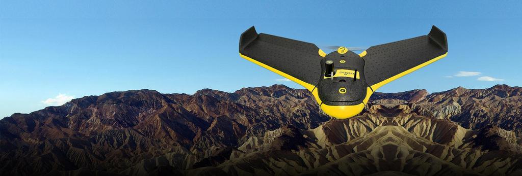
 and the Agricultural Market Information System (AMIS).")
9 Several Crop Monitoring systems in use GEOGLAM-Crop Monitor: Agricultural Market Information System (AMIS) and Early Warning system (EW). Following the global food price hikes in 2007/08 and 2010, as part of the Action Plan on Food Price Volatility and Agriculture, the G20 Heads of States endorsed in their 2011 Declaration both Global Agricultural Monitoring (GEOGLAM) and the Agricultural Market Information System (AMIS). Bulletin April 2017
 information on crop areas and yields.")
10 Several Crop Monitoring systems in use EU-JRC MARS: The JRC s monitoring of agriculture using remote sensing started in 1988, initially designed to apply emerging space technologies for providing independent and timely (monthly) information on crop areas and yields. Since 1993, this activity has contributed towards a more effective and efficient management of the common agricultural policy (CAP) through the provision of a broader range of technical support services to DG Agriculture and Member-State Administrations. RS data provided by

11 Several Crop Monitoring systems in use China-RADI Cropwatch : CropWatch is China s leading crop monitoring system since Using remote sensing and ground-based indicators the system assesses national and global crop production. The CropWatch bulletin is published four times a year in English and Chinese. The bulletin presents the latest CropWatch forecast of global and national crop production and condition. CropWatch is one of the participants in the GeoGLAM initiative.


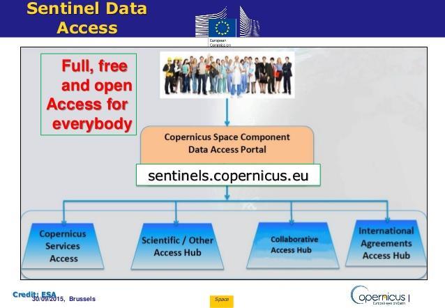
12 Open data is crucial!
 project is designed for evolving training")

13 Capacity building is key! Training within the MESA Program MESA (Aug 14 Aug 17, EDF funded) project is designed for evolving training and capacity development, so that African stakeholders can more effectively monitor Environment and Security using up-to-date MESA operational information services. Distance Education: 789 participants On site training EN & FR: 54 courses and 737 participants Training of trainers: 131 participants

14 16 Developed by

15 17 Developed by
16 But there is more


17 We live in a new era of remote sensing
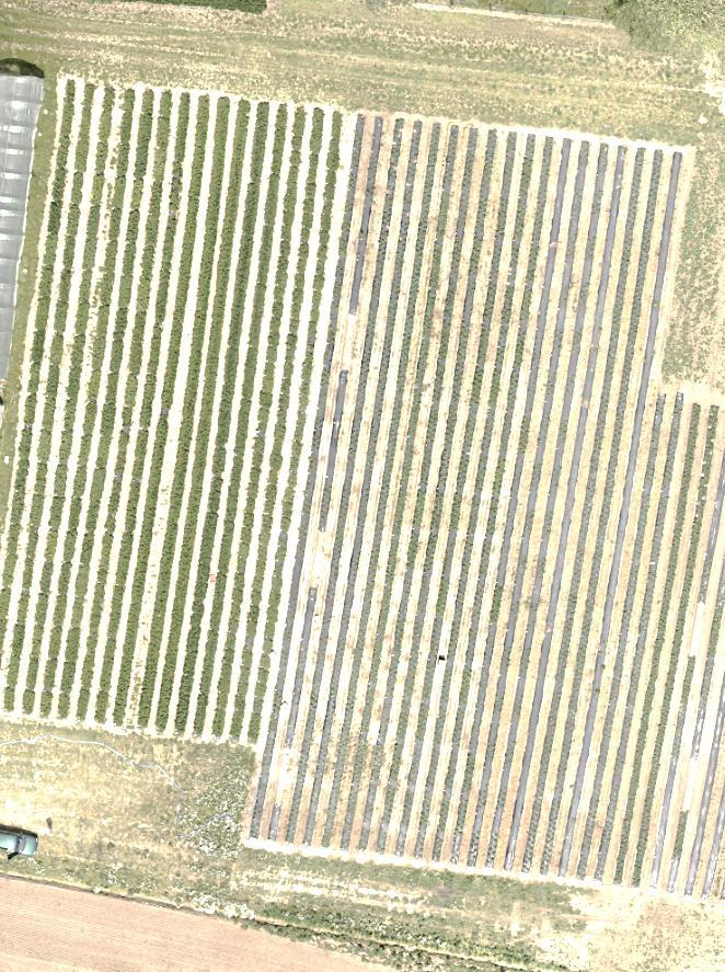


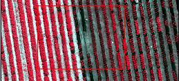


18 Monitor experimental Strawberry field plots Interpret raw image spectral image Chlorophyl index map Data collected at status map


19 Drones in farming Monitoring of parcels Diseases & Stress (Drought)


20 Drones in farming Monitoring of parcels Follow growth process Flowering intensity


21 Drones in farming Monitoring of parcels Follow growth process


22 Potato monitoring & Yield prediction Source: Global Opportunity Network Developed by
23 Take home messages Remote sensing does not lie we see what is on the field! Amount of -open- data available increases exponentially Big data platforms are emerging & big data analytics is still in its infancy Drones open new, unprecedented possibilities for smart farming Remote sensing is a very efficient tool to monitor the SDG indicators Smart farming is a top priority! It is needed (70% increase of food needed by 2050) + it creates a huge business potential! And remote sensing is a key technology to achieve smart farming.

24 Thank you