Climate Smart Territories; what are they and how do we evaluate progress towards this goal?
|
|
|
- Alisha Chambers
- 5 years ago
- Views:
Transcription


1 Climate Smart Territories; what are they and how do we evaluate progress towards this goal? * John Beer 1, Bastiaan Louman 1, Leida Mercado 1, Sara Scherr 2, Jacob Van Etten Montpellier March 16 18, 2015

2 Climate Smart Territories Geographical and social spaces where ecosystem services are maintained or restored, improving wellbeing of local people while continuously optimizing mitigation and adaptation to global change

3 Climate-smart territories: what scale? Evolution of tree cover in the Dominican Republic 100% 90% 90% 83% 80% 70% 75% 71% 60% 50% 40% 30% 23% 28% 33% 39% 20% 10% 12% 14% 10% 0% Based on Ovalles (2011) and Ramírez Tejada (2006)


4 Climate smart landscapes: strategies for mitigation, adaptation and food security Photographer: Nate Dappen
5 Four reasons why we should focus on Climate Smart Territories (CST) 1) Agriculture (or any other land use) should not be developed in isolation of surrounding land use 2) Environmental (or ecosystem) services, that are essential for adaptation to climate change and variability, are provided at the territorial scale rather than the farm or plot scale 3) Conflict resolution over access to resources and services requires the participation of a range of actors with different thematic and geographical interests 4) Mitigation options can t be addressed only at the farm or plot scale; e.g., issues of leakage
6 Kericho Mau Landscape, Kenya

7 Methodology Research and development Policy support On farm management practices Climatesmart landscape Landscape planning and coordination Energy systems Financing
8 System approaches used to contribute to Climate Smart Territories (CST) 1) Value chains 2) Agroecology and agroforestry 3) Livelihoods and community capitals 4) Territorial Territorial/landscape approaches e.g., watershed management; biological corridors; buffer zones and national parks; model forests, integrated rural development projects are not new though the integration and use of information over different scales is still a challenge.
9 Political, regulatory, economic and social framework Science based decision making, for the reformulation of policies and rules, building from the farmers context all the way up to national policy The backbone of CST initiatives is a co learning process whereby a diverse group of stakeholders seek agreement on the key decisions about the use of the resources in their territory
10 Principle actions required to create a CST 1) Create a shared vision among stakeholders 2) Establish or reinforce inter institutional platforms for dialogue, negotiation and planning 3) Promote land use practices that have multiple functions, as well as providing climate change mitigation and adaptation benefits (CSA) 4) Alignment of policies and markets 5) Explicit management of synergies and trade offs between different stakeholders Constructing a CST will always be a work in progress, constantly adapting to changing conditions!
11 Robust practical monitoring and evaluation system Diverse actors (private sector including both companies and farmer cooperatives; local government; NGO s; etc) need to know to what degree their decisions and actions are contributing to creating a CST A simple and cost effective set of principles, criteria and indicators need to be defined Proxy variables which reflect a large number of underlying variables related to good (and hence Climate Smart) land use; e.g., tree cover, known to be related to a wide range of ecosystem services that contribute to our climate smart goals
12 CATIE s Mesoamerican Agroenvironmental Programme uses the following key variables to evaluate progress towards CST 1) Food security and nutrition 2) Agriculture diversification and intensification 3) Agricultural innovations producing co benefits (adaptation and mitigation) 4) Sustainable production of ecosystem services using tree cover as a proxy 5) Increased participation of women and youth in decision making 6) Producer organizations with greater access to competitive and equitable value chains 7) Enabling conditions such as policies and planning frameworks favorable to CST
13 Four key results that can be used to show that a territory is climate smart 1) Adaptation measures are successful 2) Emissions are lower than for business as usual practices 3) Income, education and health have improved (HDI, for example) 4) Greater equity has been reached in terms of decision making and access to community capitals


14 From desolation toward forest management for territorial development: Hojancha, Costa Rica Co authors: Roger Villalobos, Emel Rodríguez, Patricia Madrigal, Ronnie de Camino, Jean Pierre Morales


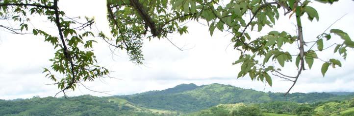
15 Hojancha: A municipality within Guanacaste Province, Pacific Coast of Costa Rica 261 km 2 Hilly terrain with small valleys, elevation masl Moist tropical forests Precipitation mm, with distinct dry/rainy seasons Min 19 o C; Max 36.3 o C


16


17 Forest cover of the Nicoya peninsula, Costa Rica; the Chorotega model forest

18 Land use in Hojancha in the1970 s


19 Land use in Hojancha today


20 Chorotega Model Forest
21 Milestones 1970 s: 86% land degraded Weak institutions Decline in meat prices; unproductive soils; 56% migration Local development planning processes Promotion of local leaders 1980 s: Cantonal Agricultural Diversification Center (CACH) Cantonal Commission for Development Guanacaste, including cattle ranchers Association for forest development, local research & technical assistance 1990 s: Development projects Promotion of national credits and incentives (PES & others) Local research and technical assistance financed by external cooperation 2000 s: Promotion of credit and incentives (PES & others) Local forestry advisory groups and forest program integrated into local development priorities
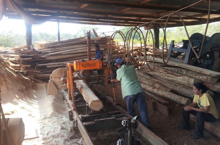
22 Hojancha today More than 54% of territory in natural regeneration (vs. 12% in the 80s) Two public Protected Areas under co management and various private protected areas 10,000 hectares of improved pastures (from extensive livestock management to more intensive practices) More than 400 ha agroforestry/coffee for export More than 3500 hectares under forest management by more than 250 producers
23 Lessons learned Local awareness + education + leadership create landscape reforestation and restoration, forest production, integrated rural development. effective governance structures + local political empowerment + local institutional development, which facilitates capacity building + policies for incentives + business development, as the basis for: Threats: tourism, real estate development, commercial forest markets


24


25 National Landscape Create an enabling environment to sustainable practices through better policies and institutions Production or conservation unit Direct actions in the field to increase productivity while conserving Negotiation and coordination among stakeholders to construct a shared vision of the territory


26
27 Conclusions Adaptation, mitigation and livelihoods activities are most efficiently planned and managed together Need multi stakeholder planning and coordination to manage these multiple objectives Effective implementation of climate smart agriculture requires a landscape approach