Supporting Transportation
|
|
|
- Frederica Sullivan
- 6 years ago
- Views:
Transcription

1 Maryland s egis Program: Supporting Transportation Professionals and the Public Maryland State Highway Administration
2 GIS at Maryland State Highway Administration GIS falls under the Office of Planning and Preliminary Engineering in the Data Services Engineering Division (DSED) Provide GIS support across the organization; work with stakeholders to improve their business processes with GIS solutions SHA s Enterprise GIS (egis) Portal was established in 2011
 Public egis (JS) KPA Dashboards (JS) ArcGIS")
3 Enterprise GIS at SHA egis Portal (Flex) Operational egis (JS) Public egis (JS) KPA Dashboards (JS) ArcGIS Online
4 egis Portal Statistics Number of contents: 256 Public contents: 58 Custom contents: 198 Number of users: 2,383 SHA users: 2,293 Non SHA users: 90 Widgets: 50 Unique Users by Office
 Green Asset Management System (OED) Asset Data Warehouse (OPPE) TAP (OPPE) Roadway Projects (OHD) OHD Office Pavement IRI (OMT) ADA Compliance (OHD) TMDL (OED) HMIS Highway System")
5 Workflows Supported by egis PowerBuilder SPD Database Form 42 (OOF) Engineering Data Warehouse (OMT) Property and Parcel (ORE) Structures (OOS) Commitments Salesforce esnowbook Project Data (CTP, Funds, Planning) Green Asset Management System (OED) Asset Data Warehouse (OPPE) TAP (OPPE) Roadway Projects (OHD) OHD Office Pavement IRI (OMT) ADA Compliance (OHD) TMDL (OED) HMIS Highway System (OPPE) Integrated with another system NPDES (OHD Slope Failure (OMT) Output only Wholly egis supported
6 egis Portal Demonstration

7
8 SHA s Key Performance Areas Highway Safety Mobility & Economy System Preservation & Maintenance Managing our Agency Environmental Compliance & Stewardship Customer Communications, Service and Satisfaction Focus on OUTCOMES Objectives and Strategies are Specific Measurable Achievable/Attainable Results oriented Time-bound Agency wide and office/ district level plans are aligned

9 KPA Dashboards Tell a story Increase transparency Increase accountability Showcase SHA s performance-based approach
10 KPA Dashboard Features Review performance metrics Charts and tables - aggregated and differentiated data Mapping Quickly identify problem areas View mitigation strategies with hotspots Filtering Location, year, time of day, attributes Metadata for charts Definitions for technical terms

11 Asset Management Dashboard Demonstration

12
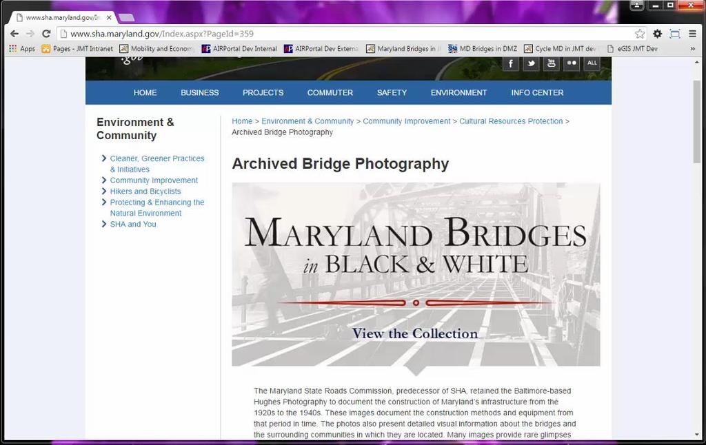
13 Public egis Objectives Intuitive user interface Excellent performance Limited functionality Focused story Public egis Contents Bay Restoration Viewer Maryland Bridges in Black & White AADT Locator
14 Public egis Demonstration
15


16 Operational egis Successor to egis Portal JavaScript HTML 5 framework Built with ArcGIS API for JavaScript Single framework will support a variety of contents

17 ArcGIS Online Maps PDF Map Access County maps Municipal maps Grid maps Highway index maps Truck volume maps SHA District Offices and Shops Maryland Traffic Volume Transportation Alternatives Program
18 Challenges & Lessons Learned Challenges Silos of information Bad data collection habits Changing technology Budget constraints Expectations of the user base Development time Performance of application Functionality Data currency Responsive design Lessons Learned Importance of understanding the user base Getting data owners to take ownership of their data Creating and maintaining metadata Use of wireframes or mockups to convey proposed design and workflow to stakeholders
19 Communication & Outreach Internal egis Portal Training egis Newsletter egis Landing Page GIS Day egis User Group egis Technical Team External Landing pages Take a tour videos
20 Way Ahead Migration to Operational (JavaScript) egis Expansion of KPA dashboards Freight Dashboard Safety Dashboard More Public egis contents Freight Finder Pavement Projects Responsive Public egis


")
21 Q & A Laurie Goudy Maryland SHA Assistant Division Chief (410) lgoudy@sha.state.md.us Niki Miller JMT Technology Group Project Manager (443) nmiller2@jmt.com
Mobility and Economy Dashboard. Promoting Maryland SHA s Performance-Based Approach to Safety and Mobility Improvements
 Mobility and Economy Dashboard Promoting Maryland SHA s Performance-Based Approach to Safety and Mobility Improvements Agenda Project Overview Vision Key Messages Application Features Demonstration System
Uses of Geospatial Applications for Transportation Performance Management Thursday, April 7, 2016
 The Federal Highway Administration (FHWA) GIS in Transportation Program presents on Uses of Geospatial Applications for Transportation Performance Management Thursday, April 7, 2016 Presenters Mark Sarmiento,
One Maryland One Centerline. GIS-T 2014 May 7, 2014
 One Maryland One Centerline GIS-T 2014 May 7, 2014 Current Road Centerlines in Maryland SHA maintains a statewide centerline Supports HPMS program Represents state and local roads Capturing dual carriageways
Enterprise GIS Water Utility Data Migration: Service Location Case Study
 Enterprise GIS Water Utility Data Migration: Service Location Case Study Anthony Pologruto, GIS Analyst Joe DeLuca, Project Manager Since 1942 Services Serve over 140,000 customers. Provide both water
Successes & Challenges in Traffic Monitoring
 Successes & Challenges in Traffic Monitoring Jerry Einolf Highway Information Services Division State Highway Administration (SHA) Maryland Department of Transportation Brief History In 1995, decision
Appendix H: Tracking Tool Recommendations
 Appendix H H-1 Appendix H: Tracking Tool Recommendations wq-s1-80u Purpose of this Document Tracking progress toward the Minnesota Nutrient Reduction Strategy (NRS) goals and milestones requires a wide
MASSDOT GIS QUINN MOLLOY GIS MUNICIPAL COORDINATOR
 MASSDOT GIS QUINN MOLLOY GIS MUNICIPAL COORDINATOR MASSDOT GIS SERVICES About GIS Services In the Office of Transportation Planning Managed by Kevin Lopes Primary function is to maintain the Road Inventory,
January 31, 2018 Asset Management and Performance Measures for Roads and Bridges Maryland Department of Transportation State Highway Administration
 January 31, 2018 Asset Management and Performance Measures for Roads and Bridges Maryland Department of Transportation State Highway Administration Amy J. Purves, PE Asset Management and Performance Measures
ArcGIS for Emergency Management An Overview. Walter Potts Nikki Golding
 ArcGIS for Emergency Management An Overview Walter Potts Nikki Golding Agenda Introduction Solution Offering What s Next? Your Feedback ArcGIS as a Platform Knowledge Workers Executive Access Public Engagement
Maryland Adaptation and Vulnerability Assessment Maryland State Highway Administration
 Maryland Adaptation and Vulnerability Assessment Maryland State Highway Administration October 4, 2016 Maryland: Introduction Atlantic Ocean and Chesapeake Bay 7,719 miles of shoreline Coastal in the East
ArcGIS Data Reviewer Planning and Deploying Data Quality Services
 ArcGIS Data Reviewer Planning and Deploying Data Quality Services Edwin Waite & Shankar Chandrasekaran A few examples of why data validation matters Leaning Tower of Pisa Mars Climate Orbiter Garbage in
The Importance of Data Quality Within Your Organization. Sherry Fagin and Andy Ommen
 The Importance of Data Quality Within Your Organization Sherry Fagin and Andy Ommen Workshop Agenda Perspectives of Data Quality What is ArcGIS Data Reviewer? Quality Control Processes Reporting Data Quality
ArcGIS Data Reviewer: Integrating Data Quality Control into Web Applications. Shankar Chandrasekaran
 ArcGIS Data Reviewer: Integrating Data Quality Control into Web Applications Shankar Chandrasekaran Agenda What is ArcGIS Data Reviewer? Automated Review Semi-Automated Review Analyzing & Reporting Data
Topics. Traffic Signals and Safety
 Topics Traffic Signals and Safety TSAMS (Traffic Signal Asset management System) GLG-Green Light Go Program Traffic Signal Remote Communication Policy Automated Signal Performance Measures Unified Command
ODOT Asset Management Plan 0
 ODOT Asset Management Plan 0 Table of Contents Executive Summary... 1 ODOT s Experience with Asset Management... 1 A New Way of Doing Business... 2 ODOT s Investment Plans... 3 Moving Forward... 5 1.0
GEOGRAPHIC information system Planning an Enterprise GIS Project
 GEOGRAPHIC information system Planning an Enterprise GIS Project Karen Stanford (Con Edison) Aaron Patterson (Schneider Electric / Paleon Solutions) 1 Consolidated Edison Company Profile as of 2013 Service
ArcGIS for Transportation. Tom Brenneman, Gary Waters
 ArcGIS for Transportation Tom Brenneman, Gary Waters ArcGIS for Transportation A product for Esri s transportation customers A series of useful maps and apps focused on transportation Organized into modules
NASCIO 2013 Open Government Initiatives
 NASCIO 2013 Open Government Initiatives 1. Title: Utah s Open Transportation Data in the Cloud with ugate and UPlan 2. Category: Open Government Initiatives 3. Project Initiation and completion date The
Configuring for Agility: A Strategy for Sustainable Apps. Christian Carlson Scott Oppmann
 Configuring for Agility: A Strategy for Sustainable Apps Christian Carlson Scott Oppmann Why do you care? Generate greater return from your platform investments Mitigate service delivery issues Transition
ArcGIS for Emergency Management-
 ArcGIS for Emergency Management- Configuring the Solutions Jess Neuner Nikki Golding Agenda Introduction Solution Offering What s Next Your Feedback ArcGIS as a Platform Simple, Open, and Configurable
Lift Station Inspection System ( LSIS ) using Arc GIS Server
 using Arc GIS Server") Lift Station Inspection System ( LSIS ) using Arc GIS Server Jacksonville, Florida 1 Topics 1. Illicit Discharge Detection and Elimination Inspections 2. LSIS System Architecture 3. GIS and workflow database
Lift Station Inspection System ( LSIS ) using Arc GIS Server Jacksonville, Florida 1 Topics 1. Illicit Discharge Detection and Elimination Inspections 2. LSIS System Architecture 3. GIS and workflow database
Creative Ways to better Manage your Infrastructure, new and emerging Technology. Karen Stewart Esri Canada
 Creative Ways to better Manage your Infrastructure, new and emerging Technology Karen Stewart Esri Canada Traffic camera Electric wiring Information portal Road signage Viaduct Traffic sign Canal Fleet
Advancing Esri s Mobile Solutions for Leak Survey and Leak Reporting
 Advancing Esri s Mobile Solutions for Leak Survey and Leak Reporting Scott Ewart GIS Lead Peoples Gas Scott Orkis Manager, GIS & Planning Peoples Gas Joe Hershman Sr. Consultant RAMTeCH Peoples Gas (PNG)
PAMS: Leveraging a GIS-Based Pavement Assessment and Management System to Validate and Justify Roadway Project Formulation
 PAMS: Leveraging a GIS-Based Pavement Assessment and Management System to Validate and Justify Roadway Project Formulation AASHTO GIS for Transportation Symposium May 7, 2014 Candice Ottley-Francois, PMP,
ArcGIS Data Reviewer: An Introduction. Chandan Banerjee Jay Cary
 Chandan Banerjee Jay Cary Workshop Agenda Importance of Data Quality What is ArcGIS Data Reviewer? Automated review Semi-automated review Managing errors and reporting data quality Summary/Resources Importance
MAP-21 Moving Ahead with Progress Title in the 21 st Century Subtitle
 MAP-21 Moving Ahead with Progress Title in the 21 st Century Subtitle Performance Management Elements An Overview of Requirements and Implementation Status Meeting Date Northeast Pavement Preservation
Terminology. GIS Centric Computerized Maintenance Management System (CMMS) Public Asset Management System (also known SCAUG
 Public Asset Management System (also known SCAUG") Jeremy White Regional Account Manager Cityworks Azteca Systems SCAUG 2011 1 Terminology GIS Centric Computerized Maintenance Management System (CMMS) Public Asset Management System (also known as AMS)
Jeremy White Regional Account Manager Cityworks Azteca Systems SCAUG 2011 1 Terminology GIS Centric Computerized Maintenance Management System (CMMS) Public Asset Management System (also known as AMS)
Esri Roads and Highways Solution Overview. Eric Floss Transportation Practice Manager
 Esri Roads and Highways Solution Overview Eric Floss Transportation Practice Manager Agenda Esri LRS Solution Briefing Advanced Linear Referencing Support User Interface Experience Open Discussion GIS
ArcGIS for Emergency Management Configuring the Situational Awareness Solutions. Jess Neuner
 ArcGIS for Emergency Management Configuring the Situational Awareness Solutions Jess Neuner ArcGIS for Emergency Management A solution to support the EM Mission Series of useful maps and apps focused on
2014 NWPMA Conference
 2014 NWPMA Conference Asset Management The Big Picture Factors contributing to asset management Status of asset management in state DOTs Current TAM initiatives Future trends Presented By: Katie Zimmerman,
Best Practices for your ArcGIS Online Organization
 Best Practices for your ArcGIS Online Organization Bern Szukalski @bernszukalski Jeff Archer @vee_dubb Esri UC 2014 Technical Workshop Best Practices for your ArcGIS Organization Workshop Overview Not
ArcGIS for Environment and Natural Resources An Overview. Matt Bullock Nikki Golding
 ArcGIS for Environment and Natural Resources An Overview Matt Bullock Nikki Golding Agenda Introduction Solution Offering What s Next? Your Feedback ArcGIS as a Platform Knowledge Workers Executive Access
ArcGIS for Emergency Management: An Overview
 2013 Esri International User Conference July 8 12, 2013 San Diego, California Technical Workshop ArcGIS for Emergency Management: An Overview Jeff Baranyi Lindsay Thomas Esri UC2013. Technical Workshop.
Session A: Inventory, Level of Service and Condition Assessment
 Asset Management as a Process Workshop Photo Session A: Inventory, Level of Service and Condition Assessment 2016 APWA Washington Puyallup, Washington Bryan Chappell, Water Quality Supervisor 1 About Pierce
OFFICE OF STRUCTURES MANUAL FOR HYDROLOGIC AND HYDRAULIC DESIGN CHAPTER 19 CONSTRUCTION GUIDELINES
 OFFICE OF STRUCTURES MANUAL FOR HYDROLOGIC AND HYDRAULIC DESIGN CHAPTER 19 CONSTRUCTION GUIDELINES APRIL 2011 MANUAL FOR HYDROLOGIC AND HYDRAULIC DESIGN CHAPTER 19 - CONSTRUCTION GUIDELINES TABLE OF CONTENTS
Building West Virginia DOT s Geospatial Capabilities:
 Building West Virginia DOT s Geospatial Capabilities: GIS Web Portal And Straight-line Diagram Application Current Status, Upcoming Enhancements, and Integration Marshall Burgess, WVDOT Don Kiel, GeoDecisions
GIS-Centric Asset Management System (AMS) Promotes GIS. City of Augusta, Georgia
 Promotes GIS. City of Augusta, Georgia") GIS-Centric Asset Management System (AMS) Promotes GIS City of Augusta, Georgia Our team. Evelyn Chanti GIS Analyst, City of Augusta Ryan Butler Senior Systems Analyst, Woolpert Michele Pearman GIS Manager,
GIS-Centric Asset Management System (AMS) Promotes GIS City of Augusta, Georgia Our team. Evelyn Chanti GIS Analyst, City of Augusta Ryan Butler Senior Systems Analyst, Woolpert Michele Pearman GIS Manager,
NCHRP Report 666 (NCHRP 8-70) For: TRB Webinar February 23, 2011
 For: TRB Webinar February 23, 2011") NCHRP Report 666 (NCHRP 8-70) For: TRB Webinar February 23, 2011 GoToWebinar Interface Click to edit Master title style 1. Viewer Window 2. Webinar Control Panel Our webinar presentation slides appear
NCHRP Report 666 (NCHRP 8-70) For: TRB Webinar February 23, 2011 GoToWebinar Interface Click to edit Master title style 1. Viewer Window 2. Webinar Control Panel Our webinar presentation slides appear
ArcGIS for Local Government Solutions: An Overview. Rachel Weeden, Esri Patrick Callahan, Prince George s County
 ArcGIS for Local Government Solutions: An Overview Rachel Weeden, Esri Patrick Callahan, Prince George s County ArcGIS is a Platform Knowledge Workers Executive Access Public Engagement Work Anywhere Enterprise
Comparing Tools for Managing Infrastructure. VUEWorks. September 15, 2016
 Comparing Tools for Managing Infrastructure VUEWorks September 15, 2016 Foundations (10 Minutes) 2 1 3 VUEWorks Performance-Based Asset Management - Forecast capital budget needs - Create & manage
DelDOT s. Online Resource. Information. For. Network. Mapping
 DelDOT s Information Network For Online Resource Mapping What is INFORM? Information Network For Online Resource Mapping DelDOT s s Web-based based GIS Application Centralized Source for DelDOT GIS Data
Master Data Management
 Master Data Management A Framework for the Public Sector By Harry Black Data analytics, data management, and master data management are part of an overall imperative for public-sector organizations. They
Chapter 10 Goals, Objectives + Policies
 Chapter 10 Goals, + Policies Warehouse on Nestle Way near I-78 114 115 10.1 ESTABLISHMENT OF CONSISTENT GOALS 10.2 NATIONAL FREIGHT GOALS The Lehigh Valley s freight transportation investment decisions
NCDOT s Improvements in Operational Performance Reporting. Jennifer P. Brandenburg, PE State Asset Manager July 20, 2015
 NCDOT s Improvements in Operational Performance Reporting Jennifer P. Brandenburg, PE State Asset Manager July 20, 2015 Outline Legislation Measuring Condition Measuring Performance Measuring Efficiency
Open source supply chain planning software. Introduction for supply planners
 Open source supply chain planning software Introduction for supply planners Agenda Supply planning workflow Initial plan generation Plan review, adjustment and approval Export to ERP system A day in the
Utilizing Transportation Data for Low Cost Safety Improvements
 Utilizing Transportation Data for Low Cost Safety Improvements Samuel Sturtz Transportation Planner Iowa Department of Transportation samuel.sturtz@dot.iowa.gov Photo Credits: Ken West- Kenneth G. West
Will County Freight Advisory Council Meeting. April 11, 2017
 Will County Freight Advisory Council Meeting April 11, 2017 1 Agenda Summary of Last Meeting Plan Progress and Update Performance Measures Break-Out Discussion Projects and Project Evaluation Criteria
ENGINEERING & GUIDE RAIL MANAGEMENT
 Transportation Engineering and Safety Conference ENGINEERING & GUIDE RAIL MANAGEMENT GIS AS A PLATFORM FOR CONDUCTING GUIDE RAIL ASSESSMENT. December 7, 2017 ENGINEERING & GUIDE RAIL MANAGEMENT Project
GIS Lighting Up The Enterprise
 Marketing Operations Field Workers IT Professionals Executives Project Management Citizen Engagement Mobile GIS Lighting Up The Enterprise Conference Theme - GIS Lighting Up the Enterprise Lighting up
Connecticut s Open Data Initiative
 Connecticut s Open Data Initiative Category Open Government & Data, Information and Knowledge Management State Connecticut Contact Mark Raymond, Chief Information Officer mark.raymond@ct.gov Project February
Introduction. Performance Measurement. Pg. 01
 Pg. 01 Introduction The Alamo Area recognizes the importance of transportation performance tracking, goal setting and measurement to provide greater accountability and transparency and to achieve a more
Esri Solutions for Weather Maintenance Snow and Ice Management
 Esri Solutions for Weather Maintenance Snow and Ice Management Become a Modern Snow Fighter Today s winter maintenance professionals use geographic information system (GIS) technology to meet the challenges
History. Partnership and the Maryland State Highway Administration (MDSHA) proposal for making the Route 301 Project the 1st Green Highway.
 proposal for making the Route 301 Project the 1st Green Highway.") History (wrr) A pilot Registry grewout of the Green Highways A pilot Registry grew out of the Green Highways Partnership and the Maryland State Highway Administration (MDSHA) proposal for making the Route
History (wrr) A pilot Registry grewout of the Green Highways A pilot Registry grew out of the Green Highways Partnership and the Maryland State Highway Administration (MDSHA) proposal for making the Route
Title Performance Subtitle Management: Advancing a National Meeting Transportation System Date
 5 th International Transportation Systems Performance Measurement and Data Conference Driving Decisions: Aligning Performance Measures to Support Decisions Title Performance Subtitle Management: Advancing
TRANSPORTATION RESEARCH BOARD. Pavement Management Practices in the US and Canada. Monday, July 17, :00-2:30 PM ET
 TRANSPORTATION RESEARCH BOARD Pavement Management Practices in the US and Canada Monday, July 17, 2017 1:00-2:30 PM ET The Transportation Research Board has met the standards and requirements of the Registered
Turn your conversations into memorable conversations by learning how to showcase Dynamics CRM Online value proposition to Technical Decision Makers.
 The Technical Brief provides answers to key Technical Decision Maker questions and/or concerns in topics such as: Extensibility Security Deployment and Management Integration Application Architecture Collaboration
Coordinating Minnesota s Transportation Assets and Climate Change and Extreme Weather Vulnerability
 Coordinating Minnesota s Transportation Assets and Climate Change and Extreme Weather Vulnerability Duane R. Hill, PE District Engineer, District One Minnesota Department of Transportation What is a Transportation
Transportation Asset Management Webinar Series
 Transportation Asset Management Webinar Series Webinar 34 Integrating PM2 Targets with the TAMP Sponsored by FHWA and AASHTO Webinar 34 October 10, 2018 FHWA-AASHTO Asset Management Webinar Series This
IBM Planning Analytics Express
 Performance management and business intelligence for midsize organisations IBM Planning is a performance management (PM) and business intelligence (BI) solution for midsize organisations. It delivers the
OPEN DATA & PROJECT TRACKER. Michael Chamberlain TPP, Data Management
 OPEN DATA & PROJECT TRACKER Michael Chamberlain TPP, Data Management October 11, 017 Table of contents 1 People 3 Attributes 4 3 Locations 5 4 Systems 6 5 Reports 7-8 6 Applications 8-13 7 Closing 14 Data
ArcGIS for Emergency Management. Walter Potts Jeff Baranyi Nikki Golding
 ArcGIS for Emergency Management Walter Potts Jeff Baranyi Nikki Golding Agenda Introduction Solution Offering What s Next? Your Feedback A common experience. Hurricane Sandy 2004 2005 Southeast Tornadoes
BETTER OUTCOMES BETTER COLLABORATION. begin with. Design better civil infrastructure with OpenRoads Designer
 BETTER OUTCOMES begin with BETTER COLLABORATION Design better civil infrastructure with OpenRoads Designer COLLABORATION IS KEY Collaboration in civil infrastructure projects is nothing new, but we have
Implementing the Massachusetts TAM Strategic Plan
 Implementing the Massachusetts TAM Strategic Plan presented to 2016 AASHTO Asset Management Conference presented by Cambridge Nathan Higgins, Systematics, AICP Inc. Cambridge Systematics, Inc. Jason Bittner,
WRF #4455 Rate Approval Process Communication Strategy and Toolkit August 31, 2016
 WRF #4455 Rate Approval Process Communication Strategy and Toolkit August 31, 2016 No part of this presentation may be copied, reproduced, or otherwise utilized without permission. Jonathan Cuppett Research
ArcGIS for State and Local Government: An Overview. Nikki Golding Scott Oppmann
 ArcGIS for State and Local Government: An Overview Nikki Golding Scott Oppmann Agenda Introduction Why are we doing this? What are we doing to help? ArcGIS as a Platform Knowledge Workers Executive Access
Ohio River Bridges Project: Communications & Public Outreach. Purdue Road School
 Ohio River Bridges Project: Communications & Public Outreach Angela Nichols - Program Manager, INDOT Paul Boone, PE - Project Manager, INDOT March 8, 2016 Purdue Road School P Presentation Outline Project
City of Elk Grove Evolving the use of GIS
 City of Elk Grove Evolving the use of GIS Interwest GIS Steve Gay, GISP Jason Latoski www.interwestgrp.com/gisblog Interwest Consulting Group Provides GIS and IT Services to local governments Contracted
NEW RULES OF ERP. At a Glance
 NEW RULES OF ERP At a Glance Today s manufacturer faces an ever-changing set of challenges. Customer requirements, rising numbers of orders, mergers and acquisitions, along with other demands, all impact
SAP BusinessObjects Enterprise BI Platform
 SAP BusinessObjects Enterprise BI Platform Disclaimer This presentation outlines our general product direction and should not be relied on in making a purchase decision. This presentation is not subject
Montana DOT Strategic Enterprise Architecture Presentation to 2016 IHEEP Annual Conference. September 12, 2016
 Montana DOT Strategic Enterprise Architecture Presentation to 2016 IHEEP Annual Conference September 12, 2016 Introductions Jack Dartman Application Development Supervisor and Enterprise Architect MDT
ICC Ventura Region Chapter Meeting Best Practices for Electronic Plan Review. eplan life cycle
 ICC Ventura Region Chapter Meeting 4-18-2018 Best Practices for Electronic Plan Review eplan life cycle Competing for Economic Development? Start with Electronic Plan Review get things built faster. Quick
Avature CRM. Get Engaged to Talent V 11
 Get Engaged to Talent V 11 The #1 solution for global sourcing, recruitment marketing, and candidate engagement. At Avature, we believe that CRM is not just about sourcing or feeding candidates into your
California Technology Agency
 NASCIO 2013 State IT Recognition Awards California Technology Agency The State of California GeoPortal www.portal.gis.ca.gov Category: State CIO Office Special Recognition Project Initiation Date: February
Esri Roads and Highways An Introduction
 Esri International User Conference San Diego, California Technical Workshops July 24, 2012 Esri Roads and Highways An Introduction William Isley Majunu Seran Agenda Product Overview Desktop - Demo: Network
The ipems MAP-21 Module
 The ipems MAP-21 Module Producing the information you need from the National Performance Management Research Data Set (NPMRDS) January 2015 Innovation for better mobility Use the ipems MAP-21 Module to
September Public Meetings. Developing a Blueprint for the Corridor
 September Public Meetings Developing a Blueprint for the Corridor Study Background Study initiated by the Commonwealth Transportation Board (CTB) and administered by VDOT in association with VDRPT. Addresses
New Jersey Department of Transportation. Local Freight Impact Fund Handbook. Procedures and Criteria for Local Freight Impact Fund Grant Program
 New Jersey Department of Transportation Local Freight Impact Fund Handbook Procedures and Criteria for Local Freight Impact Fund Grant Program Page 1 of 10 Overview The New Jersey Department of Transportation
Using GIS to Support Multi-year Pavement MR&R Need Analysis
 Using GIS to Support Multi-year Pavement MR&R Need Analysis Yichang(James) Tsai, Ph.D., P.E. Bo Gao, Ph.D. Candidate Georgia Institute of Technology Bryant Poole, P.E. JT Rabun, P.E. Georgia Department
ArcGIS for Local Government: An Overview SCOTT OPPMANN
 ArcGIS for Local Government: An Overview SCOTT OPPMANN Agenda Introduction Why? Solution Offering What s Next Your Feedback Using ArcGIS to understand and mitigate challenges Housing Forecasting Urban
STRATEGIC ASSET MANAGEMENT POLICY
 STRATEGIC ASSET MANAGEMENT POLICY Purpose: Camrose County is responsible for providing a range of essential services to the community, including transportation networks, facility infrastructure, utility
Optimizing Local Government Management through Performance and Data Analytics
 Optimizing Local Government Management through Performance and Data Analytics The Cincinnati Story By Harry Black Government can operate at a high level of performance although some local governments optimize
New Jersey Turnpike Authority Utility Management System May 6, 2013
 Creating Value Delivering Solutions New Jersey Turnpike Authority Utility Management System May 6, 2013 Presentation Agenda Introduction Utility Challenges System Approach Requirement Gathering Application
Capital Planning and ROW Permitting Maps and Apps for Local Government. Chris Fox Scott Oppmann
 Capital Planning and ROW Permitting Maps and Apps for Local Government Chris Fox Scott Oppmann Agenda Introduction Solution Offering What s Next Your Feedback ArcGIS Solutions for Local Government Improving
Project Delivery. Rodger Rochelle, PE Technical Services Administrator. Mike Holder, PE Chief Engineer
 Project Delivery Rodger Rochelle, PE Technical Services Administrator Mike Holder, PE Chief Engineer NC : Project Delivery - Preconstruction Overview of Project Delivery Process Review of Other States
MONITORING IMPLEMENTATION AND PERFORMANCE
 12 MONITORING IMPLEMENTATION AND PERFORMANCE The FAST Act continues the legislation authorized under MAP-21, which created a data-driven, performance-based multimodal program to address the many challenges
Ian Kidner, GISP GIS Systems Administrator Office of Technical Services
 / Ian Kidner, GISP GIS Systems Administrator Office of Technical Services Ian.kidner@dot.ohio.gov 614-752-5743 TIMS Vision Provide Easy & Reliable Access to Information Data Consistency Enables Decision
Esri UC ADWEA's Digital Transformation: Geospatial Asset Management Initiative. Walid Abou Chacra K&A
 Esri UC 2017 ADWEA's Digital Transformation: Geospatial Asset Management Initiative Walid Abou Chacra K&A Agenda 2 Introductions About ADWEA ADWEA s GIS Platform Evolution Geospatial Asset Management Current
TWO-N. TWO-N Inc. is a New York based design studio working on the intersection of new media, graphic design, and the built environment.
 TWO-N CONCEPT * DESIGN * DEVELOPMENT TWO-N Inc. is a New York based design studio working on the intersection of new media, graphic design, and the built environment. We are committed to experimentation
ARC. The data bridge between planning and operations. Presentation by: Grady Smith Jim Evans Dave Mulholland
 ARC The data bridge between planning and operations Presentation by: Grady Smith Jim Evans Dave Mulholland The Need for TSM&O and Data Management The Need for Planning for Operations The purpose of the
Developing A Traffic Data Performance Measure Program
 Developing A Traffic Data Performance Measure Program A Data Business Plan Approach Jack Stickel Alaska Department of Transportation and Public Facilities Private Sector Partners Cambridge Systematics
ArcGIS for Environment and Natural Resources. Matt Bullock Nikki Golding
 ArcGIS for Environment and Natural Resources Matt Bullock Nikki Golding Agenda Introduction Solution Offering What s Next Your Feedback ArcGIS as a Platform Simple, Open, and Configurable Knowledge Workers
Implementing Engaging Portal Sites with SAP Cloud Platform Portal
 Implementing Engaging Portal Sites with SAP Cloud Platform Portal Customer Solution Overview March, 2017 Disclaimer This presentation outlines our general product direction and should not be relied on
IBM Cognos What s New? Webinar. December 12,
 IBM Cognos 10.2 What s New? Webinar December 12, 2012 www.senturus.com 1 Helping Companies Learn From the Past, Manage the Present and Shape the Future GoToWebinar Control Panel Submit questions here Click
Situational Awareness Overview
 ArcGIS for Emergency Management Situational Awareness Overview JESS NEUNER ArcGIS for Emergency Management A solution to support the EM Mission Series of useful maps and apps focused on emergency management
DEVELOPMENT OF AN INTEGRATED WEB-BASED PLATFORM FOR ANALYSIS OF CHANGES
 11/28/2012 1 DEVELOPMENT OF AN INTEGRATED WEB-BASED PLATFORM FOR ANALYSIS OF CHANGES Zar Chi Aye (ESR-09) Prof. Michel Jaboyedoff Dr. Marc-Henri Derron CRET - Université de Lausanne, Switzerland 11/28/2012
Porteo Ready to Roll Intranet
 Porteo Ready to Roll Intranet Designed by a Microsoft Gold SharePoint partner Provides a solid foundation to roll-out and grow One-Day Installation Runs on SharePoint on premise or cloud Watch Video at
GeoPlatform Today December 7, 2016
 GeoPlatform Today December 7, 2016 GeoPlatform Today: Topics 1-8 Patrick Neal / Image Matters LLC Topic 1: Marketplace Topic 2: Dataset Search Topic 3: Map Viewer Topic 4: Map Manager Jeff Harrison / Carbon
A Guide for Local Governments: EAM and GIS for Complete Asset Management
 29 91 $1,487 A Guide for Local Governments: EAM and GIS for Complete Asset Management A Guide for Local Governments: EAM and GIS for Complete Asset Management Think back to a time before smartphones. You
Travel Time Index: Why All the Fuss? Tim Lomax Texas A&M Transportation Institute
 Travel Time Index: Why All the Fuss? Tim Lomax Texas A&M Transportation Institute http://mobility.tamu.edu/ Key Aspects of TTI s Performance Measurement Recommendations Goal: Help a range of audiences
ArcGIS Online for Administrators. Rachel Weeden
 ArcGIS Online for Administrators Rachel Weeden Agenda 1. Establishing the vision and governance 2. Configuring your organization s home 3. Establish your brand 4. Organize your organization 5. Add useful