ArcGIS for Emergency Management. Nikki Golding
|
|
|
- Sherman Cunningham
- 5 years ago
- Views:
Transcription

1 ArcGIS for Emergency Management Nikki Golding

2 Agenda Introduction Solution Offering What s Next Your Feedback

3 ArcGIS as a Platform Simple, Open, and Configurable Knowledge Workers Executive Access Public Engagement Work Anywhere Enterprise Integration ArcGIS Making Mapping and GIS Available Across Your Organization Professional GIS Transforming the Role of GIS
4 EXTENDING THE PLATFORM WITH SOLUTIONS Ready to use workflows and apps that make implementation easier and sustainable. Desktop Web Device Basemaps Web Apps Analytical Workflows Models and Charts Web Centric Mobile Apps ArcGIS for Emergency Management


5 ALIGNING OUR DEVELOPMENT TO SUPPORT EMERGENCY MANAGEMENT Providing solutions that address the needs of the four phases Mitigation Hazard Analysis Vulnerability Assessment Infrastructure Work Public Education Preparedness Emergency Response Planning Training and Exercises Partnership Building Recovery Economic Recovery Debris Management Housing Health and Social Services Response Life Safety Incident Stabilization Evacuations and Shelters Mass Care

6 Our Mission To help you ArcGIS for State Government Solutions for Esri s government customers Collection of useful maps and apps Configurable and extensible Freely available and fully supported Editing Workflows Focused Maps and Apps Analytical Models Community of users Best Practices / Implementation Support Network of Esri Services and Partner offerings Help users implement, sustain and enhance..available on-premise or in the cloud
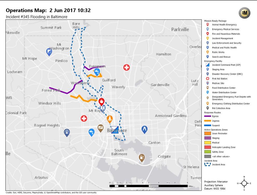
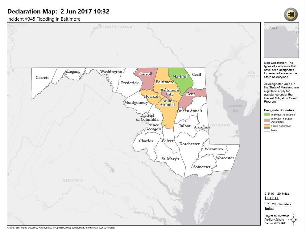
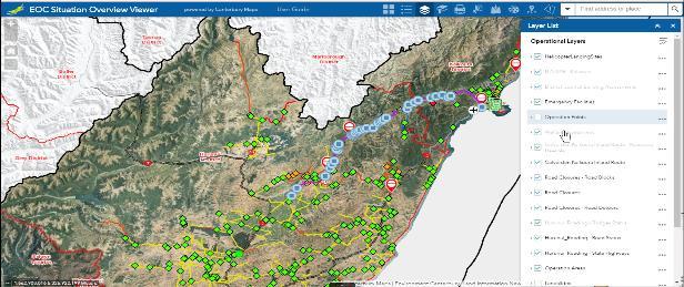
7 Emergency Management Solutions- November 2017 Mitigation Resilience Preparedness Response Recovery Entire Organization Hazard Assessment and Analysis Hazard Vulnerability Analysis Mitigation Dashboard Mitigation Plan Status Mitigation Feedback Community Resilience Resilience Outreach Resilience Dashboard Community Impacts Community Impacts Dashboard Community Resilience Dashboard Community Resilience Surveys Flood Planning Community Events CAMEO Tools Emergency Assistance Evacuation Zones My Hazard Information Floodplain Inquiry Community Parcels Community Addresses Emergency Management Maps Impact Summary Map Public Information Map Road Closures Incident Briefing Citizen Reports Health & Safety Reports Debris Reporting Common Operational Picture Situation Awareness Viewer Damage Assessment Photo Survey Health and Safety Reports Debris Reporting ArcGIS Online for Emergency Management Community Parcels Community Addresses Crowdsource Manager Crowdsource Reporter Map and App Gallery Operations Response Logistics Planning Incident Status Dashboard Citizen Service Request Photo Survey Shelter Locator
8 Disaster Resilience the power or ability to return to the original form... NOAA State of Colorado City of Boulder Explore Hazards Assess Vulnerability and Risks Investigate Options Prioritize Plans Take Action Educate and Engage Risk and Vulnerability Assessment Tools Local Resiliency Strategies Colorado Community Resiliency Partnership Mapping and Land Use Tools Develop State and Local Indicators Connect and Prepare Assess Economic Strength Incentivize Businesses Develop Impact Assessment Strategies Partner and Innovate Create Citizen Science Strategy Ensure Food System Resilience Make Data Accessible Crowd Source Solutions Transform and Integrate Create Community Resilience Centers Foster Climate Readiness Build Sustainability Framework Embed Resilience in Comprehensive Plan Green Infrastructure and Ecosystem Management


9 Disaster Resilience Solutions Analyze Communicate Engage Colorado Office of Resiliency NY Department of State Coastal Resiliency Commission City of Boulder FERNLeaf/NEMAC Educate
10 Demo
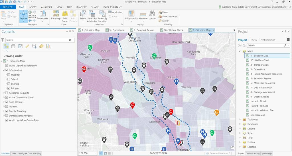
11 Emergency Management Maps A foundation for Emergency Management Solutions..2.1 Will support Disconnected Maps
12 Emergency Management Maps Getting started 1. Download the template 2. Populate with your data - Operational data - Reference data - Esri Data and Maps, Living Atlas, other live feeds 3. Share layers and maps via - ArcGIS Online organization - Printed maps - Digital map books - ArcGIS Open Data site


13 Emergency Management Maps A foundation for EM solutions Texas EGRT Eagle Technologies Status
14 Demo

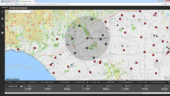
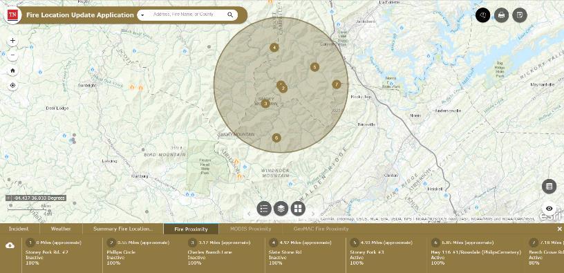

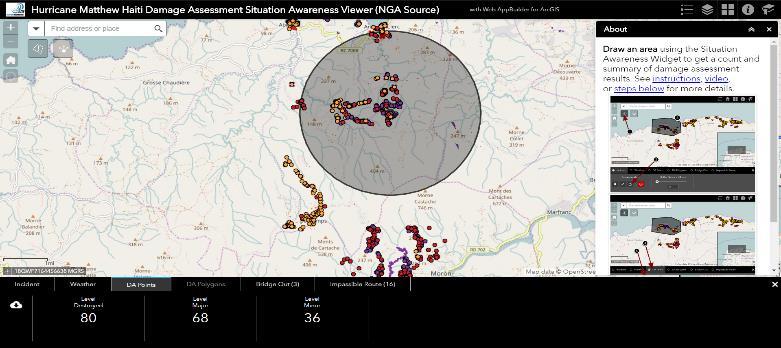
15 Reporting Snapshots Layer visibility Situational Awareness

16 Demo


17 Join the Community It s not just about the technology
18 Closing Deliver solutions that enables success Easier to deploy and sustain Evolve and grow the collection of apps Develop a community of users Provide a platform for partners to deploy their solutions
19 Thank you Be innovative, aware, and know you are not alone


20