Command and Control Applications
|
|
|
- April Flynn
- 5 years ago
- Views:
Transcription


1 Command and Control Applications Scott Cecilio Tyson Quink
2 Agenda -Trends in Command and Control and GIS -Use Cases -A GIS Platform Approach to Command and Control
3 Trends in GIS and Command and Control
4 Characteristics and Trends in C2 Applications Modernizing Command and Control Networks Identity Real-Time Bandwidth Distributed Services Security Connected/Disconnected Time-Sensitive Multi-National Deployments Client / Server Stovepiped Systems Unconsolidated Infrastructure Physical Servers Information Overload Proprietary Data Reactive Analysis One Size Fits All Applications Complex User Interfaces Long Development Cycles Risk Averse Web Services / SOA Seamlessly Integrated Systems Cloud and Elastic Computing Virtualization and Data Centers Relevant Pictures Open Data & Shared Services Predictive Analysis Lightweight Reusable Apps Intuitive User Experiences Short Iterations Risk Aware


5 Capability GIS & C4ISR Operations An Evolution of Technologies File-based RDBMS based SOA based Web Based Single user Multi-user / Department Installation wide / Enterprise Multi-National / Infrastructure


6 Web GIS Is a Transformational Architecture Opening, Integrating and Simplifying Everything Desktop Apps Bringing Together Your Existing Systems... and Creating a System of Engagement Server Web Maps Web Scenes Layers


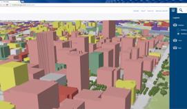
7 Web GIS Supports Multiple Missions Integrating Organizations and People Intelligence Planning Sustainment Command Field Operations Operational Environment Enabling Sharing, Collaboration, and Decisive Action
8 What can the ArcGIS Platform bring to Command and Control? Integrate and exploit existing investments in data and infrastructure Monitor the situation through real-time tracking, routing & communications Incorporate real-time data from many sensors Maintain & share the Common Operational Picture Portal Manage the data Gather, Fuse, Analyze & Share Intelligence Formulate & Disseminate Plans Manage deployed Forces Collect Analyse Share Act
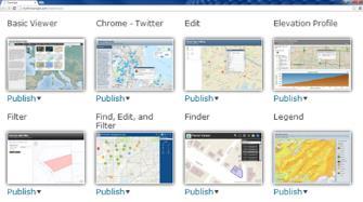
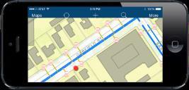
9 An Initial Operating Capability through Lightweight, Reusable Apps Delivering essential capabilities right away Common Operational Picture: Operations Dashboard Briefing tools: Story Maps Mobile Apps: Collector, Navigator, AppStudio Web Apps: Web AppBuider, App Templates Portal Collaboration environment, Content Management system Real-time sensor inputs: e.g. CCTV, Drones/Video, AVLS, Weather Dynamic Overlays Data Management System Basemaps Data from other systems
10 Use Cases
11 A Platform Approach to Military Operations Enabling a System of Engagement for Command and Control Operations Planning Mounted Operations Server Sensors Environment Intelligence Dismounted

12 A Platform Approach to Military Operations Enabling a System of Engagement for Command and Control Operations Planning Mounted Operations Server Sensors Environment Intelligence Dismounted
13 A GIS Platform Approach to Command and Control
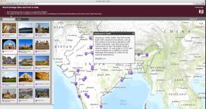
14 1 Web Maps as Information Products


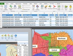
15 Web GIS Can Represent All Data Types As Web Maps and Web Services Enterprise Data Social Media Services Imagery Web Map Sensor Networks Maps Big Data Full Motion Video / WAMI Providing a New Medium for GIS
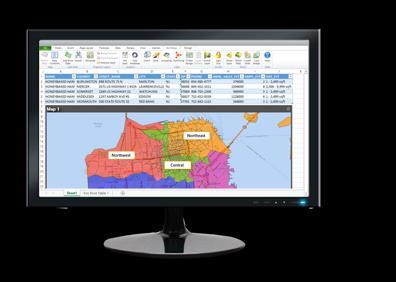
16 Web Maps Integrate Information / Configure / Share Source Information Apps User Needs Desktop Spreadsheet Web Map Dashboards Current Operations Databases CSV Field Operations Mobile Sensor & Real-Time Data 3D Data Apps Planning and Analysis Web Apps Basemaps Analytical Services Briefings and Public Information

17 Web Maps - Air Plan - Current Operations
18 2 Real-time Analysis and Authoritative Analysis


19 Processing Real-Time Data Feeds At Machine Speed From Raw Data to Actionable Information through Reporting by Exception Sensor Monitoring Vehicle/Platform Tracking AIS Vessel Tracks Alert when values exceed min. or max. thresholds Aircrafts in severe weather At risk Filtered by position and attribute e.g. slow boats that could be boarded by pirates


20 Applying Real-Time Analytics GeoEvent filtering A Filter eliminates GeoEvents based on an expression = = = =
 Air")
21 Real Time Analysis Maritime Events (Big Data) Air Tracks
22 Thinking Geospatially The Language of Spatial Analysis Understanding WHERE are my forces and my SIGACTS? Measuring What are the main characteristics of my operating environment? Determining What are the likely enemy egress routes from a given location? Finding How should I place my sensors allowing for optimal coverage? Detecting What are the impacts of my operations on the distribution of SIGACTs? Making predictions on Where are likely choke points that may impact my ability to maneuver? Understanding how we map our world

23 The Language of Spatial Analysis

24 Submarine Operations Suitability Where are the high probability areas for DPRK submarine operations? Complex queries and speed models Predictions based on multiple sets of data
25 3 Apps


26 Reusable, Configurable Apps Take advantage of COTS Story Maps Templates Explorer Dashboard Collector Maps for Office Web Scene Viewer Open Data GeoPlanner Crowdsourcing


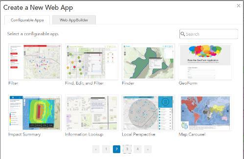


27 App Builders App Templates Story Maps 1 2 AppStudio 4 3 Web AppBuilder


28 Reusable Apps - Air Plan Web App Template Operations Dashboard - Current Air Operations Briefing - Patrol After Action Report

29 4 Best Practices
30 What is a Template? Fully documented and open source Maps - Useful examples of standard information products - MPK, Web Maps etc.. Tools - Standalone Tools or scripts Services - Map, Image, Geoprocessing, Event Processing Application Configurations Templates are not new technology! Instead they are built on what you already have and use.


31 Take Advantage of Open Source Solution Templates Ready to use services and applications Helicopter Landing SITEMP CCM Fields of Fire Visibility and Range Artillery Emplacement Cover and Concealment Incident Analysis Compound Mapping Lines of Communication Drop Zone Avenues of Approach Point of Origin Key Terrain Sun Position Analysis

32 Solutions Templates - solutions.arcgis.com - esri.github.io/#defense
33 Take Advantage of the GIS Server Enabling Web GIS Everywhere Desktop Apps APIs/SDKs Simple Integrated Open Web GIS Server GIS Imagery Real-time Big Data Community Additional Capabilities Online Content and Services
34 Follow Architectural Best Practices

 Maps Layers Tools Files LOAD BALANCED Basemap & Environment")

35 EXTERNAL SYSTEMS AND SERVICES SDKs / APIs / Data Formats P O R T A L SDKs / APIs INFRASTRUCTURE OGC / REST SDKs / APIs SDKs / APIs APPS SDKs / APIs Sample Conceptual Architecture for Military Operations Data Management Planning & Analysis Field Mobility Operational Awareness Constituent Engagement Location Enablement Data Integration Basemap Management Overlay Data Management Real Time Info Management <Functional Services> Intel Reports Ops Plans Terrain Analysis ACO/ATO Incident Analysis BMS <Functional Services> (COP/RMP/RAP/REP) <Functional Services> Briefs Story Maps Business Apps Desktop / Web / Mobile Users * Groups * Items * Tags (Content and Capabilities) Maps Layers Tools Files LOAD BALANCED Basemap & Environment Management Enterprise Business Systems: CRM BI ERP Microsoft SharePoint Microsoft Office Caching Overlay Management Real Time Feeds Management External Data: National Mapping Agency Tactical Data Links Military Intelligence DB METOC AIS Equipment Database Analysis External Systems: Coalition Nations HIGH AVAILABILITY PUBLICATION STRATEGIES WORKLOAD SEPARATION GEOCENTRIC GEOENABLED
36 Summar y
37 Characteristics and Trends in C2 Applications Modernizing Command and Control Networks Identity Real-Time Bandwidth Distributed Services Security Connected/Disconnected Time-Sensitive Multi-National Deployments Client / Server Stovepiped Systems Unconsolidated Infrastructure Physical Servers Information Overload Proprietary Data Reactive Analysis One Size Fits All Applications Complex User Interfaces Long Development Cycles Risk Averse Web Services / SOA Seamlessly Integrated Systems Cloud and Elastic Computing Virtualization and Data Centers Relevant Pictures Open Data & Shared Services Predictive Analysis Lightweight Reusable Apps Intuitive User Experiences Short Iterations Risk Aware


38 Please Take Our Survey on the Esri Events App! Download the Esri Events app and find your event Select the session you attended Scroll down to find the survey Complete Answers and Select Submit
39 Print Your Certificate of Attendance Print stations located in the 140 Concourse Monday 12:30 PM 6:30 PM GIS Solutions Expo, Hall B Tuesday 10:45 AM 5:15 PM GIS Solutions Expo, Hall B 5:15 PM 6:30 PM Expo Social, Hall B 6:30 PM 9:30 PM Networking Reception, Smithsonian National Air and Space Museum


40