EXPLOITS GENERATION: PROPOSED GRAND FALLS MAIN DAM REHABILITATION
|
|
|
- Bernadette Little
- 5 years ago
- Views:
Transcription
1 EXPLOITS GENERATION: PROPOSED GRAND FALLS MAIN DAM REHABILITATION Environmental Assessment Registration Pursuant to the Newfoundland and Labrador Environmental Protection Act Submitted by Nalcor Energy May 2016
2

3 EXPLOITS GENERATION: PROPOSED GRAND FALLS MAIN DAM REHABILITATION Environmental Assessment Registration Pursuant to the Newfoundland & Labrador Environmental Protection Act (Part X) Submitted by: Nalcor Energy Hydro Place, 500 Columbus Drive P.O. Box St. John s, Newfoundland and Labrador A1B 4K7 Canada Prepared with the assistance of: Amec Foster Wheeler Environment & Infrastructure A Division of Amec Foster Wheeler Americas Limited 133 Crosbie Road, PO Box St. John s, Newfoundland and Labrador A1B 4A5 Canada May 2016
4 Table of Contents 1.0 INTRODUCTION Nature of the Undertaking Purpose of the The Proponent Environmental Assessment Process and Requirements PROJECT DESCRIPTION AND SCOPE Overview of Existing Exploits Generation Grand Falls Dam and its Operation Water Flows and Fish Conveyance Systems at Grand Falls Project Purpose, Rationale and Need Project Components and Lay-out Concrete Refurbishment and Reshaping Inflatable Crest Gates Improved Access Construction Construction Activities and Sequence Construction Workforce Operation and Maintenance Project Schedule and Cost Estimate Project Documents Environmental Management and Protection Environmental Protection Planning Safety, Health and Environmental Emergency Response Plan Environmental Permits and Approvals CONSULTATION Public Open House Meeting with Grand Falls Windsor Town Council Overview of Consultation Findings ENVIRONMENTAL SETTING, POTENTIAL INTERACTIONS AND MITIGATION Exploits Generation: Proposed GF Main Dam Rehabilitation May 2015 TF Page i
5 4.1 Existing Environment Biophysical Environment Socioeconomic Environment Potential Environmental Interactions and Planned Mitigation Atmospheric Environment Terrestrial Environment Freshwater Environment Socioeconomic Environment Environmental Monitoring and Follow-up SUMMARY AND CONCLUSION REFERENCES List of Figures Figure 1.1 Location of the Grand Falls Hydroelectric Generating Facility... 2 Figure 1.2 Nalcor Energy Organizational Structure... 5 Figure 1.3 Existing Newfoundland and Labrador Generation and Transmission System... 6 Figure 2.1 Existing Dam Structures on the Exploits Watershed... 9 Figure 2.2 Grand Falls Generating Facility: Overall Layout and Main Components (Site Plan View) Figure 2.3 Grand Falls Generating Facility: Overall Layout and Main Components (Air Photo View) Figure 2.4 Grand Falls Generating Facility (Photographs) Figure 2.5 ERMA Fishway and Associated Facilities Figure 2.6 Overview of the Grand Falls Generating Station and Associated Fish Conveyance Systems.. 15 Figure 2.7 Fish Conveyance System at the Power Canal Figure 2.8 Louver System in Place in the Grand Falls Power Canal Figure 2.9 Seining Procedure Figure 2.10 Proposed Concrete Refurbishment and Reshaping Existing (Left Pane ) and Modified (Right Pane) Dam Structure Figure 2.11 Inflatable Crest Gates (Representative Diagrams, For Illustration) Exploits Generation: Proposed GF Main Dam Rehabilitation May 2015 TF Page ii
6 Figure 2.12 Proposed Vehicle and Pedestrian Bridges Figure 2.13 Proposed Construction Phases and Sequencing Figure 4.1 Exploits River Water Flows (Monthly Discharge, ) Figure 4.2 Population of Grand Falls Windsor: Age / Gender Structure (2011) Figure 4.3 Grand Falls-Windsor: Labour Force by Industry (2011) Figure 4.4 Existing (Regional) Socioeconomic Environment List of Tables Table 2.1 Grand Falls Main Dam: Primary Components and Dimensions Table 2.2 Occupations Likely to be Represented in the Construction Work Force Table 3.1 Summary of Environmental Questions and Considerations Raised During EA Consultations 32 Table 4.1 Climate Normals for Grand Falls-Windsor ( ) Table 4.2 Fish Species Known to Occur in the Exploits River Table 4.3 Summary of Key Migration Times for Fish Species Known to Occur in the Exploits River Table 4.4 Population of Grand Falls Windsor ( ) Table 4.5 Environmental Effects Assessment Summary: Atmospheric Environment Table 4.6 Environmental Effects Assessment Summary: Terrestrial Environment Table 4.7 Environmental Effects Assessment Summary: Freshwater Environment Table 4.8 Environmental Effects Assessment Summary: Socioeconomic Environment List of Appendices Appendix A Appendix B List of Potentially Applicable Permits and Authorizations Public Consultation Materials Exploits Generation: Proposed GF Main Dam Rehabilitation May 2015 TF Page iii
7 1.0 INTRODUCTION PROJECT NAME: Exploits Generation: Proposed Grand Falls Main Dam Rehabilitation 1.1 Nature of the Undertaking Since 2009, Nalcor Energy has managed and operated the hydroelectric facilities on the Exploits River on behalf of the Government of Newfoundland and Labrador. The existing generating facility at Grand Falls-Windsor (Figure 1.1) is the largest of three existing stations on the Exploits system, and has an electrical generating capacity of 75 megawatts (MW). The facility includes a main dam extending across the Exploits River, a gated intake structure, power canal and penstocks, two vertical generating units and four double runner horizontal units with spill gates, fish bypass systems, and nearby transformers and terminal stations which are used to transmit the electrical output of the facility to and through the Island grid. Nalcor Energy s main areas of focus for its Exploits Generation operations include a commitment to safety, the environment and the operational performance of these assets. In keeping with these objectives and principles, the company is proposing to undertake a number of required modifications and rehabilitation works at the Main Dam at Grand Falls-Windsor (hereinafter also referred to as the Project), including: Rehabilitation of the existing concrete dam structure to refurbish deteriorated concrete, along with the installation of additional concrete mass shaped to improve the hydraulics of the spillway; Replacement of the existing, temporary flashboard system along the top of the dam with an inflatable system; Construction of a single lane vehicle bridge across the existing power canal to provide access for vehicles and equipment during construction and for future maintenance activities; and Construction of a pedestrian bridge over sections of the above described dams works to provide additional, safe access to the dam structure for construction and maintenance activities. Construction activities are planned to be completed in various phases over a three year period, during and after which the dam and overall Grand Falls generating facility will continue to function as per current operational activities and parameters. Exploits Generation: Proposed GF Main Dam Rehabilitation May 2015 TF Page 1


8 Figure 1.1 Location of the Grand Falls Hydroelectric Generating Facility Exploits Generation: Proposed GF Main Dam Rehabilitation May 2015 TF Page 2
9 1.2 Purpose of the The proposed Project is subject to Part 10 of the Newfoundland and Labrador Environmental Protection Act and the associated Environmental Assessment Regulations. This document is intended to initiate the provincial environmental assessment (EA) review, and in doing so it: Identifies the Project s proponent and describes its goals, core values, and environmental management approaches and procedures; Describes the proposed Project, including its overall purpose and rationale, as well as its key components and planned construction and operational activities; Describes a number of recent Project-related consultation activities undertaken by Nalcor Energy and their main findings; and Provides an overview of the existing environmental setting for the Project, some of the potential environmental considerations that have been identified to date, and Nalcor Energy s planned approaches for addressing these in moving forward with Project planning and eventual implementation. This document has been prepared and submitted by Nalcor Energy, with assistance from Amec Foster Wheeler Environment and Infrastructure. 1.3 The Proponent Newfoundland and Labrador has an immense and diverse energy warehouse. In 2007, guided by a long-term Energy Plan to manage these energy resources, the Government of Newfoundland and Labrador created a new provincial energy corporation. That corporation - Nalcor Energy - is the operator of the existing electrical generation facilities on the Exploits River, and is therefore the Proponent of this proposed Project. Name of Corporate Body: Address: President and Chief Executive Officer: Nalcor Energy Hydro Place, 500 Columbus Drive P.O. Box St. John s, Newfoundland and Labrador Canada A1B 4K7 Tel. (709) , Fax. (709) info@nalcorenergy.com Edmund J. Martin Exploits Generation: Proposed GF Main Dam Rehabilitation May 2015 TF Page 3
10 Contact Person for Environmental Assessment Purposes: Brent Sellars Team Lead - Capital Projects / Environmental Assessment Environmental Services Department Tel. (709) , Fax. (709) bsellars@nalcorenergy.com Nalcor Energy s foundation is built on its core business - the generation and transmission of electrical power and the corporation has a strong commitment to providing safe, reliable and dependable electricity to its utility, industrial, residential and retail customers. Beyond that core business, the corporation s focus has expanded into the broader energy sector, including oil and gas, wind energy, and research and development. Nalcor Energy s vision is to build a strong economic future for successive generations of Newfoundlanders and Labradorians. As a proud, diverse energy company, its people are committed to a bright future for the province, united by the following goals and core values: Goals Safety: To be a world class safety leader Environment: To be an environmental leader Business Excellence: Through operational excellence to provide exceptional value to all consumers of our energy People: To ensure a highly-skilled and motivated team of employees who are strongly committed to our success and future direction Community: To be a valued corporate citizen in Newfoundland and Labrador Core Values Open Communication: Fostering an environment where information moves freely in a timely manner Accountability: Holding ourselves responsible for our actions and performance Safety: Relentless commitment to protecting ourselves, our colleagues, and our community Honesty and Trust: Being sincere in everything we say and do Teamwork: Sharing our ideas in an open and supportive manner to achieve excellence Respect and Dignity: Appreciating the individuality of others by our words and actions, and Leadership: Empowering individuals to help guide and inspire others Exploits Generation: Proposed GF Main Dam Rehabilitation May 2015 TF Page 4
11 Nalcor Energy is leading the development of the province s energy resources, and is focused on environmentally-responsible and sustainable growth. The corporation currently has six lines of business (Figure 1.2): Figure 1.2 Nalcor Energy Organizational Structure In addition to these overall lines of business, Nalcor Energy operates and maintains several other projects, each unique and crucial to the province's energy future: a) Ramea: In this small community on Northwest Island, Nalcor has built one of the first projects in the world to integrate generation from wind, hydrogen and diesel in an isolated electricity system. b) Menihek: Nalcor assumed full operating control of the Menihek Generating Station in 2008, and has since entered into a 40-year power purchase agreement with Hydro-Québec to supply electricity to Hydro-Québec for its customers in the Schefferville region. c) Exploits River: Since 2009, Nalcor has managed and operated the hydroelectric facilities on the Exploits River on behalf of the provincial government, an overview of which was provided earlier and which are described in further detailed in a later section of this document. Additional information on Nalcor Energy, including its overall organization, values, priorities and activities, can be found at: As reflected in its above listed corporate goals and values, Nalcor Energy is striving to be a leader in environmental protection and sustainability, and is committed to maintaining a high standard of environmental responsibility and performance. Through its various subsidiaries, Nalcor Energy has constructed and currently operates and maintains an extensive electricity generation and transmission system throughout Newfoundland and Labrador (Figure 1.3). Environmental protection planning is an integral part of Nalcor Energy s planning, construction, operations and maintenance programs. The corporation has state-of-the-art and proven policies and procedures related to environmental protection and management which will be implemented throughout this Project. The corporation has an outstanding record of environmental protection and stewardship, and this objective and experience will be applied to the planning and development of this Project to avoid or reduce potential environmental effects during its various phases. Exploits Generation: Proposed GF Main Dam Rehabilitation May 2015 TF Page 5

12 Figure 1.3 Existing Newfoundland and Labrador Generation and Transmission System Exploits Generation: Proposed GF Main Dam Rehabilitation May 2015 TF Page 6
13 1.4 Environmental Assessment Process and Requirements The Newfoundland and Labrador Environmental Protection Act (NL EPA) requires anyone who plans a project that could have a significant effect on the natural, social or economic environment (an Undertaking ) to present it for examination through the provincial EA process. Under the NL EPA (definitions), an Undertaking includes an enterprise, activity, project, structure, work or proposal and a modification, abandonment, demolition, decommissioning, rehabilitation and an extension of them that may, in the opinion of the minister, have a significant environmental effect (emphasis added). The associated Environmental Assessment Regulations (Part 3) list those projects (potentially including proposed modifications, rehabilitations and extensions of same) that require registration and review. These include, for example: 34. (1) An undertaking that will be engaged in electric power generation and the provision of structures related to that power generation, including (a) the construction of dams and associated reservoirs where the area to be flooded is more than 50 hectares; (b) the excavation of reservoirs where the area to be flooded is more than 50 hectares; (c) Inter-basin or intra-basin water transfers; (d) the construction of hydroelectric power developments with a capacity of more than one megawatt In addition, Section 28 of the Environmental Assessment Regulations state that: 28. An undertaking that will occur within 200 metres of the high water mark of a river that is a scheduled salmon river under the Fisheries Act (Canada) shall be registered. Following public and governmental review of this, the Minister of Environment and Conservation will determine whether the Project may proceed, subject to any terms and conditions and other applicable legislation, or whether further assessment is required. In addition to approvals under the provincial EA process, the Project may also require a number of other authorizations from relevant regulatory authorities. These are identified and discussed further later in this document and in Appendix A. Exploits Generation: Proposed GF Main Dam Rehabilitation May 2015 TF Page 7
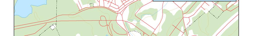
14 2.0 PROJECT DESCRIPTION AND SCOPE The proposed Project will involve a number of modifications and rehabilitation works at the Main Dam at Grand Falls, including the repair and addition of concrete, the installation of an inflatable dam mechanism along its crest, and construction of vehicle and pedestrian bridges for construction and maintenance access. Construction activities are currently planned to be completed in various phases over a three year period. The following sections provide a description of the proposed Project, including an overview of the existing Grand Falls dam and its operation as background and context, as well as the primary components and activities that will be involved in the planned rehabilitation work. It should be reiterated here that the proposed Project that is the subject of this - and for which EA approval is being sought - includes only the planned rehabilitation work at the Grand Falls Dam that is described in this document. Once these proposed construction activities are completed, the dam and other associated generating infrastructure at Grand Falls will continue to function in the same manner in which the facility is currently operated. The scope of the Project for EA purposes therefore does not include the on-going and future operation of these long-standing generation facilities by Nalcor Energy. 2.1 Overview of Existing Exploits Generation The Exploits River watershed drains a land area of approximately 10,000 km 2 extending from the southwest corner of the Island of Newfoundland northeast to the Bay of Exploits, with approximately half of the watershed draining into Red Indian Lake and the remaining portion into the Exploits River. Nalcor Energy currently operates three hydroelectric generating stations in the Exploits watershed, including facilities at Buchans, Bishop s Falls and Grand Falls, as well as various water control structures, gauging stations and other associated infrastructure throughout the system (Figure 2.1). The generating station at Grand Falls is the largest of these three stations, and is located approximately 85 km downstream from the main storage dam at Red Indian Lake and immediately adjacent to the former Abitibi paper mill on the southwestern side of the community of Grand Falls Windsor (Figure 2.2) Grand Falls Dam and its Operation The hydroelectric potential at Grand Falls was first harnessed in 1906 by the Anglo Newfoundland Development (AND) Company, and the facility has since been modified, expanded and upgraded to the current installed capacity of 75 MW. Nalcor Energy has managed and operated this and other hydroelectric facilities on the Exploits River on behalf of the Government of Newfoundland and Labrador for the past number of years. The Grand Falls generation facility consists of a main dam extending across the Exploits River, which is comprised of an overflow concrete gravity dam structure, as well as a gated intake structure consisting of 17 gates (nine submerged and eight at surface), a 1,500 foot (467 m) power canal with roller compacted concrete (RCC) spillway, three steel penstocks (ranging from 4.6 m to 6.2 m in diameter), two spill gates (one in the main dam and the other in the power canal) and a powerhouse (Figures 2.2 to 2.4). Exploits Generation: Proposed GF Main Dam Rehabilitation May 2015 TF Page 8
, and the facility is a completely run of river plant with virtually no water storage in its head pond.")
15 Figure 2.1 Existing Dam Structures on the Exploits Watershed The total plant output of 75 MW is produced from a head of approximately 100 feet (30.5 m), and the facility is a completely run of river plant with virtually no water storage in its head pond. The Grand Falls power plant consists of two vertical generating units and four double runner horizontal units, as follows: Unit #4 (29 MW), Unit #9 (also referred to as the Beeton Unit, 30 MW) and Units 5 to 8 (4 MW each). From the facility s overall drainage area of approximately 8,390 km 2, water is released or impounded at the main storage dam at Red Indian Lake to maintain the required level of water flow and electrical generation at Grand Falls and other facilities. The existing dam structure creates a small reservoir in the river for ice control. The operation of the Grand Falls Dam also involves the installation and use of temporary flashboards that are put in place along the spillway each year by crews working from small boats. These are used to provide the required head for optimal power production, as well as for environmental (fishway operation, see below) and safety reasons. These 0.9 m high timber flashboards installed at the crest increase the full supply level (FSL) to approximately elevation 61 masl. An RCC Dam forms one side of the power canal which conveys water from the Exploits River to the penstock intakes and has a power production maximum flow of 310 m 3 /s. A fish bypass system that is used to keep Atlantic salmon smolt and kelt from entering the Grand Falls turbines is located on the downstream end of the RCC Dam. This dam also has three feet (0.9 m) of wooden flashboards, which are also designed to fail during larger floods (and ice rafting), thereby increasing the capacity of the overflow spillway. Exploits Generation: Proposed GF Main Dam Rehabilitation May 2015 TF Page 9


16 Figure 2.2 Grand Falls Generating Facility: Overall Layout and Main Components (Site Plan View) Exploits Generation: Proposed GF Main Dam Rehabilitation May 2015 TF Page 10


")

17 Exploits Generation: Proposed Grand Falls Main Dam Rehabilitation Figure 2.3 Grand Falls Generating Facility: Overall Layout and Main Components (Air Photo View) Exploits Generation: Proposed GF Main Dam Rehabilitation May 2015 TF Page 11


18 Figure 2.4 Grand Falls Generating Facility (Photographs) Exploits Generation: Proposed GF Main Dam Rehabilitation May 2015 TF Page 12


19 Exploits Generation: Proposed Grand Falls Main Dam Rehabilitation Grand Falls Generating Facility (Photographs - Continued) Exploits Generation: Proposed GF Main Dam Rehabilitation May 2015 TF Page 13
20 A summary of the current features and key characteristics of the Grand Falls Main Dam is presented in Table 2.1. Table 2.1 Grand Falls Main Dam: Primary Components and Dimensions Component / Feature Dimensions Length 259 m Maximum Height 6.1 m Concrete Sill Elevation 60.1 m Top of Flashboards 61.0 m Inflow Design Flood (IDF) 3,248 m 3 /sec Full Supply Level (FSL) 61.0 masl Across from the Grand Falls generating station on the side of the river between the main dam and the tailrace, there is a fish ladder owned by Fisheries and Oceans Canada (DFO) and operated by the Environmental Resources Management Association (ERMA) (Figure 2.5). The fishway allows upstream migrating Atlantic salmon adults to get past the dam. This facility also has an interpretation center, gift shop, restaurant and office. ERMA also operates a fish hatchery on behalf of NL Hydro as part of the Star Lake compensation package required by DFO. Access to the dam on this side is via a gravel / paved road which is maintained by ERMA, and access to the north side is via a concrete pedestrian walkway. Figure 2.5 ERMA Fishway and Associated Facilities There are transformers at Grand Falls which are used to transmit the generated power to the grid at the Stoney Brook Terminal Station, located across the river from the Grand Falls generating facility. A number of these are used to transform the power from the Grand Falls station prior to its transmission to and distribution through the Island of Newfoundland s electrical system. Exploits Generation: Proposed GF Main Dam Rehabilitation May 2015 TF Page 14
21 2.1.2 Water Flows and Fish Conveyance Systems at Grand Falls As described in further detail elsewhere in this document, the Exploits River system is one of the largest Atlantic salmon rivers in Eastern North America, and the salmon population in this river has been established and maintained through an extremely successful fish stocking program and fishway systems. Nalcor Energy plays a key stewardship role in helping maintain a large and healthy fish population in this portion of the Exploits River system. This occurs through its operational practices and the associated management of water levels and flows at specific times of the year, as well as the establishment and the operation of fish conveyance structures at Grand Falls. These include (Figures 2.6 to 2.8): A Nalcor Energy owned and operated fish bypass system at the Grand Falls Main Dam; A DFO-owned fish ladder downstream of the Main Dam at the ERMA Salmon Interpretation Center; and A Nalcor Energy owned and operated fish guidance louver and bypass structure in the power canal. Figure 2.6 Overview of the Grand Falls Generating Station and Associated Fish Conveyance Systems Exploits Generation: Proposed GF Main Dam Rehabilitation May 2015 TF Page 15
22 Exploits Generation: Proposed Grand Falls Main Dam Rehabilitation Figure 2.7 Fish Conveyance System at the Power Canal As part of these initiatives, Nalcor Energy has entered into a Minimum Flow Agreement with DFO to ensure that juvenile salmon (smolt) are successfully moved downstream past the dam and adult salmon are successfully moved upstream to spawn. Minimum flow regimes are in place and adhered to for most of the existing dams in the watershed, including the Grand Falls Dam, which are intended to maintain adequate flow for habitat maintenance (late fall to early spring) and fish migration flow (remainder of the year). Upstream Migration During the period from approximately mid-june to mid-september each year, adult Atlantic salmon pass through the Grand Falls fishway structures on their way upstream to spawn. Adequate and appropriate water flows over the dam and through the gates are required to ensure that these migrations occur. Of particular concern is proper attraction flows at the downstream entrances of the fishway structures, as too much flow can mask the fishway intake and cause salmon to become stranded below the Grand Falls Dam and delay their upstream migration. Periods of heavy rainfall and runoff can also cause uncontrolled water levels that may not only mask fishway intake flows, but can cause the existing flashboard system to fail (usually where there is more than two feet of water over the boards). The flashboard system assists in maintaining upstream water levels that are needed to provide the required hydraulic conditions for the fishways to function. Until water levels and conditions are safe to repair the flashboards, adult salmon could be stranded below the Grand Falls Dam. The flows are monitored to minimize the risk of flashboard damage occurring. Exploits Generation: Proposed GF Main Dam Rehabilitation May 2015 TF Page 16
23 Downstream Migration Downstream migration of salmon includes both adult and juvenile life stages. Adults that have spawned the previous fall and have overwintered within the Exploits River system begin moving downstream in the spring (typically April-May, during spring runoff). Juvenile salmon (smolt) will also begin downstream migrations during the spring and early summer (late-april to early July). Downstream migration of fish through the Grand Falls dam area is facilitated by several features: the dam structure / flashboards, the fishways and the fish louver / bypass structure. During high spring runoff flows, adult and juvenile salmon migrating downstream are directed through an 8.3 m wide gap in the existing flashboard system at the eastern end of the Grand Falls Main Dam. This bypass arrangement remains in place until the ERMA fishway facilities are operational (typically after high spring runoff). Once the fishways are operational, both downstream and upstream migrating salmon can be accommodated through these facilities. Studies have shown that approximately 65 percent of downstream migrating fish move through this opening, which is facilitated through minimum water flows maintained by Nalcor Energy in accordance with the above described agreement with DFO. A fish behavioral system is also installed each year across the power canal and below the water surface to help guide downstream migrating fish to the entrance of the fish bypass structure (Figure 2.8). This system is comprised of a series of louver panels on a floating boom (approximately 205 m in length) that stretches across the power canal and guides them to the bypass system, where they are entrained in high velocity water and transported back to the Exploits River via a plunge pool. This system remains operational until the completion of the annual fish transfer from the generating station s power canal to the Exploit s River below the power canal (typically mid to late July, as described below). It should be noted that while most salmon are directed away from the Grand Falls hydroelectric plant, some downstream migrating adults can enter the power canal. Existing structures and barriers prevent them from entering the power generation turbines, but these individuals are then unable to complete their downstream migration without assistance. As a result, Nalcor Energy staff began a visual monitoring program in 1997, which commences each spring within the power canal when water temperature begins to rise in April and May. Any salmon within the power canal are captured through a seining procedure that is carried out in cooperation with local fishers (Figure 2.9), and are then transported around the generating station for release downstream. Exploits Generation: Proposed GF Main Dam Rehabilitation May 2015 TF Page 17
24 Exploits Generation: Proposed Grand Falls Main Dam Rehabilitation Figure 2.8 Louver System in Place in the Grand Falls Power Canal Figure 2.9 Seining Procedure Exploits Generation: Proposed GF Main Dam Rehabilitation May 2015 TF Page 18
25 2.2 Project Purpose, Rationale and Need Nalcor Energy s foundation is built on its core business - the generation and transmission of electrical power and the corporation has a strong commitment to providing safe, reliable and dependable electricity to its utility, industrial, residential and retail customers. The Main Dam and other aspects of the existing hydroelectric generating station at Grand Falls are ageing structures that have been in place for over a century. This infrastructure has and will continue to require periodic maintenance and upgrading to help ensure that it continues to function in an effective, efficient, safe and environmentally sound manner. Nalcor Energy s planned rehabilitation work at Grand Falls is intended to help achieve these objectives, and to allow the company to continue to maintain and operate these important energy assets on behalf of the people of Newfoundland and Labrador. The planned maintenance of, and modifications to, the existing dam and spillway are intended to make these facilities consistent with current engineering standards, including the 2007 Canadian Dam Association (CDA) Dam Safety Guidelines and others, including: CSA A : Concrete Materials and Methods of Concrete Construction / Methods of Test and Standard Practices for Concrete; CSA A : Design of Concrete Structures; S6: Canadian Highway Bridge Design Code; C22, 1-12 Canadian Electrical Code, Part 1; S16-01: Limit States Design of Steel Structures; and the National Building Code of Canada (2010) In addition to helping maintain and improve the overall integrity and functionality of the Grand Falls dam structure and its operations, the planned installation of the inflatable dam structure along the spillway is designed to increase and improve the operators ability to adjust dam height (and thus water levels and flows) for power production, environmental (fish passage) and safety reasons. It will also address any potential safety and environmental considerations associated with the annual installation and removal of the temporary flashboards system by Nalcor Energy crews working along the dam crest in small boats, as well as from the periodic failure of these timbers during flood and ice events. 2.3 Project Components and Lay-out The Project, for the purposes of EA review, includes the construction of the following components: 1) Refurbishment of existing, deteriorated concrete on the main dam and installation of new concrete mass; 2) Installation of an inflatable dam structure along the crest of the main dam to replace the existing flashboard system; Exploits Generation: Proposed GF Main Dam Rehabilitation May 2015 TF Page 19
26 3) A single lane bridge to span the existing power canal to provide access to the abutment; and 4) Pedestrian bridge(s) located at the dam abutments supported on piers at the spillway. The following sections provide an overview description of the Project s key components, based on previous and ongoing engineering studies and reflecting the current stage of Project planning and design. As described below, the Project is the subject of ongoing engineering, and as with any development project this will be subject to continued refinement and optimization as its planning and eventual implementation move forward Concrete Refurbishment and Reshaping The Project will include the rehabilitation of the existing main dam structure to refurbish deteriorated concrete, along with the installation of additional concrete that will be designed and shaped to enhance the overall hydraulics of the spillway (Figure 2.10). It is currently estimated that approximately 2,500 cubic metres of new concrete will be required to complete the Project. The existing concrete dam will be salvaged where competent concrete remains, and the main dam itself will form part of the diversion structure required during construction activities (see below). The existing crest section will be removed and replaced with a new concrete cap that will bond with the existing concrete and be fastened with anchors. The new dam crest will be modified to incorporate the inflatable dam structure described below, which will help to provide more effective water flow management by Nalcor Energy s operators. Rehabilitation work on the existing dam will also include the installation of additional concrete on the upstream side of the dam. This will change the curvature of the top portion of the dam and modify the toe of the dam to allow more effective energy dissipation. The dam height will rise slightly to reduce the requirement for the current flashboard system Inflatable Crest Gates Water level control during normal and flood conditions will be enhanced by replacing the existing flashboard system with a variable head inflatable pneumatic dam along the crest. This new system will be an Obermeyer structure or similar design (Figure 2.11), which includes a rubber bladder that can be inflated and deflated to raise and lower the gates, thereby controlling the water flow over the spillway. Sections of the inflatable dam can be installed and adjusted in independent sections which can control flows differently along the dam in the most beneficial manner. Controlling the flows across the dam in independent sections provides, for example, attraction water for fish ladders, and debris or ice can be passed over the spillway such that power generation activities are not adversely affected. These inflatable dam sections will be installed in three stages, as follows (see Section 2.4 for a description of planned construction activities): Exploits Generation: Proposed GF Main Dam Rehabilitation May 2015 TF Page 20
27 Figure 2.10 Proposed Concrete Refurbishment and Reshaping Existing (Left Pane ) and Modified (Right Pane) Dam Structure Exploits Generation: Proposed GF Main Dam Rehabilitation May 2015 TF Page 21
 Phase 2 will see the installation of a 122 m section of inflatable dam (also approximately 0.9 m high) at the east abutment of the dam.")

28 1) Phase 1, where a nine metre long section of inflatable dam (approximately 1.5 m high) will be installed at the west abutment of the dam, near the ERMA fish ladder. 2) Phase 2 will see the installation of a 122 m section of inflatable dam (also approximately 0.9 m high) at the east abutment of the dam. 3) Phase 3 will involve the installation of a 128 m long section of 0.9 m high inflatable dam on the remaining (middle) section of the dam. The inflatable dam sections will be attached to the dam crest via anchor bolts and will be connected together in approximately six metre long sections. The nine metre long section from Phase 1 will consist of two 4.5 m sections with position control to allow for increasing and/or decreasing the amount of water discharged during the fish migration season. Figure 2.11 Inflatable Crest Gates (Representative Diagrams, For Illustration) Improved Access The Project will also include the establishment of a single lane vehicle bridge at the Main Dam, which will be installed in a continuous span across the power canal to provide access for vehicles and equipment during construction and for future maintenance (Figure 2.12). This bridge will be comprised of a pre-fabricated steel truss bridge or similar structure, which would span from the eastern canal embankment to the existing concrete pier in the canal and from there to the concrete dam abutment. The Project will also see the installation of a prefabricated pedestrian bridge over the above described Phase 1 and 2 works to give safe access to the dam during construction and for future maintenance (Figure 2.12). Exploits Generation: Proposed GF Main Dam Rehabilitation May 2015 TF Page 22
29 Figure 2.12 Proposed Vehicle and Pedestrian Bridges Exploits Generation: Proposed GF Main Dam Rehabilitation May 2015 TF Page 23
30 2.4 Construction A general overview of the primary activities that will be associated with the construction phase of the Project is provided in the following sections. The Project will be constructed with commonly used construction practices and in accordance with standard procedures and applicable regulatory requirements Construction Activities and Sequence As described above, the current (tentative) Project schedule would see planned Project construction activities (concrete work and inflatable dam installation) completed in three phases over a three year period, as follows (Figure 2.13): Phase 1: In Year 1, a nine metre long section would be completed at the west abutment to provide attraction flows for the fishway and water management for construction Phases 2 and 3; Phase 2: In Year 2, a 122 m long section would be completed at the east abutment to direct large flows during significant flood events away from the fishway and to provide water management for construction; and Phase 3: In Year 3, a 128 m long section will be completed along the centre portion of the dam to complete construction. Figure 2.13 Proposed Construction Phases and Sequencing Specific construction approaches and methodologies will be determined and proposed by the Contractor(s) that is eventually retained by Nalcor Energy to complete this work. The following sections therefore provide an overall and conceptual overview of likely and potential construction methods, which may be subject to further refinement as Project design and planning move forward. Any and all construction techniques and activities will, however, be in full compliance with applicable environmental legislation, regulations and authorizations (EA and permitting) and in accordance relevant Nalcor Energy policies, plans and other requirements. All construction work will be completed in a dry environment to the extent possible. Water diversion and the associated establishment and maintenance of a dry work site during construction will potentially include the Exploits Generation: Proposed GF Main Dam Rehabilitation May 2015 TF Page 24
31 installation of an upstream cofferdam consisting of a cantilevered water retention wall attached to the vertical concrete face of the existing concrete gravity dam. Based on this concept, vertical steel stanchions will be installed every 2-3 m along the dam, bolted to the existing concrete face, with seals (neoprene gasket) secured to the concrete face and square stop logs installed. Any such cofferdam installation will require demolition of the existing timber below water on the upstream side of the existing dam. These structures will be installed in the Fall of Year 1, coinciding with Phase I completion of the nine metre long section on the west abutment. Additional stop logs would then be added during Phase 2 and Phase 3 construction. Downstream cofferdams consisting of sandbag type gravity structures will also likely be required up to 3 m in height to keep work areas dry. Upstream reservoirs will be operated during the construction period to ensure appropriate and manageable water volumes and flows. Local single phase power is available from a nearby pole mounted transformer, and access to the site will be through the ERMA parking area. Ready mix concrete is locally available and will be supplied from an existing, licenced facility and trucked to the work site as required. A medium size crane will likely be used to deliver materials and concrete to the work areas themselves. Phase 2 and 3 construction activities will be completed primarily through temporary ramps installed at strategic locations along the work areas, and/or through the use of a barge to be located on the upstream side of the main dam. Work crews will have additional access to the dam structure once the pedestrian bridge is installed as part of this Project. For all Phases of construction, the existing, deteriorated concrete along the dam will be chipped with a hydraulic buster to the pre-determined lines and grades. Concrete debris will be collected and disposed of in an approved manner. Dowels will be installed in a pattern and grouted into the existing concrete, with pull out tests being used on select dowels to verify reliability. Bedrock for all the new concrete installations will be cleaned prior to placement, and concrete will be formed and cast-in-place, with reinforcing structures being comprised of conventional steel. Where required, rock anchor reinforcement will be used to stabilize the concrete section, and pressure relief holes will also be used as appropriate to improve stability. In all Project construction phases, the inflatable gates will be installed along the dam crest and include a hard shell that lies flat to the crest when they are not engaged. These hard shells are resistant to ice loads and UV deterioration, and the pneumatic lines and communication lines to operate the gates will be embedded in the concrete dam crest and protected from damage. Phase 1 Construction Phase 1 construction will commence after mid-september in Year 1 to accommodate fish migration requirements. At that time, the removal of the existing timber cribbing and silt / debris along the upstream face of the full length of the dam will be completed to an elevation of approximately 59 masl, and the stanchions for the full cofferdam (as required, for all Phases) would be installed. This work would be completed using dive teams with the reservoir water level lowered. Based on this approach, cofferdam components (stop logs) will be installed along the Phase 1 section and the existing flashboard system will be removed. A downstream cofferdam constructed of sand bags to an elevation Exploits Generation: Proposed GF Main Dam Rehabilitation May 2015 TF Page 25
32 of the top of the dam will also be put in place to help keep the work area dry. Piers for the installation of the pedestrian walkway will then be constructed, and the concrete between the existing abutment and the new pier will be rehabilitated. At this point the inflatable dam will be installed along this section and the temporary cofferdams will be removed. A temporary control building will also be established along the west bank, utilizing the existing single phase power line. Phase 2 Construction At the commencement of Phase 2 (mid June of Year 2) the cofferdam structures will be installed along this section of the Main Dam, after which the existing flashboard system would be removed. This will be followed by the demolition and replacement of the existing, deteriorated concrete along this section and the construction of several new piers for the pedestrian bridge. The inflatable gate system will then be established along this section of the dam, after which the temporary cofferdam structures can be removed. As part of Phase 2 construction, a permanent control building will be constructed on the intersecting point of the RCC Dam, Main Dam and the vehicle bridge or on the side of the canal embankment, to provide control and monitoring functions. Control for the gates will be connected via air pipes put in place as part of the Phase 2 work. The control building will eventually operate all three sections of gates, and will utilize three phase power located in the existing forebay electrical room. Phase 3 Construction Phase 3 construction (to commence in mid June of Year 3) will see very similar construction activities and sequencing as those for Phases 1 and 2. Cofferdams structure will again be installed both upstream and downstream, and the existing flashboards system and concrete will be removed along that section of the main dam. Once all deteriorated concrete has been removed and new concrete has been poured, the inflatable dam system will be installed, followed by removal of the temporary cofferdam structures Construction Workforce Project construction will be carried out on a contractual basis, with workers hired at the discretion of the Contractor and in accordance with its own hiring practices and policies. Once construction is completed, the facility will continue to be operated using Nalcor Energy s existing workforce. Nalcor Energy supports employment and gender equity in its hiring and contracting practices. An initial estimate of the Project s required construction labor force, by number, occupation and National Occupational Classification (NOC) code, is provided in Table 2.2. These occupations will be full time equivalent for the three phases of the Project. Table 2.2 Occupations Likely to be Represented in the Construction Work Force Project Phase Number (Approximate) Occupation National Occupational Classification (NOC) 1 Supervisor / Foreperson NOC Heavy Equipment Operators NOC 7521 Exploits Generation: Proposed GF Main Dam Rehabilitation May 2015 TF Page 26
33 Project Phase Construction Number (Approximate) Occupation National Occupational Classification (NOC) 1 Crane Operator NOC Concrete Finishers NOC Electricians NOC Steel Erectors NOC Roofers NOC Plumbers NOC Truck Drivers NOC Mechanical Technicians (compressors) NOC Labourers NOC Divers NOC Environmental Monitor NOC Operation and Maintenance Once construction is completed, the above described new or rehabilitated aspects of the existing Grand Falls generating station will continue be operated as per Nalcor Energy s current operating practices and processes for the facility (including the associated Minimum Flow Agreement with DFO). Project maintenance activities will include regular inspection and on-going repair and maintenance of the facility as required. The various components that comprise this Project, and the Grand Falls generation station overall, will be operated for an indeterminate time period, and decommissioning is not contemplated. Should decommissioning activities eventually be considered for some or all of the facility, these will be planned and conducted in accordance with the relevant standards and regulatory requirements of the day, and in consultation with relevant regulatory agencies. 2.6 Project Schedule and Cost Estimate Following detailed and on-going engineering design and planning, the current (tentative) Project schedule would see the initial phase of construction activity in the field beginning in the Fall of 2016 (after mid-september to accommodate fish migration requirements) and concluding that year with the onset of winter conditions. Phase 2 and 3 construction will commence in approximately mid-june of 2017 and 2018, respectively. Project sanction, initiation and scheduling is, however, subject to final Project planning and engineering activities, and the receipt of all required corporate and regulatory approvals to proceed. The estimated capital cost of the Project, based on the current stage of engineering design and planning, is approximately $20 million, which includes future engineering requirements, construction activities (labour and materials) and other components and activities. 2.7 Project Documents Apart from this, no other EA-related documents have been produced by Nalcor Energy in relation to this Project. Exploits Generation: Proposed GF Main Dam Rehabilitation May 2015 TF Page 27
34 2.8 Environmental Management and Protection The number and diversity of environmental challenges facing large companies and their development projects and operations require a structured and consistent management approach. Nalcor Energy s subsidiaries have chosen the ISO Environmental Management System (EMS) standard developed by the International Organization for Standardization (ISO) to manage environmental aspects. This decision has resulted in continual improvement of environmental performance, while fulfilling the corporation s mandate to provide customers with cost-effective and reliable power. Existing Nalcor Energy facilities have been individually registered by an external auditor (Quality Management Institute, QMI) as compliant with the ISO standard. This Project will be undertaken in accordance with Nalcor Energy s EMS Environmental Protection Planning Environmental protection planning is an integral part of Nalcor Energy s construction, operations and maintenance programs. As noted previously, Nalcor Energy and its subsidiaries currently operate an extensive electricity generation and transmission system in Newfoundland and Labrador. This includes interconnected electrical power systems in Labrador and on the Island as well as isolated distribution systems throughout rural areas of the province. As a corporation with significant experience in constructing and maintaining hydroelectric and other generation facilities and transmission infrastructure in Newfoundland and Labrador, Nalcor Energy has state-of-the-art and proven policies and procedures related to environmental protection and management which will be implemented during the various phases of this proposed Project. An Environmental Protection Plan (EPP) is an important tool for consolidating environmental information in a format that provides sufficient detail for the implementation of environmental protection measures in the field during construction. An EPP provides concise instructions to personnel regarding protection procedures and descriptions of techniques to reduce potential environmental effects associated with any construction activity. The main objectives are to: Consolidate information for planning; Ensure that environmental standards are current and complied with; Provide details of corporate commitments to environmental protection and planning; and Provide guidelines for field activities and decision-making on environmental issues relevant to construction, operations and maintenance activities. Depending on construction sequencing, one or several activity-specific EPPs will be prepared and implemented by the selected Contractor(s) for the Project s construction phase. Each EPP will be a field-useable document, addressing provisions that will avoid or reduce environmental effects which may be associated with Exploits Generation: Proposed GF Main Dam Rehabilitation May 2015 TF Page 28
35 construction. As appropriate, each EPP will include items relating to work in or near water, demolition and removal of concrete and other structures, handling and installing cement and formwork, contingency plans for unplanned events such as spills, rehabilitation and compliance monitoring, and others Safety, Health and Environmental Emergency Response Plan In the construction, operation and maintenance of any development project, an accidental release or other unplanned event is an unlikely, but unfortunately possible, event. Nalcor Energy proactively identifies potential emergency situations and develops response procedures, including Safety, Health and Environmental Emergency Response Plans (SHERPs). The purpose of a SHERP is to identify responsibilities in the event of an unplanned incident, including the accidental release of fuel or other hazardous material, on-site or during transportation, and to provide the information required for the effective response and reporting of such an incident. Nalcor Energy will conform to both provincial and federal legislation with the intent of meeting both its legal and corporate responsibilities. The establishment and maintenance of emergency response procedures addresses the: Protection and maintenance of human health and safety; Identification of the potential for accidents and emergency situations; Planned response to accidents and emergency situations; and Prevention and mitigation of potential environmental effects associated with accidents and emergency situations. Depending on construction planning and sequencing, one or several site/activity-specific SHERPs will be prepared and implemented for the Project. The Project-specific SHERP will address: roles and responsibilities, personal protective equipment, materials storage, driving safety, working at heights, working near or over water, emergency response communications, spill response, personnel injury response, search and rescue, fire response, and vehicle / equipment accidents. 2.9 Environmental Permits and Approvals In addition to approval under the provincial EA process, the Project will also require a number of other provincial and federal permits and authorizations. Nalcor Energy is committed to obtaining, and complying with the conditions of, these required permits and approvals during Project construction and operations, and will require the same of any and all contractors that are involved in this Project. A number of key environmental permits and approvals that may be required in relation to the Project include those listed in Appendix A. Exploits Generation: Proposed GF Main Dam Rehabilitation May 2015 TF Page 29
36 3.0 CONSULTATION Consultation is an important and integral component of the EA process, and is a key aspect of Nalcor Energy s approach to project planning and development. The Newfoundland and Labrador EA process provides considerable opportunity for interested parties to bring forward their views and to identify issues and ask questions about a Project for consideration in its review and in eventual decision-making. This includes consultation by the proponent and by government at various stages of the EA review process. A number of consultation activities have been undertaken by Nalcor Energy in relation to the proposed Project. These include the provision of information to, and discussions with, the local community, stakeholders, relevant government departments and agencies and others, the nature and key outcomes of which are summarized in this Chapter. 3.1 Public Open House As part of its on-going Project planning and the associated preparation of this document, Nalcor Energy conducted a public meeting in Grand Falls Windsor to provide information on the Project and to identify any associated questions or concerns that local residents and other interested members of the general public may have regarding the Project. This consultation initiative took the form of a Public Open House, held at the Mount Peyton Hotel in Grand Falls Windsor on the evening of Tuesday, March 31, This public session was advertised through newspaper ads that provided details on the purpose, location and timing of the open house, as well as through other means as follows: Advertisements were placed in the local (bi-weekly) newspaper The Advertiser in the three editions prior to the event: Monday March 23, Thursday March 26 and Monday March 30 (see Appendix B); A notification was ed to the Grand Falls Windsor Town Council for posting in the Town Office and on its website, as well as to several local businesses (hotel and retail establishments) for posting within their public areas; and Nalcor Energy staff were interviewed about the Project and its associated consultation events on local radio (CBC Central Morning Show) and in the local newspaper several days prior to the event. The public open house took the form of an evening drop in session, held from 7-9 pm at the identified venue in Grand Falls - Windsor. This format was selected as it allowed all interested parties to come to the consultation session on their own time, and to proceed to receive information, ask questions and provide input at their own pace and in whatever manner and format that they feel most comfortable. It was also used in order to establish a relatively informal and relaxed environment, where participants could provide input and ask questions through one-on-one conversations, and/or in small groups, however they preferred. Exploits Generation: Proposed GF Main Dam Rehabilitation May 2015 TF Page 30
37 Representatives of Nalcor Energy and its EA Consultant (Amec Foster Wheeler) were present to provide information and clarification, answer questions, and to record any and all questions, issues and perspectives raised. This included the following personnel: Willmore Eddy, Manager Exploits Generation, Nalcor Energy Marion Organ, Manager - Environmental Services, Nalcor Energy Brent Sellars, Team Lead - Capital Projects / EA, Environmental Services, Nalcor Energy Derek Rendell, Program Manager Exploits Generation, Nalcor Energy Jill Kenny, EHS Representative - Exploits Generation, Nalcor Energy Steve Bonnell, EA Practice Leader, Amec Foster Wheeler E&I Heather McCracken, EA Specialist, Amec Foster Wheeler E&I Upon arrival, participants were greeted by a Study Team representative at a sign-in table, who provided an overview of the open house purpose and format. The session included five information stations arranged throughout the open house venue, consisting of tables with large information panels (Appendix B) that focused on the following themes: 1) An overview of Nalcor Energy in general and Exploits Generation in particular; 2) A description of the existing Grand Falls Hydroelectric Generation Station; 3) A description of the existing fish conveyance systems and water management at Grand Falls; 4) A description of the proposed Project (primary components and planned construction / operations activities); 5) An overview of some Project-related environmental considerations and planned mitigation, and of the Newfoundland and Labrador EA process. The purpose of these information panels was to provide general background information, and to serve as a basis for prompting dialogue and the sharing of information and input by consultation participants. At the public open house, Nalcor Energy and Amec Foster Wheeler personnel were clearly identified through name tags, and were positioned at and/or between stations. A key focus was on obtaining and recording information and input related to: Questions, issues or concerns regarding Project and its potential environmental or socioeconomic effects; Local knowledge regarding the existing biophysical or socioeconomic environment in or near the Project Area; and Exploits Generation: Proposed GF Main Dam Rehabilitation May 2015 TF Page 31
38 Suggestions for any mitigation measures or other means through which any identified issues could be addressed in future Project planning and decisions / actions. A total of four individuals attended the public open house. The consultation team members continuously took notes and recorded any and all input received throughout the session, and also met as a group to debrief, record and compile all information and input received. 3.2 Meeting with Grand Falls Windsor Town Council Nalcor Energy and its EA Study Team also met with the Grand Falls Windsor Town Council (Mayor, Councilors and Senior Municipal Staff) as part of its consultation initiatives for this Project. This meeting took place at the Town Office on Tuesday, March 31, 2015, immediately prior to the above described public open house. It included a short welcome and introduction period, followed by a presentation by Nalcor Energy on the Project and a general round table discussion. Notes were again taken by the Proponent s team throughout the meeting, highlighting the various questions, issues and perspectives raised. 3.3 Overview of Consultation Findings A number of topics and themes were identified and noted during the above described consultation activities. These are summarized in Table 3.1, along with a general indication of where each of these is addressed in this document. Table 3.1 Summary of Environmental Questions and Considerations Raised During EA Consultations Question / Issue Raised Where Addressed in EA Registration Existing fish bypass structures and associated operations by Nalcor Energy Section 2.1 Location and purpose of the planned bridge installations Section Public access restrictions and adjacent land uses Section Water flows and levels, and possible changes to same as a result of the Project (and any Sections 2.1, 2.4, 2.5, 4.2 associated implications for other environmental components and activities) Project capital costs and budget Section 2.6 Other existing dams and water control infrastructure on the Exploits River system Section 2.1 Visibility and potential visual aesthetics issues Section These public and stakeholder consultation activities have provided Nalcor Energy with useful information on, and a good understanding of, the key questions and perspectives that local residents and others have regarding the Project. These issues have influenced and informed the focus and content of this. Overall, there were no significant, negative environmental concerns or other issues raised in relation to the proposed Project, and most consultation participants appeared to view it as a very positive environmental initiative. Exploits Generation: Proposed GF Main Dam Rehabilitation May 2015 TF Page 32
39 The eventual governmental and public review of this will also help to identify any important environmental questions and issues related to the proposed Project, for consideration by government in determining whether further EA review is required, and/or any terms and conditions that may be associated with EA approval. The Project will also eventually require a range of additional environmental permits and other authorizations (Appendix A). The post-ea permitting process will provide the opportunity for relevant government departments and agencies to receive and review additional Project design information, and to establish specific terms and conditions to avoid or reduce environmental effects. Nalcor Energy and/or its contractors will identify, apply for and adhere to all required permits and other authorizations that are required for Project construction and/or operations. Exploits Generation: Proposed GF Main Dam Rehabilitation May 2015 TF Page 33
40 4.0 ENVIRONMENTAL SETTING, POTENTIAL INTERACTIONS AND MITIGATION This Chapter provides an overview of the existing environmental setting for the proposed Project, including a description of relevant components of the biophysical and socioeconomic environments. This is followed by an analysis of the Project s potential environmental interactions and the identification and description of mitigation measures which will be put in place to avoid or reduce any such effects. 4.1 Existing Environment The following sections provide a general description of the existing natural and human environments in the area within which the Project will be located, based on existing and available information. The objective is to present an overview summary of the environmental setting and context for the Project Biophysical Environment The proposed Project site is located in Central Newfoundland, on the Exploits River to the immediate southwest of the Town of Grand Falls Windsor. The climate of Grand Falls-Windsor is typical of the larger region, which has the most continental climate of any part of insular Newfoundland including the highest summer and lowest winter temperatures in the area. A summary of the key climatic characteristics of the Grand Falls-Windsor area is presented in Table 4.1, based on climate normals data for the years 1981 to Table 4.1 Climate Normals for Grand Falls-Windsor ( ) Parameter Jan Feb Mar Apr May Jun Jul Aug Sep Oct Nov Dec Year Mean Temperature ( o C) Precipitation (mm) ,099 Rainfall (mm) Snowfall (cm) Source: Environment Canada (2014) Overall, the mean monthly temperature at this location is 5 o C, and ranges from -8 o C in January and February to 17 o C in July and August. The Grand Falls-Windsor area also receives fairly consistent precipitation throughout the year, averaging 1,099 mm annually. May is generally the driest month with 79 mm of precipitation, while August is the wettest on average with 107 mm. The total annual snowfall is 293 cm each year, generally occurring between October and May. The NL Department of Environment and Conservation maintain a National Air Pollution Surveillance (NAPS) monitoring station adjacent to the former Abitibi mill site. The station measures concentrations of various air pollutants including particulate matter, ozone, nitric oxide, nitrogen dioxide, other oxides of nitrogen, carbon monoxide and sulfur dioxide. During 2013, all measured concentrations in Grand Falls-Windsor were below the national average, and during this period monthly averages of all the parameters did not exceed applicable air quality guidelines. Exploits Generation: Proposed GF Main Dam Rehabilitation May 2015 TF Page 34
41 The underlying bedrock of the Grand Falls area is characterized primarily by the lower Silurian, Wigwam Formation (Rogers and van Staal 2005), and is comprised predominantly of sandstone, siltstone and conglomerate. Surficial geology within and around the Project area is primarily of fluvial origin, and consists of clays and silt deposited by the Exploits River. Surficial formations within the area are dominantly bedrock outcroppings and bog (Taylor et al 1994; Batterson 1999). Within the immediate Project site, bedrock outcroppings are the primary surficial feature, as the majority of overburden has been eroded by the Exploits River. The Project area is located within the Central Newfoundland Ecoregion (Meades 1990; DNR 2014), which encompasses much of the north-central portion of the Island of Newfoundland. This ecoregion is again characterized by a continental climate with relatively high summer temperatures and low winter temperatures. Due to the warm summer and high evapo-transpiration losses, soils in the northern part of this ecoregion display soil moisture deficiency. The hylocomium-balsam fir forest type occupies the zonal soils of this area. These soils are generally lighter in colour and have lower organic matter content compared to other ecoregions. Forest fires have played an important role in the natural history of this region, and much of the balsam firfeathermoss forest types have been converted to black spruce and some of the richer site types to hardwood forests dominated by white birch and aspen. Although aspen occurs in other regions, it is most abundant and vigorous in Central Newfoundland, but yellow birch is absent from this region primarily because of the short frost-free period. Alders rather than mountain maple are the most common species on wet seepage slopes. Within the larger Central Newfoundland Ecoregion, the Northcentral Subregion encompasses the proposed Project area itself. This area has higher summer maximum temperatures, lower rainfall and higher fire frequency than anywhere else in Newfoundland, and for the most part exhibits a rolling topography below 200 m. The rolling to undulating topography is characterized by shallow, medium quality till with a soil texture range from sandy loam to loam. Pure black spruce forests and aspen stands dominate this area because of the prevalence of fire in the natural history of the subregion. Where tree regeneration is lacking, succession to dwarf shrub heath dominated by Kalmia angustifolia occurs on the nutrient-poor coarse textured till that is prevalent through much of this area (Meades 1990; DNR 2014). The proposed Project site itself is primarily cleared ground interspersed with pockets of black spruce and shrubs. The Central Newfoundland region, with its productive and scrub forests, extensive wetlands and barren areas also provides habitats for a range of wildlife that are typical of boreal forest ecosystems. Wildlife species that are known or likely to occur in the general region include large mammals (moose and black bear), furbearers and small mammals (such as fox, hare, red squirrel, voles) as well as various resident and migratory species of birds, including raptors, waterfowl, passerines and upland game birds. There are also several species of gulls that nest in the cliffs and other surfaces along Exploits River. Gulls often begin to arrive in March (following the spring freshet), and leave following fledging of the young, typically around mid-august. They have been known to nest in high densities in some locations, upwards of several hundred birds per year. No plant or animal species that are listed under the Newfoundland and Labrador Endangered Species Act (NL ESA) or the Canadian Species at Risk Act (SARA) are known or likely to occur within the proposed Project area itself. Exploits Generation: Proposed GF Main Dam Rehabilitation May 2015 TF Page 35
42 The Exploits River flows through the Exploits Valley in the central portion of the Island of Newfoundland. The river extends from Red Indian Lake at its starting point and discharges into the Bay of Exploits near the Town of Botwood on Newfoundland s northeast coast. At approximately 246 km in length, it is the longest river on the Island (and the second longest in the province), and drains an area of over 10,000 km 2. Water flows have been measured and monitored in the Grand Falls area since the early 1940s, initially at the hydroelectric facility itself and since 2010 at a monitoring station located just upstream of Grand Falls. Typical low flows are observed in June, July and August with high flows occurring in April and May during the spring freshet. Mean daily flows are approximately 170 m 3 /s and have not been measured below 70m 3 /s. Although the highest flows measured were just below 1,200 m 3 /s, they only periodically exceed 285 m 3 /s (Figure 4.1). Figure 4.1 Exploits River Water Flows (Monthly Discharge, ) Discharge (m 3 /s) Mean Discharge Minimum Discharge Maximum Discharge Jan Feb Mar Apr May Jun Jul Aug Sep Oct Nov Dec Month Source: Water Survey of Canada (2014) The Government of Newfoundland and Labrador conducted water quality monitoring on the Exploits River from 1987 to In general, water quality fluctuated from poor to fair and showed an overall improving trend from 1988 to 1994 (NL WRMD, undated). Various fish species inhabit the Exploits River, including; Atlantic salmon (Salmo salar), brook trout (Salvelinus fontinalis), Arctic char (Salvelinus alpinus), American eel (Anguilla rostrata), rainbow smelt (Osmerus mordax) and threespine stickleback (Gasteroteus aculeatus). Each of these (with the exception of stickleback) hold recreational and/or commercial value. A brief summary of the overall life history and uses of these species is presented in Table 4.2. Exploits Generation: Proposed GF Main Dam Rehabilitation May 2015 TF Page 36
43 Table 4.2 Fish Species Known to Occur in the Exploits River Common Name Scientific Name Biological/Habitat Details Typical Habitat Atlantic salmon Salmo salar Preferred temperature: 8-16 o C Preferred depth: Variable Preferred substrate: gravel, cobble, boulder Biology and Ecology Distributed throughout Newfoundland and Labrador Occurs as landlocked (Ouananiche) and anadromous life histories Spawn in clean, well aerated, gravel bottom riffle sections of stream Diet depends on the size and habitat of fish, as well as season Juvenile anadromous salmon remain in natal watersheds for 2-4 years Adult salmon generally remain at sea for 1-3 years before returning to their natal stream to spawn Brook trout American eel Salvelinus fontanalis Anguilla rostrata Recreational/Commercial Value Recreational fishery There has not been a commercial salmon fishery in Newfoundland since 1997 Typical Habitat Preferred temperature: o C Preferred depth: m Preferred substrate: gravel, cobble, boulder Biology and Ecology Inhabits lakes and rivers throughout Newfoundland and Labrador Can be landlocked or anadromous Feed mainly on aquatic and terrestrial insects and fish Can hydribize with other salmonid species Recreational/Commercial Value Recreational fishery No commercial fishery in Newfoundland Typical Habitat Preferred temperature: variable; below freezing to over 19 o C Preferred depth: <1m Preferred substrate: boulder, rubble, silt, muck, clay Biology and Ecology The only catadromous (spawn at sea) species in Newfoundland and Labrador All American eels spawn in the Saragasso Sea. Can survive in very shallow water, and can move across wet grass or rocks during migrations Eels hibernate over the winter in soft substrates Recreational/Commercial Value Recreational / commercial fishery Few commercial licenses in Newfoundland Exploits Generation: Proposed GF Main Dam Rehabilitation May 2015 TF Page 37
44 Common Name Scientific Name Biological/Habitat Details Typical Habitat Arctic char Salvelinus alpinus Preferred temperature: 3-16 o C Preferred depth: >1m Preferred substrate: boulder, rubble, gravel Biology and Ecology Populations in Newfoundland are typically landlocked, and considered to be relict species Anadromous life histories only found north of Pistolet Bay in Newfoundland. Slower growing than other salmonids due to their northern distribution Primarily found in deeper lakes on the Island. Rainbow smelt Threespine stickleback Osmerus mordax Gasteroteus aculeatus Recreational/Commercial Value Recreational fishery Several commercial fisheries throughout Arctic Canada Typical Habitat Preferred temperature: approximately 15 o C Preferred depth: >2m Preferred substrate: cobble, gravel, sand, clay Biology and Ecology Schooling pelagic species found in lakes and nearshore marine habitats. Anadromous populations spawn in rivers in April to June Landlocked populations are known to exist in both normal and dwarf form. Recreational/Commercial Value Recreational fishery Food source for other recreational / commercial fish species Typical Habitat Preferred temperature: 9-12 o C Preferred depth: variable, generally <1m Preferred substrate: within or near vegetation Biology and Ecology Common throughout Newfoundland and Labrador, in fresh, brackish and marine environments Maximum lifespan is typically years Recreational/Commercial Value Limited; may be a food source for larger recreational / commercial species Sources: Grant and Lee (2004), DFO (2012, 2014a, 2014b) Of these species, only the American eel is designated as a species of special conservation status, being listed as vulnerable under provincial legislation (NL ESA) as well as being identified as threatened by COSEWIC (2012). Exploits Generation: Proposed GF Main Dam Rehabilitation May 2015 TF Page 38
45 All of the fish species present in Exploits River can undertake migrations (to varying degrees), which may occur as part of their seasonal changes in habitat associated with feeding and/or spawning or to avoid adverse environmental conditions (such as water temperatures). Table 4.3 presents a summary of known high intensity fish migration periods for these species. Table 4.3 Summary of Key Migration Times for Fish Species Known to Occur in the Exploits River Species Season Direction of Migration American Eel Spring Upstream Fall Downstream Atlantic salmon Spring-Fall Upstream Fall Downstream Brook trout Spring Downstream Fall Upstream Arctic char 1 Spring Downstream Fall Upstream Stickleback 2 Spring Upstream Rainbow smelt Spring Upstream 1 Arctic char do not migrate south of Pistolet Bay 2 Large scale migrations can occur in anadromous populations; landlocked populations undergo localized migrations Source: Grant and Lee (2004); Scott and Crossman (1973) Socioeconomic Environment The community of Grand Falls was originally founded in 1905 to support the development of the pulp and paper industry in Central Newfoundland, which was established and flourished due to the rich timber resources, hydroelectric potential and nearby port site. The Anglo-Newfoundland Development (AND) Company was incorporated in 1902 and the Grand Falls Pulp and Paper mill opened in October Grand Falls was the official company town established to accommodate mill employees, business owners and support workers, and was eventually incorporated as the Town of Grand Falls in Other residents settled to the north of the railway in an area known as Grand Falls Station and later the Town of Windsor, which was incorporated in In 1991 both municipalities were amalgamated to form the Town of Grand Falls-Windsor (GFW 2014a). The Town of Grand Falls-Windsor currently has a population of nearly 14,000 residents. Despite trends elsewhere in the province and the recent changes in the community s economic activity and focus, the community s population has been largely stable over the past decade (Table 4.4). Table 4.4 Population of Grand Falls Windsor ( ) Year Population Change from Previous Census , % , % , % Sources: Statistics Canada (2006a; 2006b; 2011a) Exploits Generation: Proposed GF Main Dam Rehabilitation May 2015 TF Page 39
46 Figure 4.2 Population of Grand Falls Windsor: Age / Gender Structure (2011) Age Class % Female % Male Source: Statistics Canada (2011a) Percent The Town of Grand Falls Windsor is a modern, vibrant community, which includes a wide and diverse range of public and commercial services and infrastructure for their residents and the general region, including municipal (administration, waste management, water and sewer, roads) and provincial / federal (safety and security, health care, employment and social programs, training and education) services and facilities. The economy of Central Newfoundland has traditionally been based primarily on natural resource extraction and industrial development. Much of the population lives in the general Grand Falls-Windsor / Bishop s Falls area, which is the industrial, service and government centre for Central Newfoundland. The forestry sector and associated pulp and paper industry has been a major employer in this area for decades. Since the December 2008 announcement that the Grand Falls-Windsor paper mill would close, local residents, industry and stakeholder groups, and municipal and provincial governments have been working together and taking action to help the Town and region retain its current economic activity, as well as exploring employment, business and economic diversification opportunities. Manufacturing, commercial, retail and government services currently employ a significant portion of the labour force of the Town and the larger Central Newfoundland region (GFW 2014b), and tourism and recreational activities and associated facilities are also currently a key component of the area s economy (Figure 4.3). Exploits Generation: Proposed GF Main Dam Rehabilitation May 2015 TF Page 40
47 Figure 4.3 Grand Falls-Windsor: Labour Force by Industry (2011) Real Estate, and Rental and Leasing Agriculture, Forestry, Fishing and Hunting Utilities Manufacturing Wholesale Trade Administrative and Support, Waste Management / Construction Educational Services Public Administration Health Care and Social Assistance 0.00% 5.00% 10.00% 15.00% 20.00% 25.00% Source: Statistics Canada (2011b) Grand Falls-Windsor is an incorporated municipality with a Municipal Plan and associated Development Regulations. The current Grand Falls generating station is located immediately adjacent to the former Abitibi paper mill on the south side of the community, in an area zoned as Heavy Industrial (IH). Most of this area includes a narrow strip of land zoned as Conservation (CON) along the River s edge. On the opposite side of the river, the dam connects to an area zoned as Rural (RUR) which is the location of the ERMA Fishway and Salmonid Interpretation Centre (GFW 2012; ERMA 2014). The Exploits is a Scheduled River (#46) for fishing Atlantic salmon, and attracts anglers from throughout the province as well as from elsewhere in Canada and the United States. Recreational fishing is regulated by DFO through the Newfoundland and Labrador Fishery Regulations. The Exploits River is included in Zone 4, where the 2014 season was from June 1 to September 7 with fall angling from September 8 to October 7, Catch-andrelease angling with a daily limit of four salmon was available in the fall of 2014 on the main stem of the lower Exploits River from Stoney Brook to the river mouth. DFO maintains a Watershed Management Plan for the Exploits River to meet fish conservation objectives. Regulations for class and retention limits (from 0 to 6 salmon) are established for various sections of the Exploits River based on the abundance of fish in those areas (DFO 2014c). The Exploits River is also used for canoeing and kayaking, and every year hundreds of people take advantage of this activity along the river, primarily above Grand Falls-Winsor. A number of other recreational and / or commercial land and resource use activities occur along this section of the Exploits River and in nearby areas, including (RILOT 2014; RIAL 2014; P. Devereaux 2014; ERMA 2014; NLDMIA 2014; GFW 2014b; GFGC 2014b; NLDTW 2014: Figure 4.4): Exploits Generation: Proposed GF Main Dam Rehabilitation May 2015 TF Page 41
48 Riverfront Chalets and Rafting Newfoundland (formerly Red Indian Adventures) is a private tourist operation that offers white water rafting and kayaking tours on the Exploits River. The operation is set up upstream of Grand Falls next to Aspen Brook, and generally runs from mid June to late September; Sanger Memorial RV Park, with 45 camping sites, is located three kilometers to the east; Beothuk Family Park, a privately owned park with serviced and unserviced campsites, is located on Big Rushy Pond approximately three kilometers to the west of the dam site; The Newfoundland T Railway Provincial Park, former Canadian National railbed, is located approximately two kilometers to the north and runs through the Town; The Grand Falls Golf Club is located on the Exploits River approximately four kilometers to the west; A Provincial Cottage Planning Area is located on the opposite side of the Exploits River approximately five kilometers to the west of the dam; The nearest outfitter, Central Newfoundland Outfitters Rattling Brook Lodge, is located 15 km to the east; Red Indian Lake Outfitting & Tours Inc. which offers white water rafting, kayaking, hunting, fishing and snowmobiling is located on Red Indian Lake about 135 km to the west. The Trans-Canada Highway (Route 1, NL Protected Road) is located approximately two kilometers to the north; Grand Falls-Windsor Heliport is located approximately two kilometers to the east of the dam; Several quarries are located between three and five kilometers to the south and east of the dam site; and There are two former waste disposal sites located approximately five kilometers to the north and west. Exploits Generation: Proposed GF Main Dam Rehabilitation May 2015 TF Page 42


")


49 Exploits Generation: Proposed Grand Falls Main Dam Rehabilitation Figure 4.4 Existing (Regional) Socioeconomic Environment Exploits Generation: Proposed GF Main Dam Rehabilitation May 2015 TF Page 43