Terrestrial Biomes. Physical Geography Lecture - GEOG B1. Available at
|
|
|
- Clare Lester
- 5 years ago
- Views:
Transcription
1 Terrestrial Biomes Physical Geography Lecture - GEOG B1 Available at
2 Biogeographic Realm Biogeographic realm - a geographic region where a group of associated plant and animal species evolved. Species interactions occurred as continents collided and remained attached; species became separated when continents drifted apart. Consequently, the organisms within each realm are a product of plate tectonics and evolutionary processes. Climate and physical barriers tend to maintain an isolation of species within each realm.

3
4 Biomes Biomes - a large, stable, terrestrial or aquatic ecosystem classified according to the predominant vegetation type and the adaptations of particular organisms to that environment Biogeographers often designate six major groups of terrestrial vegetation: Forest Savanna Shrubland Grassland Desert Tundra However, most biome classifications are more specific, with the total number of biomes ranging from 10 to 16, depending on the system being used. * *The specific vegetation types of each biome encourage related animal associations that also help define its geographic area. In their form and distribution, plants reflect Earth s physical system (the abiotic factors discussed in chap 19), including its energy patterns; atmospheric composition; temperature and winds; precipitation quantity, quality, and seasonal timing; soils and nutrients; chemical pathways; and geomorphic processes. Remember that biomes are defined by species that are native to a region. However, humans have altered most biomes through agricultural practices.

5


6 Ecotones Ecotone - a boundary zone between different, adjoining ecosystems at any scale An ecotone is a zone of gradual transition that varies in width depending on the physical factors involved. * *For example, the climatic boundary between grasslands and forest can occupy many kilometers of land, while a boundary in the form of a landslide a river, a lakeshore, or a mountain ridge may occupy only a few meters.

7
8 Invasive Species Native species of natural biomes have come to inhabit those areas as a consequence of the evolutionary and physical factors. Communities, ecosystems, and biomes can also be inhabited by species that are introduced from elsewhere by humans, either intentionally or accidentally. * About 10% of these non-native species are able to take over niches already occupied by native species, becoming invasive species. Those invasive species can alter community dynamics and lead to declines in native species. ** Fig *About 90% of introduced non-native species fail to move into established niches in their new community. **Examples include: Africanized killer bees in No and So America Brown tree snakes in Guam Zebra and quagga mussels in the Great Lakes Russian olive and tamarisk trees along streams in the southwest U.S. Kudzu in the southeast U.S.

9 Terrestrial Biomes Also see Table 20.1 p. 602
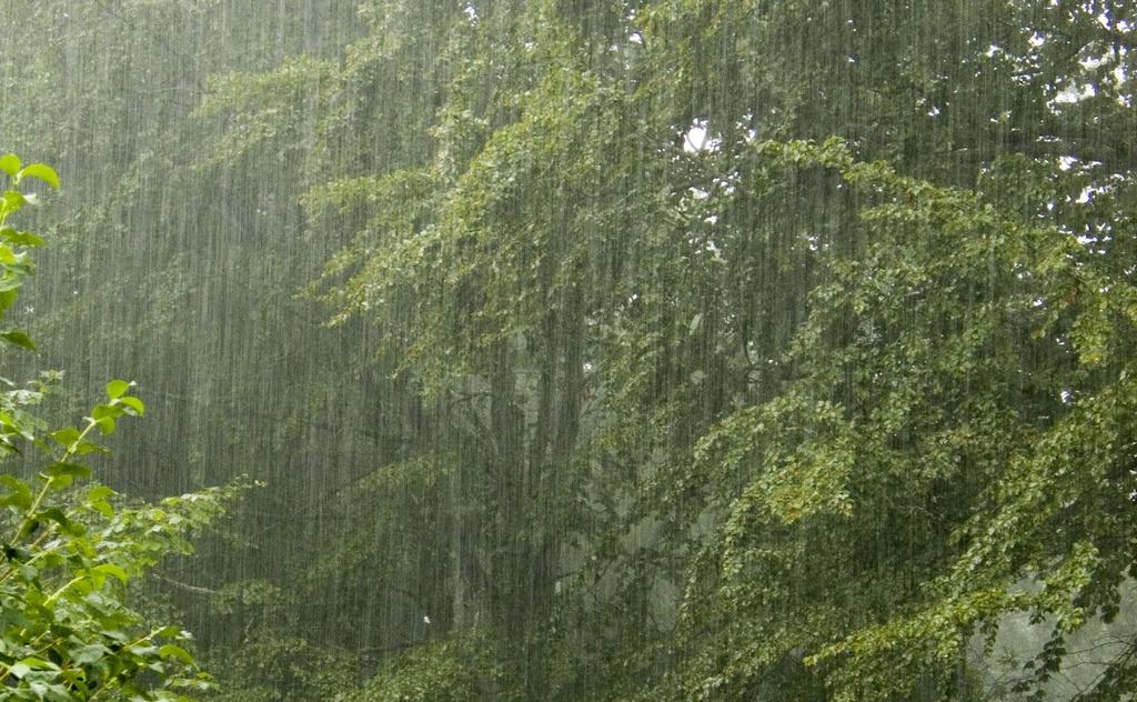
10 Tropical Rain Forest Equatorial regions - tropical High insolation - average annual temperatures around 25 (77 ) Plentiful moisture - daily precipitation - annual range cm Evergreen broadleaf forest - continuous thick, leafy canopy Levels in forest canopy - little light reaches ground Largest tract in Amazon region * 7 % of total land, but 50% of species - huge biodiversity Infertile soils - nutrients are in trees Ecological niches distributed vertically Deforestation due to agricultural practices p *Also cover equatorial regions of Africa, parts of Indonesia, margins of Madagascar and Southeast Asia, Pacific coast of Ecuador and Colombia, and the east coast of Central America. Small discontinuous patches elsewhere. Cloud forests of western Venezuela are high-elevation trop rain forests.

11
12 Tropical Seasonal Forest and Scrub Transitional between tropical rain forest and grassland Always warm with variable temps - average above 18 Shifting ITCZ affects precipitation - annual range cm (>40 rainy days during driest months) - seasonal surpluses and deficits Encompasses tropical monsoon and tropical savanna climates * Natural vegetation ranges from monsoon forests to open deciduous woodlands to thorn forests to semiarid shrublands No continuous canopy of leaves, open grassy lands, areas choked by dense undergrowth Deforestation due to ranching *Areas include: Northeastern and southeastern Brazil Paraguay Northern Argentina Brigalow scrub of Australia Dornveld of southern Africa West to east from Angola through Zambia to Tanzania and Kenya Southeast Asia Portions of India Interior Myanmar through northeastern Thailand Parts of Indonesia


13
14 Tropical Savanna Consists of large expanses of grassland, with scattered trees and shrubs Shifting ITCZ brings seasonal precipitation - annual range cm - rest of year is under influence of subtropical high = moisture deficits Grasses, drought resistant trees, thorn tree scrub Vegetation maintained by fire Soils richer in humus than wetter tropical soils Home to large land mammals, and huge grazing herds Largest area in in Africa - Serengeti Plains of Tanzania and Kenya, and the Sahel region south of the Sahara * *Grasslands also in parts of Australia, India and South America


15
16 Midlatitude Broadleaf and Mixed Forest Humid, subtropical continental climate supports a mixed forest warm to hot summers and cool to cold winters Annual precipitation range cm - seasonal pattern with summer maximum Mixed broadleaf and needleleaf trees / deciduous broadleaf - losing leaves in winter / southern and eastern evergreen pines demonstrating fire association Distinct communities in North America, Europe, and Asia Inhabited by a wide number of mammals, birds, reptiles, and amphibians


17
18 Boreal and Montane Forest Northern hemisphere - needleleaf forest - Taiga Subarctic humid continental and highlands Short, cool summer, cold winter Annual range of precipitation cm / moderate precip (snow and rain), moist soils, some waterlogged and frozen in winter - no deficits Needleleaf conifers, mostly evergreen pine, spruce, fir, Russian larch (deciduous needleleaf) East coast of Canada westward to Canadian Rockies, and parts of Alaska / from Siberia across Russia to European Plain Wolf, elk, moose, bear, lynx, beaver, wolverine, small rodents, migratory birds


19
20 Temperate Rain Forest Marine west coast of northwest U.S. * Moderate air temperatures, summer fog, overall maritime influence - mild summer and winter Annual precipitation range cm - large surpluses Narrow margin of lush evergreen and deciduous trees on windward slopes Tallest trees - coast redwoods ** Deforestation due to logging practices Most forest in this biome is secondary growth - only about 10% of original growth still stands *Also exist in southern China, small portions of southern Japan, New Zealand, and a few areas of southern Chile **Redwoods can exceed 1500 years in age. Range in height from m ( ft) with some taller than 100 m


21
22 Mediterranean Shrubland Mediterranean climate - hot, dry summer and cool winters Annual precipitation range cm / summer deficits - winter surpluses Short shrubs, drought adapted, tending to grassy woodlands and chaparral * Located poleward of shifting subtropical high-pressure cells in both hemispheres Conditions conducive to fire - rapid recovery Animals: deer, coyote, wolf, bobcat, rodents, other small animals, and birds *shrubs average a meter or two in height, with deep, well-developed roots, leathery leaves, and uneven low branches Chaparral - scrubby evergreen Species include manzanita, toyon, red bud, ceanothus, mountain mahogany, blue and live oaks, and poison oak


23
24 Midlatitude Grassland Temperate continental regime / humid subtropical and humid continental - hot summers Annual precipitation range cm / recharge balanced soil moisture Large grazing animals: deer, pronghorn, bison Also prairie dogs, gophers, turkey vultures, grouse, coyotes, black-footed ferret, badger, hawks, eagles, and owls Most modified by humans North American tallgrass prairies extended westward to 98th meridian, with shortgrass prairies in the drier lands farther west - fire association Only naturally occurring trees were deciduous broadleaf along streams and other limited sites


25
26 Deserts Warm Deserts Subtropical desert & scrubland / arid desert - influenced by subtropical high-pressure cells Avg. annual temp around 18 highest temps on planet Avg. annual precip < 2 cm / chronic deficits / irregular precip Bare ground graduating ito xerophytic plants including cacti, succulents, and dry shrubs Cold Deserts Midlatitude desert, scrubland, and steppe / semiarid steppe Higher latitudes / polar Avg. annual temp around 18 / warmest months < 10 Avg. annual precip 2-25 cm Temperate desert vegetation including short grass and dry shrubs Mosses, lichens


27 Warm Deserts


28 Cold Deserts
29 Arctic and Alpine Tundra Tundra subarctic - very cold Warmest months < 10 / only 2-3 months above freezing Average annual precipitation cm Extreme northern area of Russia and N. America - bordering the Arctic Ocean Treeless / dwarf shrubs, stunted sedges, mosses, lichens, short grasses; alpine - grass meadows Permafrost with poor drainage Musk ox, caribou, reindeer, rabbit, Ptarmigan, lemming and other small rodents, wolf, fox, weasels,snowy owl, polar bear, mosquito


30
31 Island Biogeography for Species Preservation When Europeans explorers encountered islands, they would use what wood they could find for repairs, and obtain food and water. Then they would release goats and rabbits on to the island to proliferate and be a ready food source for when they returned. Rats were often left behind accidently. These animals decimated native species population. Today there are restoration efforts - eradicating invasive species and breeding/growing native species to be transplanted or returned to the island.
32 Aquatic Ecosystem Management Human activities have also degraded aquatic ecosystems. Coastal ocean waters, in particular, continue to deteriorate from pollution and habitat degradation, as well as unsustainable fishing practices. Management was needed. Government designation of large marine ecosystems (LMEs) - distinctive oceanic regions identified on the basis of organisms, ocean-floor topography, currents, areas of nutrient-rich upwelling, or areas of significant predation, including human. Several of these LMEs now include government protected areas.* *Monterey Bay National Marine Sanctuary within the California Current LME Florida Keys Marine Sanctuary within the Gulf of Mexico LME
33 Anthropogenic Biomes Humans now have become the most powerful biotic agent on Earth. We influence all ecosystems on a planetary scale - even in the most pristine ecosystems, there is evidence of human settlement evidence. Anthropogenic biomes - result from ongoing human interaction with ecosystems, linked to land-use practices The most extensive is rangeland, followed by croplands, forested lands, and settled lands.