Lochmere Golf Course
|
|
|
- Drusilla Mosley
- 5 years ago
- Views:
Transcription
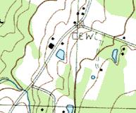
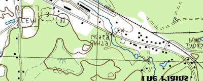
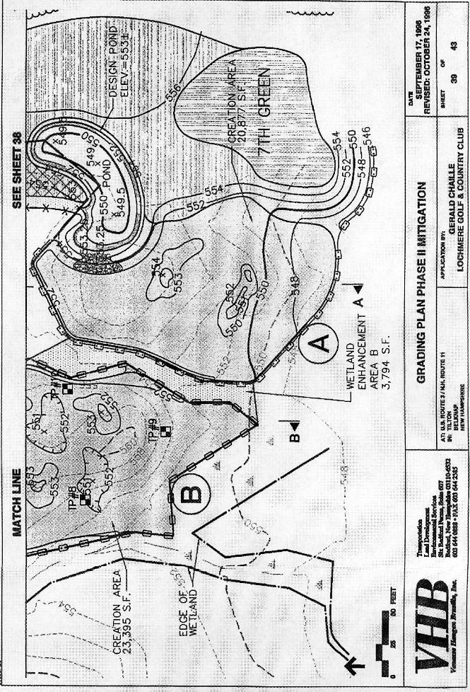
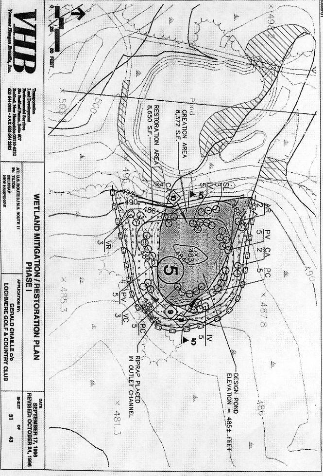
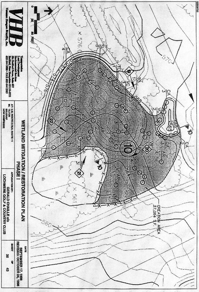
1 Lochmere Golf Course File No.: City and State: Northfield, NH General Impacts: 3.76 acres Functions and Values Lost: (From EA/SOF) Floodflow Alteration Water Quality Maintenance Wildlife Habitat Year(s) Mitigation Constructed: December 1998 Size and Type of Mitigation as Proposed: 3.88 acres PEM and PSS Proposed Functions and Values of Mitigation: Floodflow Alteration Wildlife Habitat Mitigation Special Condition(s): 7. The compensatory mitigation associated with this permit shall include 3.55 acres of creation, 0.20 acre of restoration, and 1.13 acre of enhancement of wetlands. This wetland mitigation shall proceed in accordance with the attached plan entitled Lochmere Golf and Country Club, Tilton, New Hampshire dated November Construction of the mitigation shall begin within one year of receipt of this permit. It shall continue until mitigation construction and planting is complete. Remarks: None Directions: Take 128/95 north to I-93 north. Take exit 20, Route 11. Take a left off the exit, and follow it to the Lochmere Country Club entrance. It s approximately 2 ½ miles from the exit.
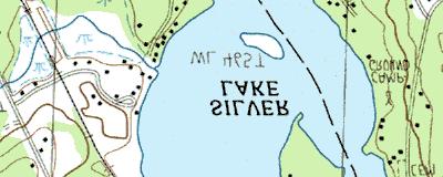
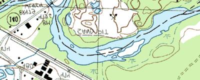
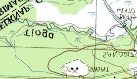
2 Street Atlas USA DeLorme. Street Atlas USA MN (16.0 W) TN Scale 1 : 8, ft m 1" = 711 ft


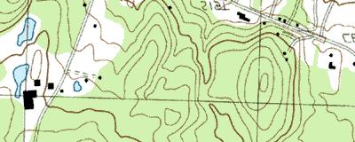

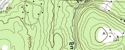
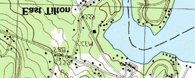

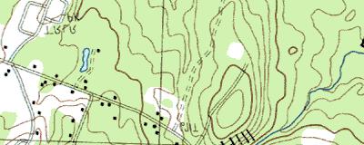


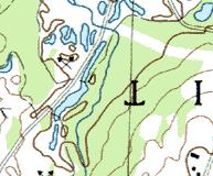


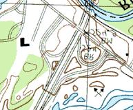


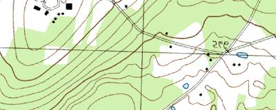


3 Lochmere Golf Course Copyright (C) 1997, Maptech, Inc.
4 MITIGATION SITE FIELD DATA FORM Site Name: Lochmere Golf Course File No City/Town: Tilton State: NH Waterbody: Monitor(s): Ladd, Barbeau, Somers, Kettenring, Danforth Date: Was site constructed? yes Is site wetland? yes Size of proposed wetland: 3.88 acres Actual size of wetland: TBD Landscape position: at sub site LGCA, southern exposure, middle depressional, riparian. At LGC5, depression. At LGC10, depression. Lat/Long Points: TBD Saved GPS Waypoint name(s): LGCA, LGC5, LGC10 GPS Tracking Log Name: N/A Perimeter: TBD Surrounding land use: LGC5- golf course (~1/2) & forested, LGCAgolf course and mit. site (1 side), LGC10- depression Is wetland function compromised by surrounding land use? Yes Plant health: No plantings were done anywhere on the site. All the volunteer vegetation looked healthy. Invasive species: Typha sp. was observed growing at all the sub sites. Phalaris was observed at LGC5, and Rhamnus was seen at LGCA. Wildlife use: At LGCA- songbirds, frogs, and red efts. At LGC5- songbirds, ribbon snakes, garter snakes, green frogs, and a yellow-throated warbler. At LGC10- a praying mantis. Plants: LGC10: Bidens sp. Carex lurida (dominant) Carex sp. (2 species) Eleocharis sp. Epilobium sp. Euthamia graminifolia (dominant) Juncus effusus (dominant) Juncus sp. Onoclea sensibilis Polygala sp. Polygonum sp. Populus tremuloides Scirpus cyperinus Solidago rugosa Thistle Typha latifolia Verbena hastata Vernonia sp. In sweet fern area of LGC10: Betula papyrifera (12 ) Euthamia graminifolia Juncus effusus Lysimachia quadrifolia Panicum sp. Panicum clandestinum Rudbeckia serotina Solidago rugosa Page 1 of 2
5 LGC 5 SITE: Alnus rugosa Aster novae-angliae Aster novi-belgii Astragalus canadensis Carex lurida Carex spp. Epilobum sp. Equisetum sp. Eupatorium perfoliatum Impatiens capensis Leersia oryzoides 5 few Phalaris arundinacea Populus tremuloides 2 few Potentilla simplex Salix discolor few 8 Scirpus cypernius Solidago canadensis Sphagnum sp. Typha latifolia (dominant) LGCA: Rhamnus frangula Typha latifolia dominates site Soils Data: DEPTH HORIZON MATRI REDO COMMENTS 0 2 A 10YR 3/3 saturated to surface 2 6 B1 (fill) 10YR 5/2 conc. and depl. directly loamy sand under A 6 12 B2 (fill?) 10 YR 5/4 12+ B3 (fill?) 5Y 5/2 common concentrations Sketch approximate mitigation site, noting areas and types of wetlands, waters, other features, landscape position, landmarks, etc., and data and photo point(s) See file. Overall Description of site: LGC10 was flat. Comments, problems, recommendations: Sub site LGCA was supposed to have been restored as a forested wetland. Part of the apparent creation area is actually enhancement. There is some woodchip fill. Page 2 of 2

6
7
8
9
10 3.88 ac yes yes Lochmere Golf Course-A golf course 10 feet Ladd 9/30/02 PEM 0 no 1 high discharge v recharge minimal do have sign identifying site as wetland mitigation for golfers North end of area was wetland. Now it has small amount of fill/sediment on top.
11 3.88 ac yes golf course and restaurant PEM no no 20 feet to cart path, 50 feet to bldg 50%. Lochmere Golf Course Ladd 9/30/02 no culvert from golf course pond middle sands and gravel, both recharge discharge, landscape position has a bermed outlet dense vegetation dense vegetation limited
12 3.88 ac golf course PEM yes no yes 0 feet to cart paths >500 feet to roads 0% Lochmere Golf Course N Ladd W /30/02 yes 0 seems perched dense, herbaceous vegetation extremely limited


13 Lochmere Golf Course Tilton, NH 9/30/92 Site 10 from the west end. Site extends to the cart path in the distance. Site 5 looking southerly from south side of the cart path.
.")

14 Site A looking south and west from north end (top of slope). Site extends to trees in center of photo and cart path on left. Site A looking west and north from southeast corner. Site extends to shrub line on left.


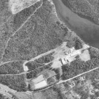
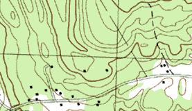
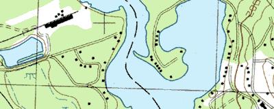
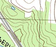
15 1 km SW of Lochmere, New Hampshire, United States 12 Apr 1998 Image courtesy of the U.S. Geological Survey 2003 Microsoft Corporation. All rights reserved.