ENVIRONMENTAL FEATURES OF THE TOWN
|
|
|
- Briana Holly Blankenship
- 5 years ago
- Views:
Transcription


1 Town of Aurora Map 1 11


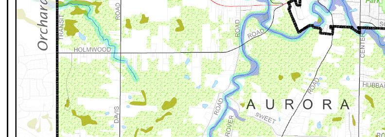
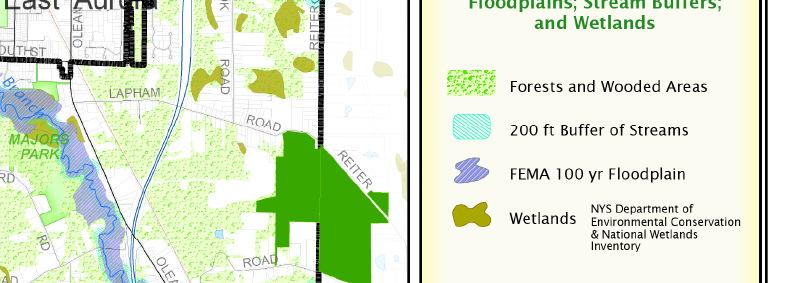
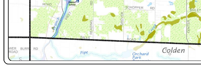
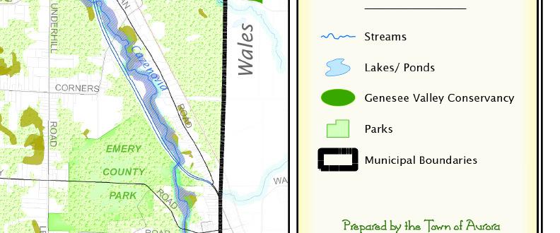
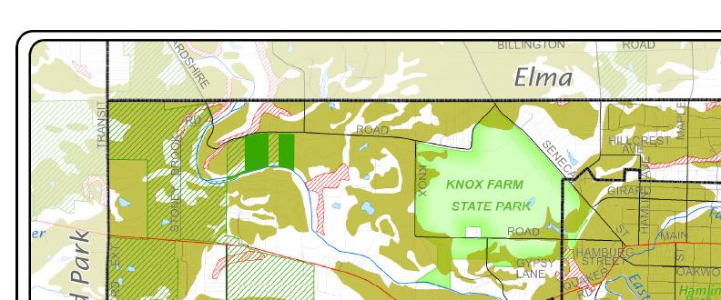
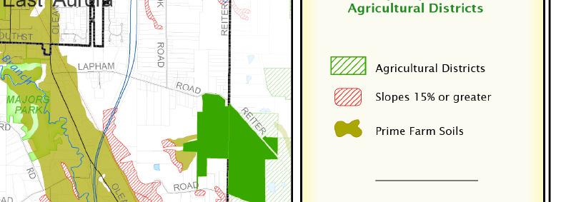
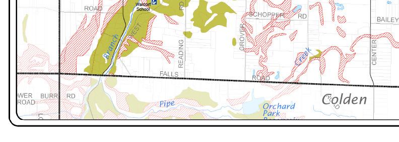
2 12 ENVRONMENTAL FEATURES TOPOGRAPY Maps 1 and 2 show the locations of important natural features of the Town of Aurora. Aurora is located in the Alleghany Plateau, a region of broad, gently sloping ridges 1,000 feet or more above sea level. There are lower, level portions of the plateau located in the northern part of the town including the Village of East Aurora. The most striking topographical feature is a large U shaped valley that contains the two branches of Cazenovia Creek. Center Street is located in the middle of the ridge between the two sides of the U. The western half of the valley extends from the Village of East Aurora through West Falls and is wide with gentle slopes; the eastern half is relatively narrow with steep slopes on its eastern side near the Town of Wales. Erosion in steeper areas has given rise to several small attractive gorges and waterfalls. One of the best examples, known as Mann s Creek Glenn, is located in the vicinity of Center and ubbard Roads. The hilly terrain gives rise to some excellent scenic views, in particular at certain locations along Mill, Lapham, Emery and Boise Roads. STREAMS AND WETLANDS The creek floodplains at the bottom of the valleys have some of the best soils and are a high priority for conservation. Wetlands are found in low-lying areas where water is retained and groundwater seeps to the surface for extended periods of time. By serving as water retention basins, they assist in sedimentation and flood control. There are ten New York State Department of Conservation regulated wetlands within the Town of Aurora which cover acres. The 141 wetland areas recognized by the federal government cover acres. Although wetlands are offered some protection by law, they still can be lost to development. Perhaps the best known wetland in the Town is Sinking Ponds, a nature preserve located near the northeast corner of the Village of East Aurora. FARMLAND istorically, farming was an important component of land use and the local economy, but the number of active farms has decreased dramatically in the last years due to economic pressures. Countywide, the total number of farms declined 27% between 1987 and 1997 alone. The active farms in Aurora include Christmas tree farms, horse stables, farms cultivating hay and straw, and farms producing fruits, vegetables, and maple syrup. The loss of active farms has resulted in land reverting to second growth forest, and the extent of wooded areas in the town has actually increased in recent years. Erie County has established several agricultural districts within Aurora. These districts are located in the northwest quadrant of the town and together comprise 1525 acres (7.9% of the town). Farmers within an agricultural district receive incentives (such as property tax benefits) to keep their land in agricultural uses. Any non-agricultural development within an agricultural district is subject to a higher level of scrutiny under the State Environmental Quality review procedure, and it requires an assessment of the impacts of any action on agriculture. owever, the regulations governing agricultural districts, like zoning laws, do not provide guaranteed protection from development (see Land Protection Tools ). Furthermore, it is important to note that much of the land that is actually still in cultivation is not located within an agricultural district.


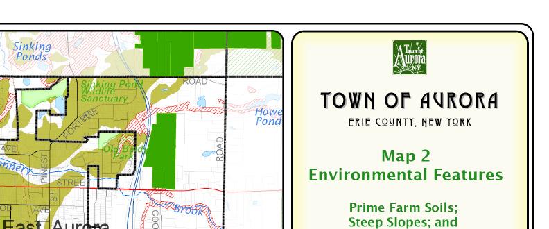


3 Town of Aurora Map 2 13
4 Survey and Property Ranking D SURVEY A community survey, conducted in March through September of 2007, revealed that 86% of the respondents feel that protecting open space is important. Residents gave highest priority to forests and wildlife habitat, followed by stream corridors, wetlands, scenic views and farmland. Many stressed that there were overlaps between these categories and that they were all important. Two thirds indicated that protecting a large number of acres was more important than having public access to protected land. PROPERTY RANKNG n order to identify the land most important for conservation, the committee ranked the 166 parcels in the town that consist of 25 acres or more. Each of these properties was evaluated with respect to the 10 attributes listed in Table 1. n addition to the attributes covered in the survey, the committee also considered the presence of steep slopes and floodplains, whether a parcel is in an agricultural district or adjacent to already protected land (for example, any of the municipal parks), and the distribution of potential protected land within the town. Care was taken to ensure that some of the chosen land is within, or adjacent to, the Village of East Aurora. Public preferences expressed in the community survey were used as weighting factors. Finally, the prioritization system was biased towards large parcels because they provide the most cost-effective, comprehensive way to conserve natural resources. This does not preclude the protection of meritorious smaller parcels such as the many small parcels along East Cazenovia Creek or near the Village of East Aurora. Using all of these parameters, a score was calculated for each property. 8 n evaluating these criteria, maps from the following sources were used: Town of Aurora, Erie County Dept. of Environment and Planning, NYS Dept. of Environmental Conservation, NYS Office of Cyber Security and Critical nformation Coordination, New York Natural eritage program, US Dept. of Agriculture, US Dept. of the nterior, Fish and Wildlife Service, and the Federal Emergency Management Administration. 14 Tree cover Water resources Wildlife habitat Farmland Scenic views Wetlands Steep slopes Floodplains Linkages Property size TABLE 1 Criteria used to rank properties 8 Each 5 acres or more of contiguous woodland Creeks and tributaries; other water bodies Endangered species habitat; diverse habitat - presence of a mix of water, forest and open land (edge effect) Location in agriculture district; presence of prime soils; active farming in the last 10 years Unique panoramic view or varied picturesque landscape that is accessible to the public Federal or New York State Department of Environmental Conservation designated wetlands > 15% Slope Federal Emergency Management Association designated 100 year floodplains Adjacent or near other protected land (e.g. parks) Each 25 acres up to 100 or more acres D

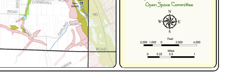
5 Town of Aurora Map 3 Elma TOWN OF AURORA 2 Erie County, New York 1 Map 3 Priority Conservation Properties * Orchard Park 2 Priority Property Grouping 1 - Knox Park 2 - Sinking Ponds/ Northeast Agricultural District 4 - Stream Corridors 5 - Mann's Creek Glen 6 - Central Emery Park 8 - West Falls 9 - South Central Wales igh 6 Genesee Valley Conservancy Parks Municipal Boundaries 7 * NOTE: This does not preclude the protection of meritorious smaller parcels Waldorf 9 Gow Prepared by the Town of Aurora Open Space Committee µ 8 2,000 1,000 Colden Feet 2,000 Miles 4,