Sky Meadows Golf Course
|
|
|
- Gervais Turner
- 5 years ago
- Views:
Transcription
1 File Nos.: and Sky Meadows Golf Course City and State: Dunstable, MA and Nashua, NH General Impacts: Unknown Functions and Values Lost: Wildlife Habitat Year(s) Mitigation Constructed: Unknown Size and Type of Mitigation as Proposed: 3.05 acres tidal emergent 2.02 non-tidal scrub-shrub Proposed Functions and Values of Mitigation: Unknown Mitigation Special Condition(s): Unknown Remarks: Project file is missing. A 1996 report by Frank Smigelski, Wetland Scientist, included these notes: This nationwide permit allowed 1.81 acres of fill to be retained and required restoration/creation of 5.07 acres of wetlands as resolution of an enforcement action. The site was visited in May of 1988 and again in late Even with the elevated water levels (due to a small debris dam at the system s outlet) during the last visits it was evident that the site has much more dense wetlands than it did in The golf course representative took a personal interest in this project and put a considerable level of effort into this project despite facing both fiscal (bankruptcies of their clients) and physical problems (geese eating plants, uncooperative grounds keeping help). This effort and care is reflected in the relative success of the restoration. Also, the Corps had wanted an evergreen buffer placed in the project area. This was mentioned in the plan, but not stated in the permit, so the golf course staff did not follow through with this, assuming it was not required, and not of any restoration benefit. The author agrees it would not have provided much ecological benefit, and would have taken more time than it was worth to try to force plan compliance.
2 Directions: Conclusions- The author says the bulk of the restoration areas came back nicely and would certainly be wetlands within Federal jurisdiction. However, because a golf course now surrounds the project site, the wetland s values and functions have changed since its pre-disturbance days. Thus, the project isn t really compensatory mitigation, but restoration and impact minimization. Take Route 128/I-95 north to exit 32B/32A Route 3. Take 3 North, Middlesex Turnpike. Once you get into NH, take exit 1. Bear left at the exit. Go through 3 sets of lights. Pass a fire station on the right, and take a left at the ballpark. Look for sign indicating Sky Meadow at second driveway on right. Proceed to groundskeeper s building. It is the one with equipment in and around it.
3 Street Atlas USA DeLorme. Street Atlas USA MN (15.7 W) TN Scale 1 : 8, ft m 1" = 711 ft
 1997,")


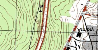

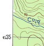
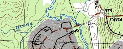
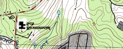


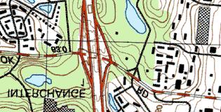


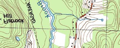


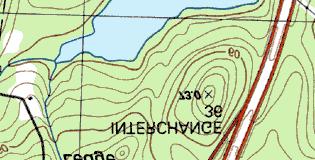


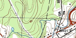

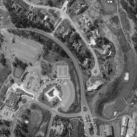
4 Copyright (C) 1997, Maptech, Inc. Sky Meadow Golf Course
5 MITIGATION SITE FIELD DATA FORM Site Name: Sky Meadows Golf Course File No. : City/Town: Nashua State: NH Waterbody: Golf Ponds Monitor(s): Date: Ladd, Minkin, Wright, McKee Date: Was site constructed? yes Is site wetland? yes Size of proposed wetland: ~ 5 acres Actual size of wetland: TBD Painted Turtles, Great Blue Heron, and Dragonflies. Landscape position: bottoms of rolling landscape Lat/Long Points: N degrees, W degrees Saved GPS Waypoint name: SKY1 GPS Tracking Log Name: N/A Perimeter: TBD Surrounding land use: Golf course surrounded by residential land Is wetland function compromised by surrounding land use? Wildlife disrupted by frequent human interruption. Poison ivy sprayed with Roundup and wetland plants are mowed. Plant health: Very healthy except for the wetland plants in fringes which are repeatedly mowed. Ground in this area is wet. There was also evidence of woody species being cut, including maple, alder, dogwood, and arrow wood. Invasive species: Phalaris arundinacea, Lythrum salicaria. Wildlife Use: One beaver chew was observed. Crawfish and catfish. Red-winged blackbirds, Mallard w/young, Bullfrogs w/tadpoles, Green frogs, Page 1 of 2 Plants: Acer rubrum Alnus rugosa Betula populifolia Carex sp. (ovales) Carex spp. (8) Carex lurida Carex stipata Eleocharis sp. Eupatorium maculatum Eupatorium perfoliatum Fraxinus pennsylvanica Hieraceum sp. Impatiens capensis Iris versicolor Juncus spp. Juncus effusus Lythrum salicaria Onoclea sensibilis Osmunda cinnamomea Osmunda regalis Phalaris arundinacea Pinus strobus Polygonum sagittatum Potentilla sp. Potentilla recta Rhamnus frangula Rubus spp. Salix nigra Sambucus canadensis Scirpus microcarpus Sisyrinchium sp. Sphagnum sp. Thelypteris sp.
6 Typha latifolia Viburnum dentatum Viola lanciolata Soils Data: Soils data not collected at this site. Sketch approximate mitigation site, noting areas and types of wetlands, waters, other features, landscape position, landmarks, etc., and data and photo point(s): See file for course schematic. Overall Description of site: None Comments, problems, recommendations: Golf course staff member noted that the pond water level is stable. Also noted that mallard chicks are being eaten, possibly by snapping turtles. The water levels are higher than was expected from looking at maps in the file. Some wetlands that were supposed to be scrub shrub were marsh or open water. Evergreen buffers described in permit were nonexistent. Page 2 of 2
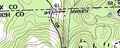
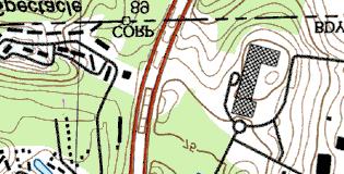
7 Sky Meadows Golf Course Nashua, NH
8 5.07 ac golf course POW/PEM modified no no 200 feet residential 0 Sky Meadow Golf Course N W RL PM 6/4/02 no 2-3 rills middle intermittent watercourse, water level stayed same in drought outlet? 2 crayfish, schools of catfish 2,3,5 herbicides used on golf course, would trap sediment, very narrow edge 1,4,2,5 large deep water, not very dense vegetation, algae = excess nutrients 4,6,8 high plant species, low vegetative structure very low erosion, very thin border of wetland for common species only generalists Plant Life Habitat many species of Carex major function toxicant retention


9 , Sky Meadows Golf Course Nashua, NH 6/04/02 Looking northeast at the southeast side of the finger of wetland east of the save exist. trees and near the legend on the plan. Looking southeasterly from the southernmost bridge towards some saved trees.


10 Looking south and southwest from the long, central bridge. 11 th hole on the far right. Looking southwesterly along the northwest edge of the wetland near the 10 th hole
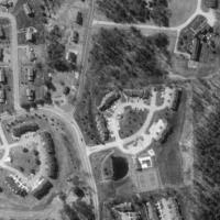
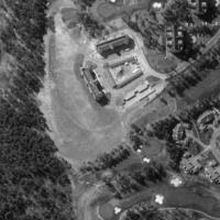
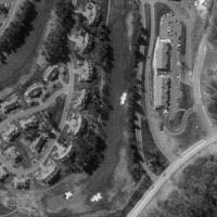
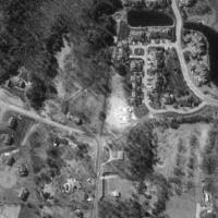


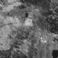


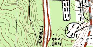
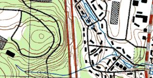
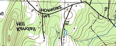
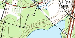
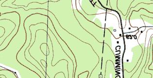
11 TerraServer Image Courtesy of the USGS 7 km S of Nashua, New Hampshire, United States 11 Apr 1998 Image courtesy of the U.S. Geological Survey 2002 Microsoft Corporation. All rights reserved.