Cartographic Representations of Cave Run Lake and the Morehead Ranger District
|
|
|
- Margaret Morgan
- 5 years ago
- Views:
Transcription
1 Cartographic Representations of Cave Run Lake and the Morehead Ranger District An Honors Thesis by Ian Fawley Thesis Advisor Dr. Amy Sheaffer Ball State University Muncie, IN May 7 th, 2005

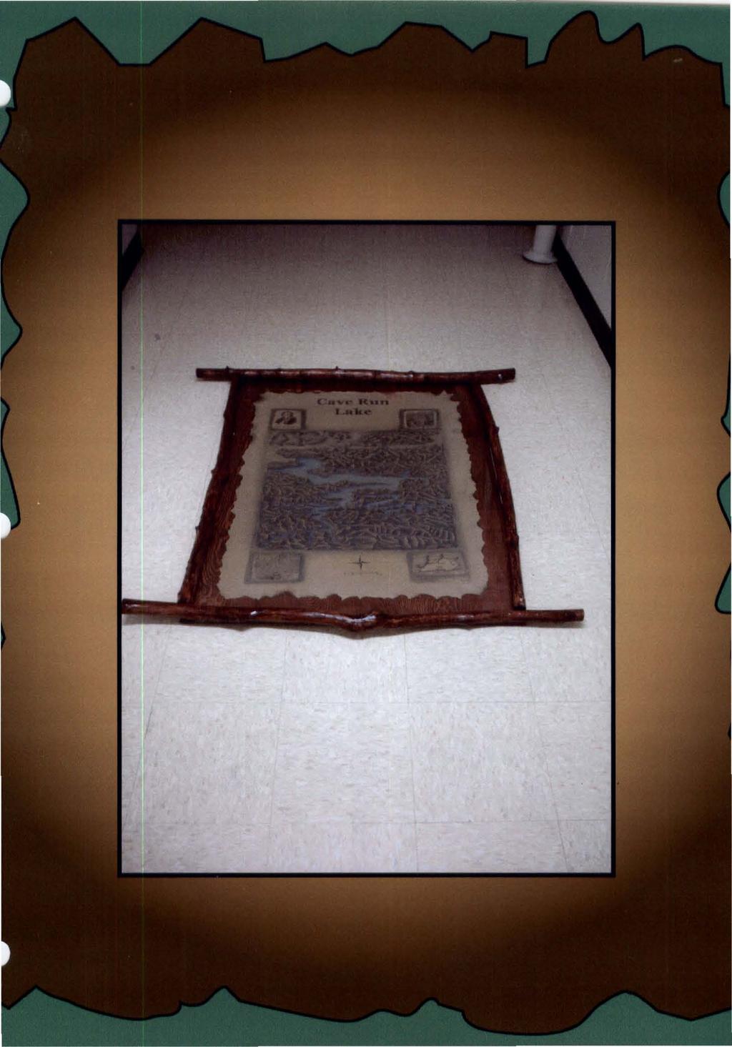
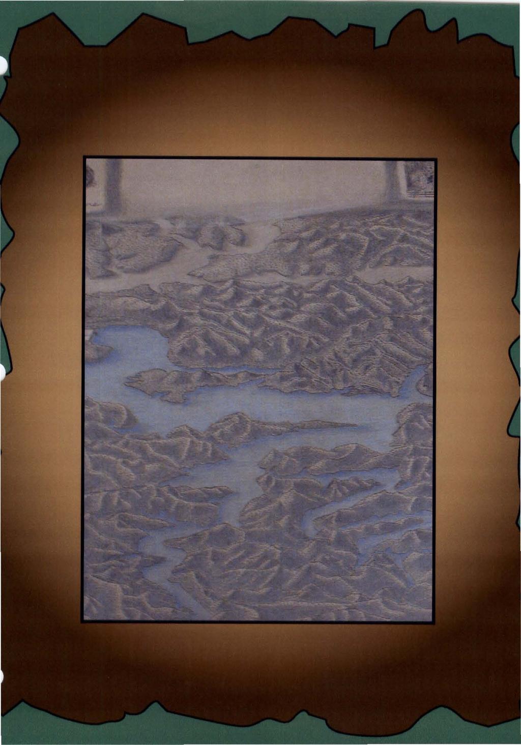
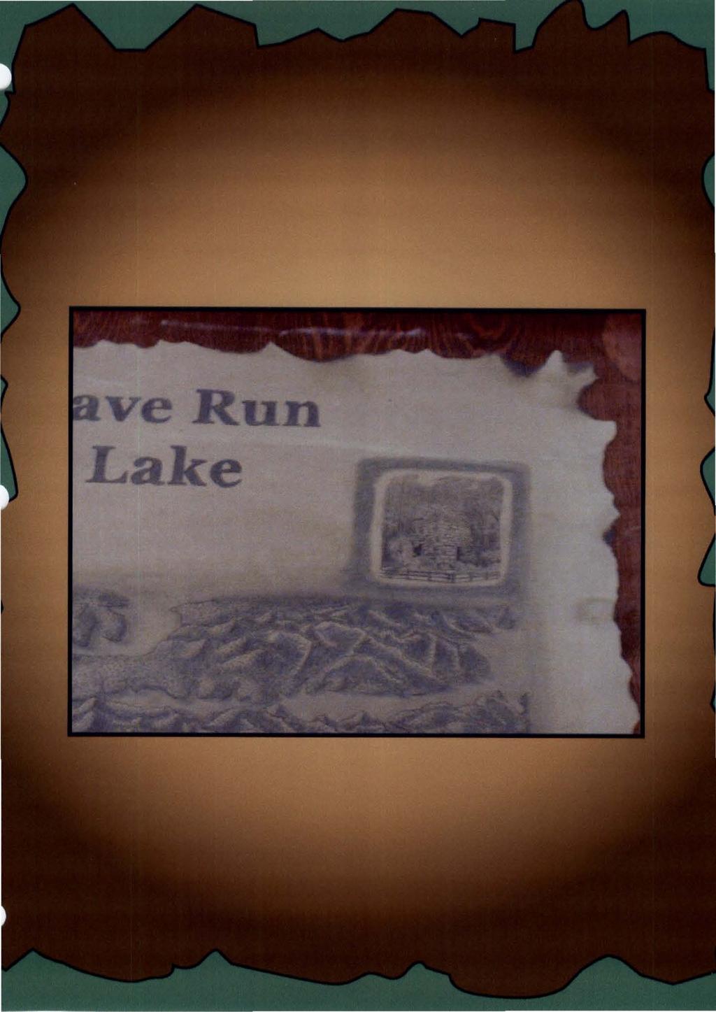
2 ::>fl<:lu IhCSI Lj) c'i8. Q. Z if 2m':. F '<9 Abstract Cartography is an art. As computerized mapping becomes more and more popular, hand-drawn, map making is becoming a lost art form. Many of the most famous and appreciated maps are the intricate, antique maps of the past. Mter pouring nearly 150 hours into my thesis, I firmly believe these maps are highly valued due to the time and detail the cartographers put into their creations. Maps need not simply be functional; they can also be cherished for their aesthetic qualities. The works referenced for my thesis are largely the images of Cave Run Lake and the surrounding hills and hollows. Only by thoroughly knowing the lay of the land were the cartographers of the past able to create their works of art. By spending a summer working for the Daniel Boone National Forest Service, hiking the hills around Cave Run Lake, I was able to capture the heart of this region on paper. The style of my maps can be attributed largely to a series of Civil War battlefield maps compiled by Michael Sharpe. The oblique perspective of these historical maps seemed to capture the topography of Cave Run Lake perfectly. Many of the maps available from the Forest Service also influenced my thesis creation. The Forest Service's publications have a rustic quality that I tried to capture through my maps. By integrating the functionality of the computer-generated map with the art of the hand-drawn map, I have brought the future of cartography face-toface with its roots. In order for more people to appreciate the art of cartography as I have come to, I am contributing this thesis to further the educational and cultural pursuits of the Morehead Ranger District Visitor Center.
3 Acknowledgements I want to thank first my Heavenly Father for creating such amazing subject matter and providing me the energy to complete this thesis. Thank you, Dr. Sheaffer, for providing such caring guidance throughout the whole thesis process as well as a quiet place to draw. Thanks also to the employees of the Morehead Ranger District of the Daniel Boone National Forest for all of your encouragement last summer. Thank you, Dr. Doyon, for sharing your knowledge of cartography with me. A big thank you goes out to all of my friends who gave their honest opinions and suggestions throughout my thesis creation. Thanks to all those cartographers who created such beautiful works of art who had no aid of technology.
4 Works Referenced "Cave Run Lake." Map. USDA Forest Service. Daniel Boone National Forest Southern Region. Morehead Ranger District "Cave Run Lake and Daniel Boone National Forest." Map. Kentucky Department of Travel Development and Morehead Tourism Commission. October "Daniel Boone." Image. < Image. CD-ROM. USDA Forest Service. Daniel Boone National Forest Southern Region "do~mosaic. " "Kentucky." Map. AaronPeter.com Maps < kentucky _ map.gii>. "Nordostschweiz." Map. Druck: Eidenbenz & Co. St. Gallen, Switzerland. "Pioneer Weapons Area; Wildlife Management Area." Map. USDA Forest Service. Daniel Boone National Forest Southern Region. Morehead Ranger District. August "Red River Gorge." Map. USDA Forest Service. Daniel Boone National Forest Southern Region. Stanton Ranger District. January Sharpe, Michael. Historical Maps of Civil War Battlefields. London: PRC Publishing Ltd, "Sheltowee Trace National Recreation Trail." Map. USDA Forest Service. Daniel Boone National Forest Southern Region. April "Tater Knob Fire Tower." Map. USDA Forest Service. Daniel Boone National Forest Southern Region. Morehead Ranger District. November Theis, Marc. "Fishing." Image. Images of Luxembourg. 17 January < "USDA Forest Service Recreation Symbols." Program. CD-ROM. San Dimas, CA: Technology and Development Center. "White Sulphur ATV Trail." Map. USDA Forest Service. Daniel Boone National Forest Southern Region. Morehead Ranger District. January "Winterparadies Ostschweiz und Fiirstentum Liechtenstein." Map. Verkehrsverband Ostschweiz. St. Gallen, Switzerland.
5

6

7 ('ltv I L~k an
8

9 Ca e
10
11
12