Natural Systems Planning Primer
|
|
|
- Randell Matthews
- 6 years ago
- Views:
Transcription
1 Natural Systems Planning Primer Land Use and Natural Systems Unit Planning and Growth Management November
2 Welcome Policy Framework Development Review Ottawa s Forestry & Tree Bylaws BREAK Interactive Case Study WRAP-UP Today s Topics 2
3 Mission The Natural Systems Unit serves the city through the development and implementation of policies and guidelines to sustain the natural environment for current and future generations 3

4 What is a liveable city? 4


5 9 OUT OF 10 CANADIANS say that when they felt connected to nature they felt happier 5 OUT OF 10 CANADIANS travel to experience nature 70% OF CANADIANS spent time in nature within the previous 12 months. THE NATURE EFFECT 1 million VISITS TO OTTAWA EACH YEAR FOR OUTDOOR RECREATION $40.4 billion SPENT BY CANADIANS ENGAGING IN NATURE-RELATED ACTIVITIES Nature based tourism creates jobs in TRANSPORTATION ACCOMMODATIONS ATTRACTIONS RETAIL GUIDING
6 Value Proposition Why should a family choose to come to Ottawa instead of Toronto, Montreal or Calgary? Mayor s State of the City Address, January
7 POLICY FRAMEWORK 7
8 Legislative Menu Legislation Planning Act PPS Environmental Assessment Act Municipal Class EA Municipal Act Drainage Act Ontario Water Resources Act Fisheries Act Species at Risk Act Clean Water Act Environmental Protection Act Conservation Authorities Act Ontario Building Code Act Municipal Function Official Plan Development Review Subwatershed Studies Environmental Management Plans By-laws Municipal Drains Source Water Protection Certificates of Approval Records of Site Condition Generic Regulations Building Code Permitting and Enforcement 8

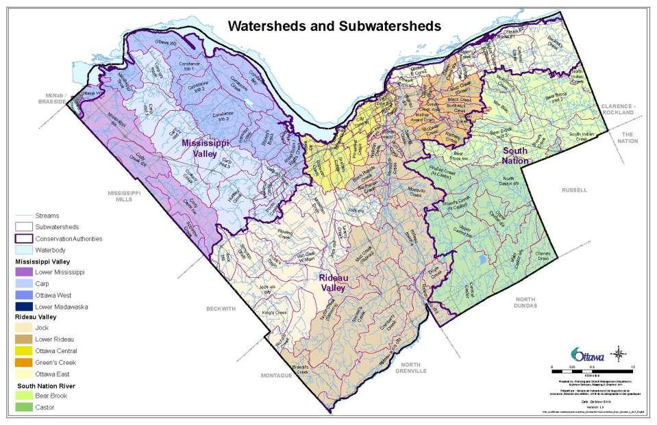
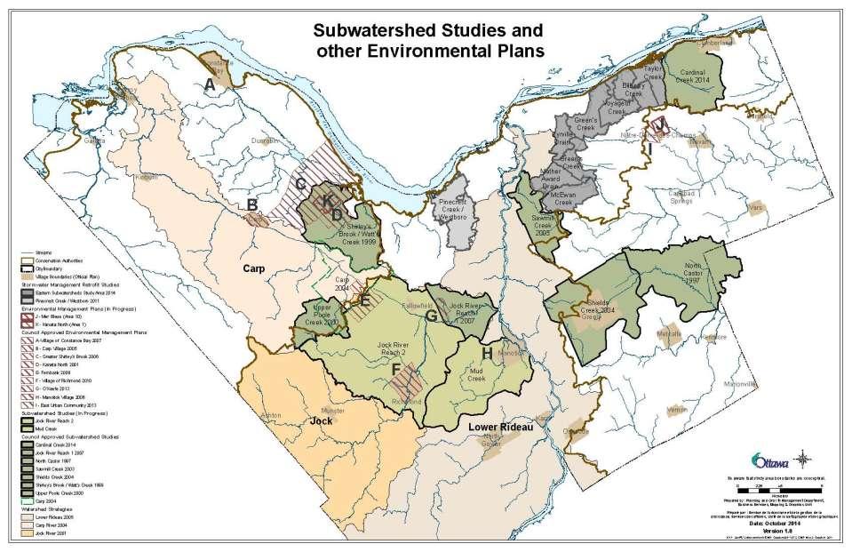
9 Subwatershed Plans 9
10 Planning Act Provides the Legislative Framework How the planning system will work Who the decision makers are How disputes are resolved How public can provide input Establishes municipal role in planning Official Plan & zoning by-law Development review 10
11 Provincial Policy Statement Establishes provincial land use planning interests, and how those interests are to be protected while providing for appropriate development Strong, healthy communities Wise use and management of resources Public health and safety Municipal planning policies shall be consistent with the PPS 11
12 Provincial Policy Statement Defines & protects natural heritage system No development or site alteration in: significant wetlands habitat for fish or endangered / threatened species unless authorised under relevant legislation No negative impacts to any other significant natural heritage features, or adjacent to any of the above 12
13 Natural Heritage System 13
, parts of the system that can be mapped Some areas protected through")
14 Official Plan NHS defined in s NHS Overlay (Schedule L), parts of the system that can be mapped Some areas protected through designation (Schedules A & B, s. 3.2) S. 4.7 directs development review 14


15 Ecoregion Natural Area Geographic Scale Scales of Effective Conservation Planning Property 15

16 Centres of Biodiversity 16
17 17
18 18

19 Conservation Authorities Flood plain/ Hazard Management Watershed Reporting Managing Natural Resources Water Quality & Quantity Monitoring Educational Programs Planning and Regulations Forest Management 19
 Over")


20 Species at Risk Identified under provincial or federal legislation (in many cases, both) Over 60 SAR may occur in our area (some are quite common!) Endangered / threatened species habitat protected through legislation Habitat for species of special concern = significant wildlife habitat 20

21 By-laws Examples Zoning Tree Bylaws Idling Control Sewer Use 21
22 Building on Ottawa s Accomplishments Ottawa River Action Plan Since 1960 s the City has acquired over 10,000 hectares of natural areas Stewardship Programs Air Quality and Climate Change Management Plan Stormwater Management Retrofit plans for older urban areas Water Quality Monitoring Wildlife Strategy and Wildlife Protocol 22
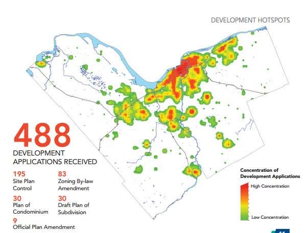
23 Development Review Development Review Services Branch November
24 Today s Topics PGM and Development Review Services Development Review Process Environmental Planning Where to find more information Ottawa.ca 24


25 Planning and Growth Management Transportation Planning Development Review Policy Development and Urban Design Building Code Services Business Services 25
26 26

27 Development Review Services Geographically based: urban (2), suburban (2), rural Land Use Planners, Engineers, Transportation, Parks Planners, Environmental Planners and Heritage 27
28 Development Review Process 1. Pre-Application Consultation 2. Application Submission 3. Application Deemed Complete / Reviewed for Adequacy 4. Community "Heads Up" 5. Circulation to Technical Agencies, Community Organizations and Ward Councillor 6. Posting of On-Site Signs 7. Community Information and Comment Session 8. Issue Resolution - Staff Memorandum or Committee Report Preparation 9. Notice of Decision by Staff (Applications Under Delegated Authority) 10. Notice of Public Meeting 11. Notice of Decision by Committee or Council 12. Post Application 28
29 Pre-Consultation Meeting with applicant Identify environmental features Content of Environmental Impact Statement 29

30 Application Deemed Complete All required reports provided Reports complete Ready for circulation 30


31 Circulation and Issue Resolution Circulated to community and agencies Internal Departments Issue Resolution iterative process 31


32 Post Approval Draft Approval of Subdivision Appeals to OMB Construction 32
33 Environmental Review 33

34 Supporting Studies 34


35 Environmental Impact Statement Required for NHS, PSW, NEA, RNF, UNF, ANSI and adjacent lands EIS to demonstrate no impact on the ecological function of above (OP Section 4.7.8) 35
36 no negative impact, defined as degradation that threatens the health and integrity of the natural features or ecological functions for which an area is identified due to single, multiple or successive development or site alteration activities. 36

37 Scoped Severances Minor UNF Adjacent Full or Detailed Subdivision Site Plans Types of EIS 37


38 Provincially Significant Wetlands Evaluated by Consultants Approved by MNRF Protected by CA and City 38

39 Example Southwest Stittsville OPA re-designated land Zoning and Subdivision created lots, roads, greenspace 39
40 40
41 Areas of Natural and Scientific Interest 20 Life Science ANSIs in Ottawa Carp Hills ANSI abuts Village boundary Limit is identified and protected through EIS and development outside of the feature 41

42 Carp Hills 42

43 This page has been intentionally left blank 43

44 Species At Risk EIS identifies potential habitat and surveys Habitat must be addressed prior to draft approval MNRF lead Avoidance and Compensation 44


 Geotechnical hazard")
45 Watercourse Setbacks Adjacent to rivers, lakes, streams Corridors protected through a setback: 15 m top of bank 30 m from normal high water mark Flood plain (OP Section and CA) Geotechnical hazard Whichever is greater 45

46 Groundwater Impact Statement OP policies for development review s. 4.7 Subwatershed studies map recharge, discharge areas Different for Rural vs Urban 46

47 Stormwater Management OP policy: SWM plan support subdivision, site plan Set treatment objectives quantity of water released controlled quality managed by reducing suspended solids Discussion fish compensation Locations for ponds 47
48 Other Environmental Planning Wellhead Protection (OP 4.8.2) Unstable Soils or Bedrock (OP 4.8.3) Contaminated Sites (OP 4.8.1) Mine Hazards and Abandoned Pits and Quarries (OP 4.8.5) Constraints Due to Airports/Aircraft (OP 4.8.6) Environmental Noise Control (OP 4.8.7) Personal Security (OP 4.8.8) Energy Conservation Through Design (OP 4.9) Greenspace Requirements (OP 4.10) 48

49 Wellhead Protection Study Wellhead protection area designed on Schedule K OP Section
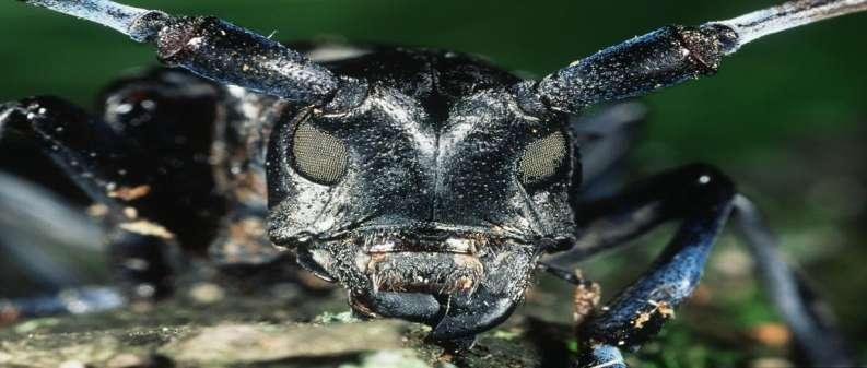
50 50
51 ottawa.ca/devapps 51
52 Ottawa s Forests Mark.Richardson@ottawa.ca Martha.Copestake@ottawa.ca Land Use and Natural Systems Unit Planning and Growth Management November

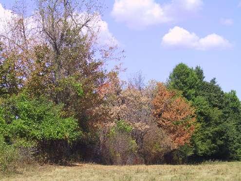
53 Ottawa s Forests 53

54 Ottawa s Forests 54

55 Ottawa s Forests Ottawa: 2796 km 2 total area Ottawa: 780 km 2 treed Very diverse species distribution, age class, structure Human influences past, present and future 55

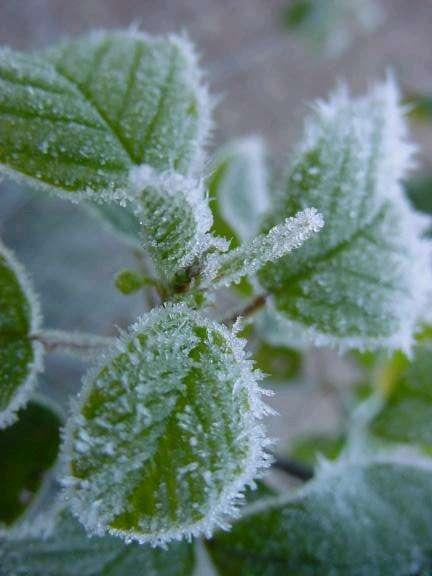
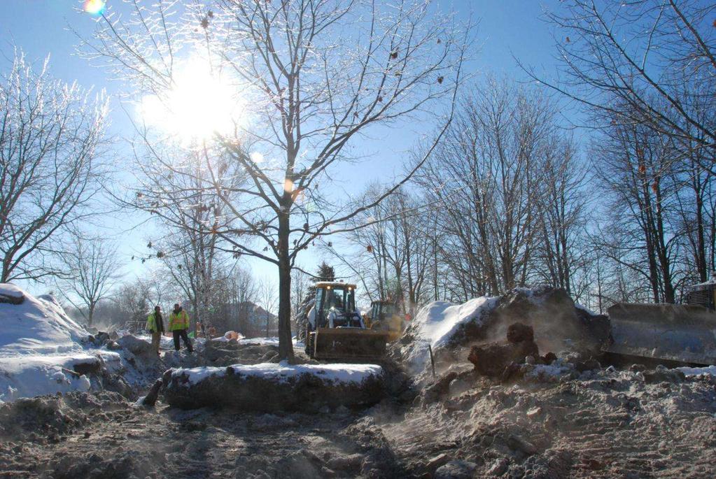
56 Ottawa s Forests City-managed Forests 300,000 plus street trees 10,000 ha of Community Forests 900 parks with trees Privately-managed Forests Farm woodlots Privately-owned trees Commercial forests, maple syrup operations 56

57 Should we manage our urban and rural forests? If so, why? Why not? 57
58 Economic Higher property values Income Tourism Values Environmental Wildlife habitat Water benefits Carbon storage Soil protection Social Recreation Health and happiness Sense of place 58

59 Agents of Change Ottawa is a settled landscape Trees and forests have a life cycle Management geared at controlling change Many factors influence forest change 59


60 Invasive Species Before EAB: 25% ash 60

61 Invasive Species 61

62 Invasive Species 62
63 Human Influences 63

64 Human Influences

65 Human Influences

66 Weather Events 66

67 This page has been intentionally left blank Weather Events 67

68 Cultural practices can amplify damage caused by even minor weather events 68

69 Weather Events 69
70 Policy Ottawa s official plan foundation for all tree-related policies 2.4 Maintaining Environmental Integrity Natural Features and Functions Greenspaces 3.2 Natural Environment 4.7 Environmental Protection Protection of Vegetation Cover Environmental Impact Statement 70
71 City Departments Planning and Growth Management Public Works Natural Systems 2 Planning Foresters City Hall Development applications Tree / Forest Policy Forestry Services 5 Foresters Constellation City-owned trees Distinctive Tree 71
72 Tree By-laws in Ottawa Urban Tree Conservation By-law (2009) Municipal Trees and Natural Areas By-law (2006) Private trees PGM & Forestry Services Urban area only Public trees Forestry Services Urban & rural areas 72
73 Tree By-laws in Ottawa Rural area tree by-laws: 1. Municipal Trees and Natural Areas By-law 73


74 Municipal Trees and Natural Areas By-law All city-owned trees are protected Can t injure or destroy a city-owned tree without permission Forestry Services provides permission Compensation sought for all trees removed 74
75 Municipal Trees and Natural Areas By-law Permission granted... City construction project Development site and no options for tree retention Permission denied... Resident doesn t like tree Trees are blocking views Construction not approved by the City Healthy No justifiable reason 75
76 Urban Tree Conservation Bylaw Properties <1Ha & condo properties >1Ha Properties >1Ha or planning application files Distinctive Tree Permit Tree Cutting Permit Managed by Forestry Services Privately-owned trees Managed by PGM Privately-owned trees 76


77 Distinctive Tree Permits 50cm or larger Issued for: Unhealthy tree Unsafe/hazardous Causing foundation damage Construction Not issued for: Less than 1Ha Unhealthy, but alternatives to removal Owner does not like tree Improve view 77

78 Distinctive Tree Permits Process Call 311 Get an arborist report Forestry Inspector dispatched Permit issued when warranted 78

79 PGM issued Tree Cutting Permit > 10cm Properties > 1ha Planning application files - site plan, plan of subdivision Any tree >10cm diameter 79

80 PGM issued Tree Cutting Permit Process Preconsult Tree Conservation Report Review & Comment Permit Approval 80


81 PGM issued Tree Cutting Permit Tree Conservation Reports 1. Stand-alone report 2. TCR / Landscape Plan combination 3. TCR / Environmental Impact Statement combination 81
")
82 PGM issued Tree Cutting Permit Tree Conservation Reports Components: Maps Tree information Species Diameters Health Status Plans remove/retain Tree protection information (Schedule A of the Urban Tree Conservation Bylaw) 82

83 Tree Protection Critical Root Zone = 10*diameter 83
84 Boundary Trees Tree Trees with trunks that cross a property line are co-owned by both property owners Not just ground level Even if the tree was not originally planted on the property line Property Line 84
85 Coming soon... Urban Forest Management Plan Vision for our future urban forest Consultative development process 85

86 Additional Information: Ottawa.ca 86

87 Cardinal Creek Case Study Land Use and Natural Systems Unit Planning and Growth Management November

88 Cardinal Creek Subwatershed Study Initiated to address: Changing land uses Water quality Cardinal Creek Erosion & slope stability 88
89 What does the study include? Natural Heritage Identification of a natural features, linkages, ecological functions Natural Heritage Water Resources relationship Development Issues Areas for conservation/protection, hazard lands, surface water, groundwater Guidelines for development Public access Monitoring and Management Recommendations for monitoring Recommendations for stewardship, mitigation, restoration, compensation 89

90 Natural Heritage System Identifies a system of significant natural features that must be evaluated and considered in any development scenarios 90

91 Groundwater Protection Most groundwater recharge occurs in natural areas. 91

92 Karst ANSI Hazard Groundwater infiltration and recharge feature 92

93 Watercourse Setbacks Study recommends setbacks for protection of watercourses. They can be refined through site investigation as part of development review process. 93
94 Agricultural Risks to Water Quality Some agricultural activities have a higher risk of affecting water quality. Best Management Practices are important. 94
95 Hydrology Model Predicts the impacts of residential development Establishes flow targets for stormwater management 95

96 Restoration and Enhancement Slope stabilization Riparian plantings and restoration on Cardinal Creek Valley Promotion of agricultural best management practices Continued maintenance of municipal drains 96

97 Be the Natural Systems Planner! There is an urban expansion area within the subwatershed Use the maps provided to identify the environmental constraints Draw the constraints on the Study Area Map 97
98 What did you decide? 98

99 Community Plan Greenspaces Watercourse setbacks Reduced stormwater discharge Groundwater recharge areas 99
Credit Valley Conservation (CVC) Board of Directors. Chief Administrative Officer (CAO) Watershed Knowledge. Watershed Management
 Board of Directors. Chief Administrative Officer (CAO) Watershed Knowledge. Watershed Management") Credit Valley Conservation (CVC) Board of Directors Chief Administrative Officer (CAO) CVC Foundation Human Resources Corporate Watershed Knowledge Watershed Watershed Transformation Planning and Development
Credit Valley Conservation (CVC) Board of Directors Chief Administrative Officer (CAO) CVC Foundation Human Resources Corporate Watershed Knowledge Watershed Watershed Transformation Planning and Development
Sustainable Natural Environment Fish Habitat
 Town of Huntsville Official Plan Review - POLICY BACKGROUND PAPER Sustainable Natural Environment Fish Habitat BACKGROUND: Lakes, rivers, streams, ponds and many wetlands provide fish habitat. Intermittent
3. SHIRLEY S BROOK / WATTS CREEK SUBWATERSHED STUDY COMMITTEE RECOMMENDATION
 3. SHIRLEY S BROOK / WATTS CREEK SUBWATERSHED STUDY COMMITTEE RECOMMENDATION That Council endorse the Shirley s Brook/Watts Creek Subwatershed Study (September 1999) as the technical document to guide
GRAND NIAGARA Proposed Secondary Plan
 GRAND NIAGARA Proposed Secondary Plan Public Open House #3 January 17. 2017 scope + process BUILT Grand Niagara Secondary Plan The Grand Niagara Secondary Plan will establish a framework for the future
Ottawa-Trussler Area Sewage Facility Class Environmental Assessment
 Welcome to the Ottawa-Trussler Area Sewage Facility Class Environmental Assessment Public Open House May 7, 2013 September 25, 2013 Welcome The purpose of this second Public Open House is to: Present the
LAND DEVELOPMENT AND PLANNING FORUM 2014 THE 2014 PROVINCIAL POLICY STATEMENT AND ENVIRONMENTAL PROTECTION
 LAND DEVELOPMENT AND PLANNING FORUM 2014 THE 2014 PROVINCIAL POLICY STATEMENT AND ENVIRONMENTAL PROTECTION MARY L. FLYNN-GUGLIETTI AND ANNIK FORRISTAL THE 2014 PROVINCIAL POLICY STATEMENT & ENVIRONMENTAL
ENVIRONMENTAL IMPACT STUDY GUIDELINES
 ENVIRONMENTAL IMPACT STUDY GUIDELINES Version 1 September, 2012 Section 1 Environmental Impact Study Overview TABLE OF CONTENTS What is an Environmental Impact Study (EIS) and What is its Purpose?.....................................
Provincial Policy Statement 2014 Training Aid
 This job aid has been developed for education and training purposes as a high-level summary of the policy changes in the PPS 2014. It should not be relied upon as a substitute for specialized legal or
City of Ottawa. Environmental Impact Statement Guidelines. 2 nd Edition April 2012
 DOCUMENT 1 City of Ottawa Environmental Impact Statement Guidelines 2 nd Edition April 2012 Planning and Infrastructure Portfolio Planning and Growth Management Department Policy Development and Urban
Chapter 5. Natural Features. Environmental Management Mode Land Resources Water Resources Air Quality Preparing for Climate Change
 Chapter 5 Natural Features Natural Features Environmental Management Mode Land Resources Water Resources Air Quality Preparing for Climate Change 5.1 NATURAL FEATURES BACKGROUND Maple Ridge encompasses
- :~MM~Si6~ER:)ETc:...
ETc:...") AltMo,-_t This Is ExhIbit u"3 u, referred to In the Affidavit of M..r \(. t-\c.~ sworn beforeme this z» "" day of M,l '0'''\ - :~MM~Si6~ER:)ETc:... REGION OF PEEL REGIONAL OFFICIAL PLAN REGIONAL OFFICIAL
AltMo,-_t This Is ExhIbit u"3 u, referred to In the Affidavit of M..r \(. t-\c.~ sworn beforeme this z» "" day of M,l '0'''\ - :~MM~Si6~ER:)ETc:... REGION OF PEEL REGIONAL OFFICIAL PLAN REGIONAL OFFICIAL
ENVIRONMENT ACT TERMS OF REFERENCE NOVA SCOTIA DEPARTMENT OF TRANSPORTATION AND PUBLIC WORKS. Beaver Bank Bypass
 ENVIRONMENT ACT TERMS OF REFERENCE NOVA SCOTIA DEPARTMENT OF TRANSPORTATION AND PUBLIC WORKS Beaver Bank Bypass Highway 101 to the Beaver Bank Road Halifax County, NS NOVA SCOTIA DEPARTMENT OF THE ENVIRONMENT
WATERSHED. Maitland Valley. Report Card 201
 Maitland Valley WATERSHED Report Card 201 The Maitland Valley Conservation Authority has prepared this report card as a summary on the state of our forests, wetlands, surface water, and ground water resources.
Preface. MNR # Queen s Printer for Ontario, 2012 ISBN (PRINT) ISBN (PDF)
 ISBN (PDF)") Preface In 2008, the inter-agency Drainage Act & Section 28 Regulations Team (DART) was established by the Ministry of Natural Resources (MNR) and the Ministry of Agriculture, Food and Rural Affairs (OMAFRA)
Preface In 2008, the inter-agency Drainage Act & Section 28 Regulations Team (DART) was established by the Ministry of Natural Resources (MNR) and the Ministry of Agriculture, Food and Rural Affairs (OMAFRA)
AUMA Policy Paper 2013.A1
 AUMA Paper 2013.A1 AUMA Board of Directors Municipal Water on Wetlands WHEREAS in 2012 the AUMA Board of Directors issued the mandate of developing Municipal Water Policies and approved advancing polices
MURPHY DRAIN CATCHMENT
 The RVCA produces individual reports for 16 catchments in the Lower Rideau subwatershed. Using data collected and analysed by the RVCA through its watershed monitoring and land cover classification programs,
Provincial. Statement
 Provincial Statement This publication was produced by the Ministry of Municipal Affairs and Housing. For more copies of this document, in either English or French, please contact: Publications Ontario
Rural Settlement Strategy
 Rural Settlement Strategy 2008 Official Plan Review City of Ottawa Publication 23-16 2007021018.indd ottawa.ca Index Foreword... v Part 1 - Background... 1 1. Introduction...1 a. Rural Ottawa...1 b. Purpose
DEVELOPMENT AND INTERFERENCE WITH WETLANDS AND WATERCOURSES REGULATION - POLICIES AND PROCEDURES MANUAL For Planning Act Applications
 DEVELOPMENT AND INTERFERENCE WITH WETLANDS AND WATERCOURSES REGULATION - POLICIES AND PROCEDURES MANUAL For Planning Act Applications REVISED JANUARY, 2017 (administrative edits) Executive Board Motions
The Ministry of Natural Resources and Forestry and Municipal Planning Lake Links
 The Ministry of Natural Resources and Forestry and Municipal Planning Lake Links October 21, 2017 Lyn Garrah District Planner MNRF 1 Kemptville Presentation Outline Ontario s Planning System MNRF s role
Environment & Conservation Introduction
 Environment & Conservation Introduction Anacortes is blessed with an abundance of natural beauty. Residents identify marine shorelines, streams, lakes, forested areas, and other natural features as defining
Policies, Procedures and Guidelines for the Administration of Ontario Regulation 155/06 and Land Use Planning Policy Document
 Policies, Procedures and Guidelines for the Administration of Ontario Regulation 155/06 and Land Use Planning Policy Document December 12, 2007 (Original NPCA Board Approval) December 9, 2009 (Housekeeping
OFFICIAL PLAN FOR THE MUNICIPALITY OF MAGNETAWAN
 OFFICIAL PLAN FOR THE MUNICIPALITY OF MAGNETAWAN Prepared by July 24, 2002 May 16, 2005 and June 14, 2005 With Jim s Notes on Modifications Modifications provided by MMAH on May 10, 2005 and June 8, 2005
Municipal Stormwater Management Planning
 Municipal Stormwater Management Planning Christopher C. Obropta, Ph.D., P.E. Water Resources Extension Specialist with Rutgers Cooperative Extension Assistant Professor with Department of Environmental
DESIGN BULLETIN #16/2003 (Revised July 2007) Drainage Guidelines for Highways Under Provincial Jurisdiction in Urban Areas.
 Drainage Guidelines for Highways Under Provincial Jurisdiction in Urban Areas.") Drainage Guidelines for Highways Under Provincial Jurisdiction in Urban Areas. July 2007 Update to Design Bulletin #16/2003: Added under Design Criteria Culverts of 600mm diameter are commonly used to
Drainage Guidelines for Highways Under Provincial Jurisdiction in Urban Areas. July 2007 Update to Design Bulletin #16/2003: Added under Design Criteria Culverts of 600mm diameter are commonly used to
Otonabee Region WATERSHED
 Otonabee Region WATERSHED Report Card 2018 Otonabee Conservation has prepared this report card as a summary of the state of your forests, wetlands, and water resources using data from 2012 to 2016. WHERE
Information Request 37
 Information Request 37 Information Request 37 37-1 Response to Information Request 37 Response to Information Requests 37a Response to Information Requests 37b 37-3 37-5 Federal Review Panel Information
PHASE 3 SUBWATERSHED MANAGEMENT STRATEGY AND IMPLEMENTATION
 PHASE 3 SUBWATERSHED MANAGEMENT STRATEGY AND IMPLEMENTATION 1. INTRODUCTION 1.1 Background The North West Brampton Subwatershed Study (SWS) process for the Huttonville Creek and Fletcher s Creek has been
PLANNING RATIONALE MACLEOD III AND V QUARRIES
 PLANNING RATIONALE MACLEOD III AND V QUARRIES Project No.: OCP-16-0280 Prepared for: Cornwall Gravel Company Ltd. 390 Eleventh Street West Cornwall, Ontario K6J 3B2 Prepared by: McIntosh Perry Consulting
Provincial Policy Statement 2014
 Natural Heritage Provincial Policy Statement 2014 NATURAL HERITAGE Nature is bountiful. It is also fragile and finite. Provincial Natural Heritage 0 Interest: Ontario s natural heritage resources are valuable
Canada-Ontario Domestic Action Plan for Lake Erie Phosphorus Reduction. Agriculture Sector Working Group April 19, 2017
 Canada-Ontario Domestic Action Plan for Lake Erie Phosphorus Reduction Agriculture Sector Working Group April 19, 2017 Purpose Present an overview of the Canada-Ontario Draft Action Plan for Lake Erie
Theme: Supporting Sustainable Development and Urban Ecosystems
 Theme: Supporting Sustainable Development and Urban Ecosystems Action 1: What is a Climate Change Adaptation Plan and what does Natural Heritage have to do with it? A climate change adaptation plan examines
Assessment of Landfill Footprint Alternatives West Carleton Environmental Centre. Option #4 Impact on Agriculture
 Assessment of Landfill Footprint Alternatives Figure 422 99 Option #4 Impact on Agriculture The net effects with respect to continued service to customers, the optimized site life/ capacity is 65 million
Polluted Runoff and Land Conservation: What s the Connection?
 Polluted Runoff and Land Conservation: What s the Connection? Caroly Shumway, Ph.D. Executive Director, Merrimack River Watershed Council In partnership with NMCOG Overview Purpose Of This Talk Is To Convey
County of Calaveras Department of Planning
 Date: July 18, 2013 To: From: Project: Advisory Agencies Amy Augustine, AICP - Planner County of Calaveras Department of Planning Rebecca L. Willis, AICP ~ Planning Director Phone (209) 754-6394 Fax (209)
TORONTO MUNICIPAL CODE CHAPTER 813, TREES. Chapter 813 TREES. ARTICLE I Inspection; Removal of Infested Trees
 Chapter 813 TREES ARTICLE I Inspection; Removal of Infested Trees 813-1. Inspection for presence of Asian Long-Horned Beetles and other pests; removal of infested trees. 813-2. Right to enter private property.
DAKOTA COUNTY SOIL AND WATER CONSERVATION DISTRICT COMPREHENSIVE PLAN
 DAKOTA COUNTY SOIL AND WATER CONSERVATION DISTRICT COMPREHENSIVE PLAN 2011-2015 4100 220 th Street West, Suite 102 Farmington, MN 55024 651-480-7777 www.dakotacountyswcd.org I. INTRODUCTION A. Purpose
Climate Data Training Session April 26, 2017 Ontario Science Centre
 Adaptive Management To Address Climate Change Uncertainty in EA Process A Case Study of the Don Mouth Naturalization and Port Lands Flood Protection Project EA (DMNP EA) Climate Data Training Session April
Provincial Policy Statement 2014
 Provincial Policy Statement 2014 Planning for Prosperity and Sustainability Intersecting Challenges Integrated Solutions The Provincial Policy Statement (PPS) sets out Ontario s land use planning directions
City of Kingston Tree By-Law Guidelines
 City of Kingston The maintenance of mature tree cover is recognized as contributing to human health and quality of life and therefore it is the City s goal to increase the urban forest. Trees are an important
STREAM RESTORATION PURPOSE, PRACTICE, AND METHODS. By Marcus Rubenstein, CPESC
 STREAM RESTORATION PURPOSE, PRACTICE, AND METHODS By Marcus Rubenstein, CPESC WHAT IS STREAM RESTORATION? The return of a stream s lost natural functions, usually resulting from watershed alterations,
Our Water is Worth It!
 SUSTAINABLE MUNICIPAL WATER MANAGEMENT Our Water is Worth It! If this information is required in an accessible format, please contact 1-800-372-1102 ext.2029. 1 CONTENTS Page Section 2. Introduction 3.
Climate Change and Watershed Management
 Climate Change and Watershed Management Moving to a Living City OSEE Conference 2009 by Chandra Sharma MCIP RRP Watershed Specialist About TRCA Focus of Presentation Urban Watershed and Climate Change
Environmental Information Worksheet
 Environmental Information Worksheet Water System Owner (Attach additional sheets if necessary) Needs and Alternatives Provide a brief narrative that describes: Current drinking water system needs. Project
ADDRESSING CLIMATE CHANGE ADAPTATION IN EASTERN ONTARIO APRIL 15, 2013
 ADDRESSING CLIMATE CHANGE ADAPTATION IN EASTERN ONTARIO APRIL 15, 2013 IPCC DEFINITION UNFCCC DEFINITION Climate change in Intergovernmental Panel on Climate Change (IPCC) usage refers to a change in the
The Social and Economic Importance of Canada s Privately Owned Forest Lands
 The Social and Economic Importance of Canada s Privately Owned Forest Lands Key Points n Private forests make up 6% of Canada s 402 million ha of forested land and 13% of the managed forest. n Private
DETAILED IMPACT ANALYSIS OF MARMOT BASIN LONG RANGE PLAN
 2.0 JURISDICTION Parks Canada s decisions about the acceptability of proposals presented in the LRP are guided by a number of regulatory instruments and policies, the most relevant of which are described
Chapter 1. Introduction
 Chapter 1 Introduction James P. Heaney, Robert Pitt, and Richard Field Introduction Stormwater has traditionally been considered a nuisance, requiring rapid and complete drainage from areas of habitation.
BAEN 673 / February 18, 2016 Hydrologic Processes
 BAEN 673 / February 18, 2016 Hydrologic Processes Assignment: HW#7 Next class lecture in AEPM 104 Today s topics SWAT exercise #2 The SWAT model review paper Hydrologic processes The Hydrologic Processes
Municipal Class Environmental Assessment for Pottersburg Creek Slope Stability Study South of Hamilton Road, Schedule B
 Municipal Class Environmental Assessment for Pottersburg Creek Slope Stability Study South of Hamilton Road, Schedule B February 13, 2013 Municipal Class EA Process We are here Purpose and Objective of
C Fish Lake C Rice Lake C Mud Lake C Weaver Lake C Elm Creek*
 IV. PROBLEMS AND CORRECTIVE ACTIONS Outlined below is an assessment of existing and potential water resource-related issues that are known at this time. These issues have been identified based on Commission
Development in the City of Toronto
 Development in the City of Toronto Water Infrastructure Challenges and Opportunities Graham Harding, P.Eng. Toronto Water, City of Toronto Urban Land Institute Leadership Program February 16, 2017 Toronto
STREAM AND BUFFER AREA PROTECTION/RESTORATION
 STREAM AND BUFFER AREA PROTECTION/RESTORATION AMENDMENT OPTIONS TO STRENGTHEN POLICY IN HEADWATERS AREAS DRAFT SUBSEQUENT TO THE JANUARY 25, 2007 MEETING OF THE PLANNING COMMISSION ENVIRONMENT COMMITTEE
GENERAL SPECIFICATION FOR ENVIRONMENTAL PROTECTION FOR CONSTRUCTION IN WATERBODIES AND ON WATERBODY BANKS
 ONTARIO PROVINCIAL STANDARD SPECIFICATION METRIC OPSS.PROV 182 NOVEMBER 2012 GENERAL SPECIFICATION FOR ENVIRONMENTAL PROTECTION FOR CONSTRUCTION IN WATERBODIES AND ON WATERBODY BANKS TABLE OF CONTENTS
Managed Forest Tax Incentive Program Encouraging Responsible Forest Stewardship Ministry of Natural Resources and Forestry
 Managed Forest Tax Incentive Program Encouraging Responsible Forest Stewardship Ministry of Natural Resources and Forestry Rob Spence Administrator MFTIP OLTA Gathering Oct 2015 1 Overview Private Lands
Airport Zoning Regulation to Protect Hospital Helicopter Flight Paths- Final Report. Planning and Growth Management Committee
 Revised PG24.3 STAFF REPORT ACTION REQUIRED Airport Zoning Regulation to Protect Hospital Helicopter Flight Paths- Final Report Date: October 18, 2017 To: From: Planning and Growth Management Committee
SANTA CLARA Protections in place:
 SANTA CLARA s in place: General Plan Language Specific Tree Retention/ Replacement The Tree prohibits cutting 12 dbh trees on hillside zone parcels
Guidelines for the Implementation of Ontario Regulation 179/06
 A Watershed for Life Guidelines for the Implementation of Ontario Regulation 179/06 LSRCA Board of Directors Meeting March 27, 2015 Beverley G. Booth, MSc., MCIP, RPP Manager, Planning, Regulations and
Chapter 10 Natural Environment
 Chapter 10 Natural Environment Existing Conditions The Natural Environment Element addresses the protection, conservation, preservation, and restoration of the natural resources the Bayview Ridge Subarea,
Managing Growth and Development
 Managing Growth and Development This technical document is part of a series of draft discussion papers created by Municipal Affairs staff and stakeholders to prepare for the Municipal Government Act Review.
GUIDE TO THE DEVELOPMENT OF A MINING AND RECLAMATION PLAN IN NEW BRUNSWICK
 PROVINCE OF NEW BRUNSWICK DEPARTMENT OF ENERGY AND RESOURCE DEVELOPMENT Minerals and Petroleum Development Branch GUIDE TO THE DEVELOPMENT OF A MINING AND RECLAMATION PLAN IN NEW BRUNSWICK Guide to the
ENVIRONMENT LONG-TERM GOAL: INTRODUCTION: Environment 117
 ENVIRONMENT LONG-TERM GOAL: There is a complex relationship between physical geography and human life. Humans continually have a significant impact upon the environment through actions such as construction,
Oak Ridges Moraine Conservation Plan
 Oak Ridges Moraine Conservation Plan INTRODUCTION Oak Ridges Moraine Conservation Plan TABLE OF CONTENTS About This Plan... 1 Authority to Establish the Plan... 3 Smart Growth and the Oak Ridges Moraine...
Strategic Plan. Grand River Conservation Authority
 Grand River Conservation Authority Strategic Plan The Grand River Conservation Authority is a partnership of 39 municipalities created to manage water and natural resources for the benefit of the 960,000
WATERSHED MANAGEMENT INITIATIVE: GOALS & IMPLEMENTATION OBJECTIVES, JULY 26, 1999
 WATERSHED MANAGEMENT INITIATIVE: GOALS & IMPLEMENTATION OBJECTIVES, JULY 26, 1999 The following table indicates the draft goals and objectives for the Santa Clara Basin WMI process. The overall objectives
Ordinance No Lot Surface Drainage
 Ordinance No. 35-2008 - Lot Surface Drainage The Township has adopted a new Lot Surface Drainage Ordinance which amends Chapter 170, Article IX, Subdivision and Site Plan Review by adding a new Section
Natural Resources and Climate Resiliency in Germantown
 Natural Resources and Climate Resiliency in Germantown Ingrid Haeckel, Andrew Meyer, and Elizabeth Murphy NYSDEC Hudson River Estuary Program and Cornell University Presentation to the Town of Germantown,
TORONTO GREEN STANDARD VERSION 2.0
 For New Mid to High Rise Residential and all New Non-Residential The Toronto Green Standard (TGS) is a two-tier set of performance measures, with supporting guidelines for new development. Its purpose
Outcomes. Kelly Karll-SEMCOG Margaret Barondess - MDOT
 Eco-Logical: I-75 Corridor I-75 Conservation Transportation Action Planning in to Monroe Achieve County: Multiple Stormwater Environmental Considerations Outcomes Kelly Karll-SEMCOG Karll@semcog.org Margaret
Headwater Wetland Restoration Techniques The Wetland Drain Restoration Project
 Headwater Wetland Restoration Techniques The Wetland Drain Restoration Project Tools for Managing Small Drainage Features in Rural Landscapes Workshop, March 5, 2014 Dave Richards, Partnership Specialist,
RURAL RESIDENTIAL COMMUNITY ROLE COUNCIL ROLE RURAL RESIDENTIAL ALL COMMUNITIES
 Orderly and Efficient Land Use Align land use, development patterns, and infrastructure to make the best use of public and private investment. Discourage future development of rural residential patterns
The Don River and Central Waterfront are among the most degraded waterways in the City of Toronto.
 This document was put together following the fourth round of public consultation for the Class Environmental Assessment study for this Project. In June 2011, the Project Team consulted with stakeholders
PROVINCIAL POLICY STATEMENT RELATION TO THE PROVINCIAL PLAN
 COUNTY OF LAMBTON OFFICIAL PLAN UPDATE BACKGROUND REPORT NO. 1 PROVINCIAL POLICY STATEMENT RELATION TO THE PROVINCIAL PLAN Image Source: (Word Clip Art Stock Photos, 2011) Date: May, 2015 BACKGROUND PLANNING
VALUING ECOSYSTEM SERVICES COMMENTARY KAISA MUSTAJÄRVI, RAMBOLL FINLAND. HENVI Science days
 VALUING ECOSYSTEM SERVICES COMMENTARY KAISA MUSTAJÄRVI, RAMBOLL FINLAND The pictures used in this presentation are from Sastamala Where the forests owned by the municipality where surveyed 2011with funding
Sustainable Halton Overview of ROPA 38
 Sustainable Halton Overview of ROPA 38 Public Open House October, 2009 What is ROPA 38 about? Fulfilling the provincial requirements under the Growth Plan, the Greenbelt Plan, the Provincial Policy Statement
RIPARIAN PROTECTION Questions & Answers
 RIPARIAN PROTECTION Questions & Answers 1. What is a riparian corridor and why is it important? Answer: A riparian corridor is a space on both sides of a stream or around a lake or wetland. The corridor
CITY OF MAPLE RIDGE TREE PROTECTION & MANAGEMENT BYLAW BYLAW NO
 THE FOLLOWING DOCUMENT HAS BEEN REPRODUCED FOR CONVENIENCE ONLY and is a consolidation of the following: 1. Maple Ridge Tree Protection & Management Bylaw No. 7133-2015 2. Maple Ridge Tree Protection &
EROSION, SEDIMENTATION, ETC
 EROSION, SEDIMENTATION, ETC. 19-61 ARTICLE V. WATER QUALITY REVIEW IN SPECIAL PROTECTION AREAS. Sec. 19-60. Findings and purpose. (a) The County Council finds that streams, rivers, wetlands, and other
Definitions York Region Official Plan
 Definitions York Region Official Plan The Regional Municipality of York Official Plan Office Consolidation - April 2016 York Region Official Plan 168 York Region Official Plan - Office Consolidation: April
Carp Creek 2013 Summary Report
 Monitoring Activity in the Carp River Watershed In 2012, Mississippi Valley Conservation Authority (MVCA) worked with Friends of the Carp River (FCR) on a preliminary assessment of the Carp River. This
Wetlands in Alberta: Challenges and Opportunities. David Locky, PhD, PWS, PBiol Grant MacEwan University
 Wetlands in Alberta: Challenges and Opportunities David Locky, PhD, PWS, PBiol Grant MacEwan University Overview What & Where Function & Value Alberta s Keystone Ecosystem Losses & Impacts Restoration
What we ve heard key issues
 Aug 10, 2016 Process to Date Update began early 2015 Information & engagement spring & summer 2015 August 5, 2015 open house (draft 1) October 5, 2015 release of draft 2 November 5, 2015 public meeting
WATER BALANCE ASSESSMENTS WITHIN THE YORK REGION WHPA-Q2
 CTC Source Protection Plan Water Balance Requirements 1 WATER BALANCE ASSESSMENTS WITHIN THE YORK REGION WHPA-Q2 Regulatory Authority under the Clean Water Act, 2006 The approved Source Protection Plan
CITY CLERK. Removal and Injury of Private Trees - 8 Spadina Road (Trinity-Spadina, Ward 20)
") CITY CLERK Clause embodied in Report No. 1 of the, as adopted by the Council of the City of Toronto at its meeting held on January 30, 31 and February 1, 2001. 4 Removal and Injury of Private s - 8 Spadina
CITY CLERK Clause embodied in Report No. 1 of the, as adopted by the Council of the City of Toronto at its meeting held on January 30, 31 and February 1, 2001. 4 Removal and Injury of Private s - 8 Spadina
719 Griswold, Suite 820 Detroit, MI DANVERS POND DAM REMOVAL AND STREAM RESTORATION PROJECT
 Great Lakes Restoration Initiative Grant Final Report US EPA Grant GL 00E006 43 October, 2013 Valley Woods Wetland Southfield Lola Valley Grow Zone Wayne County Parks Venoy Park Grow Zone Wayne County
City of Fairmont Storm Water Pollution Prevention Plan (SWPPP) January 23, 2017
 January 23, 2017") City of Fairmont Storm Water Pollution Prevention Plan (SWPPP) January 23, 2017 Why is Water Quality Important? Water has always been important to Minnesota and is a key part of our history, culture, economy
City of Fairmont Storm Water Pollution Prevention Plan (SWPPP) January 23, 2017 Why is Water Quality Important? Water has always been important to Minnesota and is a key part of our history, culture, economy
A Salt Marsh Advancement Zone Assessment of West Haven, Connecticut
 A Salt Marsh Advancement Zone Assessment of West Haven, Connecticut Front cover image: Open space and unprotected parcels critical to the conservation of marsh advancement corridors in West Haven; from
Manitoba s Submission Guidelines for Peatland Management Plans
 Manitoba s Submission Guidelines for Peatland Management Plans Peatland Management Guidebook Forestry and Peatlands Branch Manitoba Sustainable Development First Published: September 2017 Review by: 2022
Policy # Section Biodiversity Policy and Program Development
 Subject Conservation Land Tax Incentive Program Policy Compiled by - Branch Biodiversity Branch, Ontario Ministry of Natural Resources Policy # Section Biodiversity Policy and Program Development Date
Oak Ridges Moraine Conservation Plan (2017)
") Oak Ridges Moraine Conservation Plan (2017) OAK RIDGES MORAINE CONSERVATION PLAN (2017) May 2017 Table of Contents Introduction 1 Context About the Oak Ridges Moraine Authority to Establish the Plan
Oak Ridges Moraine Conservation Plan (2017) OAK RIDGES MORAINE CONSERVATION PLAN (2017) May 2017 Table of Contents Introduction 1 Context About the Oak Ridges Moraine Authority to Establish the Plan
Chapter 4: Natural and Scenic Resources and Environment
 CHAPTER 4: NATURAL AND SCENIC RESOURCES SUMMARY 39. Chapter 4: Natural and Scenic Resources and Environment THEME: SUSTAIN NATURAL AND SCENIC RESOURCES AND ENVIRONMENTAL QUALITY WHY IS THIS THEME IMPORTANT?
Introduction The Stewardship Bylaw Toolkit Policies for Stewardship Bylaws General Clauses...21
 Stewardship Bylaws: A Guide for Local Government Revised June 1999 Table of Contents Foreword Section 1 - Scope of Stewardship Bylaws Introduction... 1 The Stewardship Bylaw Toolkit... 3 Policies for Stewardship
Credit Valley Conservation
 Credit Valley Conservation Strategic Plan Update 2008 Update and Compendium to 2006 Strategic Plan Contents About the Strategy Update 1 About Credit Valley Conservation Authority 2 Our Vision 4 CVC s Core
Reducing Flood Risk in Toronto. David Kellershohn, M.Eng., P. Eng. Toronto Water, City of Toronto
 Reducing Flood Risk in Toronto David Kellershohn, M.Eng., P. Eng. Toronto Water, City of Toronto Institute for Catastrophic Loss Reduction February 19, 2016 1 Agenda Reducing Flood Risk in Toronto 1) Overview
Chapter 13 of Agenda 21
 Chapter 13 of Agenda 21 What is Agenda 21? Agenda 21 is the global plan of action that was adopted at the United Nations Conference on Environment and Development (UNCED) held in Rio de Janeiro, Brazil,
Chapter 13: Wildlife and Vegetation
 Chapter 13: Wildlife and Vegetation Introduction and Setting Nevada County contains an extremely wide range of plants, animals and habitat types. With topographic elevations ranging from 300 feet in the
CITY OF GUELPH URBAN FOREST MANAGEMENT PLAN
 CITY OF GUELPH URBAN FOREST MANAGEMENT PLAN 2013-2032 Presentation to Planning & Building, Engineering and Environment Committee October 15, 2012 A HEALTHY URBAN FOREST = A HEALTHY COMMUNITY STUDIES HAVE
Welcome. Public Information Event. Dufferin Sanitary Trunk Sewer (STS) System Improvements Municipal Class Environmental Assessment Study
 System Improvements Municipal Class Environmental Assessment Study") Welcome Public Information Event Dufferin Sanitary Trunk Sewer (STS) System Improvements Municipal Class Environmental Assessment Study Please sign in to be added to the study mailing list and receive
Welcome Public Information Event Dufferin Sanitary Trunk Sewer (STS) System Improvements Municipal Class Environmental Assessment Study Please sign in to be added to the study mailing list and receive