Appendix 6.1 SWG Presentation (early version)
|
|
|
- Suzanna Banks
- 5 years ago
- Views:
Transcription
1 Appendix 6.1 SWG Presentation (early version) Presented on these occasions: organizational meeting of CWCS partner agencies and NGOs, including biologists and academics Central Arkansas Audubon (during early steering teamwork) AR Chapter TWS (during early steering teamwork) AGFC Legislative Funding subcommittee (during early steering teamwork) SEAFWA Ad-Hoc SWG Committee (regional coordination committee) outlining planning process Joint meeting of AR chapters TWS/AFS (during science work with draft SGCN list) Wildlife staff (during science work) Fisheries staff (during science work) Senior agency staff (before public involvement) Commission (prior to public involvement)
2 State Wildlife Grants Begin with the end in mind
3 Funding History 30 year effort to obtain federal NG funding WCRP $50 mil $566,536 SWG I $85 mil $906,455 SWG II $65 mil $673,685 SWG III $70 mil $714,925 SWG IV $69 mil $713,114 SWG V ($74-85 mil)
4 WCRP/SWG Education allowed in WCRP for planning for implementation Species of Greatest Conservation Need
5 Fund Source Project # Project Title Obligation Status SWG T-16 Status survey of grassland birds $ 22, Underway; grant expires 6/30/05 WCRP R-1 Hulsey Hatchery Watchable Wildlife $ 53, Complete WCRP R-2 Grandview WMA exhibit panels $ 22, Complete WCRP R-3 Craig Hatchery Watchable Wildlife $ 33, Complete WCRP R-4 AGFC Conservation Camps $ 88, First year complete; second year in planning stage WCRP R-5 AGFC Publications $ 90, of 5 publications completed; 2 remain in editing WCRP R-6 Naturemapping $ 24, Complete WCRP R-7 Fishes of Arkansas (book revision) $ 55, Planning and editing underway; grant expires 9/30/04 WCRP R-8 Schoolyard Habitats $ 60, Complete WCRP R-9 Little Rock Headquarters Exhibits $ 166, Planning Underway; grant expires 2/28/05 SWG T-1 Statewide Wildlife Conservation Planning $ 543, of 14 projects completed; 13 remain in progress or and Research awaiting final reports; grant expires 6/30/04 SWG T-2 Comprehensive Wildlife Conservation $ 450, Planning underway; due for completion September '05 Strategy Planning SWG T-3 State Wildlife Grants Implementation $ 21, Underway; grant expires 6/30/04 Projects (NHC subgrant) SWG T-4 New Cave Invertebrates $ 7, Underway; grant expires 6/30/04 SWG T-5 Status survey of Arkansas Mammals $ 2, Underway; grant expires 6/30/04 SWG T-6 Status and Identification of Crayfish $ 11, Underway; grant expires 6/30/04 SWG T-7 Status survey of Rafinesque's big-eared bat $ 37, Underway; grant expires 6/30/04 and Southeastern bat SWG T-8 Identification and cataloguing of crayfish $ 4, Underway; grant expires 6/30/04 SWG T-9 Ouachita creekshell study $ 37, Underway; grant expires 6/30/04 SWG T-11 Swallow-tailed kite study $ 72, Underway; grant expires 6/30/05 SWG T-12 Herp Database $ 25, Underway; grant expires 6/30/04 SWG T-13 Swainson's Warbler study $ 172, Underway; grant expires 6/30/07 SWG T-14 Cerulean Warbler study $ 52, Underway; grant expires 6/30/06 SWG T-15 Magness Lake Trumpeter Swan foraging $ 58, Negotiations underway with landowner habitat improvement
6 String Attached A Comprehensive Wildlife Conservation Plan (CWCP) by 1 October 2005
7 Comprehensive Wildlife Conservation Strategy (CWCS) Goals Keep species off the ES list Leverage funding and information with partners Keep common species common Keep the pieces (habitats)
8 COMPREHENSIVE WILDLIFE CONSERVATION PLAN (CWCP) REQUIRED ELEMENTS distribution and abundance of species locations and relative condition of key habitats problems adversely affecting species and habitats and priority research conservation actions necessary plans for monitoring species and habitats 10 year review and revision plan coordination with federal, state and local land and water agencies broad public participation in identification of species of greatest conservation need (SGCN) and in plan development and implementation

9
10 Steering Committee Guide the planning process Steve Filipek (Fisheries), Lucy Moreland (Education), Doyle Shook (Wildlife) Kris Rutherford (Grants Coordinator) John Sunderland (Planning Coordinator) Bill Holimon (ANHC) Ken Smith (Audubon AR) Allan Mueller (USFWS) Mike Fuhr (TNC) Betty Crump (USFS, AR Academy of Science)
11 CWCS Vision - Begin with the End In Mind a living, accessible planning tool that is both strategic and operational, for leveraging funds, information and effort to species and habitat conservation on public and private lands more vision than plan. will establish a process/method/tool to set funding and other conservation action priorities. The basic data used to set priorities will include quantified goals, site specific if possible, for all species and habitats of concern.


12 Species information from AGFC + Partners Habitat information from AGFC + Partners Current management plan data from AGFC species plans + other sources as necessary AGFC SWG Database Standardized Reports by species containing: 1. Distribution and abundance 2. Habitats and community types 3. Problems facing the species 4. Conservation actions 5. Proposed plans for monitoring species and their habitats

13 Species of Greatest Conservation Need?
14 Species of Greatest Conservation Need? Determined by the state Fauna, not flora May include aquatic species and invertebrates May include federal and state listed wildlife species List has no legal context except for SWG funding List will change as status or information changes
15 Species Team Work in taxa sub-groups to select species of greatest conservation need Work with Habitat Team and partners to assess species viability and habitat conditions in each ecoregion Populate the CWCS database and obtain peer review of data
16 Habitat Team Determine ecoregion delineation Select land (habitat) classification for terrestrial species Determine habitat classification for aquatic species Work with Species Team and taxa sub-groups to link species/habitat
17 Data/GIS Team Develop data protocols and metadata Oversee data infrastructure development and acquisition Develop GIS analysis and mapping capability

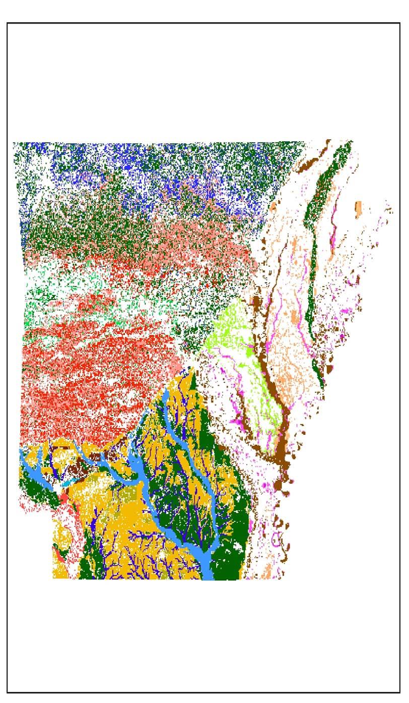
18 Ecoregions of Arkansas
19 Terrestrial Central Interior Acidic Cliff and Talus Ozark-Ouachita Pine-Oak Forest Ouachita Montane Oak Forest Ouachita Mountain Forested Seep Ouachita Novaculite Glade and Woodland Central Interior Highlands Dry Acidic Glade and Barrens Ozark-Ouachita Riparian Ozark-Ouachita Dry Oak Woodland Ozark-Ouachita Dry-Mesic Oak Forest Ozark-Ouachita Mesic Hardwood Forest South-Central Interior Large Floodplain West Gulf Coastal Plain Pine-Hardwood Forest West Gulf Coastal Plain Small Stream/River Forest West Gulf Coastal Plain Wet Hardwood Flatwoods Caves, Mines & Karst Habitat Ozark-Ouachita Pine/Bluestem Woodland Ozark-Ouachita Pine-Oak Woodland Arkansas Valley Prairie and Woodland Central Interior Highlands and Appalachian Sinkhole and Depression Pond Lower Mississippi Alluvial Plain Grand Prairie Lower Mississippi River Bottomland Depression Lower Mississippi River Dune Woodland and Forest Mississippi River Alluvial Plain Loess Slope Forest West Gulf Coastal Plain Calcareous Prairie West Gulf Coastal Plain Mesic Hardwood Forest West Gulf Coastal Plain Nepheline Syenite Glade West Gulf Coastal Plain Saline Glade West Gulf Coastal Plain Sandhill Oak and Shortleaf Pine Forest and Woodland West Gulf Coastal Plain Seepage Swamp and Baygall Southeastern Great Plains Tallgrass Prairie Central Interior Calcareous Cliff and Talus Central Interior Highlands Calcareous Glade and Barrens West Gulf Coastal Plain Dry Pine-Hardwood Flatwoods Lower Mississippi River Riparian Forest Lower Mississippi River Low Bottomland Forest Lower Mississippi River High Bottomland Forest West Gulf Coastal Plain Large River Floodplain Forest West Gulf Coastal Plain Red River Floodplain Forest Lower Mississippi Flatwoods Woodland and Forest Cultivated Forest Pasture Land Crop Land Urban/Suburban Ponds, Lakes, and Water Holes Emergent Wetlands Mud Flats Littoral Pelagic Pool Side channel Shoal Slough Oxbow - connected Other Riffle Run Glide Cave Stream Spring Run Seep Groundwater Swamp/Wetlands Oxbow - disconnected Aquatic
20
21

22
23

24

25

26

27
28 Communications Team Assist in-reach and partner information Manage public information and involvement Cooperative Extension Service lead Ecoregion workshops Interactive CWCS website UALR/IOG survey research center Public opinion survey Publish plan in various formats
29 Plan Formats Glossy Publication for FWS and Partners Executive Summary Summary Brochure (color) CD Format Internet web page for public access and input Intranet web page for planning/budgeting
30 Implementation Committee Invite primary partners and identify potential cooperation Approve and own the Strategy Use as tool for setting budget and program priorities Annual symposium to report, revise and set funding priorities